The Rains of July 12, 2017

Around 7 this morning I wasn’t entirely awake, but a loud clap of thunder decided I should be. It was the first of several. Rain seems to have fallen earlier, in the wee hours, but around then it started pouring with gusto.

That didn’t last too long. But a few hours later, it happened again. And a while after that, one more time. A lot of rain had fallen by midday, though not as much as some unfortunate places north of here, such as Mundelein, Ill., in Lake County. Many of the flood pictures in this Daily Herald item are out that way.

Our streets were passable, the lower level of our houses dry. For us, it wasn’t quite the Inundation of 2008. Still, at about 2, returning from an errand, I noticed a neighborhood park, about a mile from my house, that was largely underwater. I happened to have my camera.

July 12, 2017 rain

July 12, 2017 rainJuly 12, 2017 rainAll of the water in the pictures is not normally there. A small creek runs through the park, and while I’ve seen it expand with rain, I’ve never seen it go Incredible Hulk on the rest of the park.

Porcupine Mountain Wilderness State Park (The Waterfalls)

Yesterday I wondered why people travel distances and spend money to see good vistas. I’m included in such people. Today, why do we do the same to see waterfalls? Why is Niagara the attraction that it is (was)? It can’t be on the strength of “Shuffle Off to Buffalo” alone.

Rugged and well-watered, both Porcupine Mountain Wilderness State Park and the surrounding Ottawa National Forest feature a lot of waterfalls. Not long after arriving near the park, on the afternoon of the 30th, we sought out Gorge Falls and Potawatomi Falls on the Black River, which flows through Gogebic County and into Lake Superior. From a parking lot off Black River Road — a National Forest Scenic Byway, and justly so — a looping trail of about a third of a mile takes you to both.

Gorge Falls.
Gorge Falls, MichiganThe Black River above Gorge Falls.
Black River, UP MichiganPotawatomi Falls.
Potawatomi Falls, UP MichiganAnn was determined that we walk further upstream from Potawatomi Falls, saying that “I’ve been in a car all day.” True enough. It was a good path. I made sure that she knew that a blue diamond, or sometimes a rectangle, marks a trail.

Porcupine Mountains Wilderness State ParkPorcupine Mountains Wilderness State ParkThe next morning we drove to up M-519 to a parking lot on the west bank of Presque Isle River. Go down a fair number steps on a boardwalk and you soon come to a wooden suspension bridge across the river.
Presque Isle River bridgeThe other side of the bridge is described as an island, but it looks like a peninsula on the maps. Whatever its geographic classification, it was pleasantly wooded on the approach to Lake Superior.
Presque Isle River islandLake Superior at Presque Isle RiverBack across the suspension bridge, the trail on the west bank of Presque Isle River leads to Manhabezo Falls.
Manhabezo FallsThe trail at that point is also part of the North Country Trail, which we’d happened across a number of years ago in Manistee National Forest, in that other part of Michigan. The trail goes all the way from upstate New York to central North Dakota, or vice versa, some 4,600 miles, with a fair chunk of it through the UP.

We’d planned to take the trail to another parking lot along the road, and then walk on the road the short distance back to the parking lot where we’d left our car. A bridge crossing a small gully allows you to do that, except when it’s been hit by a falling tree.
Trail near Manhabezo FallsNot sure when that had happened, but it couldn’t have been too long before. So we scurried down the side of the gully and back up again, crossing a stream small enough to step over, and encountering a lot of mud on the way. At one point the sticky mud was so thick it pulled Ann’s shoes off. What’s a hike, even a short one, if you don’t get a little (or a lot) of mud on you?

Porcupine Mountains Wilderness State Park (The Vistas)

What is it about vistas that people like? Assuming we can agree that vista refers to an aesthetically pleasing view from a high position. People drive distances, climb stairs, take elevators, pay money and sometimes even take risks for a good vista. I do those things, though the risks are never that great. I like a good vista, but I can’t quite say why.

That question triggers others. Did Petrarch really climb Ventoux for the view? Or is vista-awe actually a more recent invention, maybe a sprig of the Romantic movement or a Victorian fixation? These questions aren’t so burning that I’m going to do much research, but I do wonder. I suspect the feeling is fairly modern, and probably not universally shared even now, any more than a taste for coffee or soccer or rock and roll.

And it doesn’t just apply to views from mountains. Now that manmade towers are so plentiful, so are those vistas. At Porcupine Mountains Wilderness State Park in the UP on July 1, we enjoyed one vista of each kind: a tower top, though that was atop a high hill reached mostly by walking, and a view from a the bluff of a high hill, though we reached that mostly by driving.

The park has a lot of hiking trails through a lot of wilderness, about 59,000 acres with a Lake Superior coastline. The mountains of the name aren’t really much in the way of mountains, but it is rugged terrain: dense old-growth forests, never logged because of its inaccessible ruggedness. I read some years ago that the area was to have been a national park, but the federal government was too distracted in the early 1940s to get around to it, so the state of Michigan went ahead and created a state park in 1945.

I can’t pretend we did any serious hiking in the Porkies. The time and energy weren’t there. But we did some excellent short hikes. Off the South Boundary Road, a side road plunges into the park and ends at a parking lot for the Summit Peak Tower Trail. It’s only half a mile to a lookout tower atop a high hill.

Summit Peak Tower TrailThe trail rose gradually for a time. Except for muddy spots, no difficulties.
Summit Peak Tower TrailEventually, the grade increased and sometimes there were boardwalks and steps.
Summit Peak Tower TrailI had to rest for a minute or two a number of times — and my family kept getting further ahead of me — but before long even I’d made it to the tower. A sign at the base warns: Keep Off During Thunderstorms. Well, yes.
Summit Peak Tower TrailMore steps to the vista we’d come to see. It was worth the effort, even if it’s romantic moonshine invented by the Romantic poets. I’m all in.

Porcupine Mountains State ParkPorcupine Mountains State ParkThe other vista we decided to see is in the north end of the park, easily accessible by road: the Lake of the Clouds. A sign outside the park along M-107 pointed the way.
M-107 SignAs for the End of the Earth, it didn’t look like anything special. Talk about anticlimactic.

From the the Lake of the Clouds parking lot, a trail only a fifth of a mile leads to the first of two grand vistas.
Lake of the Clouds, MichiganNote the people somewhat higher. The trail continues to that level, which is a rocky surface behind a short wall, overlooking for one of the fine vistas of the UP.
Lake of the Clouds, MichiganPorcupine Mountains State Park Lake of the CloudsIt’s a wow. The Lake of the Clouds view reminded me of some of the exceptional Canadian vistas we saw in ’06, though those were among mighty mountains, rather than picturesque hills.
Lake of the Clouds, MichiganAnn pointed out that in the fall, the view would be entirely different, and I think entirely worth the risk of running into early-season UP snow to see its multicolors.

UP ’17

For someone who grew up in Texas, I’m unaccountably fond of the Upper Peninsula. A little, probably, since I first saw as a lad its fine ragged outline on a map, and a lot more since my first visit, solo, in 1989. Maybe my appreciation came into full flower on H-13, a two-lane road through Hiawatha National Forest, as I drove north a little faster than strictly necessary, my cassette player playing a little louder than usual, zipping between walls of pines. It was a Be Here Now moment.

Also, I’ve never grown tired of gazing out into the vastness of Lake Superior, as I first did that year and most recently on July 1 at the mouth of Presque Isle River.

Lake Superior, Presque Isle RiverThe shore was rocky at that point, with smooth white driftwood beached on the shore. Not only that, people had built small cairns there, mostly on the wood, something I didn’t notice until I did. Then I started seeing them all around. I built one too, though not this one.
Lake Superior, Presque Isle River
We left the northwest Chicago suburbs late in the afternoon on June 29, spending the first night in Madison. From there, it’s a straight shot north through central Wisconsin, for much of the way on I-39 and then the slower but more interesting US 51. On the last day of June, we made our way north to the western reaches of the UP.

As I wrote 14 years ago: “At the northern end of I-39, which runs like a spine through most of central Wisconsin, US 51 takes over, though for a time it’s a divided highway of four lanes, and thus exactly like the Interstate. Just north of the wee resort town of Tomahawk… the road narrows. By this time, the driving visuals were compelling anyway, and all the narrowing of the road did was bring the scenery that much closer.”

Near Hurley, Wis., US 51 meets US 2. Unlike the 2003 trip, this time we headed east on US 2 into Michigan, into new territory for all of us — me, Yuriko and Ann. Staying at a modest but charming non-chain hotel in Wakefield, Mich., on the nights of the 30th and the 1st, the focus of the 2017 trip was the western UP, especially the Porcupine Mountains Wilderness State Park. We also visited the Keweenaw Peninsula, but time didn’t allow a fuller look at Keweenaw.

Evenings were cool and days in the 70s F. and partly cloudy most of the time. Weather forecasts had spoken of rain, but the closer we got to the trip, such forecasts were revised, downplaying the chance of rain. In the event, only a little fell on us on July 1 as we drove back toward Wakefield in the late afternoon. On the evening before, just before sunset, patches of thick fog clung to the Black River Road near Potawatomi and Gorge waterfalls. Ann commented on its eerieness.

Walking was an important part of the trip. Essential, as far as I’m concerned. On the first day of July, Yuriko thought to check the app on her phone that counts steps. We took over 14,000 steps that day. Many of the steps were on forest paths like this.

Porcupine Mountains Wilderness State Park

Or this.

Porcupine Mountains Wilderness State Park

A lot of the steps looked like this.

Porcupine Mountains Wilderness State Park

I felt my age. I usually brought up the rear, and took more breaks than I might have 10 or 20 years ago, but I got through.

Since time was short and distances, while not great, did involve miles to cover, driving was important, too. Also an essential experience on the trip, in my opinion. Tracing a course around the southern edge of the state park, the utilitarian-named South Boundary Road snaked through the intense summertime UP greenery, made all the more flush by a rainy spring, up and over hills, encountering few other cars. Light traffic on a two-lane road like that is the difference between an enjoyable time and constant white-knuckle dread. It was car-commercial driving. I got a kick out of that road.

Other roads in that part of the UP, routes through Ottawa National Forest and up into Keweenaw, were more developed and traveled, but had their attractions as drives and for their roadside sites. Though I know they represent a backstory of hardship — the UP must be a difficult place to make a living for a fair number of people — the area’s abandoned buildings were strangely fascinating. Such as a derelict store with gas pumps near (in?) Silver City.

Silver City, Michigan 2017

Detroit has no monopoly on abandoned Michigan structures. I suspect no root beer has been served at this former Wakefield drive-in in some time.

Family Root Beer Drive In, Wakefield, Mich 2017

In Wakefield, I made a point of taking a picture of a couple of Lake Superior Circle Tour signs.
Lake Superior Circle Tour signs, Wakefield, MichThe Circle Tours are networks of roads that, as the name implies, go all the way around each Great Lake, and in this case Superior. The idea was obviously hatched to promote tourism, and not that long ago, in the 1980s. To that I say, so what? The signs sit there quietly, but make a grand suggestion to passersby all the same.

I saw Lake Michigan Circle Tour signs in the late ’80s, as far south as Illinois, and on a sunny September day in ’89, on M-28 headed west to Marquette, I first saw a Lake Superior Circle Tour sign, which I hadn’t known existed. To me, the sign said — still says — Drop Everything and Drive Around the Lake. I’ve managed to drive around Lake Michigan, clockwise and counterclockwise. Lake Superior, no.

Millennium Carillon, Naperville

Near Riverwalk Park in Naperville is the Millennium Carillon, which is in a 160-foot structure called Moser Tower. Though the tower wasn’t completed until 2007, work began in 1999 and it must have been partially finished soon after, because I’m pretty sure we listened to its bells as part of the city’s Independence Day celebration in 2001, or maybe 2002.
Millennium Carillon, NapervilleIt’s possible to pay $3 and take a tour of the tower, but I didn’t have time for it on Friday. It’s 253 steps up to its observation deck, so we better visit before we get much older. Also, before the tower gets much older. It’s possible the tower will be gone in a few years.

“Cracks and deterioration of its concrete walls could cause pieces to fall ‘without notice,’ and corrosion of structural steel connections could decrease the building’s stability, a consultant found in a two-year, $50,000 study of the tower’s condition,” Marie Wilson writes in the Daily Herald.

“Options include fixing the structure and maintaining it as-is, fixing it and improving the base to help prevent future corrosion, or maintaining it for a while and then tearing it down.”

Such problems after only 10 years. Luckily, nothing fell without notice when I visited (though shouldn’t that be “without warning”?). I’m not a structural engineer, but it sounds like corners were cut during the original building. Of course, it was a money problem.

“The most expensive options would involve upgrading the bottom of the tower to match original designs by Charles Vincent George Architects, which called for the lower 72 feet and 9 inches to be enclosed in glass and temperature-controlled, Novack said.

“Enclosure plans were scrapped when the Millennium Carillon Foundation, which conducted the first phase of work in 1999 to 2001, ran of out of money.”

According to the Naperville Park District, the Millennium Carillon is the fourth largest in North America and one of the “grand” carillons of the world, featuring 72 bells spanning six octaves. Didn’t hear the bells during this visit. Concerts are inconveniently on weekday evenings. Inconvenient for non-residents, that is.

Near the tower is a bronze of Harold and Margaret Moser, who ponied up $1 million for the tower’s construction.
Harold & Margaret Moser statueBeginning after WWII — and that was the time to subdivide in earnest out in the suburbs — Harold Moser was a major residential developer in Naperville, credited with building at least 10,000 houses in the area. His nickname was Mr. Naperville, and a plaque on the back of the statue calls them Mr. and Mrs. Naperville.

They both died in 2001. The statue, by Barton Gunderson, dates from 2009.

Mr. & Mrs. Naperville

It’s fitting to honor the Mosers in bronze, but their smiles are a little unnerving.

Friday Afternoon in Naperville

Yuriko and Lilly wanted to go to the Aurora Outlet Mall last Friday, and they asked me to drive. It’s a fair number of miles via expressway, but rather than see that as a chore, I think of it as an opportunity to visit somewhere in the far western suburbs, where I don’t go all that often, after I drop them off at the mall (such as the Fox River as it passes through Aurora, or the Fermilab grounds).

My destination of choice this time was Grand Army of the Republic Hall in Aurora, but I found that the building is only open on Saturday afternoons, and the first Friday of the month in the summer. So an alternate was Naperville. A little far to the east of Aurora, but always a worthwhile place to visit.

First stop: the 40-acre Naperville Cemetery, a burial ground since 1842, and still active. It’s between Naperville Central High School (you can see the stadium) and the main campus of Edward Hospital, and also not far from the open air Naper Settlement museum.

According to the cemetery web site, Joe Napier himself, founder of Naperville — and a good friend of Jebediah Springfield, maybe — is buried there. I couldn’t find him among the 19th-century stones, but I didn’t try very hard.

Naperville CemeteryOn the whole, it’s a pleasant cemetery with some history, upright stones, a bit of funerary art, a fair number of trees, and a veterans memorial plaza.

Naperville CemeteryNaperville CemeteryNaperville CemeteryA few blocks away is the Riverwalk Park, part of downtown Naperville. The park is a series of trails and green spaces along the West Branch of the DuPage River, plus some public facilities such as a swimming pool with an artificial beach, all developed in the 1980s. Been a number of years since I’d been there.

Riverwalk Park, NapervilleRiverwalk ParkRiverwalk Park, NapervilleRiverwalk Park, NapervilleThe Aurora Outlet Mall’s a nice outdoor shopping center, but for me a walk along a river on a Friday in June beats it hands down.

Chicago Pride Parade ’17

The 47th annual Chicago Pride Parade, which was held yesterday on the North Side, is easily the most colorful parade I’ve ever seen.Chicago Pride Parade 2017And the most exuberant since the Greenwich Village Halloween Parade. The girls and I posted ourselves on the west side of Broadway, a few blocks north of Irving Park Blvd., toward the beginning of the parade route.That area had the advantage of a relatively thin line of spectators, at least compared to what the crowds must have been like further south along North Halsted St., which is in Boystown proper.Chicago Pride Parade 2017 As it was, the girls found a spot next to the street, and I stood behind a street parking collection box, since I was tall enough to see over it without a problem. The weather was made to order for a parade, low 70 degrees F., partly cloudy, some light winds.

We were there for more than two hours, watching — and though overused, the word fits here — the diversity parade by: floats, trucks, buses, motorcycles, riders, dancers, and walkers with private organizations and clubs, public agencies, corporations, churches, synagogues, advocacy groups, and entities without easy definition.

Sound systems provided most of the music, though there were a few bands, with the paraders and parade-watchers not shy about making their own noise. Beads, candy and other trinkets were tossed freely.

All kinds of attire were part of the parade, as well it should have been.Chicago Pride Parade 2017Chicago Pride Parade 2017Chicago Pride Parade 2017Chicago Pride Parade 2017Chicago Parade Parade 2017Chicago Pride Parade 2017

Chicago Pride Parade 2017

Chicago Pride Parade 2017

Chicago Pride Parade 2017

Chicago Pride Parade 2017

Various politicos were on hand, including aldermen, other local officials, state office holders, and a number of candidates for governor. U.S. Sen. Tammy Duckworth rode by.Chicago Pride Parade 2017 - Tammy Duckworth

The standard rainbow flag was ubiquitous, but I also saw a few less familiar designs, such as a Libertarian rainbow and a Star of David rainbow.

Chicago Pride Parade 2017There was less political content than I expected, but there was some.
Chicago Pride Parade 2017Mostly the event had the feel of a big party, rather than a protest. With a party comes balloons. A lot of balloons. I’ve never seen such a concentration of balloons, many of them attached in some way to parade-walkers.Chicago Pride Parade 2017

More than mere attachments, there were also examples of balloon-wear.
Chicago Pride Parade 2017Some floats blasted confetti, too.Chicago Pride Parade 2017There was an acrobat, tossed into the air suddenly.Chicago Pride Parade 2017Glad they caught her. Him. The acrobat.

Who was this bozo? Bozo, of course.
Chicago Pride Parade 2017For once not the most colorful attendee of the parade.

Bremen, West Germany, 1983

Around this time of the year 34 years ago, I spent a couple of days in the north German city of Bremen. City-state, actually: Freie Hansestadt Bremen, the Free Hanseatic City of Bremen. Once a state in the German Confederation, then a component state of the German Empire, it was merely a city according to the Nazis. Since 1947, it’s been a state again, the smallest in area of the Federal Republic.

Odd, Bremen and Hamburg got to be states again, but not poor old Lübeck. Such are the vagaries of history.

I had a fine time. How could I not? I was a young man with exactly nothing else to do at that moment but see a new city in an interesting old country. I was a free man in Bremen/I felt unfettered and alive… Well, that lyric wouldn’t have quite the same vibe, but that’s not too far off. Anyway, my tourist impulse was in full flower.

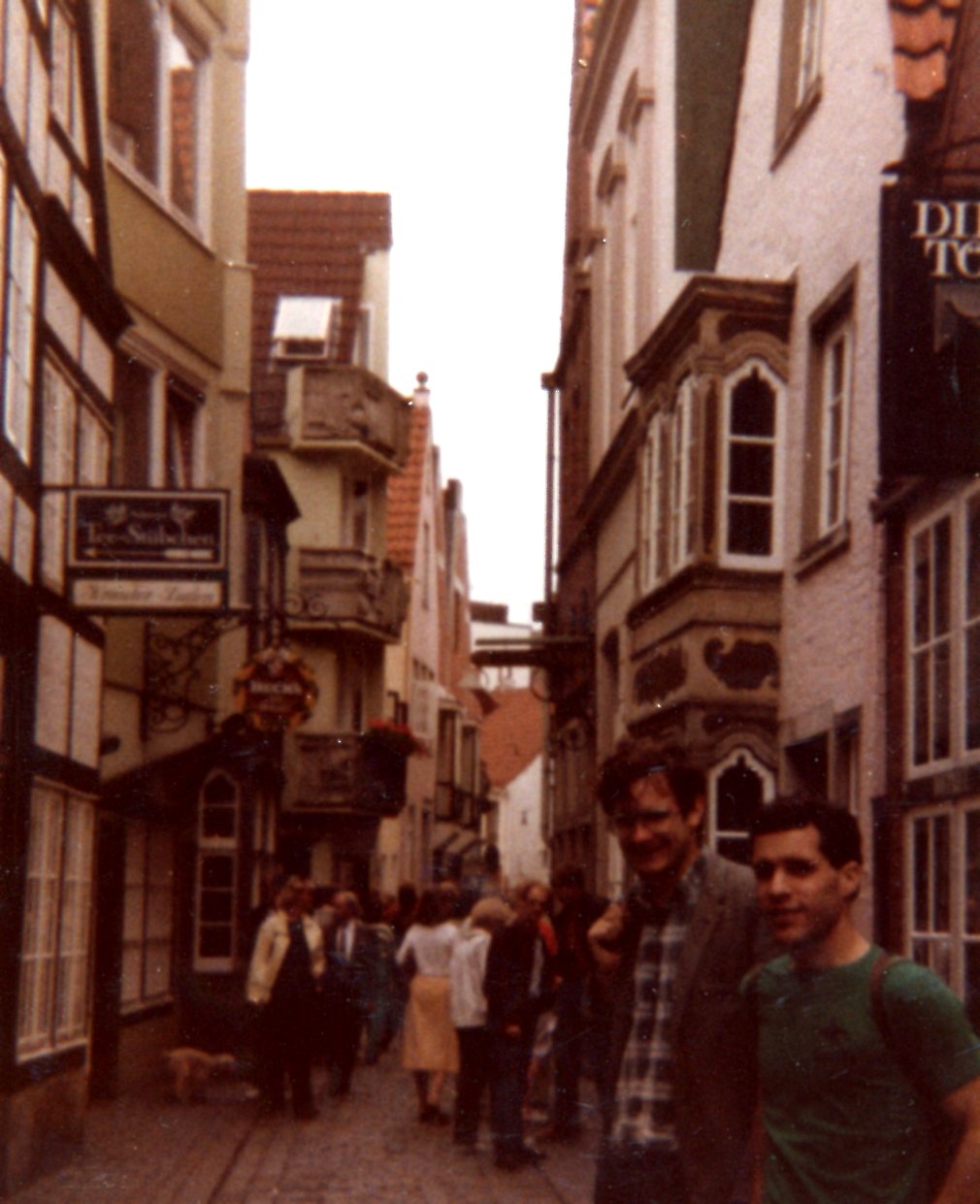
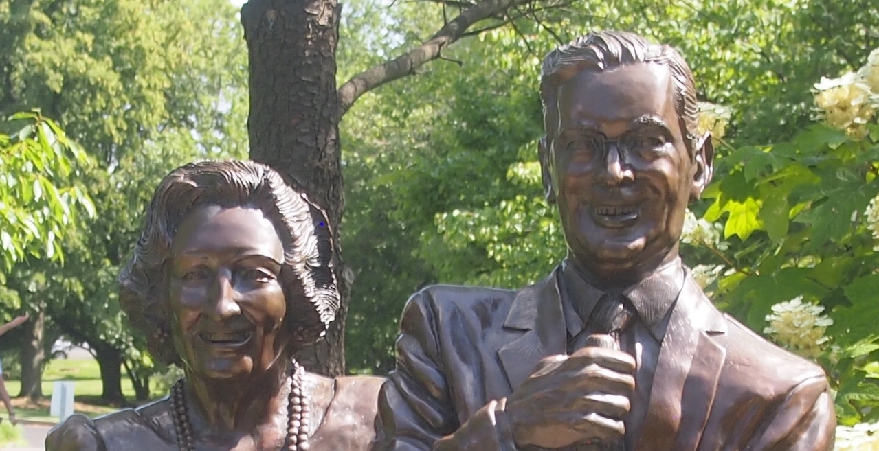
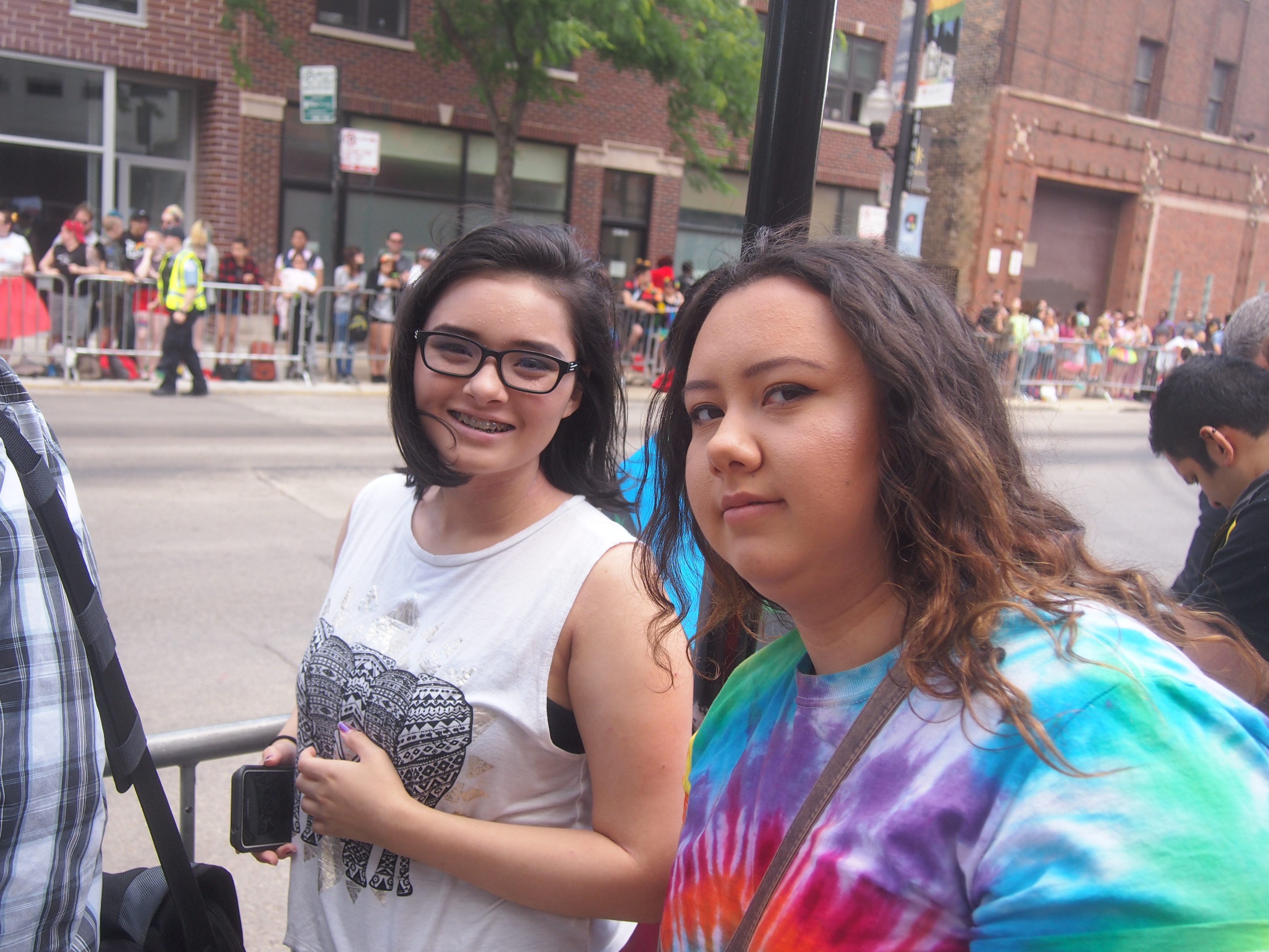
This is David and me. He was the brother of a New Yorker friend of mine in Germany, Debbie. Mostly I was by myself in Bremen, but I met up with them toward the end of my visit. The background is the Schnoor, more about which later.
BremenJuly2.83The following is an edited version of what I wrote at the time.

“At Bremen I exited the station, got a map, and experienced the first-time rush of a new place. You aren’t tired, you feel open to the world, you want to look at everything you pass by. I crossed downtown Bremen’s large fussgangerplatz, walked by shops and goods and people, and enjoyed the sights and sounds. That kind of rush doesn’t last long, but it’s great while it does.

“I found the Jugendherberge, an ugly squarish building between downtown and the industrial Weser riverside. Check-in wasn’t until 1:30, so I sat under a bridge near St. Stephen’s and ate the bread and wurst I brought. The brot was a little dry and the wurst something like raw hamburger, but I needed the sustenance.

“Then I checked in and began wandering. I found the Rathaus first, then the famous 1404 statue of Roland. I spent a good while in Bremen Cathedral (St. Petri Dom zu Bremen), marveling at its intricate, aesthetic wonders, such as the painted pillars and the statues illustrating the Parable of the Ten Virgins. Went to the crypt, thought to be the oldest room in Bremen, dedicated in 1066.

“Sometimes I mulled a bit gloomily that time will sooner or later reduce the cathedral to dust — via nuclear attack in August or 10,000 years of erosion or something. But it’s here, now, and so am I. Before I left, I bought a little book about the cathedral.
Bremen Cathedral“Not long after I left, I spotted a series of white dots painted on the sidewalk, with the words Zum Schnoor –> every 30 or 40 feet to go with them. I followed them to the Schnoor. I’d heard that the Schnoor was the oldest surviving section of the city, and so it seems. The Schnoor is focused on a narrow street of that name, lined with aged shops and other buildings. Some of the side streets are even narrower, barely wide enough for two people to pass.

“En route to a church I never got into because it was always locked, I came across Böttcherstraße. Every ten feet or so is another work by one Bernhard Hoetger, some interesting stuff dating from pre-you-know-who Weimar years. Apparently the Nazis didn’t much like the works, but they survived them and the war. [Brick Expressionism, I’ve read, is the term, at least for some of the buildings.] There was also a small cinema tucked away in the area. Showing that evening: Death in Venice. An Italian movie with German subtitles, probably, or dubbed in German. I decided not to go.

“I walked further afield, near some small city lakes, and then to the Übersee Museum Bremen, near the main train station. It’s an ethnographic museum, complete with huts from New Guinea, a Japanese shrine with a manicured garden and a pond with goldfish, and a elegant Burmese temple. All of the labels were in German, but that didn’t matter much [I experienced something similar some years later at the National Museum of Ethnology in Osaka.]

“There was a special exhibit of schoolchildren’s paintings: ‘Japanese kids see us and German kids see Japan.’ A funny mix of cultural and political images, mostly, tending toward the stereotypical. My favorite was a Japanese drawing of a German with a grinning Volkswagen for a head, eating sausage and drinking beer. Hitler’s face and swastikas were common, as was Beethoven’s face, and some drawings showed Germany torn between the Stars & Stripes and the Hammer & Sickle.

“After the museum I had dinner at the Restaurant Belgrade. For DM 16, I had an excellent Hungarian goulash, potatoes, salad, bread and beer. Returned to the hostel at about 10, very tired, and went to sleep almost at once.

“At breakfast at the hostel I talked with a Japanese girl who’d been to the Bremen Geothe Institut and who was about to go home. She was pleasant, and showed me postcards of Japan. After checking out, I wandered the streets on the other side of the Weser a while, then at 10 took a harbor cruise.

“It was a busy place, with ships from all over, and vast industrial areas along the banks, including a huge drydock belonging to Krupp, and a Kellogg’s factory with enormous murals of Tony the Tiger and Snap, Crackle & Pop on its side. I couldn’t catch a lot of the narration, but it seemed mostly about ship sizes and carrying capacities, so I didn’t mind.

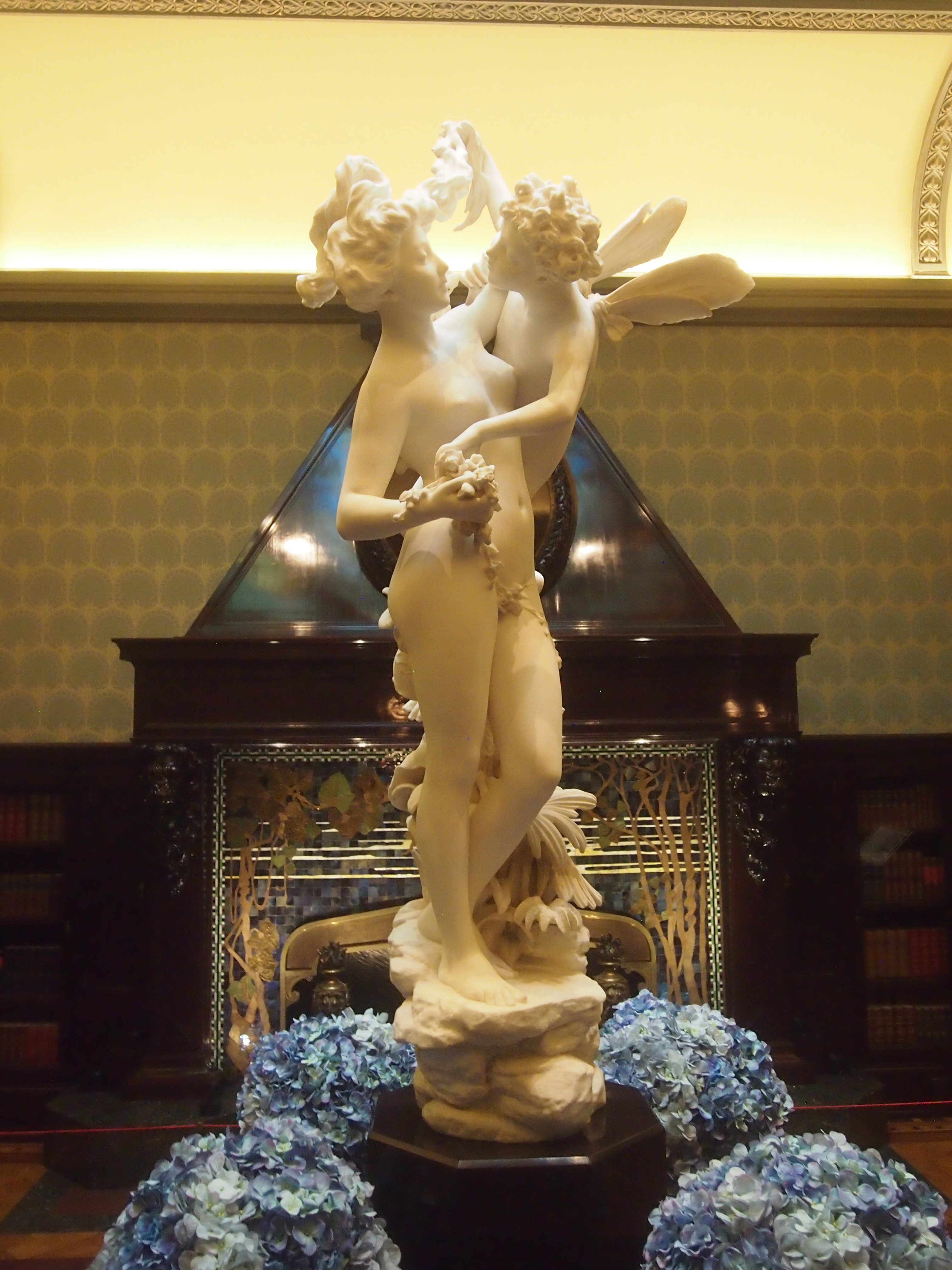
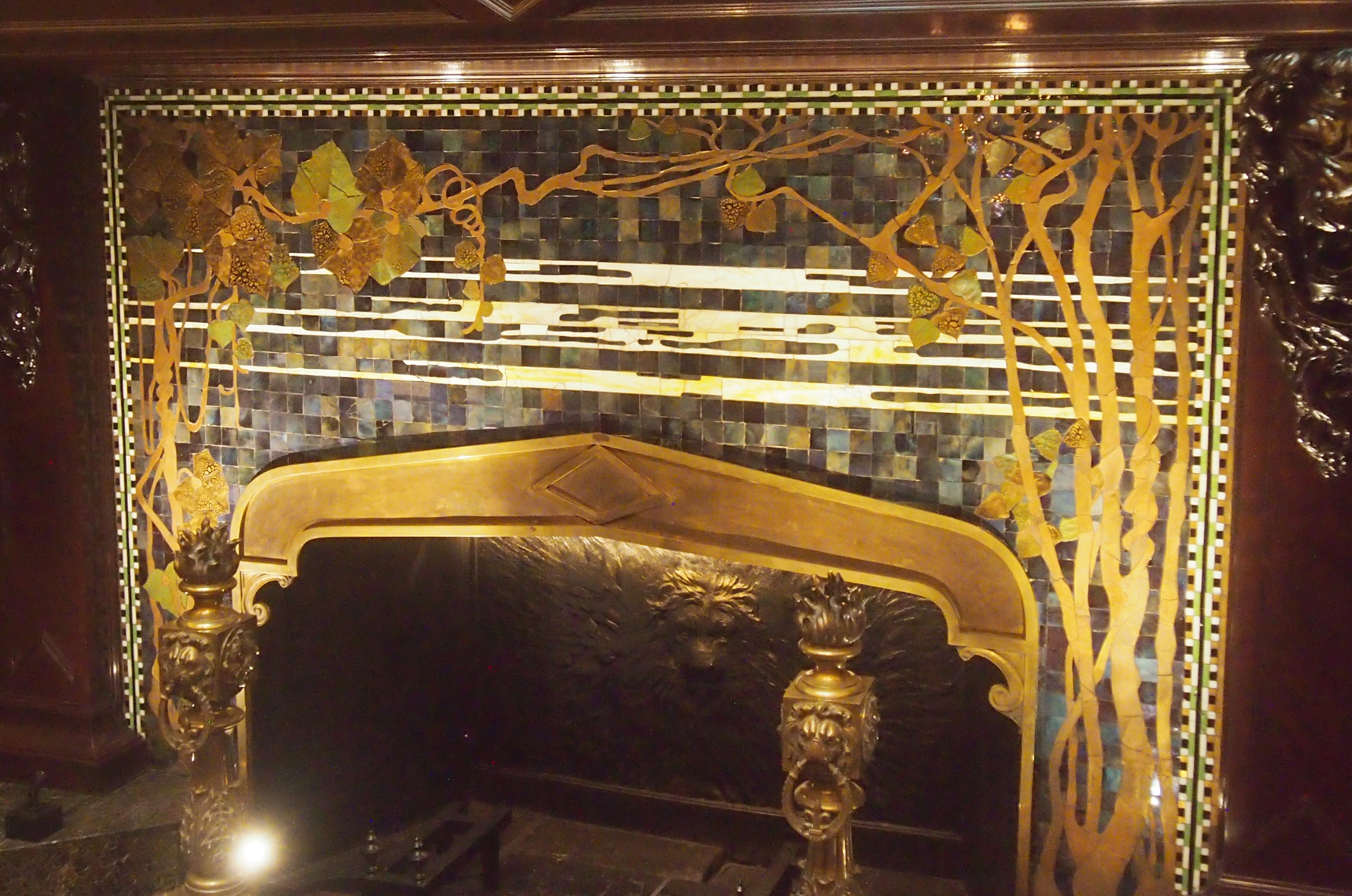
“Back on land, I visited the church opposite the Dom, Unser Lieben Frauen Kirche, the second-oldest church in the city, and not as ornate as the cathedral. I took a tour of the Rathaus, and as Steve promised, the place has remarkable woodwork. For example, the puti-like faces on some of the chairs managed to have lustful and leering expressions. The Rathaus also has a fine collection of model ships, mostly the 17th-century Bremen fleet, and an assortment of portraits of Holy Roman Emperors.

“As if that wasn’t enough, I then went to the Ludwig Roselius Museum, which houses paintings & furniture & gold & maps from the 17th and 18th centuries. Saw the original black painting of Martin Luther that I’ve seen reproduced a number of other places [Lucas Cranach].

“My energy was low by this time, but I walked some more, returning to the Böttcherstraße at 3 and hearing the chimes of the Glockenspiel House and seeing the rotating woodcarvings of explorers and airmen. Met Debbie and David soon after, and we repaired to a nearby cafe for beer. They’d been there the day. Returned to Lüneburg soon after on a faster direct train, and had dinner together at another Yugoslav restaurant. For DM 14, got Serbian combo of meat, rice and beans, along with beer.”

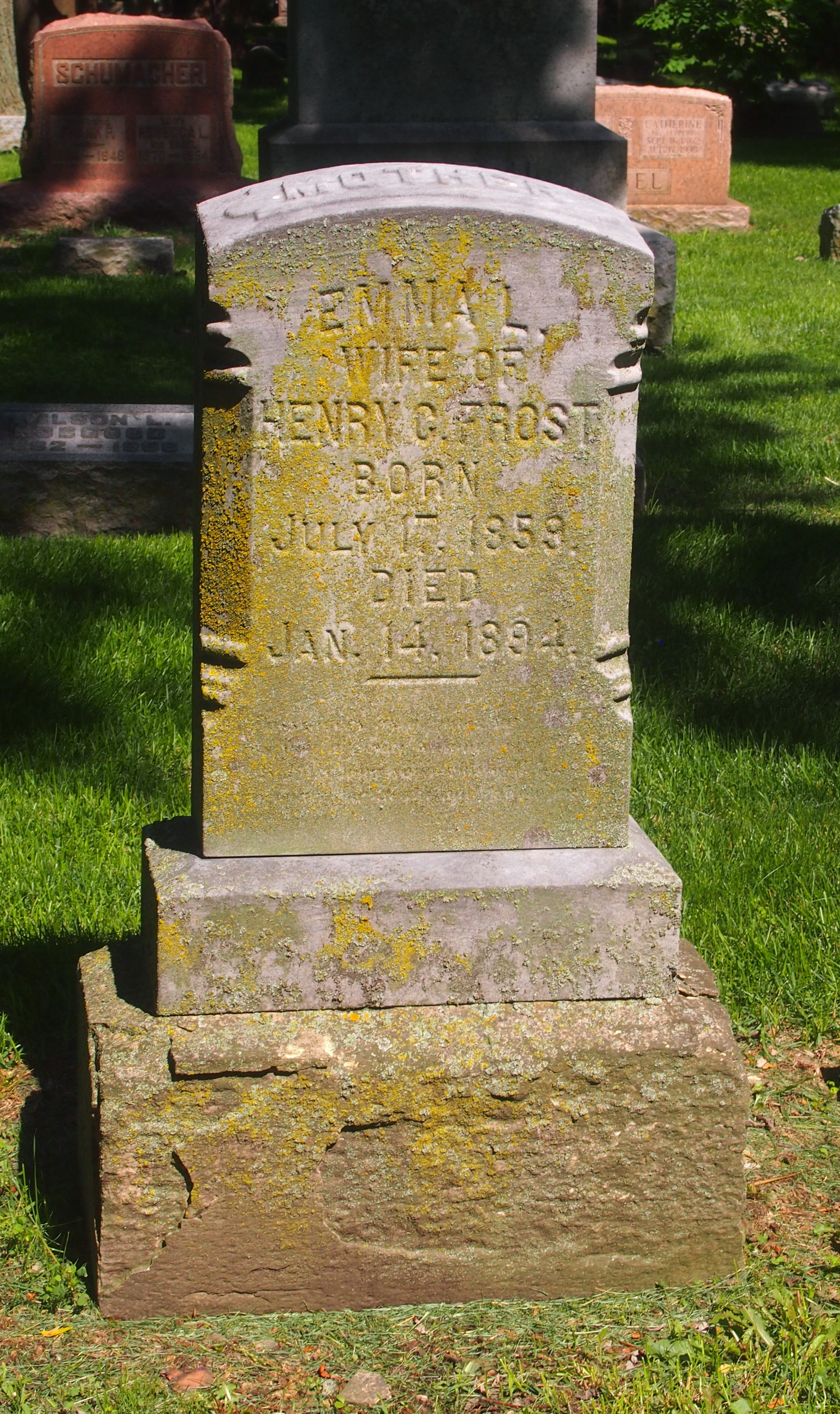
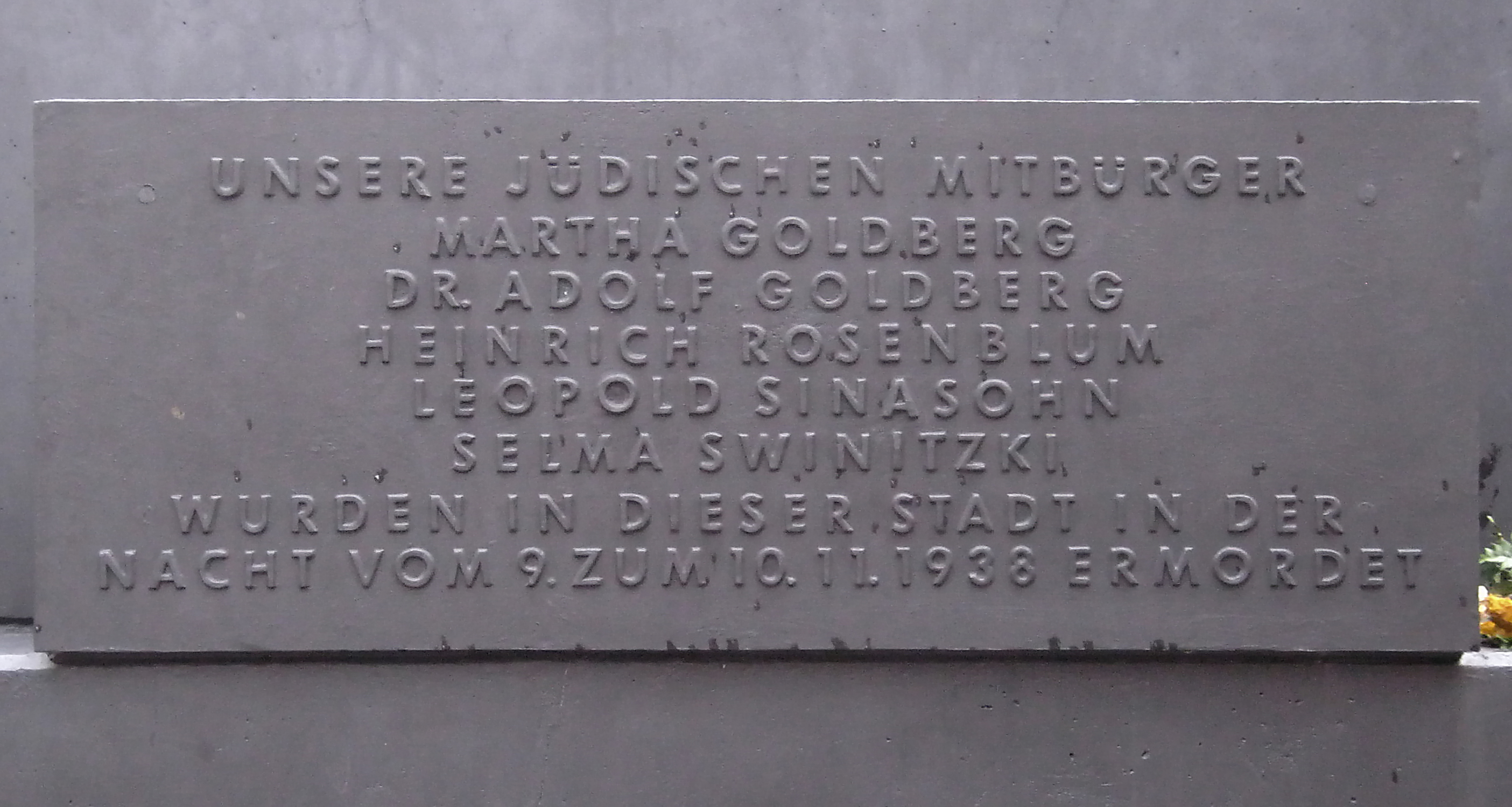
One more thing. In Bremen, near the Schnoor, I found a memorial I didn’t expect. I made notes about it in my Bremen Cathedral book, which is what I had at hand.
Bremen Cathedral
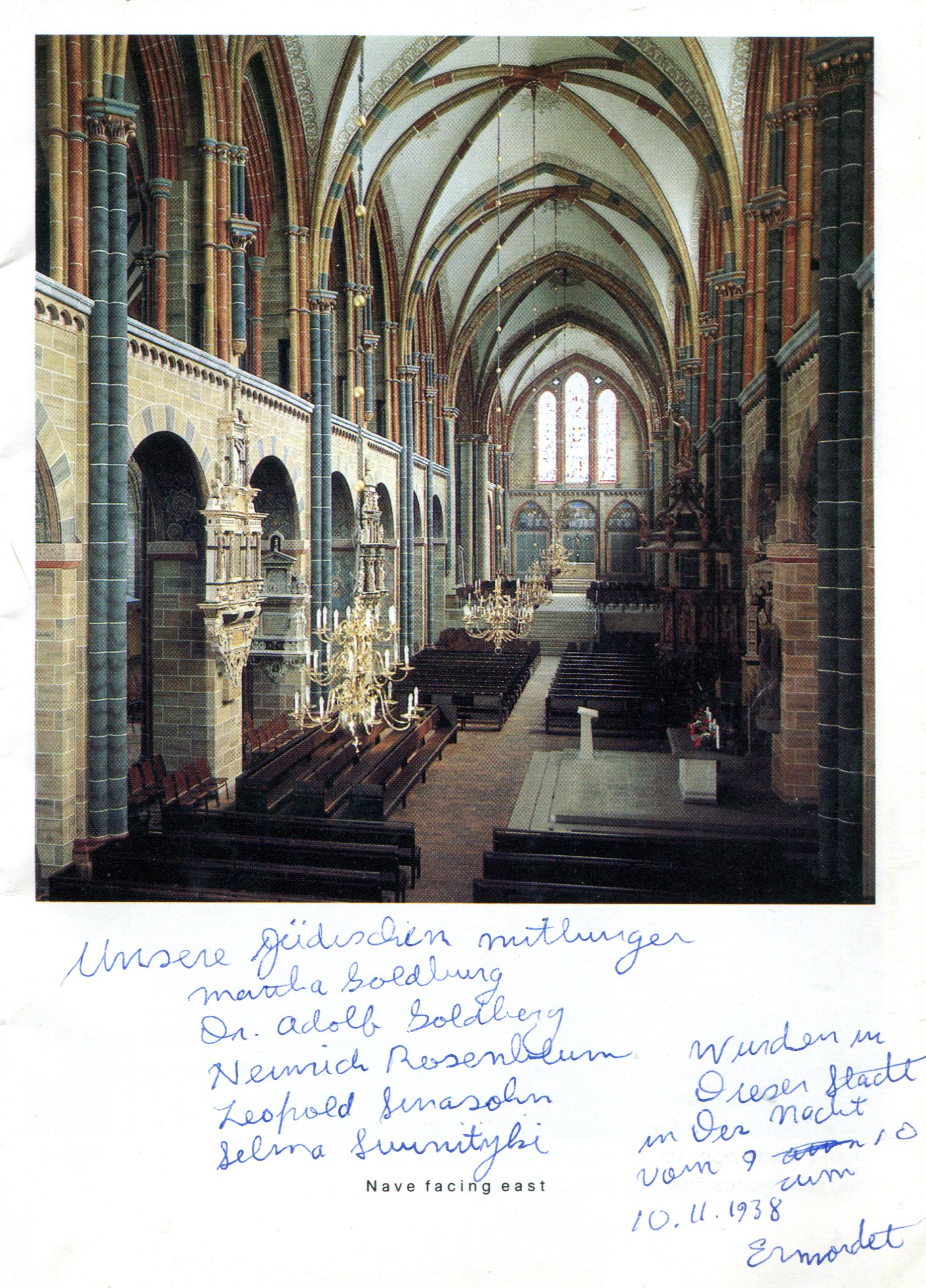
Unsere Jüdischen mitbürger

Martha Goldberg
Dr. Adolf Goldberg
Heinrich Rosenblum
Leopold Sinasohn
Selma Swinitzki

Wurden in dieser Stadt in der Nacht vom 9. zum 10.11.1938 ermordet.

Murdered during Kristallnacht, in other words. This is what the plaque looks like. Remarkably, Adolf Goldberg has a Wiki page, which also tells me that the memorial was erected in 1982, only a short time before I saw it.
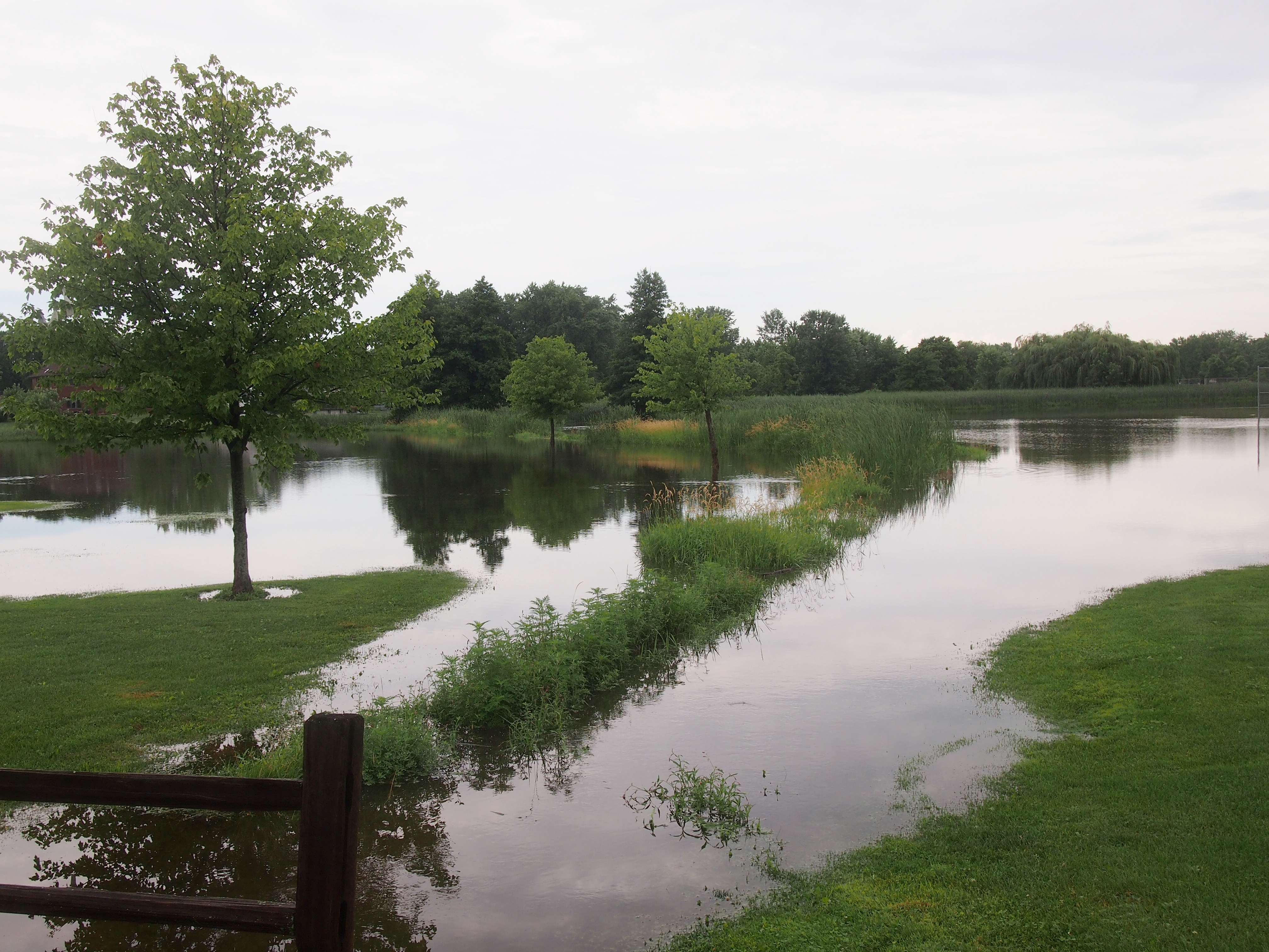
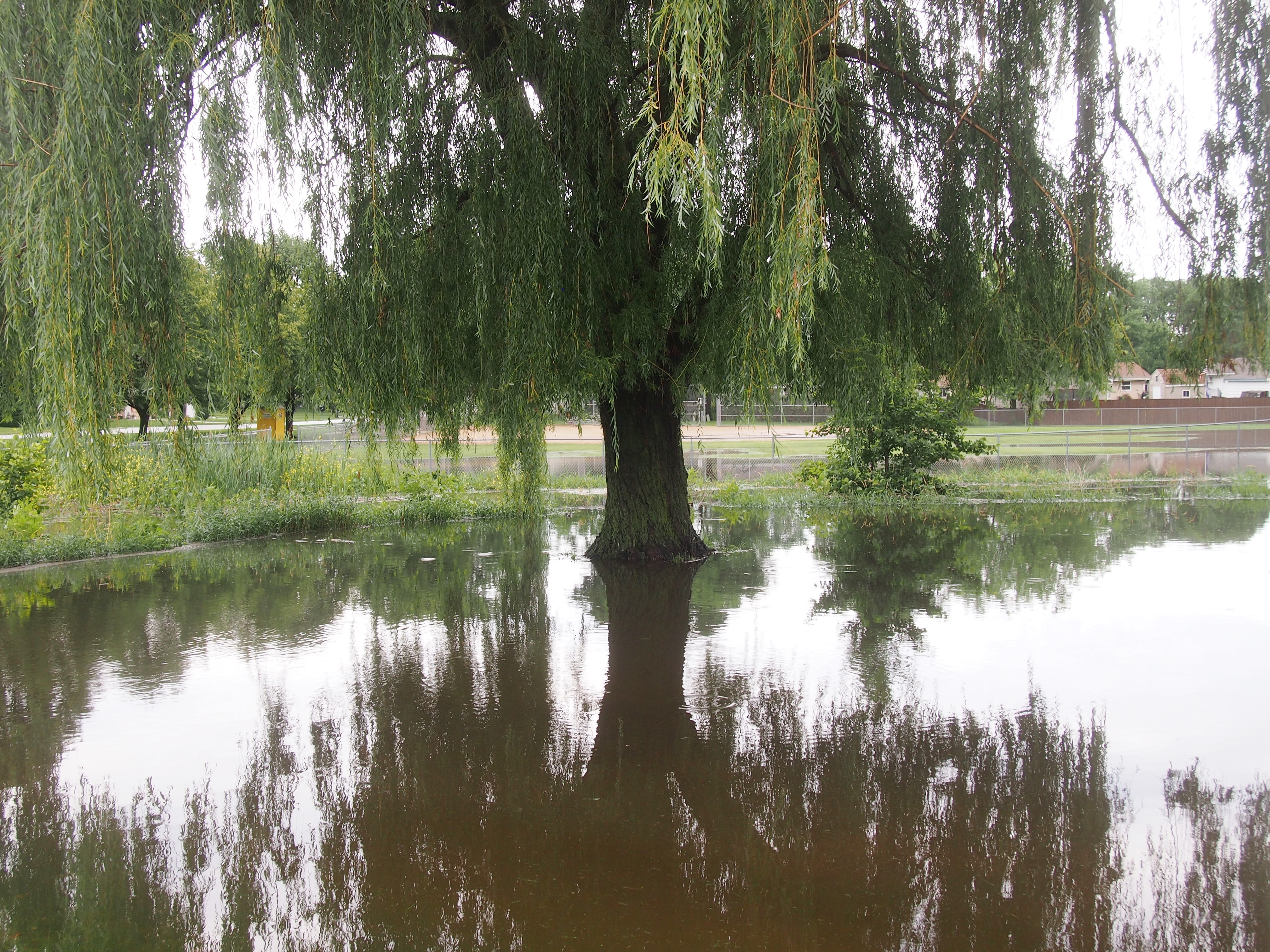
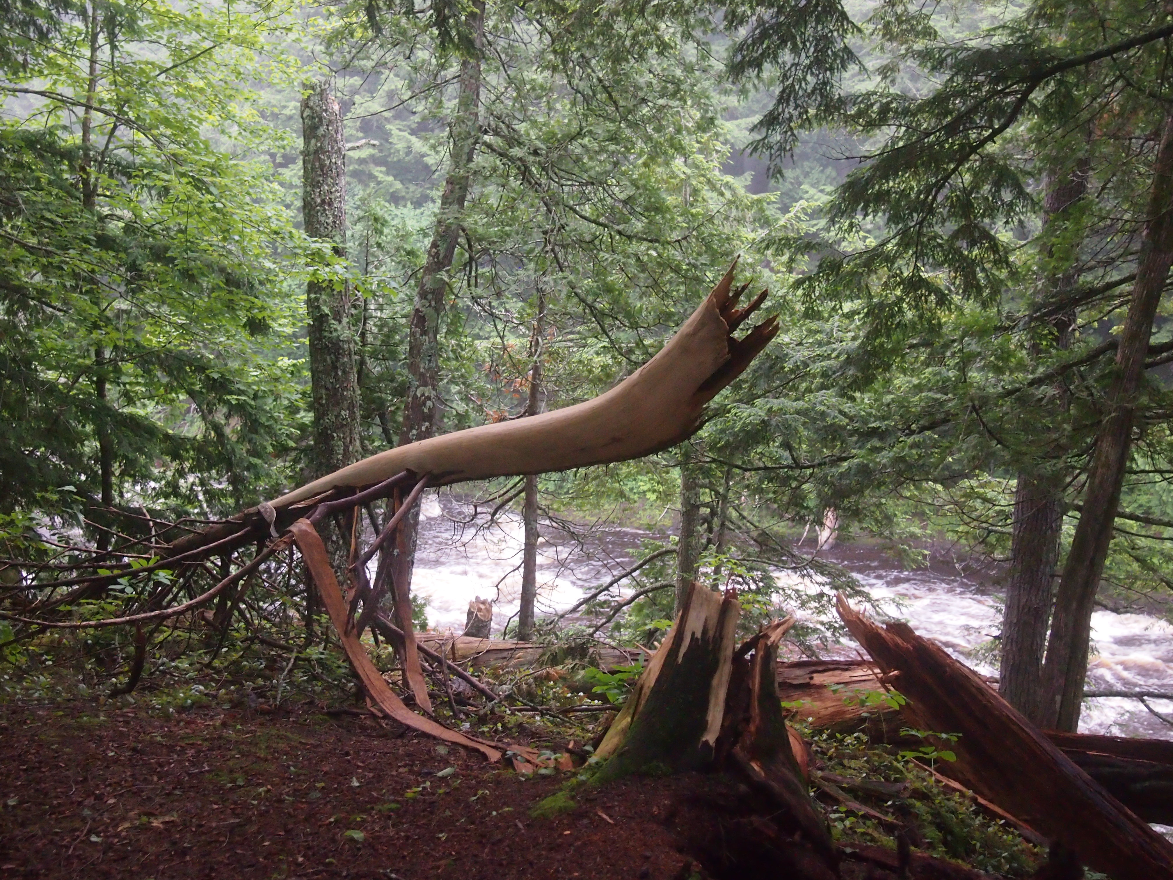
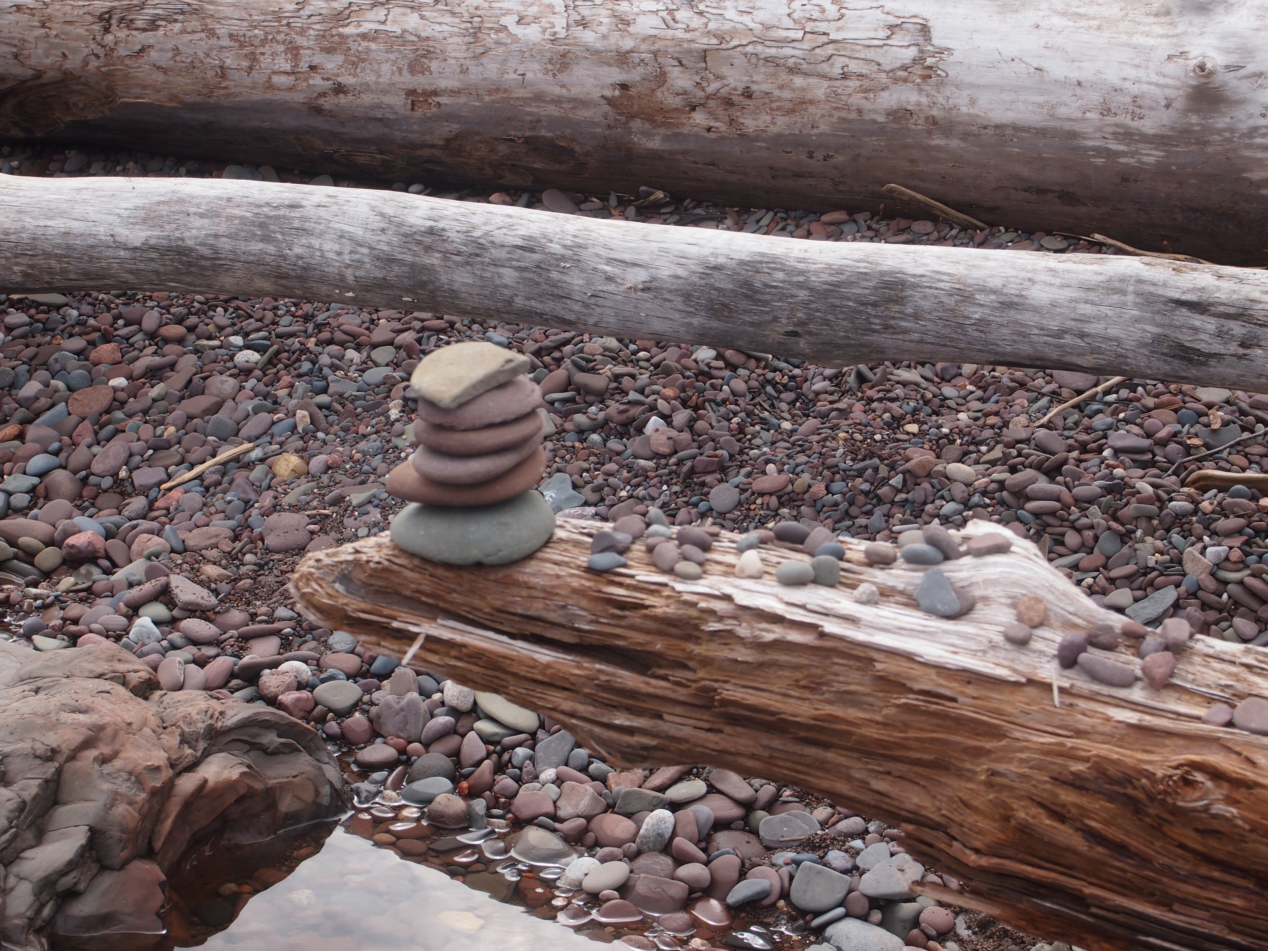
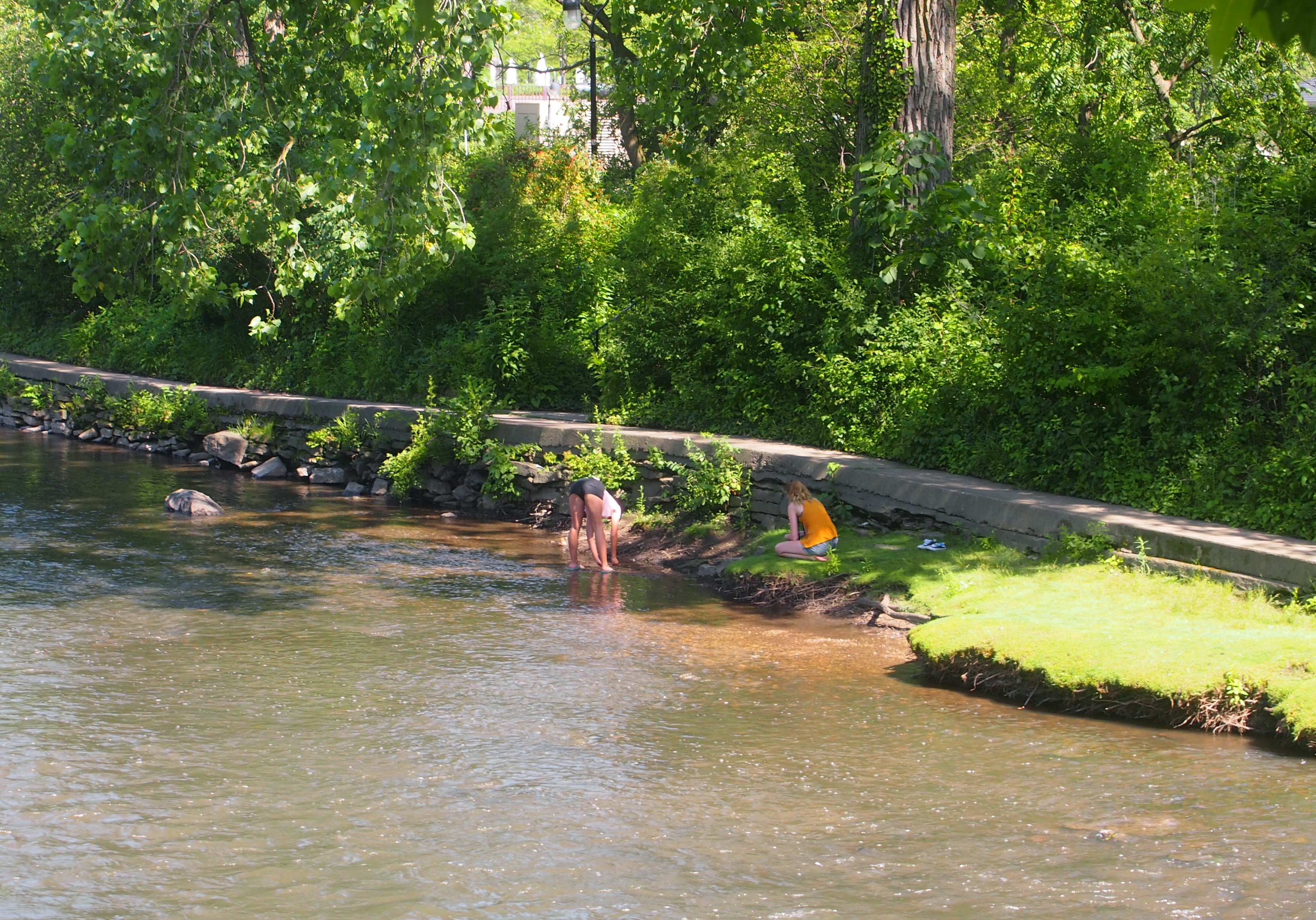
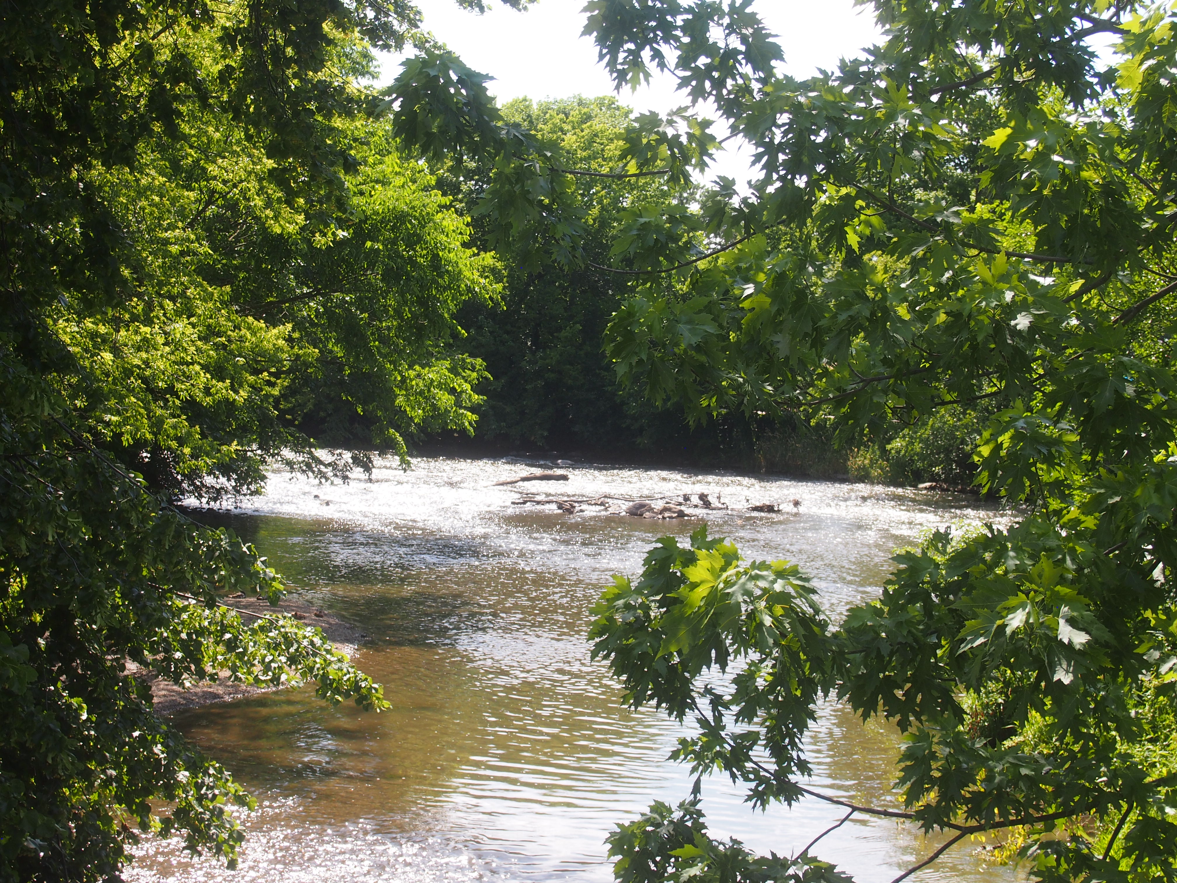
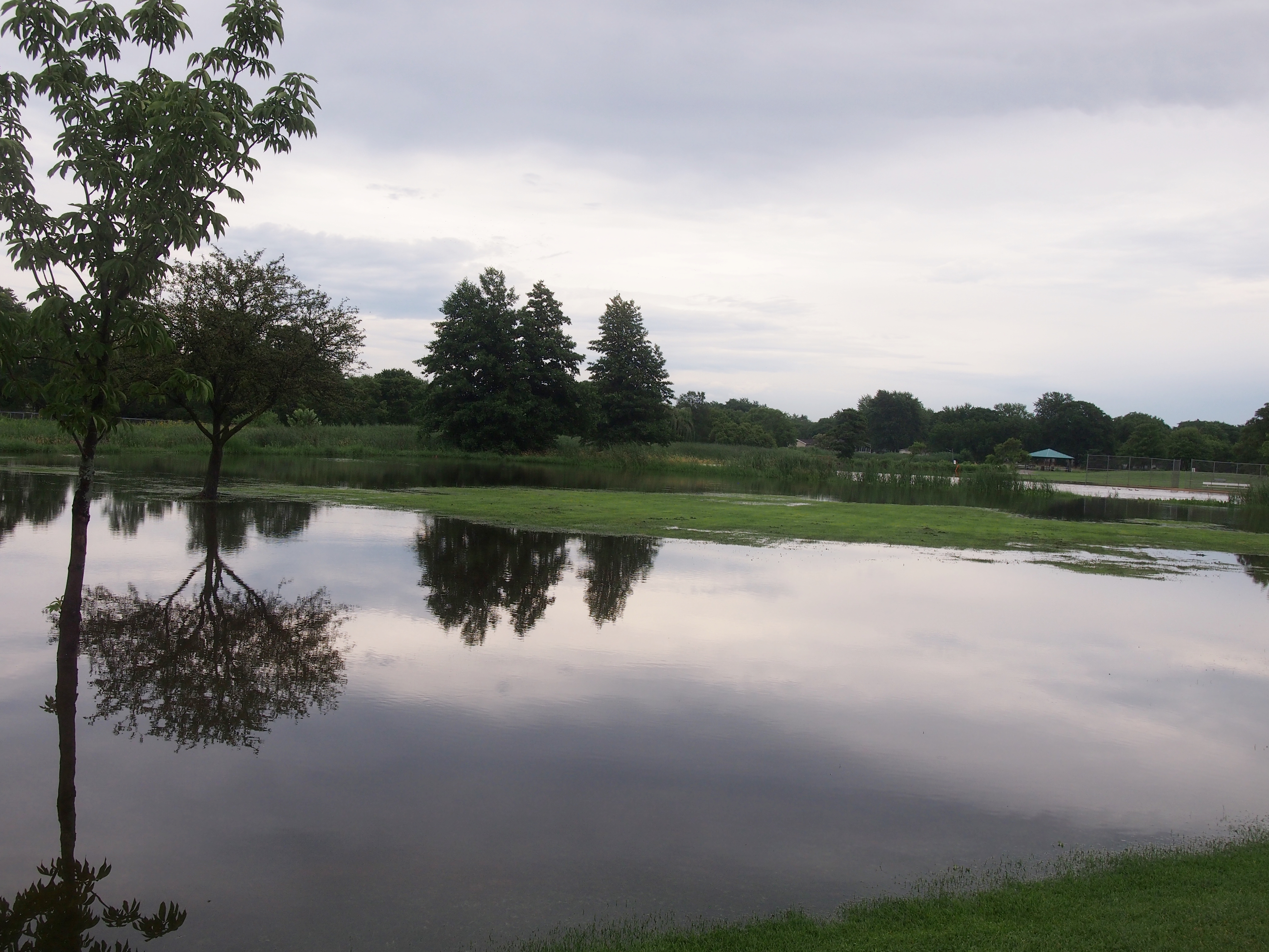
The Last Gasp of the Federal Works Agency

Not something you see everyday: a plaque marking a project by the Federal Works Agency. But there it was last weekend for me to see, at the Chicago subway station of the CTA Blue Line (O’Hare-Forest Park).

Federal Works Agency plaque, Chicago StationThe Federal Works Agency only lasted until 1949, but it’s a safe assumption that the subway construction project started under its aegis in the late ’40s, so it was thought fitting to use the name even in 1950. The agency had been created as a part of a major federal government reorganization in 1939, authorized by Congress and overseen by the executive branch.

To quote President Roosevelt, in his message to Congress on the Reorganization Act of 1939: “[The FWA will include] the Bureau of Public Roads, now in the Department of Agriculture; the Public Buildings Branch of the Procurement Division, now in the Treasury Department, and the Branch of Buildings Management of the National Park Service… now in the Department of the Interior; the United States Housing Authority, now in the Department of the Interior; the Federal Emergency Administration of Public Works; and the Works Progress Administration, except the functions of the National Youth Administration.”

Various additions and subtractions were made to that list until 1949, when the FWA’s remaining functions were parceled out to other agencies, as well as the newly created General Services Administration. As federal bureaucracies go, the FWA had a fruit-fly lifespan.

With a 10-year run, there couldn’t be that many FWA plaques. Certainly not as many as the GSA — nearly 70 years now — or even the WPA or the CCC, which also had short runs, but were really busy in their heydays. So maybe in the hobby of plaque-spotting the FWA is a nice find.

If there is such a hobby. Surely someone looks for plaques in a more enthusiastic or systematic way than I do. And is Blue Plaque-spotting a thing in the UK, or does this Spectator article merely refer to casually walking by them?

The Driehaus Museum

A fine Solstice. Clear and not particularly hot, followed by a short cool night.

The least plutocrats can do for posterity is build lavish, highly aesthetic houses that, decades or even centuries later, are restored and open to the public in one way or another. I suspect modern magnates, business tycoons, and captains of industry are mostly failing in this regard.

Late 19th-century and early 20th-century plutocrats, on the other hand, did not shrink from their duty along these lines. They might have imagined they were celebrating their worldly success in a highly visible way, and maybe they were, but sic transit gloria mundi. Beyond their own time and concerns, they were leaving something for later hoi polloi to ogle.

I will give Richard Dreihaus his due, however. I’m not sure he counts as a plutocrat, but he is a wealthy fund manager of our time. He might not have built a lavish house — or maybe it’s still private — but in any case, he managed to restore the Samuel M. Nickerson House at 40 E. Erie St. on the Near North Side of Chicago to its Gilded Age glory.

Now it stands, stocked with fine art and objets d’art, for the hoi polloi to see (for a fee). Hoi polloi such as Yuriko and I on Sunday afternoon, when we visited the Richard H. Driehaus Museum, which occupies the Nickerson House.

Richard H. Driehaus Museum

Chicago magazine in 2007 on the philanthropist: “Driehaus, the founder of Driehaus Capital Management… is no ordinary preservationist. He is a man who can afford to indulge his passions — for art, for parties, but mainly for restoring historic architecture — on a boundless scale, as anyone who has visited his many residences and offices around the world can attest.

“In the past two decades, Driehaus has emerged as one of Chicago’s most prominent advocates for historic preservation. He has also taken a leading role in encouraging the city and public institutions and groups to adopt a more design-centered approach to civic projects.”

Driehaus bought the building at 40 E. Erie St. in the early 2000s, when it was being used as an art gallery, and spent a good deal restoring it, including cleaning the exterior, which I’ve read was black from a century-plus of pollution. Considering its location on Erie, I’m sure that I walked and rode by the building any number of times in the 1980s and ’90s — and took exactly no note of it.

Since 2011, it’s been open to the public as the Driehaus Museum. I still took no note of it until last year, when I was walking by and saw its sign. Museum? This is a museum? Since when? Even in the Internet age, it’s hard to keep track of things.

Samuel M. Nickerson was a successful banker in early Chicago who tasked Edward J. Burling of the firm of Burling and Whitehouse to build him a mansion, which was completed in 1883. Burling had a long career in Chicago, with many of his buildings destroyed by the Fire.

The Nickerson House rooms feature 17 types of marble, along with onyx, alabaster, carved and inlaid wood, glazed and patterned tiles, mosaics, and Lincrusta, which was brand-new to the United States at the time. During Nickerson’s time, the place was replete with his and his wife Mathilda’s artwork, later donated to the Art Institute. Driehaus not only restored the house to its Gilded Age look, after years as office space and other uses, but made it into museum space for his collection of art from the period.

The museum says: “When the Driehaus Collection was formed during the early 1970s, acquisitions focused primarily on Art Nouveau posters by Alphonse Mucha and his contemporaries. From that essential core, the collection has grown to include master works of design by such Belle Epoque luminaries as Louis Majorelle, the Herter Brothers, Édouard Colonna, John La Farge, Emile Gallé, and Josef Hoffmann. In addition to these important holdings, the Driehaus Collection is one of the country’s leading private collections of works by preeminent American decorative designer Louis Comfort Tiffany.”

The lighting was good for looking, less so for non-flash photography. I got a few half-decent images, mostly of some of the artwork or room details, but not the rooms.

Richard H. Driehaus MuseumRichard H. Driehaus MuseumRichard H. Driehaus MuseumThat statue is in the Gallery Room. Always good to have a reminder of the Psyche and Eros story around. I especially liked the fireplace behind it.

Richard H. Driehaus MuseumThe fireplace was put in by the second owner of the house, paper baron Lucius Fisher. He also had the distinction of commissioning Daniel Burnham to do the excellent Fisher Building, which still stands in the South Loop.

The fire surround, dating from 1901, was by Giannini & Hilgart, done in lacquered cherry and iridescent glass. Remarkably, traces of that operation remain on line. The studio also did the striking glass dome in the same room as the fireplace. Looks like Tiffany, but no.

Whatever else you can say about the Gilded Age, its aesthetics were first-rate, if you had the scratch for that kind of thing. A better look at the interior is this WTTW production, but even so it’s a pale substitute for being there.