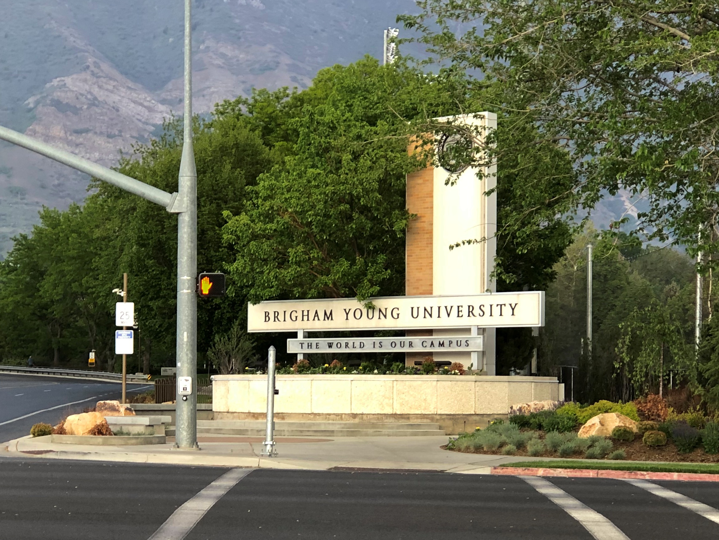
We arrived in North Webster, Indiana, not long after 11 a.m. on July 3. We stopped there because the night before, I read the Atlas Obscura item about the Dixie.
“Steamboats first began sailing on the Webster Lake as early as 1902,” the item explains. “In 1914, Captain Joseph Breeck began operating a 65-foot, wooden-hulled sternwheeler named the Dixie, which today is the oldest of its kind still in operation.
“The original Dixie was later replaced by Captain Breeck with the current 76-foot steel-hulled Dixie in 1929, and he continued to operate the ship until his retirement in 1939.”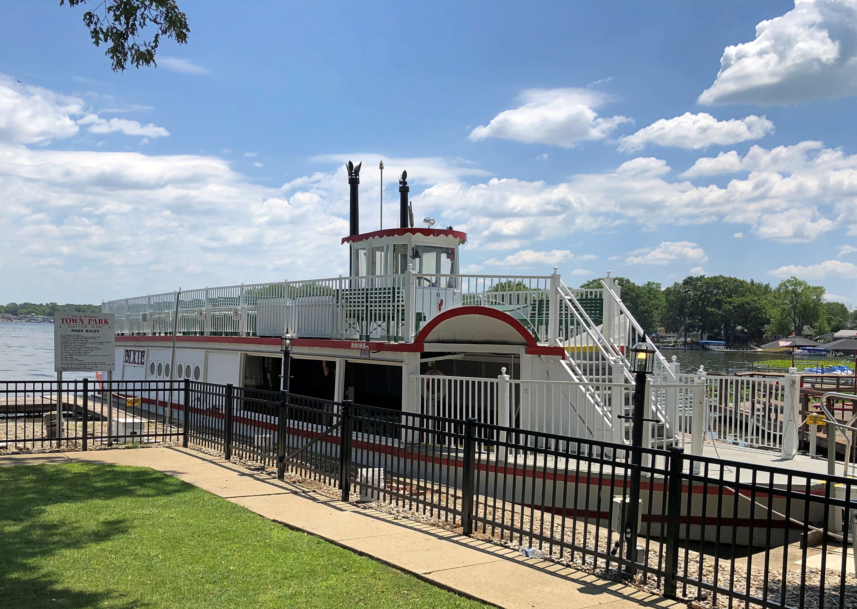
Eventually, in the early 21st century, a nonprofit acquired the vessel, renovating and updating it, paid for in large part through local donations. Now it makes tourist runs on Webster Lake in the summer months. We caught the 1 p.m. sailing.
The day was clear and very warm, perfect for a lake outing. Dixie wasn’t packed, but a fair number of people rode on both lower and upper decks. Tickets were a bargain: $7 for adults. Good for the nonprofit — it isn’t out to gouge tourists.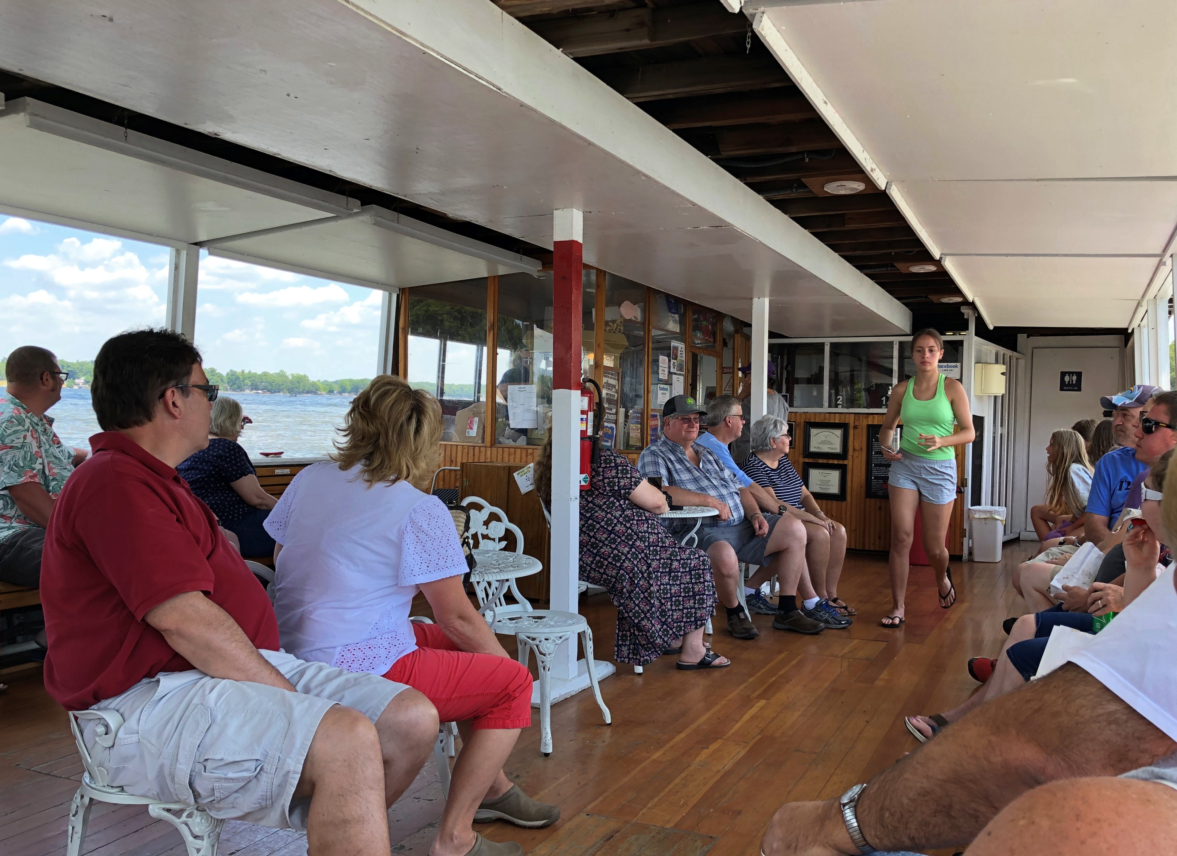
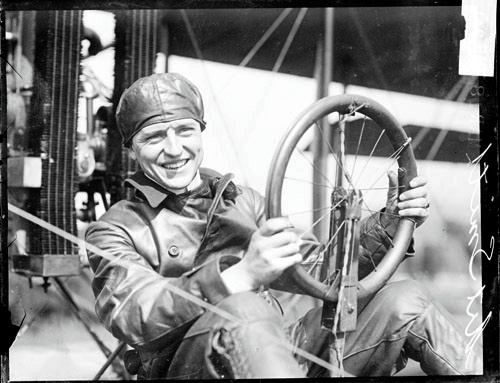
Dixie is a sternwheeler, and here’s the wheel. At the stern.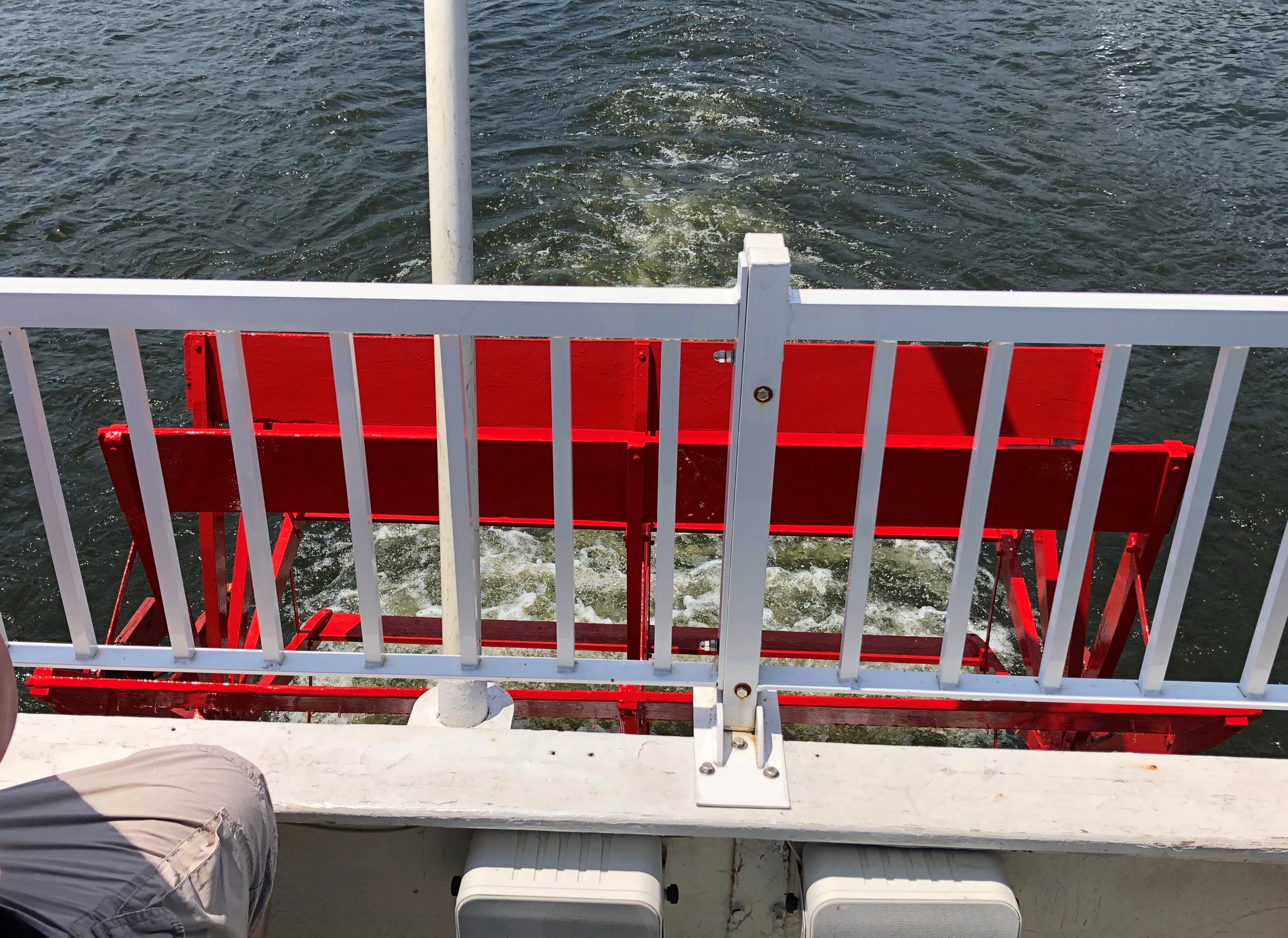
A moment before I took that picture, a boy of about six was standing at the rail, looking down at the wheel. His mother encouraged him to leave, though I hadn’t said anything to her. I was ready to wait my turn.
“He’s fascinated by the wheel,” she said.
“I bet he is,” I said approvingly, but I don’t think she heard me. Managing a small child can be distracting. But if that was his first ride on a sternwheeler, I hope she made note of it on his ticket, and that the family is packratish enough so that he finds it sometime in the 2070s.
As tour boat patter went, Dixie’s taped program was well crafted — a voice talking about the ship, the lake and the surrounding land, with some interludes of peppy but not overwhelming banjo and guitar instrumentals. More actual history than you get on some tours, but not an overload. No intentionally bad jokes, either, but some good detail, especially describing the earlier days of the Dixie.
Capt. Breeck wasn’t a tour operator. He was master of a small working ship, crossing the lake in clement weather to deliver cargo and packages, as well as passengers, such as womenfolk visiting the stores in the town of North Webster. Dixie also carried groceries that it sold, and for a while the captain — clearly a jack of some trades, anyway — operated a small smithy at the back of the vessel.
His successors eventually evolved into tour operators as the surrounding farms gave way to postwar pockets of resort-like development. By now at least three generations have taken rides, including first dates of later married couples, and people taken by their grandparents who are now taking their grandchilden.
Got some views from both decks.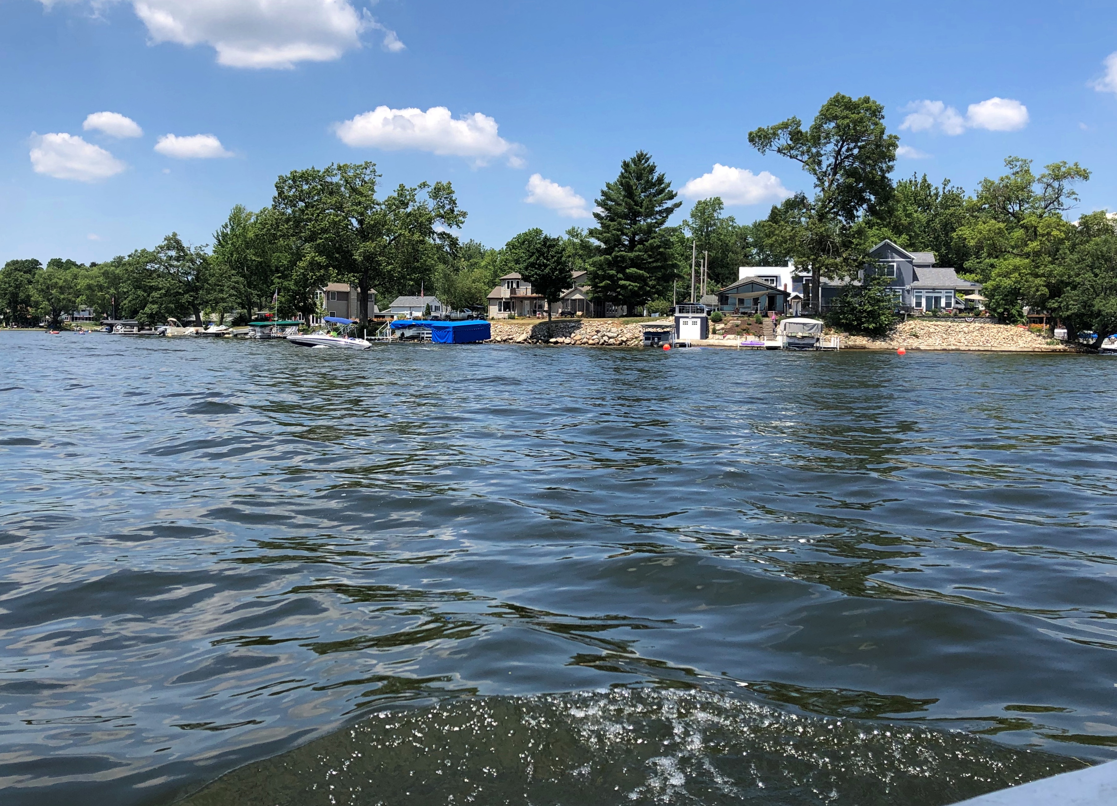
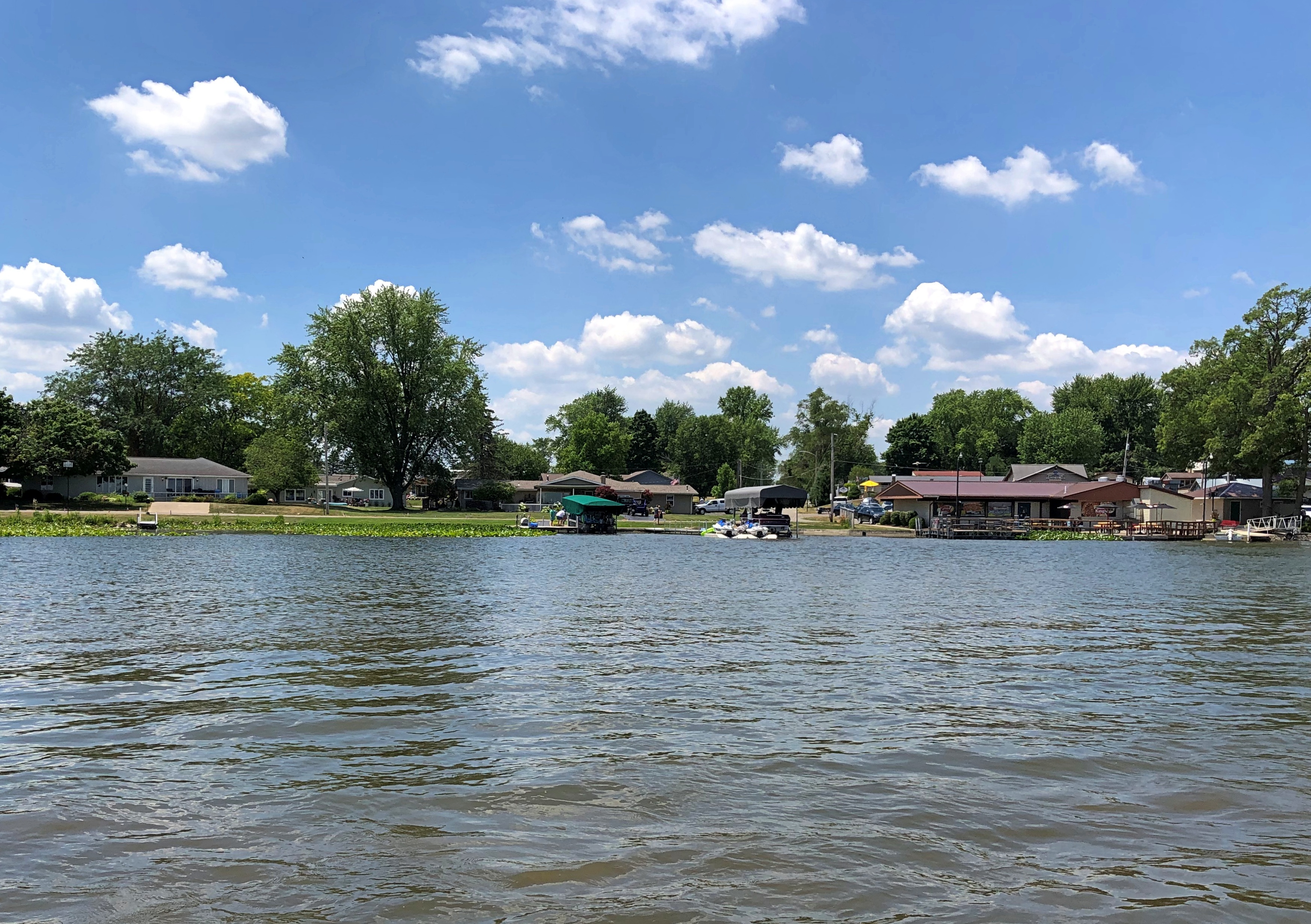
The presentation’s detail about the shoreline is a bit of a blur — the boat docked here or there sometimes, the captain had his house at this other place, that island in the middle of the lake is owned by some notable Indiana family. The names came and went: Fisherman Cove, Miller’s Landing, Stumpy Flats, Weimer’s Landing.
But my ears perked up during the talk about the two sizable hotels that used to be on the lake. One was the Yellow Banks Hotel.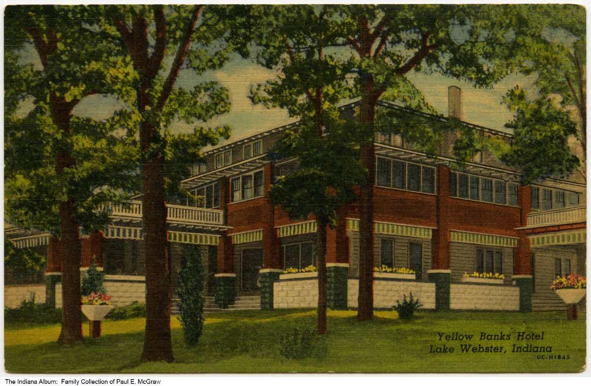
“A very grand hotel, built in 1902,” says the Dixie web site. “The original hotel and its wooden rowboats were painted yellow… This was a scheduled stop for the Dixie until the early 1960s. In the late 1960s the hotel changed owners and fell into disrepair. It briefly became an Italian restaurant (Novelli’s) in the late 1970s, but was dismantled in 1980. Dillinger and his gang stayed at the Yellow Banks Hotel, probably in October 1933 or April 1934.”
The Epworth Forest Hotel (from the web site).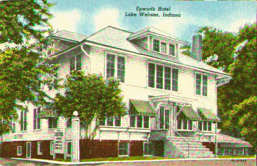
The Epworth had an outdoor amphitheater. “The Dixie would pickup passengers in this protected cove on windy days,” the web site continues. “In 1955 the Dixie began hosting Epworth Forest’s production of Showboat. Once per year the Dixie became the stage for this off-Broadway play.
“By 1964 the cast and production became too large for the boat. From 1964 through 1980, the Dixie would simply deliver the cast of Showboat to this amphitheater for their annual performance. By 1981 the new owners of the Dixie had cancelled this tradition.”
Both of these hotels were cancelled, too, in the way things are usually canceled, not as the result of some moral outrage, but rather by the course of business. By the late 20th century, the economics of even a small resort area like Webster Lake meant that single-family homes, short-term rentals and condos became the norm along the shore.
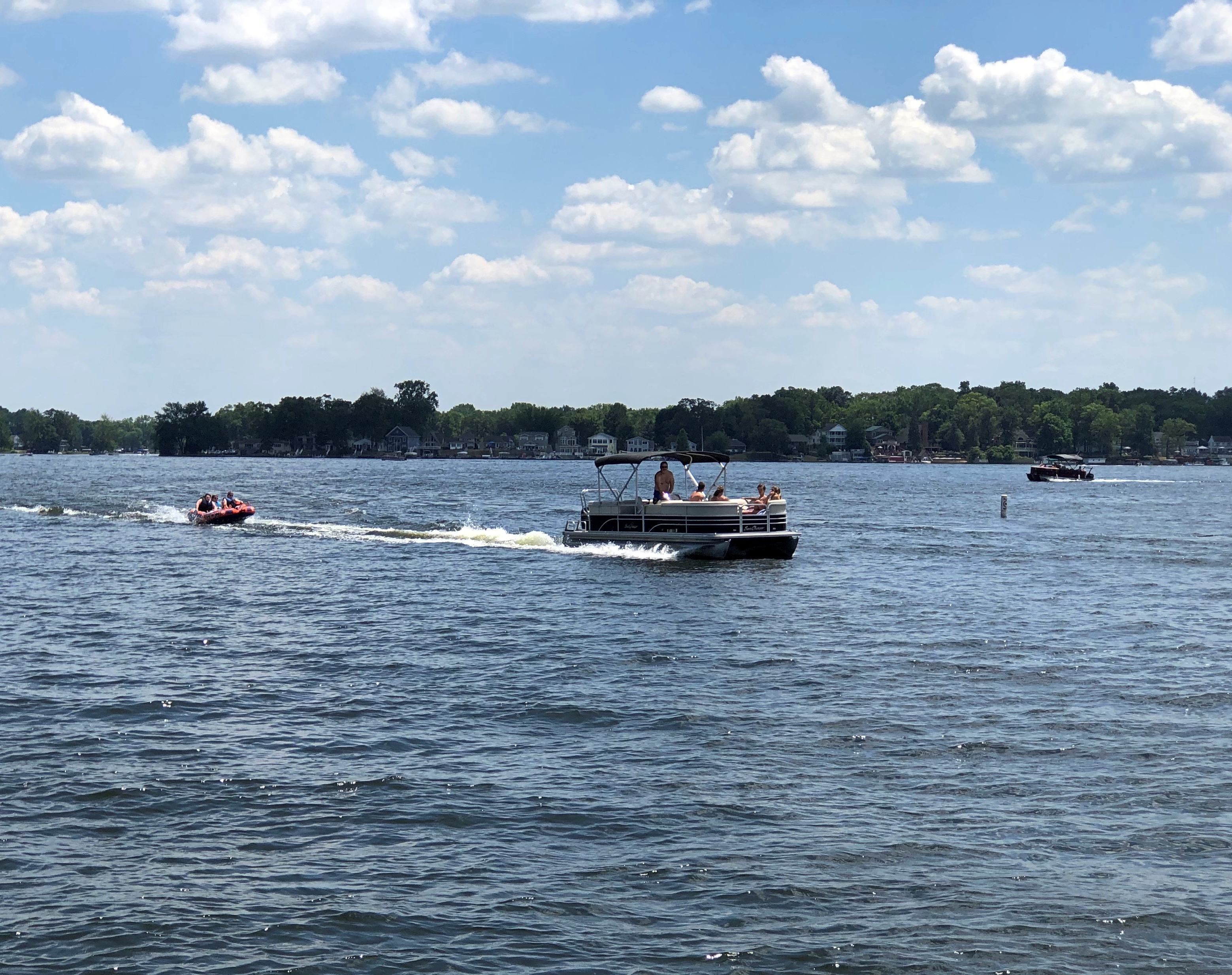
Plenty of other watercraft were in the lake on that second day of the Independence Day long weekend. We got a lot of waves from passersby, and most everyone on the Dixie waved back. Us too.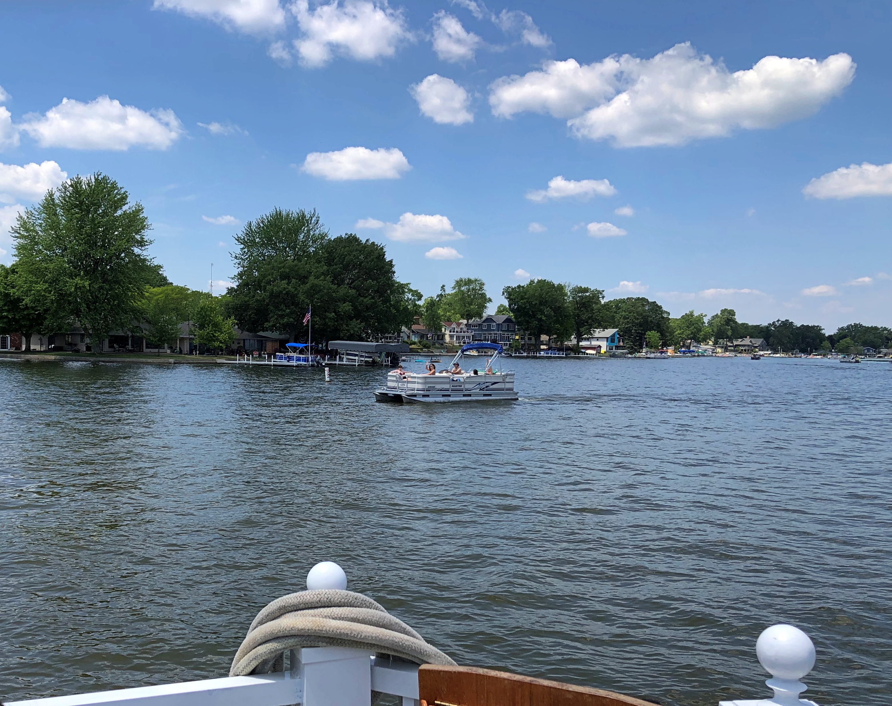
I was out and about throughout the hour and a half or so the tour lasted, though I spent most of my time on the lower deck. My deck companions across the way didn’t, as far as I noticed, get up and move about.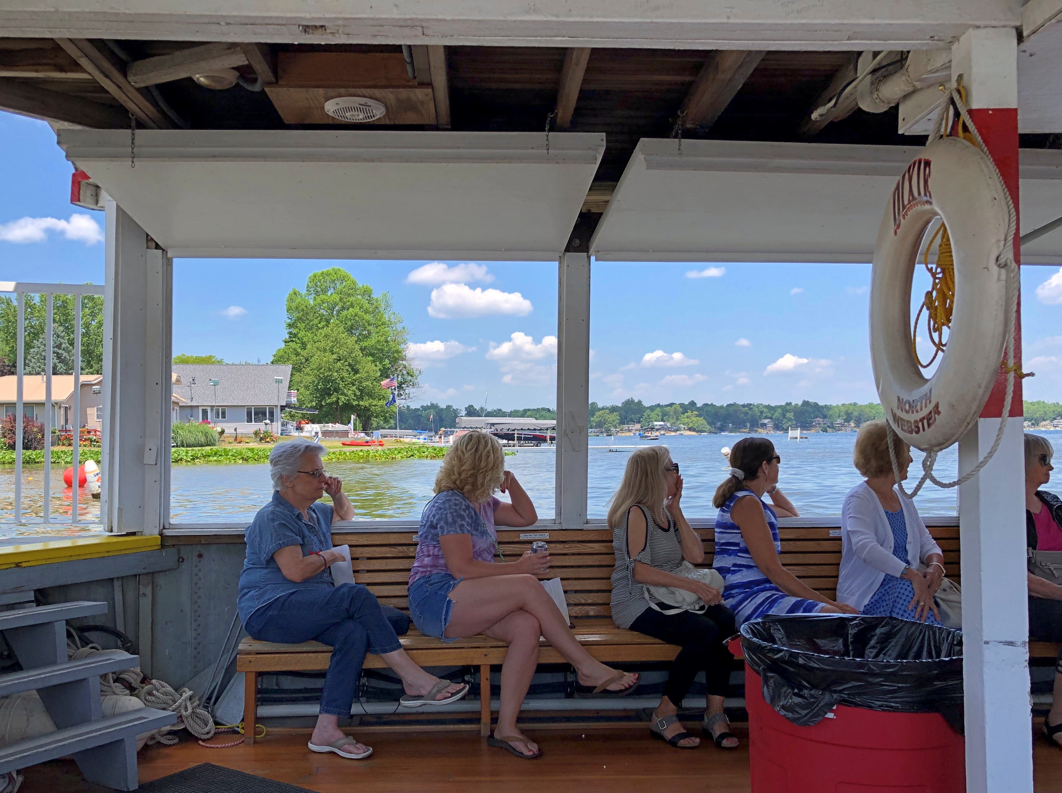

They did shift a few times, though.