Natural Bridges National Monument

A question for very serious presidential history buffs: how many national monuments did President Theodore Roosevelt create? He was the first president with the authority to do so, since the passage of the Antiques Act of 1906, which was actually fairly late in TR’s time in office. Of course, he’d been instrumental in its passage.

Not a man for half measures, the president created 18, including the very first, Devils Tower in Wyoming, coming in at over 1,300 acres, as he took advantage of the fact that the law didn’t limit the size of the monuments. Some of TR’s national monument designations no longer apply, since they later became national parks, such as Petrified Forest, Lassen Peak, Mount Olympus and especially the Grand Canyon.

One by TR that retains its monument status is Natural Bridges National Monument in southern Utah. Created on April 16, 1908, it measures more than 7,600 acres, featuring some of the largest natural bridges in the Western Hemisphere. Natural Bridges also happens to be the first established of Utah’s many national parks and monuments, created about eight years before the National Park Service itself.

We arrived late in the afternoon of May 18.Natural Bridges National Monument

As NPS entities go, Natural Bridges isn’t that large, and can be accessed via a ring road that passes within sight of three major natural bridges. At each, you have the choice of looking at the natural bridge from a viewpoint near the road, or following a trail closer to the feature. Each bridge also has a Hopi name.

Sipapu Bridge.Natural Bridges National Monument

The NPS calls this a “mature” natural bridge, and it is the monument’s tallest and greatest in span. “It endures very little stream erosion because its abutments stand far from the stream,” the pamphlet says.

Kachina Bridge.Natural Bridges National Monument

A little hard to see, but it’s the dark curve almost filled by a tree in my pic. It’s young, according to the park service, with canyon floodwaters still at work enlarging its span.

At the beginning of the trail to Owachomo Bridge.Natural Bridges National Monument

We took a walk closer to Owachomo, about 20 minutes each way.Natural Bridges National Monument Natural Bridges National Monument Natural Bridges National Monument

We encountered no snakes along the way to the bridge. I think we would have heard one before seeing it, anyway. Owachomo’s an “old” bridge, the NPS says: “The bridge may now have a fatal crack, or it may stand for centuries.”

Yep. We didn’t go quite all the way to its underside, since it was time to call it a day — an extraordinary day, as any day that includes Monument Valley and Natural Bridges and the Moki Dugway would be, but exhausting.

Utah 261 & The Moki Dugway

When planning our recent trip to scenic corners of the Southwest, I determined that we were going to make the move from Page, Arizona, to Moab, Utah, on May 18 by way of Monument Valley. I figured the mid- and late afternoon would be given over to the drive out from Monument Valley.

The most direct route to Moab from there is U.S. 163 through Mexican Hat, Utah, then on to U.S. 191 north through Blanding, Monticello and La Sal Junction, all Utah towns. Of course I examined some road maps as part of the process. (Doesn’t everybody? No? How is that possible?)

I spied an alternate route. Just after Mexican Hat, take Utah 261 north to Utah 95, then west a few miles to Natural Bridges National Monument as a possible stopover. I didn’t know anything about that national monument; there are so many. One hundred twenty-nine in fact, of which I’ve only visited a mere 20 or so, counting those on this trip.

A quick look at the park service map of the monument on line told me that is isn’t very large, and a single road loops through it with places to stop. Perfect for a short visit, I decided, before heading on to Moab. We might be a little more tired when we got to Moab, but it would be worth it. I was right.

I didn’t look into Utah 261 any further. On the Rand McNally road atlas, the small label Moki Dugway is next to the road, with a small arrow pointing from that name to about the mid-point of the road. I don’t remember noticing that. Later, I would. Michelin doesn’t mention the dugway at all.

So we set out from Monument Valley, stopping for a moment roughly where Forrest Gump stopped, but otherwise pushing on through. I expected more at Mexican Hat, which seemed to be a hotel or two overlooking the San Juan River plus a few other buildings. North of Mexican Hat, Utah 261 is an ordinary if remote two-lane highway through the desert. Dead ahead are the cliffs of a plateau, but it’s still off in the distance.

Before long, signs warn drivers that the road ahead will be unpaved for a few miles. No problem unless it’s raining, when reportedly unpaved desert roads gum up even four-wheel drives. It looks like it hasn’t rained here in a while.

The plateau grows closer, filling more of the windshield, and another warning sign about the unpaved segment whizzes by. I found myself thinking: does this road go around the plateau? It’s hard to see its course ahead. The road just seems to vanish into the steep cliffs of the plateau.

The next warning signs announce the road grade ahead: 10%. Also, they mention switchbacks on a narrow gravel road. By this time, you’re in the shadow of the cliffs, and realize the road goes up the side.

“Utah 261 is part of the Trail of Ancients, a National Scenic Byway that stretches across 480 miles through Colorado and Utah,” says Road Travel America. “The highway connects Utah Highway 95 with US Highway 163 by crossing Cedar Mesa and plunging down the dugway at an 10% grade, revealing sweeping views of Valley of the Gods, stripes of color in the rocks of the San Juan River Canyon known as the Navajo Tapestry, and distant Monument Valley.”

Up we went. The climb is about 1,200 feet. The road curves as much as you expect, enough to lose count of the switchbacks, all the while kicking up a little sand and gravel in your wake. There aren’t any rails, though usually there’s a rise in the ground at the edge of the cliff, so it would take more than a casual slip of the wheel to take a plunge. Or would it?

It wasn’t really a hard drive, and I didn’t think it was that dangerous, since I was going only fast enough to outpace the pull of gravity. Of course I had to hyper-focus: every instant on the road ahead, though peripherally I caught twisting and turning glimpses of the sky and the increasingly distant valley below.

I enjoyed the drive. It had a rare intensity. Yuriko was less enthusiastic, there in the passenger seat, where eyes can linger on the increasingly high drops.

Only twice did we encounter vehicles coming the other way, down, and while narrow, the road was wide enough to pass them without stopping. The state of Utah recommends that only vehicles less than 28 feet in length and 10,000 pounds in weight attempt to drive the dugway, which seems reasonable to me, and which I’m sure is routinely ignored.

“Moki is derived from the Spanish word, Moqui, a general term used by explorers in this region to describe Pueblo Indians they encountered as well as the vanished Anasazi culture,” Road Travel America explains. “Dugways are roads chiseled into steep slopes.”

Turns out that the Moki Dugway is a relic of the early atomic age, created in 1958 for trucks to haul uranium ore from the Happy Jack Mine on Cedar Mesa to the mill in Halchita, near Mexican Hat, which left a radioactive legacy of its own.

I’d learn about all that later. Of course we made it to the top. The road turned back into an ordinary two-lane blacktop. I paused to take a few pictures of the valley below. Note the lower paved level of Utah 261, snaking toward the cliffs.Valley of the Gods

Valley of the Gods, eh? Angry, unforgiving gods lording over a desolate realm, I’d say.

Monument Valley Navajo Tribal Park

Back to posting on the last day of May. Memorial Day and Decoration Day coincide this year, which won’t happen again until 2033.

“Throughout the 19th century, white settlers considered the Monument Valley region — like the desert terrain of the Southwest in general — to be hostile and ugly,” notes Smithsonian magazine. “The first U.S. soldiers to explore the area called ‘as desolate and repulsive looking a country as can be imagined,’ as Capt. John G. Walker put it in 1849, the year after the area was annexed from Mexico in the Mexican-American War. ‘As far as the eye can reach… is a mass of sand stone hills without any covering or vegetation except a scanty growth of cedar.’ ”

Tastes change. I imagine Capt. Walker’s reaction was entirely reasonable for his time, considering he and his men came by horse and mule, carrying everything they needed, living meagerly and fully aware that their surroundings could kill them all too easily, or at least make for days of uncomfortable misery, whatever season it was. Monument Valley was a vivid ordeal for them, not a notion fostered by cinematic entertainment.

We have it a good deal easier here in the 21st century, and am I glad. All it took for us to reach Monument Valley Navajo Tribal Park on May 18 was a roughly two-hour drive from Page, Arizona, by Toyota horseless carriage along paved two-lane roads through the Navajo Nation.

My main concern that morning — and we got up fairly early — was that I didn’t know for sure we’d get in. The park’s policy for visitors is, first come, first served, and there’s a limit to the number of people who can enter each day. Even on a weekday, I imagined joining a long line of cars waiting, only to be turned away.

Nothing of the kind happened. We got to the entrance booth with no one ahead, paid $8 a head, and got in to the place known as Tse’Bii’Ndzisgaii in Navajo. First stop, a fully modern visitor center.Monument Valley Navajo Tribal Park

The wind whipped the four flags in full motion: Utah, the Navajo Nation, the United States and Arizona. I wasn’t familiar with the Navajo flag, but I am now.

Something I didn’t know until we entered the park and saw a number of private roads leading off to residences in the distance: people live in Monument Valley, unlike in a national park or monument. I expect ranching and running tours are their main occupations, along with selling the products of Navajo craftsmanship to visitors.

For $8 a head — an absolute bargain, if you asked me — you get to drive around a 17-mile unpaved loop road in the park, dusty and red as Mars, but only occasionally bumpy. The road doesn’t venture that deep into the park, which measures nearly 91,700 acres. Longer treks by foot or horse or jeep are possible, available only with Navajo guides, and no doubt offer rich rewards to those undertake them.

Even so, the drive is incredible, passing formations of astounding size and shape and contour and color. It’s easy to see what enamored John Ford about the place.
Speaking of the director, the park honors him with a spot called John Ford Point.

As well it should, since he put Monument Valley on the map, as far as the more receptive imagination of the 20th century was concerned, though naturally he wasn’t the first outsider of that period to visit — the likes of Zane Grey and (of course) Theodore Roosevelt came earlier. Harsh terrain, still, but the material progress of later years allowed later visitors the leisure to appreciate the place in a way that Capt. Walker could not.

Ford must have known he had a cinematic treasure in view when he had the cameras first deployed here for Stagecoach. The world clearly agreed.

Of Ford’s many forays into the valley, Smithsonian has this to say: “The shoots were usually festive, with hundreds of Navajo gathering in tents… singing, watching stuntmen perform tricks and playing cards late into the night. Ford, often called ‘One Eye’ because of his patch, was accepted by the Navajo, and he returned the favor: after heavy snows cut off many families in the valley in 1949, he arranged for food and supplies to be parachuted to them.”

Though it wasn’t the first place we visited on the drive — in fact, it was nearly the last — the instantly recognizable view from John Ford Point is going to go first here.Monument Valley Navajo Tribal Park Monument Valley Navajo Tribal Park Monument Valley Navajo Tribal Park

Because later movies and commercials returned to this particular view so often, the other marvels on the road aren’t as famed or recognizable. But they’re equally worth a good look. Just a sampling below; there was something remarkable just about everywhere you look.Monument Valley Navajo Tribal Park
Monument Valley Navajo Tribal Park Monument Valley Navajo Tribal Park Monument Valley Navajo Tribal Park

Aside from the rock giants, the terrain itself fascinates, its colors so unusual to those of us from greener places.Monument Valley Navajo Tribal Park Monument Valley Navajo Tribal Park

Color that the road itself shares.Monument Valley Navajo Tribal Park

Without color, the contours emerge vividly; Ford must have appreciated that, too.Monument Valley Navajo Tribal Park
Monument Valley Navajo Tribal Park

We left the park that afternoon, but even as you drive north from Monument Valley on U.S. 163, it has one more gift to give, if you’re paying attention. I almost wasn’t. As we drove along, we noticed people ahead, standing in the road, taking pictures. They got out of the way before we reached them, but I wondered, what are they doing there?

Then it hit me, and we stopped at the next pullout in the road, maybe a fifth of a mile away, and looked back. A view almost as famed as that at John Ford Point, and certainly as arresting.Monument Valley Navajo Tribal Park

That isn’t quite the “Forrest Gump Stopped Here” place, but I wasn’t about to go back where those yahoos had been standing in the road just for that (unlike Stagecoach, it isn’t a movie I like very much). In fact, I wouldn’t have remembered the view was made famous in that movie, either, but some other people had stopped where we were, and I overheard them talking in German about Forrest Gump.

U.S. 89A

Much excitement yesterday afternoon around here, when the village alarm sirens went off around 3:30. Moments before, my phone told me of a tornado warning, both in English and Spanish. I was advised to seek shelter.

Instead, I took a look out of both the front and back doors. We had rain at that moment, but very little wind, and the clouds weren’t particularly dark. The sirens quit, but started again a few minutes later. I listened and watched a while.

Another warning came and went, but the wind stayed low. It might have been a reckless impulse, but nothing I saw made me want to seek shelter, which in my case would be the lower level near the bathroom, but with the bathroom door closed, because there’s a window in there. Still, I watched the skies more closely for a while. I understand that while a funnel cloud had been spotted over the northwestern suburbs, for whatever reason it never came to the ground and stir things up.

Our most recent trip was a driving one, despite the cost of fuel. I have the receipts in front of me for buying gas five times. They helpfully list the price per gallon, regular each time.

St. George, Utah (May 15): $4.599. Page, Arizona (May 17): $4.789. Blanding, Utah (May 18): $4.659. Moab, Utah (May 20): $4.689. Salt Lake City (May 21): $4.569. According to AAA, the national average for gas a week ago (May 19) was $4.589, so we were paying slightly more than average (which today is $4.600), but less than at home. A year ago, the average was $3.035, for an increase of about 51% since then.

All together, we paid $147.63 for gas on this trip, which would have (roughly) been about $100 had we taken the same trip a year ago. So that’s about $50 that Mr. Putin owes me. I suspect he’s going to stiff me on that charge.

I didn’t like paying a premium for fuel, but it was completely worth it. Some of the drives were extraordinary.

Such as the one from Page to the Grand Canyon and back, especially back, because getting to the park was the main focus in the morning, and we didn’t stop. On our return, which was in the late afternoon of May 17, we took a more leisurely attitude, and took a look at things along the way.

U.S. 89 out of Page is a good drive through a red desert landscape, generally following the Colorado River, which is mostly invisible, far below in Marble Canyon. The drive south from Jacob Lake, Arizona, on Arizona 67 through the wonderfully alpine Kaibab National Forest to the park entrance, is also good.

But the best road that day by far was the two-lane U.S. 89A, which connects the other two, U.S. 89 and Arizona 67. As visible in the map, it skirts Vermilion Cliffs National Monument.

On our return, we headed east on 89A from Jacob Lake (where 89A meets Arizona 67), which is in the forest at that point: through a fine aspen, spruce-fir, ponderosa pine and pinyon-juniper woodland. Nice, but the road is even better is when you reach the edge of the Kaibab Plateau. There’s a place to stop and see the Vermilion Cliffs and the desert flatlands below.Vermilion Cliffs National Monument Vermilion Cliffs National Monument

The thin black line is 89A. From the viewpoint, the road heads down toward the flatlands, leaving the Kaibab Plateau. As far as I can tell from the maps, the highway is the border of the monument, or very close to it. In any case, you see the cliffs looming not far away. They follow you for miles down the road.Vermilion Cliffs National Monument Vermilion Cliffs National Monument Vermilion Cliffs National Monument

“Vermilion Cliffs National Monument is a geologic treasure,” says NPS signage along the road. “Its centerpiece is the majestic Paria Plateau, a grand terrace lying between two great geologic structures, the East Kaibab and the Echo Cliffs monoclines.

“The Vermilion Cliffs, which lie along the southern edge of the Paria Plateau, rise 1,500 feet in a spectacular array of multicolored layers of shale and sandstone… these dramatic cliffs were named by John Wesley Powell in 1869, as he embarked upon his expedition of the Grand Canyon down the Colorado River.”

Earlier explorers were here, too. In 1776, Fathers Francisco Atanasio Dominguez and Silvestre Velez de Escalante came this way, though they had to turn back to Santa Fe eventually, so harsh was the terrain.

In our time, there are a handful of lodges on 89A in the shadow of the Vermilion Cliffs, but little else in the way of human artifacts, at least until you come to Navajo Bridge, which takes the road across the Colorado River at Marble Canyon.Navajo Bridge

Rather, two Navajo Bridges: in my picture, the original bridge on the left, and the modern bridge on the right, both steel spandrel arch bridges. The historic bridge was dedicated in 1929 and represented the only crossing of the Colorado for many miles, effectively joining the Arizona Strip with the rest of the state. The wider bridge opened in 1995, and the older one was repurposed as a pedestrian and equestrian bridge.

Naturally, we went across it.
Navajo Bridge

The view of the Colorado from the pedestrian bridge.Navajo Bridge Navajo Bridge

The historic plaque.
Navajo Bridge

I looked up the Kansas City Structural Steel Co. There’s a newish company of that name, founded in the 1990s, but the one referred to on the plaque seems to be this one, whose work was in the early 20th century.

There are warning signs as well.Navajo Bridge

I supposed it means a survivable sort of jump, as with a bungee cord, which no doubt lunatics do sometimes, or at least used to.

Grand Canyon National Park, North Rim

There is one way to drive on paved roads from Page, Arizona, to the North Rim of Grand Canyon National Park, at least without going way out of your way. Go south from Page on U.S. 89, then north on U.S. 89A, then south on Arizona 67. If that sounds a little roundabout, it is, but the drive is worth every minute you spend. It takes two to two-and-a-half hours if you don’t stop much.

Eventually, you end up at the park, famed the world over.Grand Canyon National Park

As the raven flies, and we saw a fair number of them soaring on the air currents around the canyon, it is about 10 miles from the North Rim to the South Rim. Driving from the North Rim to the South involves more than 200 roundabout miles.

The South Rim has fairly close access to a large metro area — Phoenix — and the sizable town of Flagstaff as a closer jumping off point. That’s what we did in 1997. It occurs to me that we visited the canyon this time two days short of exactly 25 years after the first time.

The nearest town to the North Rim is Page, reached as I’ve described. Not exactly remote, but certainly out of the way. In 2021, about 221,000 visitors came through the North Rim entrance when it was open May through mid-October, according to NPS stats. (The road is snowed in much of the year.) So for every one visitor to the north last year, there were 10 to the south, with about 2.2 million visitors coming to the South Rim during 2021.

When we got to the North Rim last Tuesday morning, the place was popular enough, but not overrun. Even mere feet away from the Grand Canyon Lodge North Rim parking lot, which is where the road into the park ends, the view doesn’t disappoint.Grand Canyon National Park

The lodge itself, just opened for the season two days earlier, is perched on the rim, and built from native stone and timber, especially Kaibab limestone from the nearby cliff at Bright Angel Point.Grand Canyon National Park

People were perched on the lodge viewpoints.
Grand Canyon National Park

Through a subsidiary, the Union Pacific Railroad originally developed the lodge in the 1920s, though the first structure burned down after only a few years, and was rebuilt  somewhat differently in the ’30s. Design by Gilbert Stanley Underwood, who specialized in lodges and railroad stations. He also designed 140 cabins surrounding the main lodge by 1928.

“Erected in 1927-28, this is the most intact rustic hotel development remaining in the National Parks from the era when railroads, in this case the Union Pacific, fostered construction of ‘destination resorts,’ ” says the National Historic Landmarks listing for the building.

“The main lodge building was rebuilt in 1936 following a devastating fire, but its most important interior spaces retained their scale, materials and flavor, and the deluxe cabins and standard cabins of log and stone construction also kept their fabric, layout and ambiance.”

From the lodge, Bright Angel Point is a 10-minute walk along a trail created by — no need to guess very hard — CCC workers. Those lads need to be honored with a bronze on the grounds somewhere, though I might have missed it.Grand Canyon National Park Grand Canyon National Park Bright Angel Point Grand Canyon National Park Bright Angel Point
Out at Bright Angel Point. Let’s just say there were impressive views. And an impressive wind whipping by.Grand Canyon National Park Bright Angel Point Grand Canyon National Park Bright Angel Point Grand Canyon National Park Bright Angel Point
We didn’t have the place to ourselves, but sometimes, almost.
Grand Canyon National Park Bright Angel Point

We had lunch in the lodge restaurant, an enormous space with high ceilings, dark woods and towering windows to bring the view of the canyon into room. The food: decent. The view: magnificent.

A separate trail leads away from the lodge and heads toward the campgrounds, a few miles away. We walked part of that trail, which generally follows the rim.Grand Canyon National Park North Rim

Offering its own views.Grand Canyon National Park North Rim

A return trail cuts through a pine forest, with no notion of the yawning canyon a short distance away.Grand Canyon National Park North Rim Grand Canyon National Park North Rim

Sometimes, we had to go around the trees lying across the trail.Grand Canyon National Park North Rim

There’s a life metaphor in that somewhere, but on the other hand, a walk in the woods is sometimes just a good ramble.

The Grundy County Historical Society & Museum

I did a quick look, and it seems that the Rockwell Inn, a restaurant in Morris, Illinois, closed for good sometime in 2013. I ate there in 1987, returning from Springfield from the first business trip I’d ever taken, and remember the dark interior, the very long and ornate wooden bar that had supposedly been at the 1893 world’s fair, and the fish — some kind of fish — cooked in a bag with almonds and spices, superbly done.

That was the only time I ever ate there. I gave it a moment’s thought after I’d visited the Grundy County Historical Society & Museum on Friday, which is in Morris.Grundy County Historical Society & Museum

If I’d thought of it while I was at the museum, I could have asked the woman at the desk, the only other person there, whether she remembered the restaurant. She might well have, or even pointed out a Rockwell artifact, though I’m pretty sure that the museum didn’t get the bar. I hope someone got it.

The museum has a lot of other things, though. That’s part of the charm of local, volunteer-run museums. Stuff. Such as items to remind us that Prince Albert is, or was, in a can.Grundy County Historical Society & Museum
Business machines of yore.Grundy County Historical Society & Museum Grundy County Historical Society & Museum

Clothes.Grundy County Historical Society & Museum Grundy County Historical Society & Museum

Things that used to be found in middle-class homes.Grundy County Historical Society & Museum Grundy County Historical Society & Museum

Farm equipment.Grundy County Historical Society & Museum

And some items specific to Grundy County industry. Coal has been mined there for a long time, leaving behind tools.
Grundy County Historical Society & Museum

Lots to look at on a rainy, cold spring day, when you have a museum all to yourself.

Thursday Grab Box

Lake Michigan was active but not stormy on Saturday. Views from Loyola.Lake Michigan 2022 Lake Michigan 2022

There’s a coffee-table book in this: chain-hung Chicago signs.
Devil Dawgs Chicago

High-res images, of course. Can go on the same coffee table with Austin neon.

Also Chicago. Specifically, on the street. Make that in the street: a Toynbee tile-like embedment doing its part to remind us of the beleaguered Ukrainians.

Recently I started reading Illegal Tender, subtitled “Gold, Greed and the Mystery if the Lost 1933 Double Eagle,” by David Tripp (2004). A remainder table find some years ago; nice hardback. As it says, the book tells the intriguing (to me) story of the 1933 Double Eagle, which tends to make lists of the world’s most valuable coins, along with the likes of the Brasher Doubloon, the 1804 Bust Dollar and the 1913 Liberty Nickel. Coins so special that their names are capitalized.

On that particular list, I hadn’t heard of the 723 Umayyad Caliphate Gold Dinar, but wow, what a name, with images of ancient treasure in distant lands woven right into the words. The 1913 Liberty Nickel was the MacGuffin in an episode of the original Hawaii 5-0. Namely, “The $100,000 Nickel,” which first aired on December 11, 1973.

“A rare 1913 Liberty Head nickel, one of only five ever made, is to be auctioned at a coin show held at the Ilikai Hotel,” says the imdb entry on the episode. “European master criminal Eric Damien gets con artist and sleight-of-hand expert Arnie Price freed from jail so that he can switch a cleverly-made fake with the original before the auction. But things do not go as planned, as Price, fearing capture, tries to dispose of the nickel in a news rack, and the chase is on to recover the nickel before anyone else finds it.”

Naturally, McGarrett and his men recover the nickel. I don’t remember that specifically, even though I saw that episode either that day or on repeat, but that’s a safe assumption for the denouement. I do remember that I’d heard of the nickel before, probably in a Coins or Coinage article.

I think the episode at least partly inspired one of the Super 8 movies I made with friends David and Steve in junior high, The $300,000 Dime, which I think involved Swiss operative Hans Lan foiling the theft of the titular dime. Sadly, this and the other Hans Lan story, The Assassin, plus the SF non-epic Teedees of Titan and a couple of others whose names I’ve forgotten, are lost as the Hanging Gardens of Babylon, except that no one cares.

South Bend City Cemetery

Oddly enough, our microtrip to South Bend last weekend wasn’t much of a trip to South Bend. Our motel was in the city, near the airport, and we drove through town a few times, but mostly we were in Norte Dame — which is a town besides being a university of that name — and Mishawaka.

Still, we had a few South Bend moments.South Bend for Pete mural

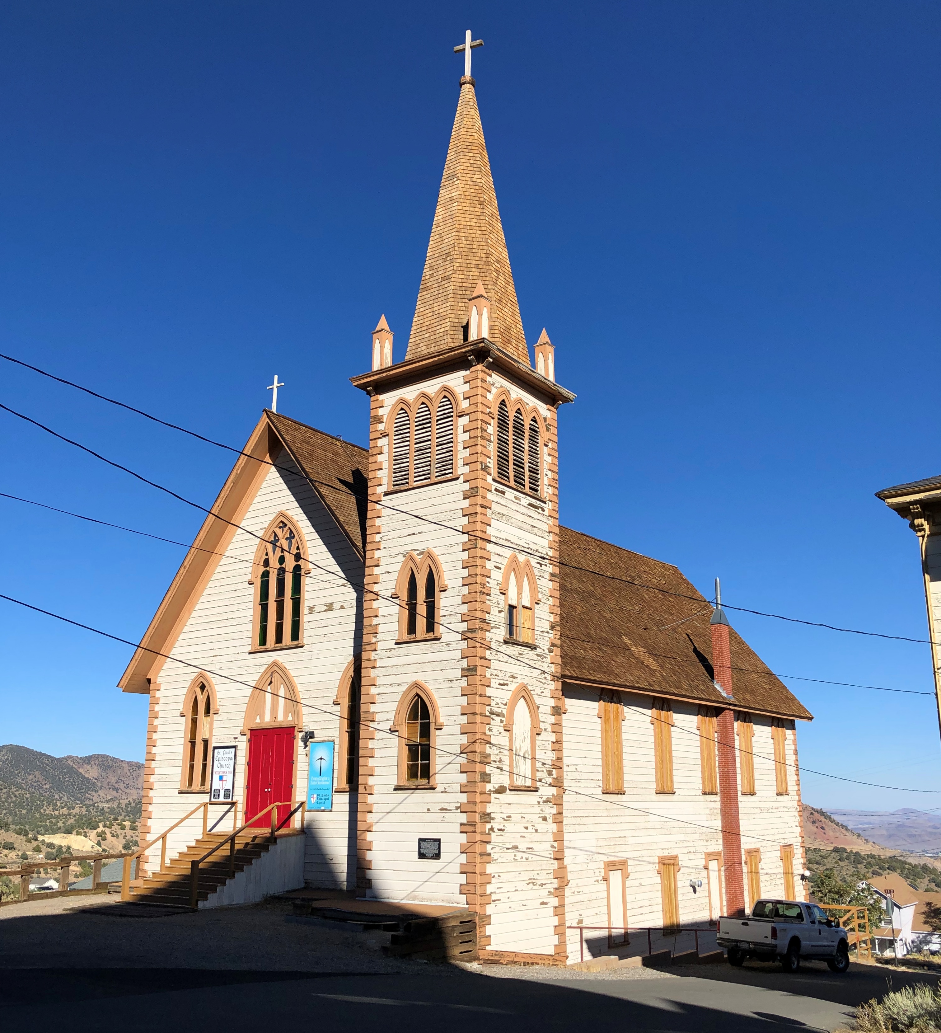
Also, on Sunday morning, I went by myself to the South Bend City Cemetery, because of course I did. On the way I took a short look at St. Paul’s Memorial Church (Episcopal), because of course I did.St Paul's Memorial Church, South Bend

With John 12:17 over one of the doors.St Paul's Memorial Church, South Bend

The cemetery is a few blocks away. Founded in 1832, with about 14,800 permanent residents, mostly from the 19th century, though I spotted a scattering of 20th-century burials.

An aside: I read this week that Kane Tanaka, regarded as the oldest living person, died at 119. Born in 1903. Though it’s clearly been true for a while, I just realized that means that no one who lived any time at all in the 19th century is still alive. No one whose age is verifiable, anyway.

Except in the sense that we still remember, personally, people who lived at least a little while in that century, such as my grandmother. Is someone not well and truly dead until everyone who remembers him or her is too?

South Bend City Cemetery, the entrance.St Paul's Memorial Church, South Bend

The cemetery office, I assume. Handsome little structure.South Bend City Cemetery 2022

Not too many large memorials or much funerary art, but well populated by a variety of weathered standing stones. As usual, I was the only living person around. Not even groundskeepers on Sunday.South Bend City Cemetery 2022 South Bend City Cemetery 2022 South Bend City Cemetery 2022

As I said, the cemetery’s pretty near St. Paul’s, which is in this image.South Bend City Cemetery 2022

A handful of mausoleums. No name on this one.South Bend City Cemetery 2022

A boarded-up mausoleum. Not something you see much. I like to believe that the cast-iron door that probably hung there went to a scrap drive and did its tiny part to defeat Hitler. But I also suspect that it might have been stolen one night instead.

Large to the small.
South Bend City Cemetery 2022

The worn, broken stone of Peter Roof, the first recorded burial. Roof, I understand, was a veteran of the Revolution.

There’s a poignancy in time eating away at memorials as surely as it did those memorialized. Worn lettering, old-time symbols, dark smudges of pollution and dirt.South Bend City Cemetery 2022

Rust, too. Such is the condition of the GAR stars I saw. This is the kind of cemetery that would have them. Rusty, but they endure as a faint echo of the camaraderie of men who fought and won the day for the Union.South Bend City Cemetery 2022 South Bend City Cemetery 2022

As you’d expect, at least one Studebaker has a sizable memorial. South Bend was their town.

The memorial has lasted much longer than the company of that name.South Bend City Cemetery 2022

I didn’t come looking for the car-making family. I had someone else in mind: Schuyler Colfax.South Bend City Cemetery - Vice President Schuyler Colfax grave

Good old Vice President Colfax of Grant’s first term, famed in — well, neither song nor story. Still, his contemporaries thought highly of him. They must have. Not only did he get the main stone, he got this.South Bend City Cemetery - Vice President Schuyler Colfax grave

And this — close to our time, in 1978.South Bend City Cemetery - Vice President Schuyler Colfax grave

Order of Rebekah? Now you know.

Leaving the cemetery, I was glad to see that it’s on Colfax Ave. It’s a more modest street than Colfax Ave. in Denver, but South Bend is a more modest town.

Notre Dame Stroll

Along with the rest of northern Indiana, the campus of the University of Notre Dame is just beginning to turn green, with grass fully that color, and bushes and trees budding. We began our walk on campus on Saturday afternoon as one does, at a large parking lot. But the lot had good placement, not far from St. Mary’s Lake.St Mary's Lake, Notre Dame St Mary's Lake, Notre Dame

A nearby lake is St. Joseph’s. You’d think there would be a Baby Jesus Pond somewhere, but I don’t see it on the map.

Next to the basilica is Norte Dame’s magnificent Main Building. Serving as the administrative center for the school, the structure dates from 1879, replacing a building that burned down early that same year, and was designed Willoughby Edbrooke. Its gold-leaf dome was added a few years later, complete with a massive gilded statue of Mary atop it.Notre Dame Main Building

The interior looks pretty spiffy. Unfortunately, it was closed for an event. So we headed south along the well-manicured lawns of Notre Dame, eventually reaching the Eck Visitor Center and the Hammes Bookstore, which would be more accurately called the Hammes ND-Themed Clothing Store.Notre Dame campus

Jesus faces the Main Building.Notre Dame campus

This isn’t the Touchdown Jesus Notre Dame is known for, however. That, alas, we didn’t see (or First Down Moses, either).

Further down the lawns is the founder and first president of Norte Dame in bronze, created by Italian sculptor Ernesto Biondi and unveiled in 1906.
Notre Dame campus

Namely, the Very Rev. Edward (Édouard) F. Sorin (1814-93), who also had time to found St. Edward’s University in Austin and have a mighty oak named for him. The plinth is inscribed with Latin, lauding Sorin.

South along the lawns is a raft of collegiate buildings with collegiate names: Sorin Hall, Lafortune Student Center, Hayes-Healy Hall, Walsh Hall and the Norte Dame law school. Formally, it’s the Eck Hall of Law. I was impressed by how new the building looked, despite its traditional stylings. It is fairly new: 2008, a design by Cardosi Kiper.
Notre Dame Campus

A lot of the buildings looked newish, which tells me that Notre Dame has the dosh in our time — or can source it from donors like Mr. Eck — for capital projects. As indeed it does: the university’s endowment is about $12.3 billion, putting it at number 8 on this U.S. News & World Report list.

That kind of money also buys some nice details, or at least it should.Notre Dame Campus

Further on, the “bookstore” didn’t let you forget where you were.Notre Dame campus

Finally, I don’t want to forget Chaplain William Corby, who rates a statue not far from the basilica and Main Building.Notre Dame campus

A plaque near the bronze says: The first bronze sculpture of Chaplain William Corby by Samuel Murray was dedicated on the Gettysburg battlefield by Civil War veterans of the five regiments of the Union Army’s Irish Brigade. His statue is on the same boulder of Cemetery Ridge where he stood to give the soldiers General Absolution on July 2, 1863, the second day of the three-day battle

Minutes later the Irish Brigade went into action at Little Round Top and the Wheatfield. The Brigade lost 27 killed, 109 wounded, and 62 missing. Gettysburg’s individual statues are of generals, except President Lincoln, Chaplain Corby, and a civilian.

This duplicate statue was dedicated here in 1911. Father Corby was president of Notre Dame twice: 1866-72, 1877-82. He planned the Grotto, finished in 1896, and died in 1897.

Crossing the Bar

Warmish day, though I didn’t have a lot of time to spend out in it, other than walking the dog just before sunset. Windy but not especially cold then, but even better was the mid-day, when the sun came out and temps nearly hit 70 degrees F.

An editorial cartoon that assumed many, or at least some of its readers would know some Tennyson. Probably a reasonable assumption in 1945.

That came over the transom today in wandering around the online labyrinth. It is April 12, after all.