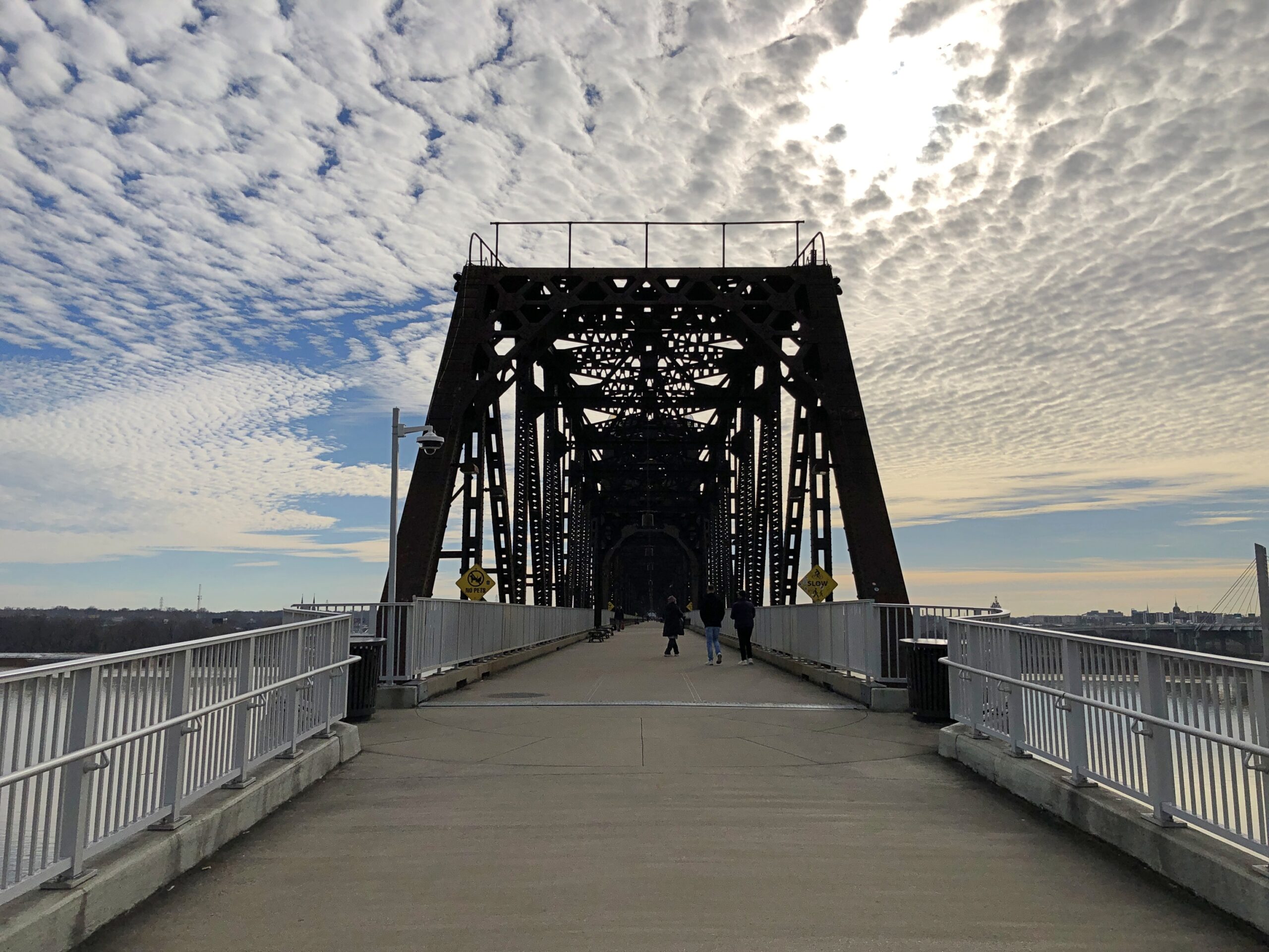
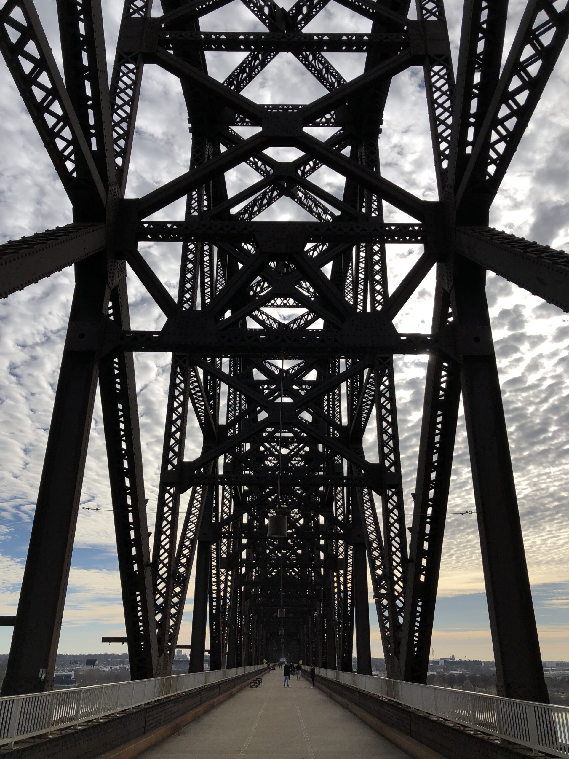
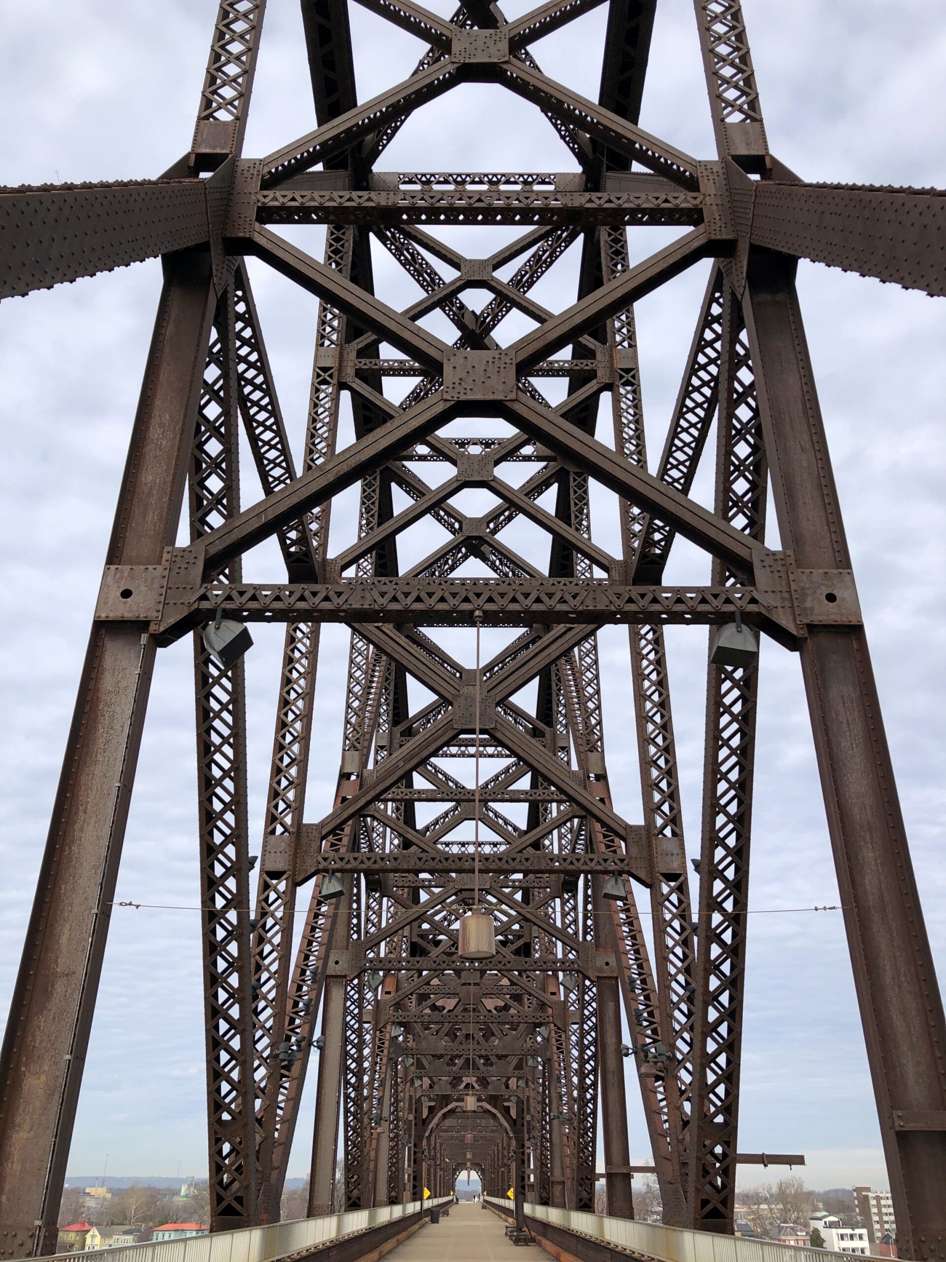
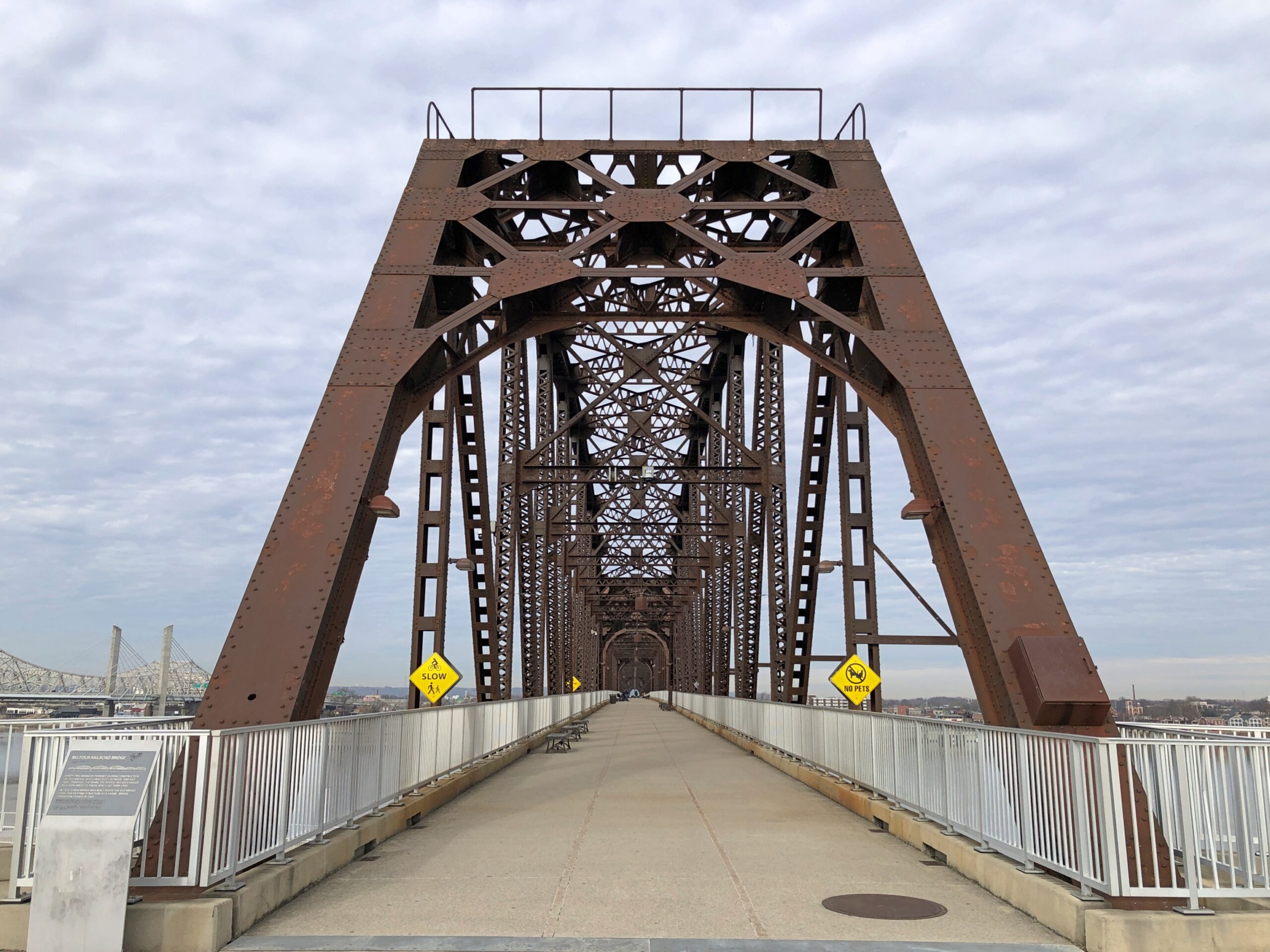
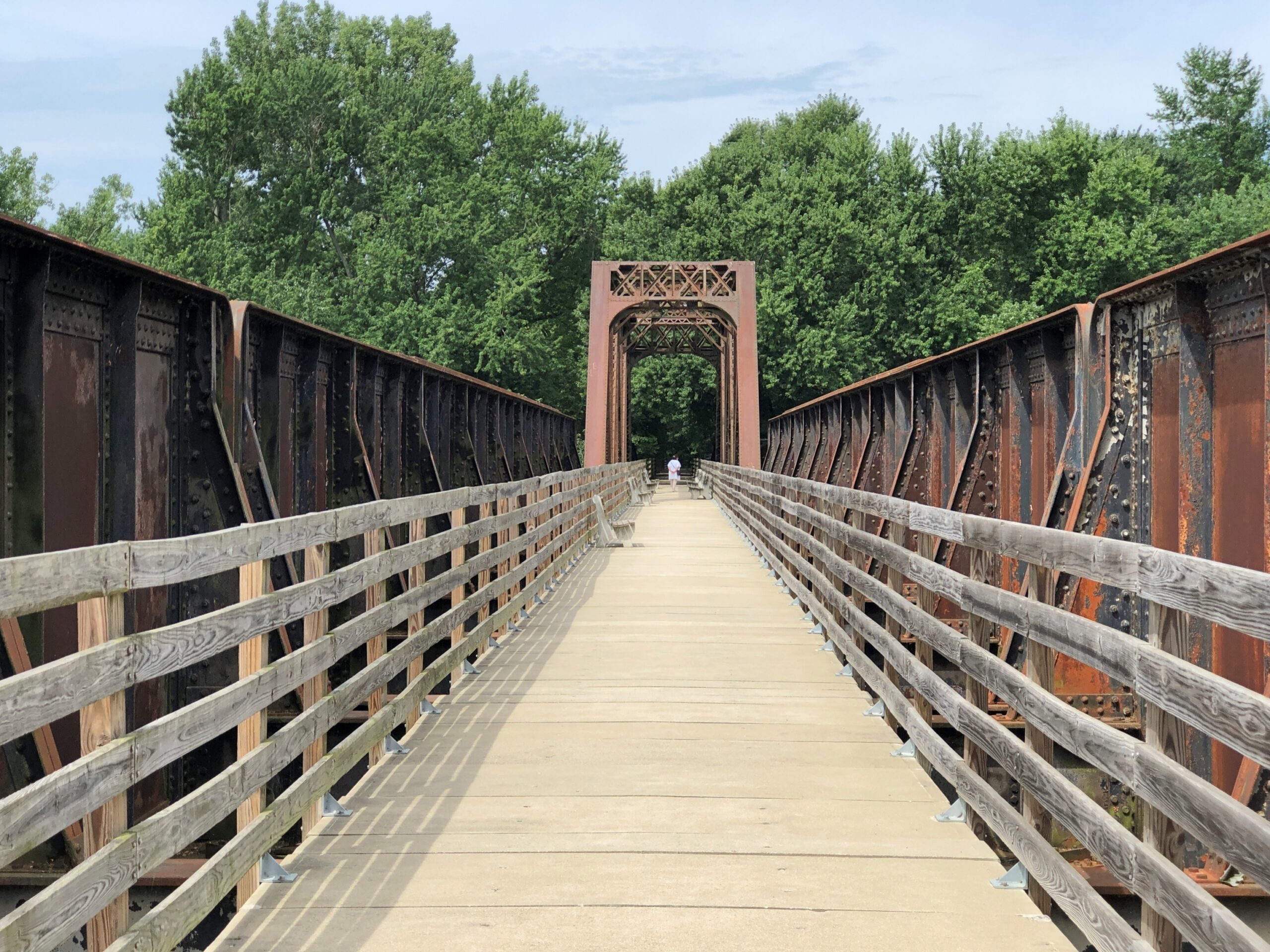
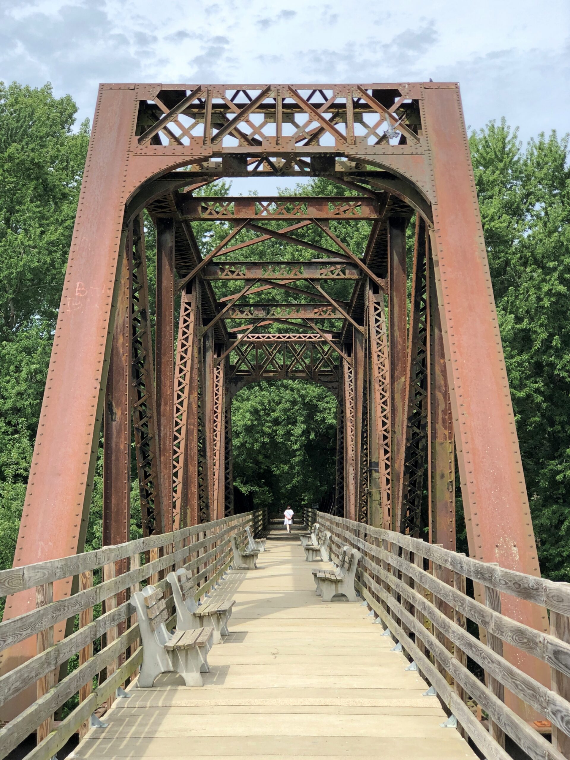
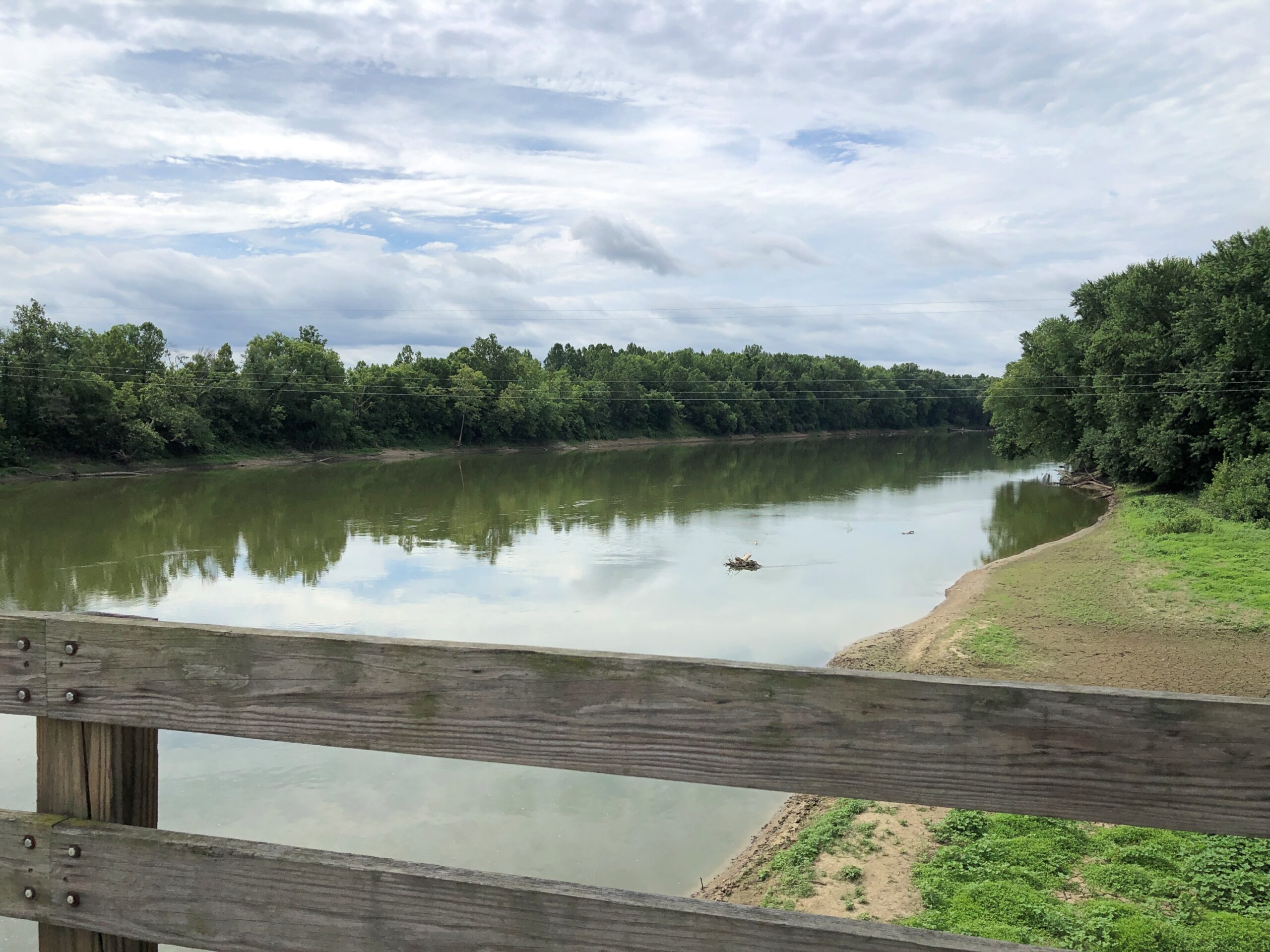
Even the last day of a long trip can include – should include – something to see. With that in mind on December 22, after we crossed the Ohio River from Louisville on the I-65 bridge, which I have done many times, we took the first exit to go to Jeffersonville, Indiana, which I have done only once, in 1990. Then we went back across the river to Louisville, this time on foot on a massive iron structure known as the Big Four Bridge.
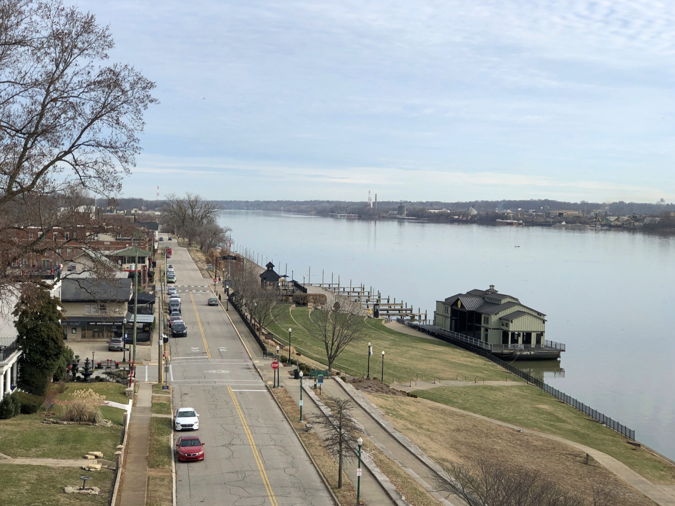
The Jeffersonville side of the bridge offers views of that town and its riverfront, where I took a wintertime stroll all those years ago. At that time, Big Four Bridge was a decaying relic, inaccessible to the public.
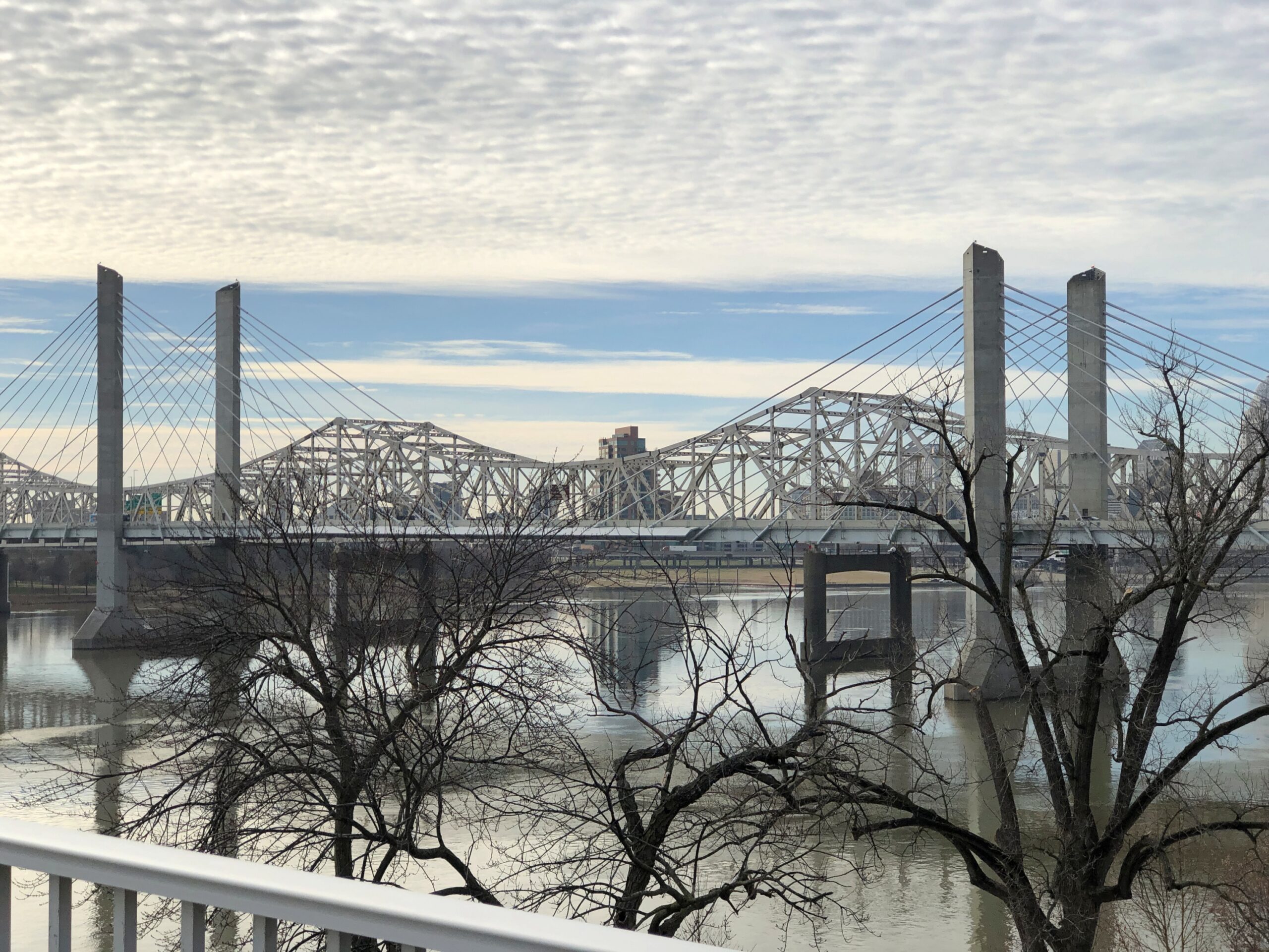
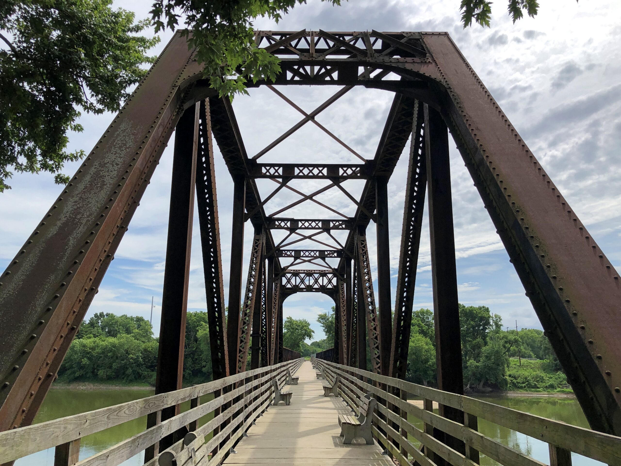
You can also see the I-65 bridge from that vantage. It too is an elegant design.
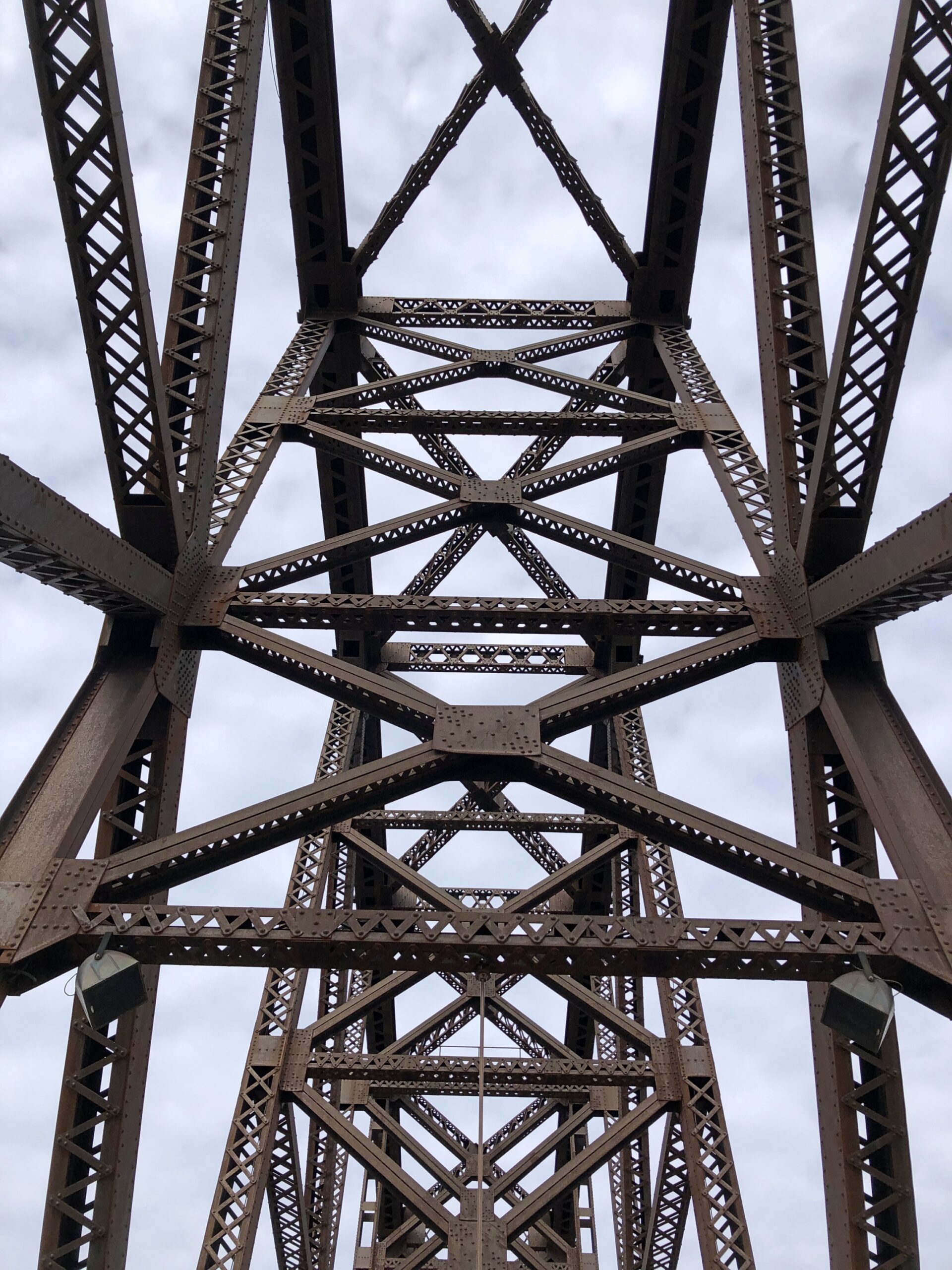
But not as impressive as the sweeping ironwork of Big Four Bridge.
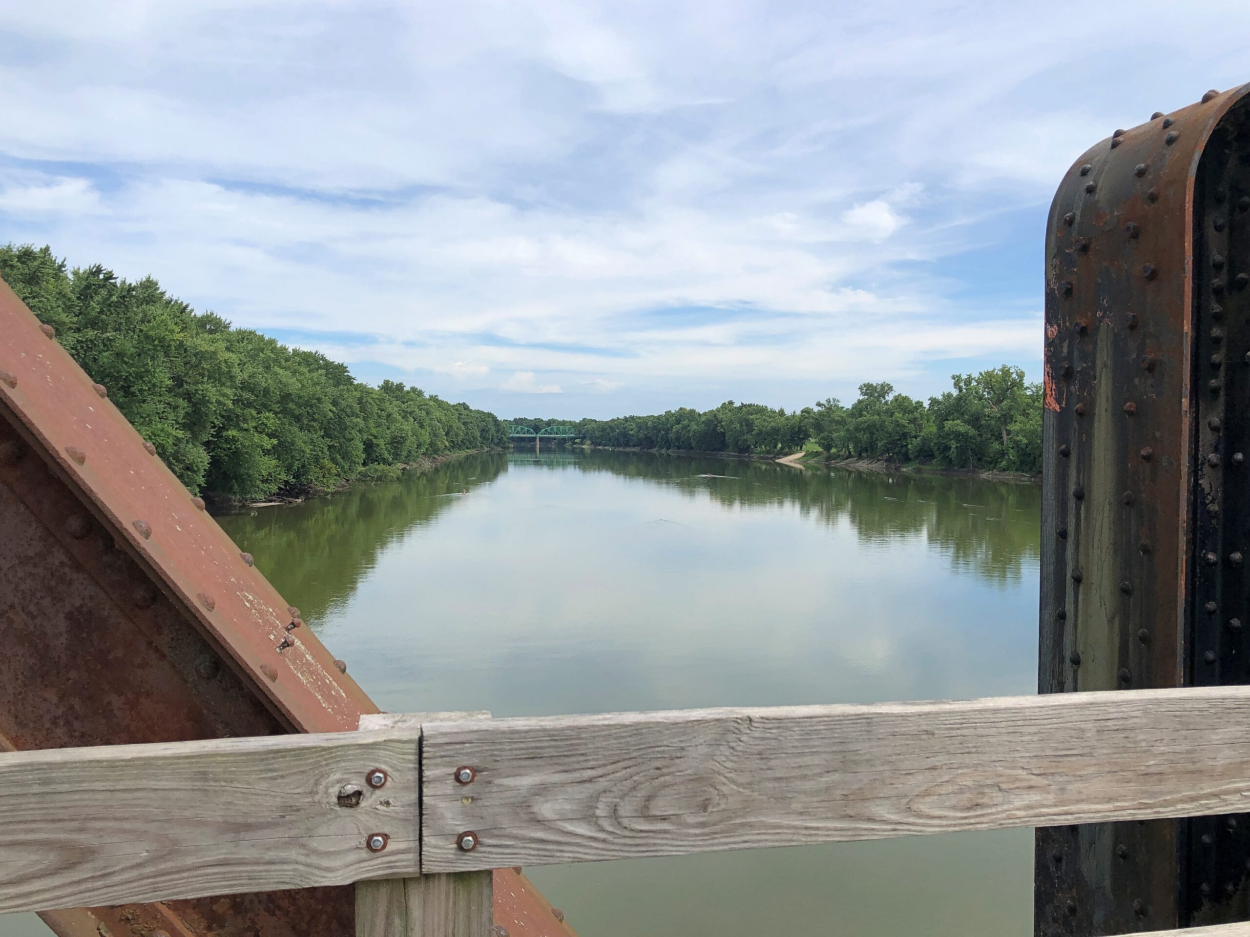
The Ohio sweeps along as well.
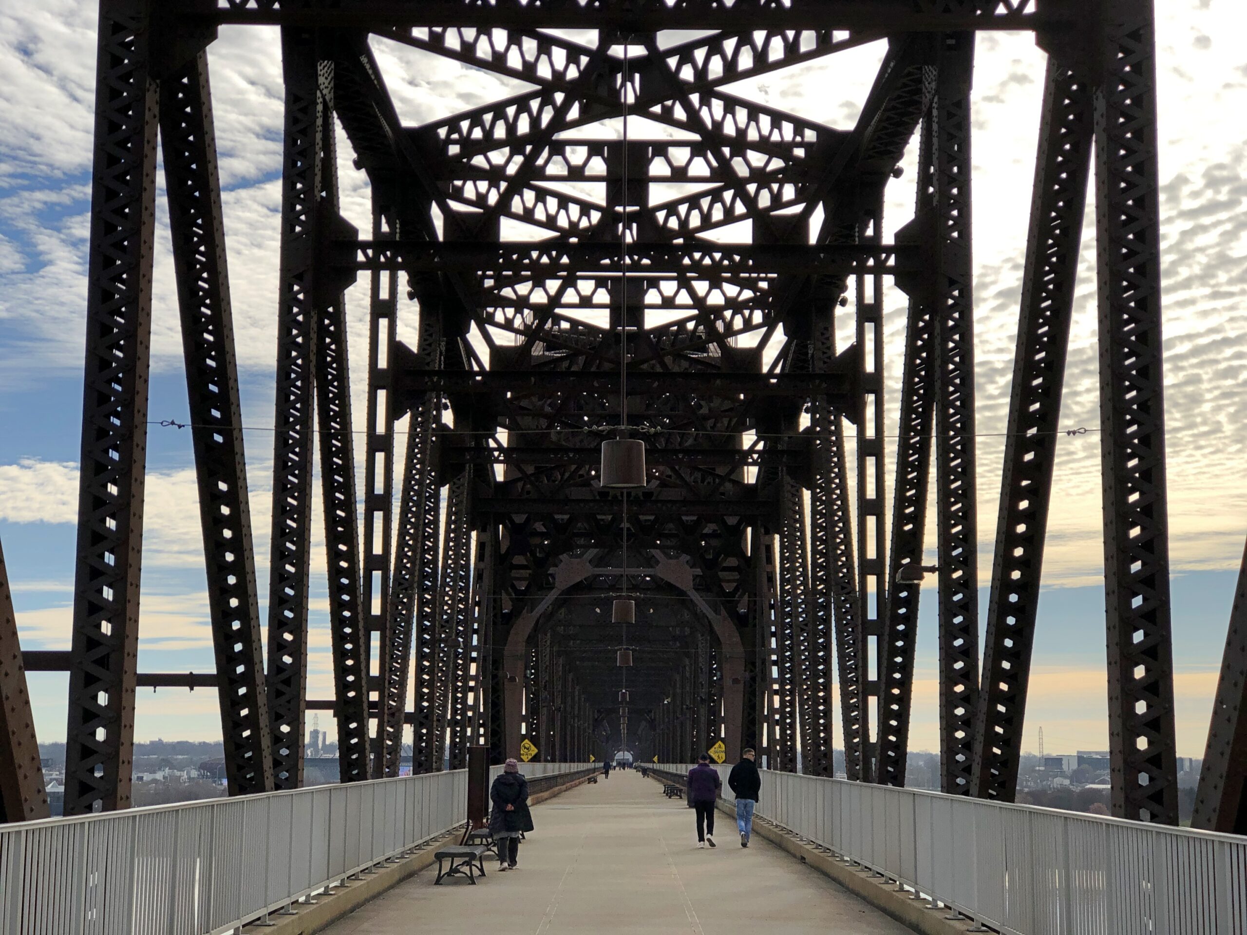
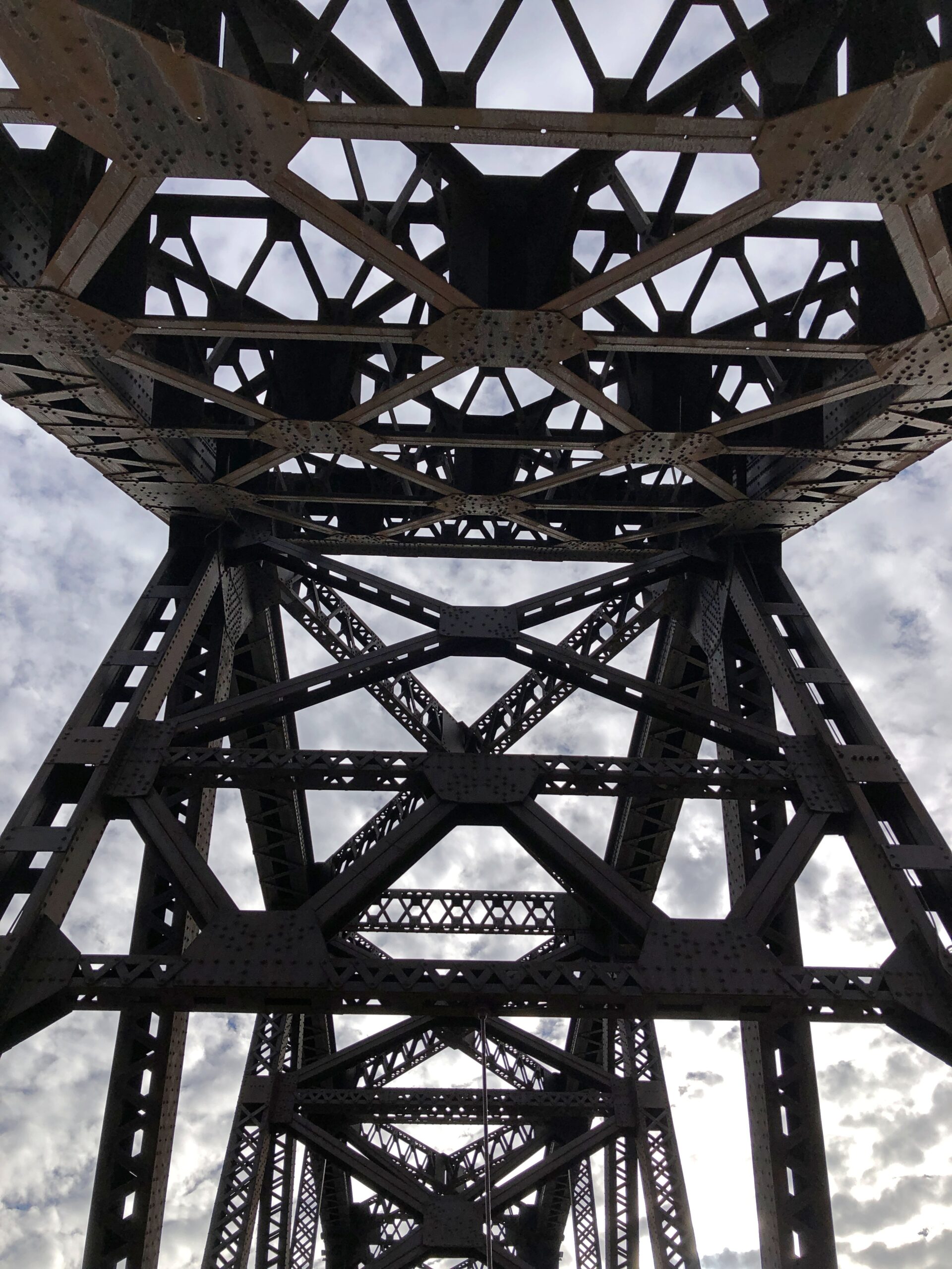
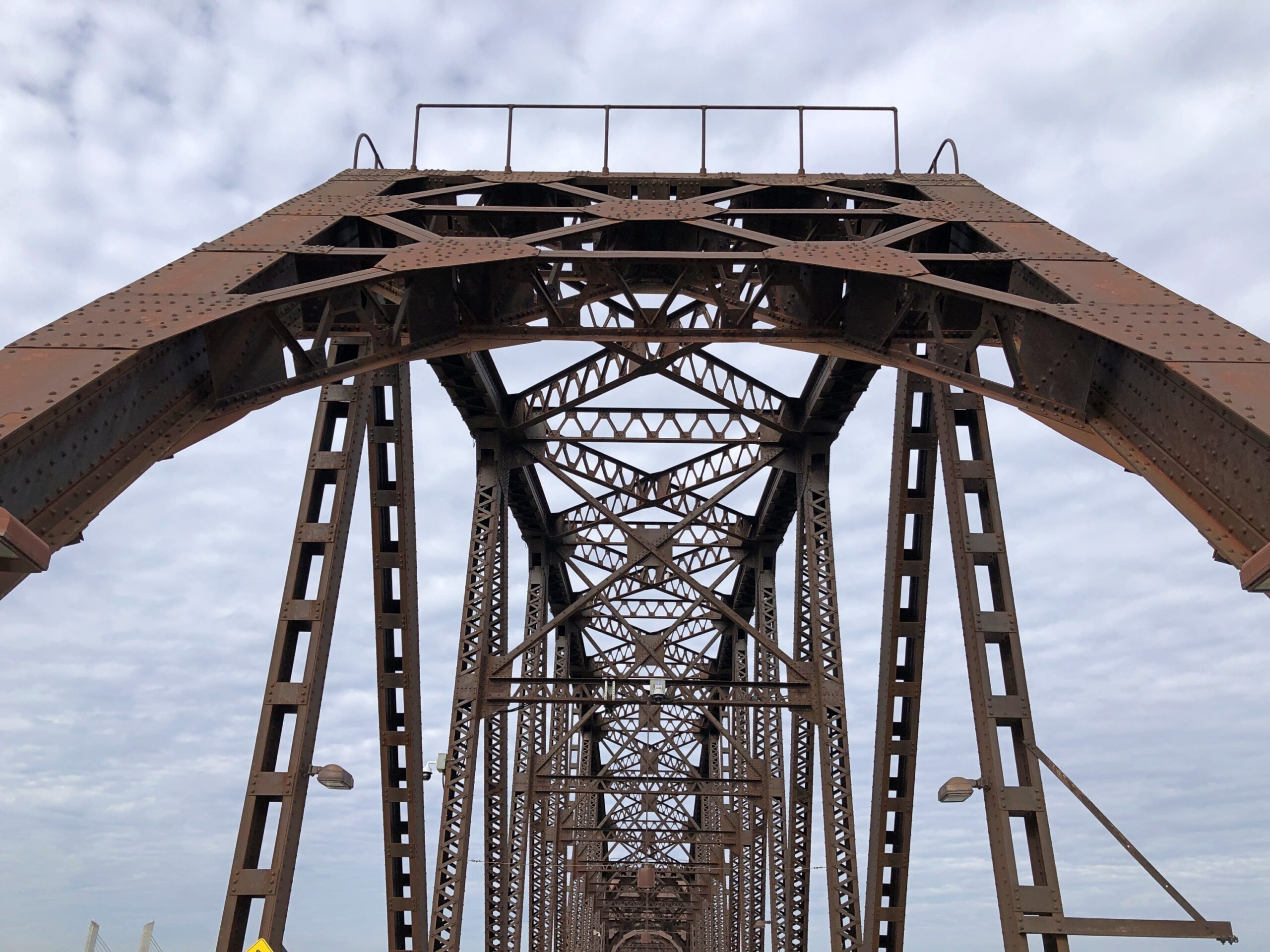
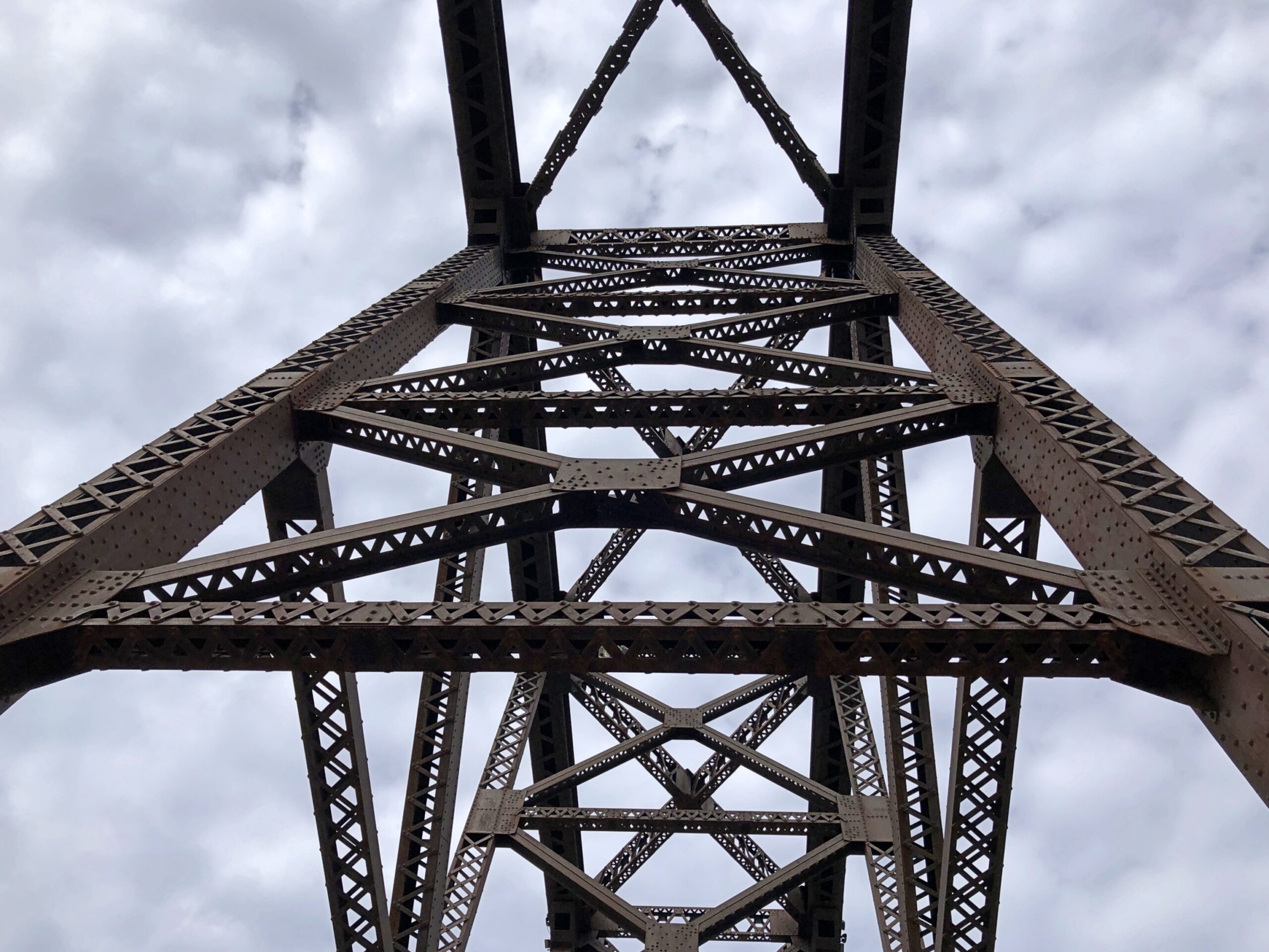
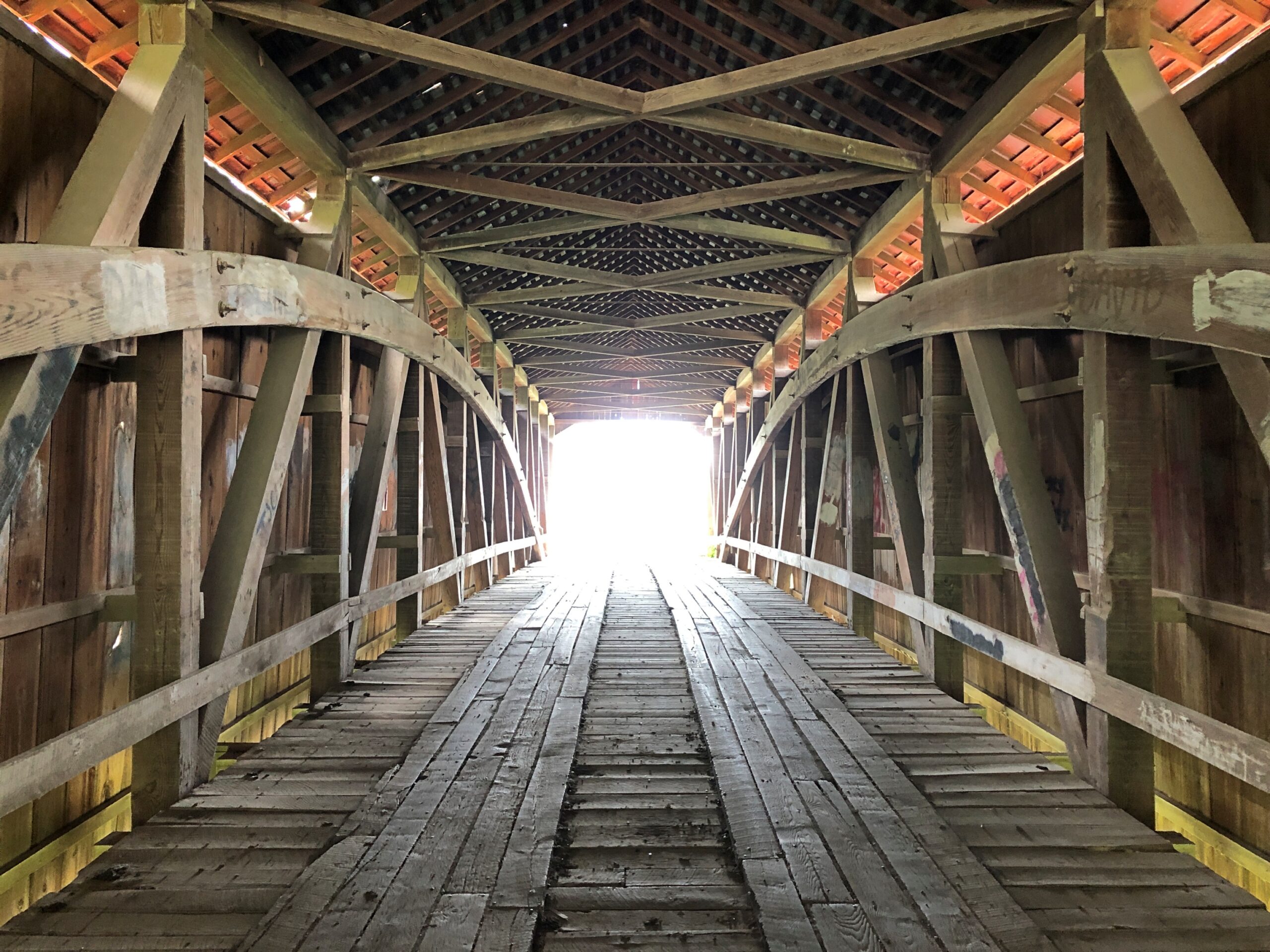
I couldn’t take enough pictures of Big Four.
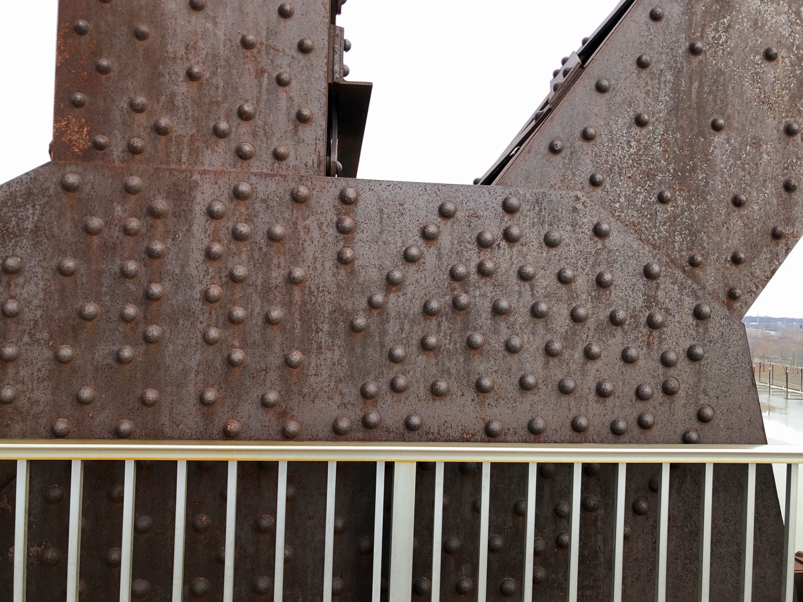
Once upon a time, Big Four carried the Cleveland, Cincinnati, Chicago and St. Louis Railway, also nicknamed the Big Four Railroad. The 2,525-foot span contains six trusses, beginning as a late 19th-century project, the sort of pre-OSHA work that killed dozens of workers during construction (so why not ghost stories?).
Completed in 1895, “The Big Four Bridge allowed freight traffic to dramatically increase in Louisville, and began carrying high-speed interurbans on September 12, 1905…” says Bridges & Tunnels. “Due to bigger and larger trains, not only in size, but in weight, contracts were let in June 1928 to build a larger Big Four Bridge. The new span, constructed by the Louisville & Jefferson Bridge Co., was built on the piers of the old bridge, while leaving the existing span intact while it was upgraded.”
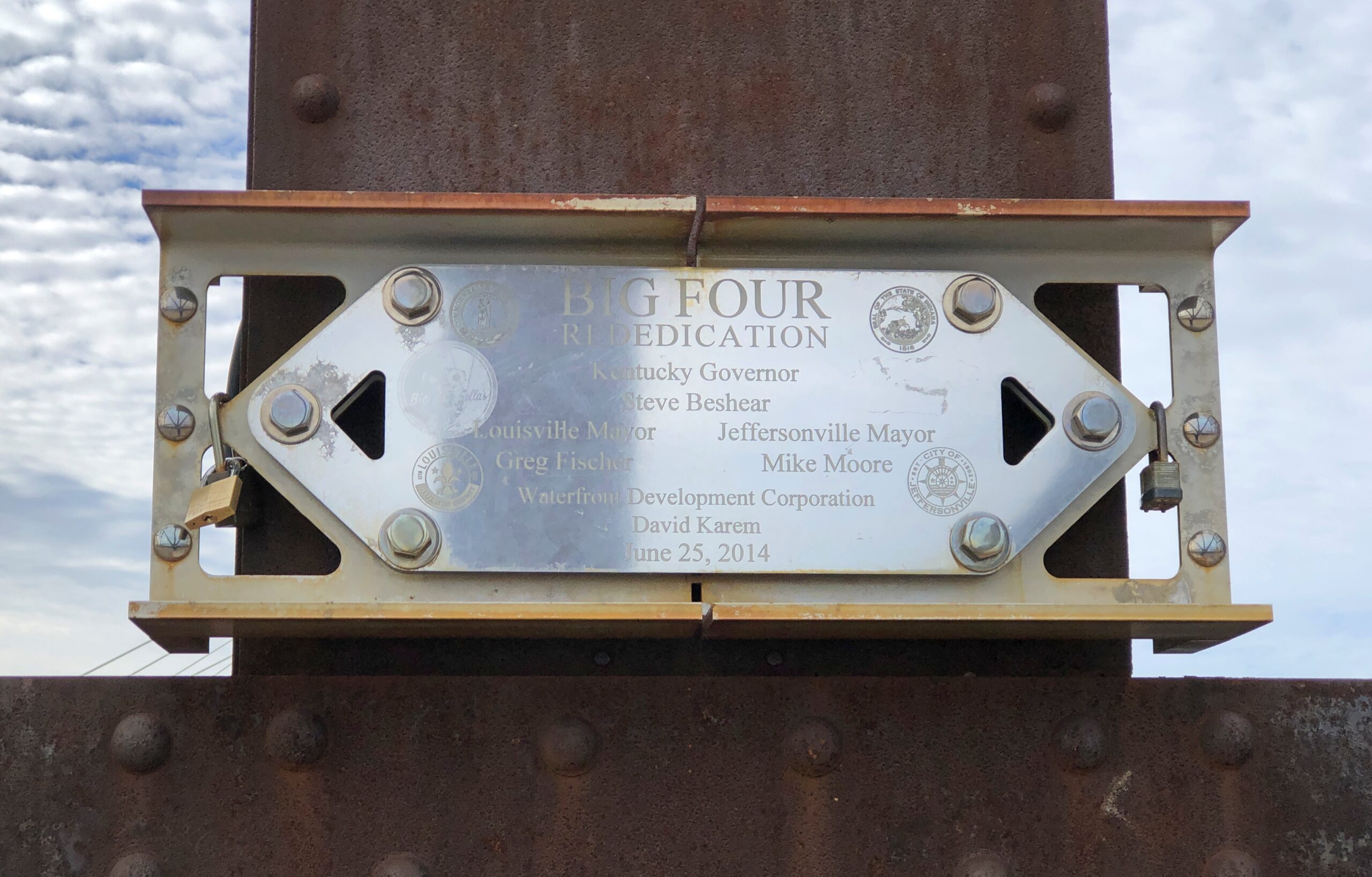
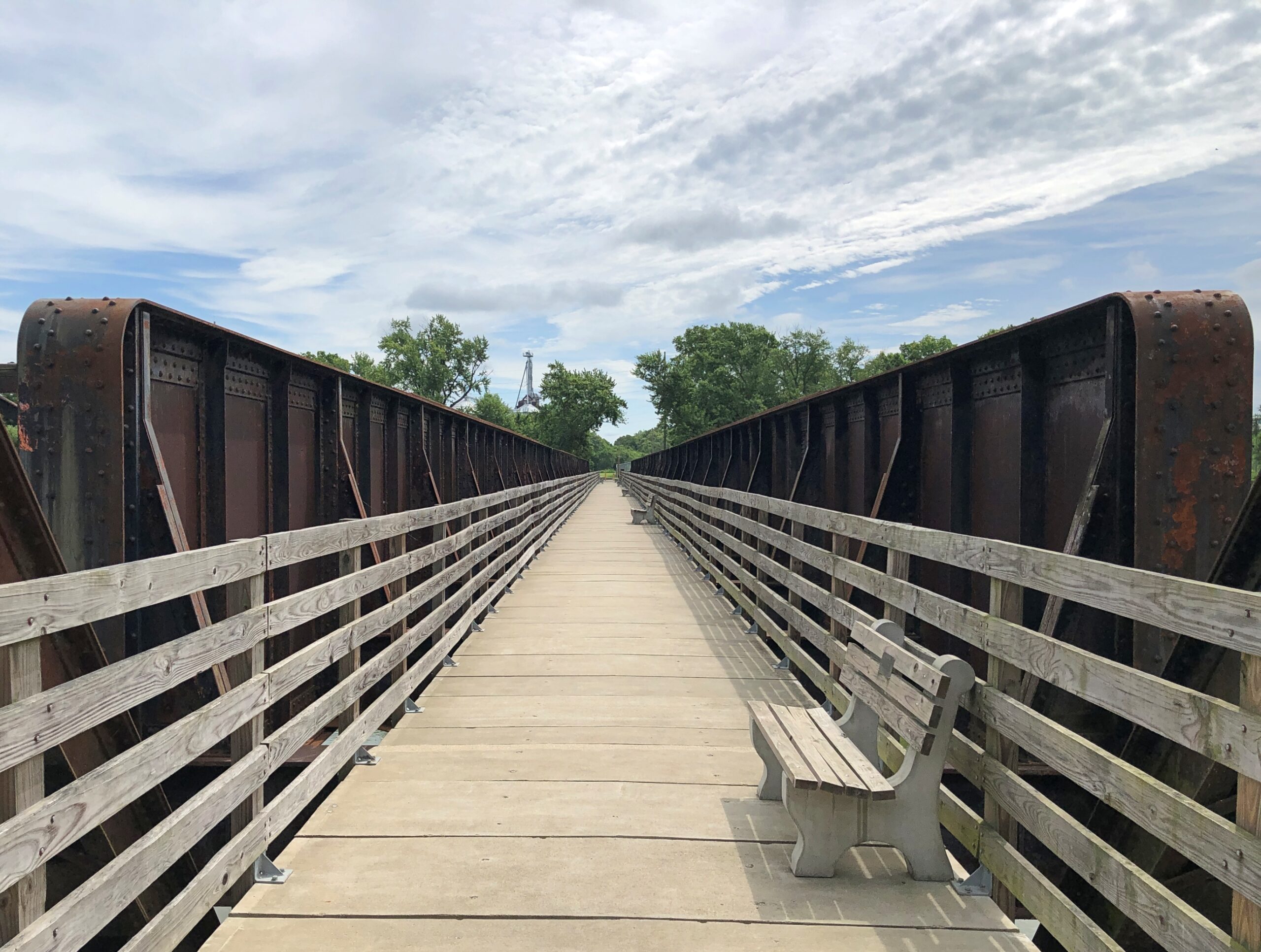
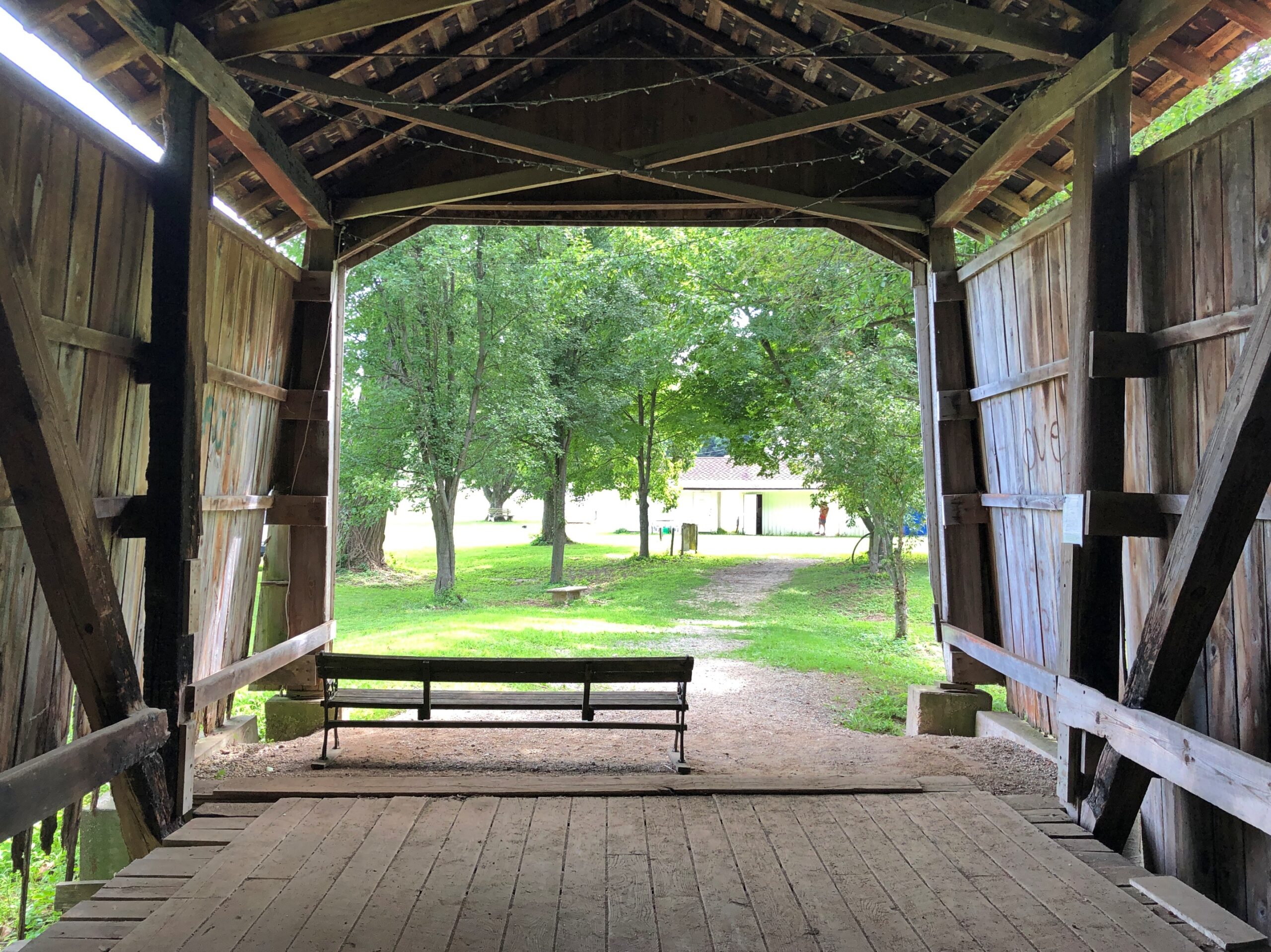
That is the structure we see today, except that in the early 21st century, it was redeveloped into a pedestrian/bicycle bridge.
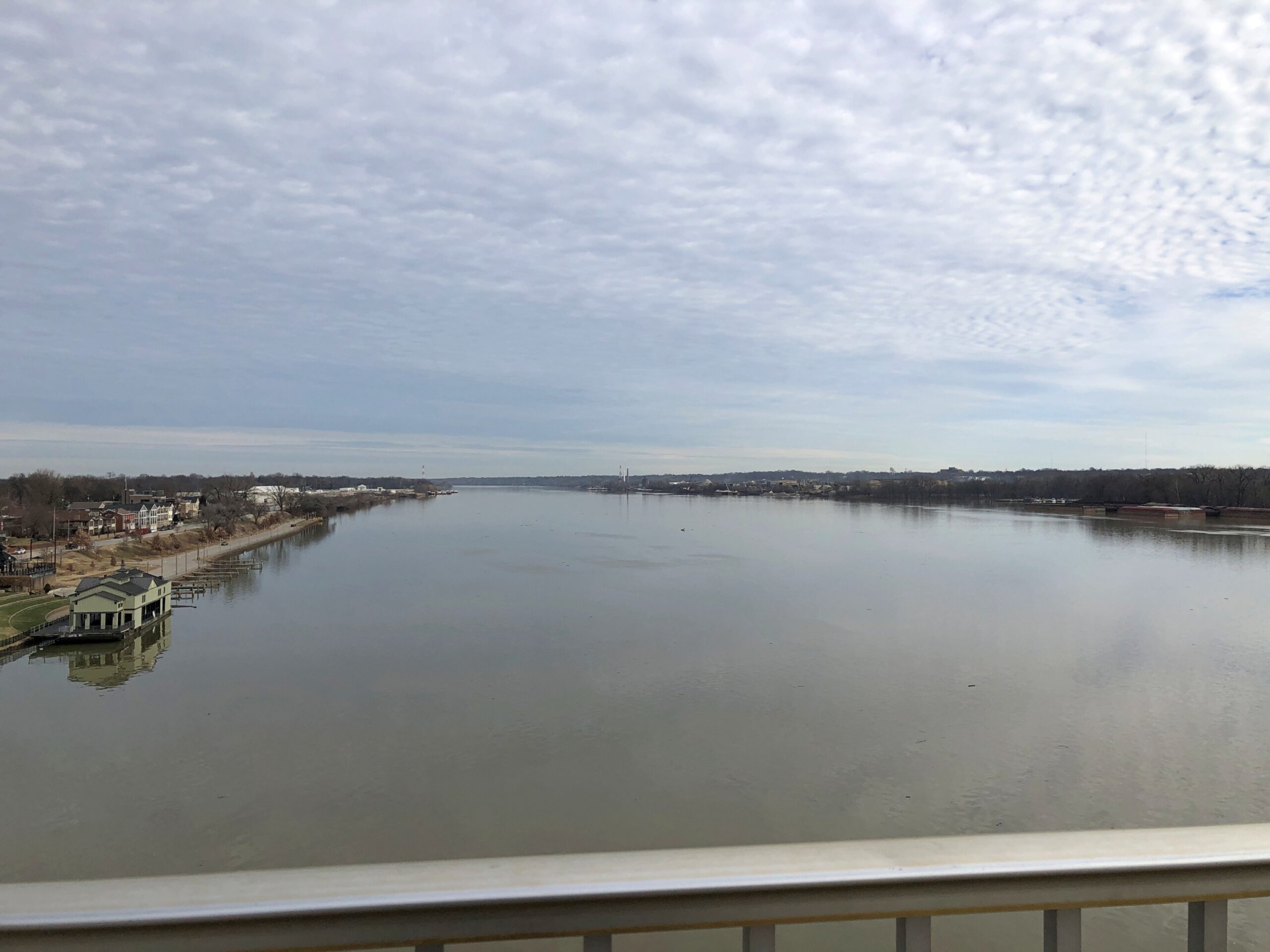
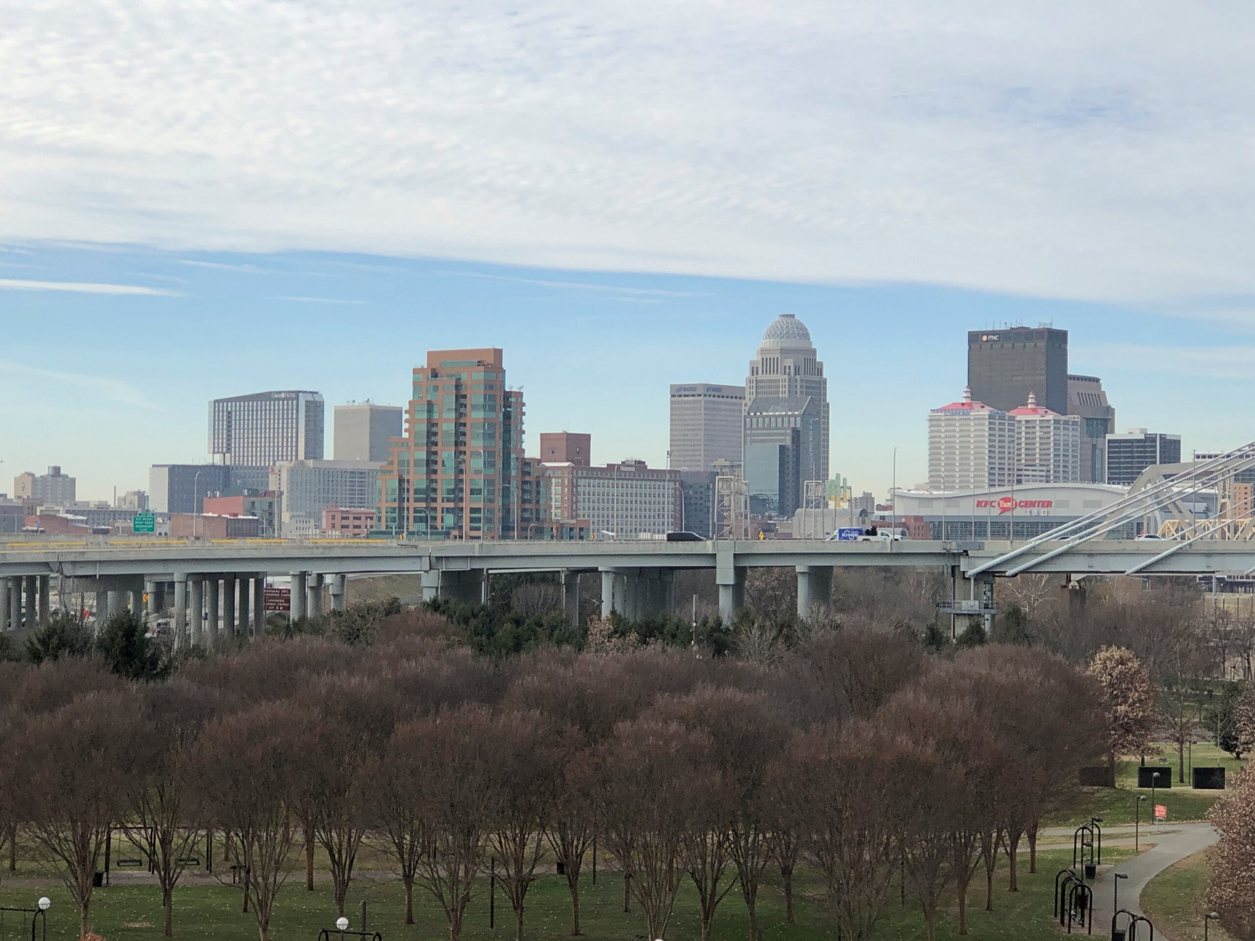
At the Louisville side of the bridge, views of the city.
And looking back at the bridge from the Kentucky (Louisville) side.
We saw the daytime bridge, of course. But “the Big Four Bridge has an LED lighting system that wraps the iron fretwork in vibrant colors,” says Our Waterfront. “The lights can be programmed to have a rainbow effect, highlighting the beauty and strength of the bridge structure. At night, the bridge becomes a colorful beacon in our city. Lights operate daily from twilight until 1 am.”
Another reason to come back to Louisville-Jeffersonville, obviously.
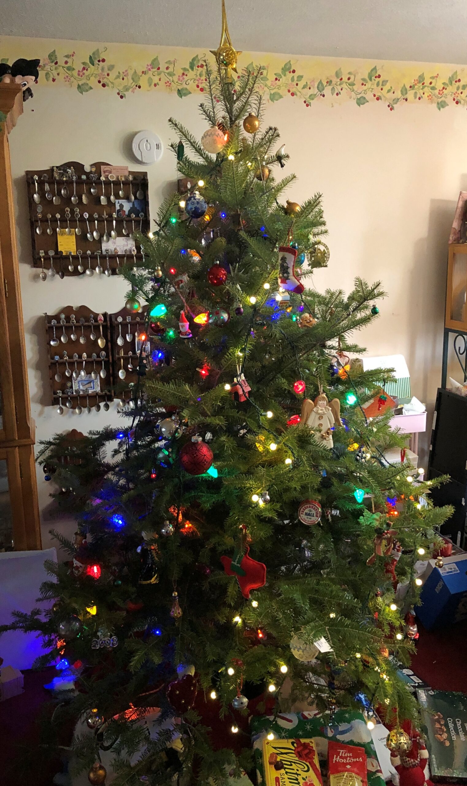
Decorating for Christmas this year meant a rapid set-up. We spent a fair number of hours on the 23rd making the living room ready for a tree – moving clutter, mostly. On Christmas Eve, I brought the tree in from the garage, and Ann mostly decorated it. Finishing touches, by me, were in progress even on the morning of Christmas Day, but since that moment in the life of our family doesn’t involve an early-morning rush downstairs by children anticipating Santa’s bounty any more, that was doable.
Ann did a fine job of decorating, in the style of our family: fill up the tree with a wide variety of glowing and glinting objects accumulated across the decades.
We got a late start on decorating for Christmas, though when I think about, decorating after the Solstice discourages the sort of front-loading of Christmas that a lot of people complain about, but which they do anyway.
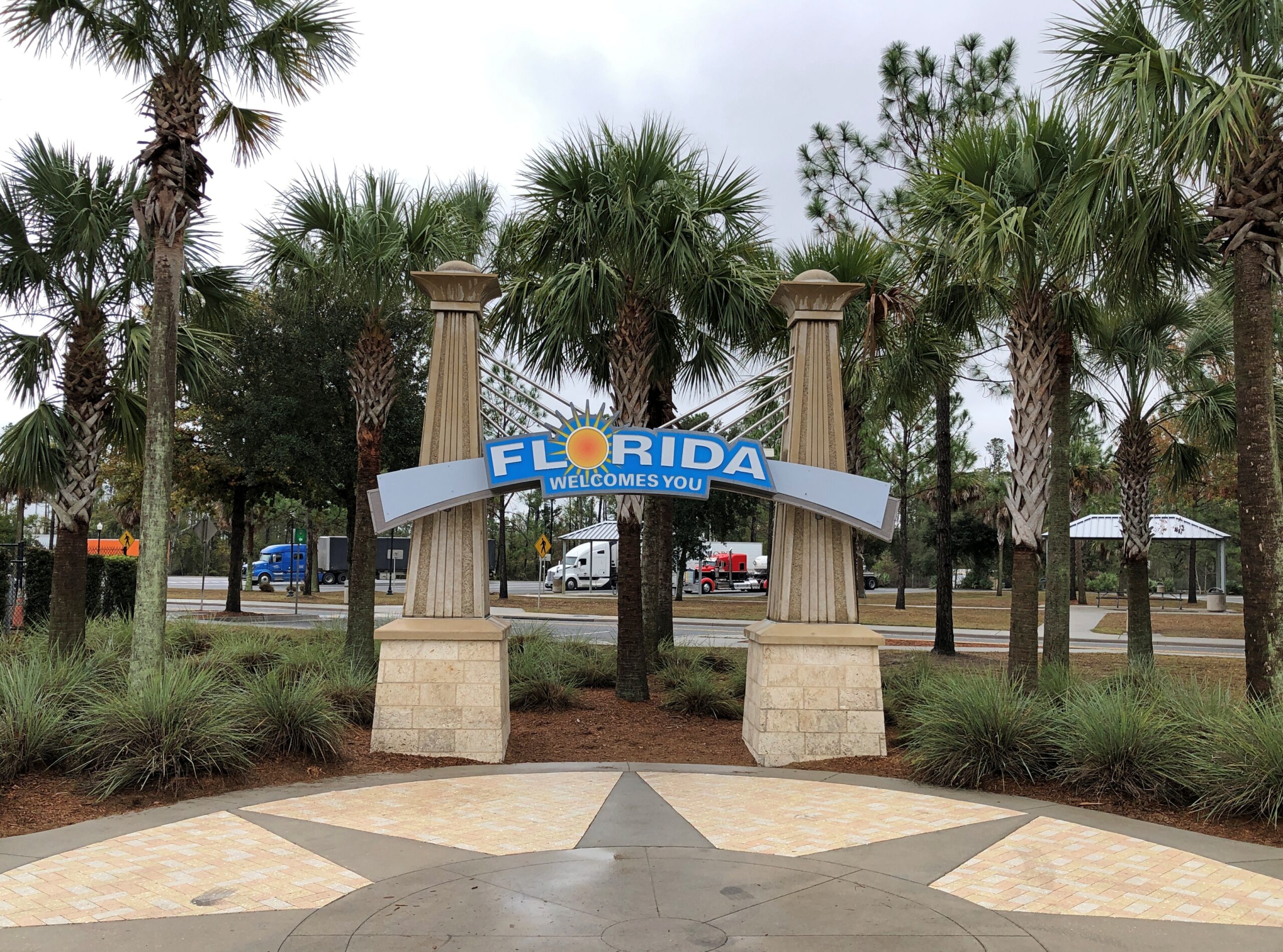
We had a good reason for the late start: a drive to Florida and back, beginning on December 4 and ending on the 22nd. Not just to Florida, but as far as you can go in that state, at least by car, namely to Key West and back. Early to mid-December seemed like a good time to do such a thing, after any traveling people do for Thanksgiving but before the worst of the Christmas-New Year’s rush. A short shoulder season in other words, but a good one, with room rates not quite subject to surge pricing, and crowds thick in some high-volume tourist destinations, but not impossible.
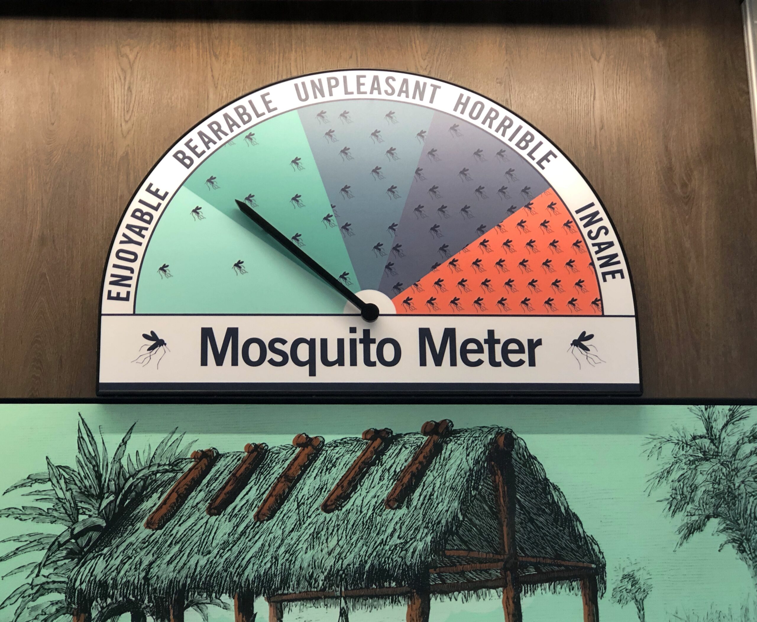
Also, Florida has few mosquitoes this time of year. Not no mosquitoes, as we found out one day in the southern reaches of the peninsula, just a “bearable” number.
Sometime earlier this year, I got the idea that I wanted to take four long drives after turning 64. Four for 64, you could say. Doing so by the end of 2025 wasn’t part of the idea, but that’s how things worked out. The drive to Florida and back, by way of such places as Indianapolis, Louisville, Chattanooga and Atlanta, totaled 3,682 miles. For all four trips since June, the total is about 14,300 miles.
That could be made to sound impressive, but in fact American men my age average more than that every year, about 15,000 miles, at least according to this source, which cites US DOT data. Younger men drive even more annually. Most of that is commuting, however. My commuting mileage by car has been exactly zero this year, and while I drive locally to stores and such, it couldn’t be more than a few thousand miles. So it seems clear that, as an American man, it was my duty to get out and drive.
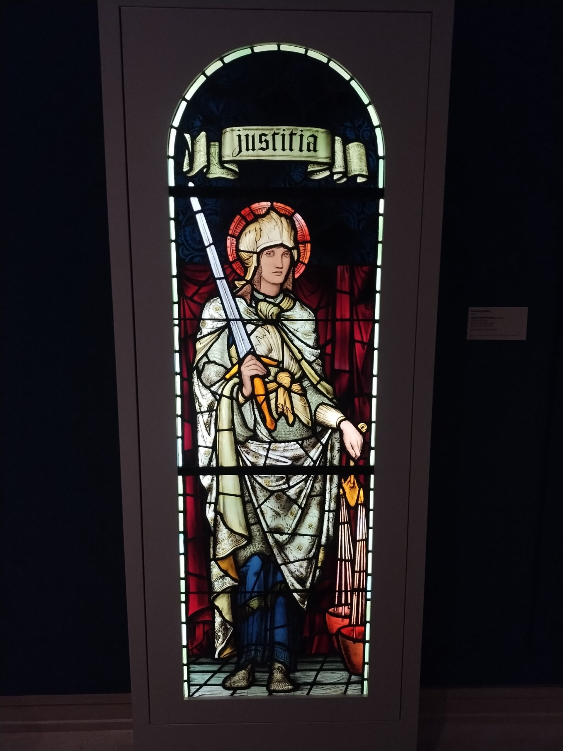
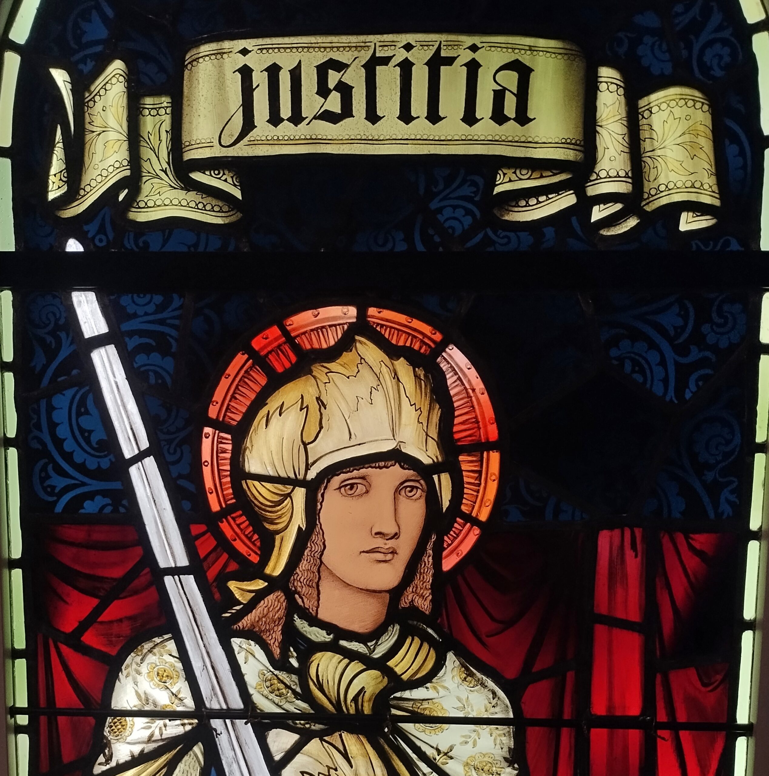
When we headed south in early December, snow covered the ground all the way past Indianapolis, where we stopped for a few hours at the Indianapolis Museum of Art, which is part of a larger campus called Newfields – and better examined in summer, I think. But the museum is a good one, with a solid collection, especially 19th-century American and European works. Such as “Justitia,” a Morris & Co. work from the 1890s.
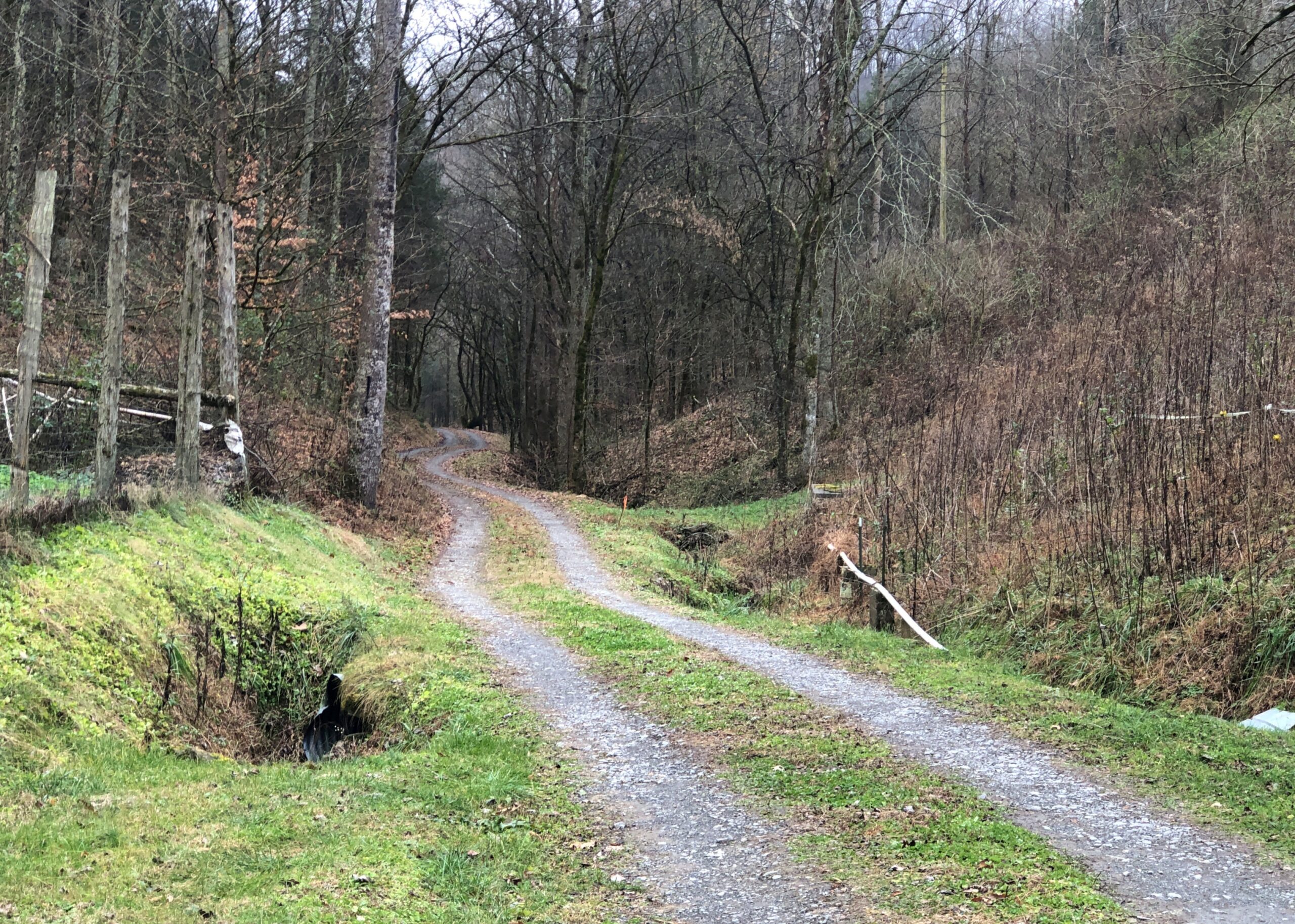
After overnighting south of Louisville, we diverted from I-65 and took smaller roads through southern Kentucky and into Tennessee to a holler in Jackson County, where we were the guests of dear friends. Tennessee musicians from those parts — some professional, others skilled amateurs — gathered on the the evening of Saturday the 6th, for one of the periodic jams in our friends’ barn, which houses no animals these days, but a small stage and some sound equipment and a fair number of folding chairs. A joyful jam it was. Food was potluck. I like to think we went to a hootenanny.
The road through the holler. By this point, no snow. We were trading cold for warmth. That was one of the goals of the trip. Maybe the main one.
From there it was mostly a straight shot down through Georgia on I-75 to Florida, and eventually US 27 to Orlando by way of non-coastal Florida places like Gainesville, Ocala and Lady Lake, a string of settlement less agricultural and less pastoral now than ever, more like an endless outer suburb. Heavy traffic is an invasive species in this part of Florida, surely as pythons are in damper parts of the state. Not just masses of cars and trucks, either, but also golf carts. We passed close enough to The Villages to see billboards advertising legal representation in the event of golf cart accidents. Carts, I’ve heard, provide transport in great numbers in that sprawl of a settlement.
The drive to and in Florida involved the usual North American mix of large and small roads, smooth and ragged, grid-like and irregular, though Florida cities tended toward the irregular (except for Key West), and as crowded as can be and as empty as can be. Snow lined the way up north, thinning out the further south we went, giving way to brown landscapes and bare trees. Then we came into greenery – evergreens and palms and even deciduous species turning color. We crossed mighty bridges over mighty rivers, small culverts over alligator haunts, and the string of bridges that make up the civil engineering marvel known as the Overseas Highway (US 1). We crossed barely acknowledged borders and signs at the Florida visitor center on I-75 proclaiming The Free State of Florida.
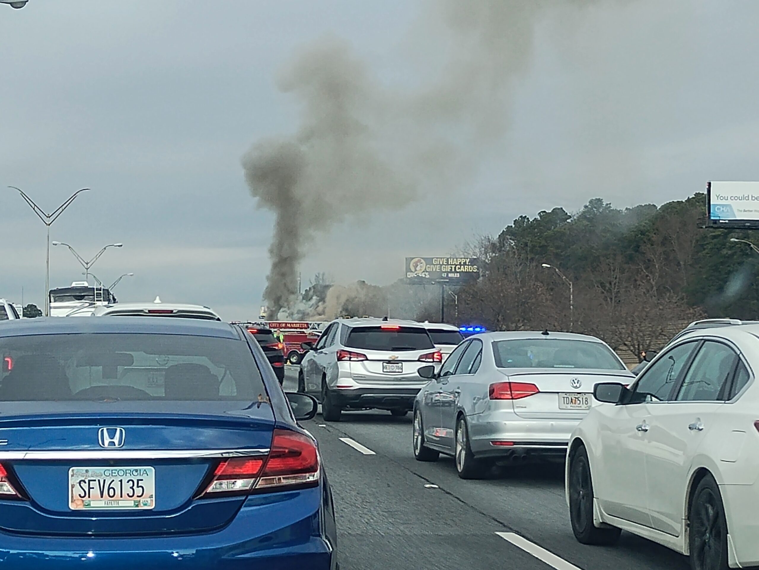
Florida Man was out and about, weaving in and out of high-speed traffic, pushing 100 and pretty sure that physics doesn’t apply to him, though I have to admit that Florida isn’t different from any other state in that way. Traffic stopped cold more than once: for a banged up, upside-down SUV; for a raging RV fire, attended by a half-dozen firemen; for a serious two- or maybe three-car wreck on the other side of a divided highway; for construction, usually without any workers in sight; and once for no reason that we could tell at all.
In Orlando, we spent all December 9 at Universal Epic Universe, a theme park that only opened in May. Ann flew in the day before we went to the park and flew home the day afterward, taking advantage of the low prices that discount airlines offer to high-volume places in a shoulder season, if you take no bags and buy nothing to eat or drink at sky-high prices, literally and figuratively. A small bag of hers had been stowed in our car for the visit.
A theme park is one thing, but I wanted a look at Orlando, at least a sliver of it, the next day. Ann’s flight was fairly late that day, so we were able to spend part of it in posh Winter Park, including a tour boat ride through the town’s small lakes, lush with greenery and expensive houses on their banks, and connected by canals.
A drive that included the stretch of US 41 that passes through the Everglades took us to Homestead, Florida, and the mid-century charms of The Floridian motel. A day in Everglades NP followed, including an airboat tour and a drive to the coast at Florida Bay. The next day, before leaving Homestead for a drive in the rain across the Overseas Highway to Key West and while the sun still shined, we toured the Coral Castle, a one-man construction project using 1,000 tons of oolite to make walls, carvings, stone furniture, and a castle tower.
Key West was a two-day, three-night mid-December ramble on the busy and less busy streets of Old Town, including humans but also chickens, taking in the likes of the Hemingway House, the Little White House, Mallory Square, the San Carlos Institute, the Key West Aquarium, and the Key West Cemetery. Also, tourist shops, boutiques and the building where Pan-Am was founded. We ate and drank, though as our wont, nothing alcoholic. Key West was decked out for the holidays but not over the top. We walked and walked some more. It felt like a couple of pleasant summer days.
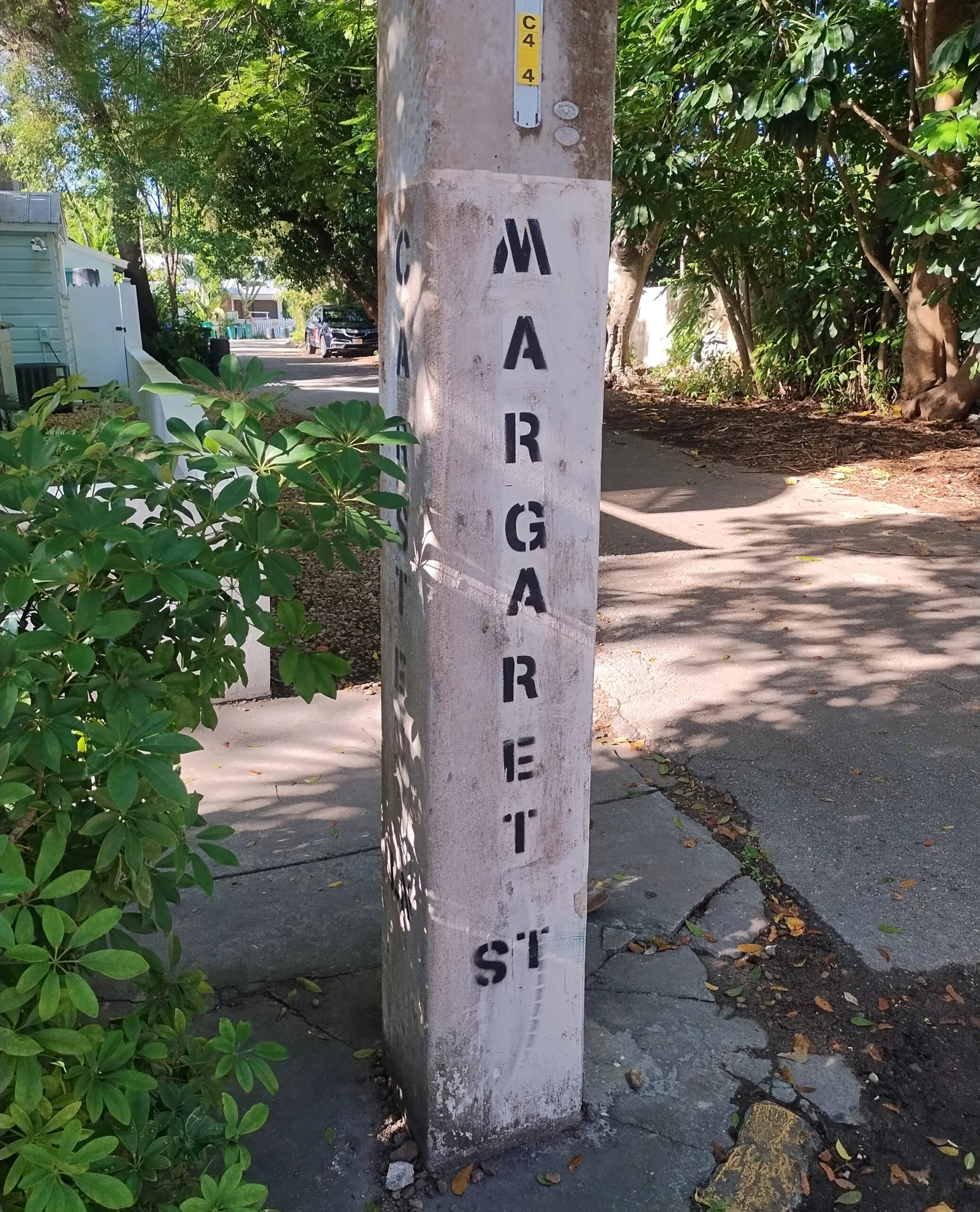
From my 2014 visit, I knew that on the back streets near the little-visited cemetery, parking was possible on an otherwise cramped island. So it was. On Margaret Street, within sight of the cemetery.
The return drive took us up the eastern coast of Florida, but avoiding the worst traffic in Miami-Dade by taking Florida’s Turnpike. By December 17, we’d arrived in Orange Park, a large suburb of Jacksonville, for a stay with two other dear friends, former Austinites now in northern Florida. Part of the next day was in and near downtown Jacksonville, one of the larger U.S. cities I’d never visited before (I believe San Jose is now the largest on that list). During our downtown stroll, we encountered the coolest building in Jacksonville and certainly one of the coolest in Florida.
We quit Florida on the 19th, but weren’t quite done with the trip. Yuriko had never been to Atlanta and wanted to go. Though I’d been however many times since 1982, I was happy to oblige, so we spent two nights and a day there, using the day to see the astonishing Georgia Aquarium and the impressive but somewhat overpriced World of Coca-Cola.
The last legs of the trip were long drives: Atlanta to Elizabethtown, Kentucky; and from there to home the next day. I wasn’t about to let them be completely dull drives, so we stopped on the second-to-last day in Chattanooga, to see the conveniently located, blocks-from-the-highway Chattanooga Choo-Choo redevelopment. On the last day of the trip, we stopped in Jeffersonville, Indiana, and walked across the Big Four Bridge, a former RR bridge across the wide Ohio, now serving pedestrians and bicyclists.
Home and then — Christmas, when things slow down for a week or so. Good timing.
Our first winterish weather blew through early this week, but we’re back to cool days. For now. Some leaves seem to be clinging a little longer than usual, but most are accumulating on the ground, as expected for November. A scattering of Christmas decorations are already up, and I don’t mean in stores, where they’ve been for weeks. Let November be November, I say.
Much of my return from the East Coast generally followed the westward course set by the National Road, though I didn’t use much of US 40, which has that nickname. If you want to make decent time, you take I-68 through Maryland and then I-70 across Ohio and into Indiana, which pretty much parallels the National Road.
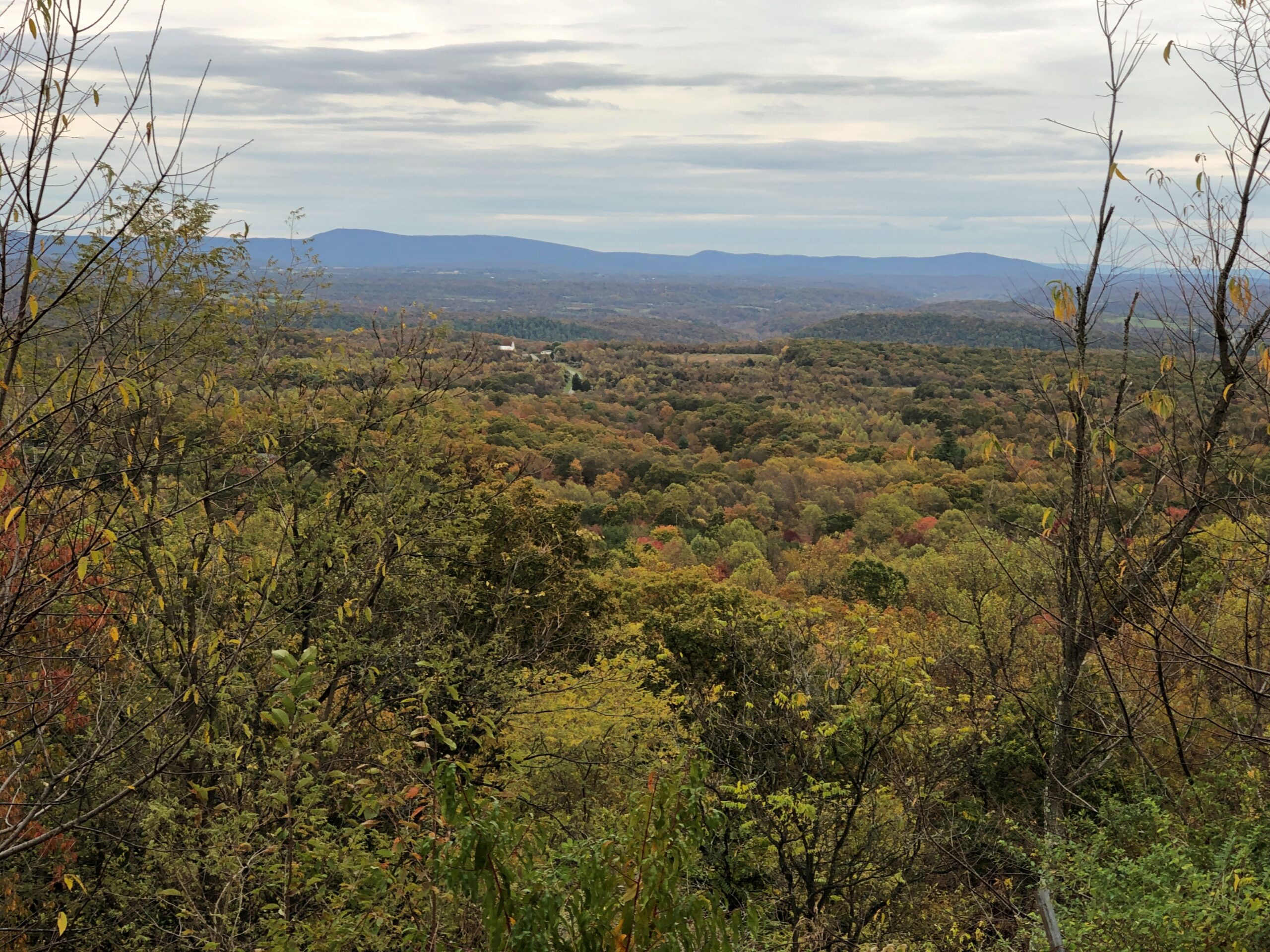
The Interstate is designed for just that kind of efficient travel. On the whole, it delivers. The four-lane highways also deliver boring drives, to hear some tell it. That’s an erroneous assumption, to hear me tell it. The Interstate has its fine stretches, such as I-68 in October, a gloriously colorful drive. Winding and hilly, too, through Maryland’s peculiar panhandle.
A rest stop near Hancock, Maryland, offers views to the north, so most of what you see is Pennsylvania.
The rest stop is at Sideling Hill, an enormous rise gouged by an enormous cut for I-68 to go through. An impressive feat of engineering, completed only in the 1980s. Then again, blowing up mountains is a thing that happens in this part of the country.
The narrowest part of the Maryland isn’t far away. At its narrowest, there is less than two miles are between the Potomac and the Mason-Dixon Line. So if you picked up Maryland by the panhandle, it would surely break at that narrowest point.
I filled my gas tank off the highway in the last town in Maryland, Friendsville (pop. 438), at a station whose enclosed retail space (between a few pumps) seemed little bigger than a walk-in closet, and yet there was a clerk manning the place on Saturday just before dark. Rotund and massively bearded, he was playing a video game when I opened the door to pre-pay. He might have been a little surprised to encounter a customer, at least one who didn’t pay at the pump.
From there, I continued into West Virginia, then took I-79 north into Pennsylvania, then headed west on I-70, which crosses West Virginia’s odd panhandle – more like a periscope – before reaching Ohio. After overnighting in Cambridge, Ohio, I bypassed Columbus but stopped in Springfield, near Dayton but with a distinct geographic identity. Alcor to Dayton’s Mizar, you might say.
Downtown Springfield was practically devoid of pedestrians that Sunday, and not that many cars drove through either. A few buildings rise high enough to suggest a more prosperous past, but look too closely and some of them seem to be as empty as the streets, or at least underutilized.
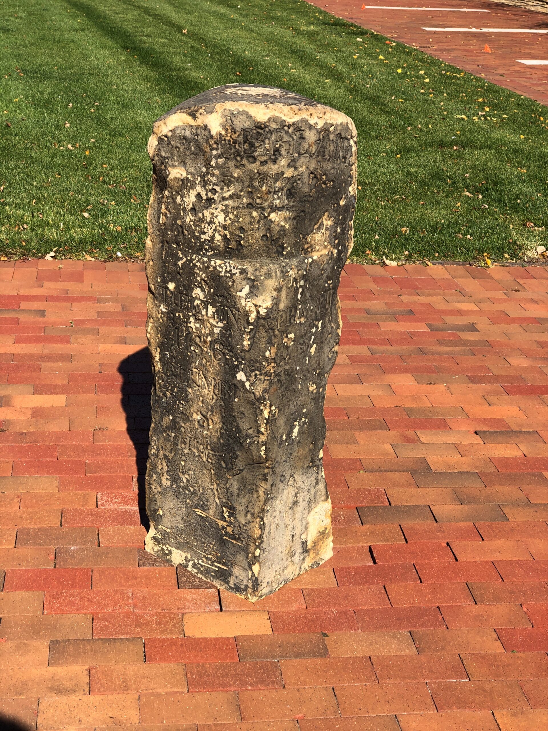
The National Road went, and still goes through Springfield, in the form of US 40. A milestone in Springfield marks the point at which the federal government quit paying for further westward expansion of the road. Anything else would be on the states, namely Ohio, Indiana and Illinois.
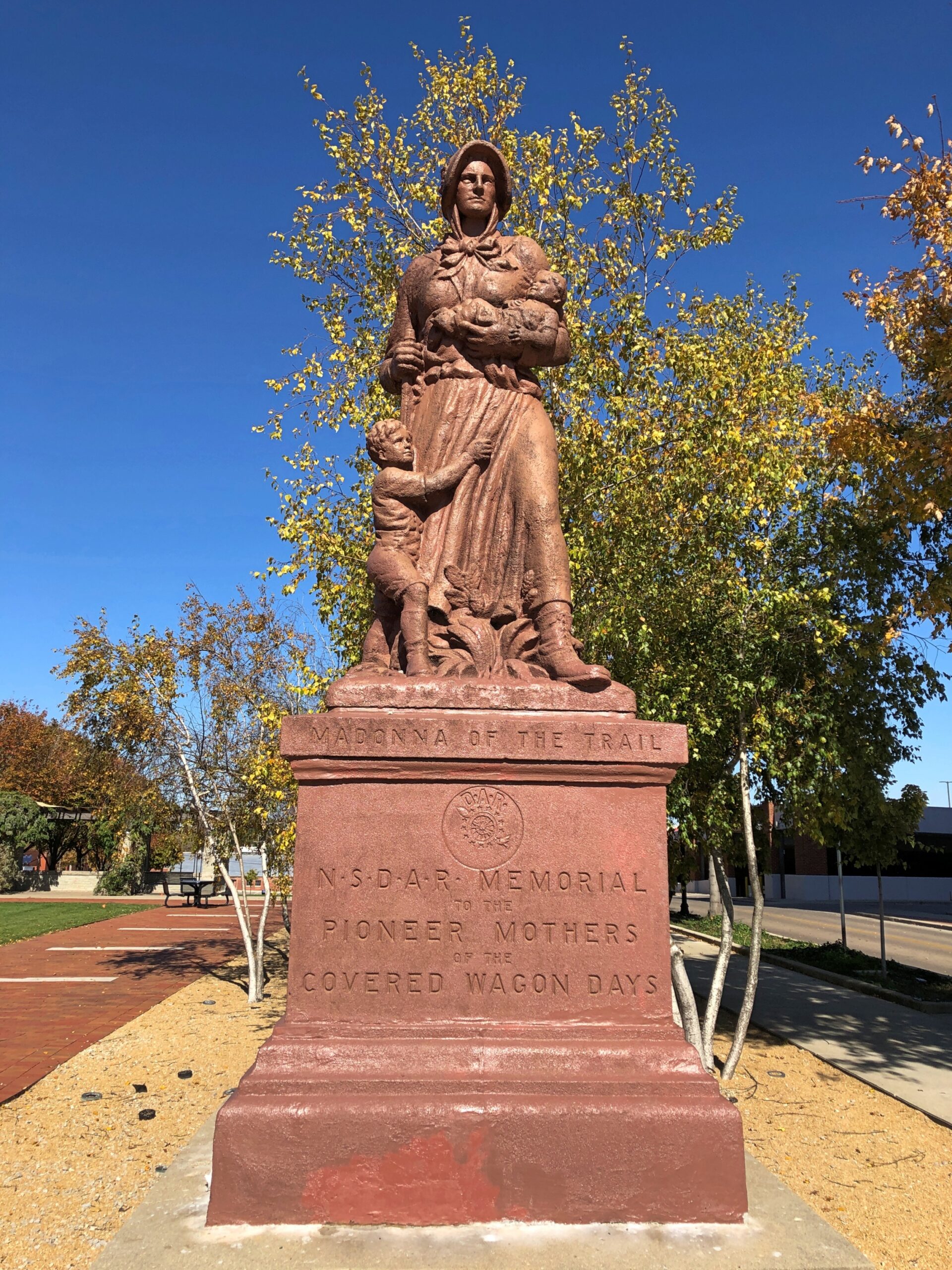
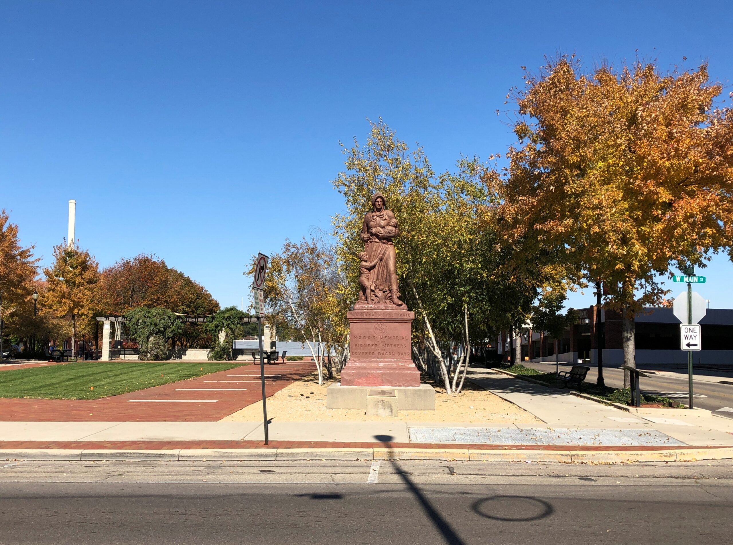
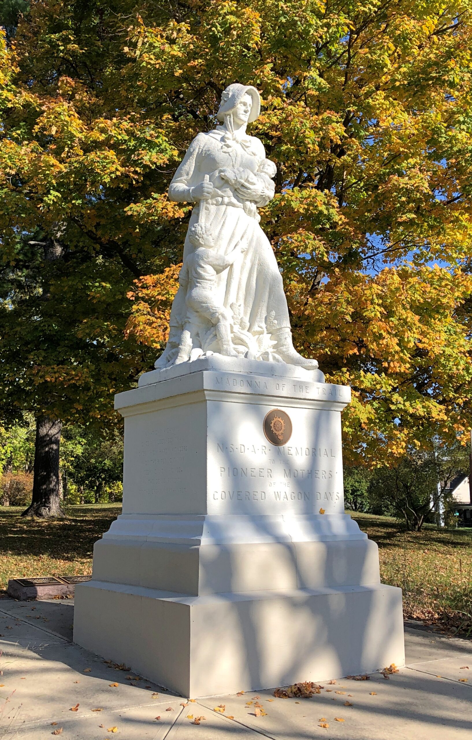
Later, after the National Road had become History, the Daughters of the American Revolution erected a series of statues along the route, and others to the west: “Madonna of the Trail.”
There are 12, with the easternmost of them along the National Road. Erected in the late 1920s, the Springfield one was renovated about 20 years ago.
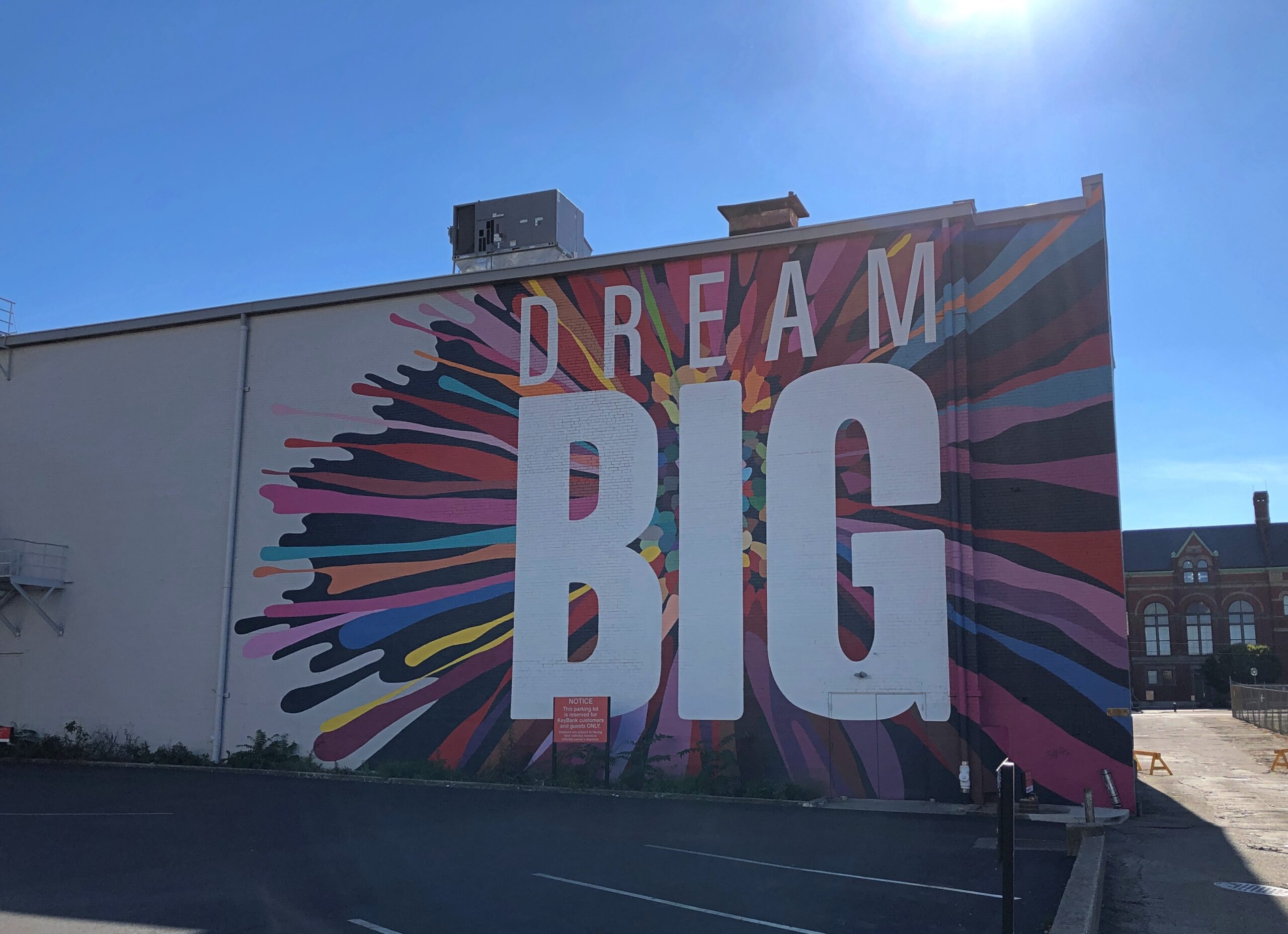
Nearby, passersby are urged to Dream Big.
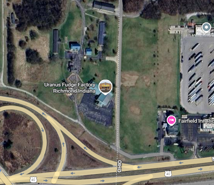
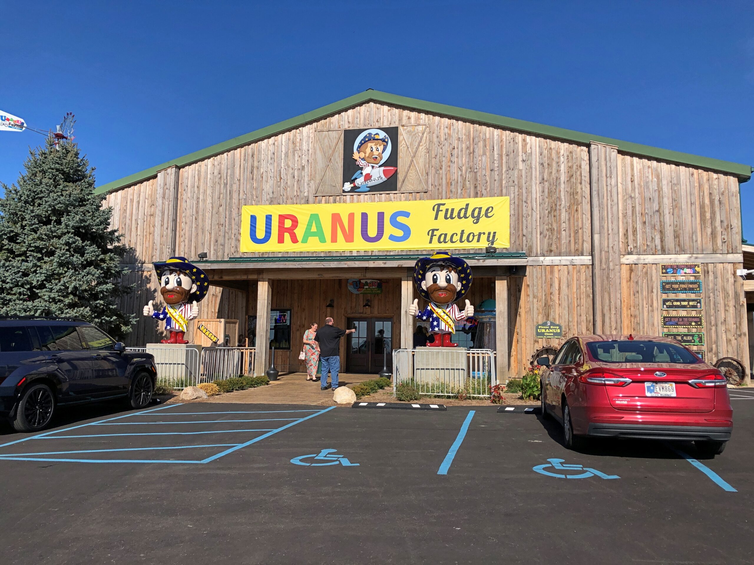
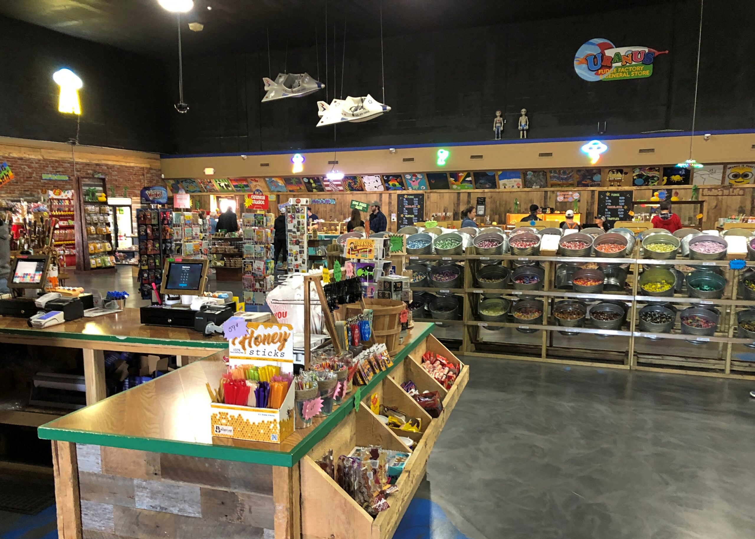
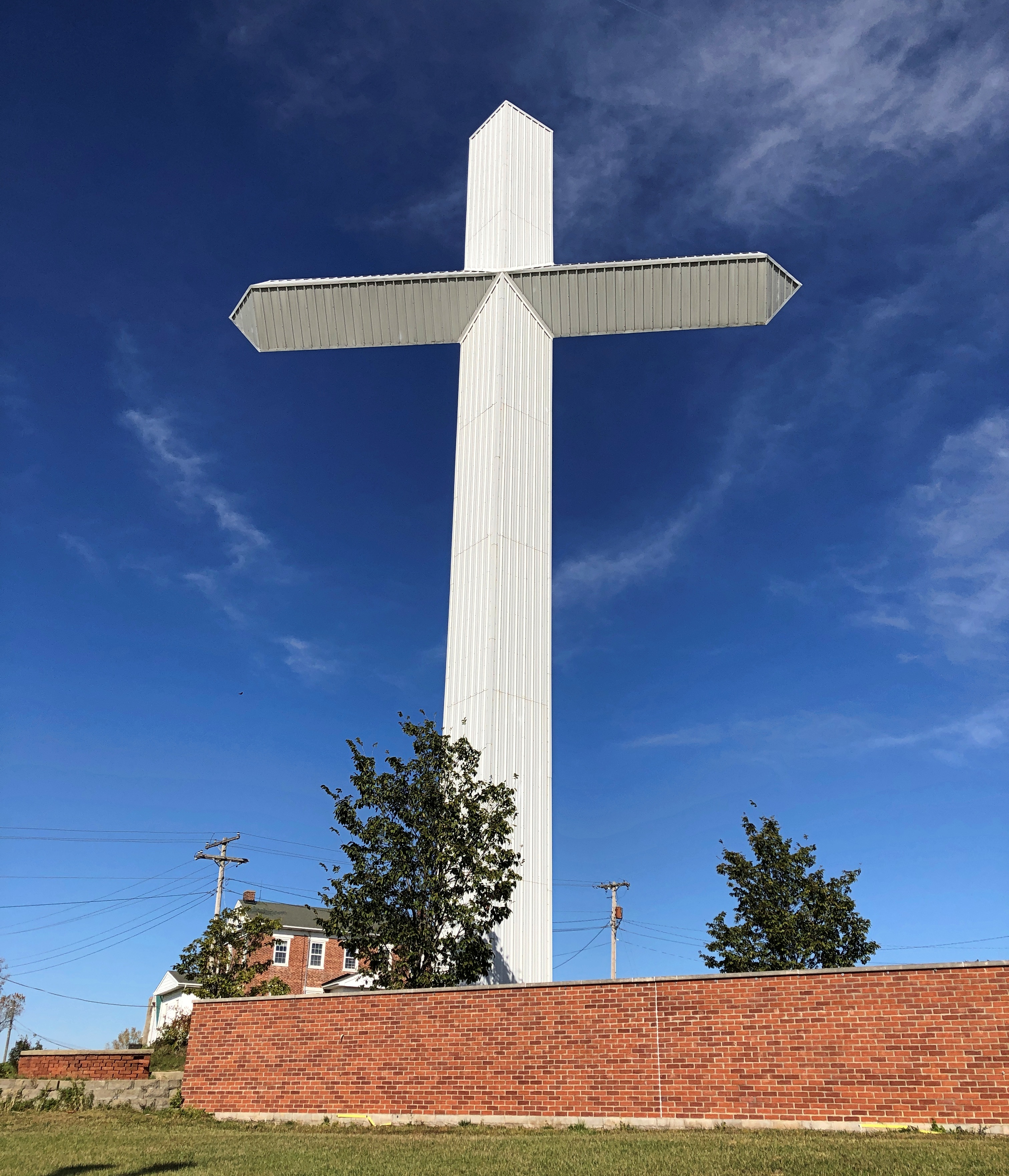
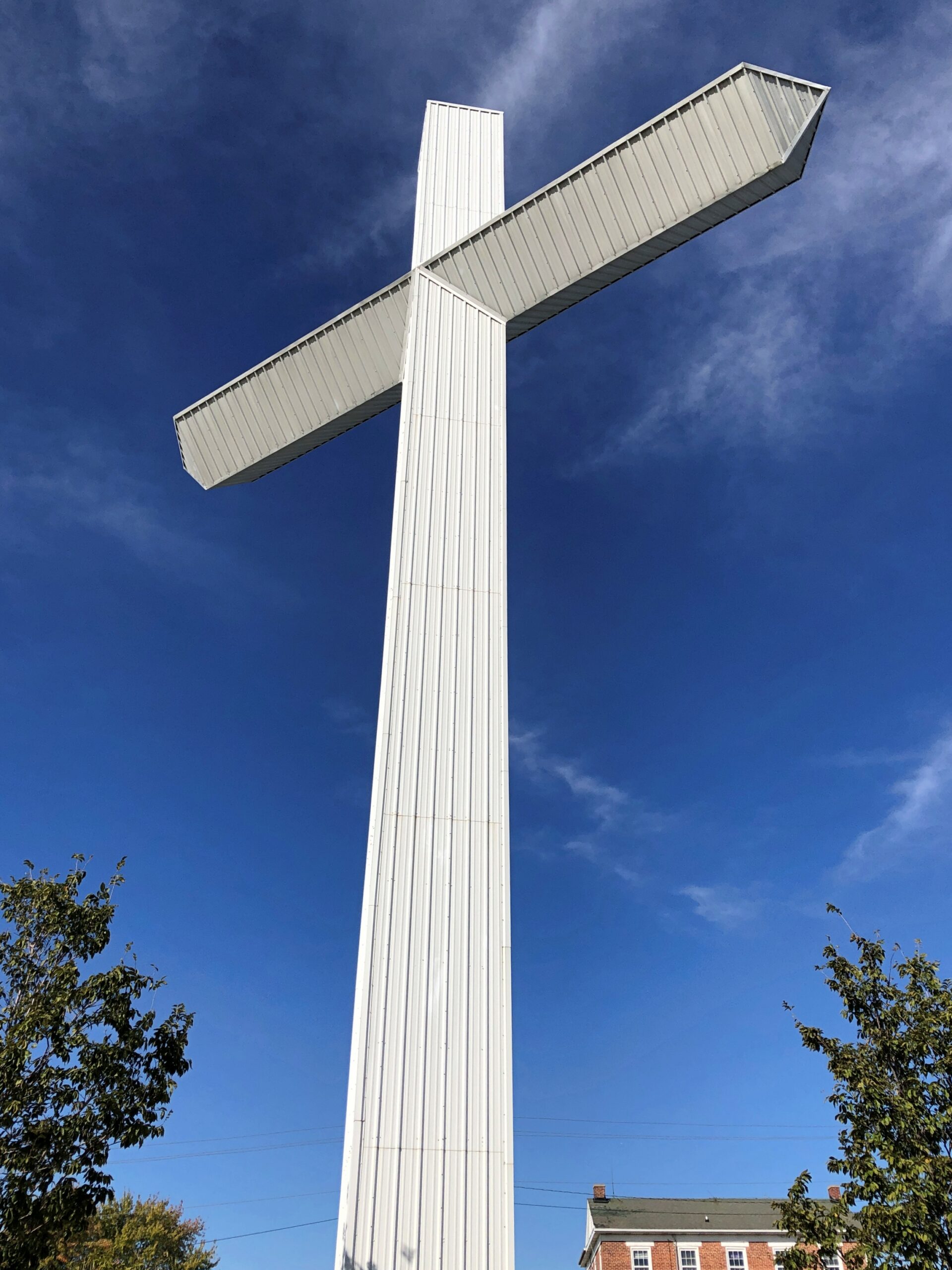
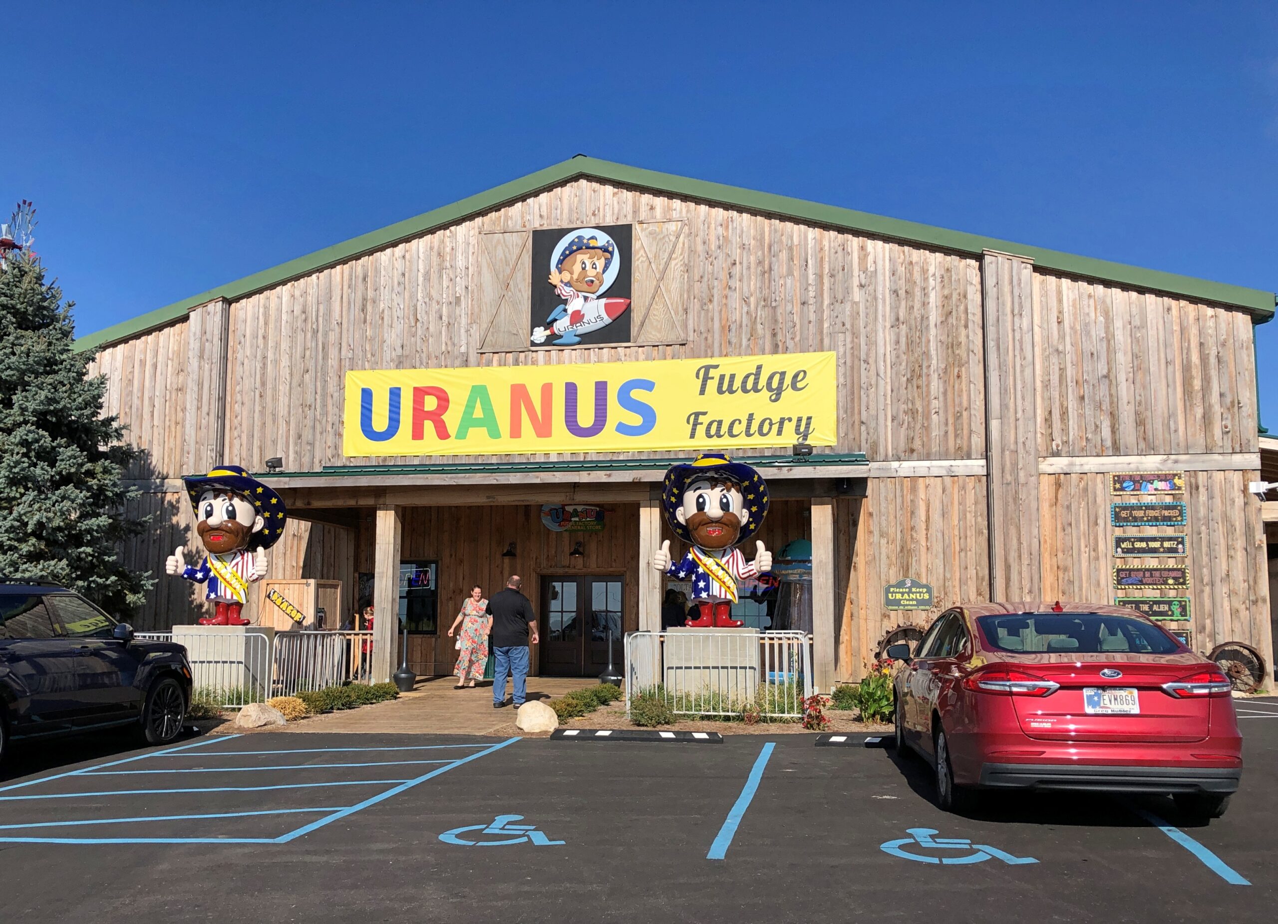
About an hour west of Springfield, at the border of Ohio and Indiana on I-70 – just barely inside Indiana – is the Uranus Fudge Factory. I had to stop for that.
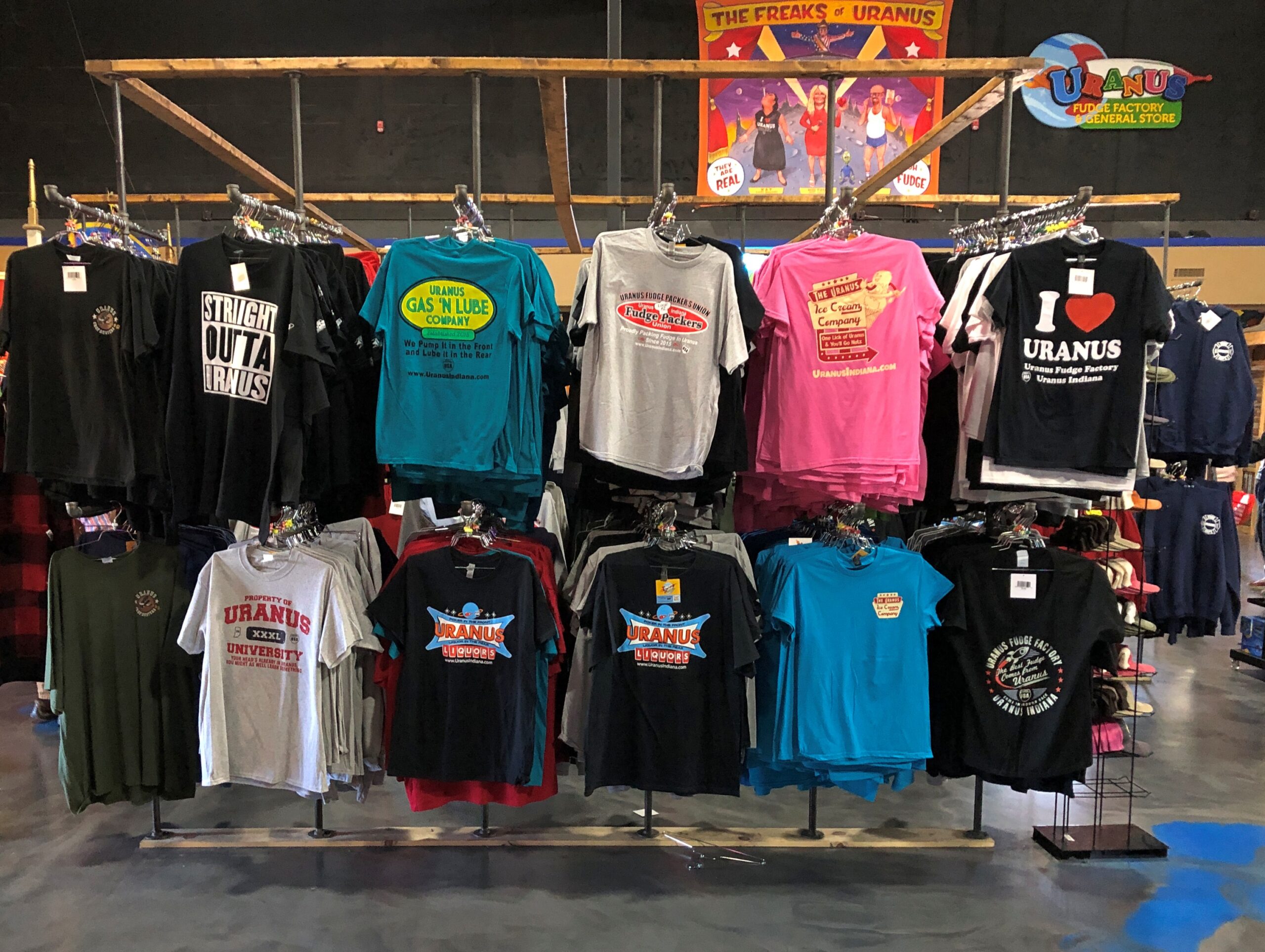
Sure, there’s fudge in there somewhere, but also a lot of gags involving the word Uranus(Your-anus). Examples can be found in the newspaper — an honest-to-God paper newspaper — that the store produces, The Uranus Examiner, and gives away. I have a copy. My kind of souvenir.
Sample front-page headlines from the Summer 2025 edition:
Breaking News: You Can Explore Uranus In Three Locations
Eating Their Way Through Uranus
Get A Lick Of Uranus
Sink Your Balls In Our Putt Holes
The second of those stories was about the 2nd Annual Eating Uranus Fudge Galactic Championship held at the Anderson, Indiana location in March. Apparently it was a Major League Eating-sanctioned event, and apparently MLE is a real thing. One Patrick Bertoletti won the 2nd championship at Uranus, putting away a bit more than nine pounds of fudge in about as many minutes.
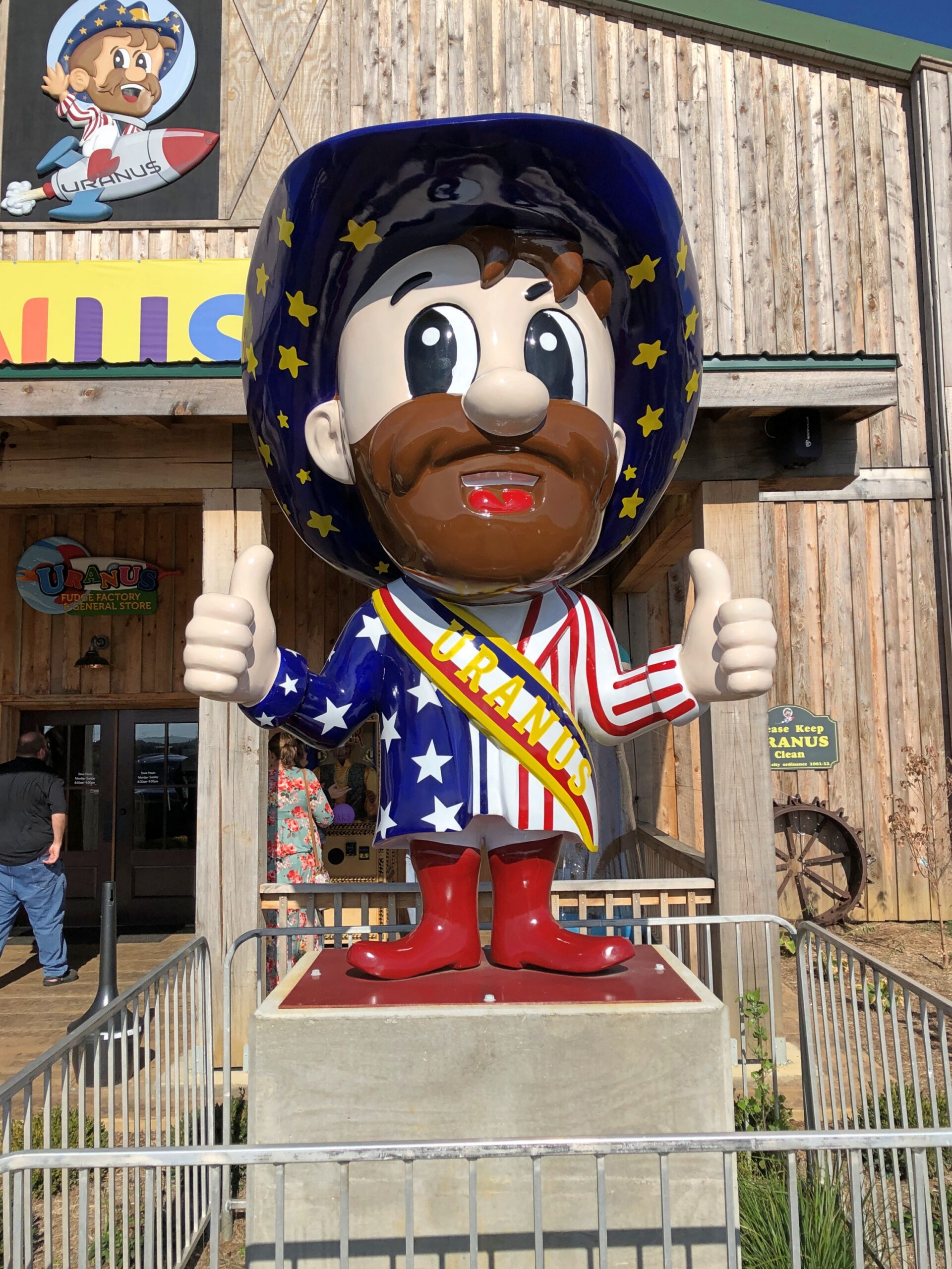
Fudge is one thing, but mostly Uranus sells stuff. A lot of stuff.
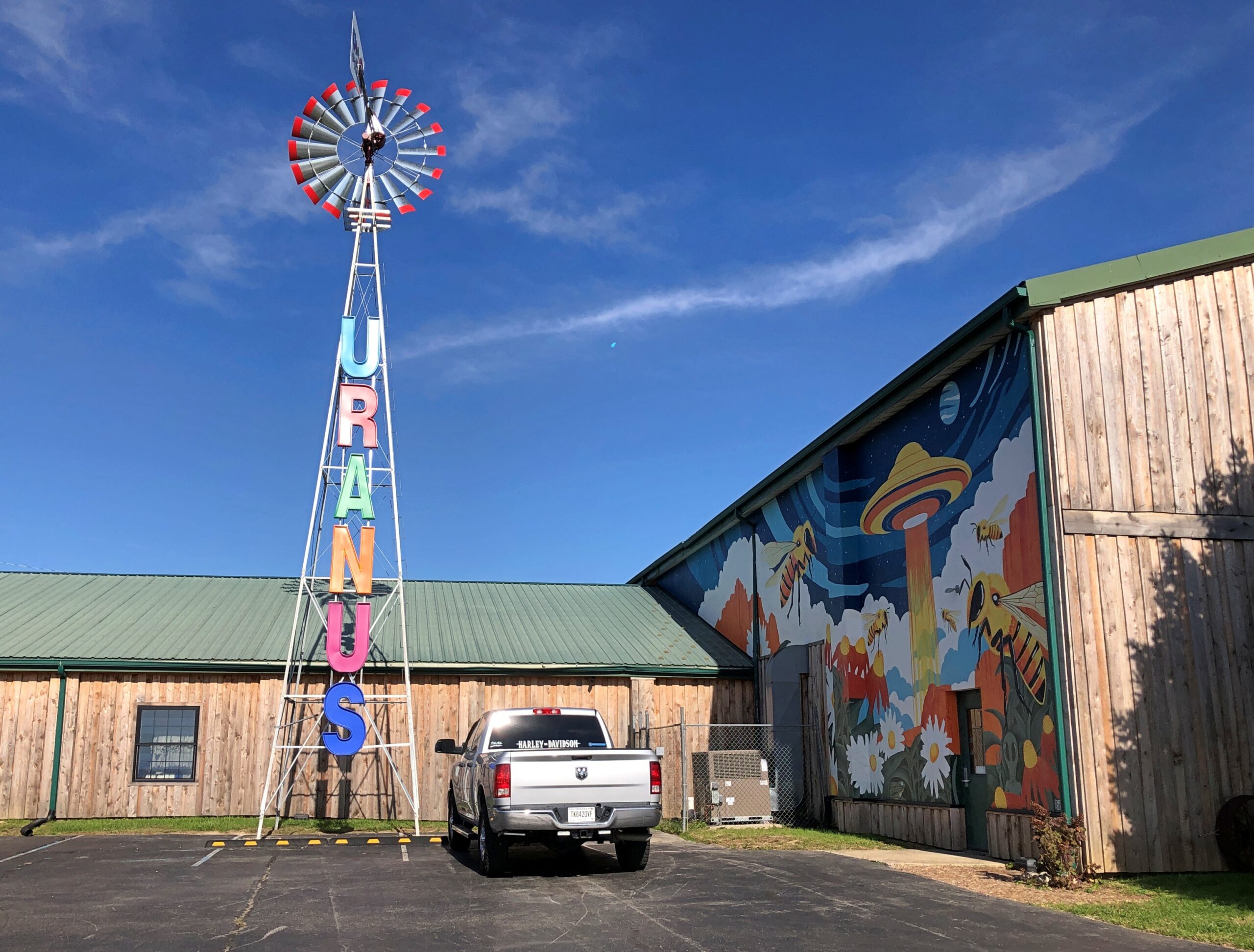
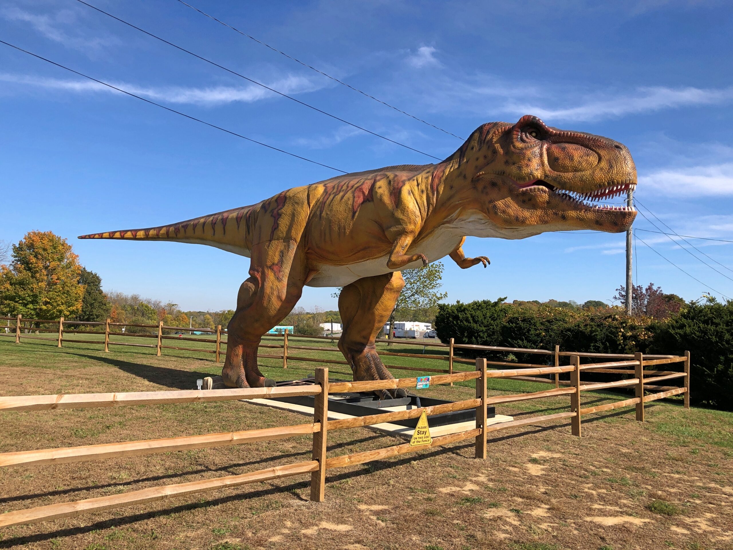
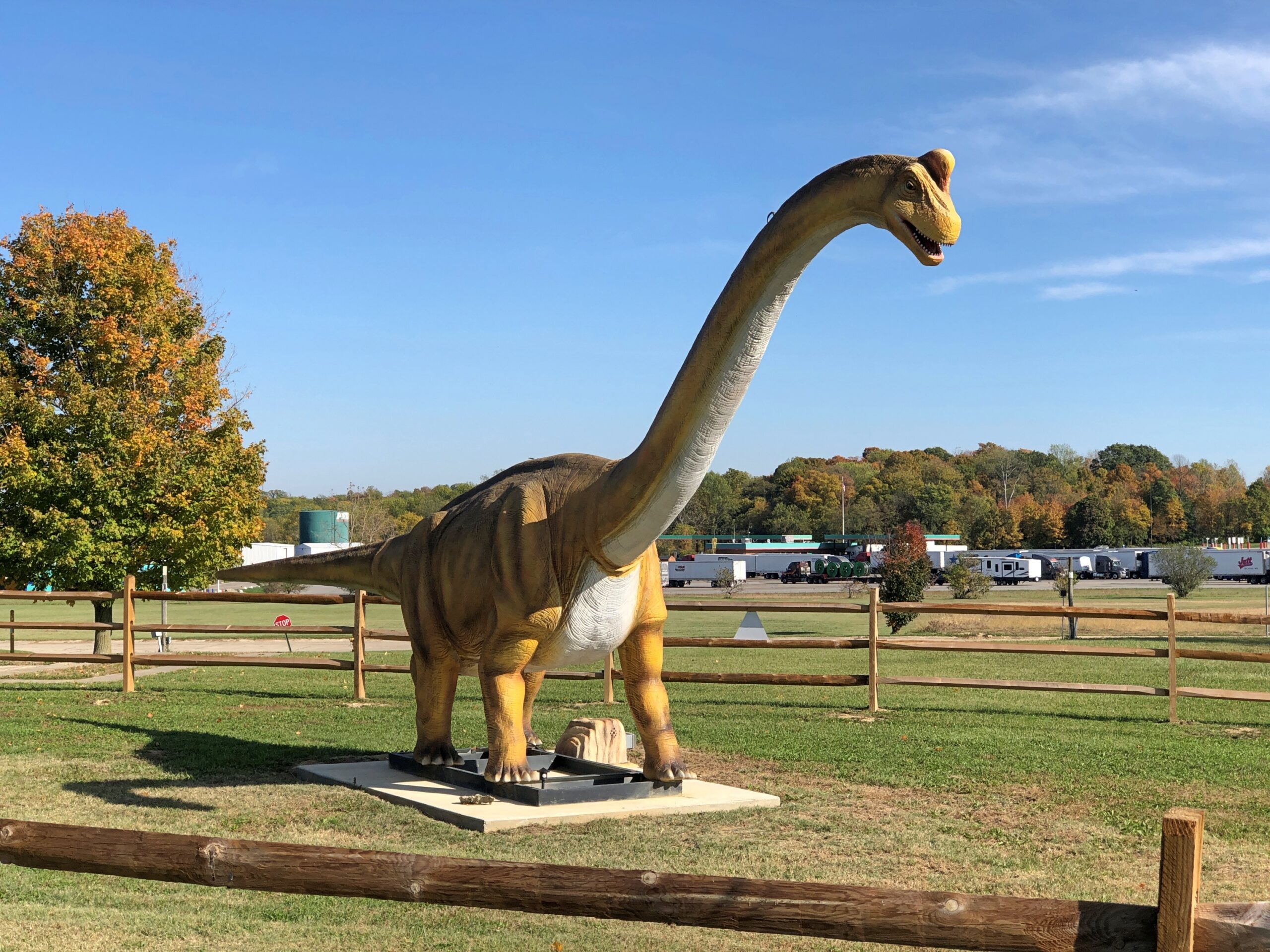
The Richmond, Indiana location is the third of three for Uranus, and I think the only one with dinosaurs —
— and a 100-foot cross of corrugated steel over a metal frame.
Until about 10 years ago, the property belonged to New Creations Chapel, which also included a church building, boarding school for troubled teens and a Bible college. The ministry, for reasons its web site explains in some detail, sold the property to Uranus, including the cross.
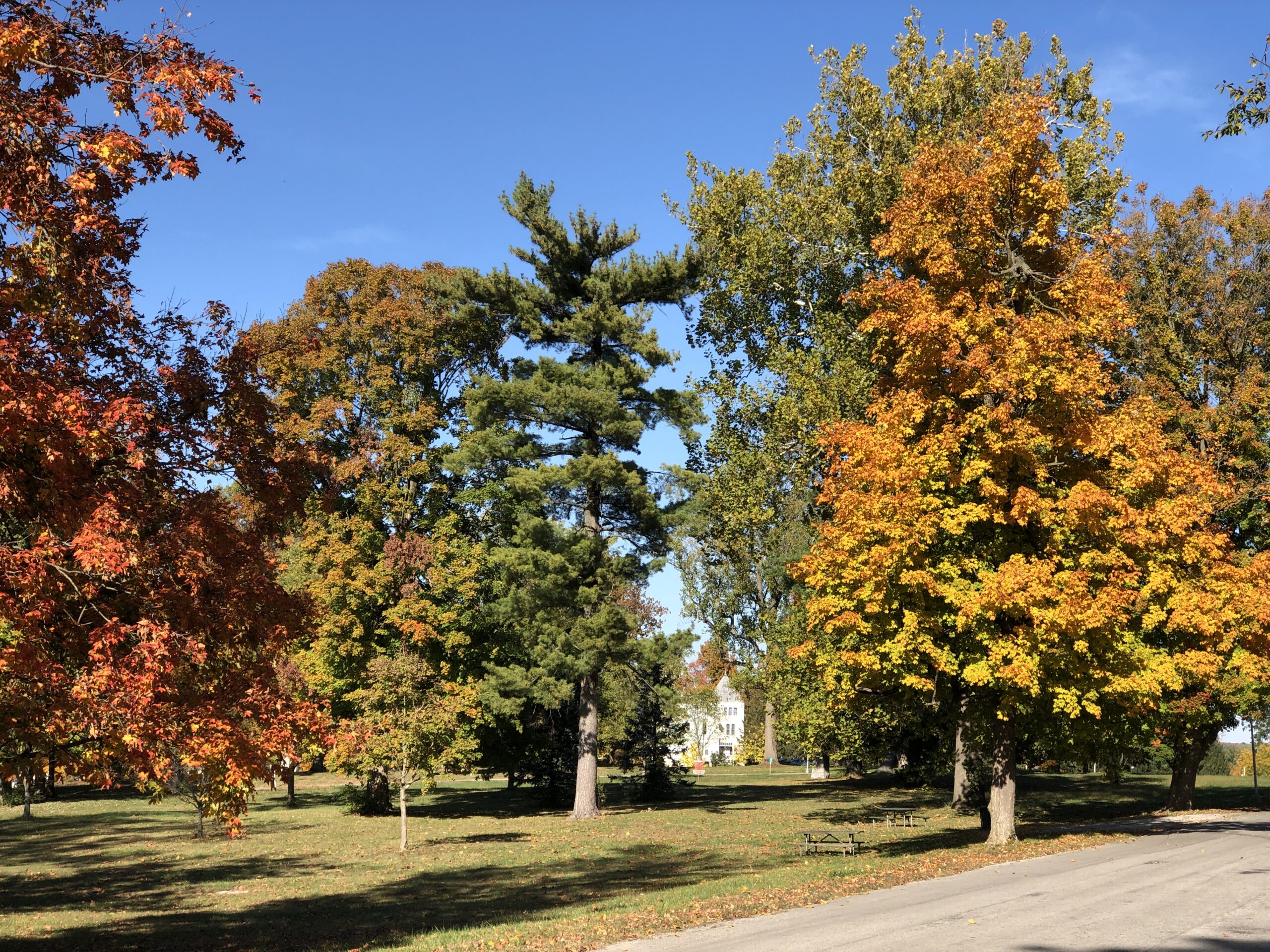
Heading through Richmond, Indiana, I stopped at an entrance to a large park to check my map. Glen Miller Park. A colorful spot in October.
Not named after the bandleader, which would be Glenn Miller Park. “Glen Miller Park was established in 1885 and was named for Colonel John Ford Miller, who was a railroad executive during the late 1860s,” the city of Richmond says. “Colonel Miller bought the land from Nathaniel Hawkins in 1880, with the intention of transforming the land into a park.”
So Glen Miller as in glen, a term that evokes pleasant Scottish valleys. I was just about to be on my way when I noticed a statue.
It was another of the 12 Madonna of the Trail statues, located at the edge of the park, where it meets US 40. Unlike the earlier one in Springfield, I hadn’t sought it out. It was just there. One’s travels, like life, can be strange sometimes.
I didn’t realize until last night that I’d driven through some geographic oddities over the last two weeks, on my way to the Northeast and back. Actually state border oddities, such as the Erie Triangle in Pennsylvania, the curious division of the Chesapeake Peninsula, and the panhandle of Maryland.
Except they aren’t really oddities. They just look that way when you’re a kid (or an adult) poring over U.S. maps or putting your state puzzle map together for the nth time. How is it that Pennsylvania has that small chimney? Why didn’t Delaware get more of the Chesapeake Peninsula? What’s the deal with the western extension of Maryland, which narrows to only a few miles at one point?
There are historic reasons for all the shapes, both rational and arbitrary, which are the subject of books and at least one TV show. Lands were granted and claimed, borders were surveyed and quarreled over, and deals and court cases and Congress eventually settled the shapes.
The border oddities may have local and legal significance, but they’re also there to enjoy. Regular borders aren’t nearly as much fun. Sure, it’s interesting that Colorado and Wyoming look about the same, but I always liked the fact that New Mexico has a stub and Idaho tapers to meet Canada, just to name two Western examples, because not all the fun shapes are in the East. Just most of them.
To reach these border areas, I drove 2,853 miles, starting October 14, from northern Illinois to the East Coast and back, through (in order) Indiana, Michigan, Ohio, Pennsylvania, New York state (and city), New Jersey, New York (city and state) again, Connecticut, Massachusetts, Rhode Island, Connecticut again, New York state (and city) again, New Jersey again, Delaware, Maryland, West Virginia, Pennsylvania again, West Virginia again, Ohio again and Indiana again, arriving home today. I got tired just typing all that out.
The original impetus for the trip was to visit New York City during its Open House event. Unlike a rational person, who would have flown there and back, I decided to drive, and let Yuriko fly there and back. NYC is achievable from metro Chicago in two driving days. I decided not to do that, either, and stretch things out to fill in some travel lacunae of mine.
For instance, I wanted to visit Eire, Pa., because I’ve always bypassed it, and many Americans can say the same. I wanted to look around Long Island, or at least part of it, for the same reason. I wanted to spend the night in both Rhode Island and Delaware: the last two states in which I’d never done so. I wanted to see the capitols of New Jersey, Delaware and Maryland, toying with the idea of Pennsylvania too, though I decided it was out of the way. I wanted to see historic sites associated with a number of presidents along the way, and maybe a battlefield or two.
I really wanted to visit a friend in New York, and my nephew Robert, and friends in the Boston area. I’m glad to report that I did so. This has been a year of visiting old friends and relations. I’d like every year to be that way.
I had a much longer list of places to visit, and added to it every time I looked at a map, paper or electronic, since I now use both, and when I was driving — so many possibilities. But there are only so many hours in the day and so much energy in my aging body. Still, I did much of what I set out to do, with one major exception due to forces beyond my control. National Park Service sites were off the table, for reasons all too obvious and not worth rehashing here. So the homes of FDR and TR, along with Antietam and Harper’s Ferry, went unvisited. Some other time, I hope.
No matter. I visited a good number of cities and towns, drove roads large and small, empty and insanely crowded, and enjoyed a few exceptional meals and many very good ones. I saw churches and cemeteries, some historic places not managed by the federal government, and encountered the largest of the many No Kings events. I read plaques. I chatted with strangers and clerks in stores. I took a swim in Massachusetts and long walks in New York. I hadn’t planned to walk across the Brooklyn Bridge again, but Yuriko had that idea, and across we went. I listened to a lot of terrestrial radio, good, bad and indifferent. I burned gas priced between about $2.70 and $3.30 a gallon. I paid entirely too many tolls, because the Northeast is lousy with toll roads and bridges — but driving across some of those bridges, especially the Bay Bridge in Maryland, was a grand experience, and surely worth the toll.
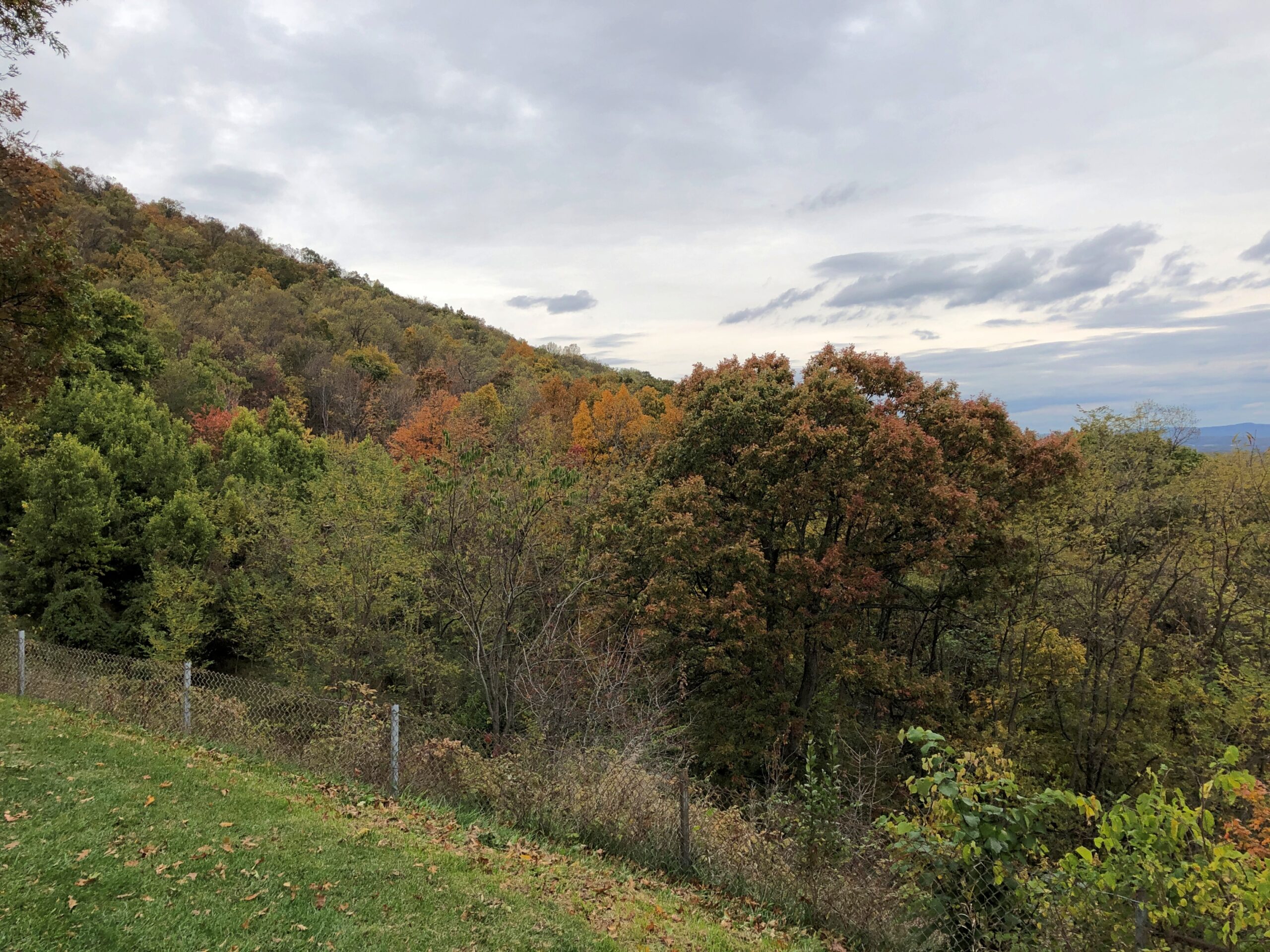
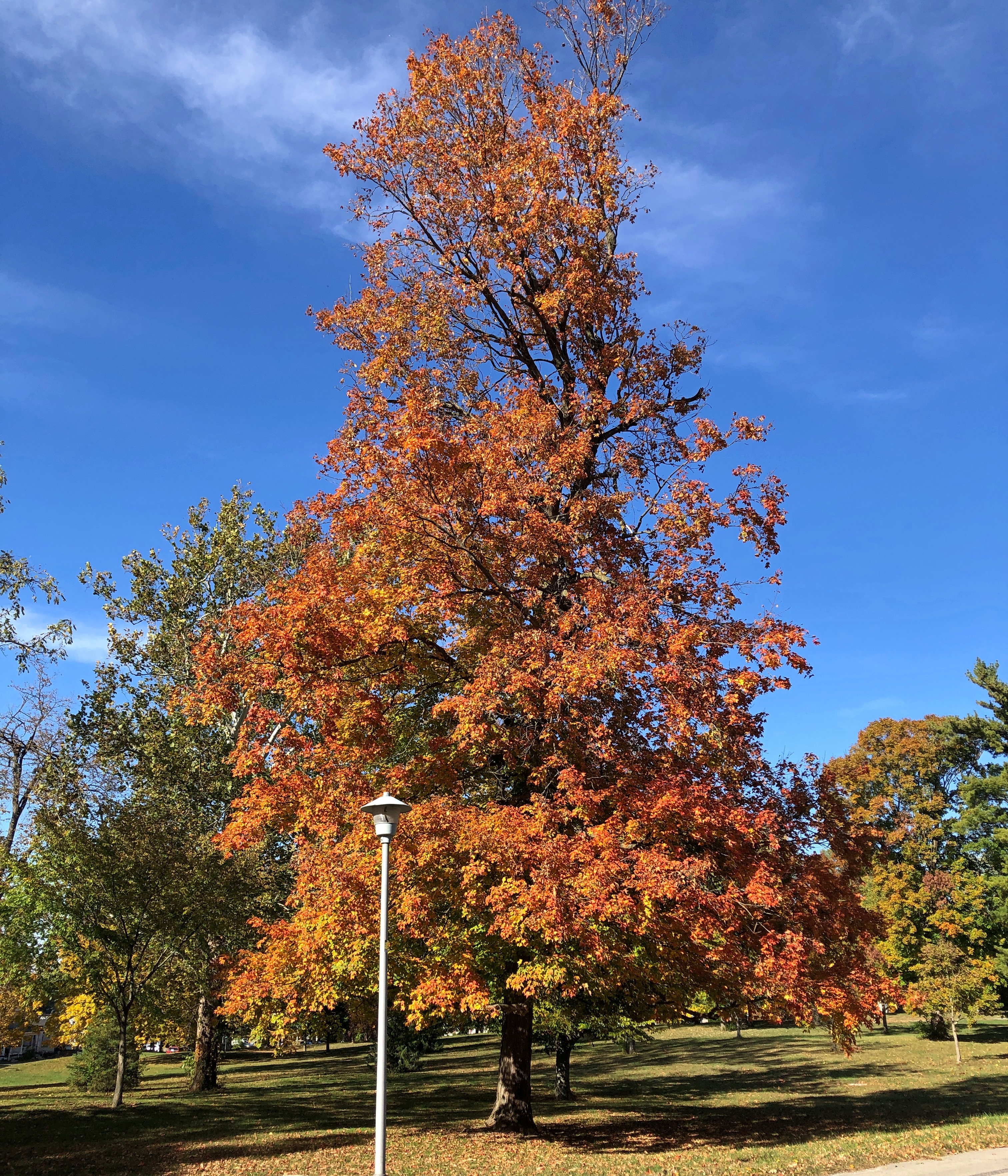
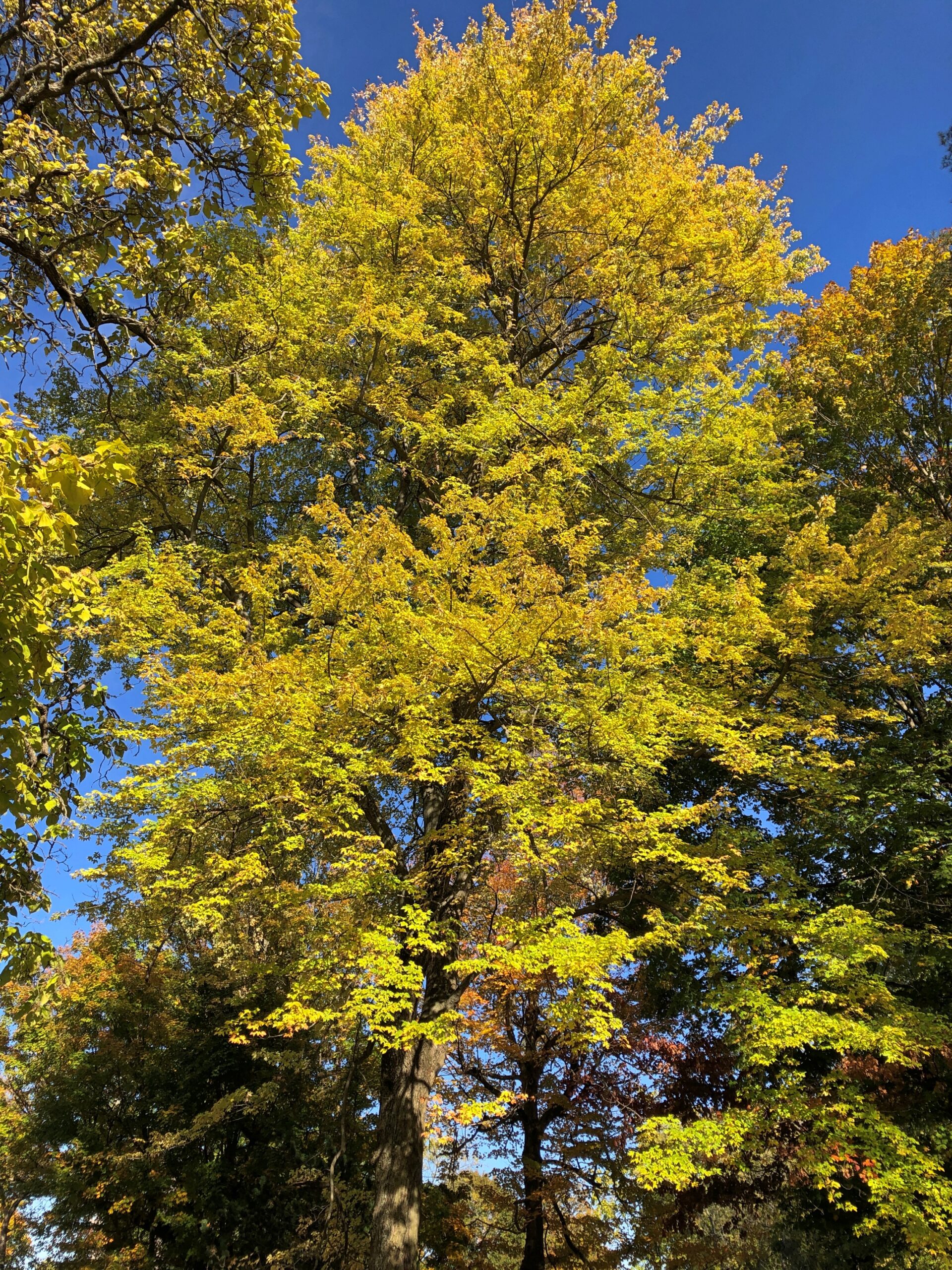
Something I didn’t anticipate, but which improved the trip immensely, was fall color. I should have anticipated it, but I suppose I had other things on my mind. When I got to New York state, driving west to east, it became clear that I’d accidentally designed myself a fall foliage excursion. The trees were gorgeous there, and in NYC (especially Prospect Park), Long Island, and parts of New England, and in Delaware and Maryland all the way across its panhandle. Even Ohio and Indiana had some nice color when I got there, and here at home too.
One more thing: unexpected oddities along the way. It’s important to watch out for those.
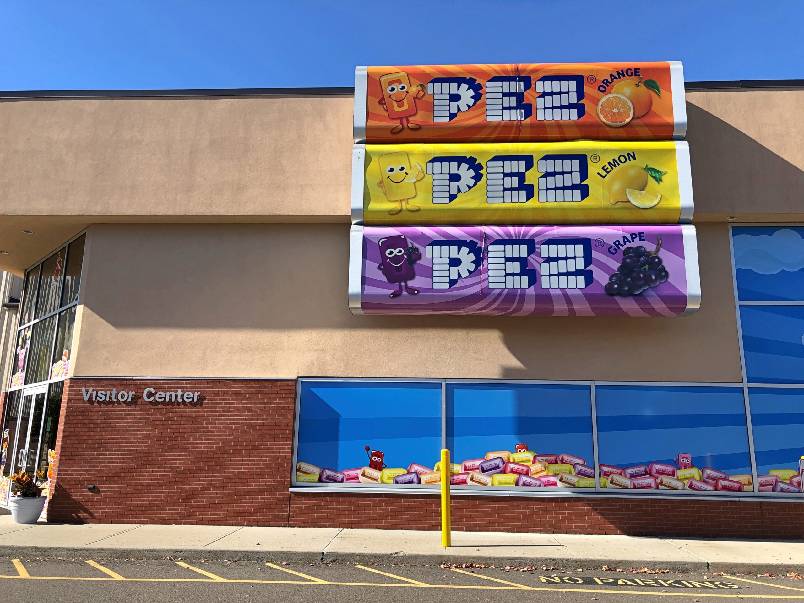
In Orange, Connecticut, I noticed a sign for the Pez Visitor Center. I had to see that.
Earlier today, at the border between Ohio and Indiana, I noticed Uranus. I had to stop.
Turns out there’s more than one; I’d only ever seen the one in Missouri (the original) in passing, never stopping. But I did this time. Now I can say I’ve been to Uranus.
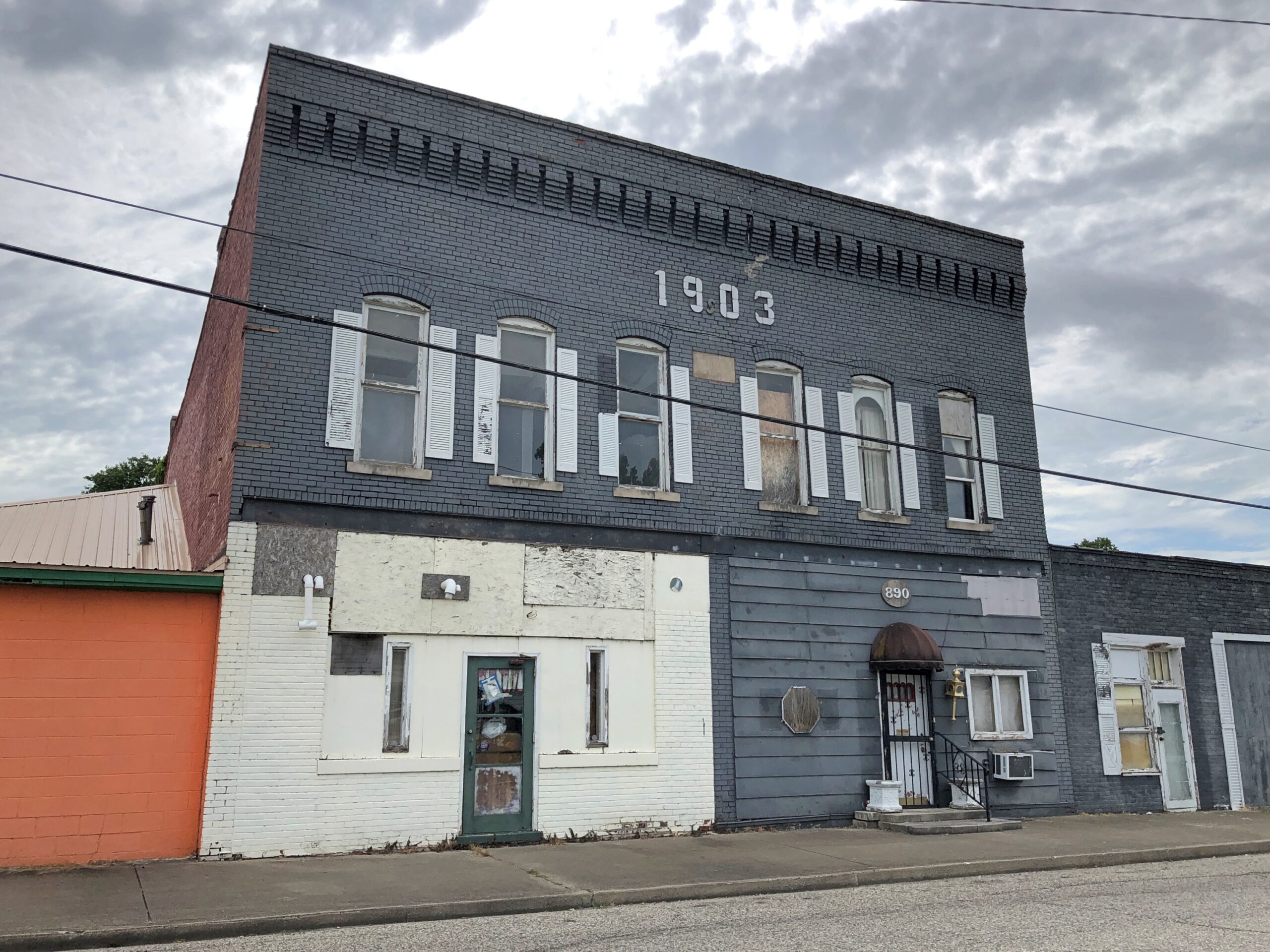
Just how many places in the United States are named after the Aztec emperor Moctezuma II, or as it’s spelled everywhere in América del Norte, Montezuma? Turning to the USGS, I find an answer: a lot. The survey lists 83 U.S. place names using the word Montezuma. There are cities, towns and populated places; water features like streams, creeks and bays; summits, peaks, ridges and a slough and a cliff and a cut-off; a county in Colorado and a mining district in Nevada; and much more. Included was the one we visited a few Sundays ago, Montezuma: Indiana.
I was looking at a fine paper map, a guide to the county’s covered bridges and the routes necessary to see them, and I saw on it the town of Montezuma. With the name like that, who wouldn’t want to go for a look? Then I found that it had its own historic bridge, but not a covered one. So we made our way west from Rockville along the likes of Strawberry Road and US 36 to Montezuma.
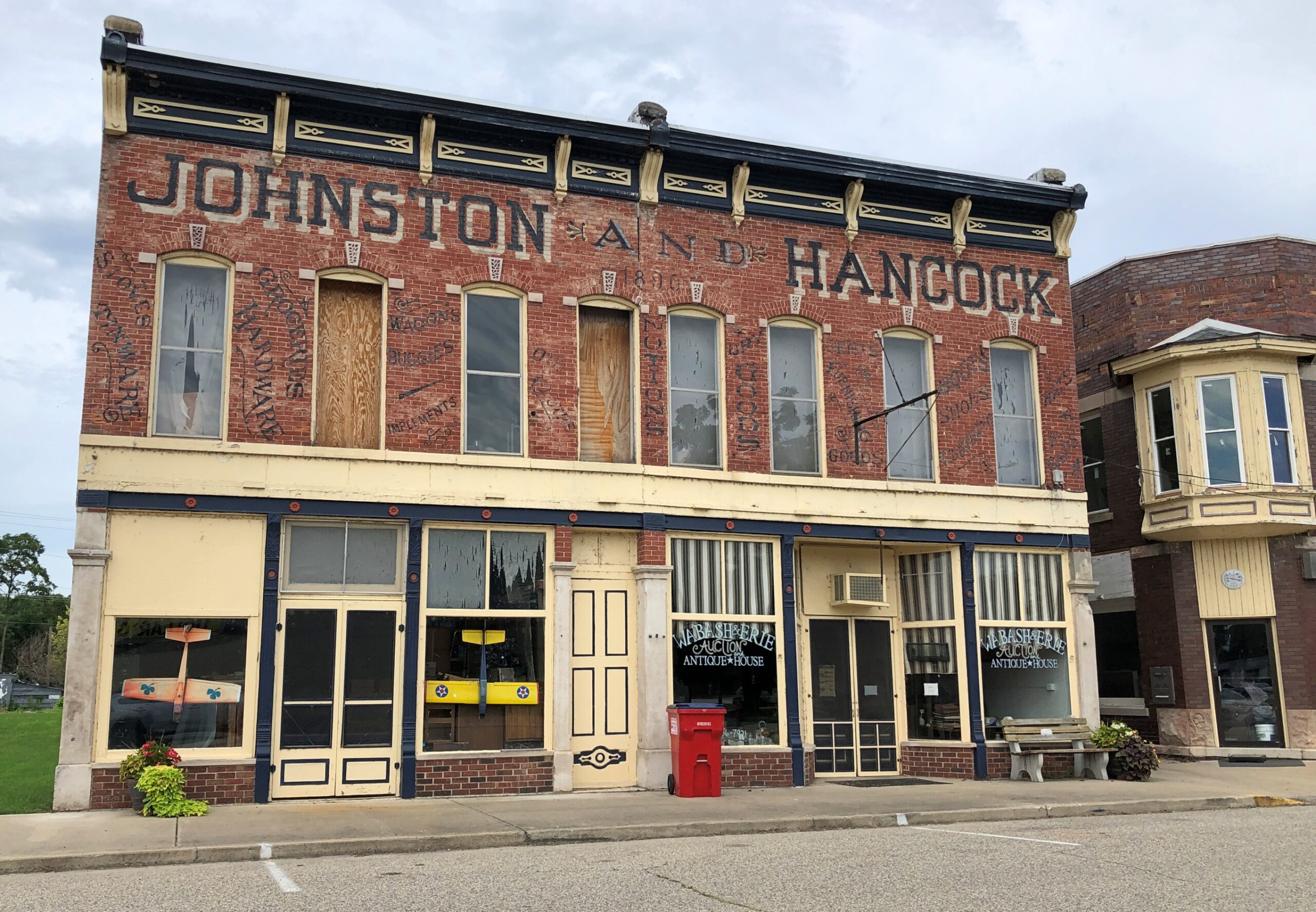
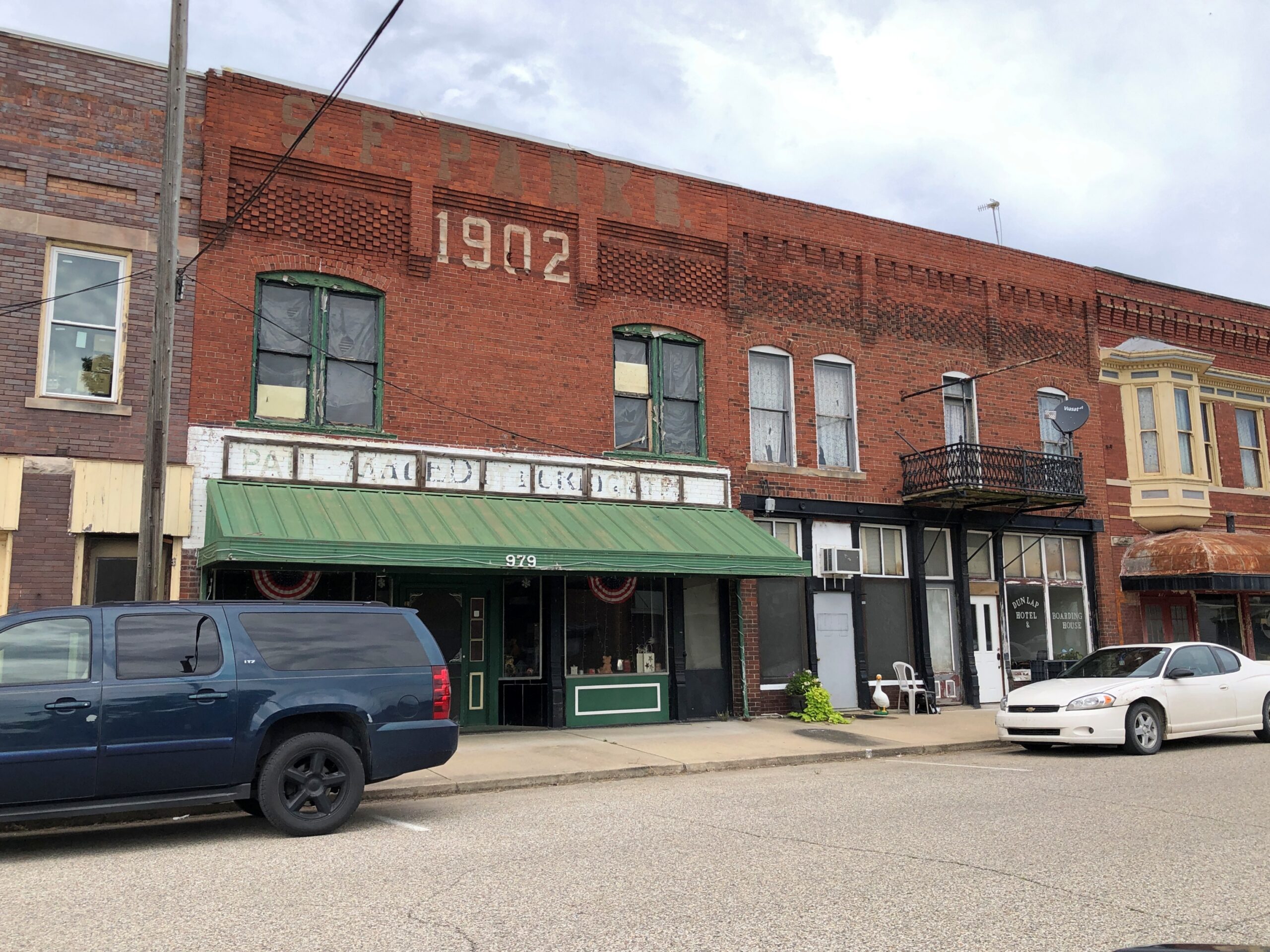
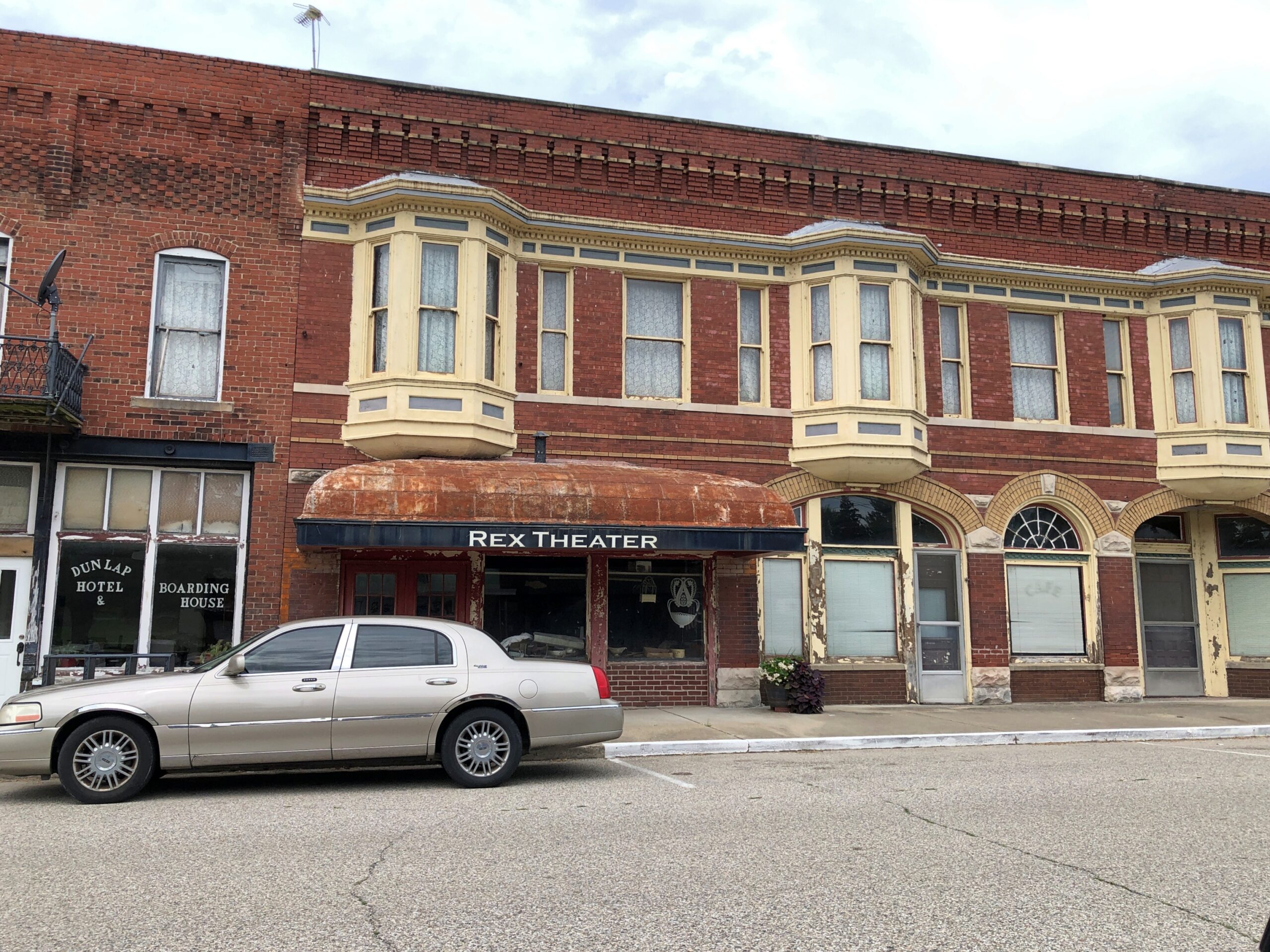
The town (pop. 1,000 or so) is at the western edge of Parke County, along the east bank of the Wabash River. It doesn’t look like downtown, deserted on a hot Sunday, has been discovered by tourists or hipsters yet.
Full of intriguing detail, these buildings, but none more than a sign for a hotel and boarding house. Along the classic model – people living in rooms upstairs, taking most meals in a room next to a kitchen? Or is it an SRO hotel (rare enough) with a vending machine in the lobby?
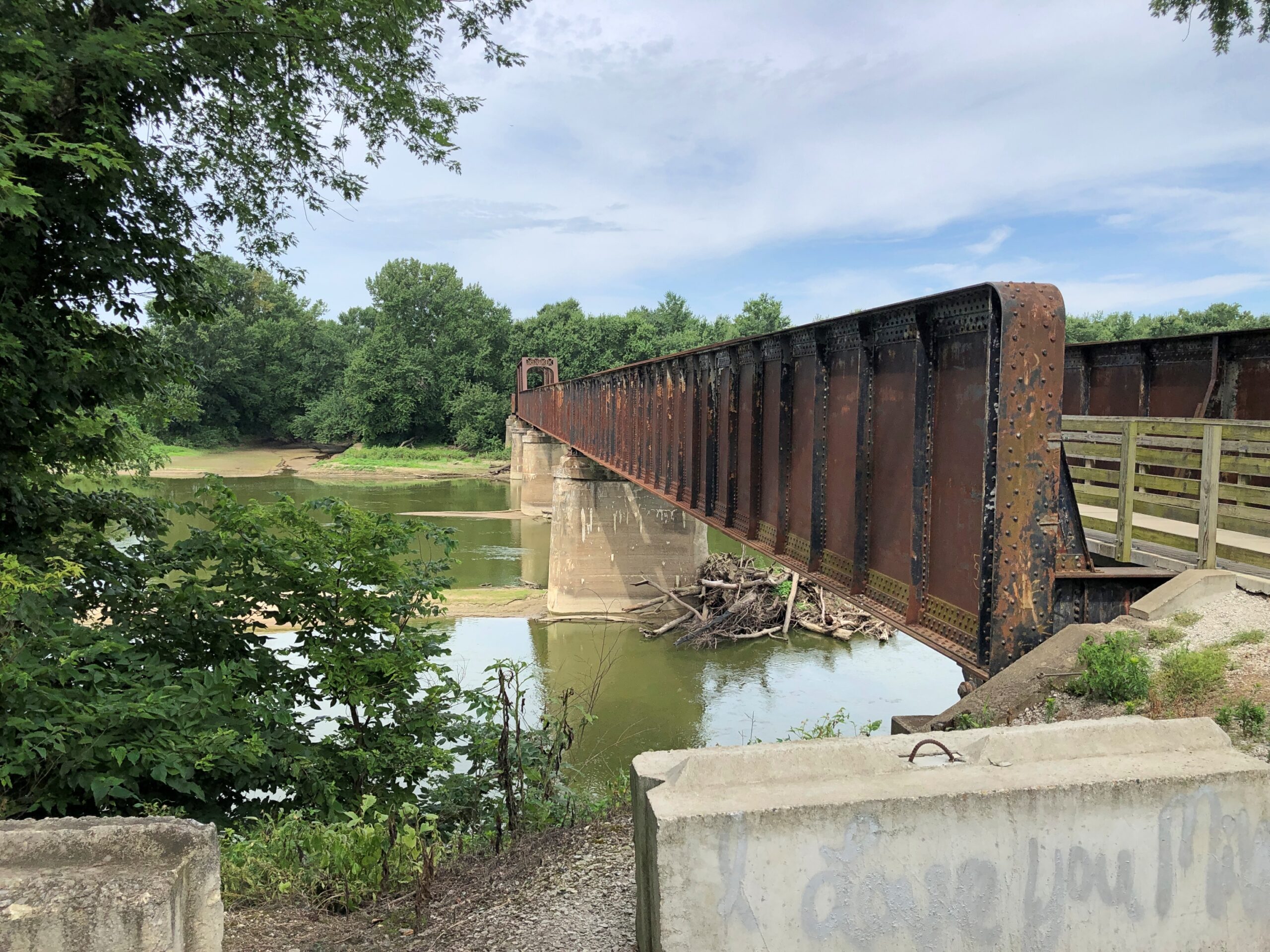
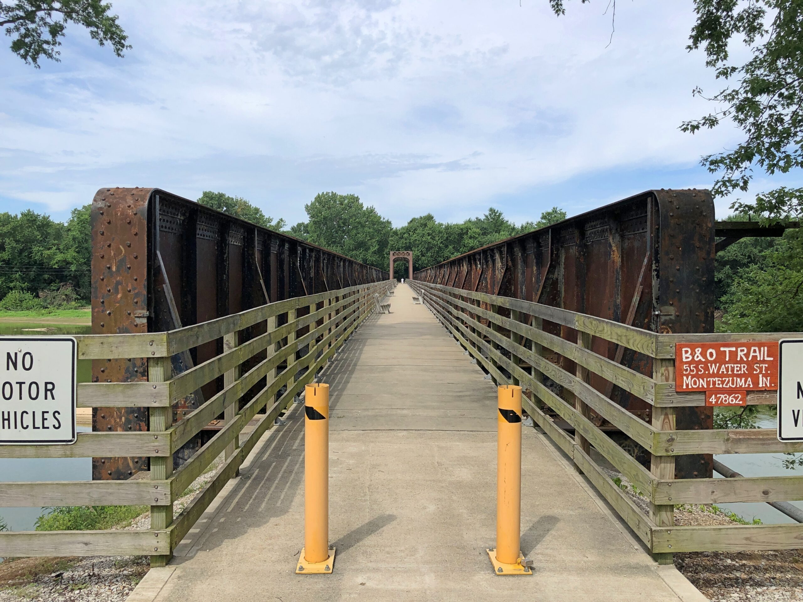
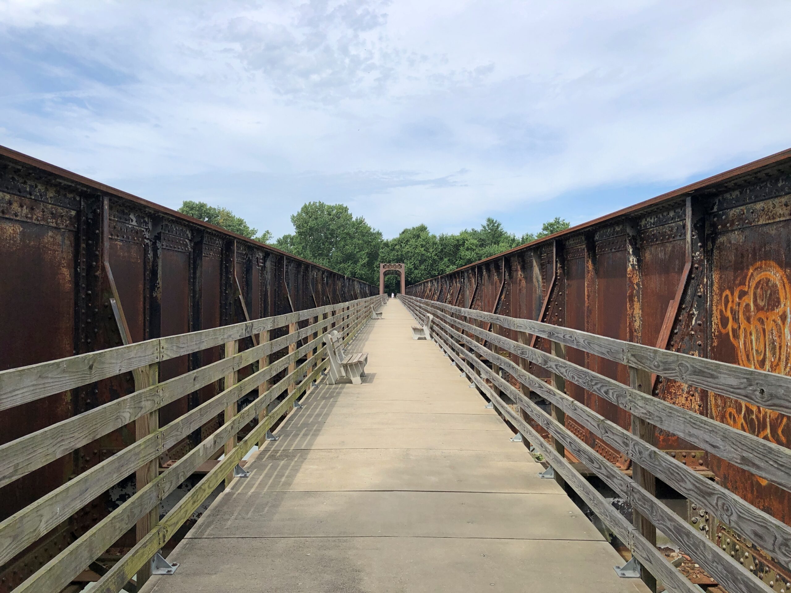
On the southern edge of town is a former B&O Railroad bridge, now a pedestrian and bicycle crossing.
Crossing the Wabash River from Montezuma takes you to Vermillion County, Indiana, which hugs the left bank of the Wabash for a long way.
Graffiti on iron. Daring, or foolhardy, since there’s a gap — between the edge of the walking bridge and the iron support features of the bridge — large enough for a careless graffiti artist to take a quick plunge to the river below.
Looking out to the river.
Looking back at Montezuma.
The B&O is as storied a railroad in North America as you can get – a pioneering commercial line sprouting from Baltimore into the Midwestern interior, eventually. Host in 1828 to Charles Carroll of Carrollton, the only surviving signer of the Declaration of Independence, at the railroad’s groundbreaking ceremony. Critical infrastructure for the Union war effort some decades later. Powerful regional RR in the Gilded Age. Famed as one of the four Monopoly RRs.
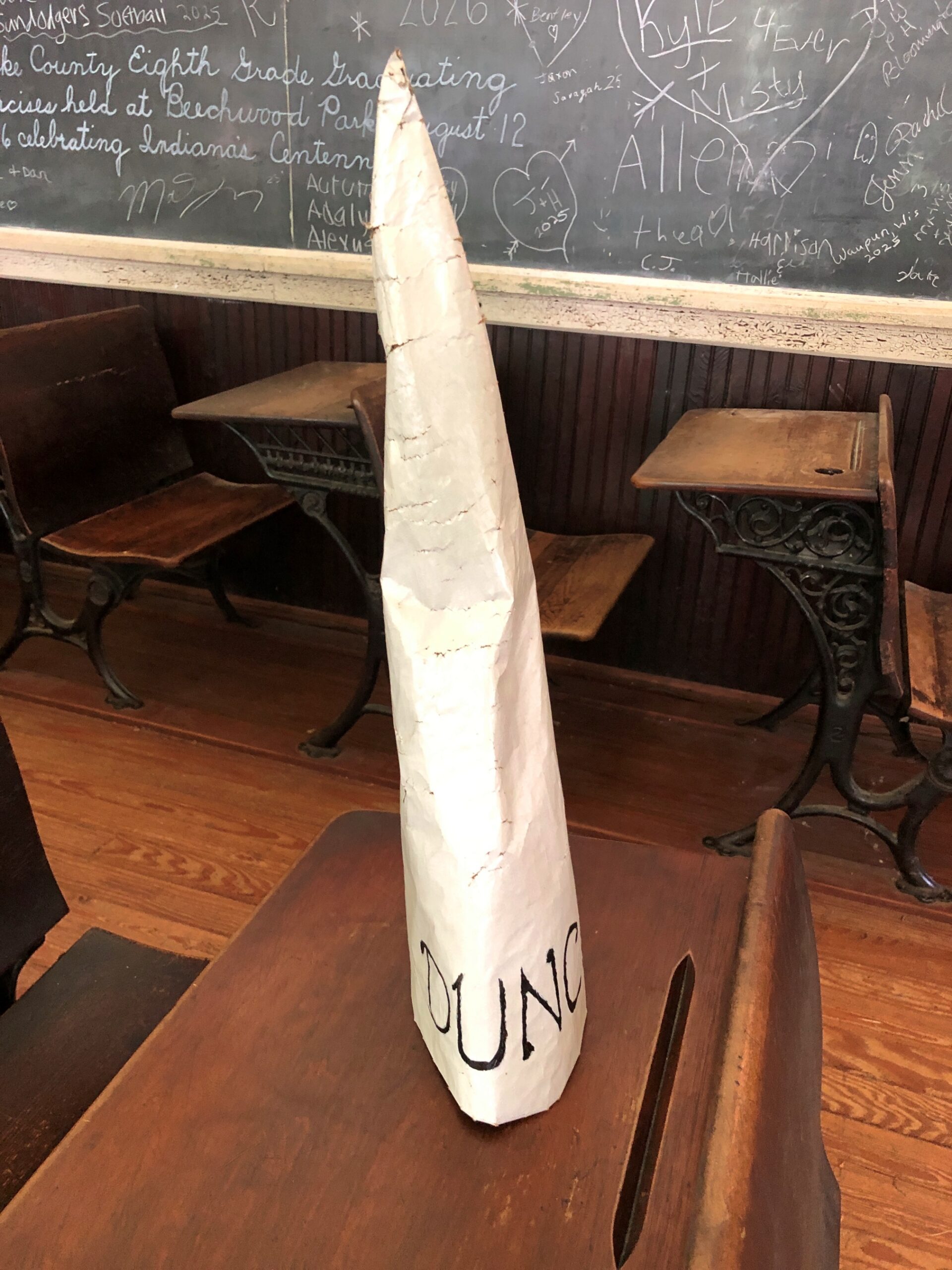
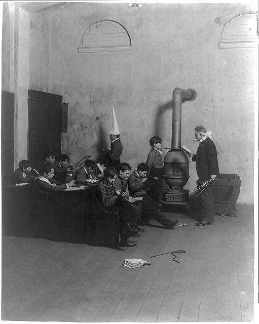
I don’t know whether it was a relic or a replica, but there it was, something we’ve all heard about, seen in drawings and as the stuff of metaphors: a dunce cap. I’d never actually seen one before that I remember, not as a physical object.
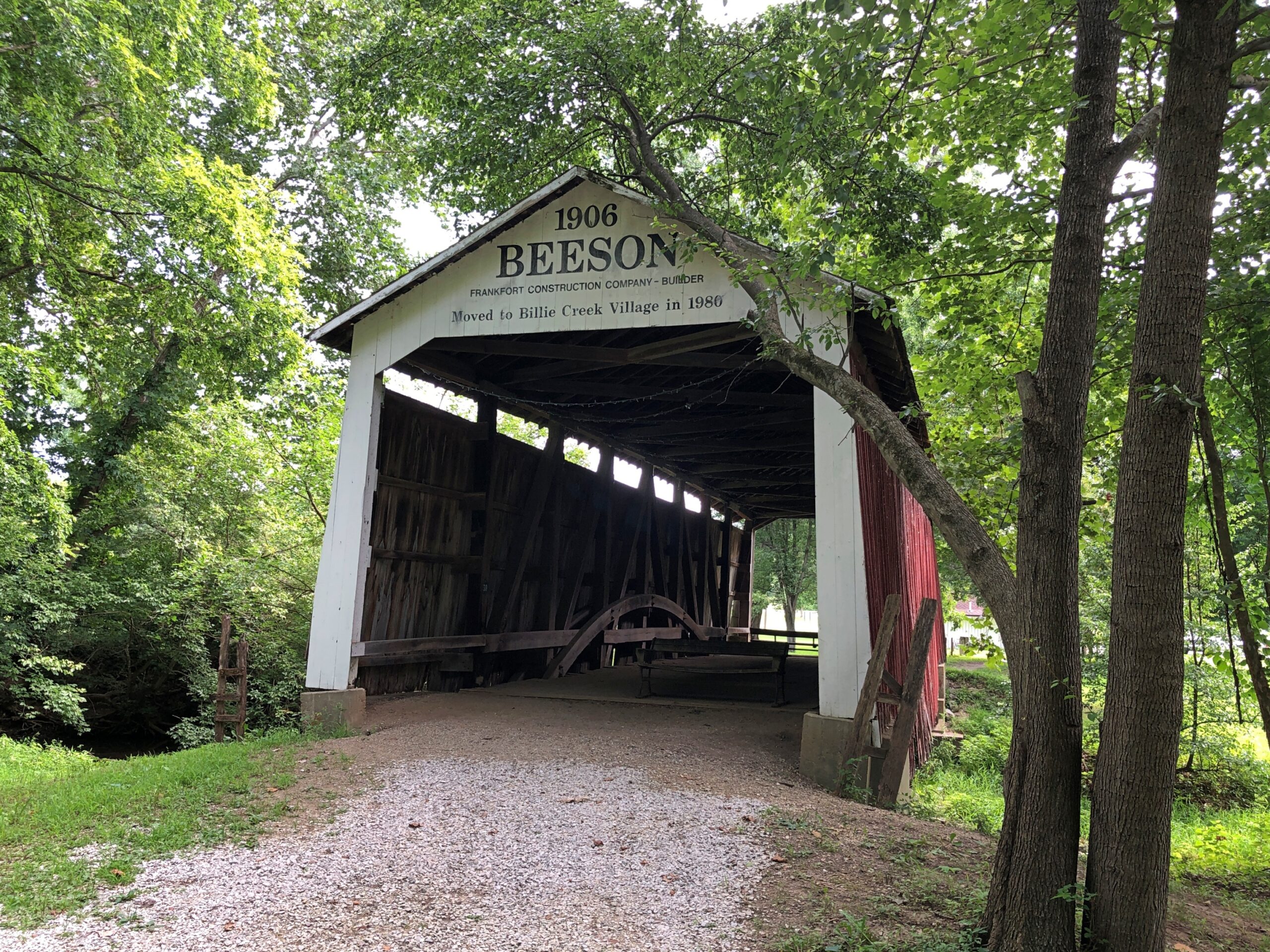
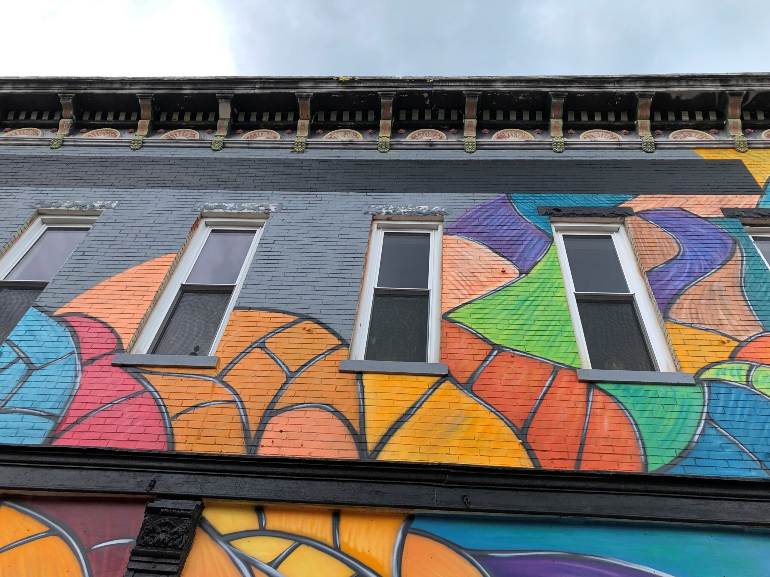
That is why you (I) visit such places as the open air museum Billie Creek Village in Parke County, Indiana. To be mildly surprised. Such as the time I encountered a can of White Star brand tomatoes with a hammer and sickle on it, or a Papua New Guinea battle shield sporting the Phantom, just to name two among many such little surprises.
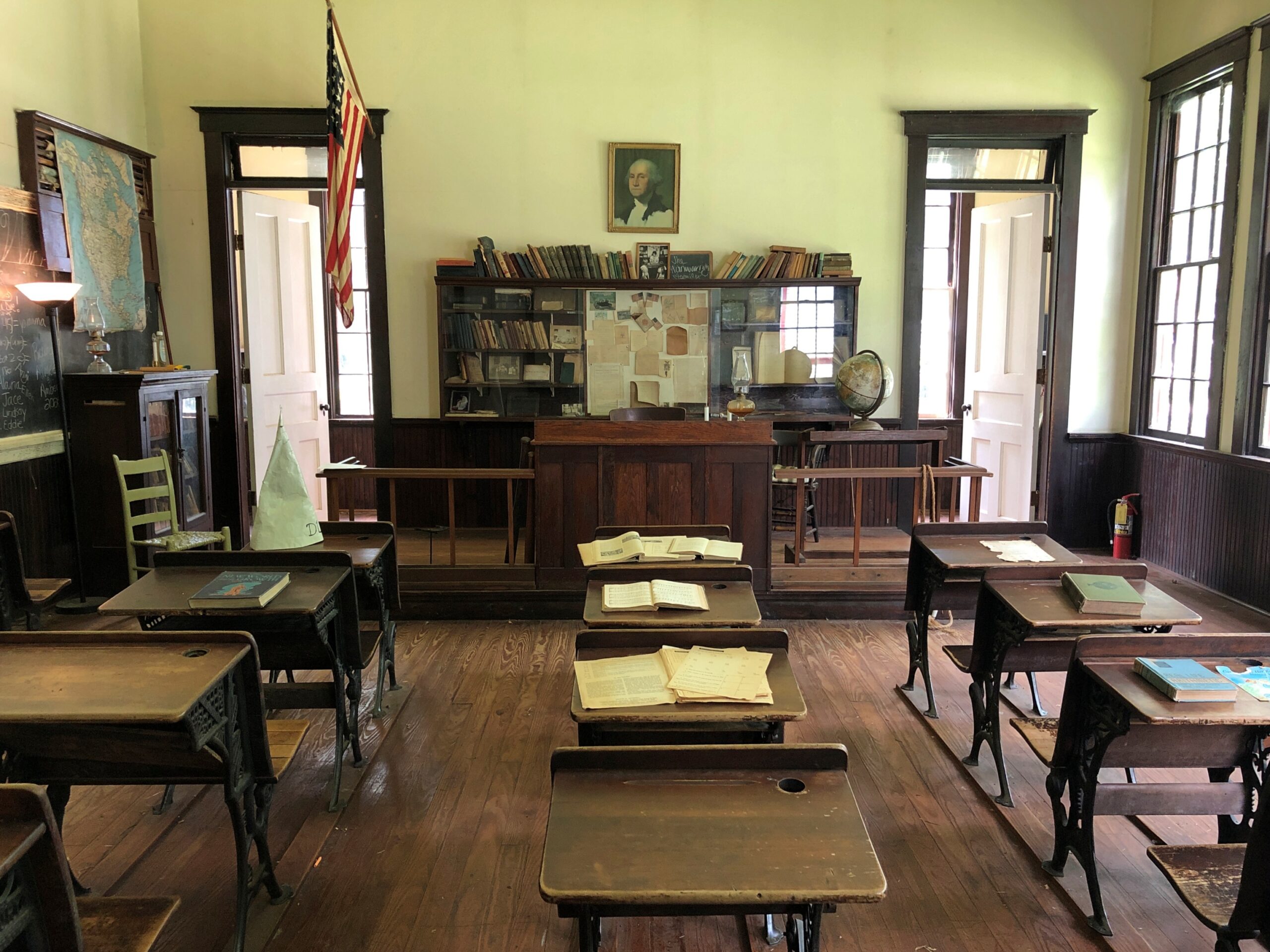
The dunce cap was on one of the desks at Billie Creek’s one-room school house, used until the early 20th century, as usual for that kind of school.
Good old dunce caps. Sure, they go against the grain of modern thinking, antiquated as a one-room school, but we all can remember a few goofballs from our school days who deserved one, can’t we? As seen in a pic from the Library of Congress, dated ca. 1905, but with no information about where it might have been. Just a small school in the years before self-esteem was discovered.
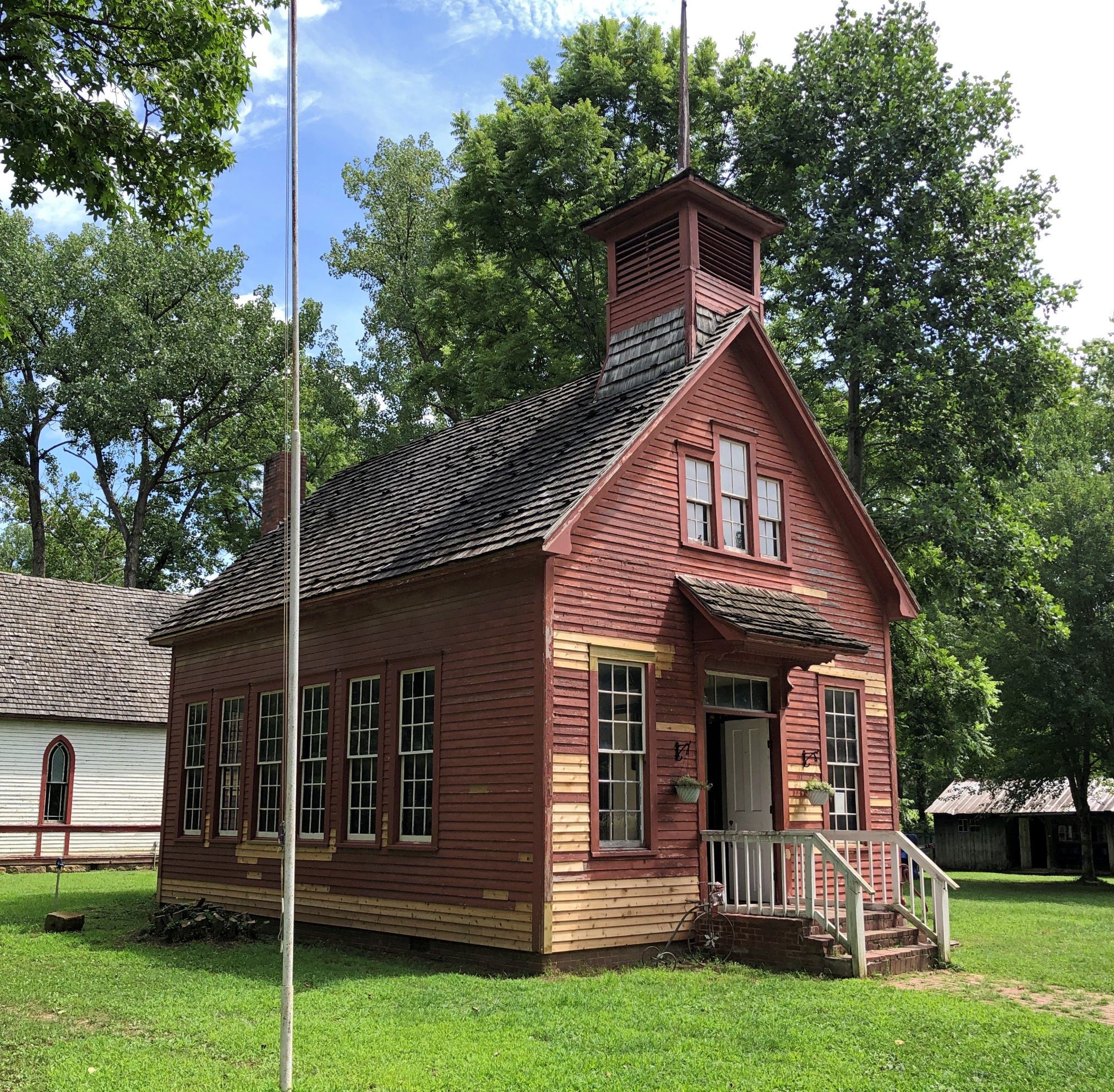
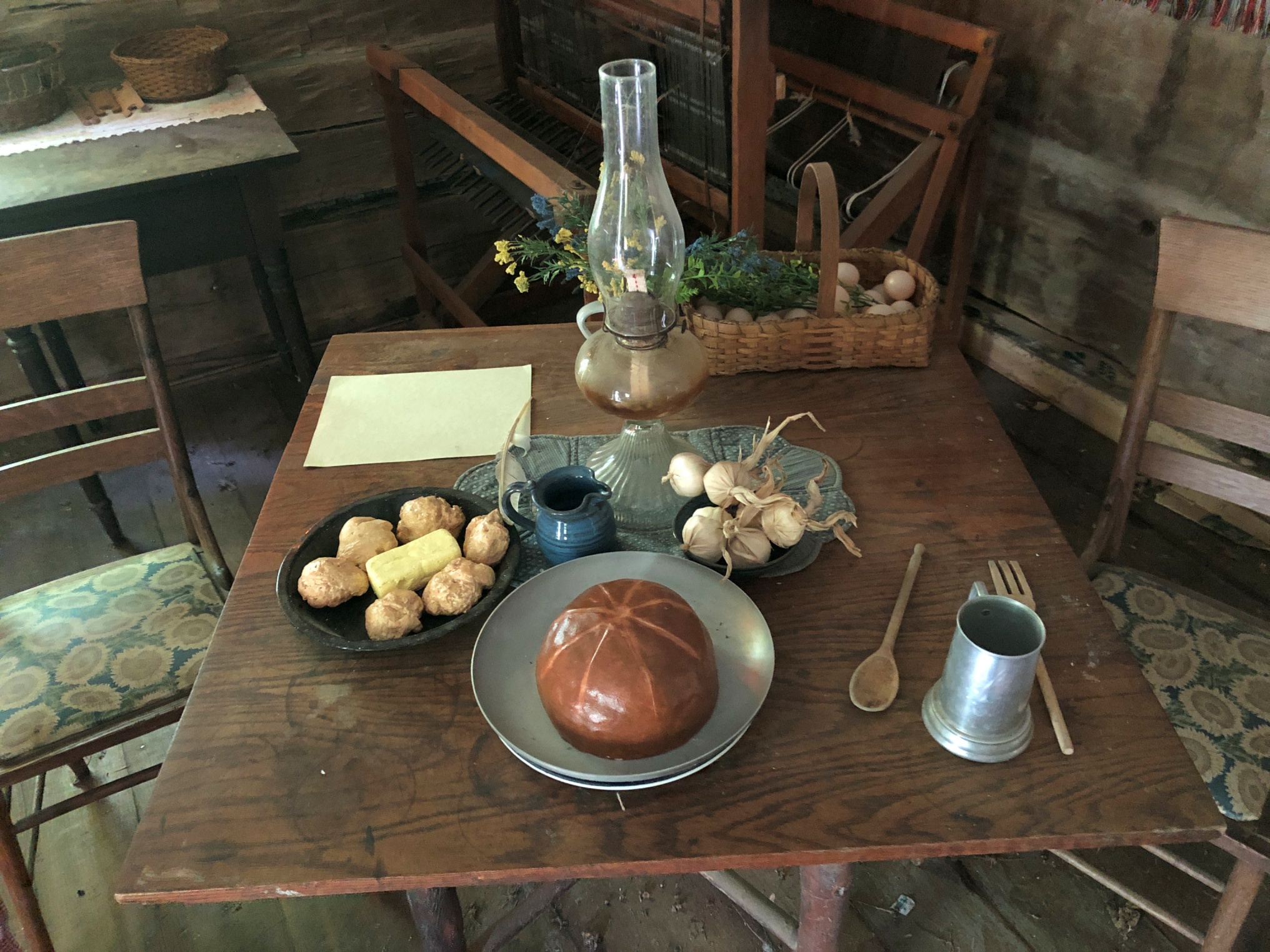
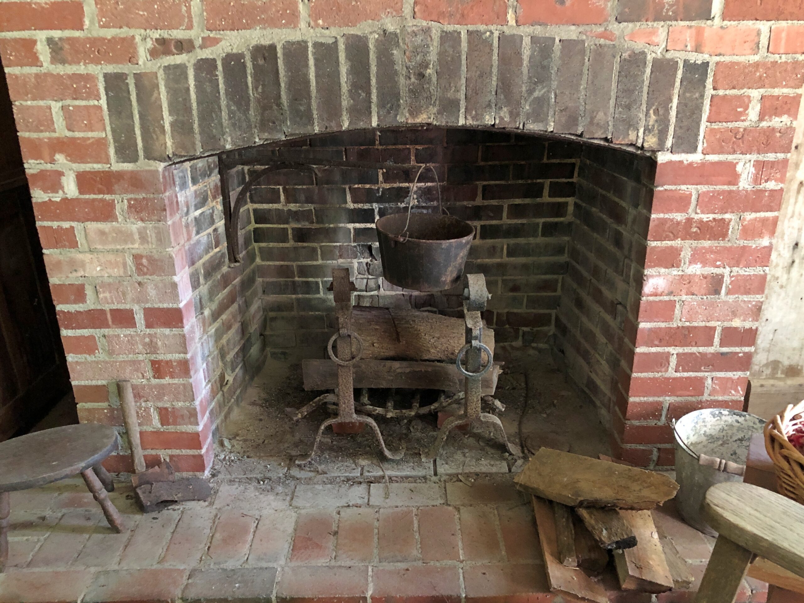
The old school house at Billie Creek is one of 38 historic structures relocated from various parts of Parke County, Indiana, to about 70 acres west of Rockville on US 36. Originally opened in 1969, the place has had a series of owners and been through periods of abandonment, but since 2022 has been under management that seems to know what its doing.
That’s my thinking, anyway, since its refreshing informality perfectly suits the place. You go, you park your car, you wander in. No irritating timed tickets, no gouging entrance fee, no expensive yet mindless luxury goods and experiences that could be pretty much anywhere. Yet there is an economic model: Billie Village hosts events – one was going on when we visited around mid-day on a Sunday – and some of the buildings are also shops, and do sell luxury goods, in the sense that such handcrafts aren’t found in modern grocery or drug stores.
We supported the place by buying a few things, including (yes!) postcards. A few dozen other people were doing so by attending the event. I watched part of some sort of award ceremony as it happened at the village gazebo, and even asked one of the bystanders about what was going on, but couldn’t quite get the gist of it. The meeting seemed to be one of those Society of Creative Anachronism sorts of things, though not that specifically. Attendees wore fantasy- and history-adjacent costumes, mostly with that homemade vibe. One of those outings for adults who didn’t get enough playing pretend when they were kids, I guess. All well and good.
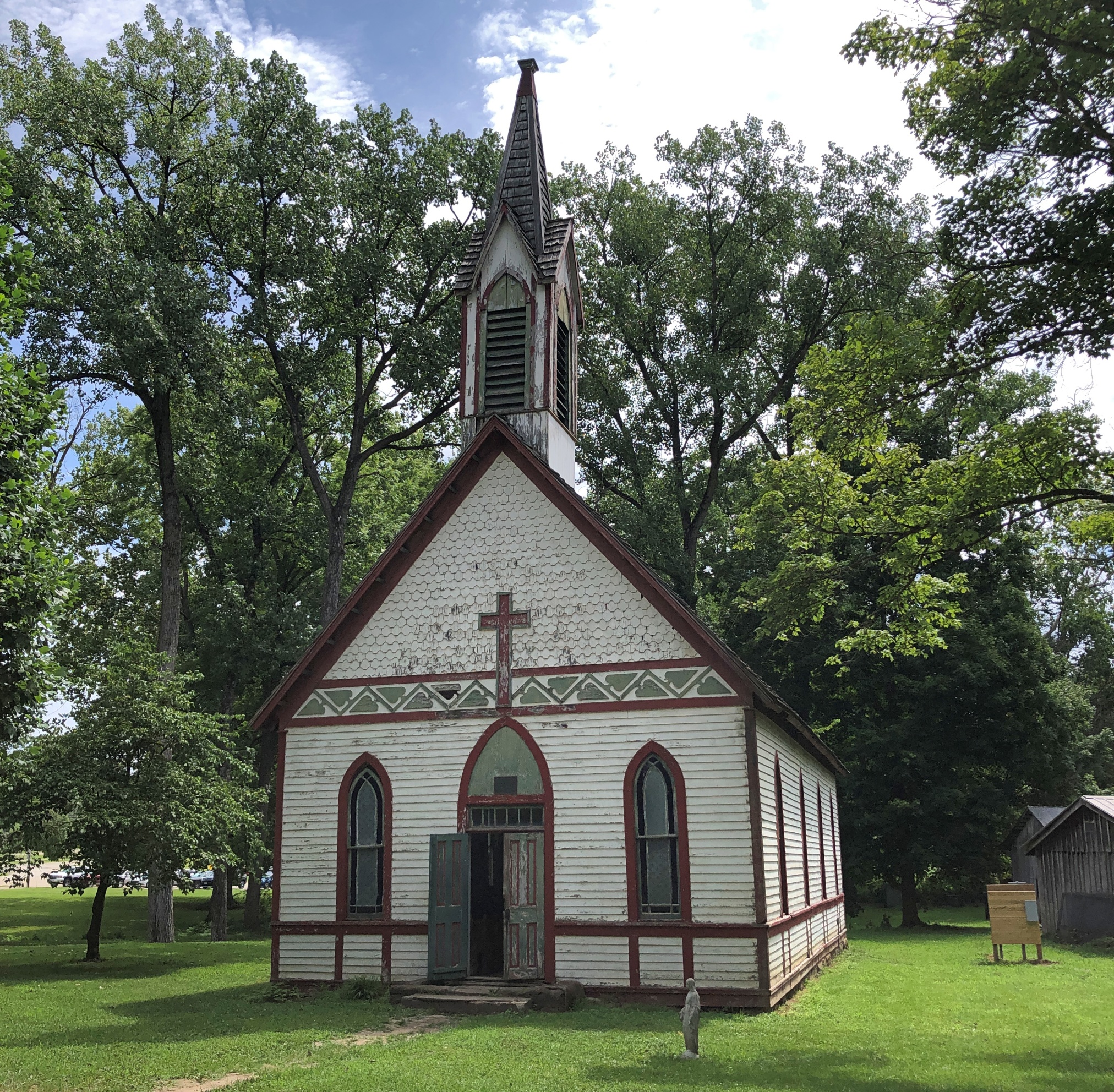
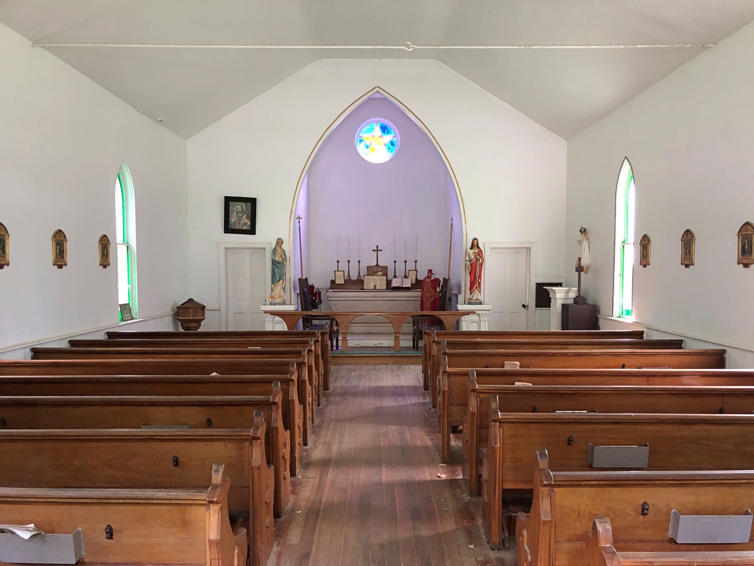
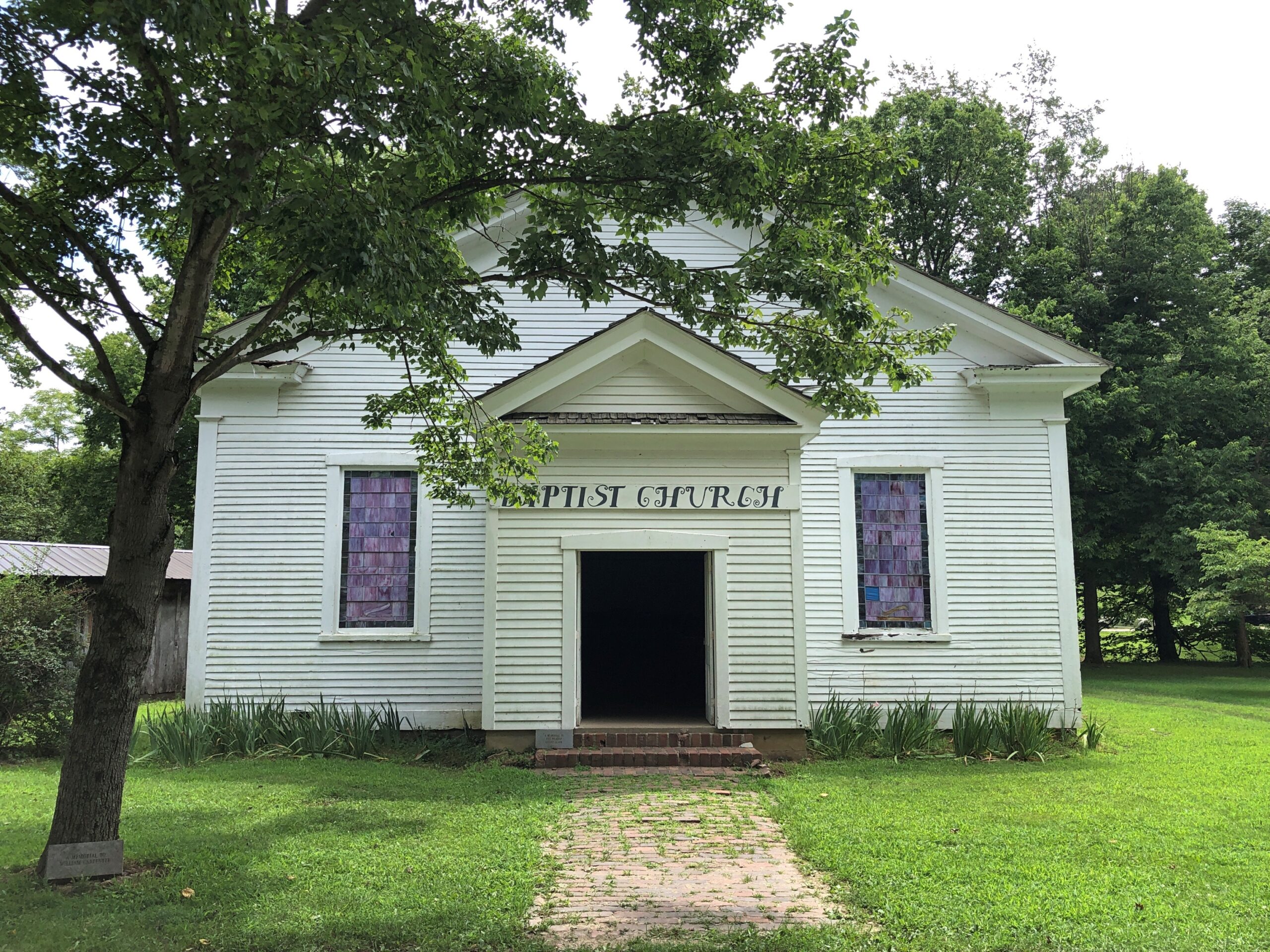
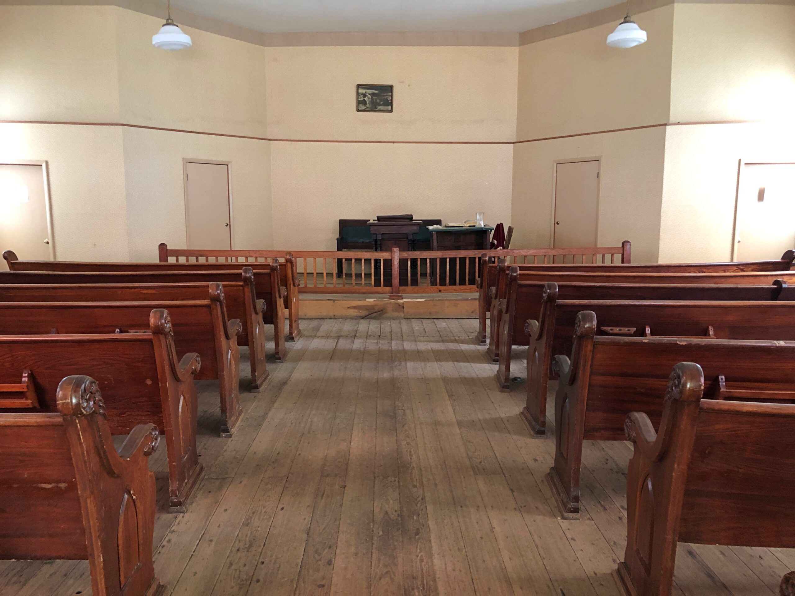
I hope that economic model keeps the place open, because one recipe for a good couple of hours on a hot weekend in July is visiting curious old buildings. Such as a couple of relocated churches.
One Catholic.
The other Baptist.
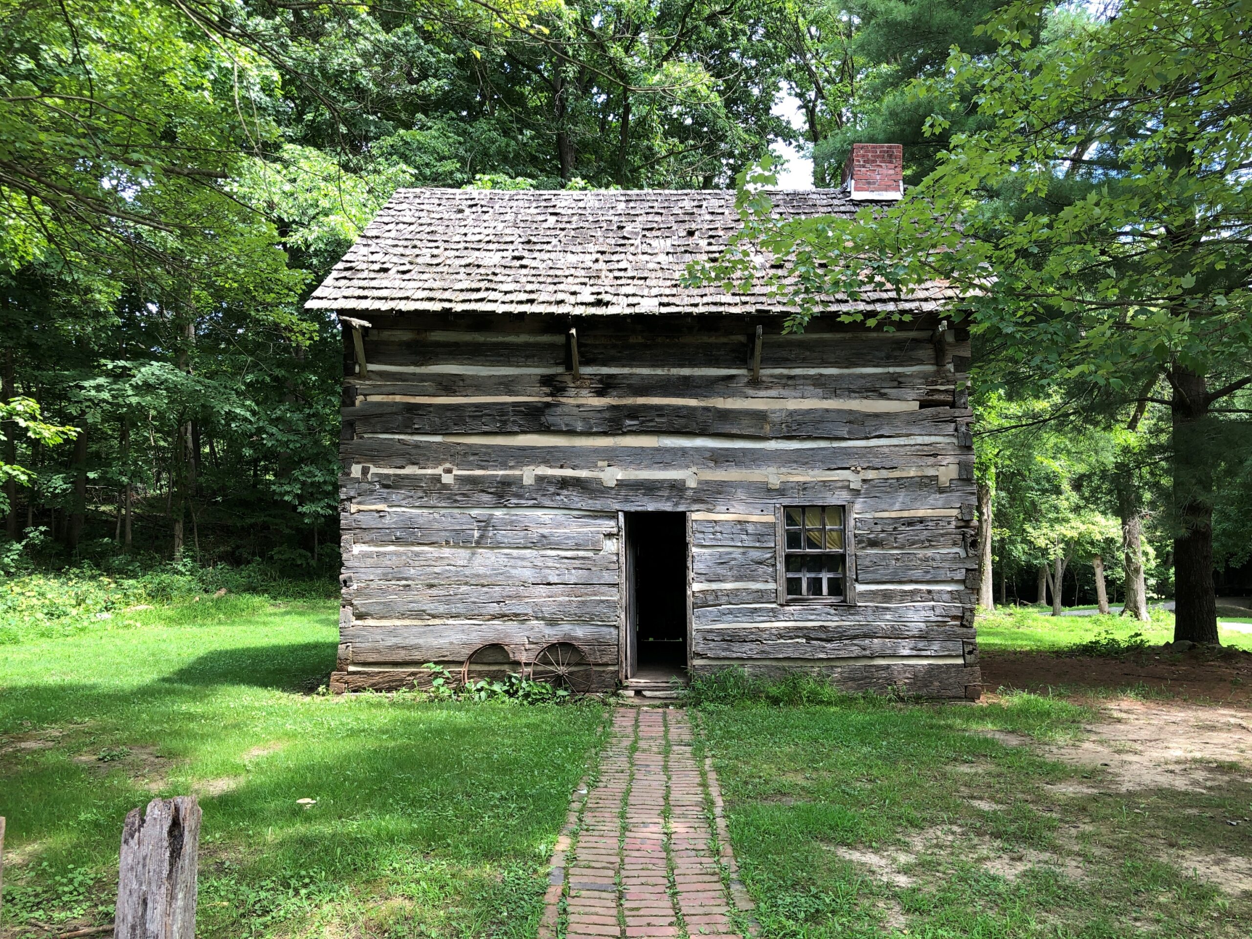
An early Parke County cabin.
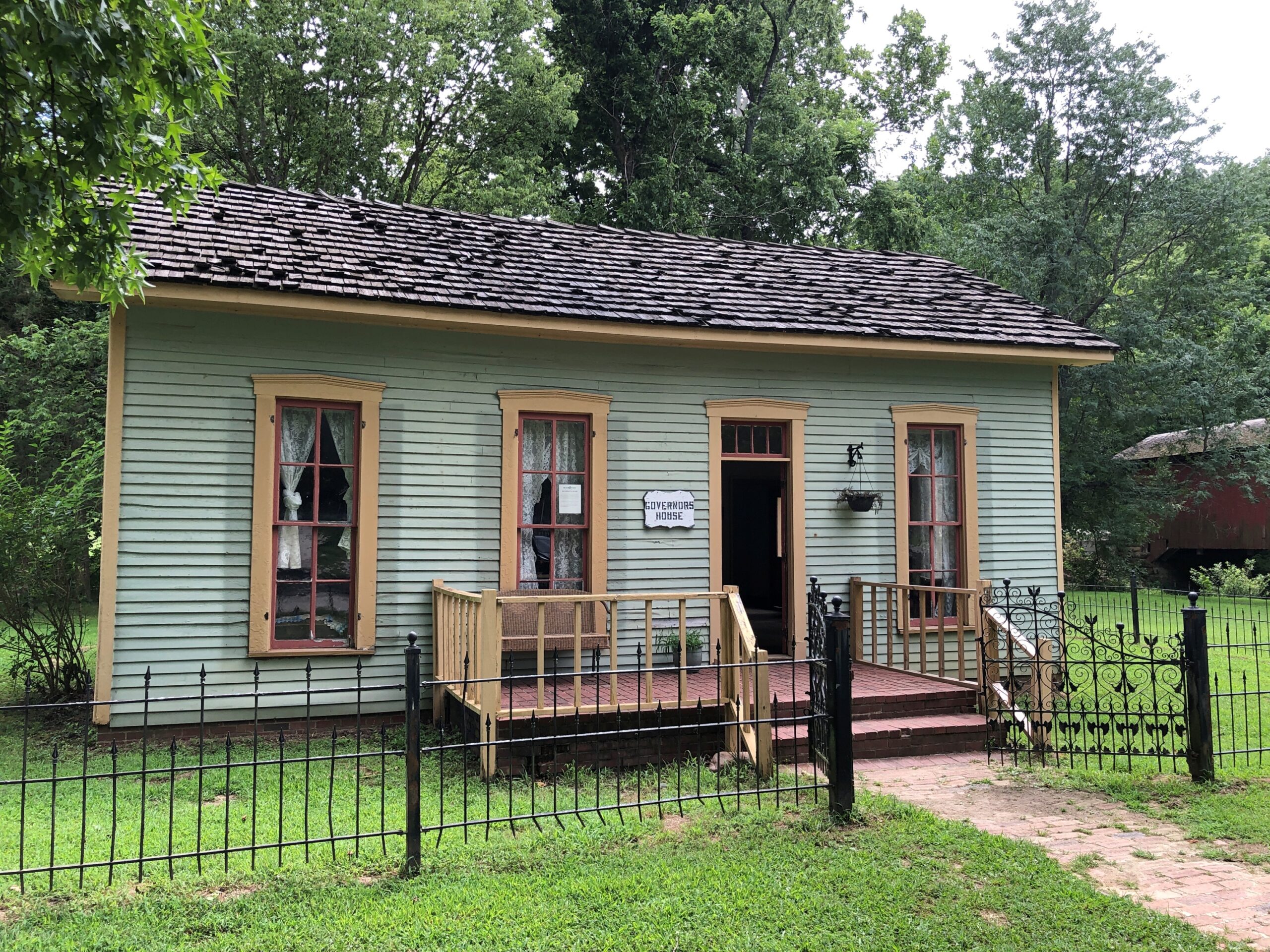
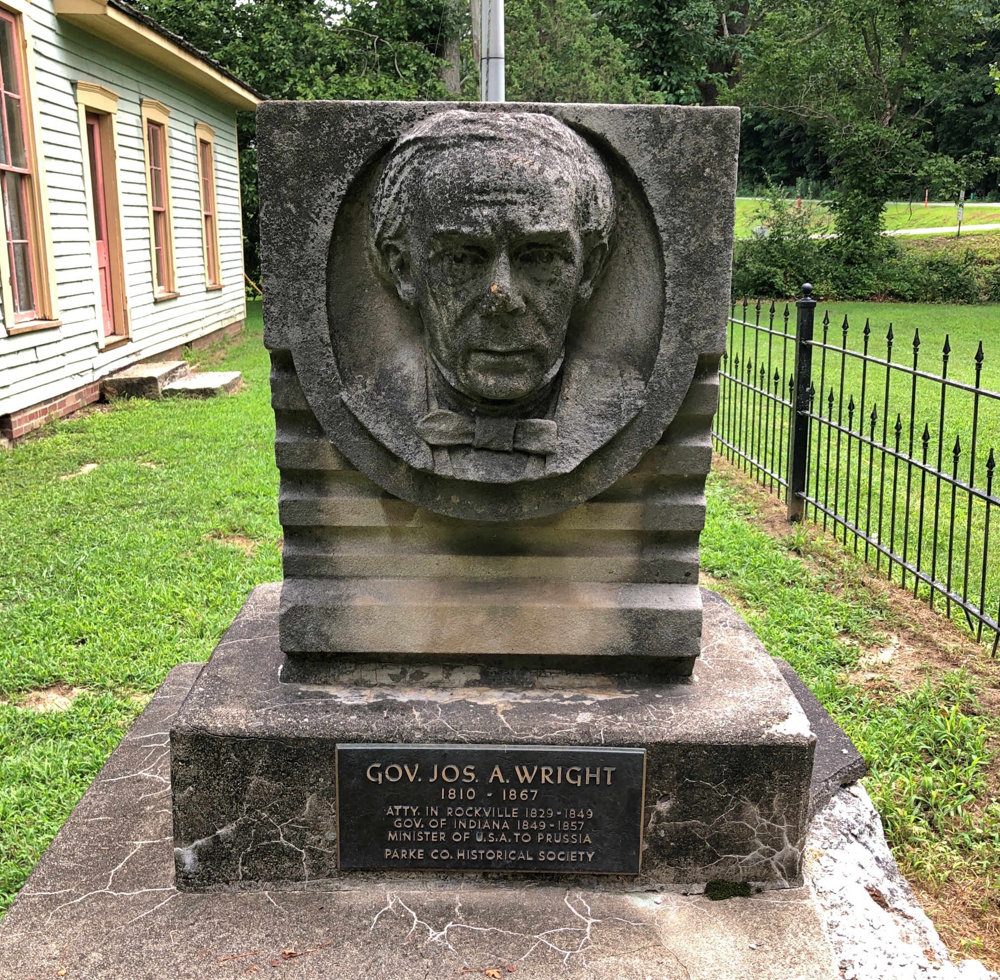
The home of an Indiana governor, one Joseph A. Wright (d. 1867), in office 1849-57. A Rockville native son.
Here he is, just outside his house, in dour Hoosier mode.
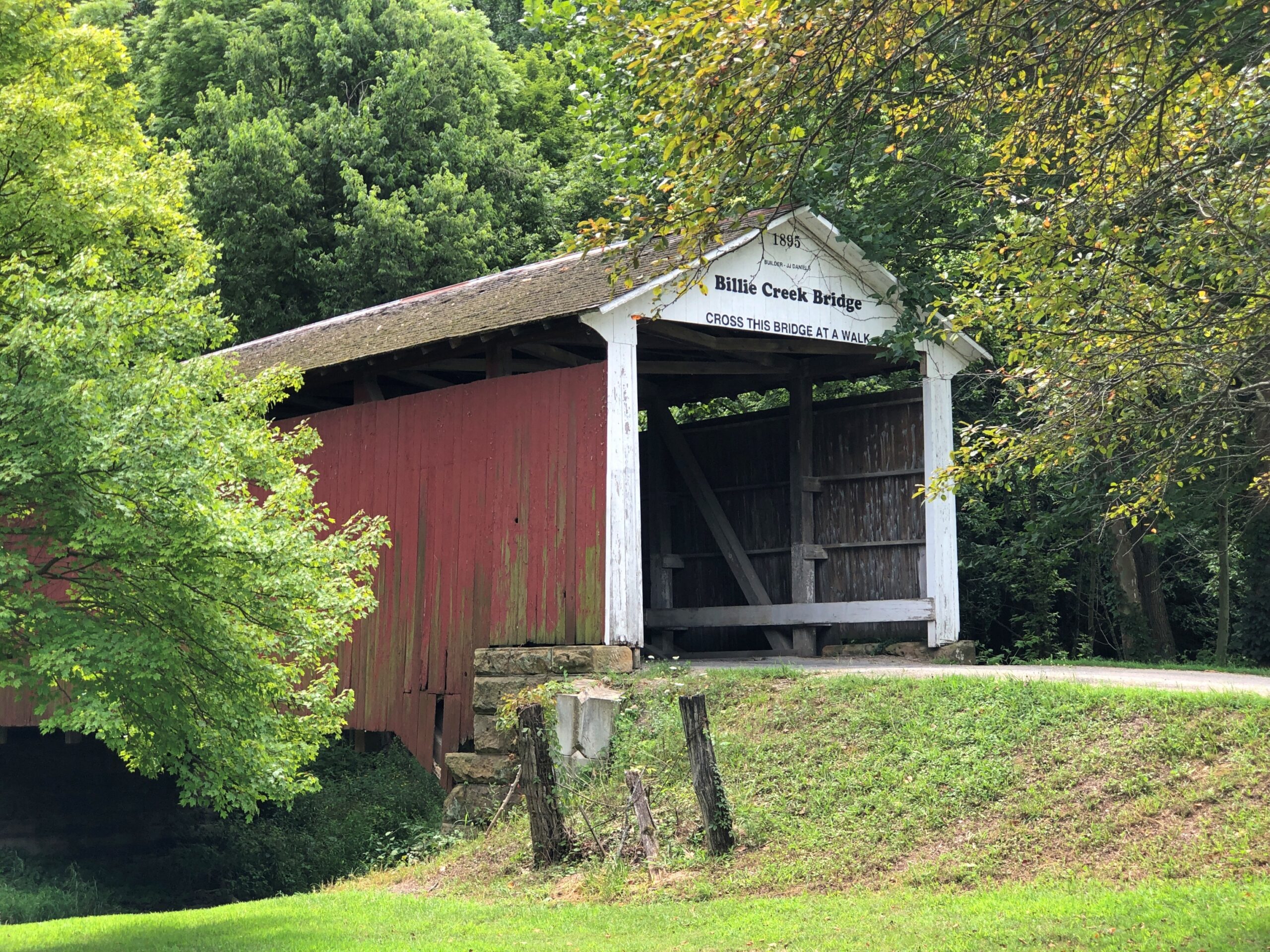
As the Covered Bridge Capital of the Galaxy (or some slogan like that for Parke County), it’s no surprise that covered bridges can also been seen at Billie Creek.
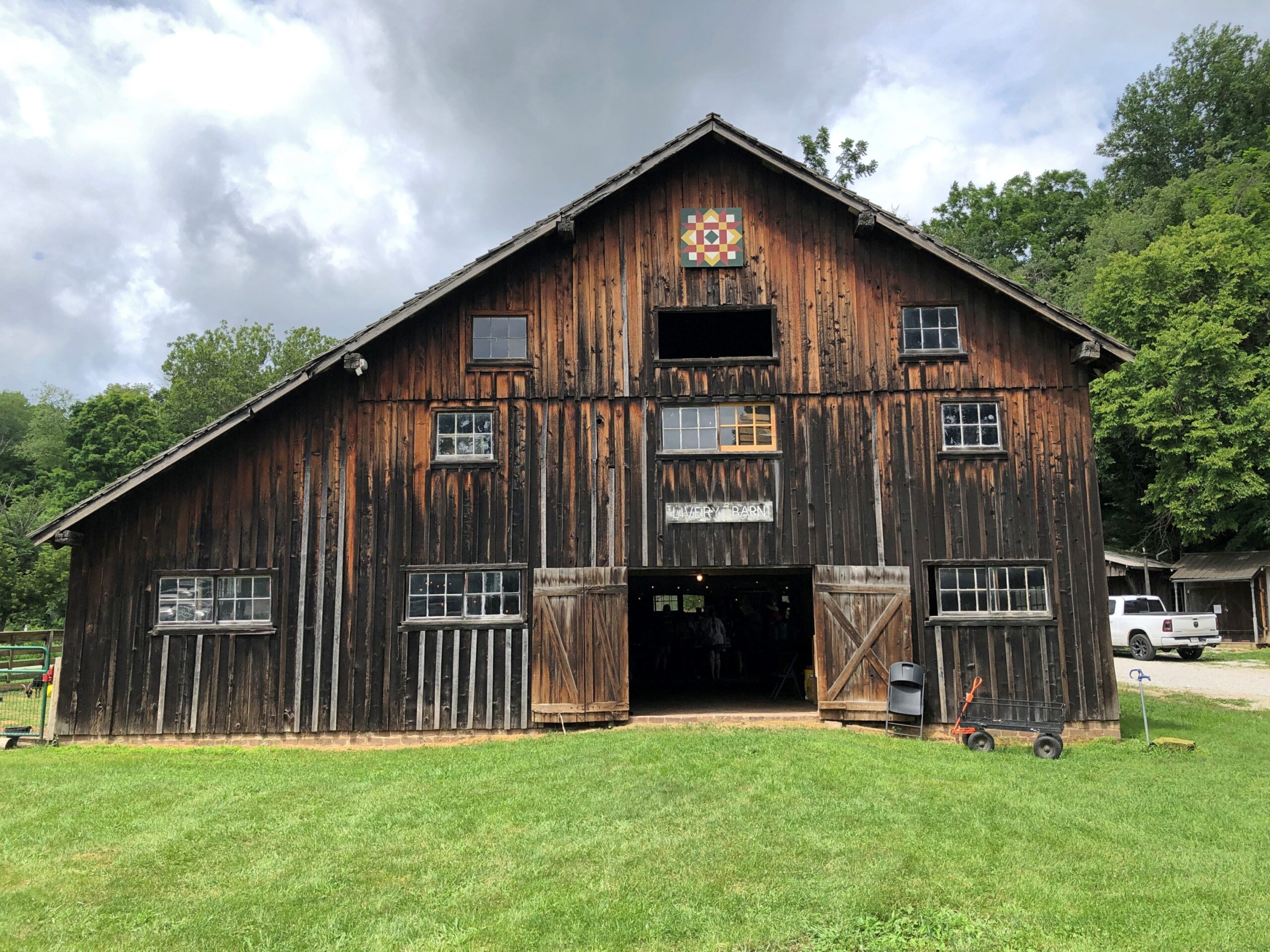
A barn, weathered yet handsome.
Craft goods were for sale inside. So were books by a local author who was there, hawking them. He told me about the books, some sort of fantasy series, and I was curious enough about them to listen to him, but not enough to buy one, which I think left him a bit miffed. Such is the writer’s lot.
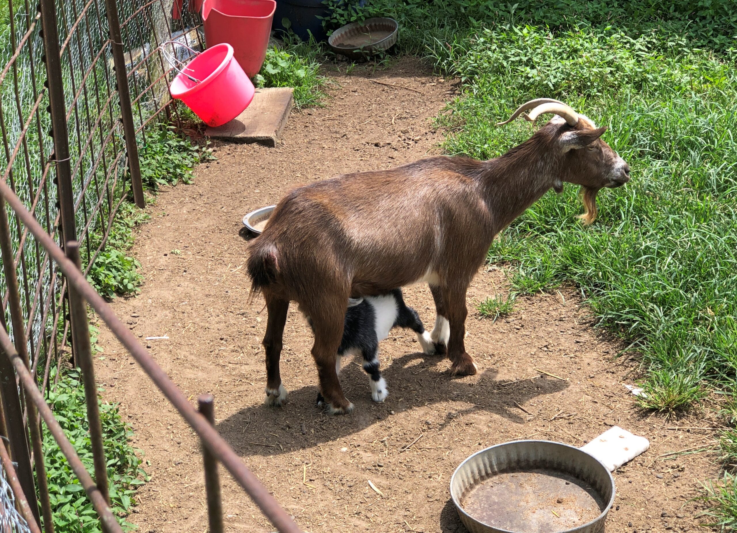
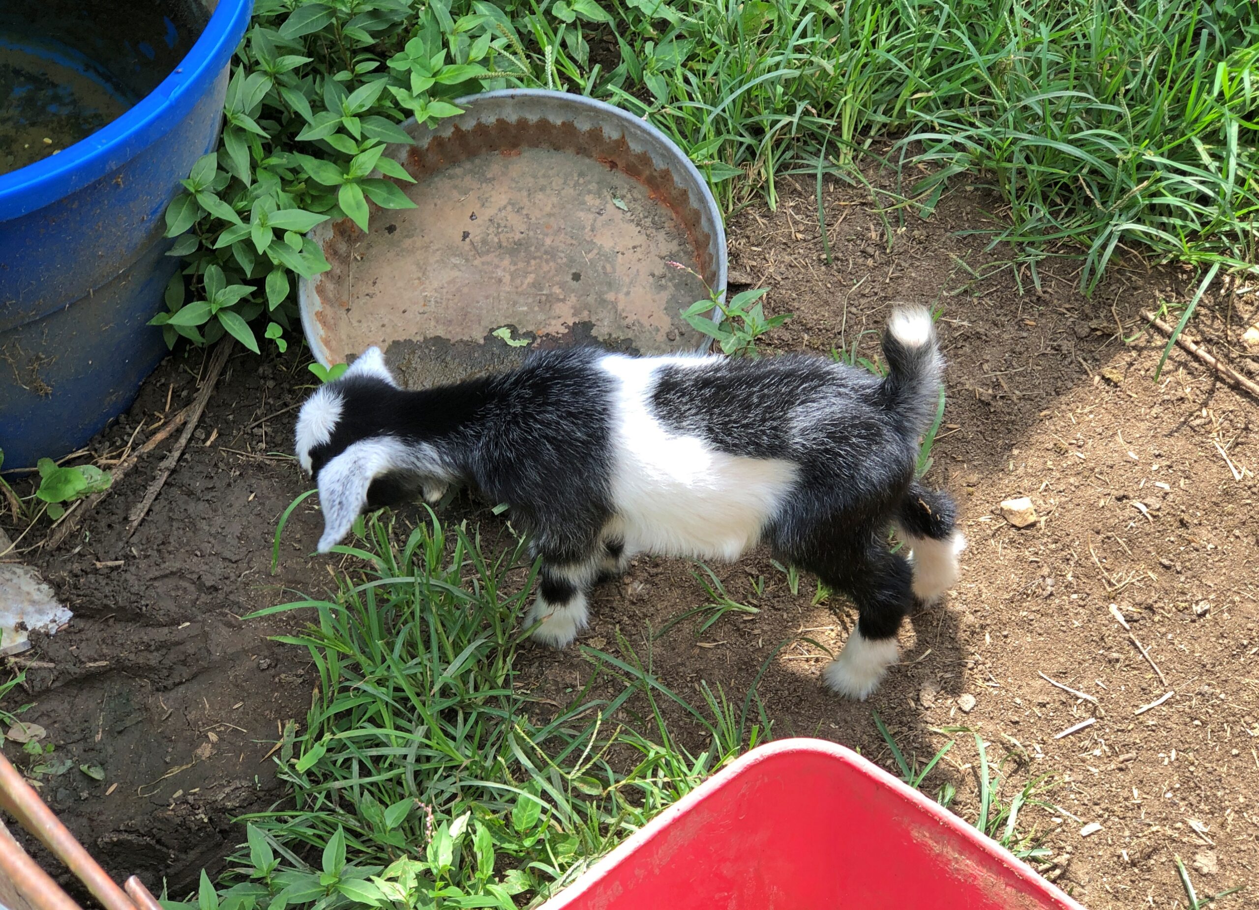
Behind the barn, goats.
I wasn’t able to test the notion that goats eat tin cans. But I already knew the answer: it’s a ridiculous myth, as this item in Goat Owner tells us.
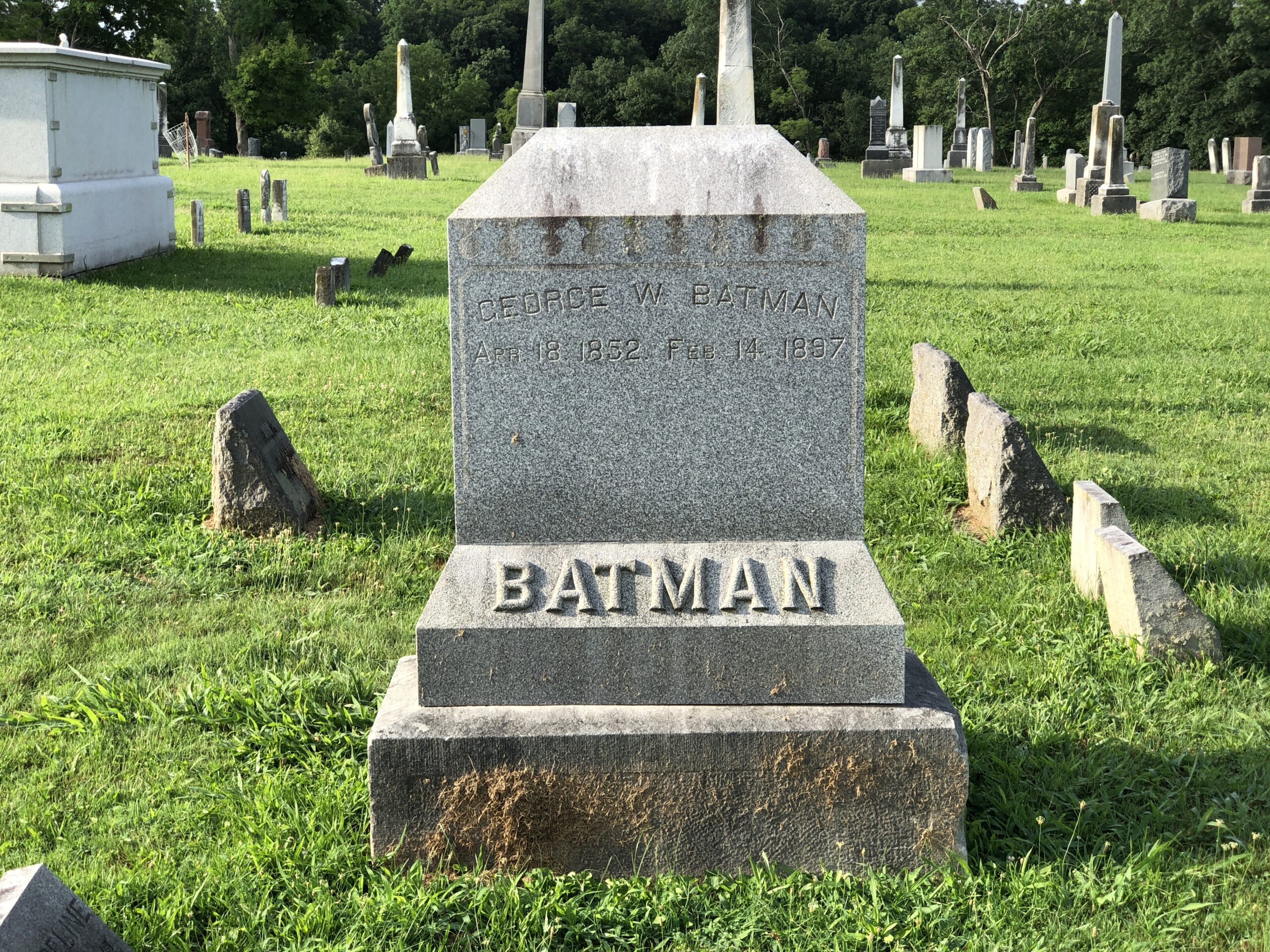
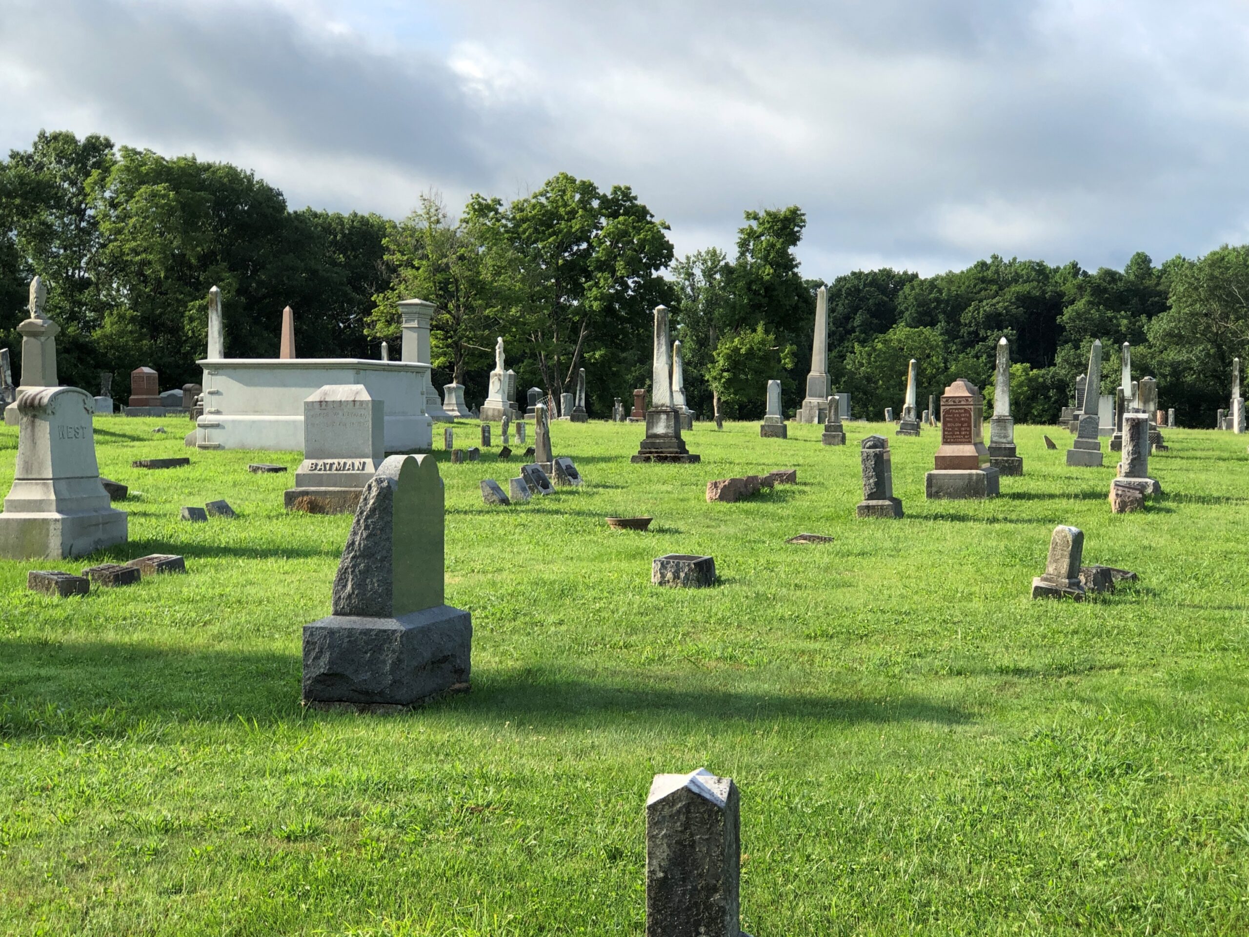
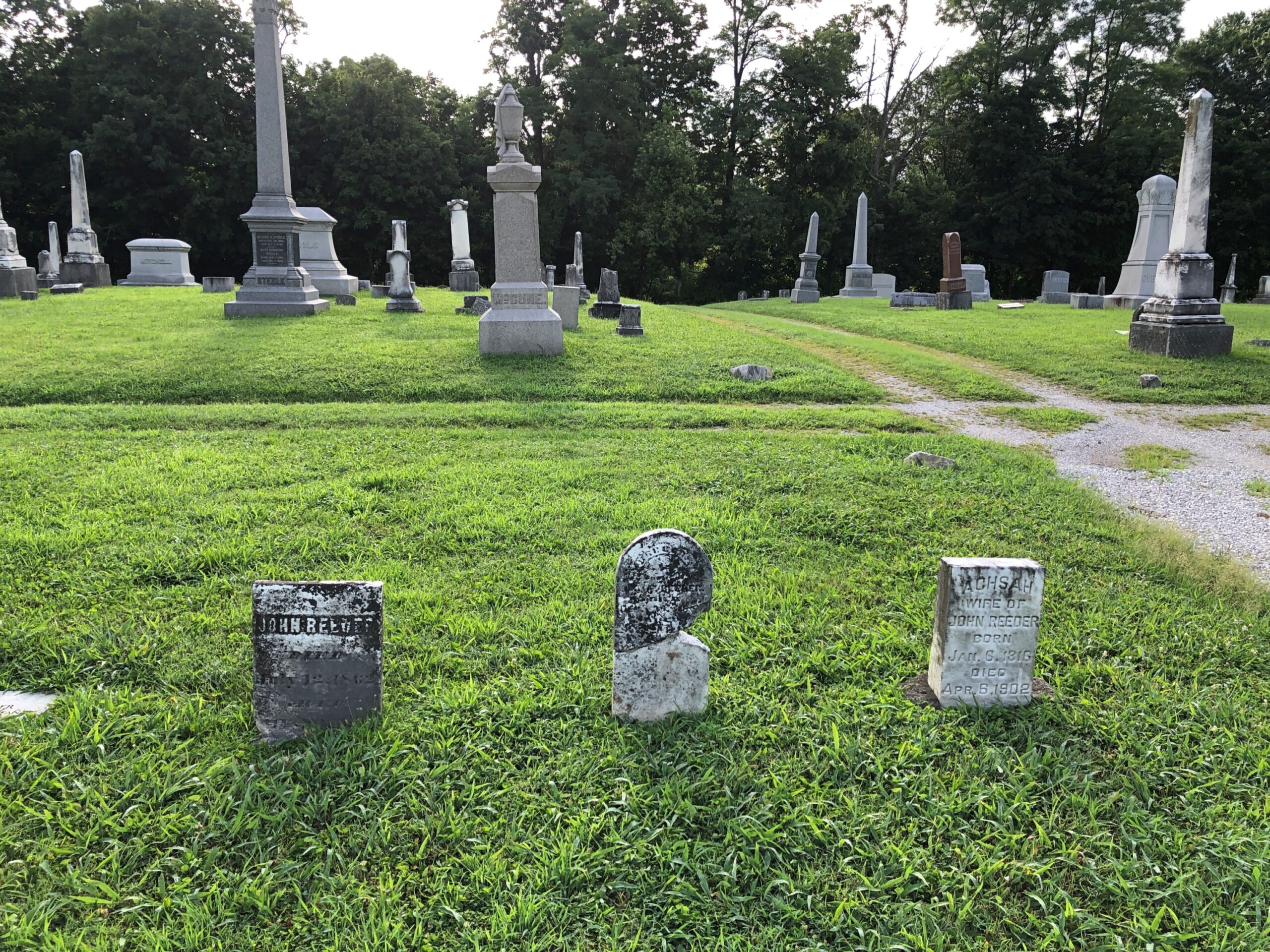
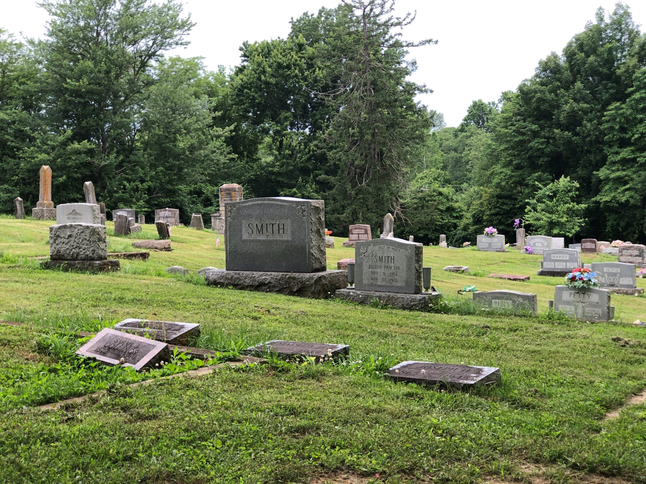
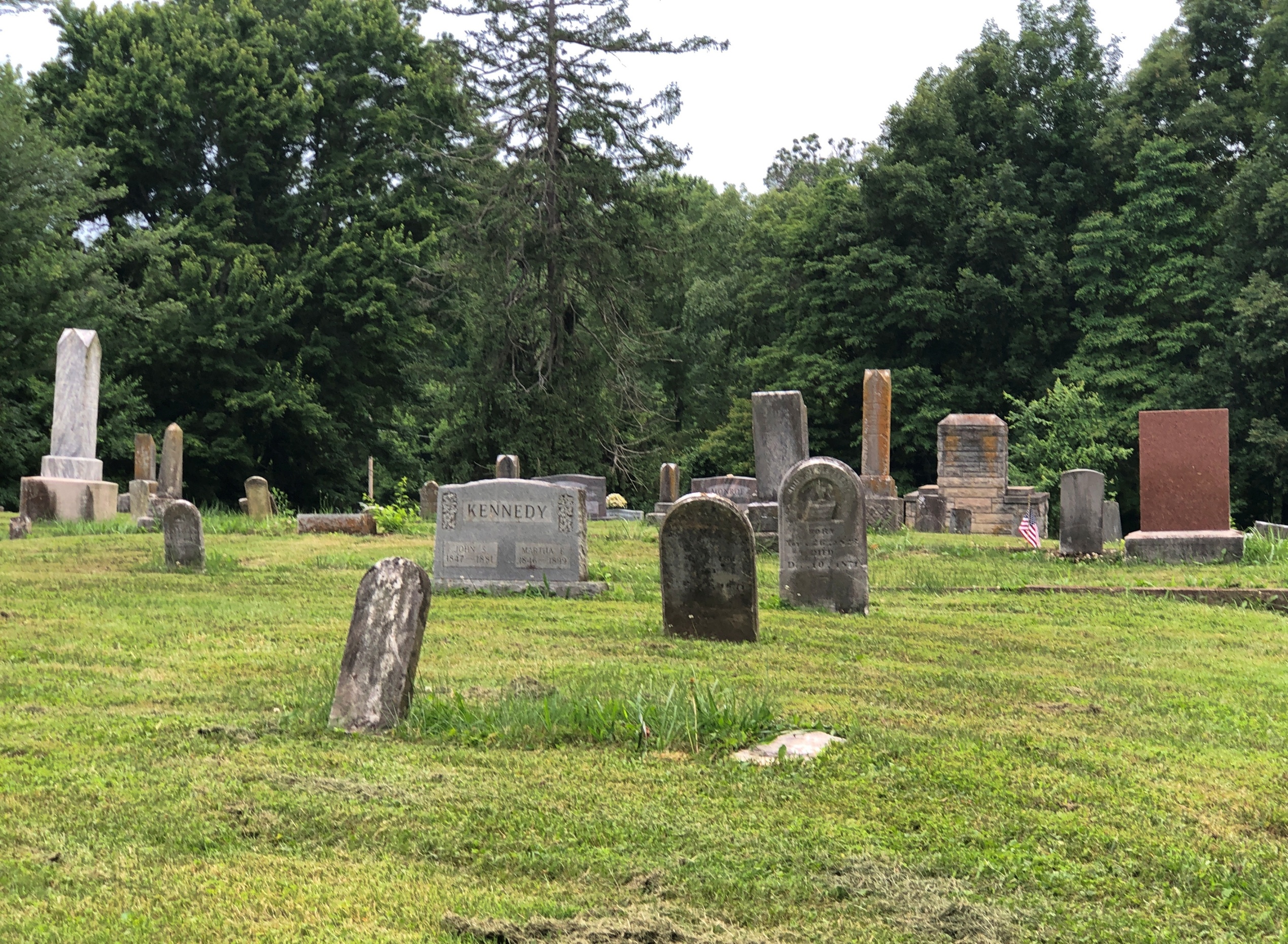
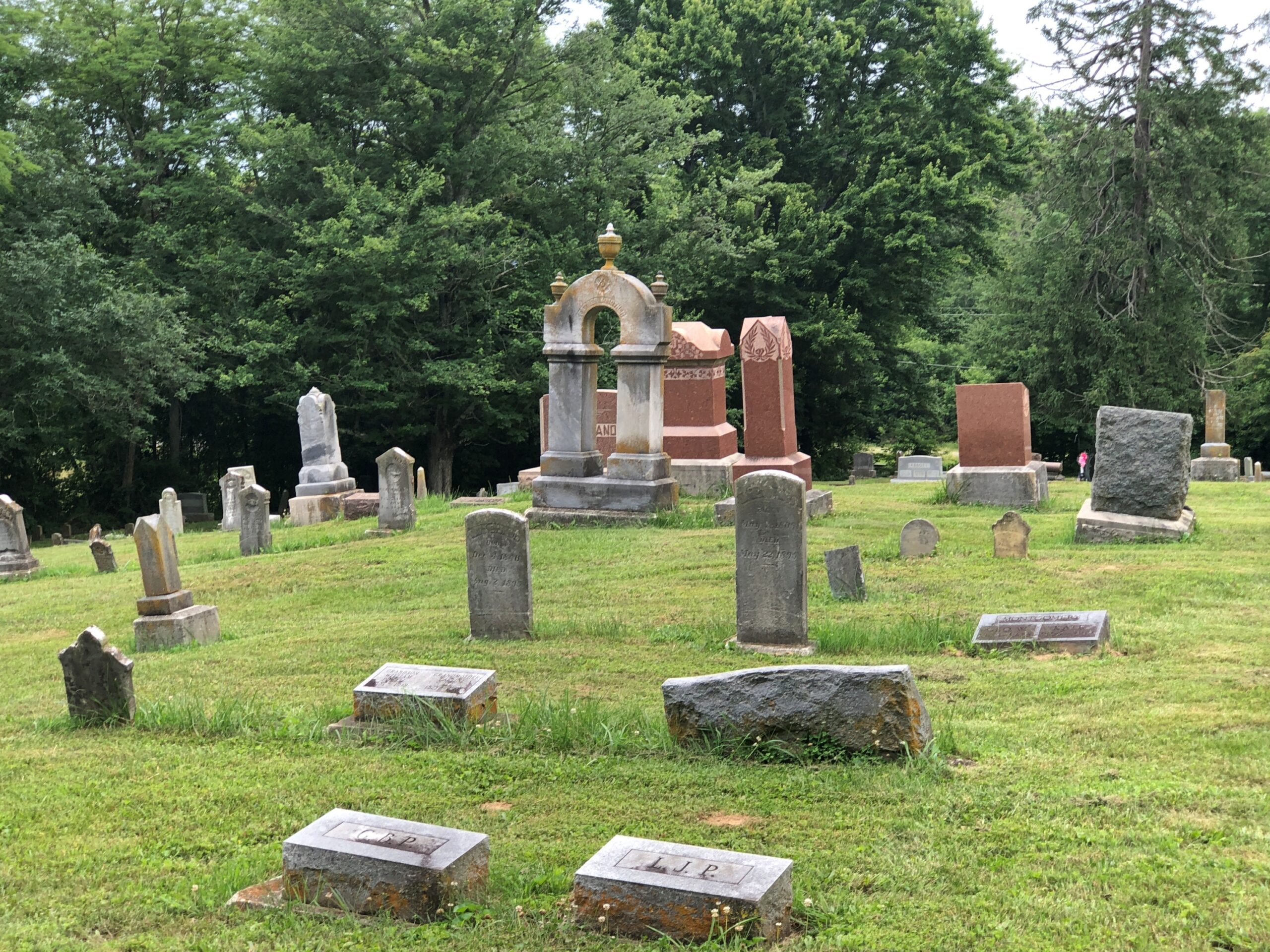
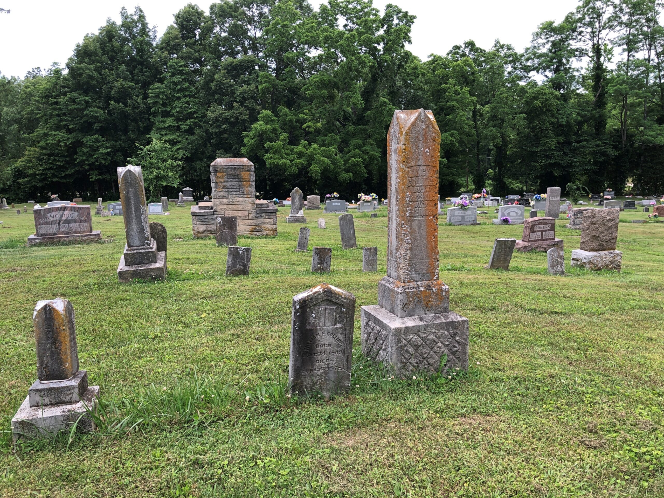
George W. Batman, that is, who died in 1897, so he never lived to see his surname put to the other uses we all know so well. Variants of his name include Bateman, Battman and Baitman, meaning that Batman really isn’t that odd. Except it does look odd on that large stone, but only because of recent conditioning by a particularly successful fictional character. George W. happens to repose at Rockville Cemetery in Rockville, Indiana, and I happened to visit early one Sunday morning in late July.
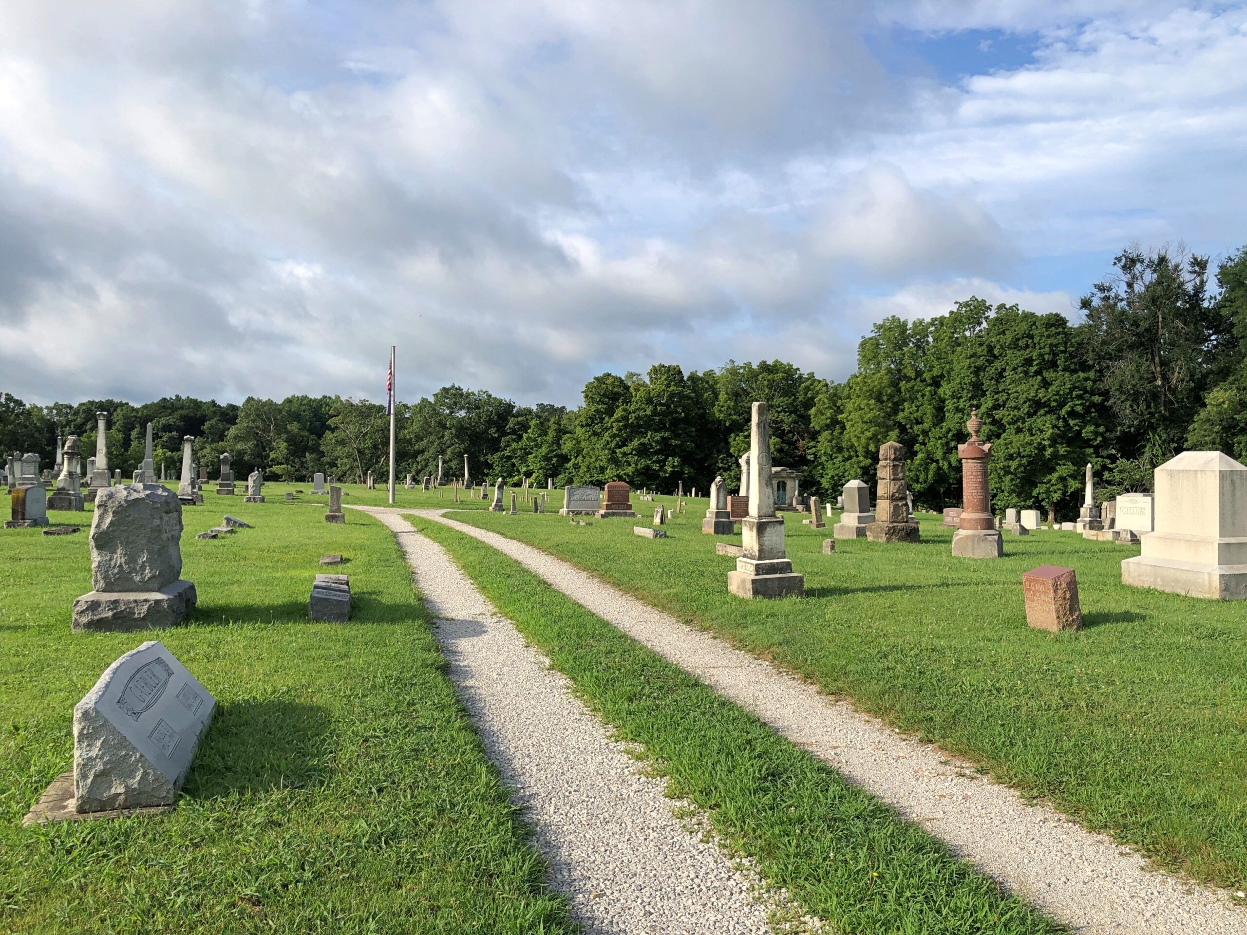
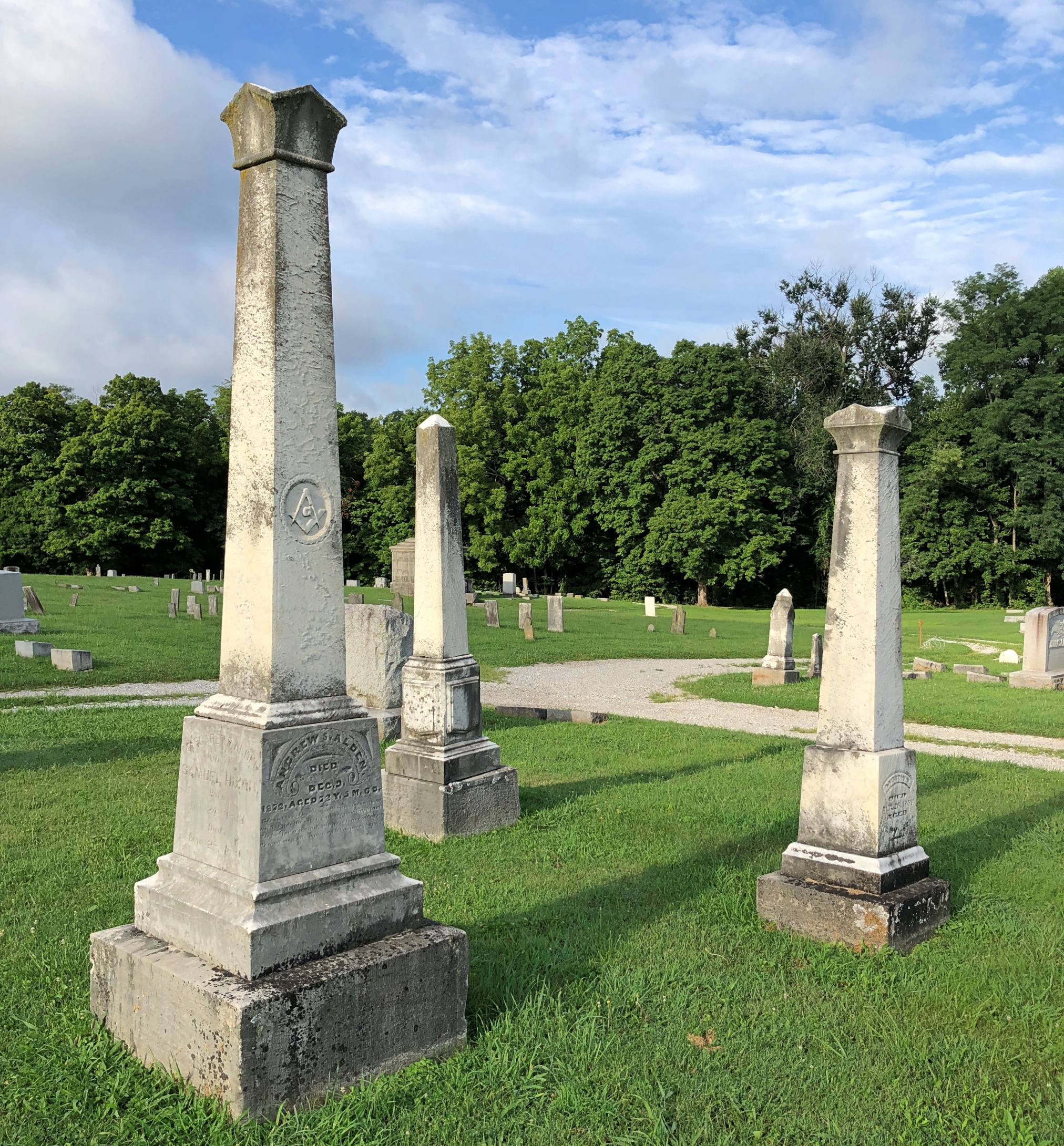
A pleasant graveyard, founded in 1824 — same year as the town itself — and well marked by upright stones, but not overly landscaped.
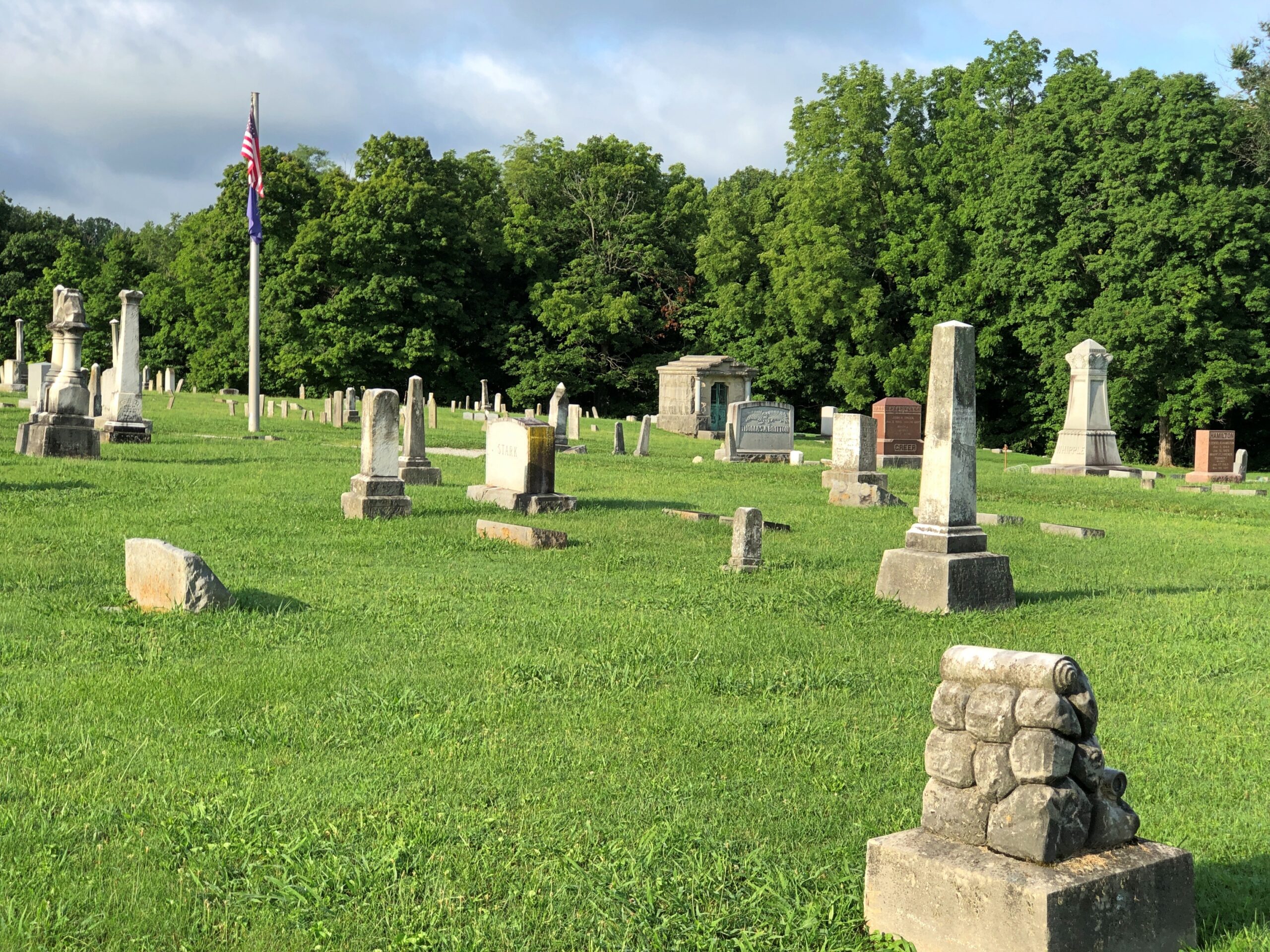
A few memorials reach upward, but not that far.
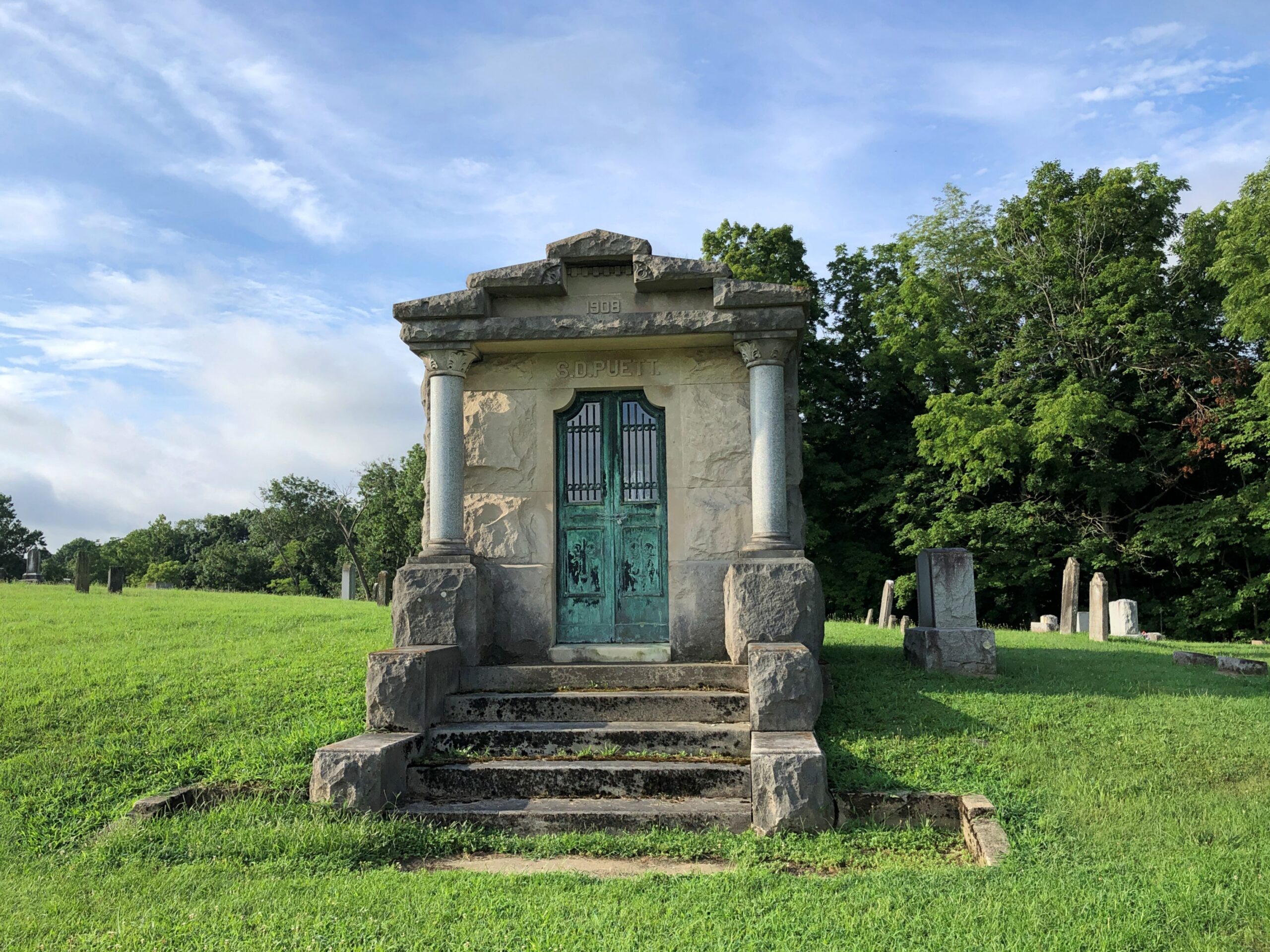
A few mausoleums denote formerly big fish in the small pond that is Rockville, seat of Parke County.
Mostly modest stones populate the cemetery, presumably for regular folks of the past.
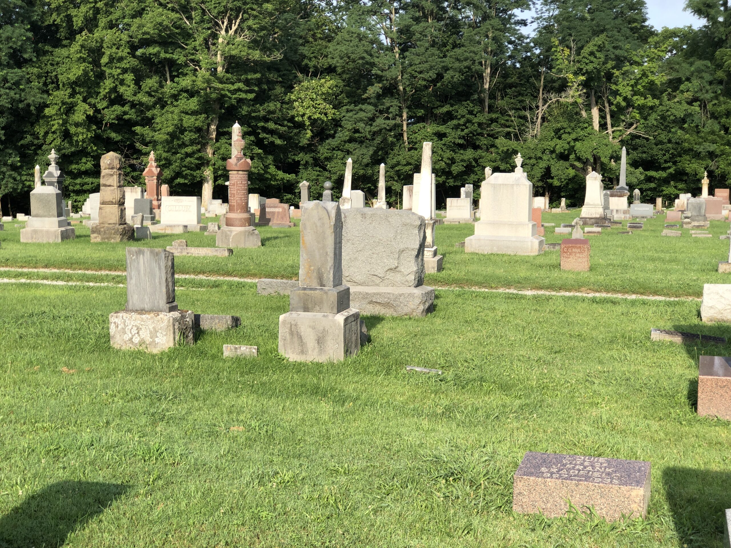
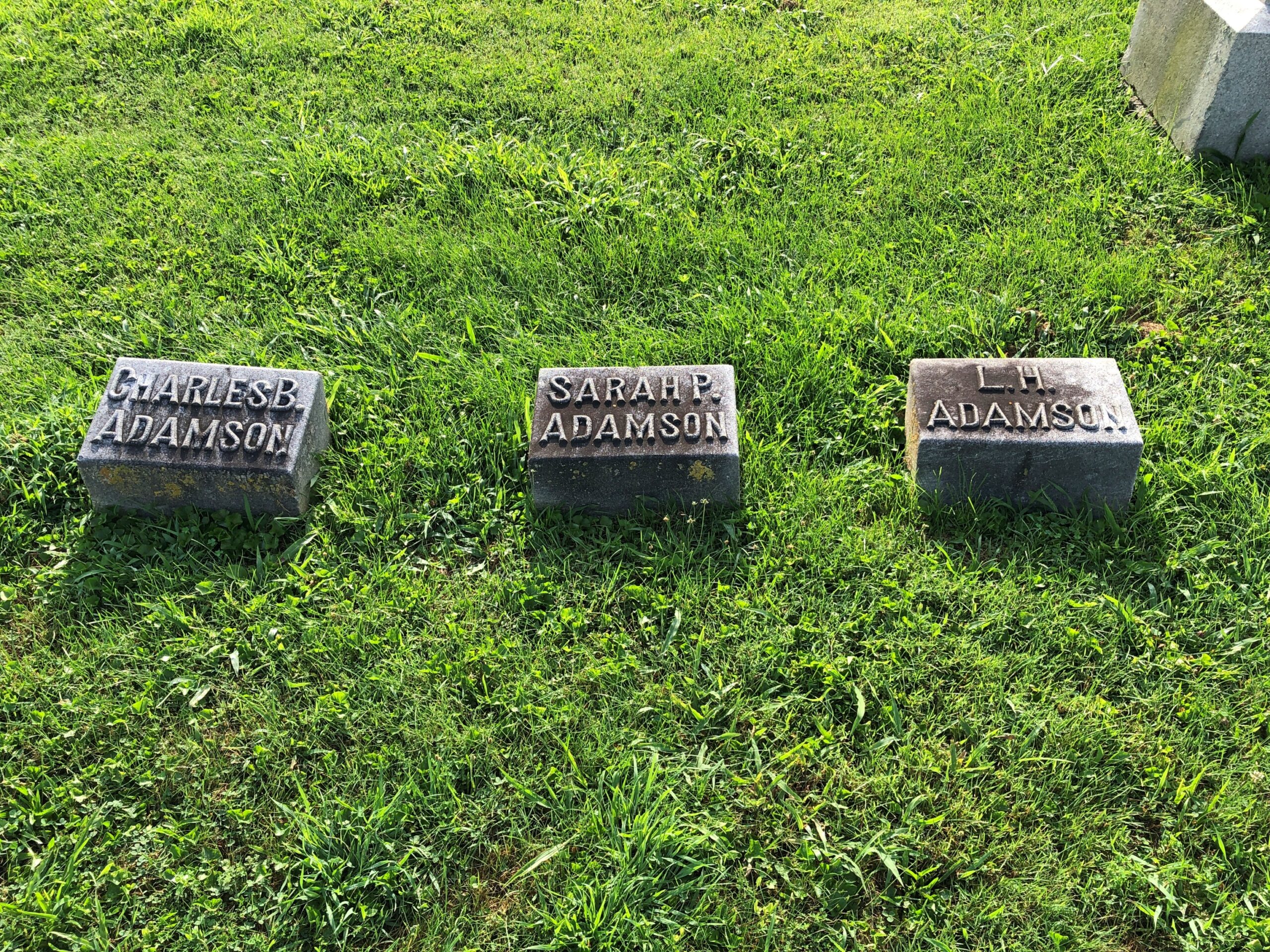
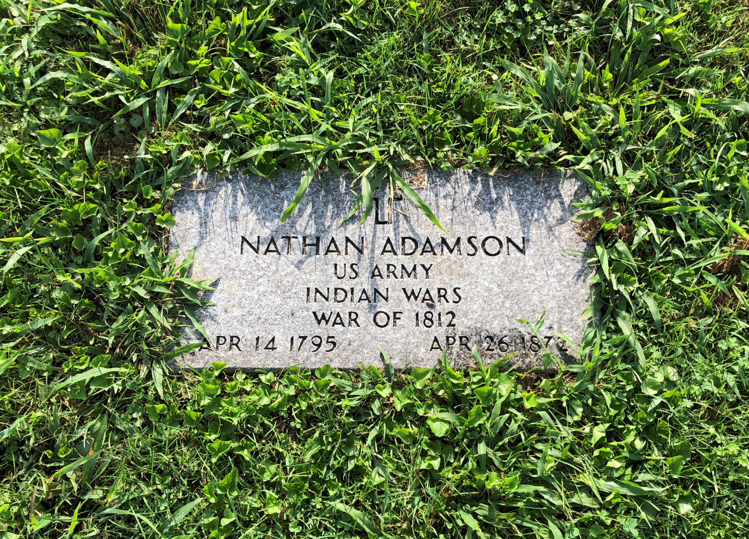
It isn’t too often that you see veterans of the War of 1812 (but not never).
Numerically speaking, there just weren’t that many compared to later, greater wars, and probably many of their graves aren’t marked as such. Nathan was near the other Adamsons, and indeed two of them (per Find-A-Grave) are his children.
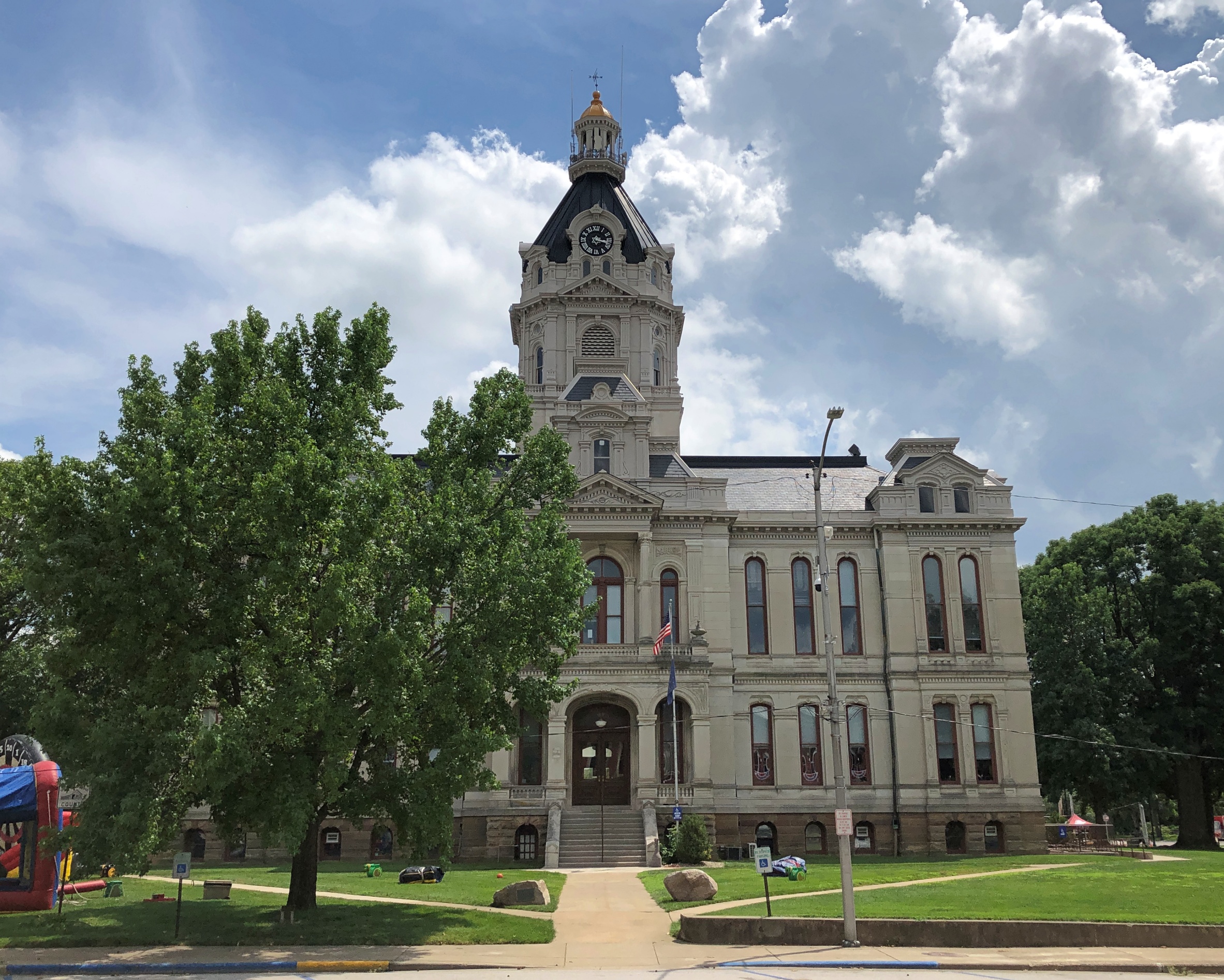
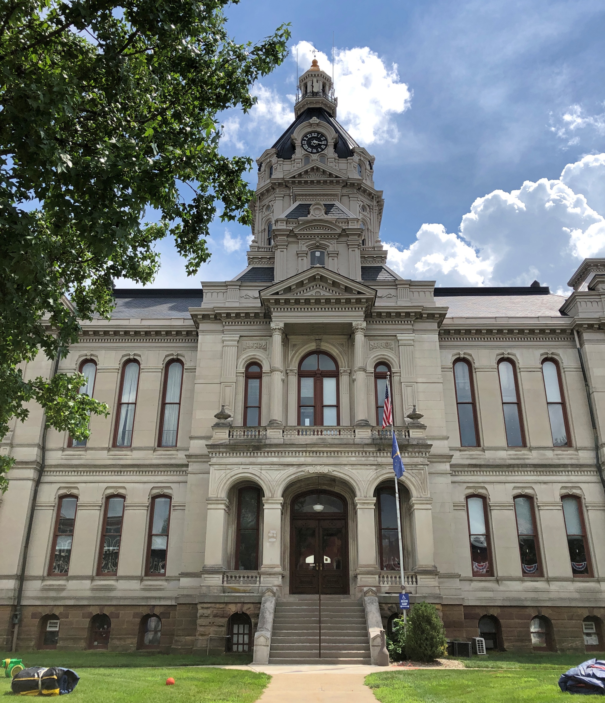
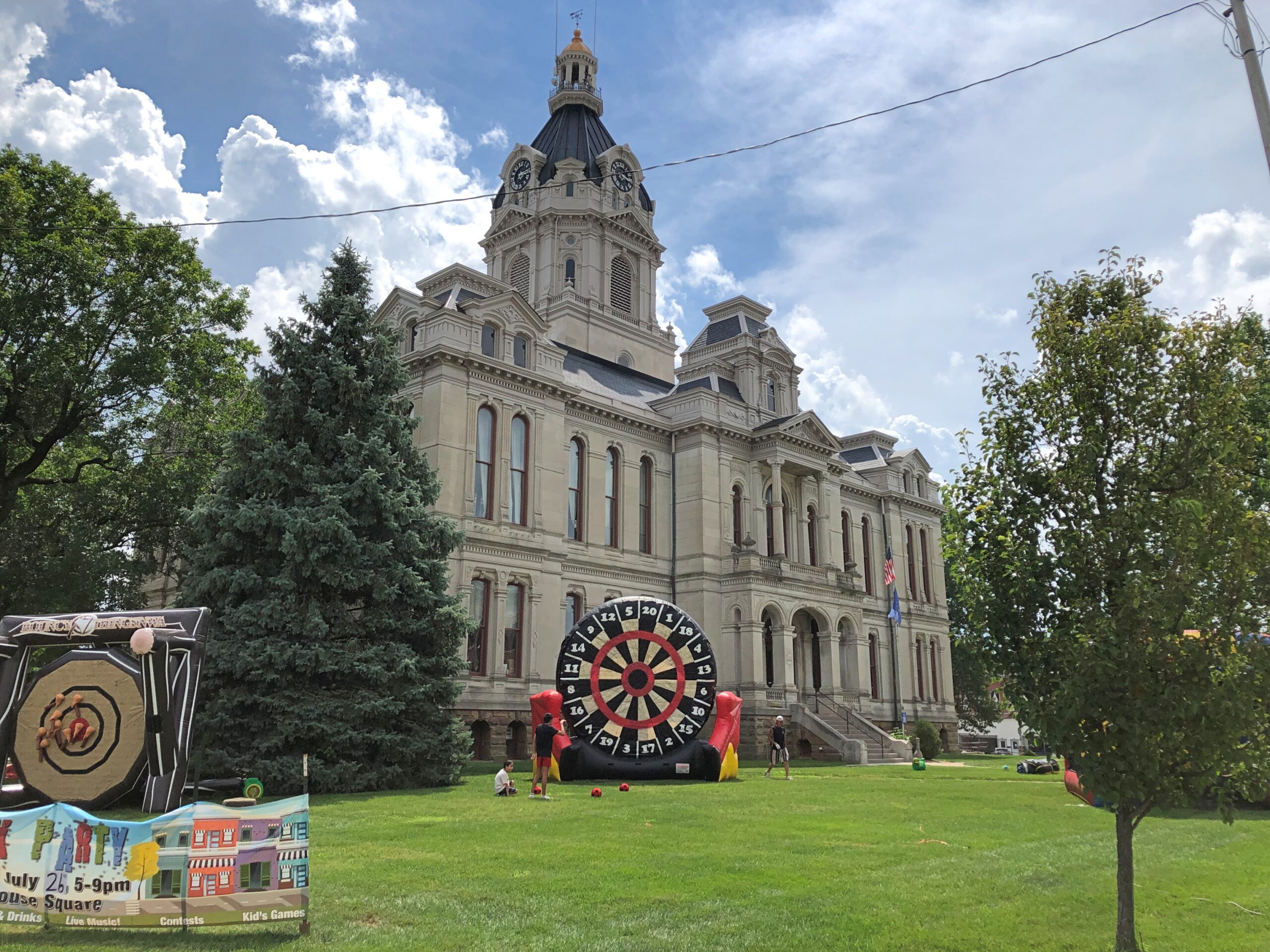
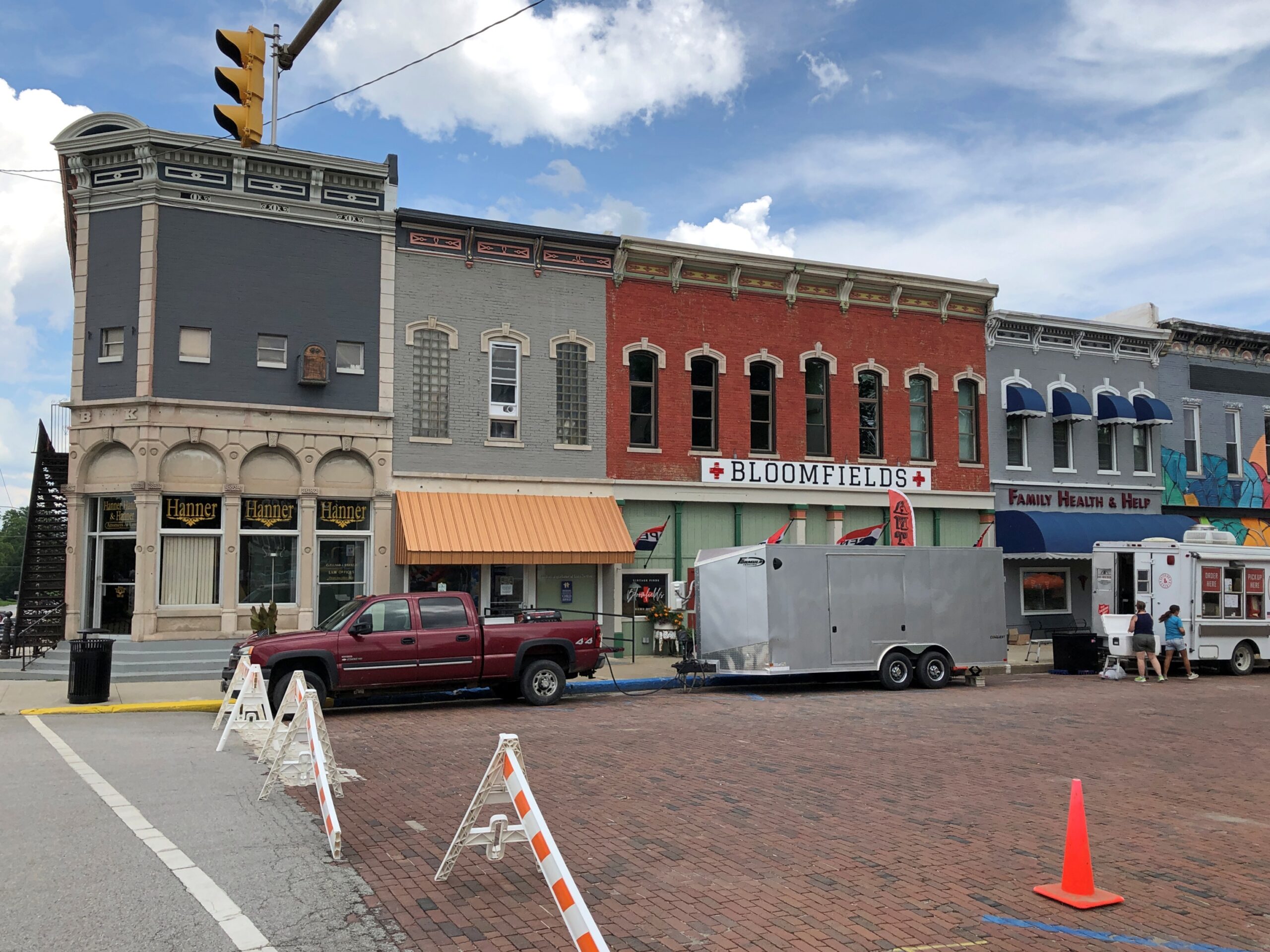
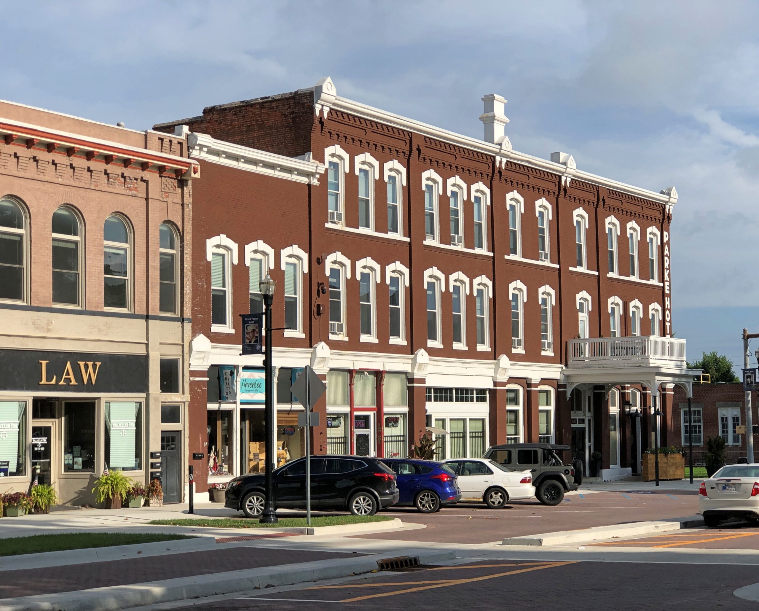
Not too many blocks from the cemetery is the Parke County Courthouse. We encountered it on Saturday afternoon, soon after arriving in Rockville (pop. about 2,600), when temps were about as high as they would be that day. Sweaty 90s.
The courthouse is a grand Second Empire pile with some Beaux Arts added to the mix, completed in 1882, during the golden age of U.S. courthouses. Designed by T.J. and Brentwood Tolan, a father and son team. They did a lot of courthouses.
The giant dartboard isn’t something you see too often on courthouse grounds. Could it be the Dartboard of Justice? That’s how sentencing is done for crimes that call for one to 20 years in the jug; a toss by the judge, or the jury foreman.
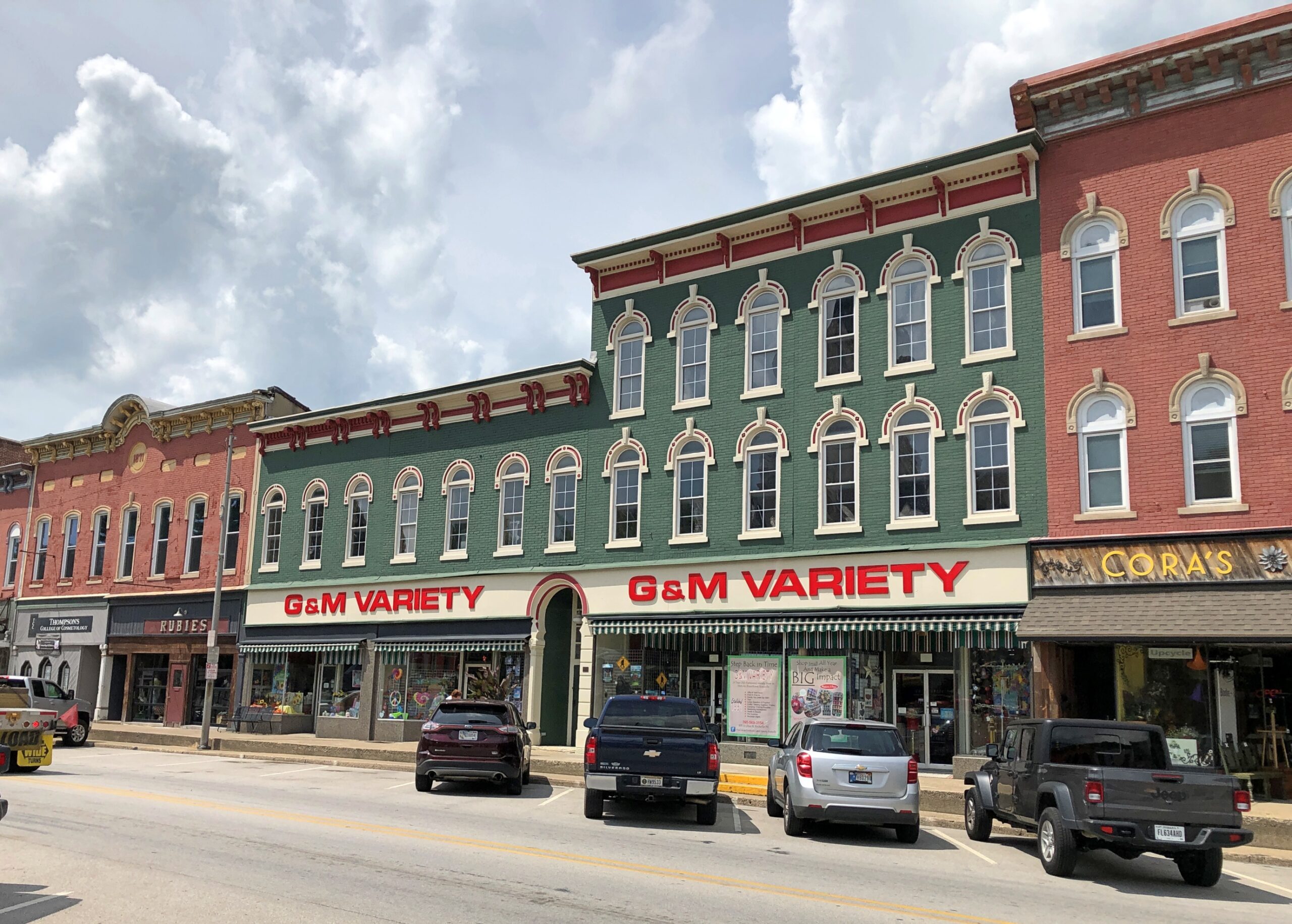
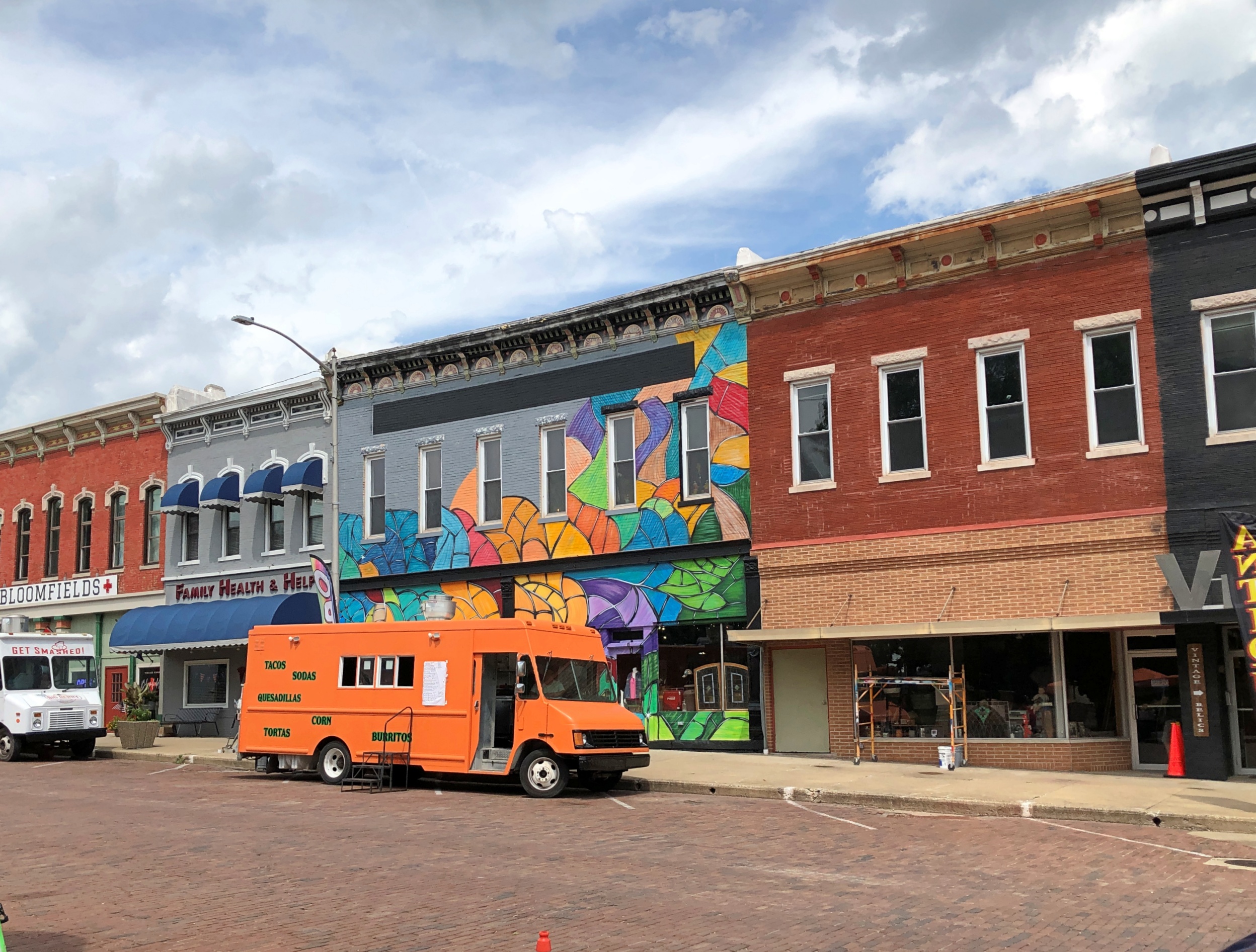
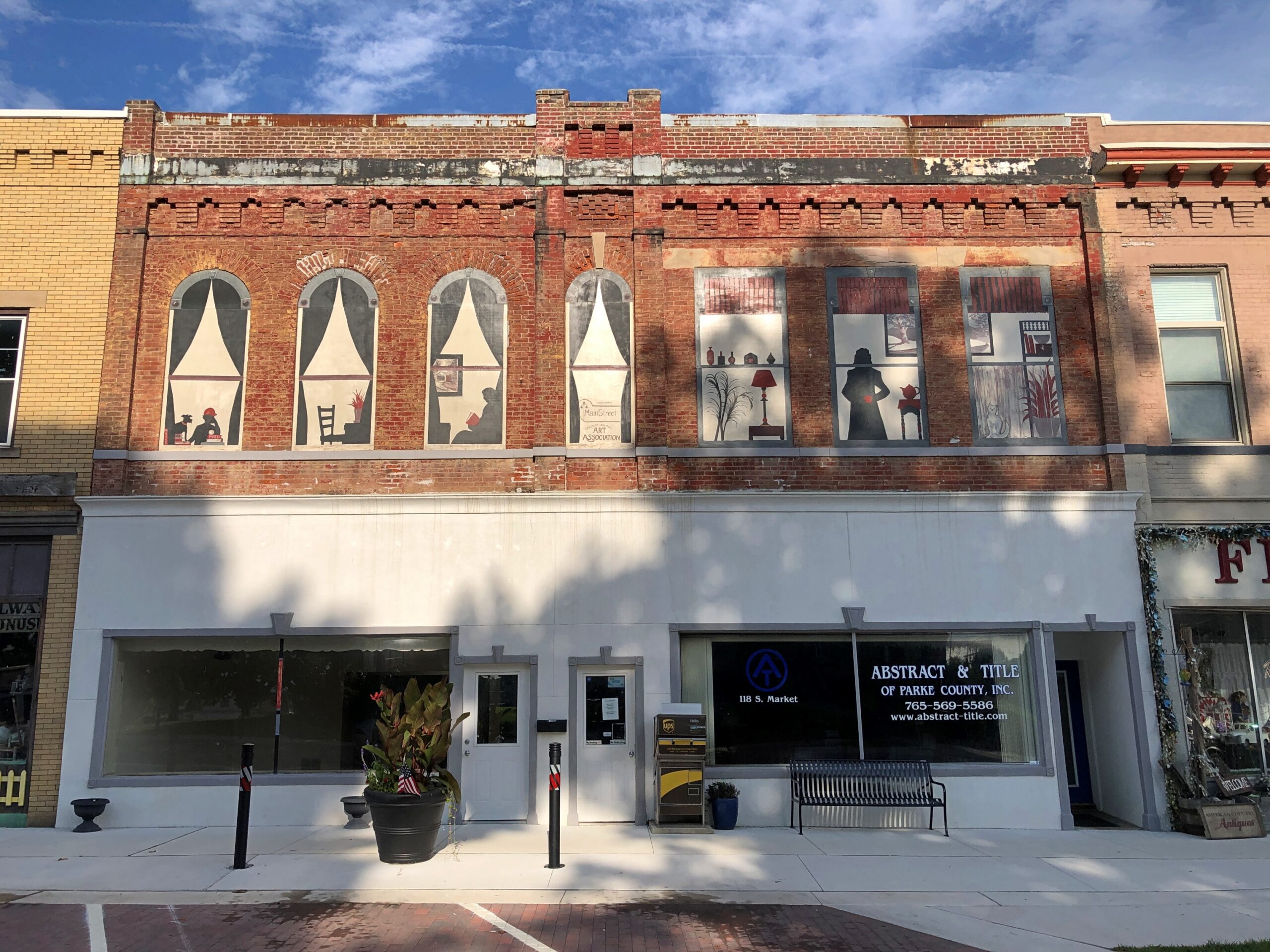
No, a small street festival was being set up at that moment, though not up and running yet. It was too hot for that anyway. But not for a quick look at some of the buildings ringing the courthouse, most in good shape and mostly tenanted.
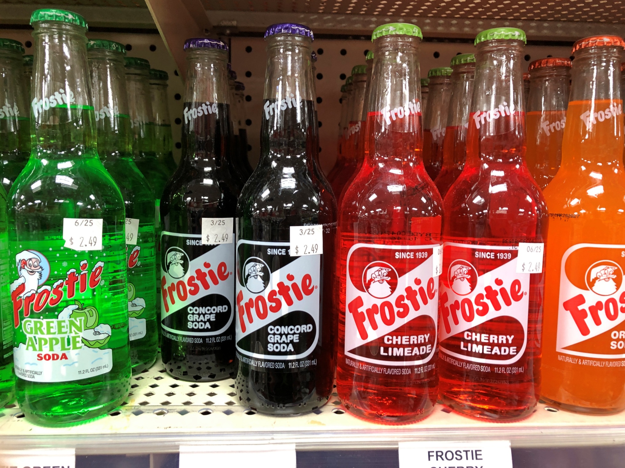
G&M Variety has the soul of a five-and-dime, but a more accurate classification these days would be a five-and-ten dollar store: a step above a dollar store, the love child of a convenience store and a standard grocery store, with a souvenir shop added to the mix. Roaming around its aisles was pleasant, for a look at the sometimes unusual merchandise, and the AC.
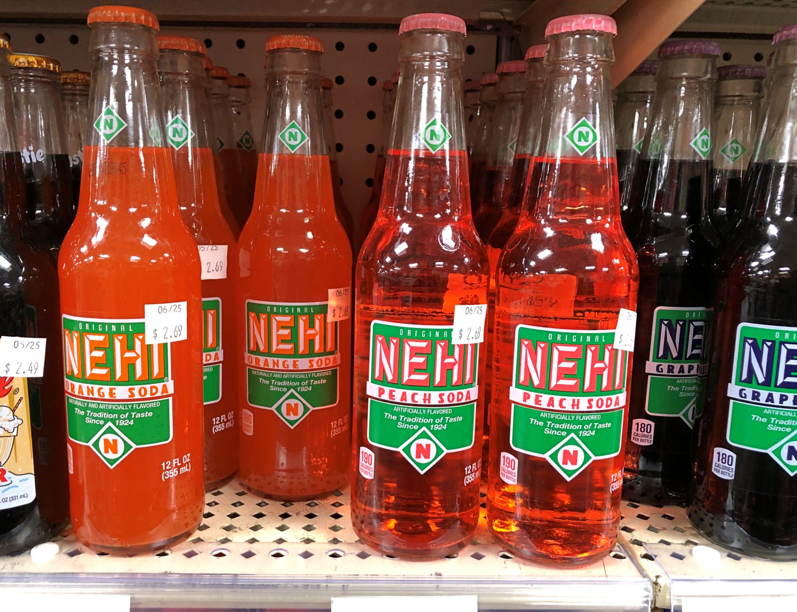
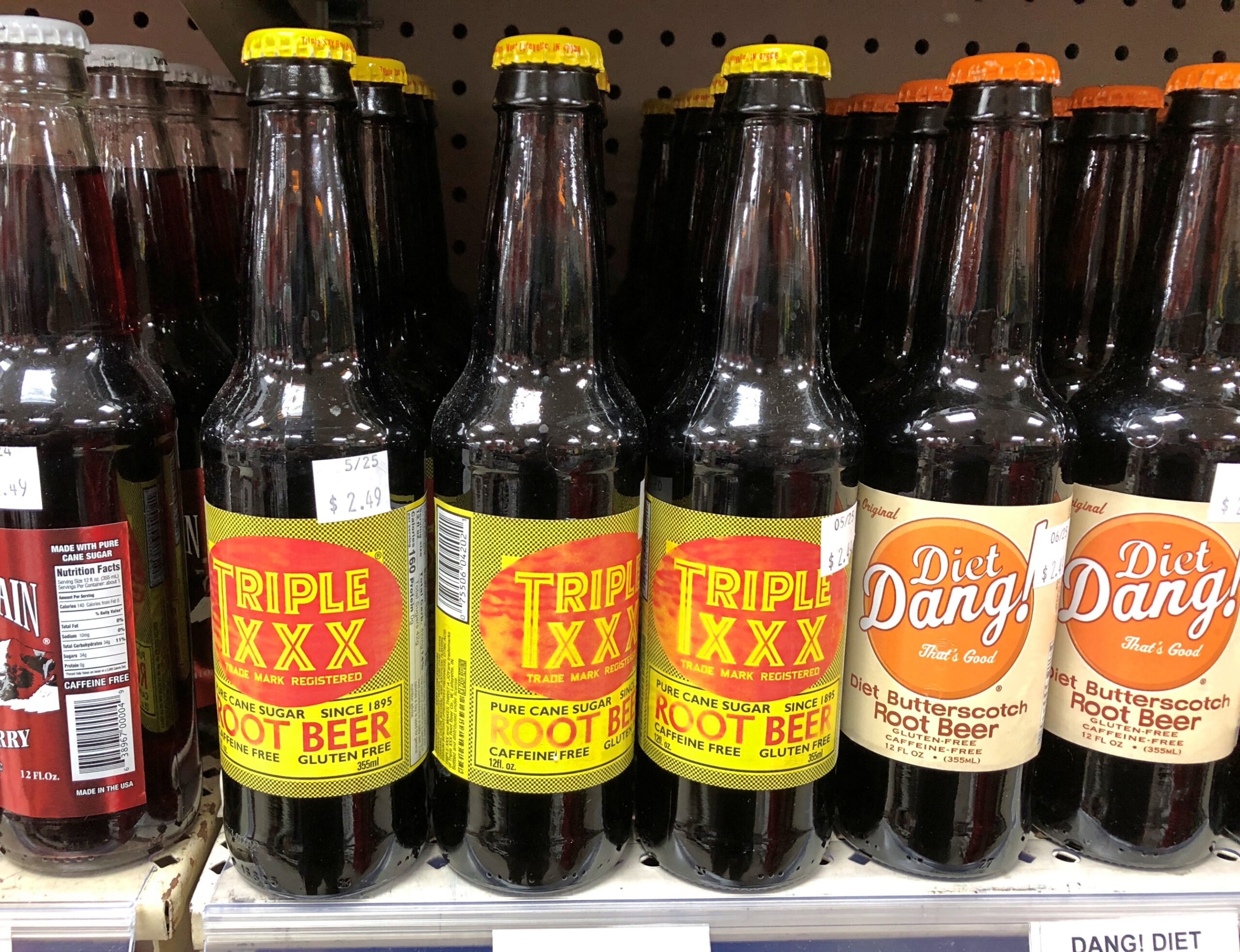
Drinks on sale that made me recollect sodas from my mid-60s childhood.
Frostie! Nehi! Triple XXX! Dang? We didn’t have Dang. Butterscotch root beer?
Pangs of nostalgia weren’t enough for me to spend $2.49 for an ordinary-sized soda, though I was a little thirsty.
More courthouse square.
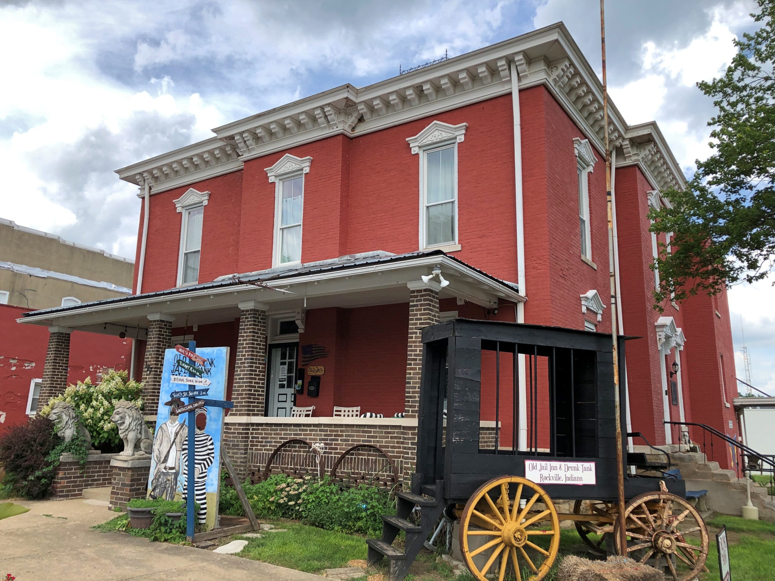
The Old Jail Inn & Drunk Tank, now a B&B.
I returned to the square on Sunday morning, after the cemetery, for a further look when it wasn’t so hot.
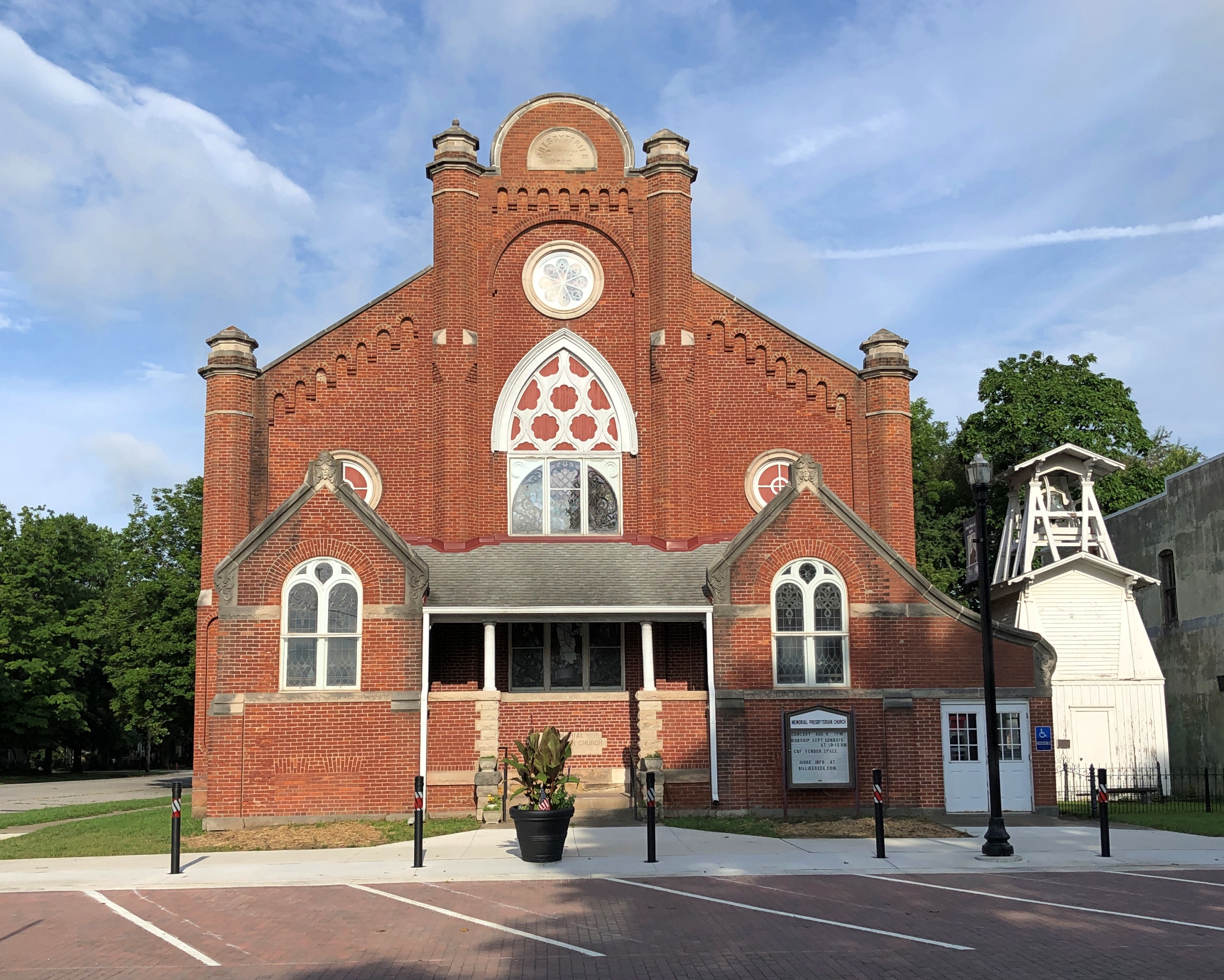
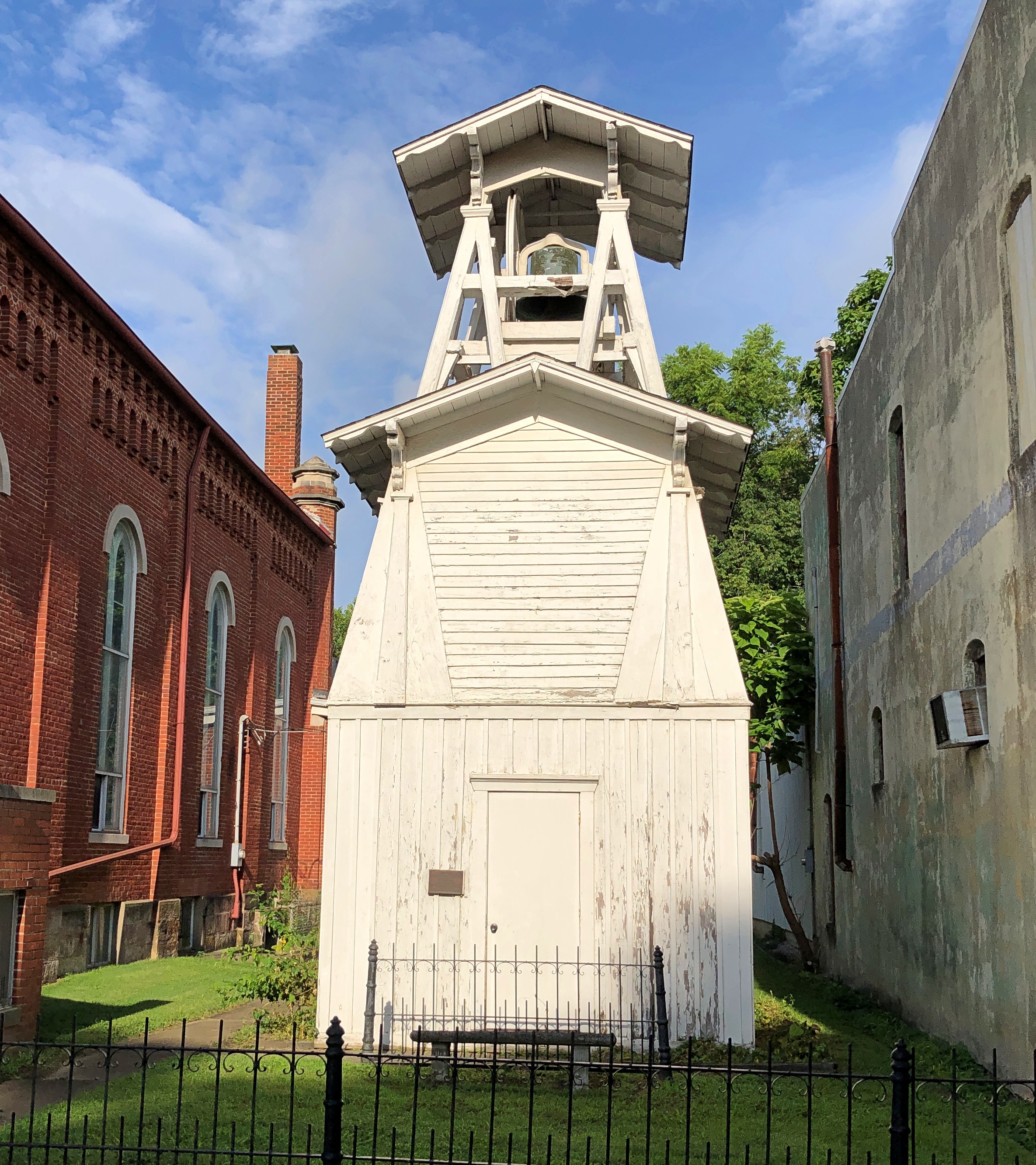
Memorial Presbyterian Church and its freestanding bell tower.
It isn’t a Presbyterian church any more — its cross conspicuous in its absence — though a Presbyterian congregation meets there sometimes. These days it counts as an event space, with music performances, recitals, meetings, and other gatherings there, according to Billie Creek Village, more about which later.
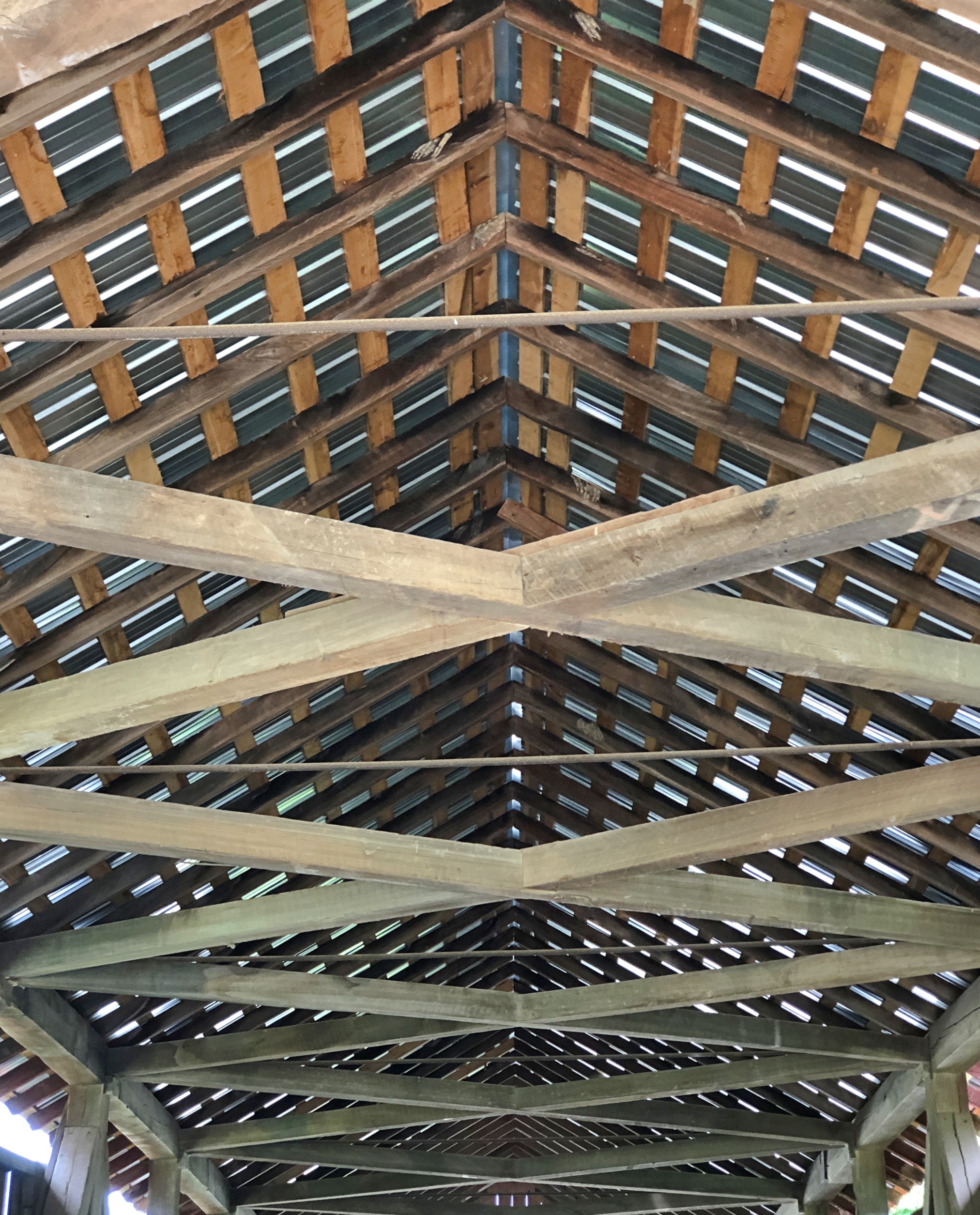
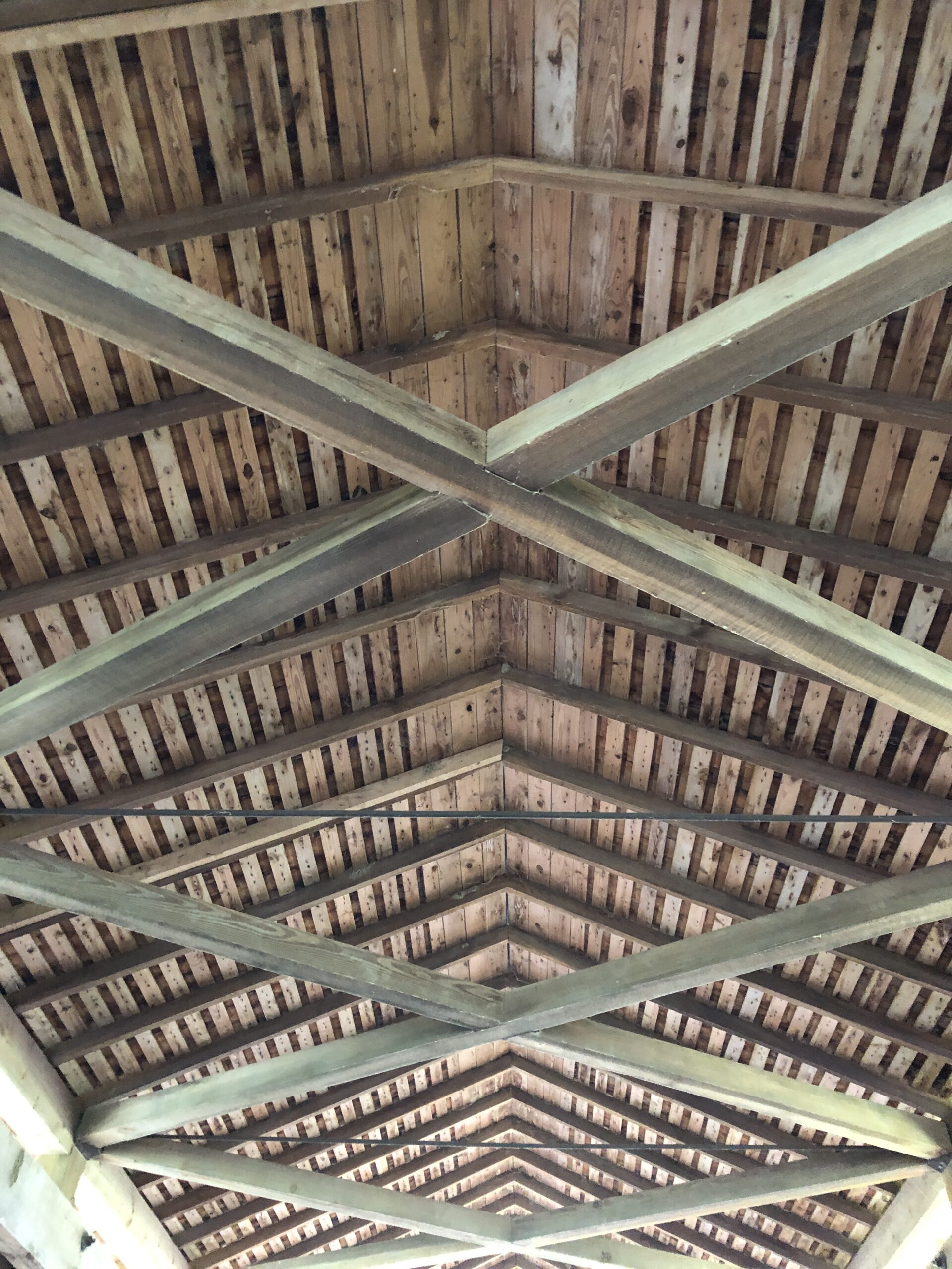
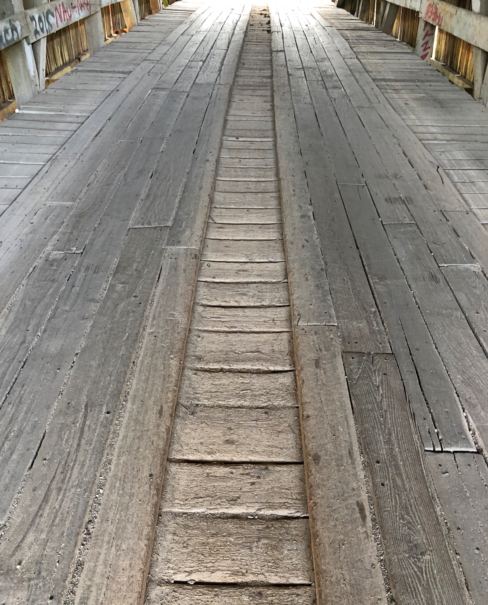
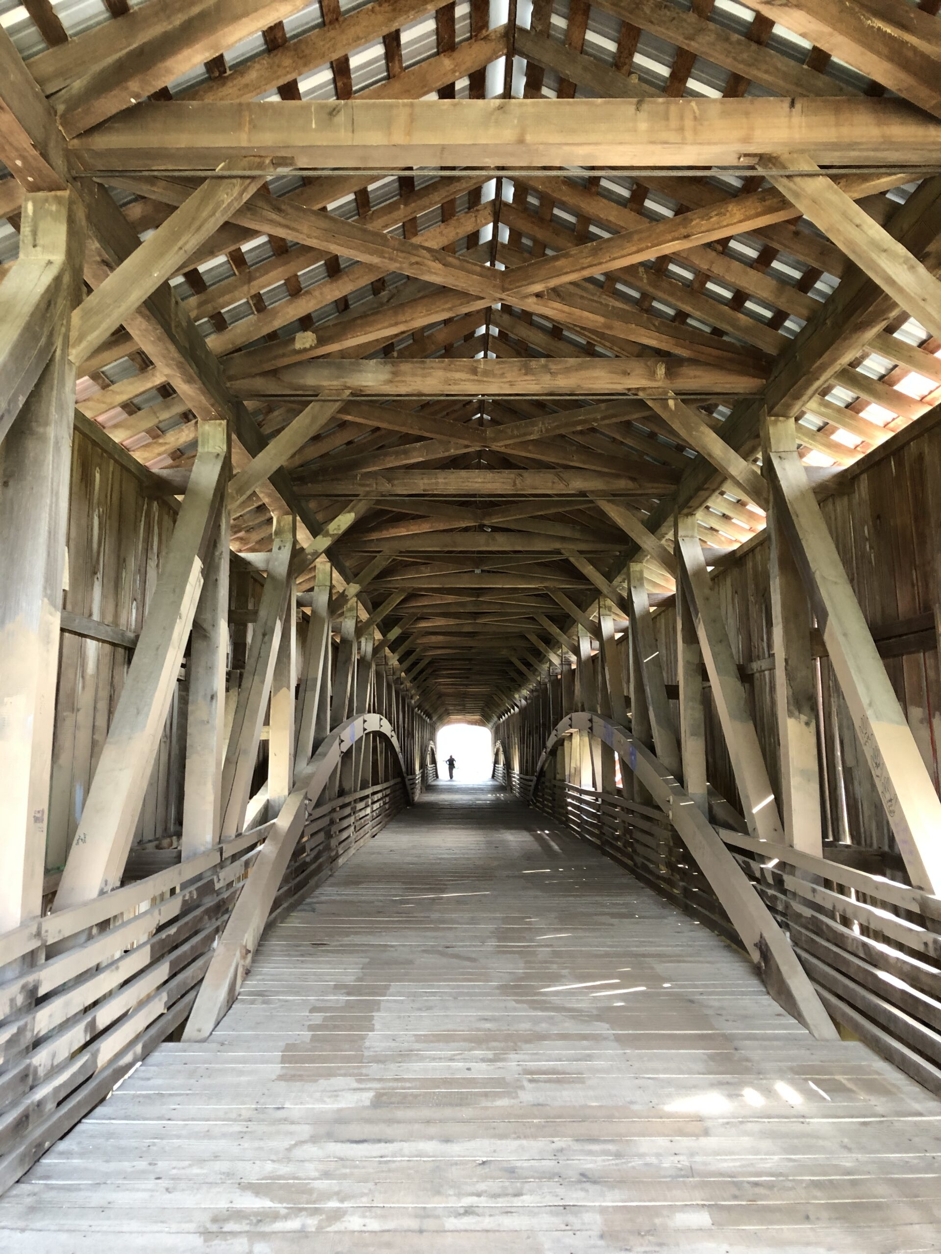
It’s one thing to admire the artistry of a Parke County, Indiana, wooden bridge standing at its entrance, or below near the edge of the creek. Another to wander in and surround yourself with all that wood, from roof –
– to floor.
Your eyes spend a few seconds being useless as they adjust, the boards creak and the wood doesn’t exactly smell strongly one way or the other, as it might have when the bridge was new, but even now there’s a faint woody odor, maybe more enhanced after a rain. No recent rain for us, just plodding over dry boards cut well over a century ago.
Being summer, there was a distinct contrast between the brightness outside and the shadows inside a covered bridge. My camera doesn’t interpret the light pouring from the other side of the bridge in quite the way my eyes did. Even so, the camera captured that distinct contrast in its own digital-image way.
Except for those times its image was closer to the eyes’.
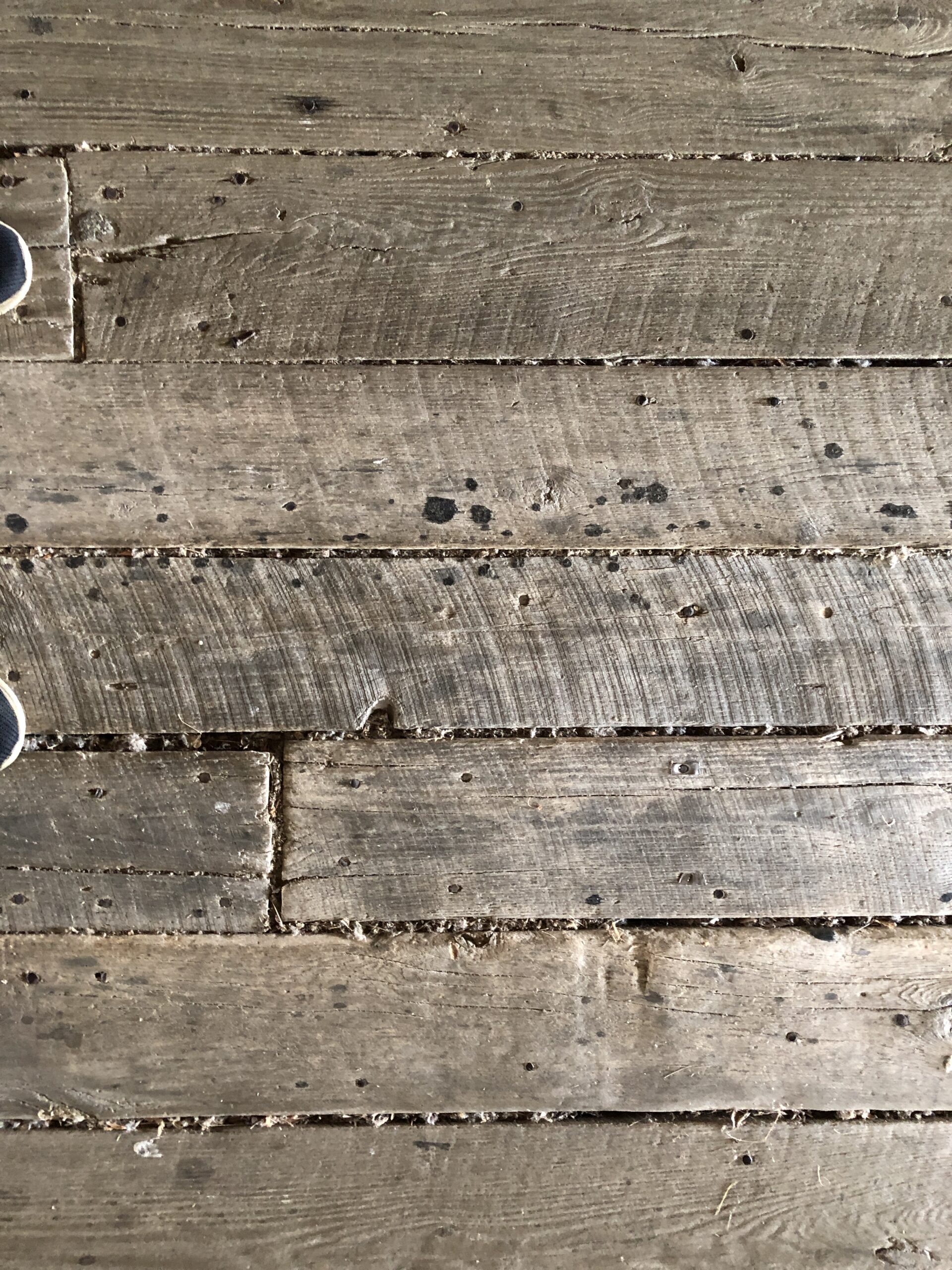
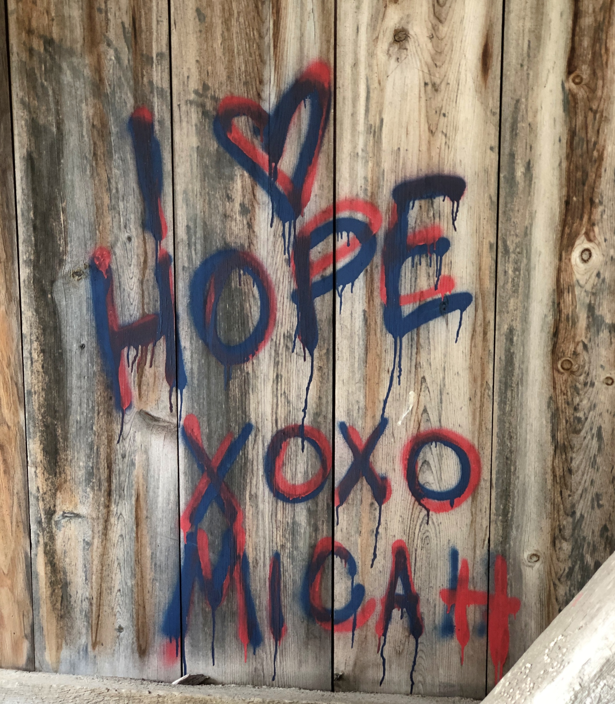
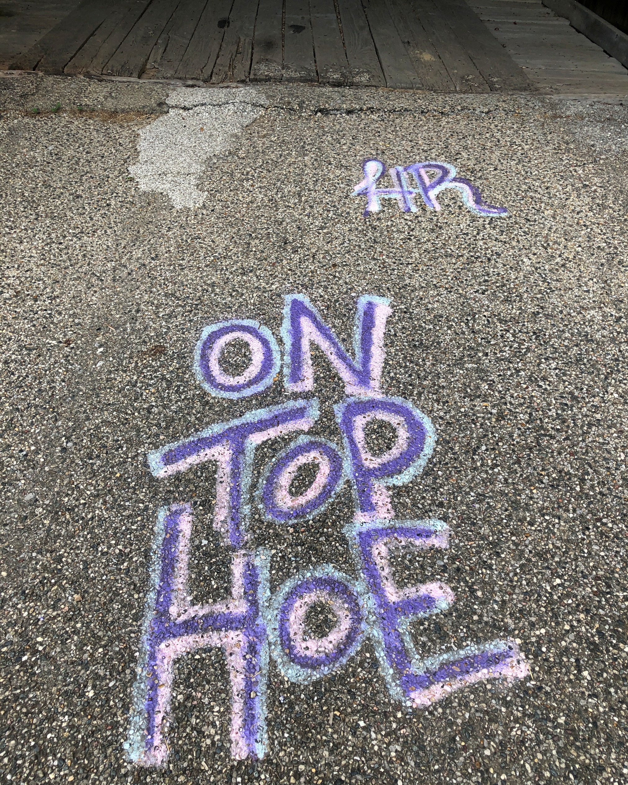
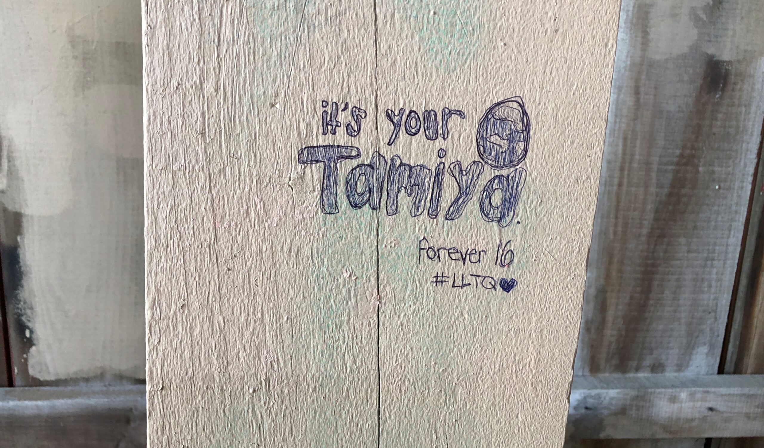
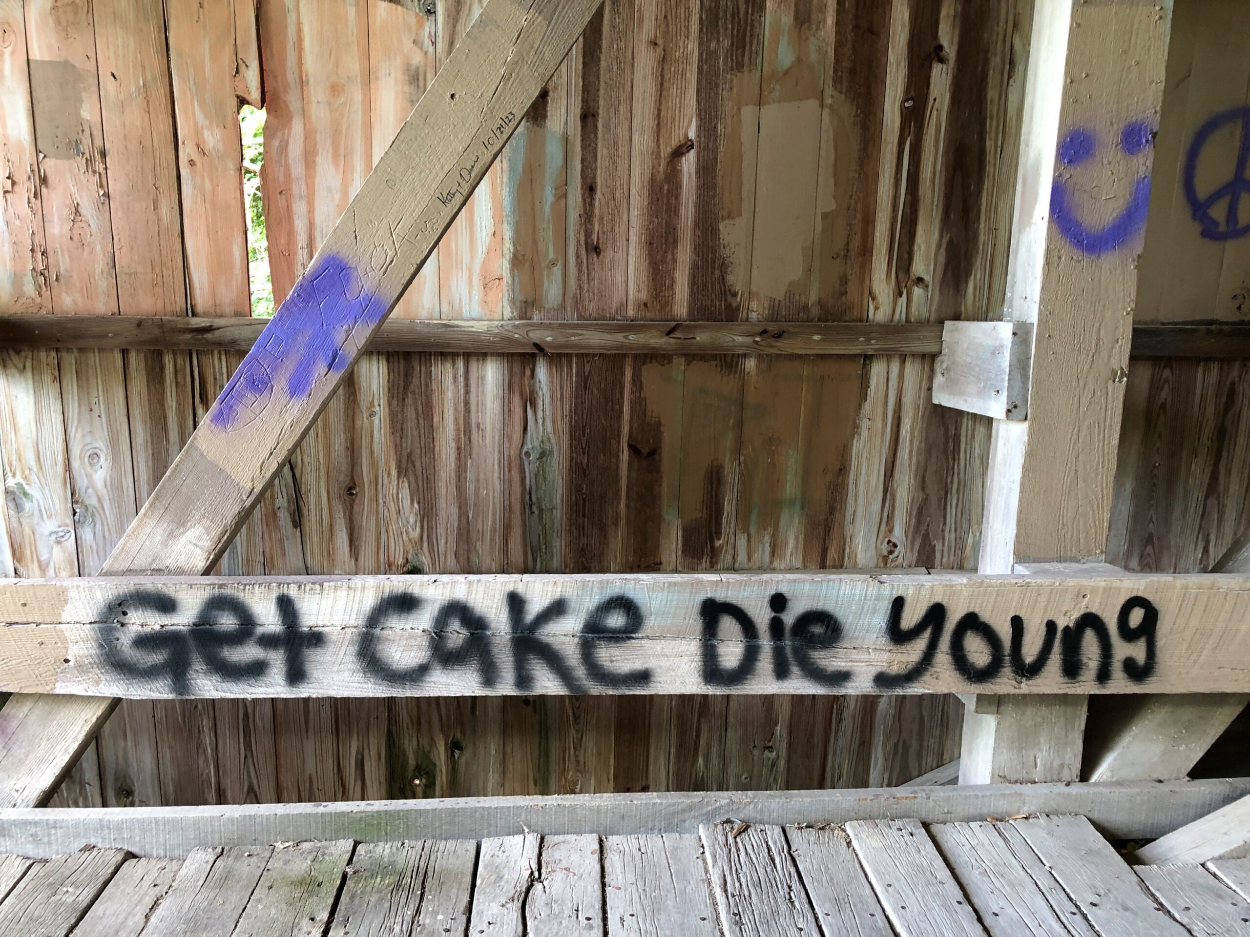
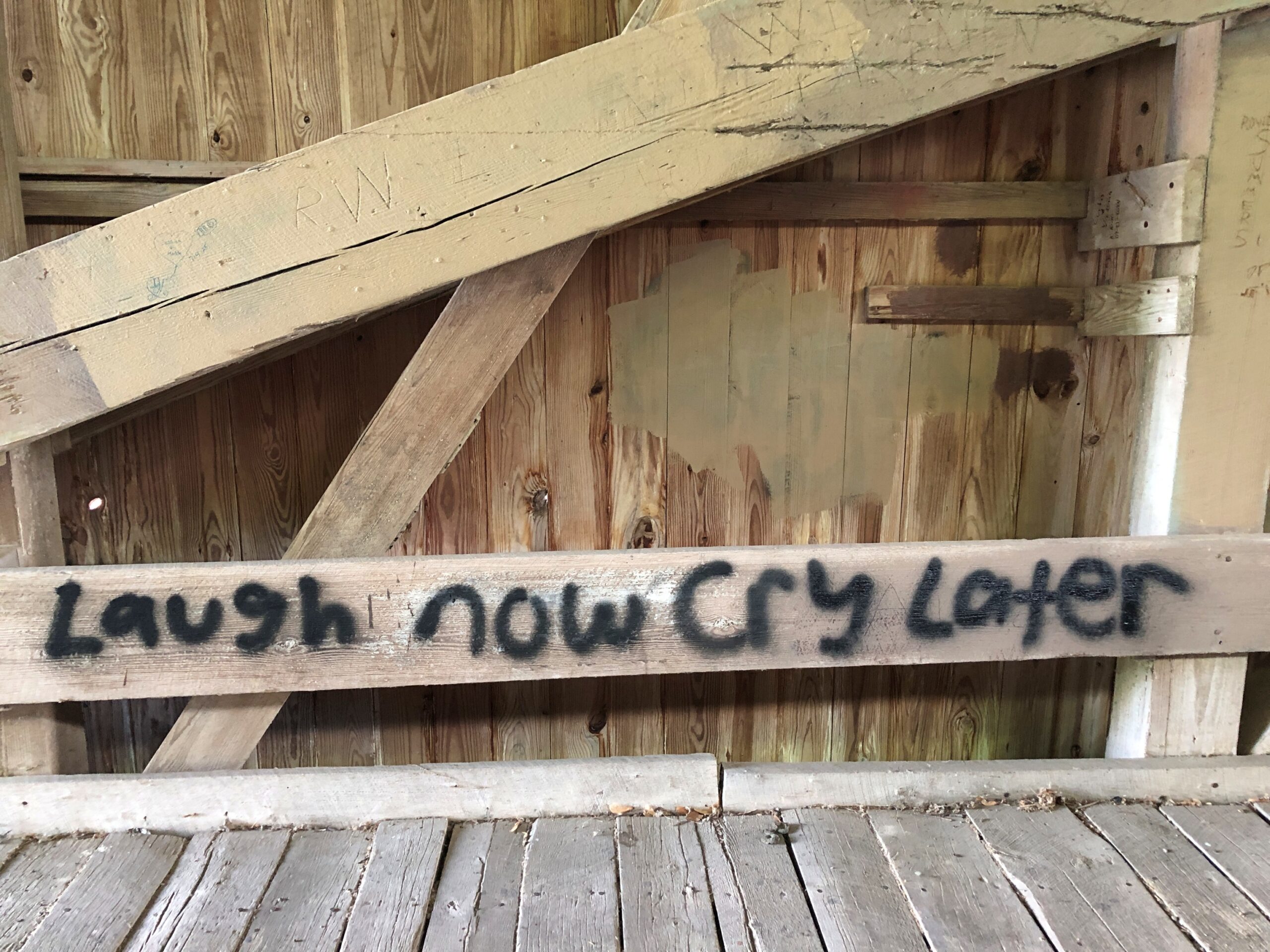
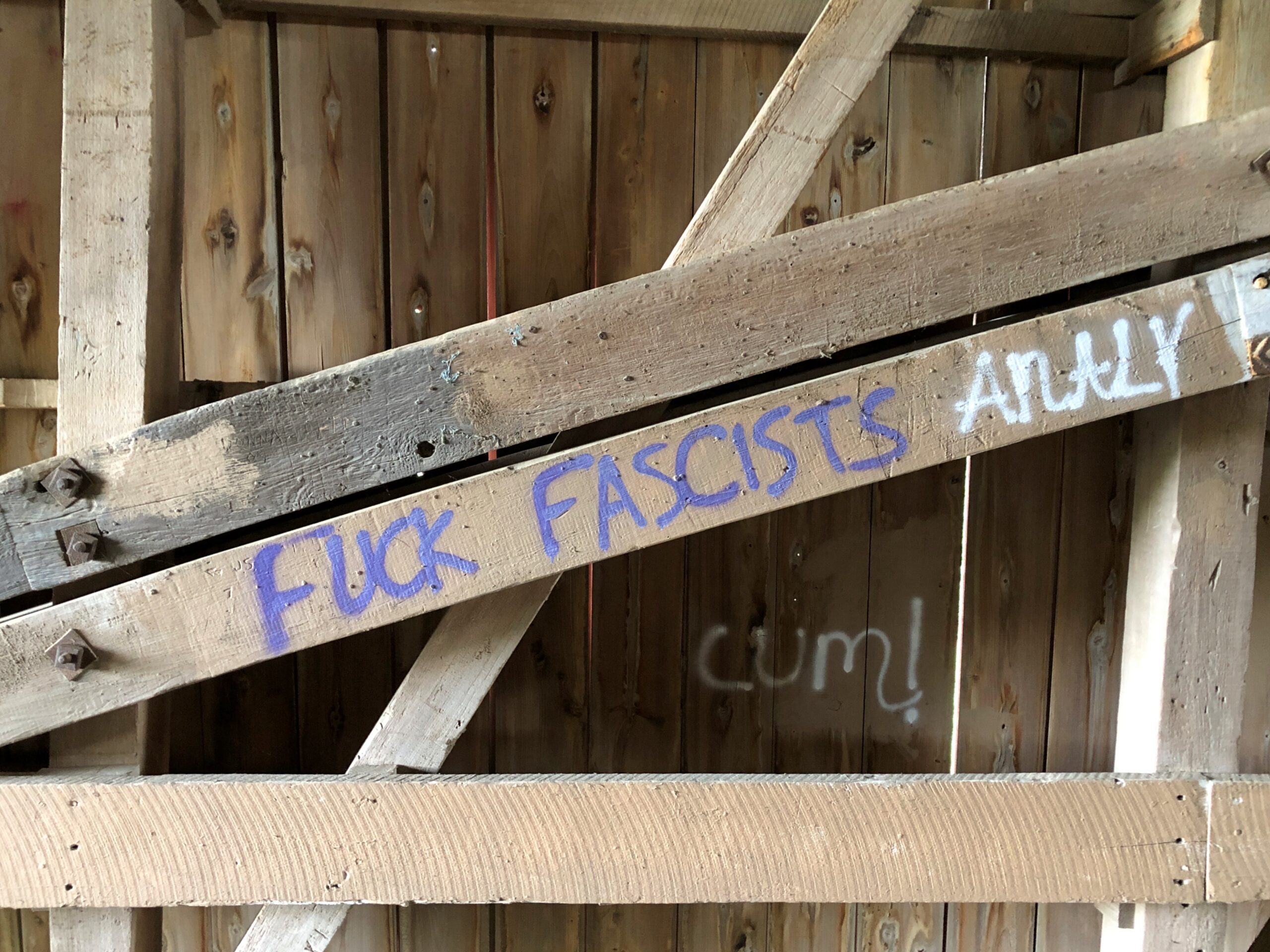
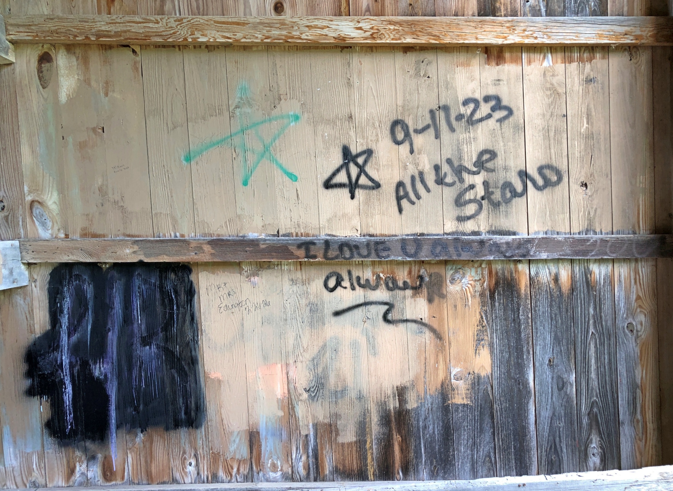
Also inside the bridges: graffiti, of course. The oldest extant covered bridge in Parke County reportedly dates from 1856. I imagine the oldest graffito – what would they use, chalk? – dates from ca. 1856.
The usual collection of declarations of love, puerile insults, political statements, enigmatic phrases and random nonsense.
And the whack-a-mole efforts to suppress it.
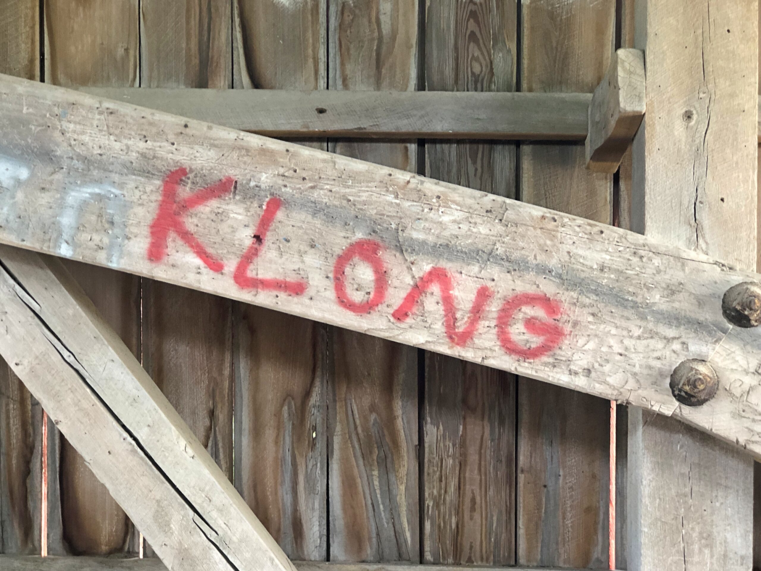
Klong. That’s my favorite from this round of graffiti spotting. An idiosyncratic item.
A dictionary meaning is canal in Thai. An alternate spelling of that, anyway. Or a Swedish homegoods retailer – reminds me of Ikea, but clearly more upmarket. Hard to know the mind of a graffitist, but I’ll bet it’s neither of those.
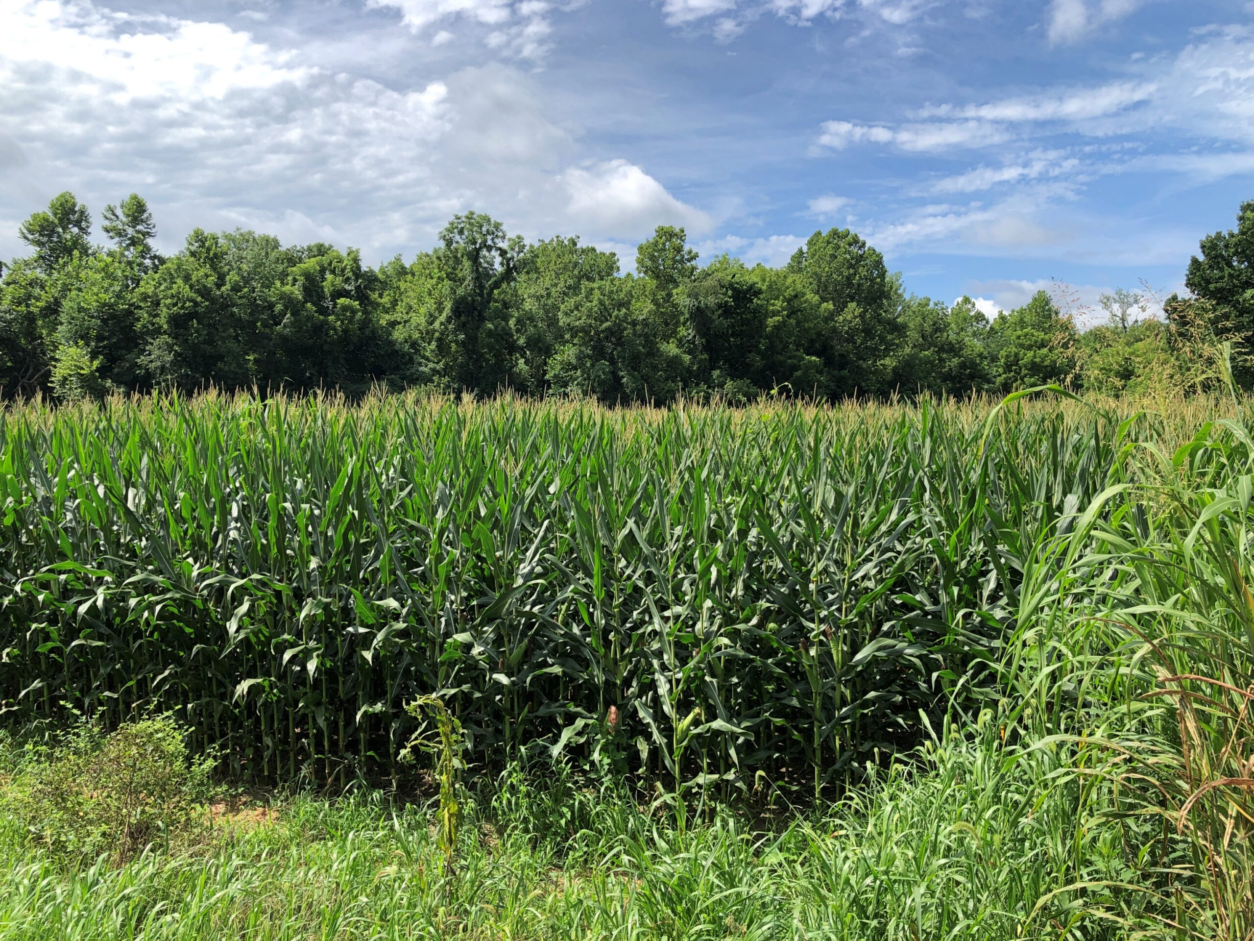
Even though you see enough corn driving through the Midwest, it’s still a little hard to imagine 5.1 million acres of corn (or anything else). Yet that’s how much corn – maize, Zea mays – was planted in Indiana alone in 2024, according to the Indiana Corn Marketing Council, with 5.05 million acres harvested. Even after being in the thick of a summer crop, the thought of that much boggles the mind.
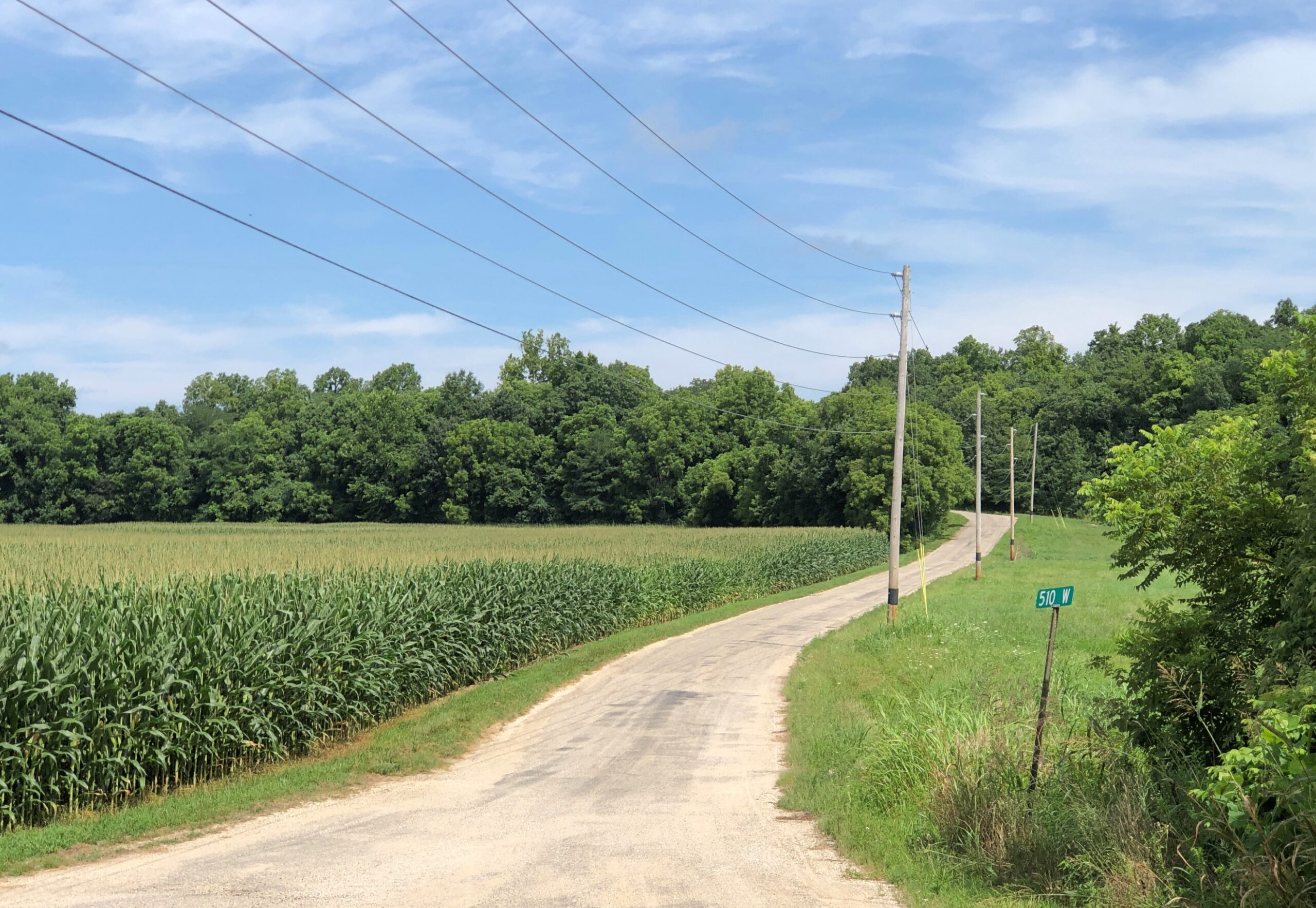
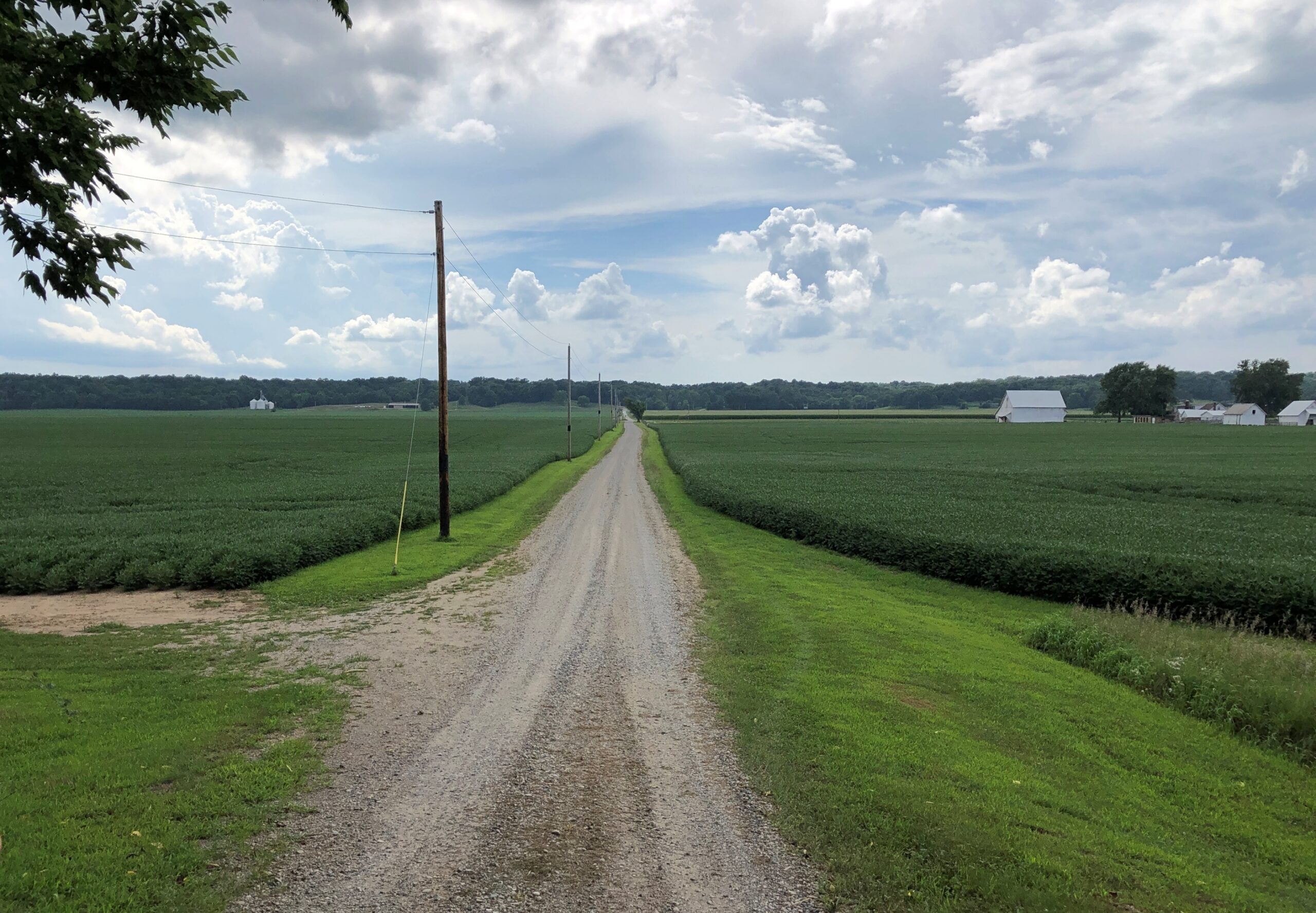
We didn’t go to Parke County, Indiana, in late July to admire the corn, though I did take a moment to make a few higher-than-an-elephant’s-eye corn pictures. You don’t have to go nearly that far to find corn. We came for the covered bridges, spending a Saturday night in the county seat of Rockville, Indiana, and out looking for bridges on Saturday afternoon and Sunday morning. To get to them, you have to take to the small roads crisscrossing the area, some paved, some not, but all pretty high quality.
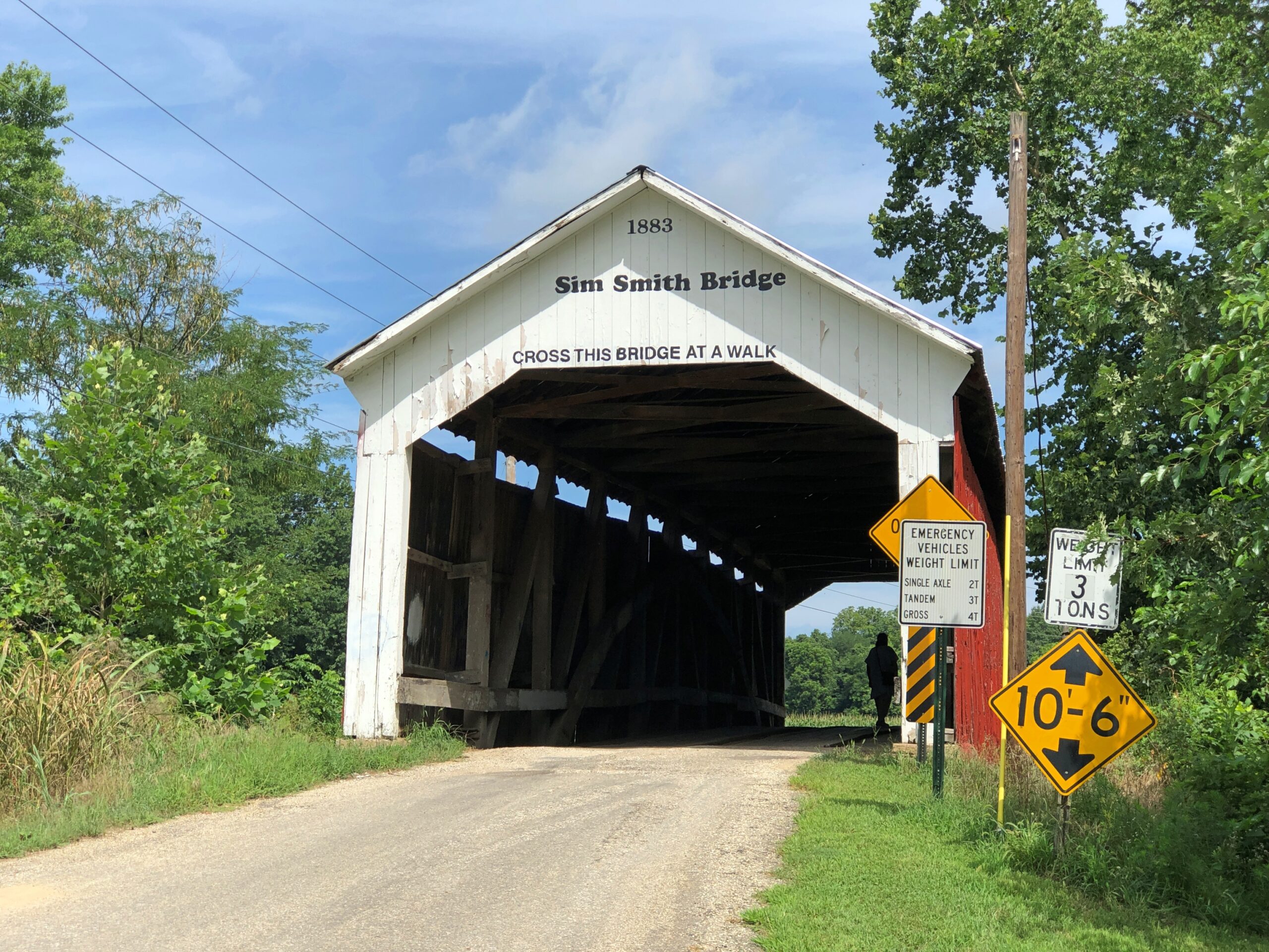
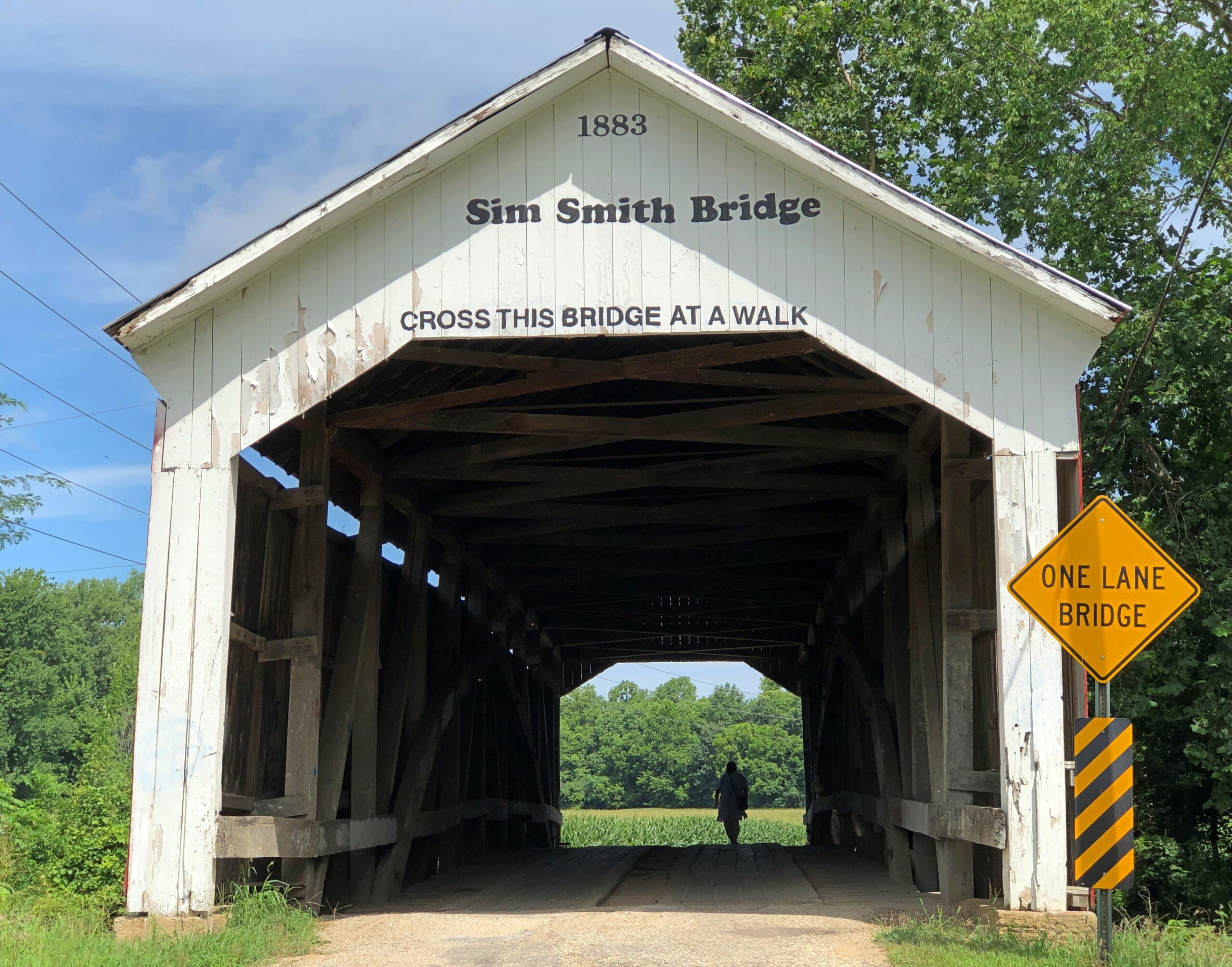
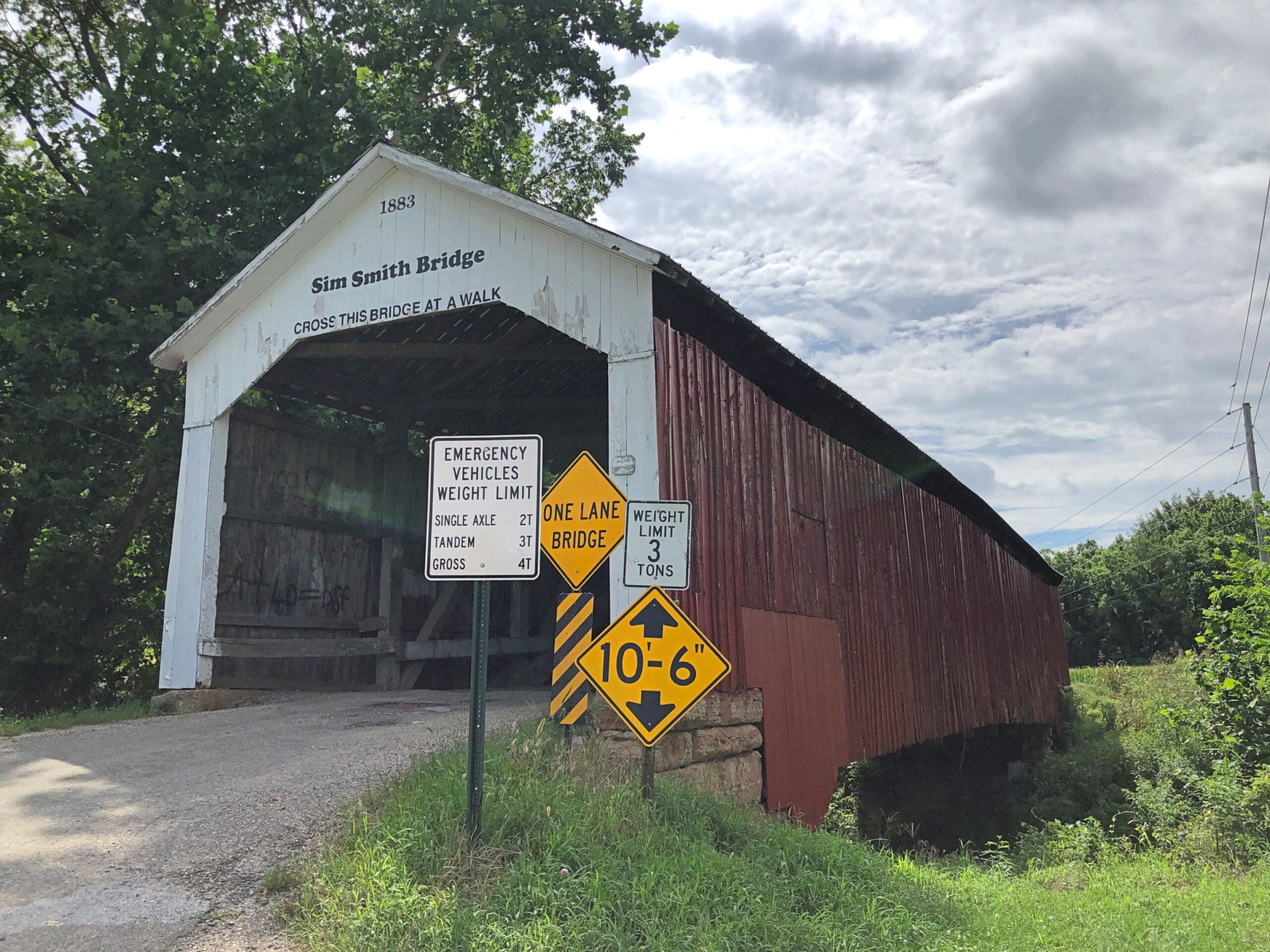
Roads lead to bridges, such as Sim Smith Bridge, vintage 1883, which crosses Leatherwood Creek. “Locally, this bridge has the reputation as haunted,” says a guide map I picked up. Uh-huh.
West-central Indiana is well-watered, a welter of creeks feeding the Wabash River. Covered wooden bridges cross many of them, each of more than a century old. Cedar is the main material. I’d guess being well-watered was good for the farmers here in the late 19th century, except for one thing: they complicated shipping one’s crop to buyers, either to animal feed processors or human-food makers. So, bridges.
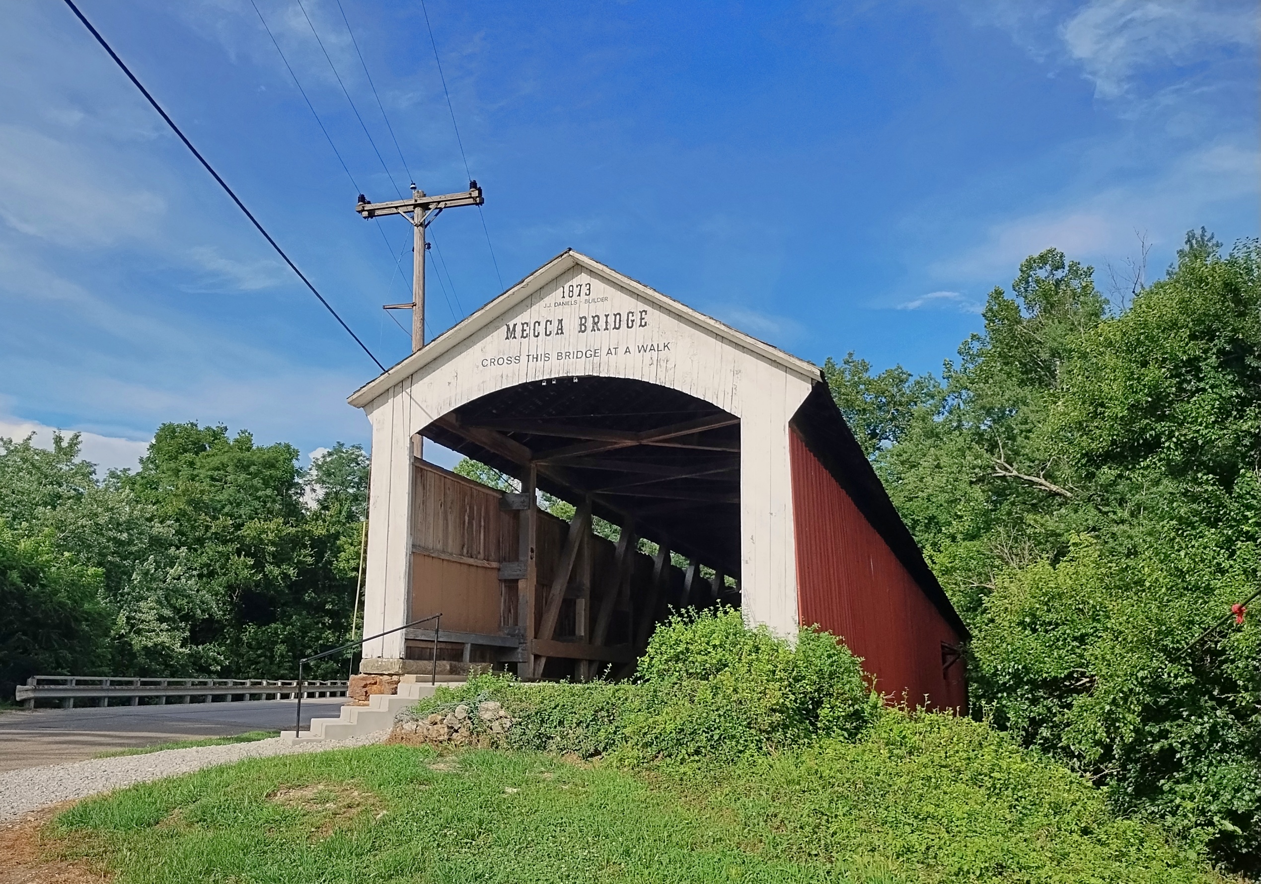
Mecca Bridge, near Mecca, Indiana, across the Big Raccoon Creek. 1873.
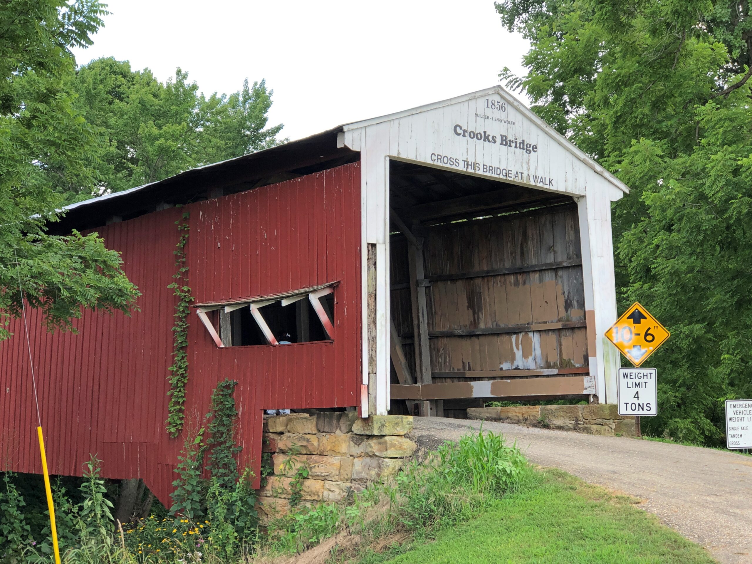
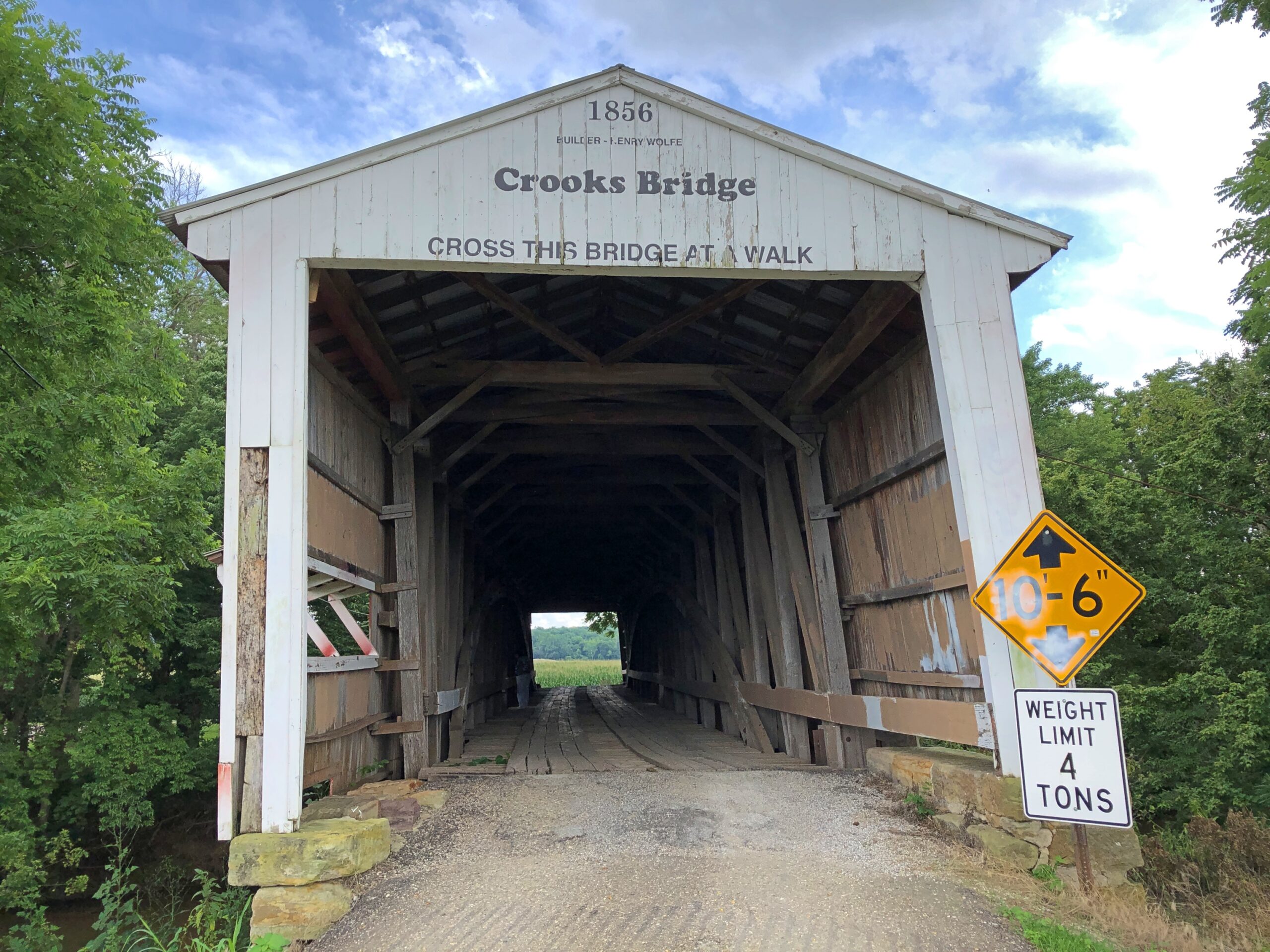
Crooks Bridge, across Little Raccoon Creek. Competed in 1856.
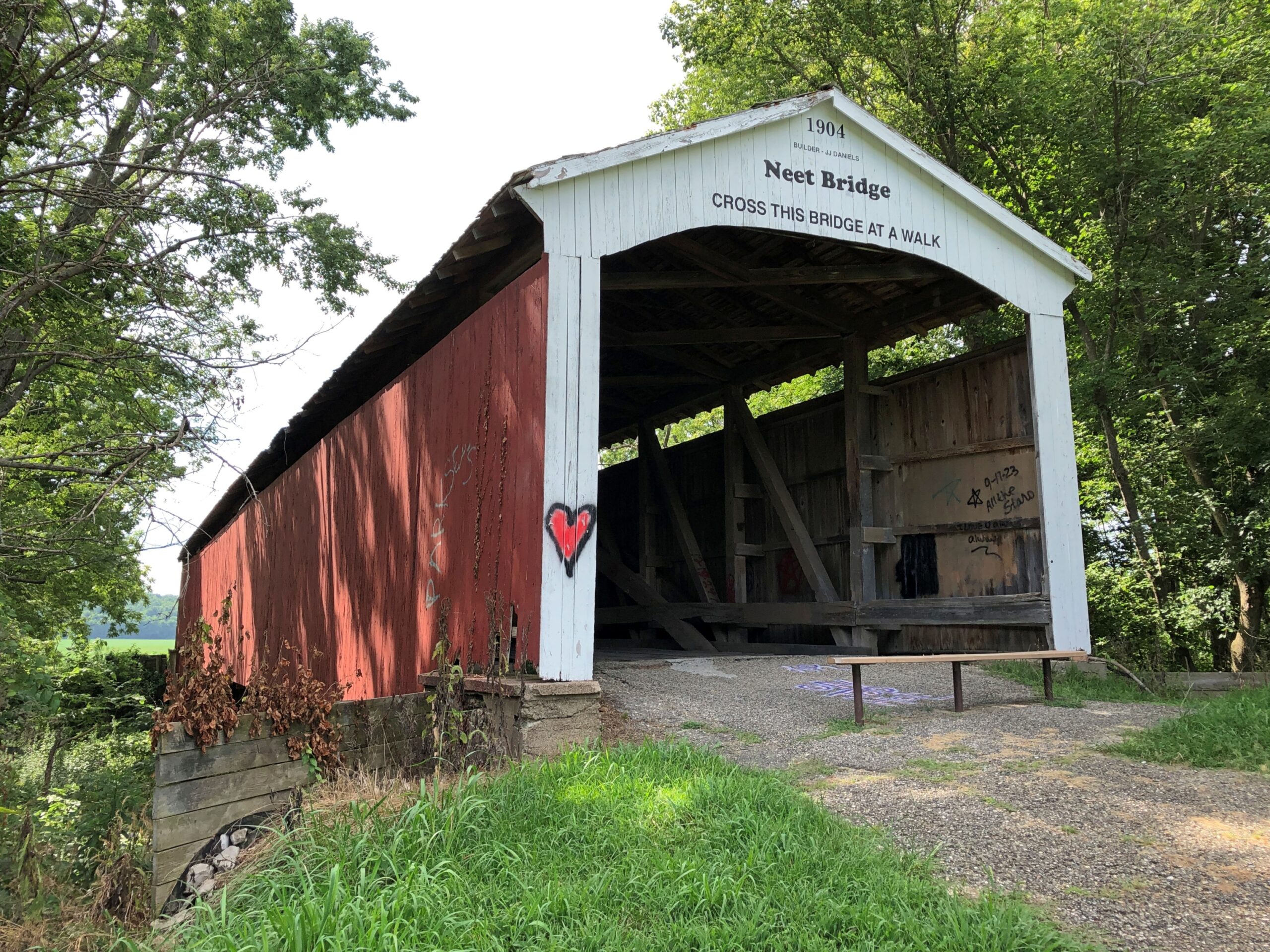
Neet Bridge, 1904, also across Little Raccoon Creek.
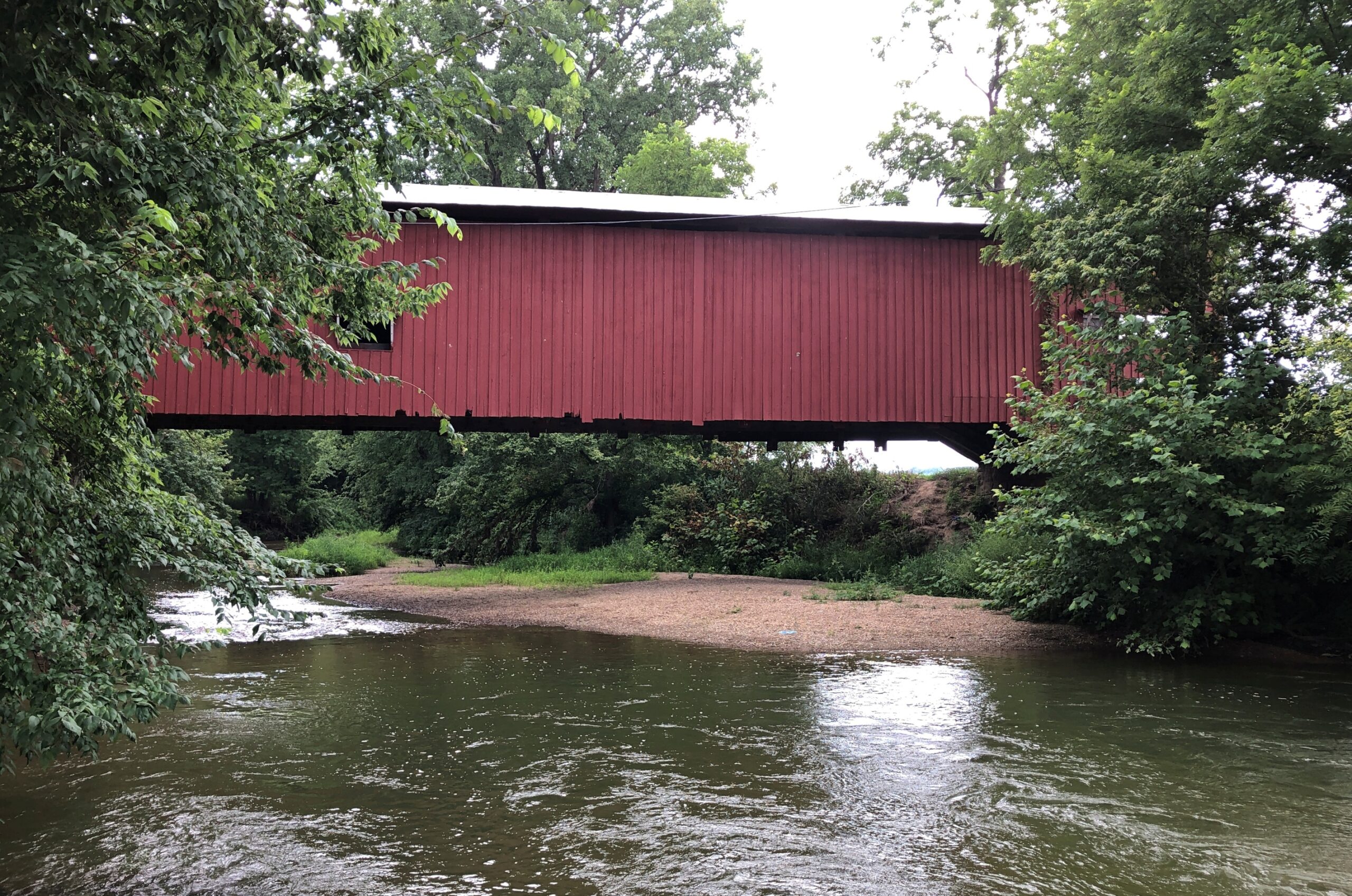
Local organizations count 31 historic bridges in Parke County, each with a name and known origin. Local organizations promote historic bridge tourism, as well they should, including a give-away paper guide (Parke County Guide) that other guides should aspire to, so detailed and useful is it. But I can also report that even on a summer weekend, when it was hot but not dangerously so, or especially humid, overtourism hasn’t spoiled the place. Most of the time, at the half-dozen or so bridges we visited on a weekend, we were alone. Even the bridges that still carried auto traffic had little, so that walking across each on foot was never an issue.
An carpenter (and lawyer) named J.A. Britton (d. 1929) built many of the bridges in Parke County in the late 19th and early 20th centuries, presumably as the organizer of a small construction crew, but also with the sort of hands-on approach that had him laboring alongside the other men. I like to think so, anyway, but whatever the arrangement, bridge building was his business, and he built them to last. Some are still vehicle bridges. Others are pedestrian bridges. Most are in situ, with a few moved to parks or other places.
Parke County was enough of a market for a few decades that J.A. Britton had a competitor, J.J. Daniels, who left behind some structures as well, such as the Neet and Mecca bridges.
Most of the Parke County bridges are Burr Arch Truss bridges, following a design that combines a truss and an arch, invented by a bridge builder back east in the early 19th century, one Theodore Burr. Seems like the design works really well for this kind of bridge.
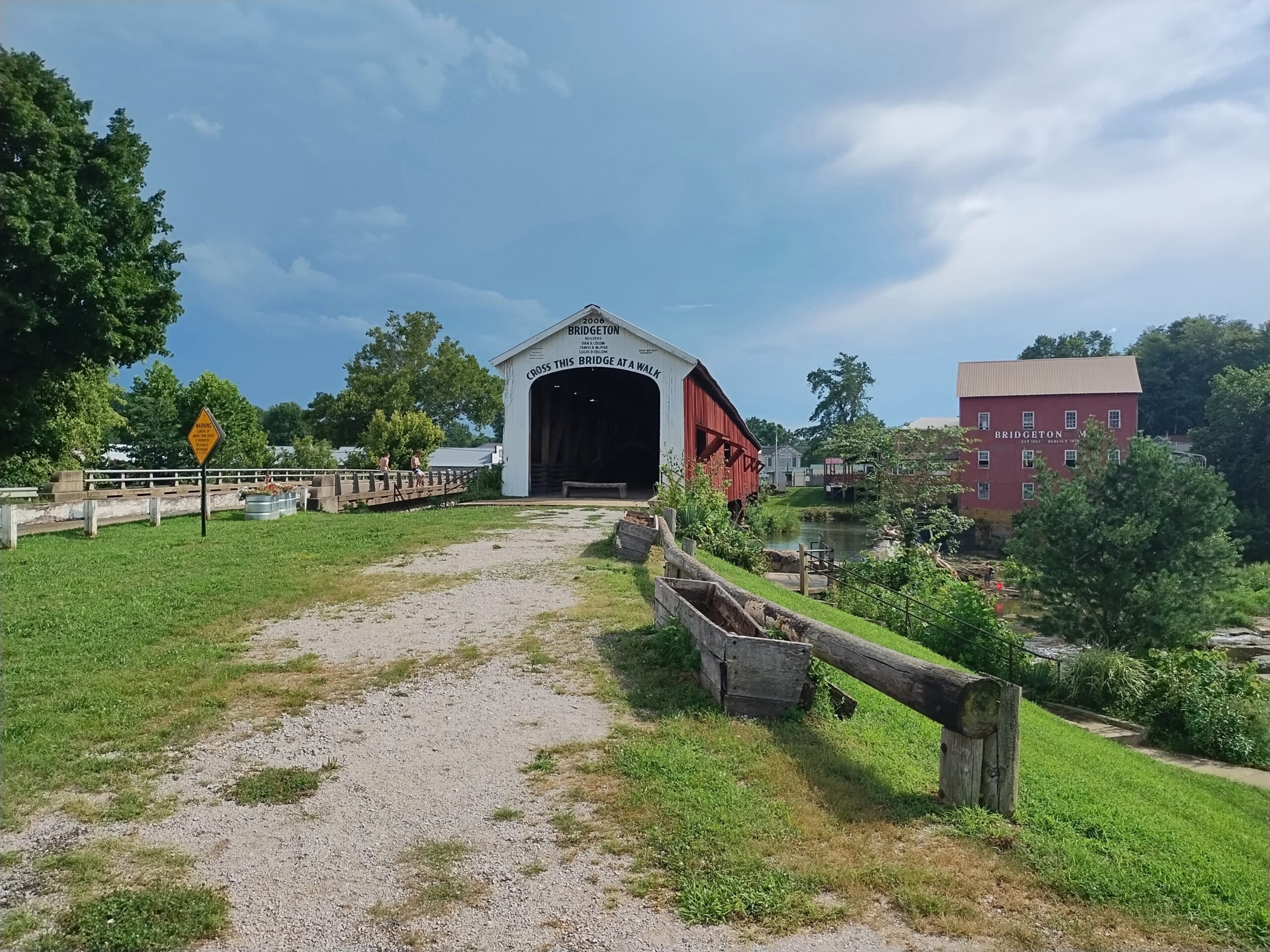
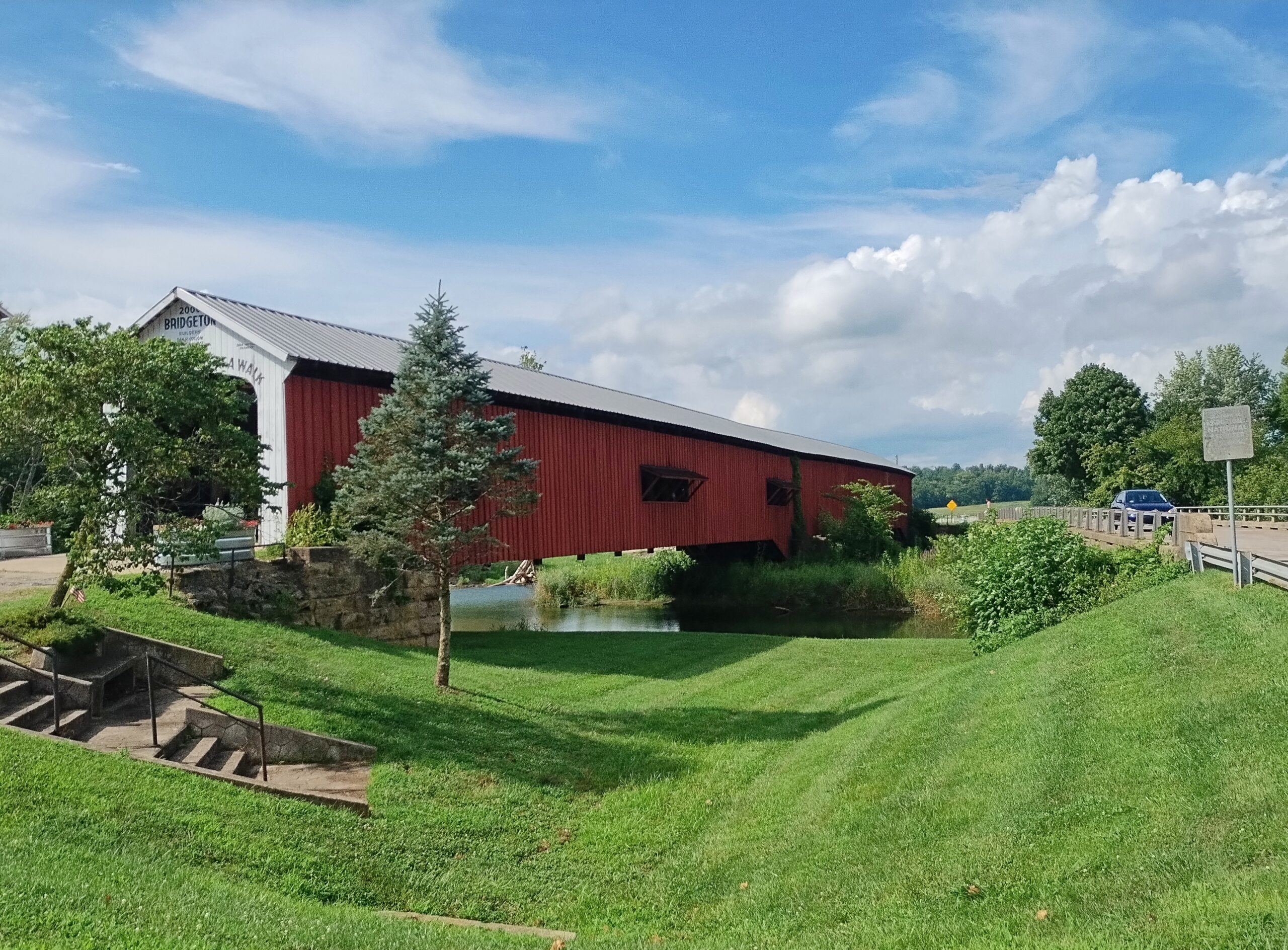
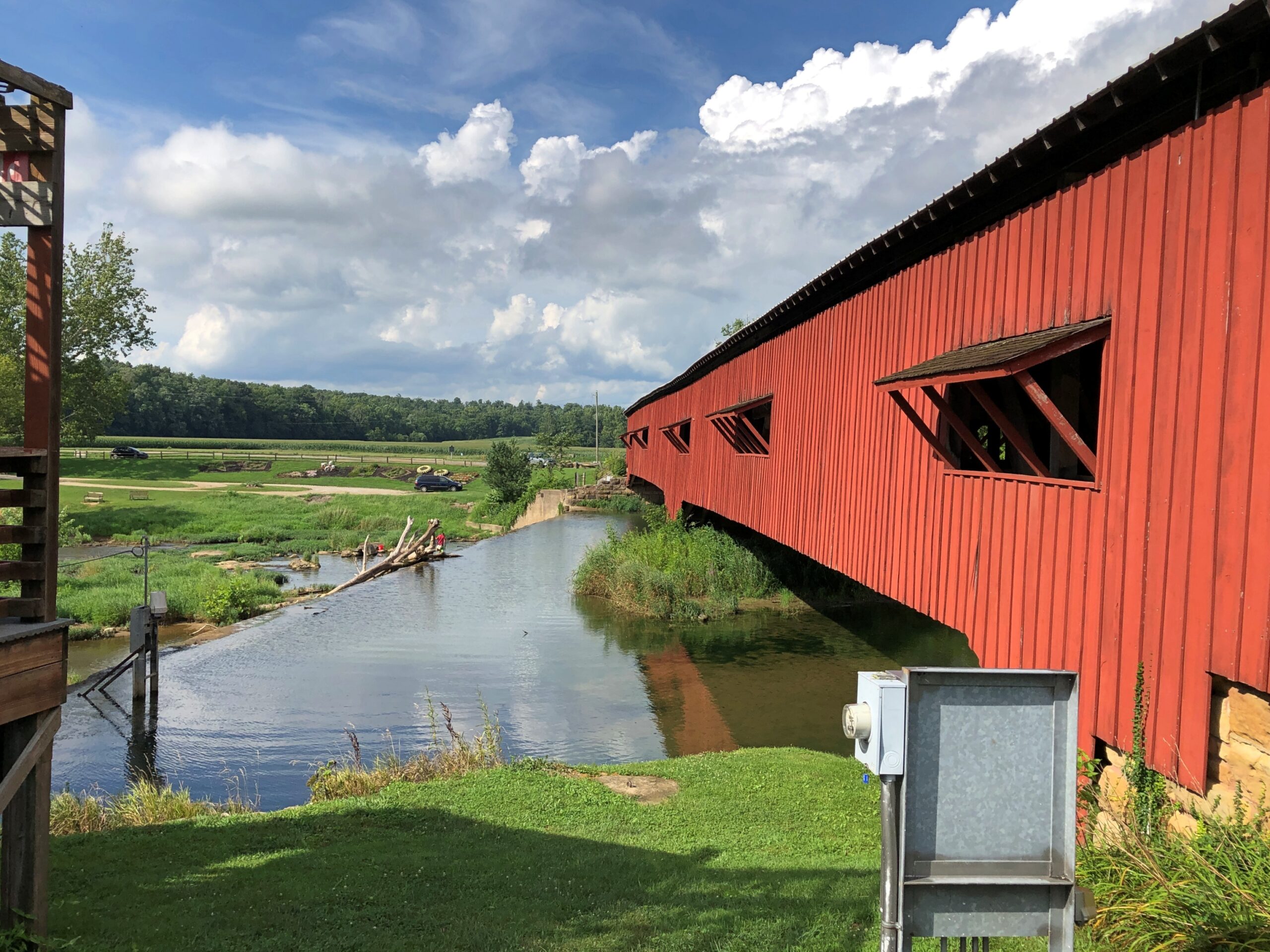
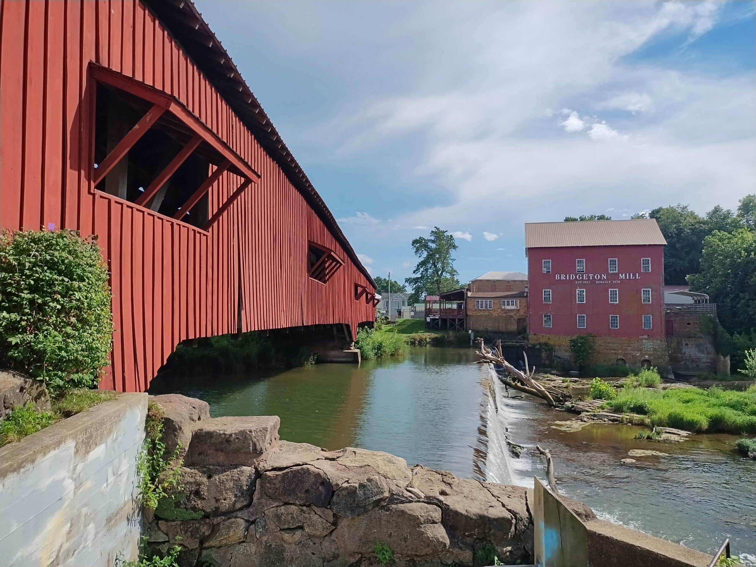
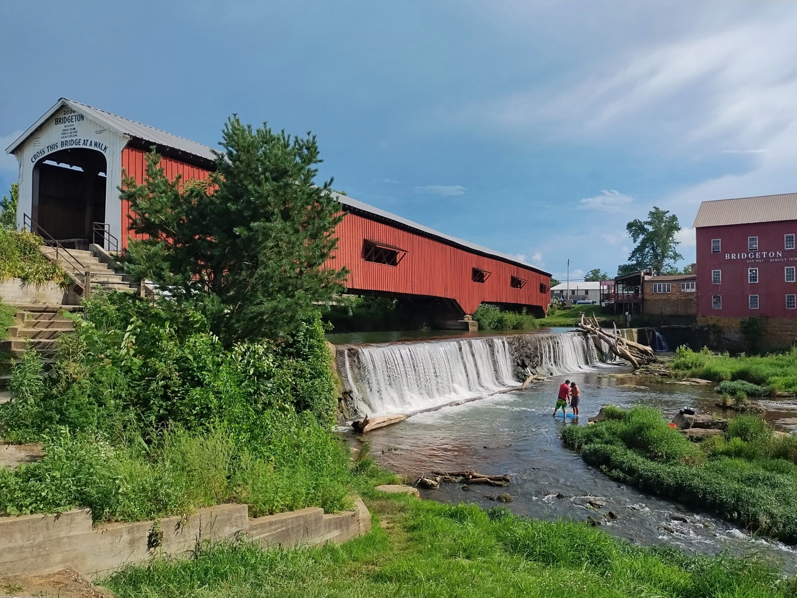
Not all the bridges are out in the corn-planted countryside. Bridgeton Bridge, crossing Big Raccoon Creek, is in the small town of Bridgeton, Indiana, which includes a former mill rising over the creek, now retail. Unlike the others we saw, it dates from 2006, a faithful replica of an earlier bridge destroyed by wanker arsonists.
Over a waterfall, for that extra picturesqueness.
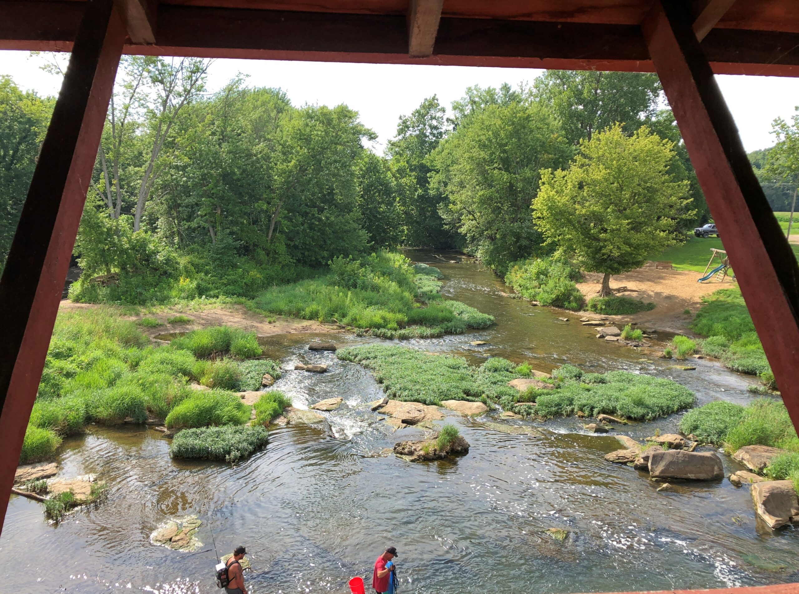
The view from the bridge.
The creek below was deep enough to allow teenagers, some boys but also at least one girl, to jump off the modern vehicle bridge next to the wooden bridge as a matter of fun, not grievous injury, because while we were around, we saw and heard them doing so. Good to see kids out having fun that didn’t involve small electronic boxes, by gar.
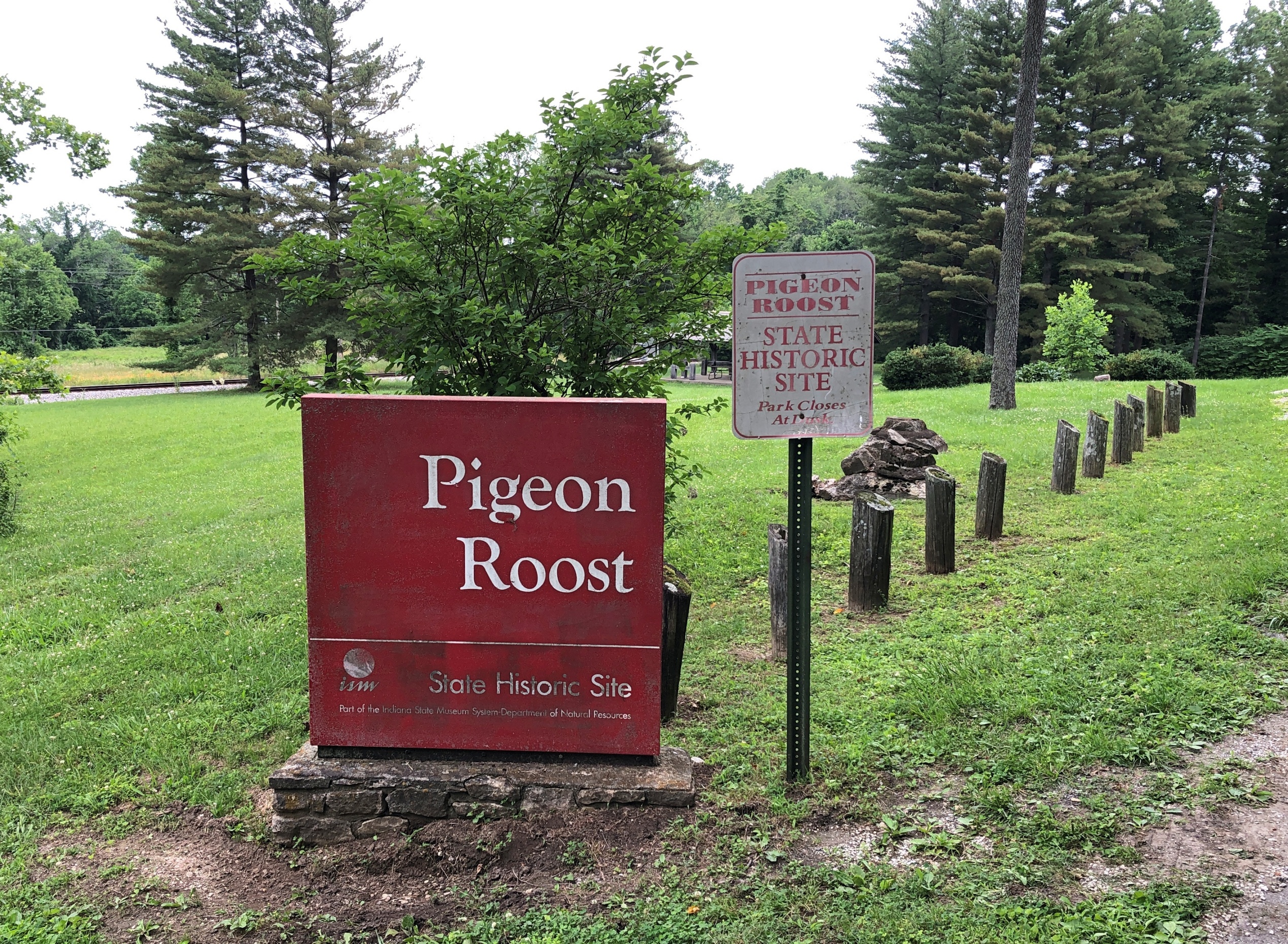
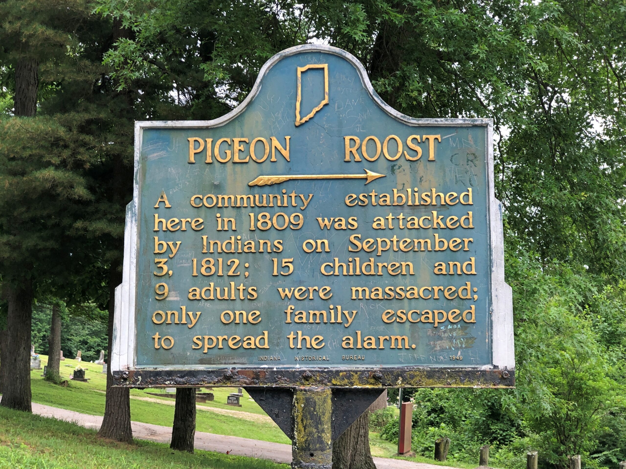
My stop in Scottsburg, Indiana, wasn’t entirely random. If you have a mind to visit Pigeon Roost State Historic Site, which is just south of town, you need to get off the Interstate and proceed to the site on US 31, and Scottsburg is a good place to do that.
As a point of interest red spot on highway maps, Pigeon Roost had intrigued me for years, but not enough to stop there. Unless I did sometime in the 1980s. Or maybe the ’90s. I’ve arrived at that point in life at which I can’t quite remember all the things I’ve seen, especially obscure memorials in obscure places. In a related trick of an aging memory, I sometimes have fairly distinct memories of places, but no memory of exactly where I was.
There are at least two layers of history at work at a place like Pigeon Roost. One is the massacre itself, whose longstanding interpretation sees it as a bloody incident in the War of 1812, with the Indians taking the opportunity – and British weapons – to fight the tide of settlement in the Northwest Territory, though they were already doing that, ultimately in vain. There also seems to be a revisionist idea that the Indians were out to settle a score with a particular group of whites and didn’t give a fig about the geopolitics of the situation, which certainly sounds plausible.
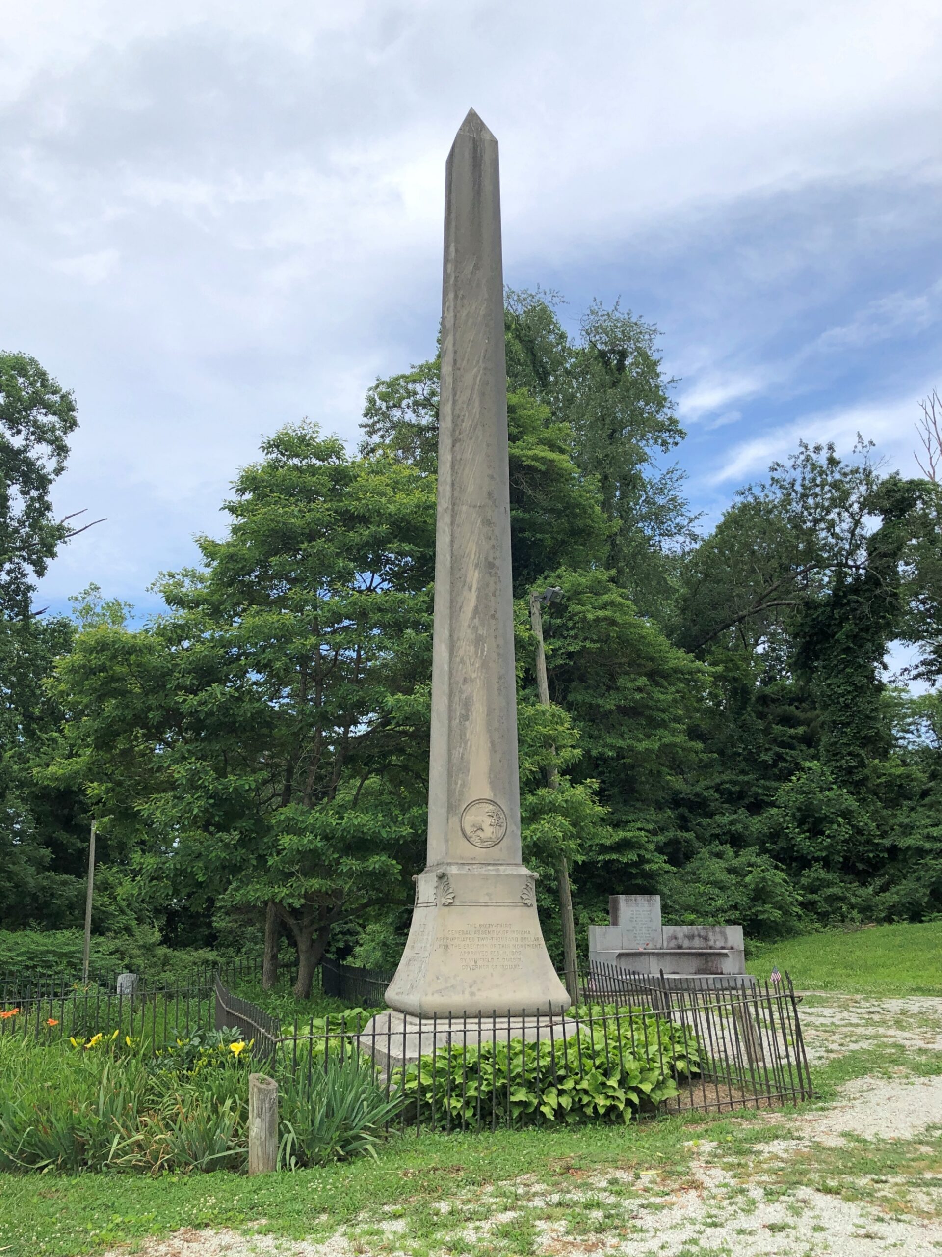
The other layer is the fact that it wasn’t until 1904 that the state of Indiana dedicated a memorial to the victims of the massacre, including what must have been a tidy sum to pay for an obelisk. Somewhere in the minutes of the legislature, and maybe in letters or newspaper reports, or maybe in a local history archive, is some inkling of why that might be: why then and not some other time. But it seems unlikely that anyone will ever take such a granular interest in the subject. Certainly not me, so I’ll have to leave it at that.
These days, Pigeon Roost is quiet and, I suspect, rarely visited. I had the place all to myself.
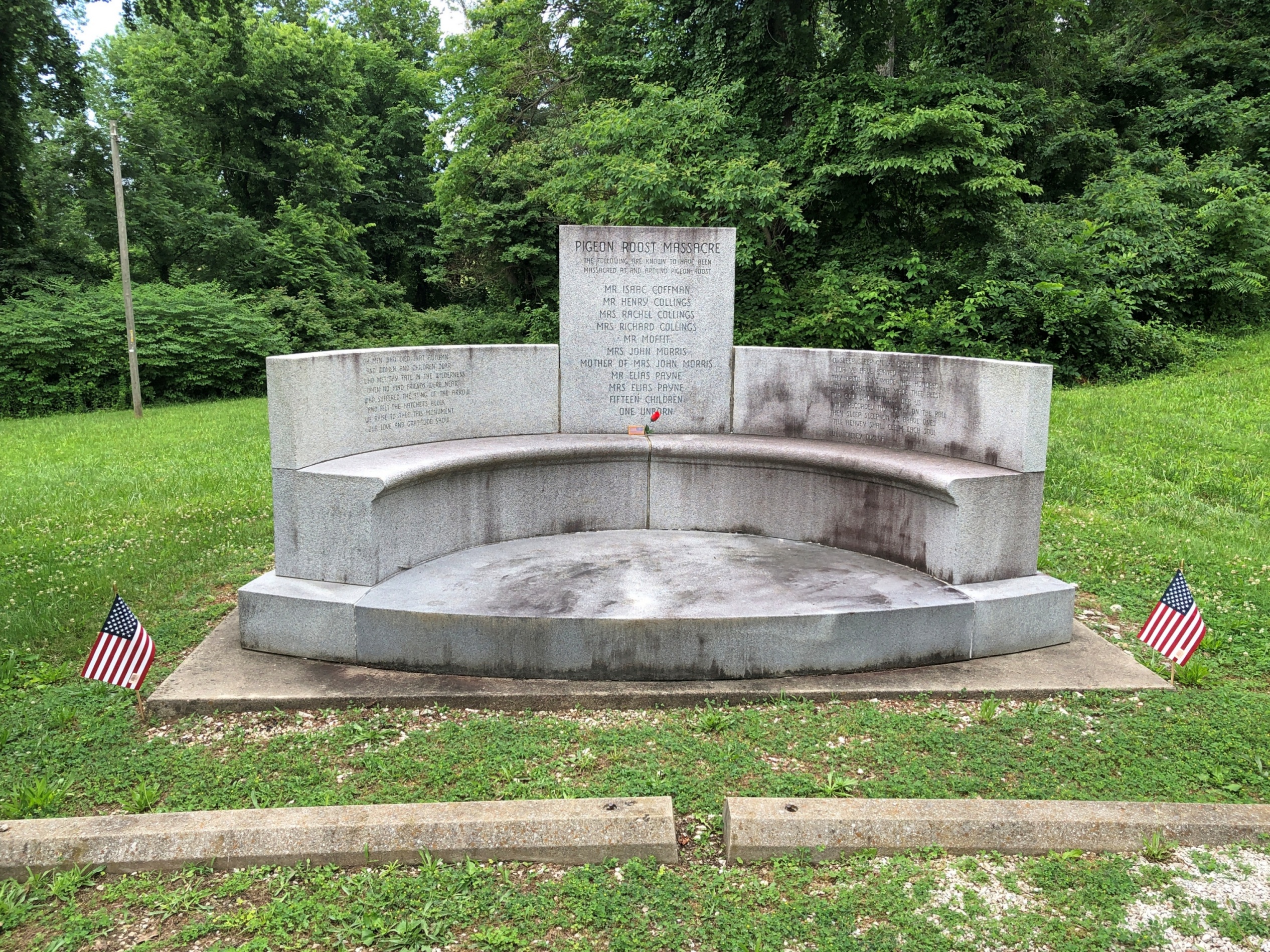
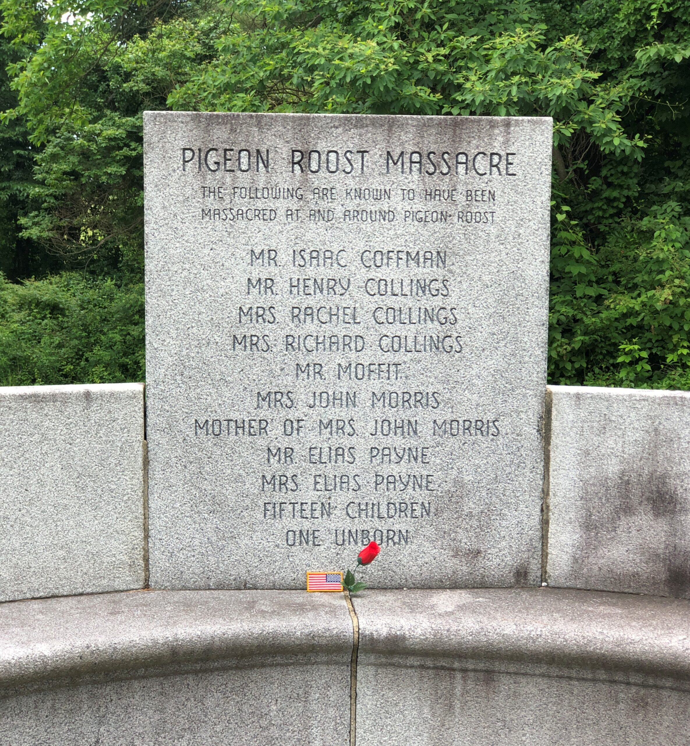
At some other point in the past, locals started burying their dead near the site.
Google Maps calls it Pigeon Roost Cemetery, aka Sodom Cemetery. The latter seems like an odd choice, but a quick look reveals a few others of that name, in Georgia, Ohio and Minnesota.
Google Local Guide Gary Collins has this to say about the place: This pioneer cemetery holds the remains of some of Southern Indiana’s earliest settlers, including some of the survivors of the infamous Pigeon Roost Massacre. At the time of the massacre, this cemetery had yet to be established, and some of the victim’s [sic] final resting places are unknown. It is generally well kept, and interments still occasionally take place.
What, no ghost stories about Pigeon Roost? Seems like perfect fodder for such tales: not only violent death, but the violent death of children and indeed entire families. There’s an opportunity here for making stuff up — I mean, paranormal investigations. What does Bachelor’s Grove Cemetery have that Pigeon Roost doesn’t?
