Colorado Plateau ’22 Leftovers

I’ve changed the name of this trip. What, doesn’t everyone name their trips? No? Anyway, Colorado Plateau ’22 is better than the ridiculous NV-AZ-UT 22, which looks like a part number in a tool-and-die factory.

But not quite all on the Colorado Plateau. Just outside Las Vegas, maybe five or so miles from where  that city finally peters out on I-15 toward Los Angeles, is Seven Magic Mountains.Seven Magic Mountains Seven Magic Mountains Seven Magic Mountains

Magic, maybe, mountains no, at least not in any literal sense. An art installation by Ugo Rondinone, a Swiss artist.

We only passed through Zion NP, stopping only for a few minutes on the side of the road.Zion NP Zion NP Zion NP

Near the entrance.Zion NP

At the entrance.Zion NP

A different entrance: Grand Staircase-Escalante National Monument. A small bit of the vastness of the place, more than 1.8 million acres.
Grand Staircase-Escalante NM

I knew that was a road I wanted to drive a little ways at least, to check out the views. My instincts were right.Grand Staircase-Escalante National Monument Grand Staircase-Escalante National Monument Grand Staircase-Escalante National Monument Grand Staircase-Escalante National Monument

When we were nearly in Page, Arizona, we stopped for a few minutes at a viewpoint over Lake Powell. I was flabbergasted by how low the lake looks.Lake Powell 2022 Lake Powell 2022

And so it is. The lowest level since the lake was built. Lake Mead is low as well, so much so that (possible) mob hit victims have been discovered. Apparently the idea of draining Lake Powell to fill Lake Mead is being entertained by officialdom, I read, though it’s hard to know how seriously.

The cookers at Big John’s Texas Barbecue in Page.Big Johns Texas Barbecue Page Arizona Big Johns Texas Barbecue Page Arizona

Man, Big John made some mean ‘cue in those cookers.

The Lake Powell Motel, also in Page, where we stayed. For the second time. We were there in 1997. A one-minute walk to Big John’s.Lake Powell Motel

When we stayed there 25 years ago, the property was called Bashful Bob’s Motel. Sometime in the 2010s, new ownership changed the name and spent a fair amount renovating the interiors so that they are pretty nice two-bedroom apartments. Back in the late ’90s, the rooms were old, but pleasant. I wonder if I have the ’97 bill somewhere to compare rates. Maybe.

Also, it’s clear that the owners had to renovate to compete with the numerous chain hotels in the town. Bashful Bob didn’t a lot of that kind of competition in the old days, just  smaller properties, a few of which linger still in Page.
Red Rock Motel Page Arizona

The Red Rock started as housing for workers building Glen Canyon Dam, built in 1958 by the Bureau of Reclamation. Actually, I suspect Bashful Bob’s started out that way as well.

In Moab, Utah, we stayed at the Apache Motel. We found it a most pleasant place to stay, and with a touch of movie history to it.Apache Motel Moab Utah Apache Motel Moab Utah

Clean, comfortable, not particularly cheap or expensive, feeling very much like a ’50s motel, though with a few modifications. The motel doesn’t let you forget that the Duke stayed there when filming movies nearby. Other stars did too.Apache Motel Moab Utah

One more feature at Temple Square in Salt Lake City: the Handcart Pioneer Monument.
Handcart Memorial

More Mormons in metal: The centerpiece of the This is the Place Heritage Park, which is on a hill at the edge of the city, where B. Young reportedly told his followers This is the Place, as in, to settle. We dropped by for a short look.This is the Place This is the Place

At the base of the memorial are six figures depicting important in the history of this part of Utah who weren’t Mormons, such as a couple of fur trappers, a chief of the Shoshone, plus adventurers and explorers.

Including this fellow, John C. Fremont.
This is the Place, John Fremont

That’s my presidential site for the trip. Ran for president in ’56, after all.

High Desert Flora

Not quite all the places we visited in May count as high desert, but mostly that’s what we saw, including a wide variety of plants. I looked at them mostly for aesthetic enjoyment, since I’m woefully ignorant about natural history, and when I try not to be, the information mostly isn’t retained by the sieve of my mind.

Still, I know a Joshua Tree when I see one. These were outside Las Vegas. The further east you go from there, the fewer you see.Joshua Tree, Nevada Joshua Tree, Nevada

Smaller than many of the yuccas at Joshua Tree NP, but Yuriko, who hasn’t visited that park, was suitably impressed.

Moving on, flora at Zion National Park.

Grand Staircase-Escalante National Monument.Grand Staircase-Escalante NM

Owl Canyon, near Page, Arizona. Amazing the places life can cling.Owl Canyon, Arizona

Also near Page.
Near Page, Arizona

National Bridges National Monument.
Natural Bridges NM

Arches National Park.Arches National Park Arches National Park Arches National Park

Canyonlands National Park.Canyonlands National Park Canyonlands National Park

Salt Lake City.Salt Lake City flowers 2022 Salt Lake City - City Creek Park

The flowers were at Temple Square, near the Assembly Hall. The second image doesn’t look much like a city view, but it was, in City Creek Natural Area. The ground gets pretty steep pretty fast as you move away from downtown.

A 180-degree turn at that point, and you see this.Salt Lake City - City Creek Park

A nice change from desert scrub, though desert flora has its fascinations.

Canyonlands National Park

In 2021, Arches NP had more than 1.8 million visitors, making it the 16th-most popular U.S. national park among the 63, while Canyonlands National Park had about half as many, 911,000, or the 28th-most popular park. It’s an interesting example of the beaten-path phenomenon.

That’s because it’s a five-minute drive to Arches from Moab, the sizable town where people stay to visit the park, and indeed where we stayed. The closest entrance to Canyonlands, on the other hand, is about 40 minutes away from Moab. Not a long drive, but not nearly as close as Arches, so that’s where people go.

So many, in fact, that this year the NPS is trying out a timed-entry system to Arches, to avoid huge lines at the park’s single vehicle entrance early in the morning. To space visitors out, that is. I reserved a time months ago, 9 a.m., so it was no problem getting in, and the park didn’t seem too crowded as the day went on, though certainly a fair number of people were around. Maybe the system is working.

In any case, I wasn’t about to miss Canyonlands, at least part of it. Two weeks ago, we left Moab for Salt Lake City, spending the morning of May 20 at Canyonlands. Or rather, at the Island in the Sky District of the park, a poetic naming choice that sums up the region nicely.

The day was overcast, and about 20 degrees cooler — the 60s F. rather than the 80s — than the day before in Arches. A front had blown through the night before.Canyonlands National Park

Unlike Arches NP, Canyonlands is fairly large (more than 337,000 acres), and like Gaul, divided into three parts. Island in the Sky, but also The Maze and The Needles, separated mostly by the courses of the mighty Colorado and its almost as mighty tributary, the Green River.

Soon after entering Island in the Sky, you’re at the Shafer Canyon overlook.Canyonlands National Park Canyonlands National Park

Way down in the canyon is the unpaved Shafer Trail Road, which leads to the equally unpaved White Rim Road, a wide loop around Island in the Sky. We’d see that road later, from a different vantage. We’d also see, looking rice-grain small, a handful of vehicles on White Rim, including motorcycles kicking up pinpricks of colored dust and no doubt fulfilling a desert riding dream or two of their riders.

Further down the paved road is the short trail to Mesa Arch.Canyonlands National Park Canyonlands National Park Canyonlands National Park

Eventually, the arch is easy to spot.Canyonlands National Park Canyonlands National Park Canyonlands National Park

Quite a view under the arch.
Canyonlands National Park

It was here that the awesomeness of Canyonlands began to dawn on me. I was looking into a canyon — marked by its own, deeper complex of canyons.
Canyonlands National Park

Awesomeness was really hammered home when we got to a spot called Grand View Point Overlook. With a name like that, it’d better be good.

The territory near the Grand View. Nice, and a bit more reddish here, but little hint of things to come.Canyonlands National Park

The overlook itself. We walked a quarter-mile or more along the edge of the canyon — the wide canyon complex, reaching miles into the distance, created by the Colorado and the Green.Canyonlands National ParkCanyonlands National Park Canyonlands National Park

Wow. The atmosphere was a little hazy that day, but that hardly mattered. My images really don’t do the place justice, but that was a persistent theme on all of this trip.

Arches National Park

When you visit a place like southern Utah, you run through all the superlatives. In the moment, the wordless feeling as you stand in awe is enough. Later, you turn the bucket over, hoping that one extra-special word that fits what you’ve just seen will tumble out. But even the jewel cave that is English — to shift the metaphor — sometimes comes up short.

What would a Spanish speaker, whose linguistic predecessors have come here for centuries, say? Magnífico, espléndido, maravilloso? What do Germans, so many of whom seek out the desert Southwest in our time, use in such a situation? Großartig, herrlich, prachtig? What of the native tongues of the region? I’m mostly ignorant of those European languages, but vastly ignorant of those spoken on the Colorado Plateau for millennia, so I do not know.

All that is a long-winded intro to the vista we saw at Fiery Furnace in Arches National Park, where we spent most of the day on May 19.

“The Fiery Furnace is a natural labyrinth of narrow passages between towering sandstone walls called fins,” says a postcard I bought in the park. “The La Sal Mountains rise in the distance to nearly 13,000 feet…” Fiery Furnace Arches National Park

That isn’t a bad image, but it barely conveys the sweeping grandeur of the vista. Though different in most details — color, formation shape, vegetation — I instantly thought of Polychrome Pass in Alaska.

“The view toward the Alaska Range at Polychrome Pass is, I believe, the grandest vista I’ve ever seen,” I wrote last year.

At Fiery Furnace, I found its equal. Just like that. All the time, money and effort to reach this point seemed, all at once, entirely worth it, just to see what we saw. Of course, I had no doubt of that before, and not a vast amount of resources actually went into the trip, since travel is easy in our time, but still.

The marvels of Arches are many. By U.S. national park standards, it isn’t a large one, at about 76,600 acres (44th largest out of 63), but somehow more than 2,000 natural sandstone arches are packed into park. We saw a tiny but impressive fraction of these, and a lot else besides.Arches National Park

Perhaps the best known feature in the park is Delicate Arch, which is depicted on Utah license plates and a postage stamp commemorating the centennial of Utah statehood.

We didn’t get that close. We didn’t care to spend the energy to get there (increasingly with age, I’m learning to ration my energy). An easier trail takes you to a good if long-distance view of the arch, however.Arches National Park Arches National Park

I’ve centered the arch in this picture. If you look carefully, you’ll see people who did make the hike up to it.Arches National Park
Arches National Park

Broken Arch, on the other hand, we were willing to make the mile or so round trip on foot to see. But first, we popped in for a look at Sand Dune Arch. It’s in a slot canyon just off the way to Broken Arch.Arches National Park
Arches National Park

Which eventually tightens up considerably.Arches National Park

The arch itself is off in a wider place in the canyon.
Arches National Park

Note the sand. The color of Mars, but the exact texture of warm beach sand on Earth. My shoes had to come off for a while.
Arches National Park

But they were back on for the hike to Broken Arch, along this path.Arches National Park Arches National Park Arches National Park Arches National Park

Eventually, you arrive at the arch, which is cracked if not broken.
Arches National Park Broken Arch

I looked at that view of the arch, and I couldn’t help thinking that it was going to say: A question. Since before your sun burned hot in space and before your race was born, I have awaited a question. That only goes to show the absurd conditioning I’ve submitted myself to in the form of entertainment, but never mind.

Another view.Arches National Park Broken Arch

Under the arch. Erosion didn’t take its ultimate toll while we were there, fortunately.
Arches National Park Broken Arch

Elsewhere in the park: long views of the La Sal Mountains and other vistas.Arches National Park La Sal Mountains Arches National Park La Sal Mountains Arches National Park La Sal Mountains
Arches National Park La Sal Mountains

Except for lizards, wildlife was a little hard to spot, but not impossible.
Arches National Park

Balanced Rock. Apt name, I’d say.Arches National Park Balanced Rock Arches National Park Balanced Rock Arches National Park Balanced Rock

Mushroom cloud rock, I’d say about that view. The rock stayed balanced while we were there. One of these days, though — tomorrow, 100 years from now — down it will come. Our still images and even our eyes deceive us: the landscape is always in motion.

Grand Canyon National Park, North Rim

There is one way to drive on paved roads from Page, Arizona, to the North Rim of Grand Canyon National Park, at least without going way out of your way. Go south from Page on U.S. 89, then north on U.S. 89A, then south on Arizona 67. If that sounds a little roundabout, it is, but the drive is worth every minute you spend. It takes two to two-and-a-half hours if you don’t stop much.

Eventually, you end up at the park, famed the world over.Grand Canyon National Park

As the raven flies, and we saw a fair number of them soaring on the air currents around the canyon, it is about 10 miles from the North Rim to the South Rim. Driving from the North Rim to the South involves more than 200 roundabout miles.

The South Rim has fairly close access to a large metro area — Phoenix — and the sizable town of Flagstaff as a closer jumping off point. That’s what we did in 1997. It occurs to me that we visited the canyon this time two days short of exactly 25 years after the first time.

The nearest town to the North Rim is Page, reached as I’ve described. Not exactly remote, but certainly out of the way. In 2021, about 221,000 visitors came through the North Rim entrance when it was open May through mid-October, according to NPS stats. (The road is snowed in much of the year.) So for every one visitor to the north last year, there were 10 to the south, with about 2.2 million visitors coming to the South Rim during 2021.

When we got to the North Rim last Tuesday morning, the place was popular enough, but not overrun. Even mere feet away from the Grand Canyon Lodge North Rim parking lot, which is where the road into the park ends, the view doesn’t disappoint.Grand Canyon National Park

The lodge itself, just opened for the season two days earlier, is perched on the rim, and built from native stone and timber, especially Kaibab limestone from the nearby cliff at Bright Angel Point.Grand Canyon National Park

People were perched on the lodge viewpoints.
Grand Canyon National Park

Through a subsidiary, the Union Pacific Railroad originally developed the lodge in the 1920s, though the first structure burned down after only a few years, and was rebuilt  somewhat differently in the ’30s. Design by Gilbert Stanley Underwood, who specialized in lodges and railroad stations. He also designed 140 cabins surrounding the main lodge by 1928.

“Erected in 1927-28, this is the most intact rustic hotel development remaining in the National Parks from the era when railroads, in this case the Union Pacific, fostered construction of ‘destination resorts,’ ” says the National Historic Landmarks listing for the building.

“The main lodge building was rebuilt in 1936 following a devastating fire, but its most important interior spaces retained their scale, materials and flavor, and the deluxe cabins and standard cabins of log and stone construction also kept their fabric, layout and ambiance.”

From the lodge, Bright Angel Point is a 10-minute walk along a trail created by — no need to guess very hard — CCC workers. Those lads need to be honored with a bronze on the grounds somewhere, though I might have missed it.Grand Canyon National Park Grand Canyon National Park Bright Angel Point Grand Canyon National Park Bright Angel Point

Out at Bright Angel Point. Let’s just say there were impressive views. And an impressive wind whipping by.Grand Canyon National Park Bright Angel Point Grand Canyon National Park Bright Angel Point Grand Canyon National Park Bright Angel Point

We didn’t have the place to ourselves, but sometimes, almost.
Grand Canyon National Park Bright Angel Point

We had lunch in the lodge restaurant, an enormous space with high ceilings, dark woods and towering windows to bring the view of the canyon into room. The food: decent. The view: magnificent.

A separate trail leads away from the lodge and heads toward the campgrounds, a few miles away. We walked part of that trail, which generally follows the rim.Grand Canyon National Park North Rim

Offering its own views.Grand Canyon National Park North Rim

A return trail cuts through a pine forest, with no notion of the yawning canyon a short distance away.Grand Canyon National Park North Rim Grand Canyon National Park North Rim

Sometimes, we had to go around the trees lying across the trail.Grand Canyon National Park North Rim

There’s a life metaphor in that somewhere, but on the other hand, a walk in the woods is sometimes just a good ramble.

NV-AZ-UT ’22 (Or, How to Overdose on Western Scenery in a Week)

Years ago, I got to talking scenic destinations with a professional photographer who contributed to the Chicago-based magazine I edited at the time. He asked me if I’d ever been to Utah. I told him I had: northern Utah, including Cache Valley and Salt Lake City, which I’d visited in the early ’80s. Pretty places, I said.

“Northern Utah is pretty,” he said. “But southern Utah is ethereal.”

Later, after I visited Zion and Bryce National Parks, I was inclined to agree. But of course I wanted to see more. This year, I did. Yes, photographer whose name I wish I could remember. Ethereal. Absolutely.

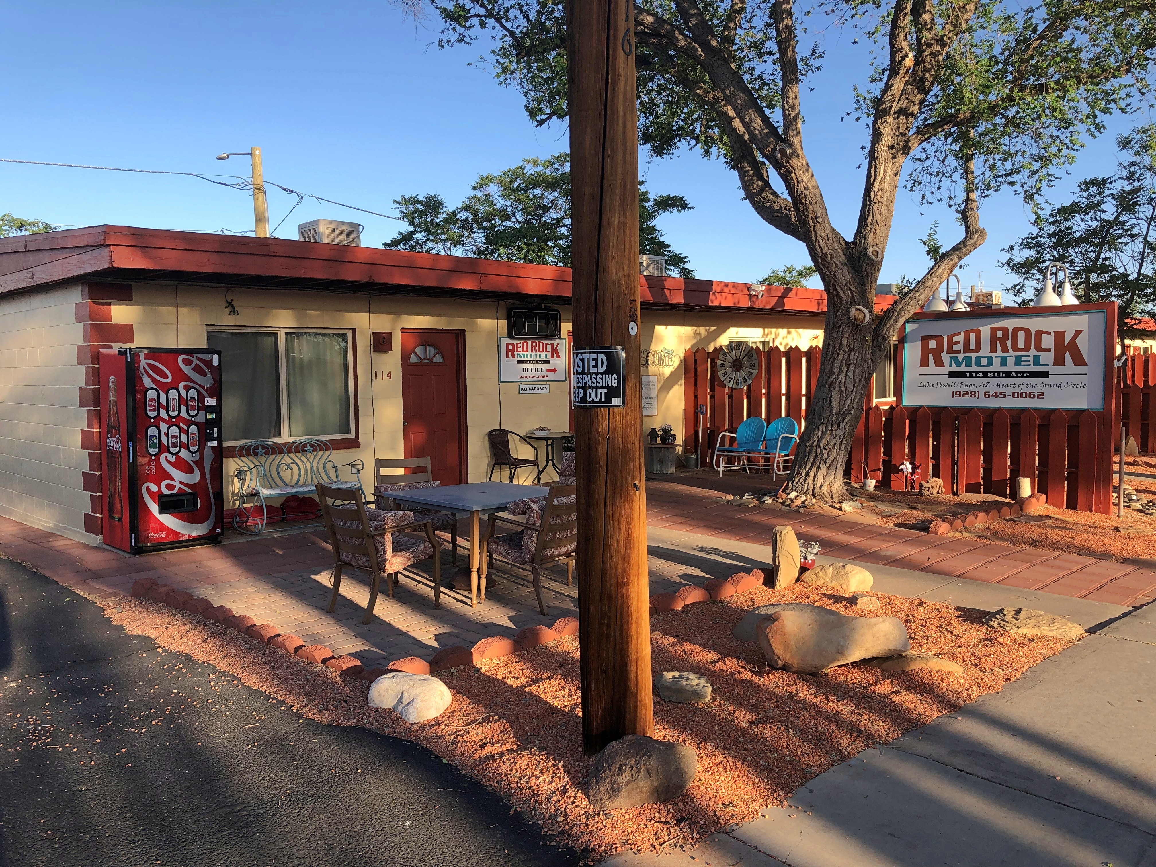
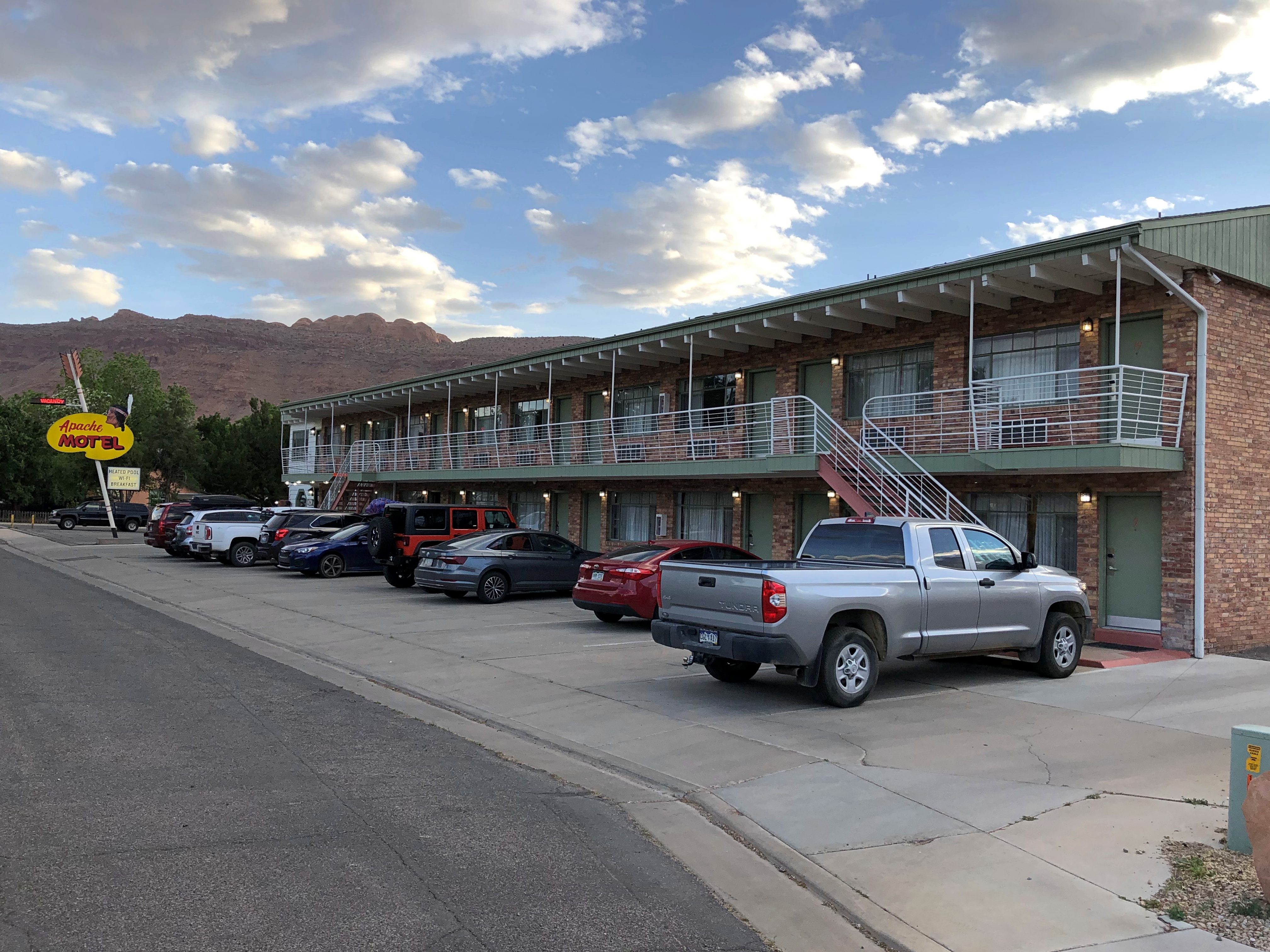
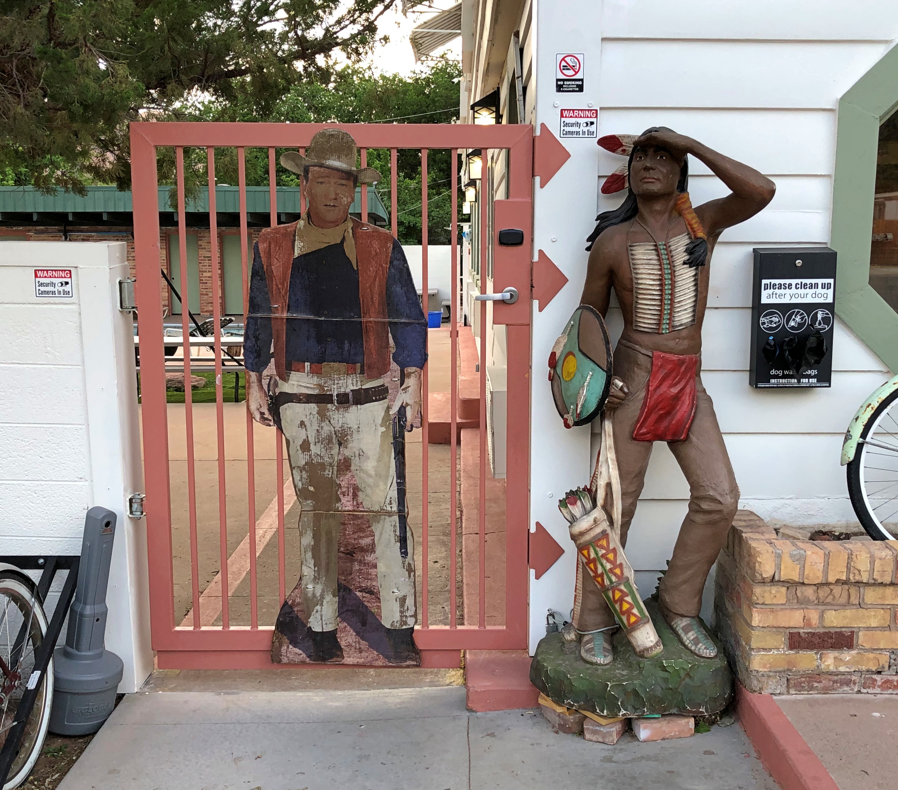
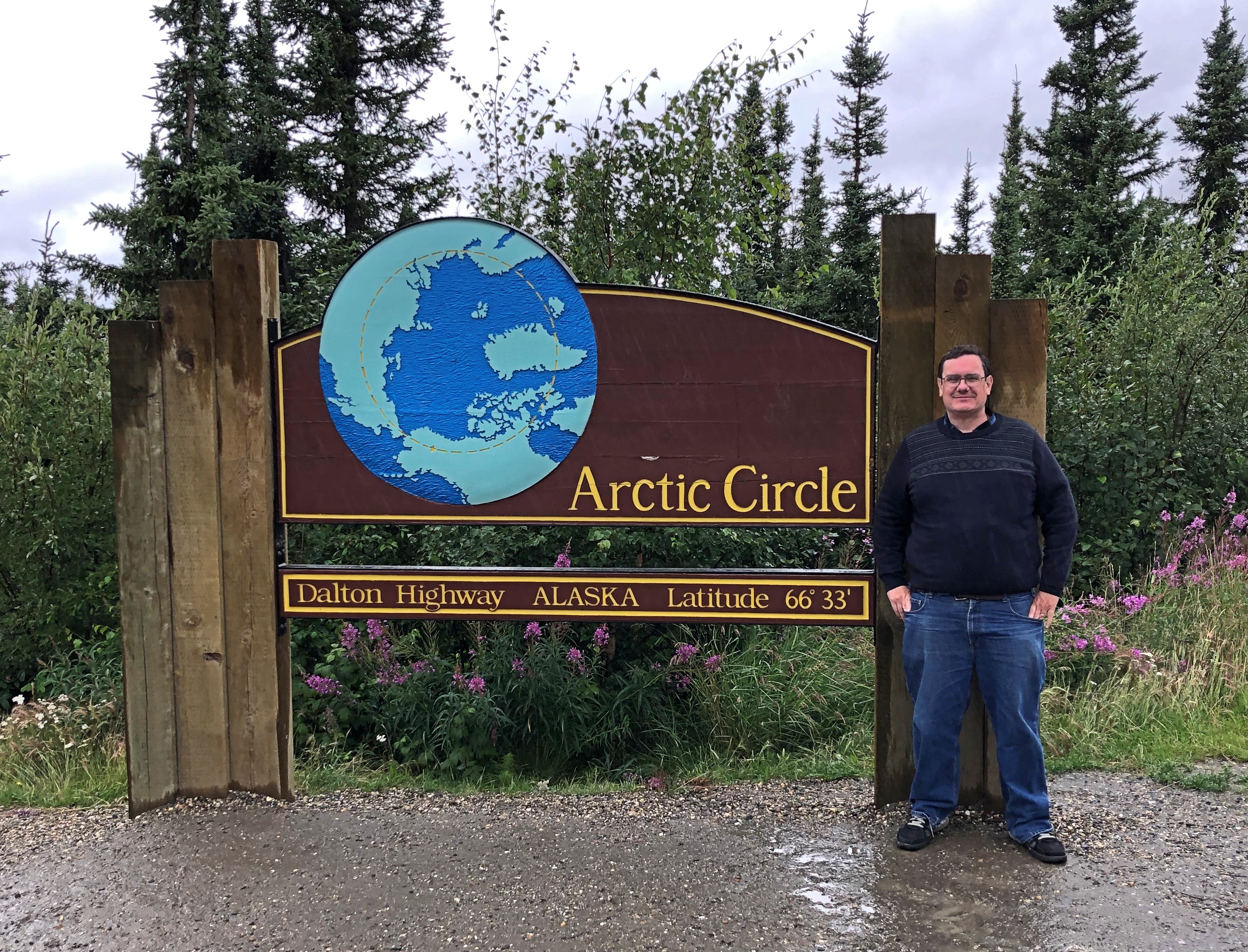
Saturday before last, Yuriko and I flew to Las Vegas, returning late this Sunday from Salt Lake City. Two days in transit, seven on the road. In that time, we visited four national parks, three national monuments and two tribal parks, all in either Arizona or Utah. We spent a little time in the aforementioned major metros, plus more time in two tourist towns — one in Arizona, the other in Utah — staying there in two non-chain motels, one of which is arguably historic. We passed through an array of other tiny towns and wide places in the road, stopping when the mood struck.

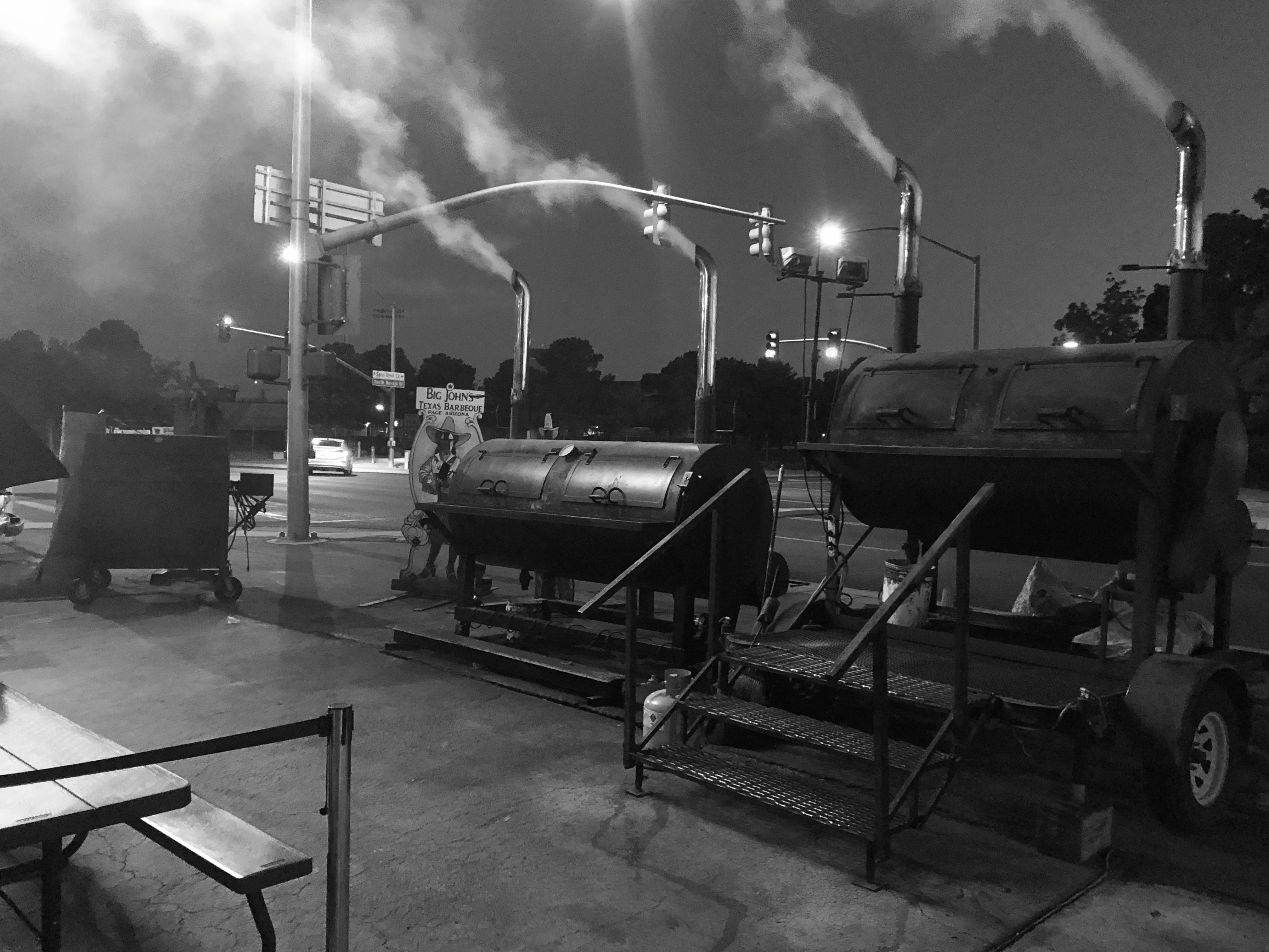
I’m glad to report we ate no fast food. Besides grocery store food in our rooms or at picnic tables, and motel-supplied breakfasts, we ate at local eateries: Vietnamese, a family restaurant, Southern fried chicken, doughnuts, Mexican, barbecue (Texas-style beef), a retro diner, Thai, pizza, Korean fried chicken and Chinese hot pot. A few of those restaurants were in the cities — Vegas and Salt Lake — but I can also report that here in the early 21st century, the American appetite for food variety has spread far and wide into a galaxy of smaller places.

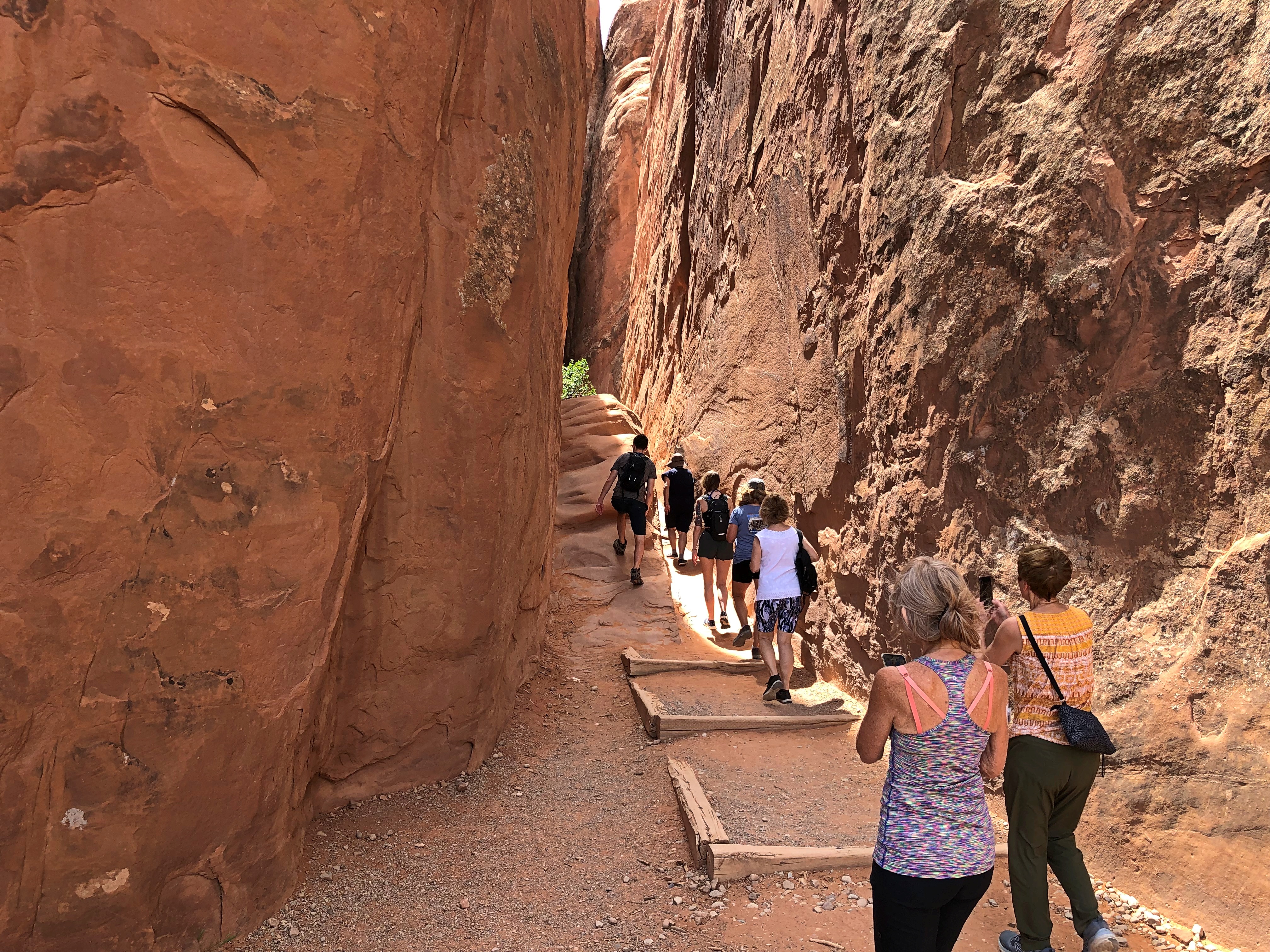
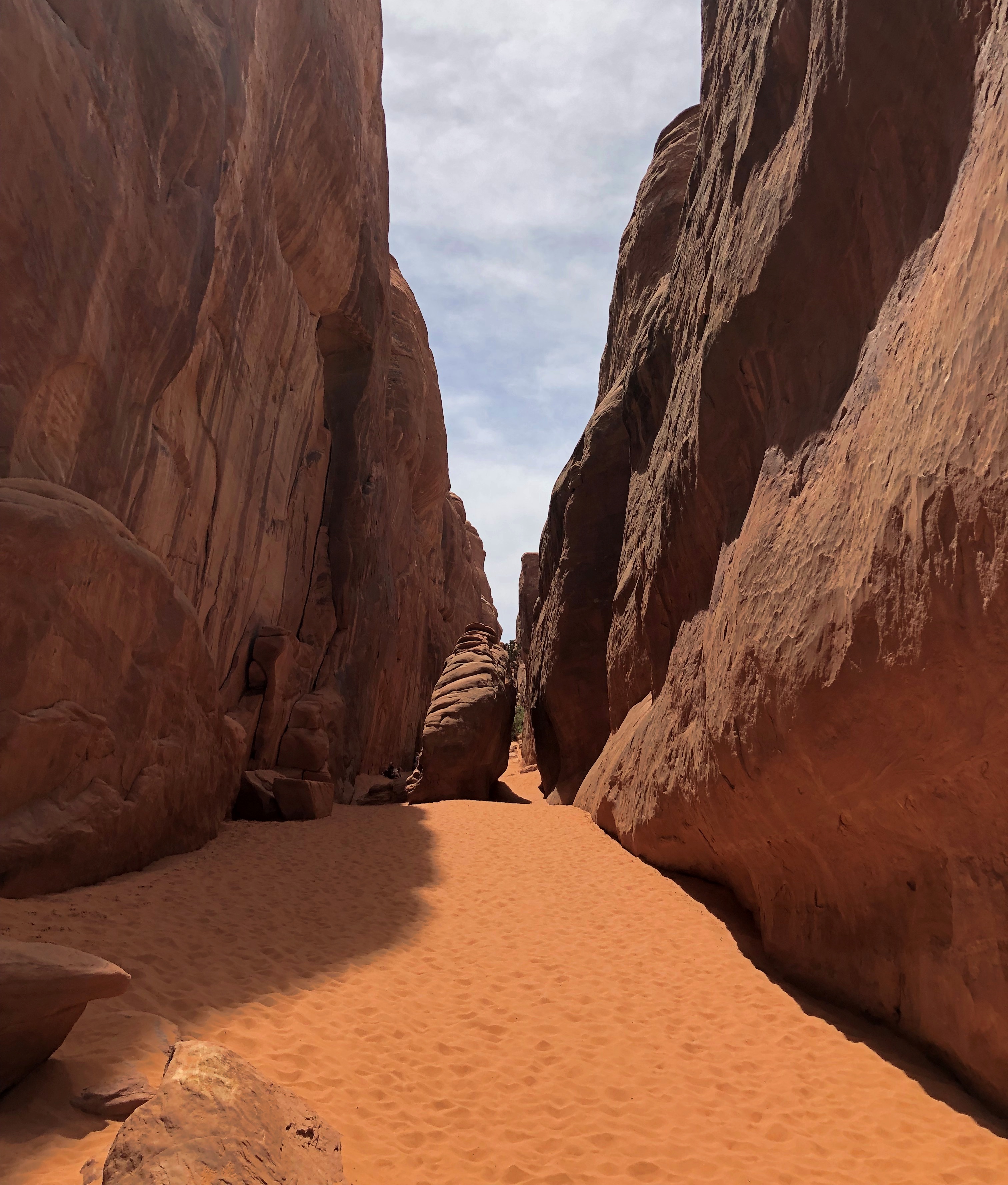
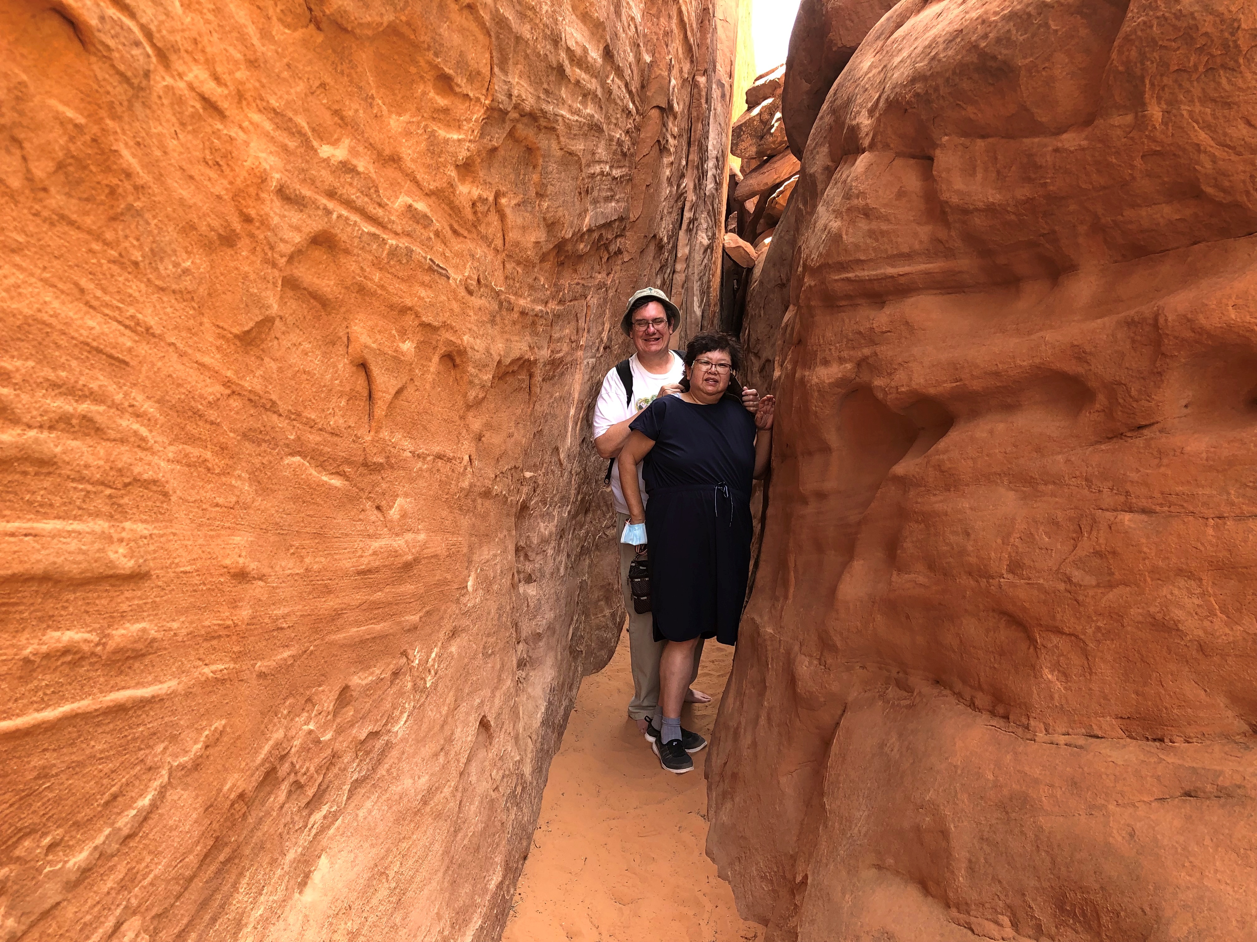
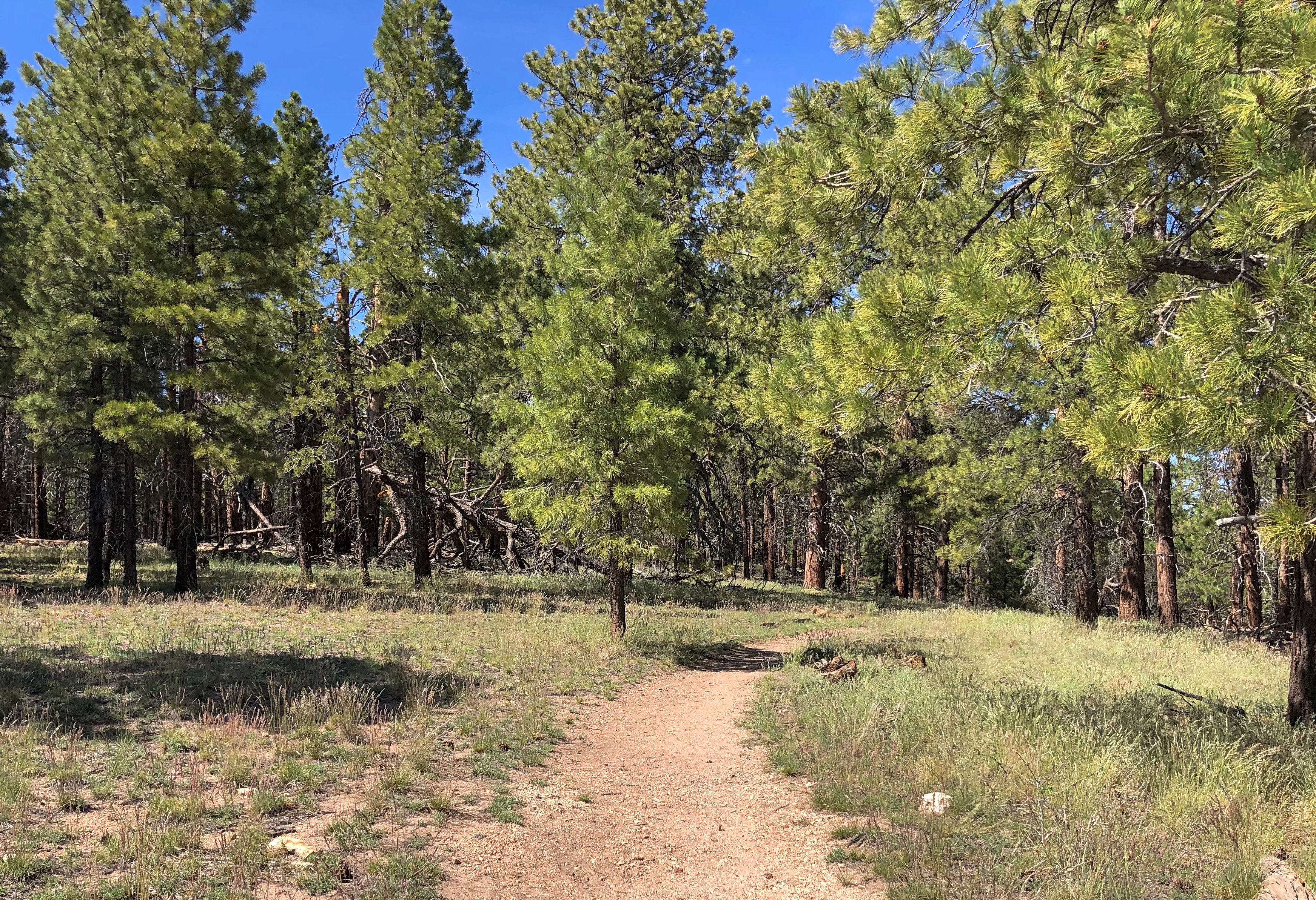
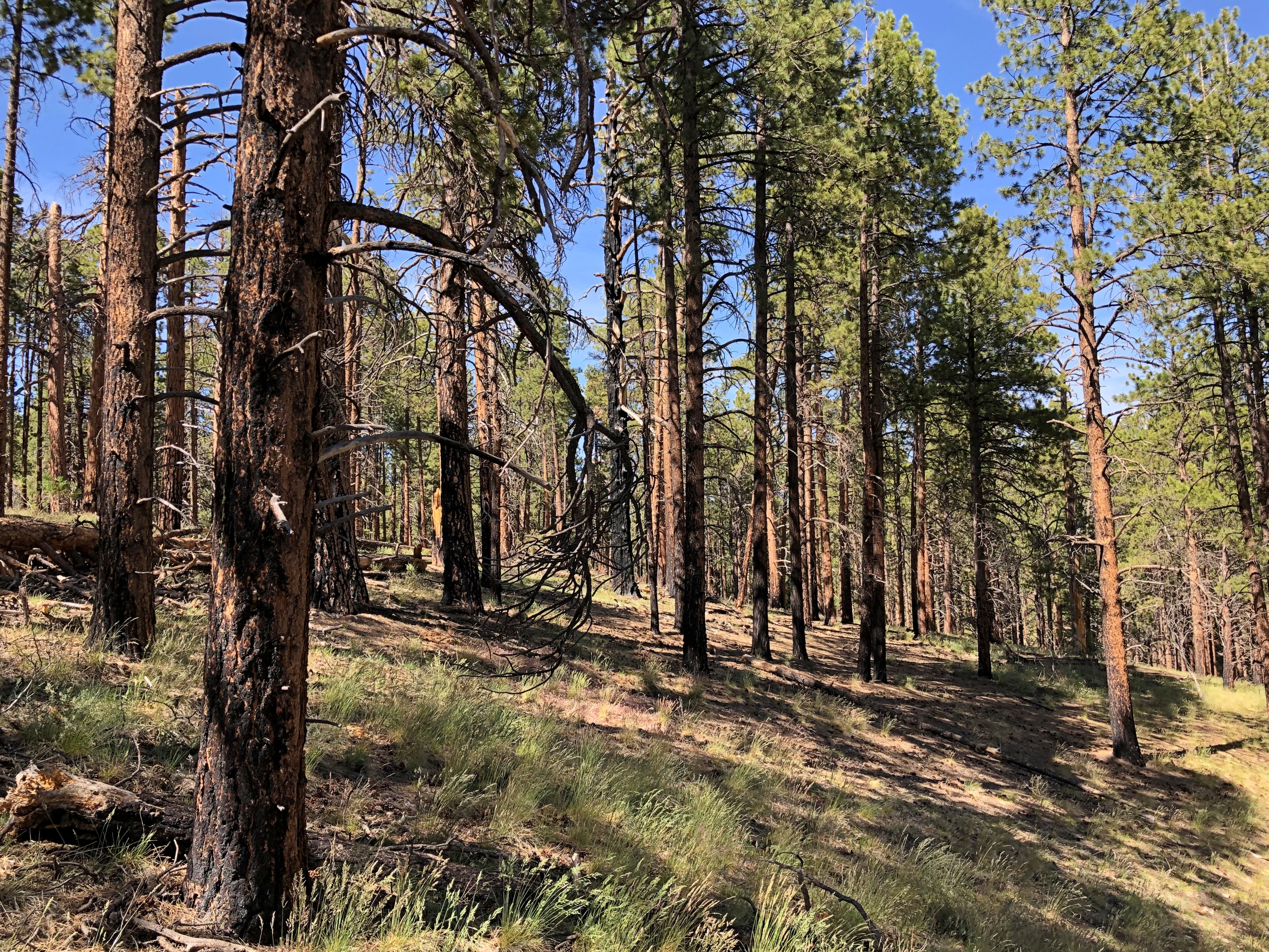
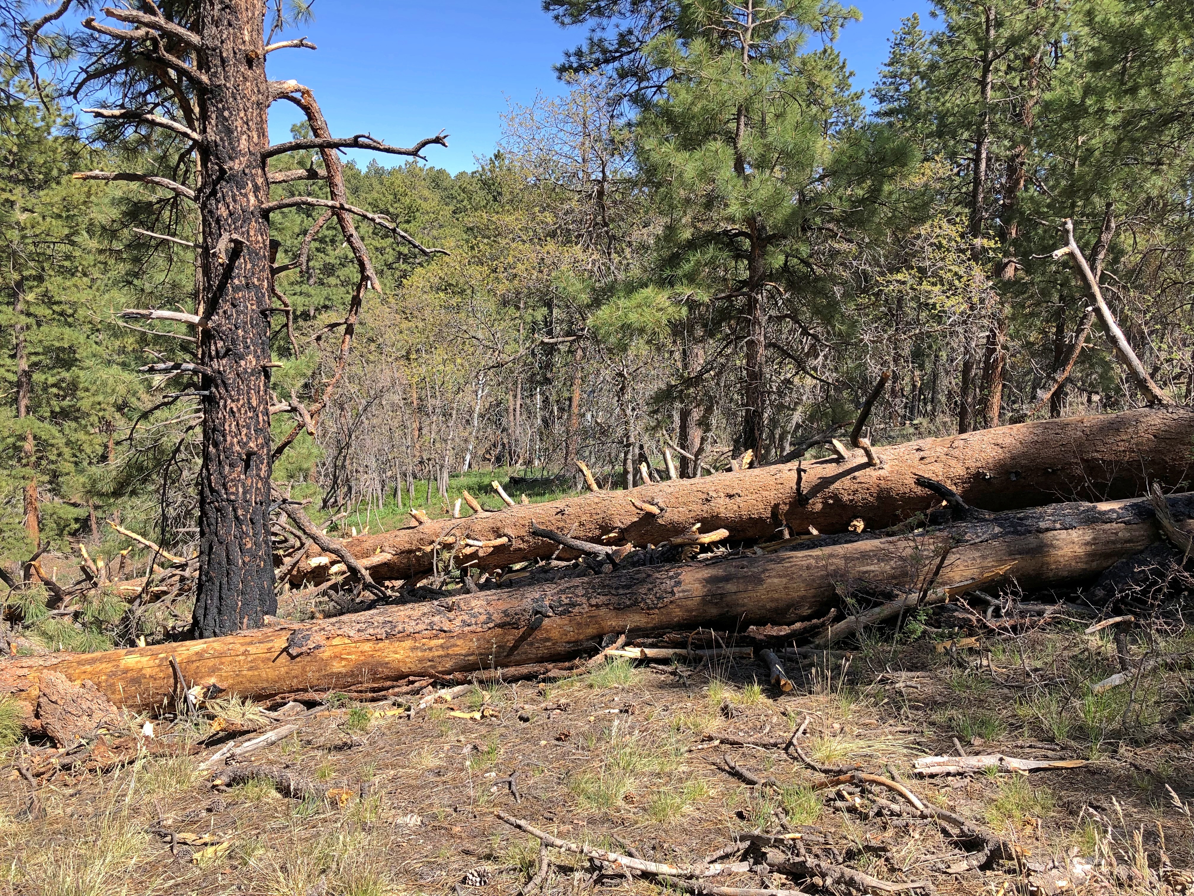
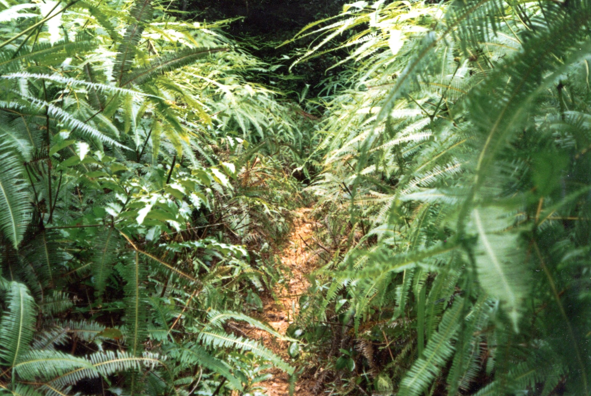
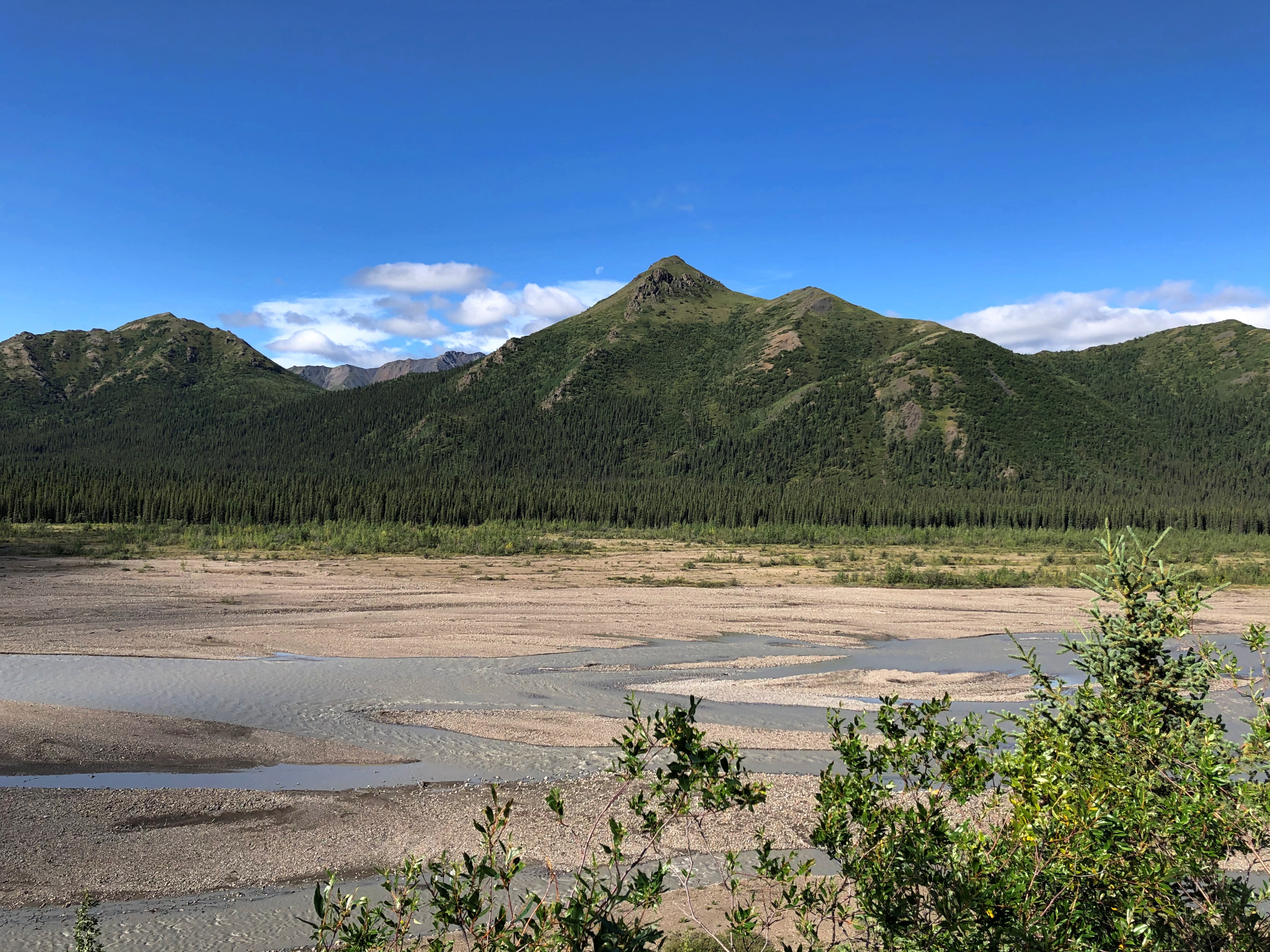
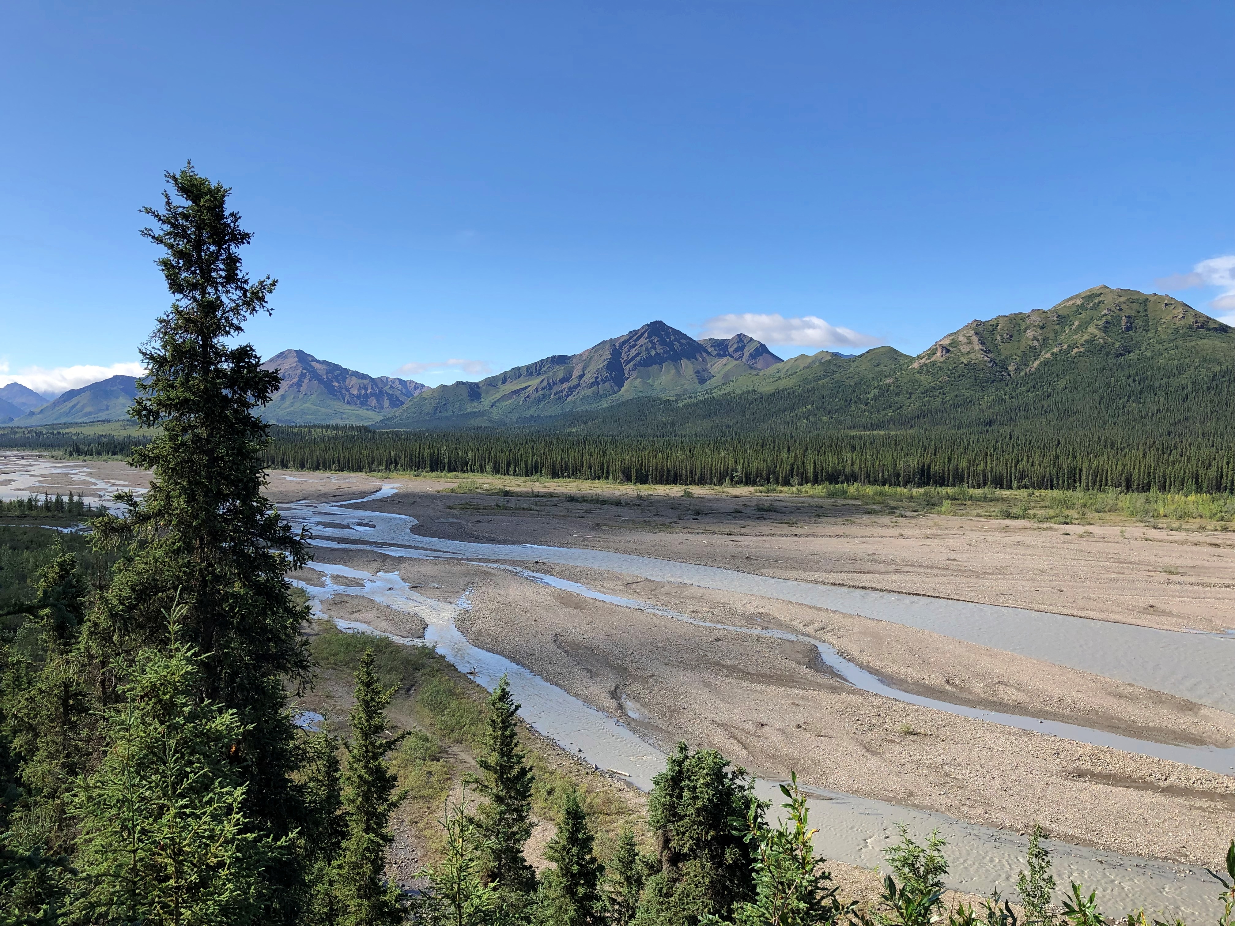
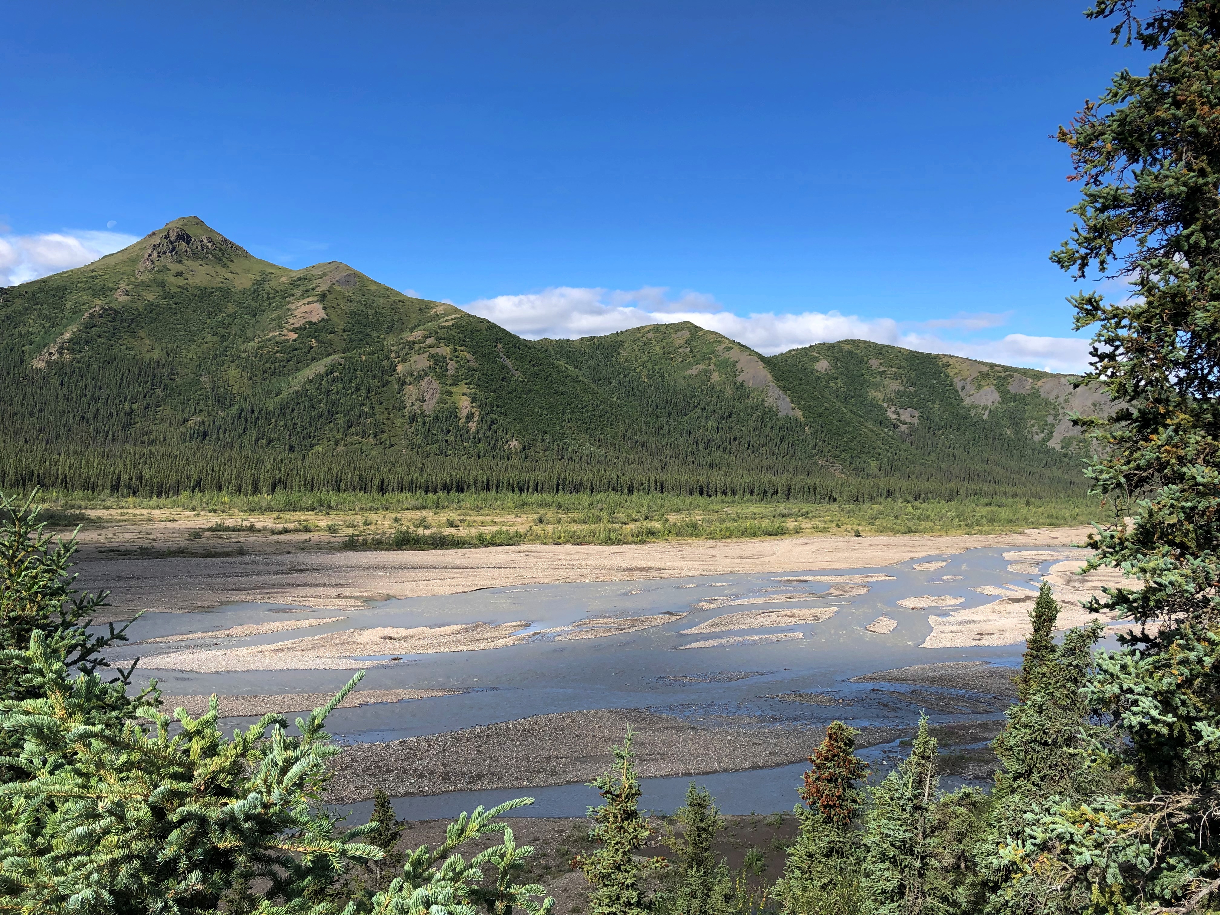
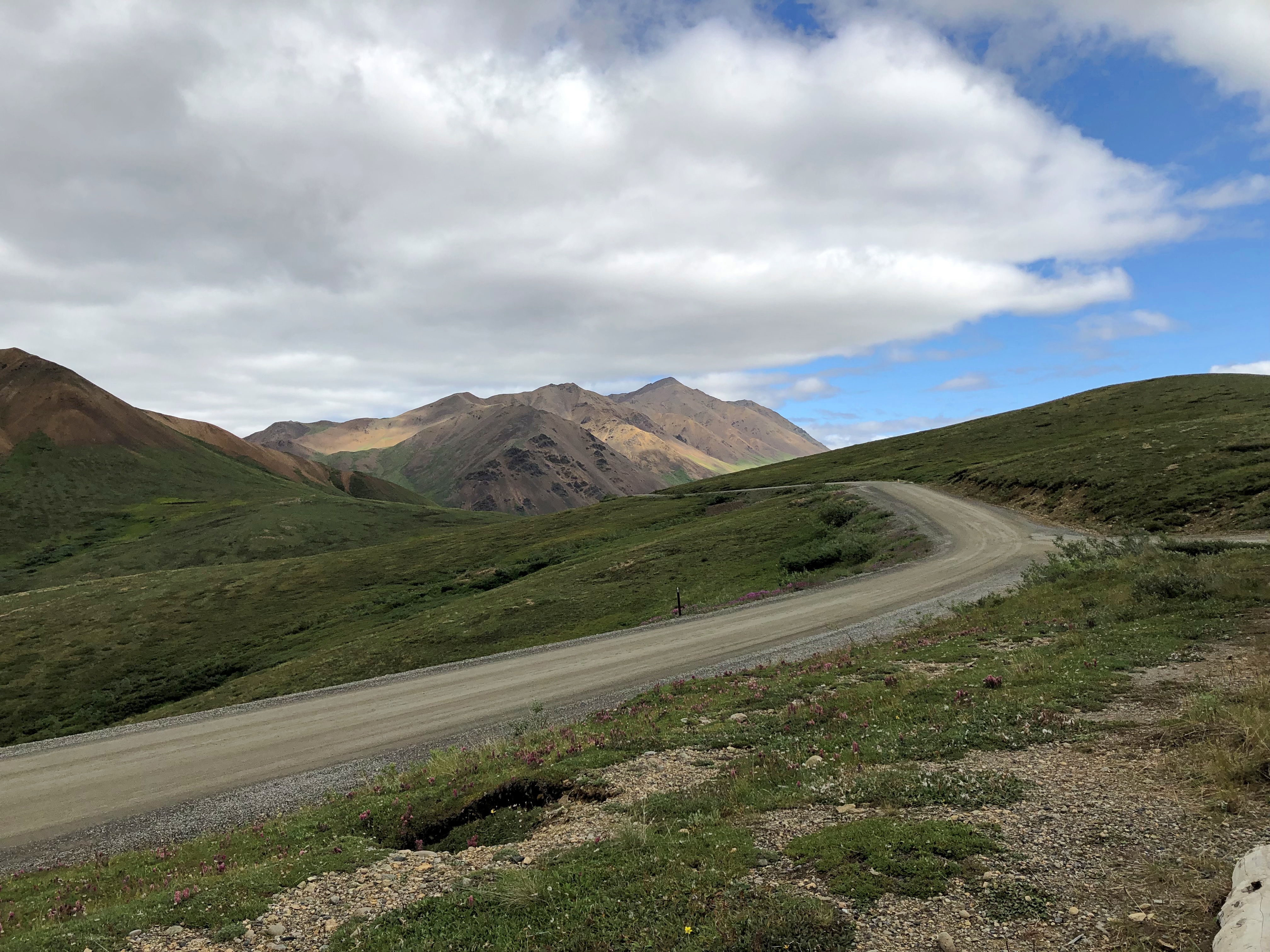
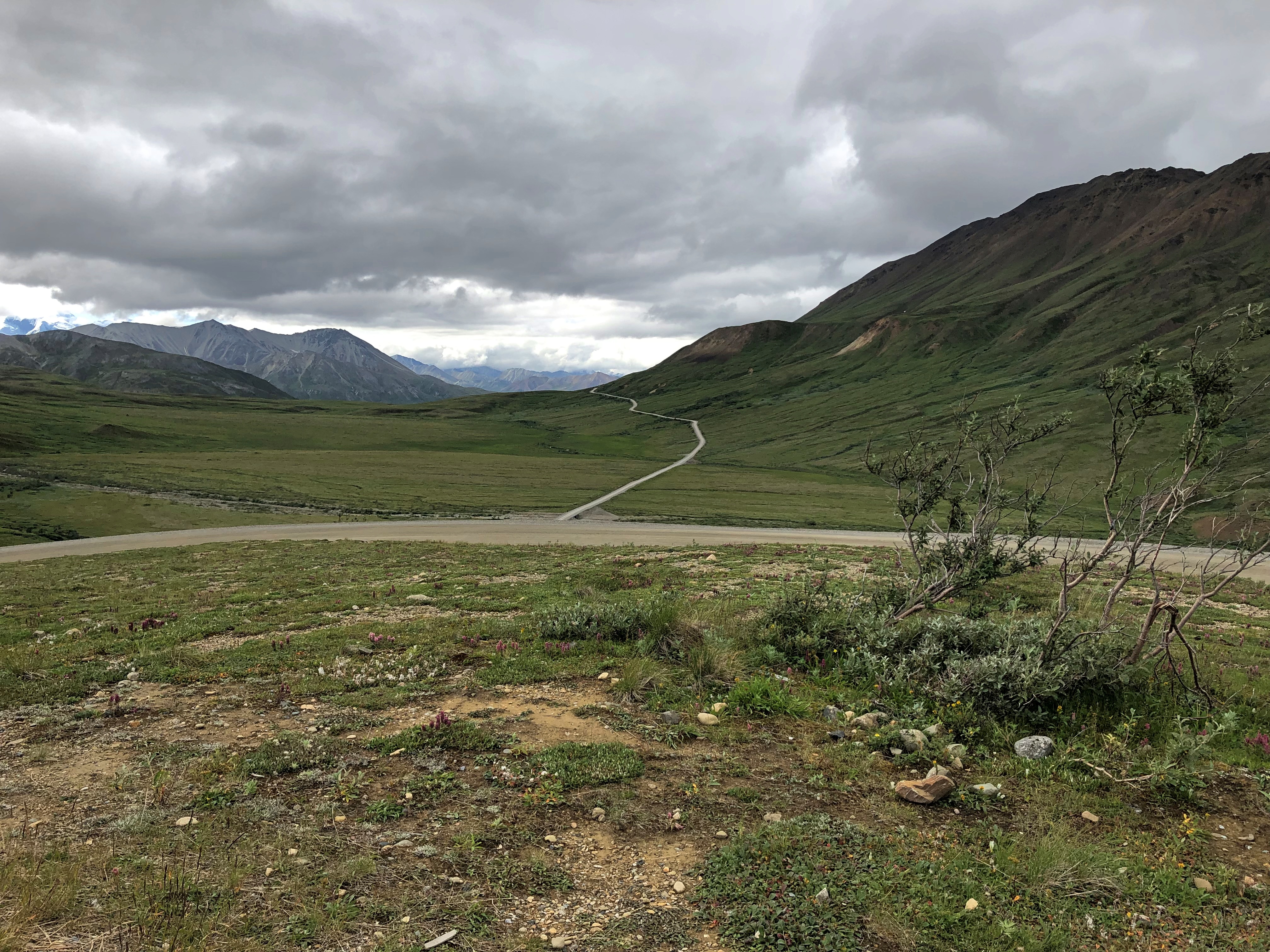
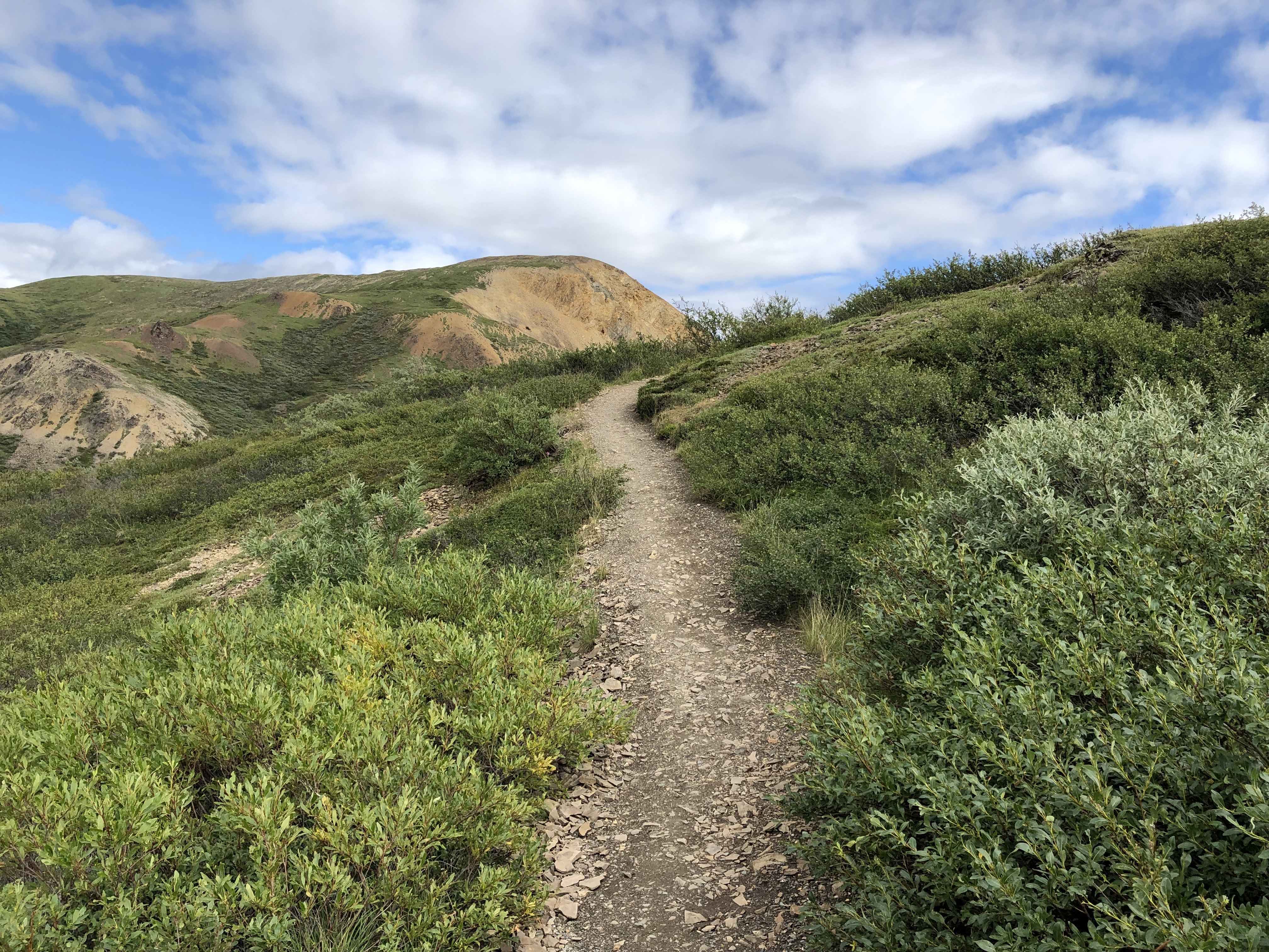
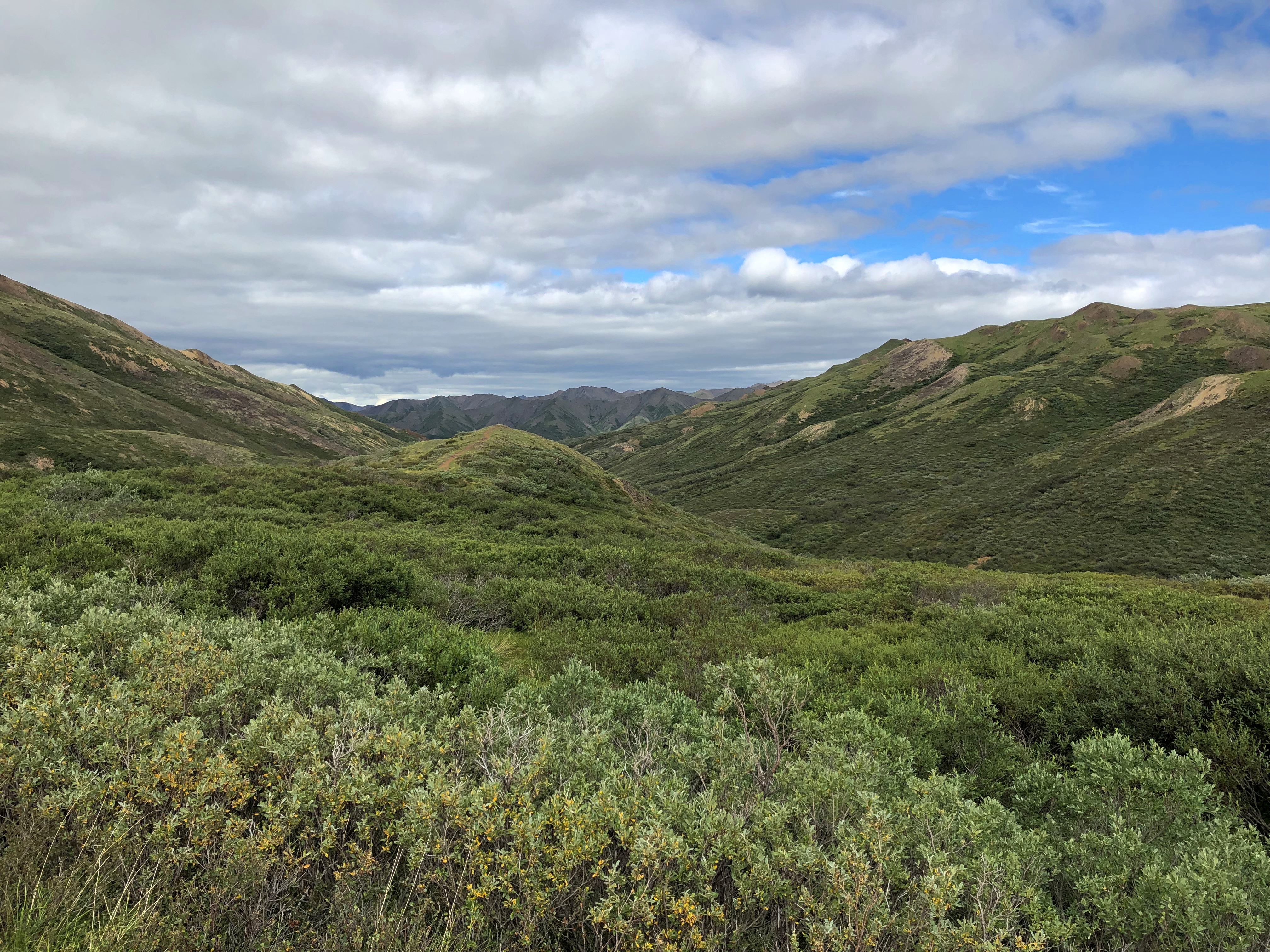
We drove briefly on Interstates, but mainly followed state, park and tribal roads, most paved, but not all. We walked a variety of trails, across sandy ground and over flat rocks, through woods but more often desert scrub. We crawled through slot canyons. All that under hot and copper skies, sunny or partly cloudy. Very warm, rather; in the 80s F. most of the time, except for a cooler spell on the last two days. Often as not, on the hot days, the wind kicked up and cooled us off, besides blowing sand at our faces and threatening to whisk our hats off high cliffs.

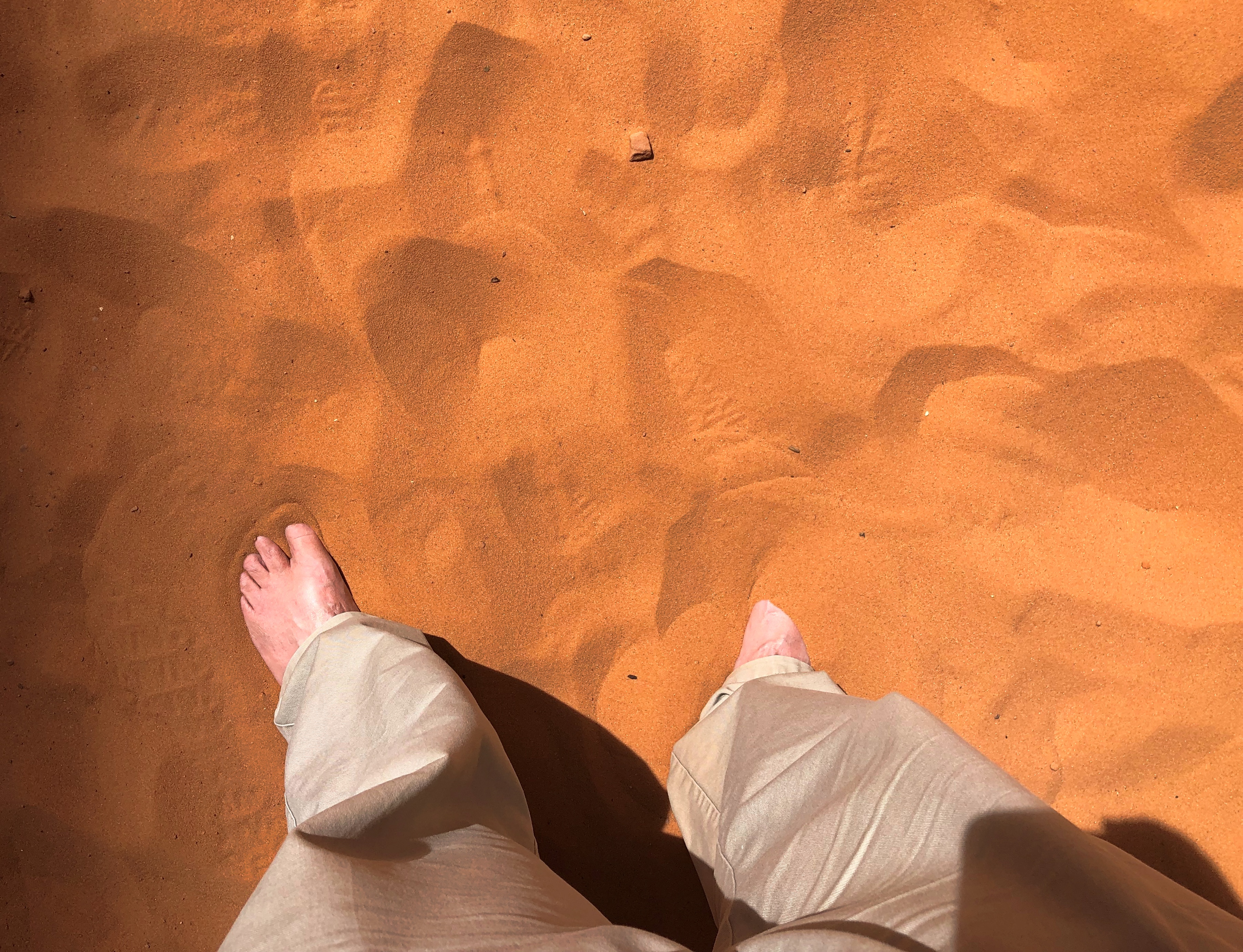
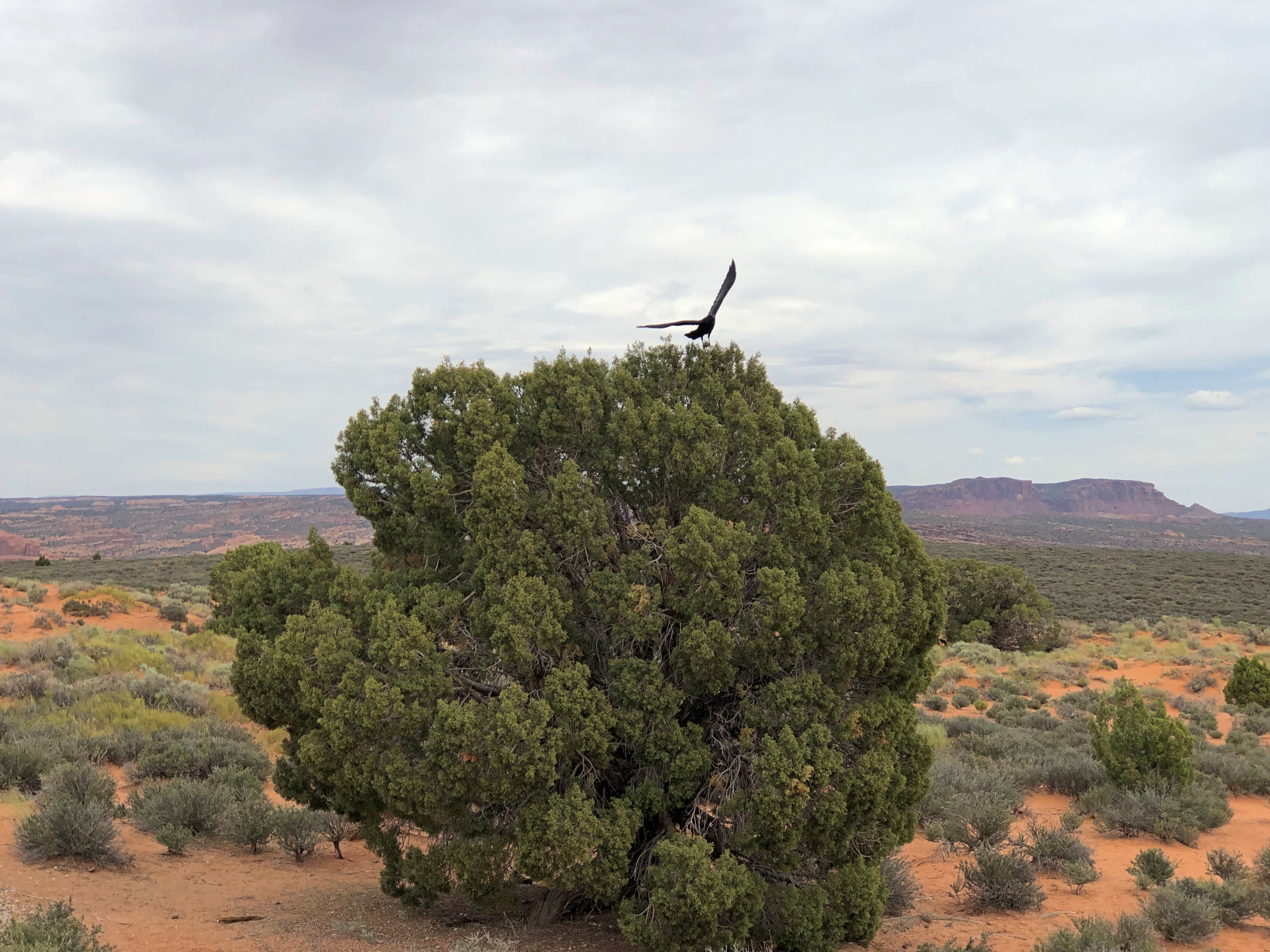
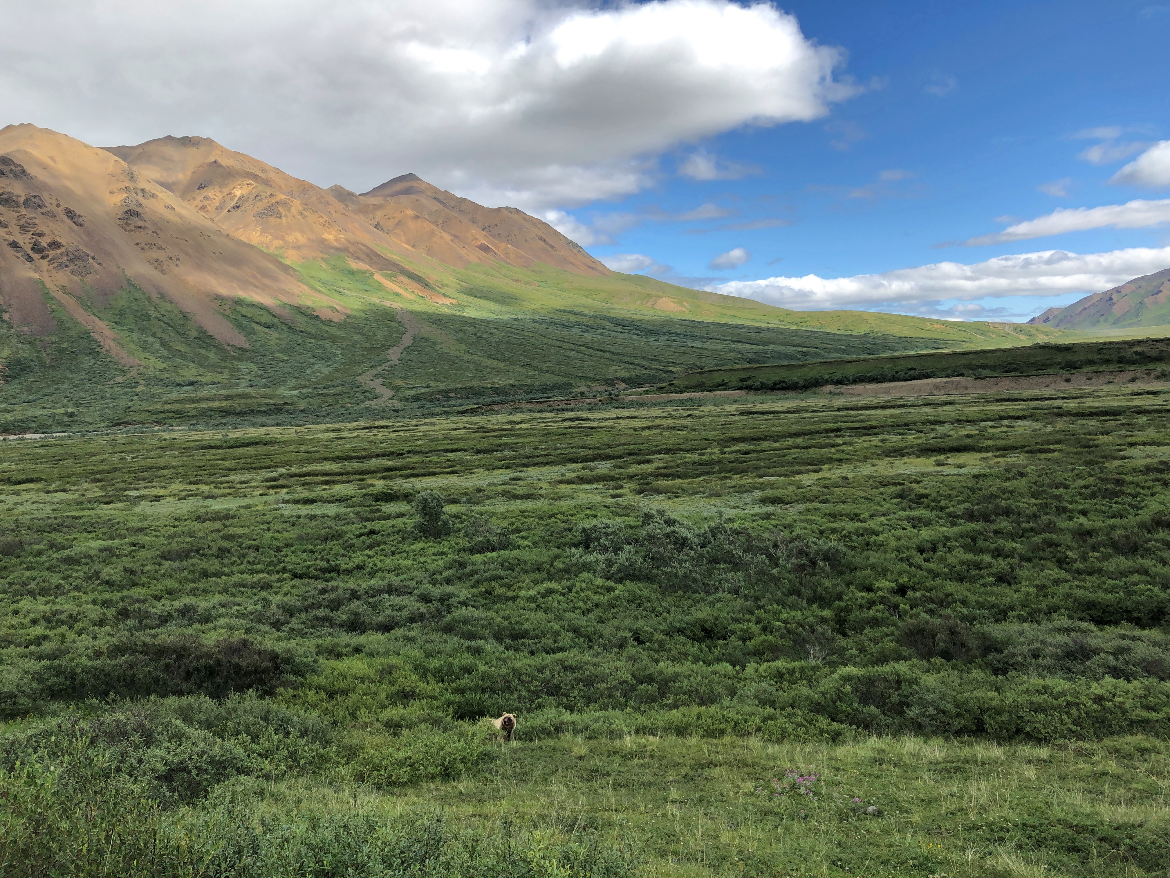
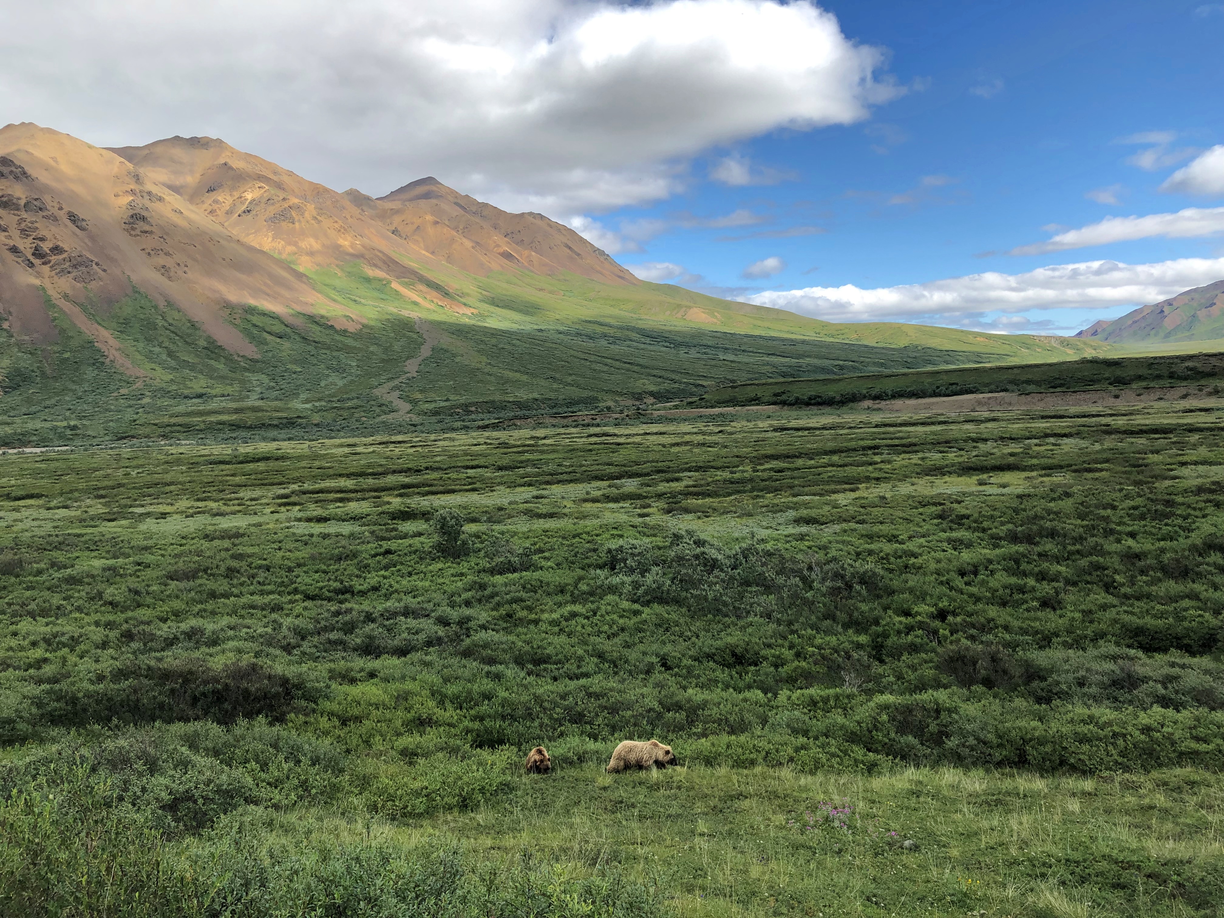
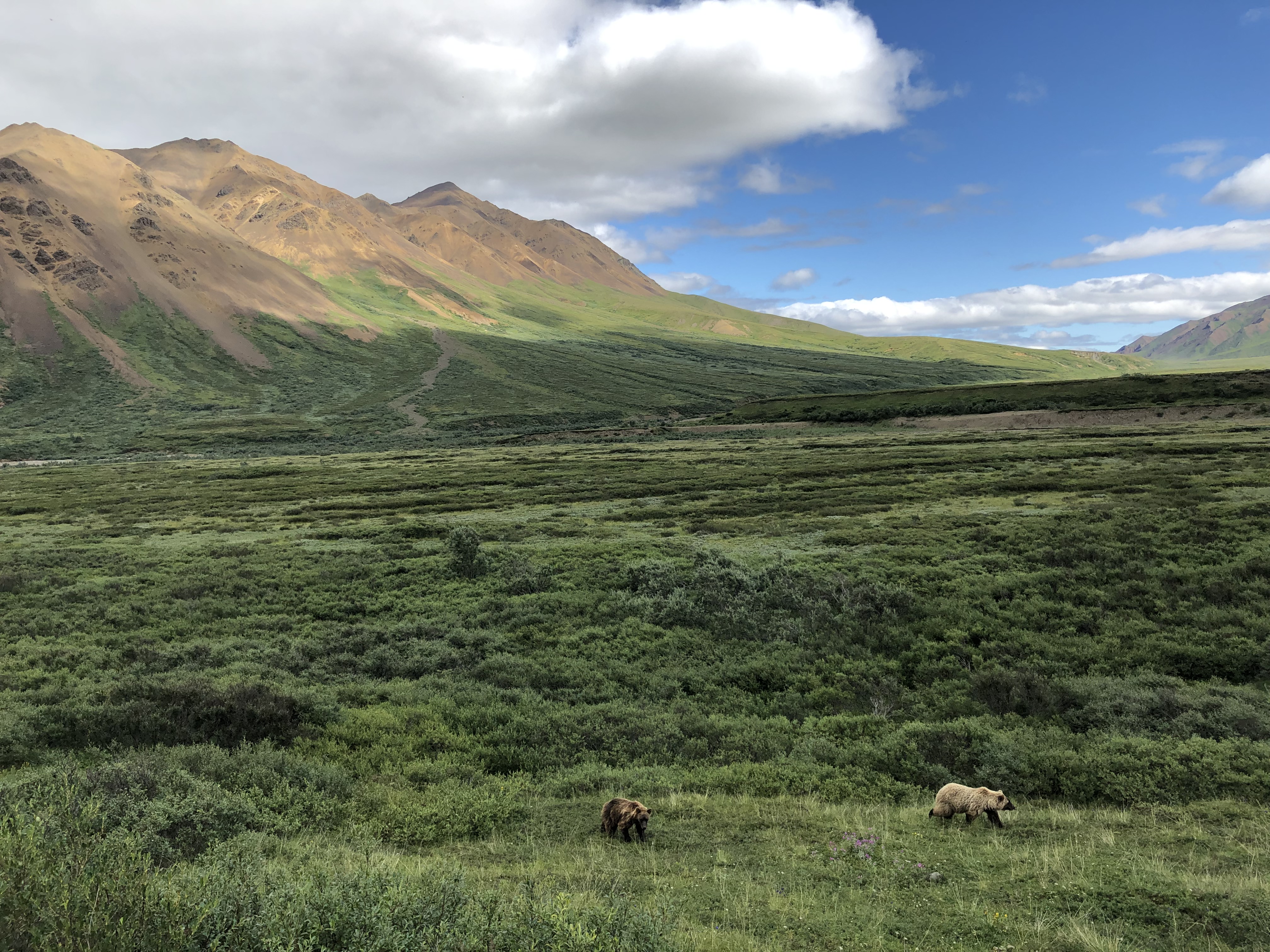
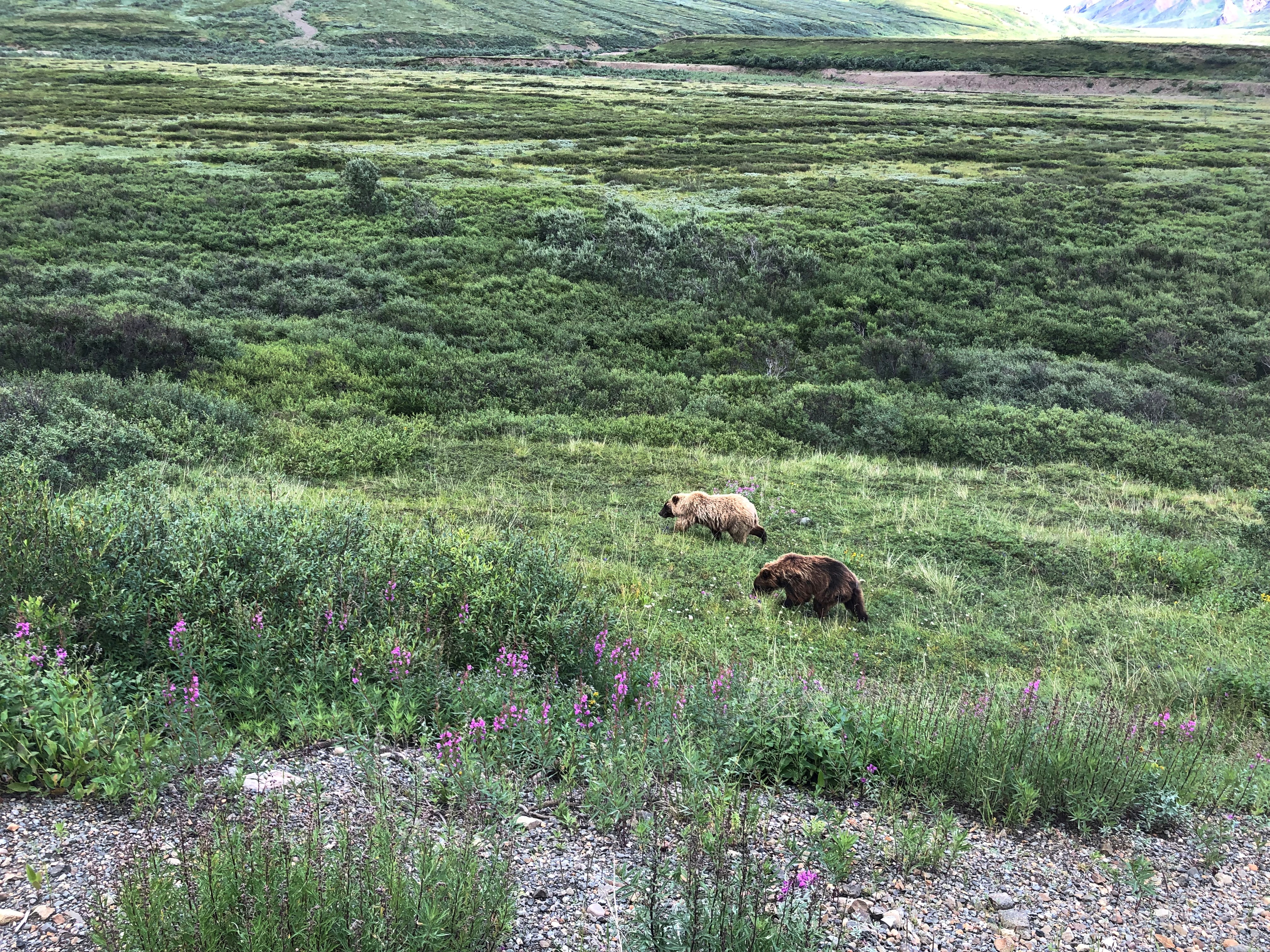
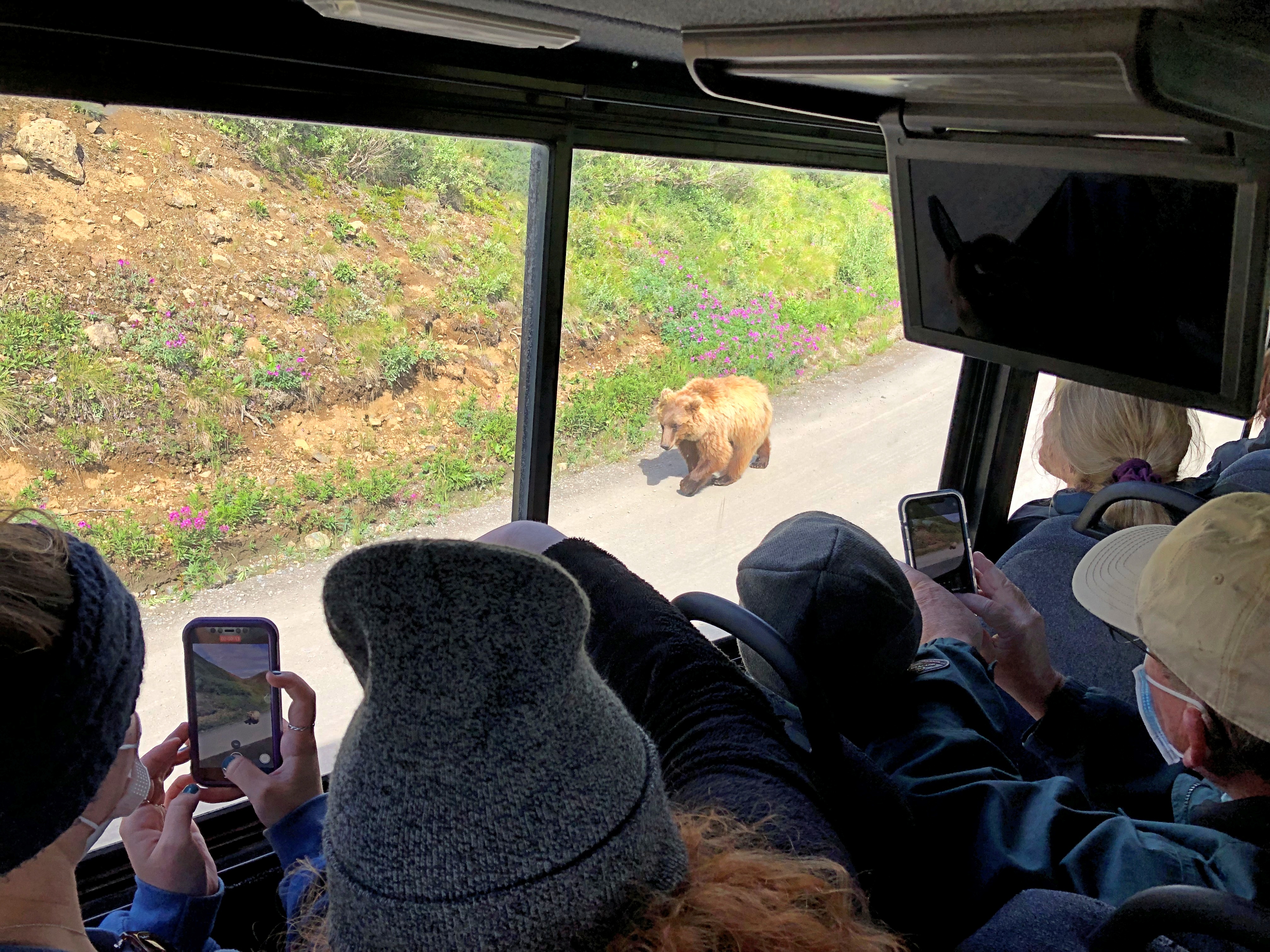
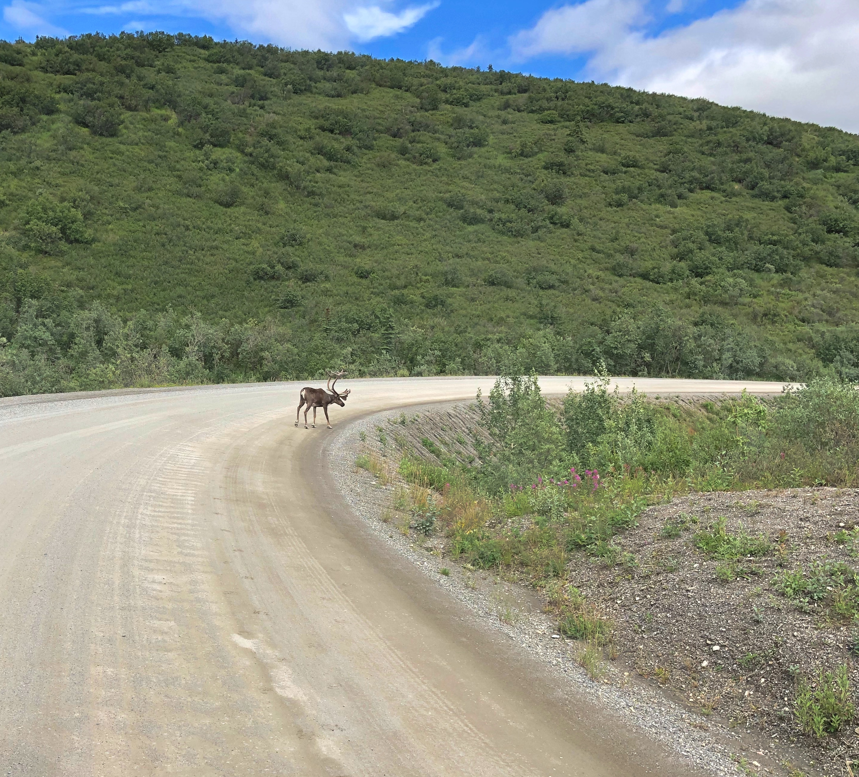
Mosquitoes were rarely a presence, fortunately, but gnats and flies made themselves known. If you looked carefully (actually not that carefully), you’d notice lizard trails in the red sands, and holes borrowed into the same sands by larger creatures who don’t care to come out during the daytime. Lizards, on the other hand, are more than happy to sit around in the sun, or scurry across the trail ahead of you or on the queer rock formations to your side.

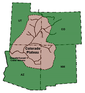
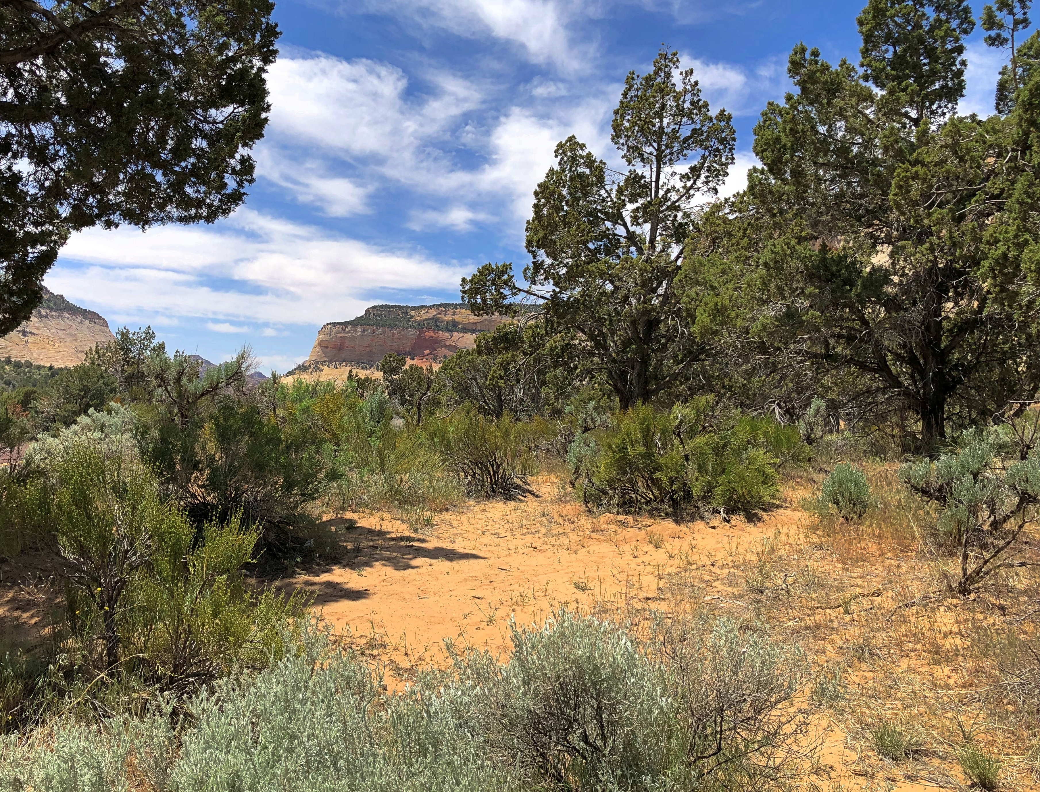
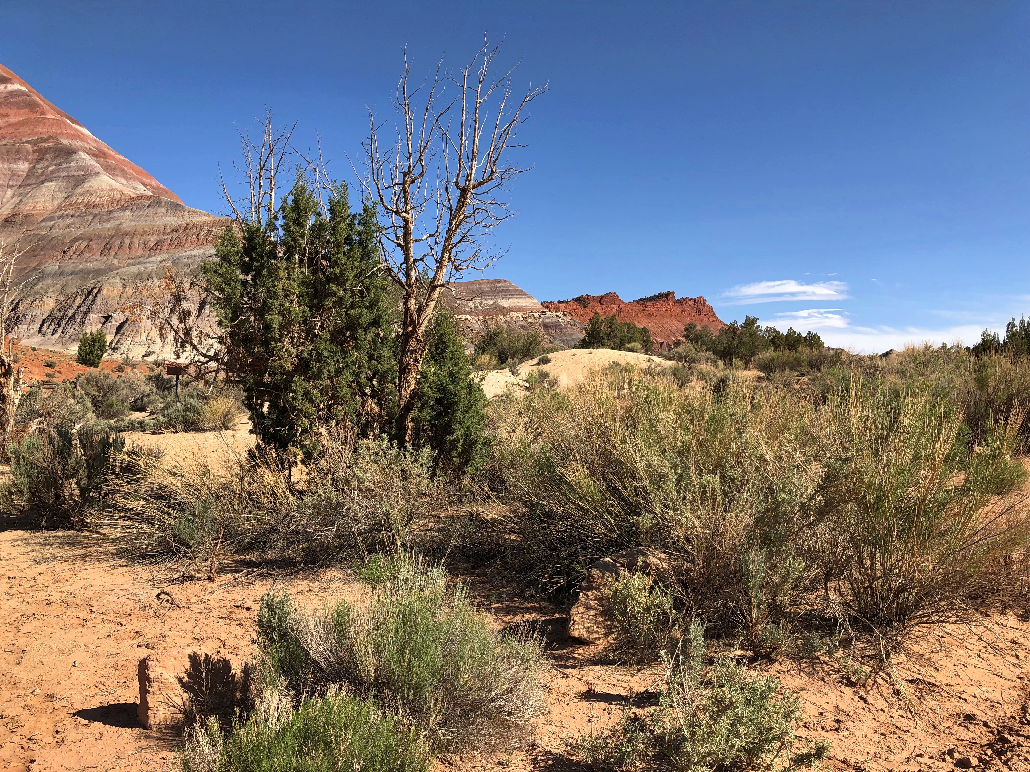
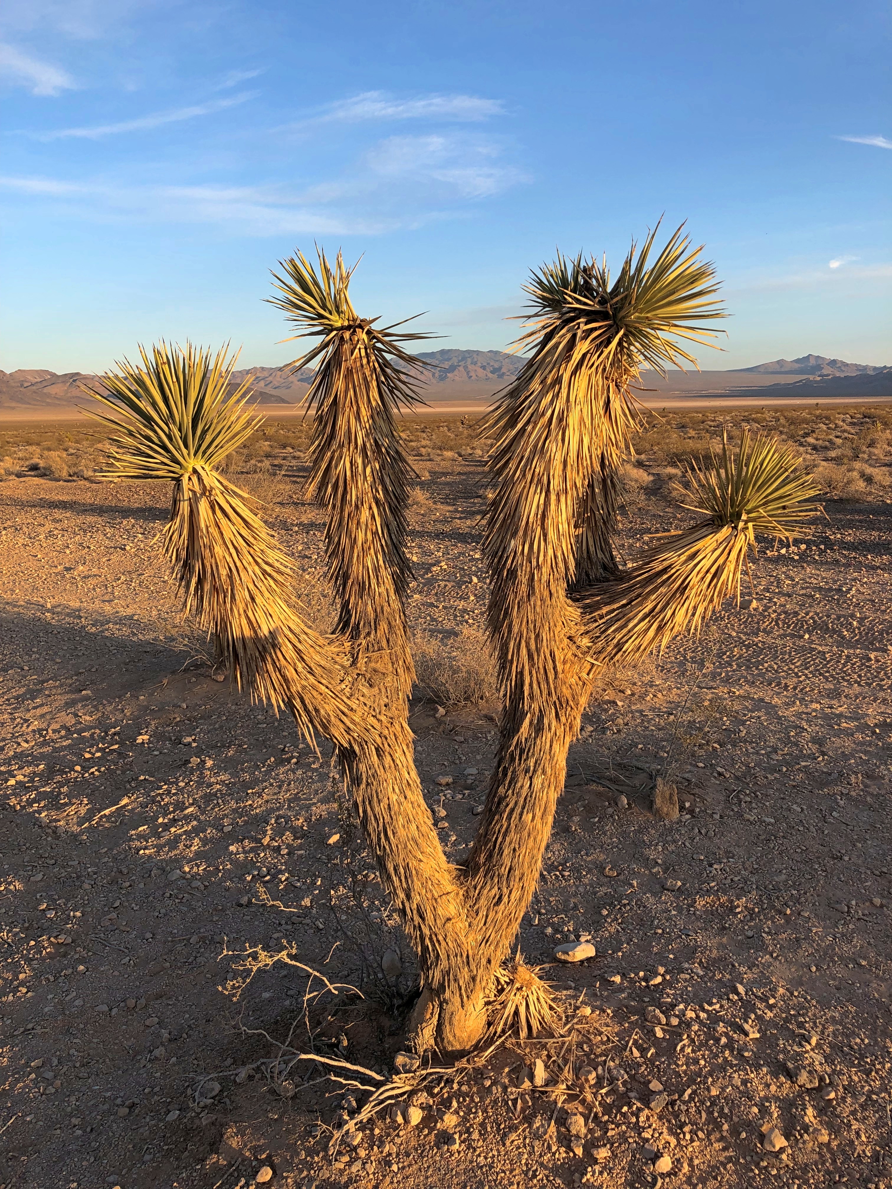
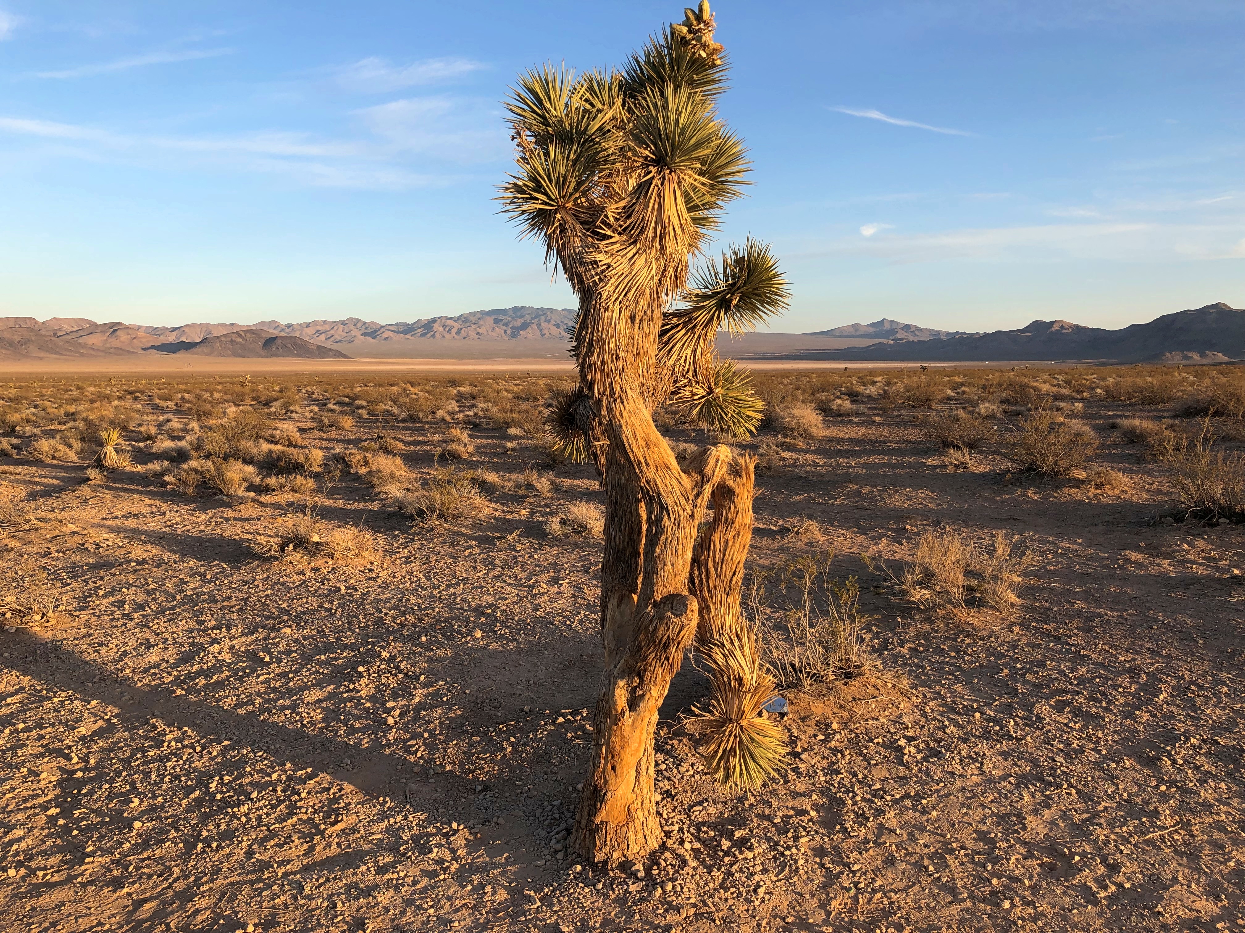
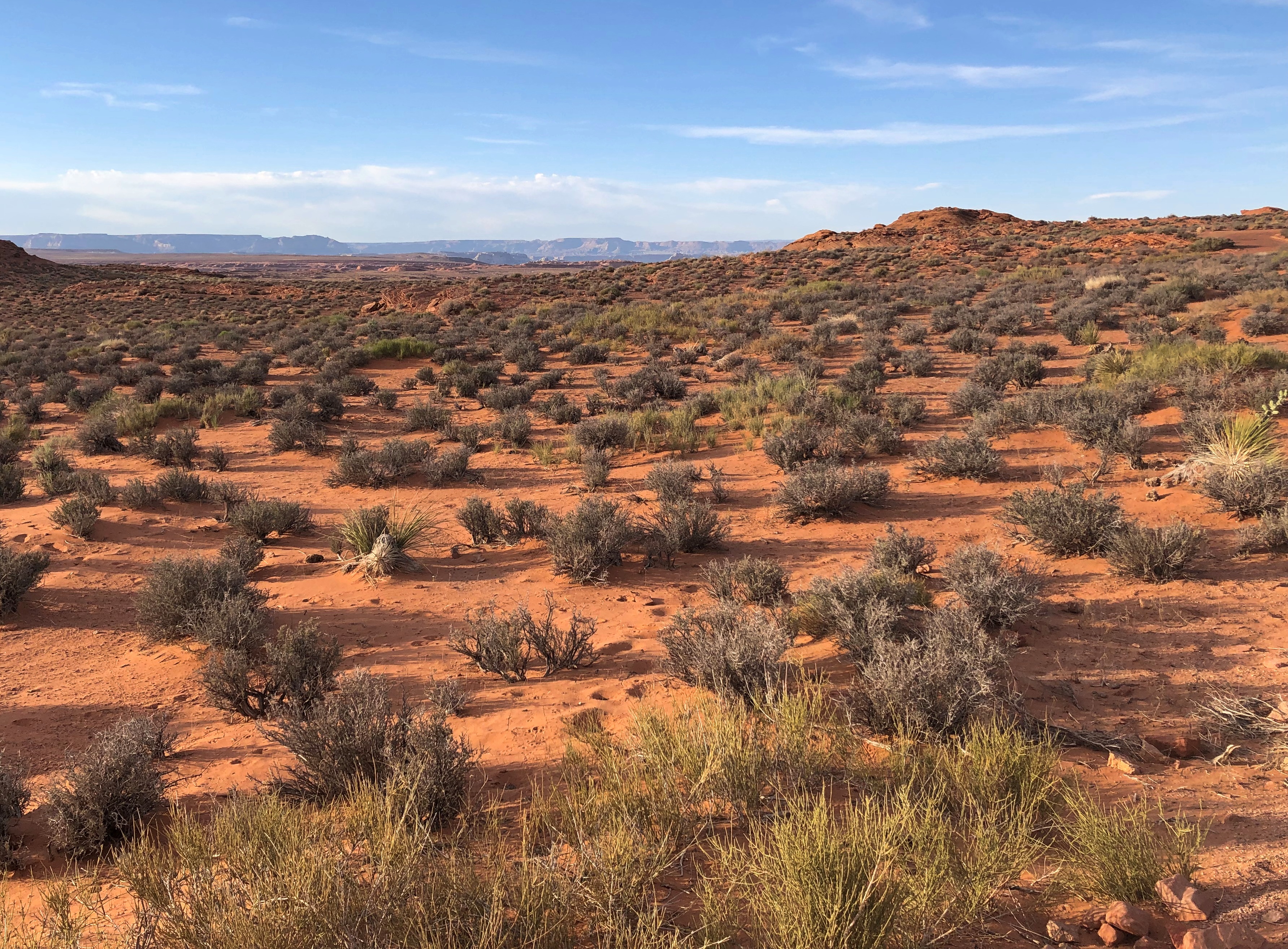
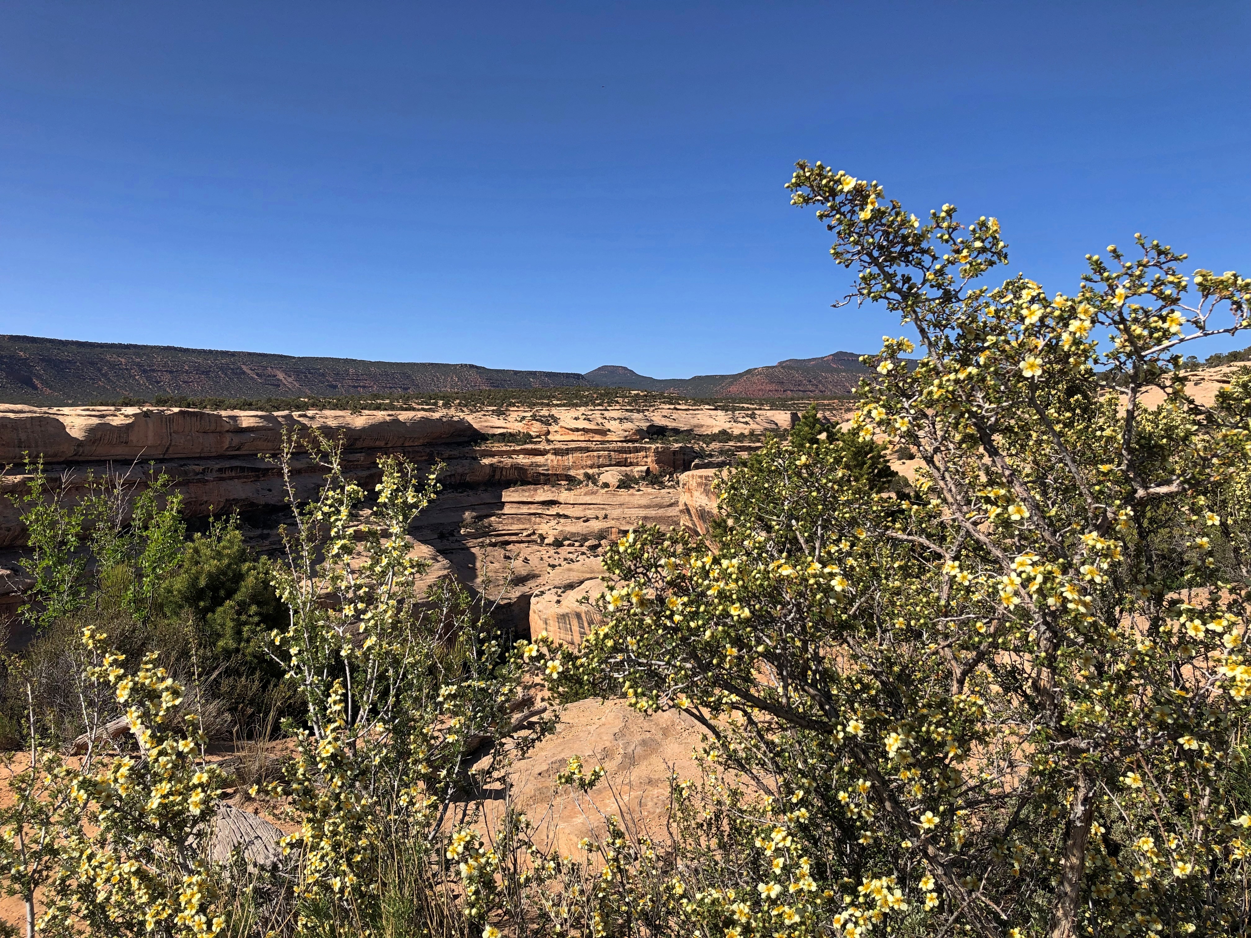
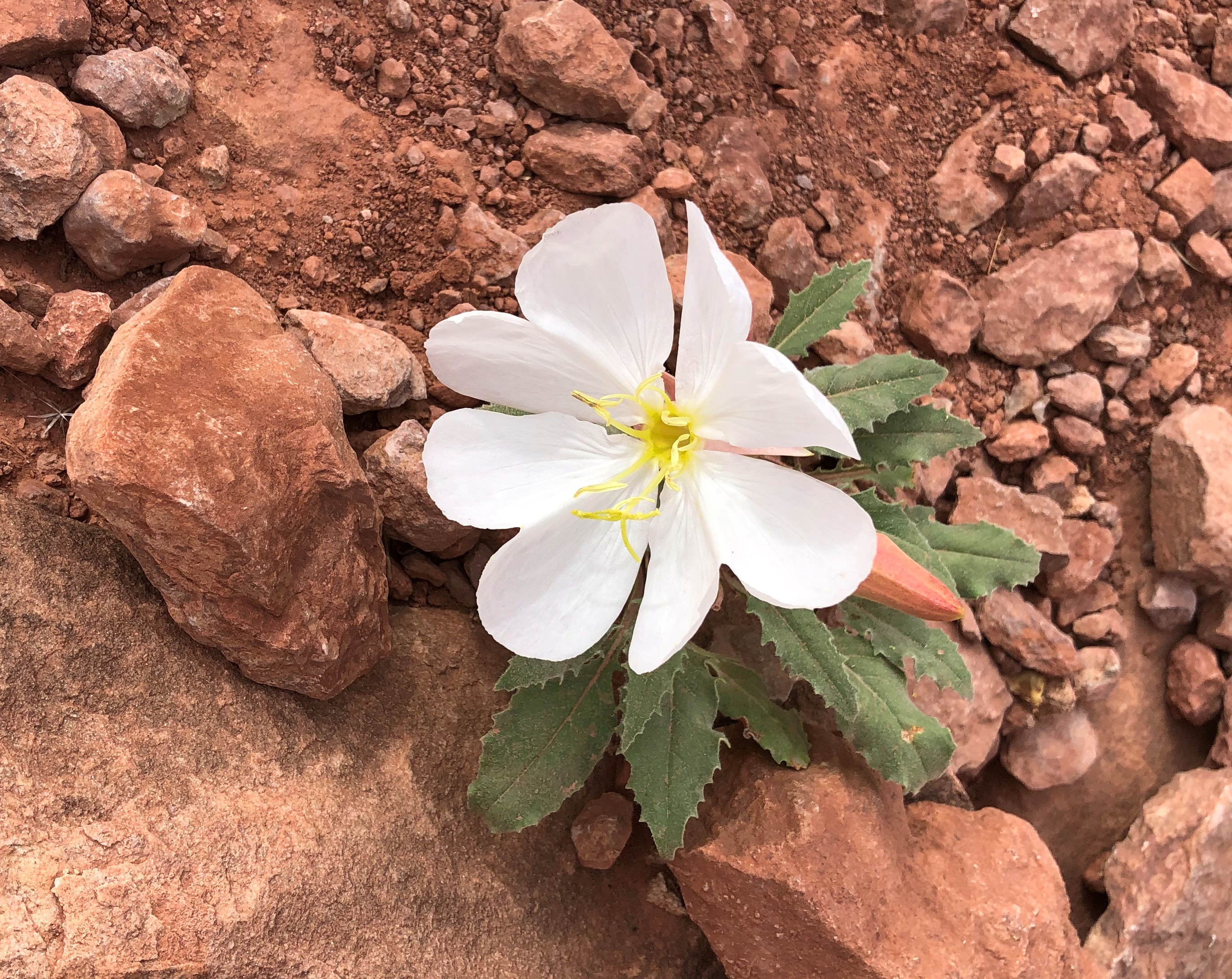
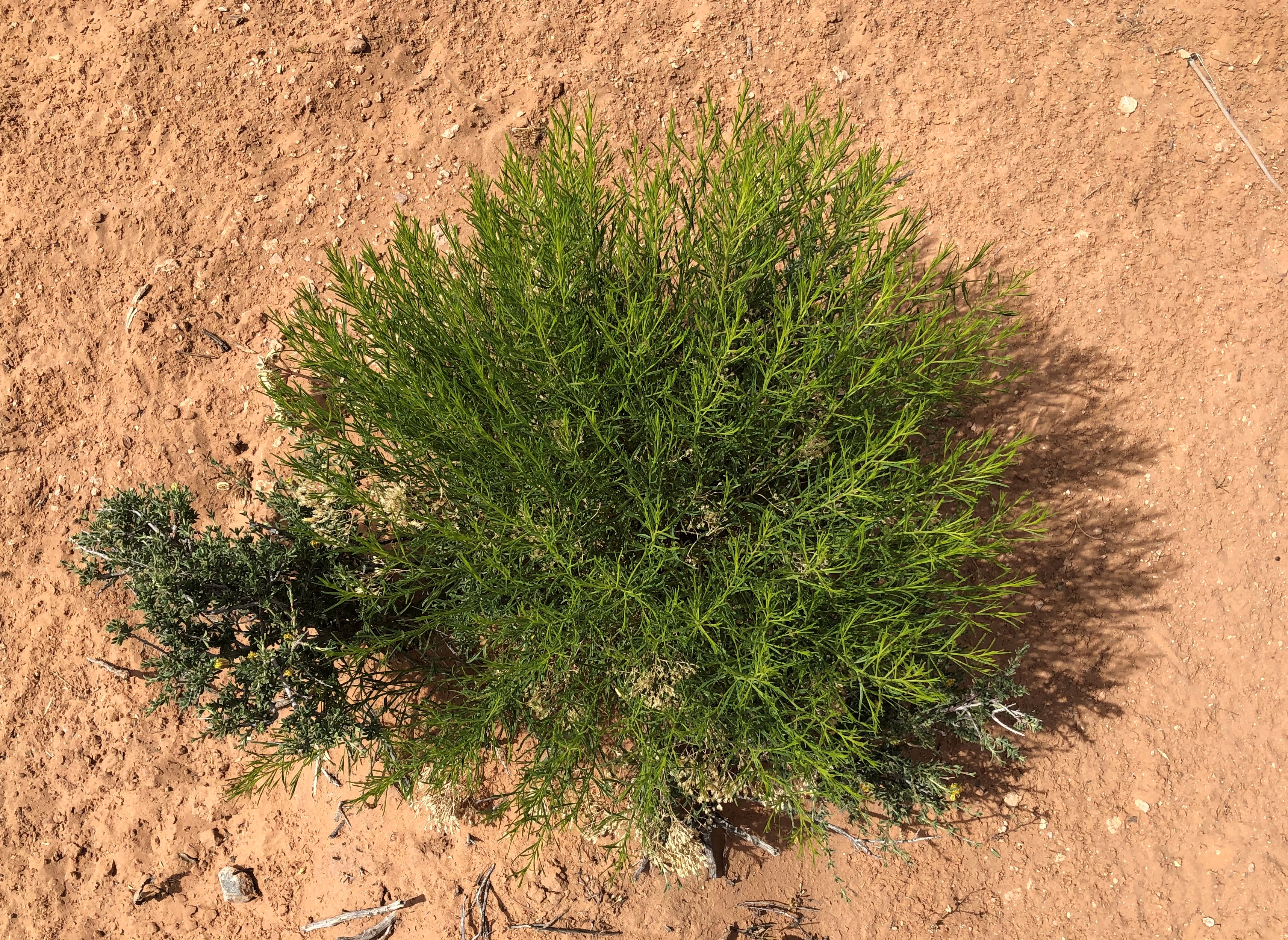
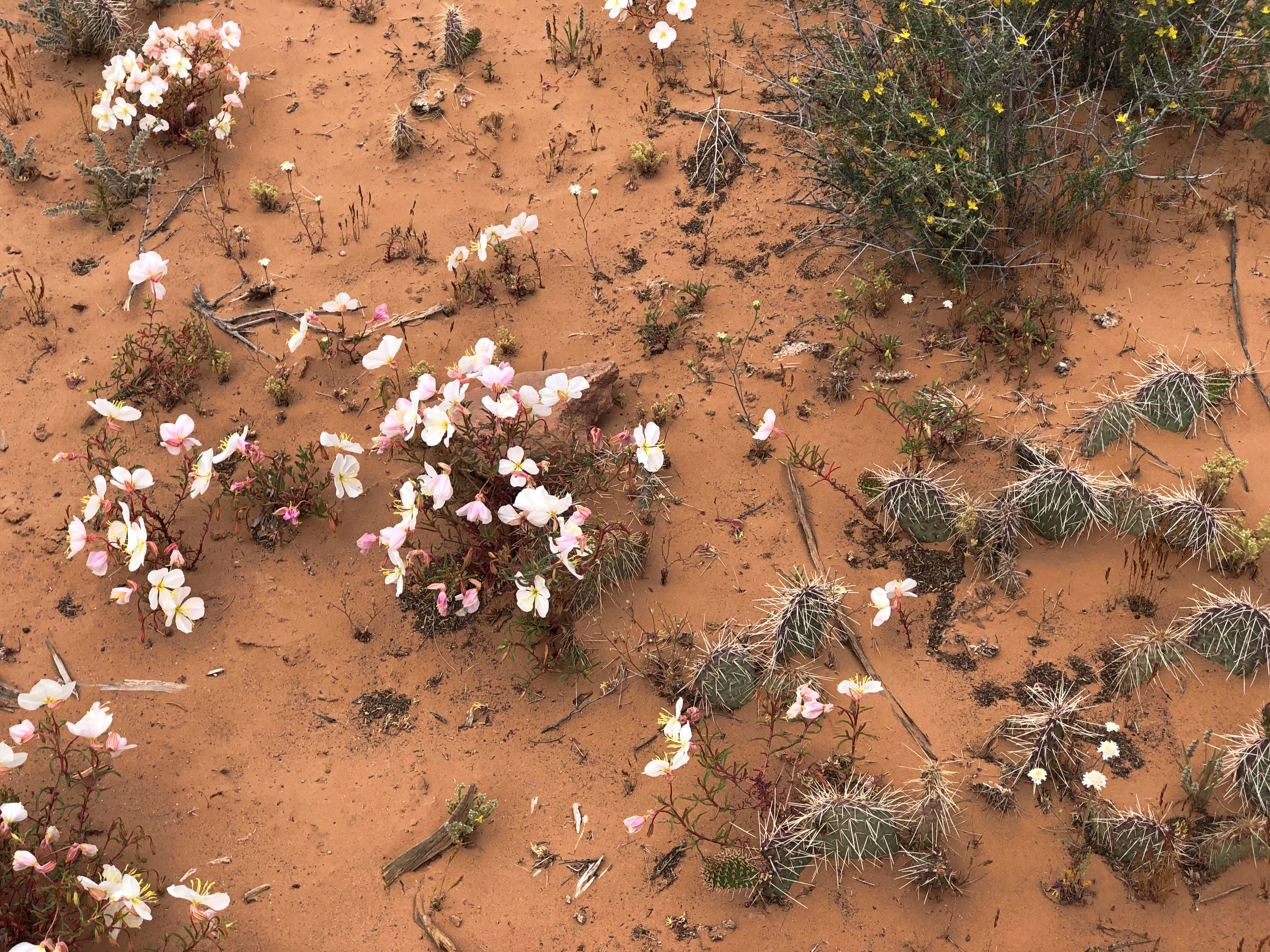
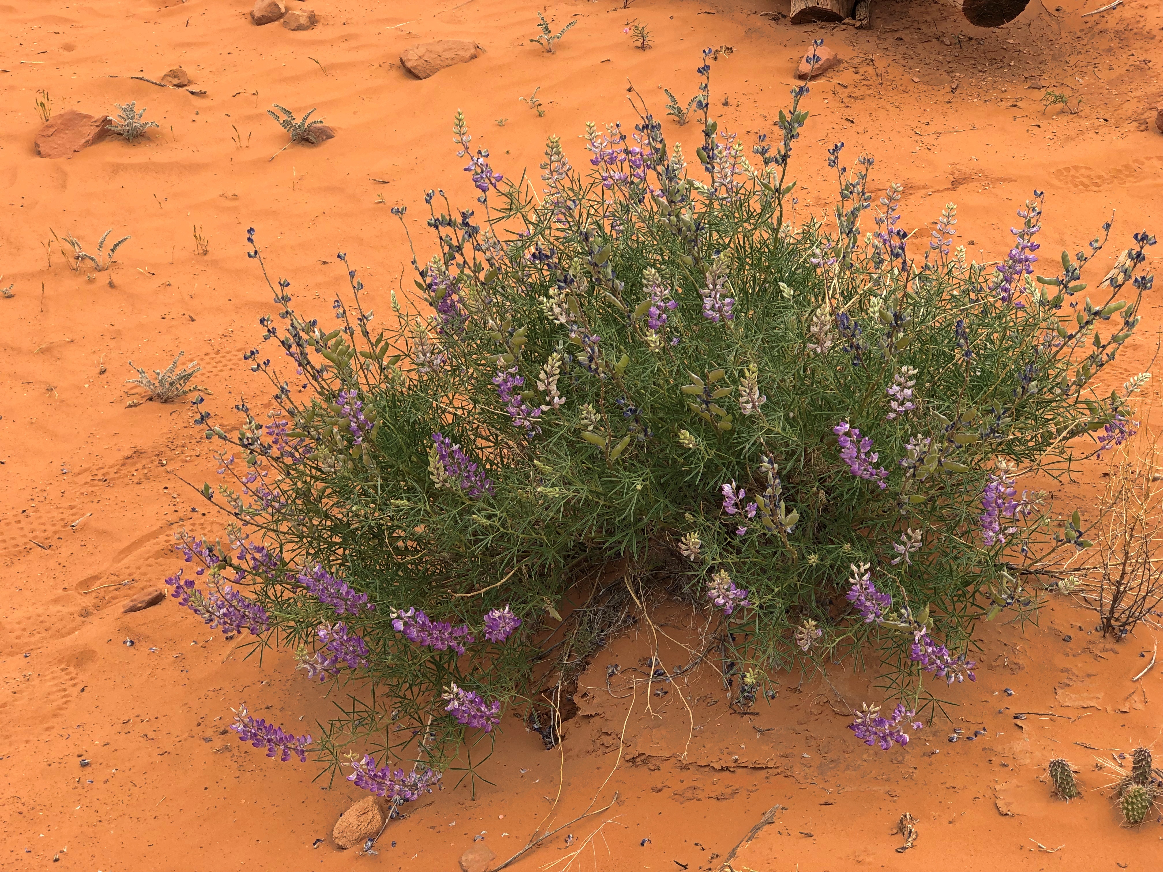
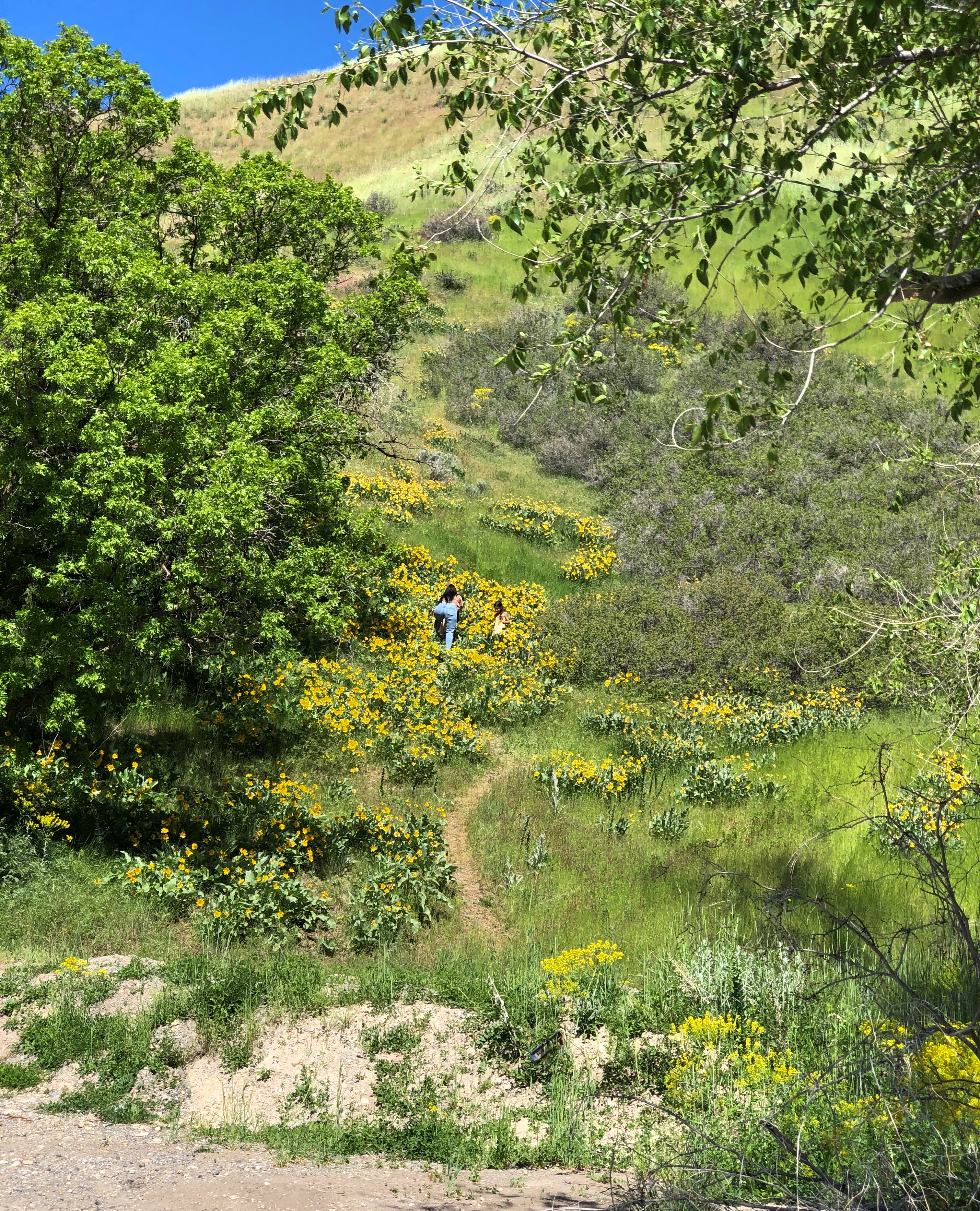
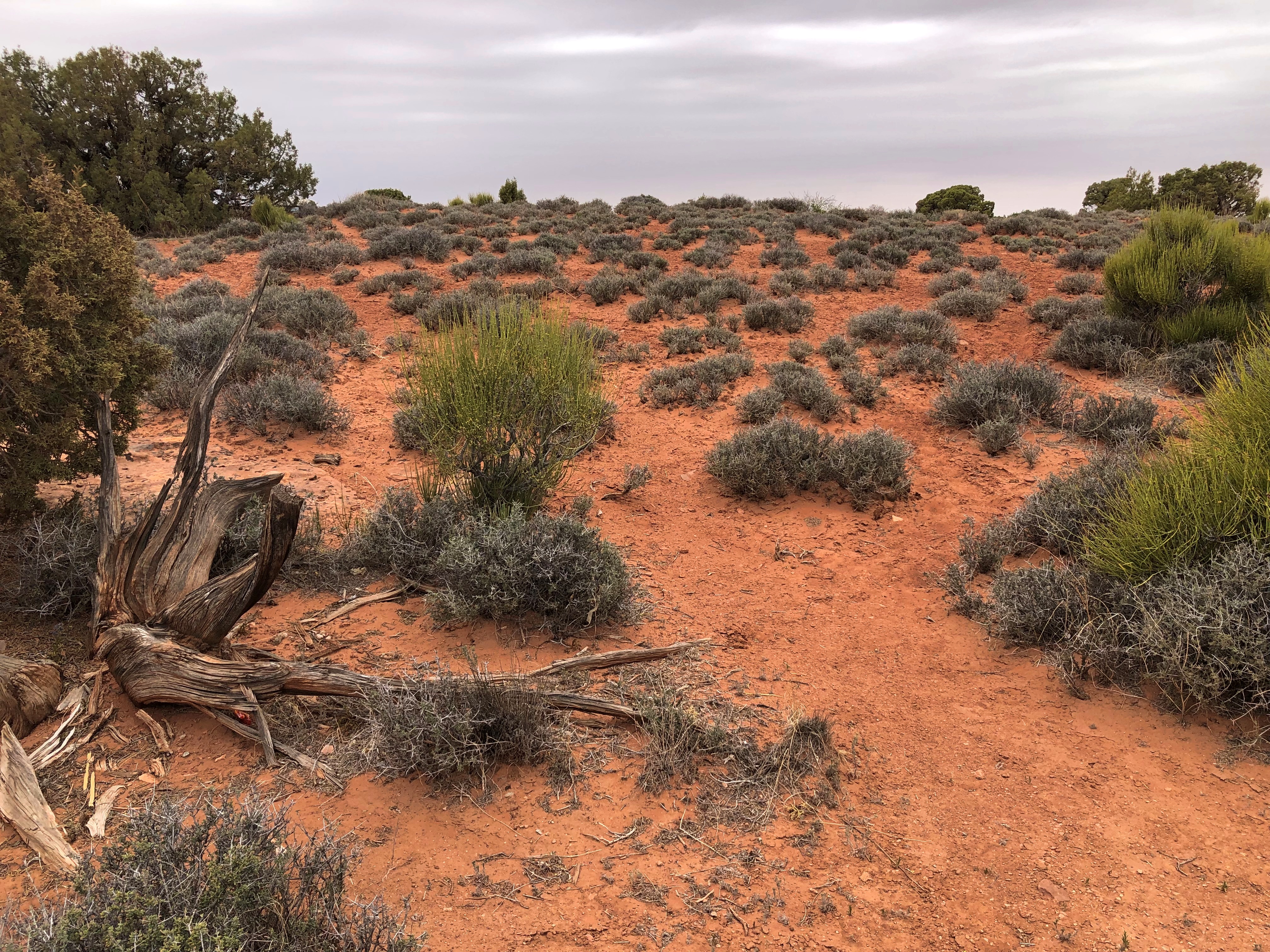
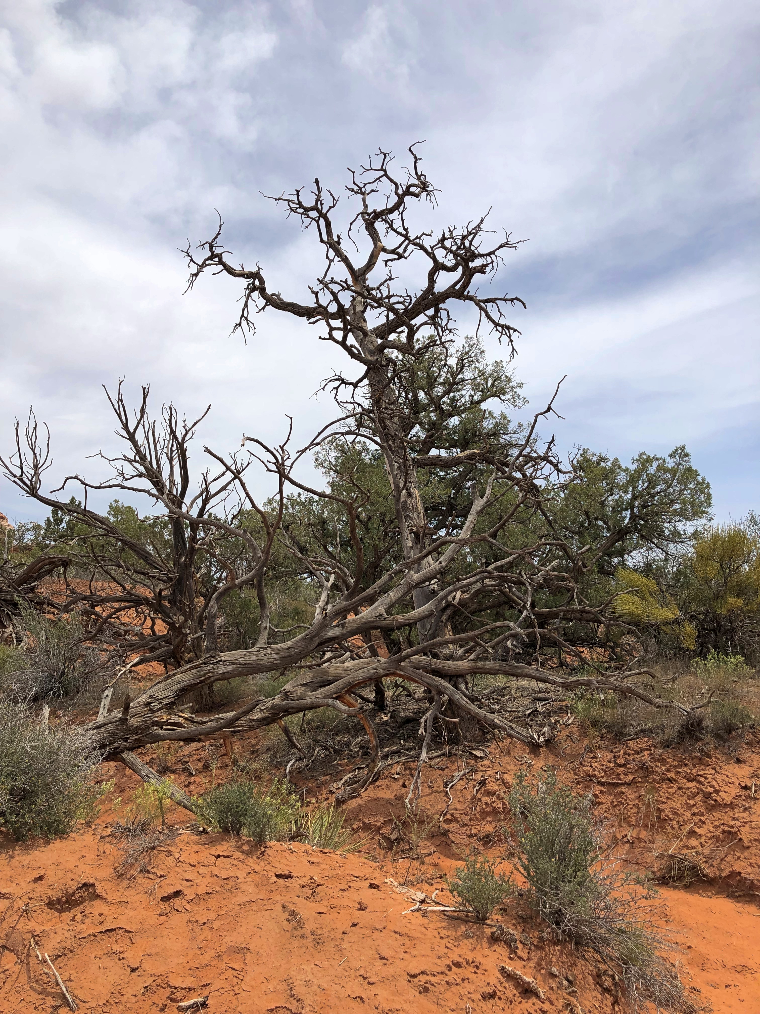
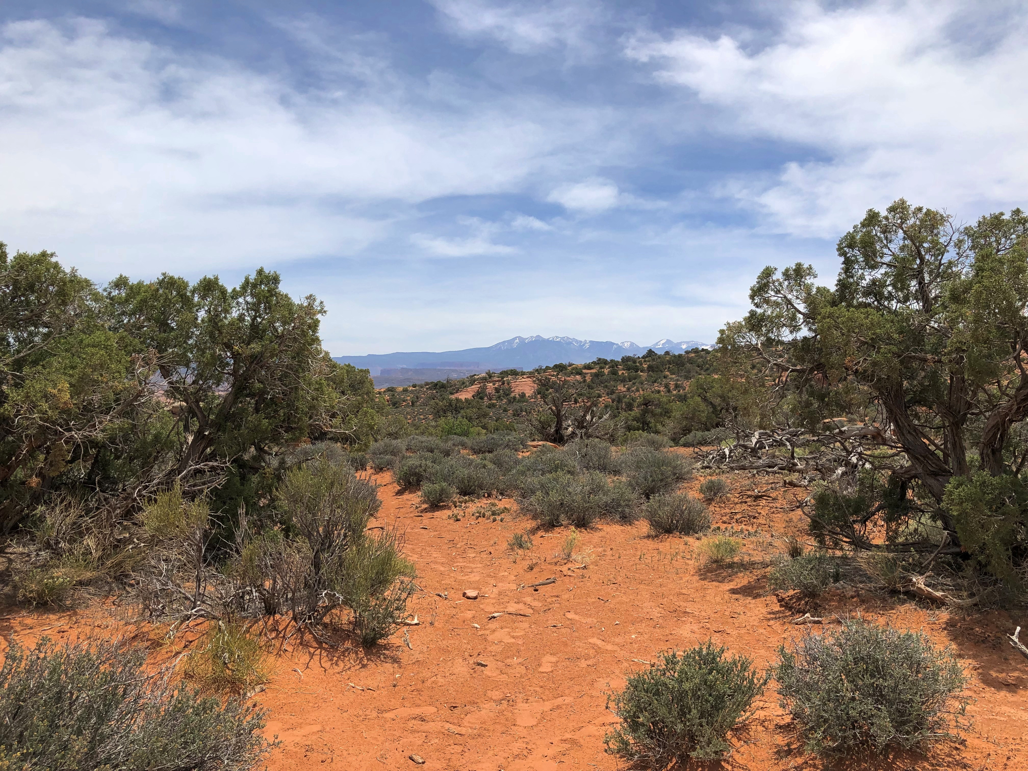
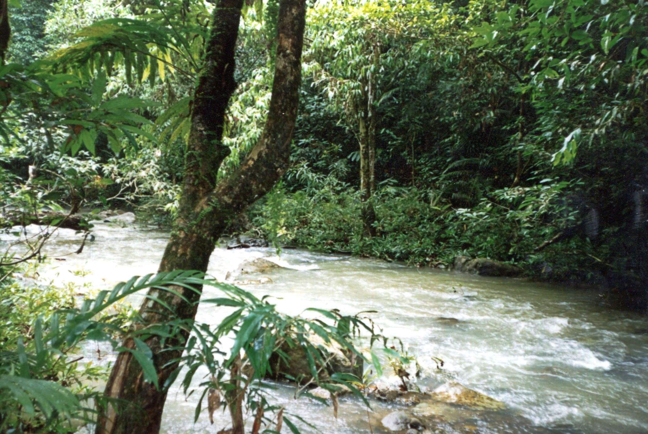
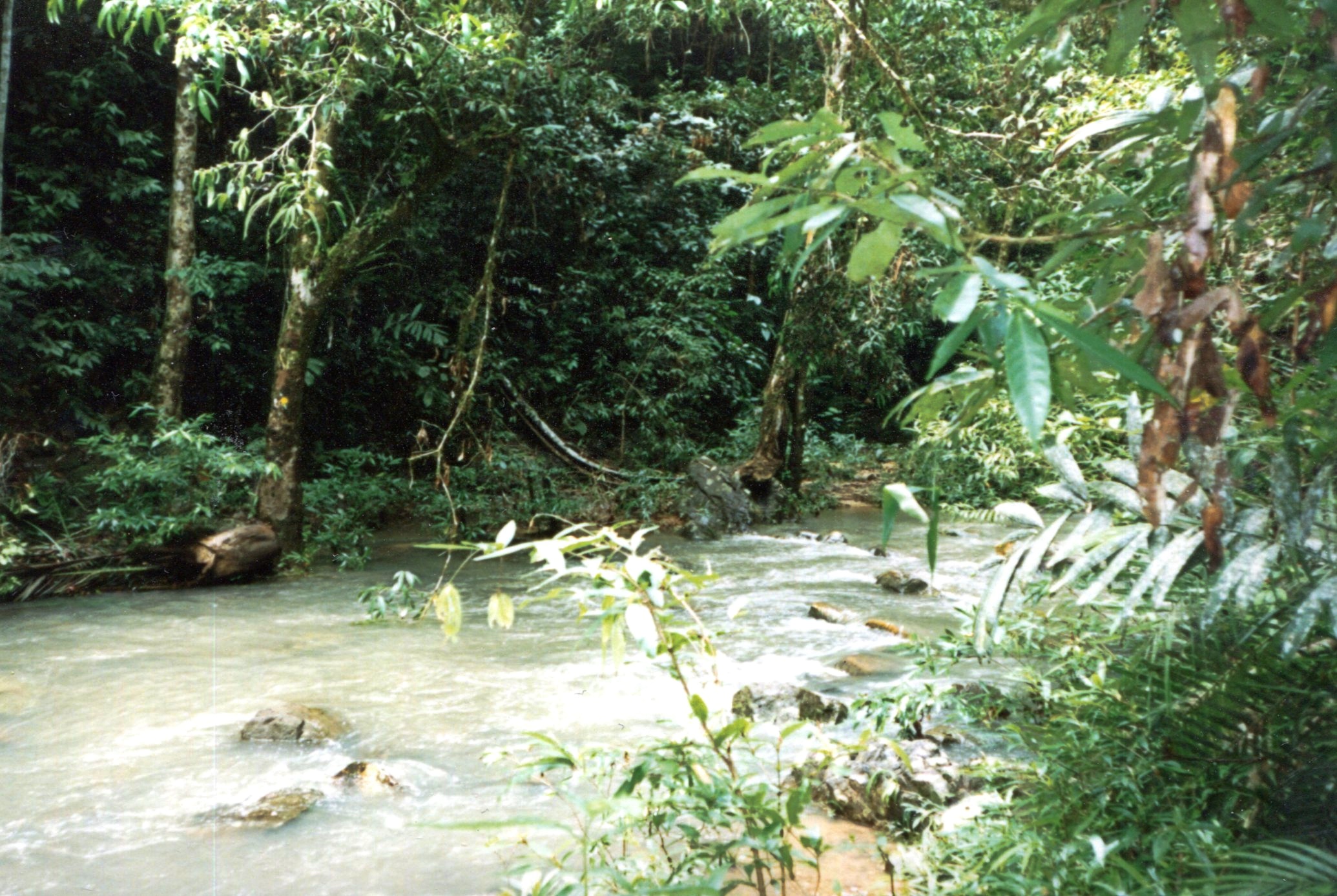
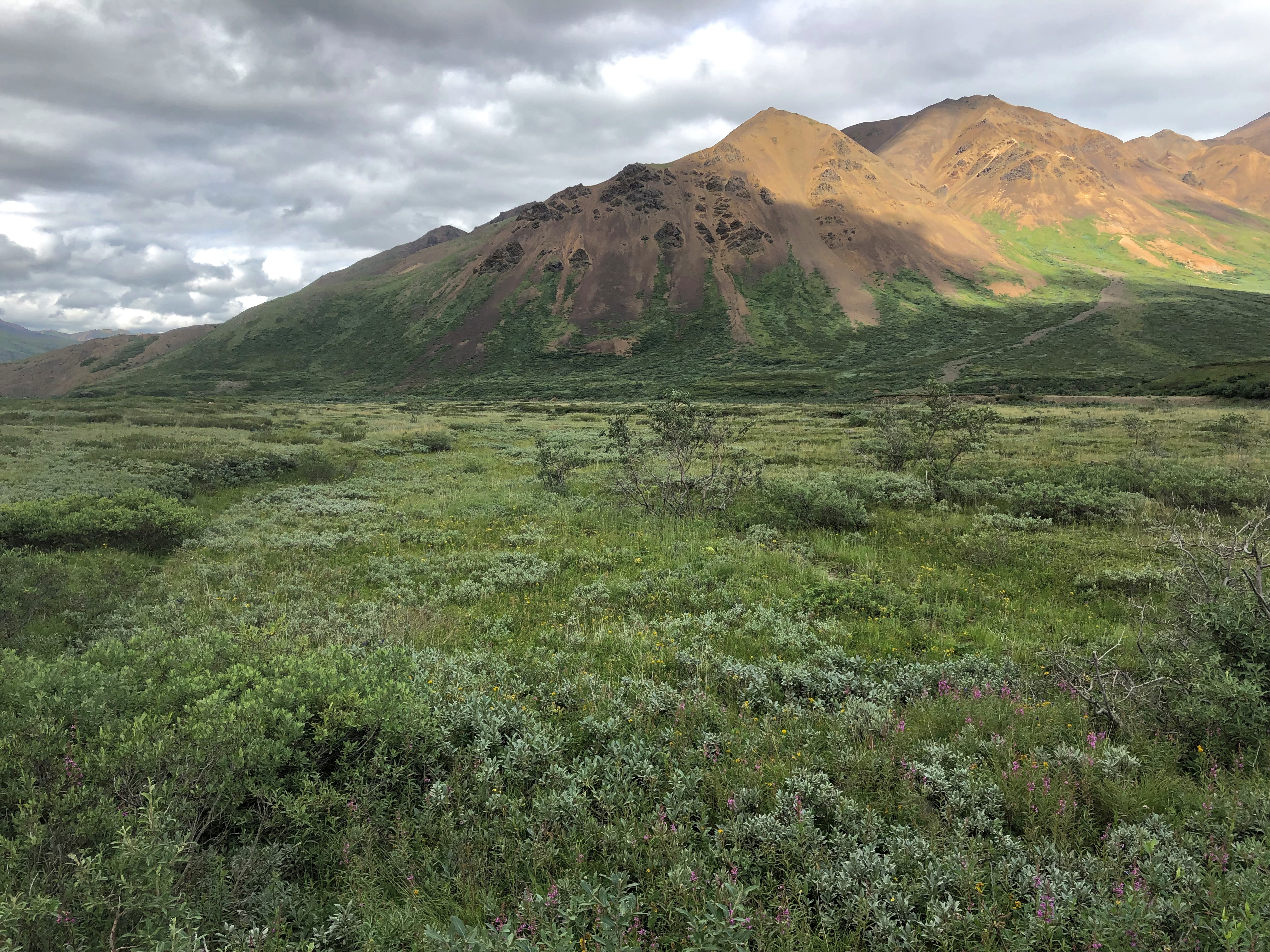
I’m not the first to notice that deserts can be surprisingly green, though not the greens you see in less arid places. Notice it I did. I’m not a farmer or horticulturist or botanist or  florist, but I tried to notice the desert flora. Wildflowers bloom in great profusion this time of the year, along the roads and trials and off into the distance, even in the harshest environments.

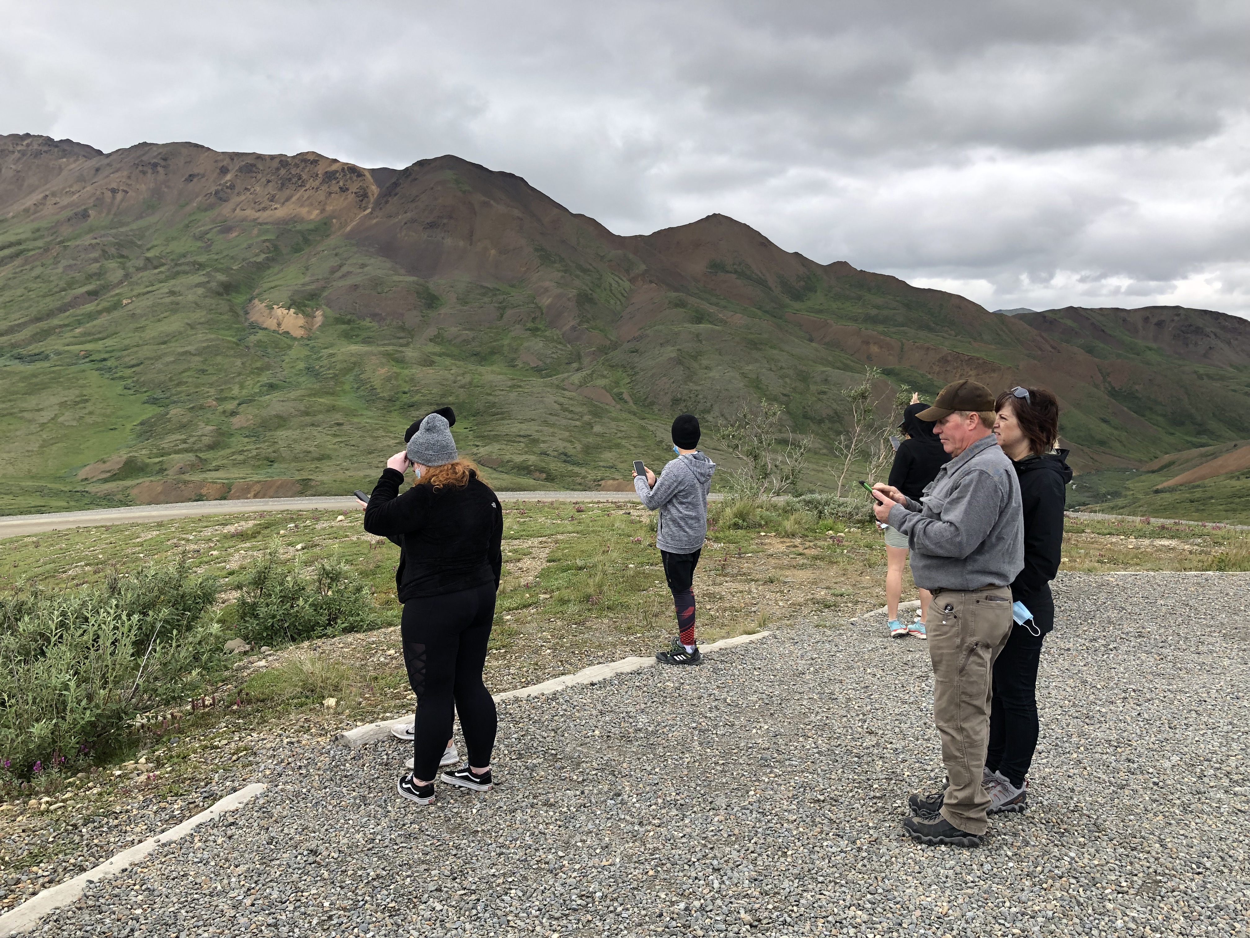
People are back in the national and other parks. Middle-class American tourists, that is, of whom I’m obviously one, plus visitors from a spectrum of European and Asian nations. Perhaps a strict majority of the tourists we encountered were older, but younger age groups, including young families and groups of young friends, were out in force. The tourists passed through an inhabited land, of course, one with as diverse a population as most any city in the nation.

No destination was exactly crowded, but a number of places were very popular, enough to erase any notion of desert solitude. Even so, there’s a mild camaraderie among the tourists, greeting each other much more frequently than they would in an urban or suburban setting, asking and offering to take pictures of strangers, pausing for each other to pass on narrow paths, sharing information about trail conditions ahead, making jokes or other observations for everyone to hear.

At one particularly windy vista, I put my hand on top of Yuriko’s head to hold her hat down, at her request, while she took pictures.

“That’s why she keeps you around, huh?” one passing fellow with about 10 years on me said.

“That and to open jars,” I answered.

The kernel of this trip was Yuriko’s longstanding wish to see Antelope Canyon (and she knows how to pick destinations). Back in bleak January, I planned the thing, expanding the list of destinations a lot. I’ve wanted visit that part of the country again for years.

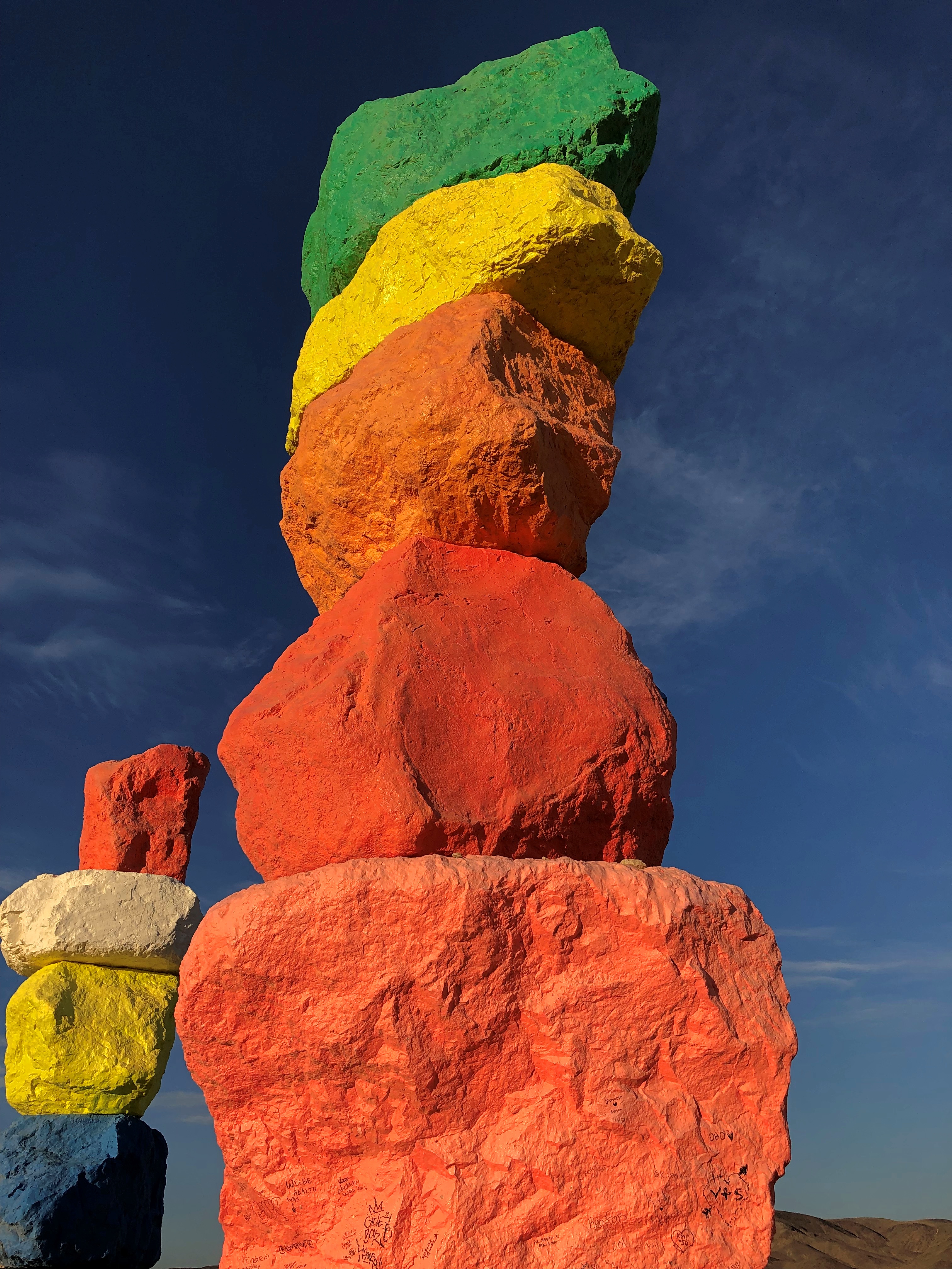
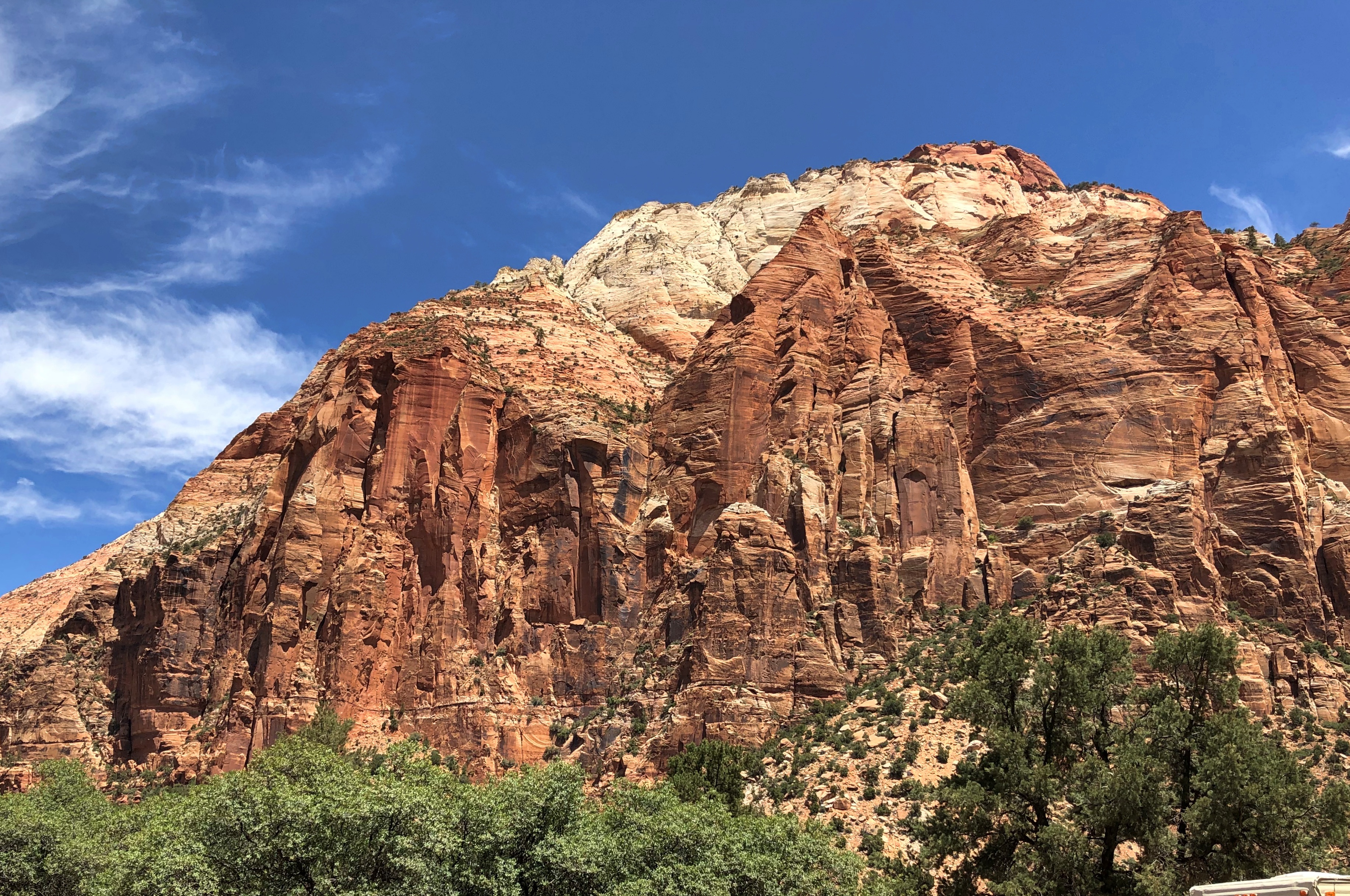
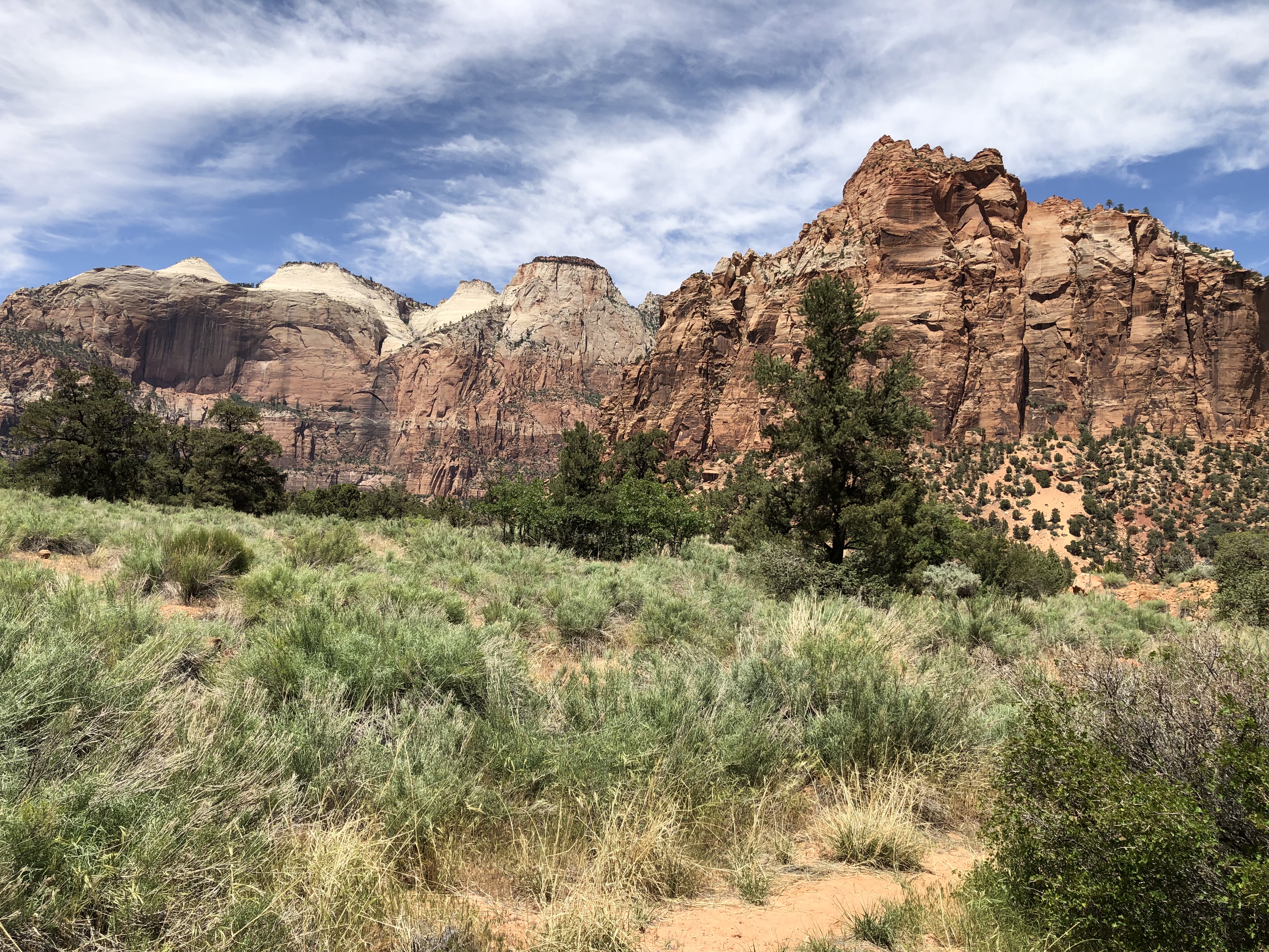
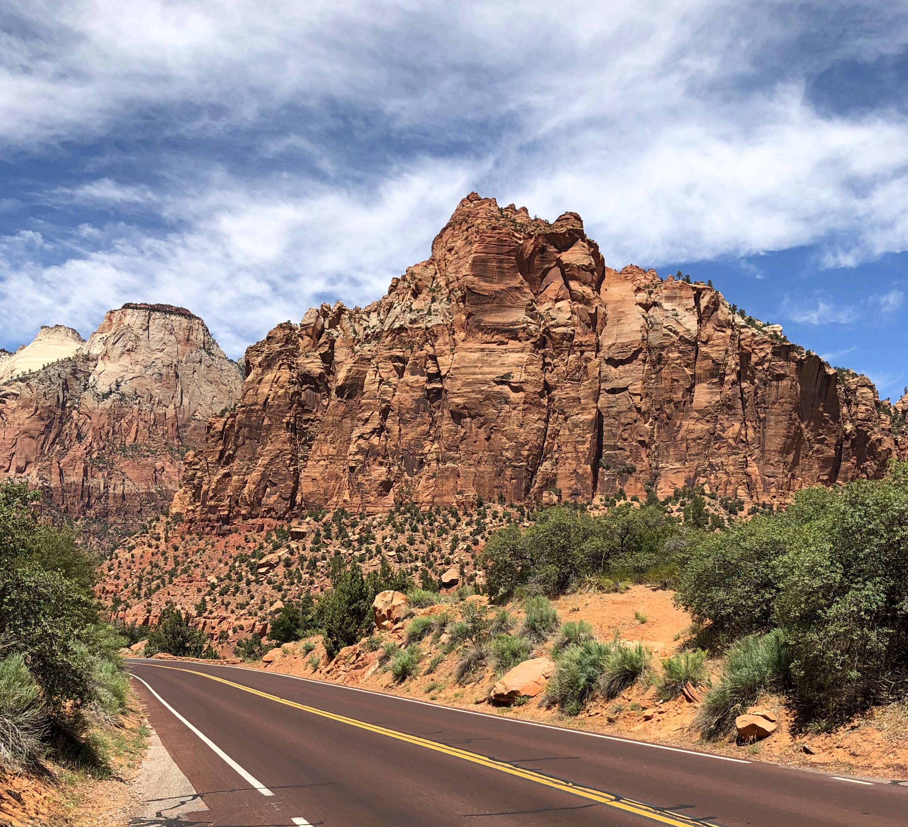
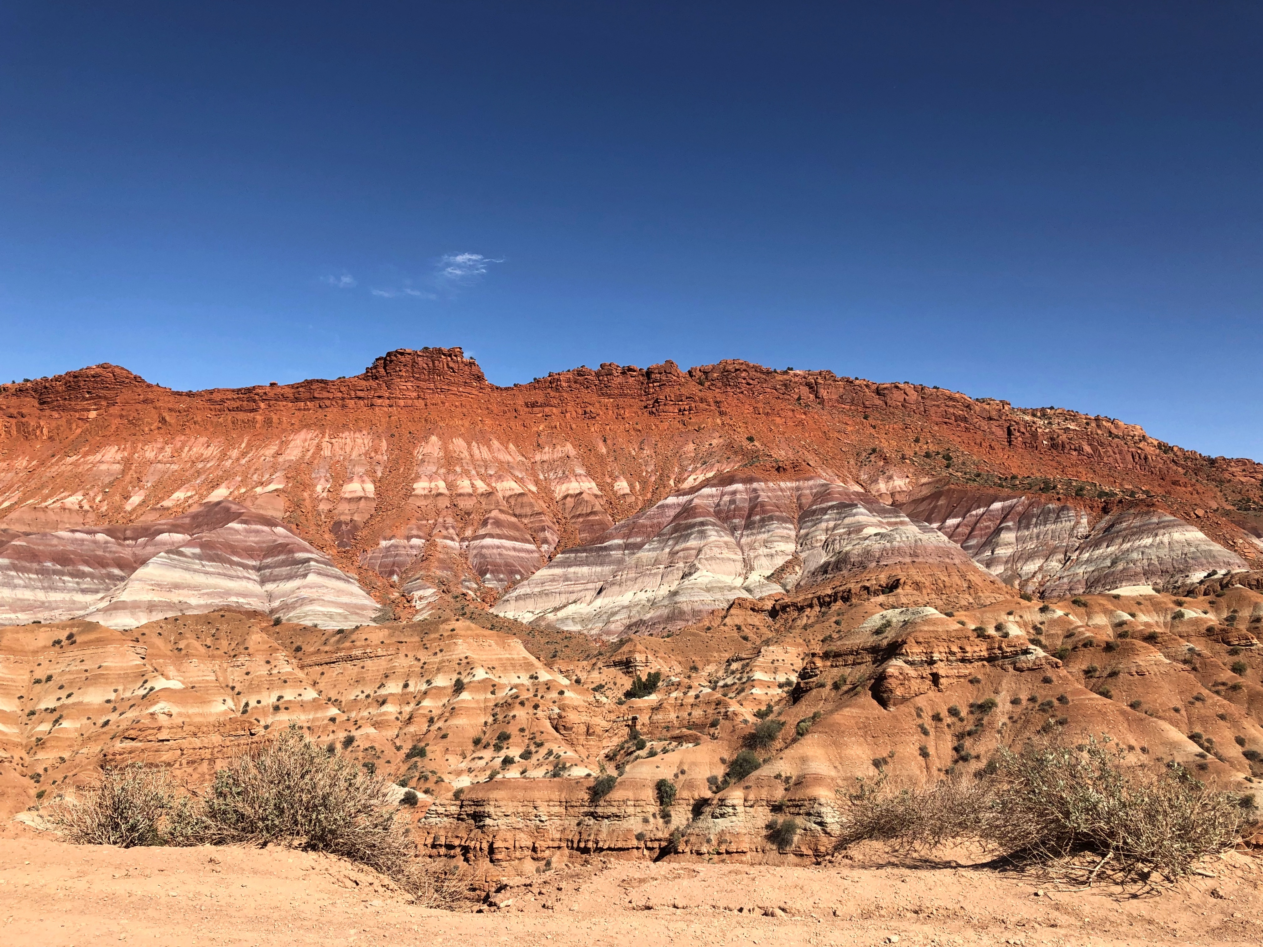
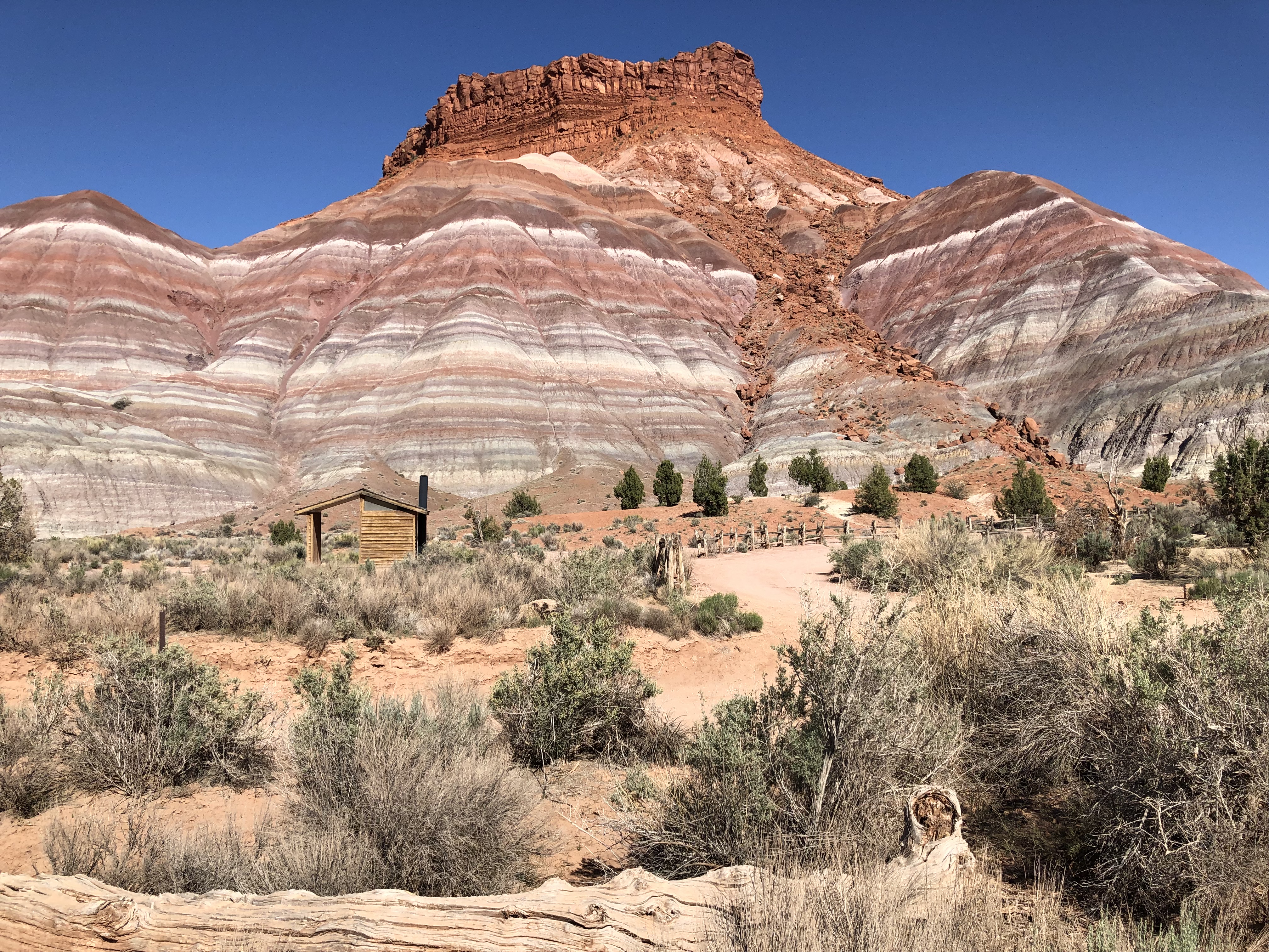
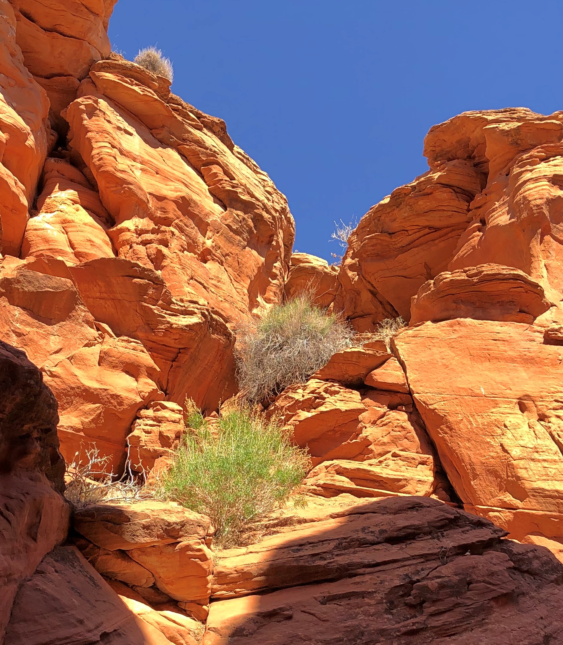
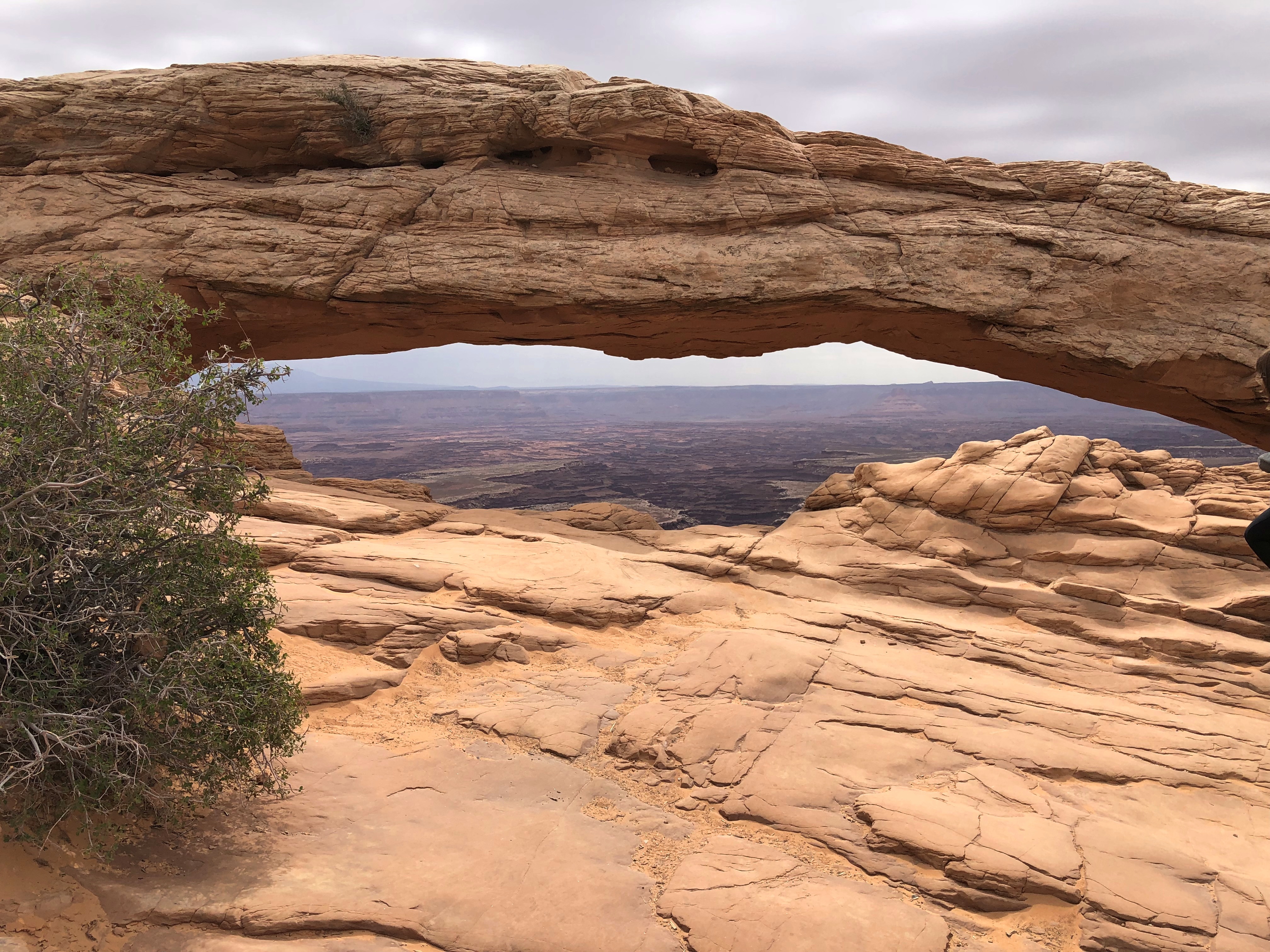
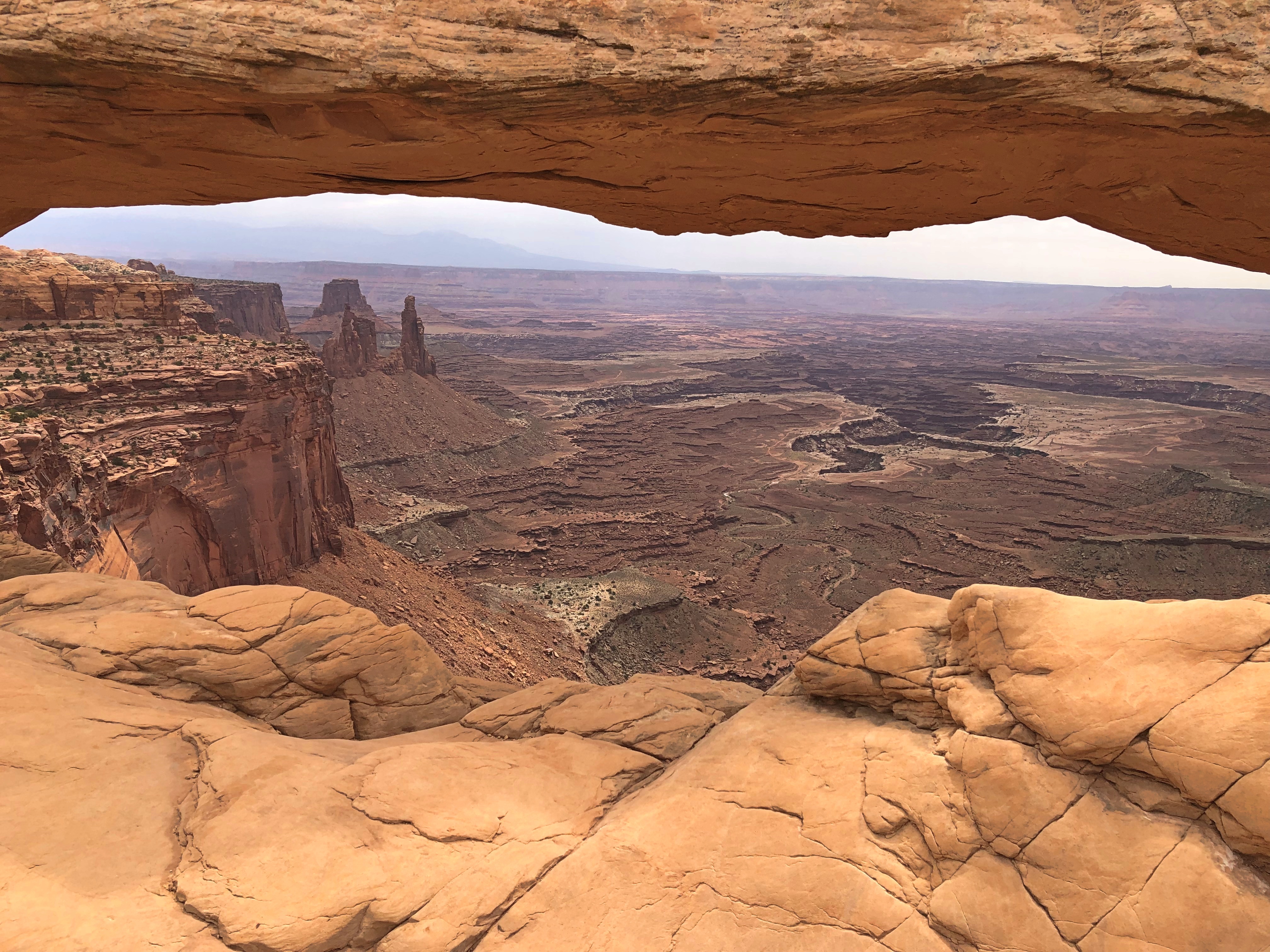
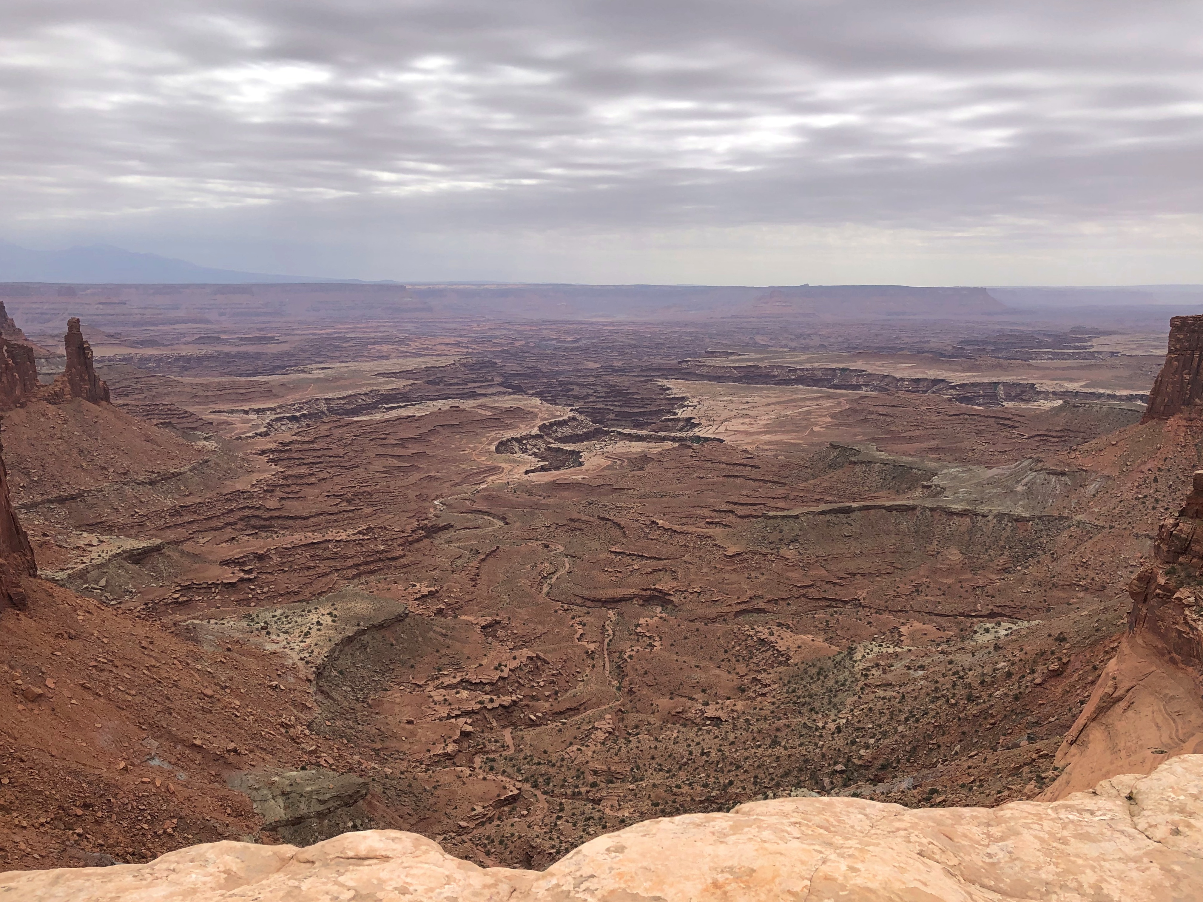
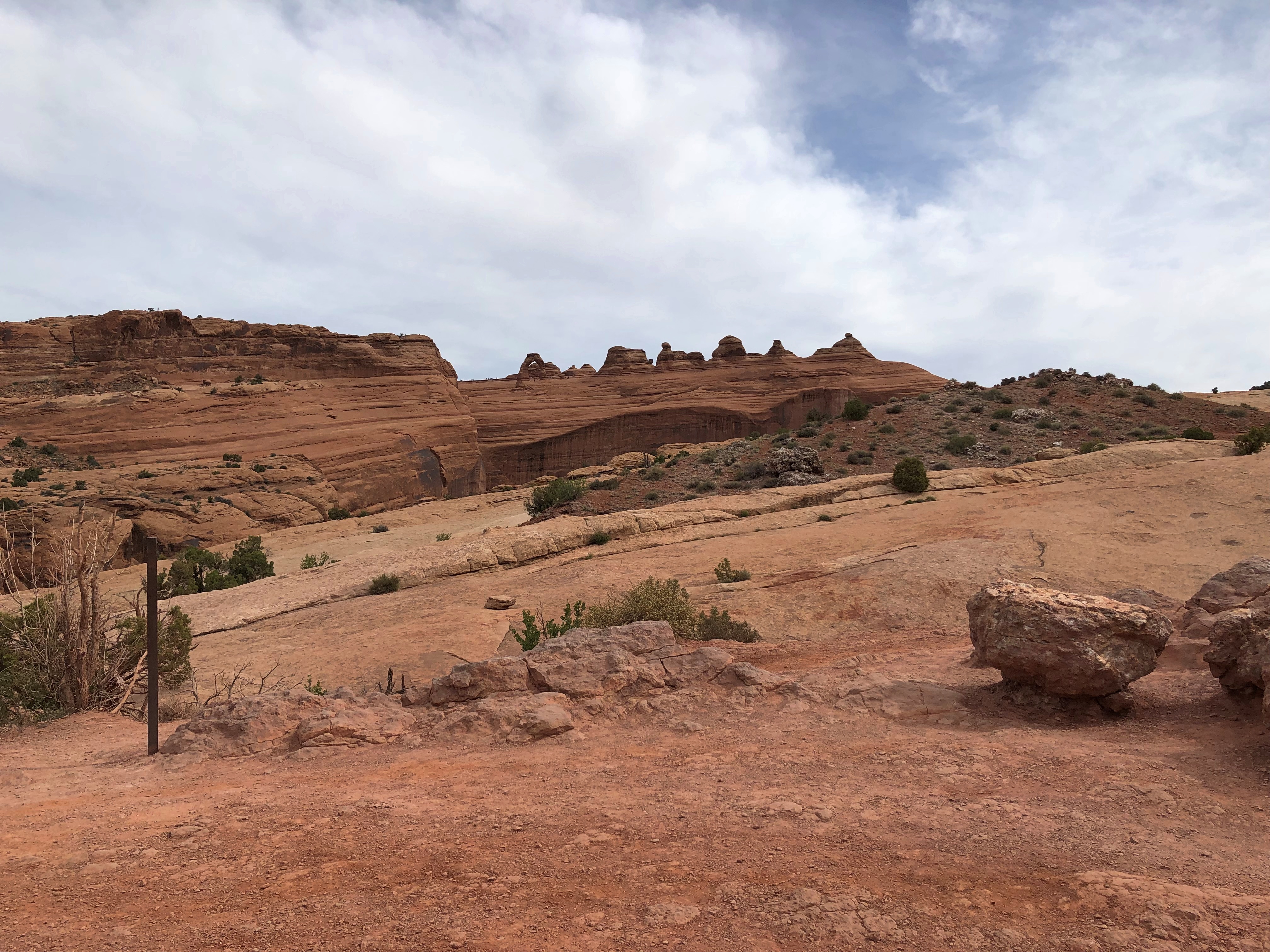
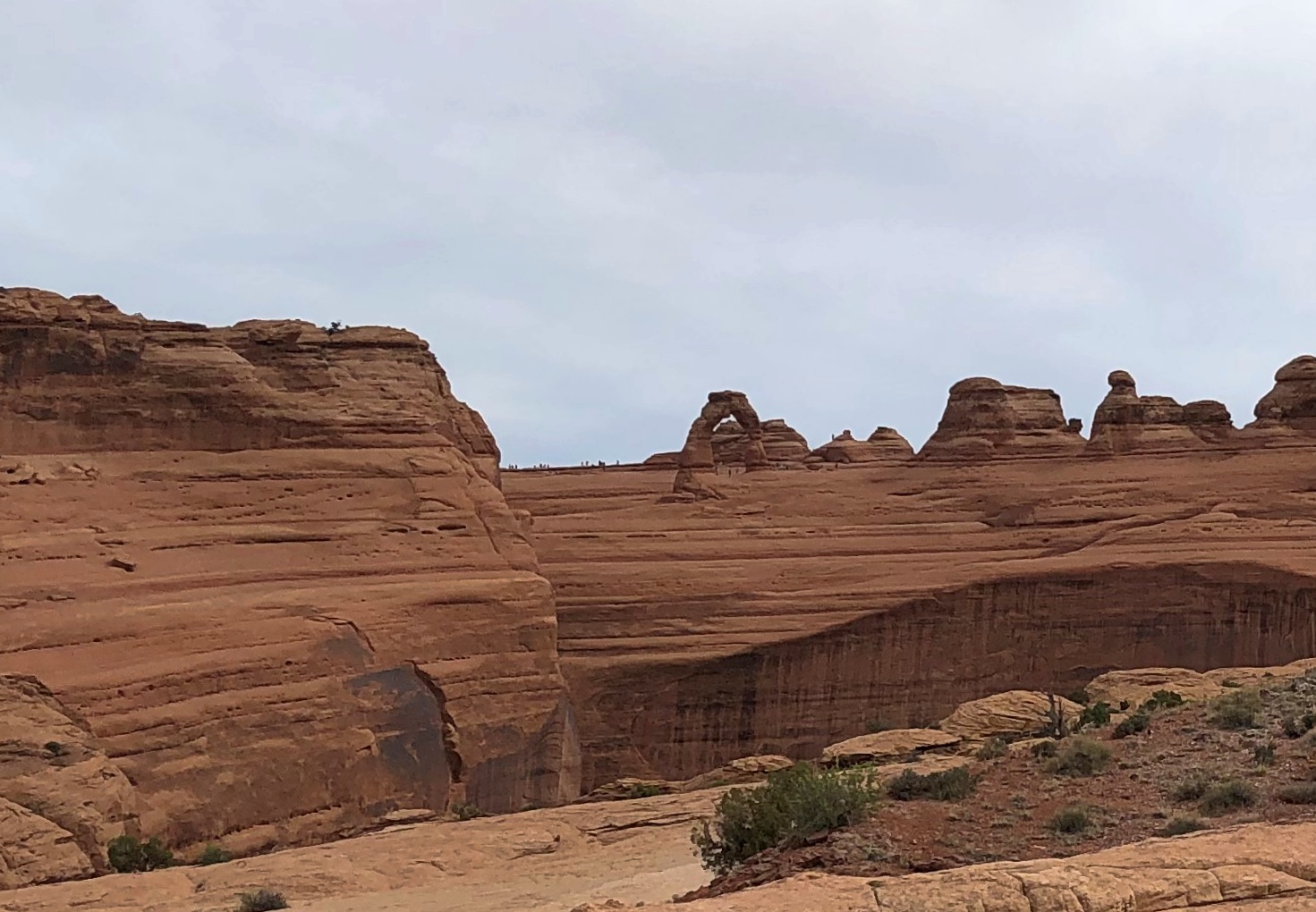
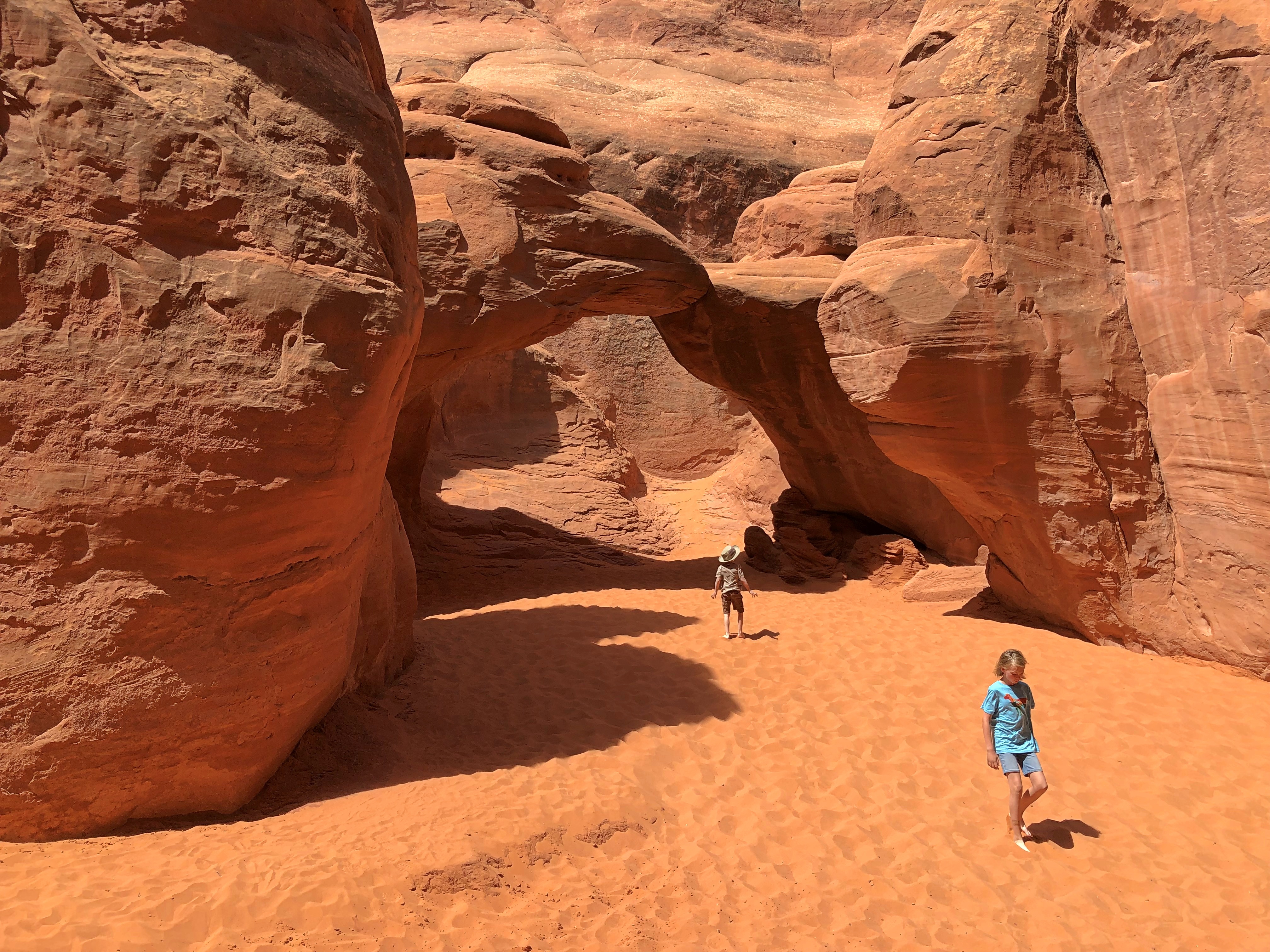
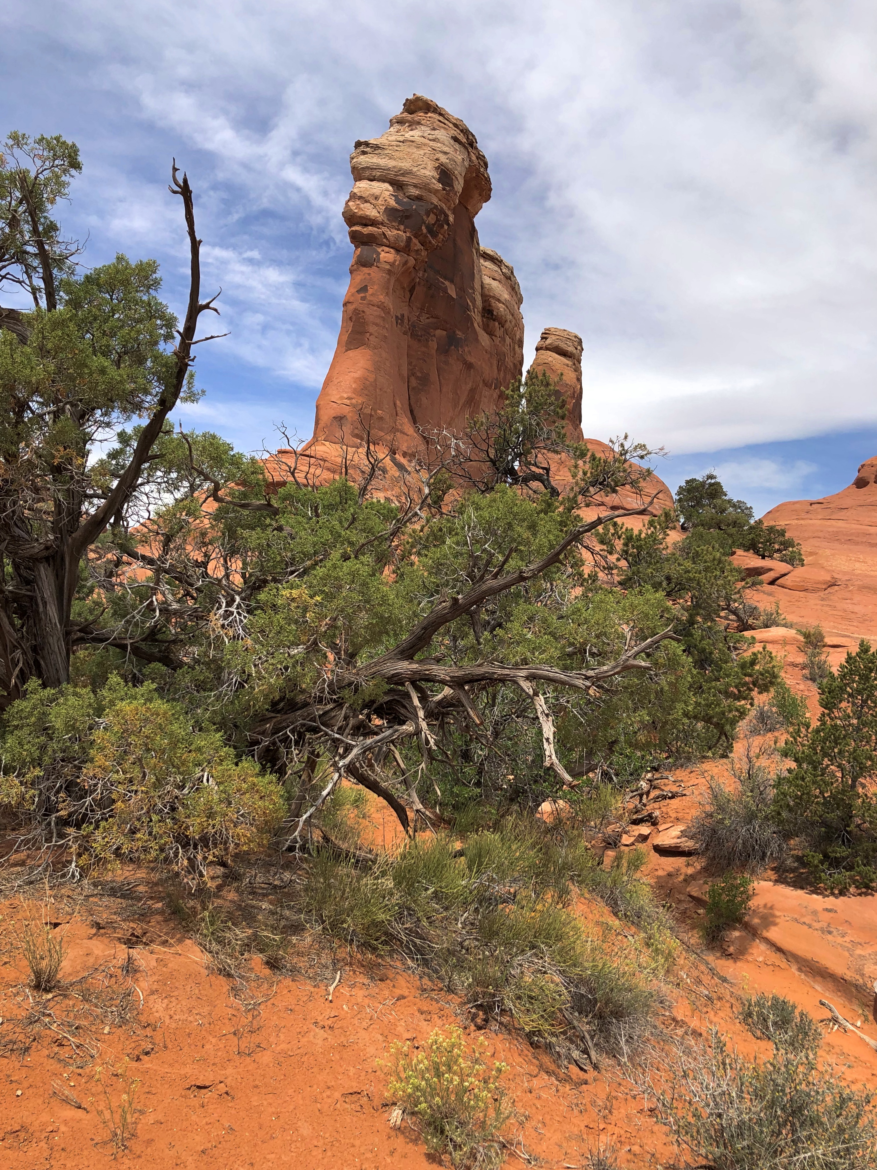
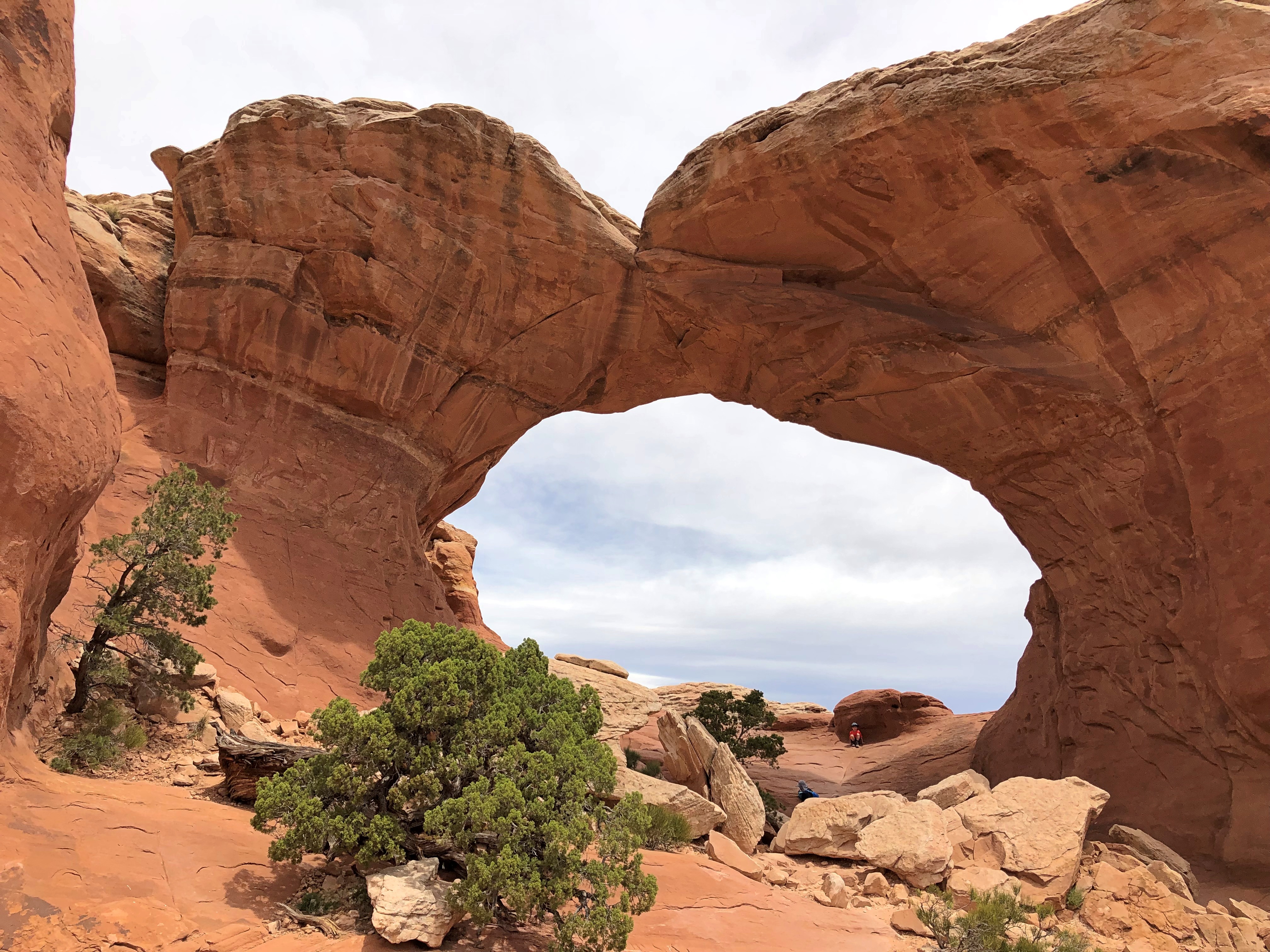
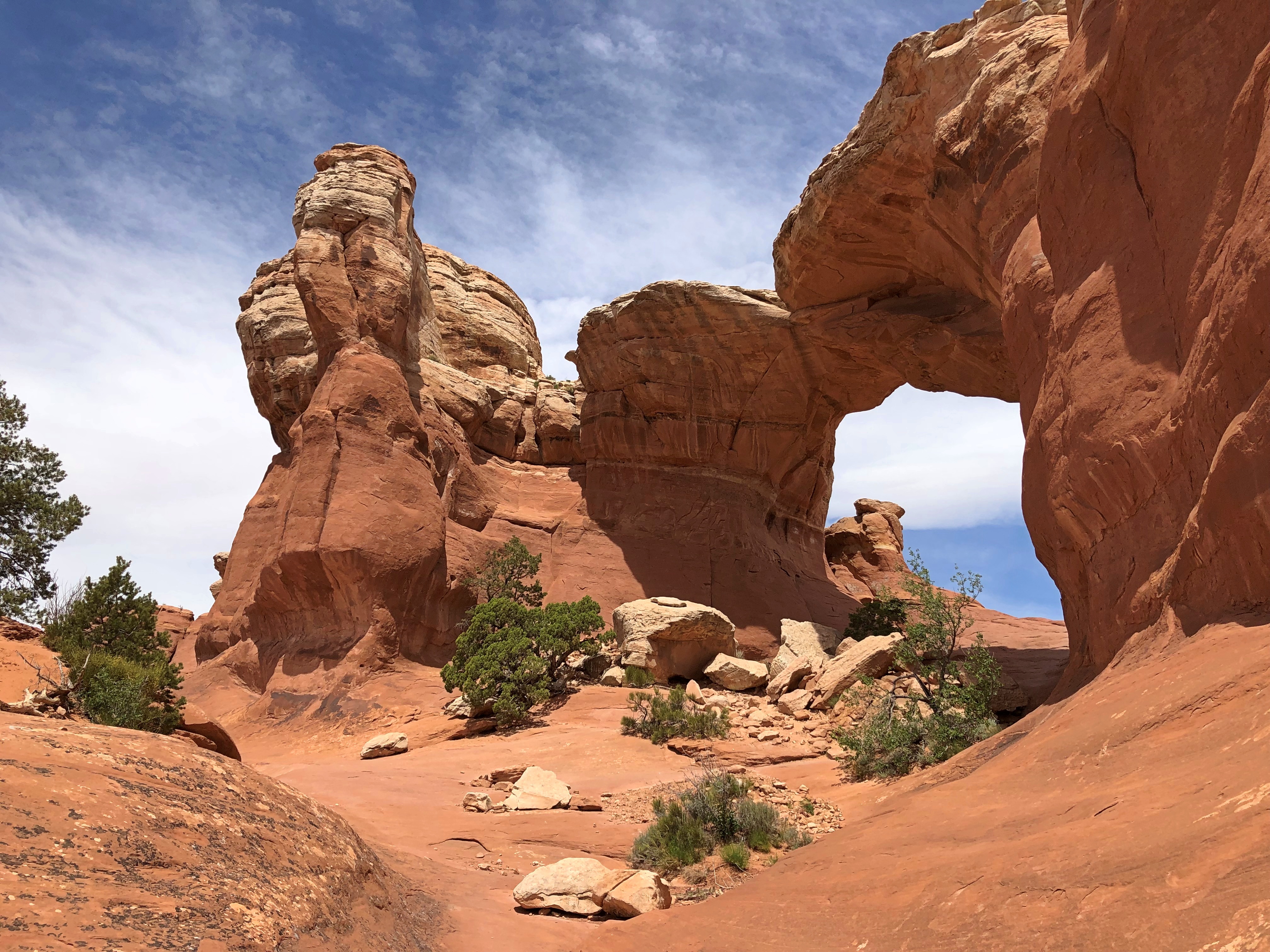
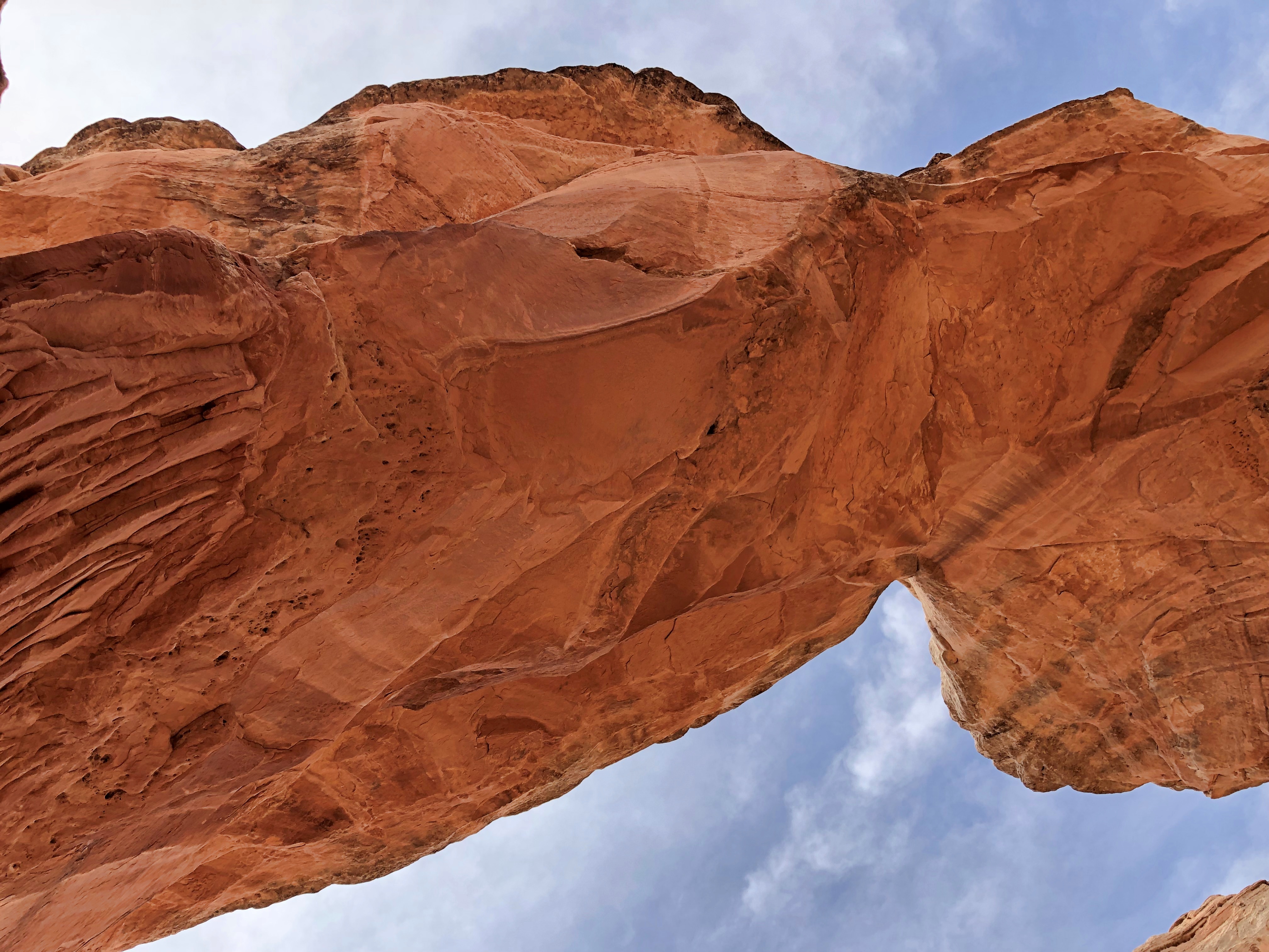
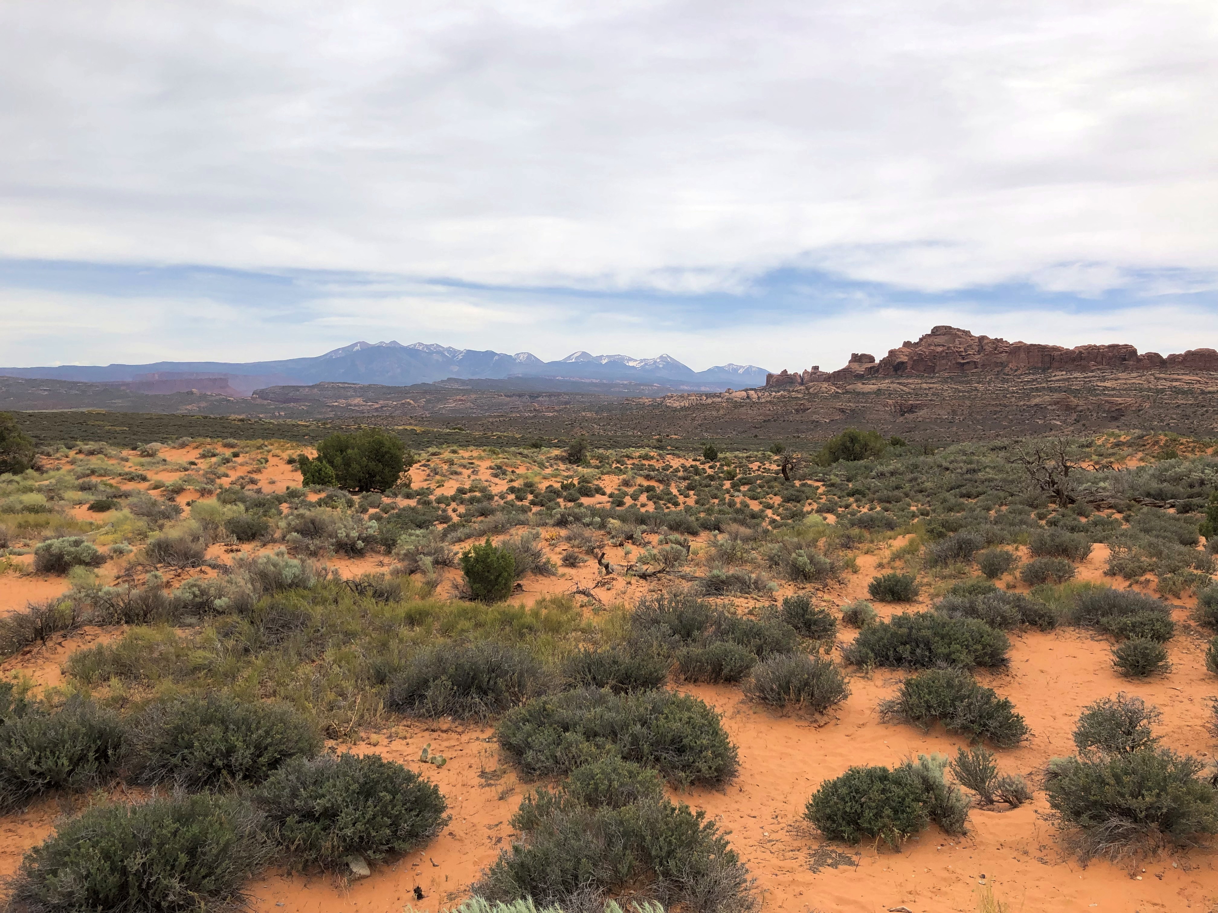
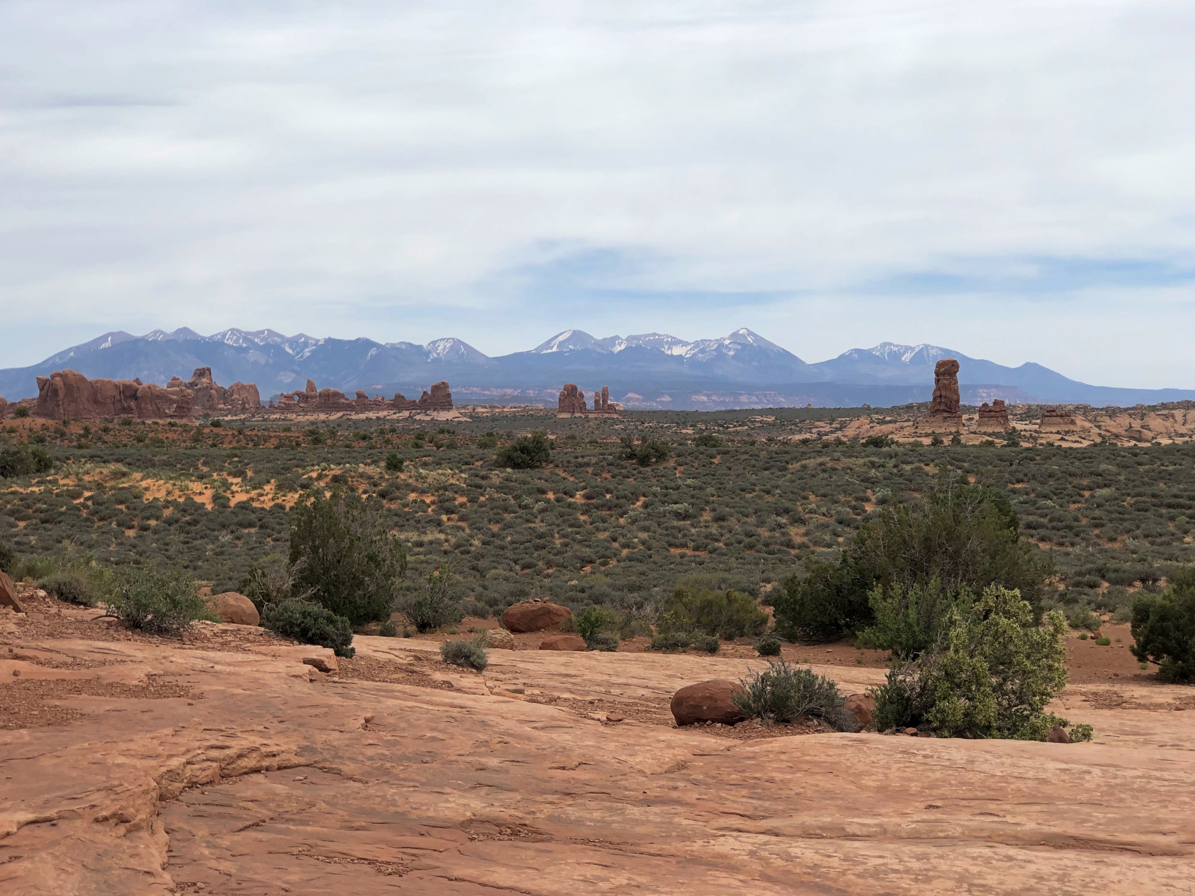
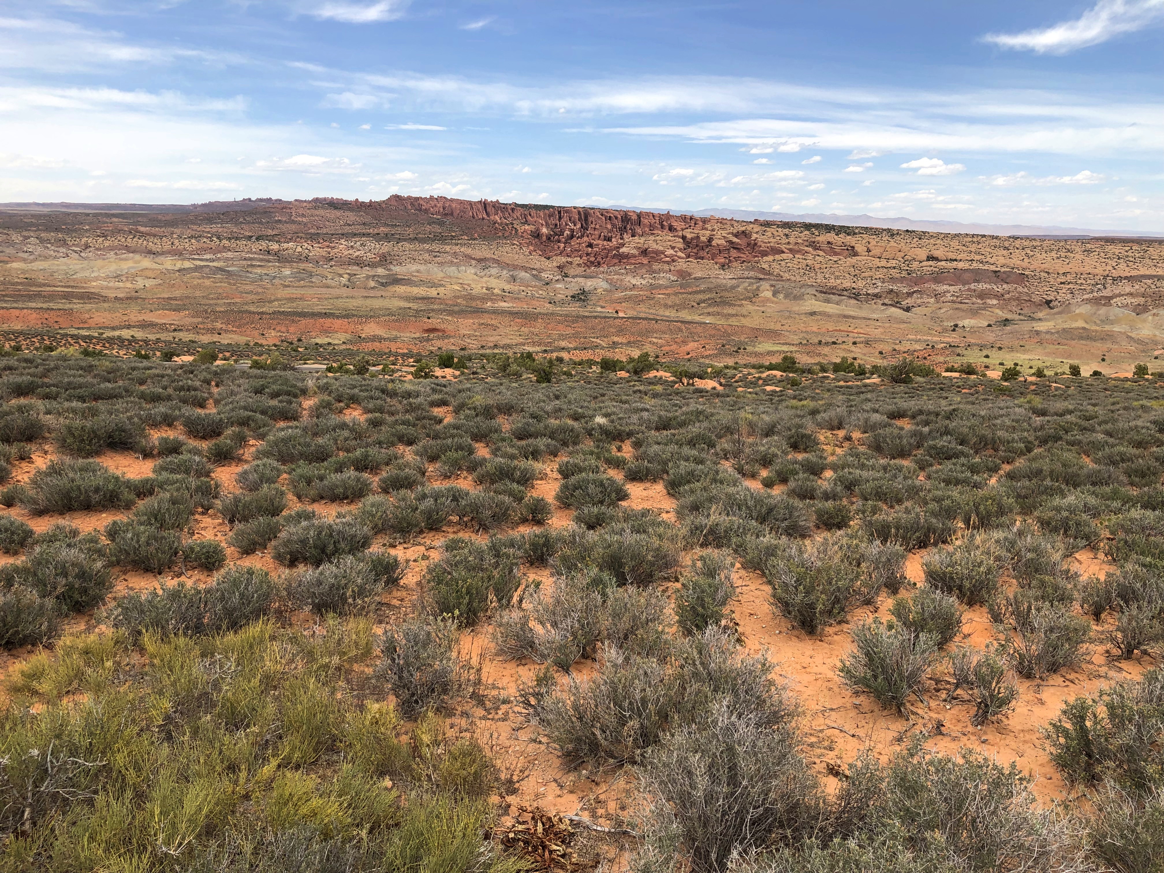
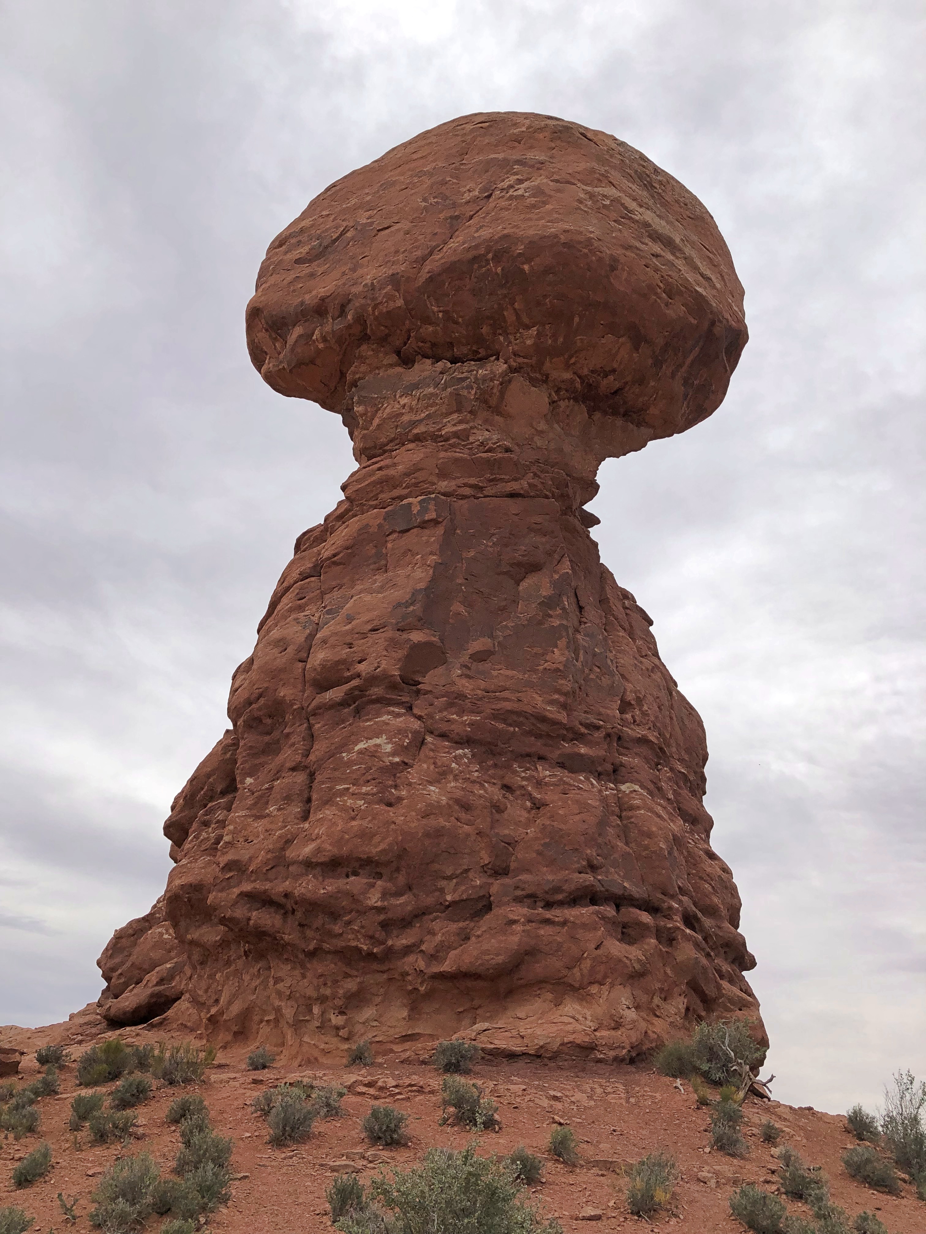
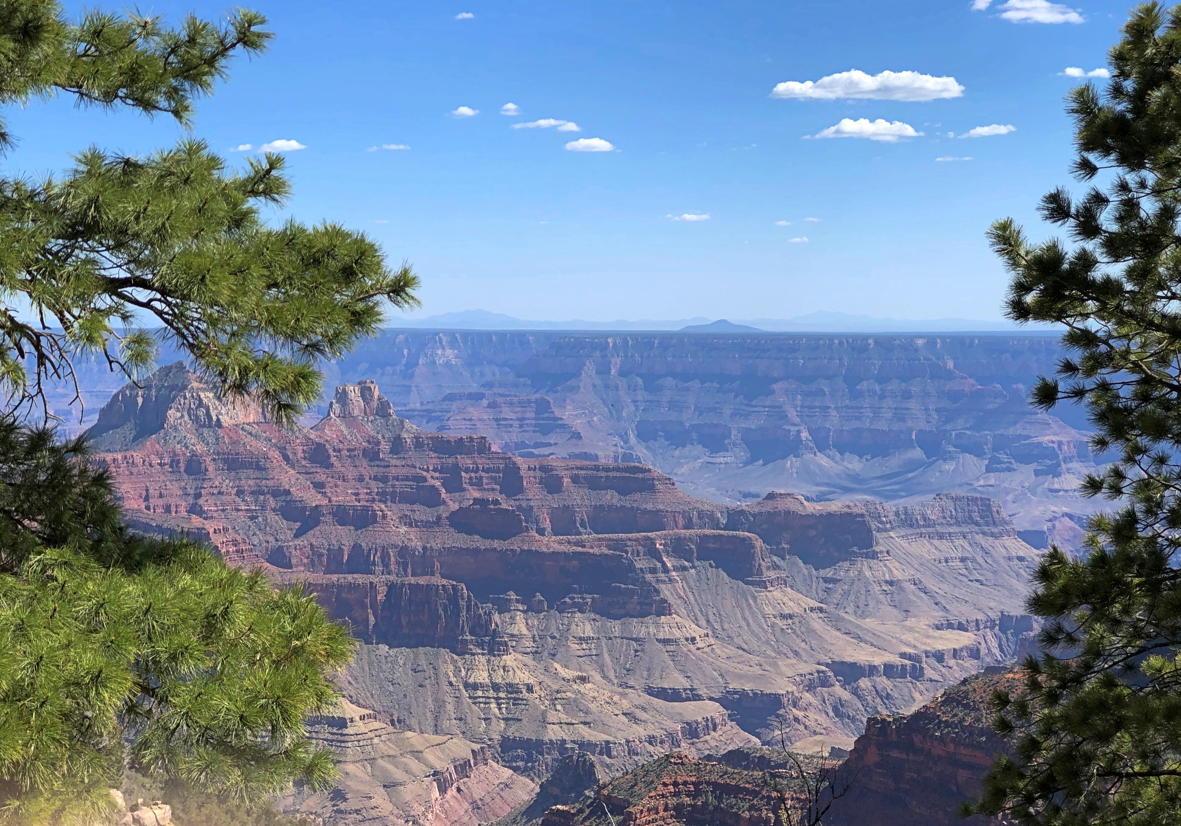
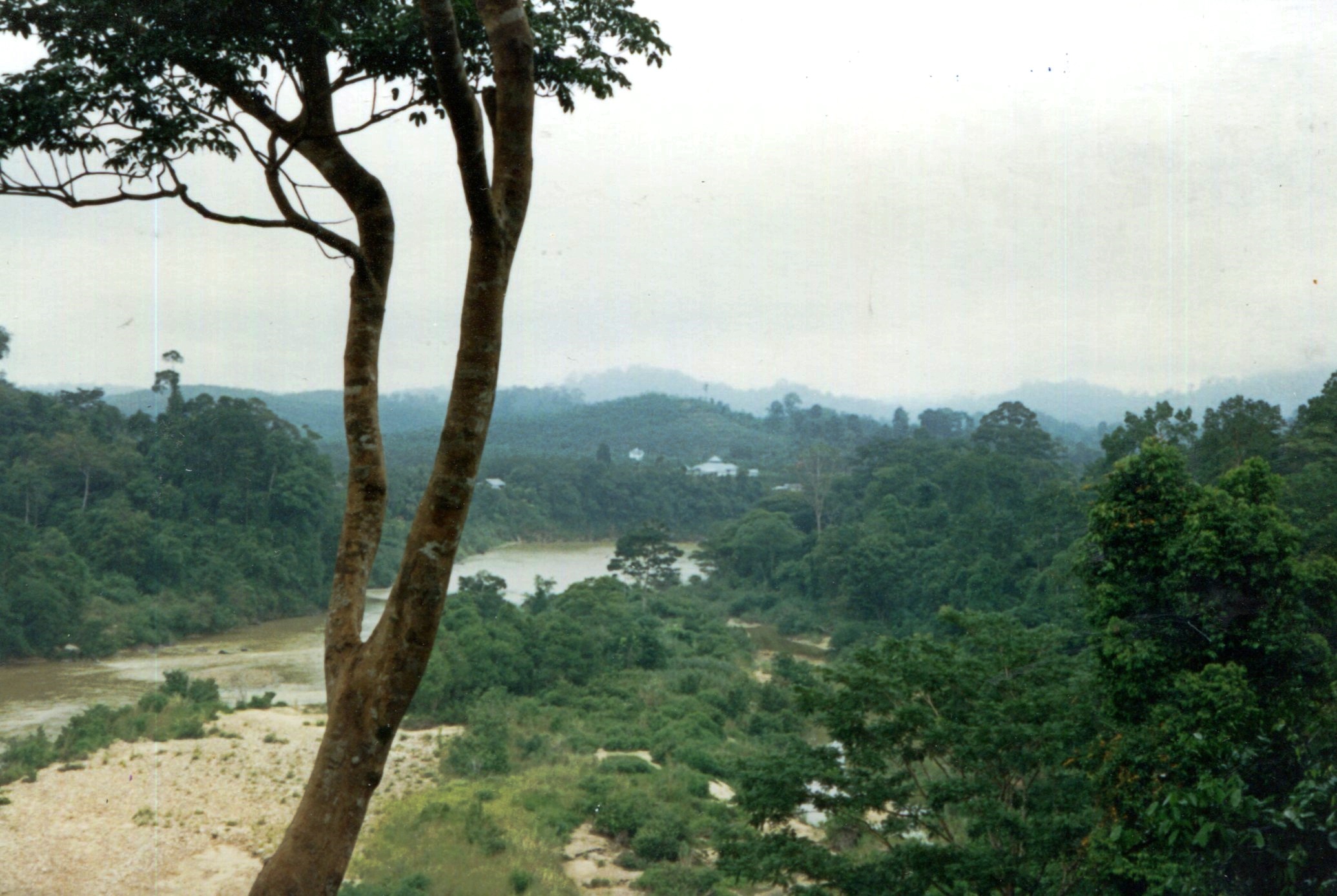
We went looking for scenic vistas formed by rocks of unimaginably various shapes, and boy did we find them — views of reds and oranges and ochers and browns and whites, seeing formations deep in canyons, vaulting high into the sky, or appearing wholly at eye level or underfoot. It boggles the mind: how did these rocks get to be so incredible to human perception? I know: wind and water and time. A lot of time. But damn. I also know — or at least have an inkling of — the fact that these rocks are temporary. Geologically speaking, only a little less the blink of an eye than my own lifetime.

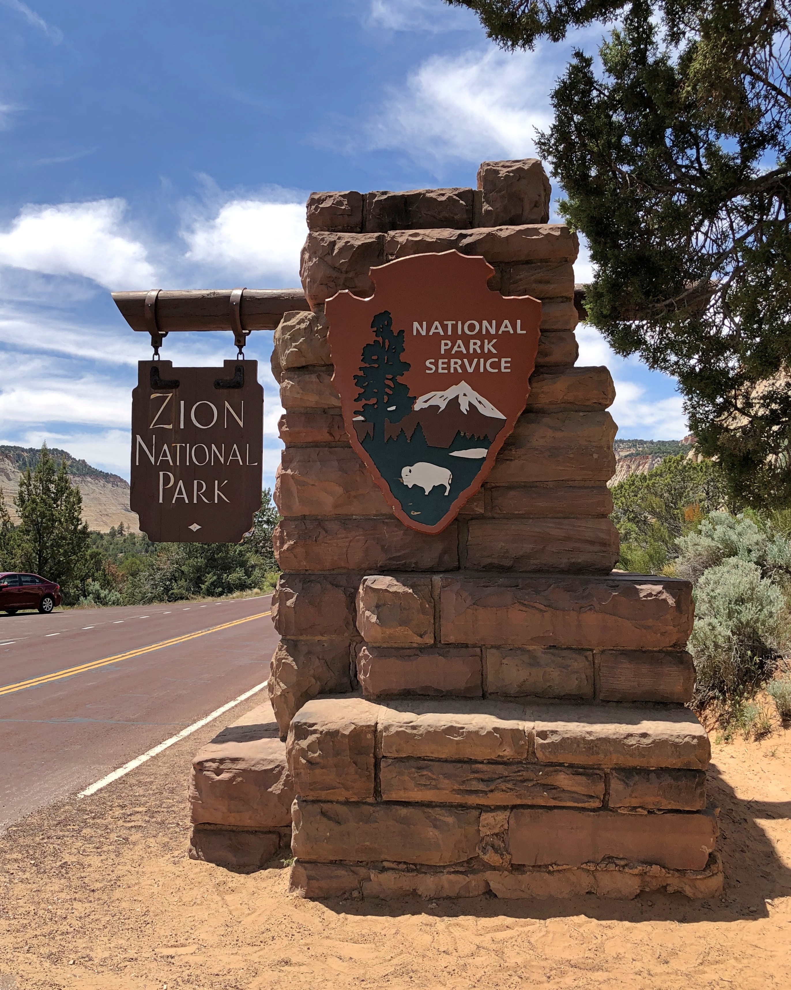
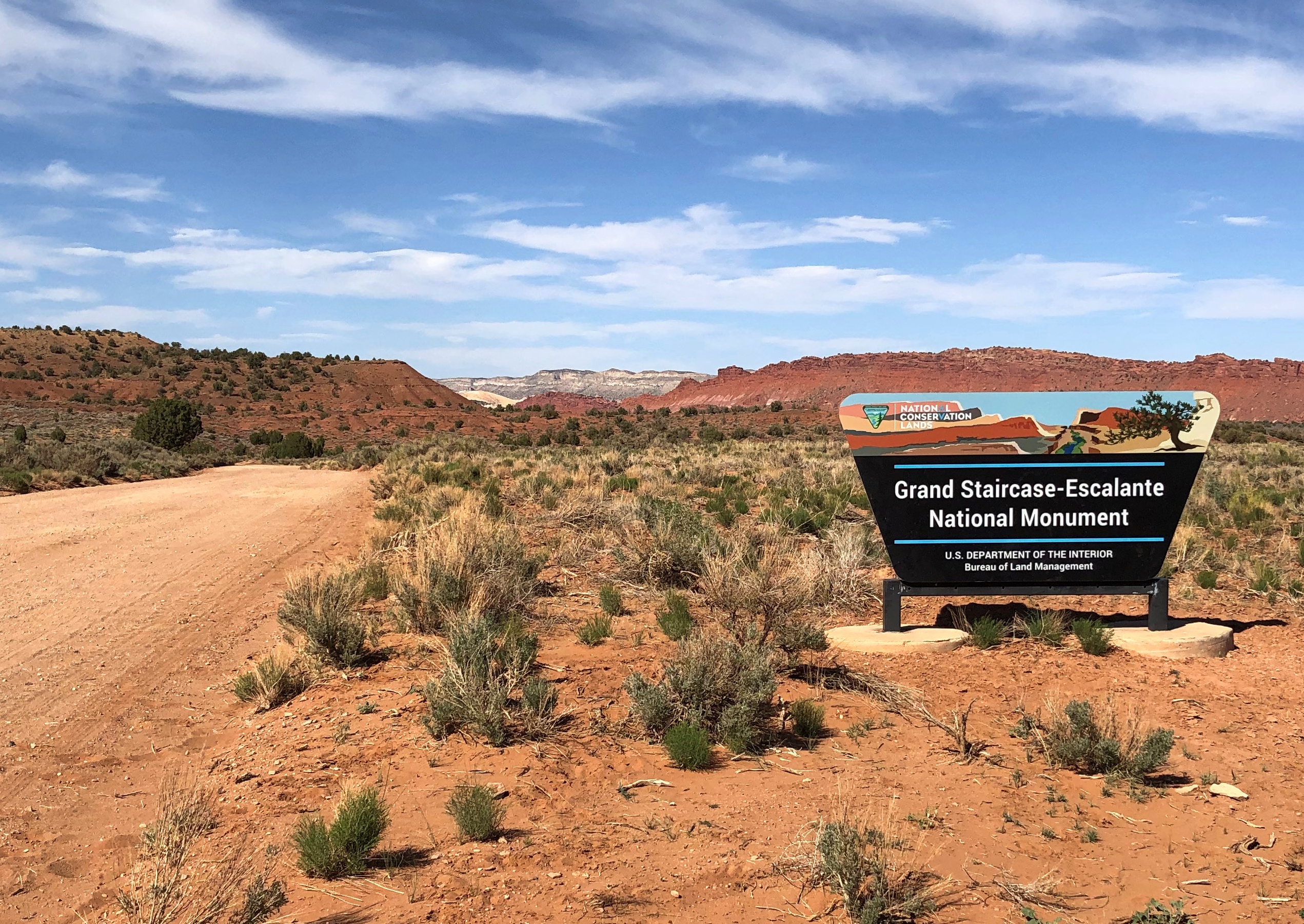
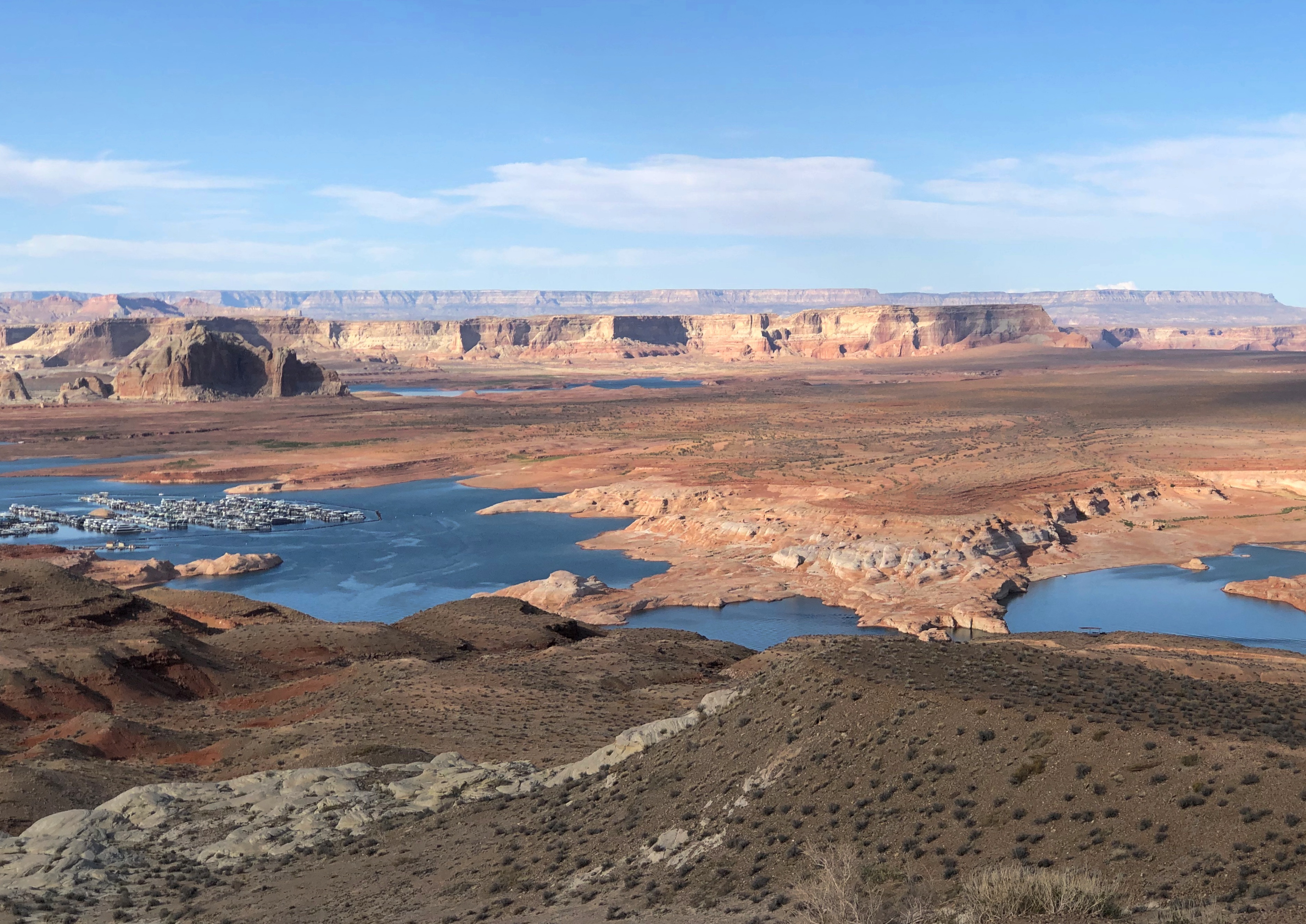
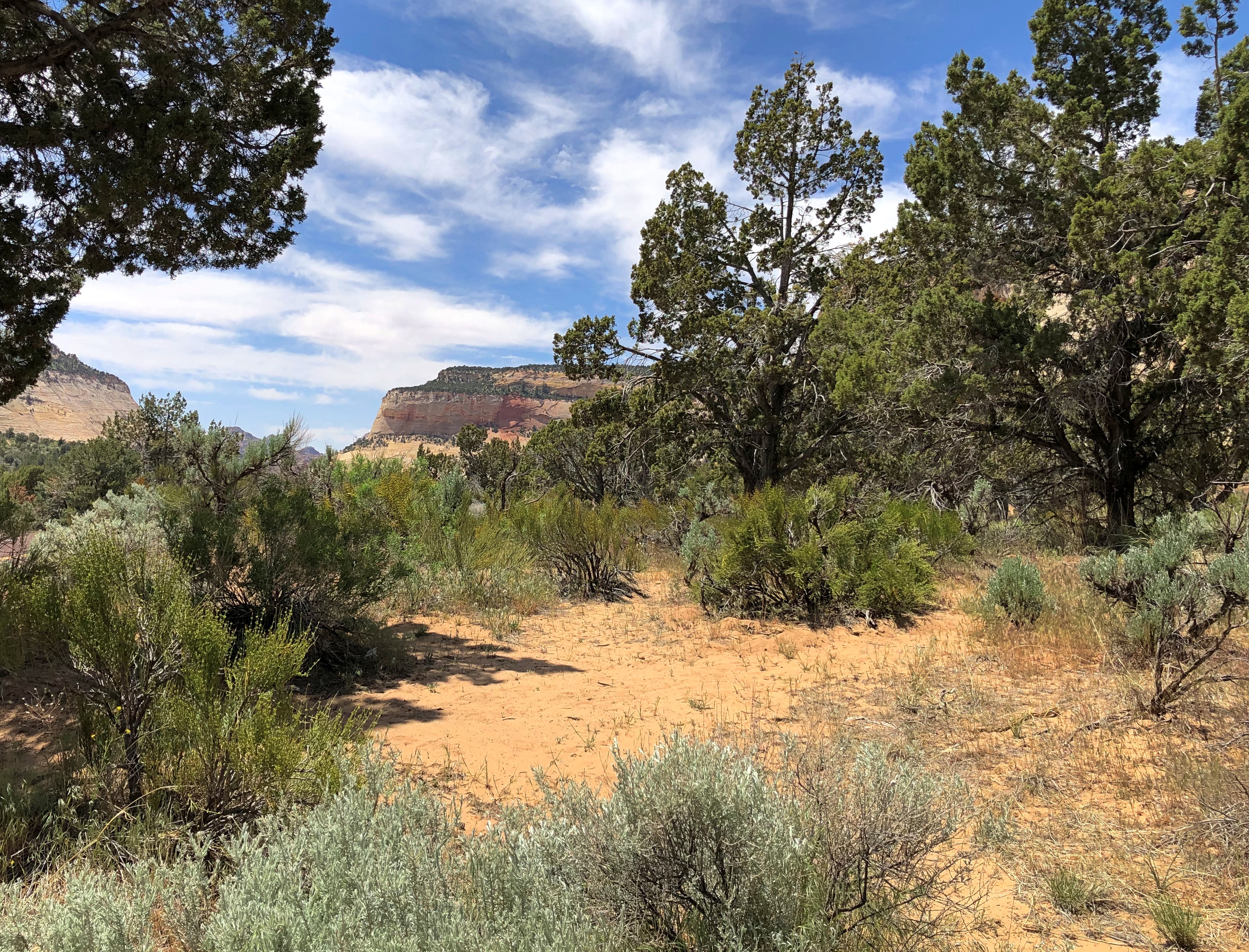
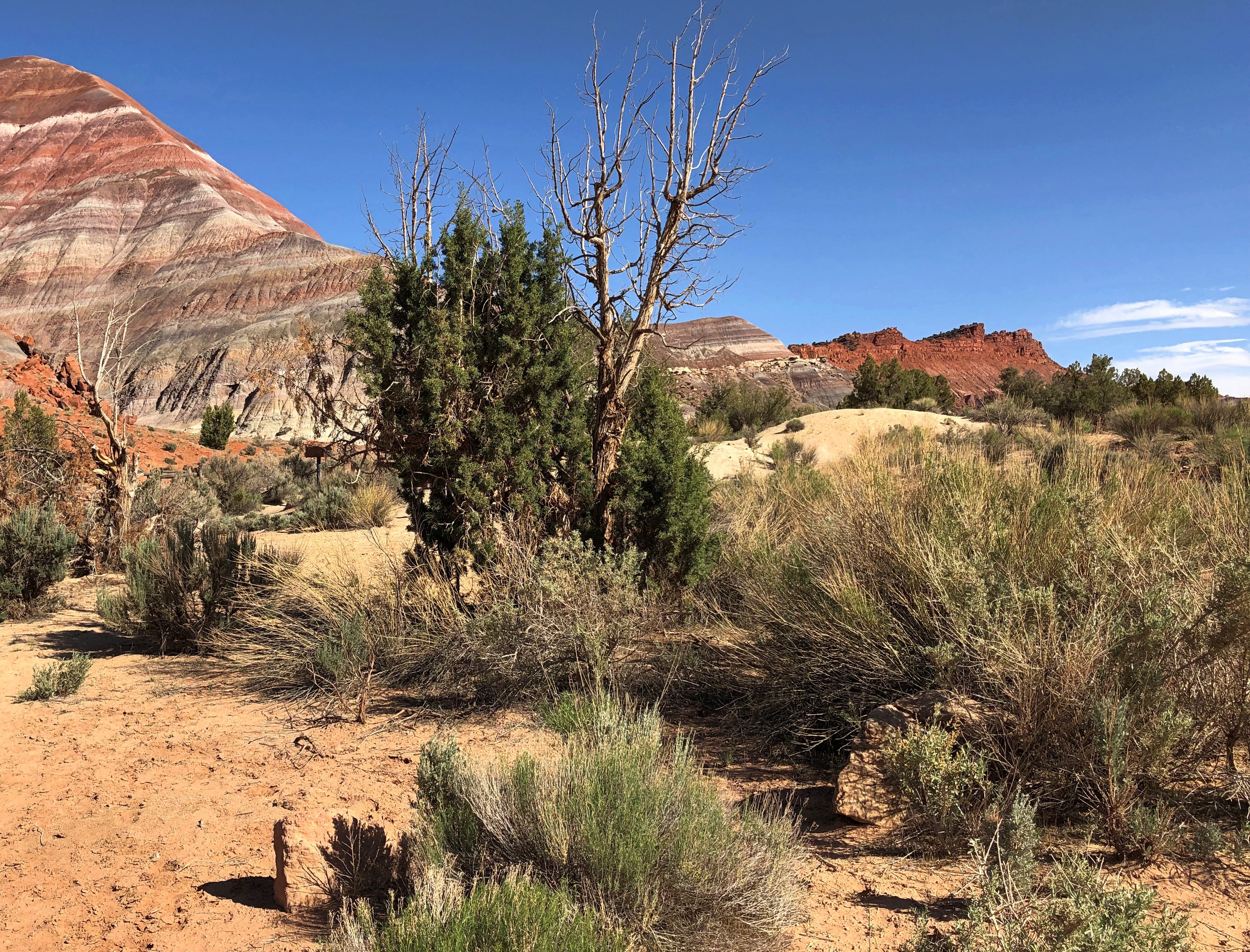
We drove out of Vegas last Sunday morning, bound for the tourist town of Page, Arizona, where we’d last stayed 25 years ago this month, when we visited Lake Powell. En route, we passed through Zion National Park (a destination in 2000 but not this time) and later ventured briefly into the vast and contentious Grand Staircase-Escalante National Monument.

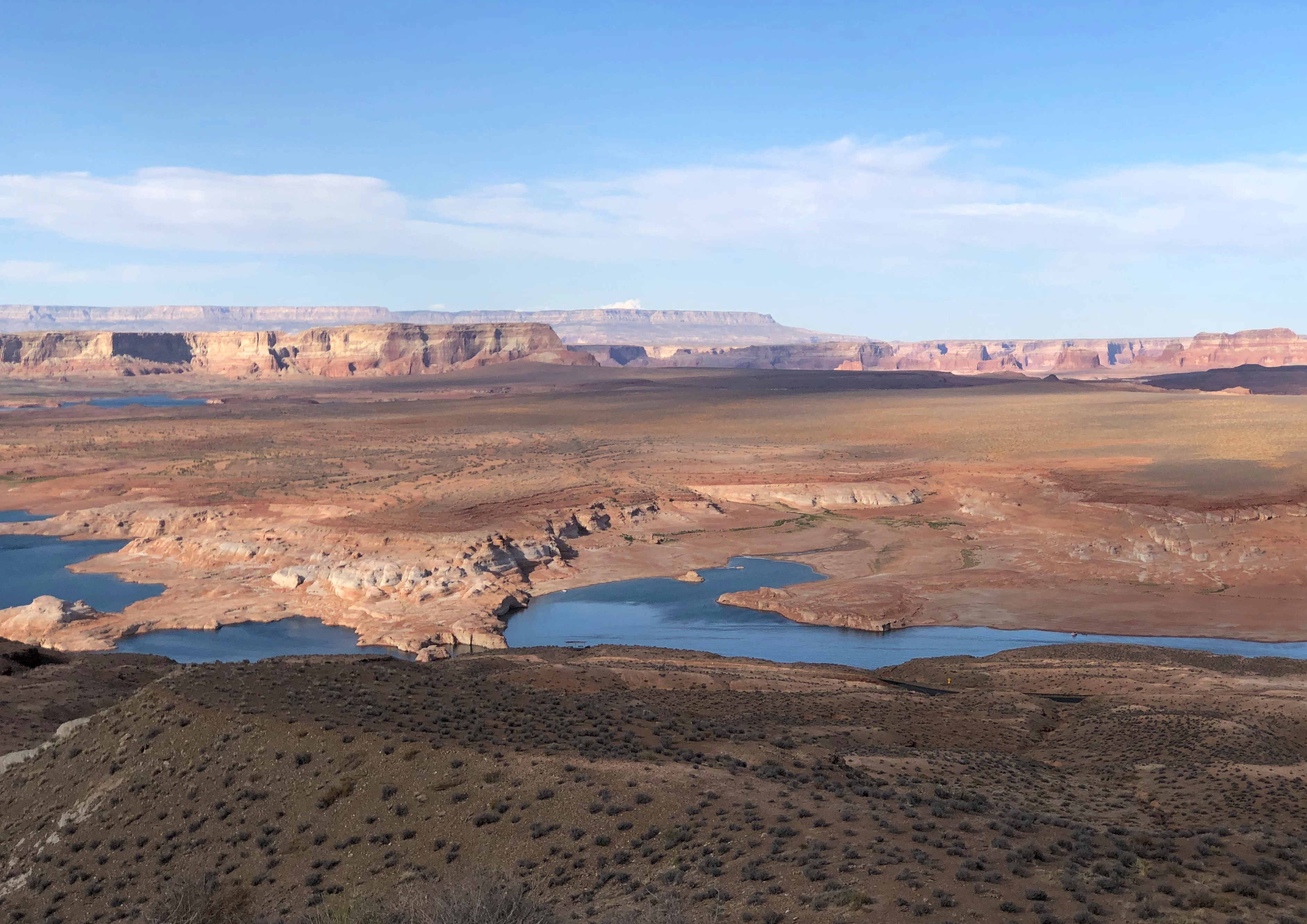
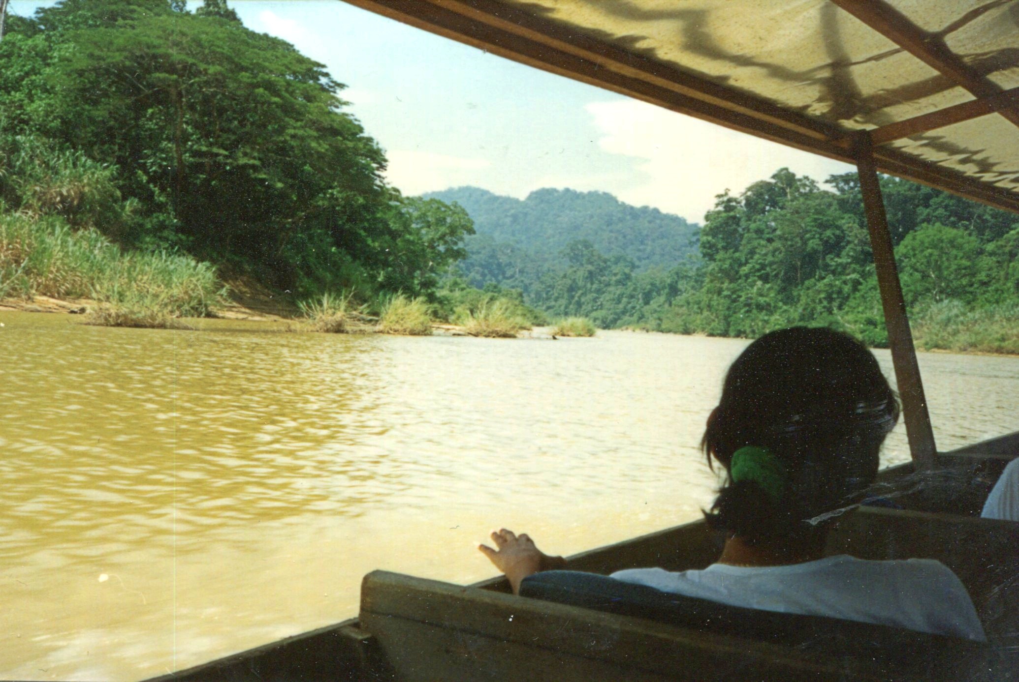
Our first major destination, a week ago on Monday morning, was the slot canyons of Lake Powell Navajo Tribal Park, an embarrassment of sandstone riches near Page. Also near Page — actually in Page, but also part of the Glen Canyon National Recreation Area — is Horseshoe Bend on the Colorado River, now famous because of Instagram. Be that as it may, we weren’t about to miss that. We watched the sun drop below the mountains in the distance at Horseshoe Bend.

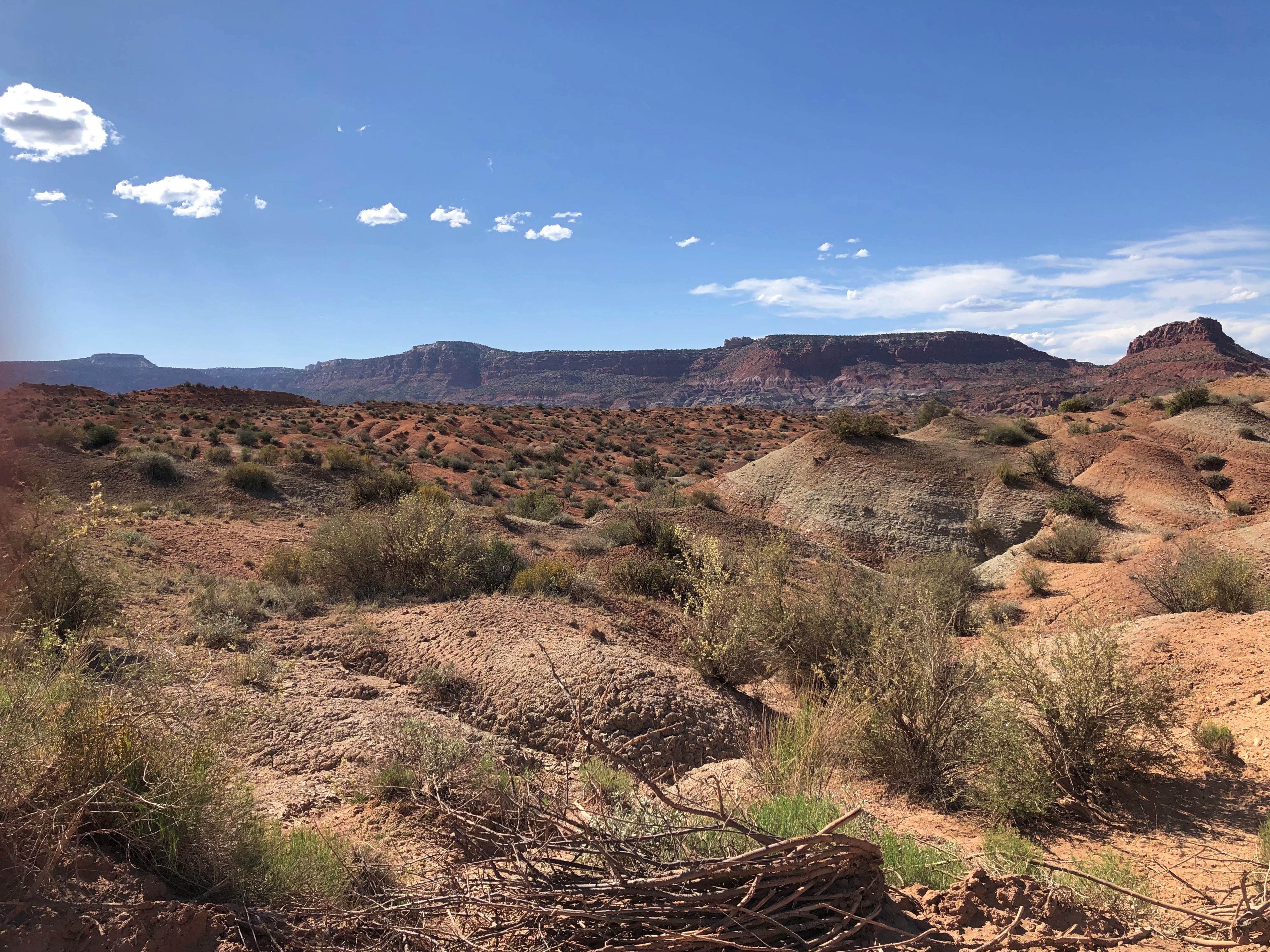
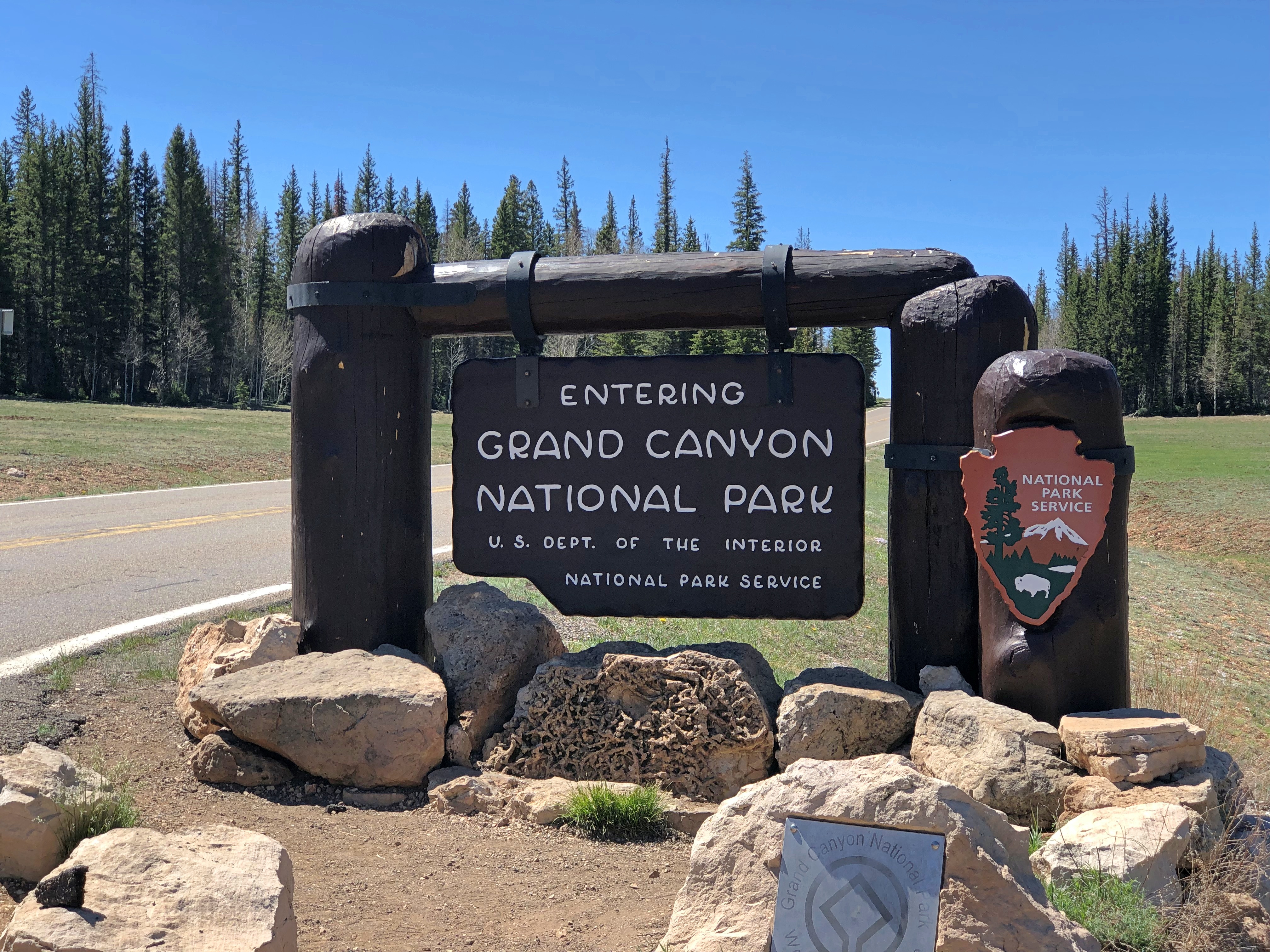
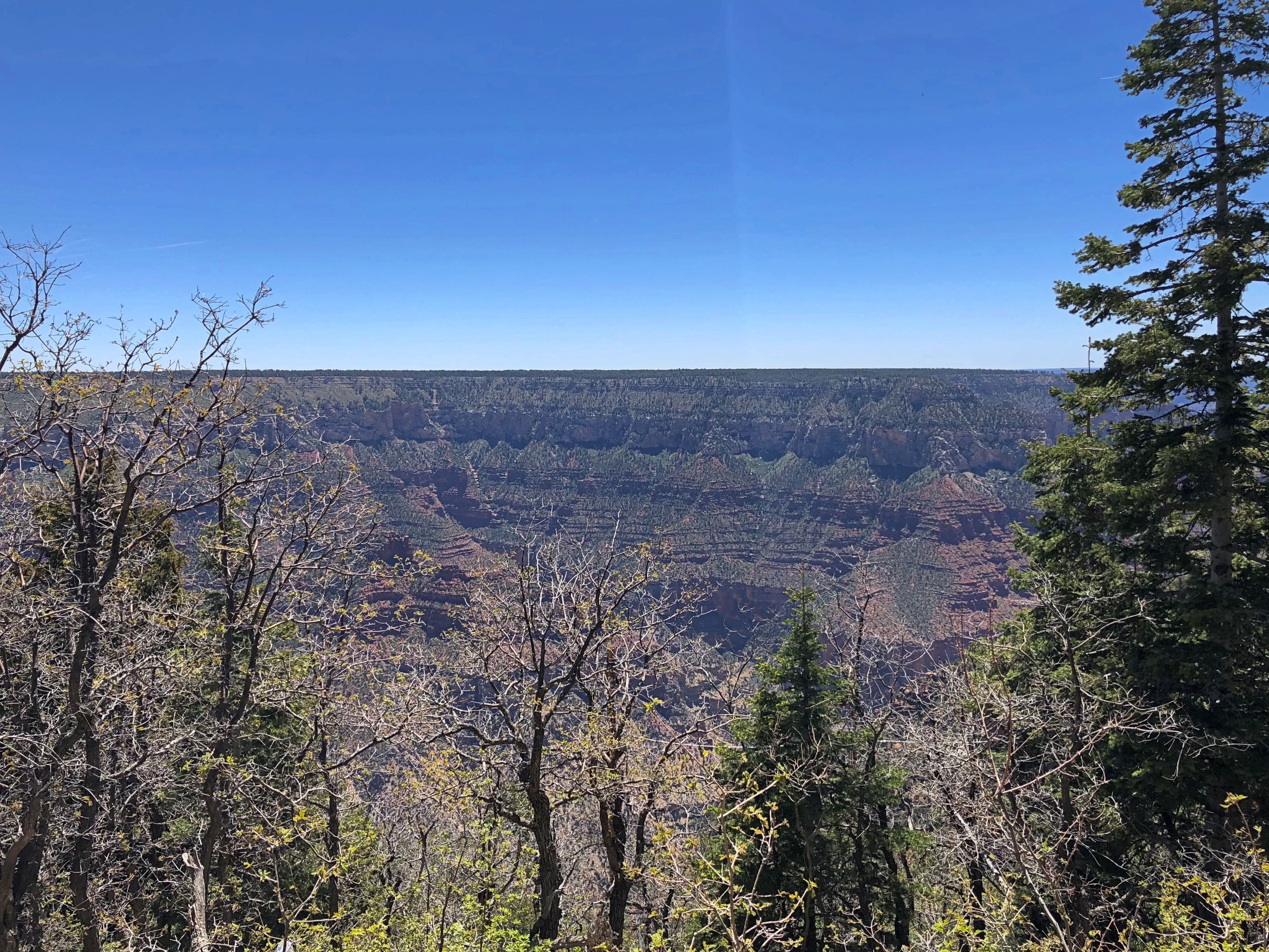
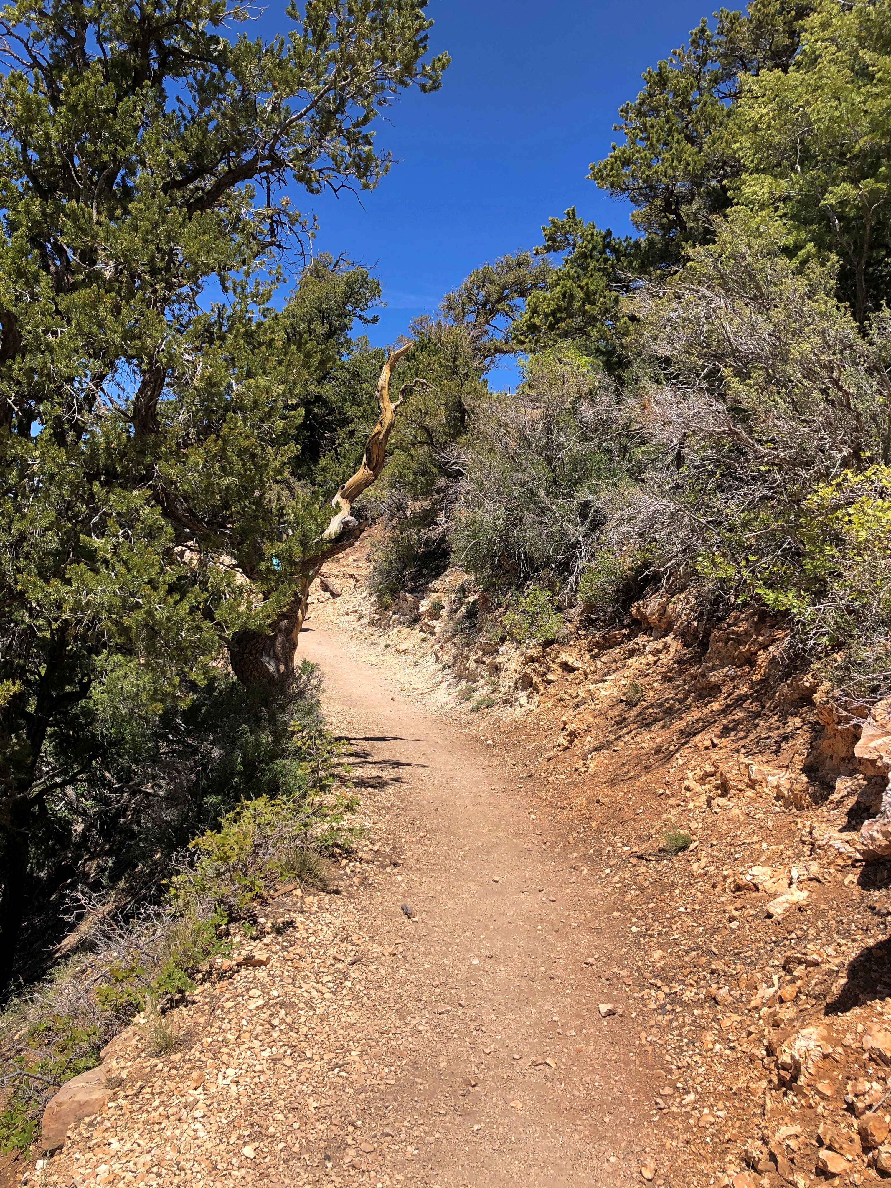
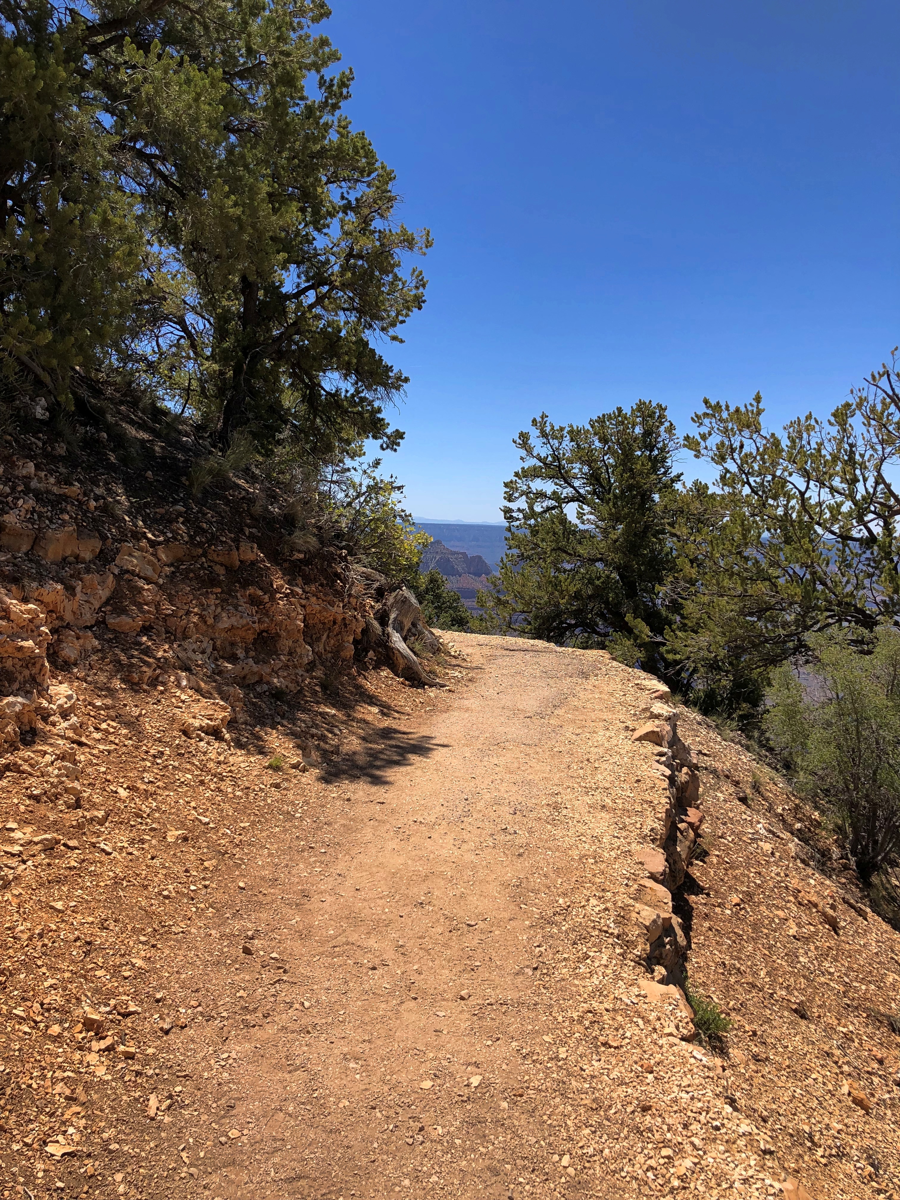
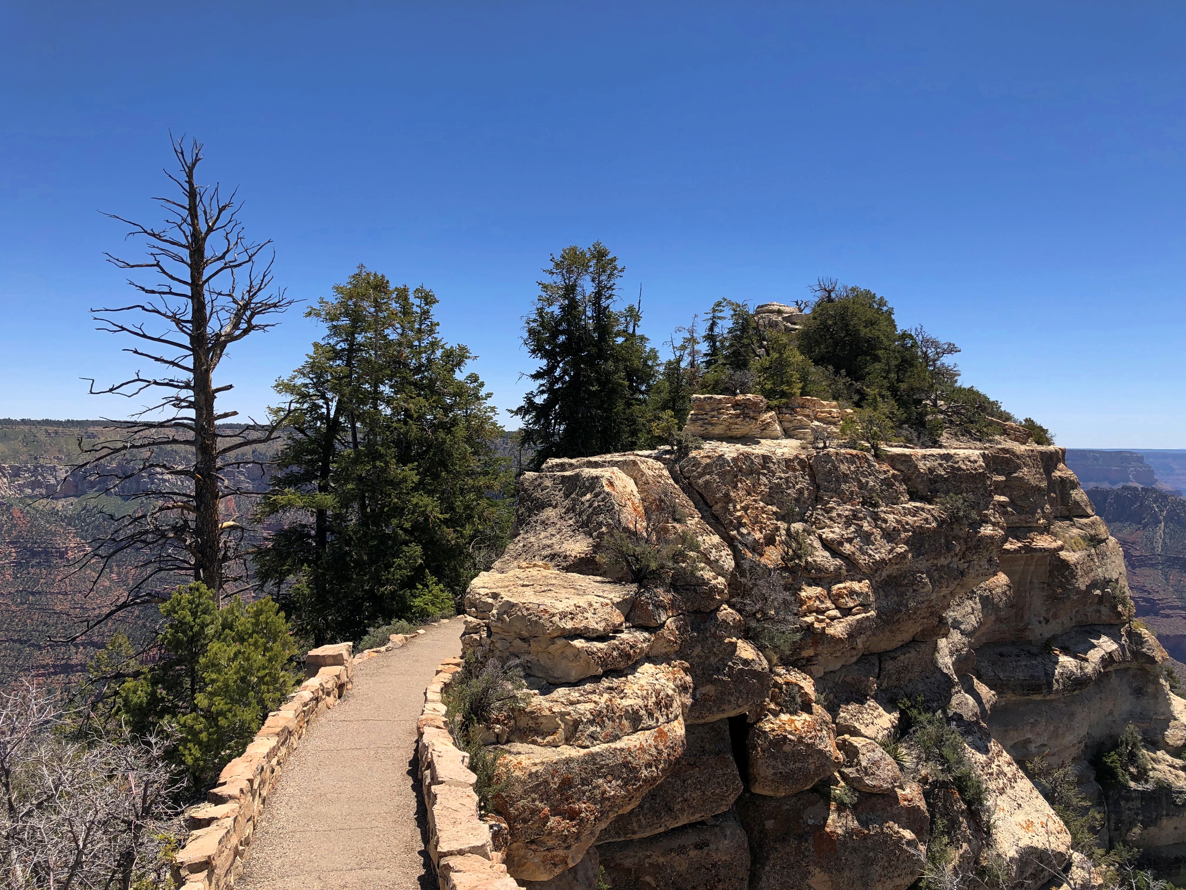
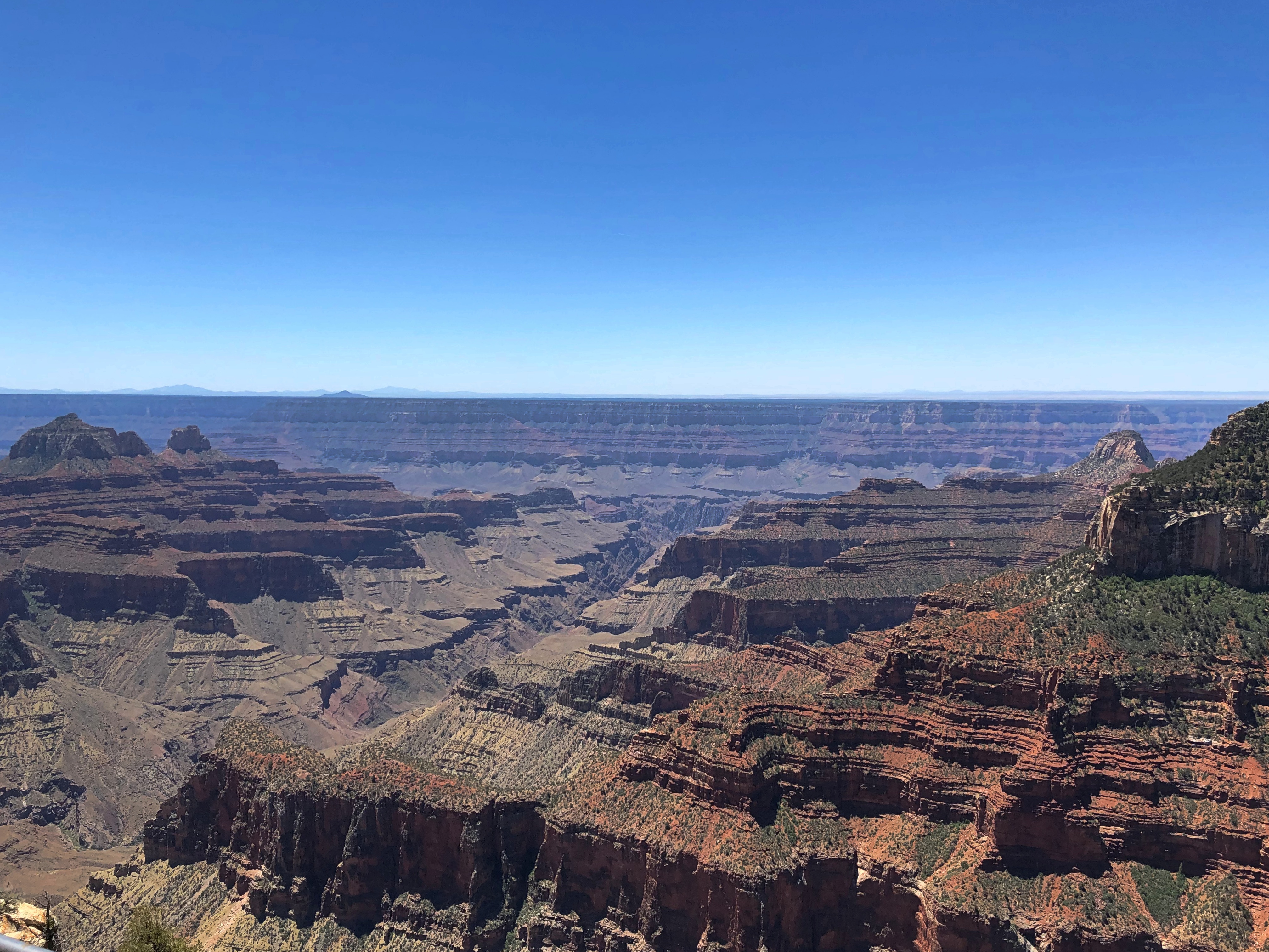
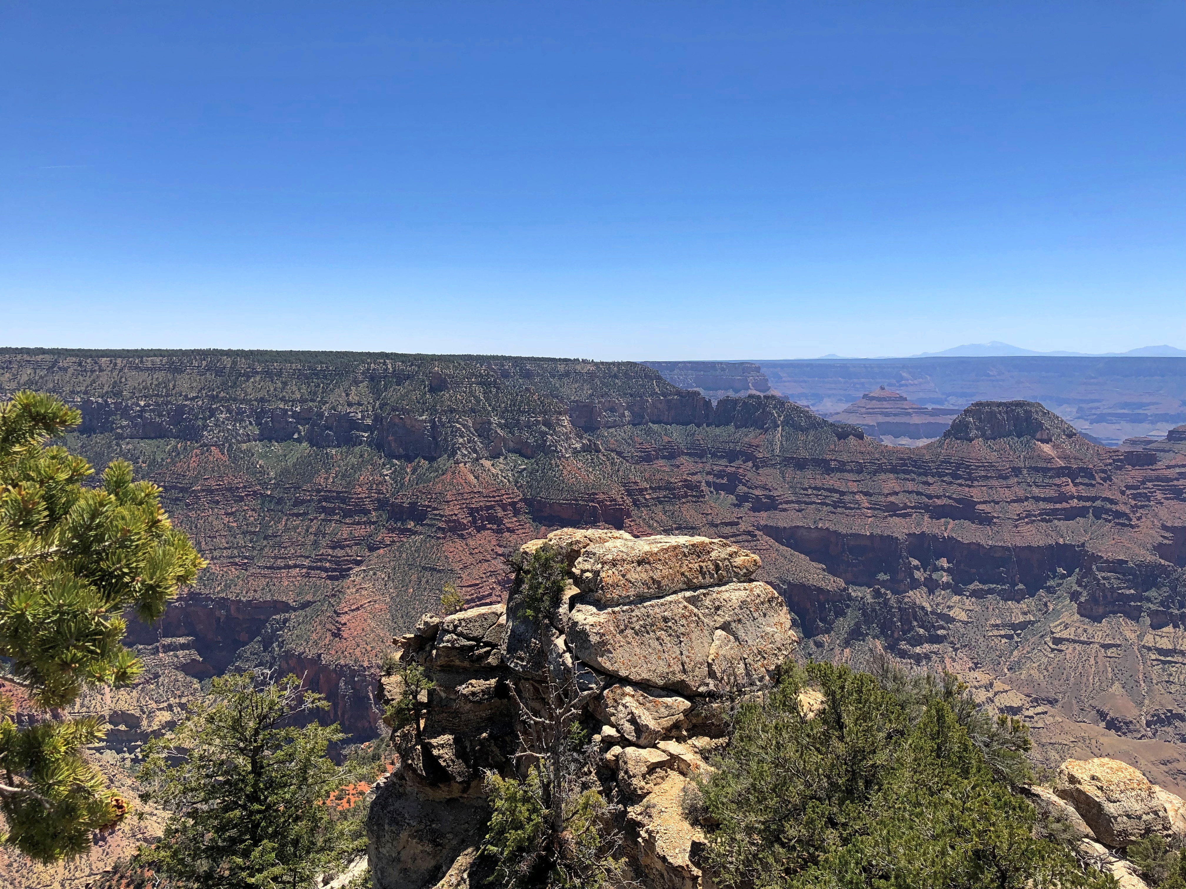
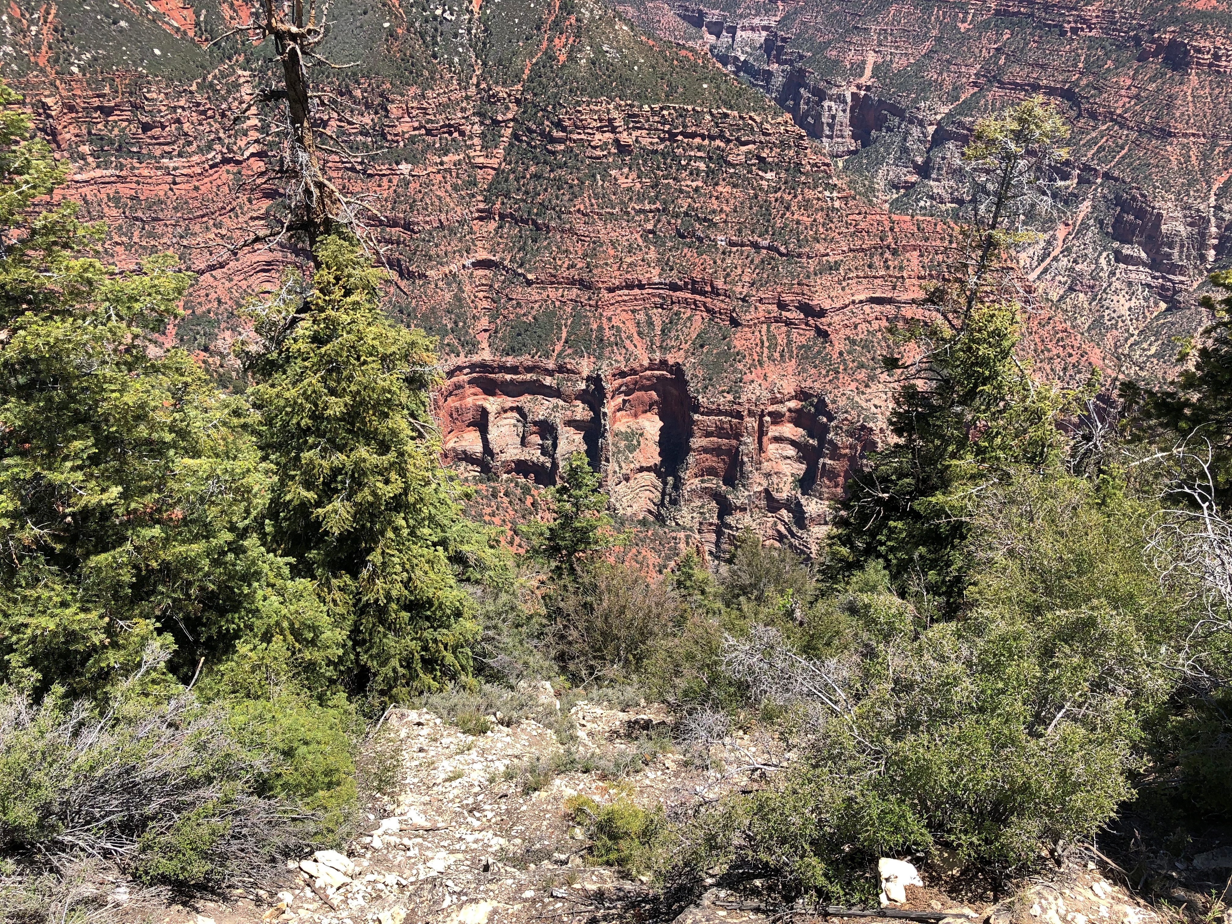
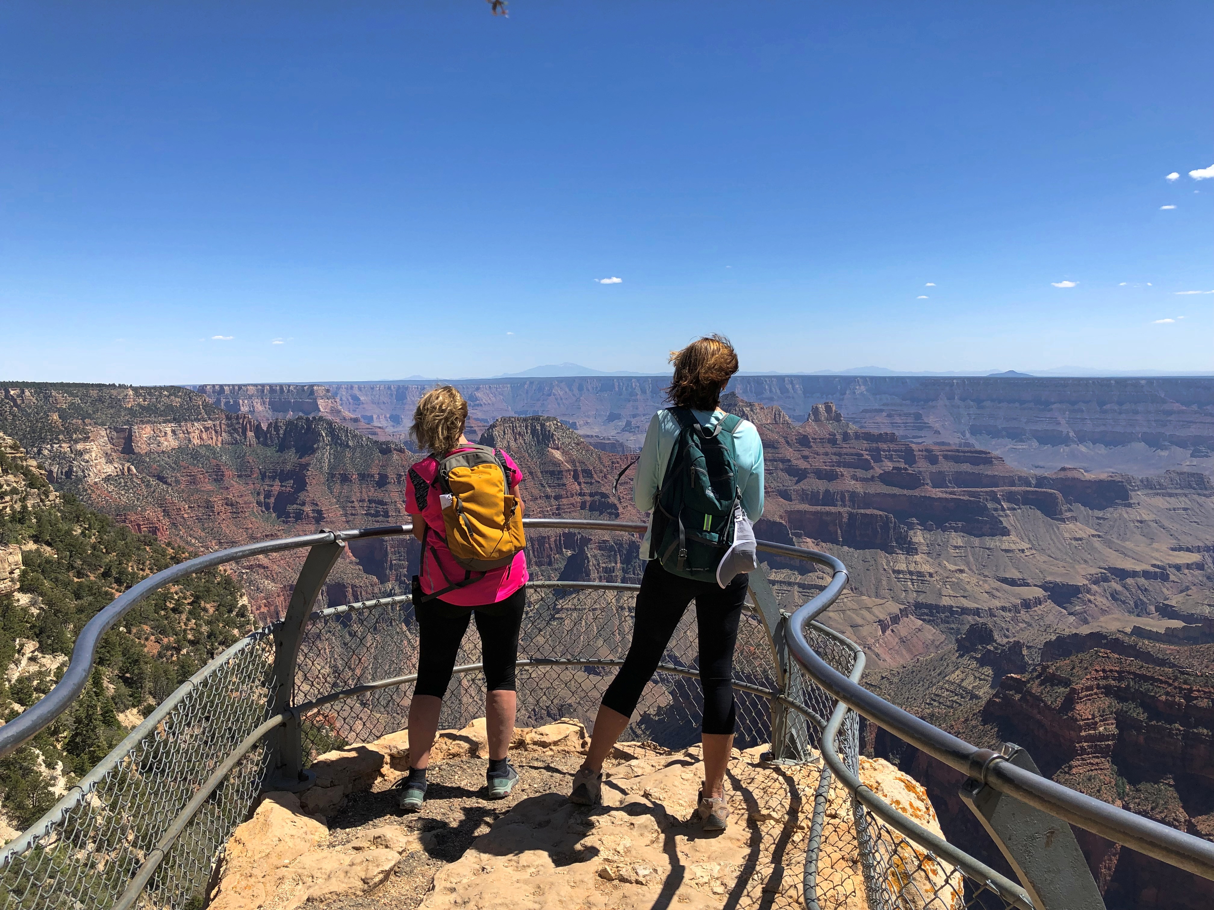
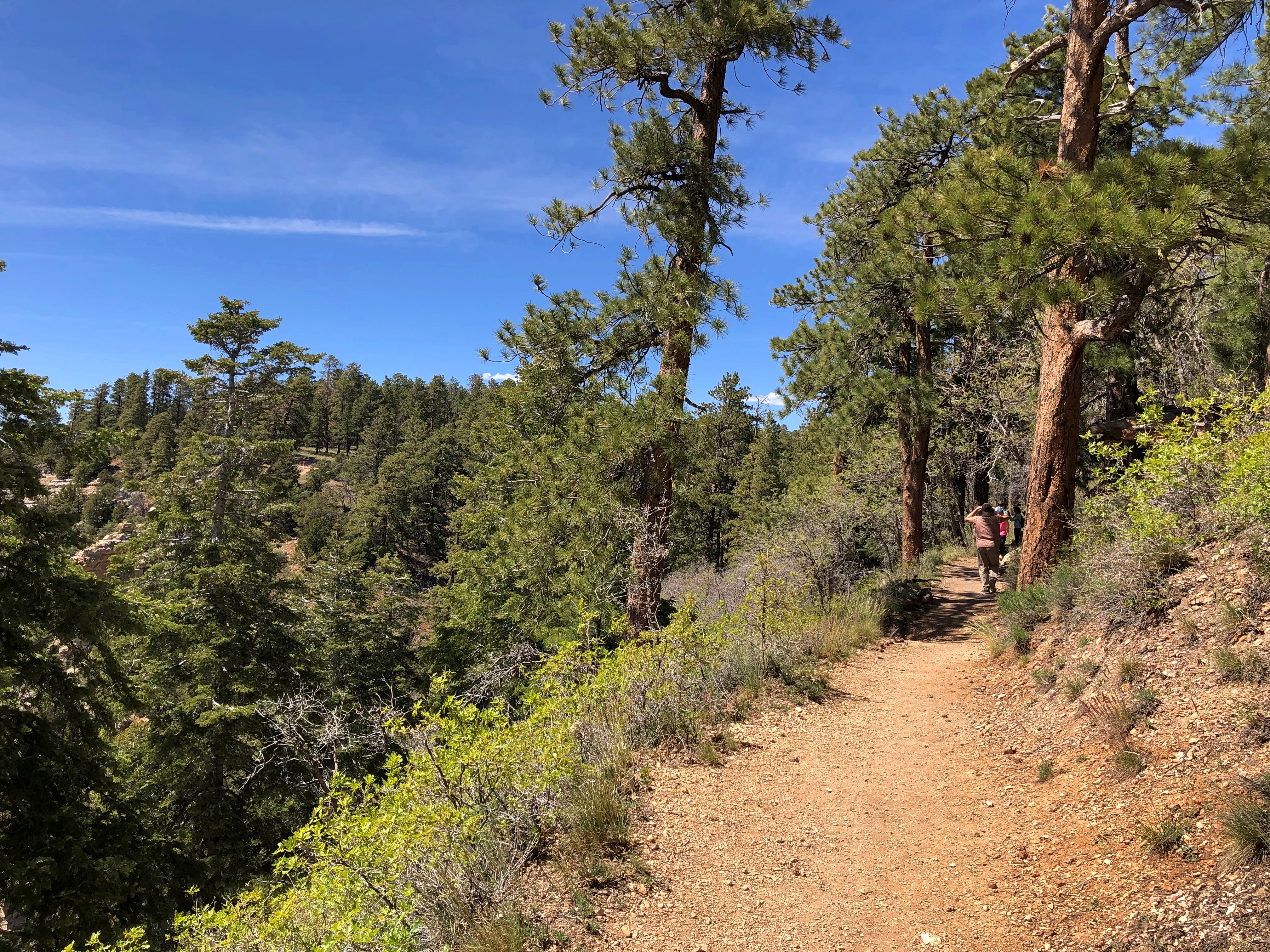
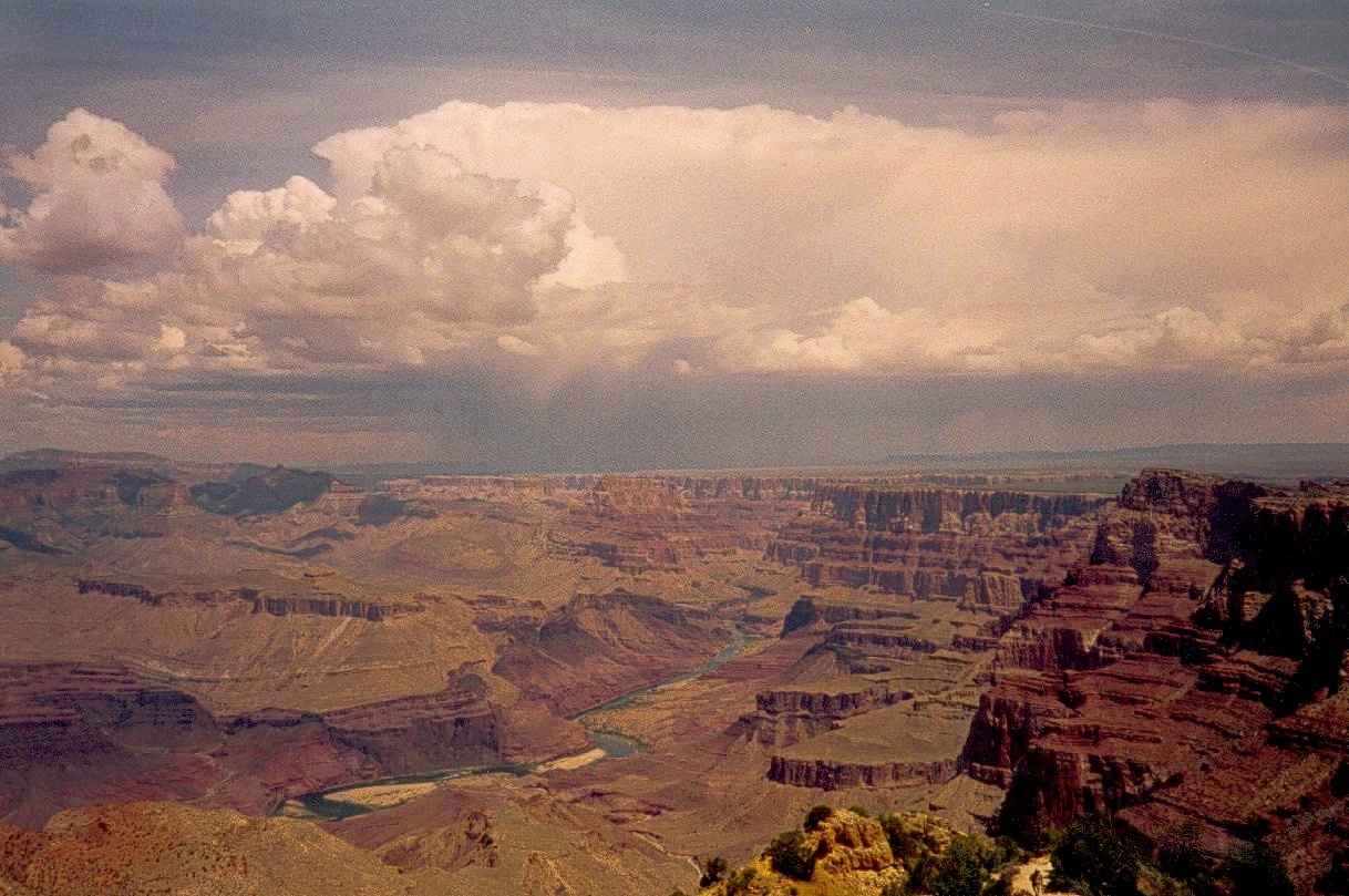
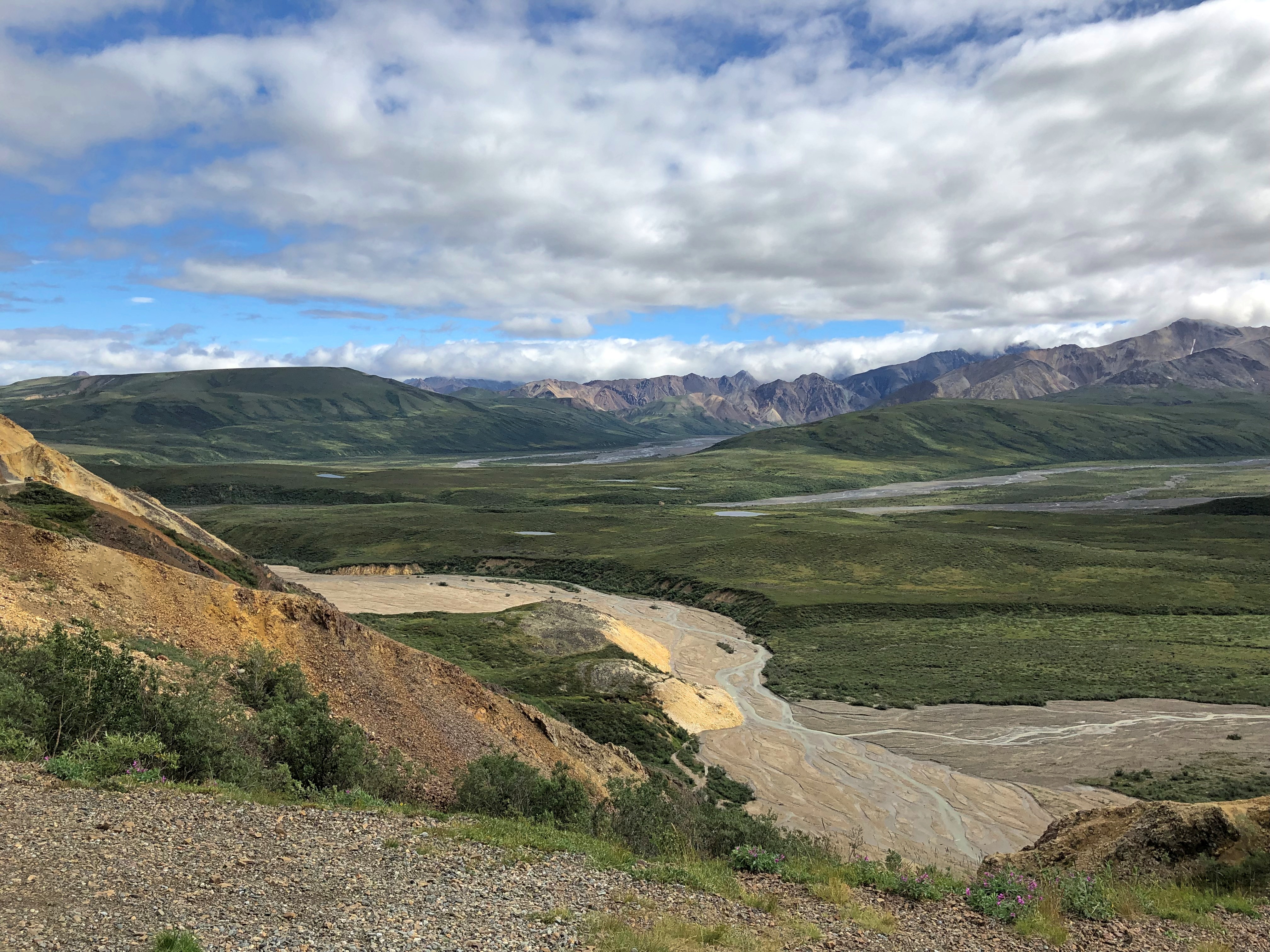
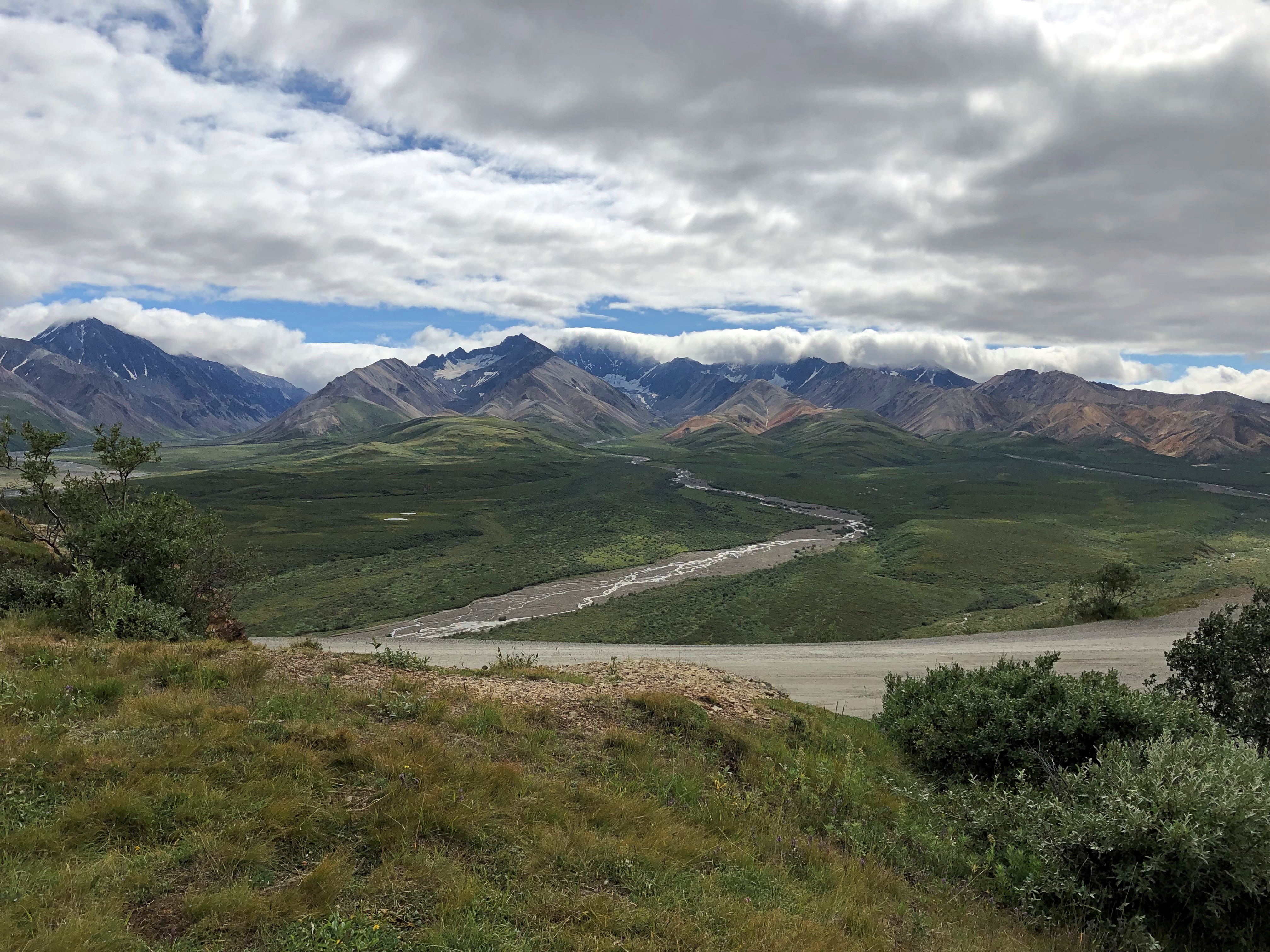
Another thing we weren’t about to miss was the less-visited North Rim of Grand Canyon National Park, which is every bit as grand as the South Rim, though it took some circuitous driving  last Tuesday to get there from Page, by way of remote roads, One of those roads, the only paved one anywhere nearby, edges the bottom of the dramatic cliffs of Vermillion Cliffs National Monument, a sprawling uplift of wilderness. Of it, the Bureau of Land Management says, “expect rugged and unmarked roads, venomous reptiles and invertebrates, extreme heat or cold, deep sand, and flash floods.”

Returning from the Grand Canyon to Page, we stopped at Navajo Bridge, which spans the Colorado River. It’s two structures: the historic bridge from the 1920s and the modern bridge from late in the 20th century, which was designed to complement the older bridge, and it does, masterfully. The old bridge is now a foot bridge, and we walked across it.

Leaving Page on Wednesday, we made our way to another tourist town, namely Moab, Utah, at first on roads passing through the Navaho Nation, until we reached Monument Valley Navajo Tribal Park, home of famed sandstone buttes. We did the drive on the park’s circular road, unpaved and dusty and rocky and as red-orange as Mars, flabbergasted by the stone masses, most of which don’t actually make it into the movies. If you think you’ve seen Monument Valley because it’s been captured on celluloid so often, let me assure you that seeing it in person is an experience a level higher.

Later that same day, before arriving in Moab, we stopped at the much more obscure Natural Bridges National Monument, whose name clearly states its prime attraction. Among the wonders of southern Utah, it is a modest one. But a modest wonder in this part of the country is still a wonder.

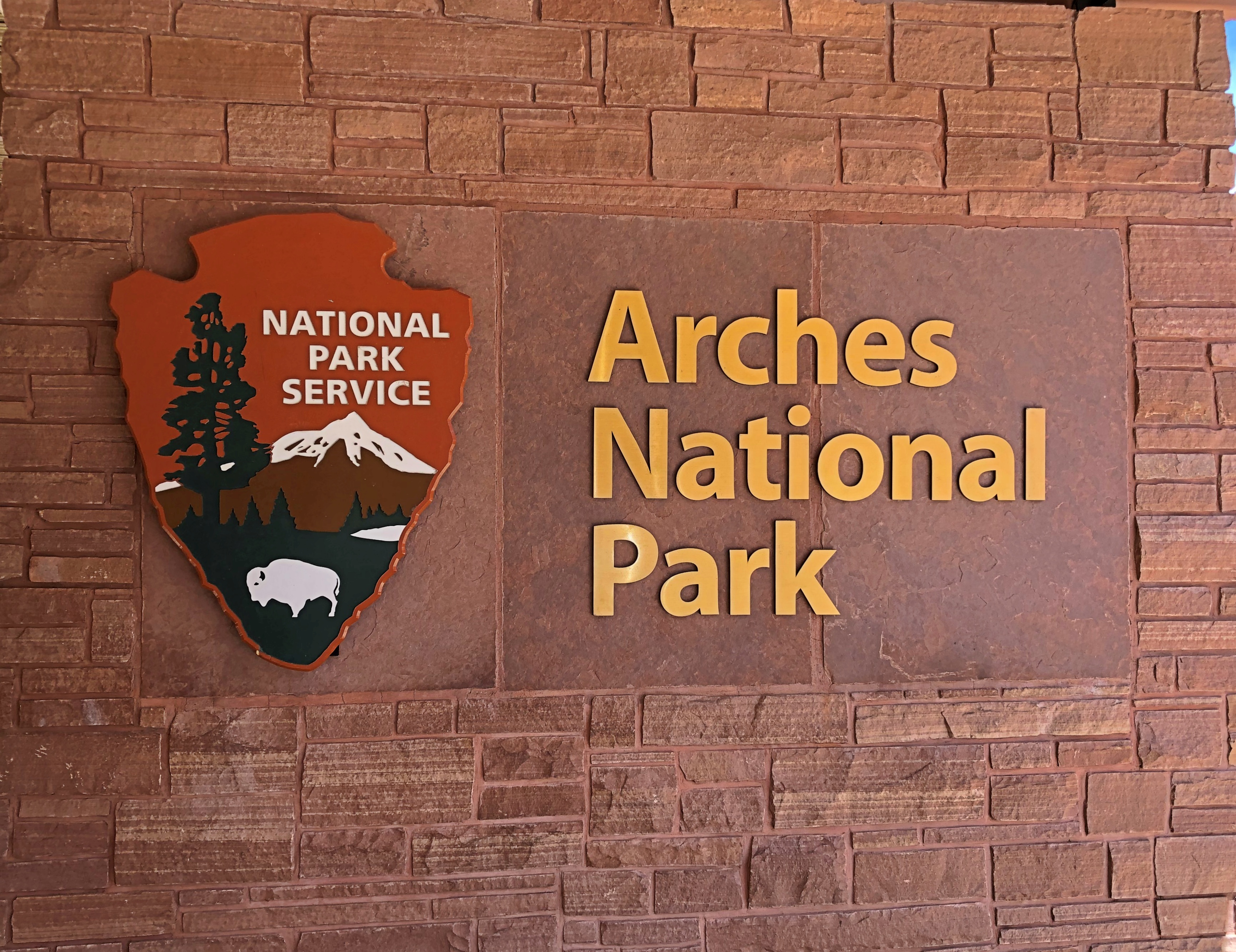
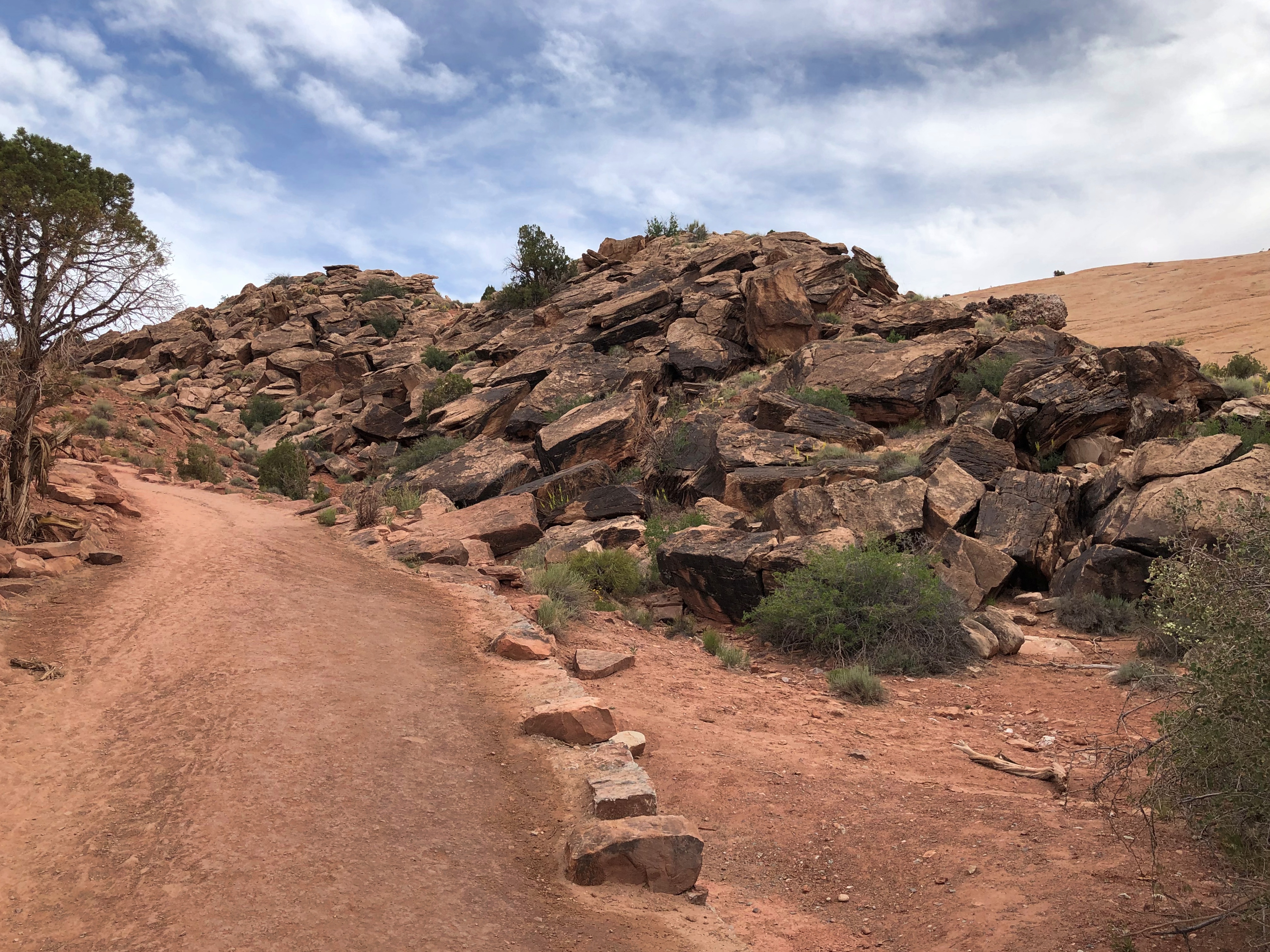
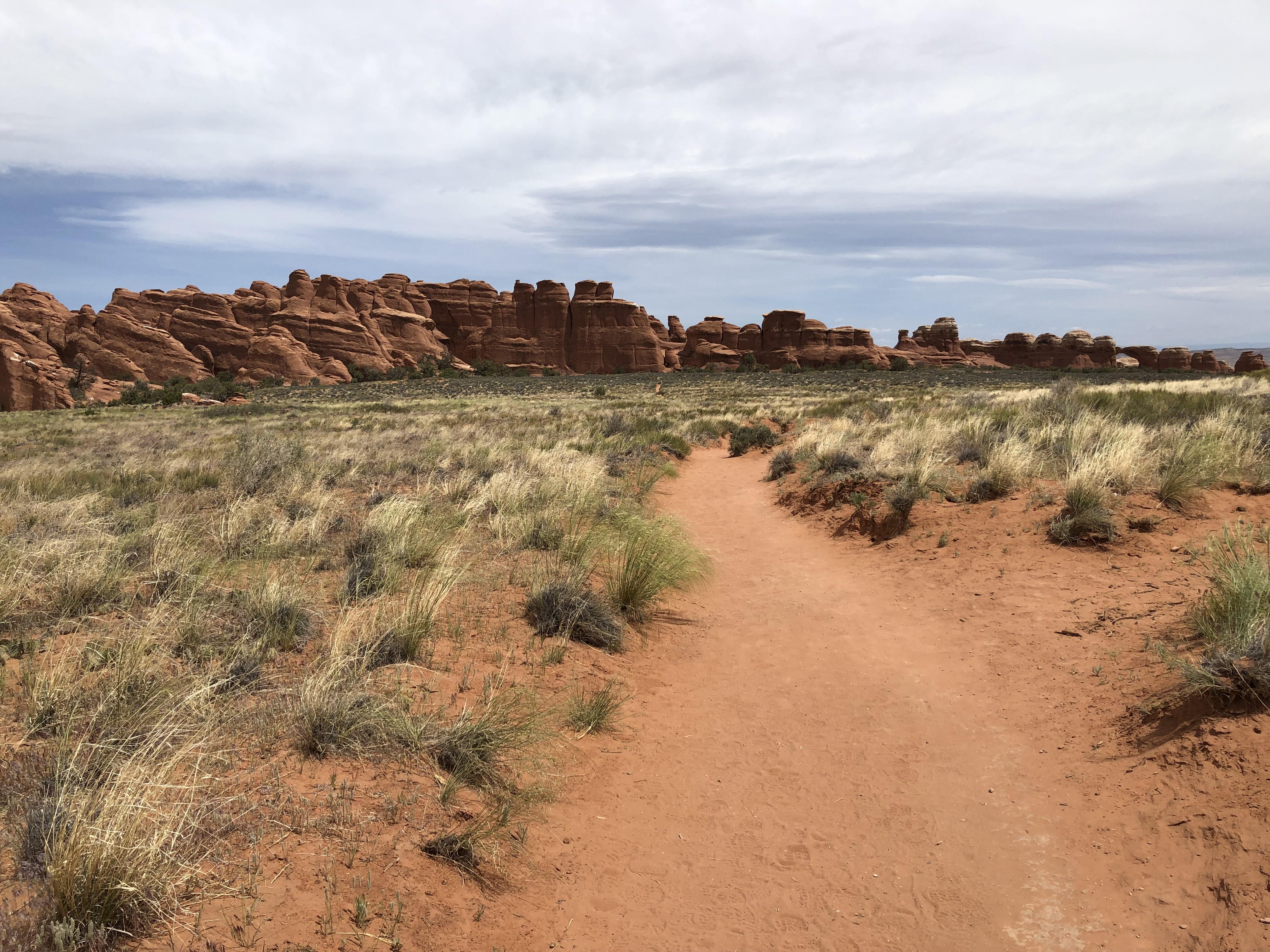
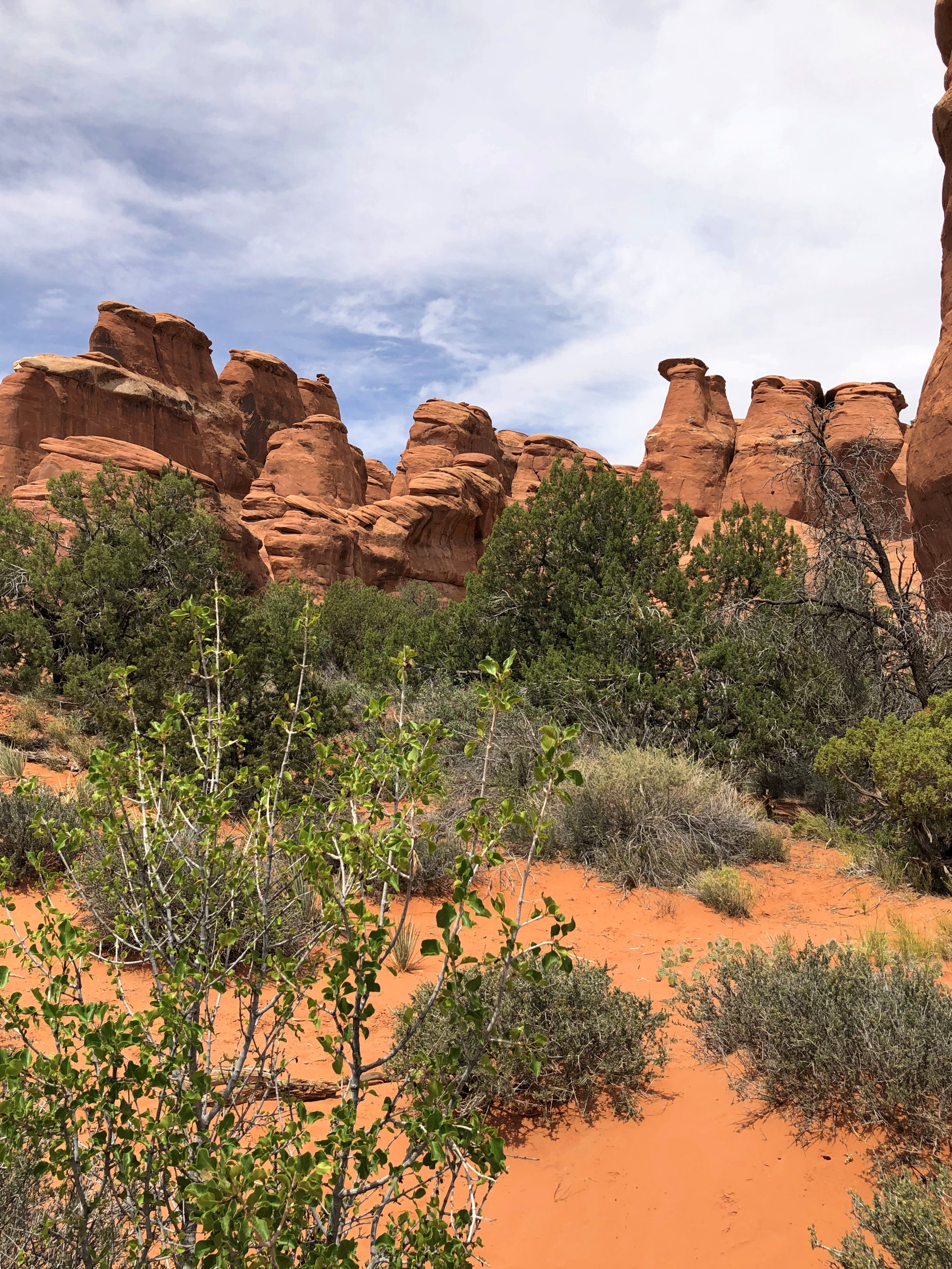
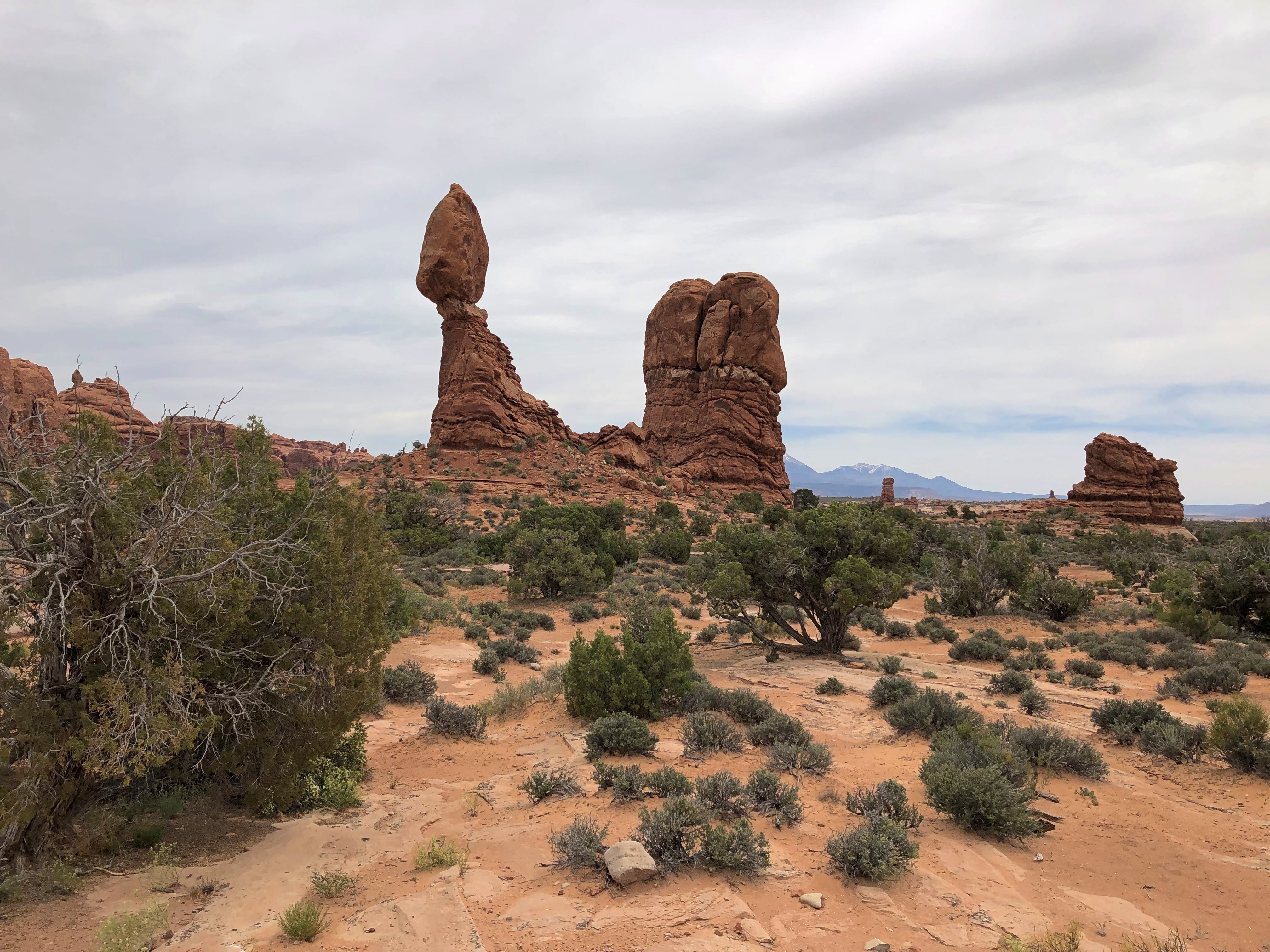
On Thursday, we drove the short distance from Moab to Arches National Park, an astounding place populated by lofty arches, but also an endless array of stone pinnacles and balancing rocks and other rock formations. We spent most of the day there. The crowds are such that timed entry is now being tested at the park, and the crowds are right. Arches is one of the places the photographer must have been talking about.

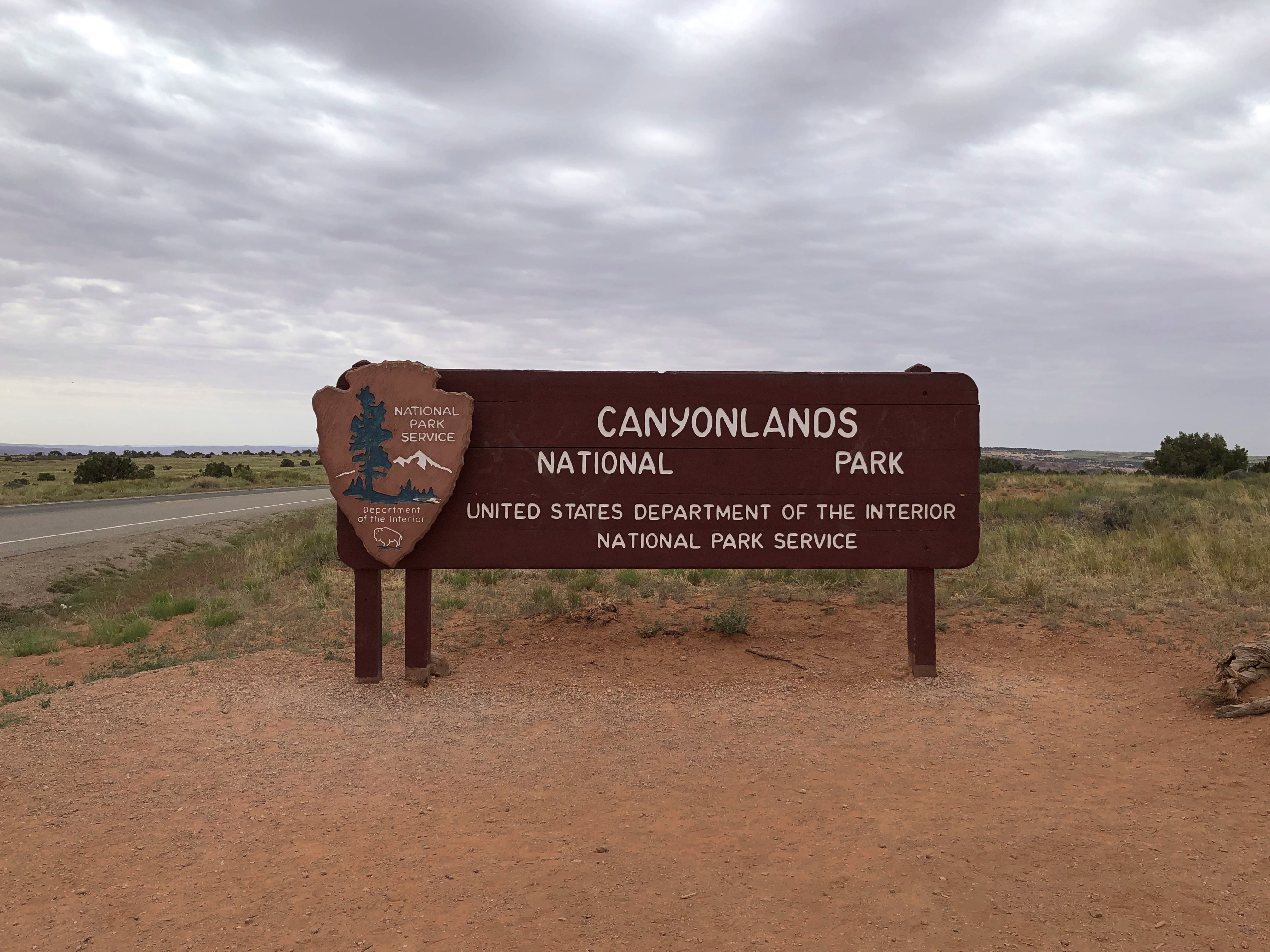
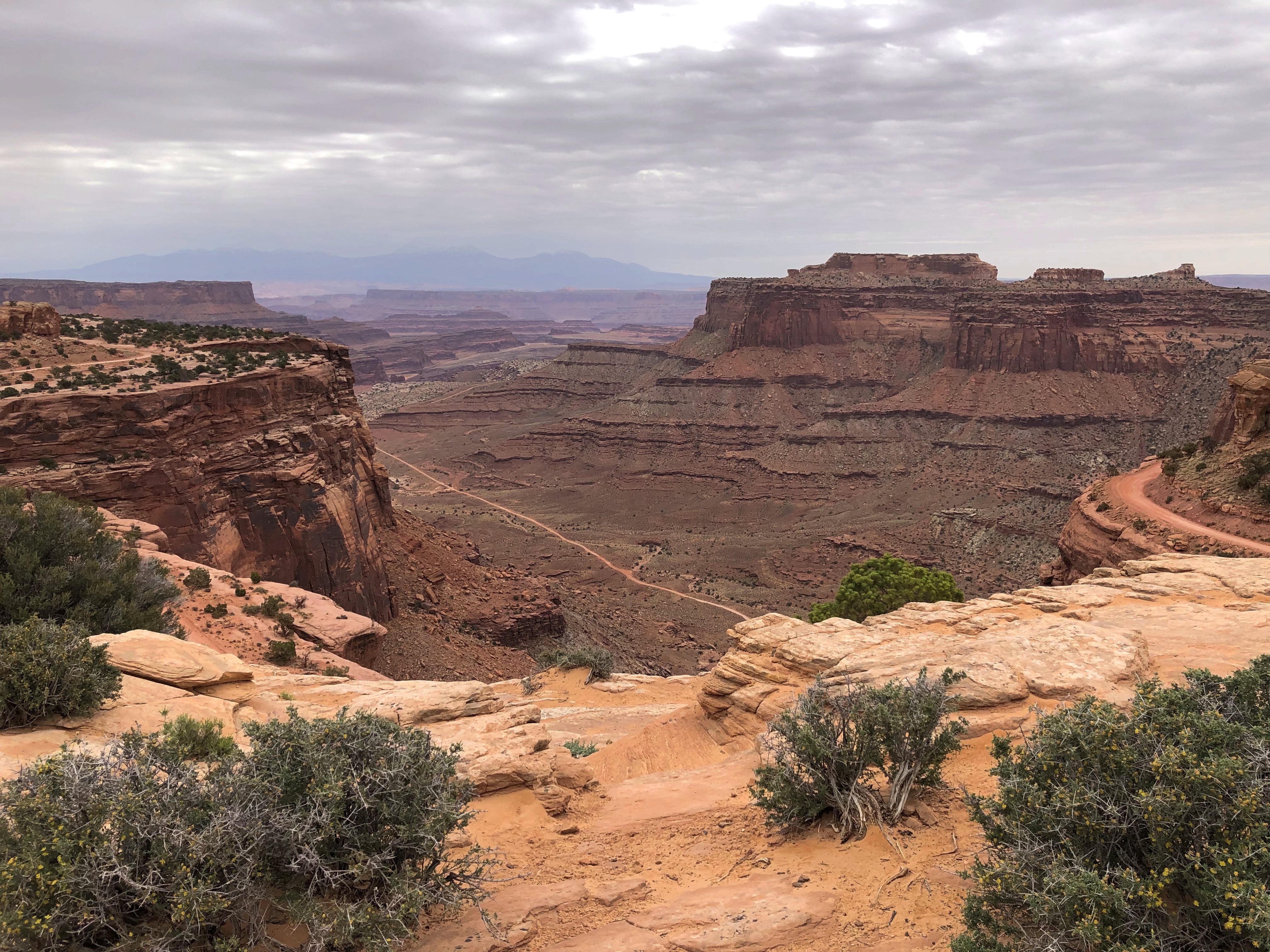
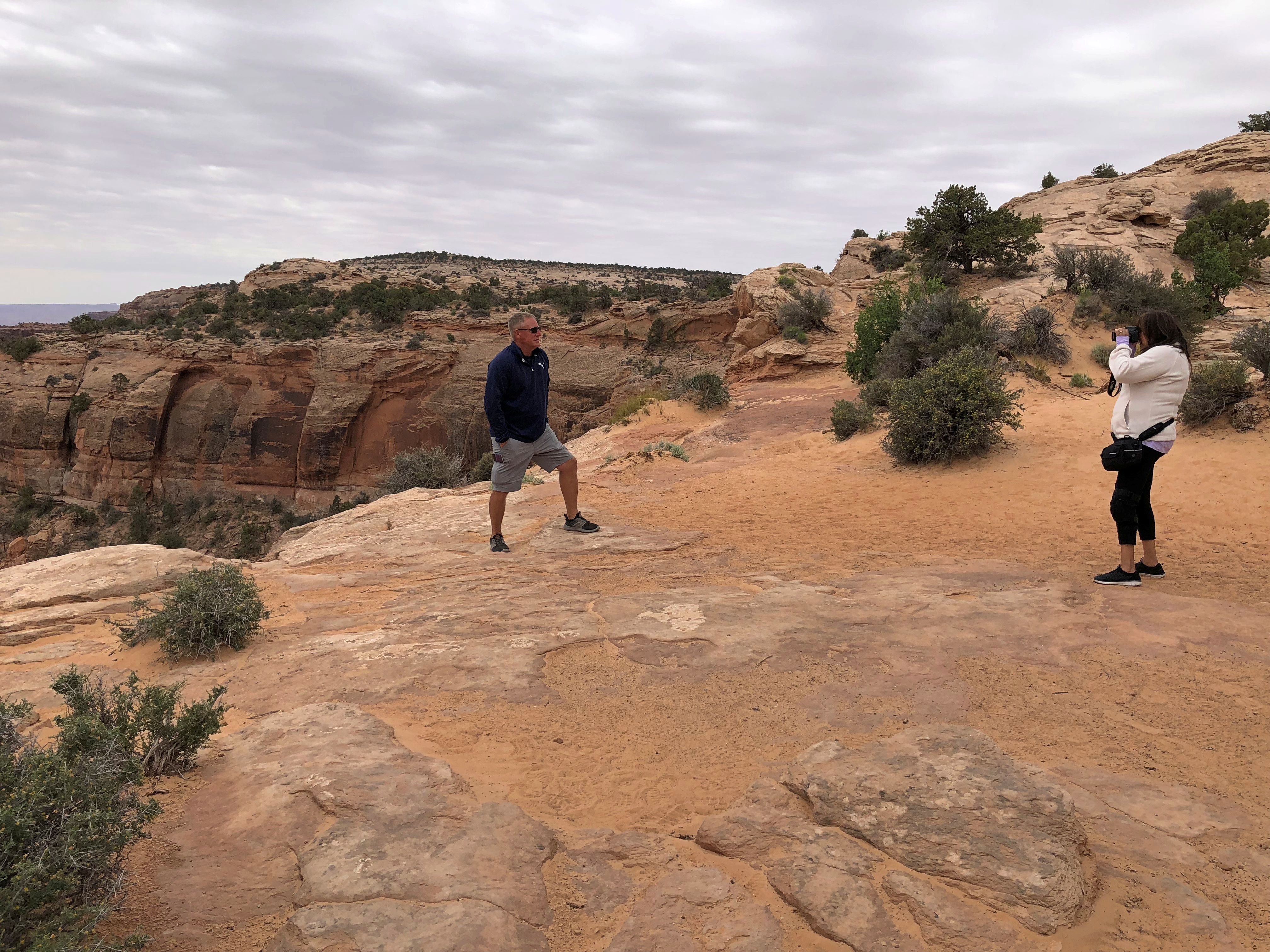
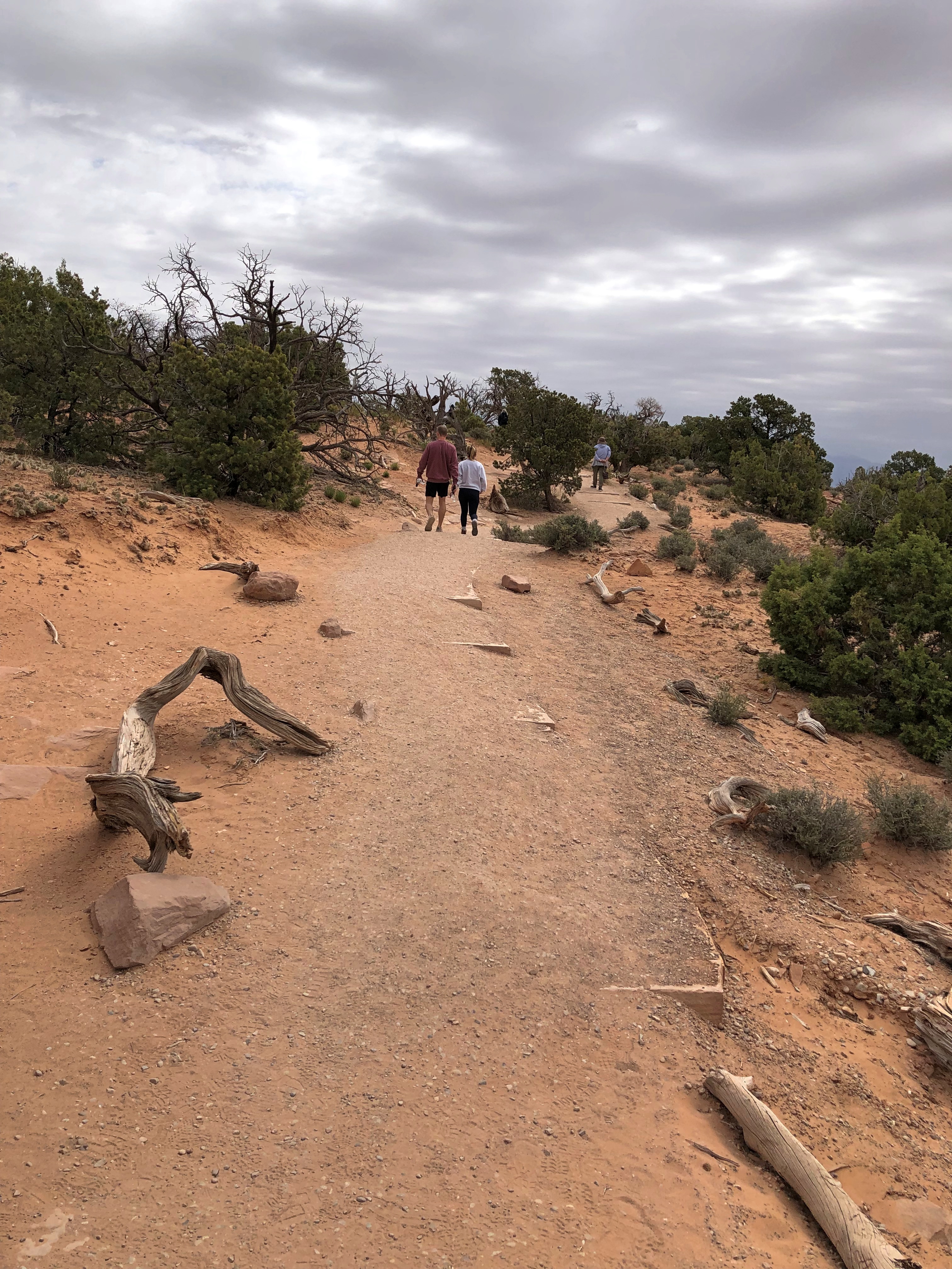
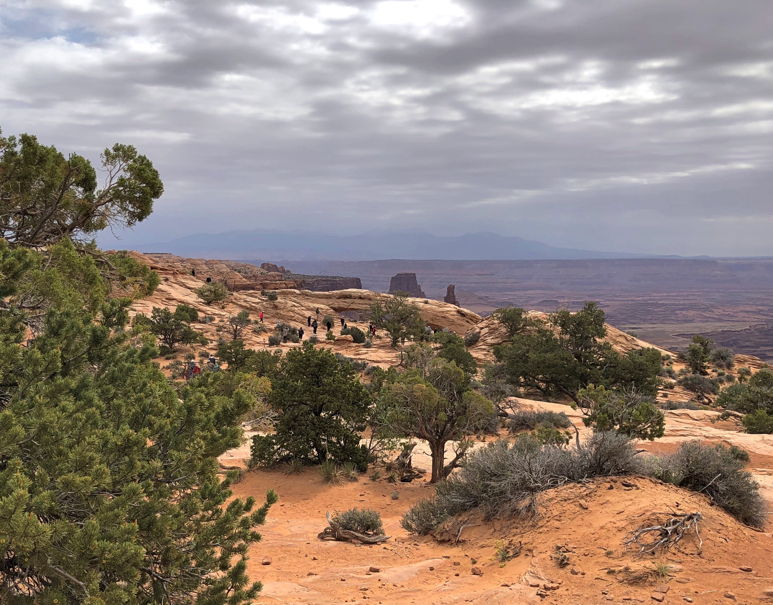
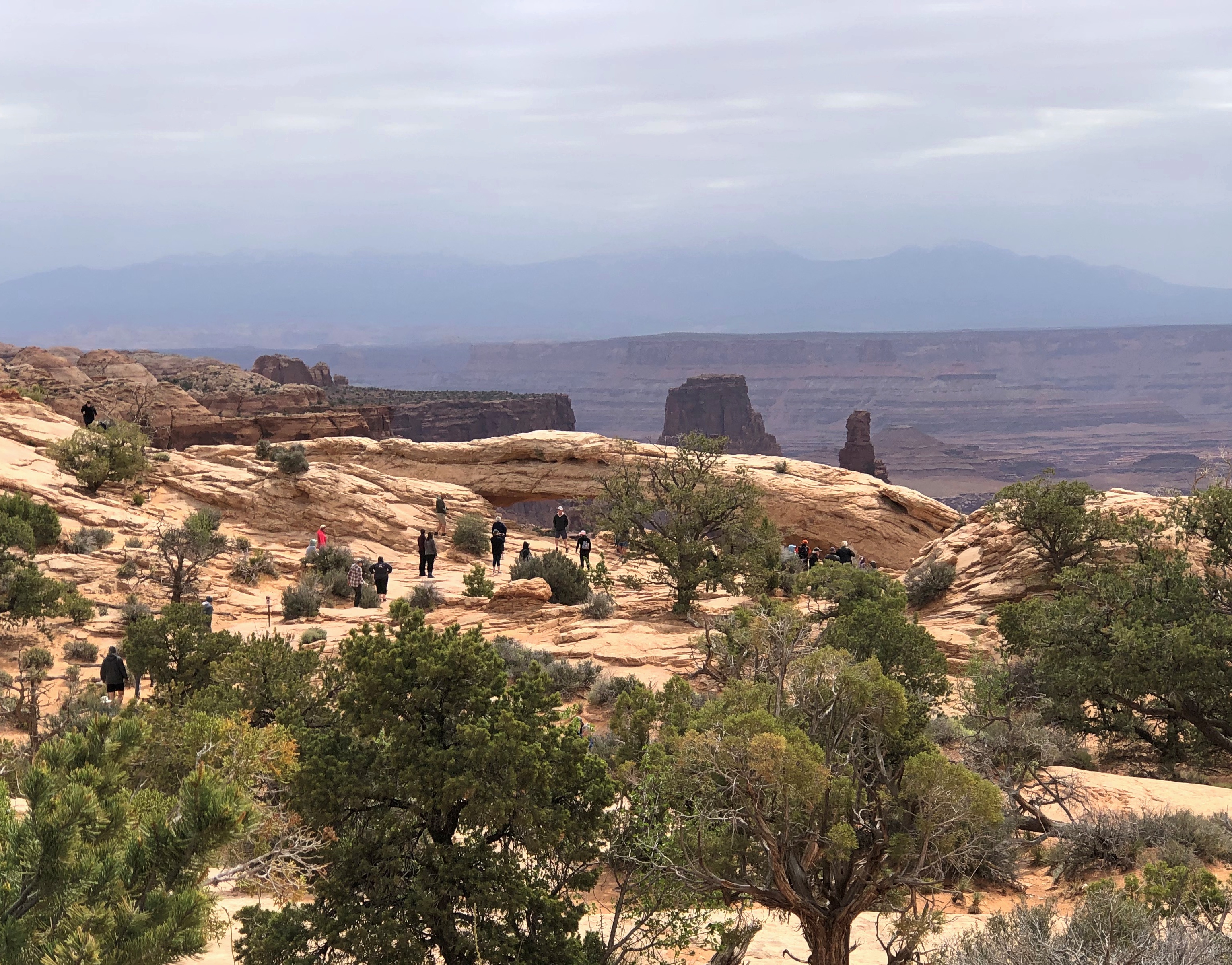
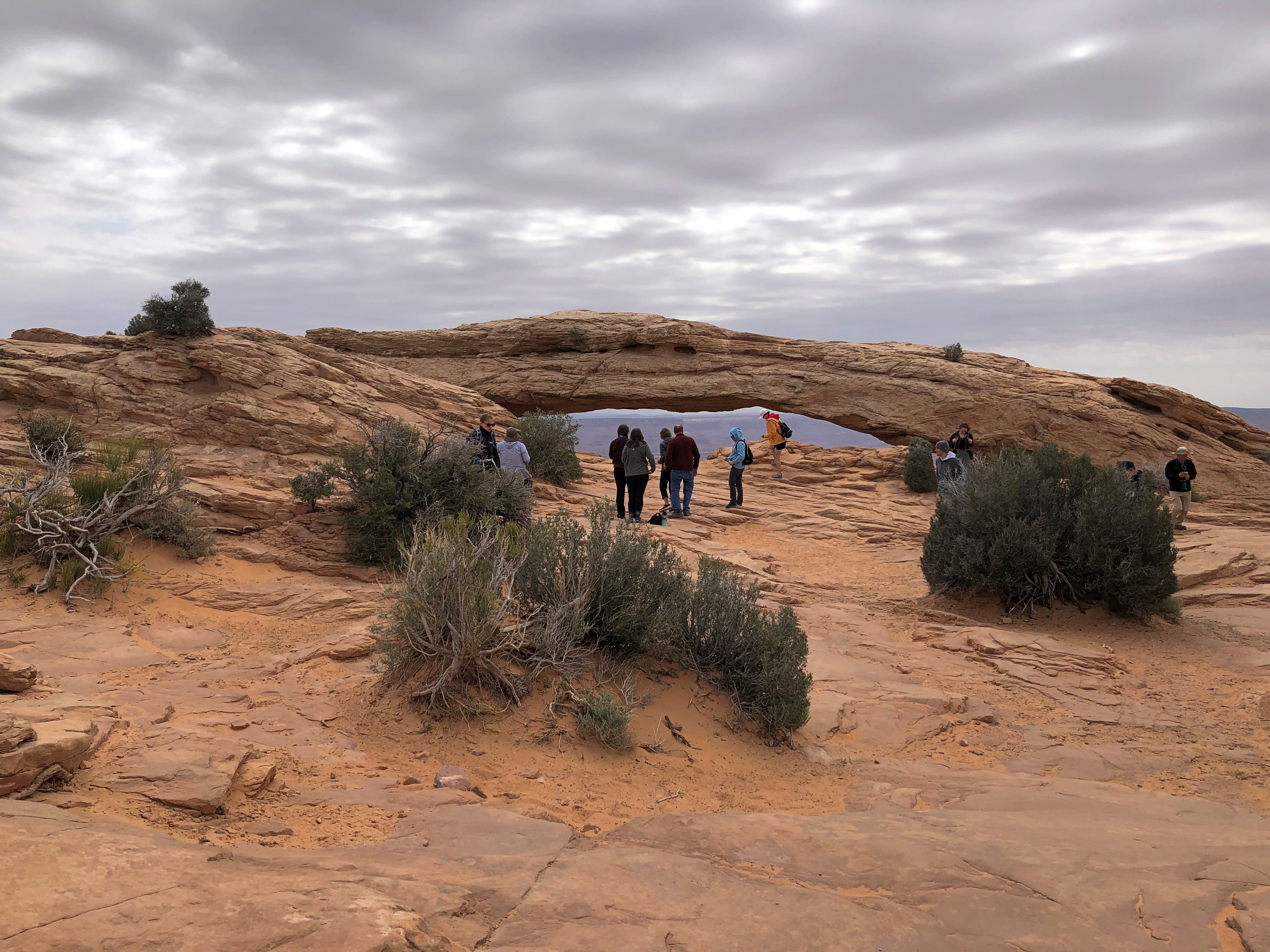
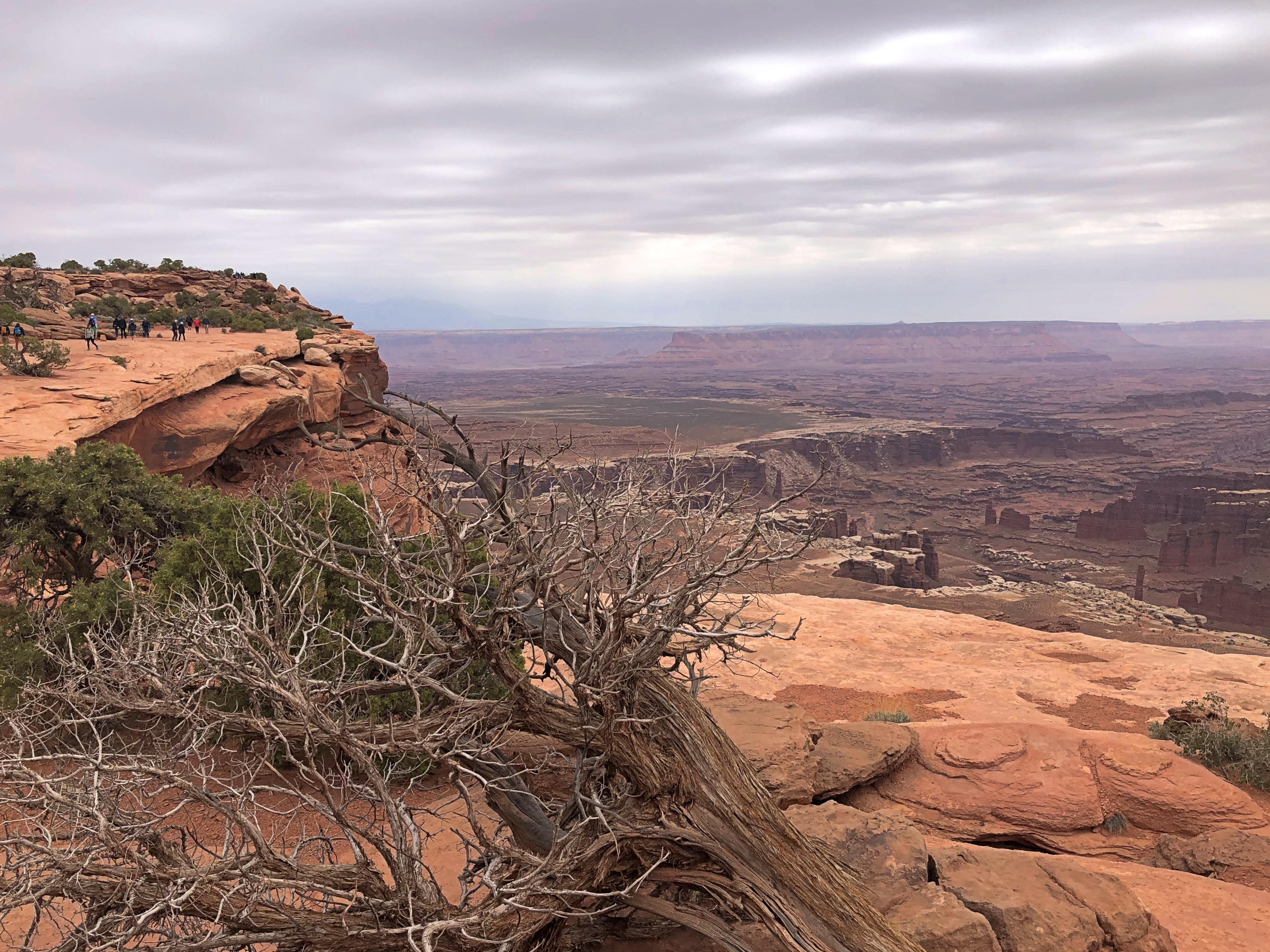
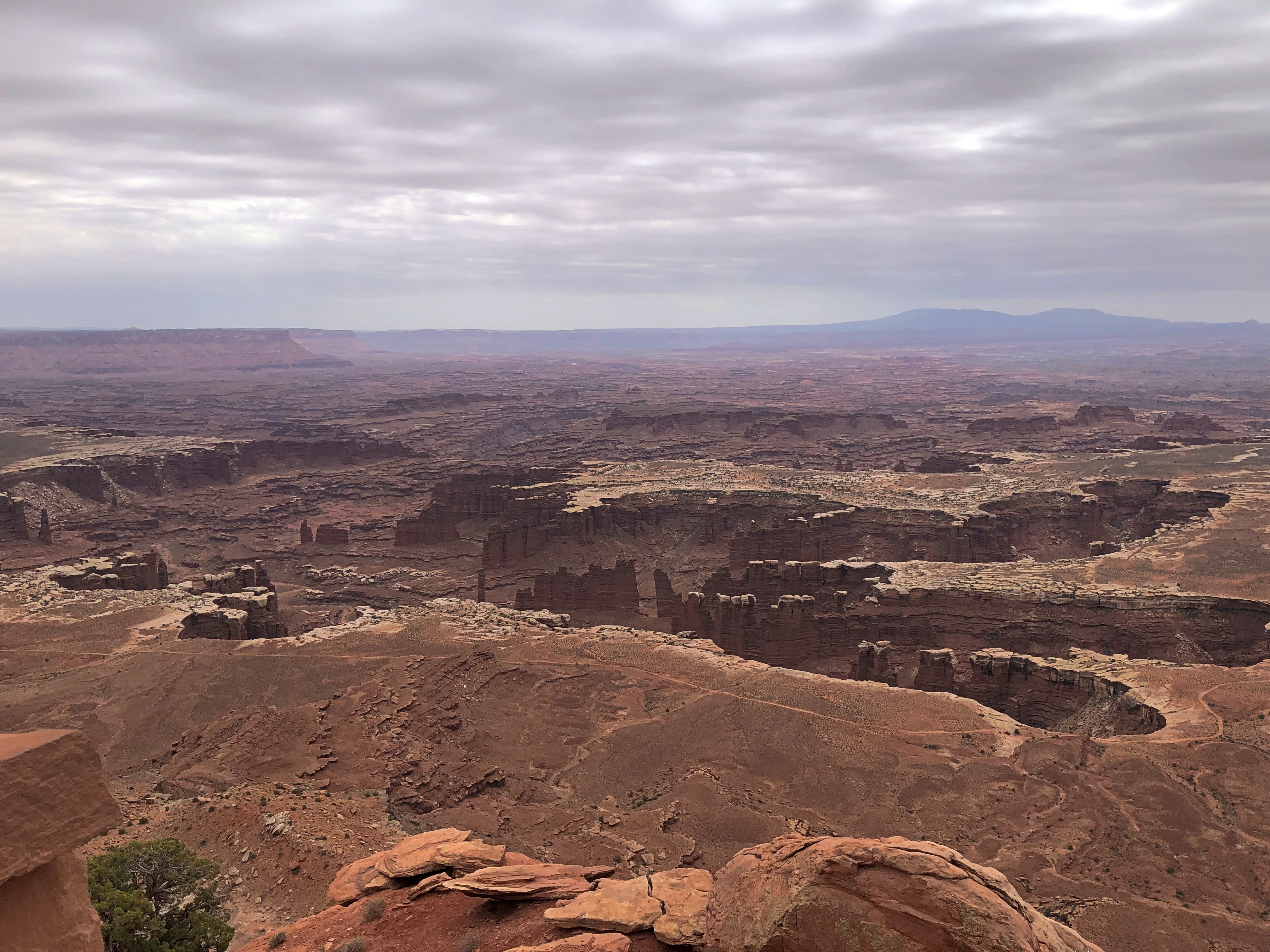
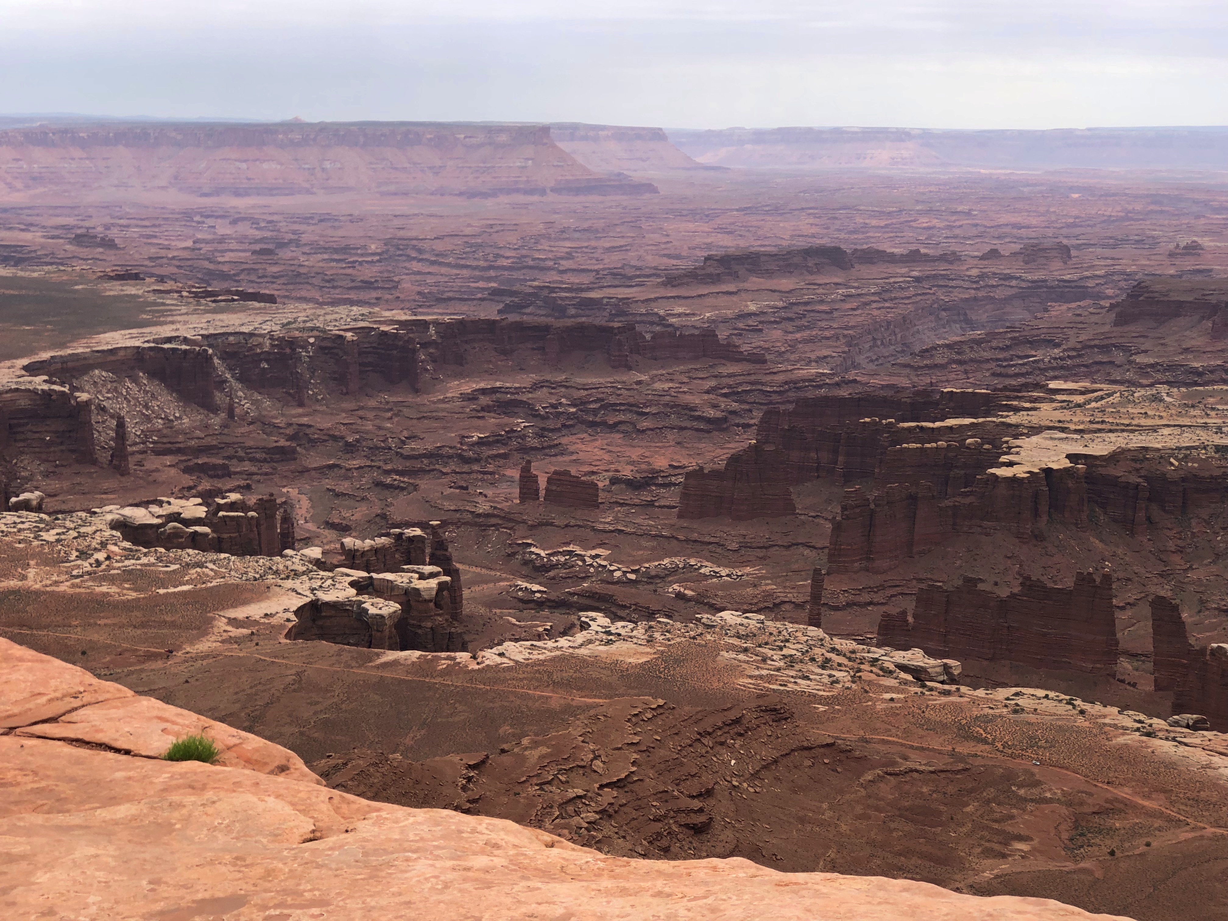
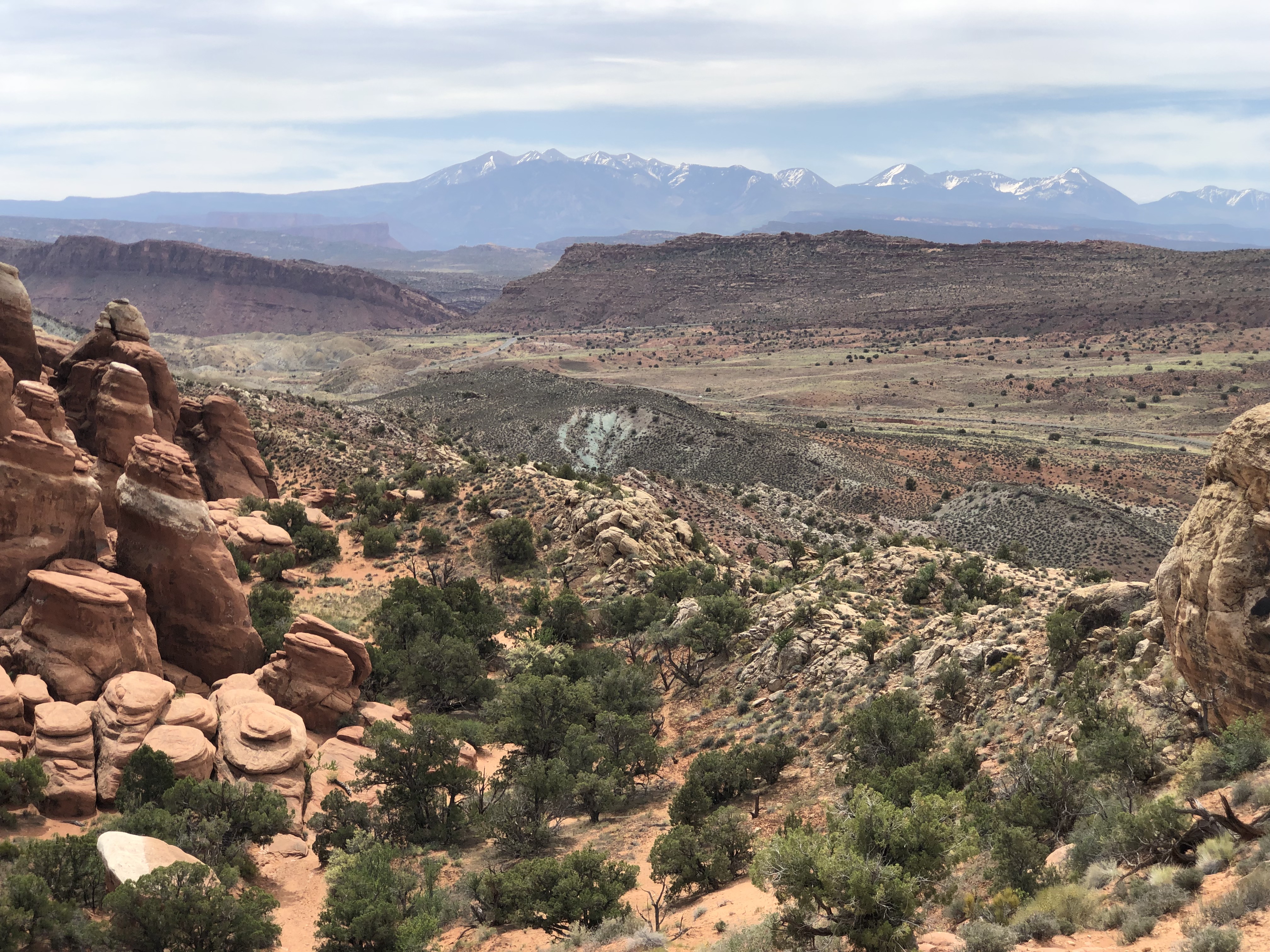
Less crowded but no less spectacular than Arches is Canyonlands National Park, a little further out of Moab. We spent Friday morning at the evocatively named Island in the Sky District of Canyonlands, whose vistas overlook canyons, mesas and buttes. Another ethereal place. On Friday afternoon, we drove to Salt Lake City on roads through pale badlands and along more cliffs, and then through the forested mountains of Carbon and Wasatch counties.

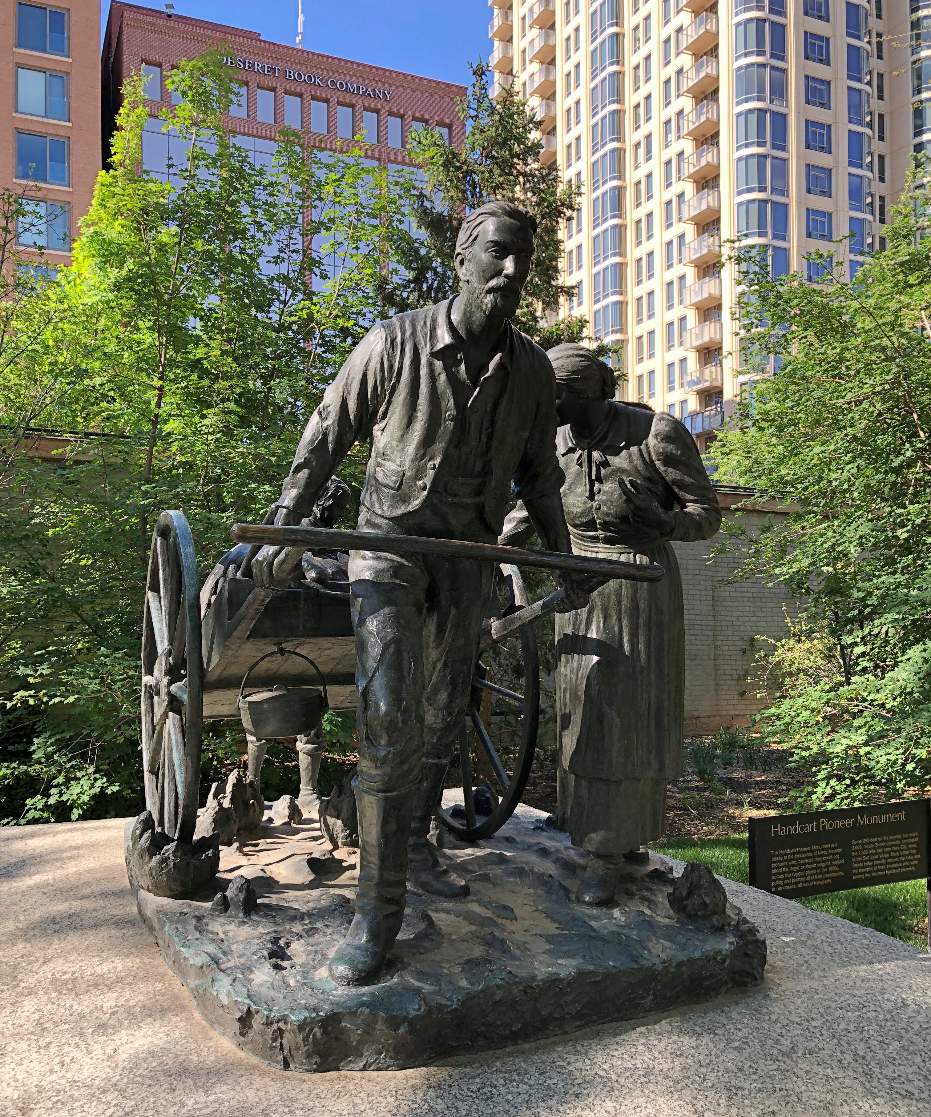
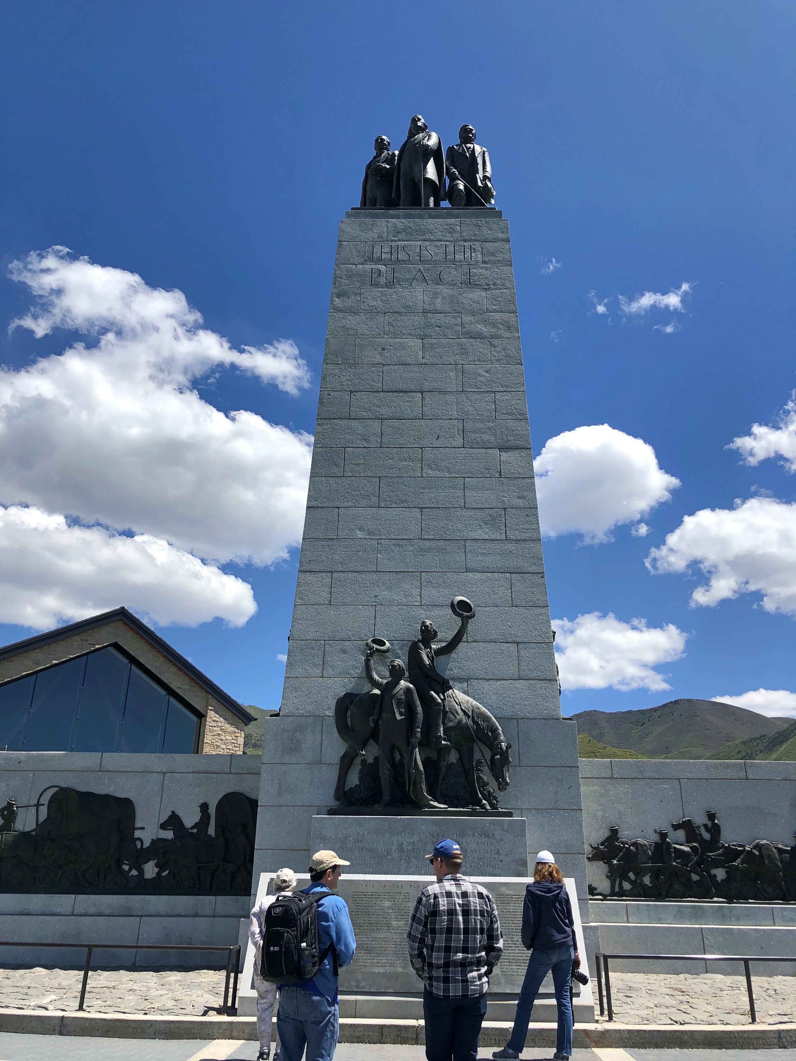
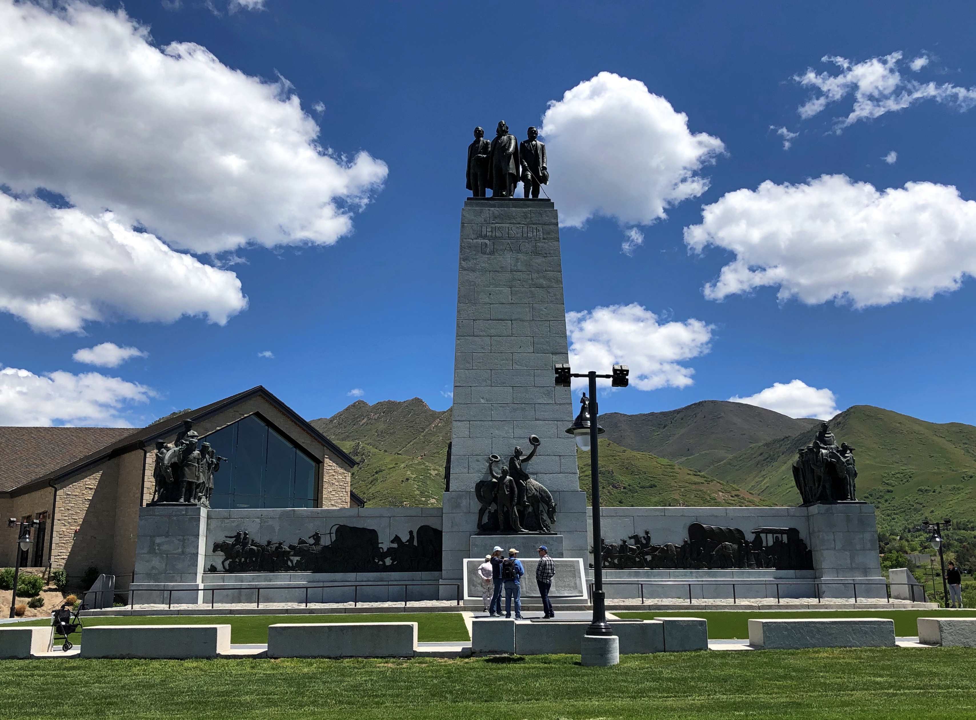
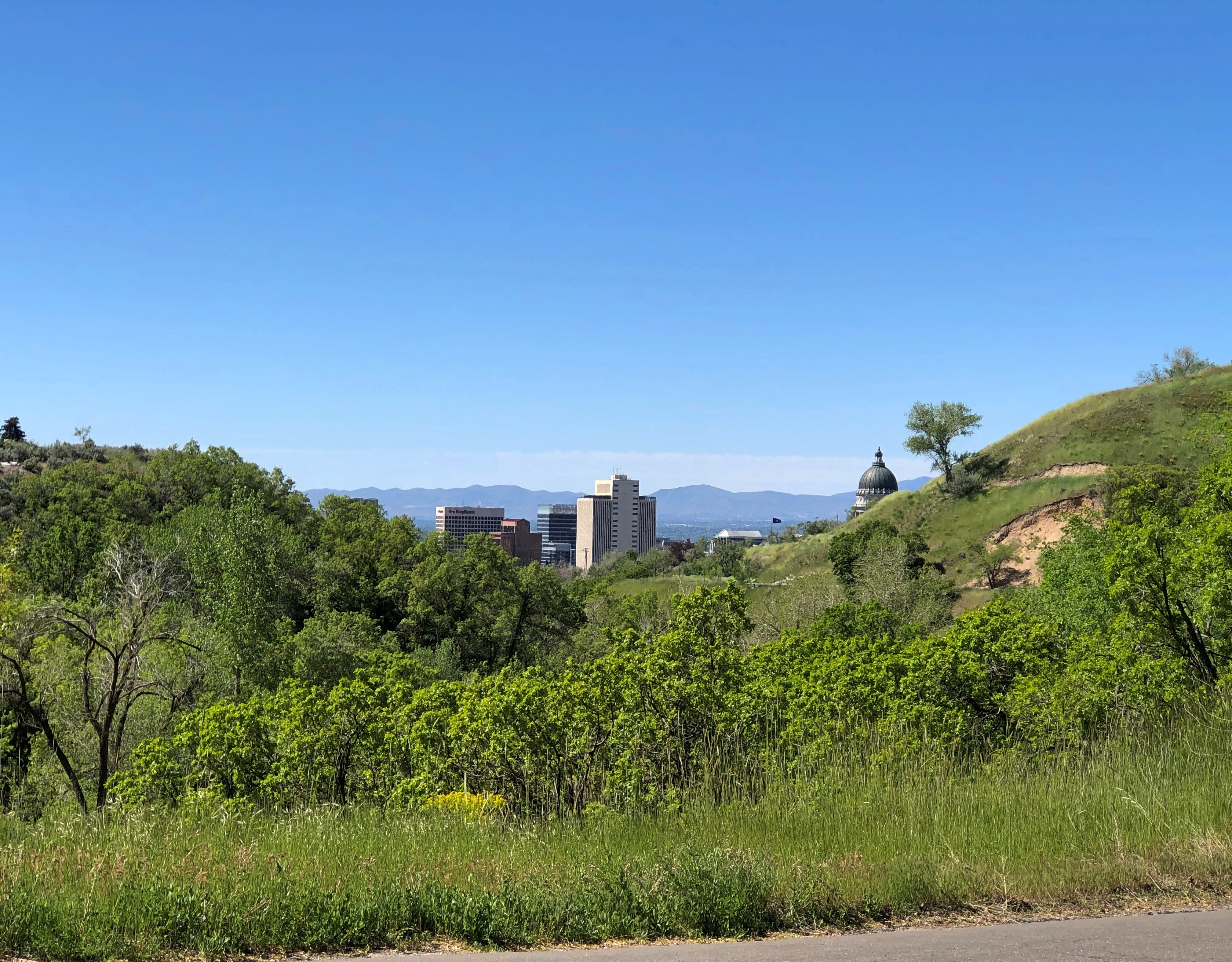
We spent Saturday in Salt Lake, a city greatly expanded since the last time I visited, in 1980. That’s so long ago it was like I’d never been there. We focused most of our attention downtown in the morning and took in urban sights, Mormon-oriented and otherwise, including Temple Square and Utah’s magnificent State Capitol. In the afternoon, we visited the This is the Place Monument on a hill overlooking Salt Lake, and finally the Natural History Museum of Utah.

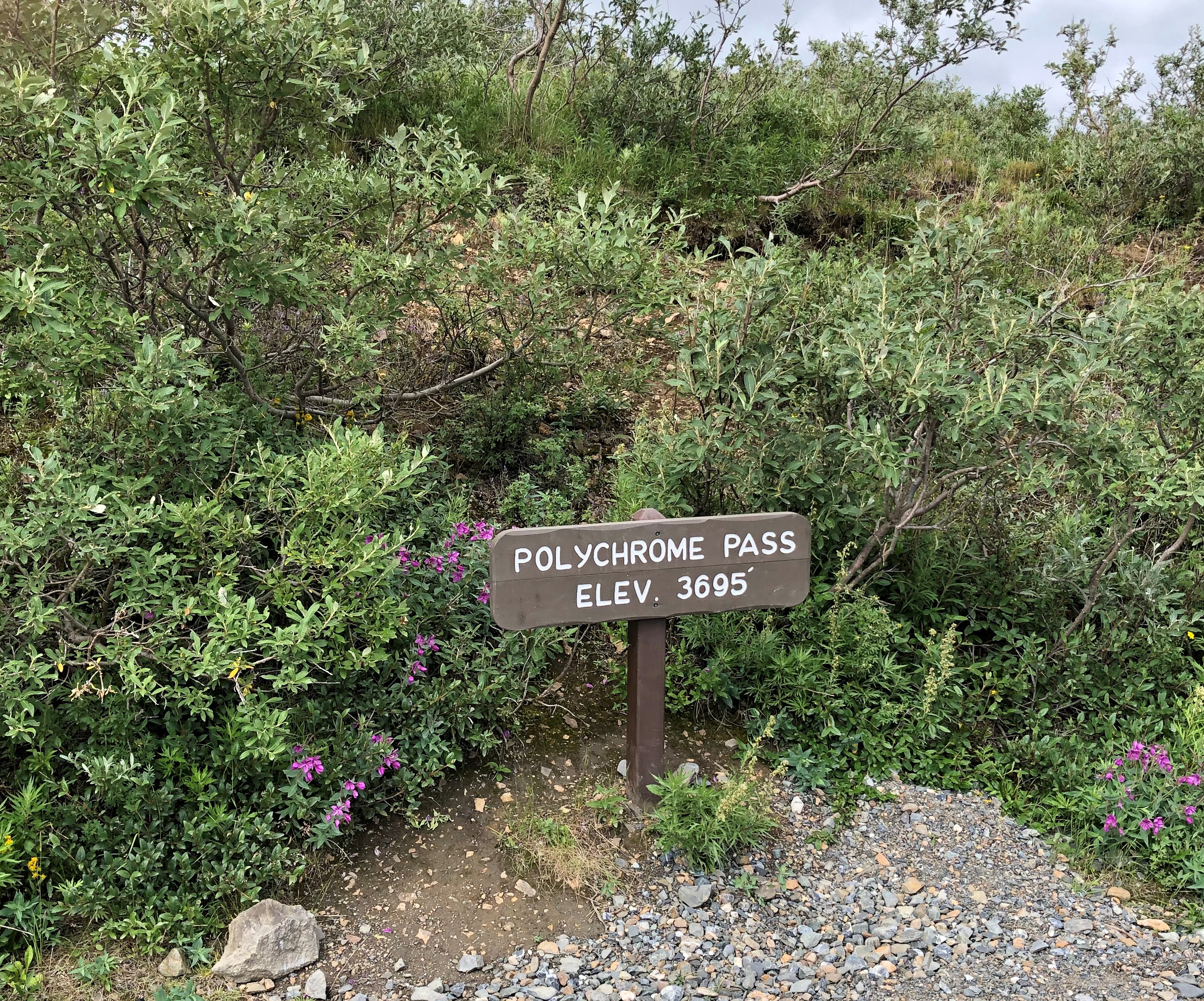
On a stretch of Utah 261, we encountered the Moki Dugway, a mountain road and one intense drive — more about which later. When we got to the top, I stopped to take pictures, including one of a road sign just ahead of the road’s first serious curve.Moki Dugway Buc-ee's

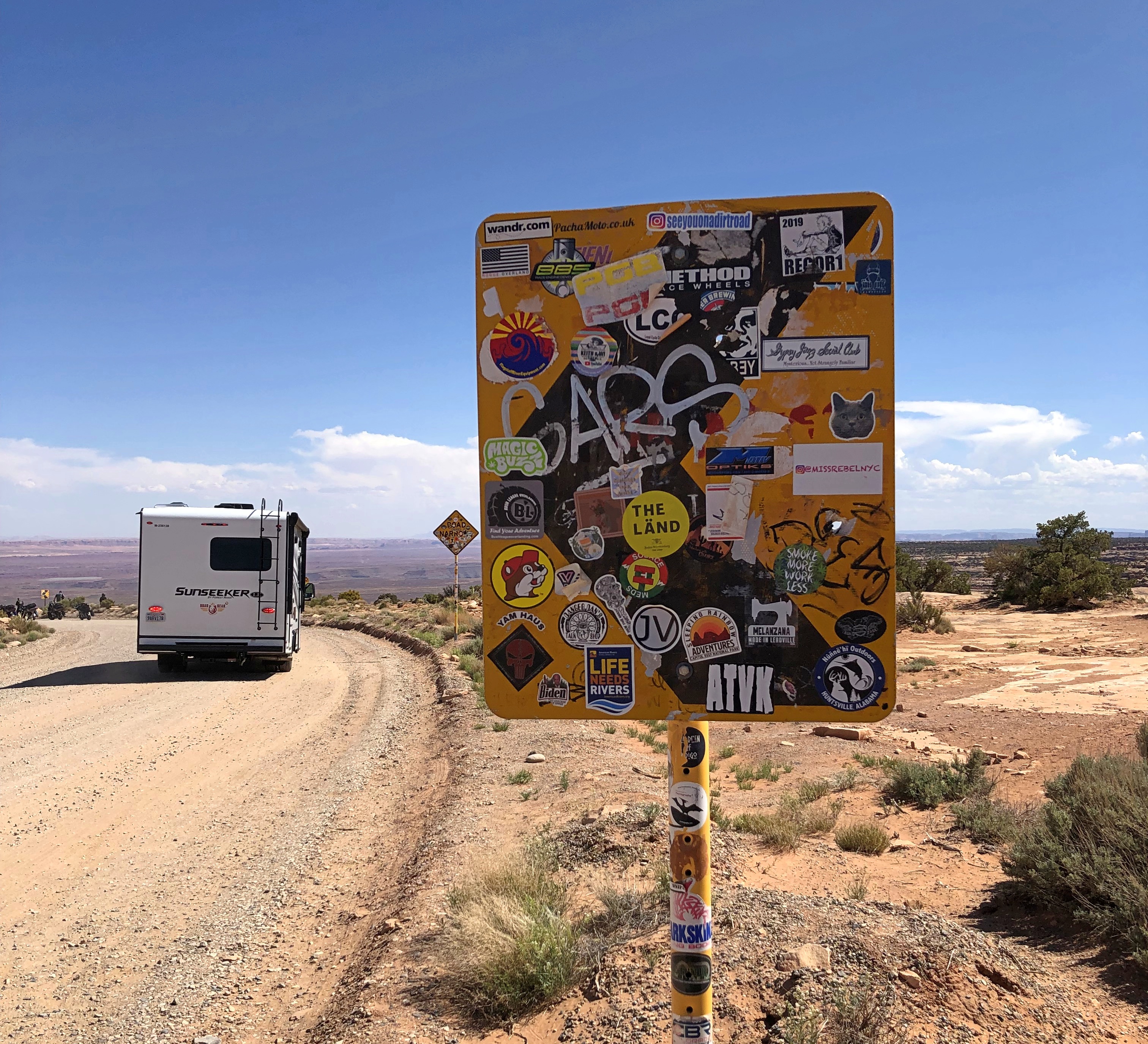
That little bastard of an amphibious rodent is everywhere.

Fuzzy Jungle Pictures

We spent late August and early September 1994 at Taman Negara, the sizable national park on the middle of the Malay Peninsula. It’s a place of jungle walks.Taman Negara 1994

We stayed where many people do, at Kuala Tahan on the Tembeling River. I’ve read that a road runs to that settlement now, but that wasn’t the case 25+ years ago — you took a boat much of the way.Taman Negara 1994

Had a basic snapshot camera in those days, so I got basic snapshots of the Tembeling. Fuzzy pics to go with fuzzy memories.

Taman Negara 1994

Taman Negara 1994Taman Negara 1994

Remarkably, whoever took the Wiki picture of the Tembeling River did so from the exact same vantage as I did a few years earlier, including what looks like the same tree in the foreground. Must be a rise on a path near the river, but I don’t remember specifically.

Denali National Park and Preserve

Up in Coldfoot, we were within Alaskan spitting distance of Gates of the Arctic National Park and Preserve, maybe ten miles on foot to the park’s invisible demarcation line. Gates of the Arctic, which is about the size of Maryland or Belgium, has no human infrastructure or services of any kind.

That’s an evocative national park name if there ever was one, summoning dreams of primeval remoteness. Only about 10,500 people ventured there in 2019, making it the least-visited U.S. national park even in an ordinary year, since the logistics of a visit are quite involved. I was no more prepared to visit Gates of the Arctic last week than to go to the Moon, so it was close but no cigar.

Denali National Park and Preserve is another story. It’s easily accessible to everyday folk, at least those willing to spend the time and money to go to Alaska, and willing to forgo private-car travel into the park. I was all in.

Chronologically, the sign was the last picture I took at Denali, but never mind. It marks the entrance off the highway Alaska 3.Denali NP

This image is also out of order, strictly speaking, since it was taken mid-tour. Our bus was the one on the left.
Denali NP buses

The bus traversed part of the 92-mile Denali Park Road, which roughly parallels the Alaska Range. The tour took us to Mile 53, a spot called the Toklat River Rest Stop.
Denali Park-Road-Map_5

“During summer, roughly late May through early September, private vehicles may drive the first fifteen miles of this road, to a place called Savage River,” the National Park Service says. “The road to Savage River is paved, and features numerous pull-outs for folks to stop and snap some scenic photos. ‘The Mountain’ can be seen as early as Mile 9, if the day isn’t too overcast, and animals of all sorts can sometimes be seen on this stretch of road — although chances to see wildlife increase greatly with a bus trip farther down the Park Road.”

Lest anyone think that mandated bus transportation is some new innovation by the feds to restrict freedom of movement, the NPS points out that banning private cars on most of the road goes back almost 50 years.

“Prior to the 1972 completion of the George Parks Highway (Alaska Route 3), which is the main travel artery into interior Alaska, visitation to Denali National Park and Preserve was fairly low. Anticipation of major increases in traffic resulting from a direct route to the park prompted park officials to implement a mass transit system beyond Mile 15 on the Denali Park Road.”

Good thing, I believe. It’s a narrow, mostly gravel road after that point. Even a few dozen cars at a time could easily jam the thing up, and fools would sometimes (often?) get stuck. Occasional unlucky souls would be in cars that pitch over the edge of some pretty steep slopes without guardrails.

So at about 9:30 on the morning of July 29, I boarded a Bus #10 outside the park and spent the day in my 24th or 25th U.S. national park (I’m never sure whether to count Guadalupe Mountains NP). One of the most magnificent so far, too.

The magnificence started early in the drive. Even before Mile 15, we could see a mostly cloudless Mount Denali, the peak I probably learned as McKinley poring over maps in elementary school, the tallest in North America. Actually there are twin summits.Mt Denali
Tour guide, bus driver and all-around effusive fellow Brian told us that maybe three out of 10 visitors to the park actually get to see Mount Denali. Like Fuji and some other mountains of renown, clouds often cloak it. Later in the tour, when we were closer to the mountain, it was invisible. Throughout the day, in fact, clouds came and went with rapidity over our entire field of view.

At Mile 15 is the wide view of the Savage River.Teklanika River
Teklanika River
Teklanika River

Further along the road, an illustration of how far greenery can reach up mountainsides.
Denali NP

Around there, we spotted a bear. Brian stopped the bus for a few minutes for us to watch. It wouldn’t be the last time he did so.
Denali NP bears

Make that two bears.
Denali NP bears

In the fullness of the day, we spotted a total of five brown bears, some of whose coats were actually blondish. Brian noted that an estimated 300 bears live in the park, and if so, we saw nearly 2 percent of them. He further said that often enough tours buses see no bears at all, the creatures being as elusive as Mount Denali. So we were a charmed bus almost from the get-go.Denali NP bears
Denali NP bears

One of the bears took a stroll on the road. Why not? For all we know, the bear considered the bus just a big lumbering animal that posed no harm, and could not be eaten, and so deserved no further consideration.
Denali NP bear

Caribou probably felt the same way.
Denali NP caribou

We also managed to see, as the day went on, Dall sheep, moose, and a lynx — another animal the guide said was rarely seen on a tour. As for the Dall sheep, they were white spots way up a mountainside, walking where I thought no animal ought to be able to walk. That only reflected my ignorance of all things Dall.

The conservation of Dall sheep was the original motive for creating Mount McKinley NP, as it was known when established in 1917. One Charles Sheldon, who made a fortune in mining and retired young to the life of a naturalist, successfully advocated for the creation of the park in the early 20th century to keep Dall from being wiped out by hunting.

At Mile 30, the rocky Teklanika River.Denali NP

Denali NP

Further in: more views of the road, which winds around. The second image looks like another road branches off, but there’s only one road in all of Denali NP.Denali NP road
Denali NP road

The purest of the purists might object to this work of man in the park, but it’s the thinnest of ribbons in a vast wilderness, built from 1923 to 1938. Since Alaska 3 didn’t exist until 1972, visitors who wanted to travel the park road before then came up by railroad to the entrance of the park.

The road went on, but our tour made its turnaround at the Toklat River Rest Stop, Mile 53.

On our return, we stopped at a place that we had bypassed earlier, Polychrome Pass, at Mile 46.Denali NP Polychrome Pass

Most of us climbed the hill next to the road.
Denali NP Polychrome Pass

The view more-or-less north, into what are known as the Wyoming Hills, was nice.
Denali NP Polychrome Pass

The view to the south proved to be my favorite in Denali NP, and in fact my favorite of the small slice of Alaska I got to see last week. Colorful, as the name implies, but much more than that. The cool brisk wind in otherwise absolute quiet added to the impression, but it was more than that too.

I will publish pictures here, but even more than all the others, they’re poor substitutes for the way the sweeping vista impressed my eyes. The view toward the Alaska Range at Polychrome Pass is, I believe, the grandest vista I’ve ever seen.Denali NP Polychrome Pass

Denali NP Polychrome Pass

How so? Even now, a week later, the enormity of the scene staggers me. It isn’t obvious from the image, but the mountains are at least 10 miles away, leaving me the impression of the largest valley, the longest sweep of vision over a wild plain, that I’d ever encountered.

Maybe that’s the conditioning of Romantic ideas about nature, echoing down the last few centuries and taking the form of TV specials, coffee table books and a tourist industry that takes people to such vistas for a fee. Maybe God speaks through the grandeur of a place like Denali NP. Maybe I have wholly idiosyncratic ideas of worthwhile vistas, because to me the view from Victoria Peak over the nighttime illuminated urban canyons of Hong Kong was almost as grand. Maybe I don’t really care about any of those ruminations. All I know is I was exceptionally glad to be there in Denali NP and see that.

North to Alaska

Last week, I found myself at the Arctic Circle. Or so the sign said. I didn’t bother to check with GPS, since I knew it was close enough, like the Prime Meridian line in Greenwich, England. I posed with it. That’s the tourist thing to do, especially when you’ve come a long way.Arctic Circle Sign, Alaska July 2021

A fleeting but memorable moment there at 66 degrees, 33 minutes North, early during my recent visit to Alaska, which ran from July 26 to July 31. Before that, I flew to Seattle to spent a long weekend with Lilly, who has established a life in that city. I also visited some of my old friends — stretching back to college and high school — now resident in that part of the country.

On the first day in Seattle, July 23, Lilly and I walked from her apartment in the Wallingford neighborhood (near Fremont) over to Gas Works Park under a warm summer sun. That was one of the first places I ever visited in Seattle in ’85, long before the notion of walking anywhere with a grown daughter. After an afternoon nap (for me), we had a delightful take-out dinner at Bill and Gillian’s back yard in Edmonds, with another friend, Matt, joining us.

On Saturday the 24th, I had breakfast up the street from Lilly’s with a high school friend, Louis, whom I hadn’t seen in… 40 years? Late in the morning, Lilly and I went to the Seattle Art Museum, which has quite the collection, arrayed in galleries each featuring a certain genre or artistic theme – usually a radically different one from the neighboring galleries. Out to smash that paradigm called “chronology” or “art history,” I suppose.

That afternoon, we went to the Ballard Locks, formally known as the Hiram M. Chittenden Locks, which connect Puget Sound with Lake Washington, a worthwhile suggestion of Jay’s. Not as impressive as the Panama Canal, Lilly said, but still a feat of 1910s engineering. That evening, old age rested (me) and youth went out (Lilly). That meant that the next morning, youth was a lot more tired than old age during the ferry ride and drive to spend the day at Olympic National Park, where we took a hike along Hurricane Ridge and then a walk to see Marymere Falls.

On July 26, I flew to Fairbanks, my base for the rest of the week. I didn’t have a rental car at first, so I got around via cabs and municipal buses in roughly equal measure – the former being infinitely more expensive than the latter, since the buses have been free since the pandemic hit. I took in the excellent Museum of the North on the sprawling campus of the University of Alaska Fairbanks and visited downtown Fairbanks long enough to get dinner.

The next day, I made my way to a general aviation runway near the airport and took a tour that involved flying in a small plane to Coldfoot, Alaska, which isn’t even a town, but rather a camp on the Dalton Highway, about 250 miles north of Fairbanks. North of Coldfoot, there are no services for 240 miles, until Deadhorse.

We didn’t continue further north. The tour then headed southward by bus on the gravel road that is the Dalton, stopping at a few places, including the Arctic Circle sign.

On July 28, I picked up a rental car and spent some time looking around Fairbanks, including the Birch Hill Cemetery on the outskirts of town, and then suburban North Pole, Alaska, for a look at the curiosities there. Mainly, the Santa Claus House. From there I headed south on Alaska 3, a two-lane road to Anchorage. I didn’t go to that city, but rather to a hotel near the entrance of Denali National Park, where I spent the night. Along that road, I unexpectedly found a presidential site.

The next day, I took a bus tour of the national park, which took us along the only road in the park to see magnificent vistas and animals along the way. We saw many of each. We also saw Denali itself for a short time without a shroud of clouds, gleaming white among the brown mountains. About 600,000 people visited Denali NP in 2019, a record, and I understand the attraction.

That evening, or rather during the long twilight afternoon, I drove back to Fairbanks, only about 90 miles. On the morning of July 30, I spent time futzing around downtown Fairbanks, this time using the rental car, occasionally marveling that I was in the furthest north U.S. city.
welcome to alaska

A heavy lunch made me tired, so I returned to my room and napped and read and wrote postcards and watched YouTube and regular TV. Even tourists need time off. If the trip had ended then, I would have been more than satisfied, but I had scheduled one more day.

It was a good one. Better than I expected. I’d considered going to a hot spring about 60 miles from Fairbanks, but I’d had enough of long drives, so instead I visited another cemetery, some churches, a couple of neighborhoods and had a lighter lunch than the day before.

That meant I was ready for the Fountainhead Antique Auto Museum in the afternoon. I almost didn’t go. Two museums seemed like enough for this trip. But I figured I’d go look at some old cars for an hour or so, since I was nearby anyway. I was astonished at the place. Not only was it an excellent car museum, it was an excellent museum, period: an amazing collection expertly displayed and curated.

That wasn’t quite all. I spent a little more time before returning to the airport walking on the trails of Creamer’s Field Migratory Waterfowl Refuge, including its boreal forest trail, a term that evokes the trackless reaches not much further out of town. My July 31 flight from Fairbanks was a redeye, bringing me home early today.

My senses had to work overtime to take in all that I experienced. Alaskan vistas tend to be intense, in spots sweeping far to the distance; more expansive than I’d ever seen, besting even the Grand Canyon or the Canadian Rockies or the Gobi Desert. Roads took me through vast forested square miles without much human presence. On learning that there are really only six main species of trees in the Alaskan forests, and that one of them is the quaking aspen, I started noticing them everywhere. At one rest stop, I listened to the wind blow through a stand of maybe half a dozen quaking aspens, a distinctive rustle I’ve heard in my own back yard, only magnified.

Mostly the temps were in the 60s and 70s, and as high as 80, though a rainy cool day on the Dalton made the gravel crunch and the mud stick, and some of it yet remains dried on my hiking shoes. As the days passed, I started noticing the hours-long twilight and the never-quite dark of the night, strange to contemplate, if you’re not used to it. The signs and businesses and other details along the way in Fairbanks spoke to a strong regional identity, as much as in Texas.

At first, Fairbanks itself didn’t impress. The Lubbock of the far north, I thought. But the longer I stayed, the more I began to appreciate its light traffic, historic spots, and restaurants that wouldn’t be out of place in any much larger American city.

And its oddities. Perhaps none as odd as the green pyramid at the University of Alaska Fairbanks, in front of the engineering building.
Engineers Tradition Stone University of Alaska
The text is here.

The Alaska leg of the trip was a little expensive, at least after arrival, because the airfares to get there and away were the least expensive part of the trip. Everything else in Alaska is expensive. But I have to add: entirely worth it.