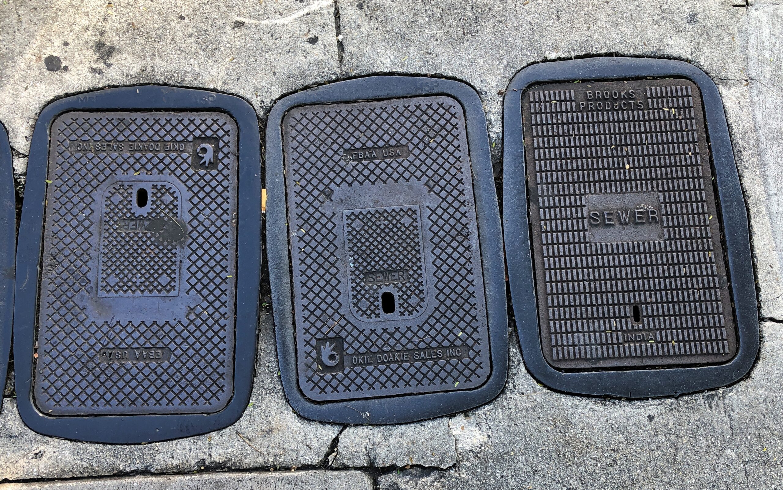
If you asked me, and no one has or will, Key West is missing something in having plain manhole and utility covers (though this isn’t bad).
I suspect custom covers cost more, and money is money, but distinctive places should have distinctive manhole covers. Aren’t details important in fostering – or in this case enhancing – a sense of place?
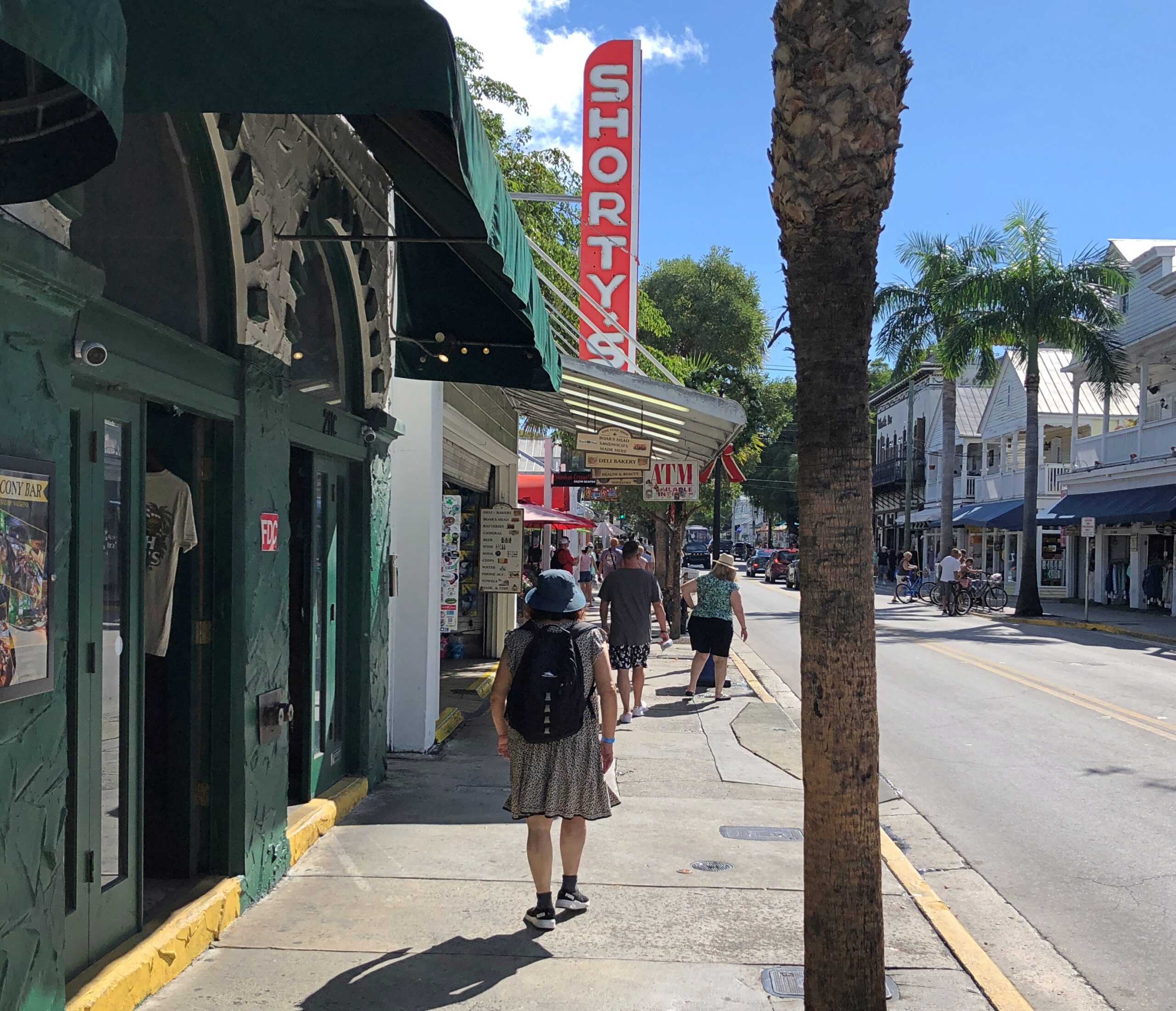
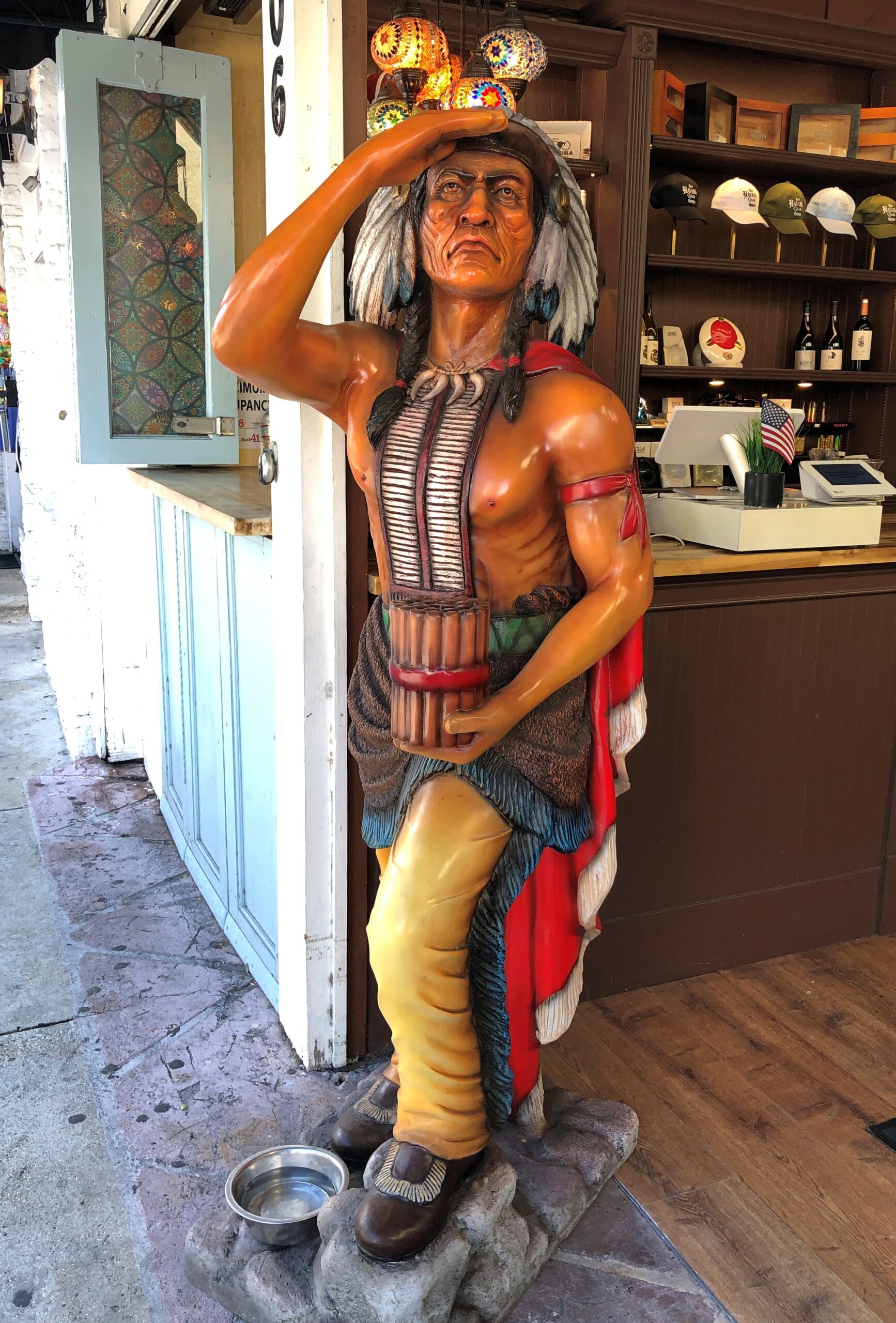
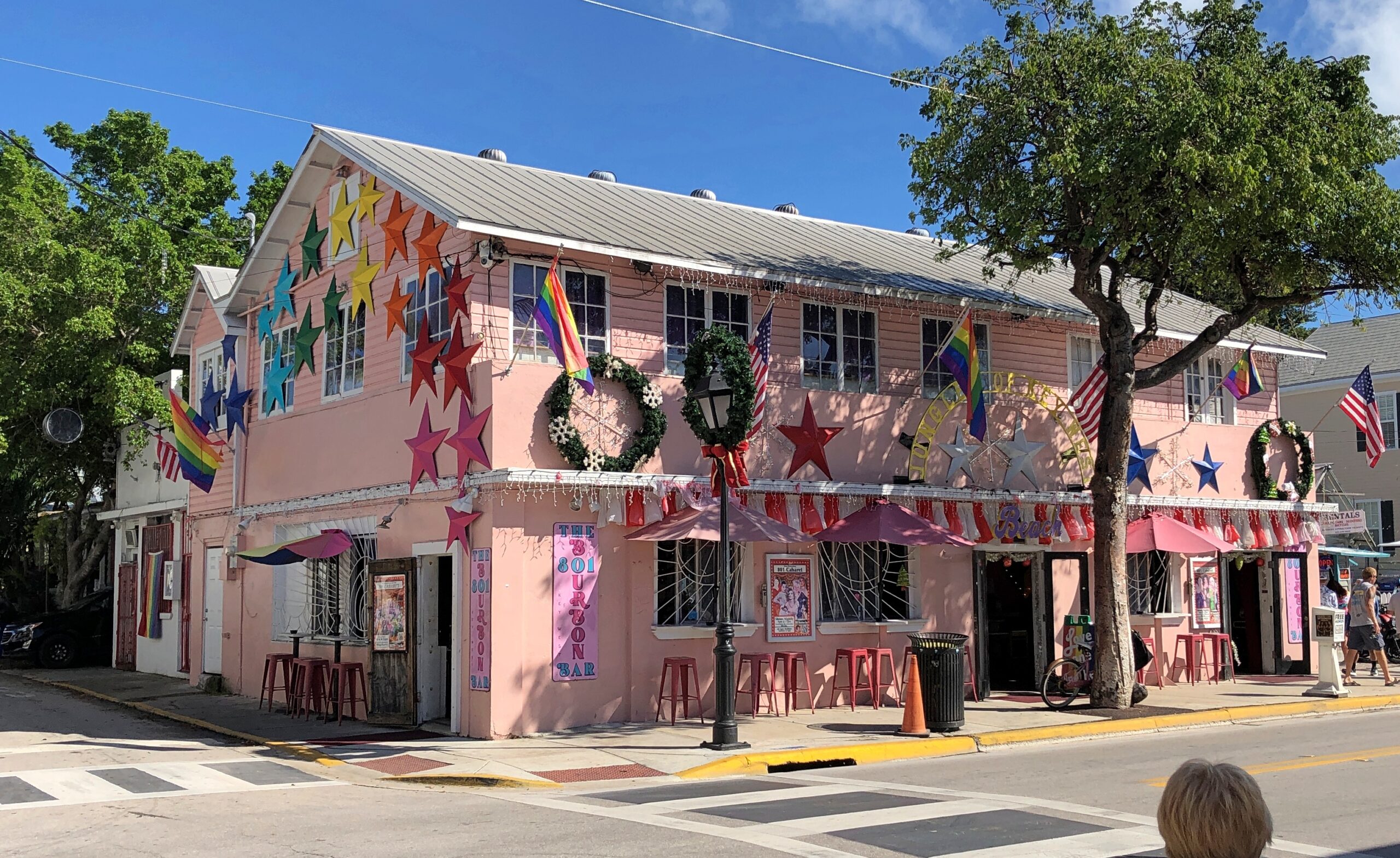
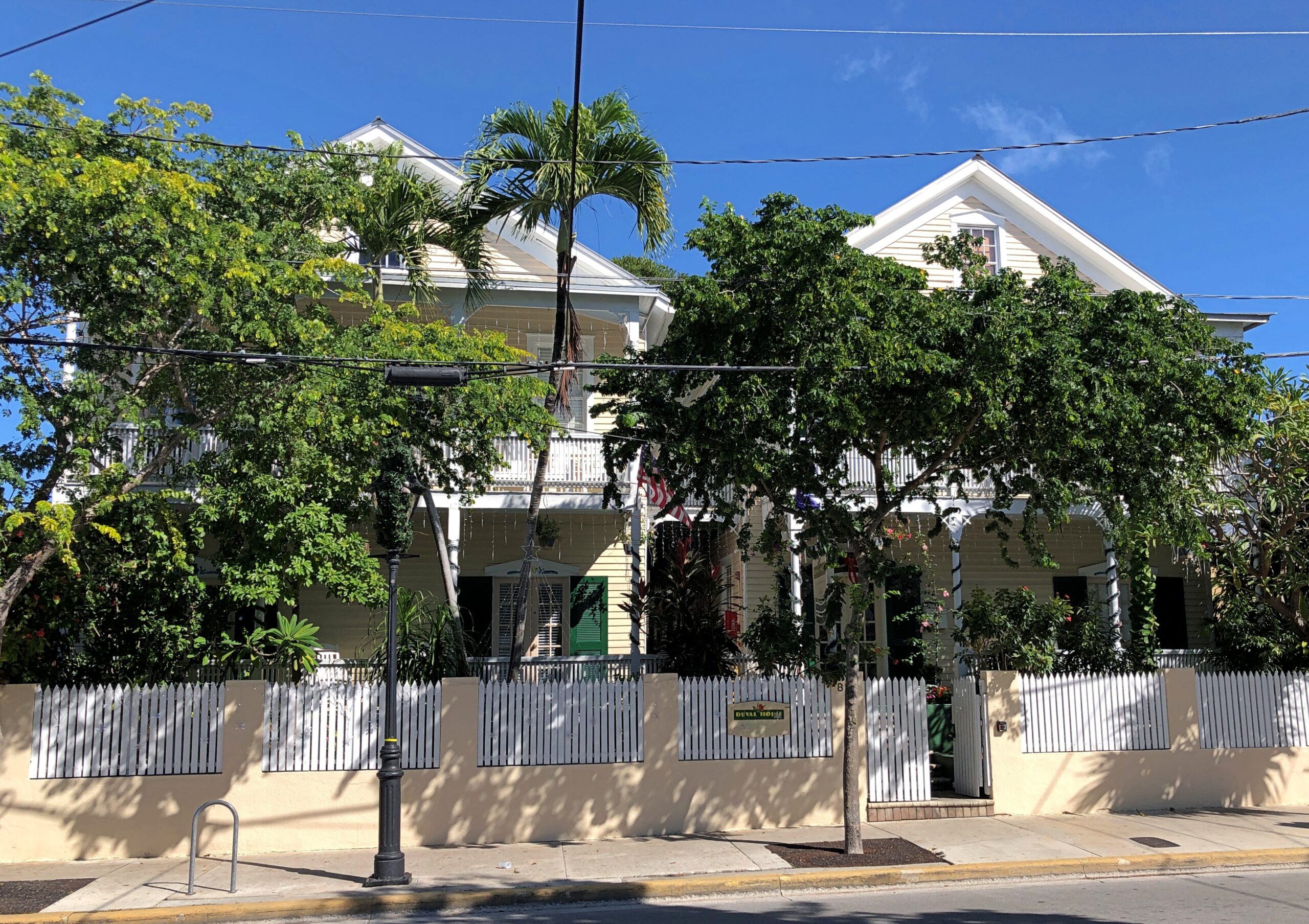
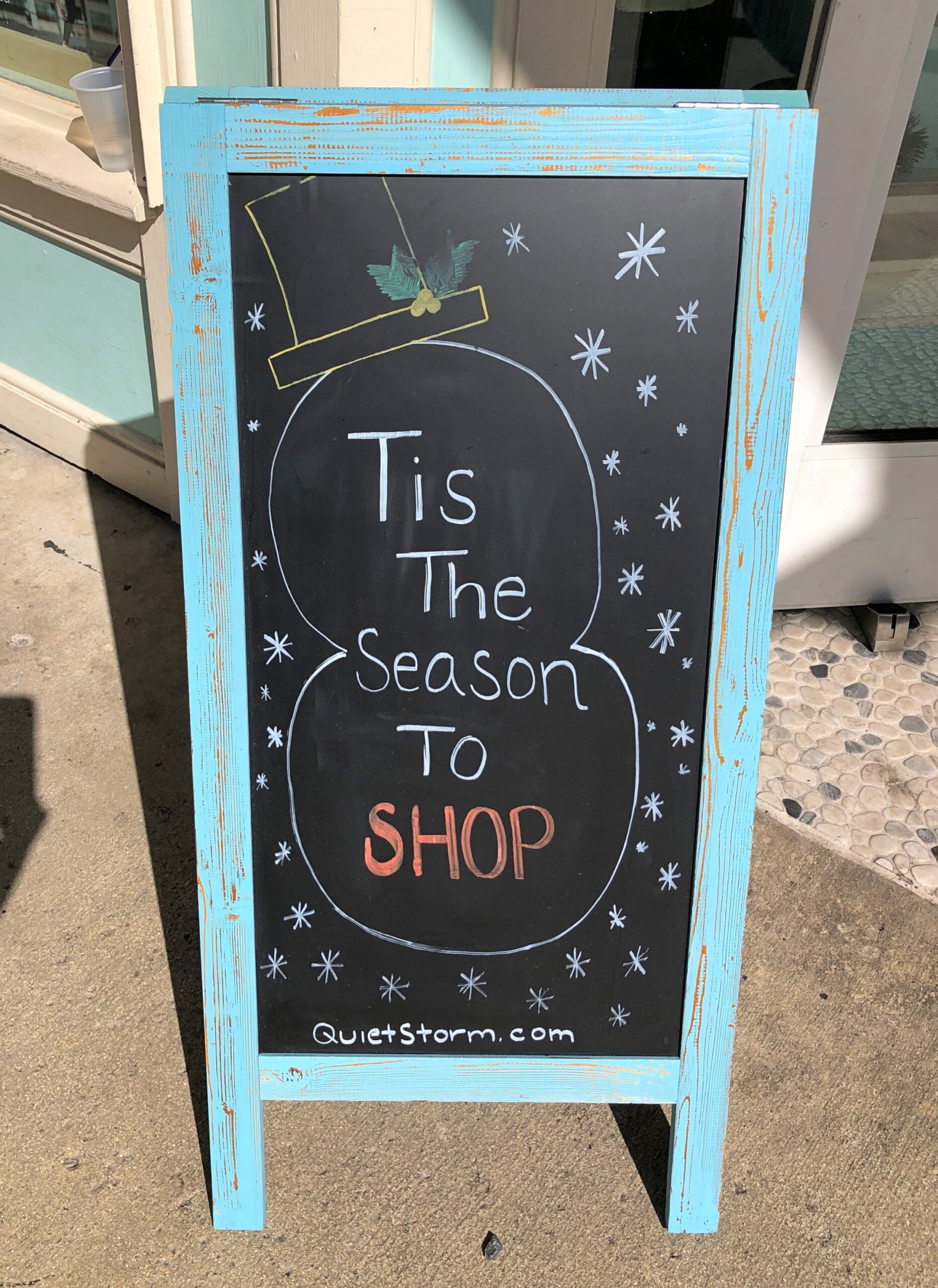
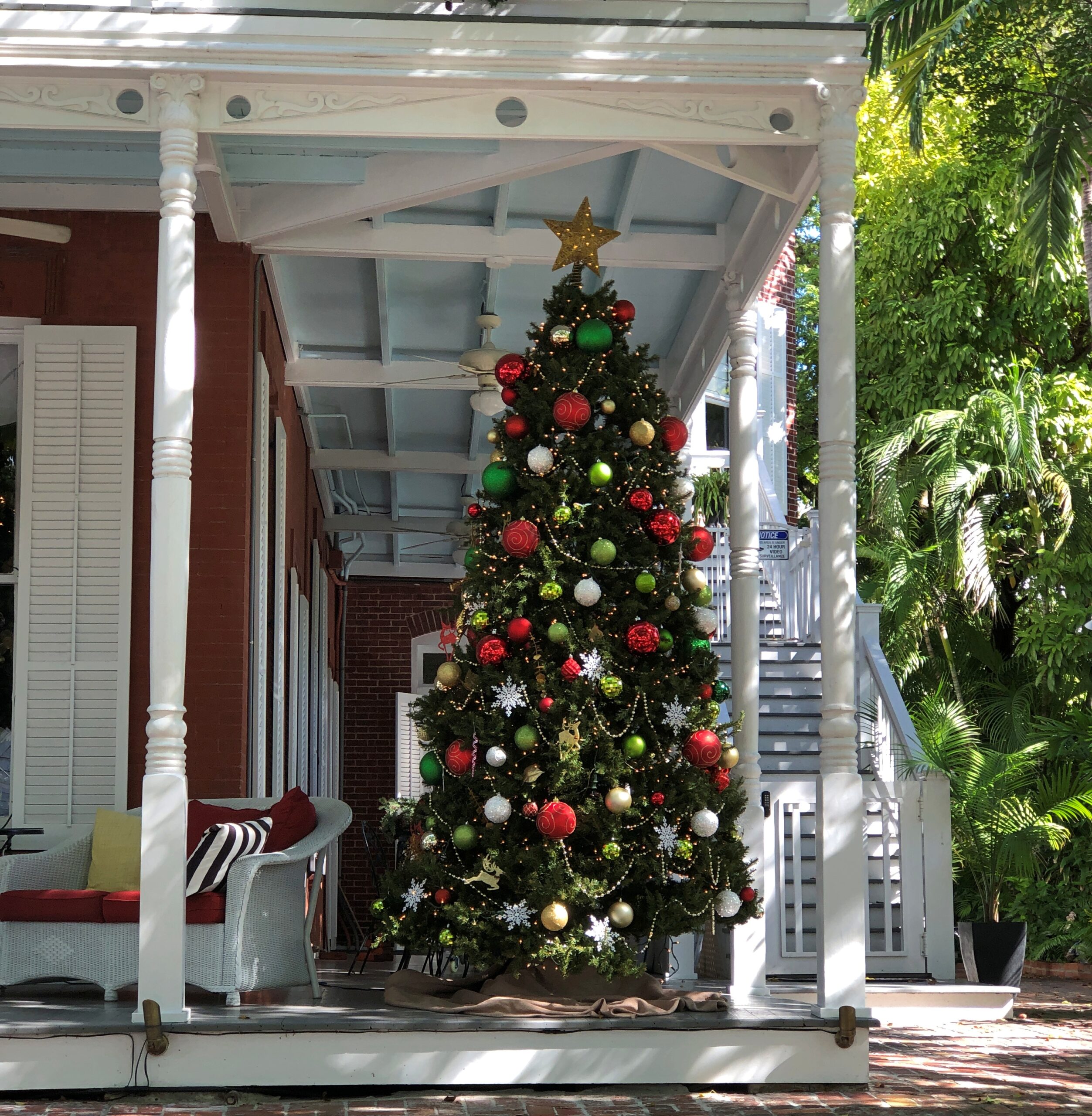
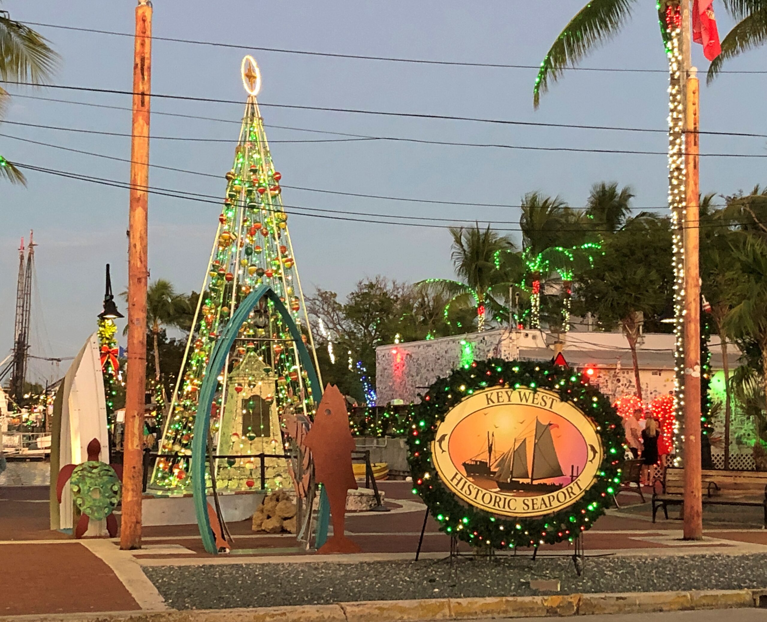
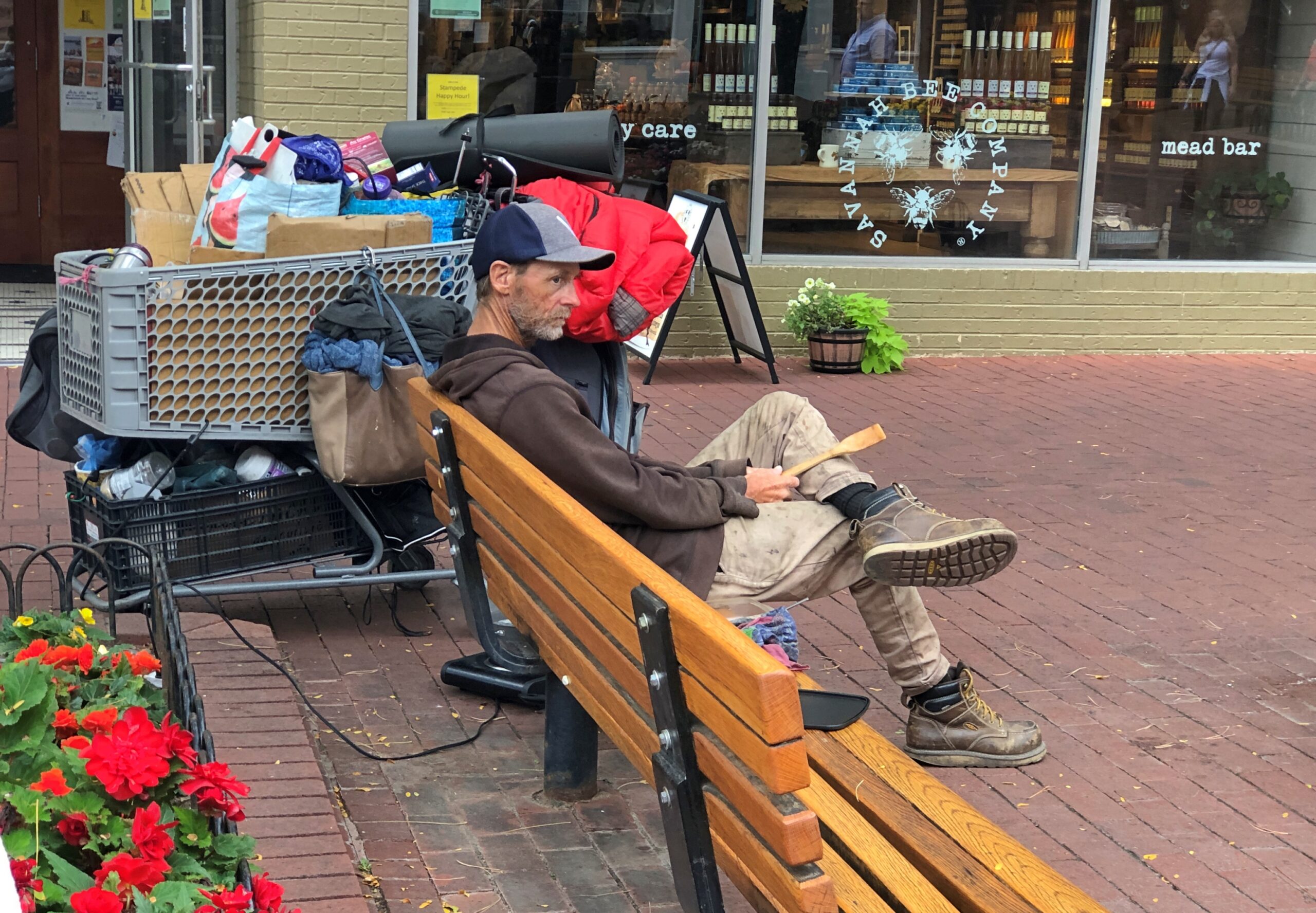
On the other hand, Key West has a sense of place without too many equals. That’s as good a reason as any to stroll down Duval Street, tourist hub of Key West, and take it all in. Or as much as you can. On a mild mid-December day, that wasn’t hard.
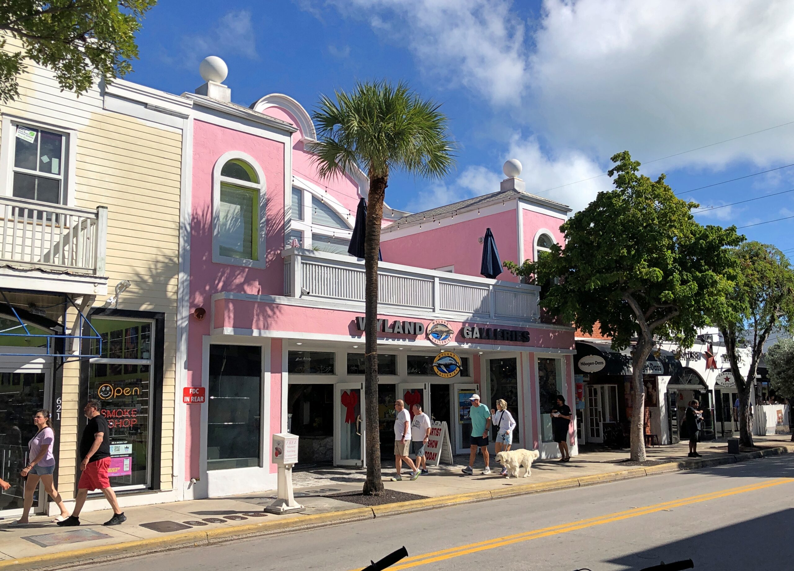
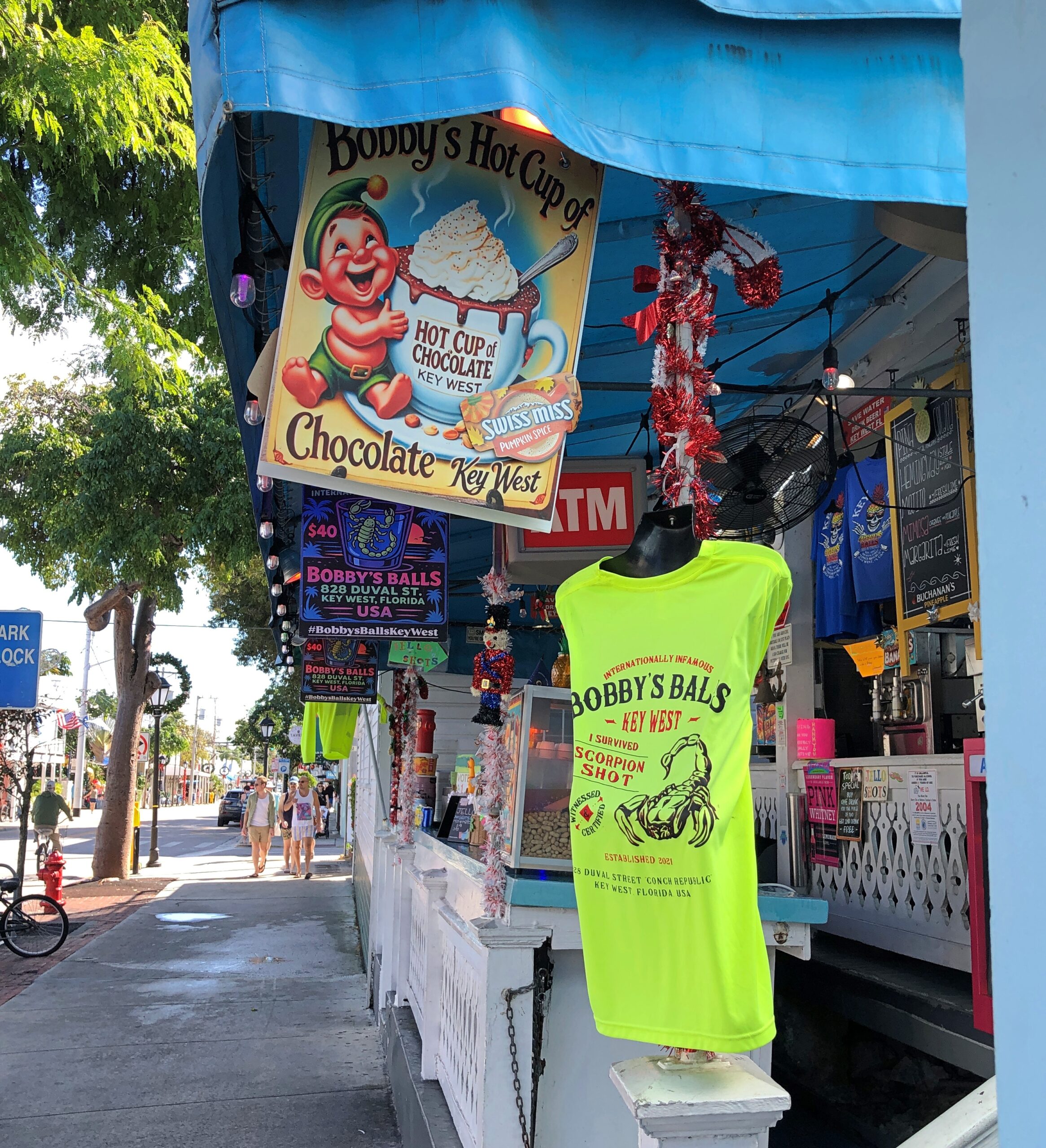
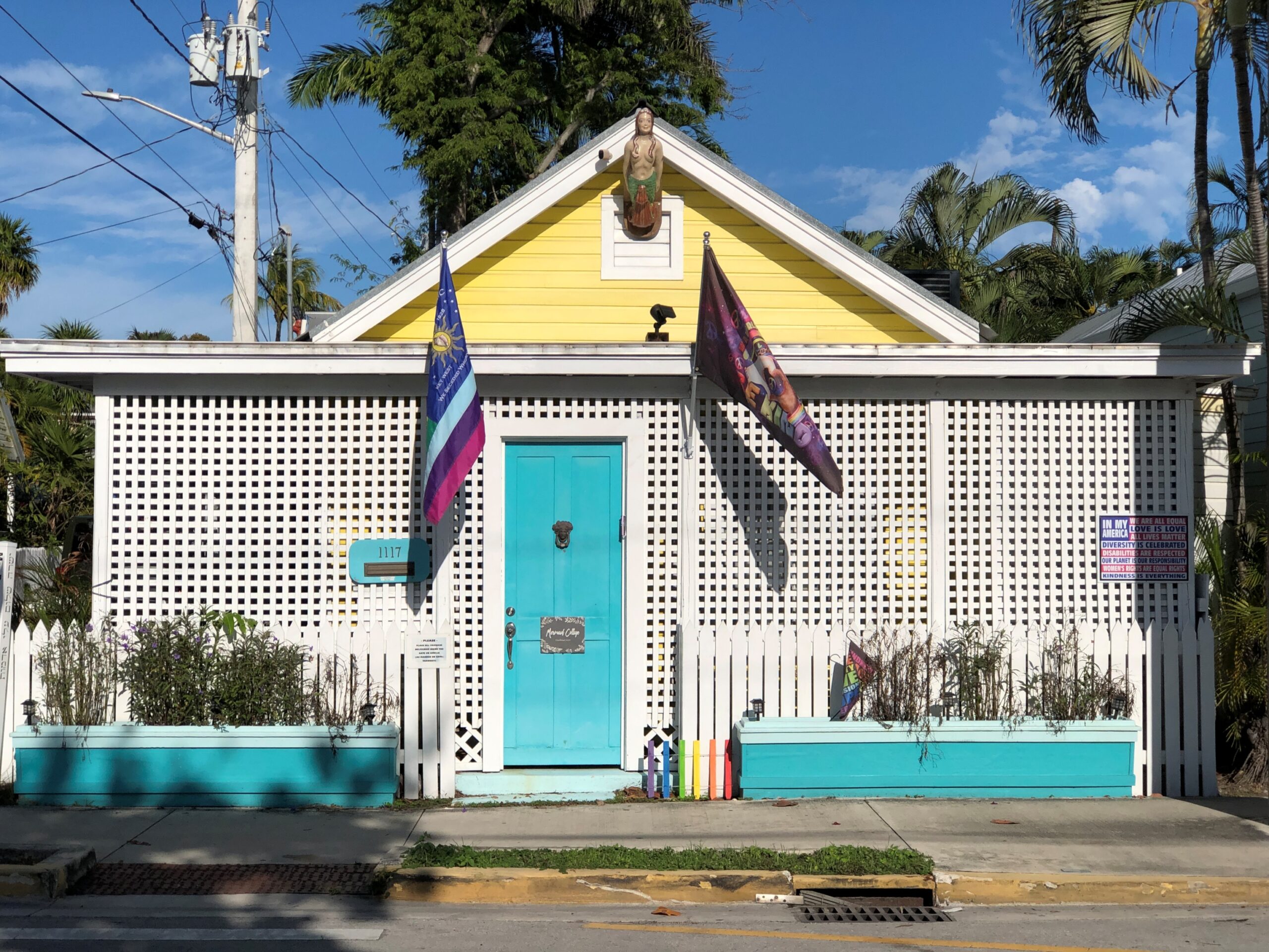
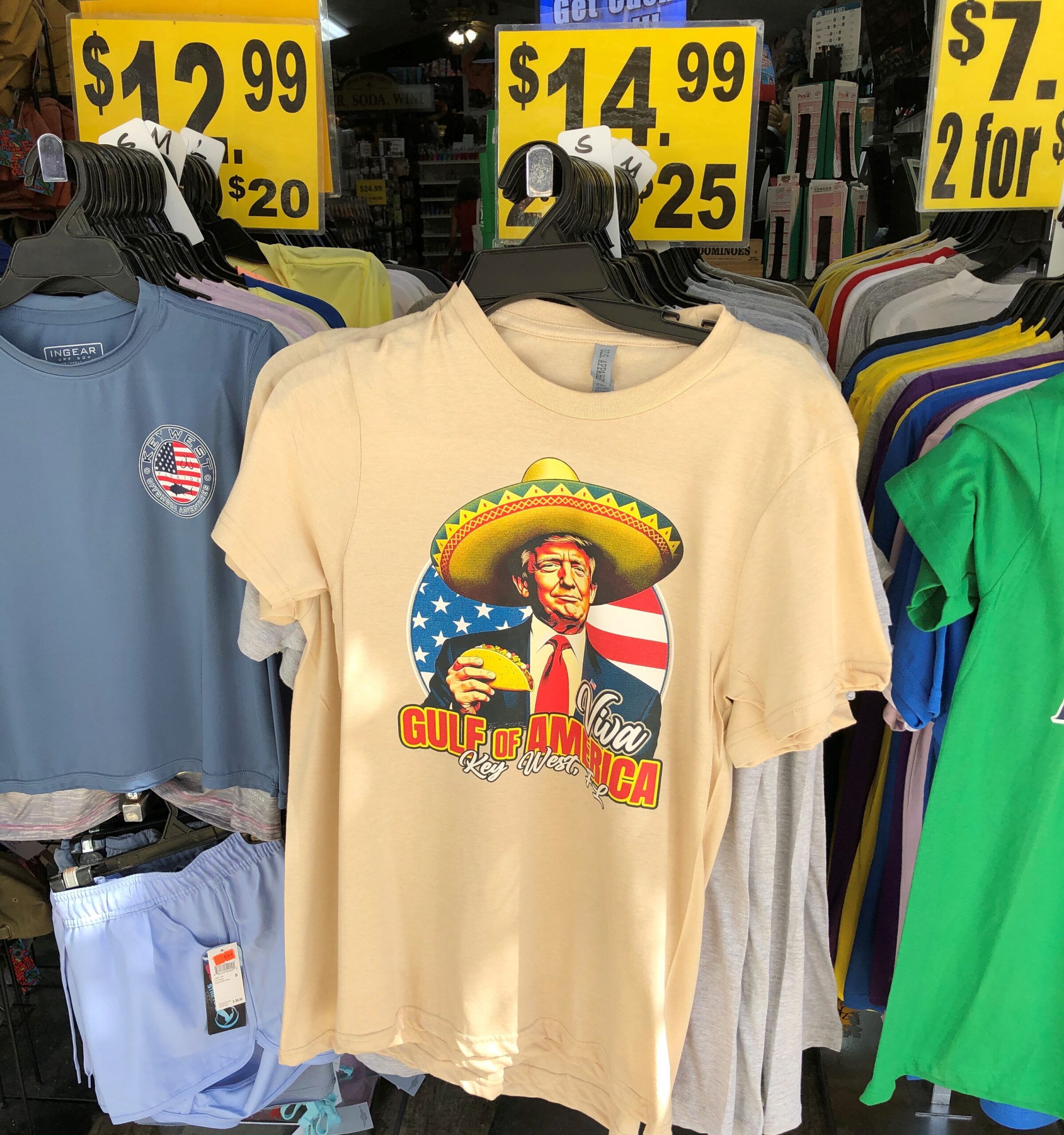
As a tourist street, a lot of retail detail.
Buildings that have somehow survived these last 100 years or so, despite the ocean’s habit of kicking up a hurricane-force fuss now and then.
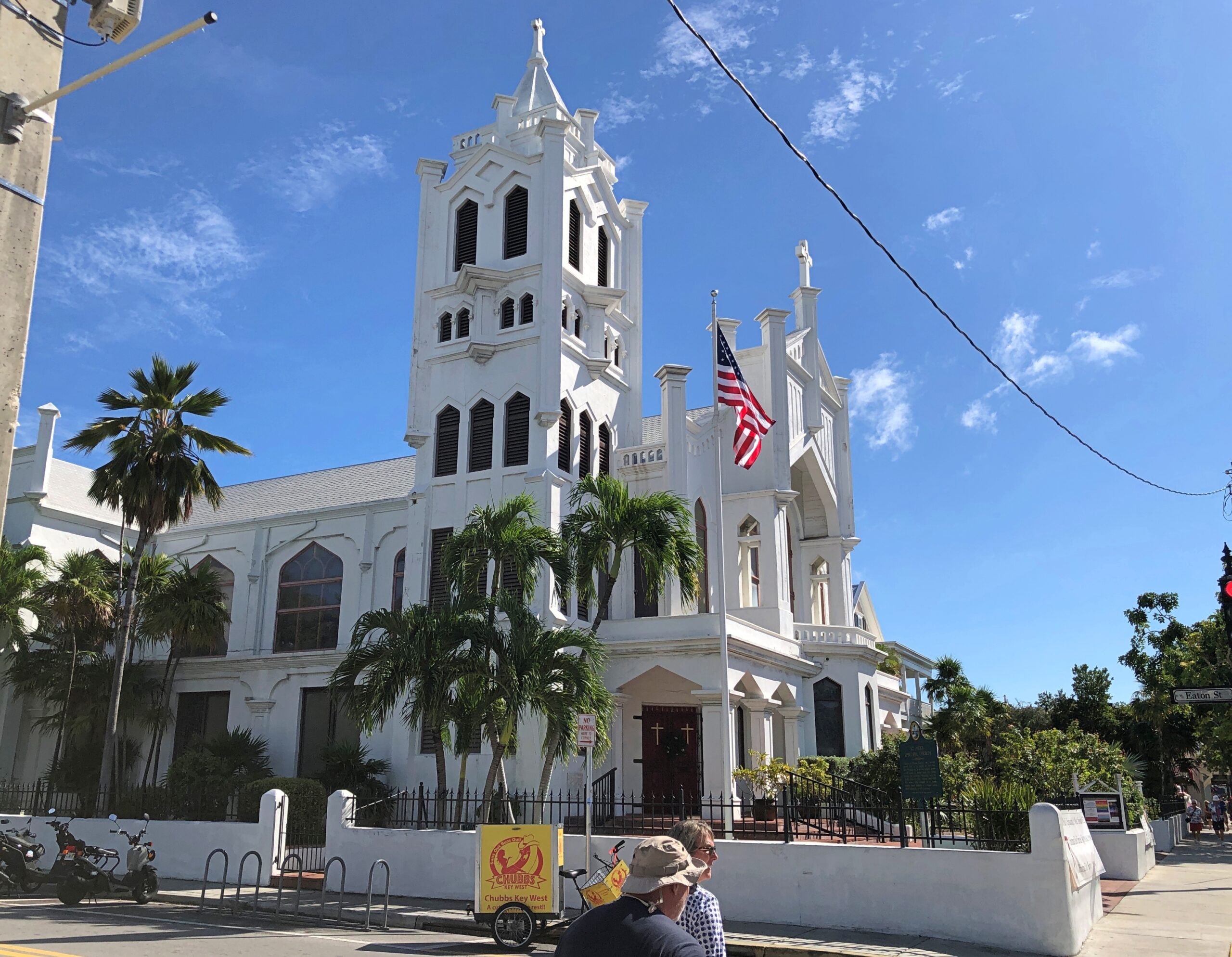
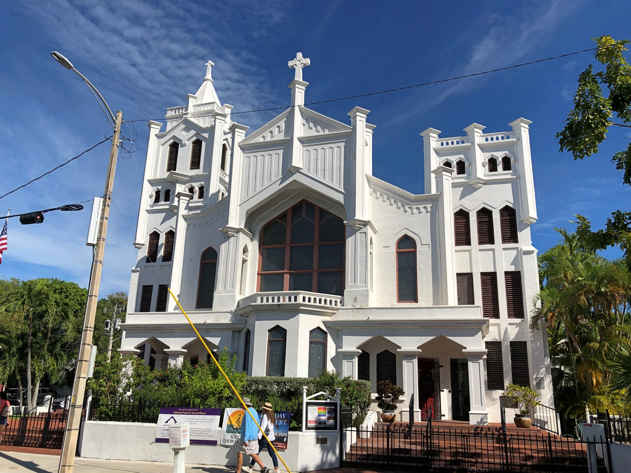
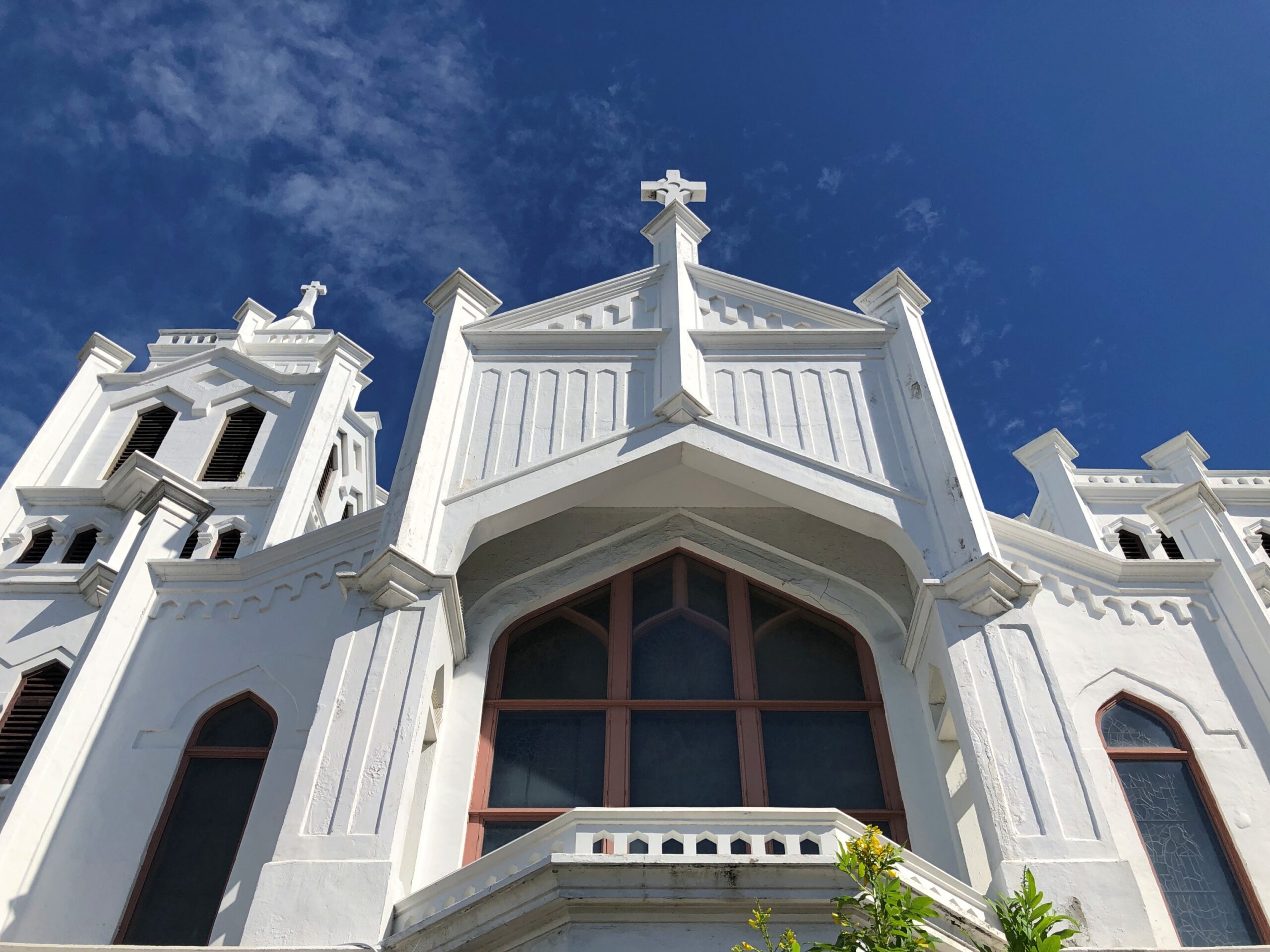
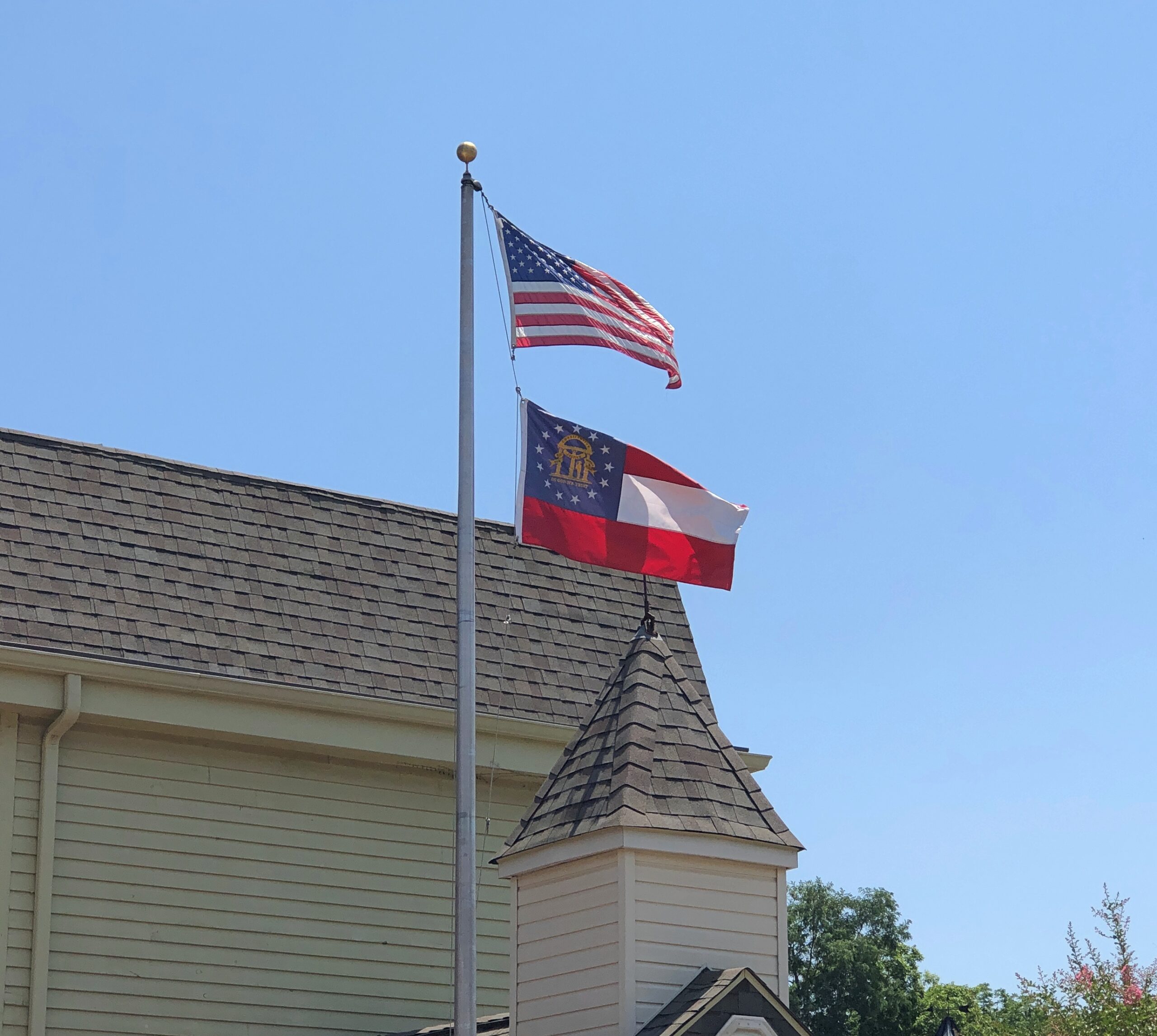
St. Paul’s Episcopal, 401 Duval.
In 2014, I ducked away from crowded Duval into the church, which seemed to be open because the organist was practicing. I sat, impressed by his vigorous noodling, and by the fact that no one else was in the church.
This time, closed.
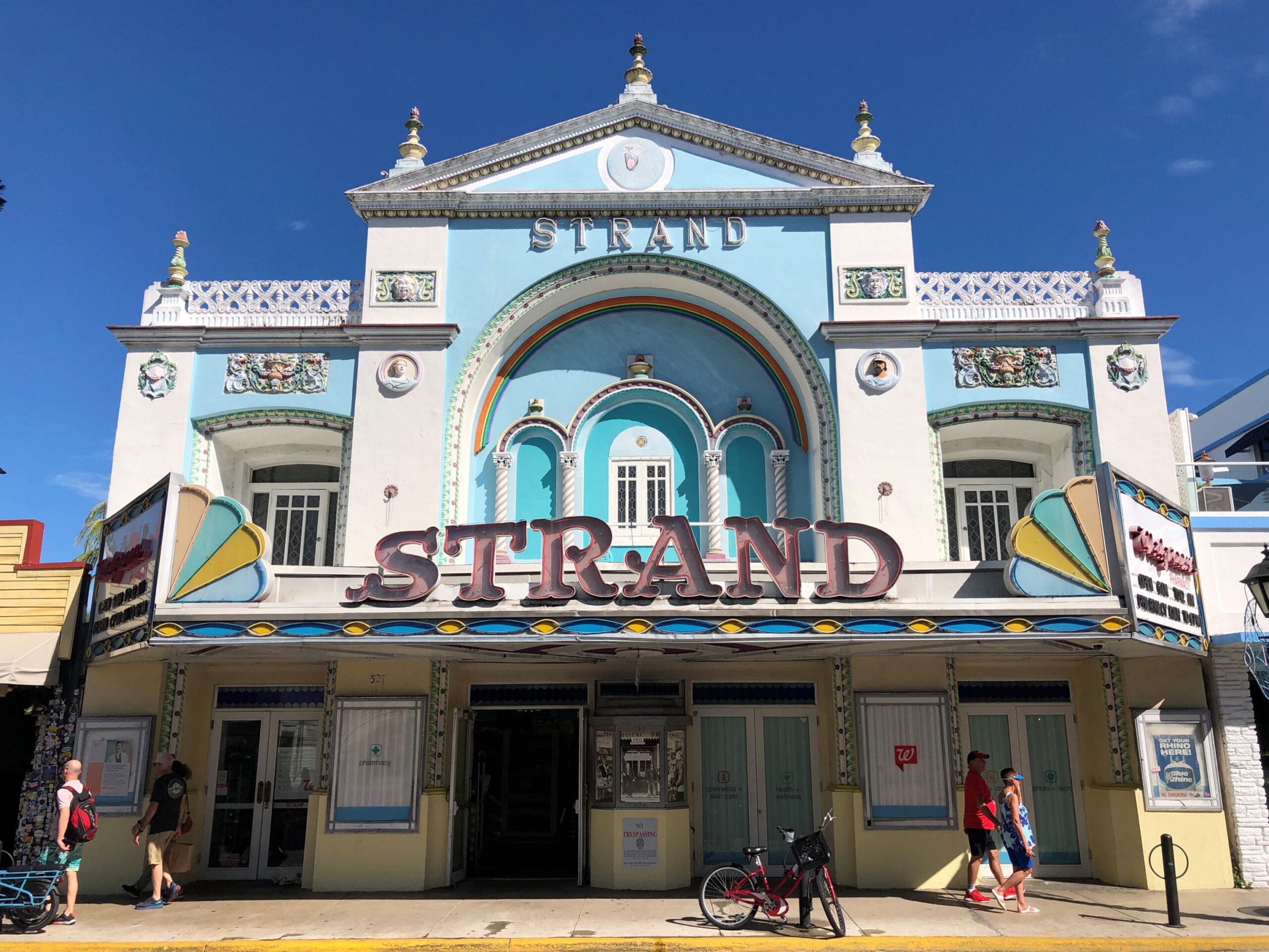
Looks like a movie theater. It was. Now a Walgreen’s.
More detail.
“Duval Street, the undisputed ‘Main Street’ of Key West, is the only place in the U.S. where one street allows you to walk from the Atlantic Ocean to the Gulf of Mexico,” says the American Planning Association, in picking Duval Street a Great Place in America.
“ A citywide commitment to preserving the National Register of Historic Places single-largest collection of wooden structures has allowed Duval Street and the rest of Key West to transition from an economy based on maritime industries and Cuban travel during its earlier years to one now supported by entertainment, art, and tourism.”
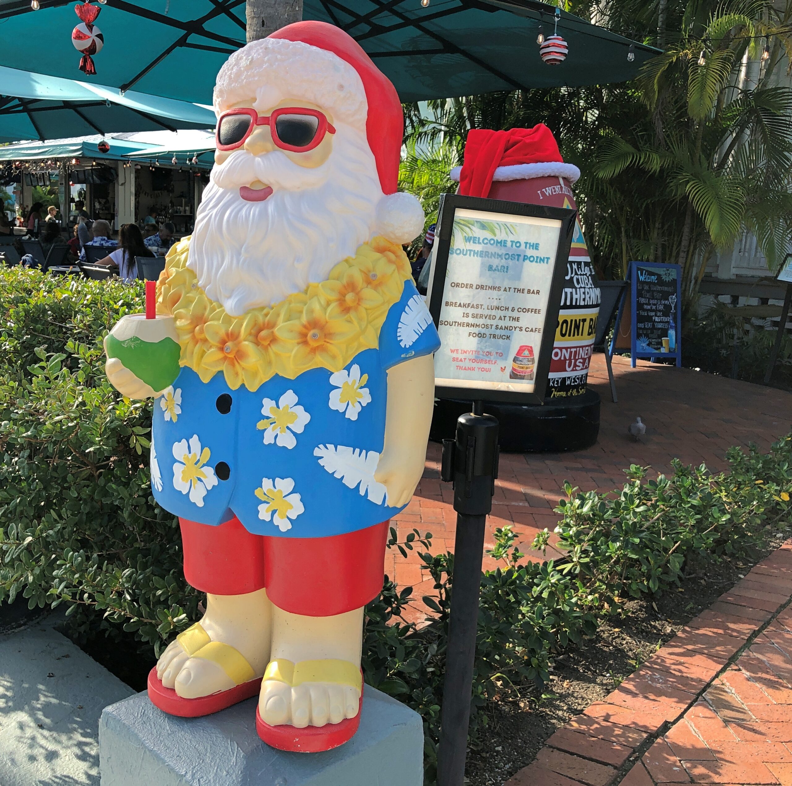
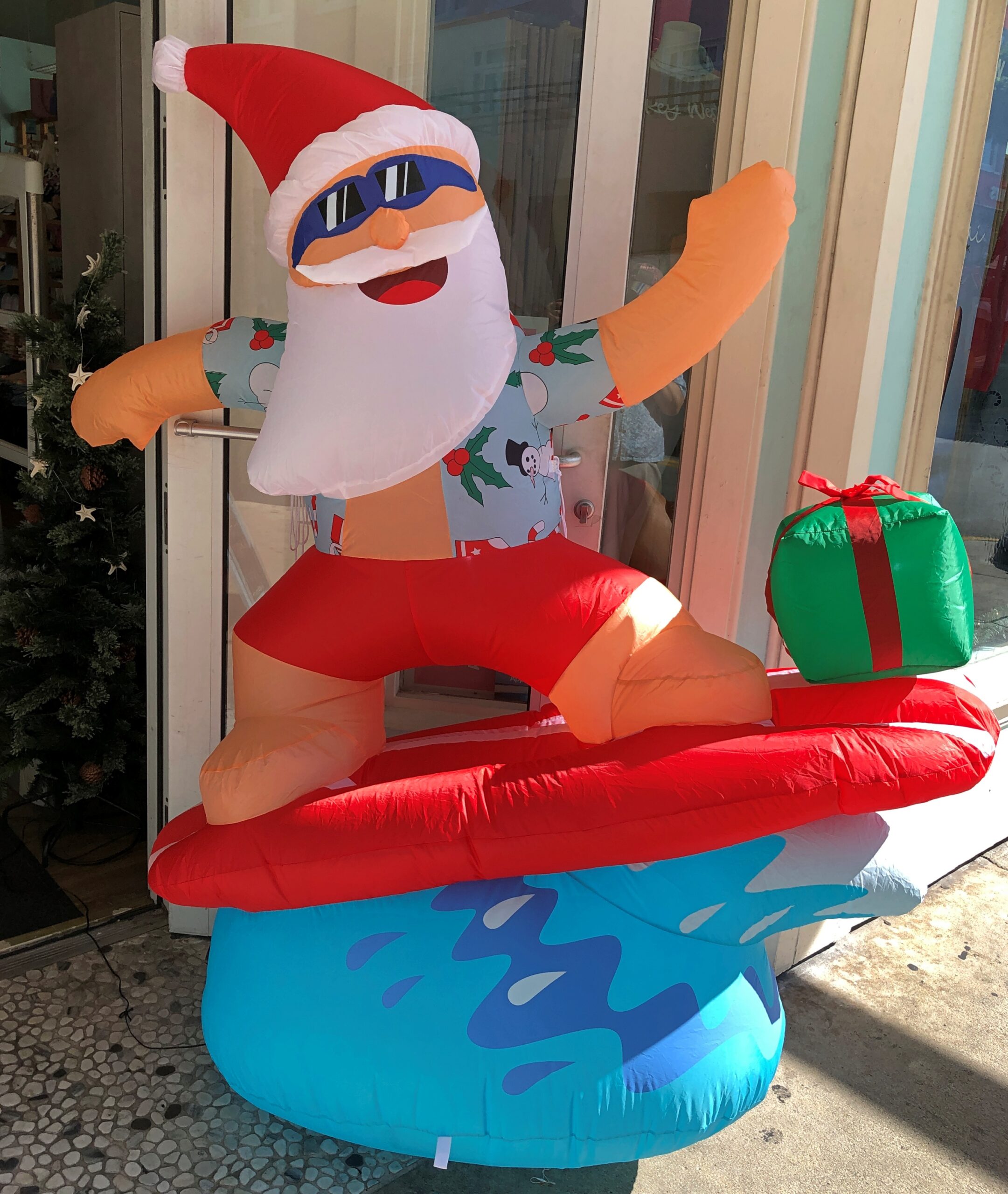
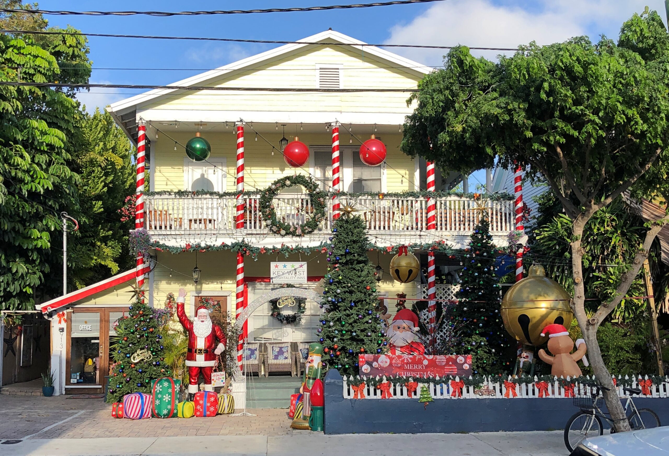
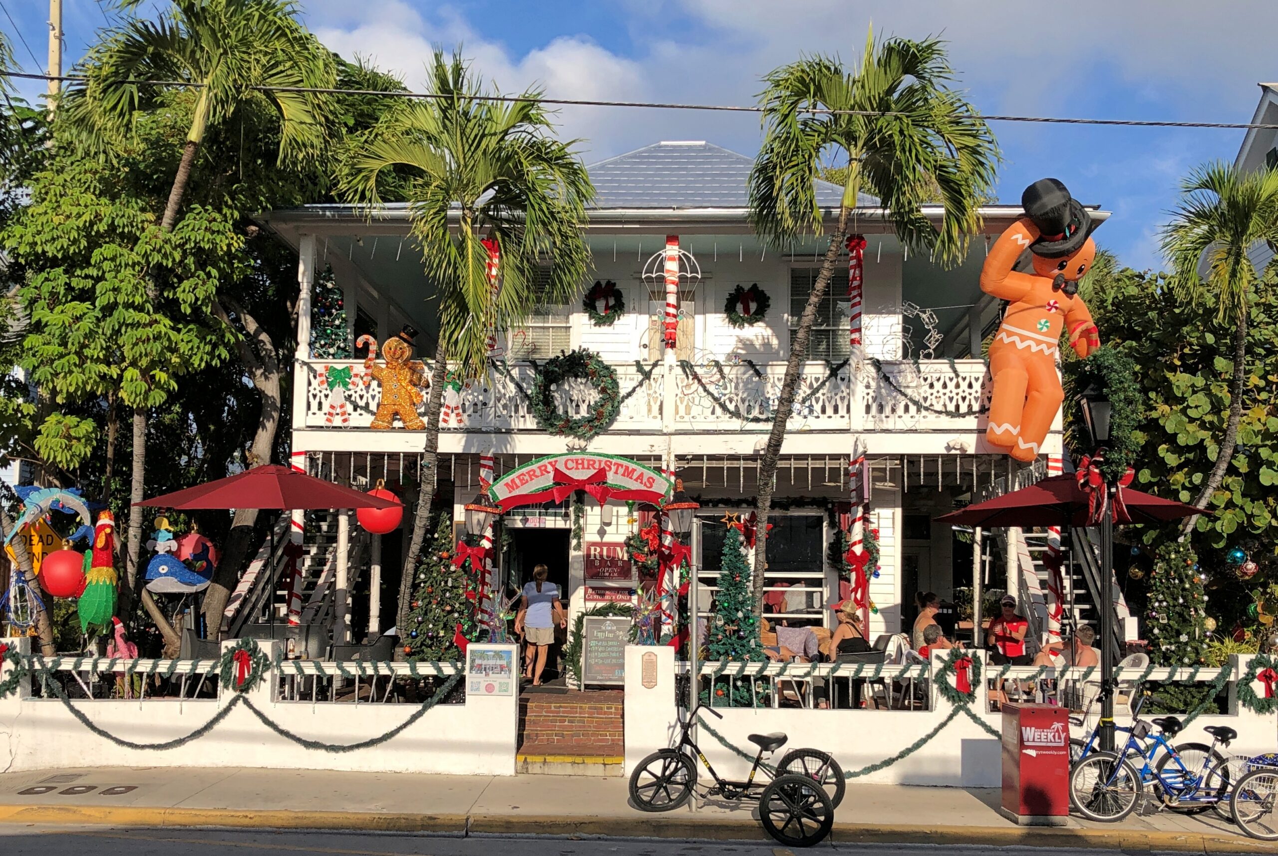
Island-vibe Santa Claus can be found in Key West in mid-December. In fact, I was expecting more such Santas. Even he needs to vacation, preferably somewhere warm (see #13).
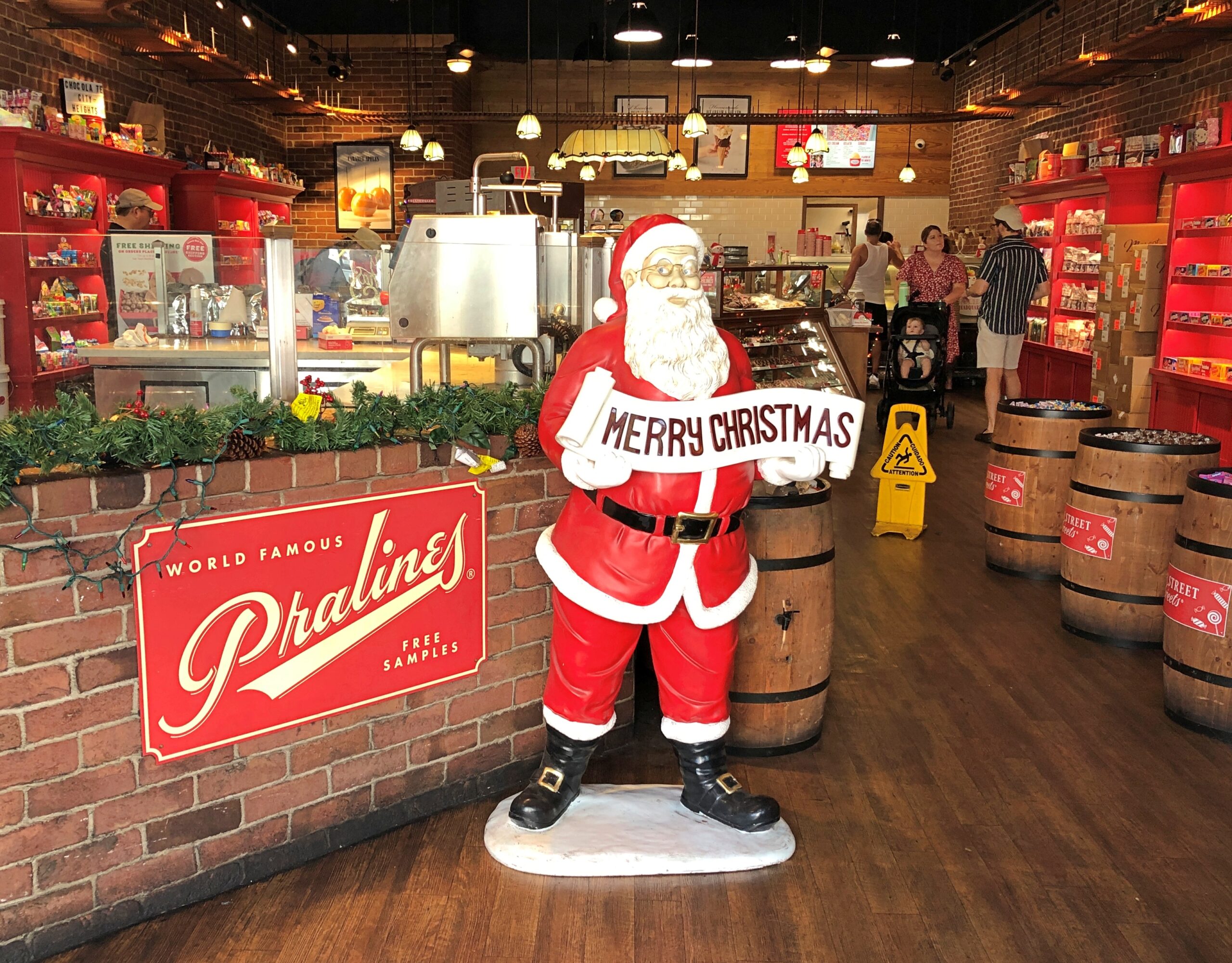
We spent two days walking around Old Town in Key West, which is time enough to cover a fair amount of ground, considering the small size of the place. More conventional St. Nicks were also to be seen, some of them finding their place in a place of business.
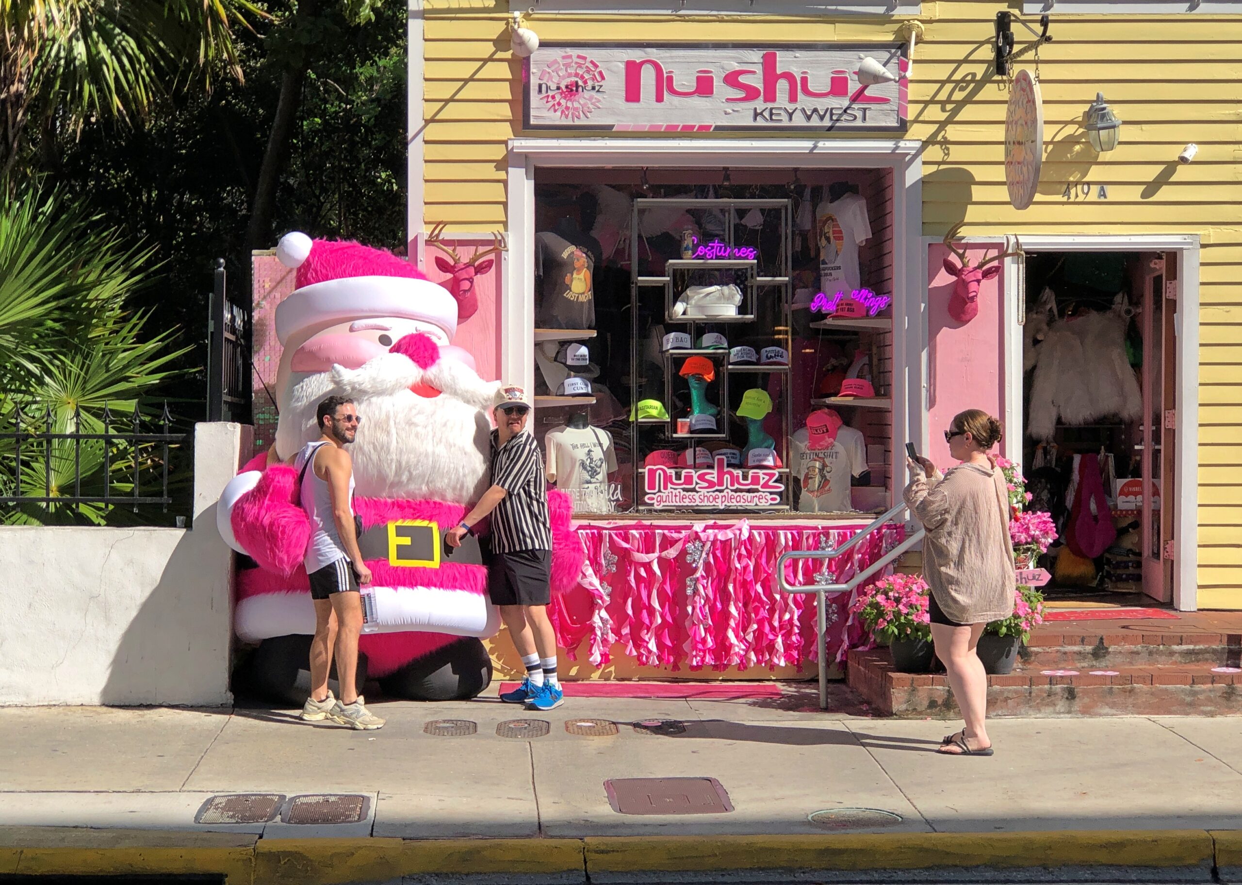
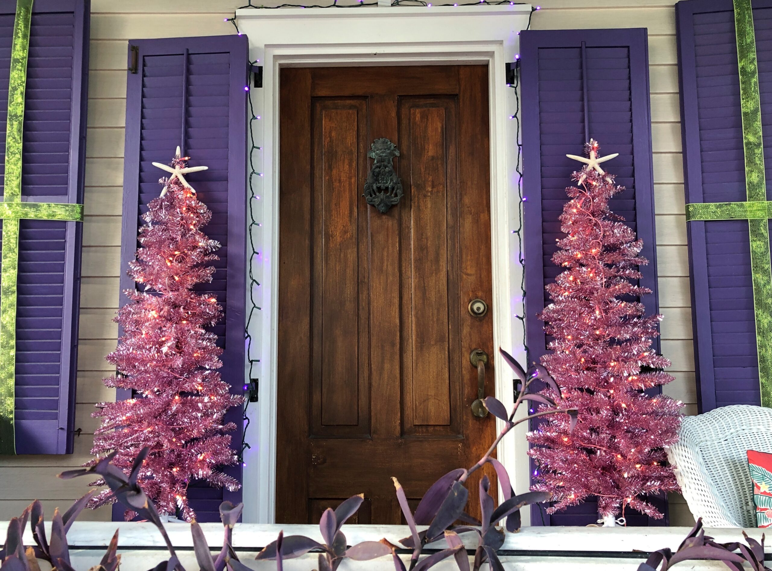
Not sure if pink counts as conventional Santa Claus. Usually he’s red, of course, a depiction of jolly old elf owes to Coca-Cola, but pink is pretty close. Anyway, pink Santa had a few fans.
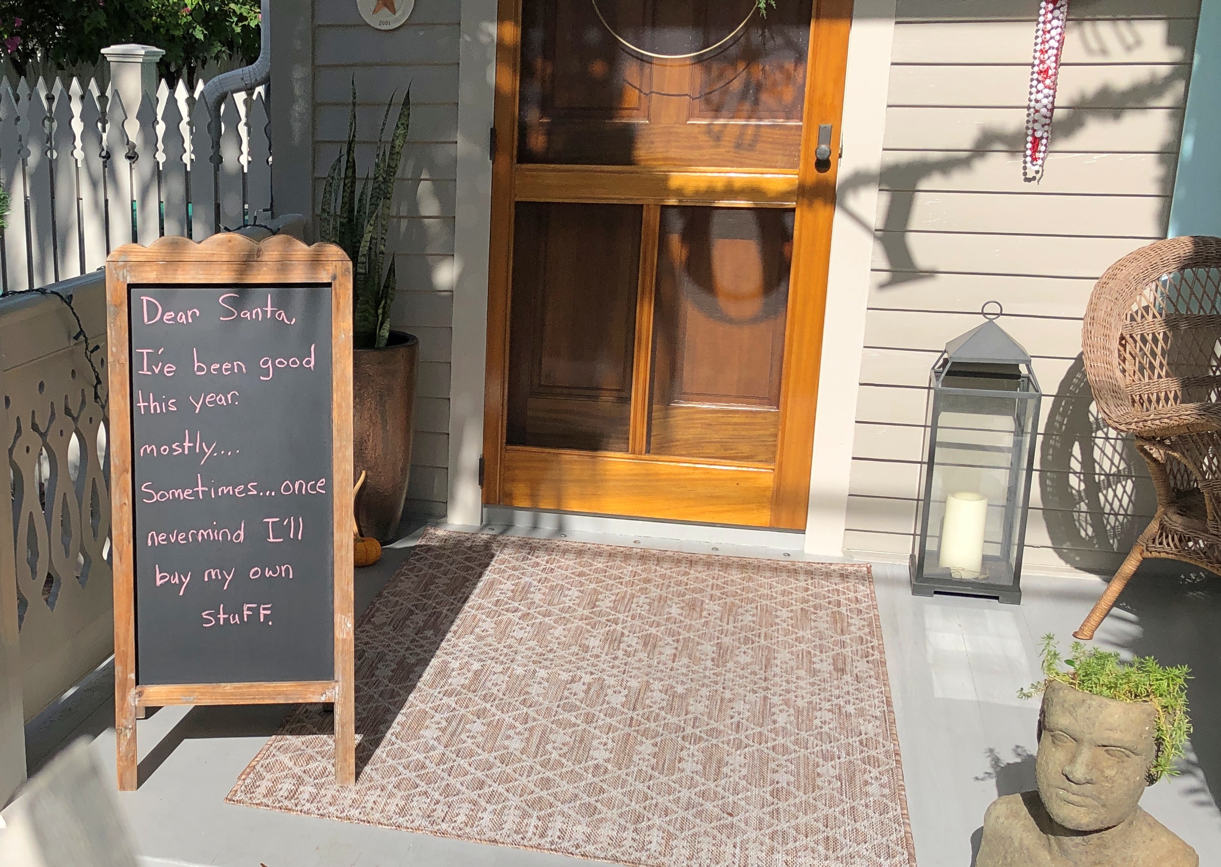
A message for Santa, going for ha ha ha, rather than ho ho ho.
This retailer gets right to the point.
Maybe not the full Griswold, but decked out in quantity.
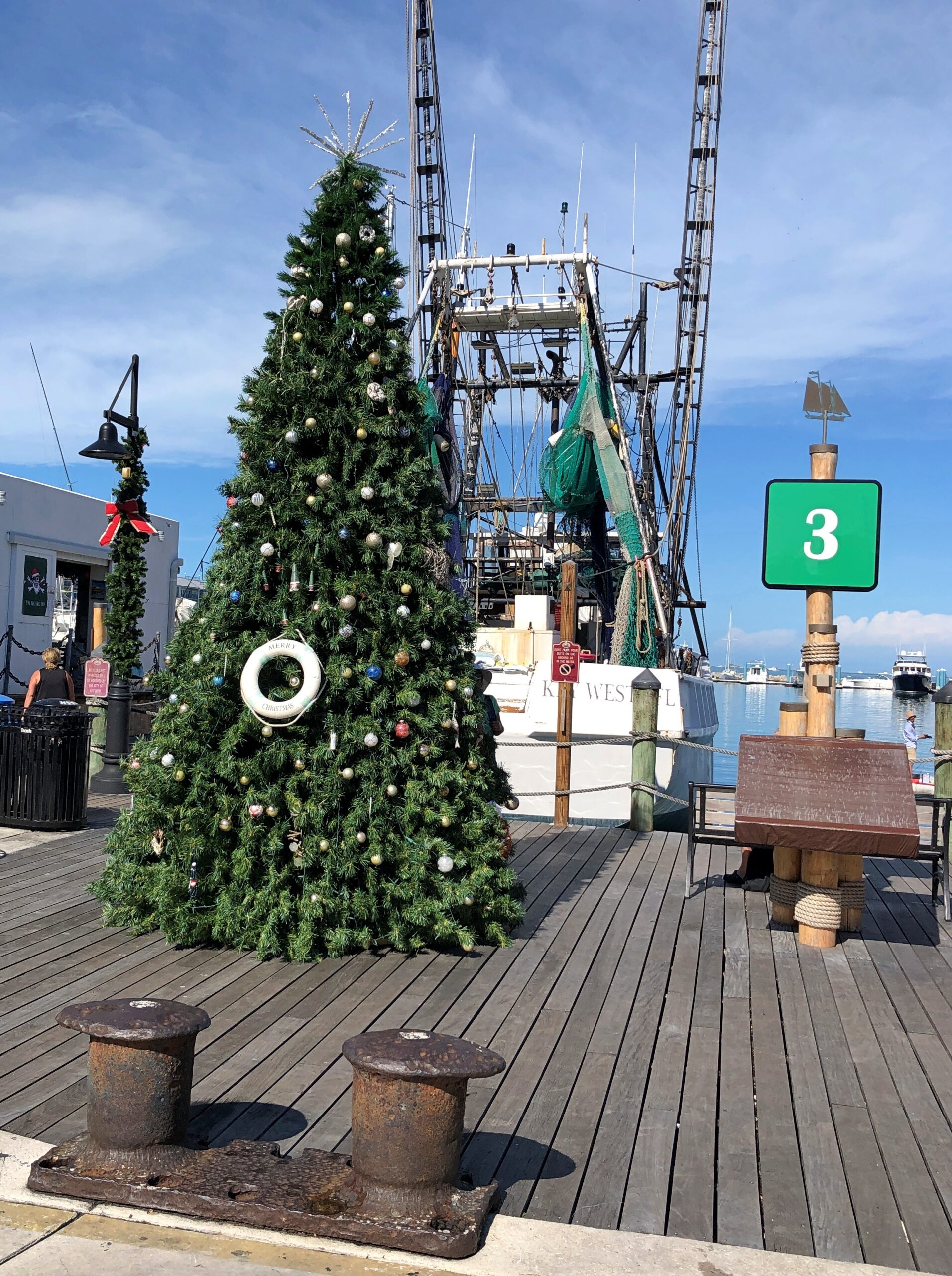
Trees: evergreen simulations, which seem a little out of place. But why not?
A pair of pink aluminum trees.
We need a revival of the aluminum tree. Not everywhere during the season, but up a notch in the Xmas décor world. Unless that’s already happened. It might have and I wouldn’t have noticed.
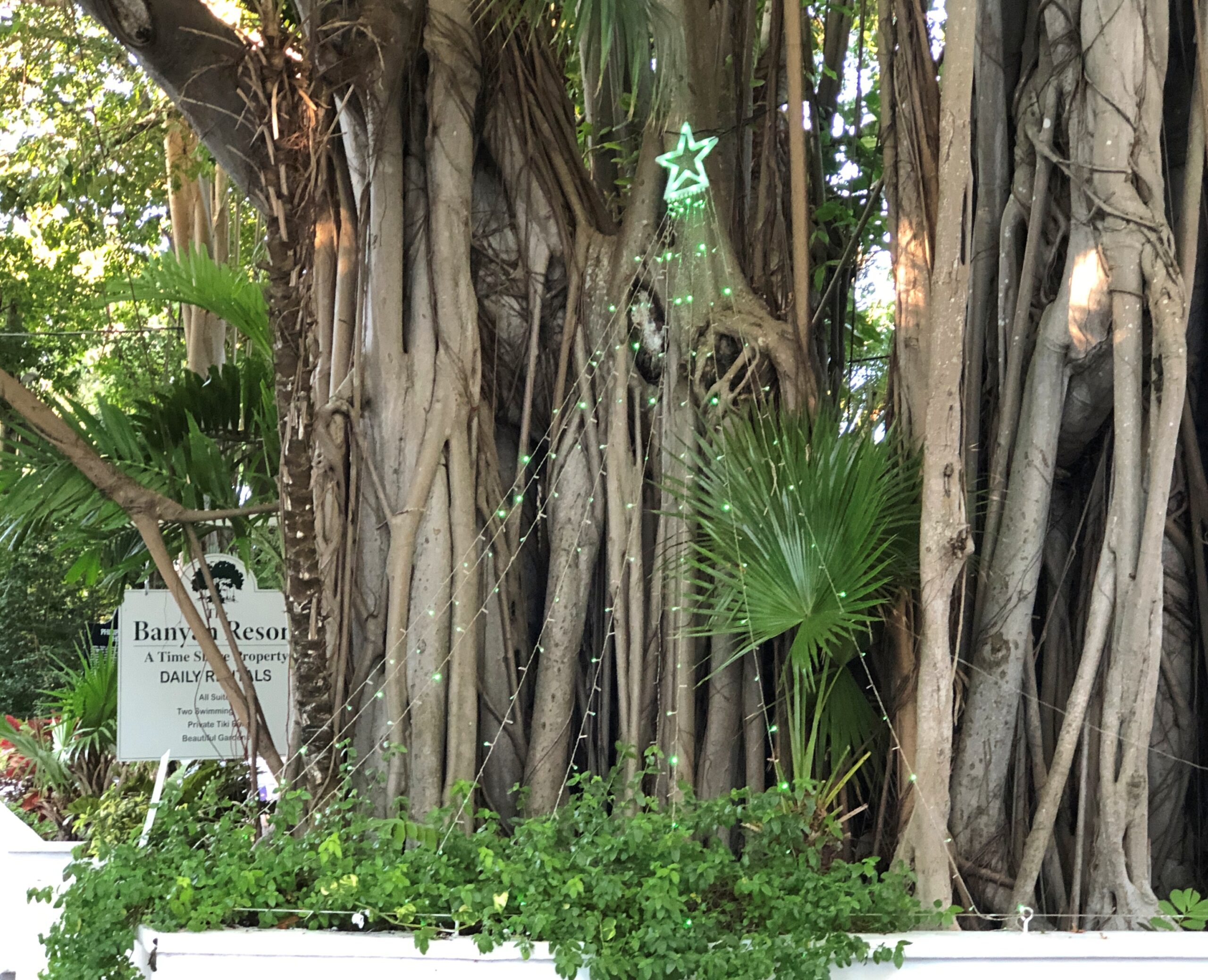
Tree in the abstract. Fronting a banyan. That, I think, counts as Key West local.
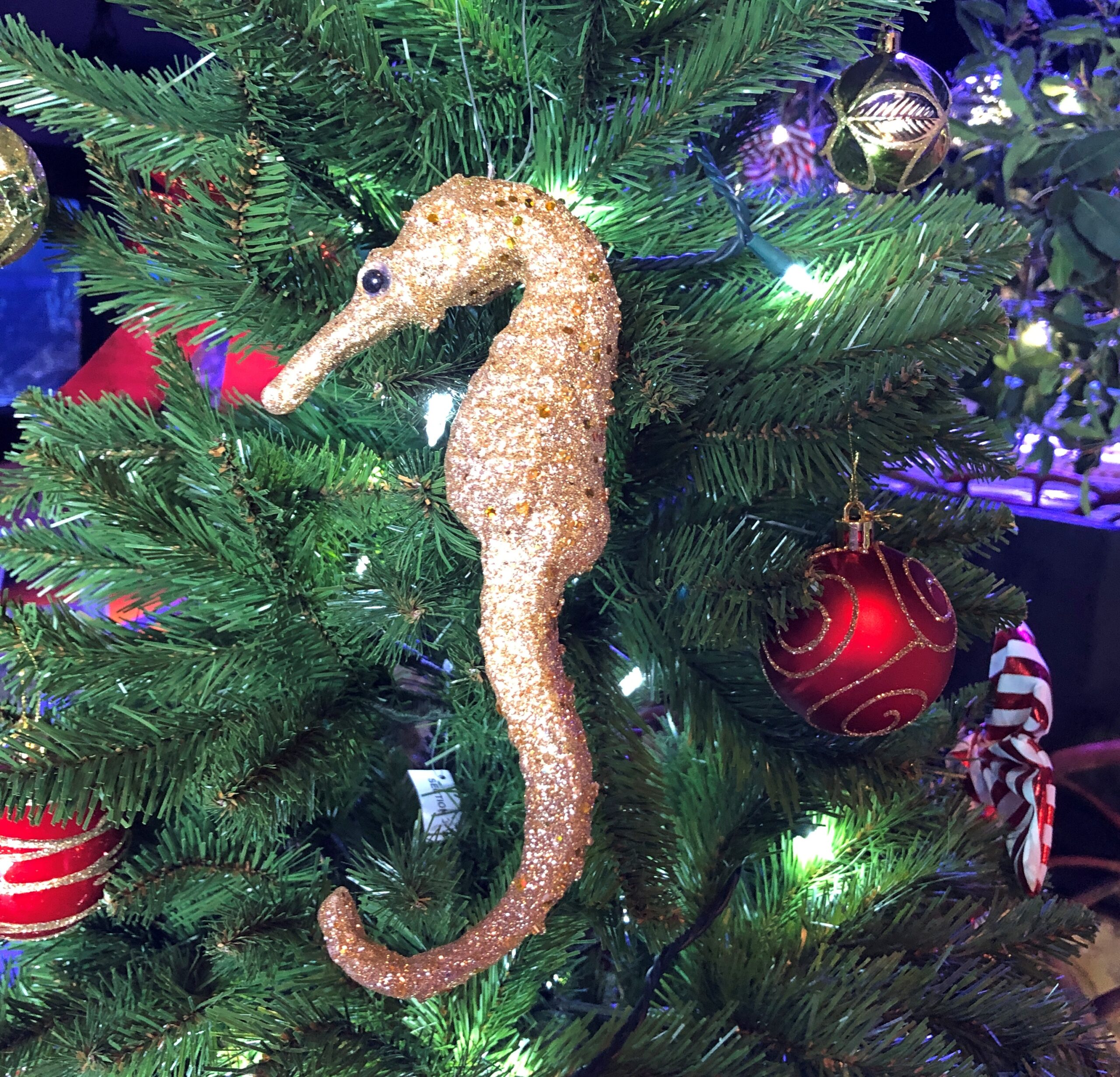
So does this.
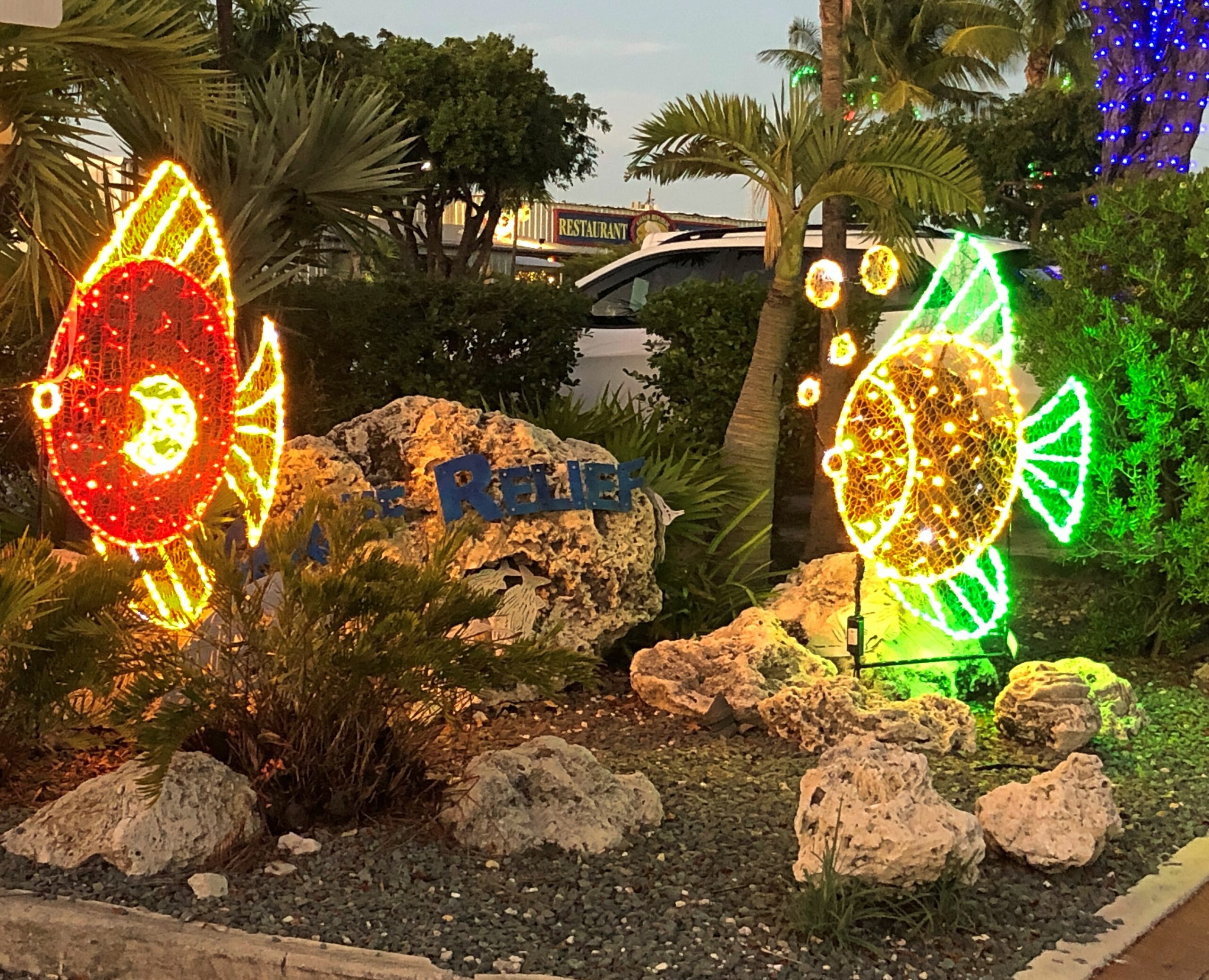
Near dusk the first day was a good time to see lights.
Not Christmas lights, but colorful all the same, and available to take home. We didn’t.
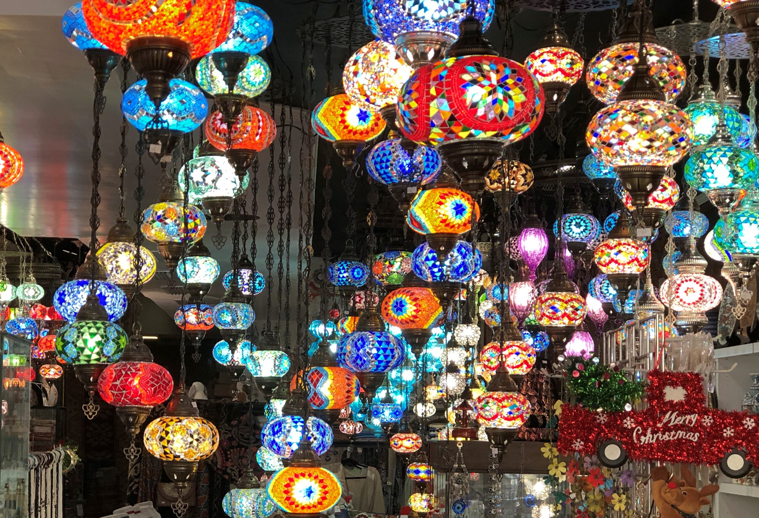
Not specifically Christmas either, but also colorful.
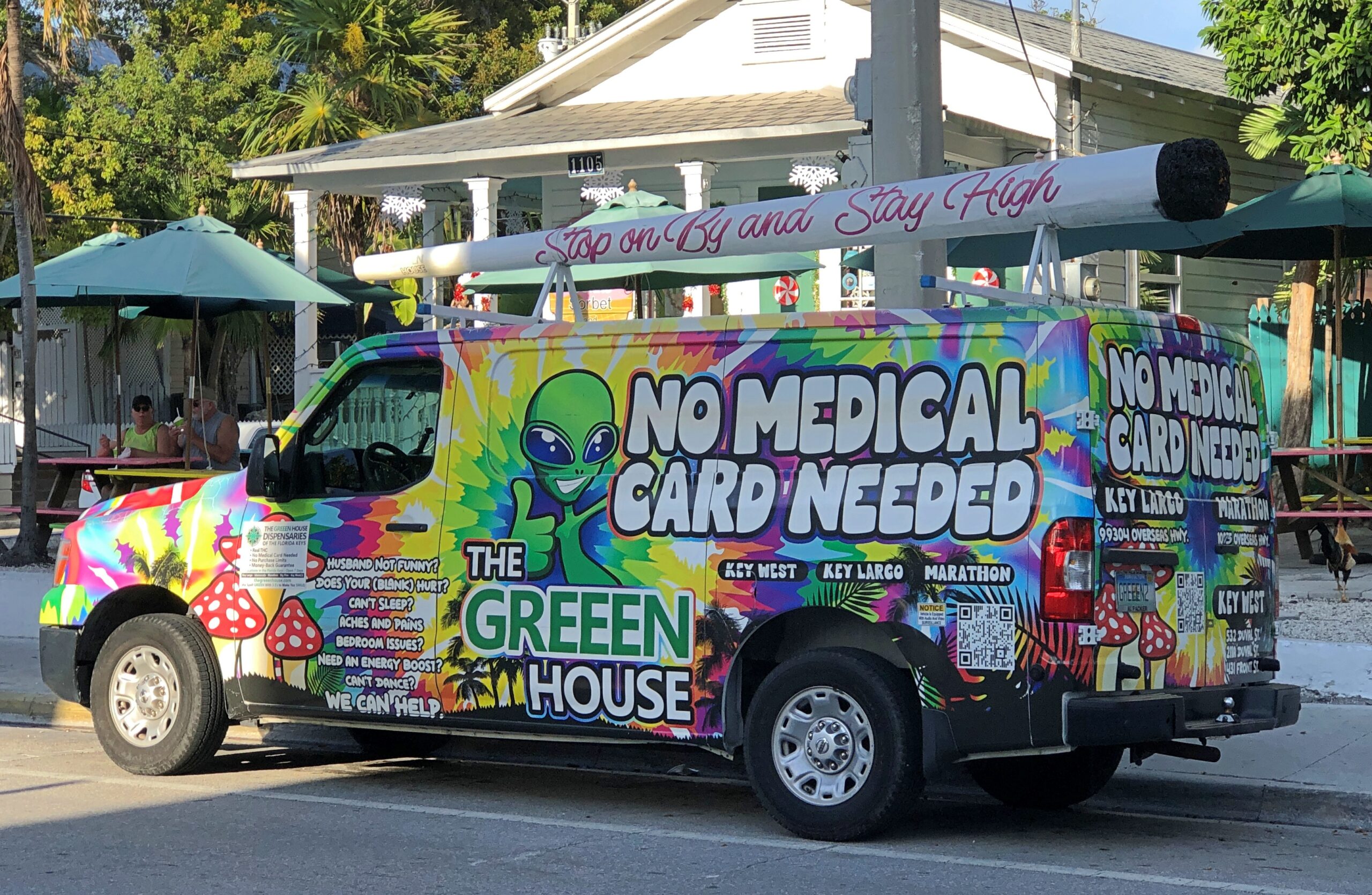
Countering the spirit of Florida cannabis law, if not the letter? Not sure. This truck wasn’t the only one we saw. Didn’t patronize them either. Ho ho ho.
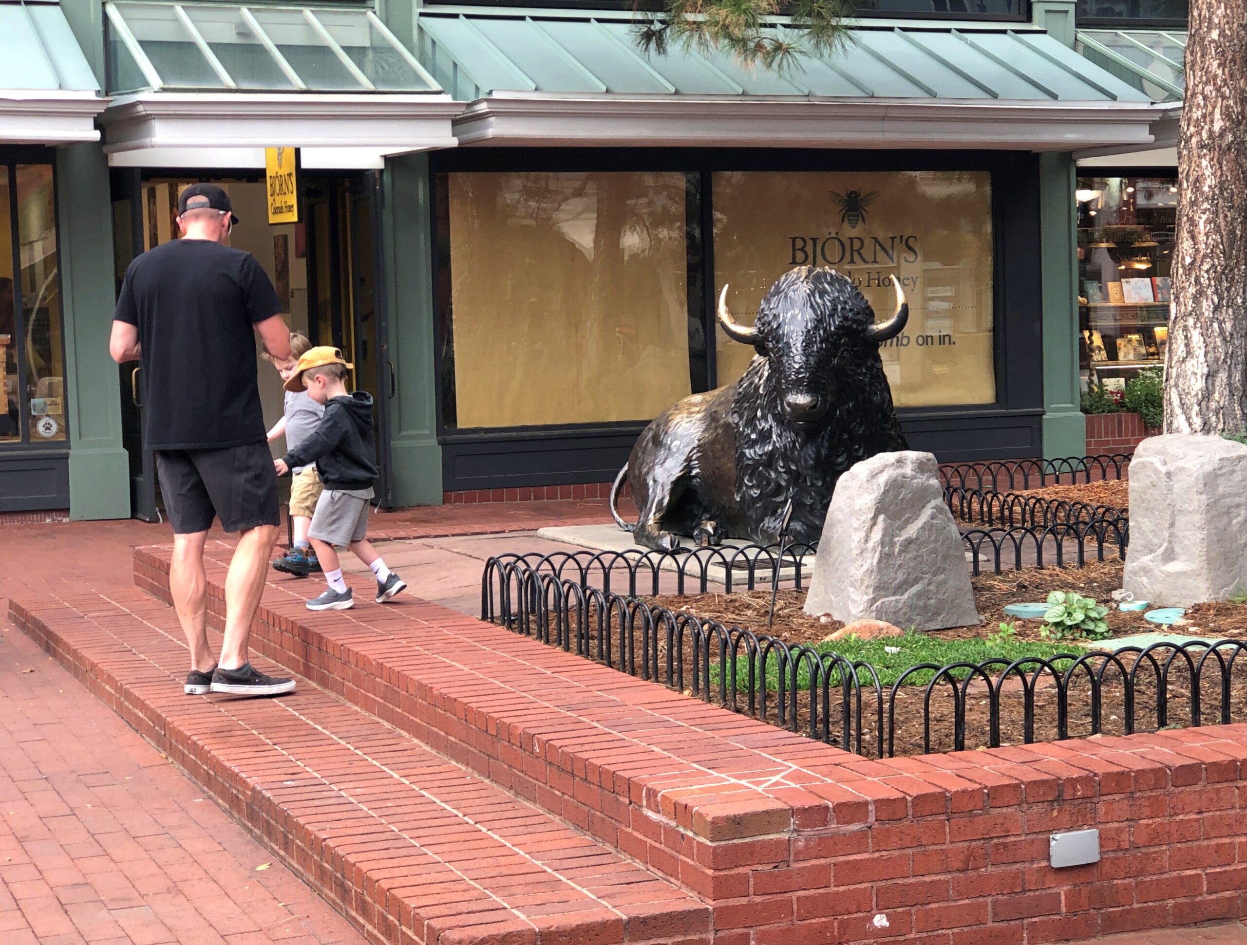
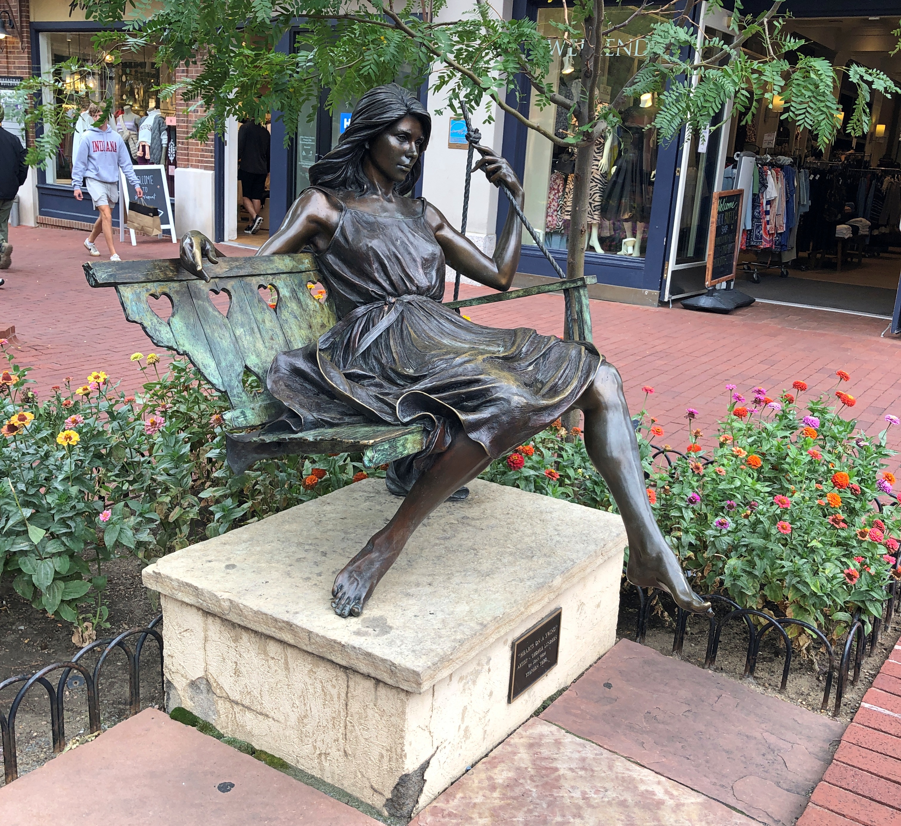
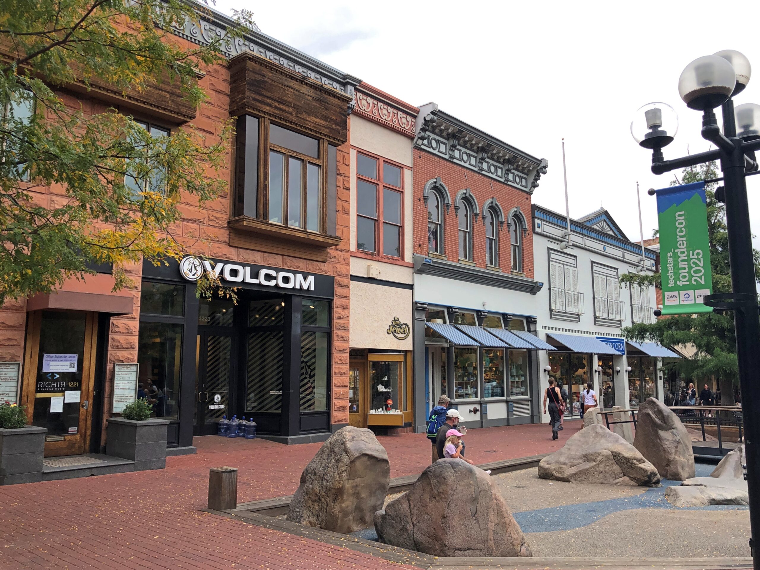
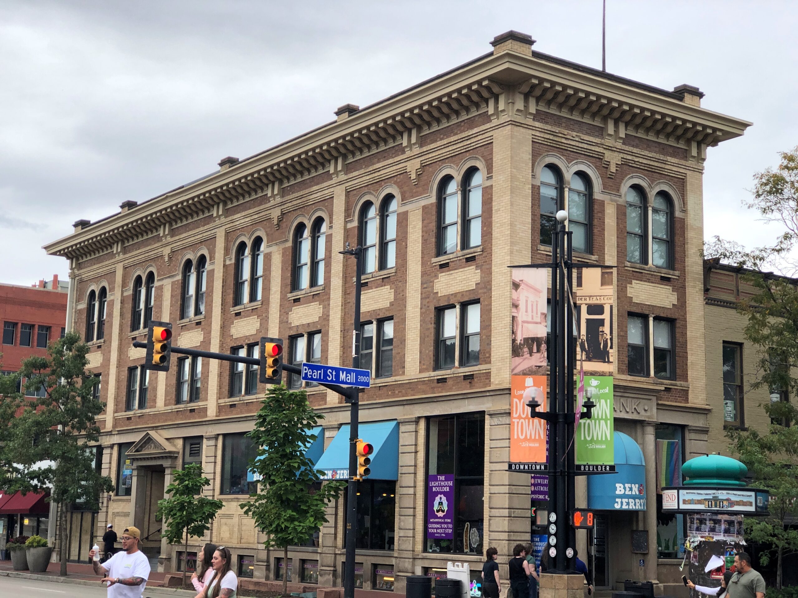
TV Land missed a bet when it didn’t commission a bronze of Mork from Ork for Boulder, Colorado. The place to put Robin Williams as Mork would be the Pearl Street Mall, the pedestrian shopping street in downtown Boulder. He’d jazz the place up a touch.
The street has some art. A buffalo with some heft and a swinging girl with lightness. Nice, but not zany Mork.
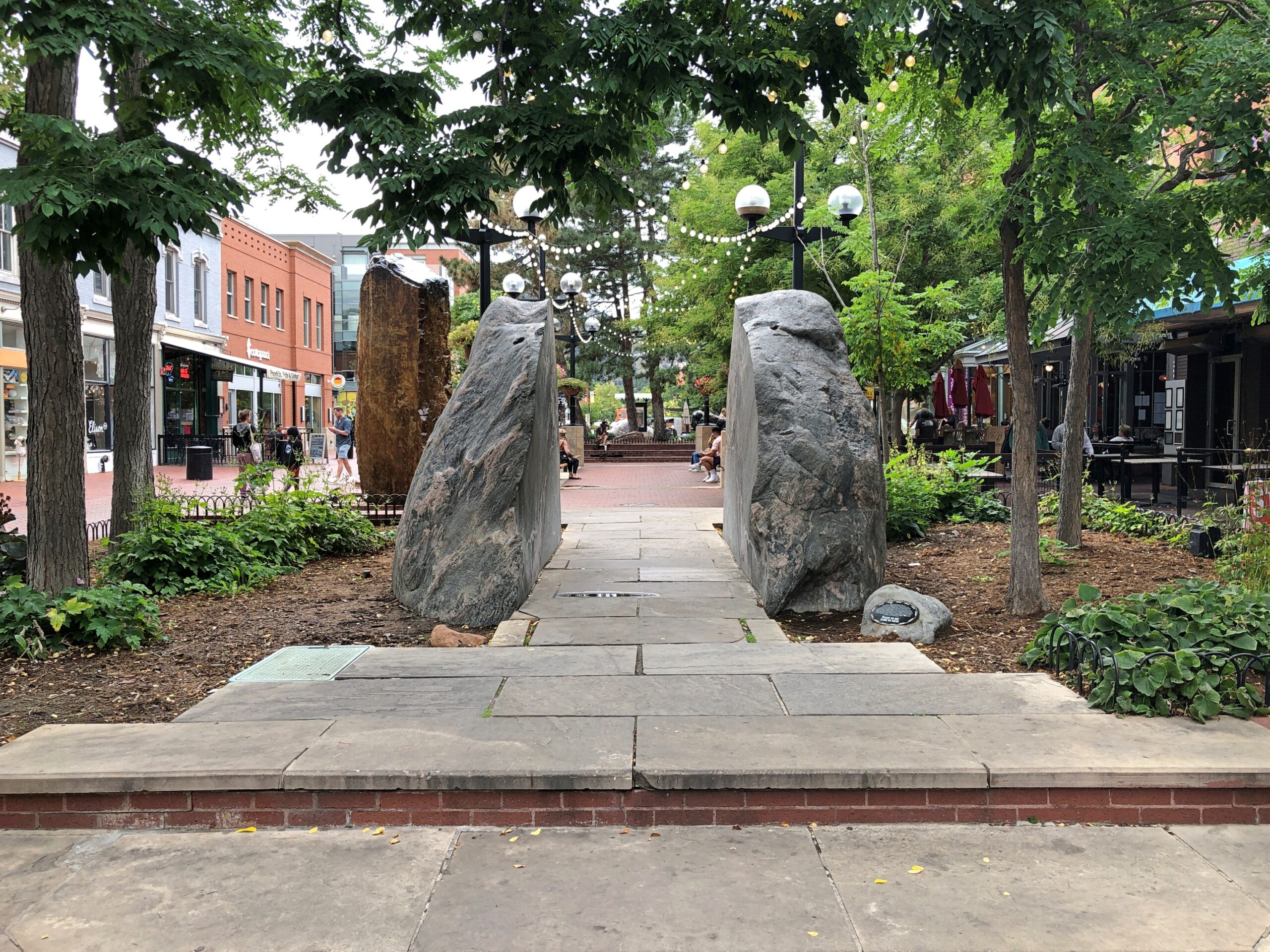
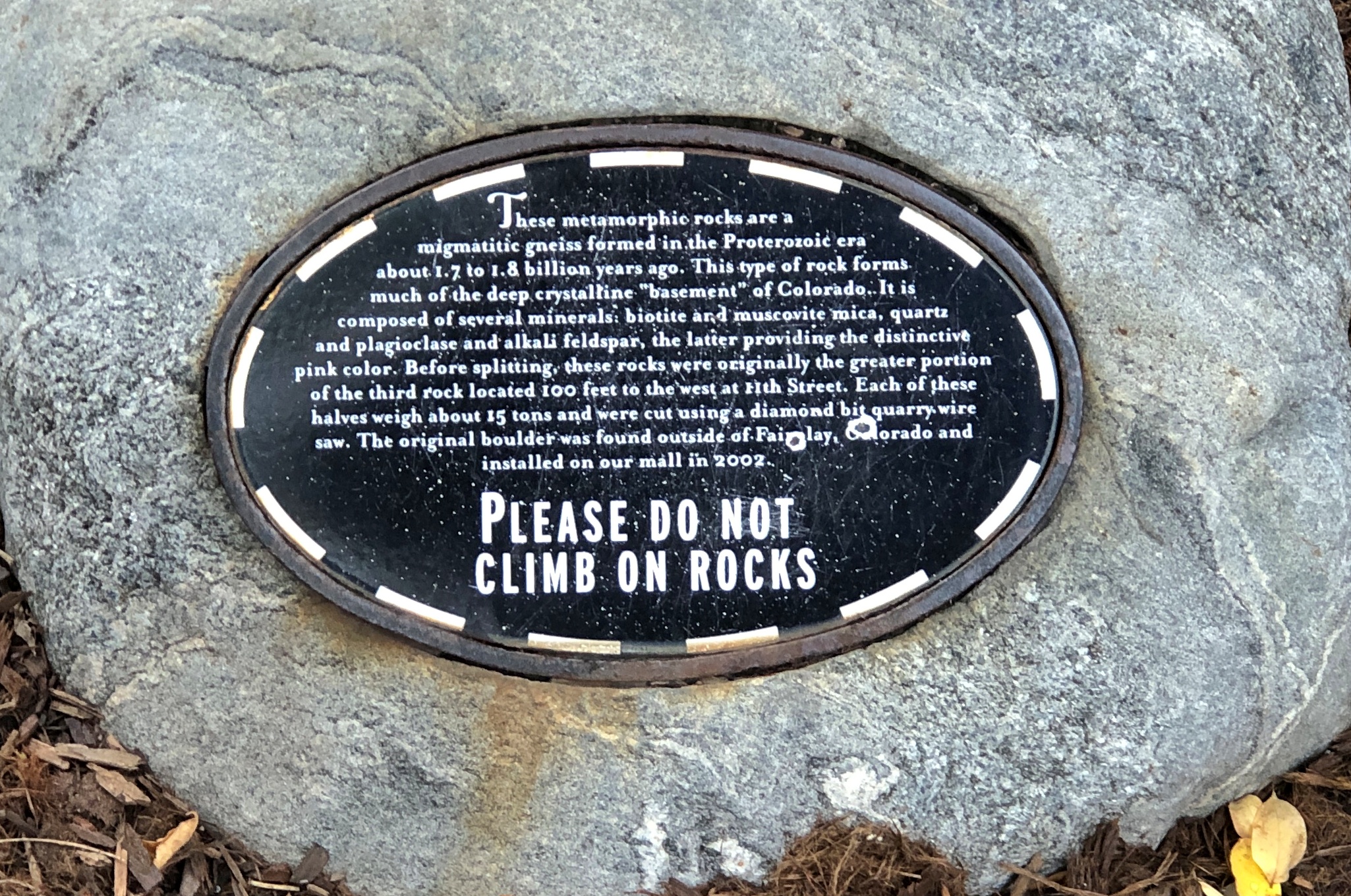
Also, there’s a boulder in Boulder. Not a bad idea.
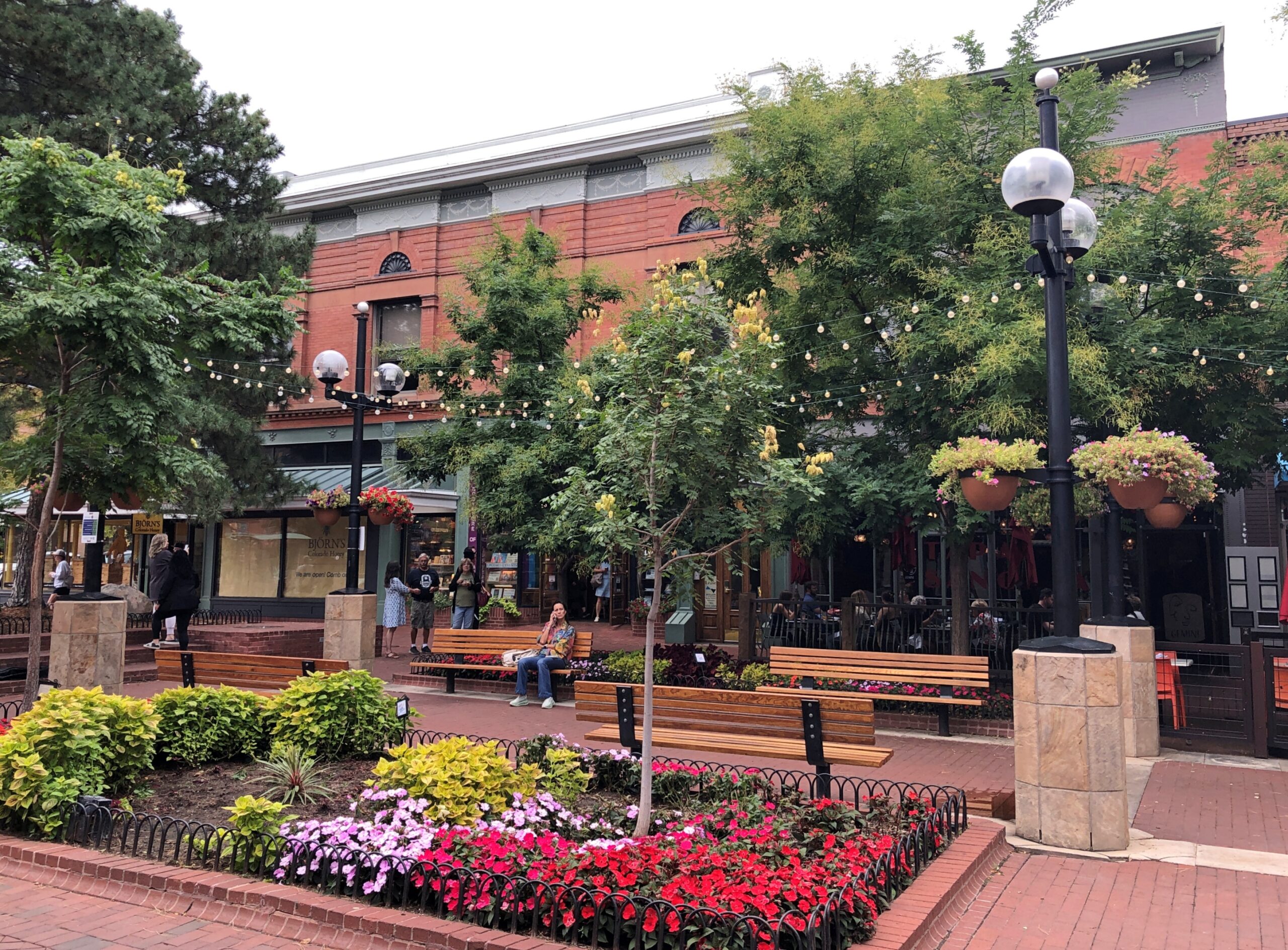
As a pedestrian street, Pearl Street has good bones. That is, picturesque old buildings that are well maintained.
All together, the mall stretches four blocks and has been around for almost 50 years, the result of a tax-funded effort to draw people back to downtown Boulder. I don’t know for a fact, but I suspect the street might have been a little run down by the early ’70s. Now it’s anything but. We arrived late in the afternoon of September 12, after spending most of the day at Rocky Mountain NP.
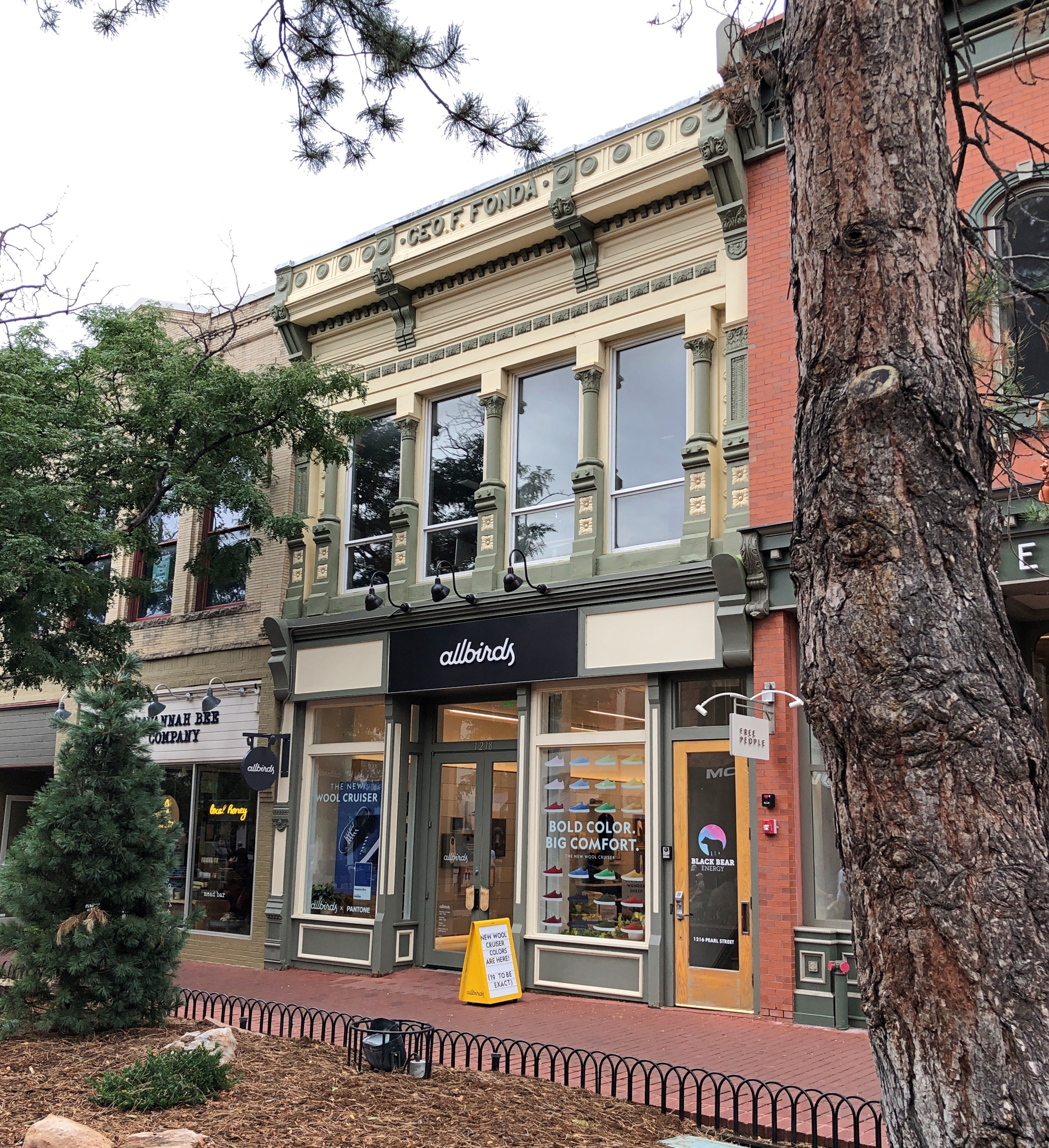
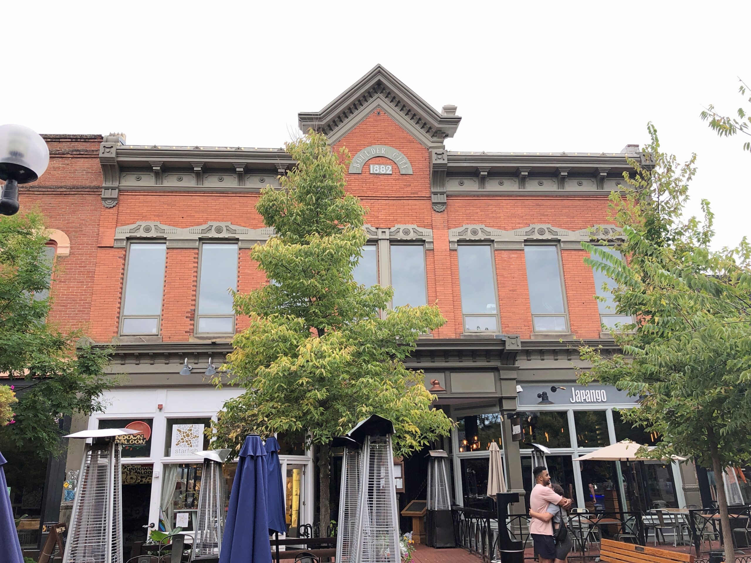
Most of the retail spaces are occupied, with the likes of the small-batch Björn’s Honey, SmithKlein Gallery, Japango sushi, Lindsay’s Boulder Deli @ Haagen Dazs, Ku Cha House of Tea, Lighthouse Bookstore, Peppercorn kitchen supply, Bramble & Hare Bistro, Into the Wind toy store, Boulder Spirits Tasting Room and much more. My own favorite sold antique maps, by themselves and mounted as art.
I didn’t go in Lighthouse Bookstore, but I took it for a Christian bookstore. Not quite, from its web site: At The Lighthouse Boulder, seekers discover many paths of wisdom for their spiritual discovery. With books to learn, spiritual tools to discover, and readings of all kinds to light the way – we’ve been serving the community since 1975.
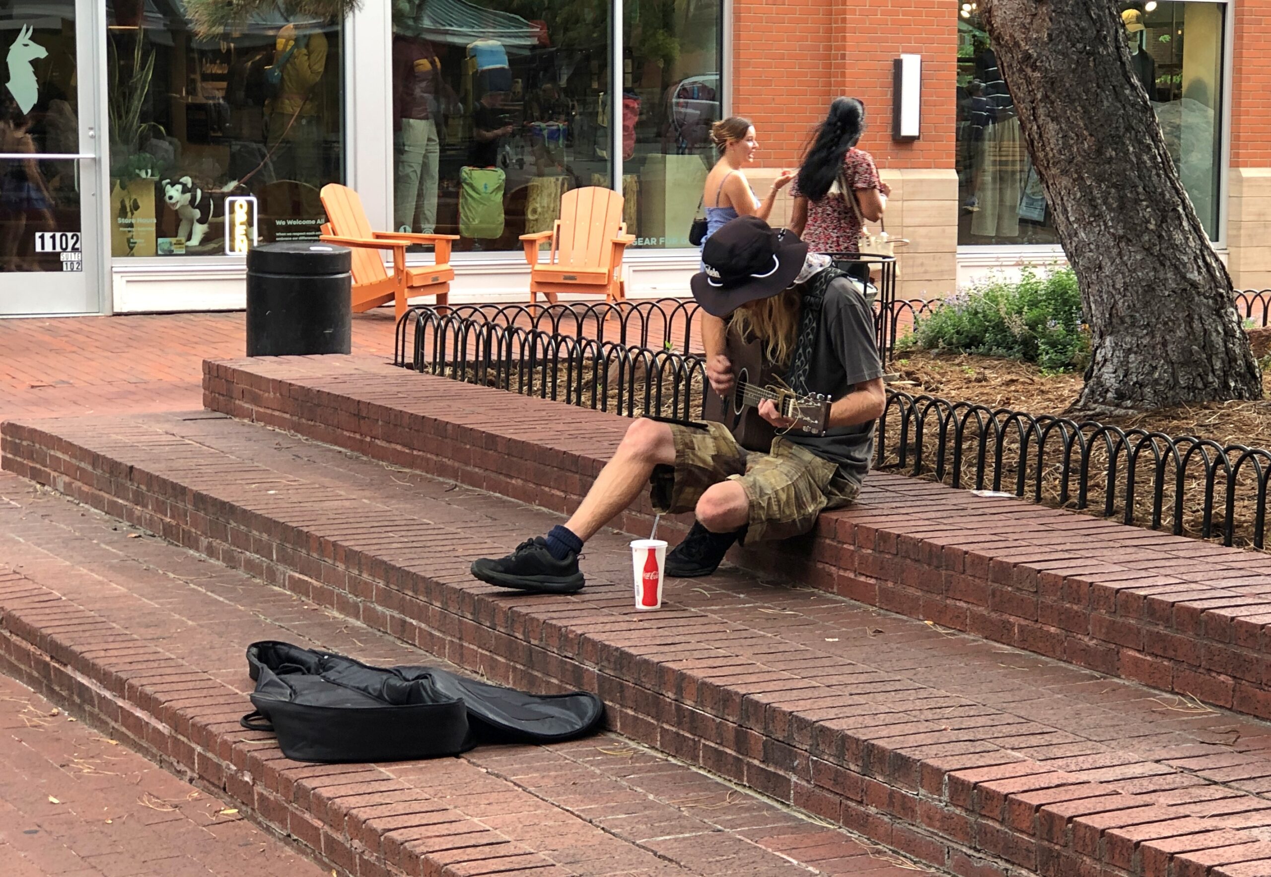
The street was fairly busy on a warm Friday afternoon. Not everyone was there to shop, however.
Wiki at least says the history of busking is robust at Pearl Street, including David Rosdeitcher, ZIP code man, who can name zip codes for places the crowd names, or name places for zip codes that they yell out. He wasn’t around the day we were. I’d have stayed for some of that act. He’s probably prepared even for someone who says, American Samoa! (Zip code: 96799) (That’s something I might pose to him). But would he know Kingman Reef? (96898). Exactly zero people live there, so why it needs a zip code is probably detailed in some memo at the USPS. Just being thorough, maybe.
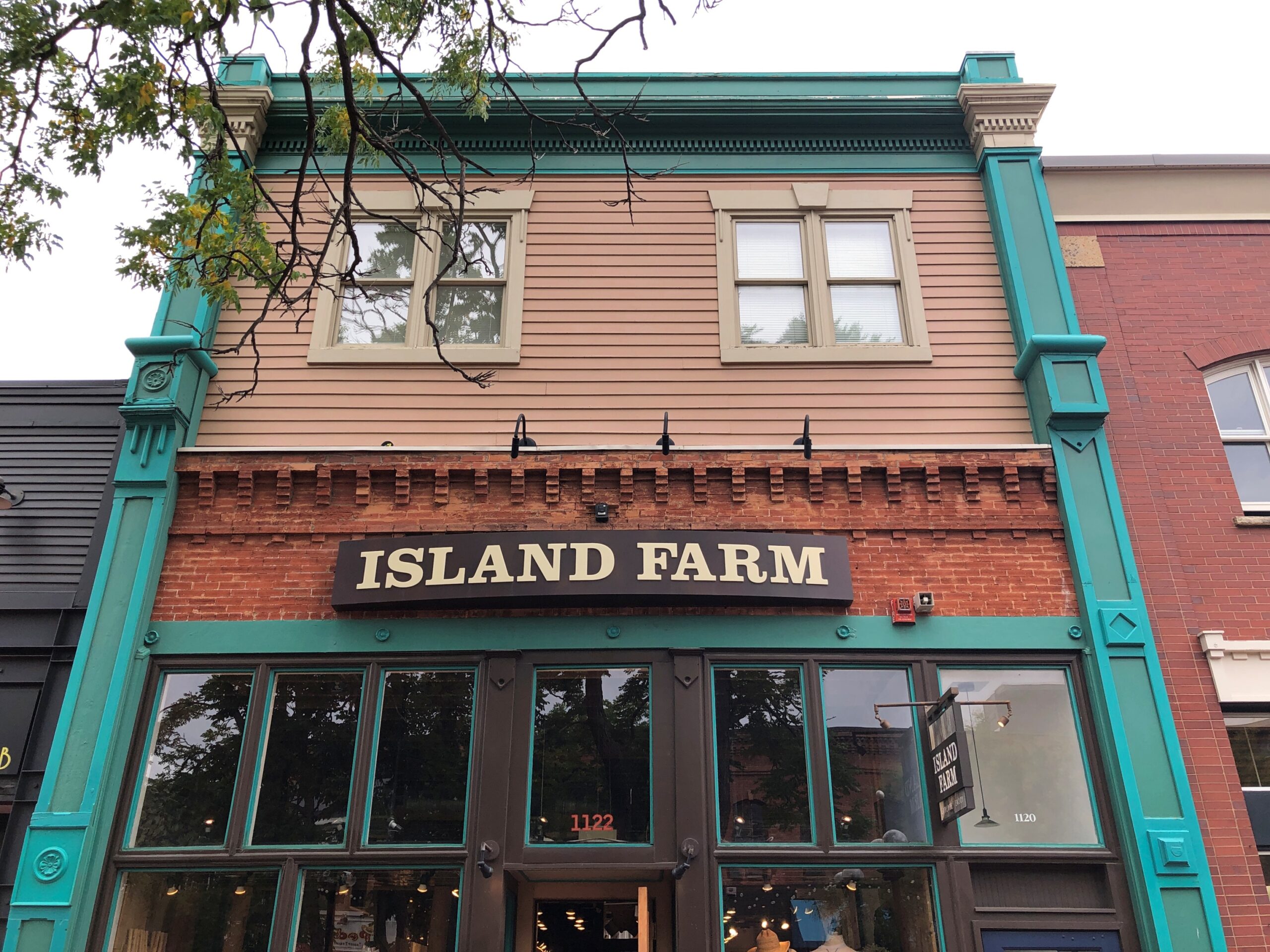
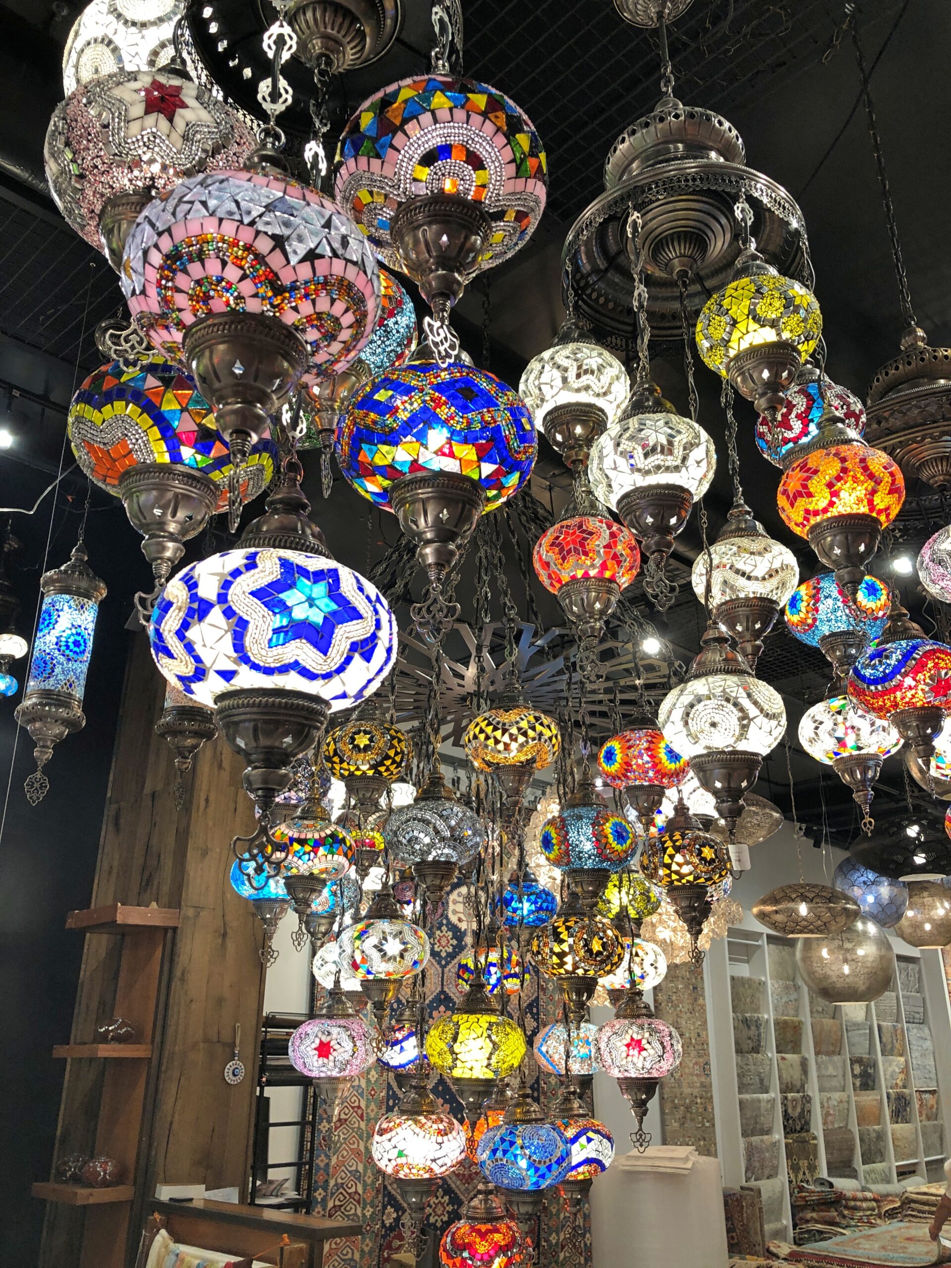
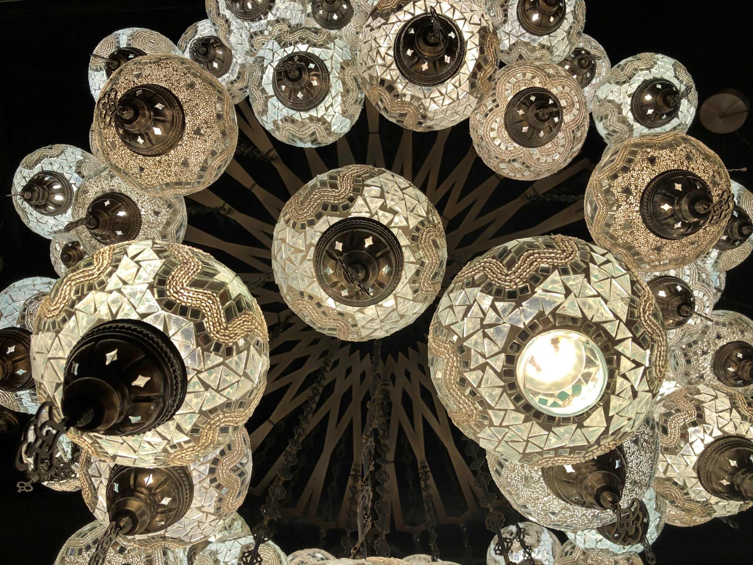
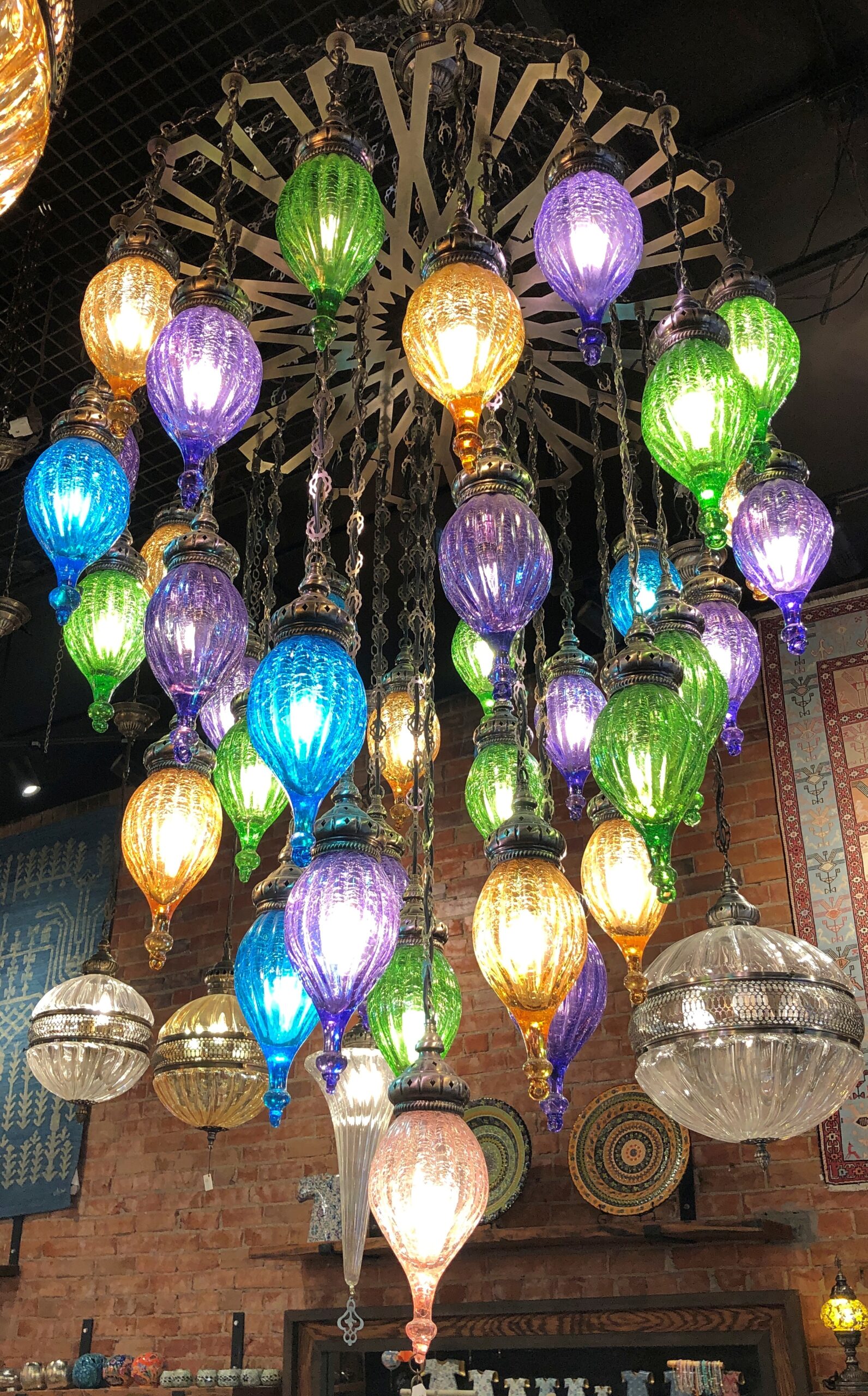
Another intriguing shop sells lamps. More than I’d care to pay, but still wonderful to look at.
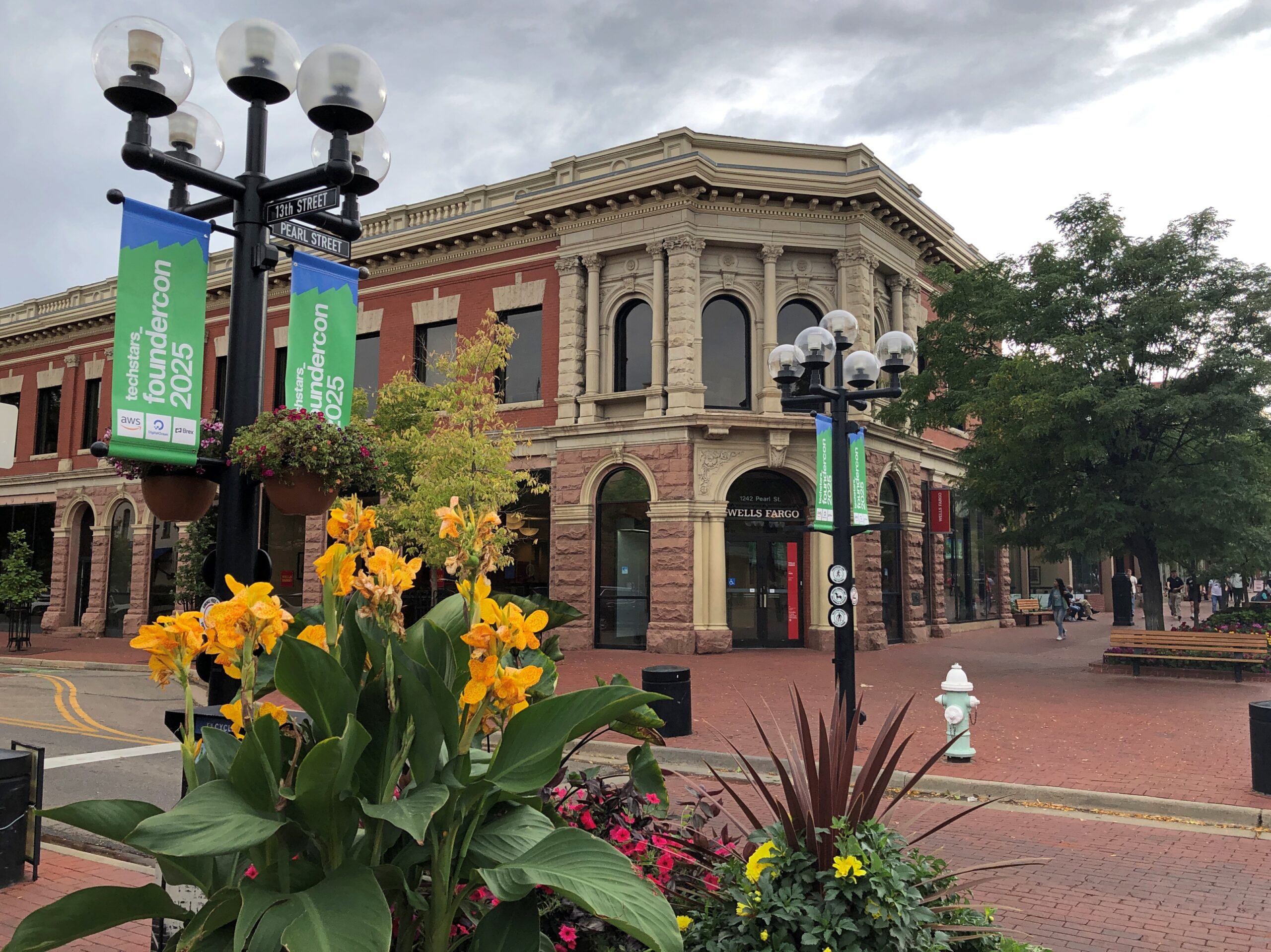
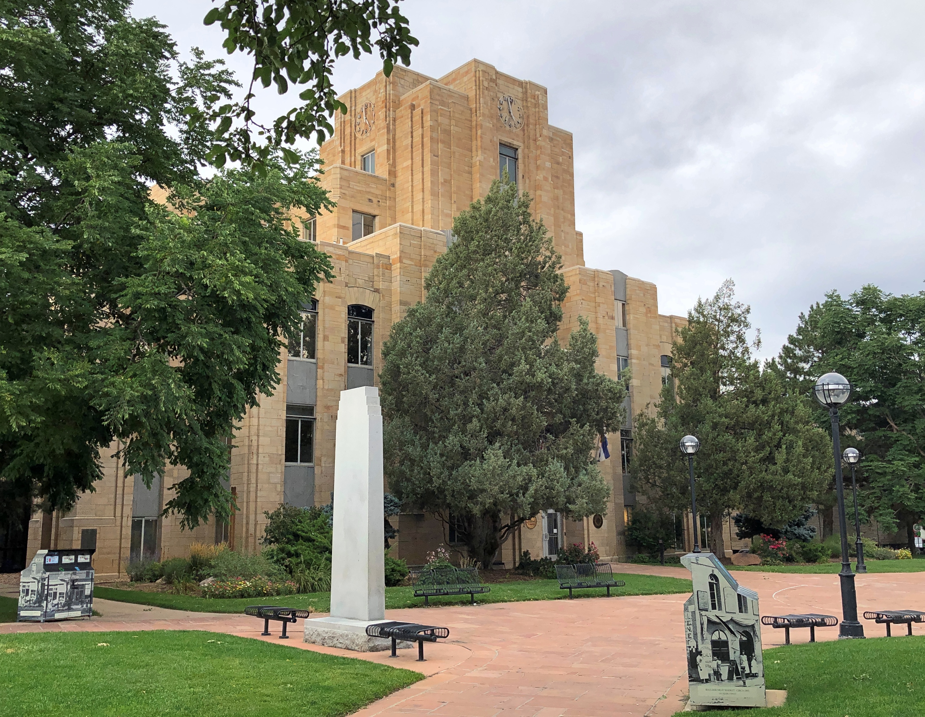
The Boulder County Courthouse is also on the street. Impressive art deco, or it might be called moderne. We walked past on our way out, to get to the car before the meter ran out, so I didn’t quite get to look as long as I wanted. There have to be studies somewhere that show that parking meters are counterproductive in generating foot traffic in such places as Boulder.
Metro Denver is enormous, much larger than I remembered, even as recently as 2017. Or so it seemed. To the south, Colorado Springs is fairly large, but some orders of magnitude less than the monster metro to its north. Further south, Pueblo doesn’t seem that big, but even so it has 111,000 residents, give or take.
Then you come to Walsenburg. Who has heard of Walsenburg, Colorado (pop. 3,035), even though it too is on I-25 and on the irregular line where prairie and mountains meet? Colorado’s brisk growth over the last few decades seem to have passed it by. Its peak population was in 1940, when more than 5,800 people lived there.
I wish I could say I’d formed an impression of Walsenburg, but we stopped only for gas, and to get off the Interstate.
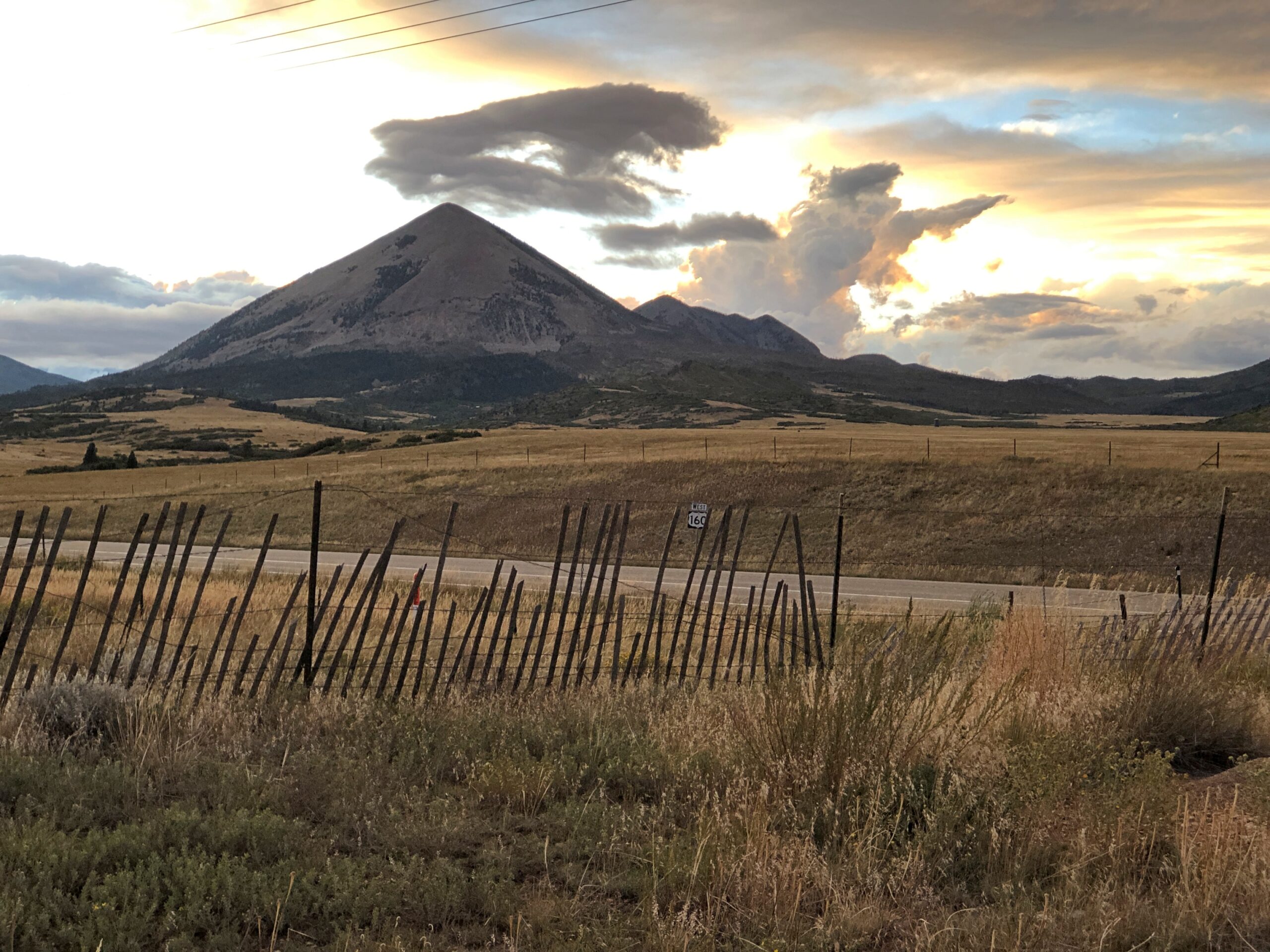
US 160, Walsenburg to Alamosa
Walsenburg has few people, and when you go west on US 160, that dwindles to practically none. The road crosses the Culebra Range of the Sangre de Cristo Mountains at North La Veta Pass, elevation 9,413 feet, into the San Luis Valley. I enjoyed writing that sentence almost a much as I enjoyed the drive itself.
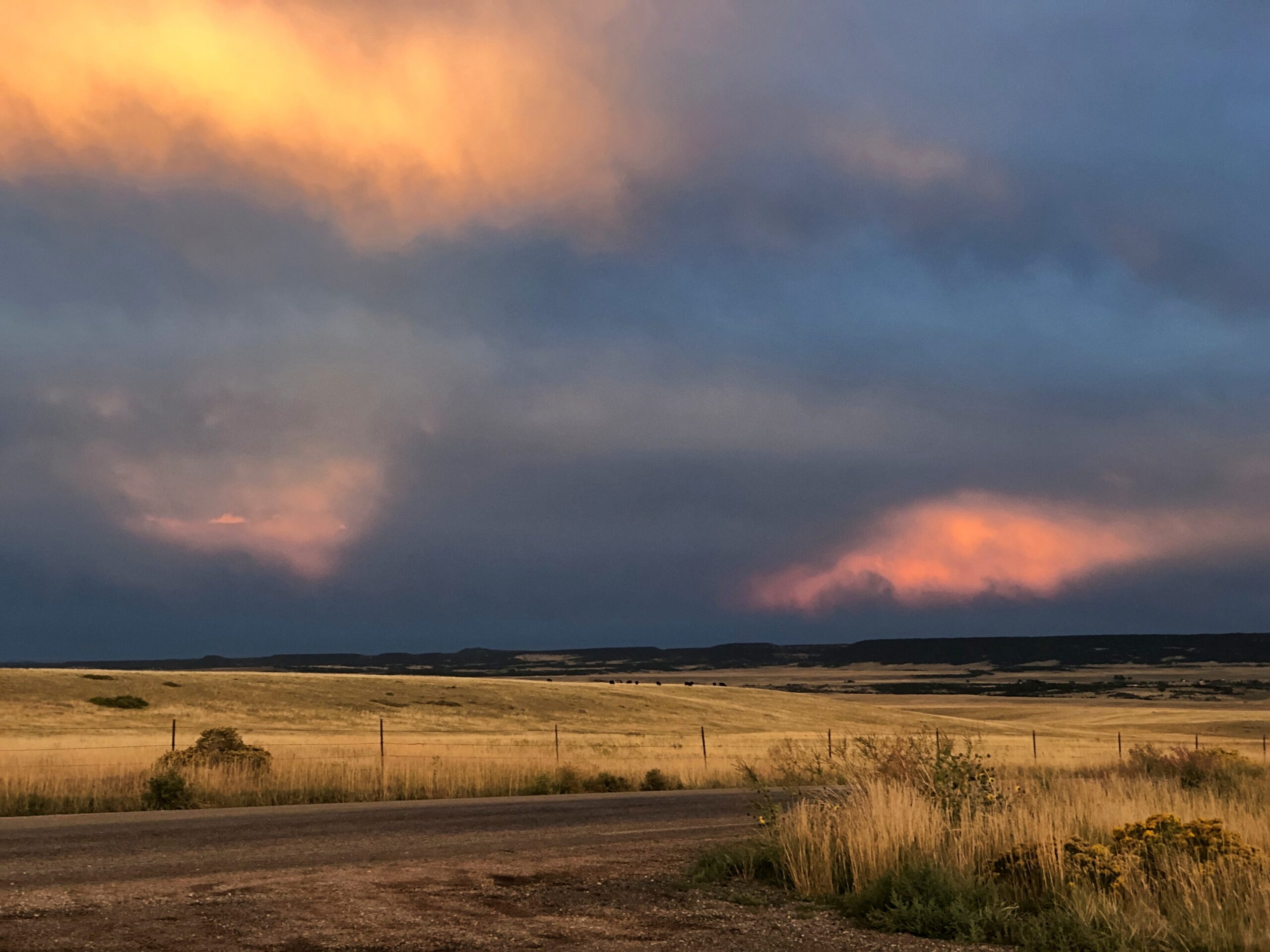
Enjoyable at least until dark. Wish we’d gotten to see more of it. We’d futzed around in Colorado Springs much of that day, September 13, including a fine lunch at Edelweiss German Restaurant. So the sun went down before we got to our destination, Alamosa. But we did stop for a few minutes on US 160 before we lost the light. A chilly wind blew clouds along at quite a speed, and for their part the clouds were catching the sunset in luminous patches. Until I can see the aurora, that will more than do.
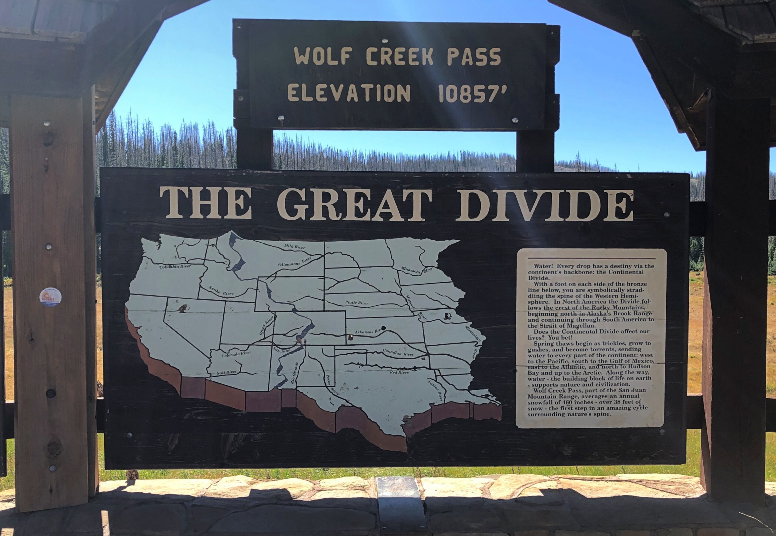
Wolf Creek Pass, Way Up on the Great Divide
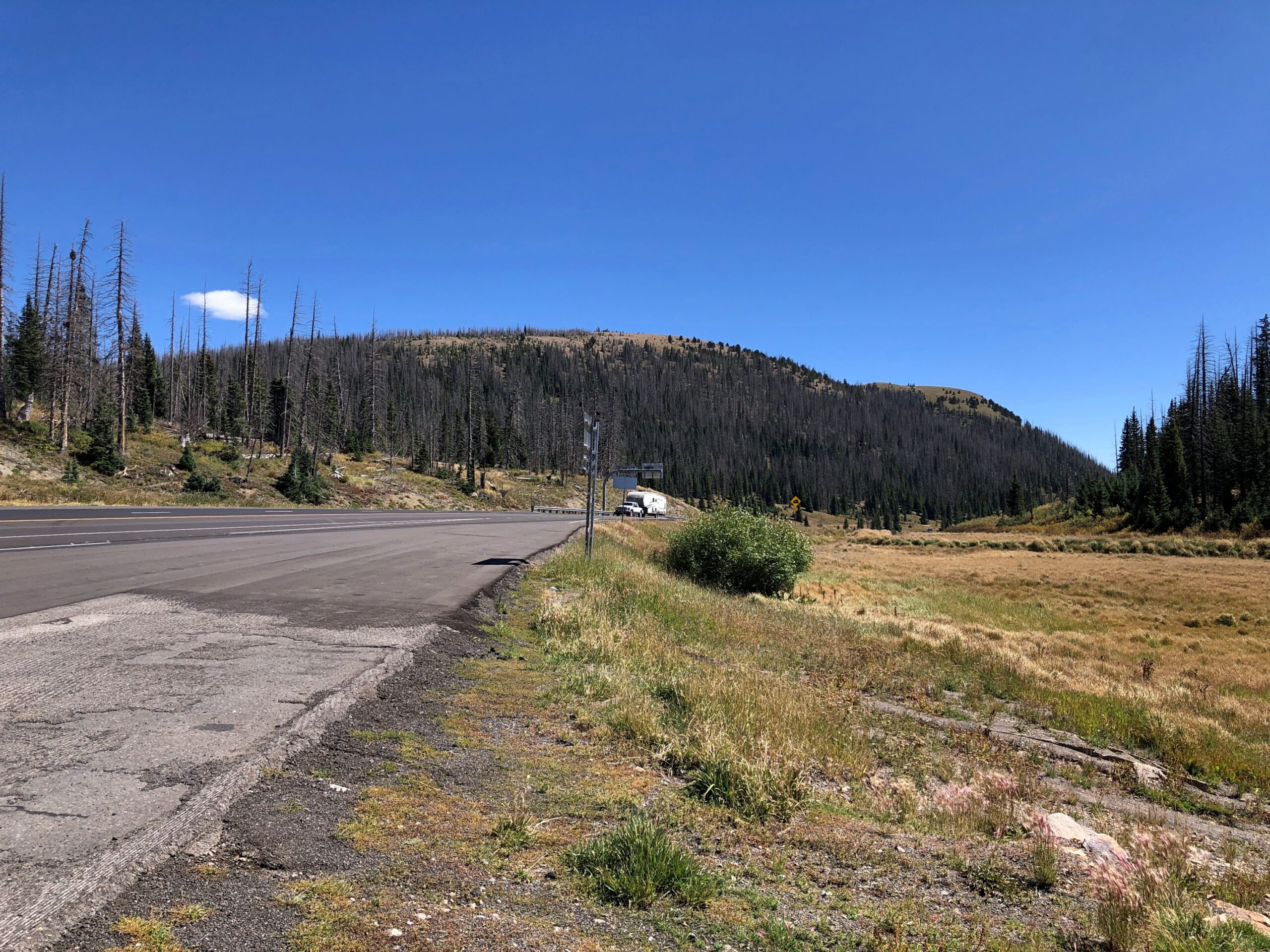
Follow US 160 west from Alamosa and eventually you’ll get to Four Corners. We didn’t go that far on the 15th, just to Durango. The road passes through much of the San Luis Valley, which is wide – the largest alpine valley in the world, they say – so the way is flat until you reach South Fork, Colorado. Then you climb into the San Juan Mountains, until you reach Wolf Creek Pass. Way up on the Great Divide.
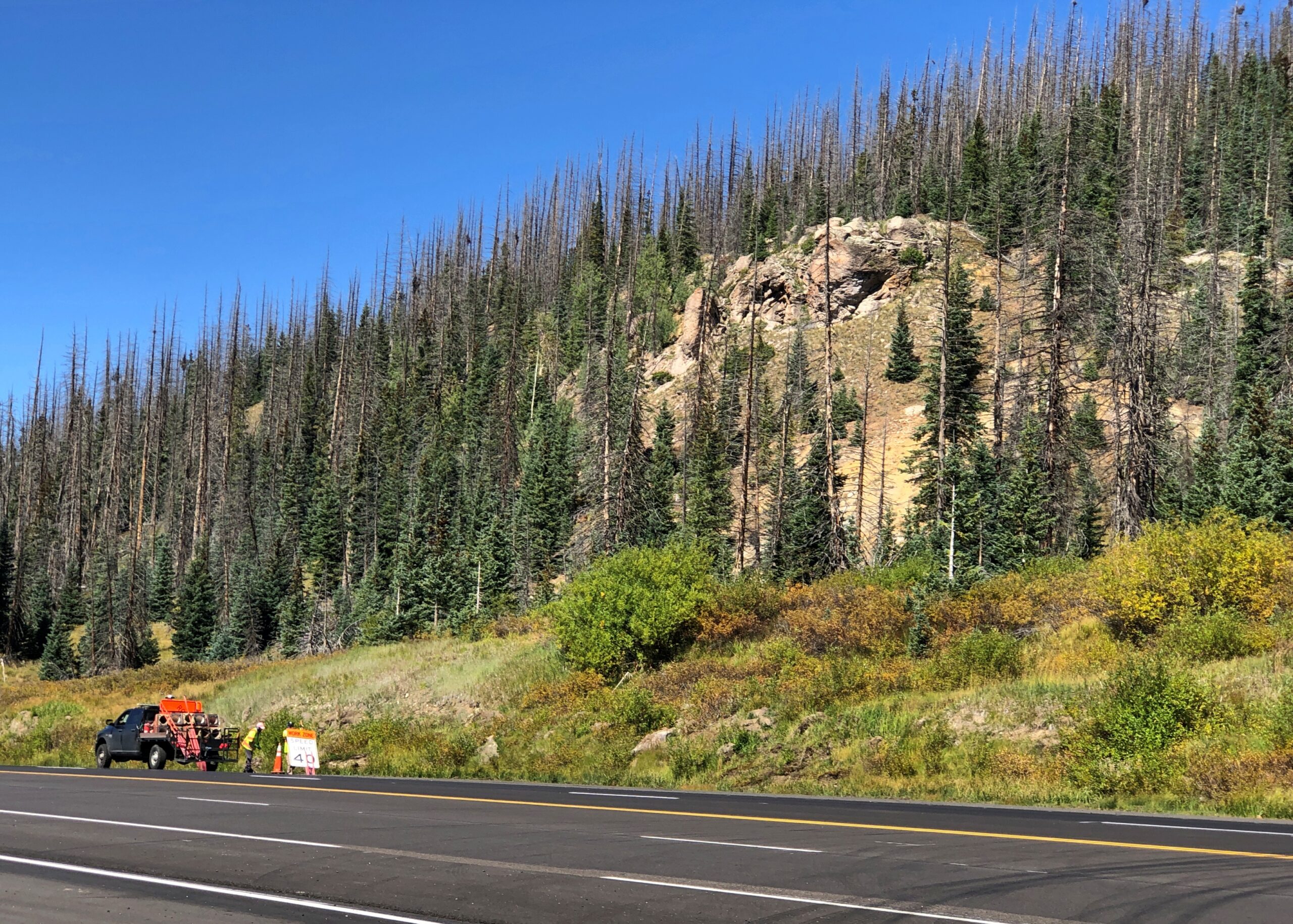
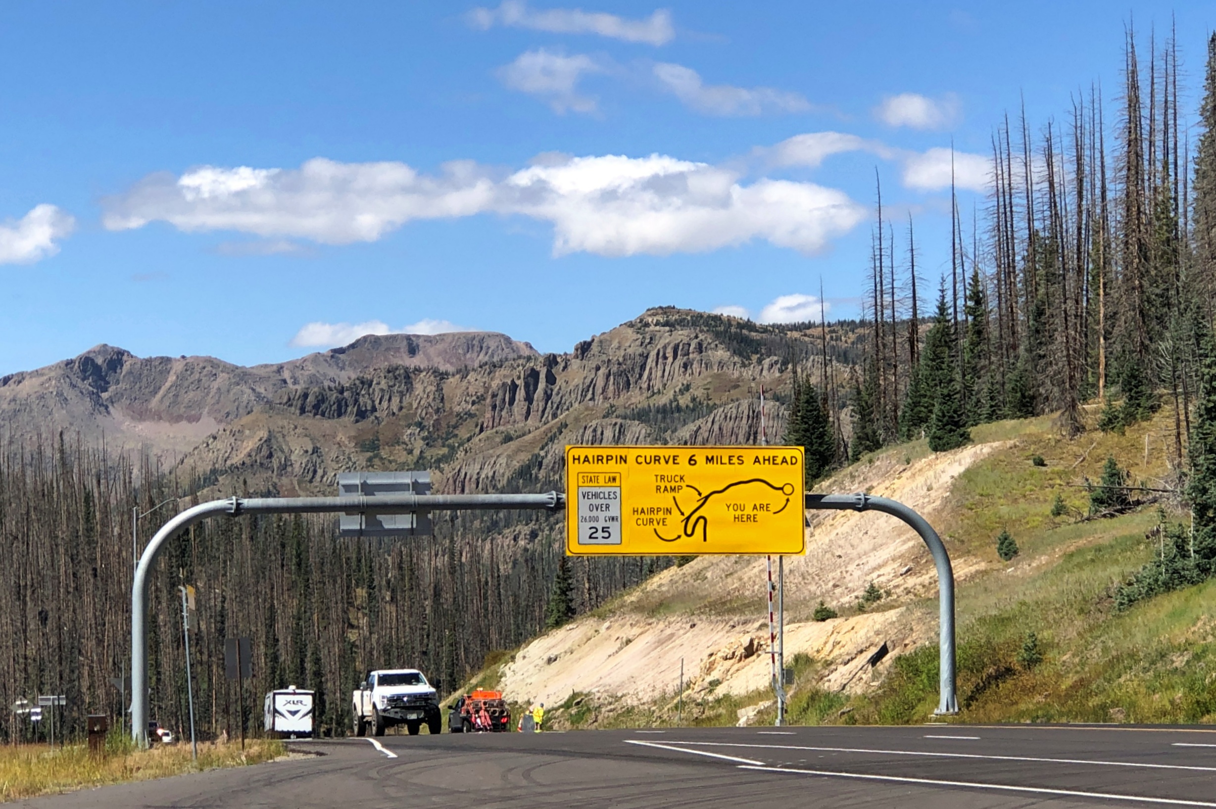
Yuriko had been driving on the ascent to Wolf Creek Pass. Usually she doesn’t care for mountain roads, but she focused on a wide-load vehicle ahead of us, and we followed it up, though not at too close a distance. She thought better of driving down the other side, even though she’s never heard it immortalized by C.W. McCall.
So I drove down. Truth be told, it’s not that bad on a clear day. In our time, US 160 down from Wolf Creek Pass is four lanes, and while curvy, only the hairpin turn – which you are well warned about – is a little tricky. Not that bad in a car, anyway. I couldn’t say about taking a truck down. I’ll bet 50 years ago the route was probably still two lanes and maybe even more winding, so C.W. was only exaggerating for comic effect, not making everything up.
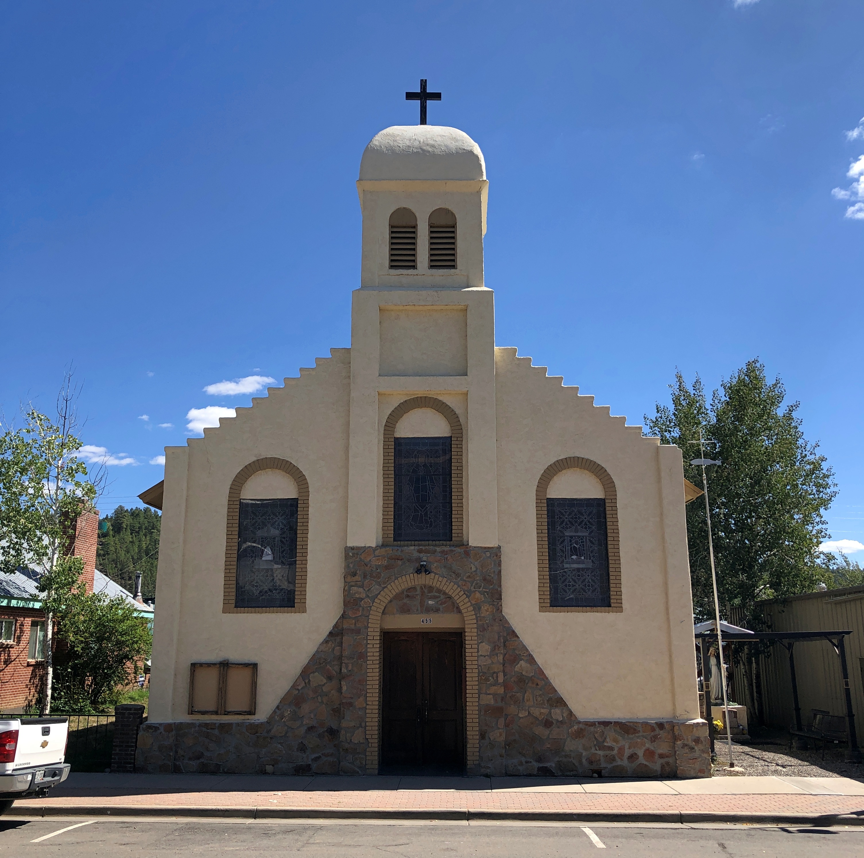
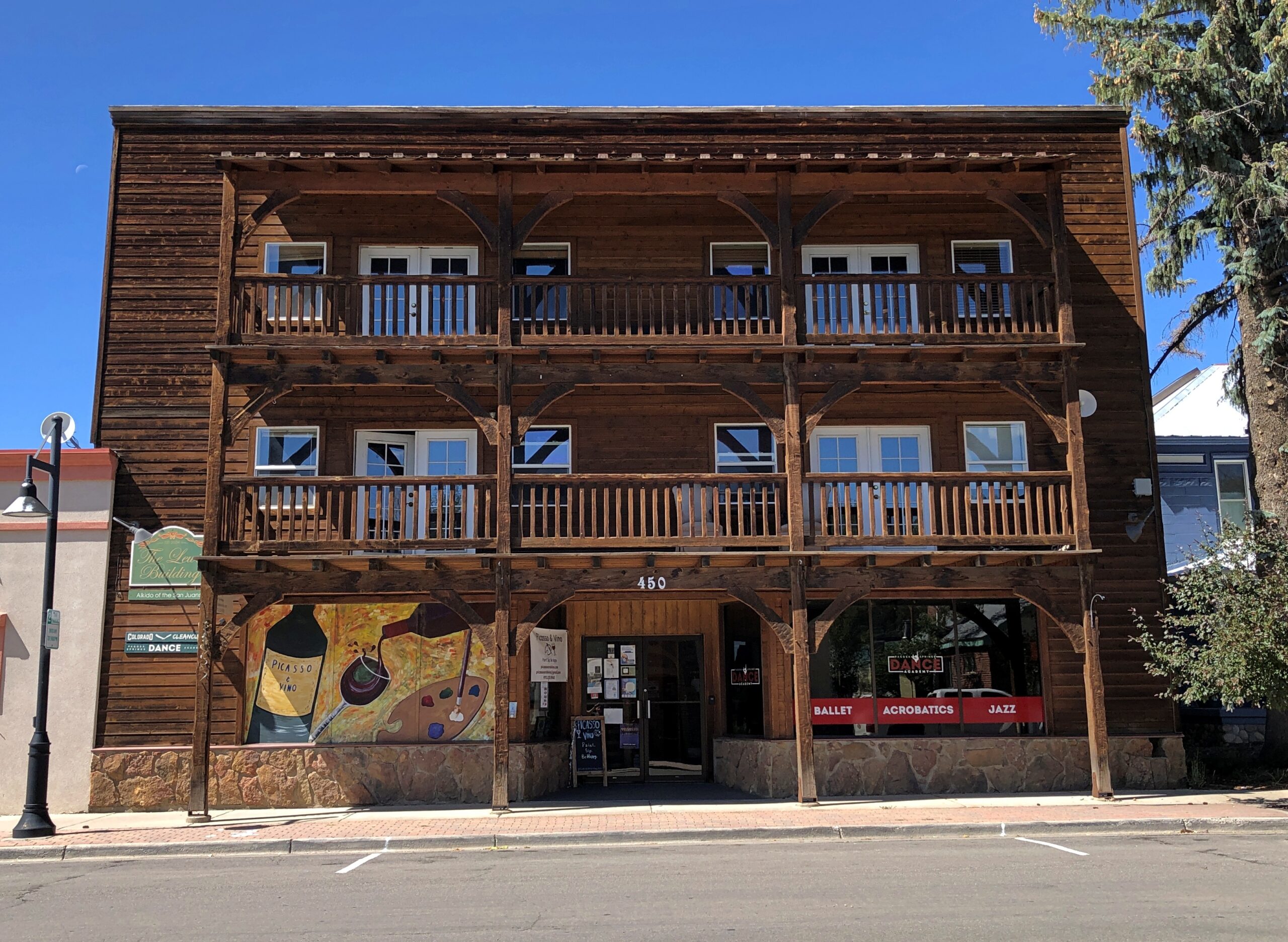
At the end of the drop is Pagosa Springs, whose main street was completely torn up with construction. We found lunch off the main drag at PS FroYo, which is one of those restaurants that makes money for a local charity, in this case Aspen House. We didn’t know that before we ate our sandwiches, just that it was near where we parked and not fast food. A nice bonus to find out.
Lewis Street wasn’t under construction, so that made for a pleasant stroll after lunch, including time at a resale shop. No post cards. Bought some nearly new jeans, which proved their $5 worth (and much more) when I was later deposited briefly in the Kansas mud. They were standing by at that moment, sitting in a bag on top of everything else in the back seat — blankets, sleeping bag, small bags with some winter wear. I didn’t have to dig around looking for them. That never happens, or so it seems, so I thought I’d remember when it did by noting it here.
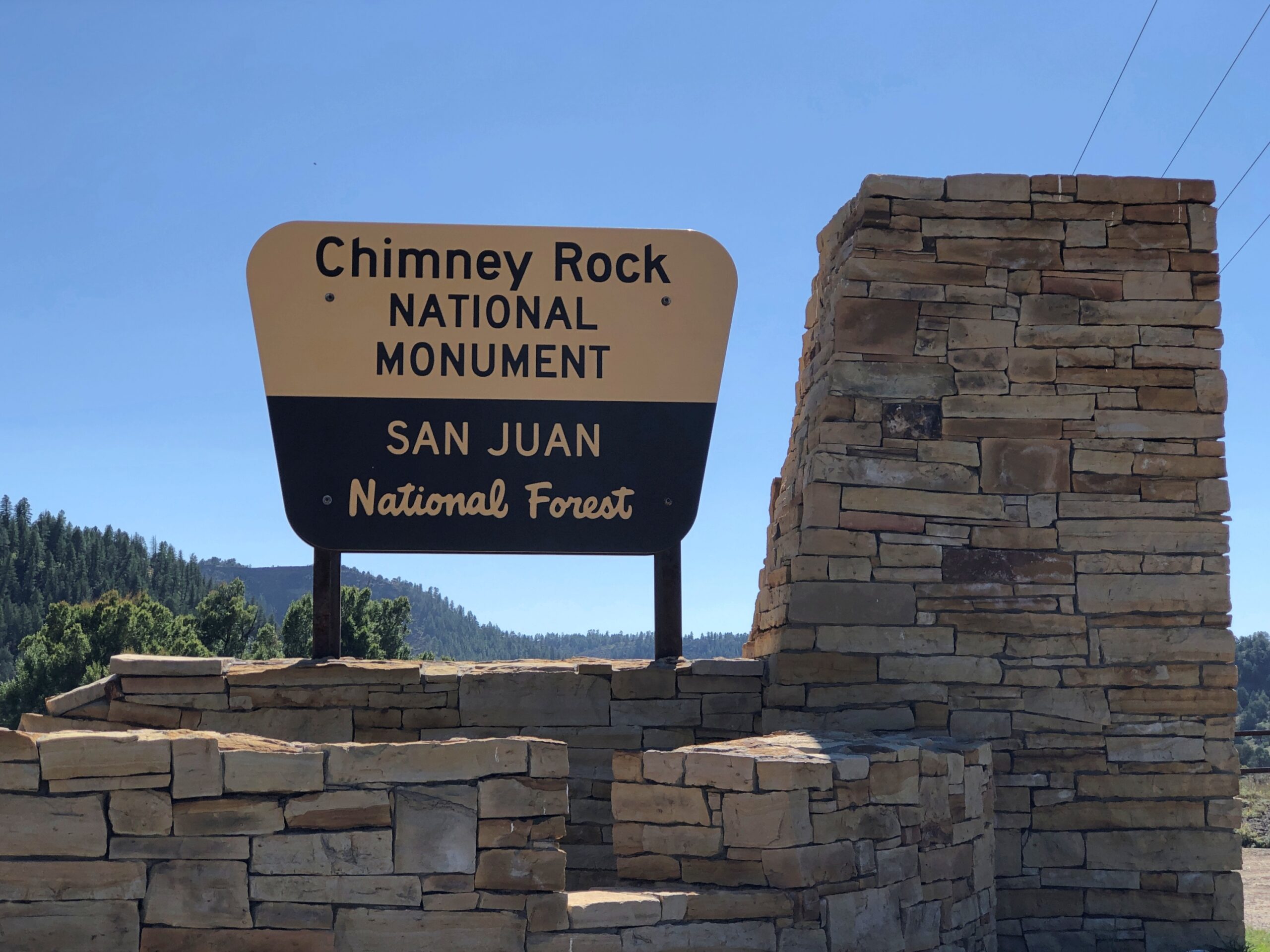
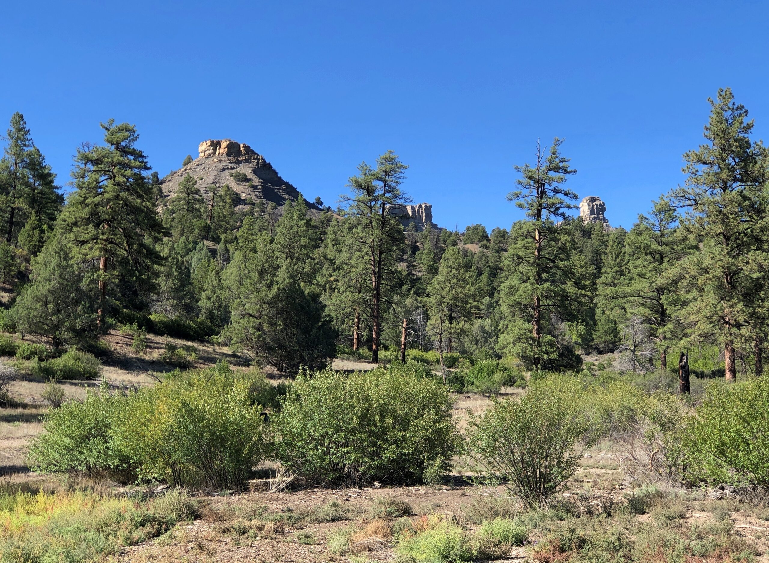
There is a road up to Colorado’s Chimney Rock, a ridge-top archaeological site that is the nucleus of the national monument, but it was closed. The small museum at the base of the rock was still open, so along with our view, we took in a little about the Ancestral Puebloans who used to live there.
Chimney Rock and Companion Rock, foci of the national monument.
“Chimney Rock covers seven square miles and preserves 200 ancient homes and ceremonial buildings, some of which have been excavated for viewing and exploration: a Great Kiva, a Pit House, a Multi-Family Dwelling, and a Chacoan-style Great House Pueblo,” says the Chimney Rock Interpretive Association. “Chimney Rock is the highest in elevation of all the Chacoan sites, at about 7,000 feet above sea level.”
US 550 North from Durango
North from Durango on US 550, the scenery starts pretty soon.
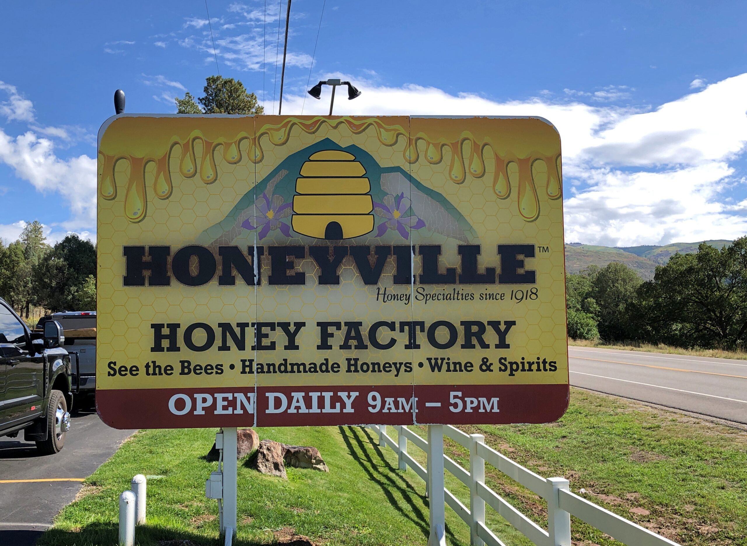
A few miles out of town, Honeyville. It looked like a good place for souvenirs.
It was. I’m still working on a Honeyville jar of whipped cinnamon honey, which makes a warm biscuit sing.
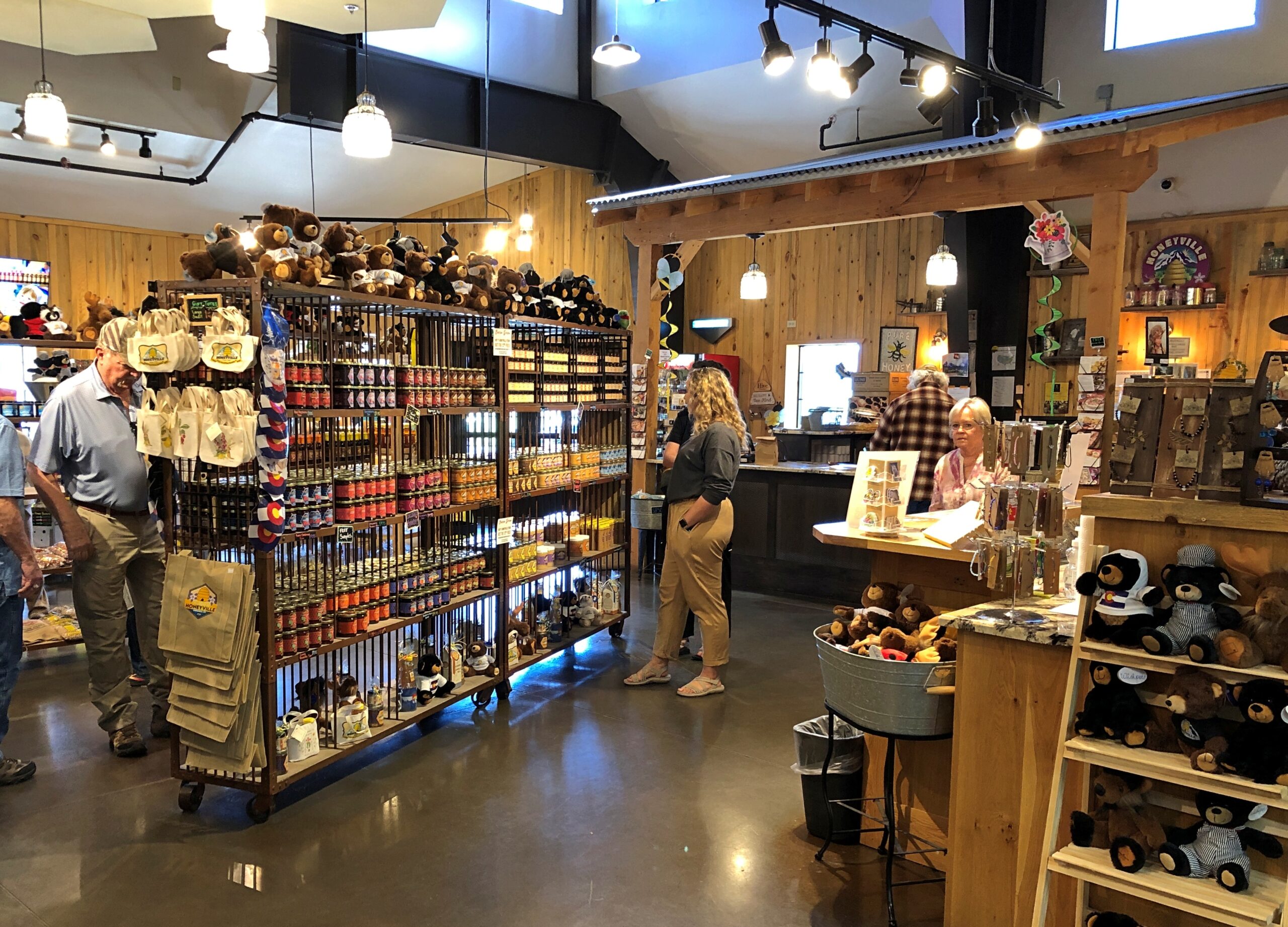
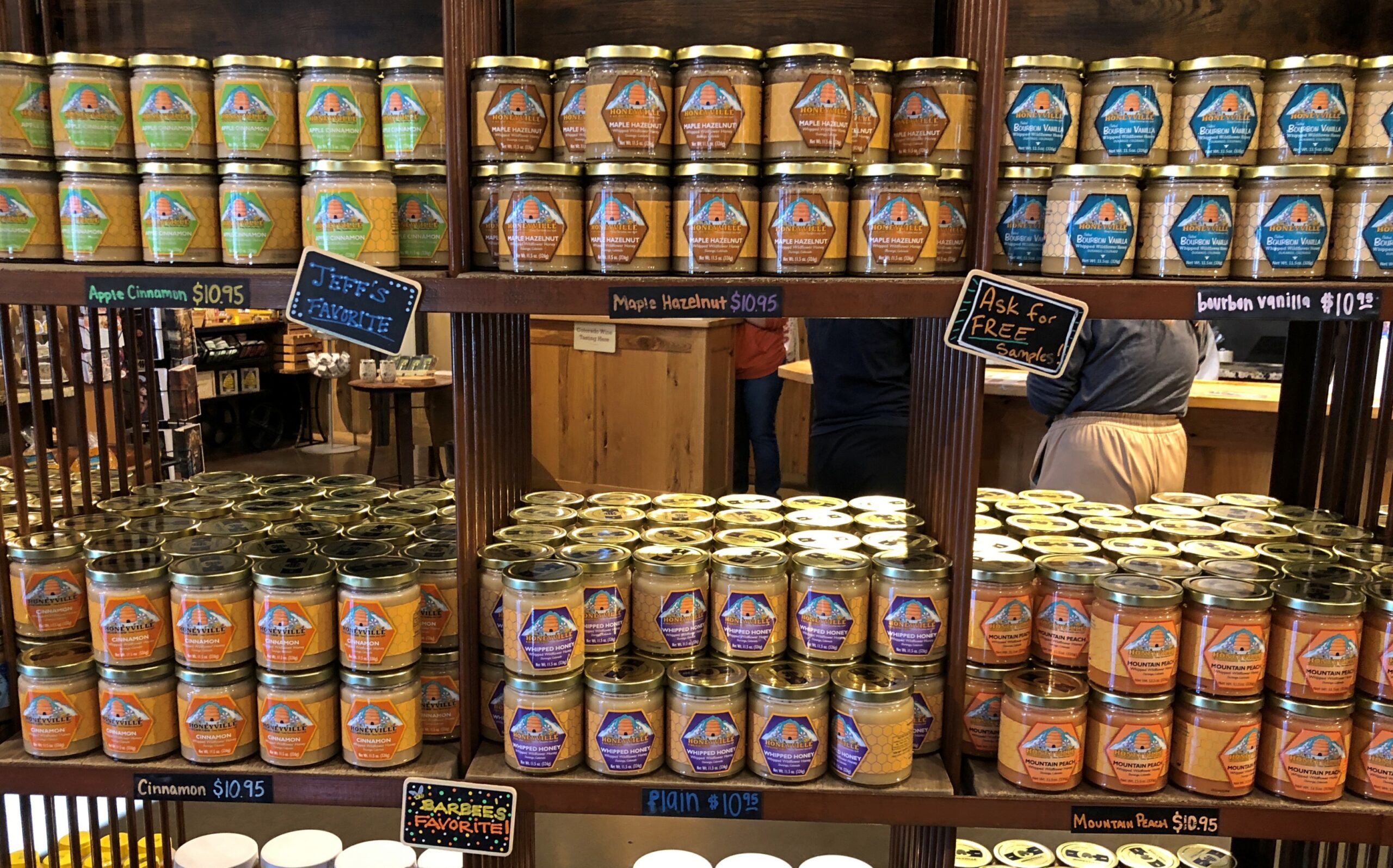
All sorts of honey products are available.
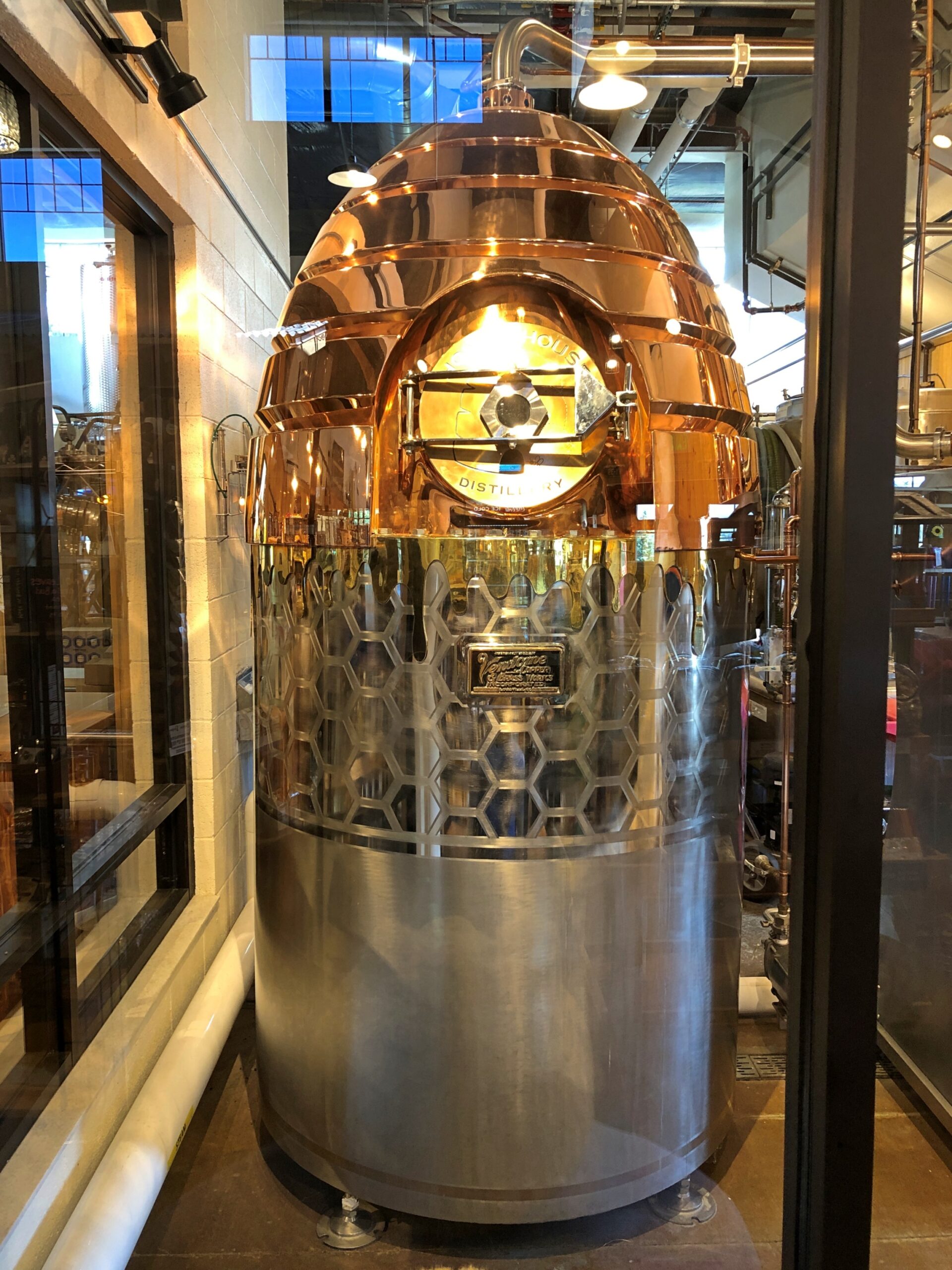
You can watch part of the process.
A warp drive engine fueled by honey? Could be that Zefram Cochrane kept (will keep) bees.
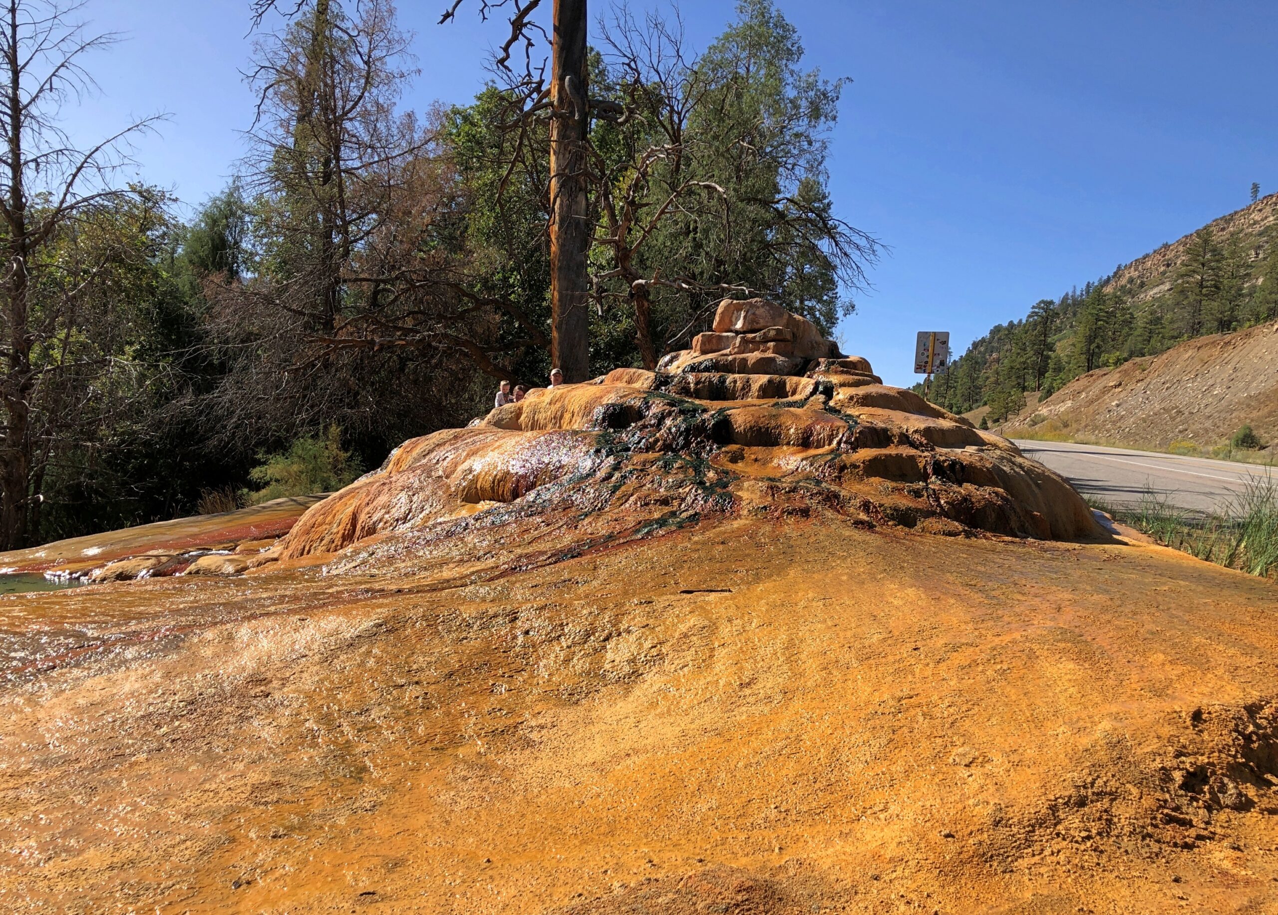
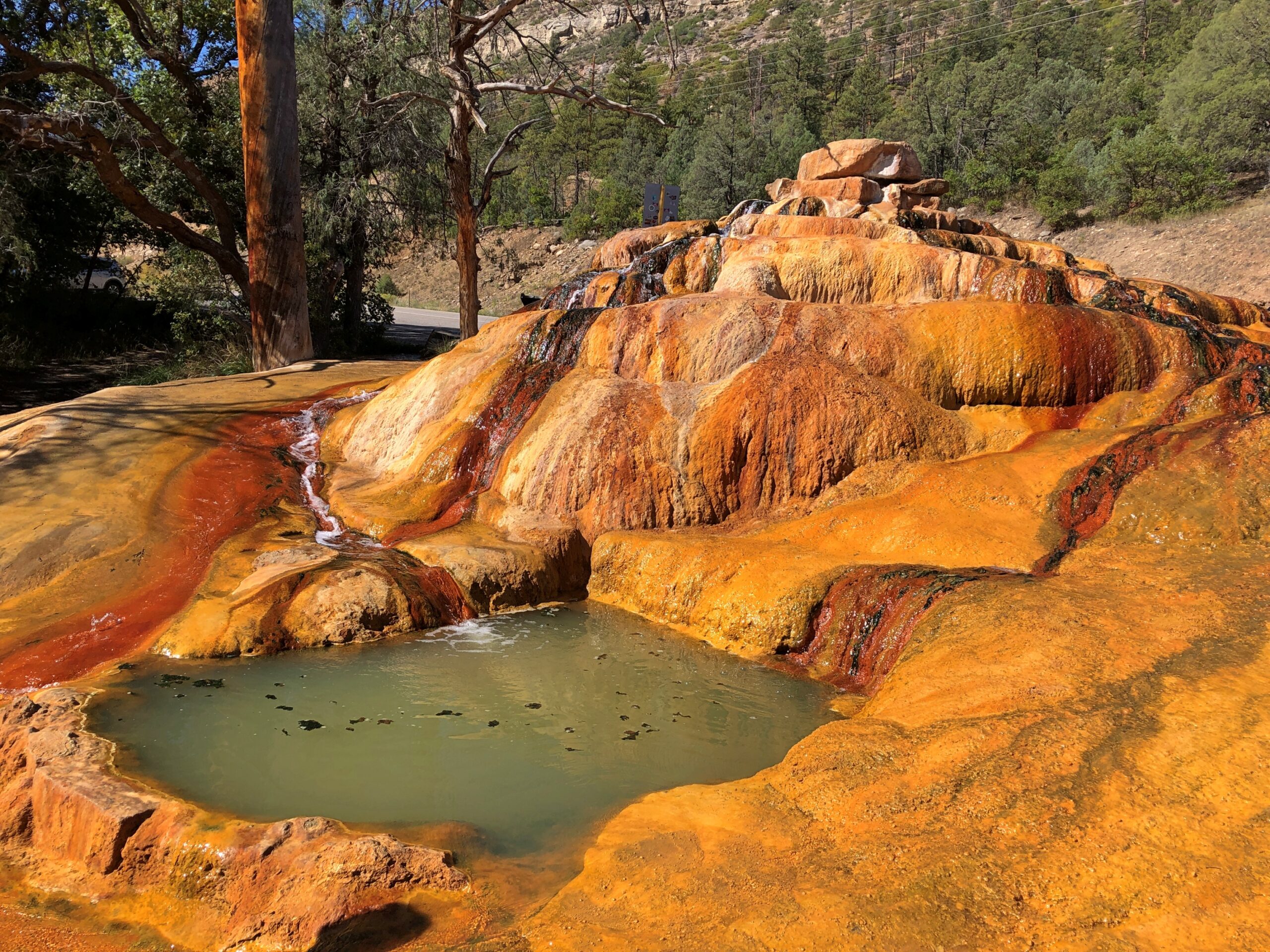
Only a few miles north, just off US 550, is Pinkerton Hot Springs, which is the kind of place that winds up on Atlas Obscura lists (actually, so does Honeyville). We took a look, but not a dip.
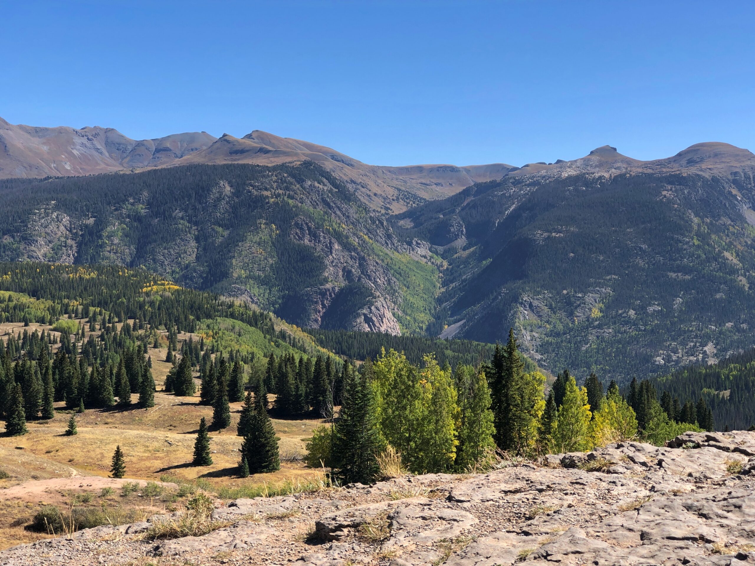
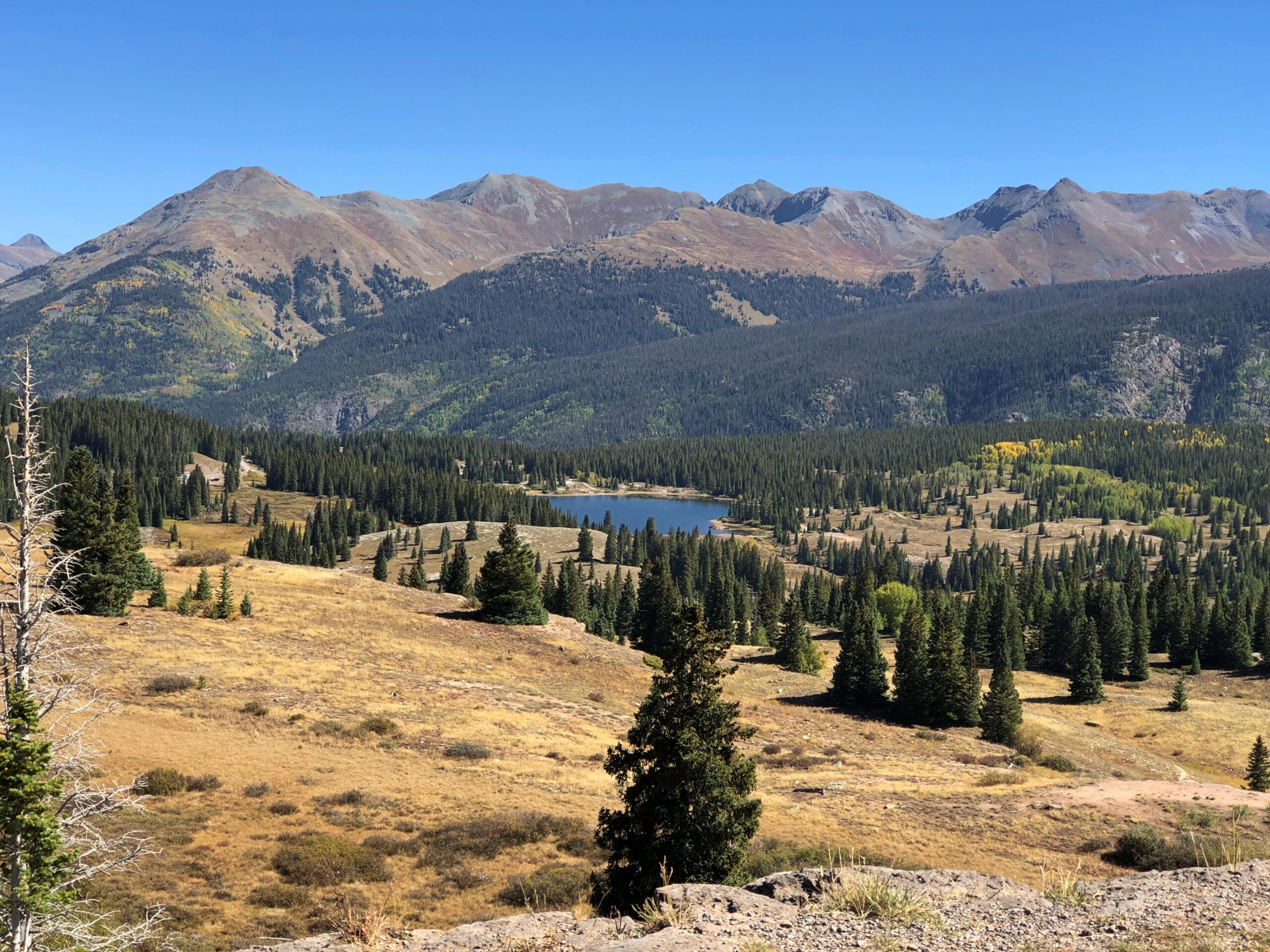
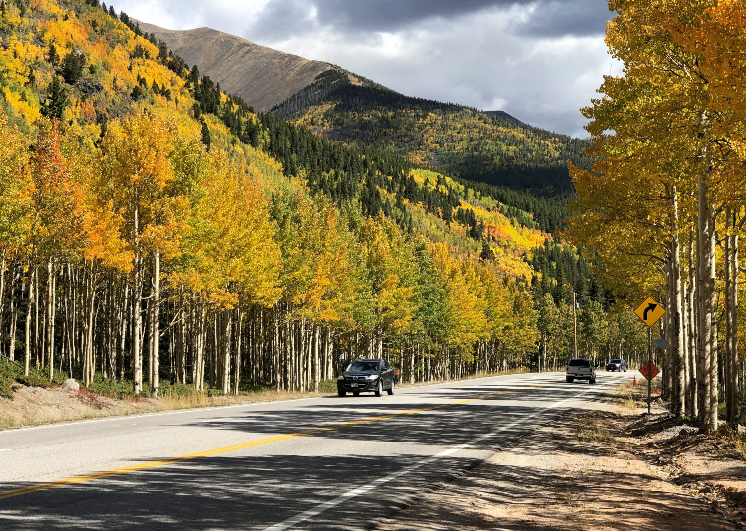
Before you get to Silverton on US 550, you cross Molas Pass, which has some terrific views of the edge of the Weminuche Wilderness. The day, by this time September 18, was clear and not exactly warm, but not that cold yet. Good day for a mountain drive.
Like the highway, the Molas Pass viewpoint was busy, but not overcrowded.
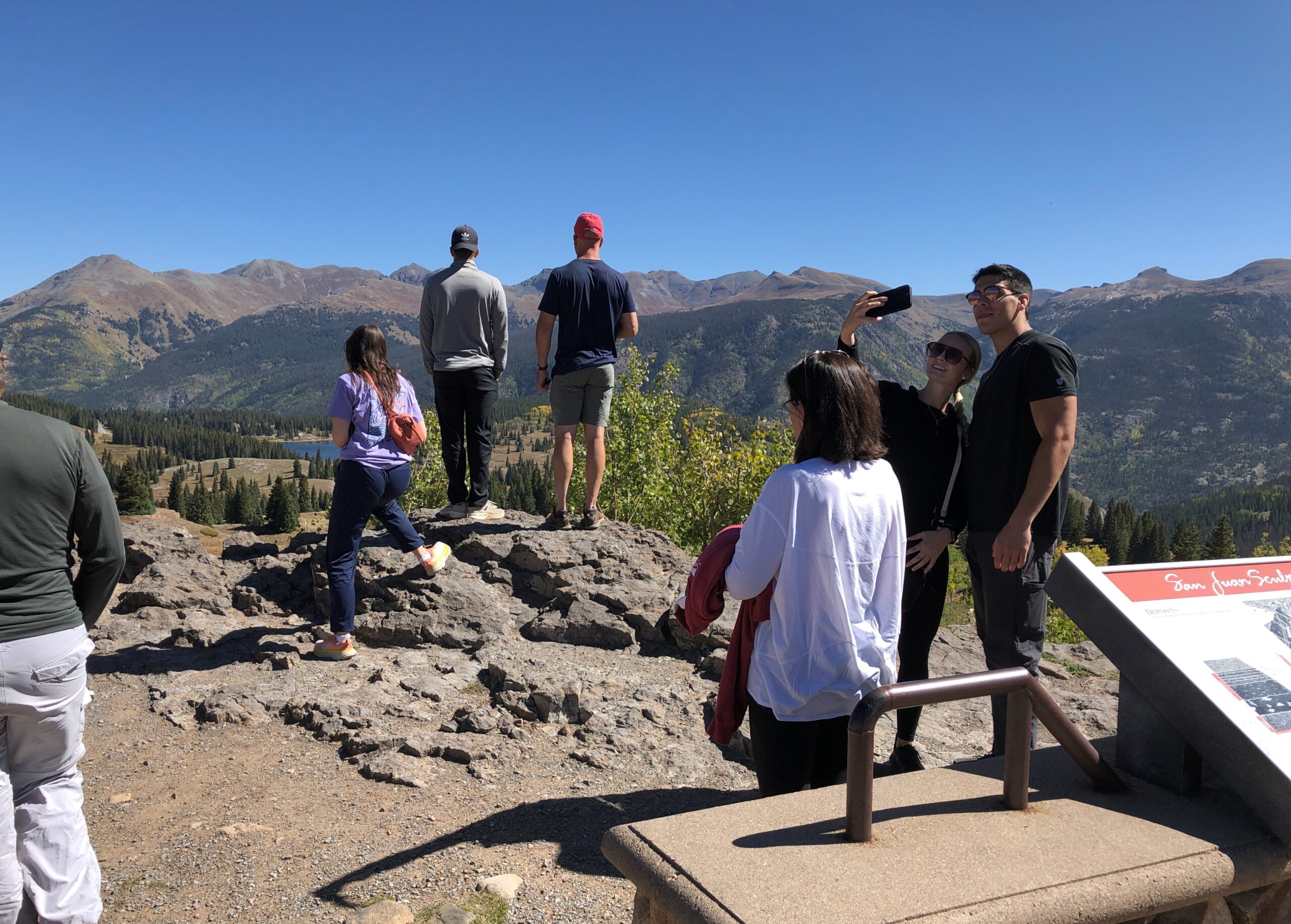
The route from Silverton to Ouray is known as the Million Dollar Highway. There isn’t a consensus about why that might be.
“There are a variety of explanations regarding the source of the name for the ‘Million Dollar Highway,’ says Roadtrip America. “One version claims it is based on the value of the ore-bearing fill that was used to construct the road, and another says it refers to the high cost of building a road over Red Mountain Pass (11,008 feet) and the Uncompahgre Gorge. One thing no one will dispute is the million-dollar views around every turn. This marvel of engineering, designed by Russian immigrant Otto Mears, slices through rugged mountains as it follows old stagecoach routes and former pack trails.”
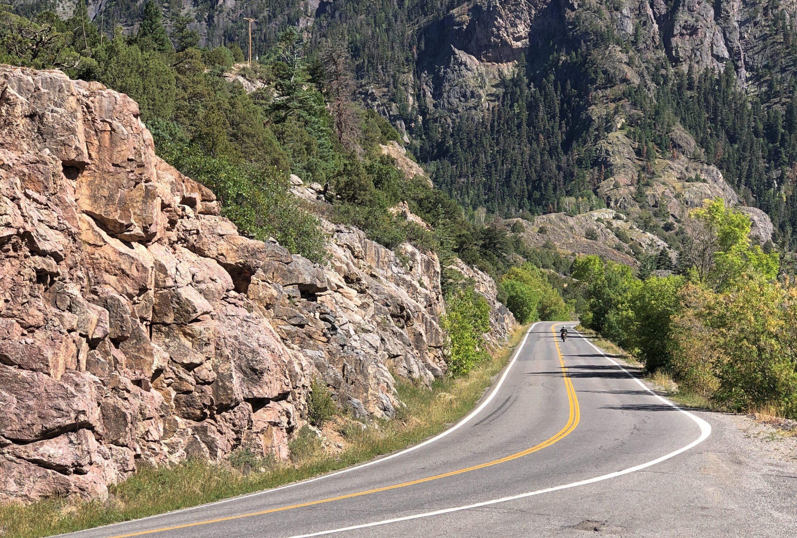
If you want some twisty mountain road action, Million Dollar’s got it. Also, stretches without guard rails.
“About 40 accidents take place on the Million Dollar Highway each year, with an average of seven deaths per year,” the Durango Herald reported in 2023. “Most of the accidents are caused by careless or fast driving in bad road conditions. Other factors are mudslides, inclement weather and wildlife appearing on the road when there is nowhere to swerve.
“While avalanches used to be a factor, the last reported death on the road because of an avalanche came in 1992.”
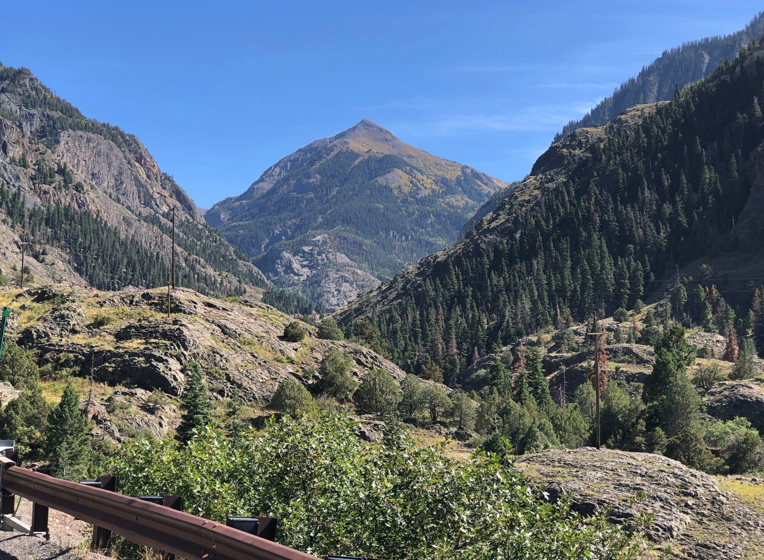
The views are exceptional, both as you move and when you stop. The road near Ouray.
Views near Ouray.
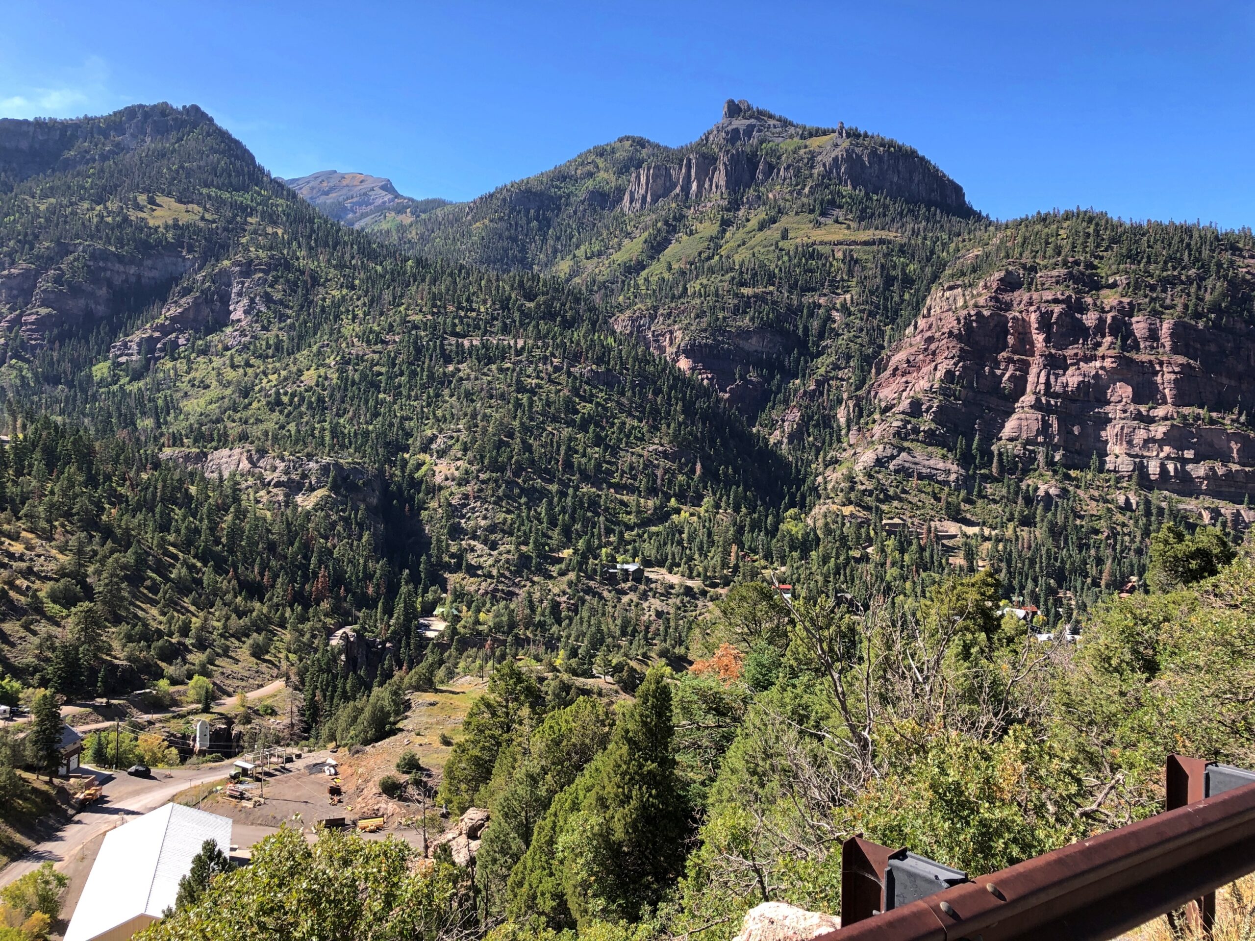
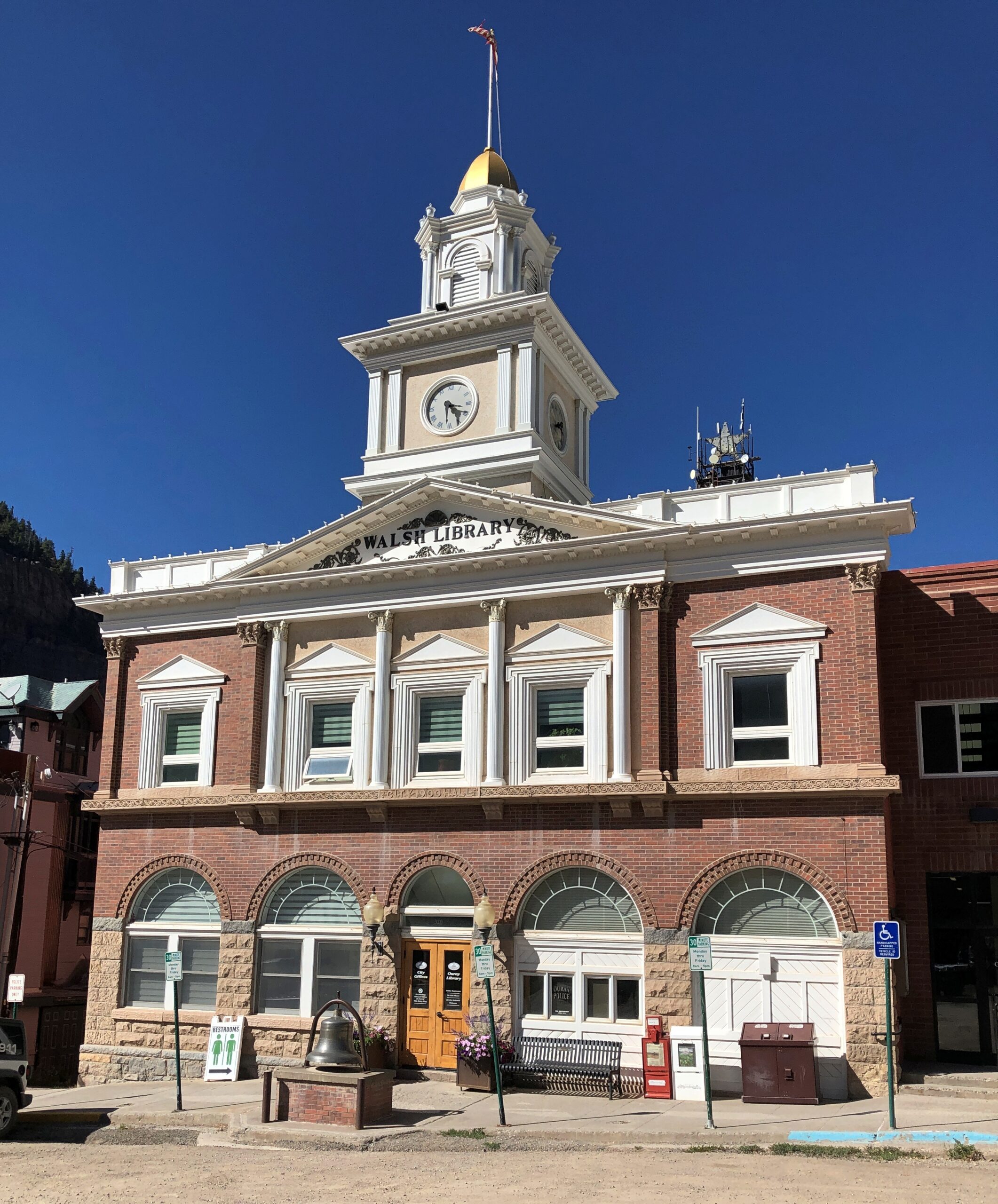
Ouray’s got some handsome buildings.
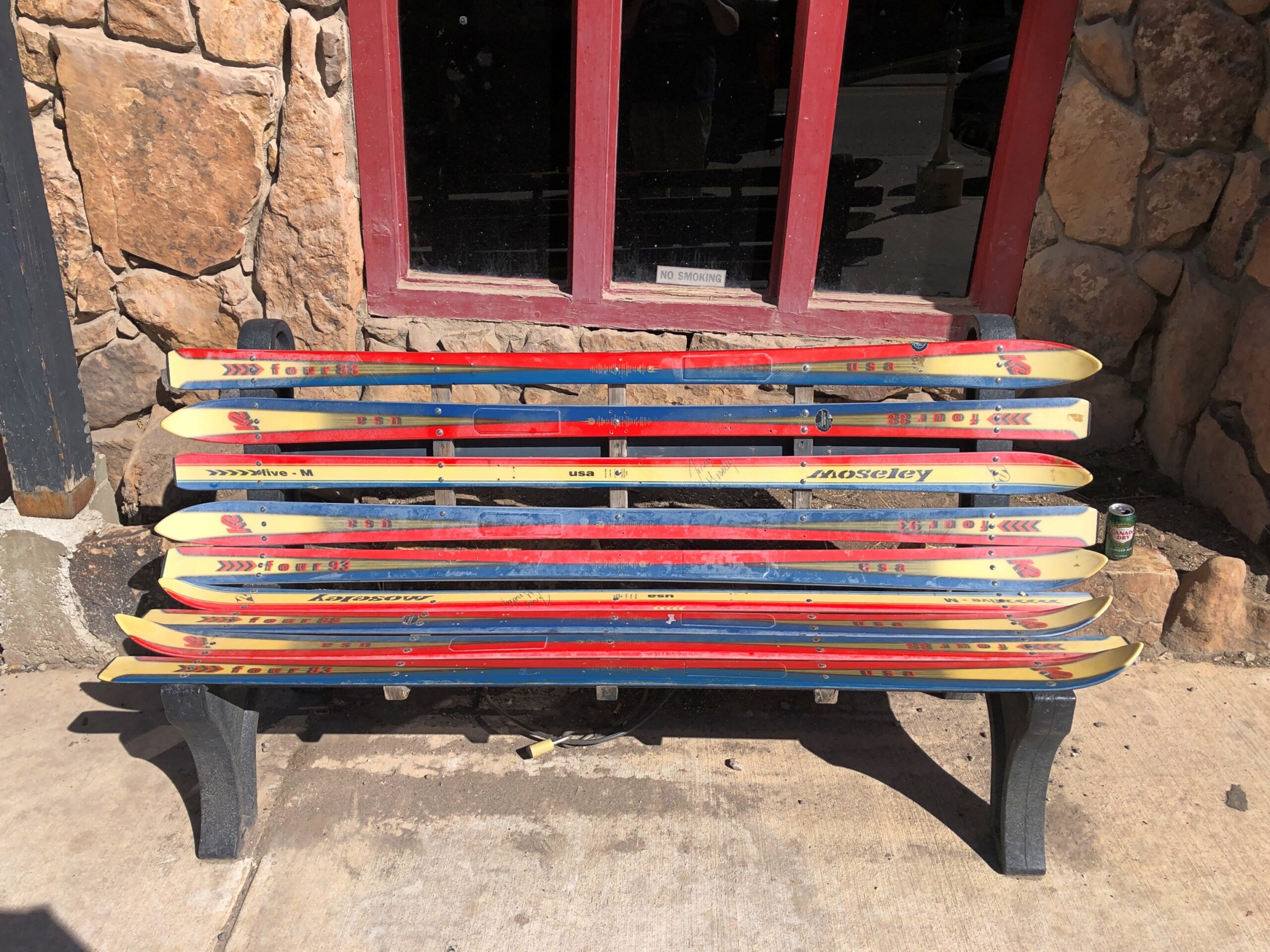
The main street in Ouray is the kind of place that has benches made from skis. Not the only time I saw that in Colorado.
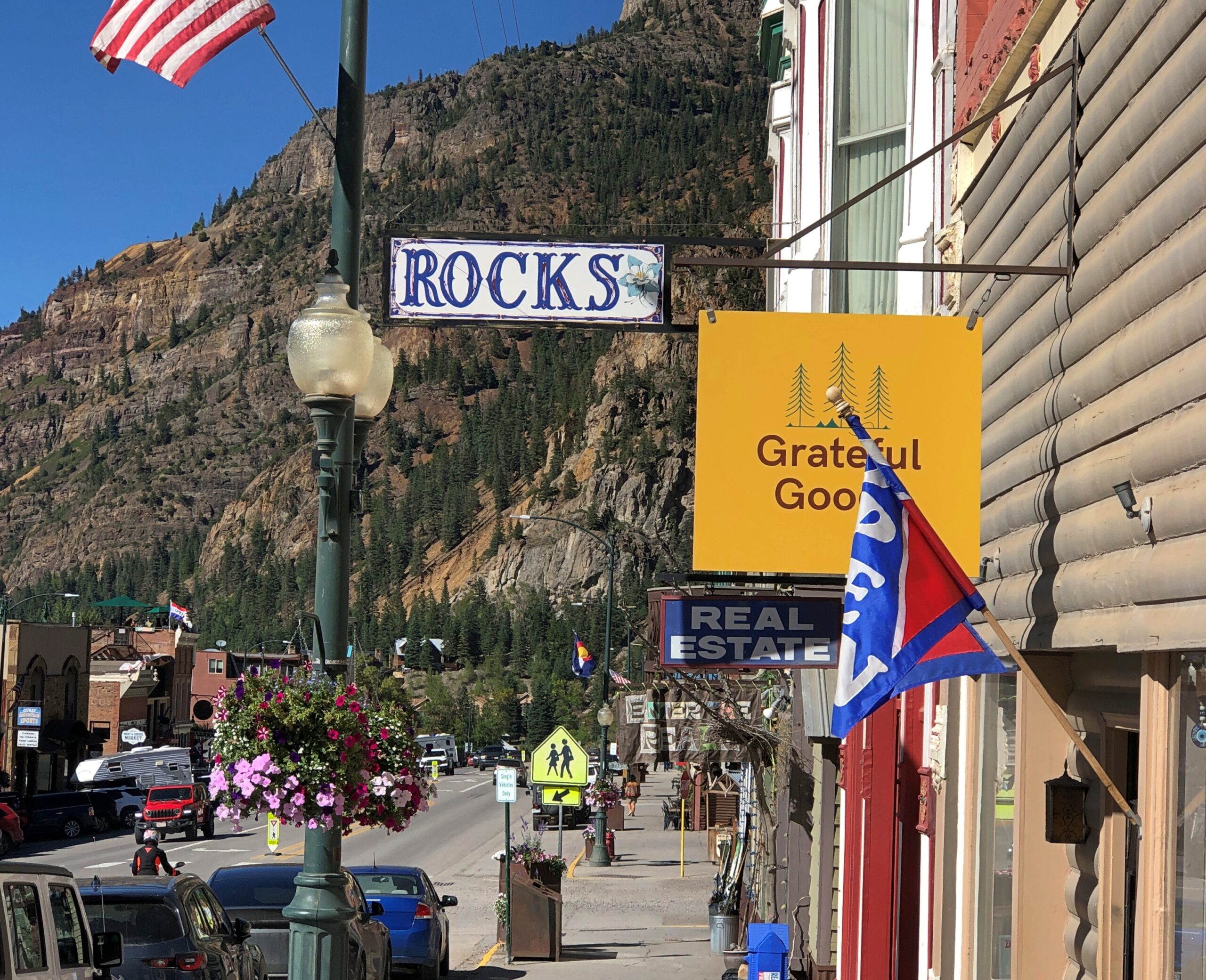
Also, some boutique retail. Good to see that Grateful Goo is available.
Who sells that again? Gwyneth Paltrow? Anyway, hipsters, or more likely plastic surgeons and orthodontists and tech millionaires, seem to have long ago discovered Ouray, close as it is to Telluride. I saw a bumper sticker-like posting on a light pole in town that said: What do you mean there’s an employee housing crisis in Ouray? My 2nd home is always empty.
Monarch Pass
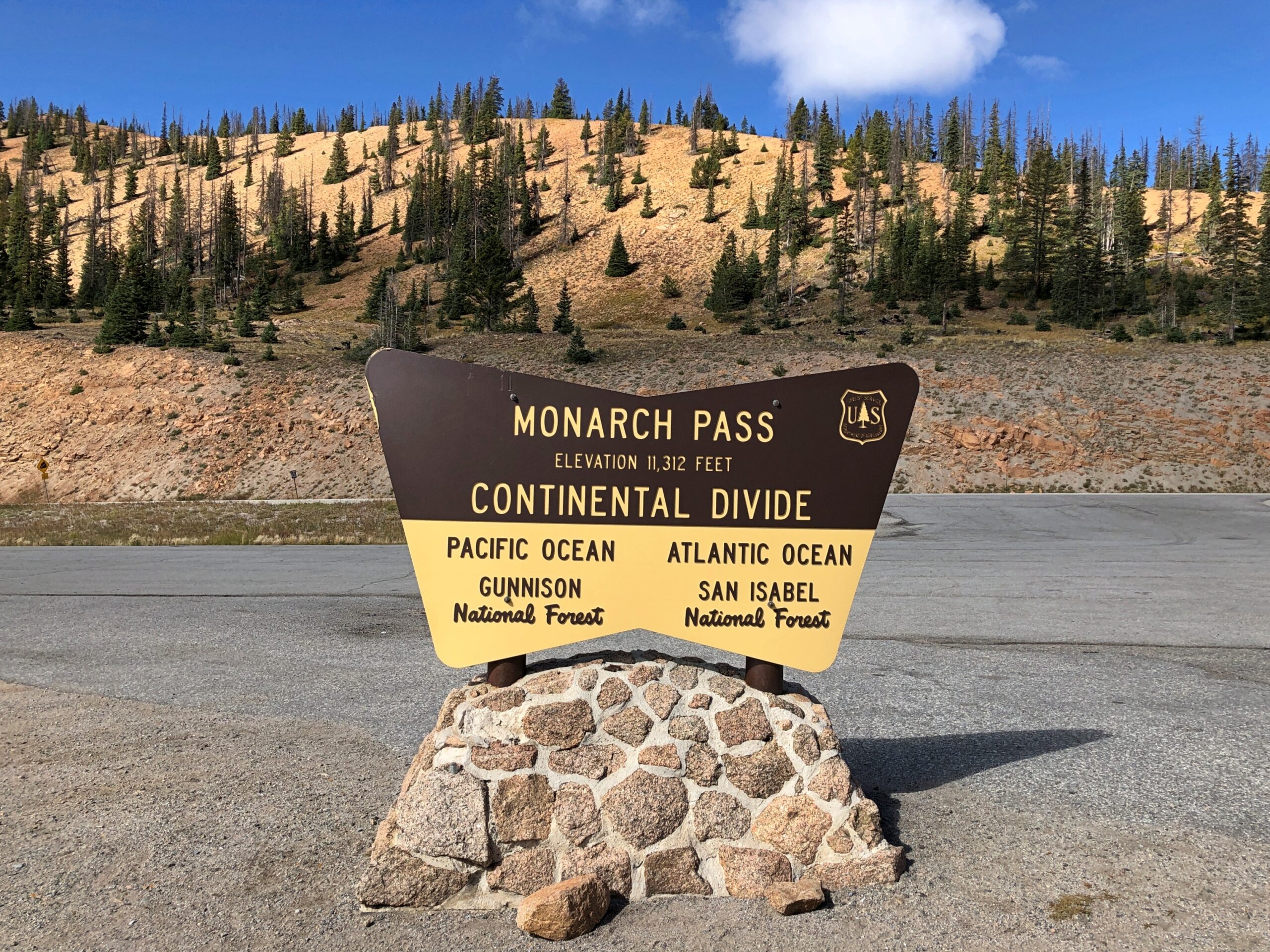
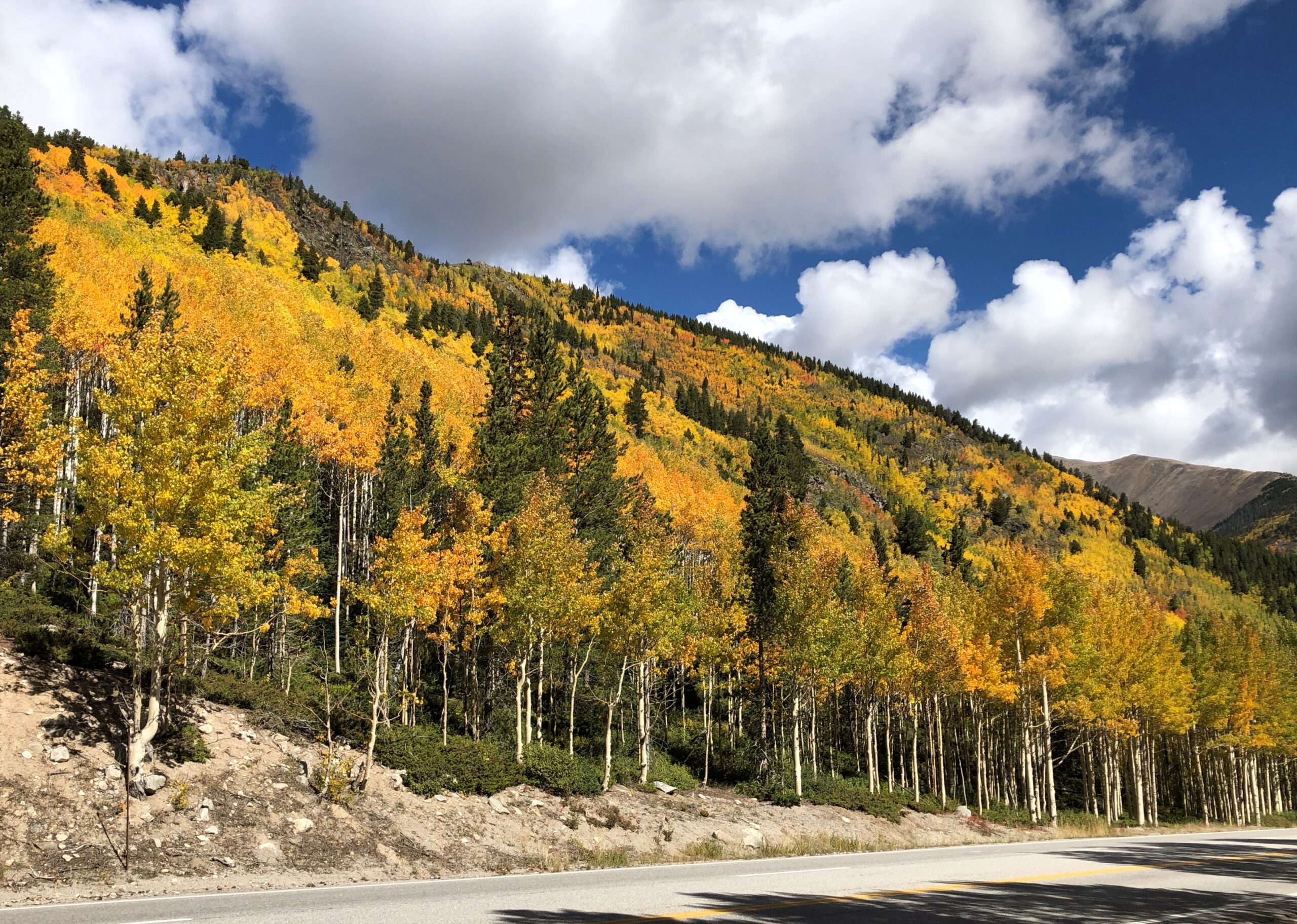
On our return to Denver, we headed out of Montrose east on US 50, a route that edges the gorgeous Blue Mesa Reservoir, and on to Gunnison and Salida. Just west of Salida, we took US 285 north, which goes to greater Denver. That highway crosses the Great Divide at Monarch Pass, elevation 11,312 feet.
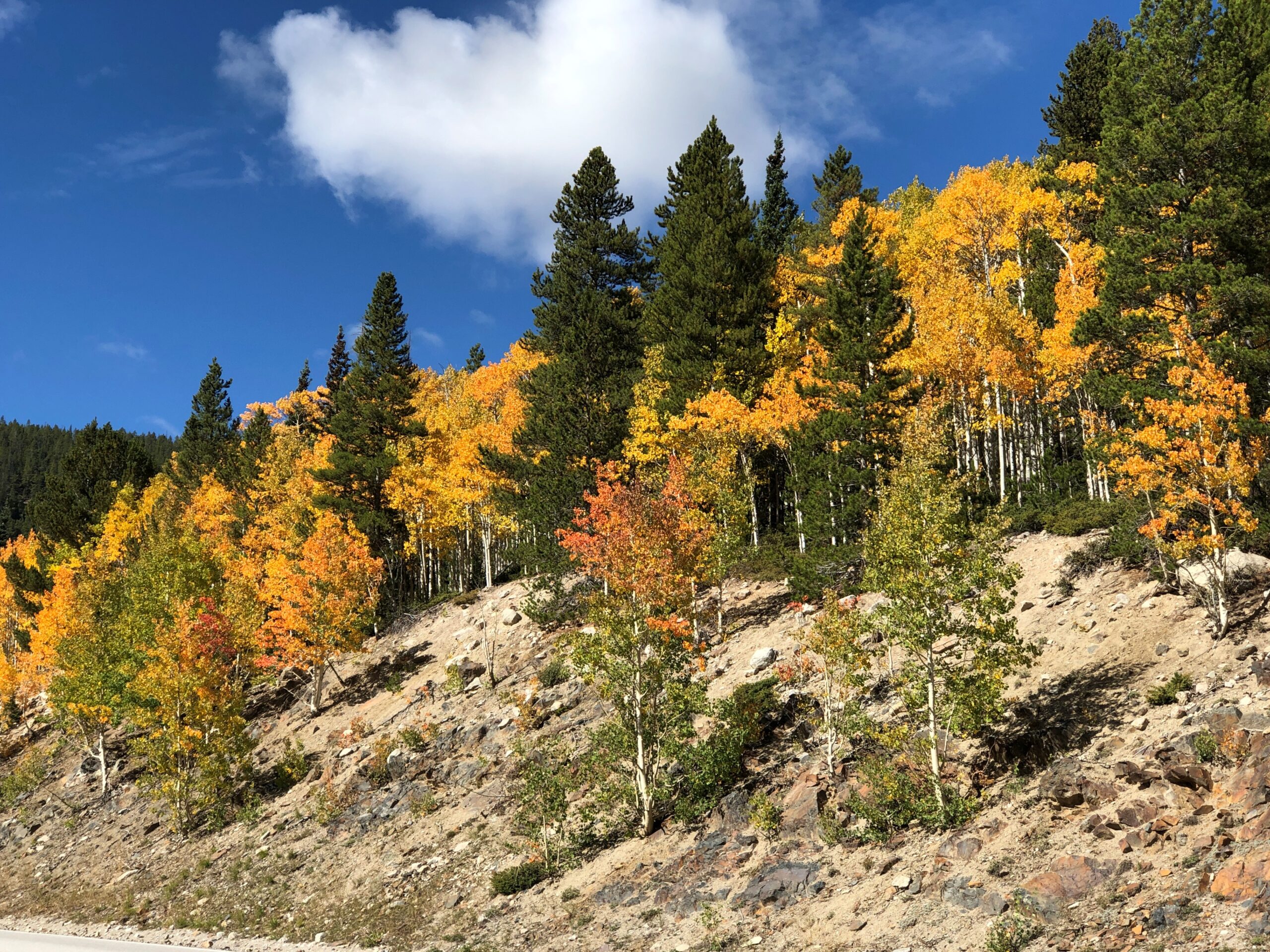
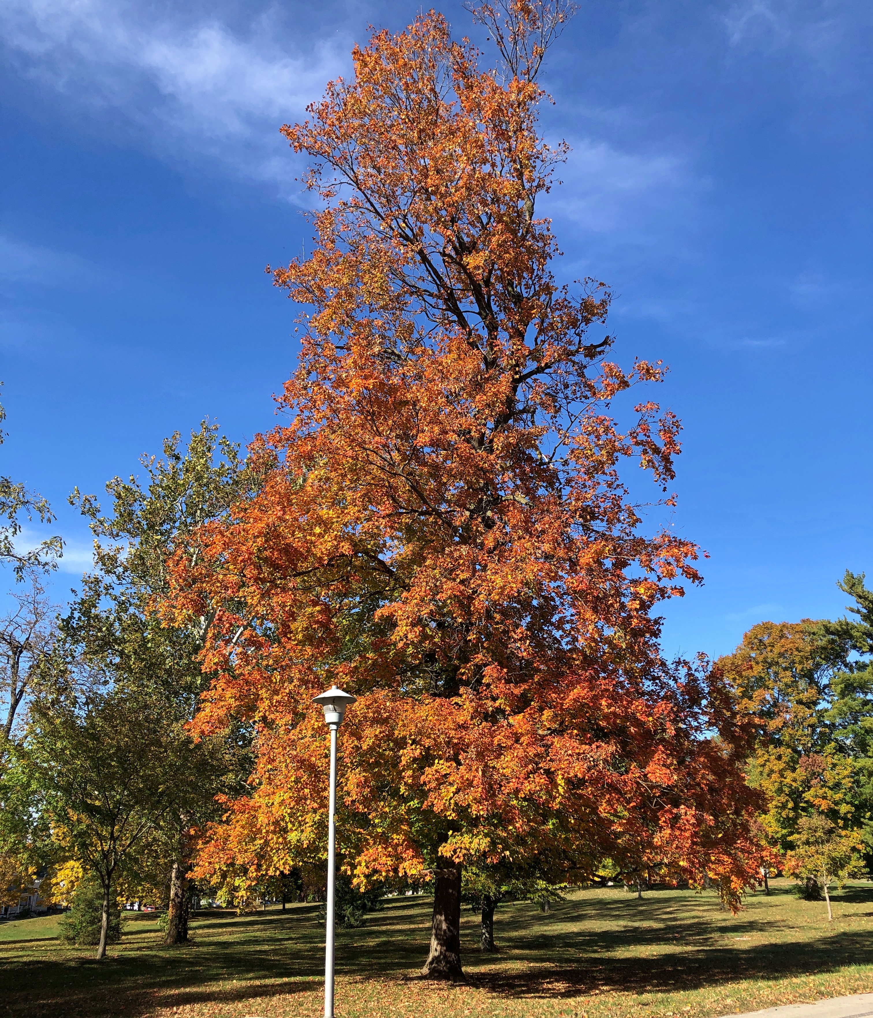
Even as early as September 20, the trees were ablaze.
I suppose that isn’t early for that elevation. We saw trees turning a week earlier, further north at Rocky Mountain NP. I didn’t know it at that time, but we were just beginning a fall season during which we’d see more colors (probably) than any other year. It’s not quite over even yet, with some reds and yellows here in the neighborhood. That isn’t so unusual. Lots of people seek out fall foliage. The odd thing was that it was completely unplanned.
Our first winterish weather blew through early this week, but we’re back to cool days. For now. Some leaves seem to be clinging a little longer than usual, but most are accumulating on the ground, as expected for November. A scattering of Christmas decorations are already up, and I don’t mean in stores, where they’ve been for weeks. Let November be November, I say.
Much of my return from the East Coast generally followed the westward course set by the National Road, though I didn’t use much of US 40, which has that nickname. If you want to make decent time, you take I-68 through Maryland and then I-70 across Ohio and into Indiana, which pretty much parallels the National Road.
The Interstate is designed for just that kind of efficient travel. On the whole, it delivers. The four-lane highways also deliver boring drives, to hear some tell it. That’s an erroneous assumption, to hear me tell it. The Interstate has its fine stretches, such as I-68 in October, a gloriously colorful drive. Winding and hilly, too, through Maryland’s peculiar panhandle.
A rest stop near Hancock, Maryland, offers views to the north, so most of what you see is Pennsylvania.
The rest stop is at Sideling Hill, an enormous rise gouged by an enormous cut for I-68 to go through. An impressive feat of engineering, completed only in the 1980s. Then again, blowing up mountains is a thing that happens in this part of the country.
The narrowest part of the Maryland isn’t far away. At its narrowest, there is less than two miles are between the Potomac and the Mason-Dixon Line. So if you picked up Maryland by the panhandle, it would surely break at that narrowest point.
I filled my gas tank off the highway in the last town in Maryland, Friendsville (pop. 438), at a station whose enclosed retail space (between a few pumps) seemed little bigger than a walk-in closet, and yet there was a clerk manning the place on Saturday just before dark. Rotund and massively bearded, he was playing a video game when I opened the door to pre-pay. He might have been a little surprised to encounter a customer, at least one who didn’t pay at the pump.
From there, I continued into West Virginia, then took I-79 north into Pennsylvania, then headed west on I-70, which crosses West Virginia’s odd panhandle – more like a periscope – before reaching Ohio. After overnighting in Cambridge, Ohio, I bypassed Columbus but stopped in Springfield, near Dayton but with a distinct geographic identity. Alcor to Dayton’s Mizar, you might say.
Downtown Springfield was practically devoid of pedestrians that Sunday, and not that many cars drove through either. A few buildings rise high enough to suggest a more prosperous past, but look too closely and some of them seem to be as empty as the streets, or at least underutilized.
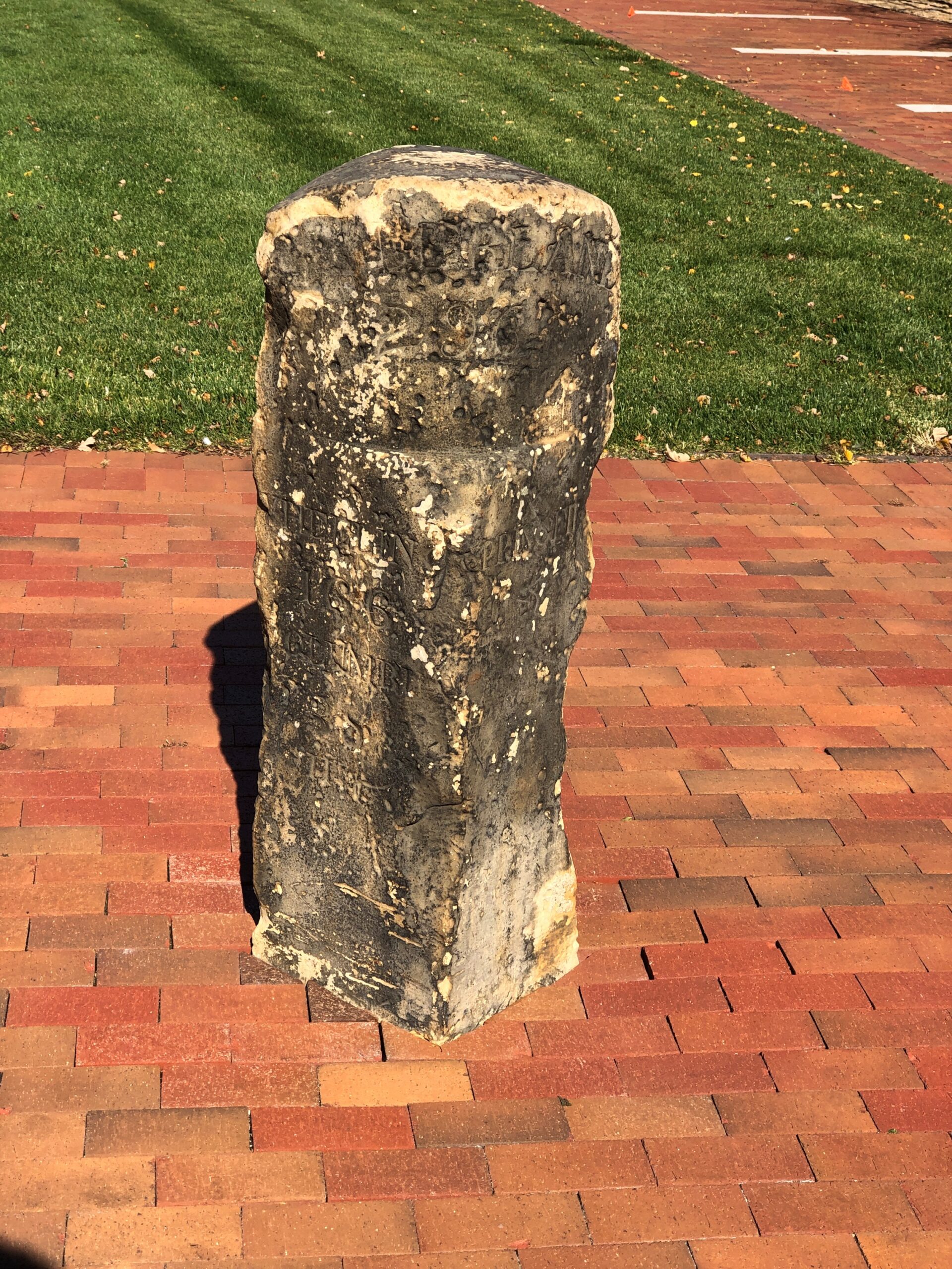
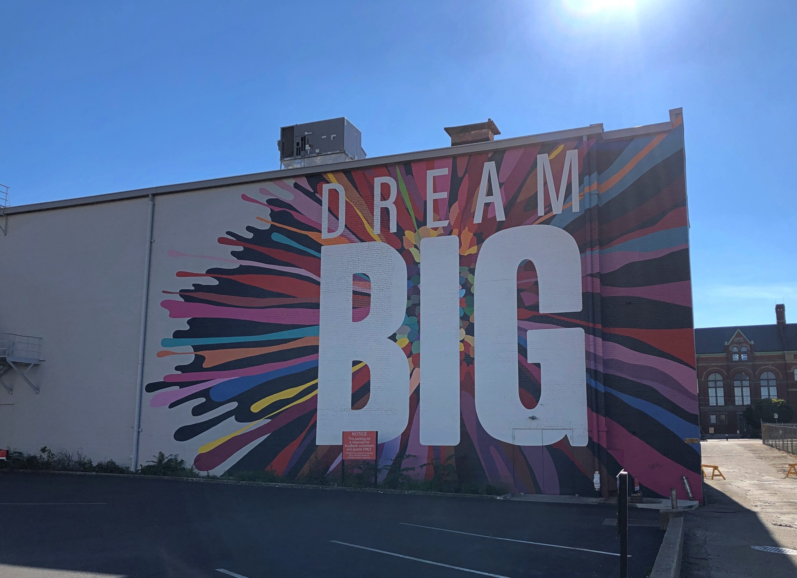
The National Road went, and still goes through Springfield, in the form of US 40. A milestone in Springfield marks the point at which the federal government quit paying for further westward expansion of the road. Anything else would be on the states, namely Ohio, Indiana and Illinois.
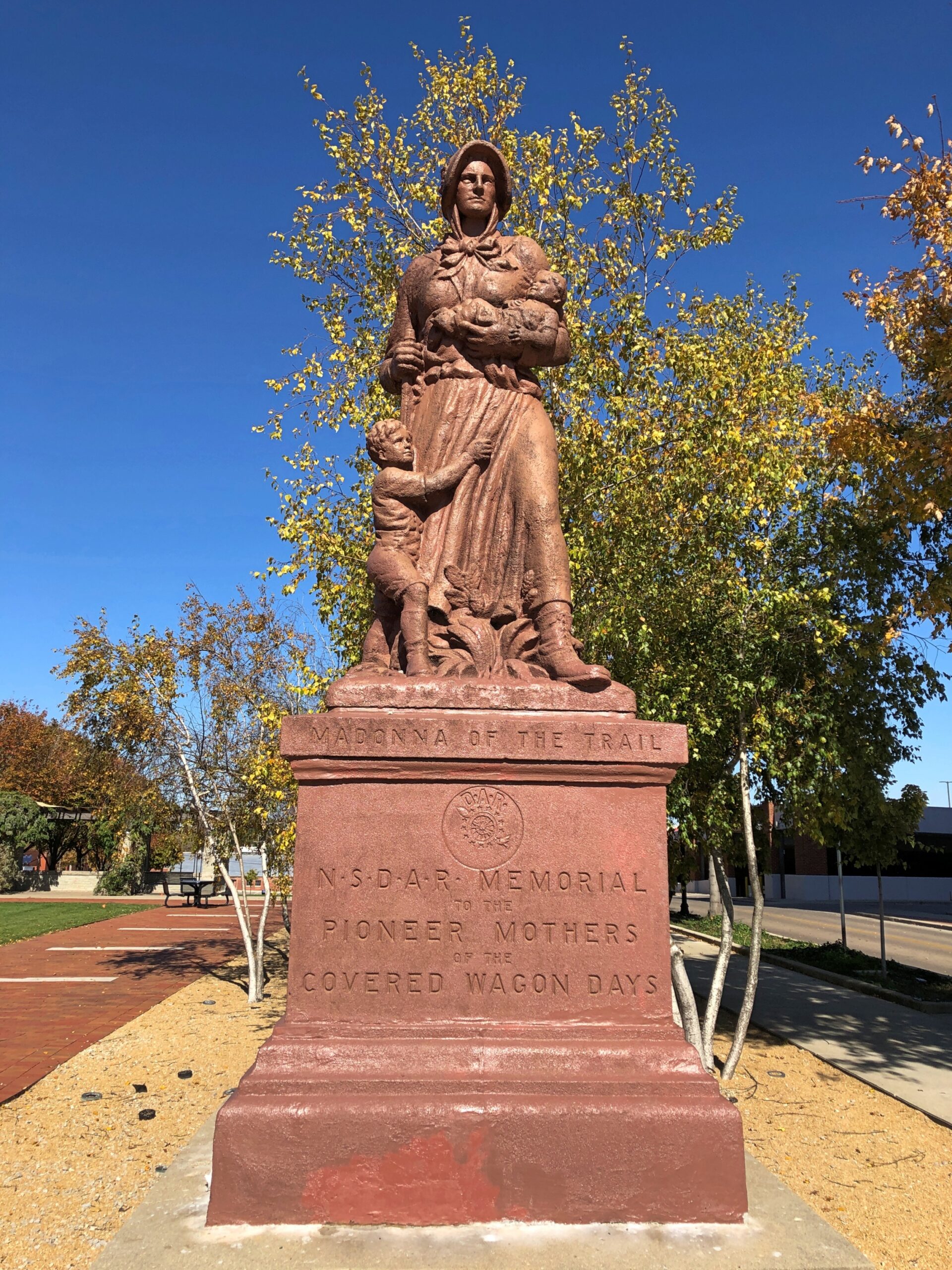
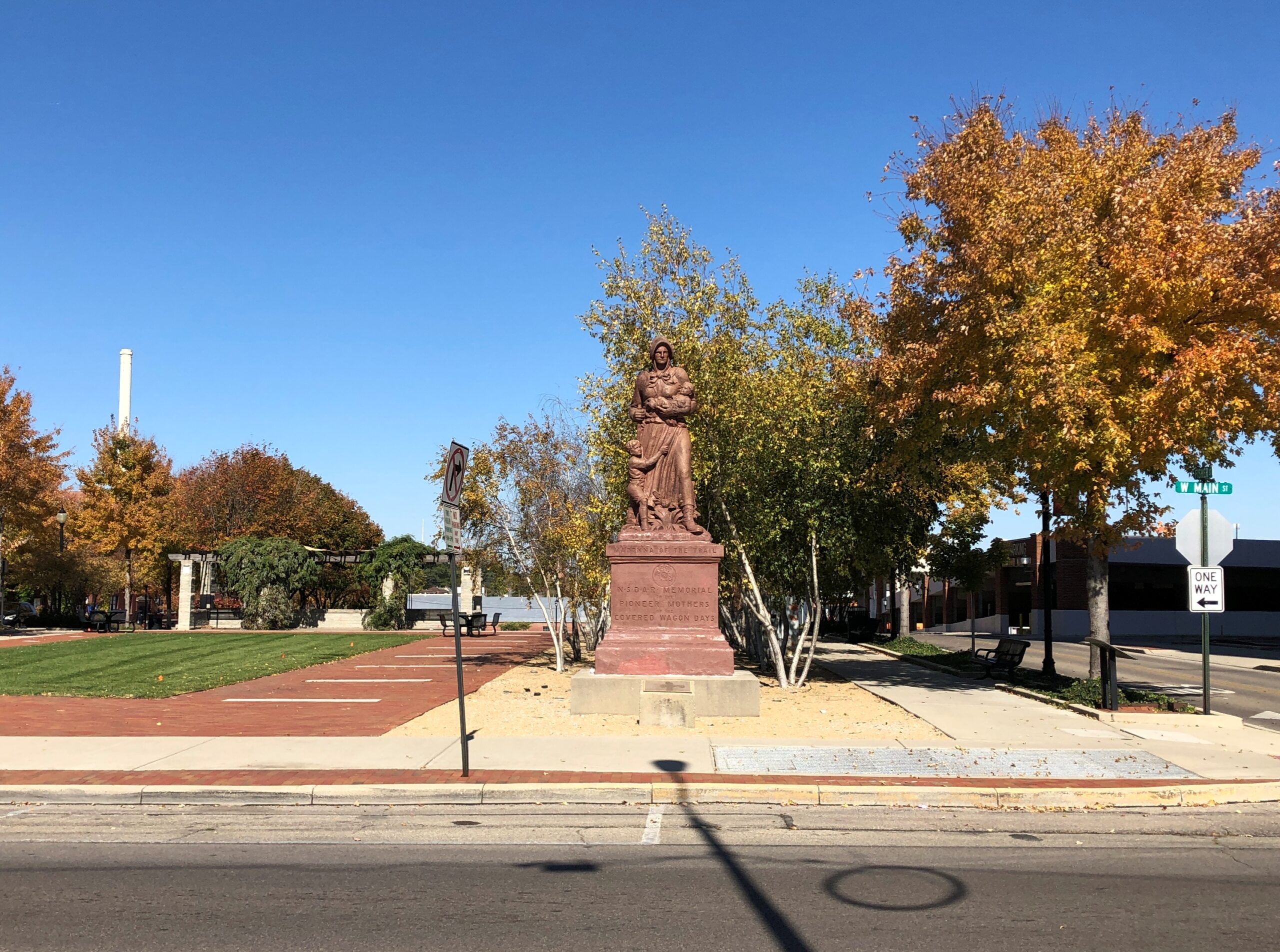
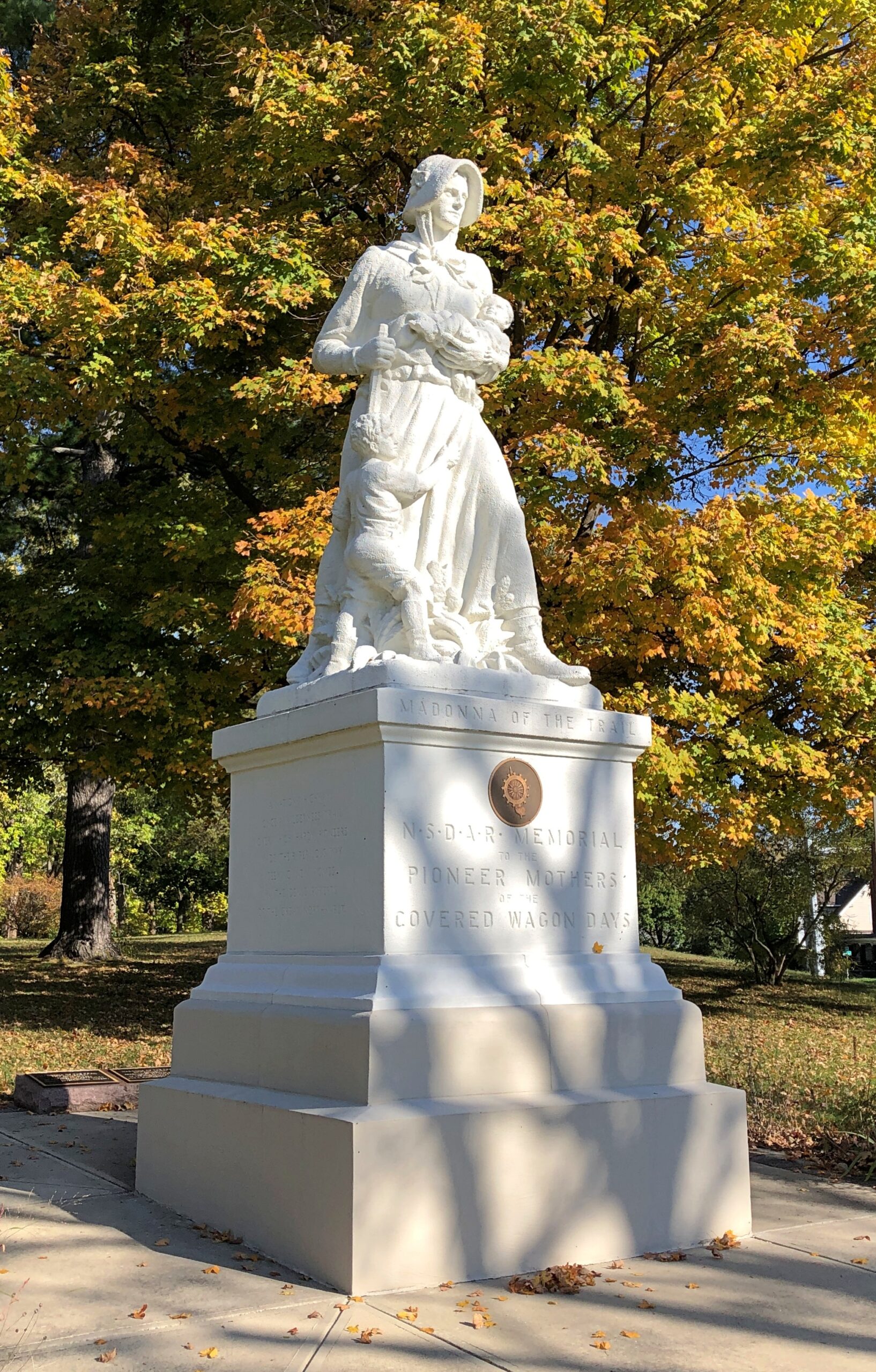
Later, after the National Road had become History, the Daughters of the American Revolution erected a series of statues along the route, and others to the west: “Madonna of the Trail.”
There are 12, with the easternmost of them along the National Road. Erected in the late 1920s, the Springfield one was renovated about 20 years ago.
Nearby, passersby are urged to Dream Big.
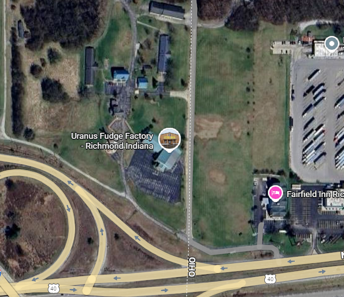
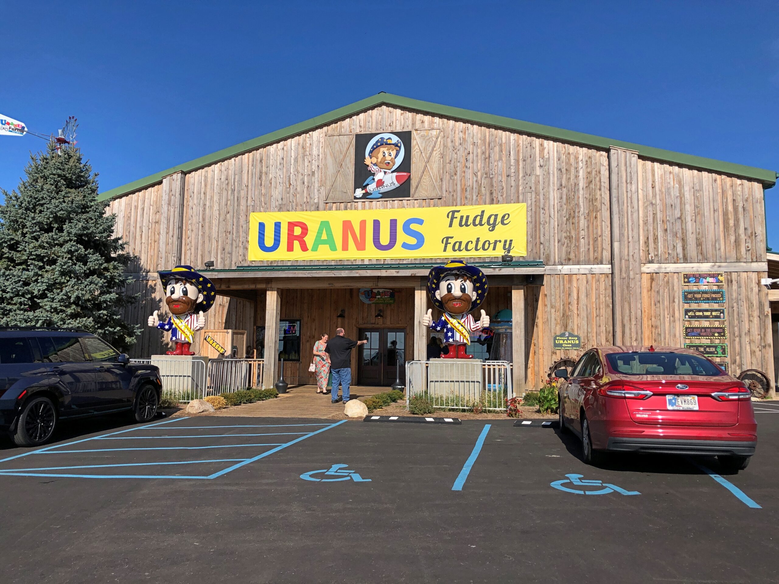
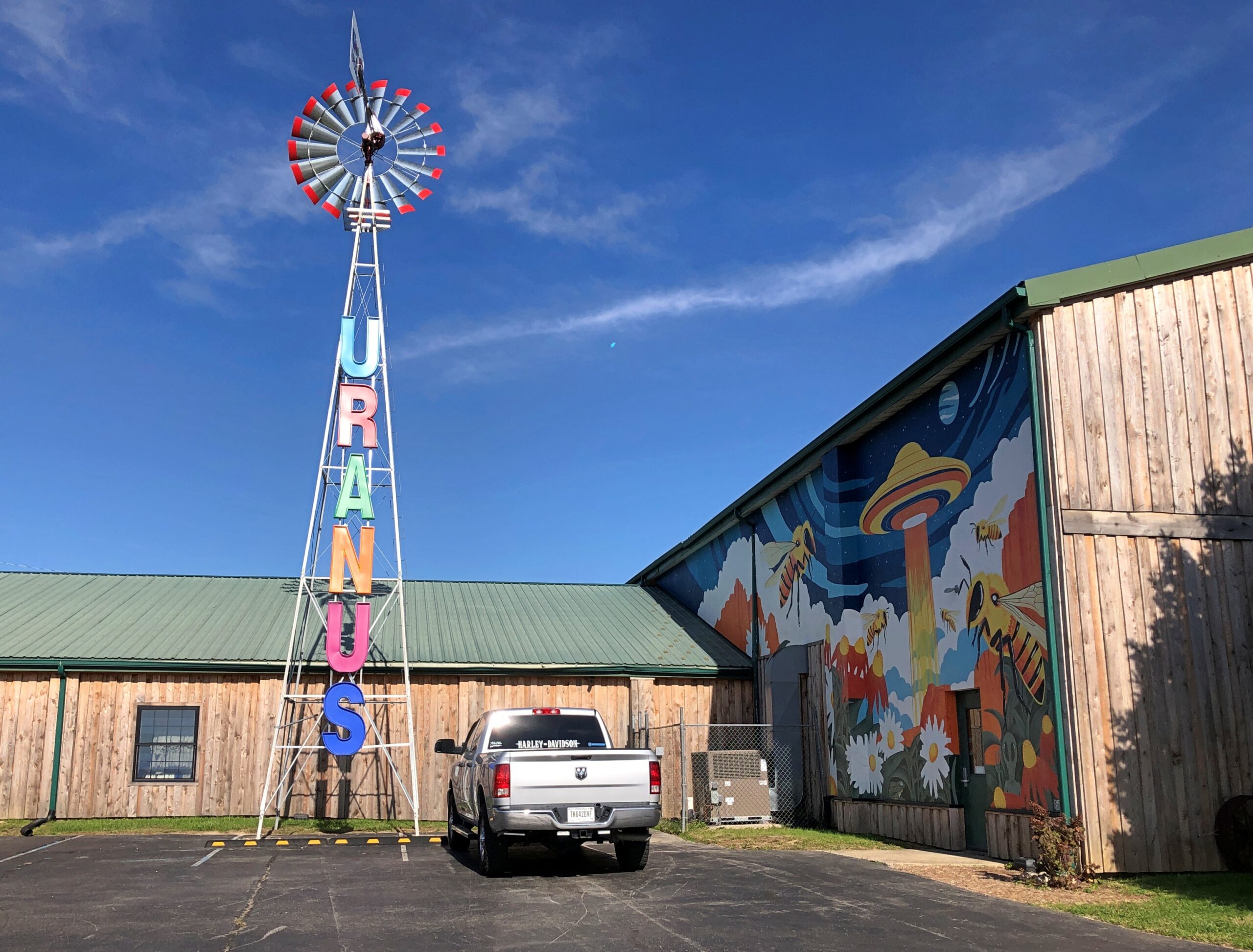
About an hour west of Springfield, at the border of Ohio and Indiana on I-70 – just barely inside Indiana – is the Uranus Fudge Factory. I had to stop for that.
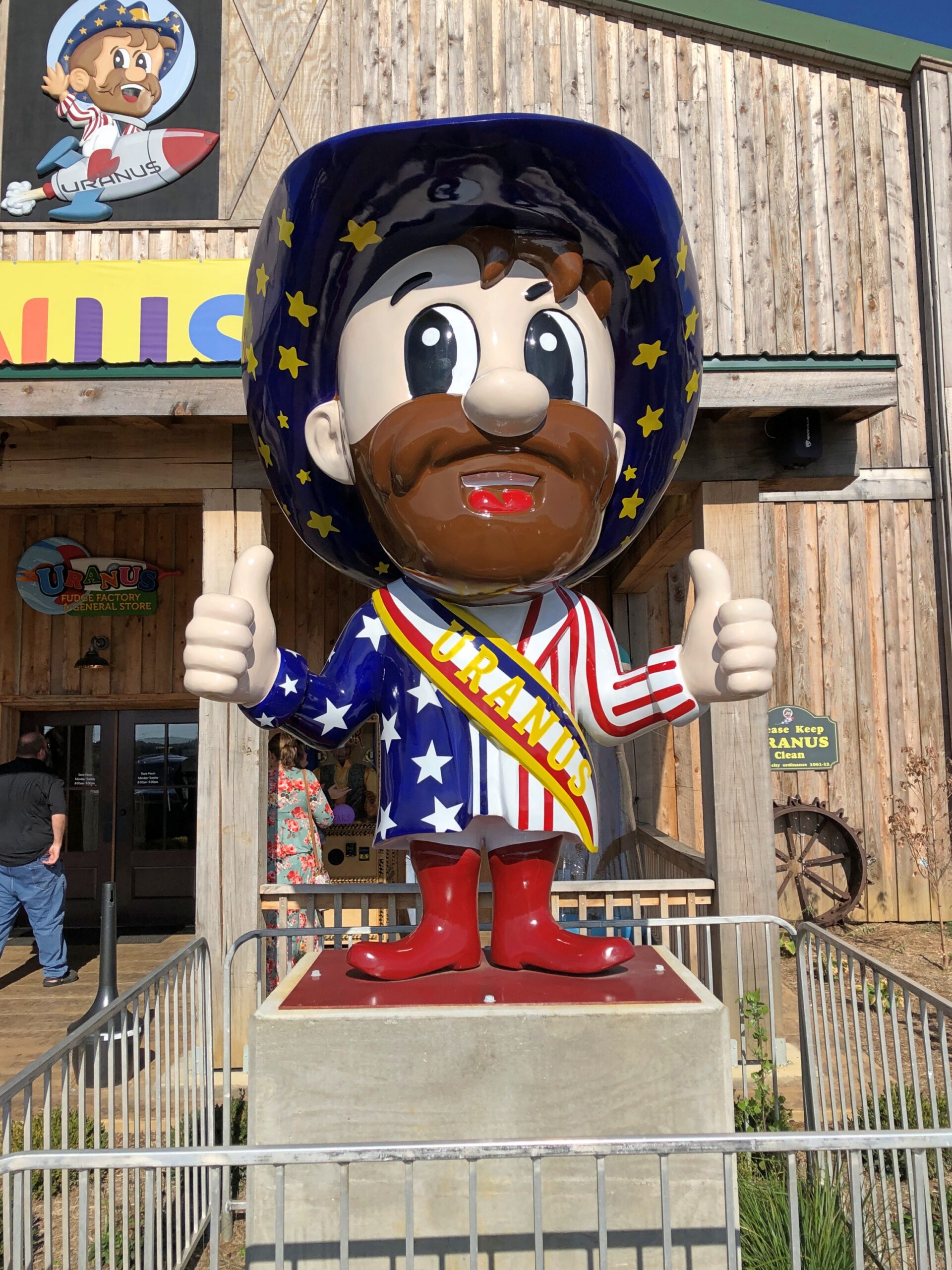
Sure, there’s fudge in there somewhere, but also a lot of gags involving the word Uranus(Your-anus). Examples can be found in the newspaper — an honest-to-God paper newspaper — that the store produces, The Uranus Examiner, and gives away. I have a copy. My kind of souvenir.
Sample front-page headlines from the Summer 2025 edition:
Breaking News: You Can Explore Uranus In Three Locations
Eating Their Way Through Uranus
Get A Lick Of Uranus
Sink Your Balls In Our Putt Holes
The second of those stories was about the 2nd Annual Eating Uranus Fudge Galactic Championship held at the Anderson, Indiana location in March. Apparently it was a Major League Eating-sanctioned event, and apparently MLE is a real thing. One Patrick Bertoletti won the 2nd championship at Uranus, putting away a bit more than nine pounds of fudge in about as many minutes.
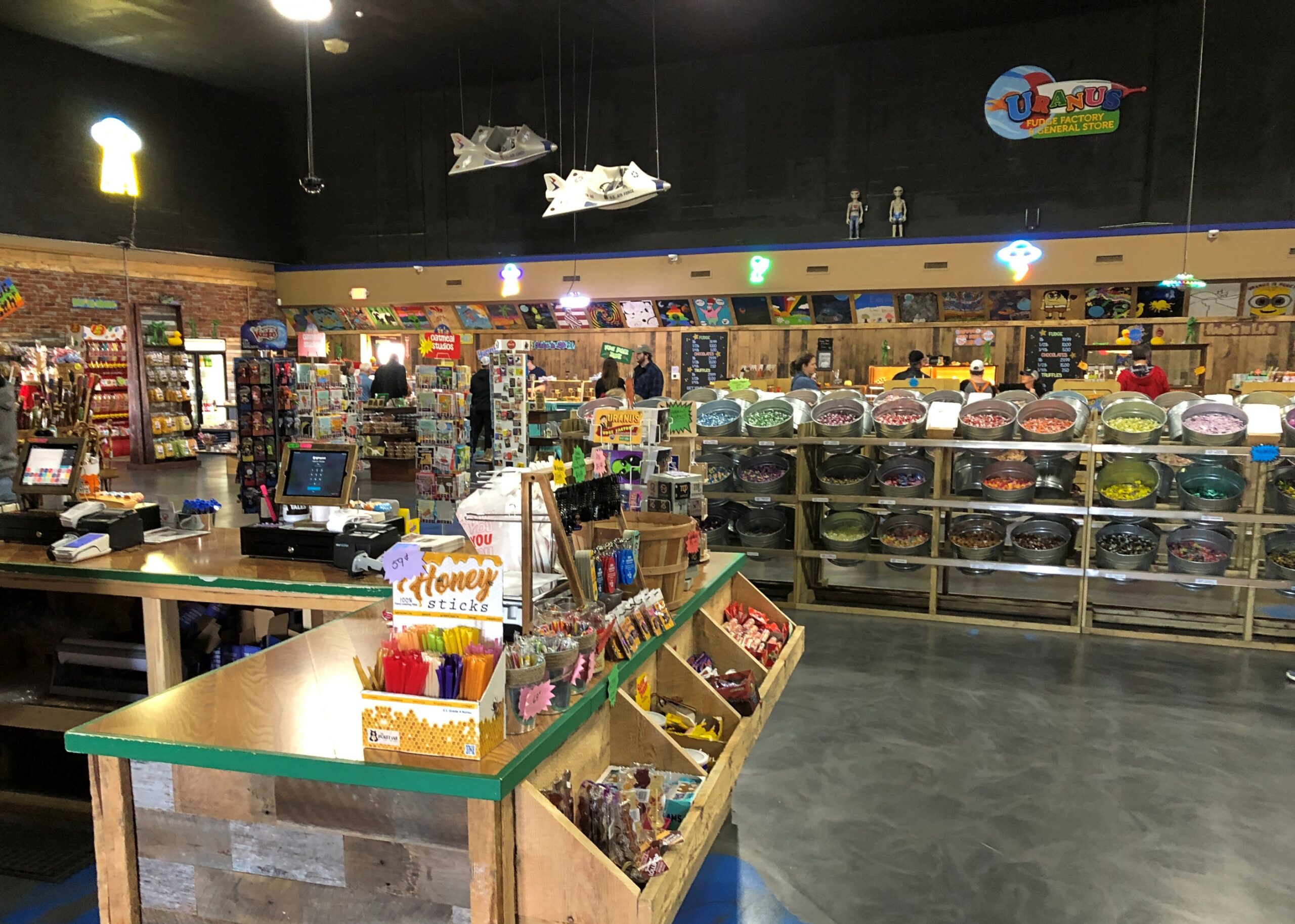
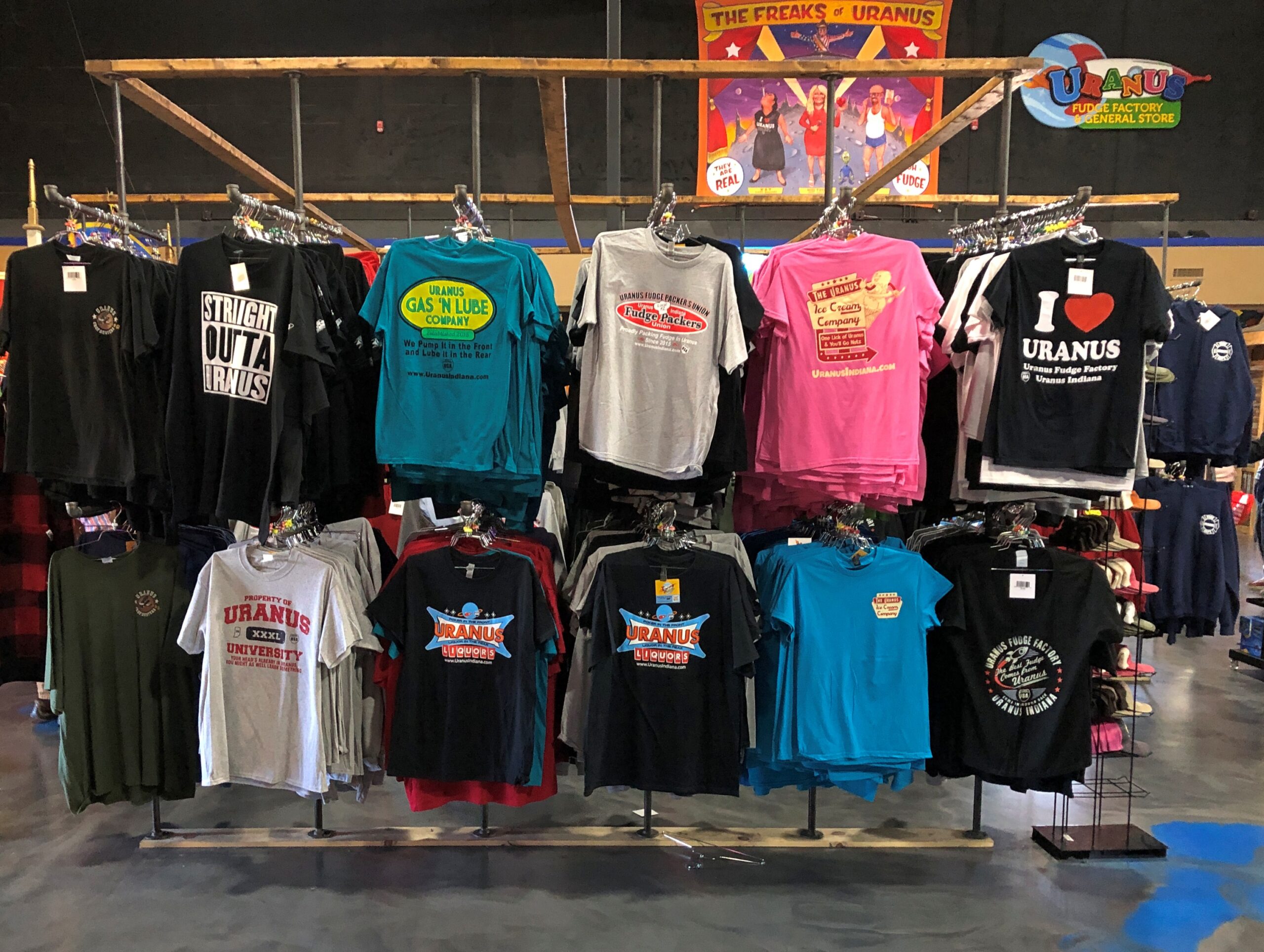
Fudge is one thing, but mostly Uranus sells stuff. A lot of stuff.
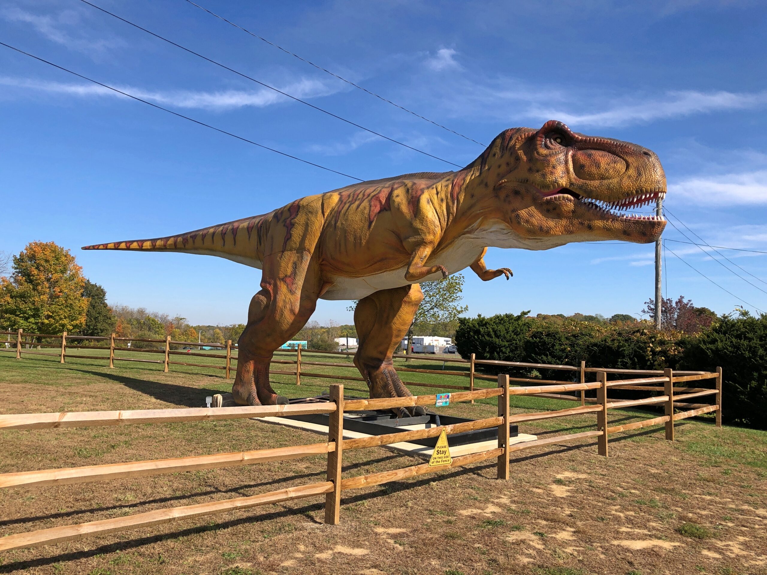
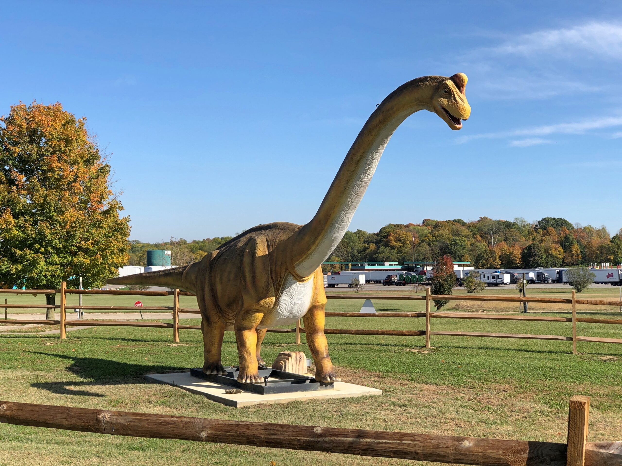
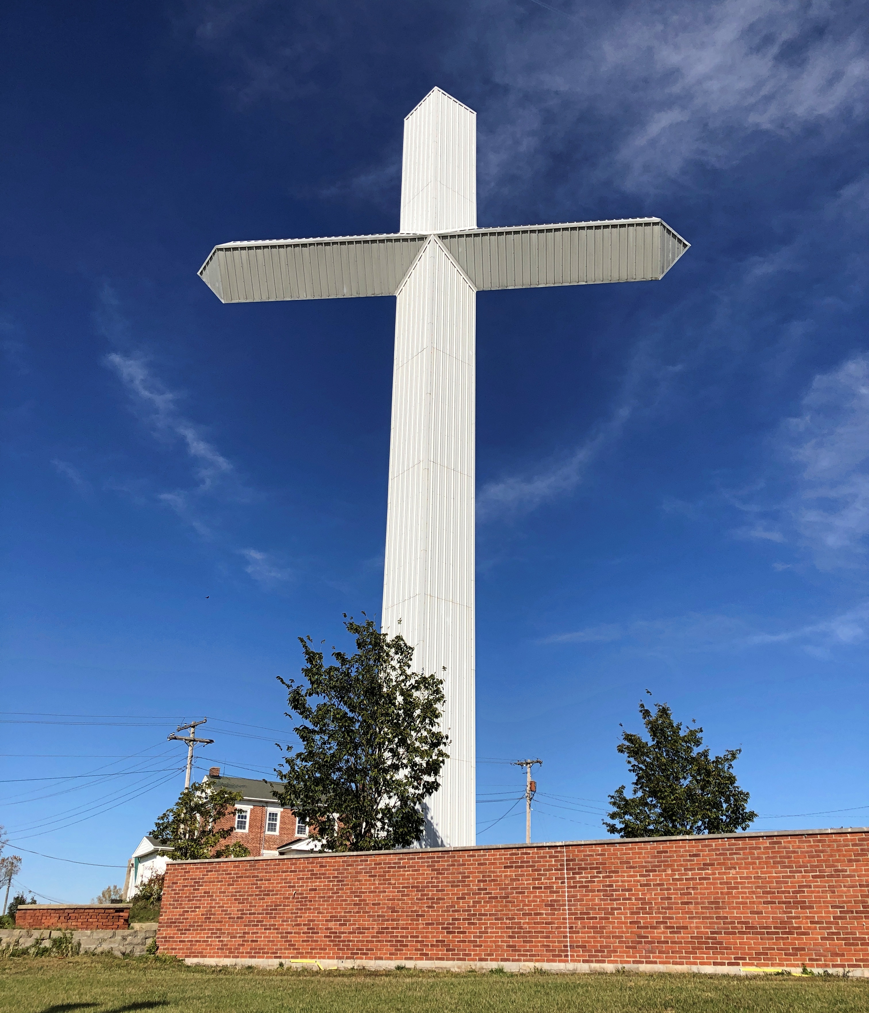
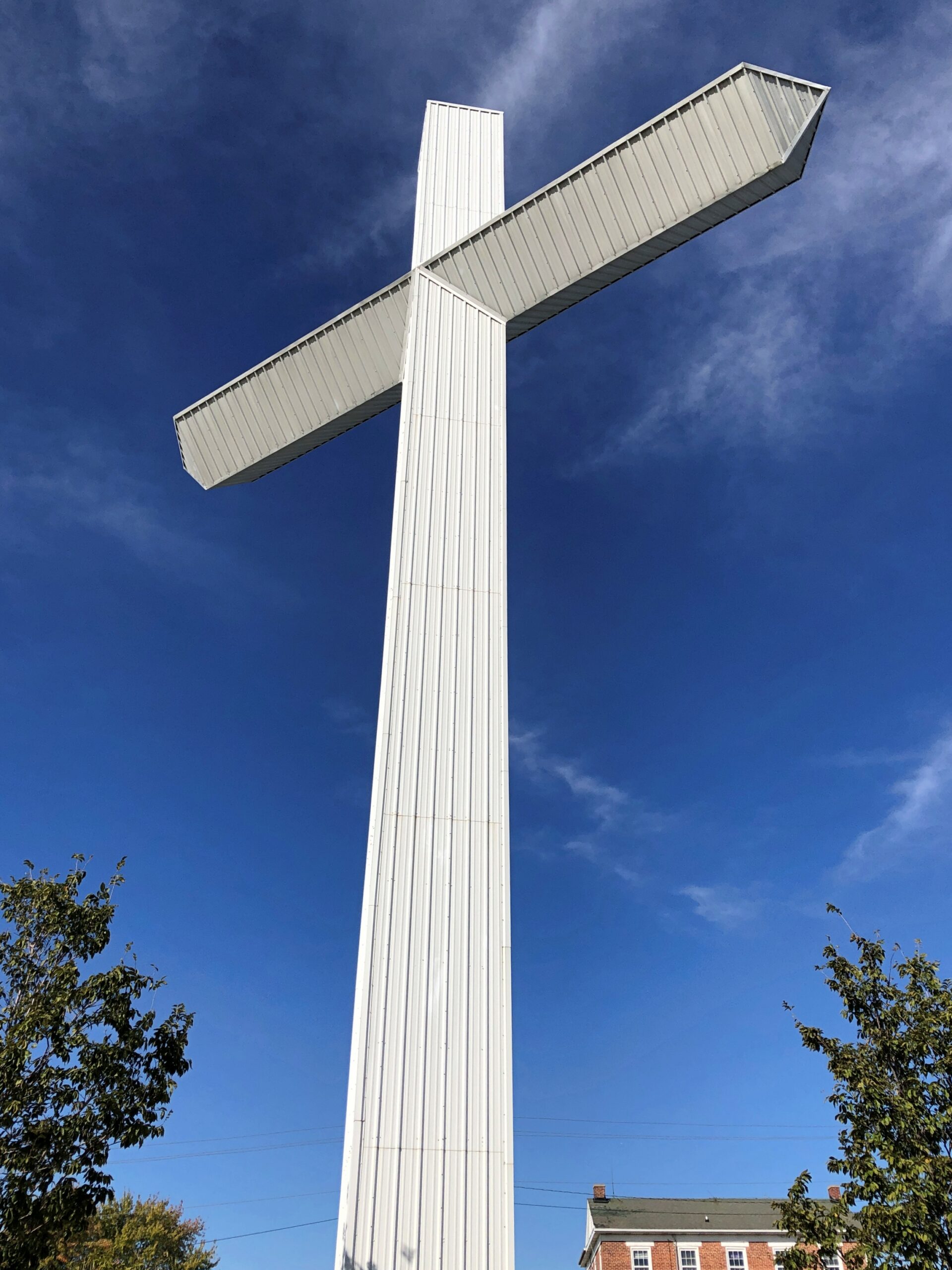
The Richmond, Indiana location is the third of three for Uranus, and I think the only one with dinosaurs —
— and a 100-foot cross of corrugated steel over a metal frame.
Until about 10 years ago, the property belonged to New Creations Chapel, which also included a church building, boarding school for troubled teens and a Bible college. The ministry, for reasons its web site explains in some detail, sold the property to Uranus, including the cross.
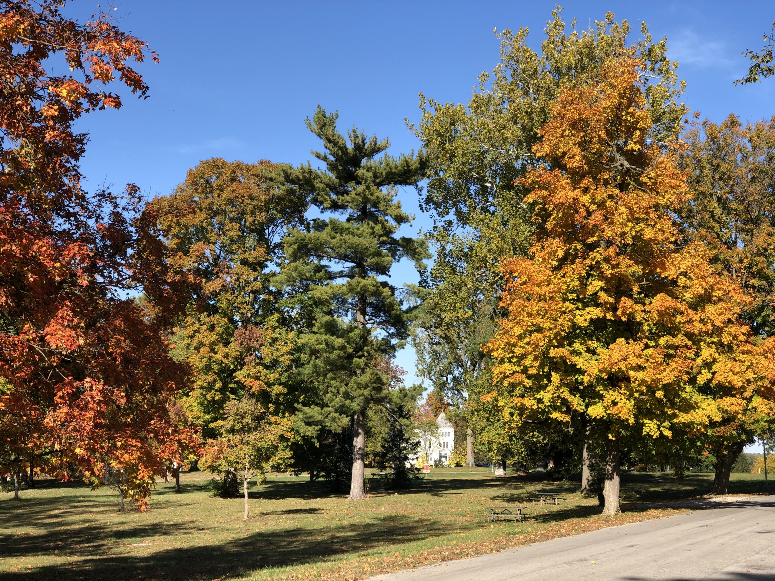
Heading through Richmond, Indiana, I stopped at an entrance to a large park to check my map. Glen Miller Park. A colorful spot in October.
Not named after the bandleader, which would be Glenn Miller Park. “Glen Miller Park was established in 1885 and was named for Colonel John Ford Miller, who was a railroad executive during the late 1860s,” the city of Richmond says. “Colonel Miller bought the land from Nathaniel Hawkins in 1880, with the intention of transforming the land into a park.”
So Glen Miller as in glen, a term that evokes pleasant Scottish valleys. I was just about to be on my way when I noticed a statue.
It was another of the 12 Madonna of the Trail statues, located at the edge of the park, where it meets US 40. Unlike the earlier one in Springfield, I hadn’t sought it out. It was just there. One’s travels, like life, can be strange sometimes.
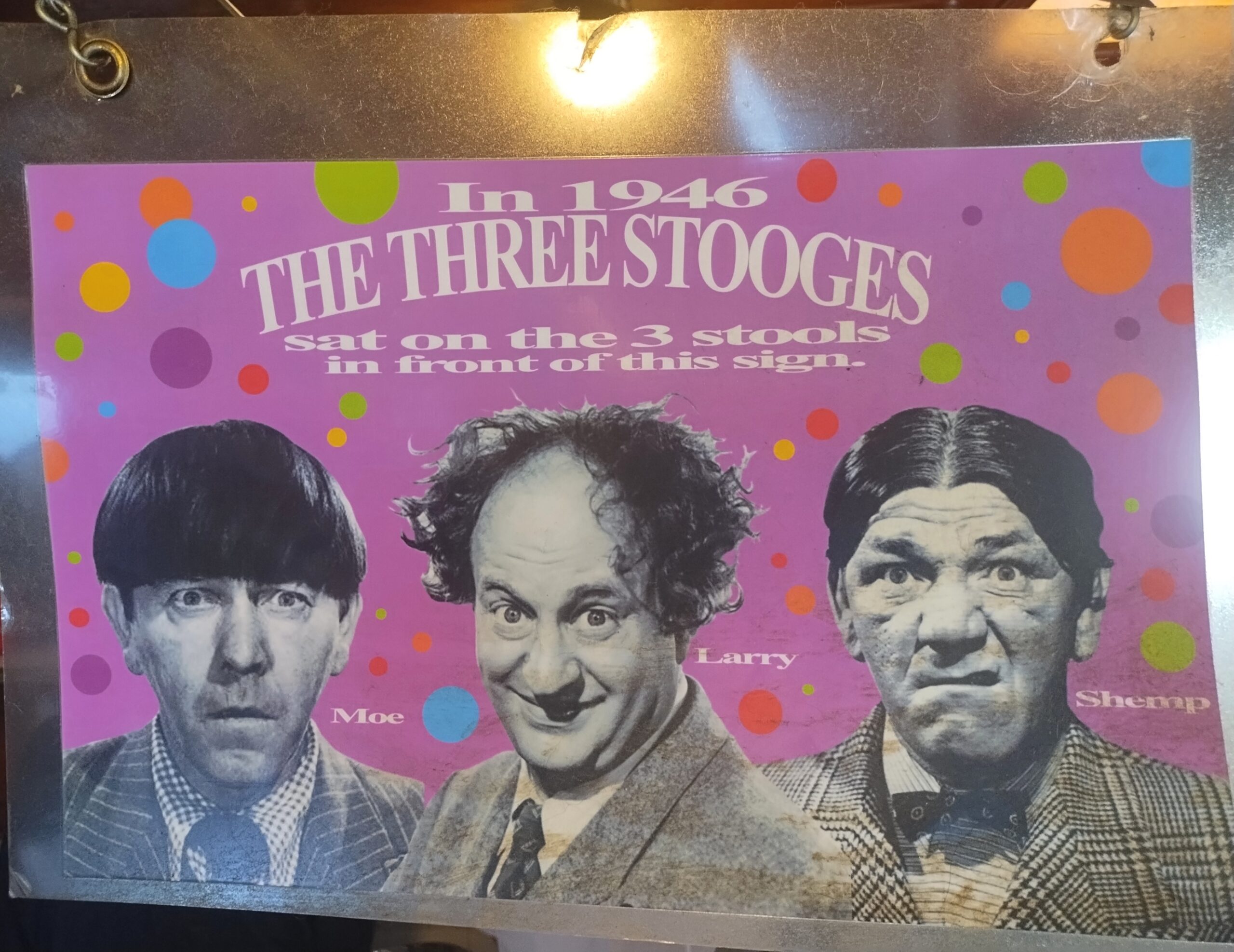
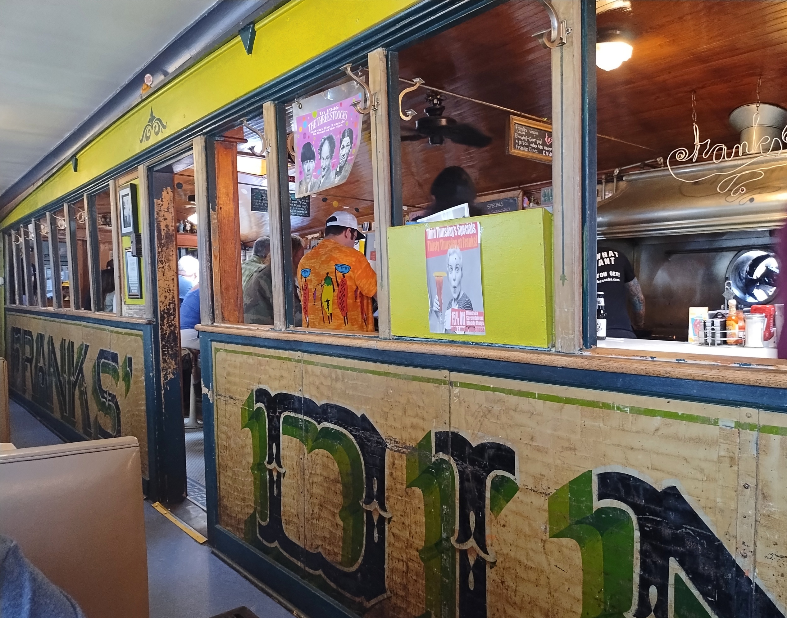
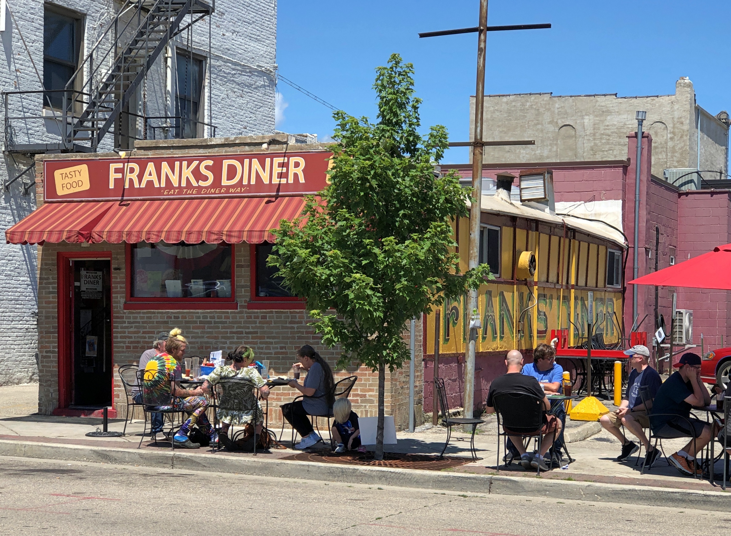
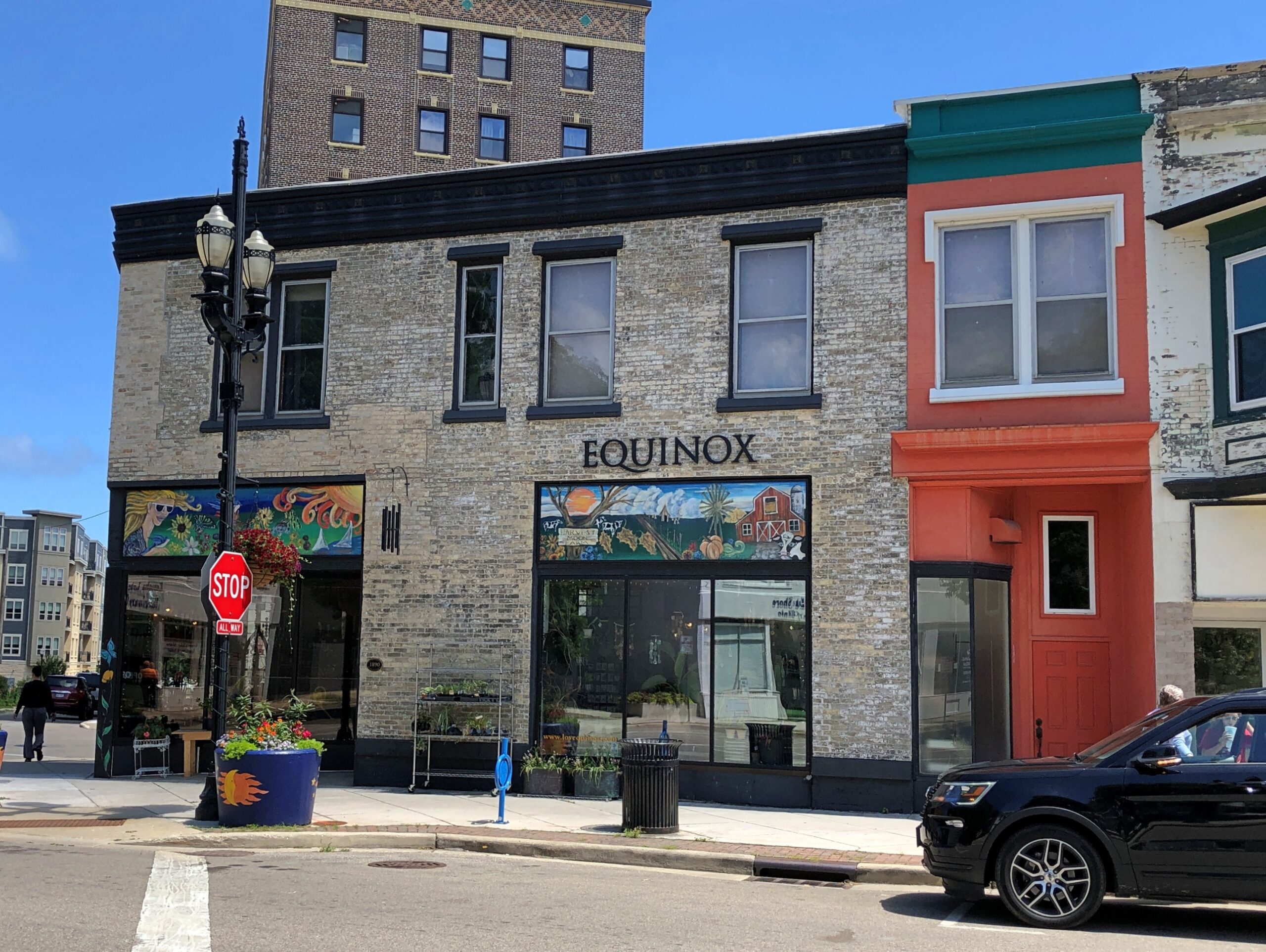
The poster is on a window at Franks’ Diner, formerly an exterior window, but with an expansion of the diner many years ago, now facing the added section, where Ann and I had lunch on a late July Friday. Kenosha, home of Franks’, was another stop in our recent rambles around southeastern Wisconsin.
Not only is the 99-year-old Franks’ still there, it’s still dishing up dandy diner fare at popular prices. Back then, I wrote:
The place had that diner smell: eggs and meats and hash browns and coffee. It also had that diner sound: the murmur of conversation, workers calling to each other, silverware scraping plates, metal clinking metal, the hiss of the griddle.
It was packed. A row of people sat at the counter, while others were at booths in the small room added to the counter room. A line of people waited for their seats in a long row behind the people at the counter.
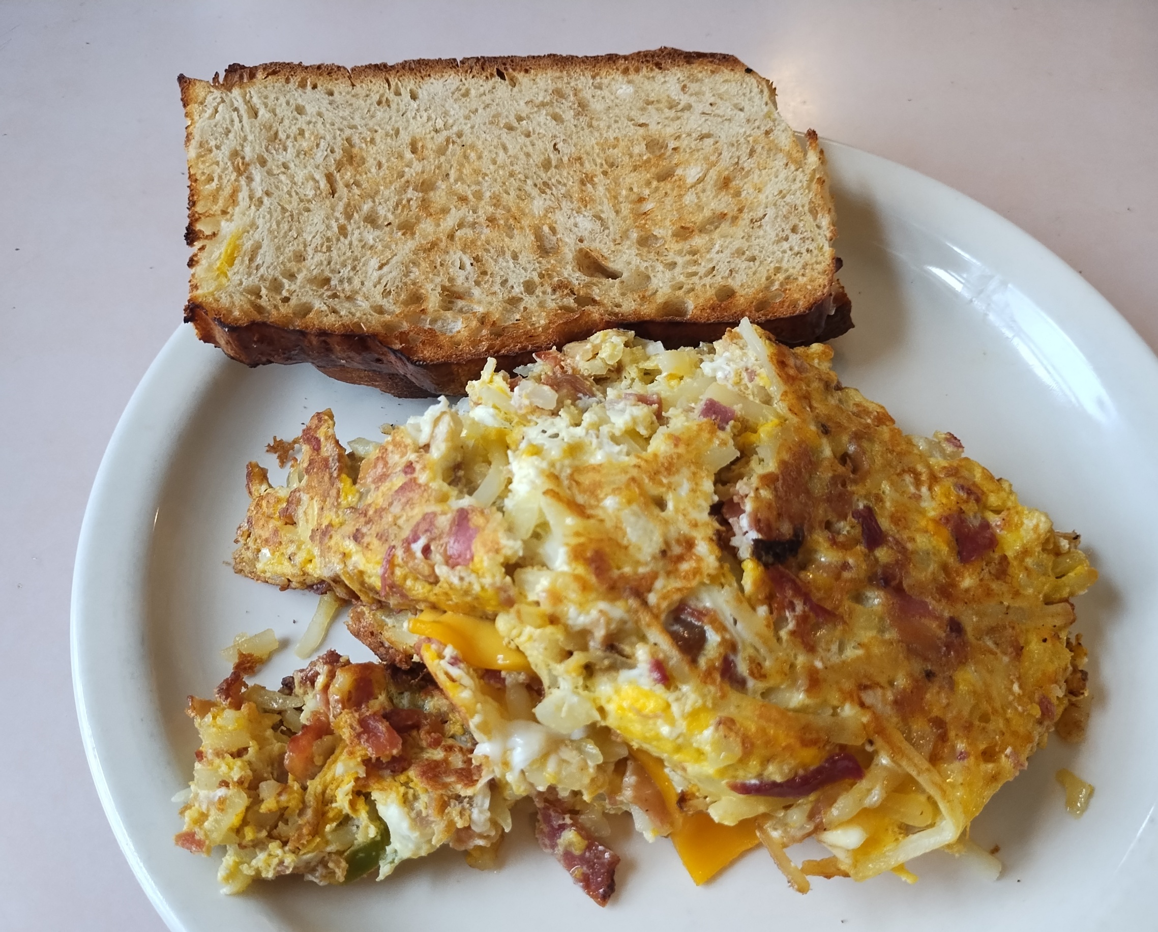
That’s exactly the same as our July visit, except that people waited outside, since it was summer instead of winter and (of course) prices were higher. Once seated, I had the Garbage Plate. I’d skipped it last time, and I wasn’t about to miss it this time around.
2012: The star of the show is its Garbage Plate, a concoction of hash-brown potatoes, eggs, green peppers, onions, jalapeños (if you want them), and a choice of three or fewer meats (or including no meat). The thing is seriously large. The standard Garbage Plate has five eggs.
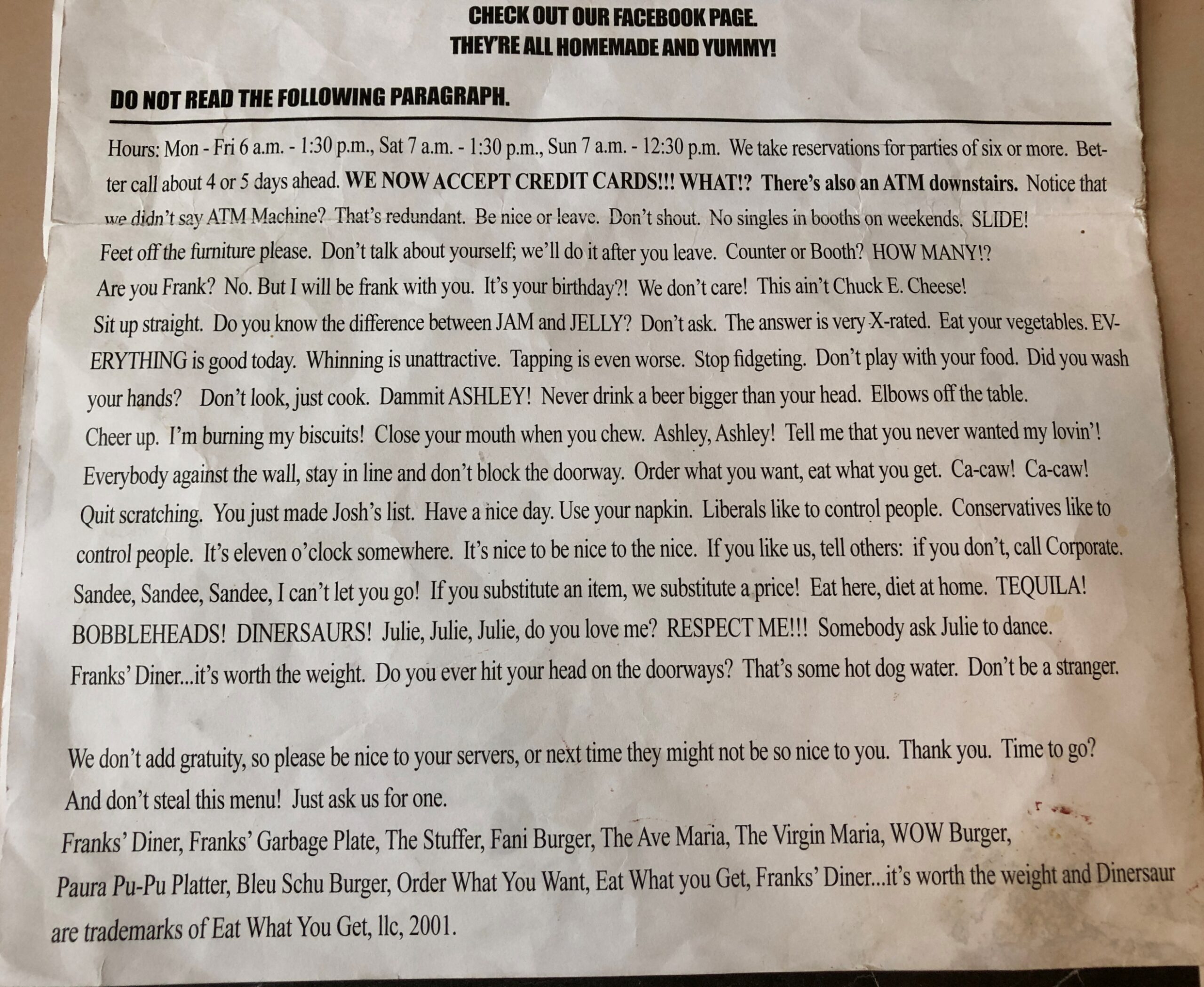
The restaurant also supplies some reading material.
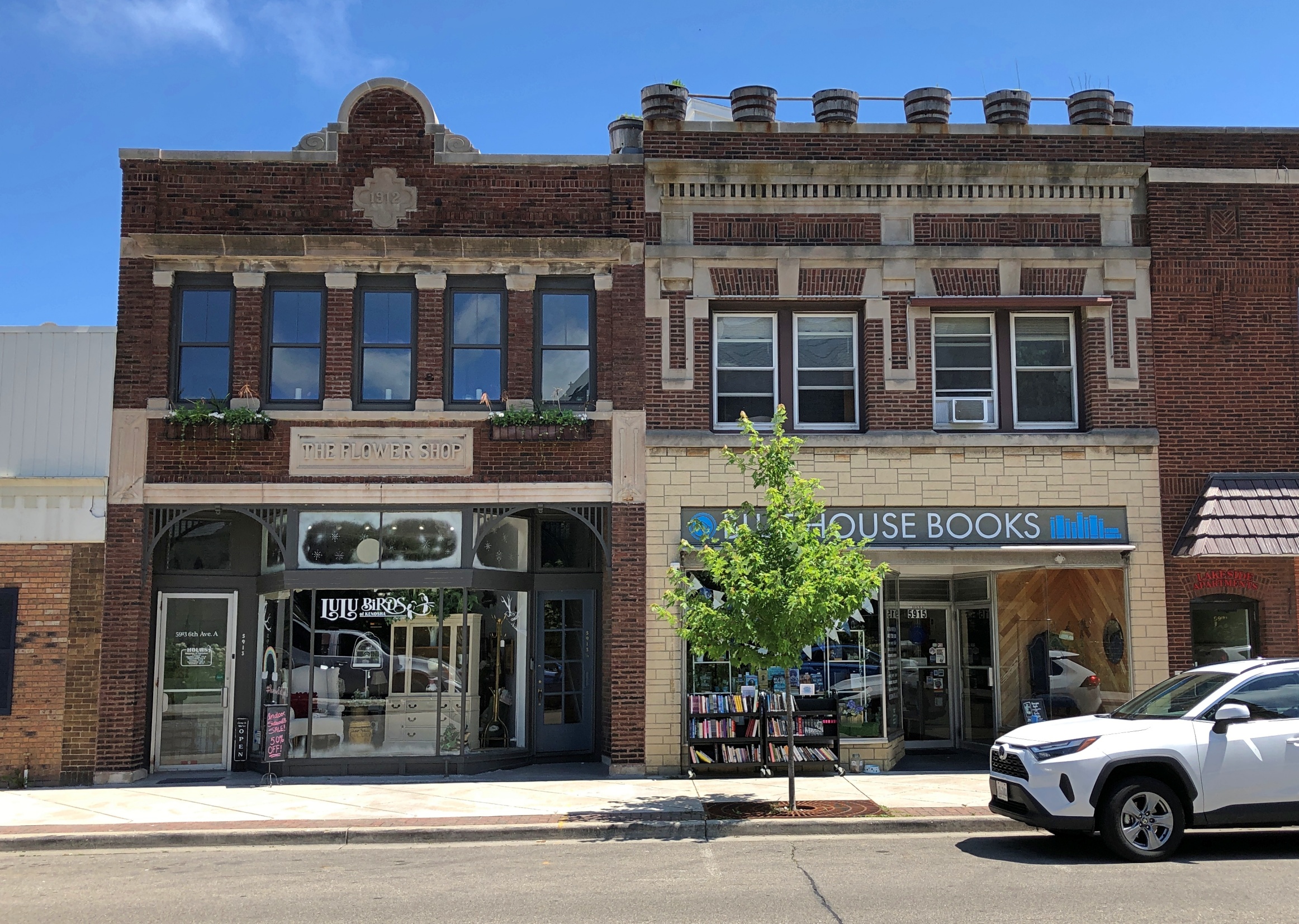
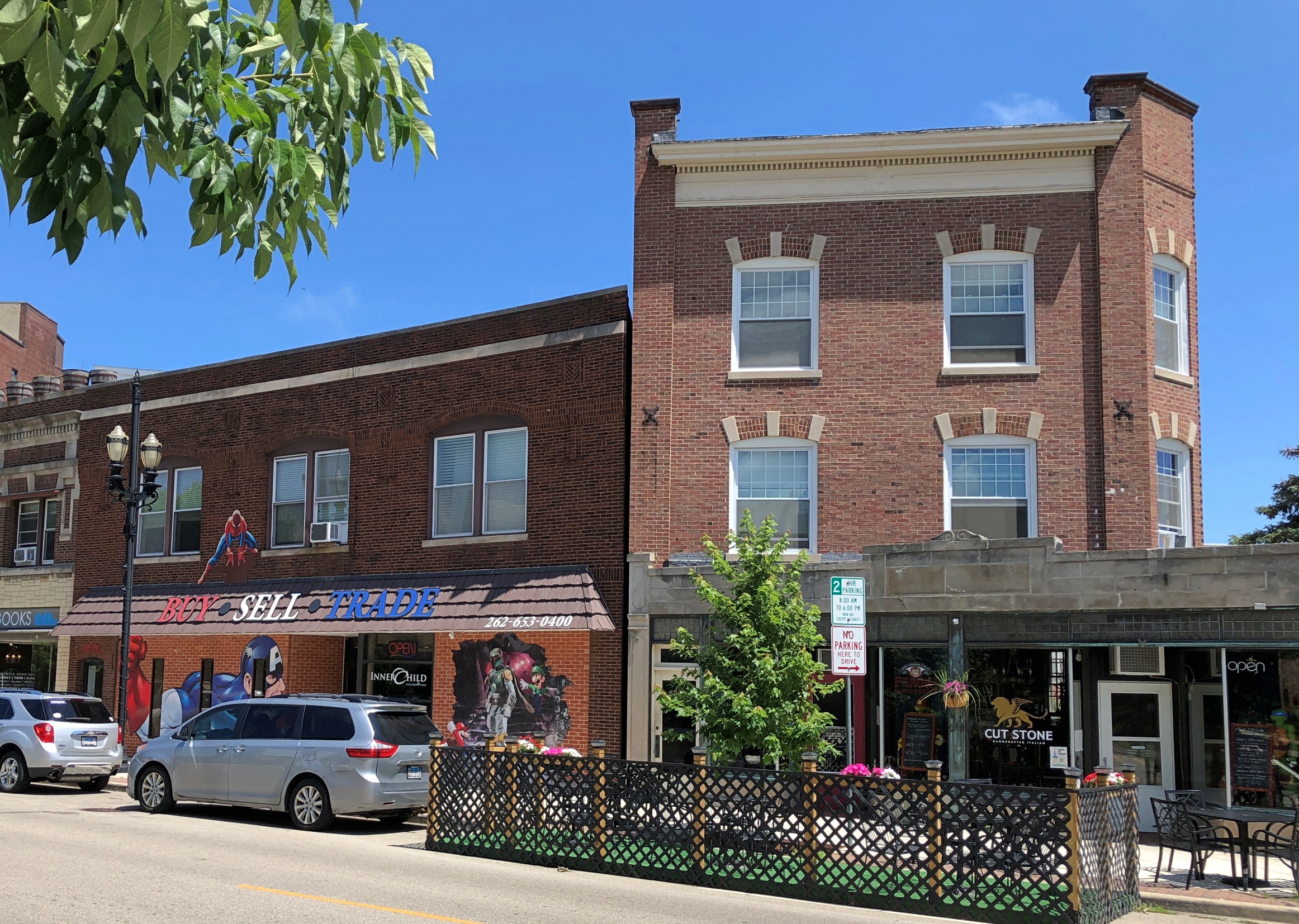
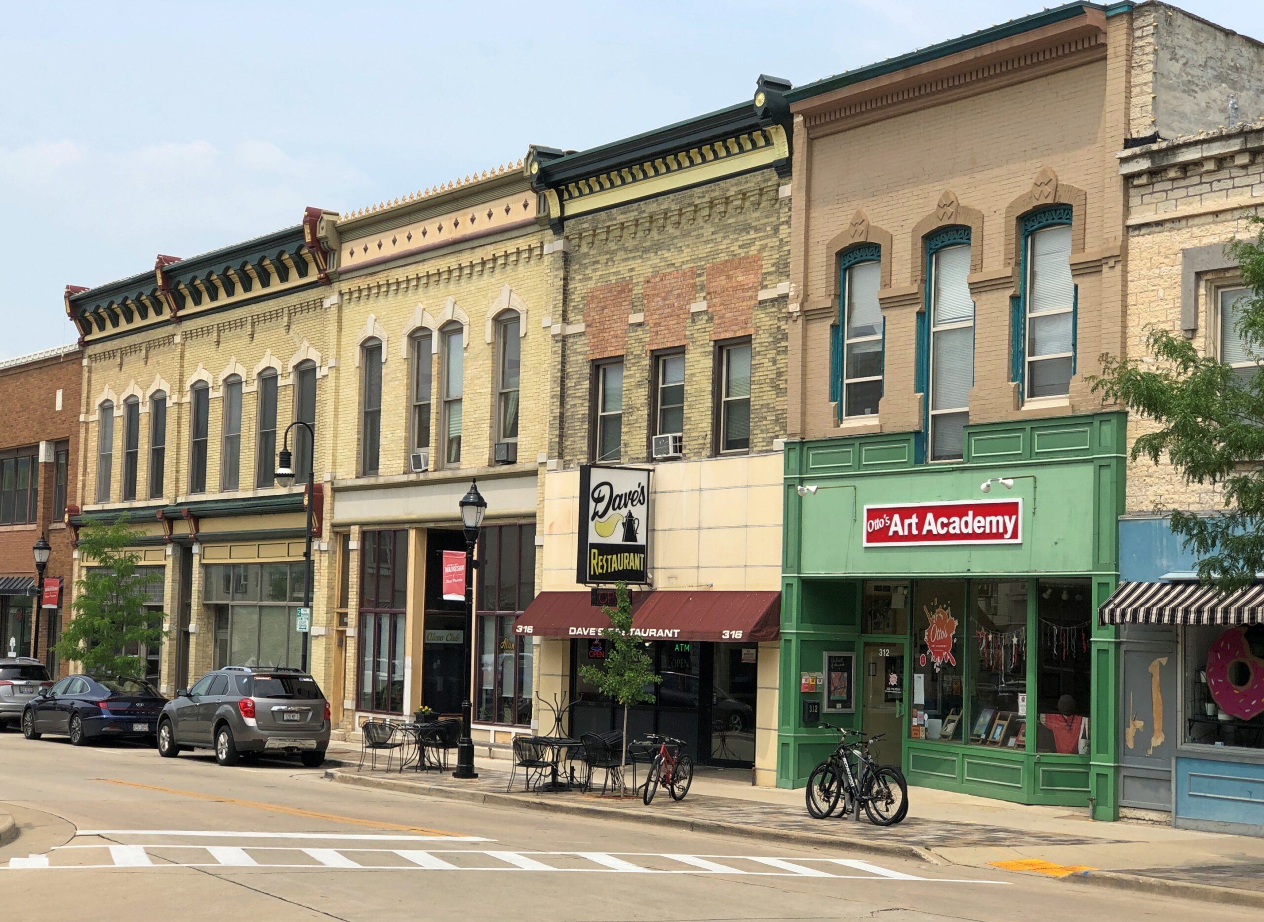
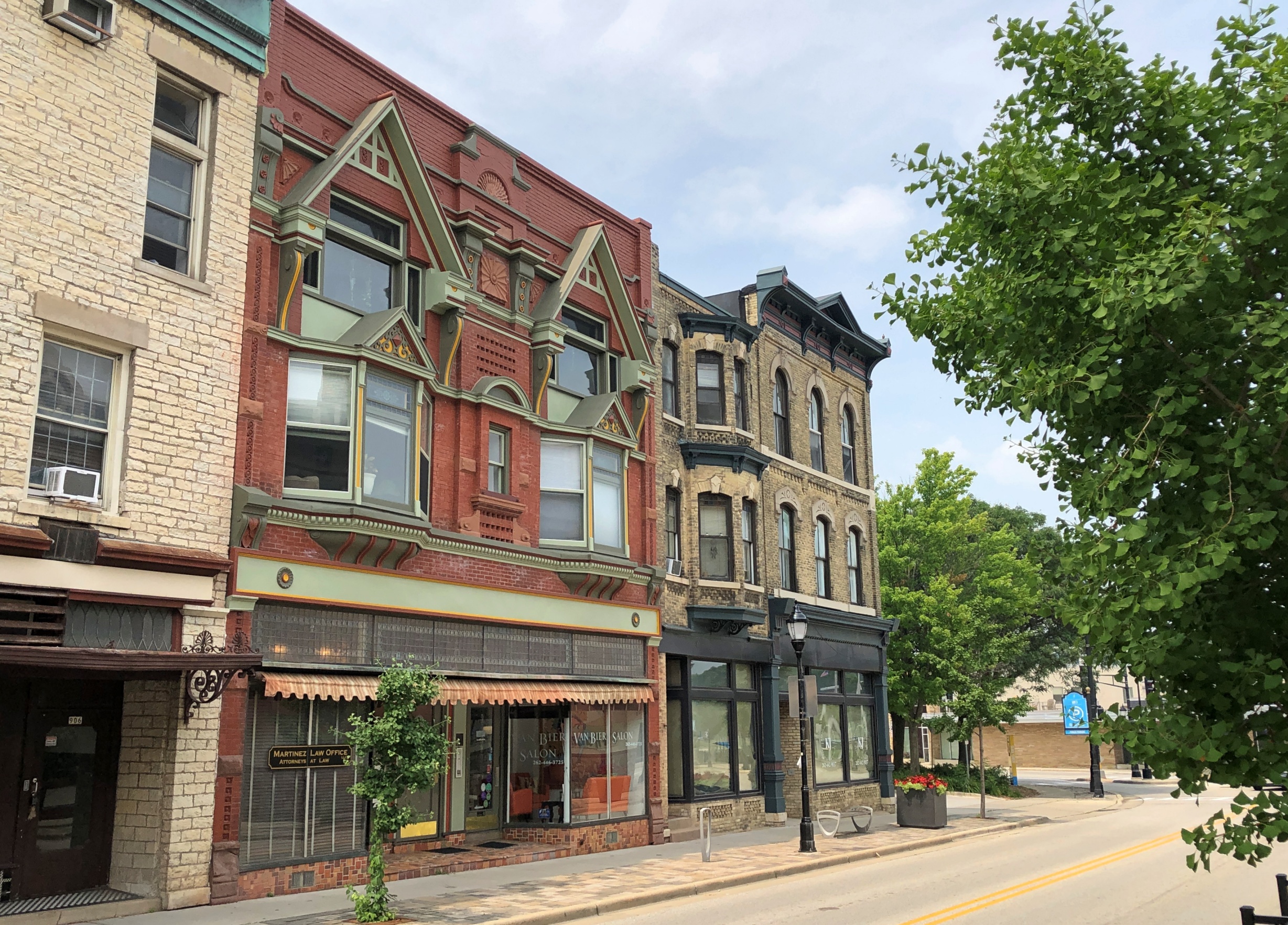
After lunch, we went a few blocks away and parked the car in the shade of large trees in Library Park. Ann waited in the car with the windows down – it was very warm, but not too warm for a few minutes of that – while I wandered around the immediate area, including a couple of streets of storefront retail in vintage structures.
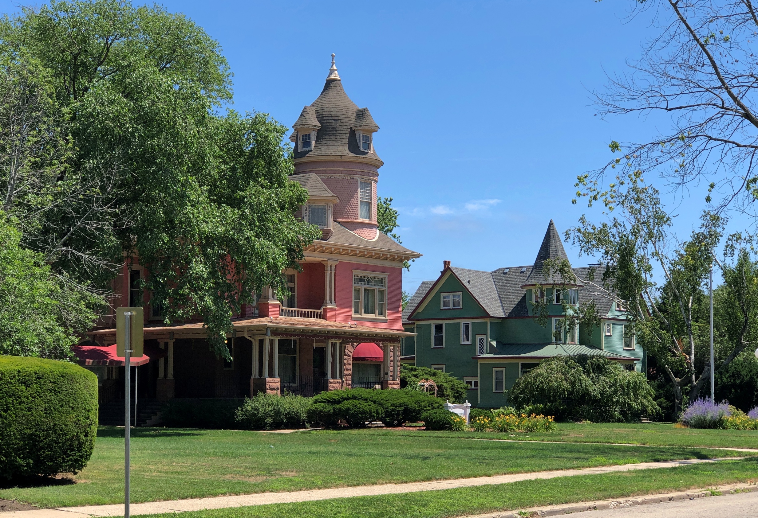
Houses across the street from where we parked.
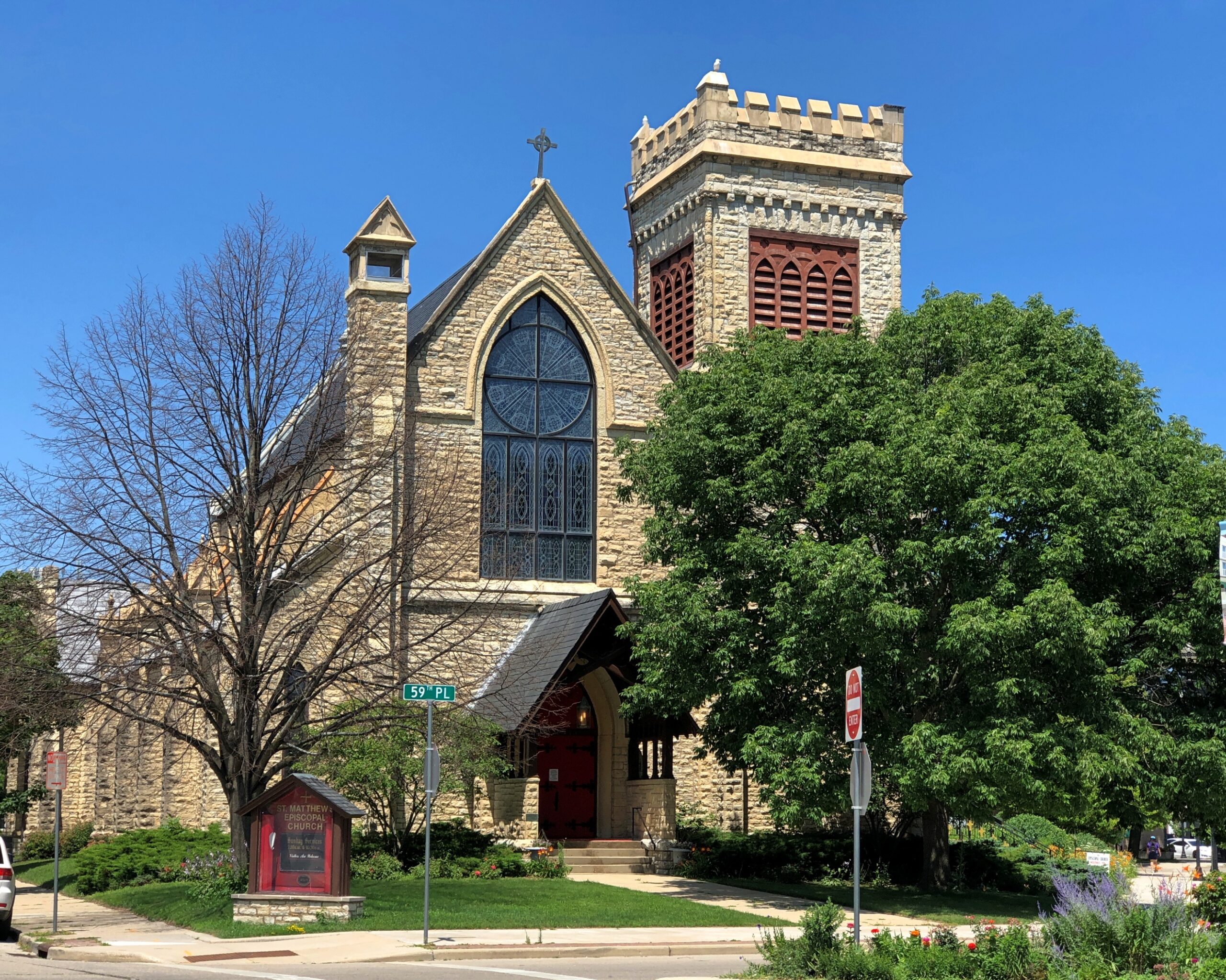
The nearby St. Matthews Episcopal Church.
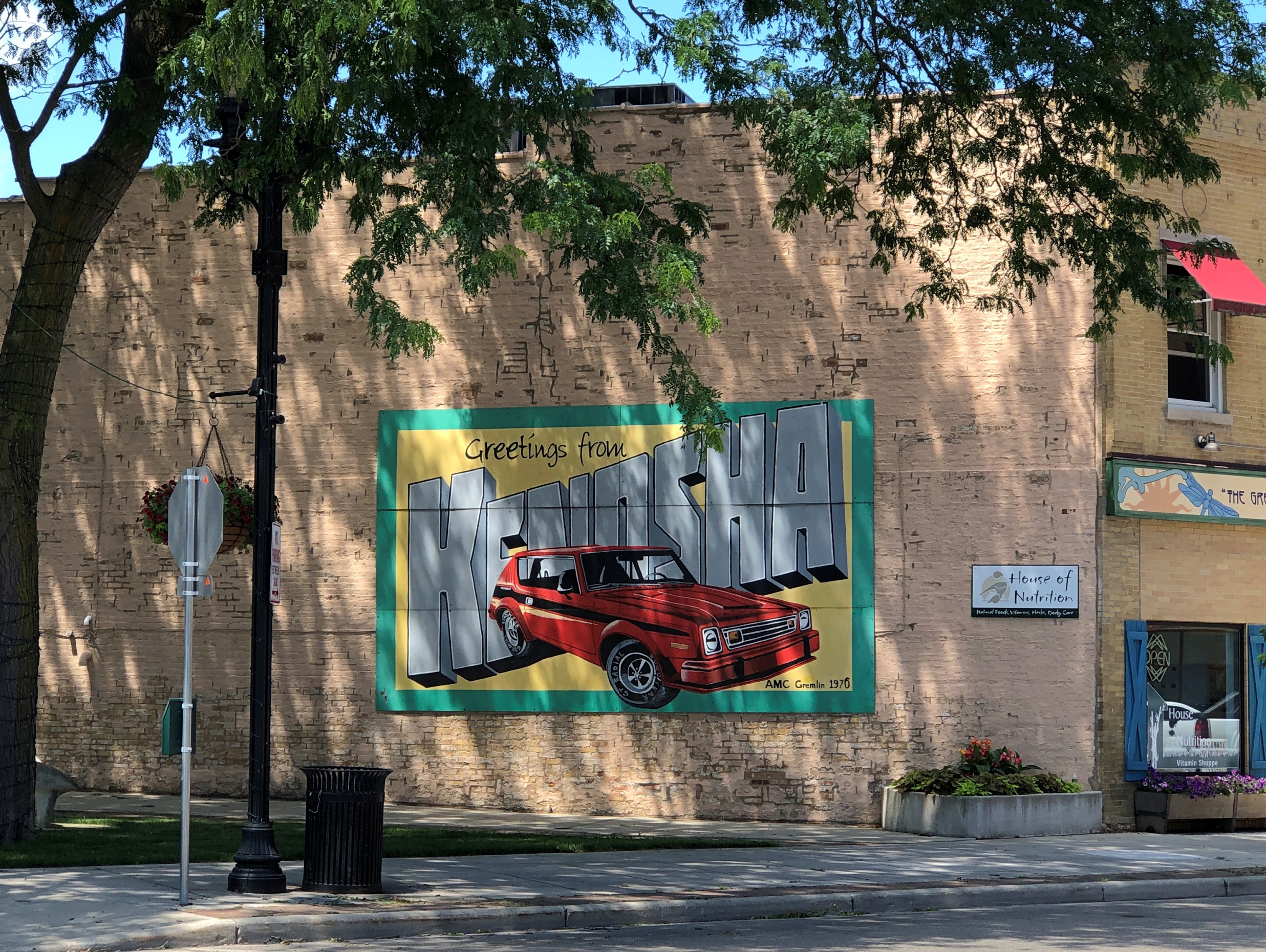
The inevitable welcome mural. The 1970 Gremlin is an unusual touch. But they were made in Kenosha, so not that unusual.
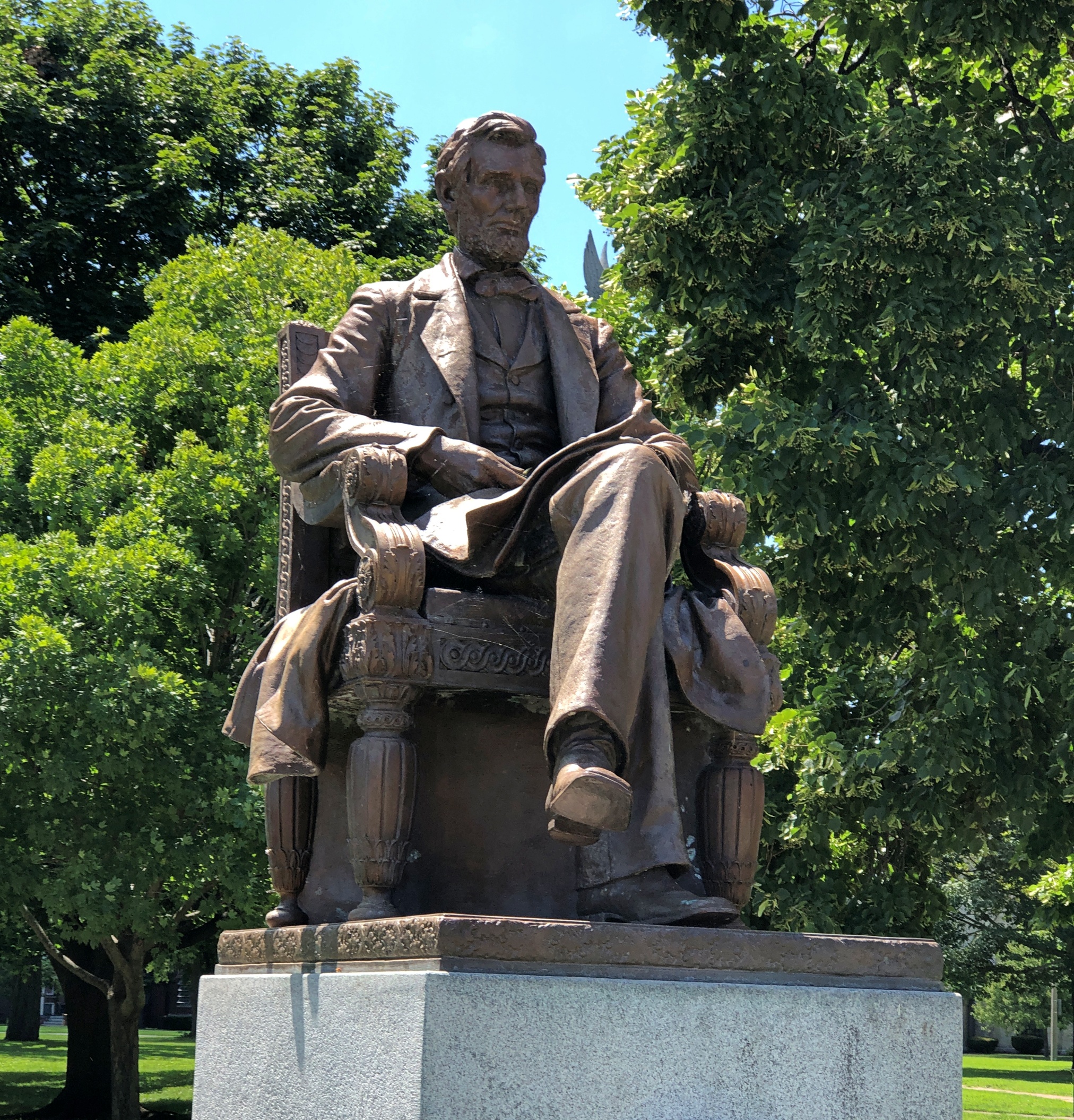
At the edge of the park, a seated Lincoln. Sculptor Charles Niehaus (d. 1935) did the work. Just one of many that he did all over the place. The president has been sitting there since 1909, centennial of his birth, with restoration work done in more recent decades.
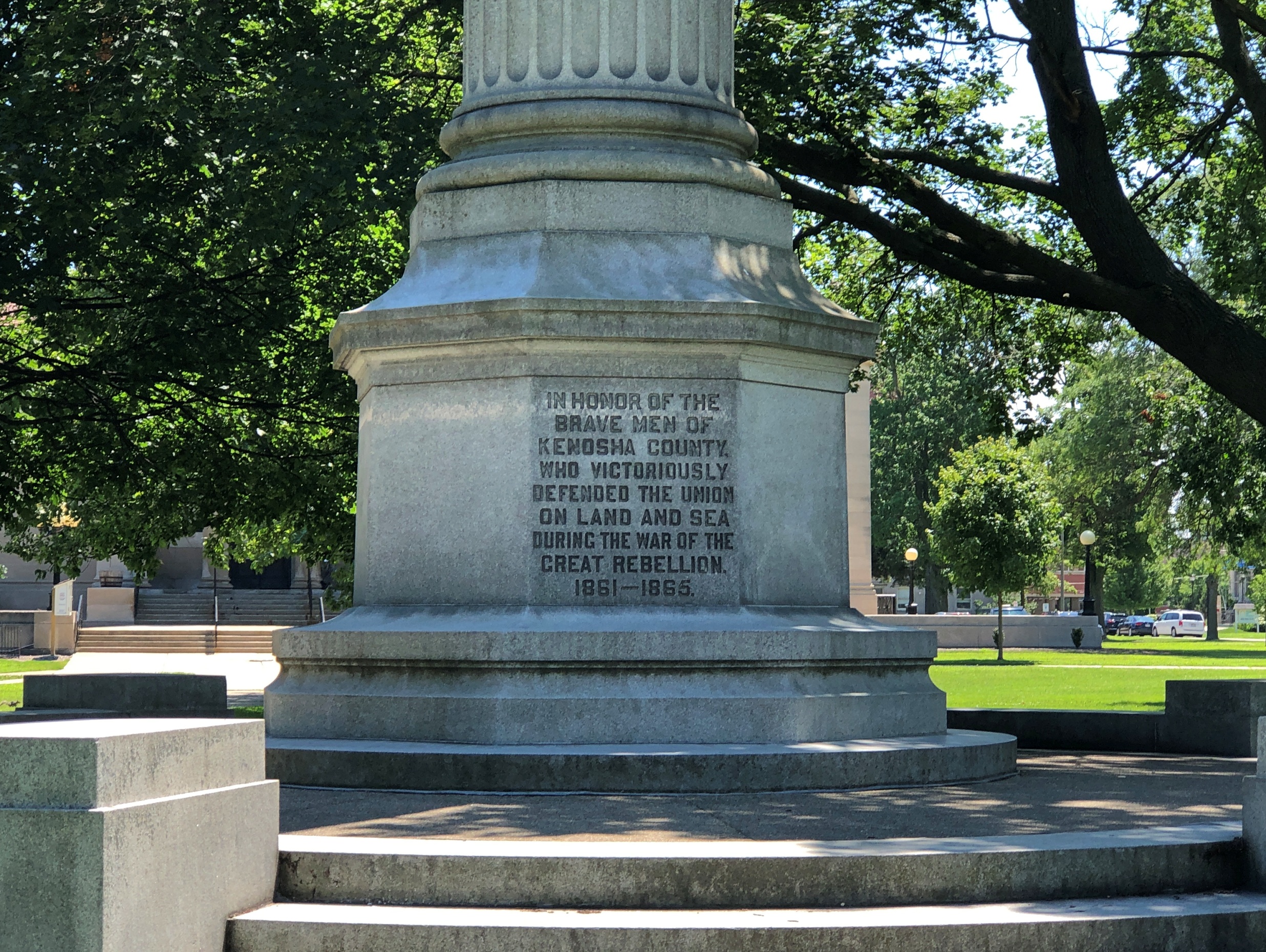
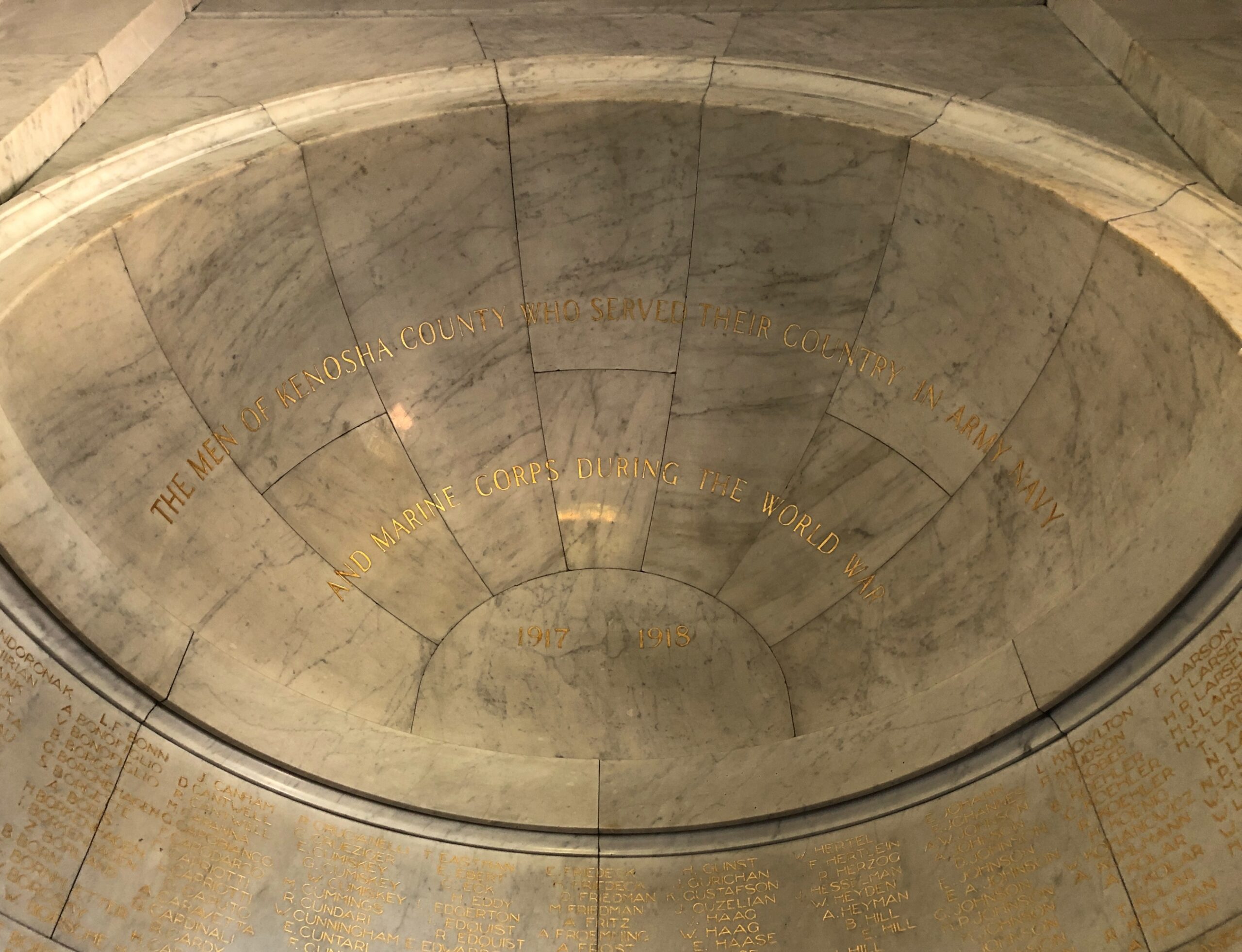
Nearby in the park, Kenosha’s Civil War memorial, called “Winged Victory” on electronic maps, a name that gets right to the point.
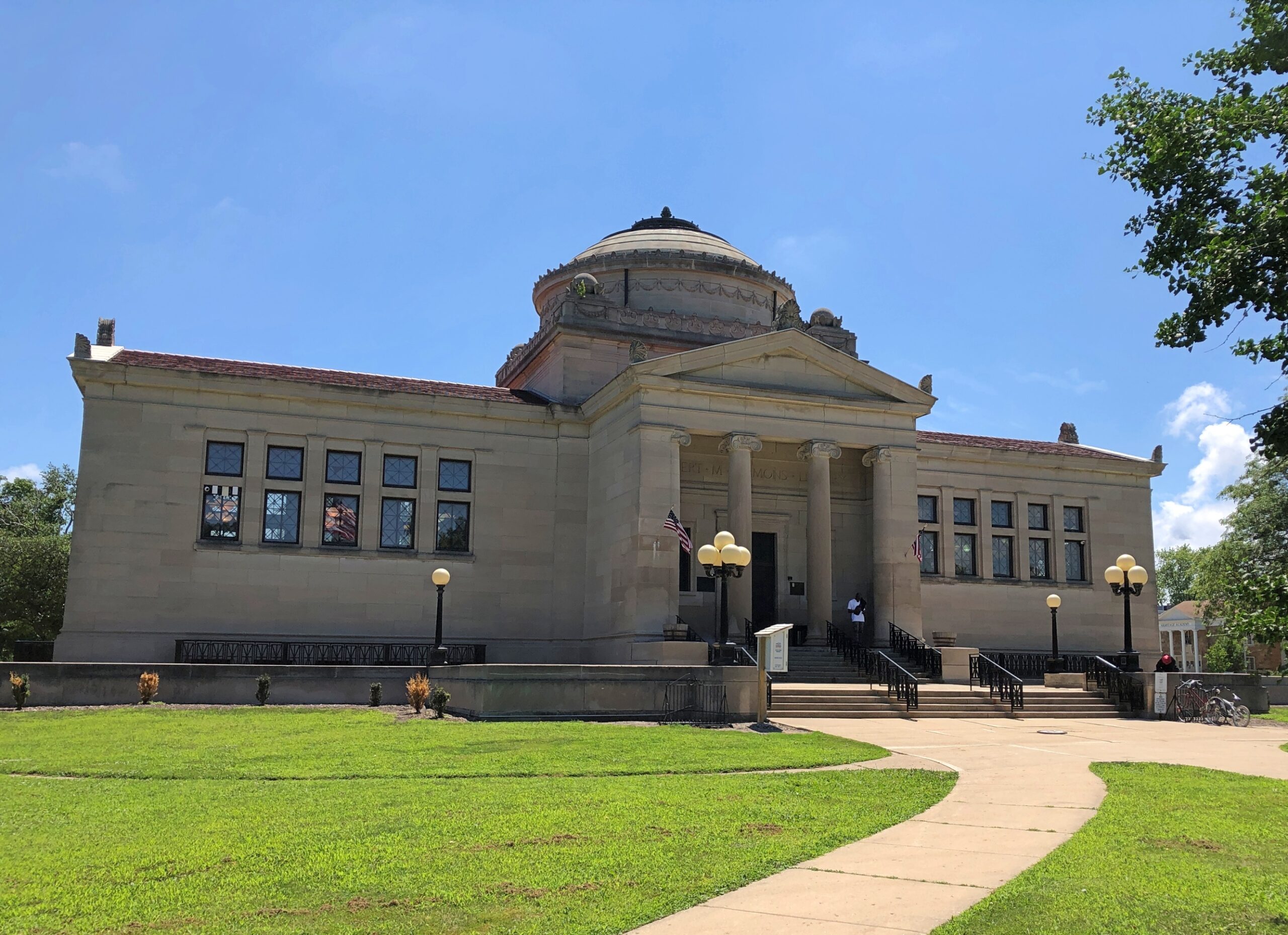
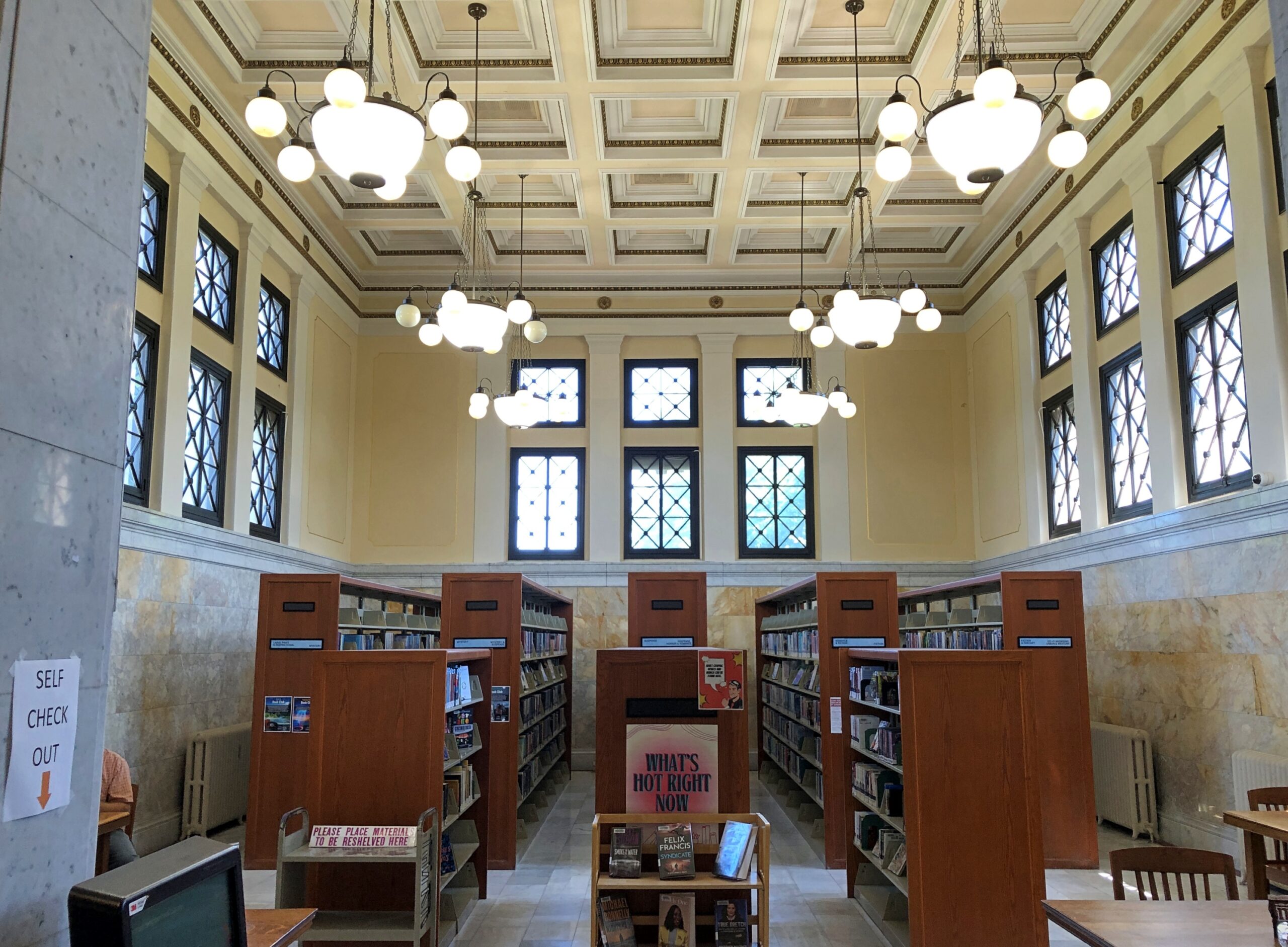
It’s Library Park because of the Gilbert M. Simmons Memorial Library, a branch of the Kenosha Public Library system, dominating its side of the park. It has a little more heft than most municipal branch libraries.
When it opened in 1900, the building formed Kenosha’s main library. Daniel Burnham designed it.
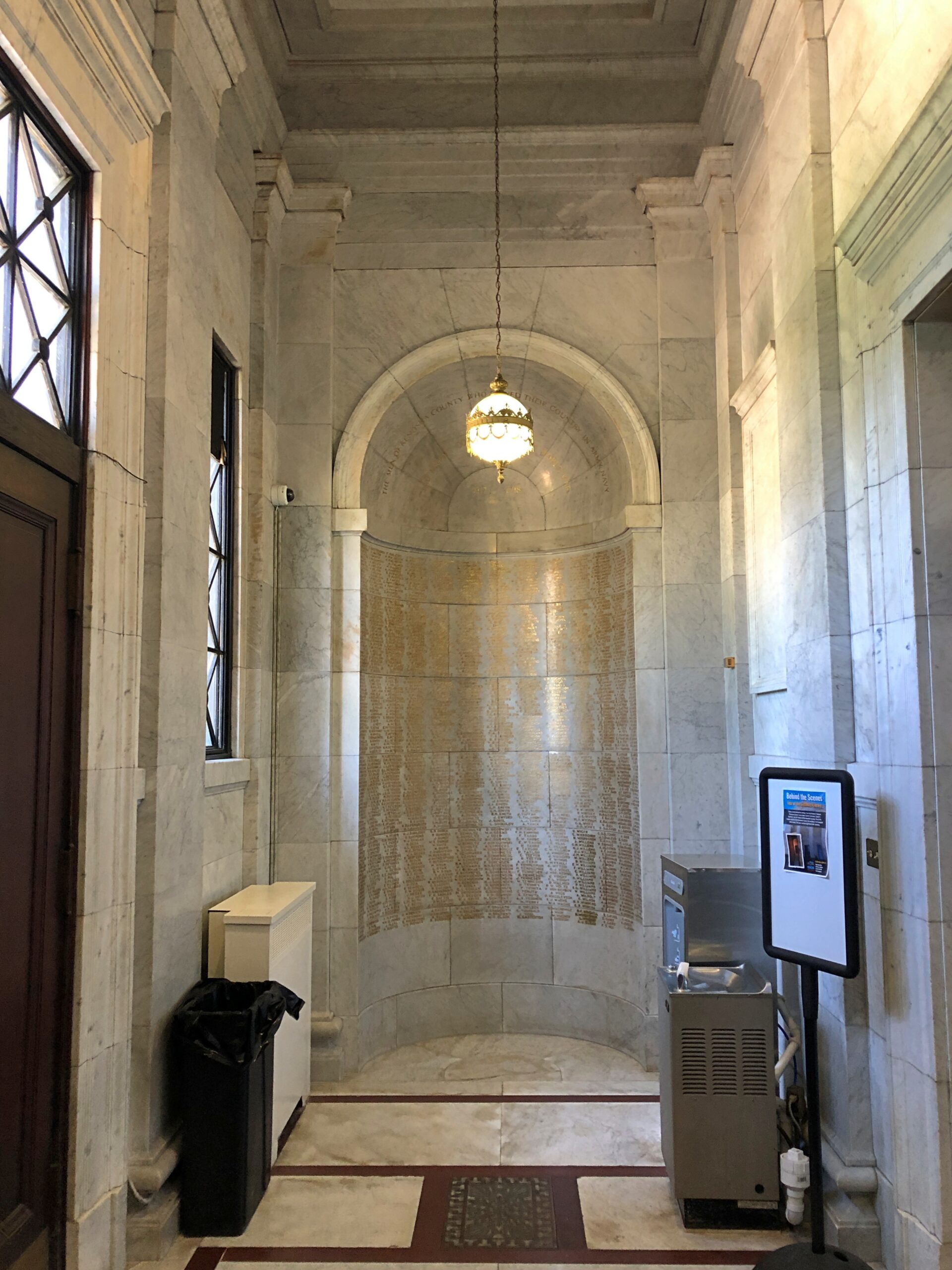
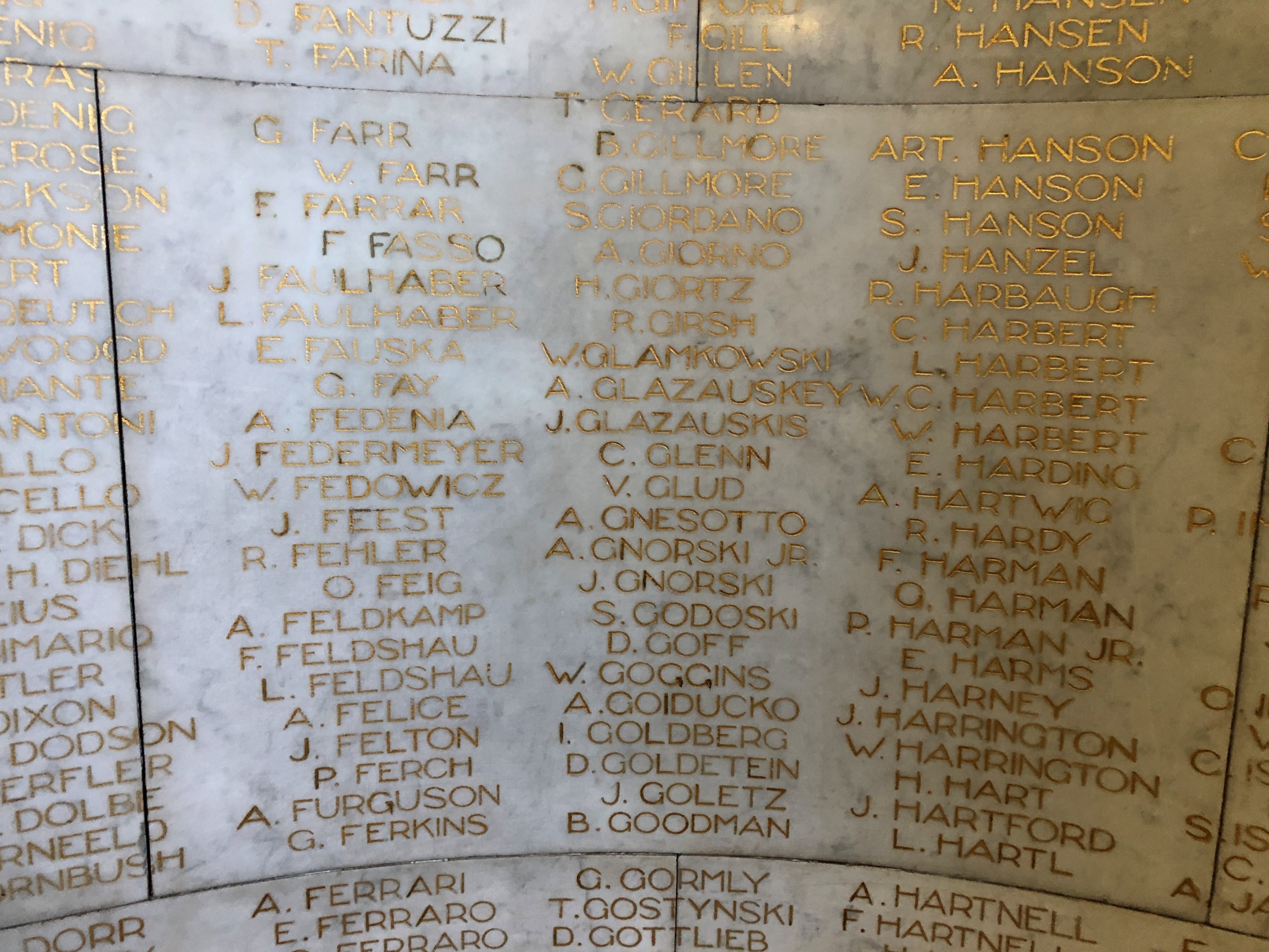
The Civil War veterans have their memorial outside. Great War vets are honored inside the library.
We’d happened on the Library Park Historic District, surrounding Library Park. The park itself goes back to the early years of Kenosha, when the land was a New England–style town commons. Forty-two properties, built from 1843 to 1930, form the district. A diner and an historic district: just the thing for a warm summer day stroll.
The other day I wondered how long it would take to count a million dollars’ worth of nickels and dimes a million times. That’s one of the dream images from “Minnie the Moocher.” Not just a dream, but an opium dream. After all, no sooner does Minnie learn to kick the gong around, does a vivid dream of wealth begin, all shiny and metallic, ending with:
She had a million dollars worth of nickels and dimes
And sat around and counted them all a million times
Let’s say half the dollar value is nickels, half dimes. That would be 5 million dimes and 10 million nickels. So 15 million individual coins. Let’s also say it takes a second to count each, just to keep it simple. That would be 15 million seconds, or 0.475 years (roughly, I shaved off a few places). Counting them a million times would thus be (roughly) 475,000 years.
Of course, if it’s an opium dream, the niceties of time and such don’t apply. Still, it sounds like a hellish task of a Sisyphean kind. But maybe it would be a heavenly task, if you have no sense of the passage of time.
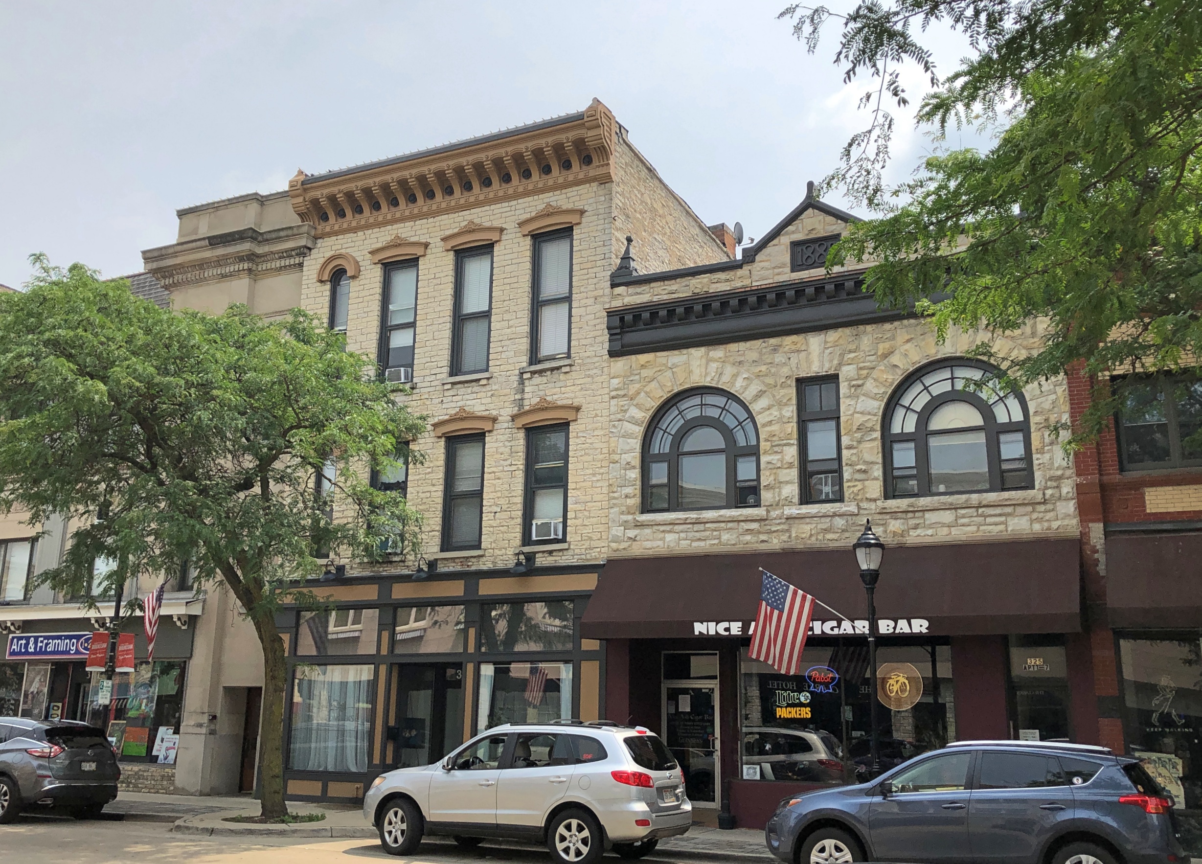
I didn’t sit down to figure all that out until I was at my desk, but the question came out of nowhere during a short interstate drive just before the end of July, up in the southeast corner of Wisconsin. One destination that day, a Sunday, was downtown Waukesha, an outer suburb of Milwaukee, but a place with a distinct history of its own, where people came to take the waters once upon a time.
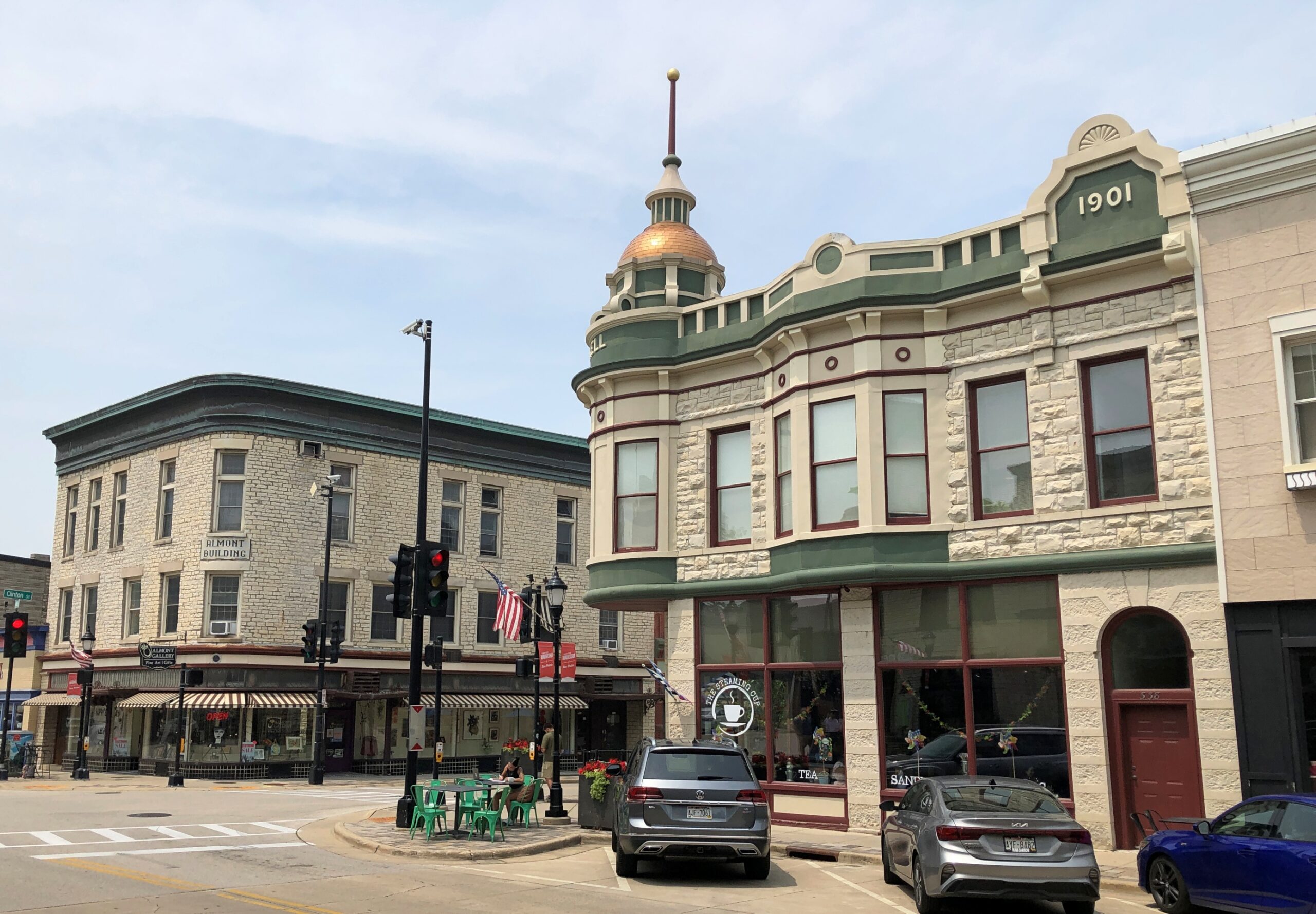
We spent some time near the five-pointed intersection of Main, Broadway and Grand, focal point of a handsome streetscape.
Now this is a set of buildings.
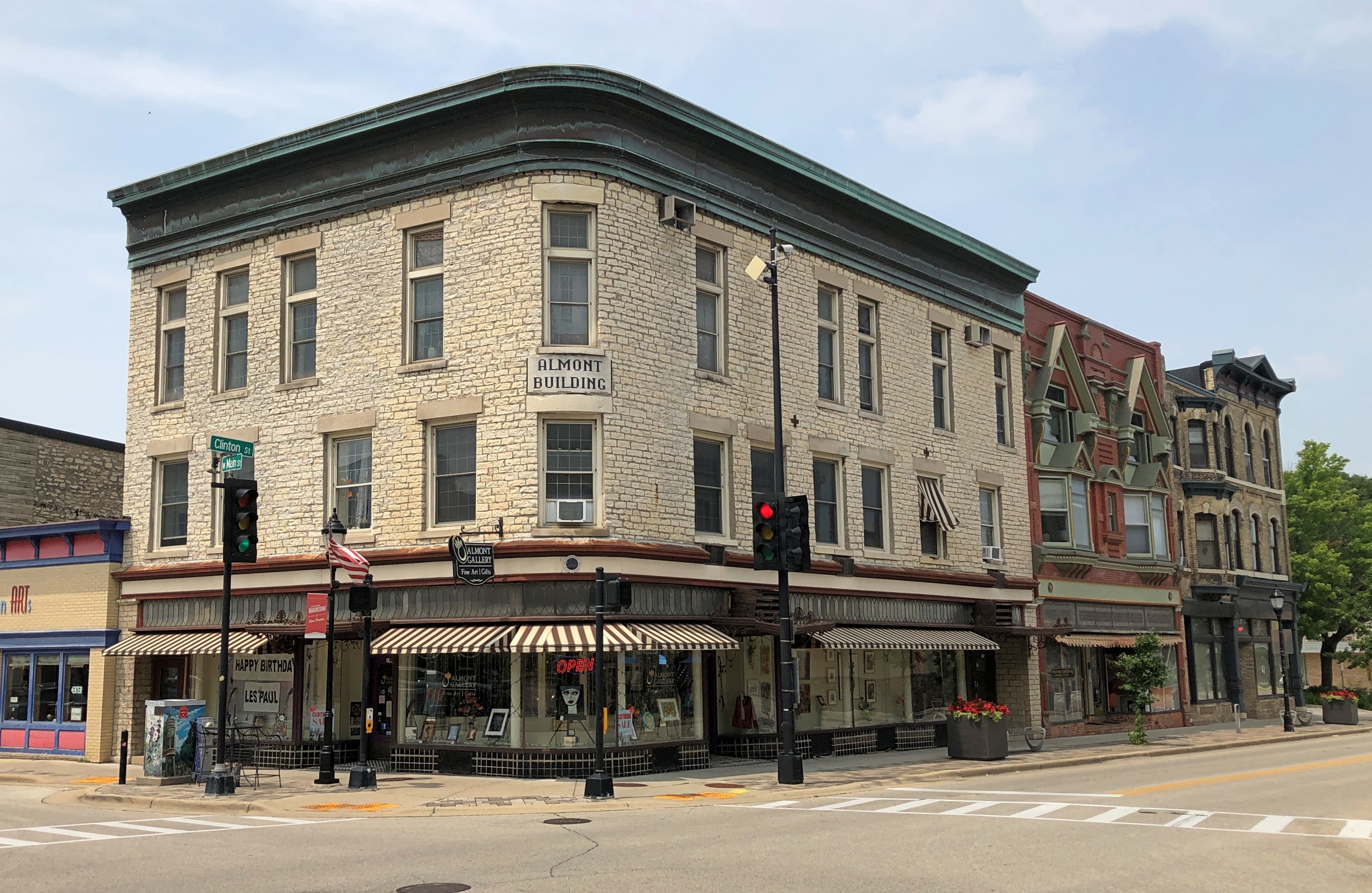
The Almont Building, whose original name was the Robinson Block.
“The core of the downtown, prior to 1856, consisted of freestanding wooden frame buildings, but a new era began after a massive fire nearly destroyed this northern section of Main Street,” the Waukesha County Historical Society & Museum says. “The Robinson Block was built in 1857 with fireproofing in mind and is the first Five Points building to use Waukesha limestone.”
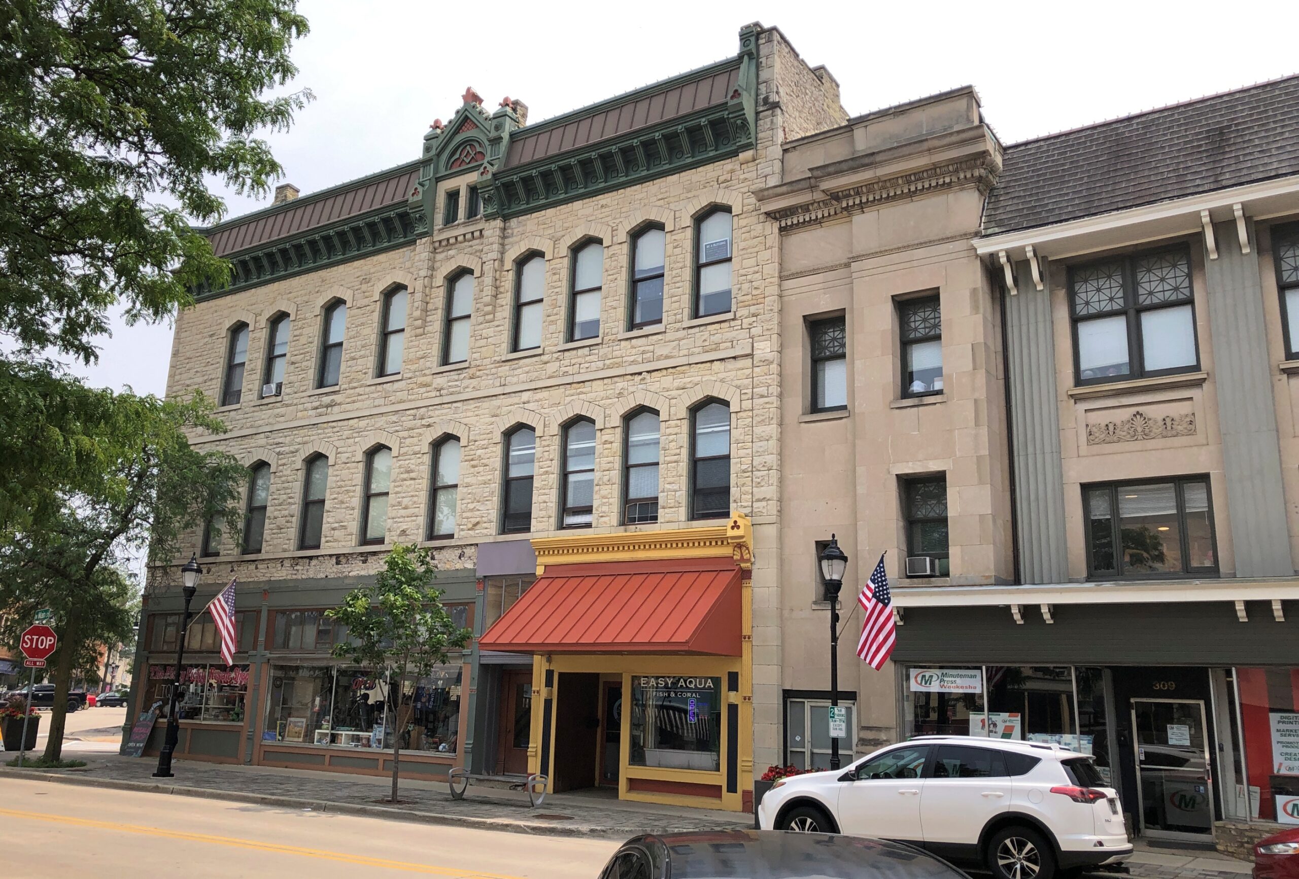
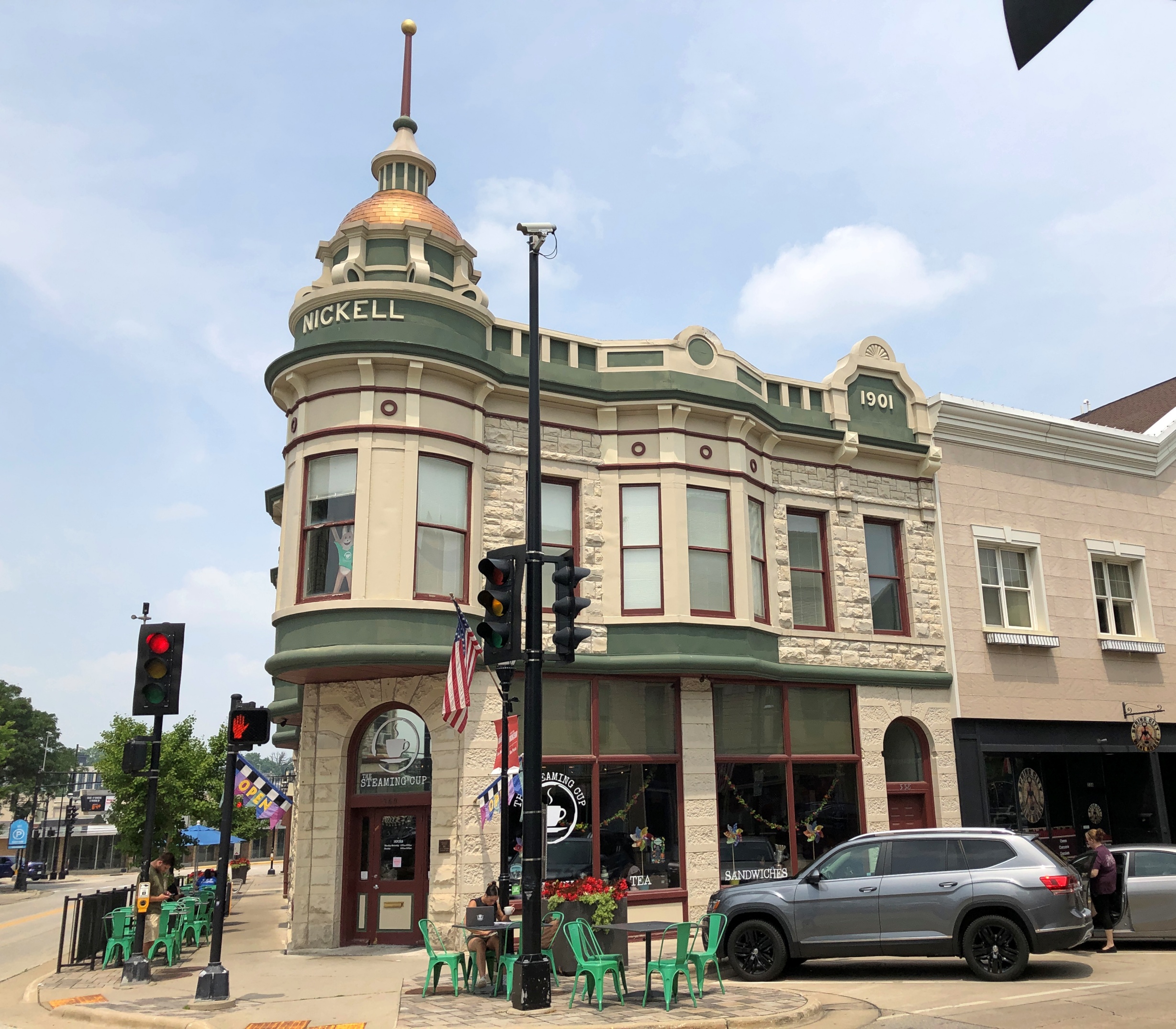
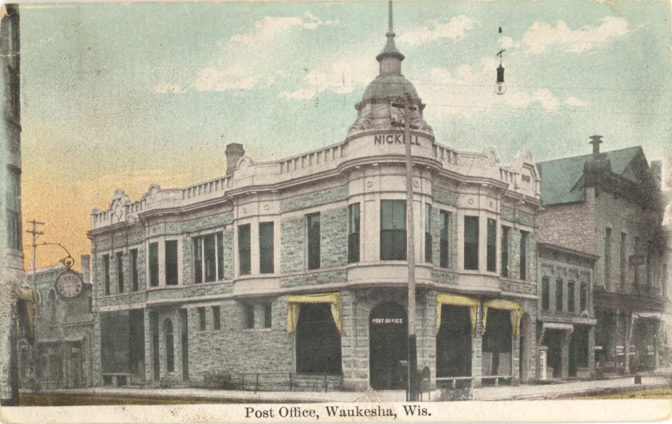
The Nickell Building, as it looked recently, and long ago.
“Built by Addison J. Nickell, local businessman and jeweler, the first floor housed the U.S. Post Office from 1902-1914,” notes the WCHS&M. “The work of Waukesha architect C.C. Anderson, this Queen Anne displays a projecting oriel and corner turret capped by a domed roof: both are covered by pressed metal.”
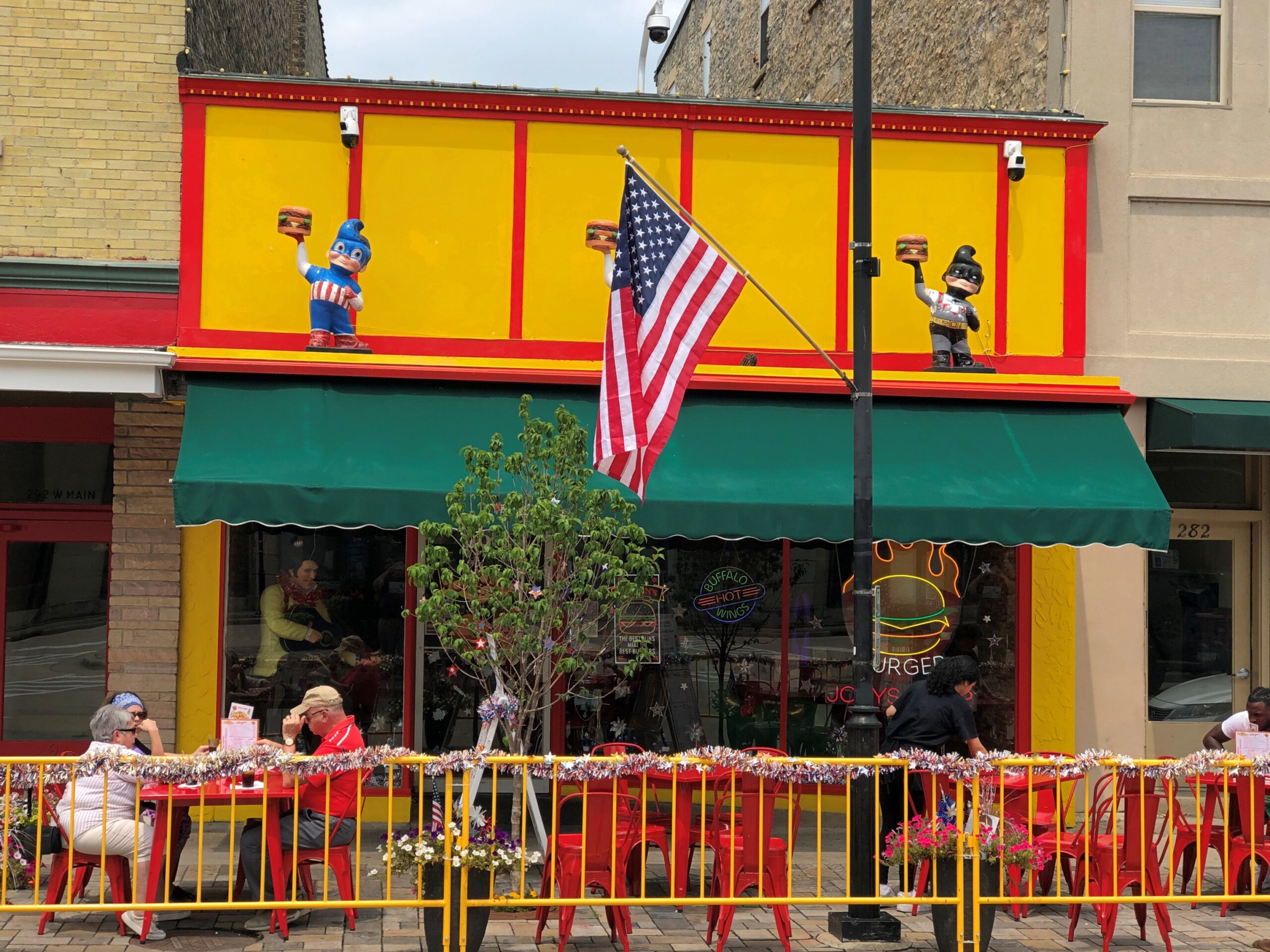
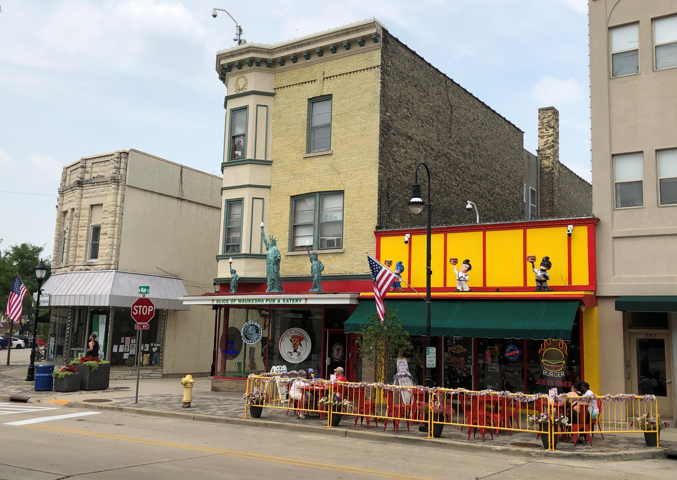
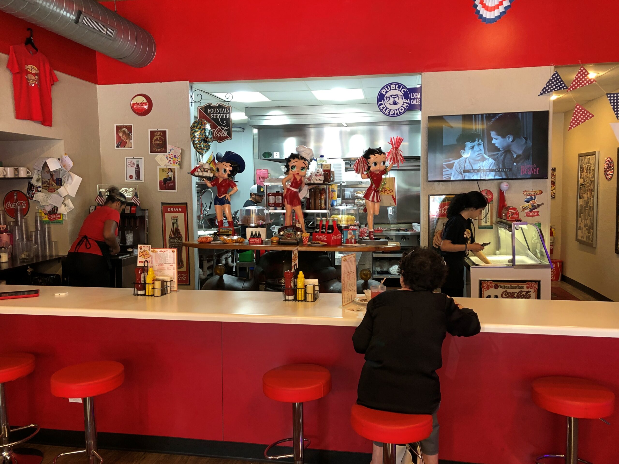
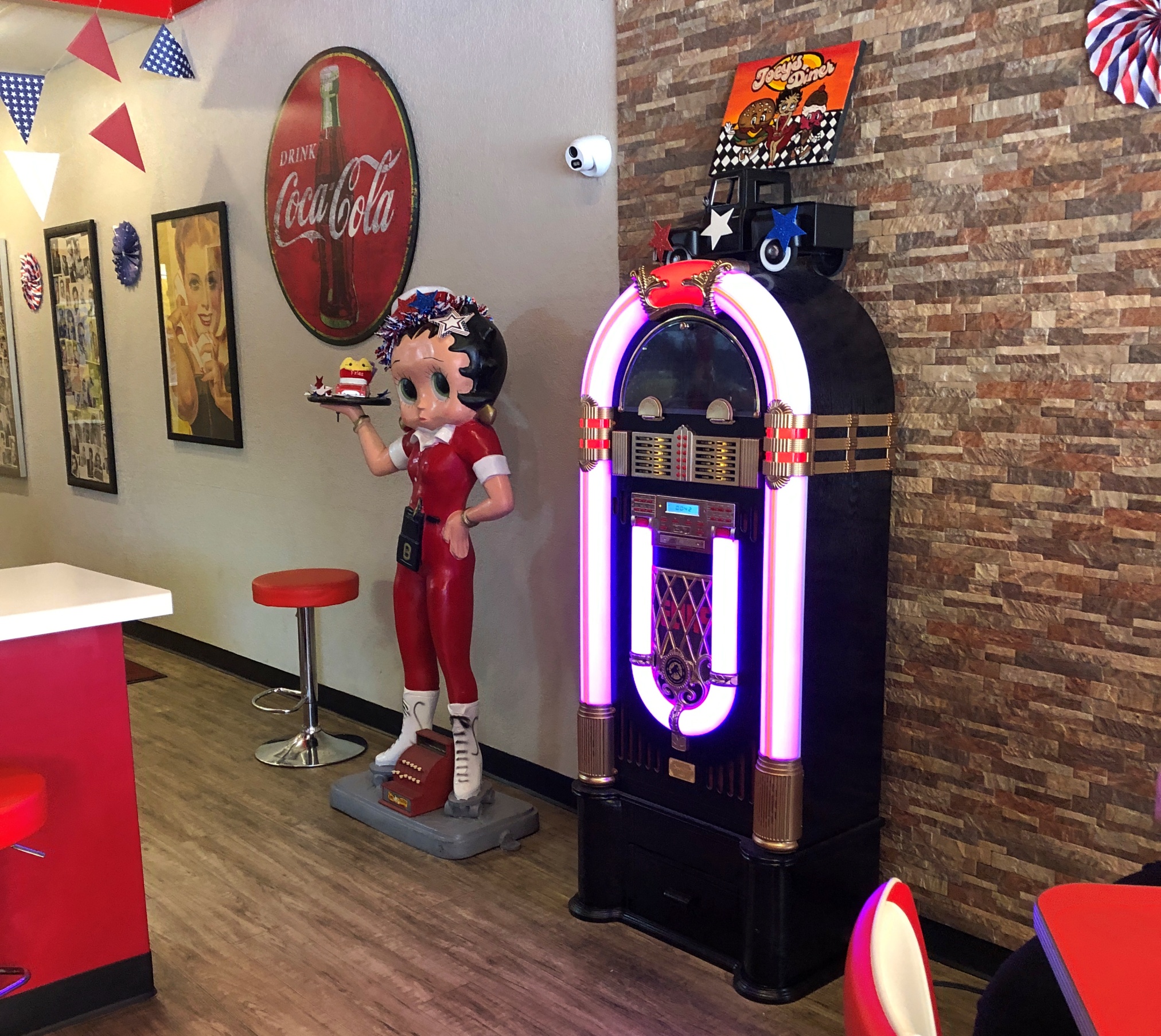
Being mid-day, one bit of business to take care of: lunch. We soon found the friendly joint called Joey’s Diner.
Joey likes Betty.
Joey’s is next to an Italian restaurant, similarly casual, that I think was owned by the same fellow. He was everywhere at once all the time — running a restaurant is nothing if not busy, and he seemed to be running two — but toward the end of our meal, asked how it was. I answered enthusiastically to the positive about my simple but also delicious hamburger. He responded by giving us a slice of chocolate cake, on the house. Thanks, Joey.
The street has other (many other) examples of places found here and nowhere else.
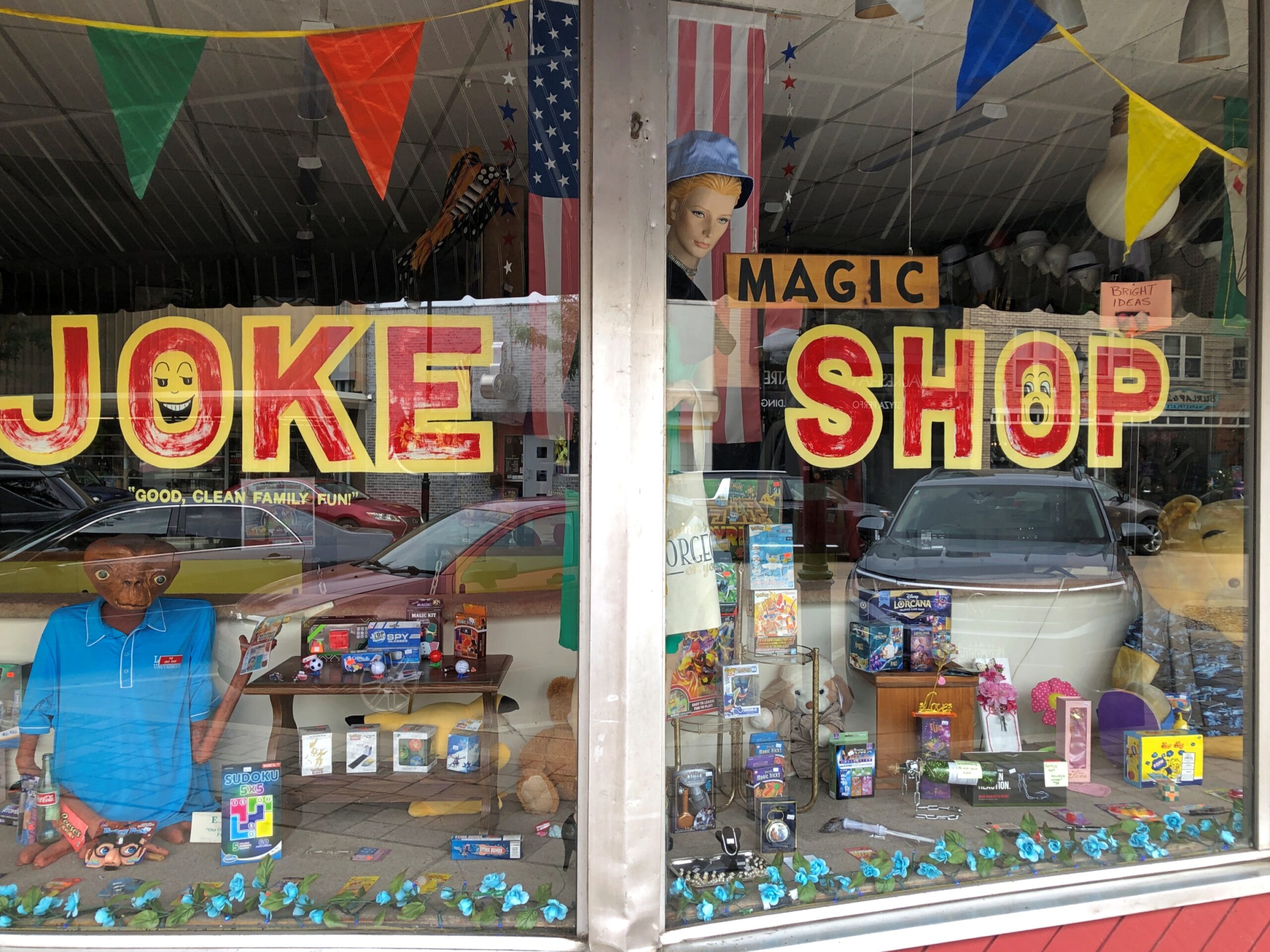
Been a while since I’d seen a joke shop. Closed.
The last one might have been Uncle Fun in Chicago, which closed some years ago. Too bad about that, but at least Jest For Fun Joke Shop, which has been at this Waukesha location more than 40 years, is keeping the retail tradition alive.
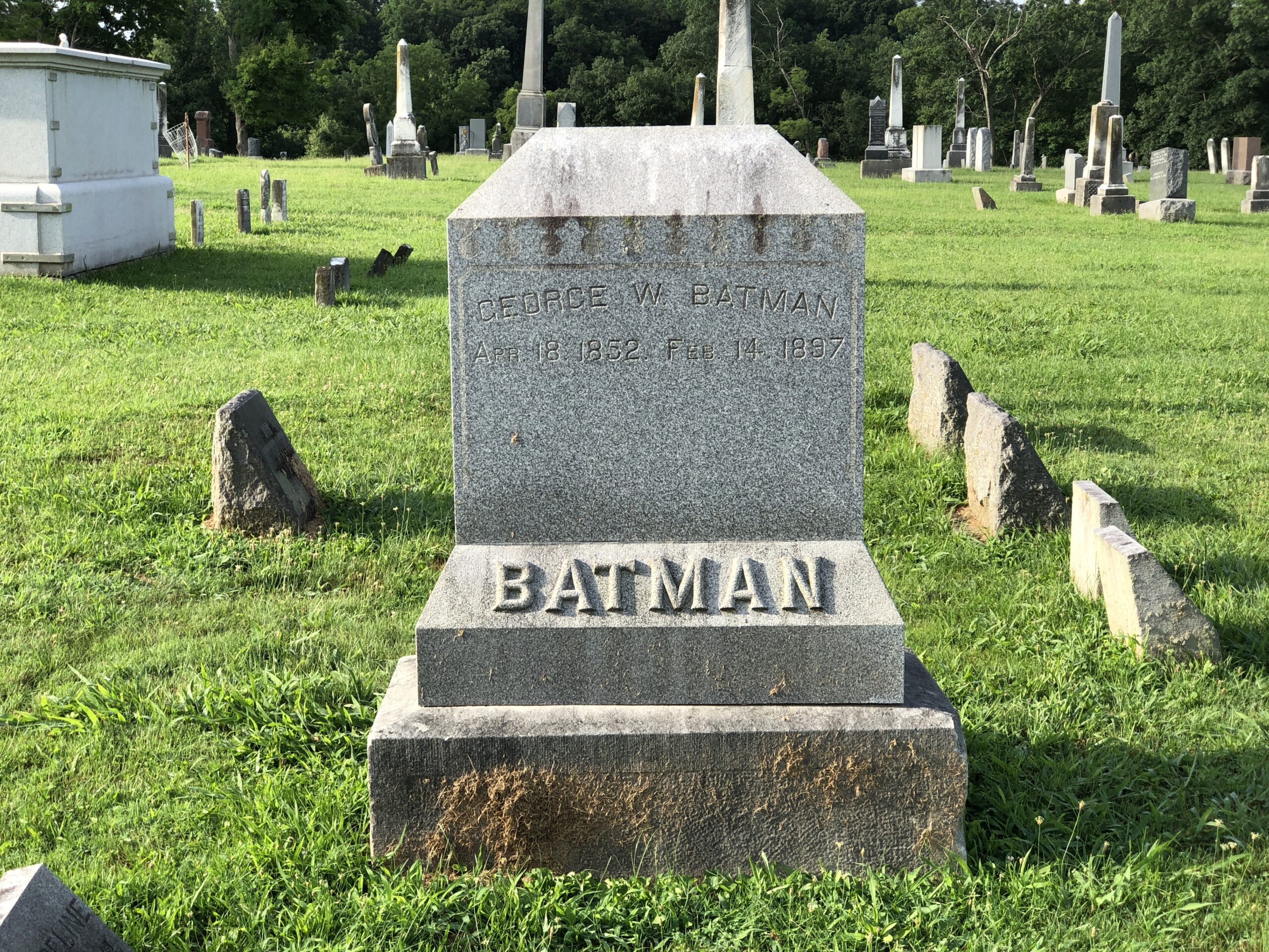
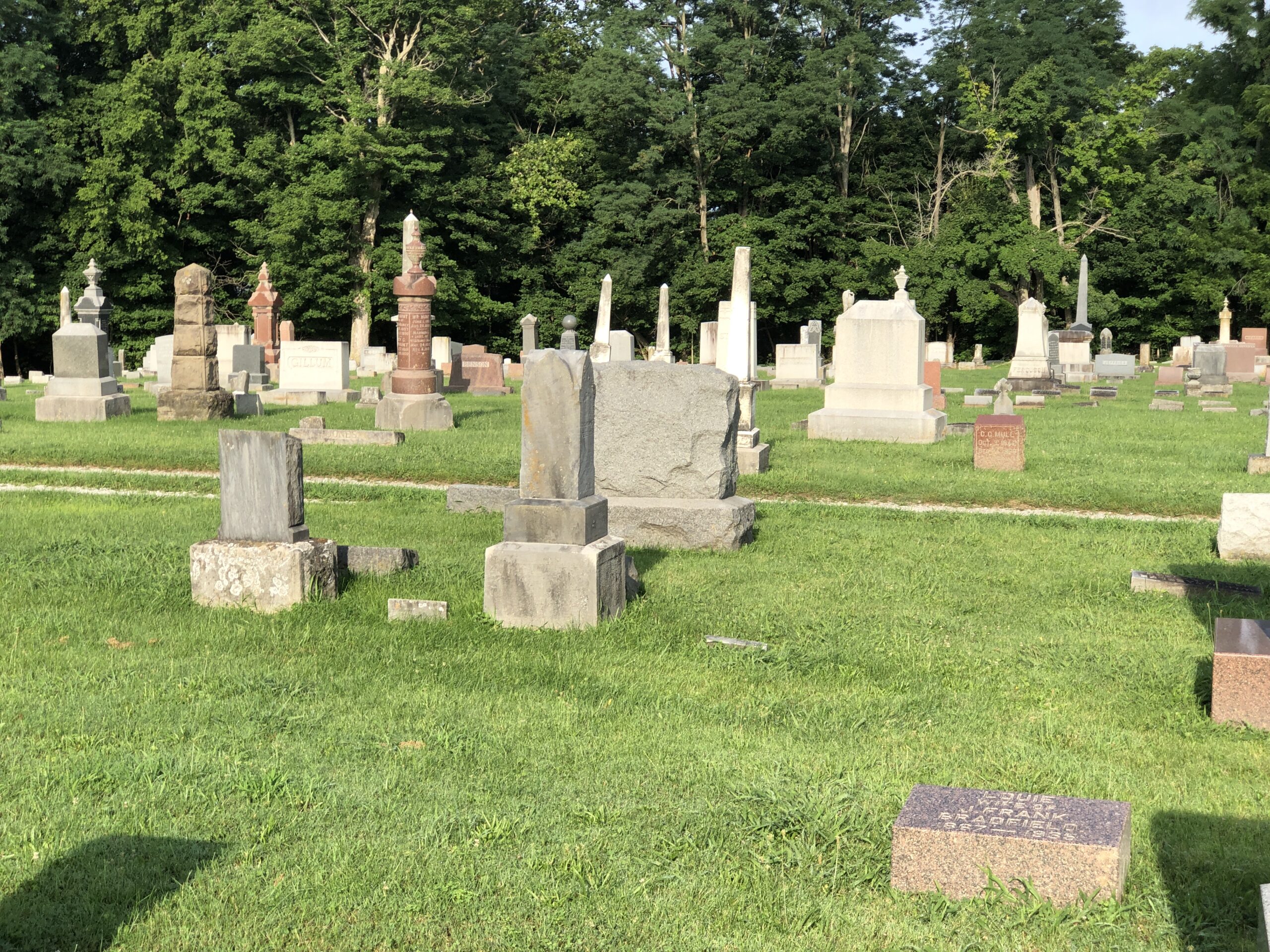
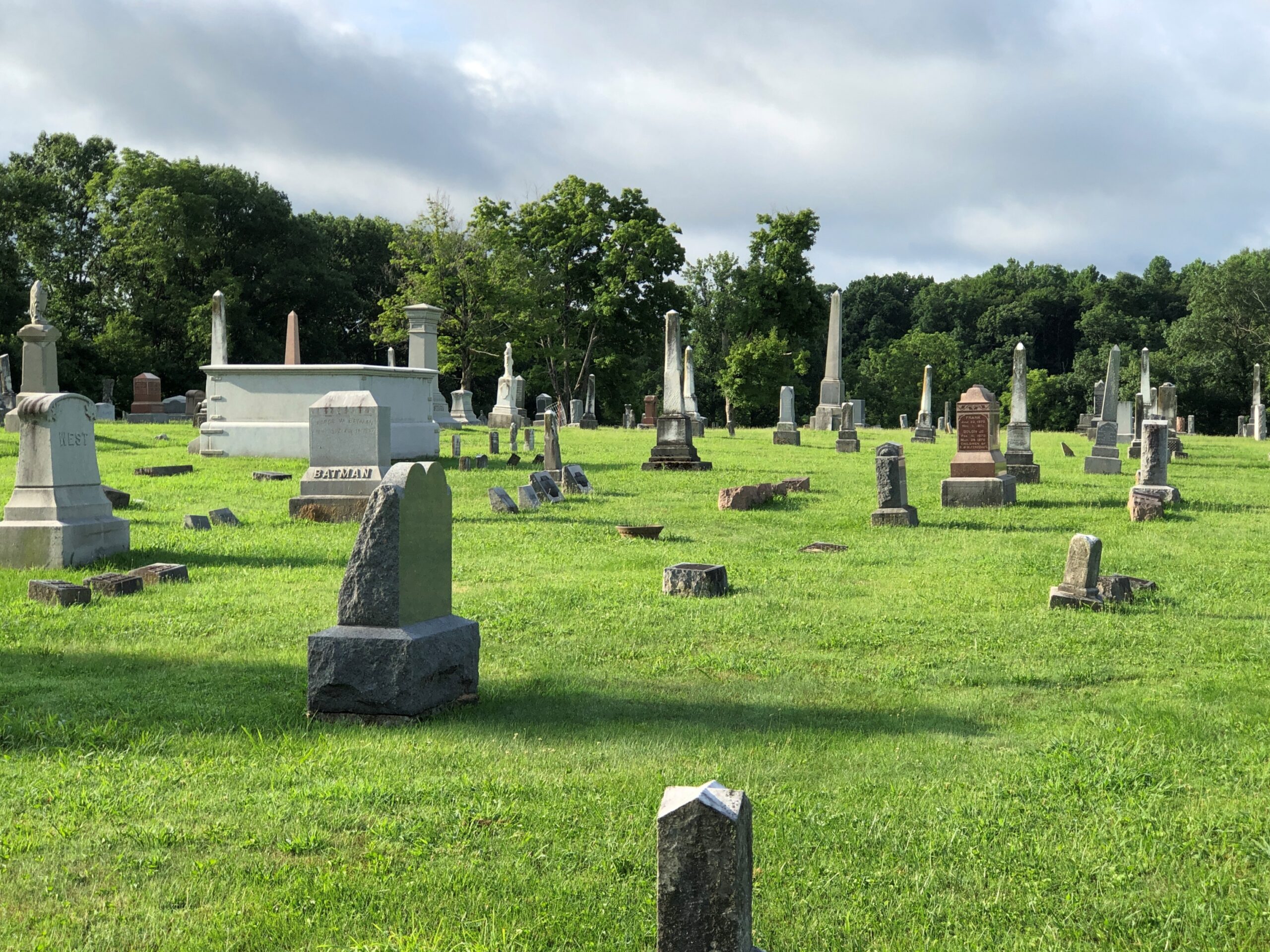
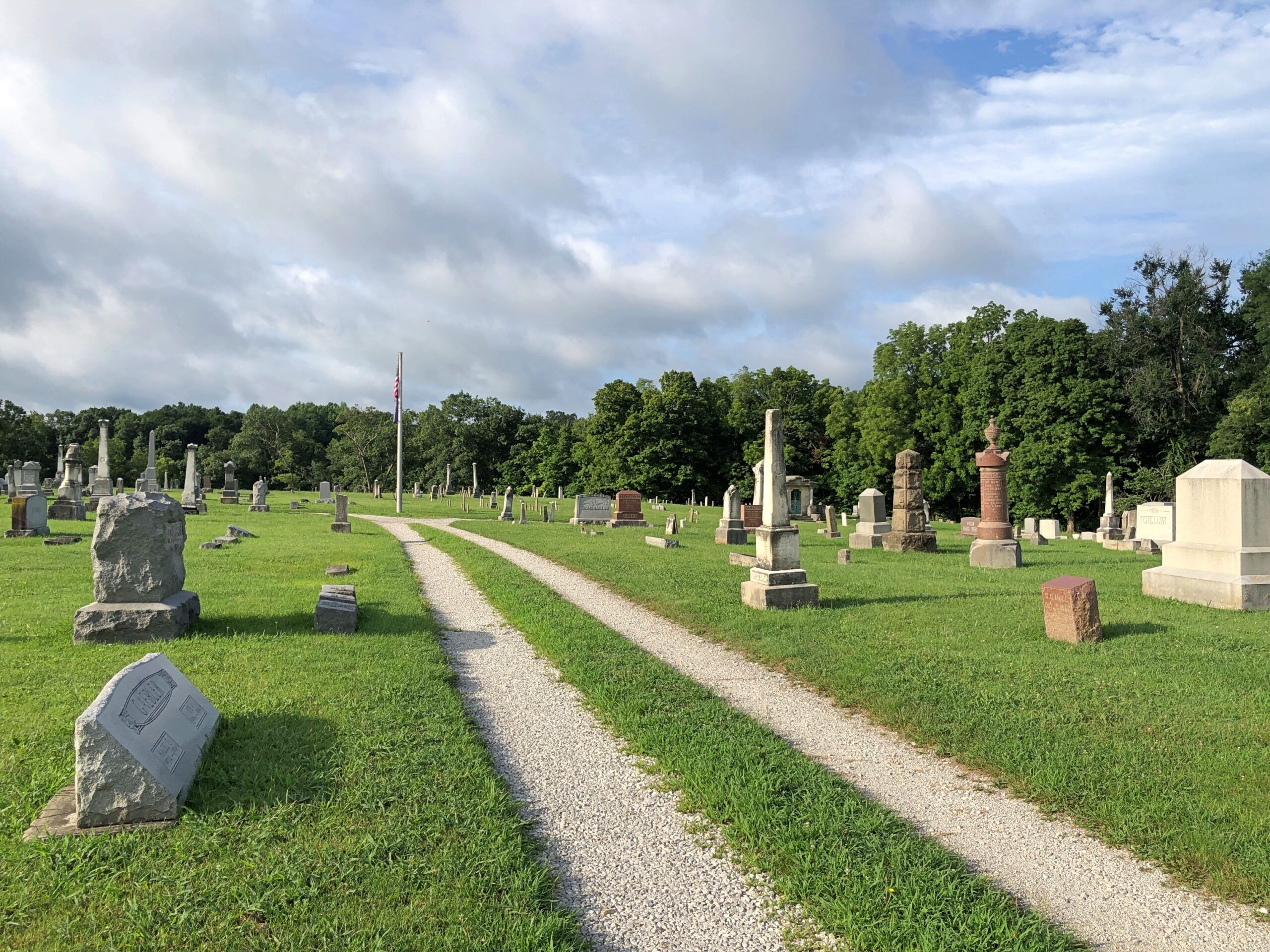
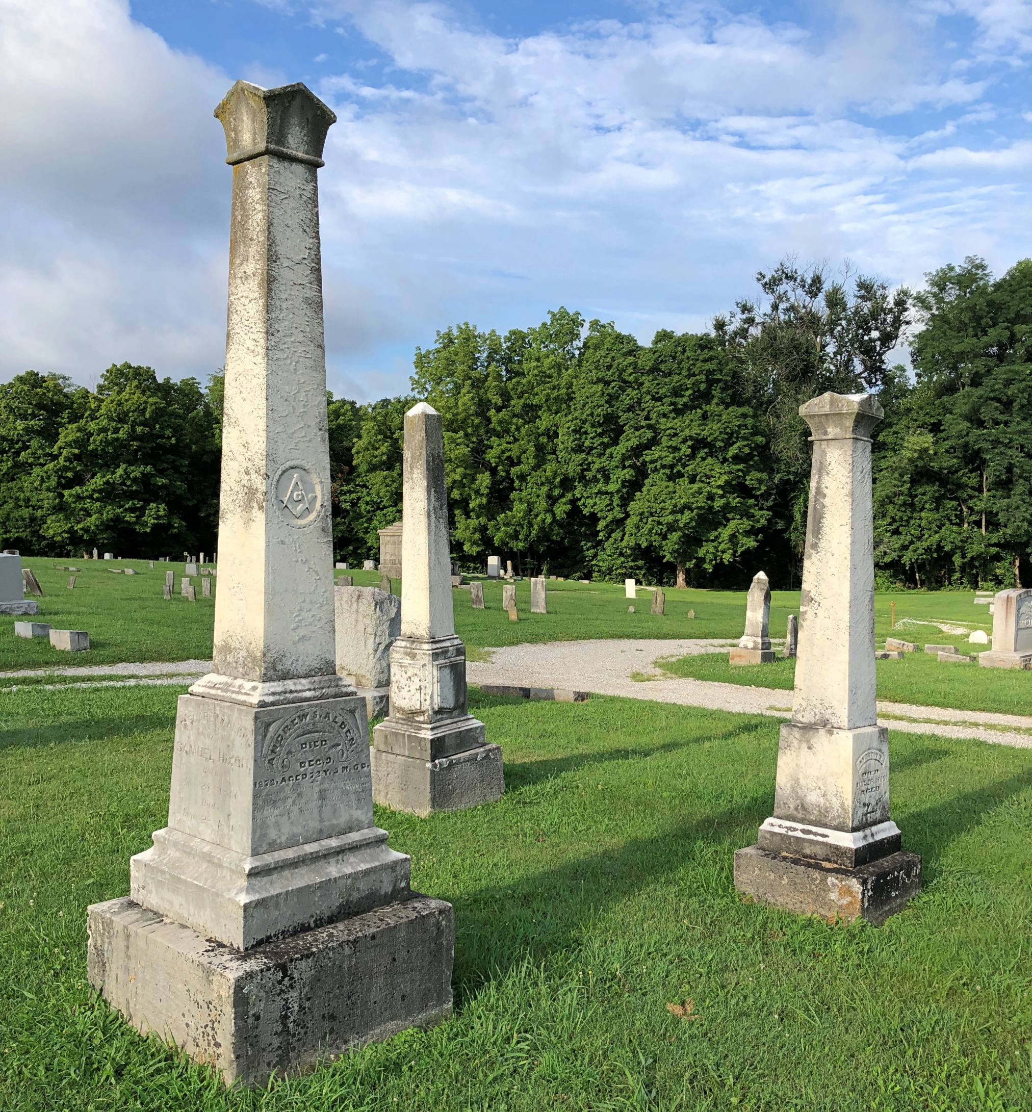
George W. Batman, that is, who died in 1897, so he never lived to see his surname put to the other uses we all know so well. Variants of his name include Bateman, Battman and Baitman, meaning that Batman really isn’t that odd. Except it does look odd on that large stone, but only because of recent conditioning by a particularly successful fictional character. George W. happens to repose at Rockville Cemetery in Rockville, Indiana, and I happened to visit early one Sunday morning in late July.
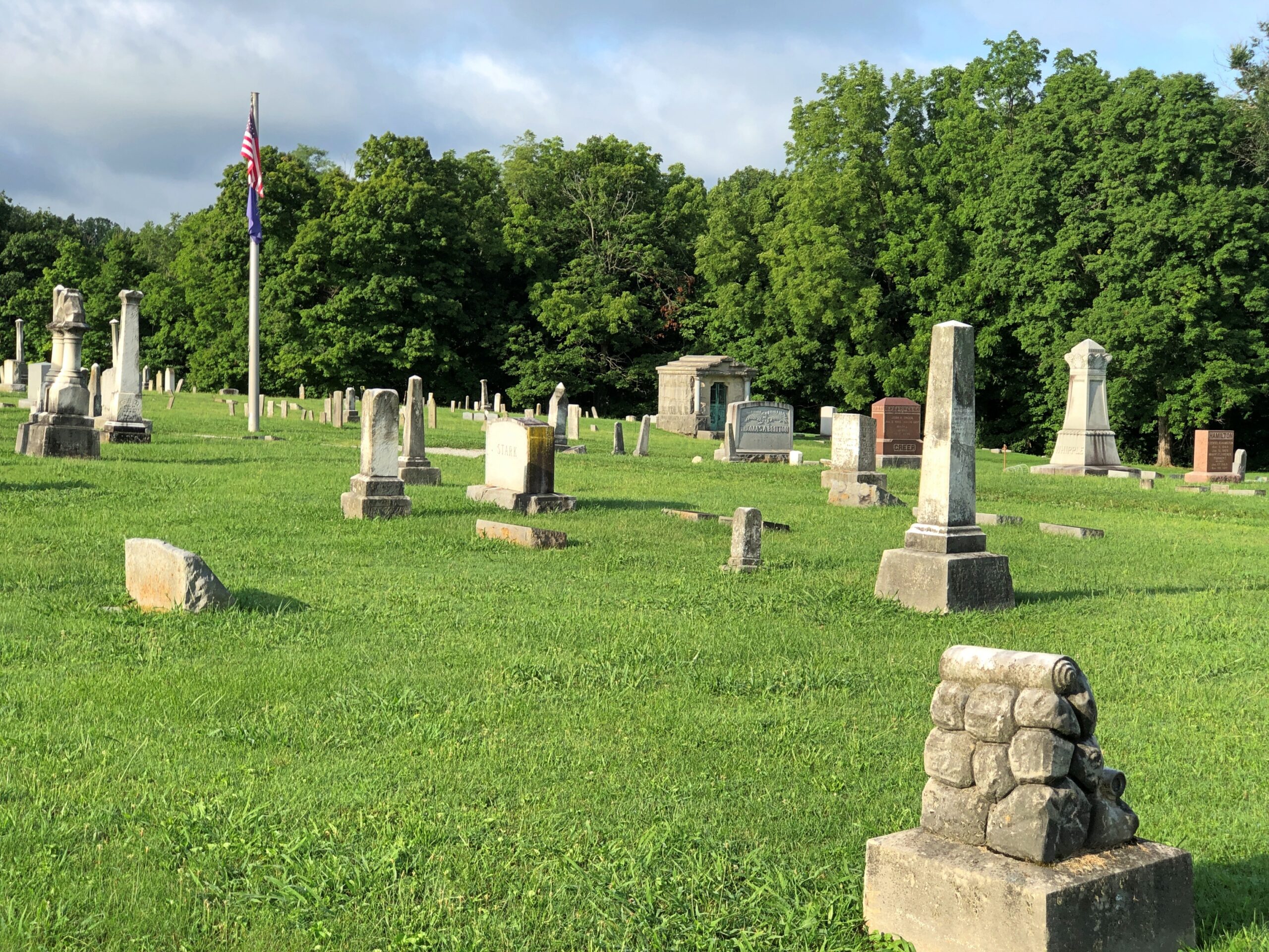
A pleasant graveyard, founded in 1824 — same year as the town itself — and well marked by upright stones, but not overly landscaped.
A few memorials reach upward, but not that far.
A few mausoleums denote formerly big fish in the small pond that is Rockville, seat of Parke County.
Mostly modest stones populate the cemetery, presumably for regular folks of the past.
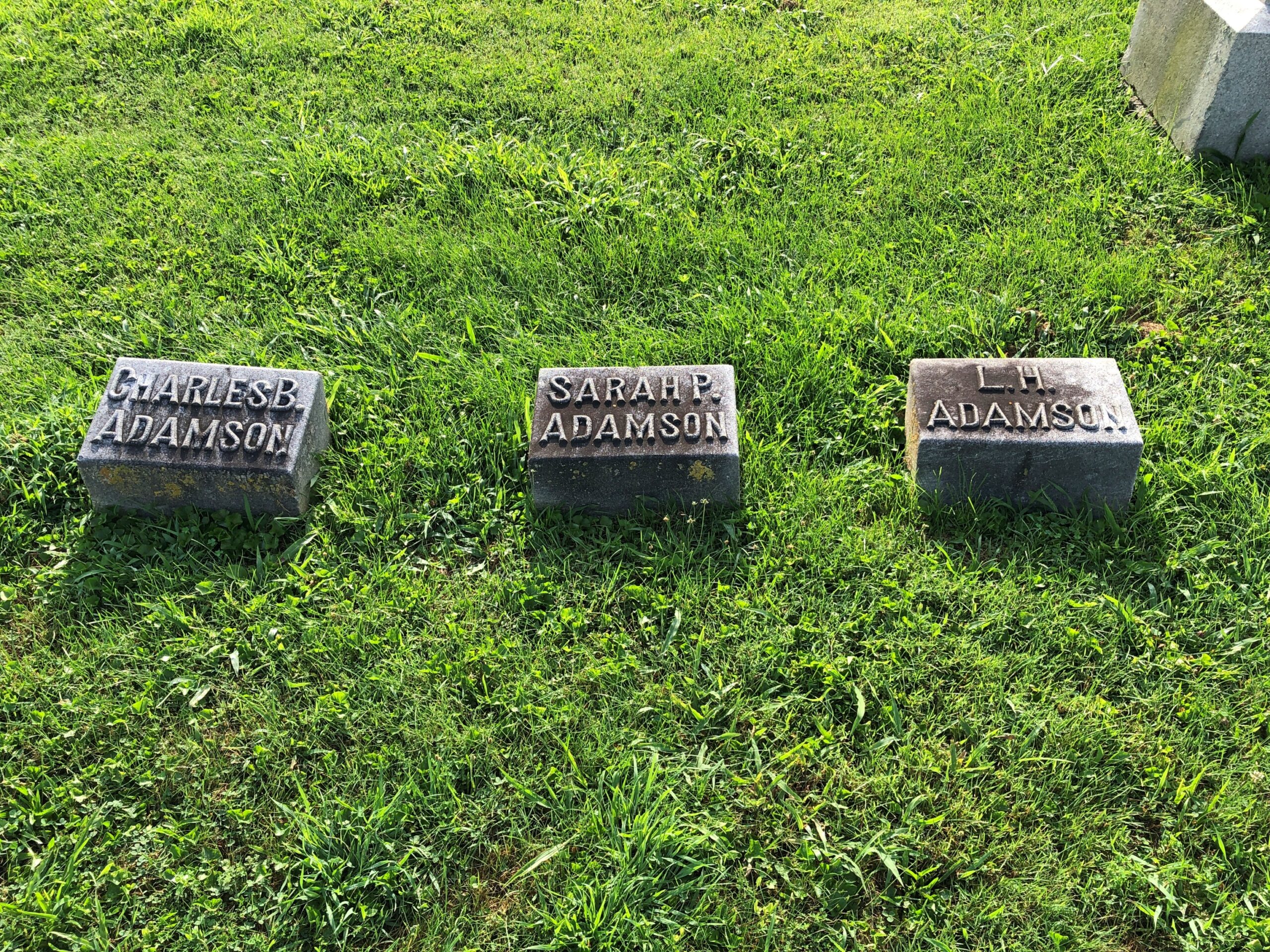
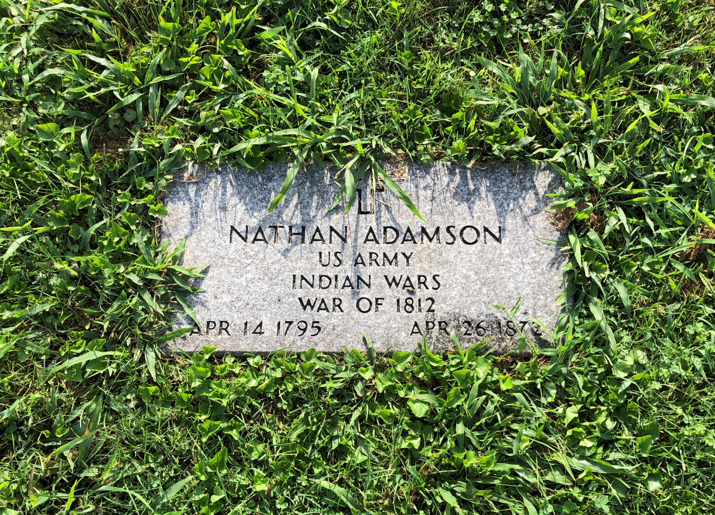
It isn’t too often that you see veterans of the War of 1812 (but not never).
Numerically speaking, there just weren’t that many compared to later, greater wars, and probably many of their graves aren’t marked as such. Nathan was near the other Adamsons, and indeed two of them (per Find-A-Grave) are his children.
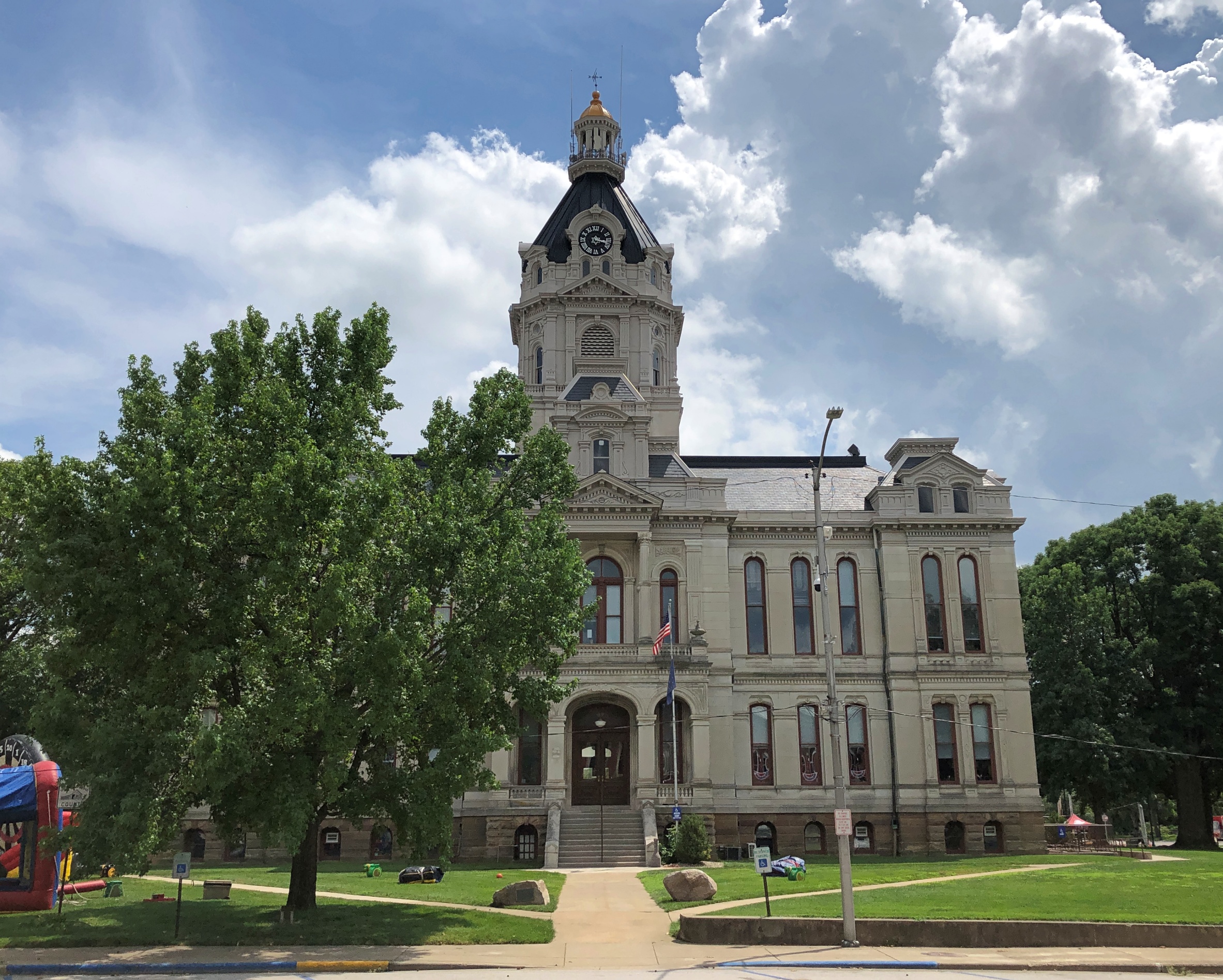
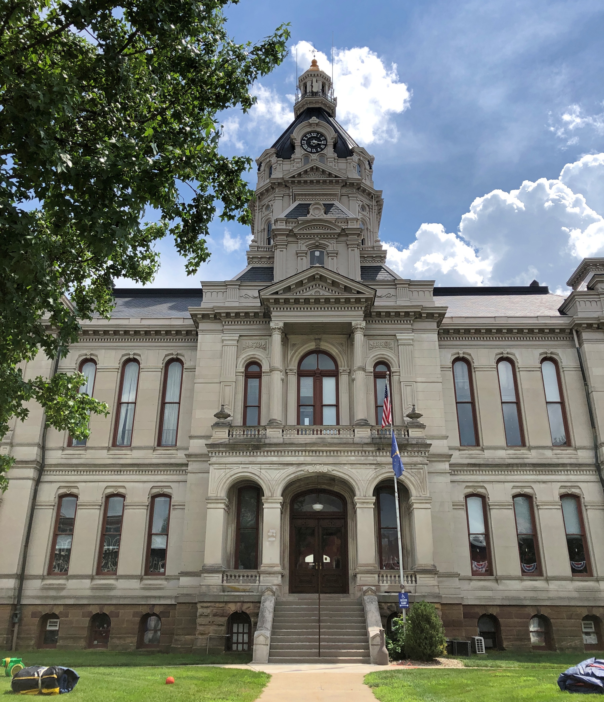
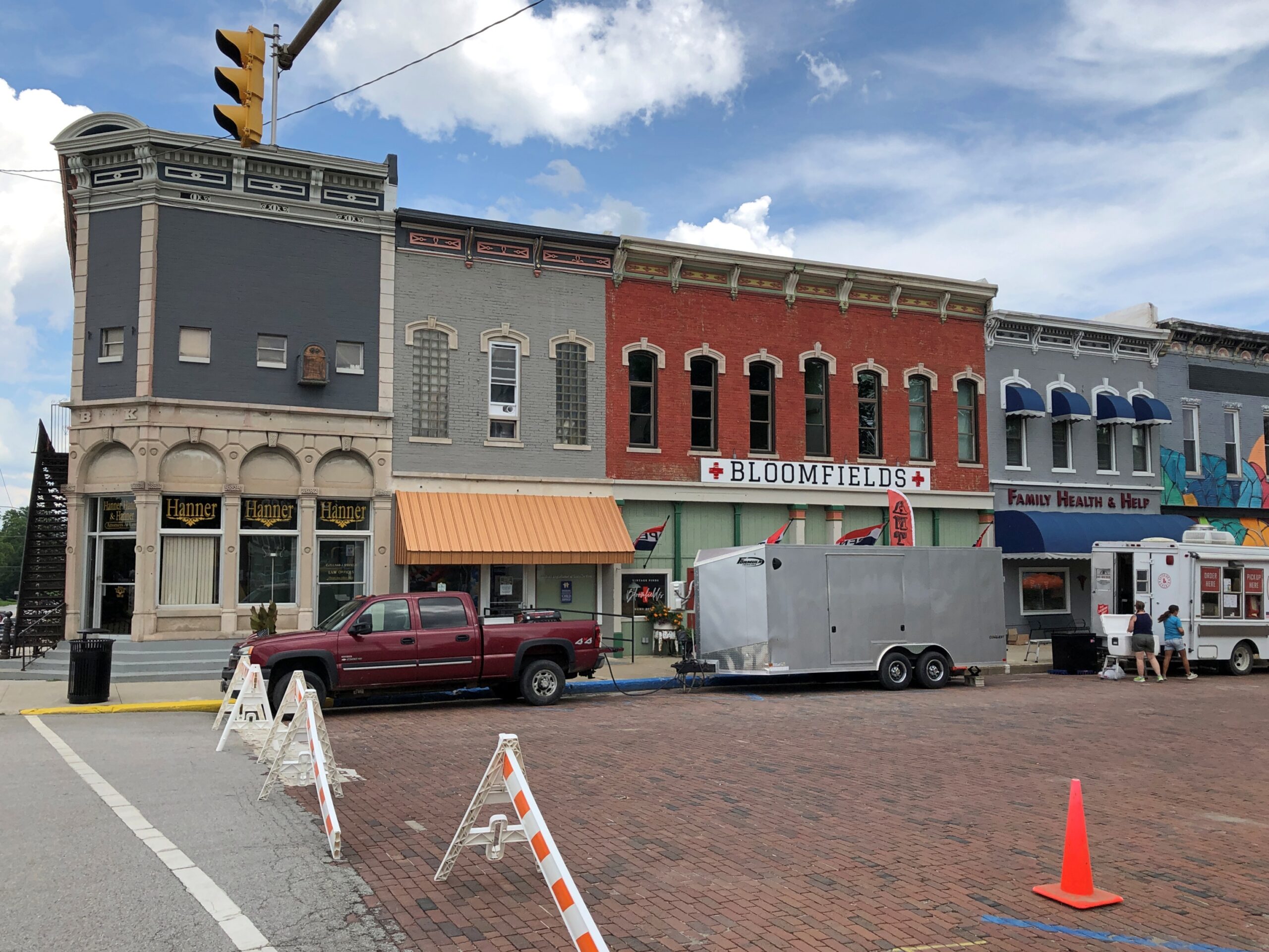
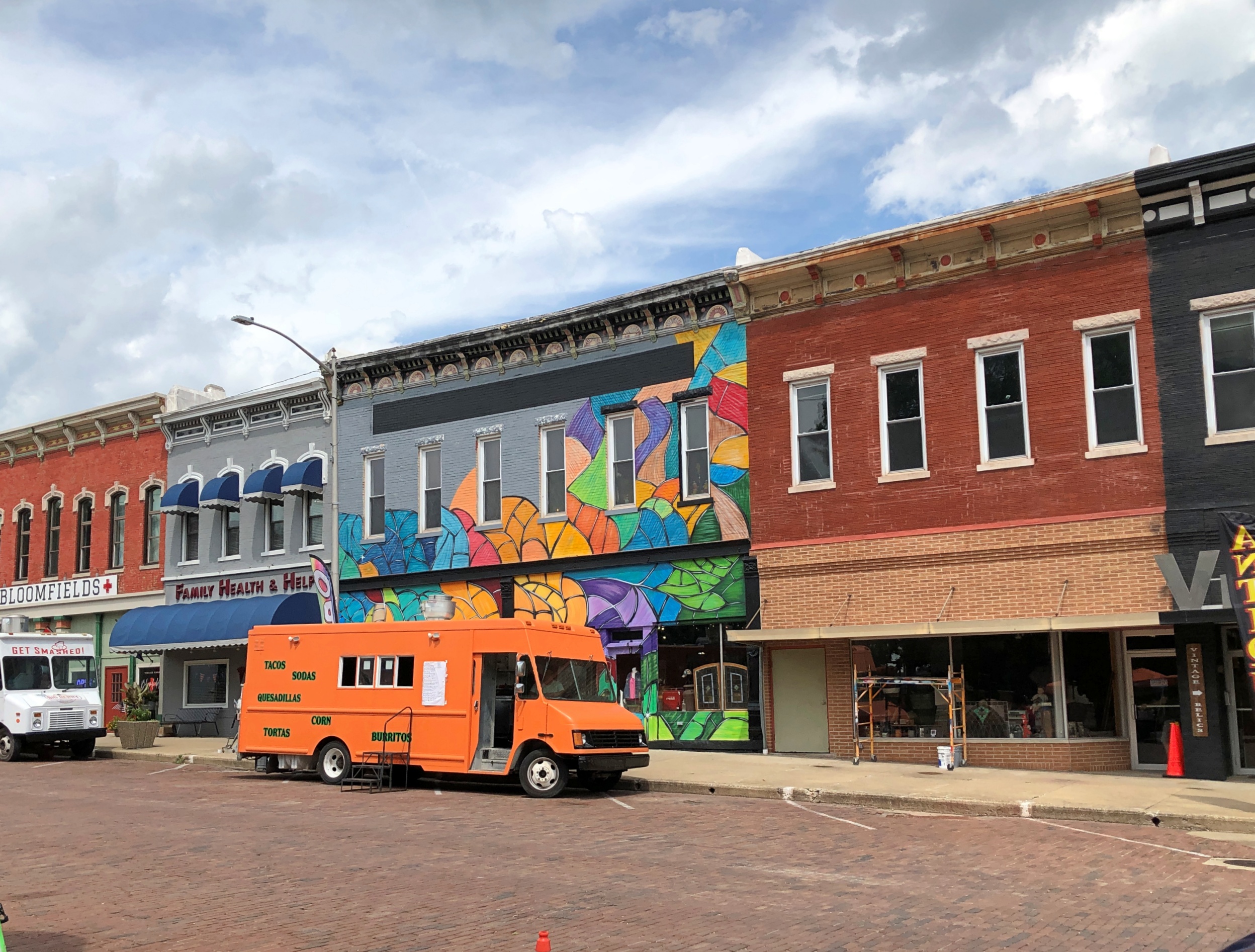
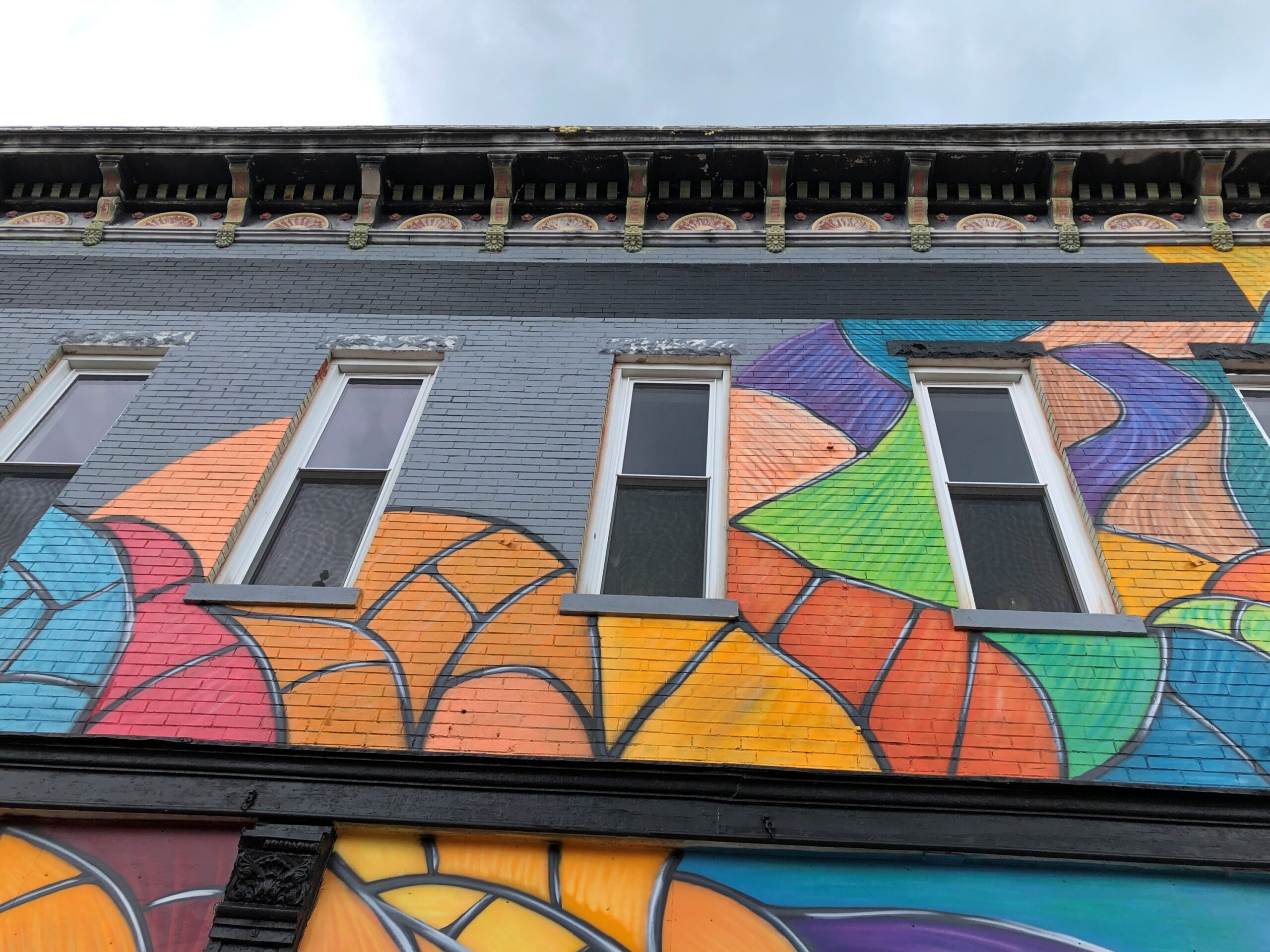
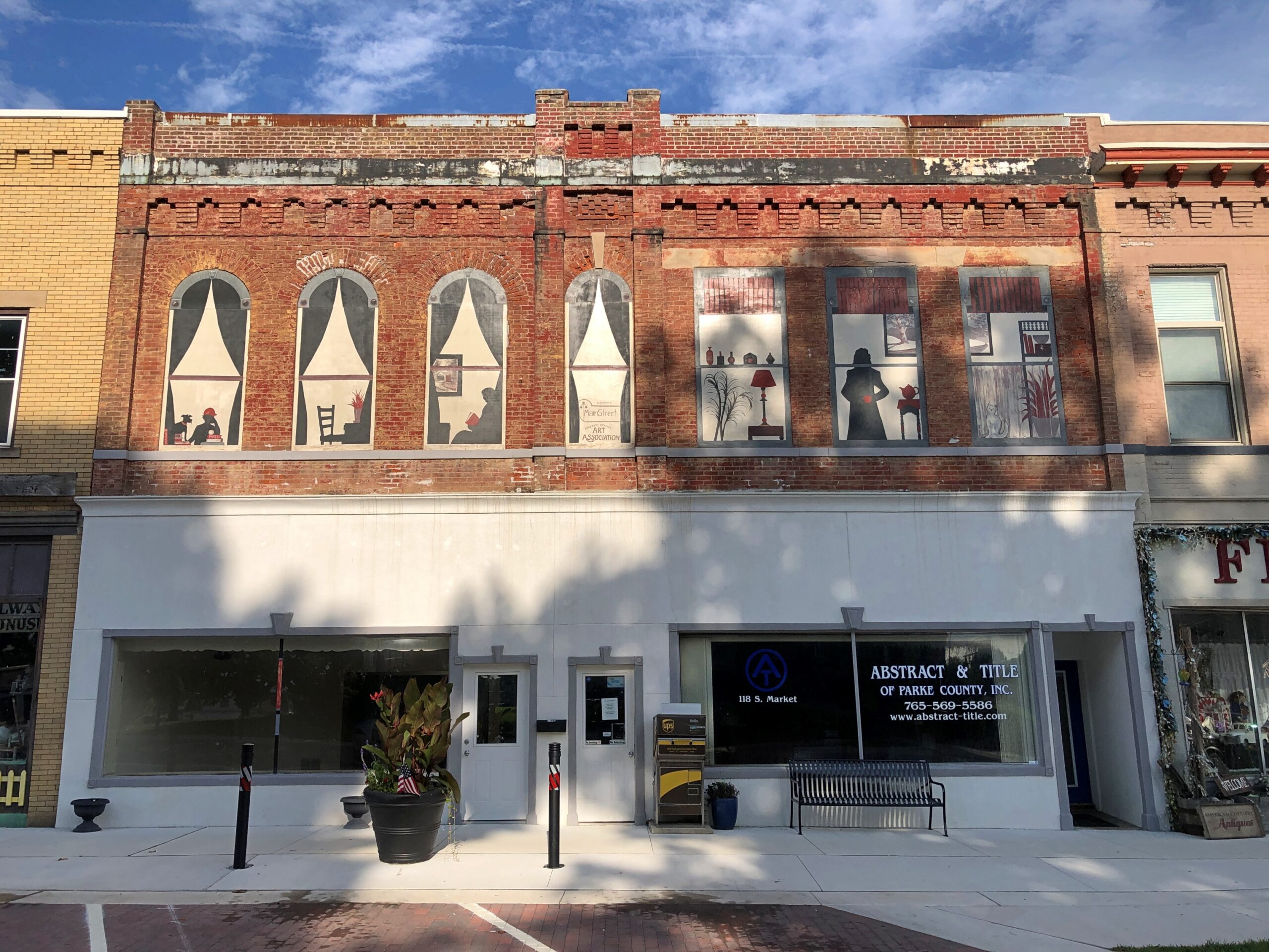
Not too many blocks from the cemetery is the Parke County Courthouse. We encountered it on Saturday afternoon, soon after arriving in Rockville (pop. about 2,600), when temps were about as high as they would be that day. Sweaty 90s.
The courthouse is a grand Second Empire pile with some Beaux Arts added to the mix, completed in 1882, during the golden age of U.S. courthouses. Designed by T.J. and Brentwood Tolan, a father and son team. They did a lot of courthouses.
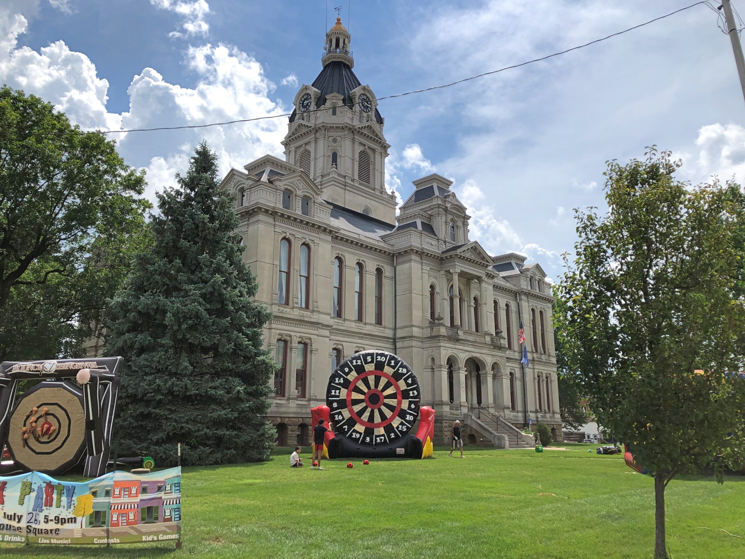
The giant dartboard isn’t something you see too often on courthouse grounds. Could it be the Dartboard of Justice? That’s how sentencing is done for crimes that call for one to 20 years in the jug; a toss by the judge, or the jury foreman.
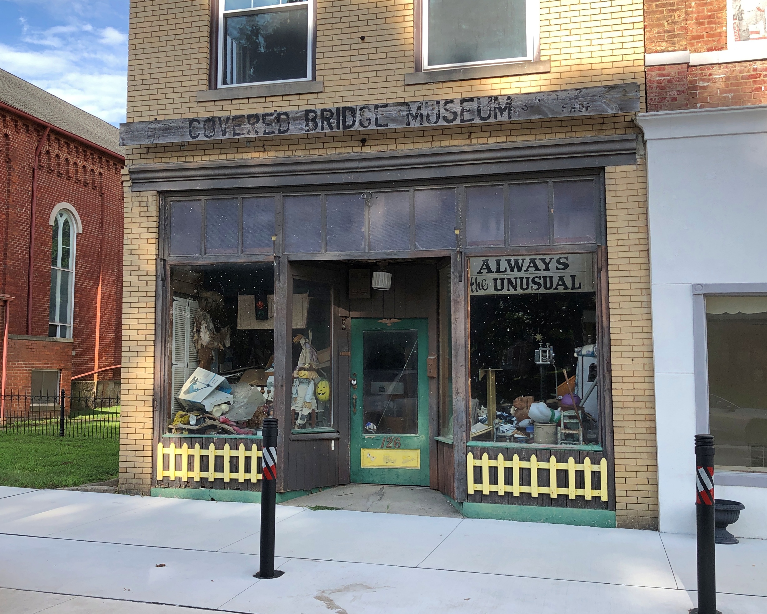
No, a small street festival was being set up at that moment, though not up and running yet. It was too hot for that anyway. But not for a quick look at some of the buildings ringing the courthouse, most in good shape and mostly tenanted.
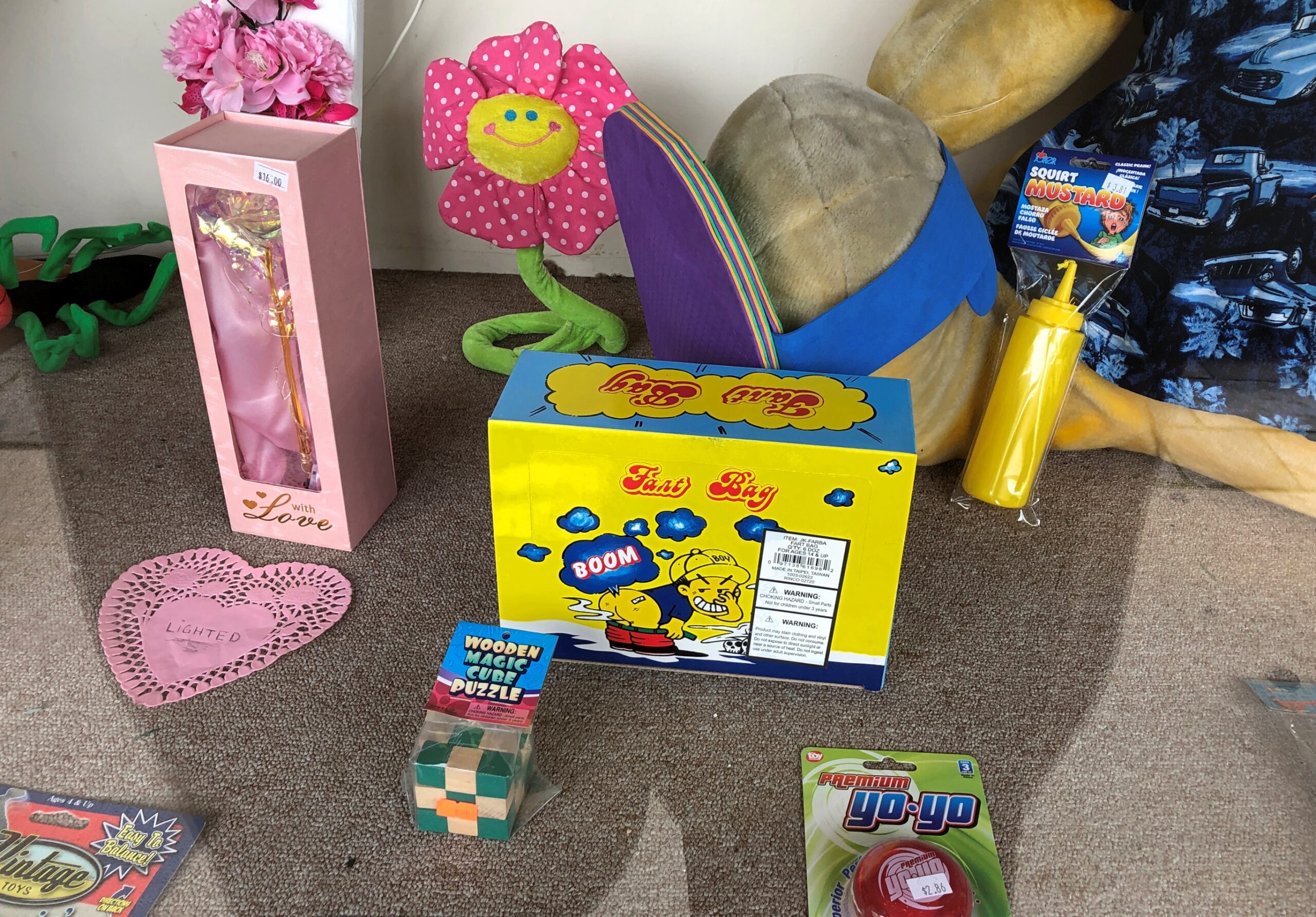
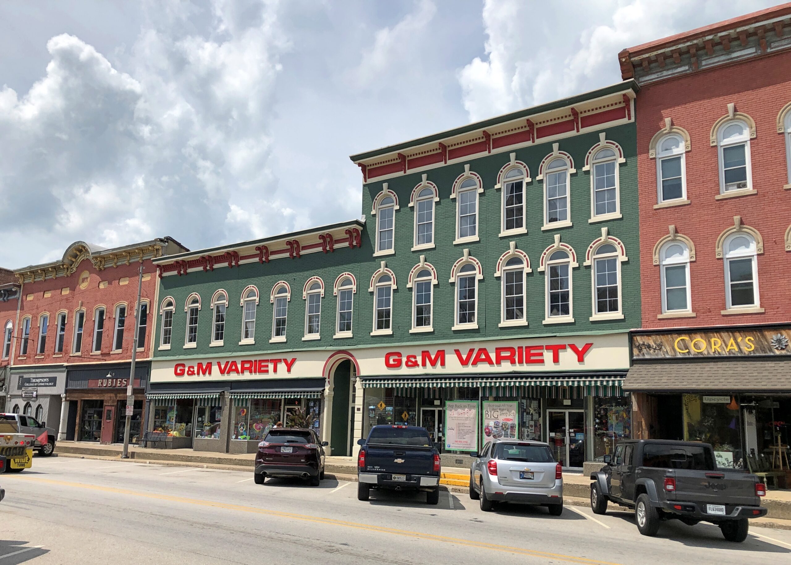
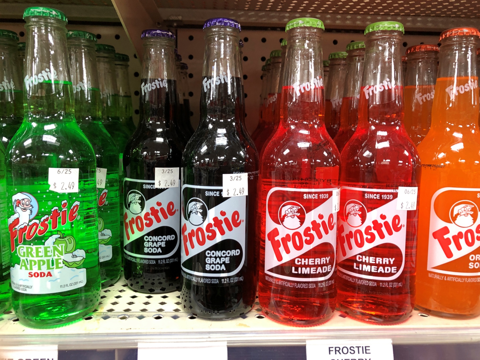
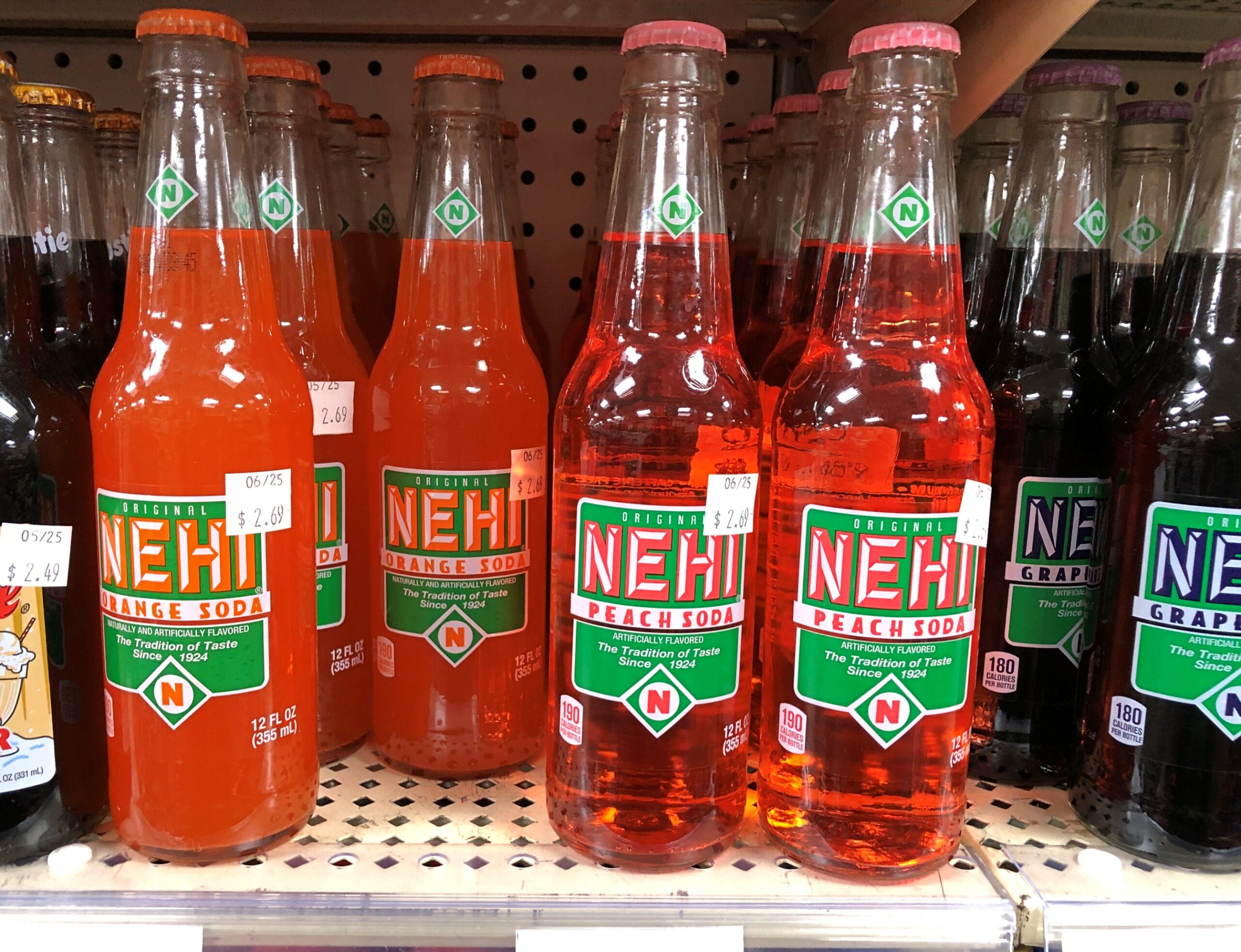
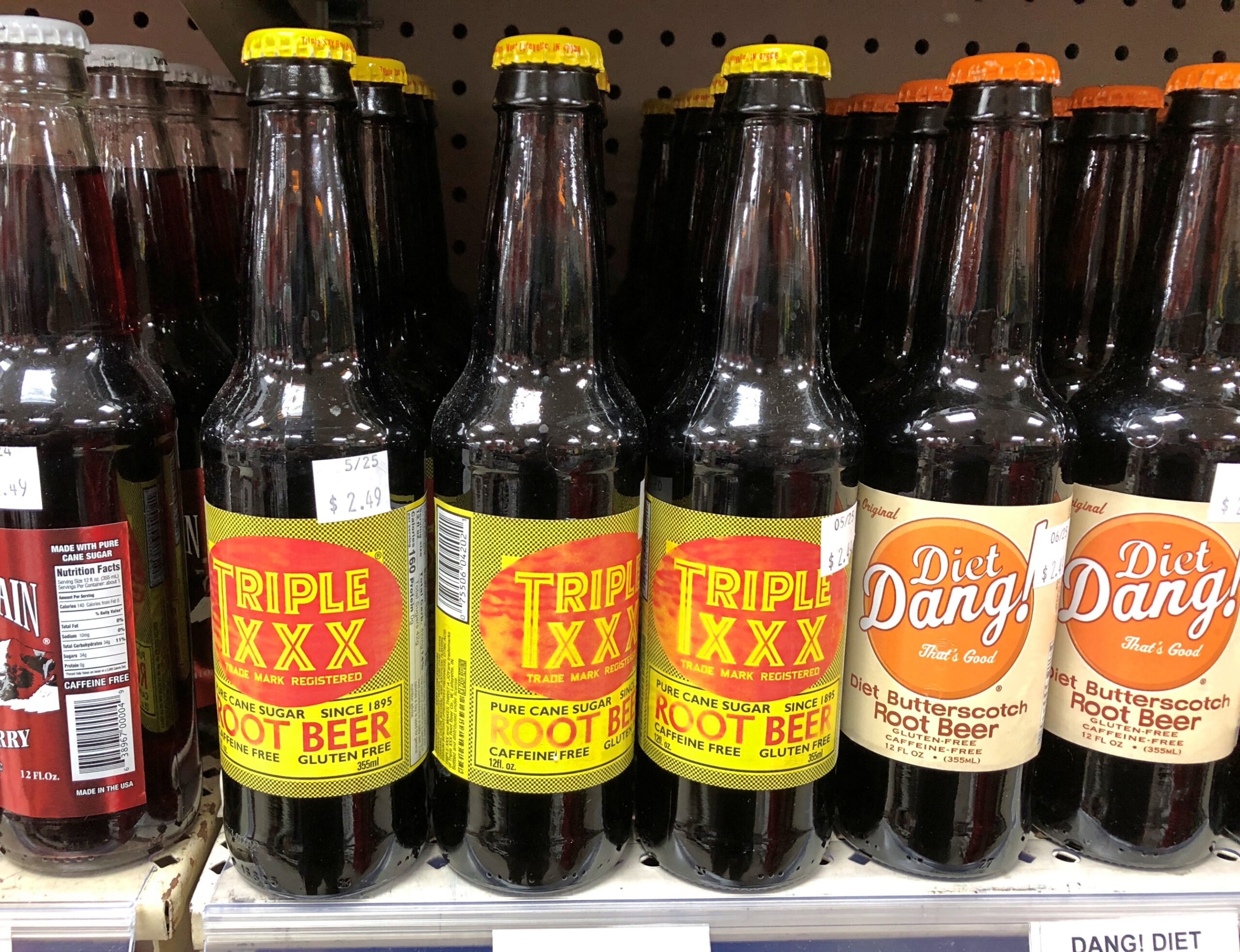
G&M Variety has the soul of a five-and-dime, but a more accurate classification these days would be a five-and-ten dollar store: a step above a dollar store, the love child of a convenience store and a standard grocery store, with a souvenir shop added to the mix. Roaming around its aisles was pleasant, for a look at the sometimes unusual merchandise, and the AC.
Drinks on sale that made me recollect sodas from my mid-60s childhood.
Frostie! Nehi! Triple XXX! Dang? We didn’t have Dang. Butterscotch root beer?
Pangs of nostalgia weren’t enough for me to spend $2.49 for an ordinary-sized soda, though I was a little thirsty.
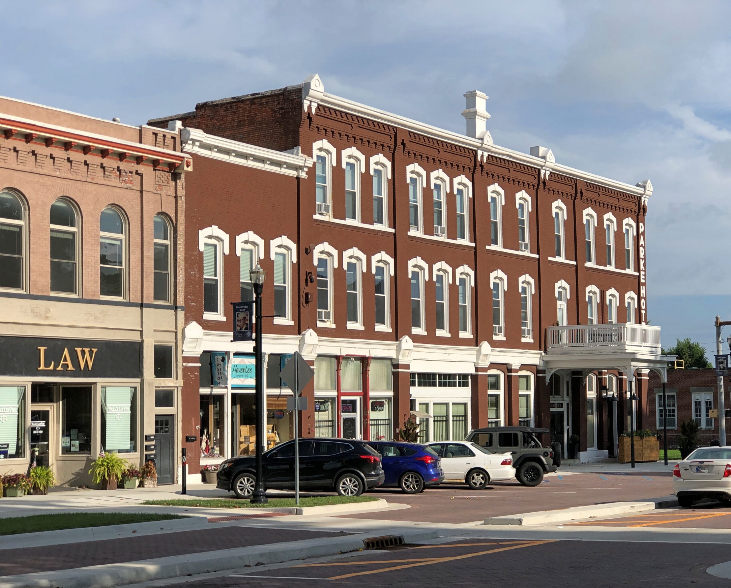
More courthouse square.
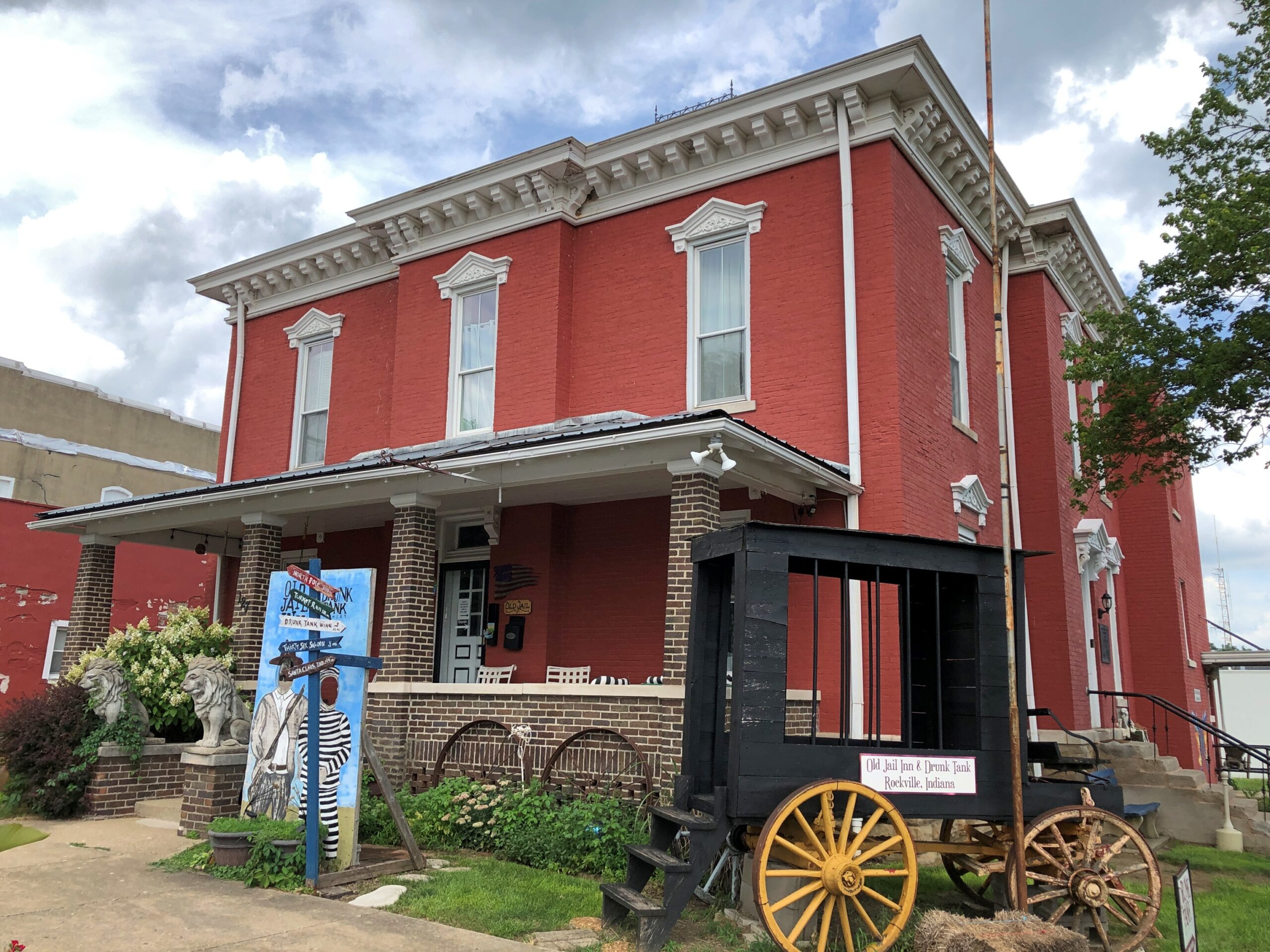
The Old Jail Inn & Drunk Tank, now a B&B.
I returned to the square on Sunday morning, after the cemetery, for a further look when it wasn’t so hot.
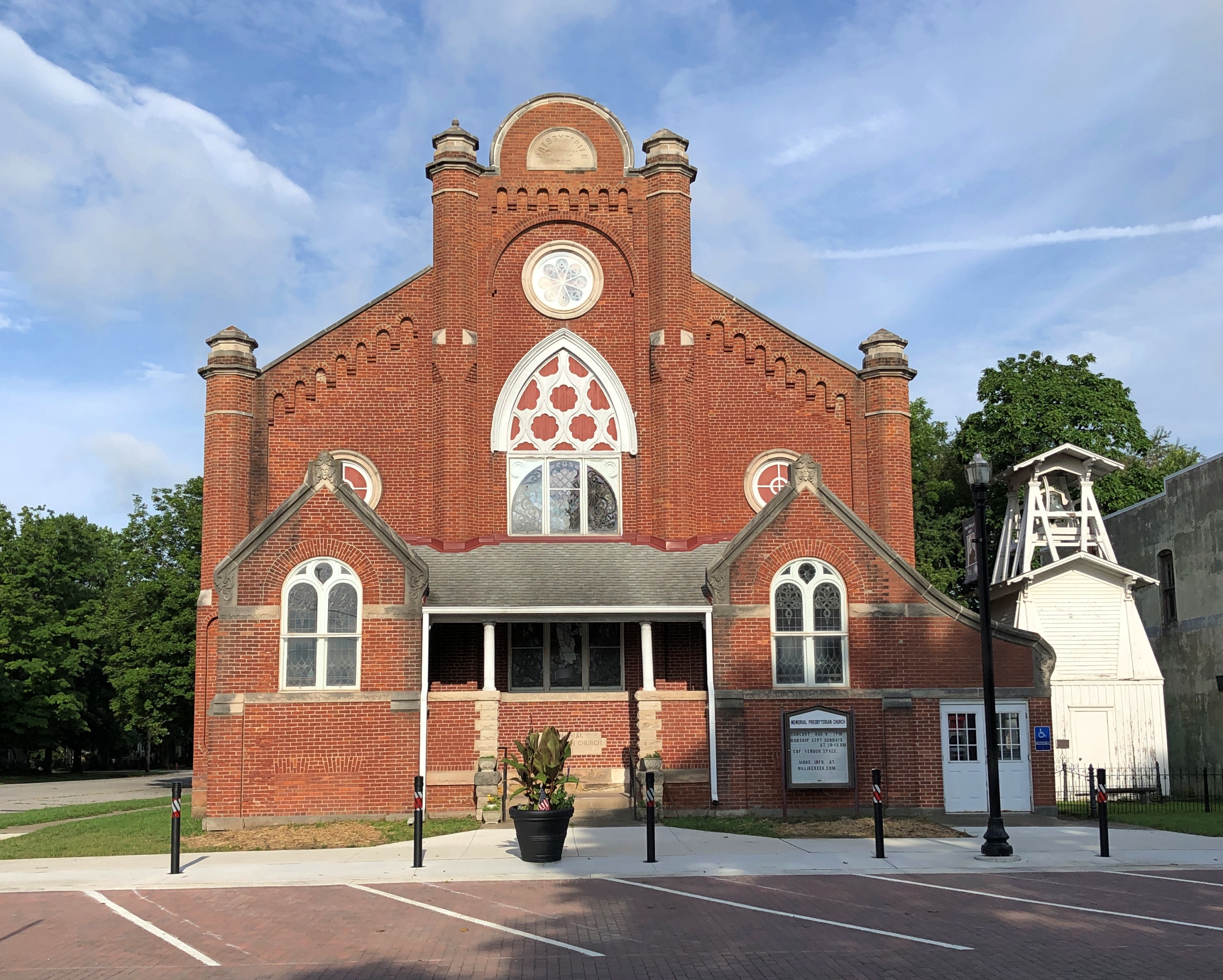
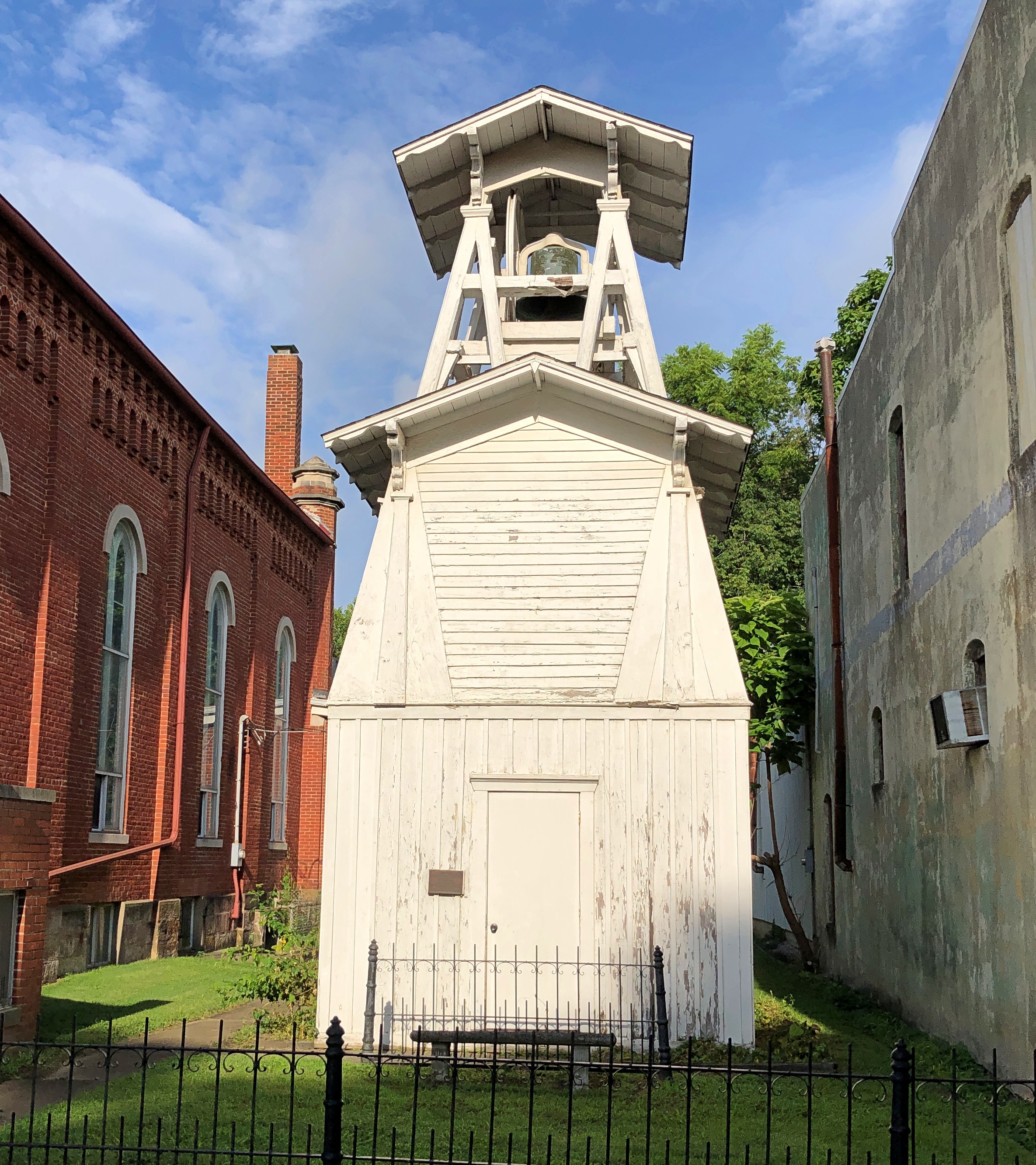
Memorial Presbyterian Church and its freestanding bell tower.
It isn’t a Presbyterian church any more — its cross conspicuous in its absence — though a Presbyterian congregation meets there sometimes. These days it counts as an event space, with music performances, recitals, meetings, and other gatherings there, according to Billie Creek Village, more about which later.
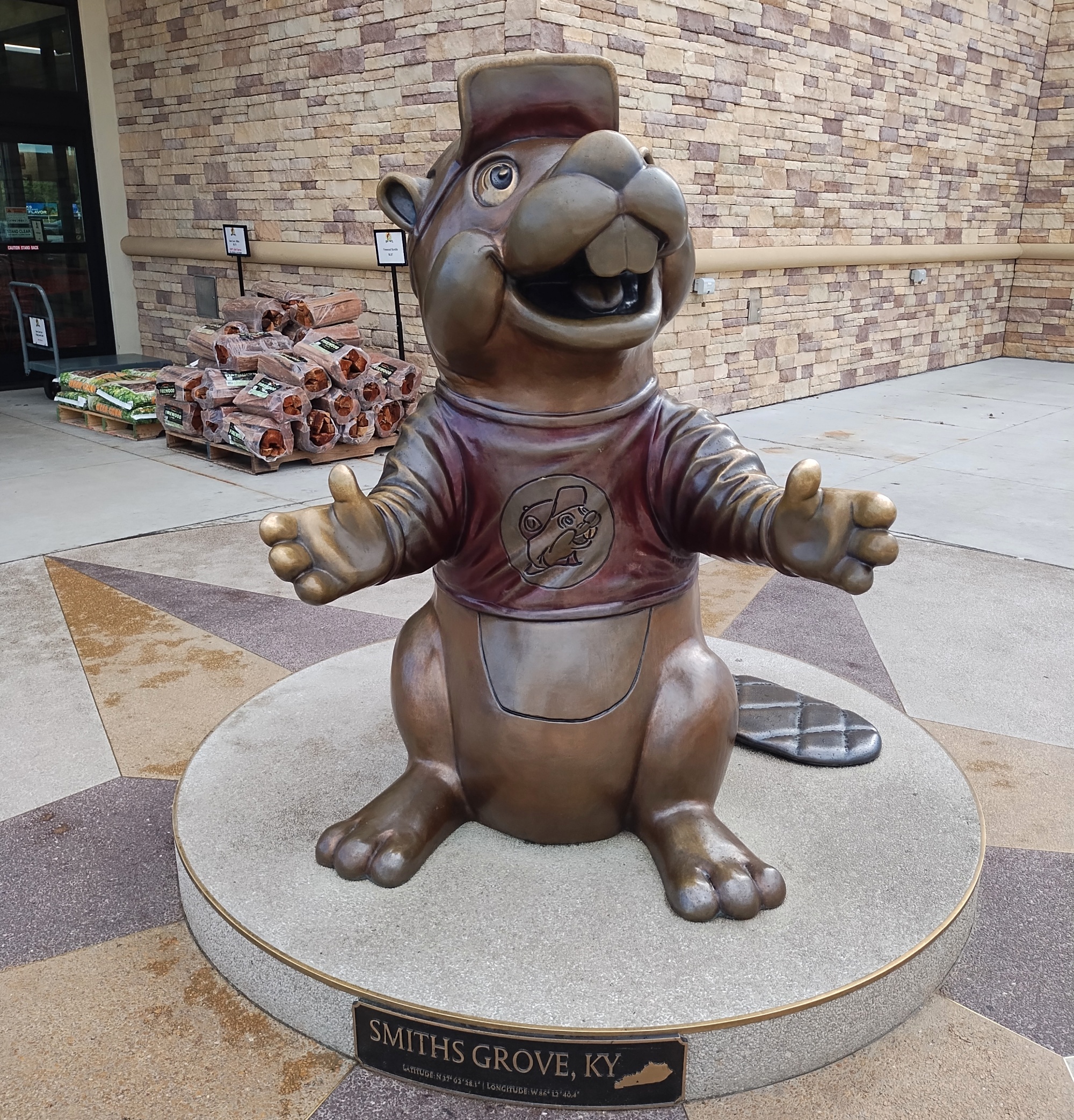
The Buc-ee’s imperium marches on. On my way to Tennessee that first day, I stopped at the location near Smiths Grove, Kentucky, to visit its gleaming facilities. Business was reasonably brisk that Monday, but nothing like the bedlam on the Sunday, nearly two weeks later (on the trip’s last day), when I stopped on the way back home at the same place, for the same reason.
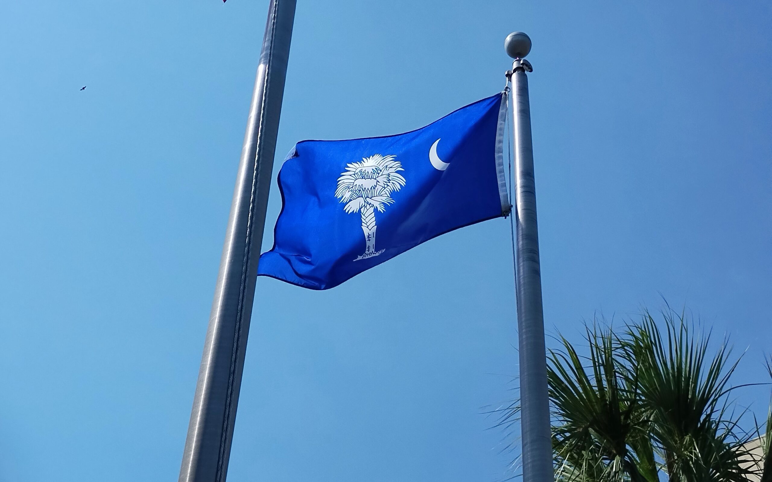
South Carolina
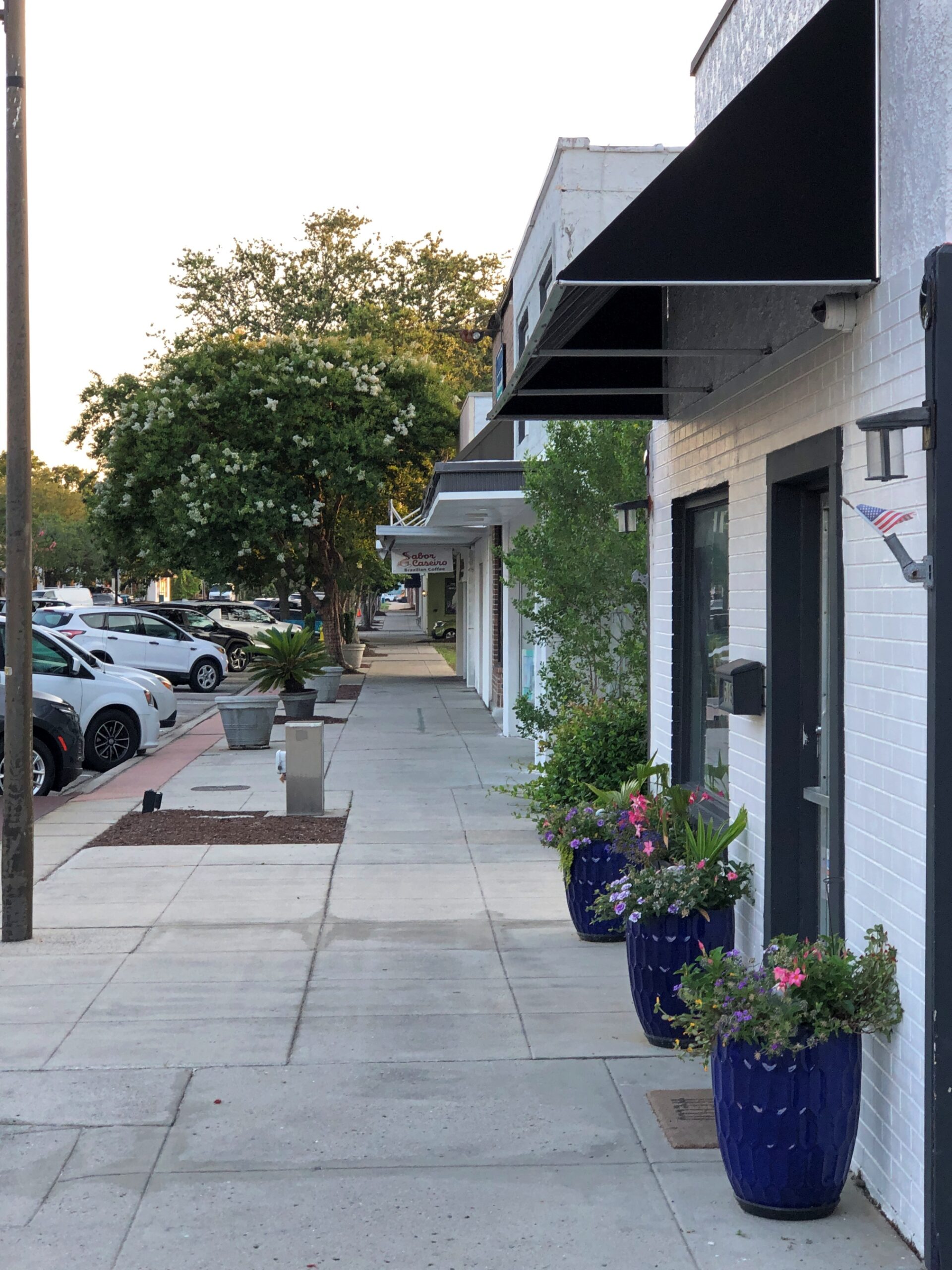
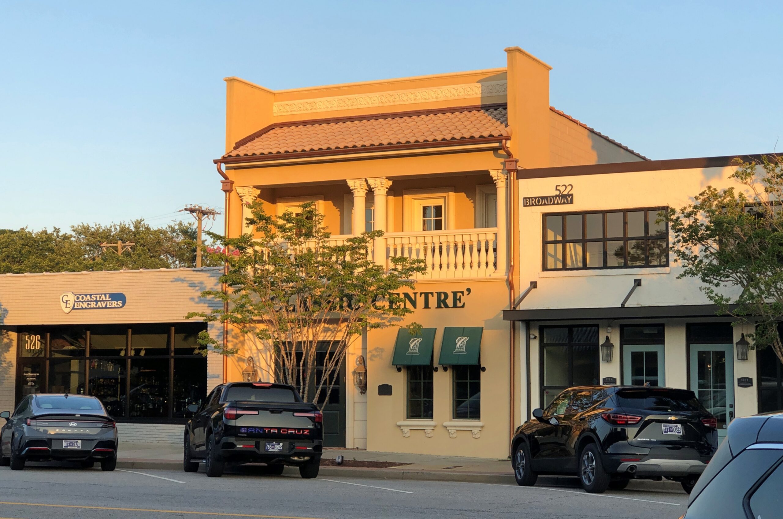
Had a pleasant walk down a non-tourist street on a Sunday in Myrtle Beach. Not a lot going on. The late afternoon light had a nice glow.
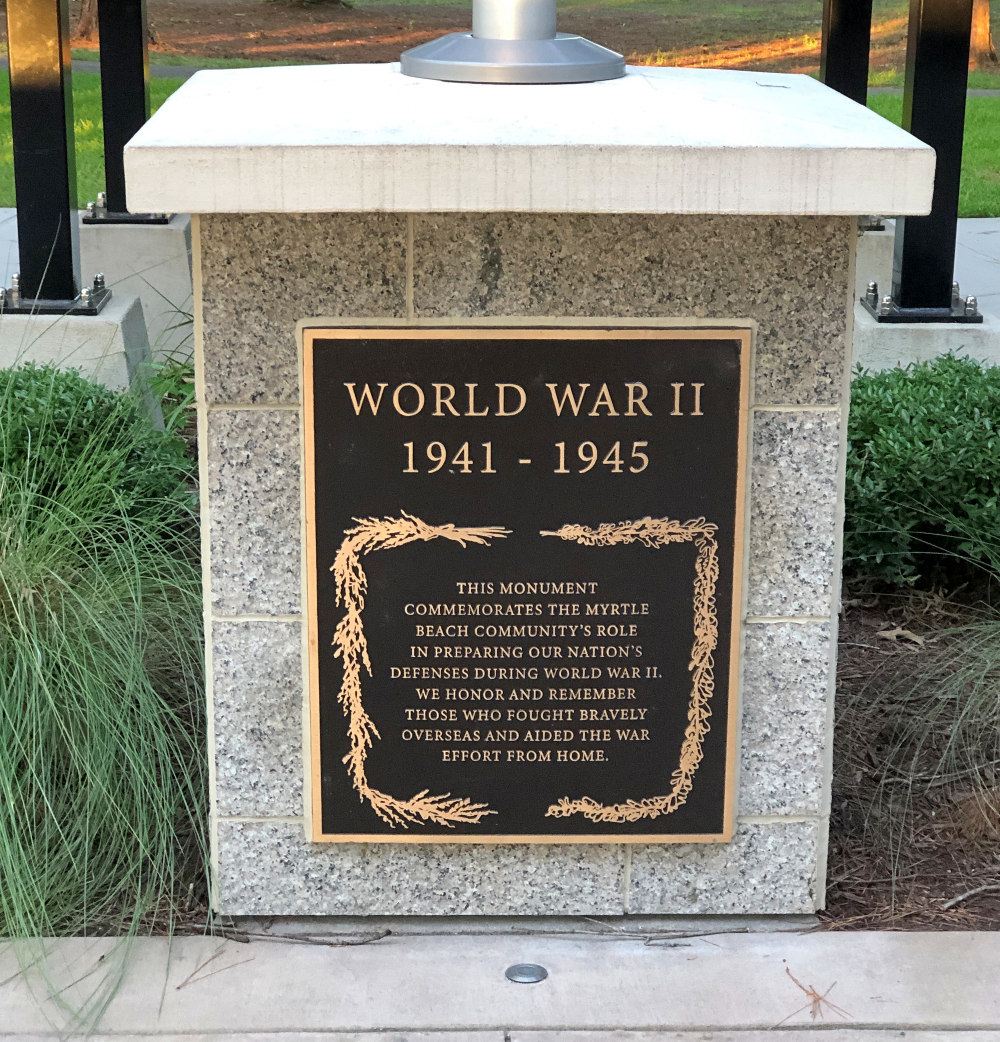
Myrtle Beach International Airport used to be Myrtle Beach Air Force Base, which began as Myrtle Beach General Bombing and Gunnery Range in 1942 for use by the U.S. Army Air Corps. It closed in 1993.
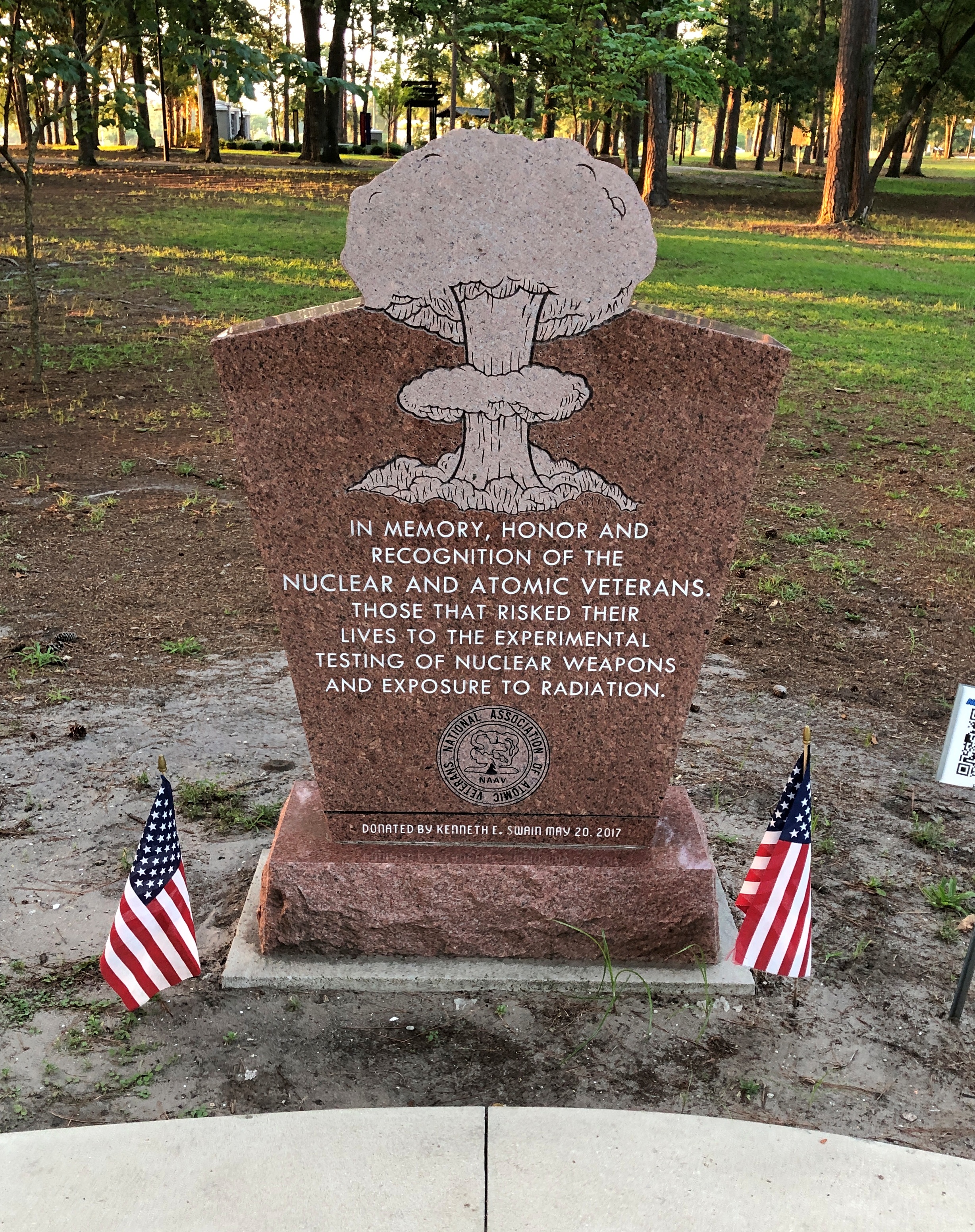
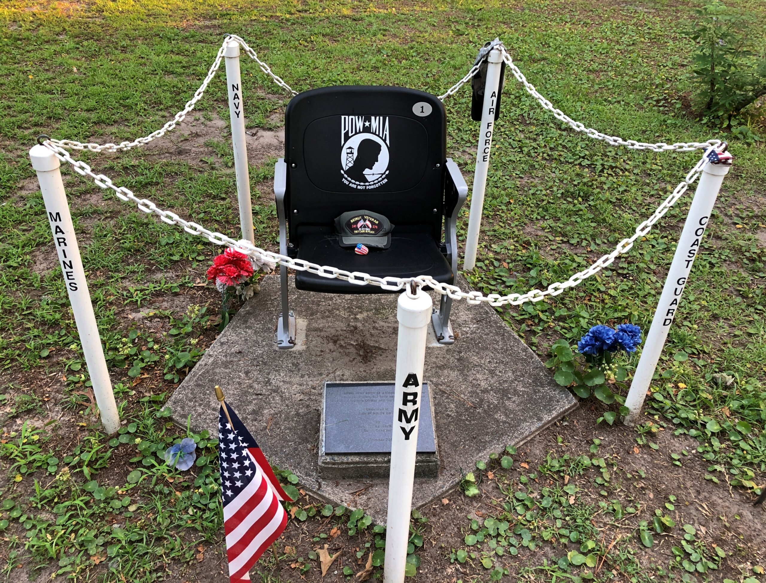
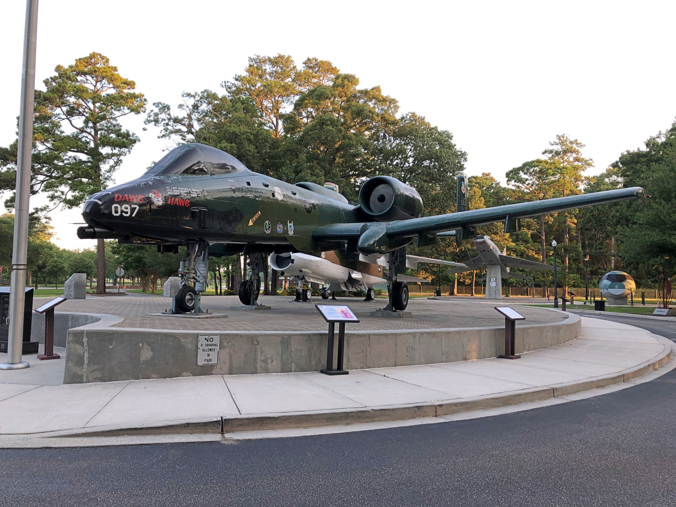
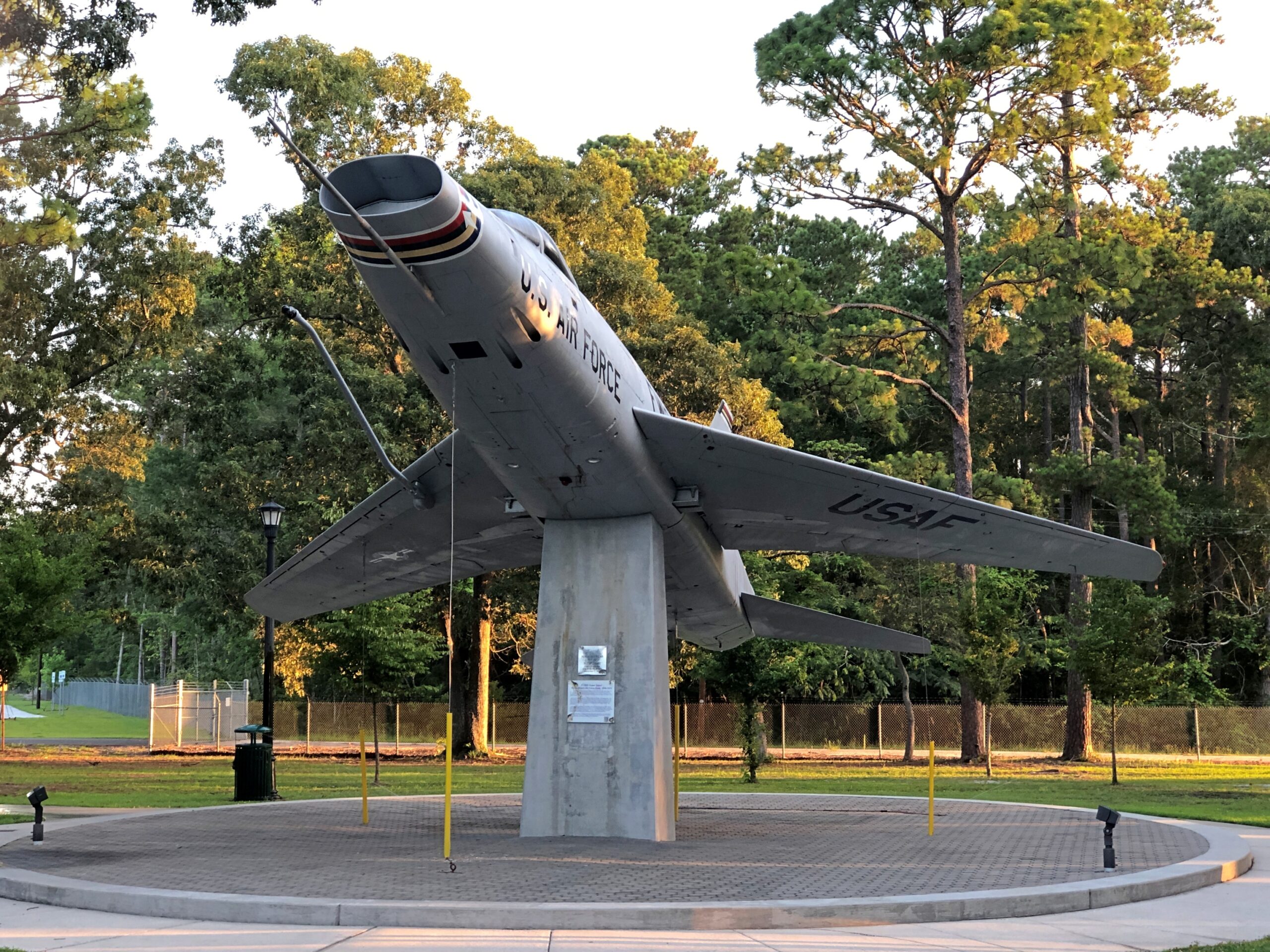
One legacy of the base is a cluster of military memorials near the perimeter of the airport – at a place called Warbird Park, which is fully accessible to casual visitors – that includes something you don’t see all the time.
It is one memorial among many.
As well as some of the aircraft that used the air base.
Found at a MB beach shop among the clothes and beach equipment. Nothing says Myrtle Beach better than skulls, no?
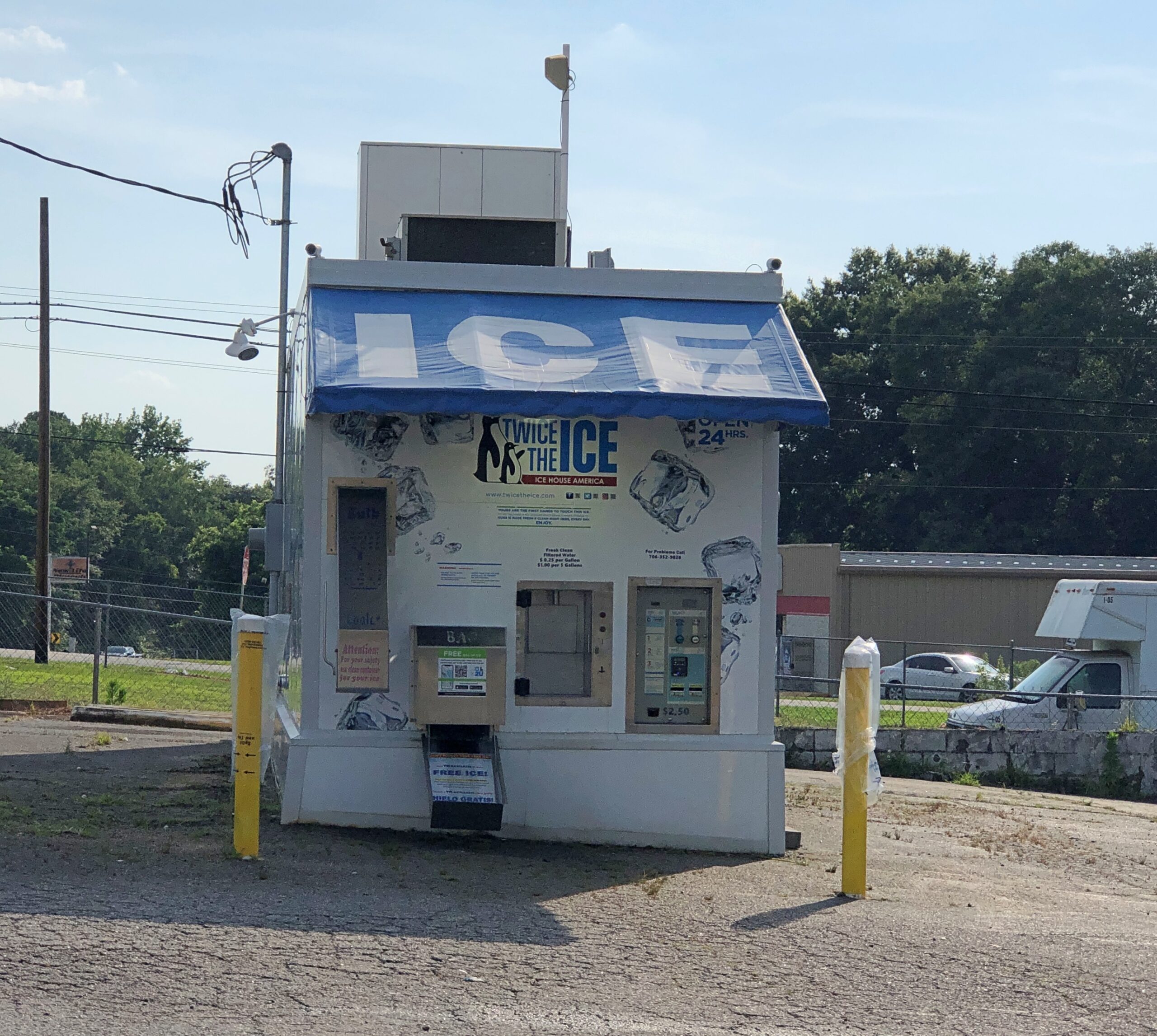
An automated, Fotomat-style ice store in north Georgia. They’re not as common up north, with the closest of this brand to me (I checked) in Aurora, Illinois.
Twice the Ice is the brand name. Quick facts: there are about 3,300 Twice the Ice locations so far in the United States and elsewhere – water and ice “vending machines,” according to one page on the company web site. Another page on the same site puts it at over 4,000 locations, which just means part of the site isn’t being updated. Whatever the exact number, there are a lot, and most if not all are franchised, representing about 1,000 franchisees.
It’s automation we call all get behind. I don’t think the machines are putting ice handlers and baggers at local gas stations and grocery stores out of work, since who holds that specific job?
So far as I know, “Ice is Civilization” is not the company motto. But it could be. It was said with such conviction by Allie Fox in The Mosquito Coast.
Of course, by the end of the book and movie both, he was howl-at-the-moon mad. So maybe some other slogan. Then again, that line is one of the few things – besides the fact that Allie Fox goes nuts chasing Utopia – that I remember from either the book or the movie after about 35 years. So it’s pretty memorable.
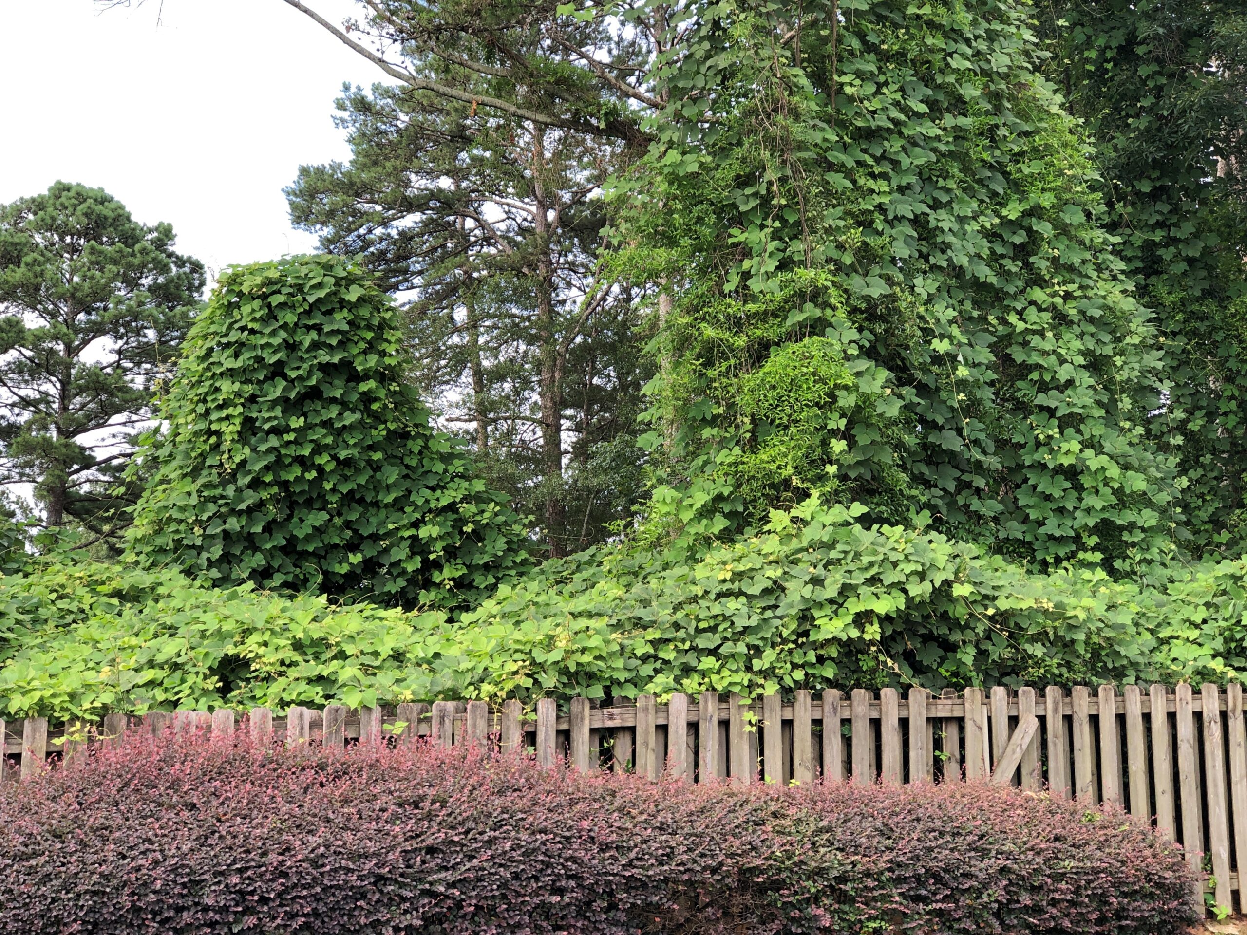
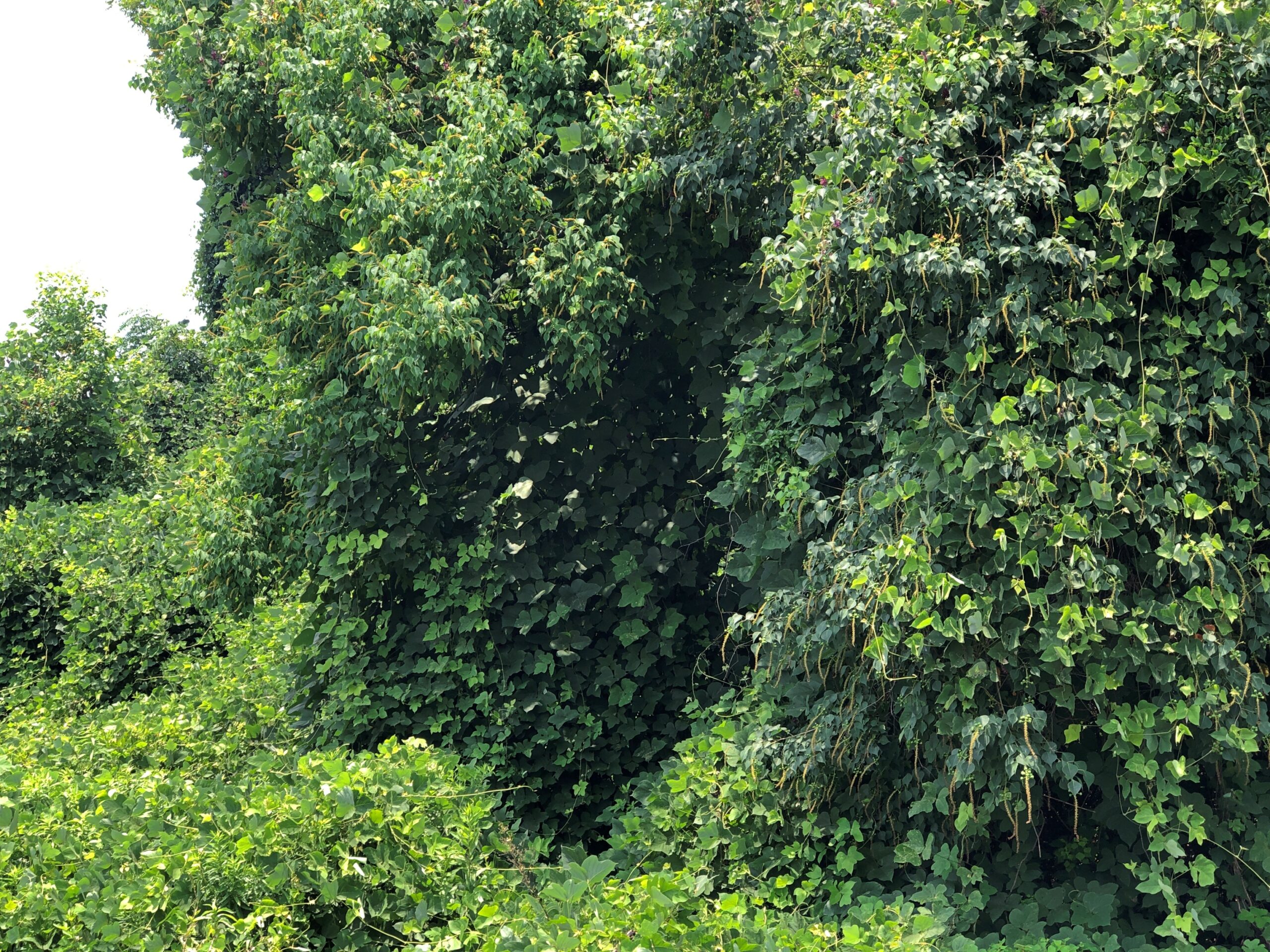
After gassing up at a station in north Georgia, I parked away from the pumps near the edge of the property to fiddle with my phone for a few minutes. Just outside the car window, kudzu lurked.
Which got closer.
And closer. Man, it grows fast.
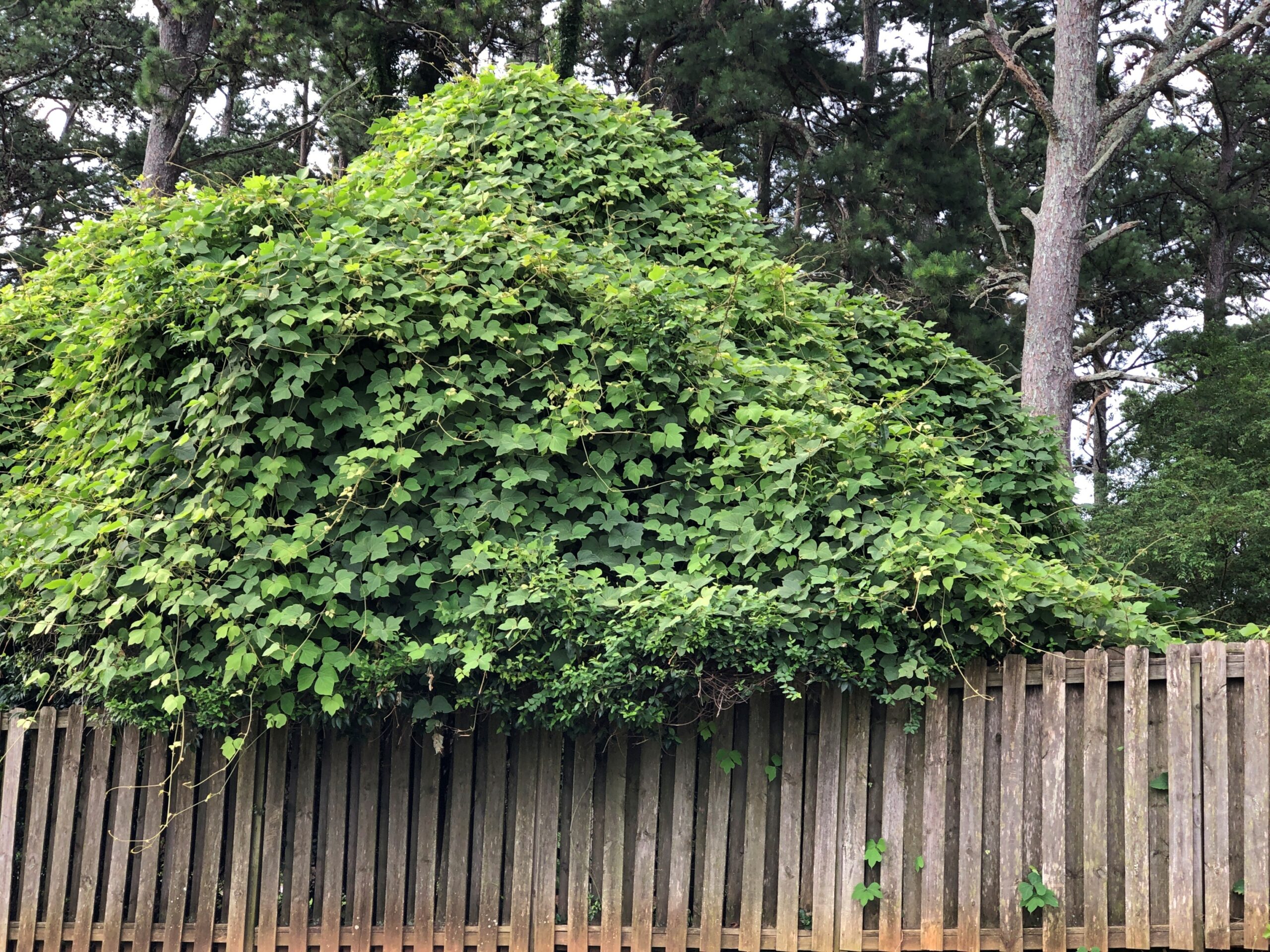
Not really, but I did see all that kudzu at the edge of the gas station property. Kudzu. Who hasn’t seen the walls of it down South?
“In news media and scientific accounts and on some government websites, kudzu is typically said to cover seven million to nine million acres across the United States,” Smithsonian magazine reported in 2015. “But scientists reassessing kudzu’s spread have found that it’s nothing like that. In the latest careful sampling, the U.S. Forest Service reports that kudzu occupies, to some degree, about 227,000 acres of forestland, an area about the size of a small county and about one-sixth the size of Atlanta.
“That’s about one-tenth of 1 percent of the South’s 200 million acres of forest. By way of comparison, the same report estimates that Asian privet had invaded some 3.2 million acres — 14 times kudzu’s territory. Invasive roses had covered more than three times as much forestland as kudzu.”
Yet kudzu is regarded as a particularly intractable invasive species. How is that? It grows well in highly visible places. Such as next to a gas station parking lot. Smithsonian notes: “Those roadside plantings — isolated from grazing, impractical to manage, their shoots shimmying up the trunks of second-growth trees — looked like monsters.”
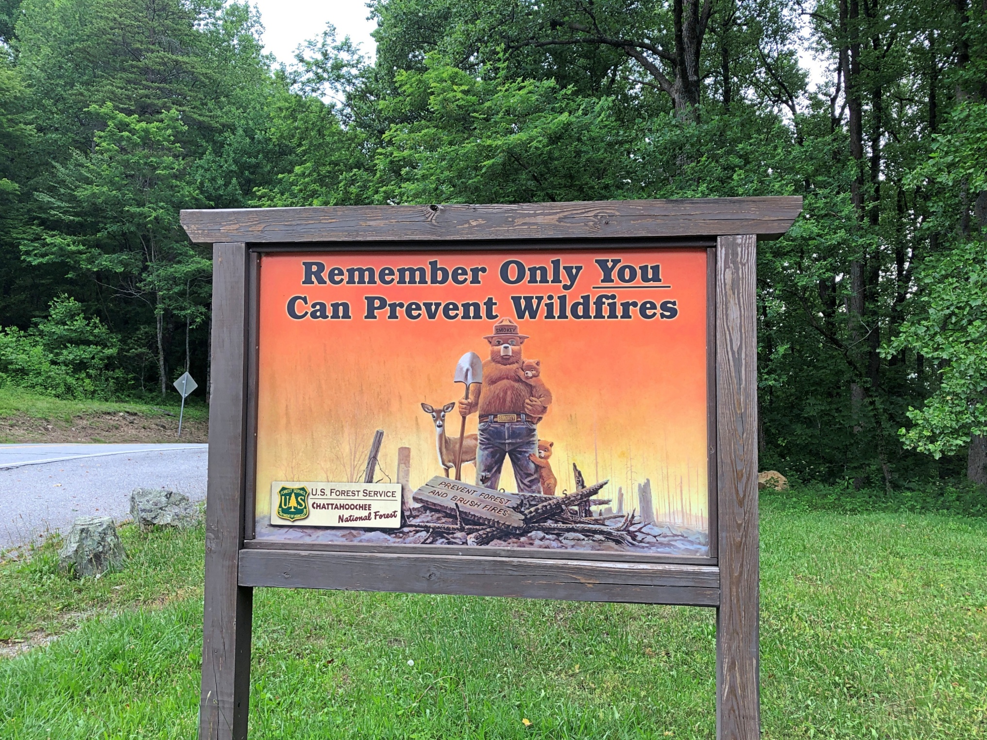
Along Georgia 60 in Chattahoochee NF, Smokey Bear is still at his job.
One thing leads to another online, and Smokey eventually lead me to “Smokey the Bear Sutra.” Only takes a few minutes to read, and it’s a trip. Just like the song “Elvis is Everywhere,” there’s a founding document of a religion in the distant future, one that asserts that humans should never have given up worshiping bears.
My spring break trip in March 1981 with Neal and Stuart involved time on the Outer Banks of North Carolina, and we planned to cross into South Carolina for a visit to Myrtle Beach. But because of the ferry schedule between islands, we spent a memorable night on Ocracoke Is., and determined that there was no time for Myrtle Beach. We made it as far as Wilmington, NC.
I thought of that on my drive between New Bern and Myrtle Beach last month, which was mostly, but not entirely, on US 17. Just another example of how I think: When I miss a planned destination for some reason or other, something doesn’t quite sit right until I go there eventually. At 44 years and some months, the lag between planning to go to Myrtle Beach and realizing that visit was unusually long, but in any case I finally made it on June 20, 2025, a Friday, and I stayed until the following Monday. Yuriko joined me those days.
Crossing into SC on US 17, you first encounter North Myrtle Beach, which seemed every bit as developed and tourist-oriented as Myrtle Beach itself, replete with restaurants and motels and retailers, including a wide variety of beach retailers whose large-letter marquees made bold and nearly worthless promises about low prices.
North MB is also where I started noticing the area’s miniature golf courses. Or, as the industry seems to call it, mini golf, because there is such a thing as the American Mini Golf Alliance and the US ProMiniGolf Association (pro?). Then again, a simple search also turns up the World Minigolf Sport Federation and Miniature Golf Association of America, along with the Professional Putters Association (professional?). There’s clearly a lot I don’t know about miniature golf.
In North MB, you drive by Hawaiian Village Mini Golf, Hawaiian Rumble (home of the Mini Golf Masters tournament), Mayday Golf, Professor Hacker’s Dinosaur Adventure and Professor Hacker’s Lost Treasure Golf, among others. In Myrtle Beach proper, among others, there’s Broadway Grand Prix, Captain Hook’s Adventure Golf, Jungle Safari Mini Golf, Jurassic Mini Golf, Popstroke, Red Dragon Cove Adventure Golf, Aloha Mini Golf, and one that was truly hard to miss, Mt. Atanticus Minotaur Golf.
Visit Myrtle Beach says there are over 30 mini golf courses in the area, their faux oddities rising near major thoroughfares – artificial landforms, cartoonish pirate ships, weird sea creatures and so many dinosaurs, at least in my memory. Had daytime temps been anything less than 90° F. or so, we might have picked one and putted some balls around for a lark. Or, failing that, I might have spend time on sidewalks outside their fences, taking pictures. There’s a coffee table book in all the Myrtle Beach mini golf spectacle, or at least an extensive Flickr page.
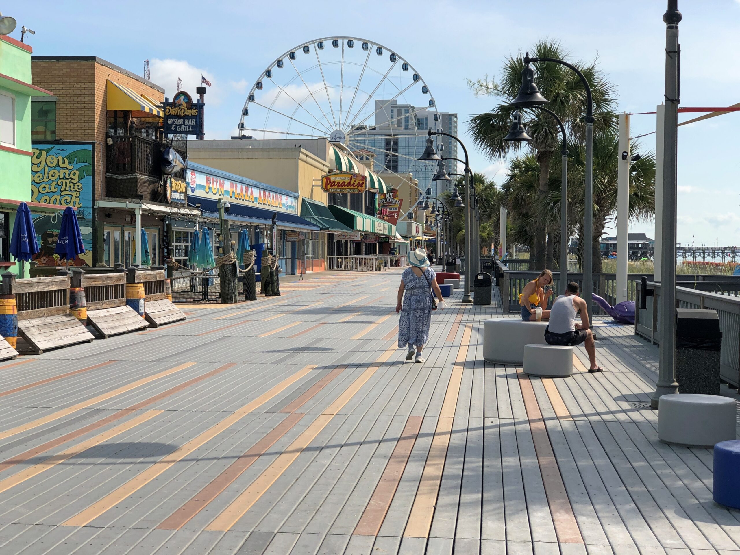
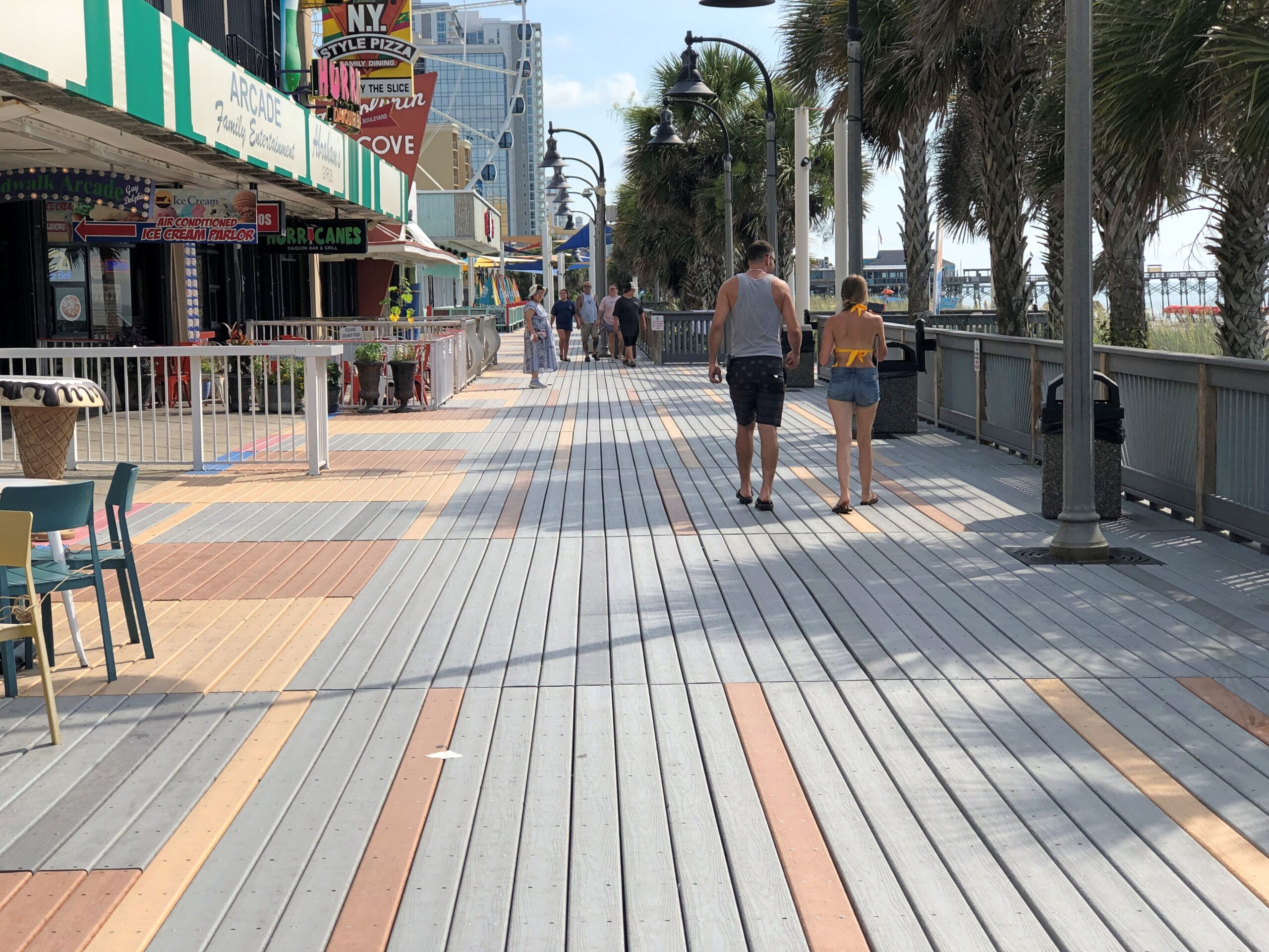
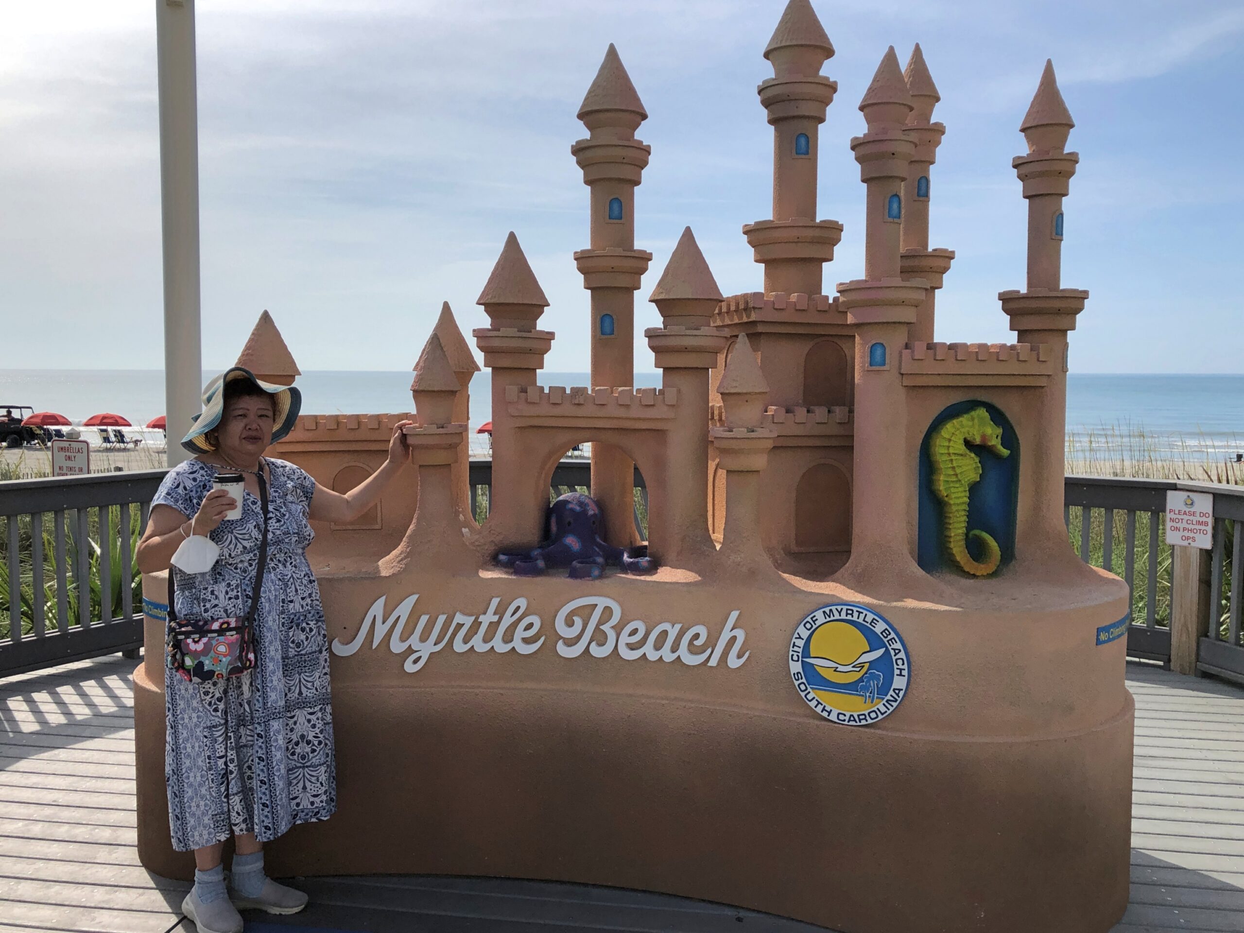
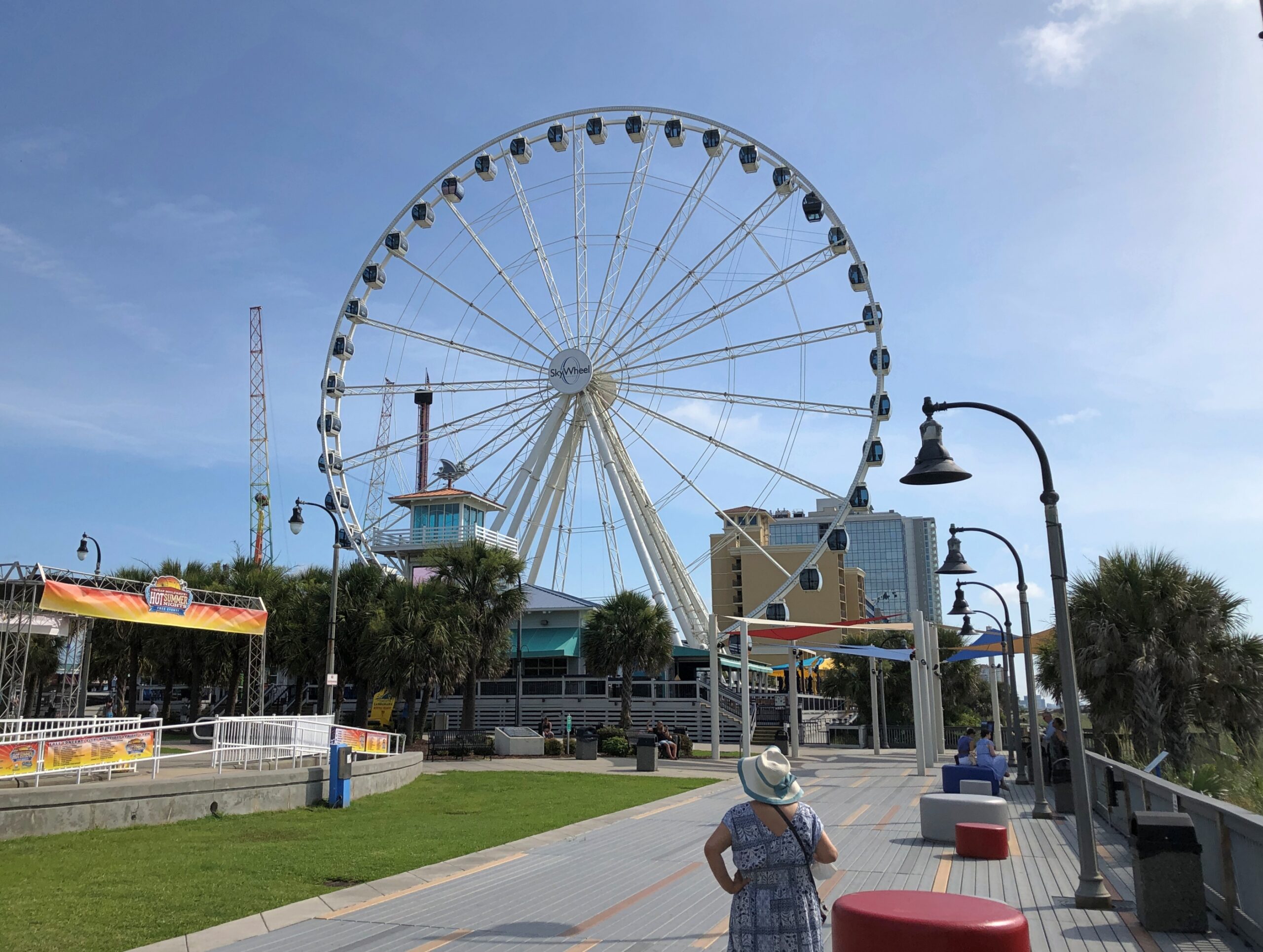
We decided instead to spend our limited amount of daytime outdoor time at Myrtle Beach’s actual beach, which is bordered by a boardwalk.
Late that Sunday morning in June, the boardwalk wasn’t particularly busy. Could have been the heat dome. I figure the place is hopping around spring break time, or the month after Thanksgiving, for instance.
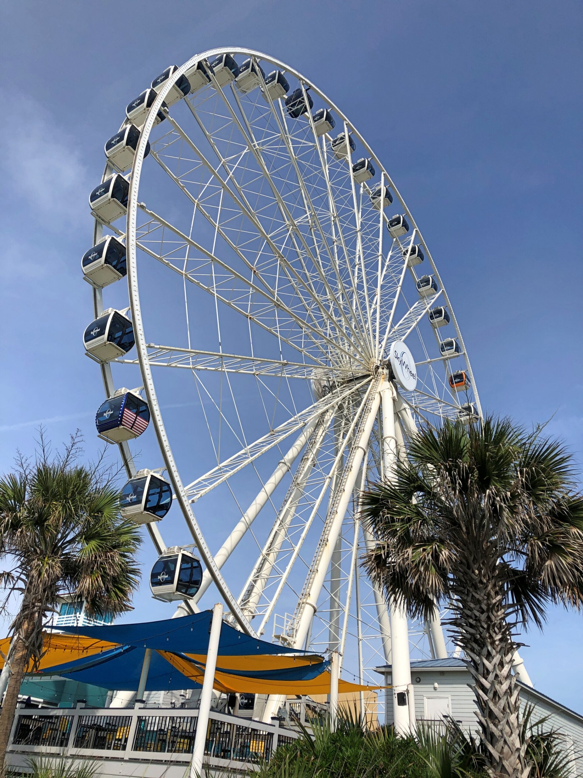
Any boardwalk with its salt is going to include a Ferris wheel in the vicinity. Officially, it’s the SkyWheel Myrtle Beach.
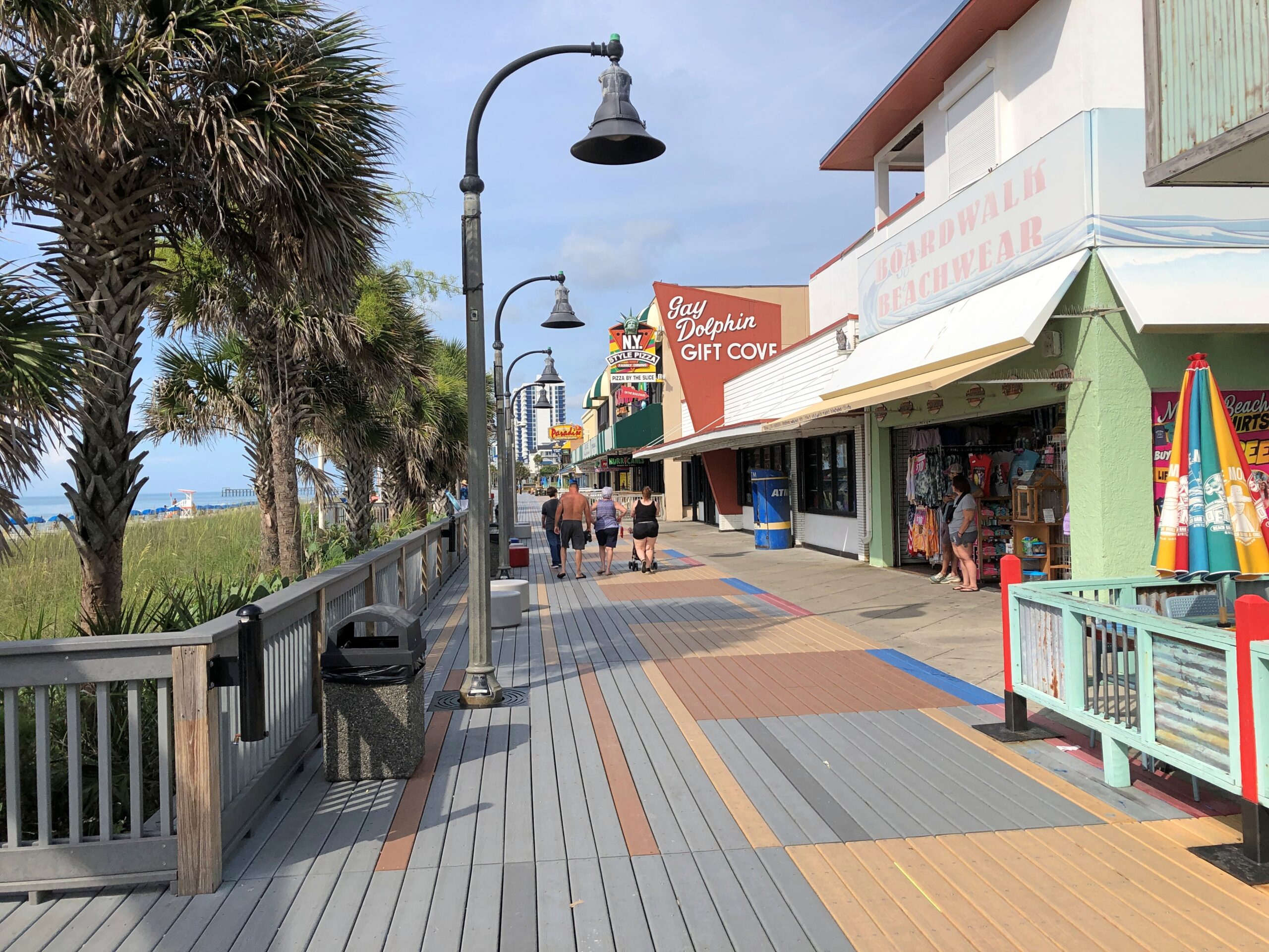
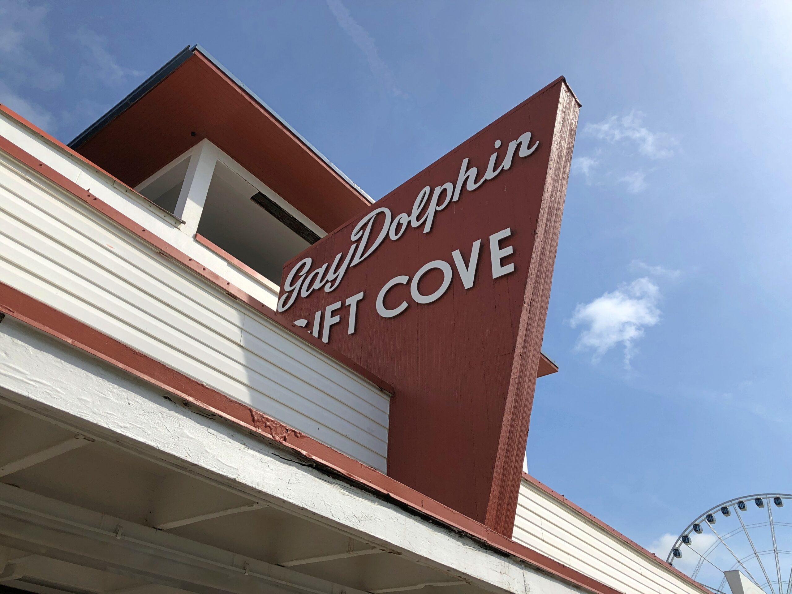
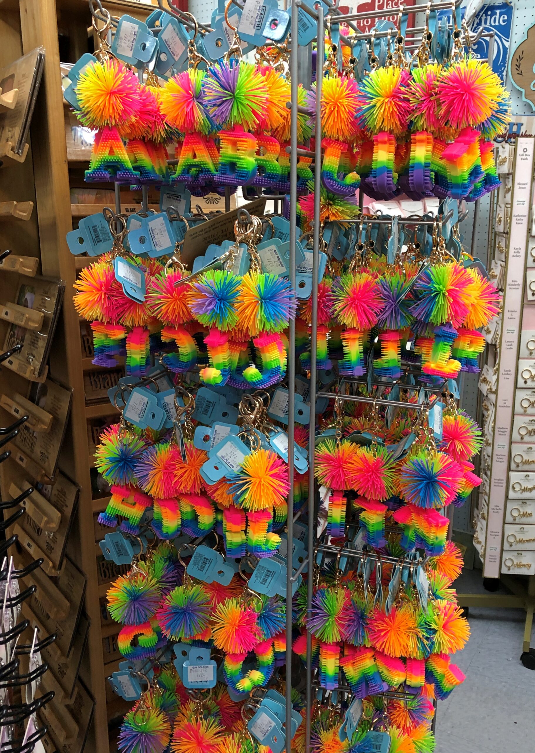
We decided that the $40+ for the two of us on the wheel would be better spent on lunch. It was, at tourist prices at a restaurant-bar open to the boardwalk, but not completely sky high. Then we found our way to the Gay Dolphin Gift Cove, whose fame preceded it. That is, I read about it online before the trip.
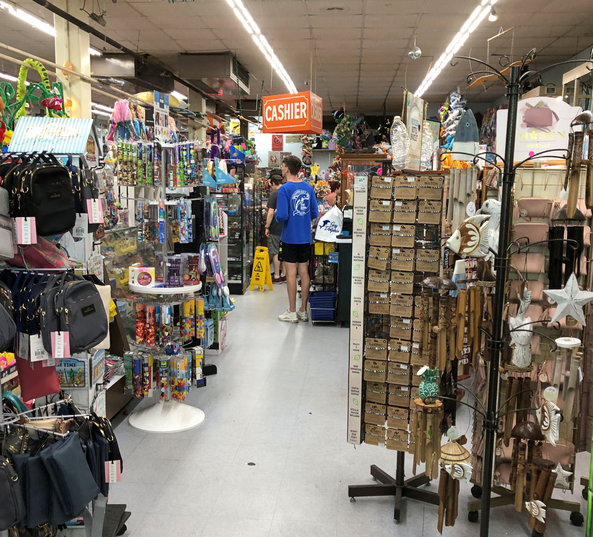
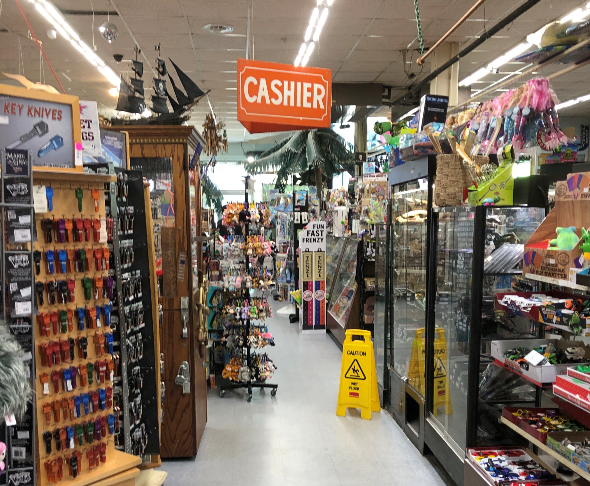
As a souvenir emporium, four stories stocked with gewgaws and gimcracks, the Gay Dolphin doesn’t disappoint. A store of that name has been on this site since 1946, though Hurricane Hazel destroyed the original in 1954, along with much of the rest of Myrtle Beach.
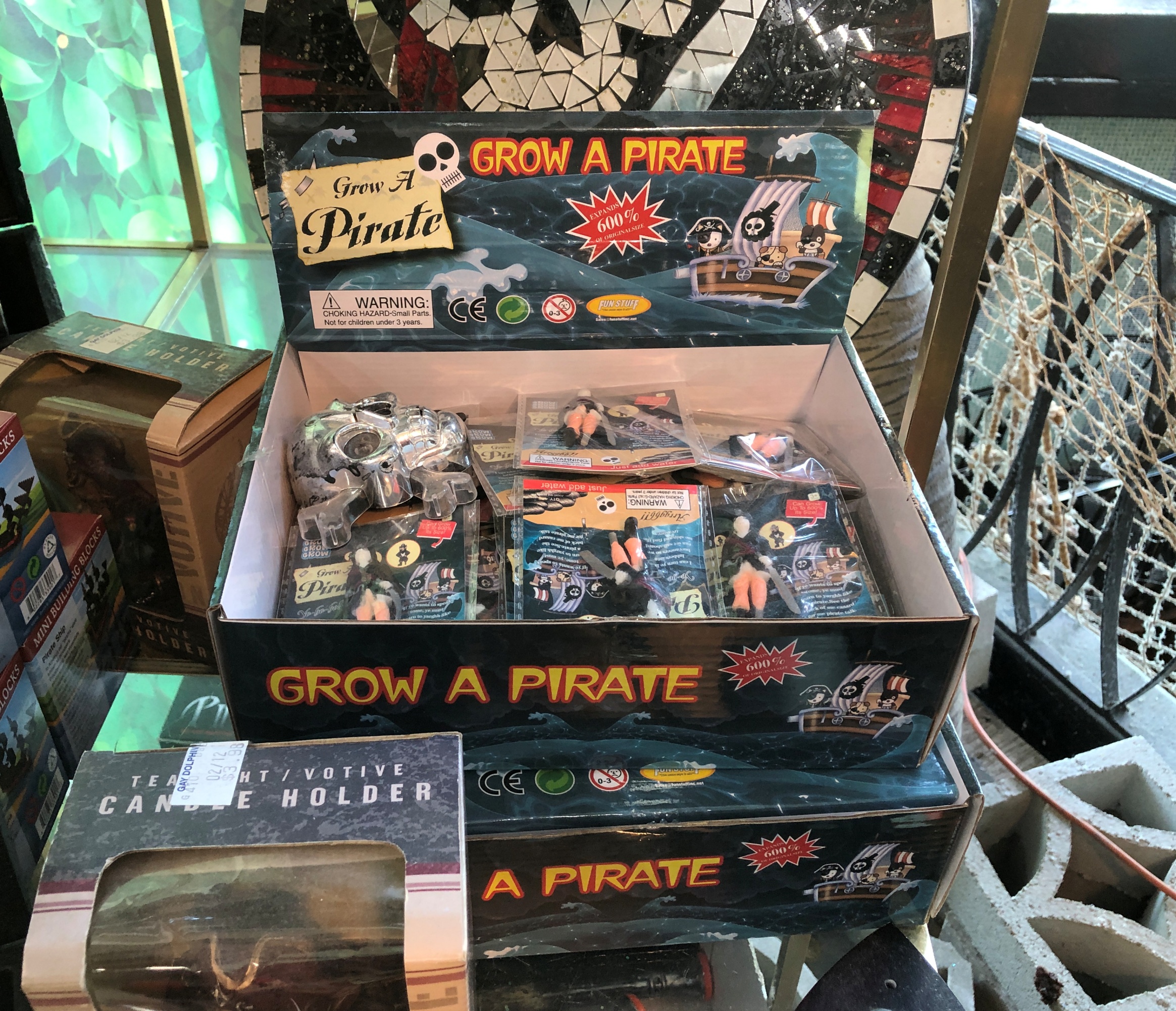
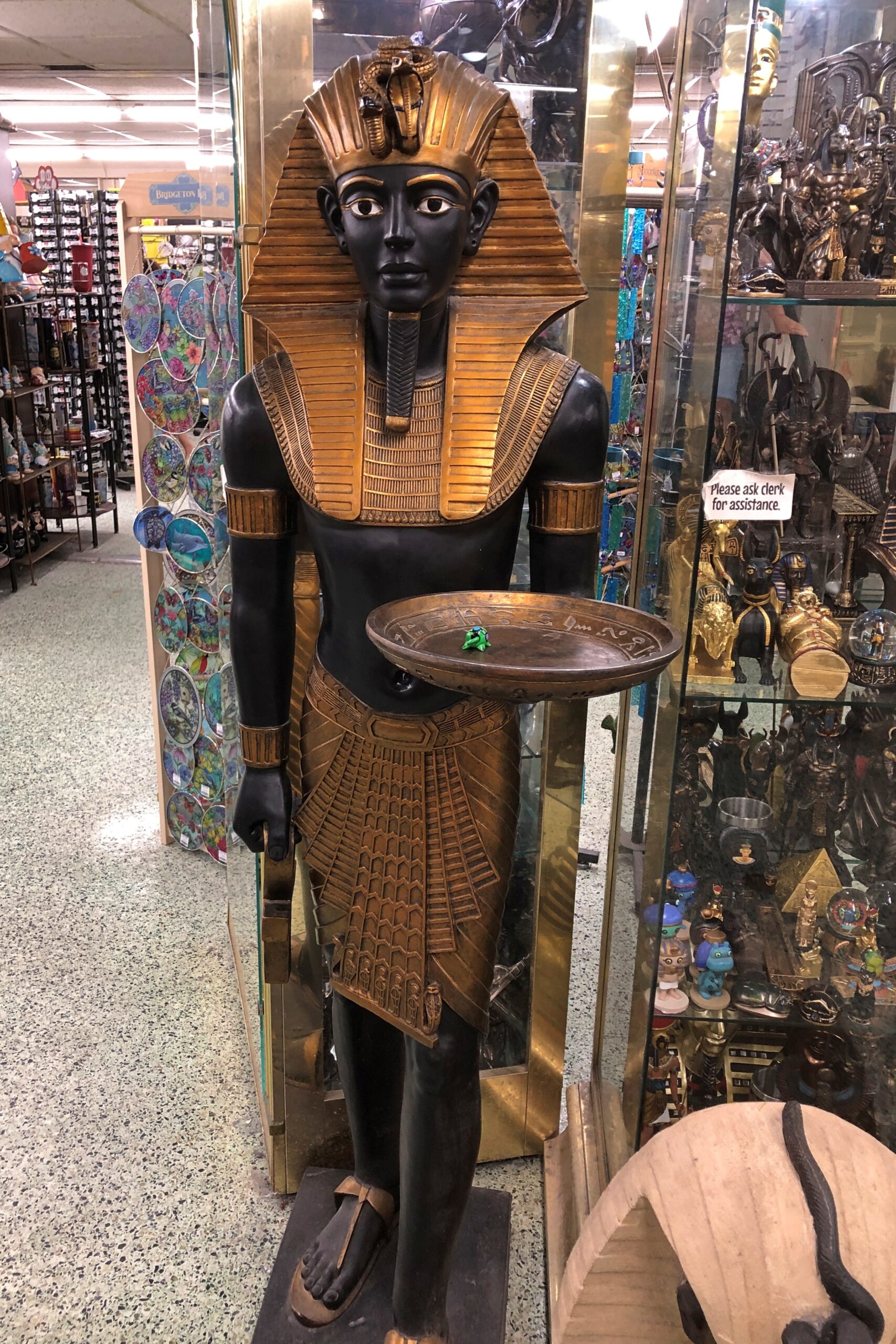
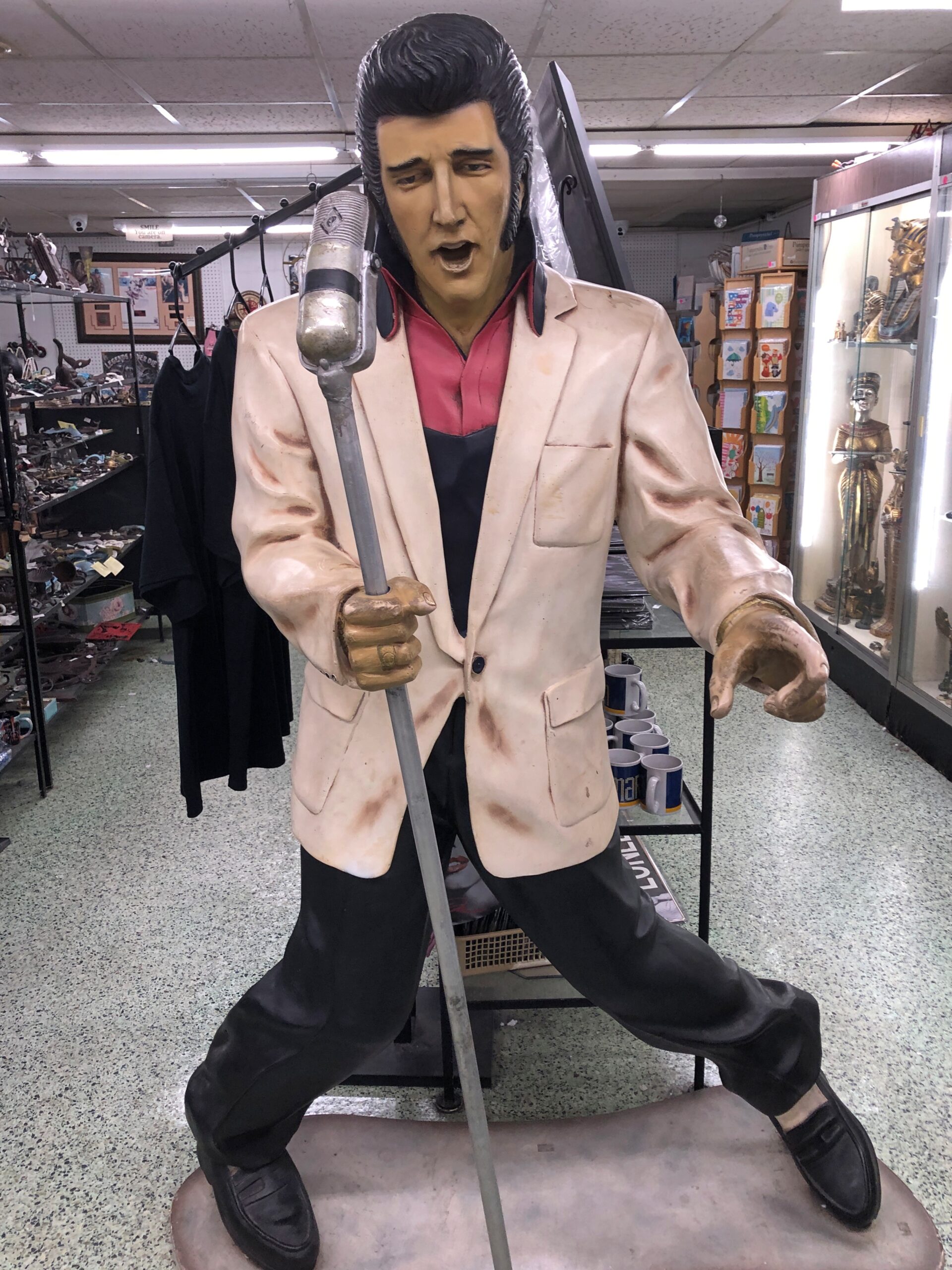
Things I never imagined would be for sale, or even exist, are for sale there.
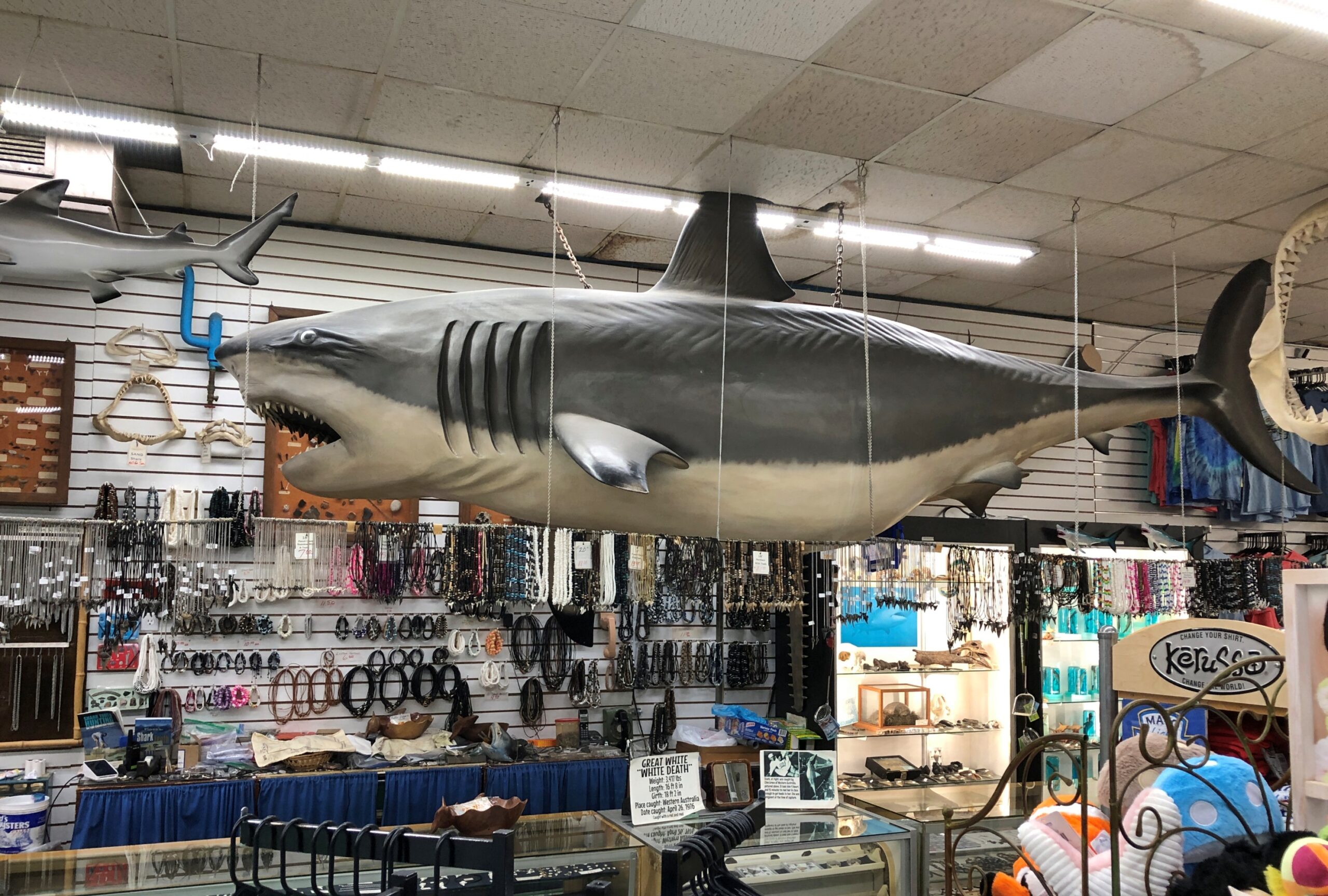
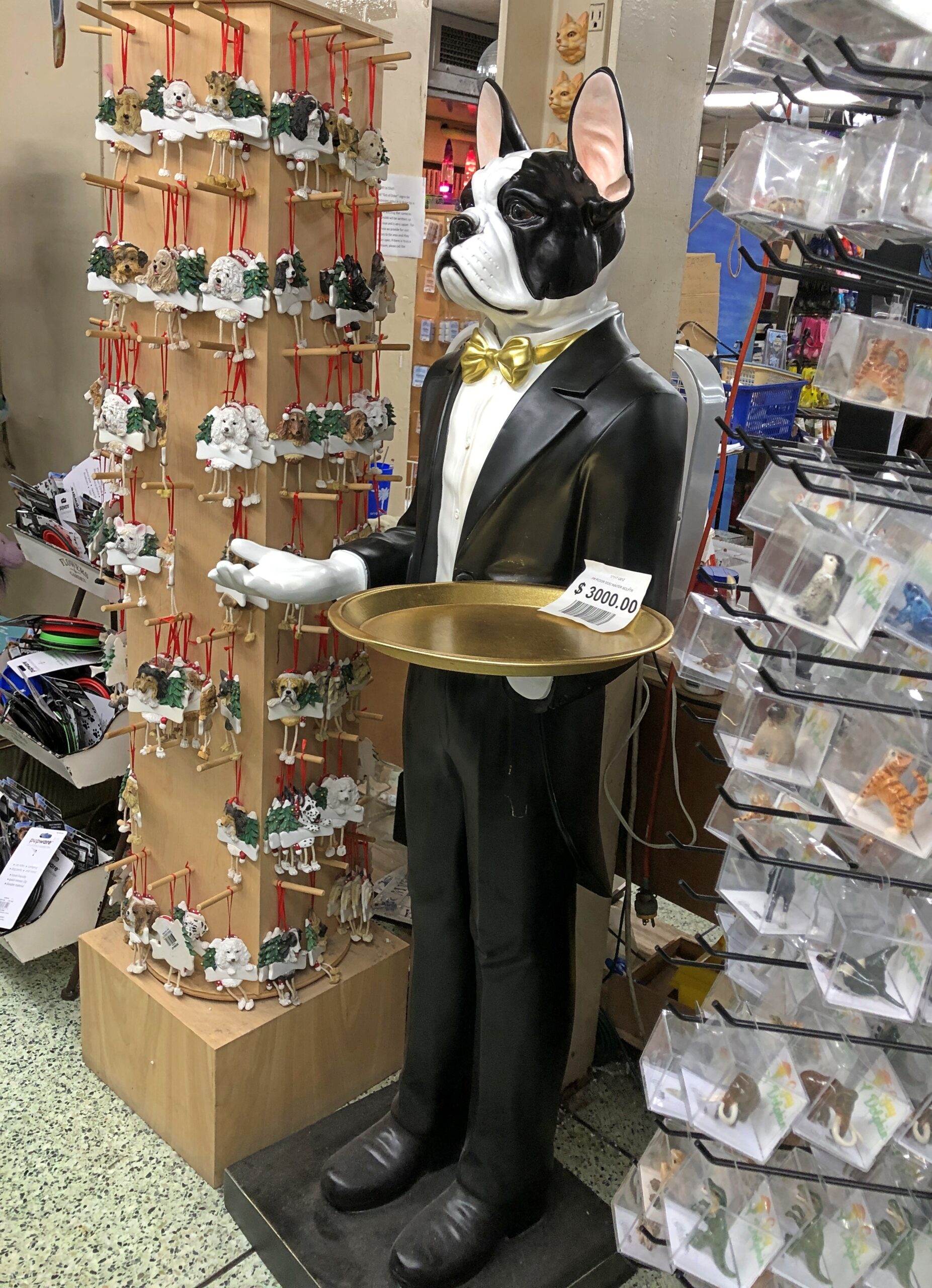
Not just small items, either, but sizable ones. Maybe this shark is for sale. It must be, just at a price I’d never want to pay.
Same for these figures.
Looks like the list price for the man-dog in formal wear is $3,000. So yes, more than I’d care to pay. We weren’t much in the market for souvenirs anyway, but I will say this for the Gay Dolphin: it had a large rack of postcards. New cards, but also vintage, mid-century cards for all of 50 cents each. I bought a bunch. Good for you, Gay Dolphin.


