The Alex Jordan Center is the first building of The House on the Rock you encounter after the ticketing building. Reached by a walkway through an “Asian garden” (an odd mix of Chinese and Japanese elements), the center is essentially a museum devoted to The House creator, Alex Jordan Jr. (1914-1989), with information about him and his lifelong obsession with building the complex, and filling it with stuff.
 There’s more information on the walls of the Alex Jordan Center than is easily available elsewhere, especially online (as Wiki puts it, “published information on Jordan’s life is scarce”). Much of what’s written about the place follows the Roadside America school of reportage: Wow, what a wacky place! Look how wacky it is! Can you believe how wacky this place is?
The House on the Rock is wacky. Ah, but so much more. My impression is that Alex Jordan was something of a ne’er-do-well whose parents supported him until he lucked into a way to support his obsessions: charging people admission to see his stuff (that, and maybe farm subsidies). Once it got up and going, the place grow’d like Topsy. Except not quite: Jordan spurred the growth. Whatever the character of his obsessions, he also clearly wasn’t stupid. I was astonished to learn that he oversaw the design and construction of some of the automatic music machines, which look as fantastically complex as any of the Disney animatronics.
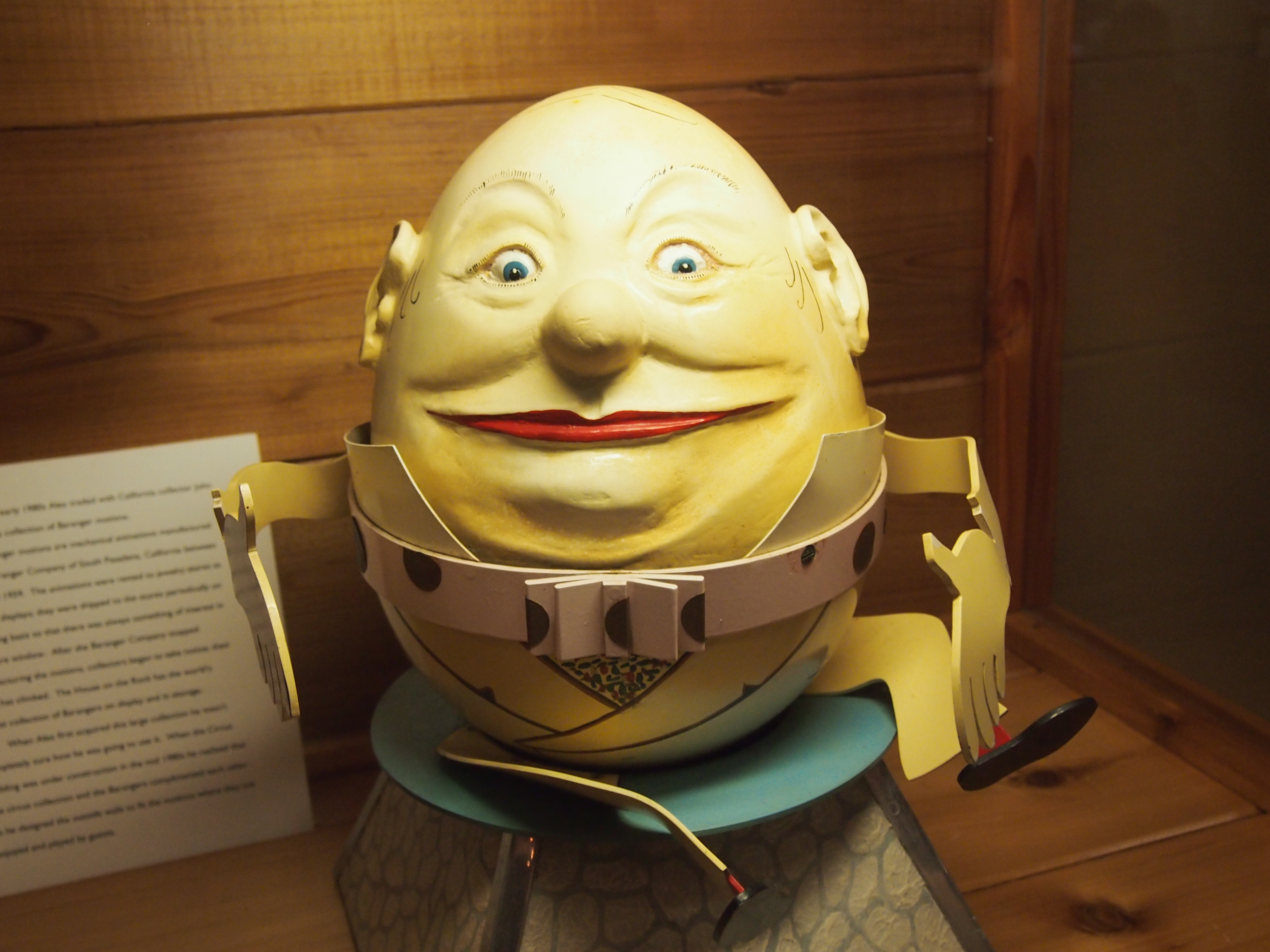
Here’s a smaller example of a kind of animatronics I’d never heard of before, one of which, with information, is in the Alex Jordan Center: “In the early 1980s, Alex traded with California collector John Daniel for a collection of Baranger motions…
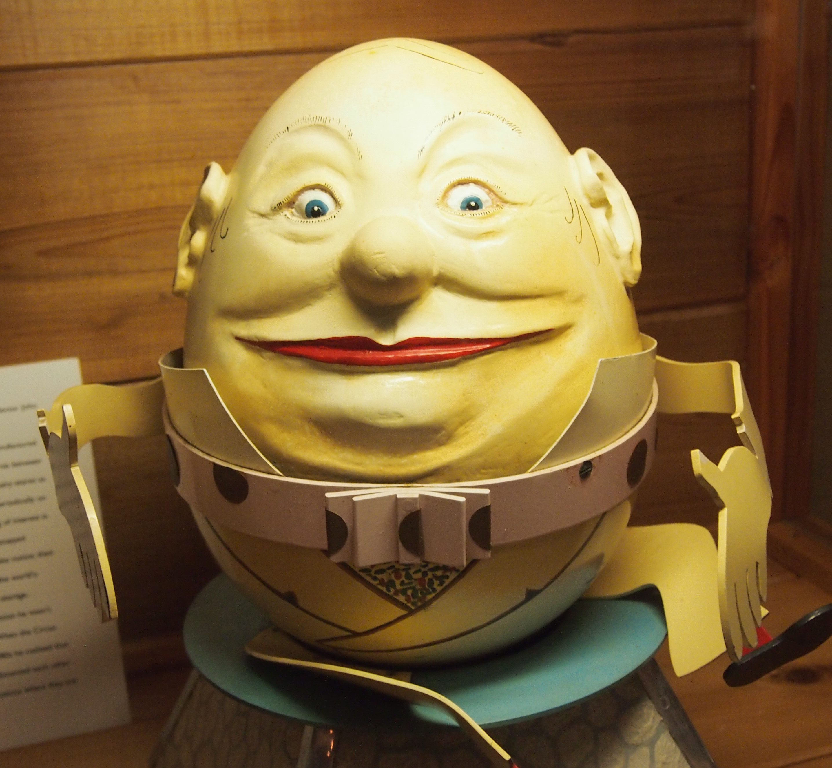 “Baranger motions are mechanical animations manufactured by the Baranger Company of South Pasadena, California between 1925 and 1959. The animations were rented to jewelry stores as window displays; they were shipped to the stores periodically on a rotating basis so that there was always something of interest in the store window… The House on the Rock has the world’s largest collection of Barangers on display and in storage.” (The Pollack Advertising Museum in Mesa, Ariz., reportedly has more.) The pictured eggman, a Humpty Dumpty Baranger, is only one of 14 in existence, according to one source.
Jordan must have also had a dash of P.T. Barnum in him. Why else would you have a three-story sea monster built for the world to see? On the other hand, I was happy to learn that The House on the Rock doesn’t particularly gouge its visitors. Admission for three adults and one child, bought at a discount on line, was less than $90, and certainly worth it. The gift shop was tourist-priced, but not excessive. One small example: postcards were a quarter each. I seem to remember that cards of Taliesin were more, maybe a dollar. The place doesn’t charge Buc-ee’s prices, in other words.
The House on the Rock is formally divided into three parts. The first part begins after leaving the Alex Jordan Center, and includes the original structure: a dimly lit collection of rooms snaking around the side of the hill. At least, that’s what it felt like. Without a map, or an aerial view of the complex, it’s hard for a casual visitor to tell how it’s all put together. Not that that matters. Once you’re into the groove of the place, passing through twisting corridors and crossing pedestrian bridges and climbing staircases and wandering along footpaths through mildly claustrophobic tunnels, and even taking in an occasional view of the outside, it’s just one thing after another. Quite literally.
The first section was also the only part of the complex that remotely resembles living quarters, featuring (among other things) a simple kitchen looking about 40 years old. Other rooms included pieces of furniture, such as couches and tables, and one has a large fireplace: elements of an elaborate man cave, to use a term more recent than The House. With some stress on cave. Rock formed the basis of most of the walls, the ceilings were low, and much of the color scheme involved brown.
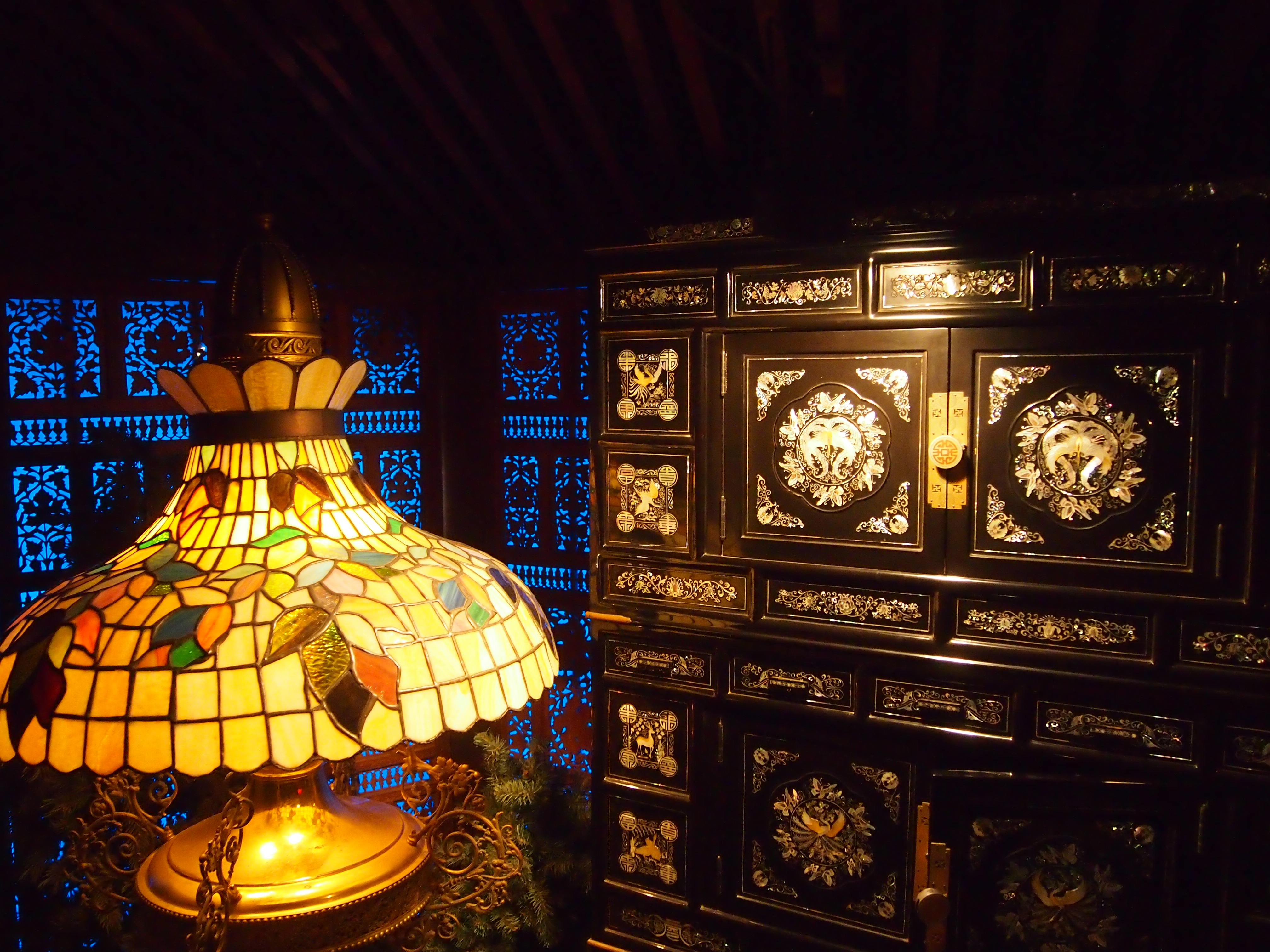
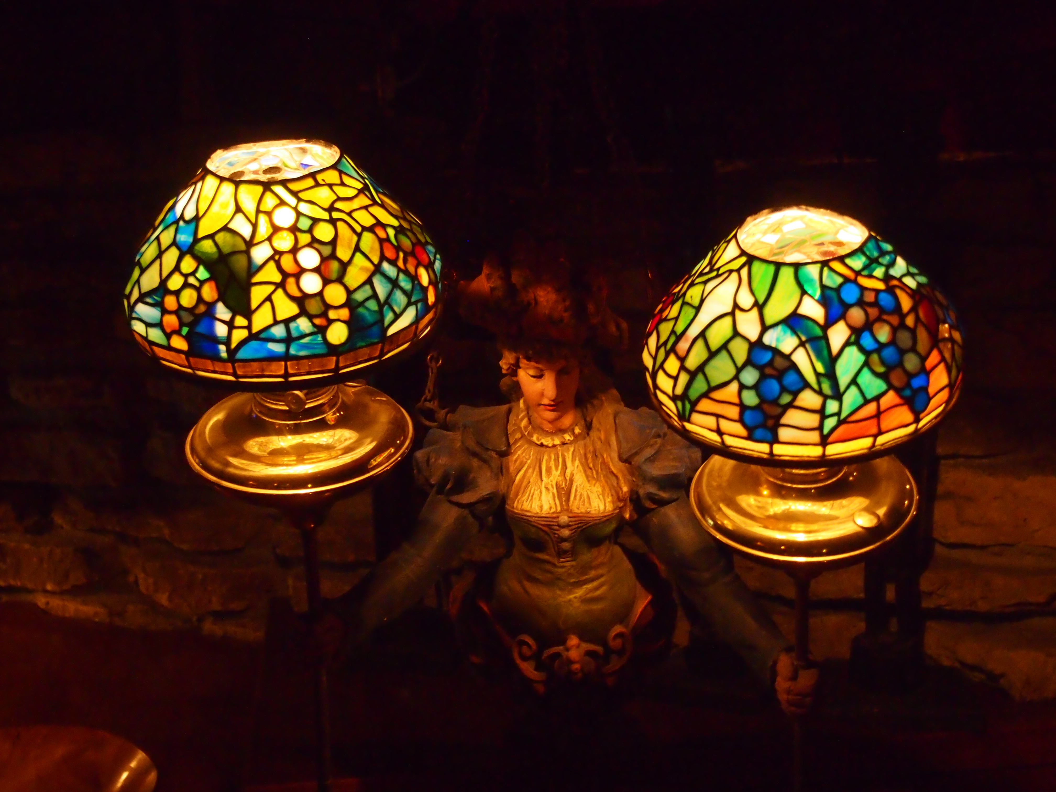
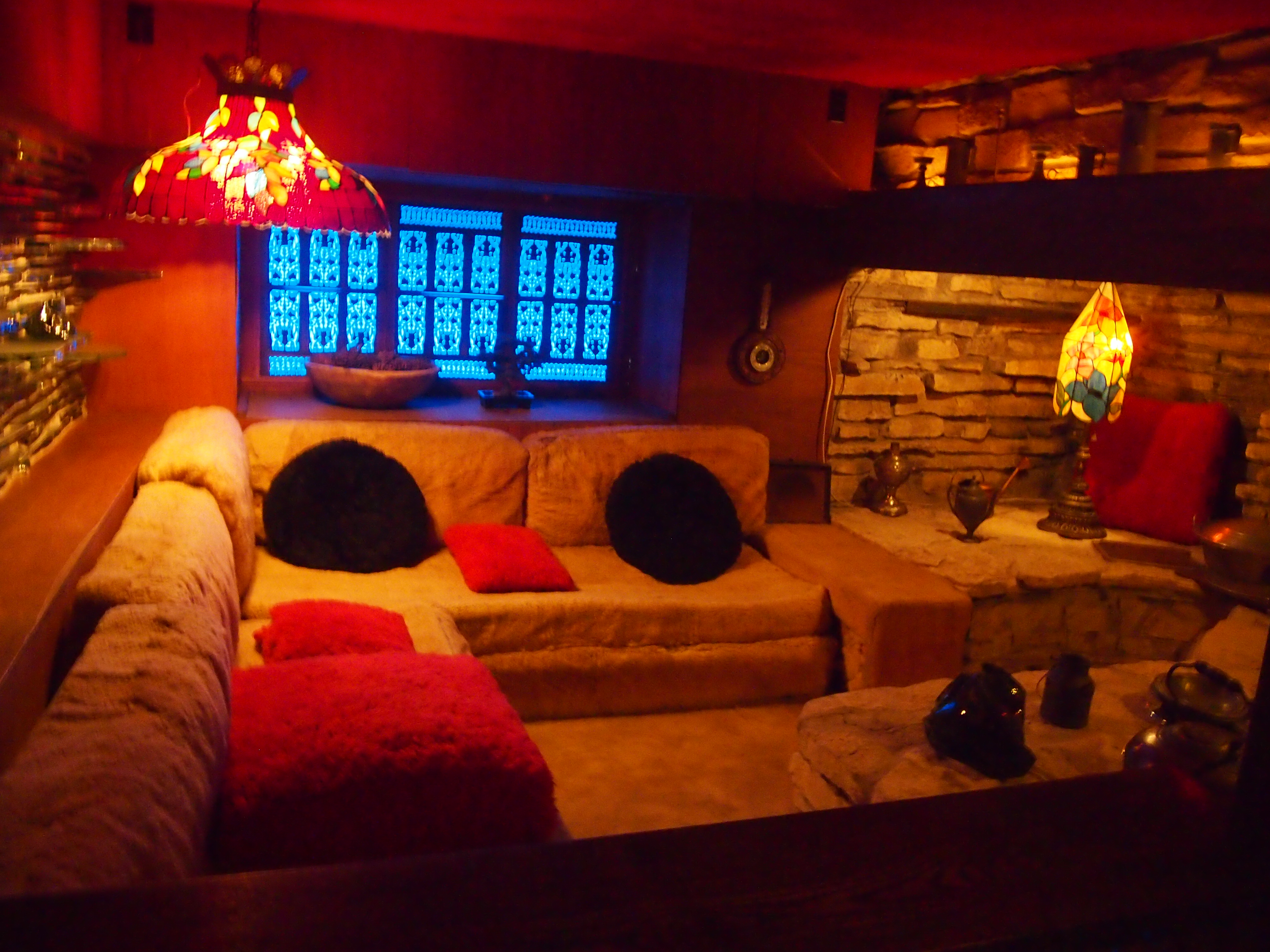 Most of the rooms weren’t so ordinary. Jordan’s fascination with collecting dolls, especially Japanese dolls, and Tiffany lamps, or Tiffany-like lamps, is apparent in many places.
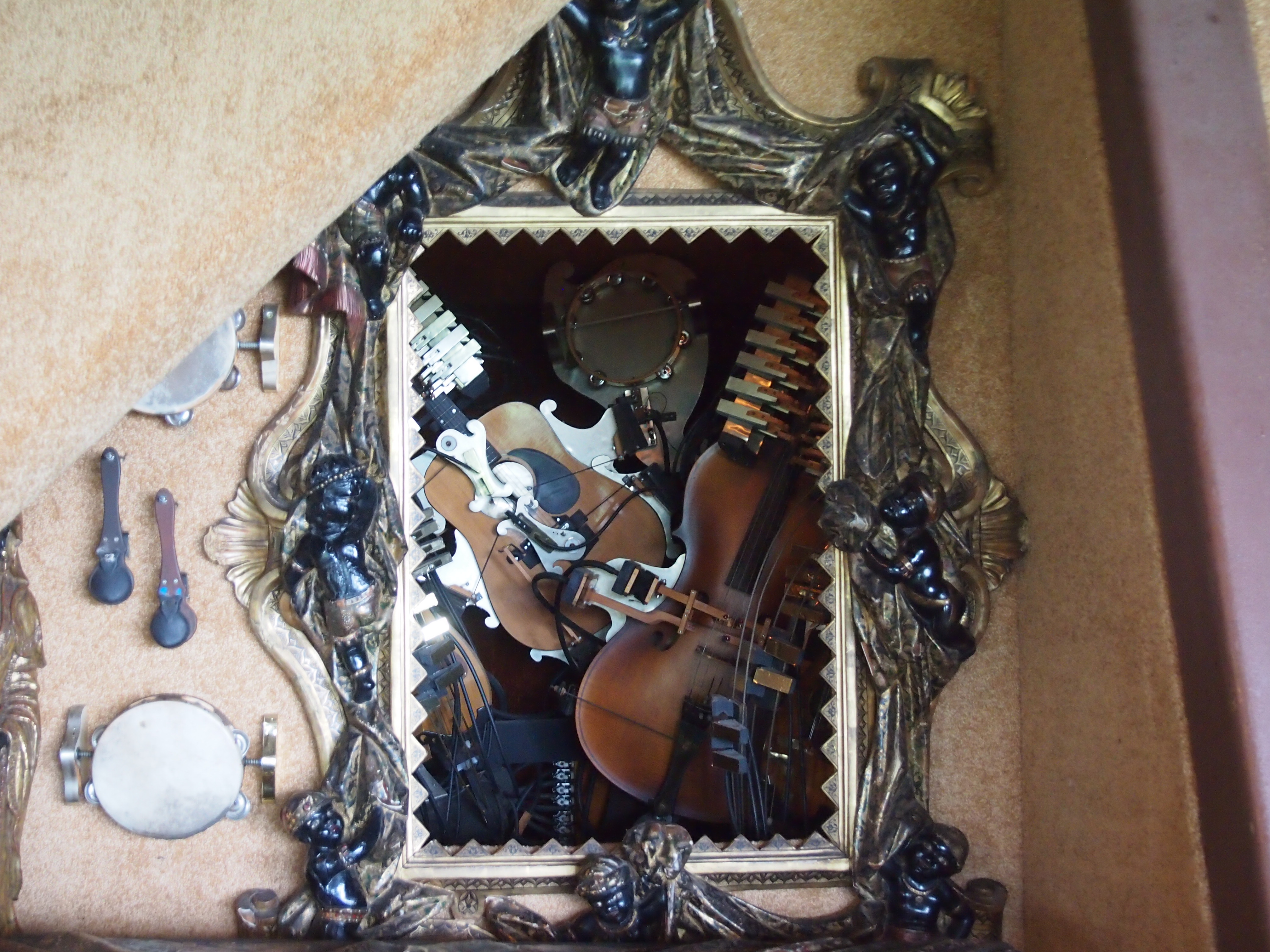
 The first section also included a handful of the automatic music machines that would show up in such quantity later in the complex. This looks like a painting of such a device — in fact, an homage to a famous painting I can’t quite place — but actually the device is behind a hole in the wall made to look like a frame. Insert a token and it makes music.
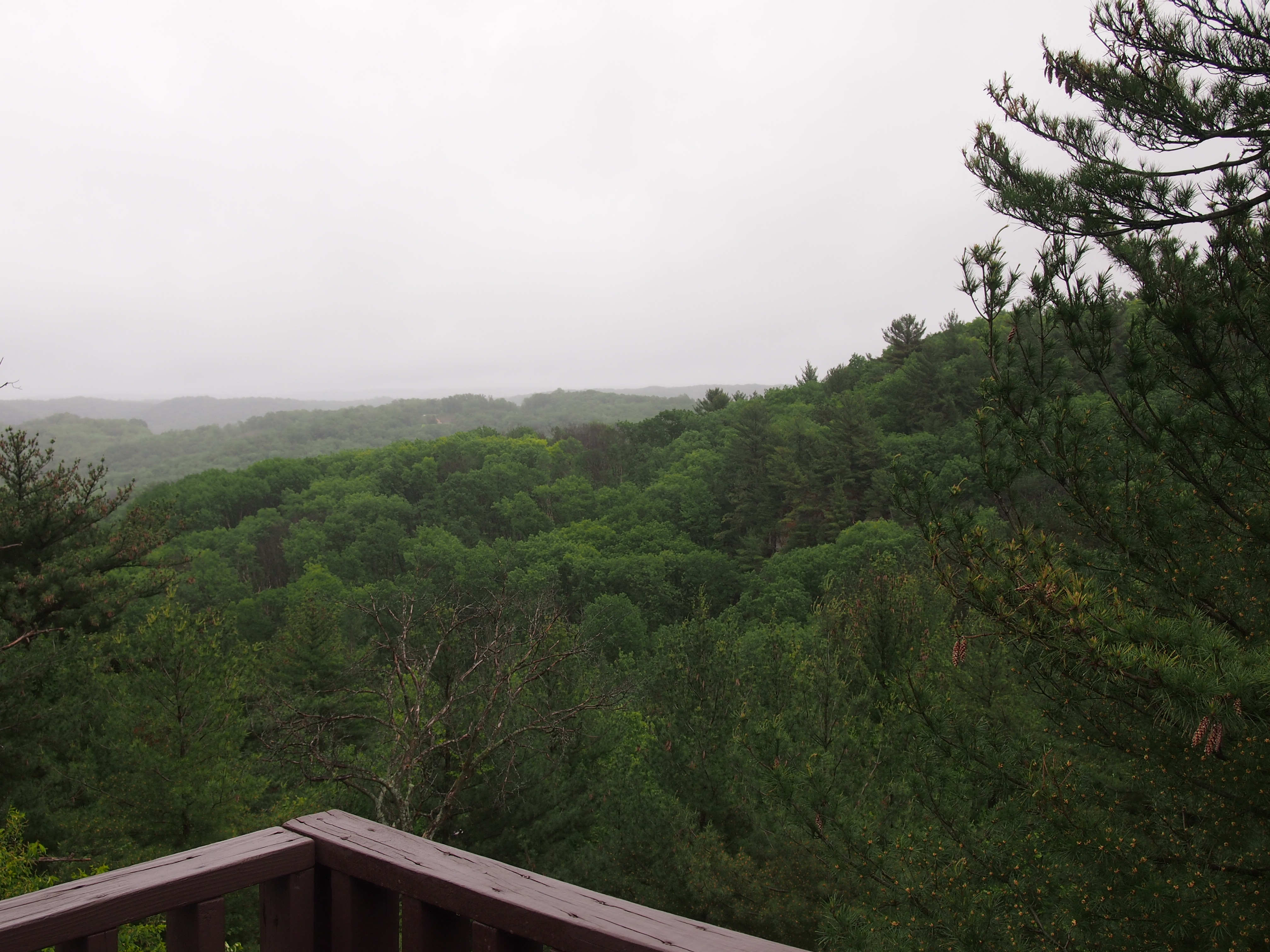
 At one point the tour trail takes you outside to enjoy the view. Even though last Saturday was overcast and rainy, I saw the appeal of the vista, off into the rolling green hills of southern Wisconsin.
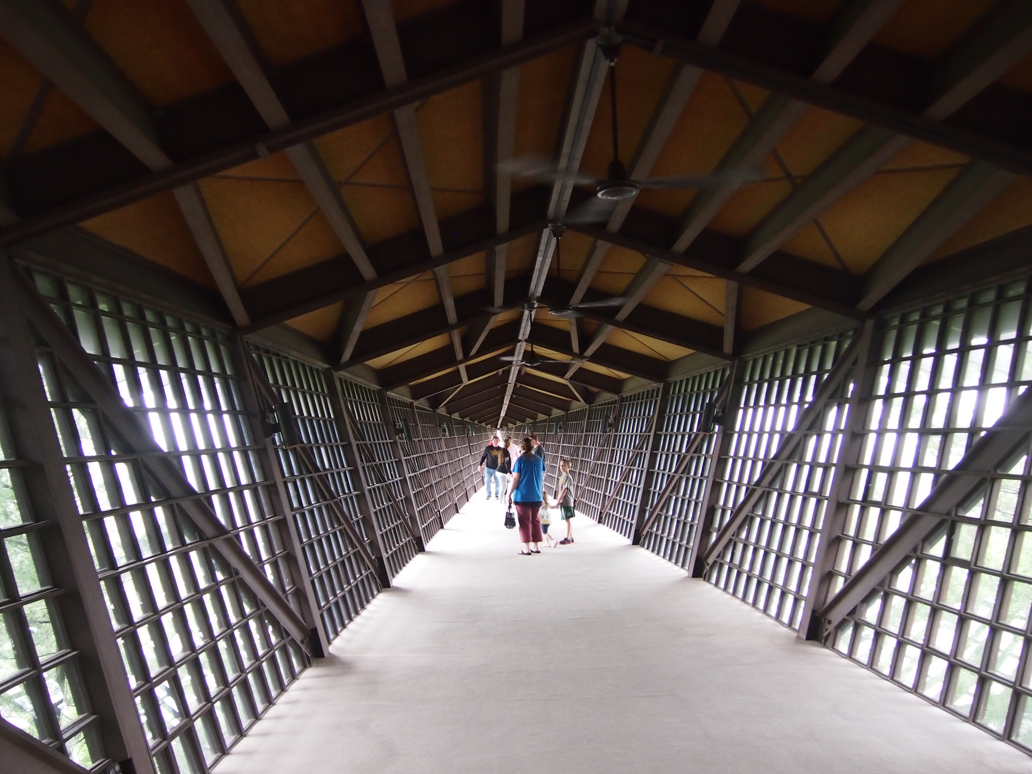
 The signature room of the first section is the Infinity Room. In its terse way, The House on the Rock web site says, “The 14th room of the House, completed in 1985, this engineering marvel extends 218 feet out over the scenic valley and 156 feet above the forests [sic] floor. The Infinity Room has 3,264 windows for walls that treat guests to a truly spectacular view.”
I wasn’t able to take a picture of the Infinity Room exterior that wasn’t obscured by trees, but there are some images on line.
Looking toward to end of the room, you see this.
 As far as you can go into the room, you see this.
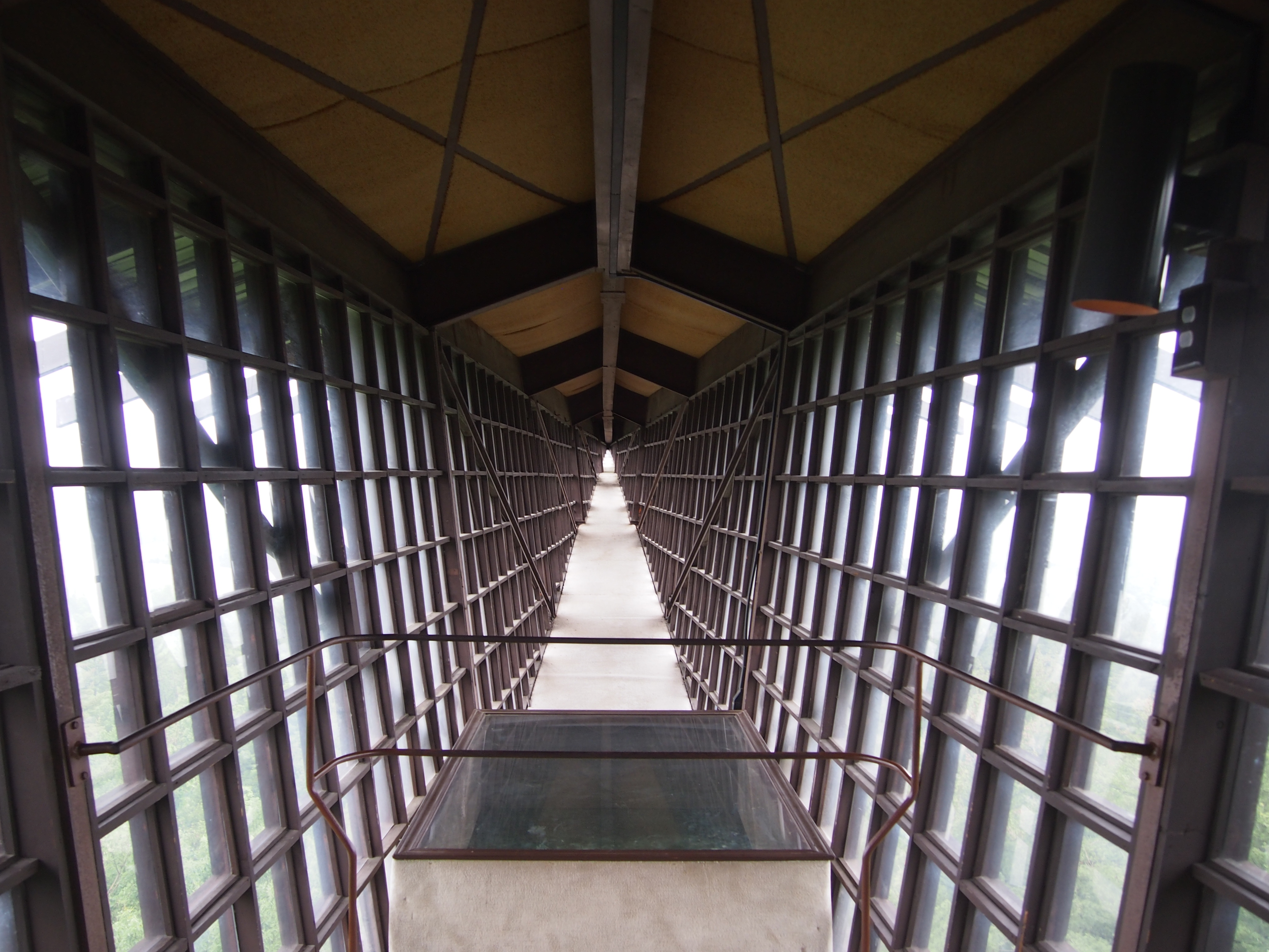 Dead ahead from there is a window in the floor that allows you to look down toward the tops of the trees. I can only hope that Jordan hired competent engineers to cantilever the thing safely, and that inspectors from Iowa County periodically take a look at it. The room’s been up for 30 years, so presumably it’s fairly sound. Still, Yuriko was unnerved by entering the room, and didn’t stay long, and she wasn’t the only one. Another woman visitor voiced her disquiet and turned around mid-way to the end point. Her young daughter went on (as did mine). The lure of infinity wasn’t to be missed.
 Fun fact about that hotel, developed in the early ’70s, I think: it had no 13th floor. Or none with that number. If they’d known how inundated the islands would soon be with Japanese tourists — and there must have been a fair number even 40 years ago — they probably would have not used the number 4 in their floors.
 Another balcony view, this time of Waikiki Beach. Two young lovers strolling the sands of Waikiki couldn’t be lost in each other’s charms for long without stepping on another beachgoer.
 Finally, Honolulu at night.
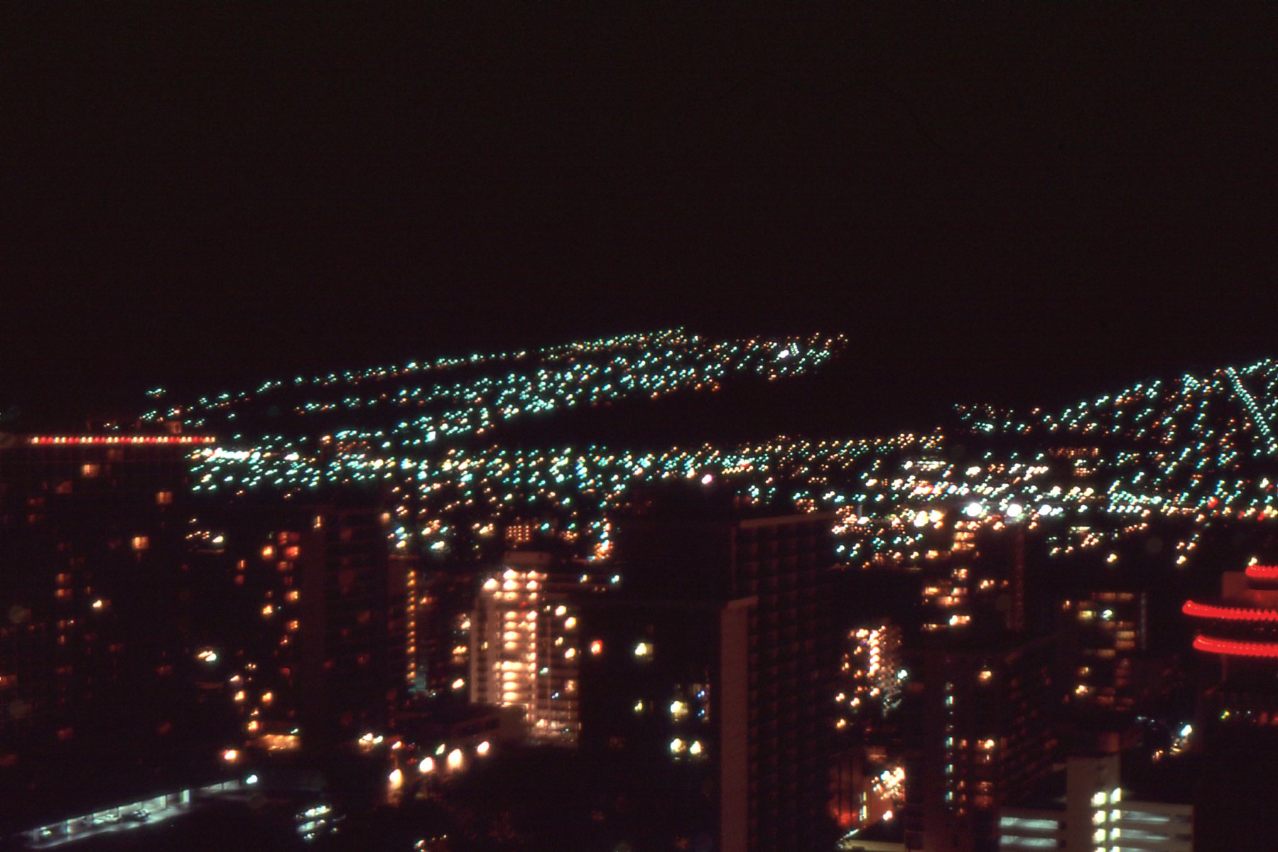 A little fuzzy, but representative of the way the lights — which is to say, development — attached itself to the foothills near Honolulu, looking for every square foot. Even then, Honolulu was the most expensive real estate market in the country.


