Nebraska Rocks

Pity the people whose job it is to promote tourism in Nebraska. Set ideas are notoriously resistant to change, at least over periods less than a generation, so I expect the idea “nothing to see there” is a constant battle for those who know otherwise.

I didn’t need to be persuaded. A drive across the state – a reward in itself, more about which later – takes you Carhenge (see yesterday) but also to terrain not generally associated with Nebraska.

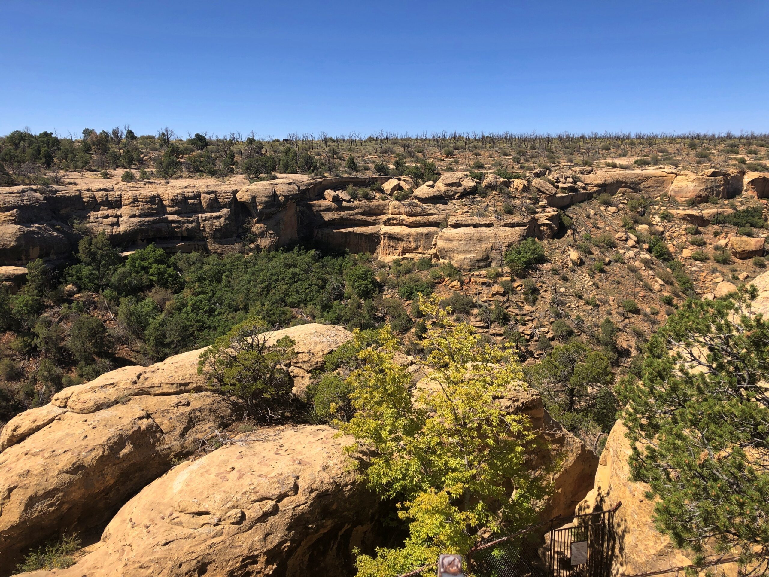
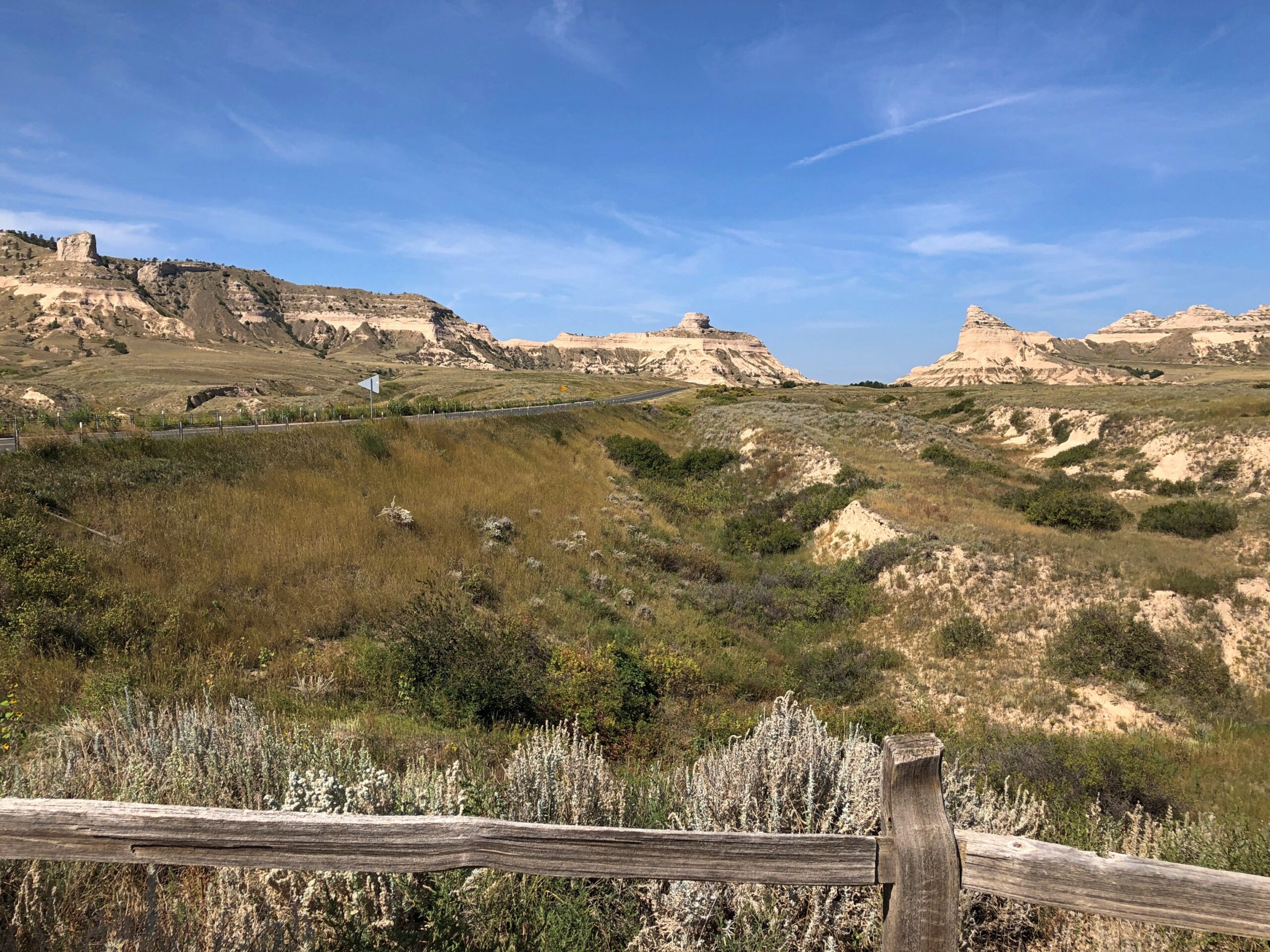
At the western edge of the state, rocks. Big, impressive rocks that poke out of the still-flat ground, stubborn geological leftovers that refuse to erode as fast as the surrounding terrain. Natives, mountain men, trappers, and wagon trains across the prairie all knew about these rocks, knew that they marked a certain point in their journeys. I’m sure they were hard to miss.

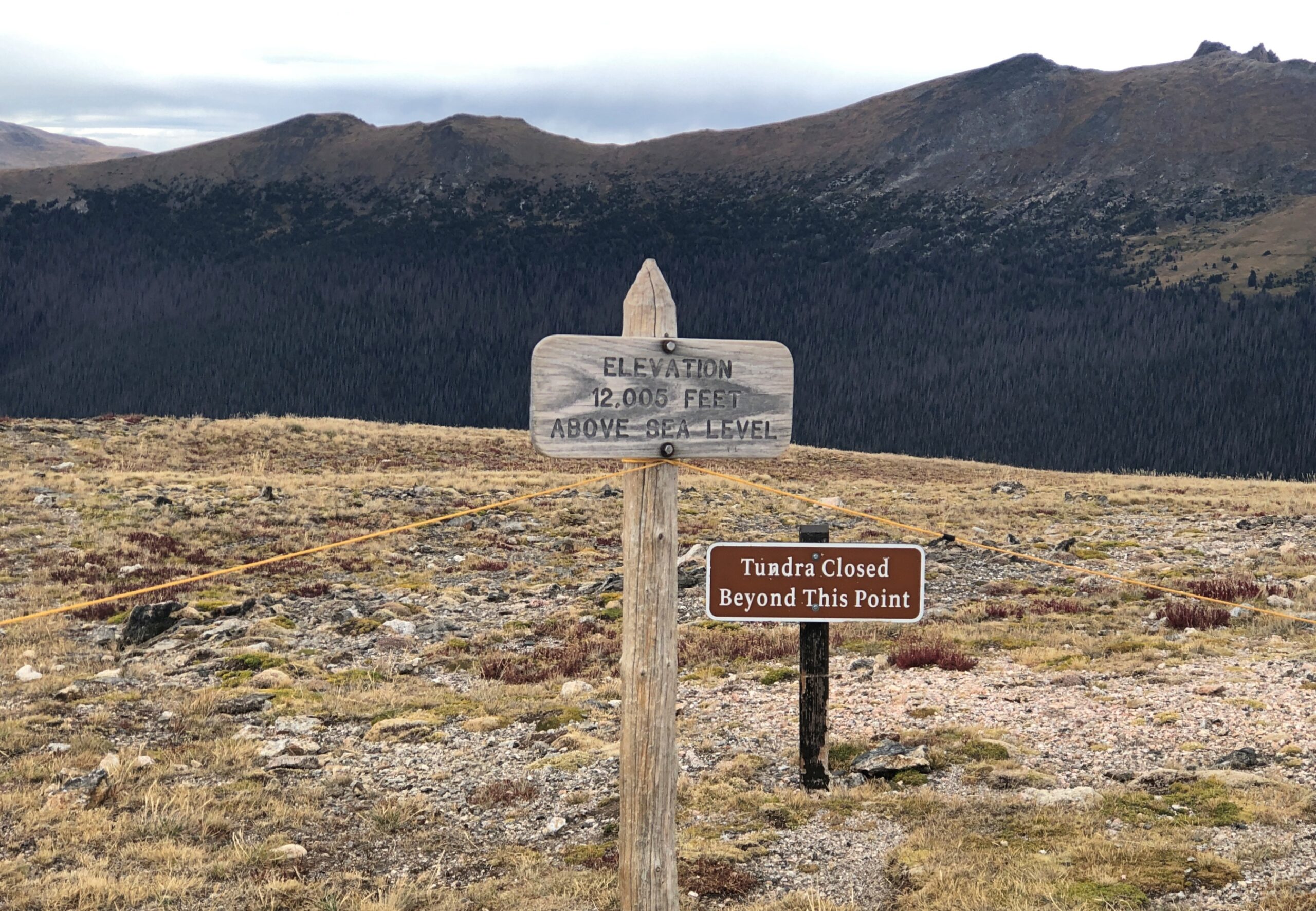
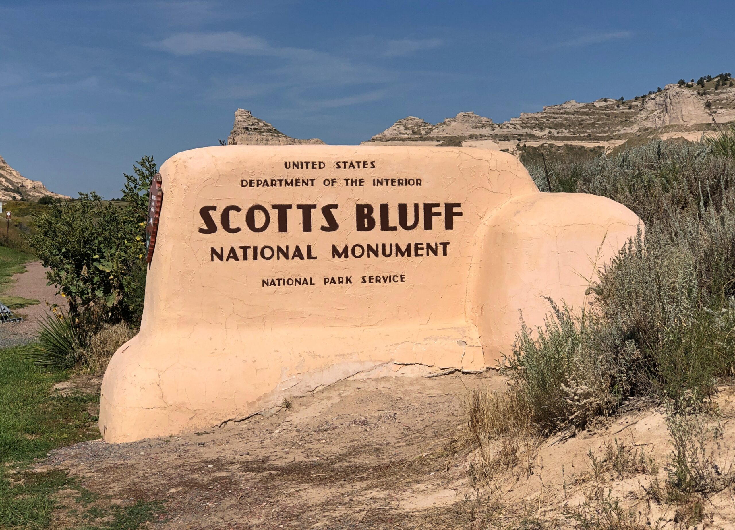
Since 1919, the rocks a few miles from Gering, Nebraska have been known as Scotts Bluff National Monument. I arrived on the morning of September 8.

Scotts Bluff National Monument

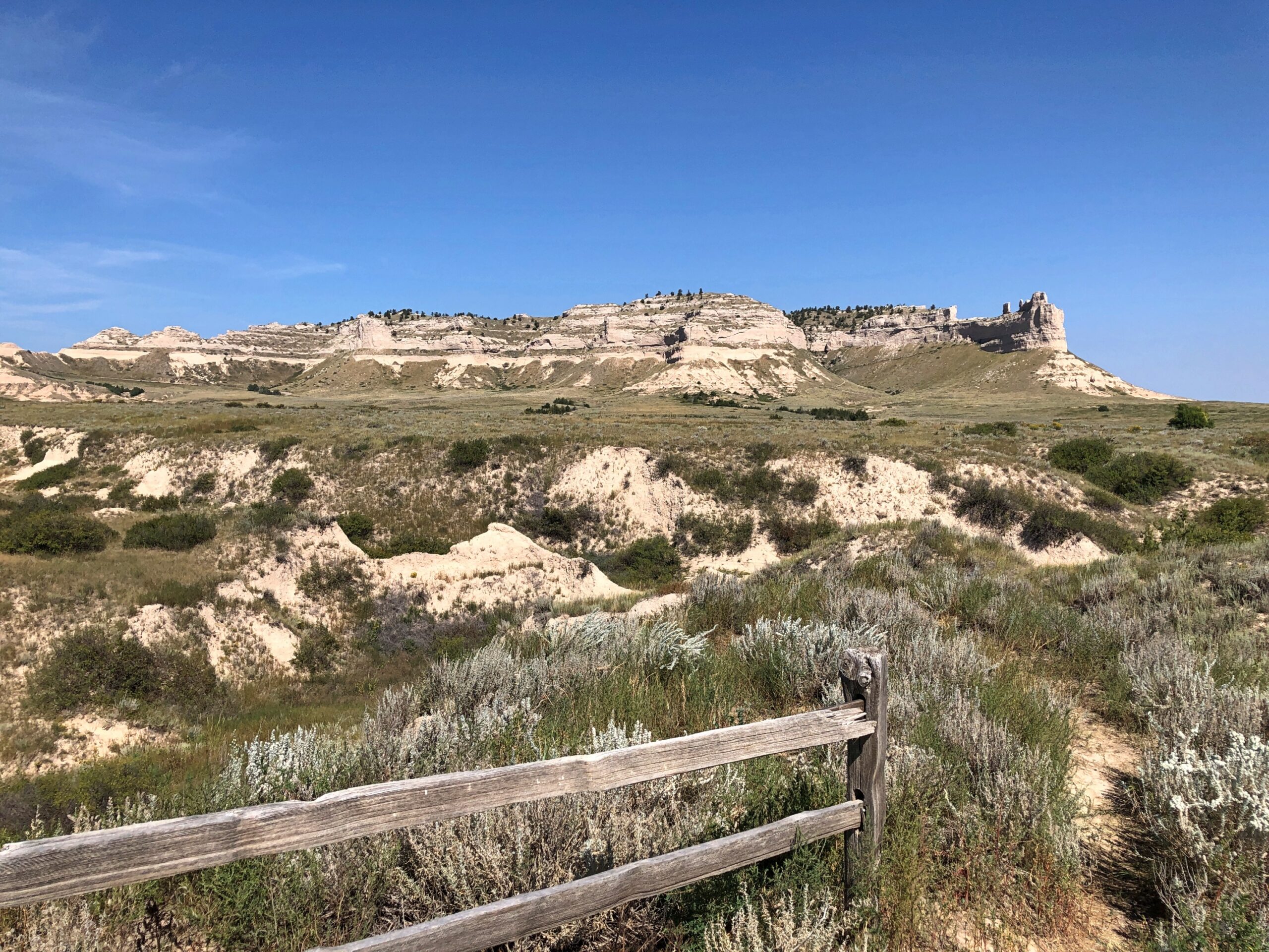
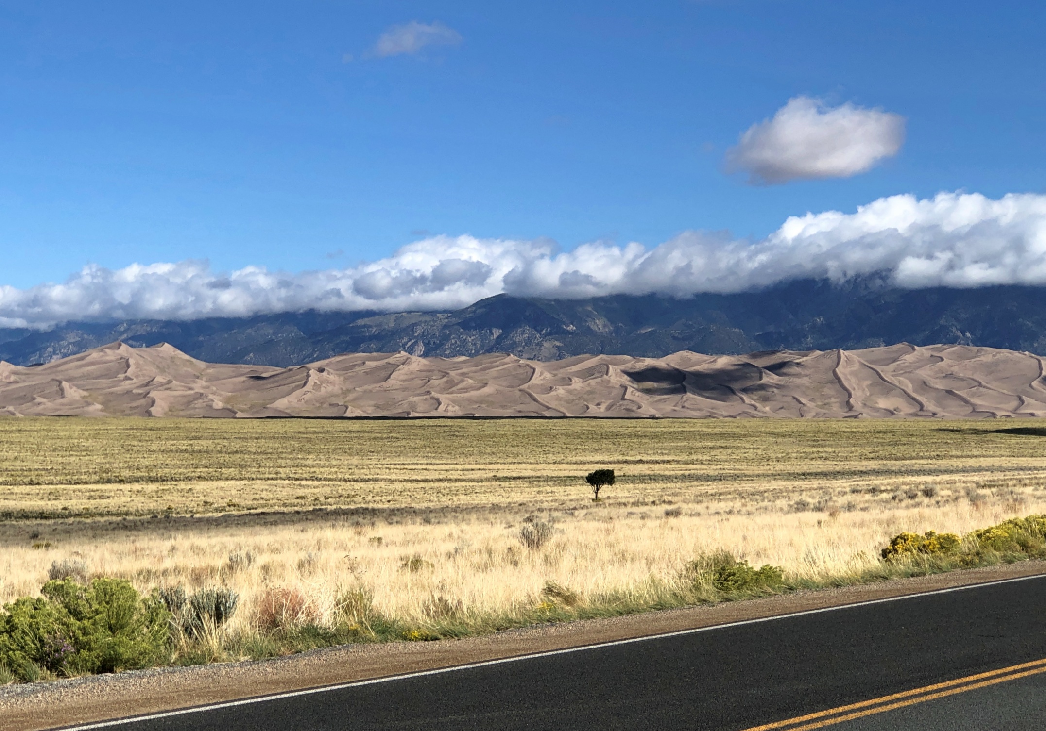
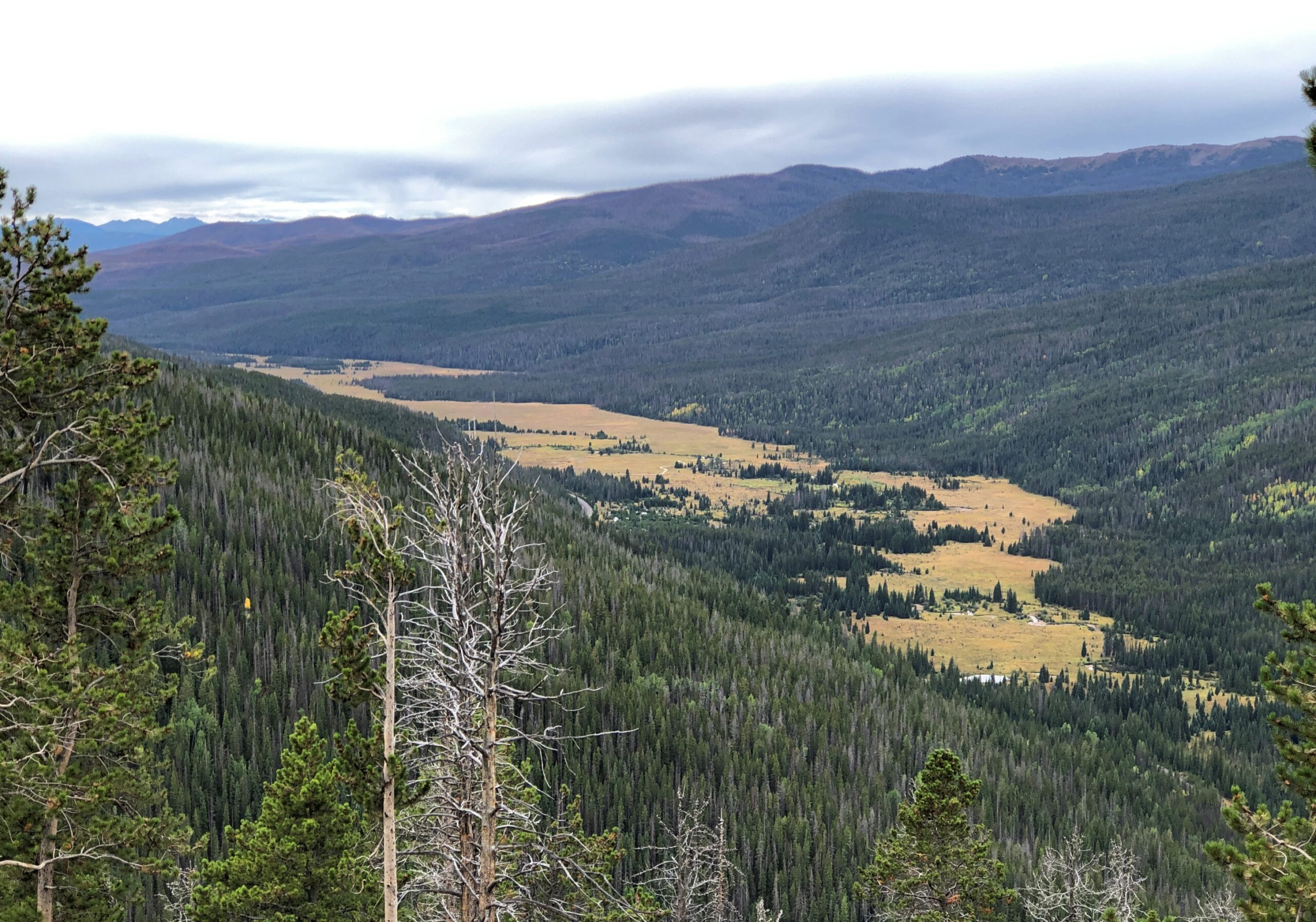
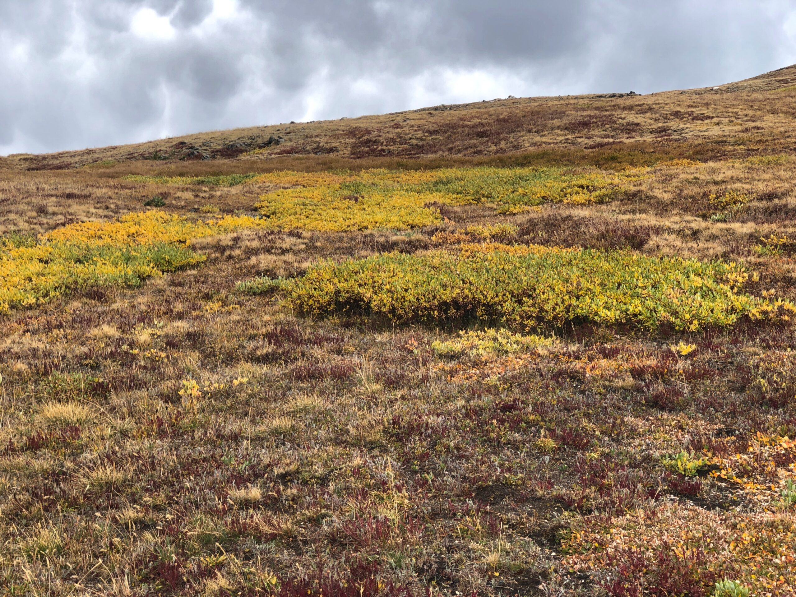
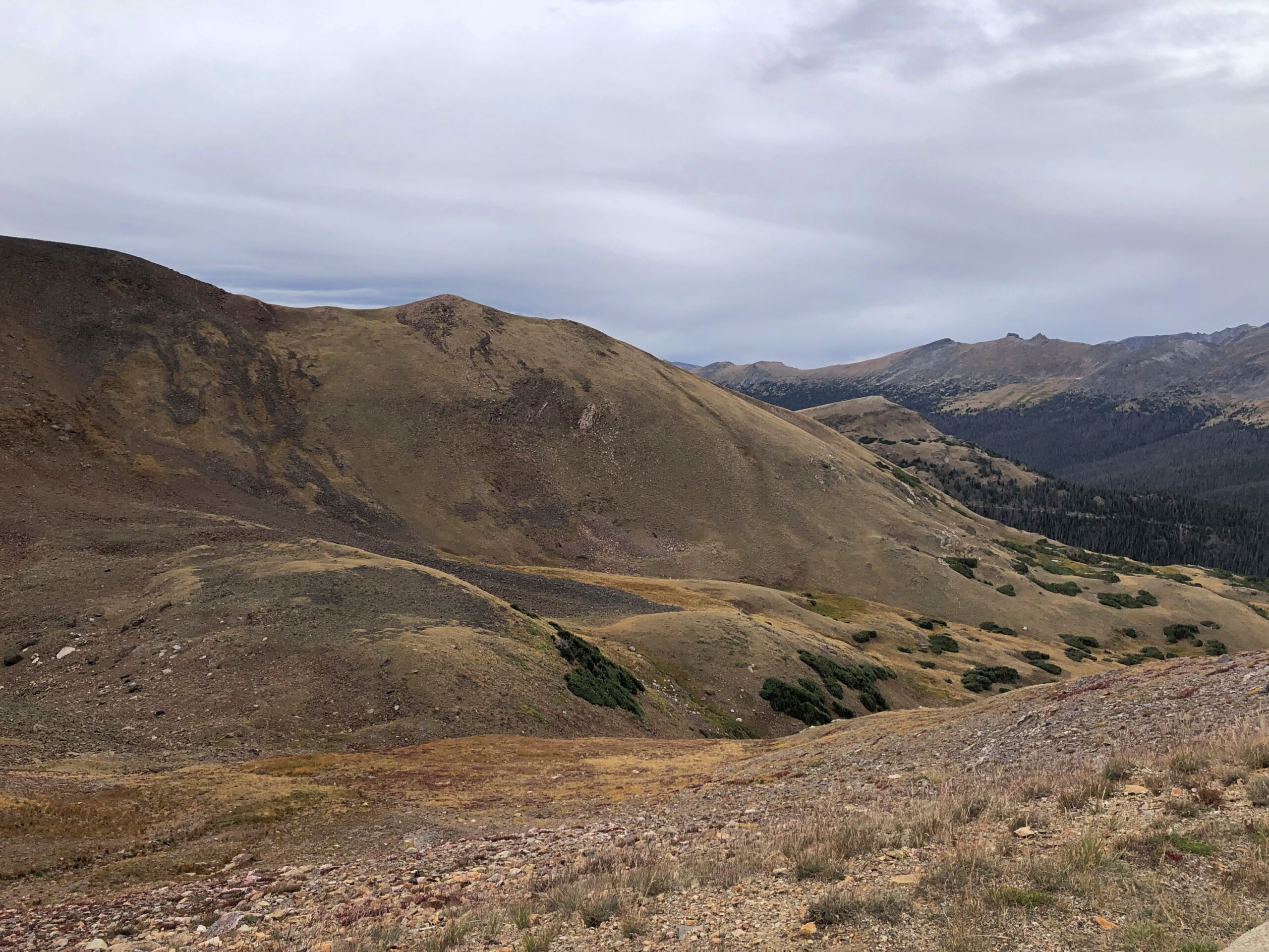
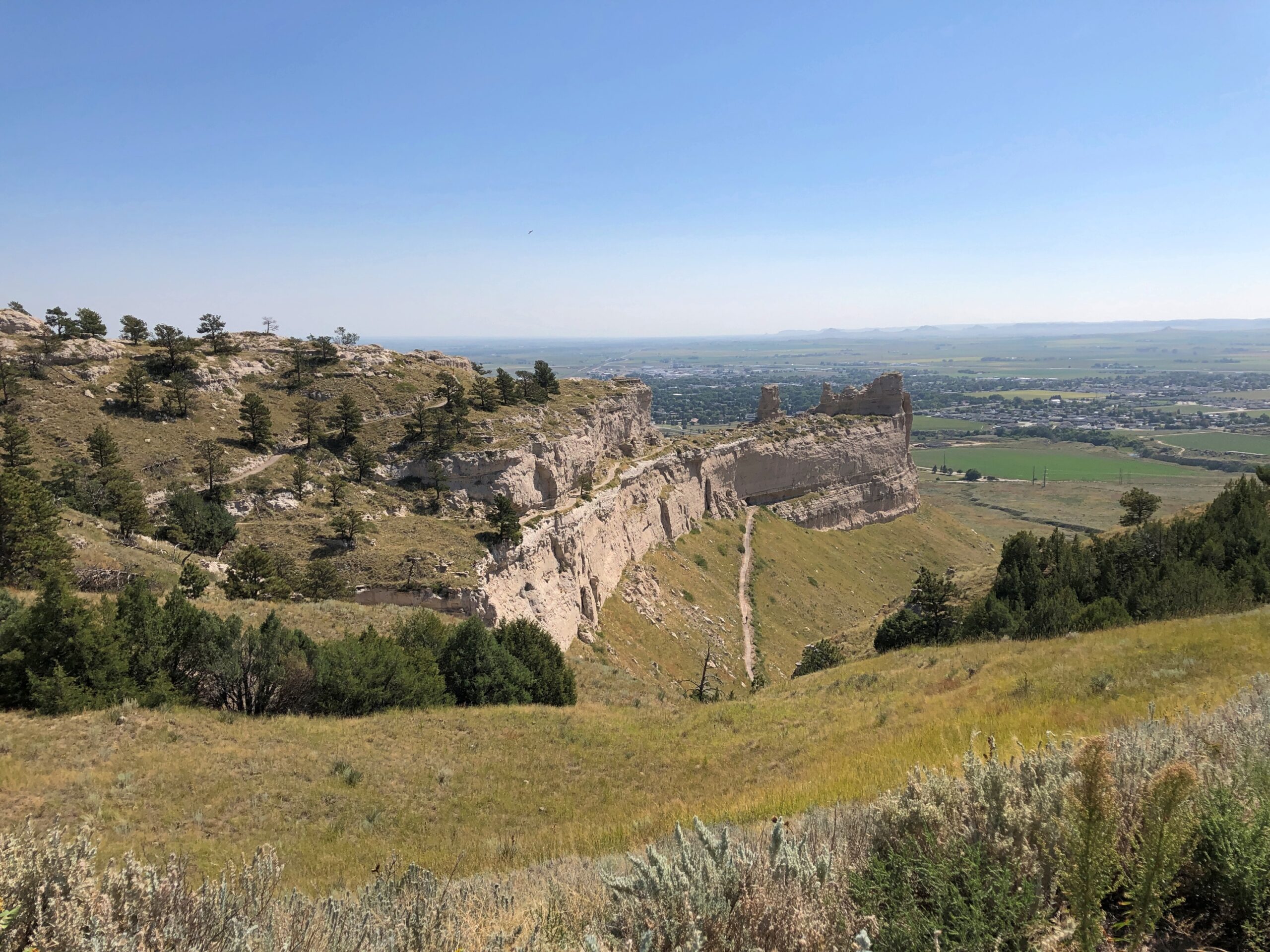
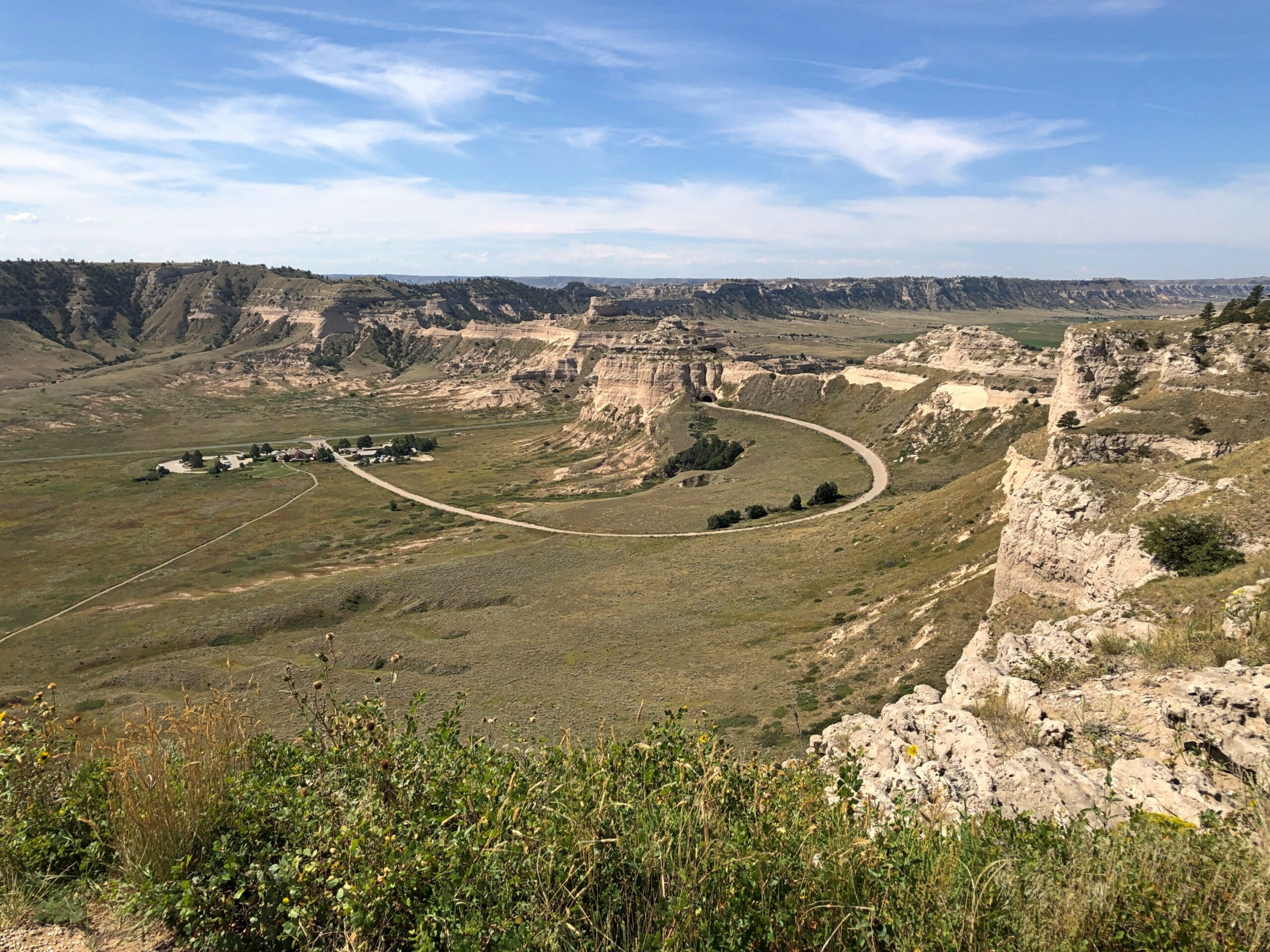
On this particular trip, the monument was an appetizer, ahead of the main course in Colorado. The Sandhills of Nebraska, which I’d just driven through, aren’t pancake flat, but waves of grassy hills with scattered outcropings of rock. After a drive like that, the Scotts Bluff seemed to appear suddenly, rising in your field of vision to take over half the sky.

I exaggerate, but only because that’s how I seem to remember it. An outcropping like that in the Rockies would be lost in the crowd, but here in western Nebraska it’s the star of the show.

Scotts Bluff National Monument

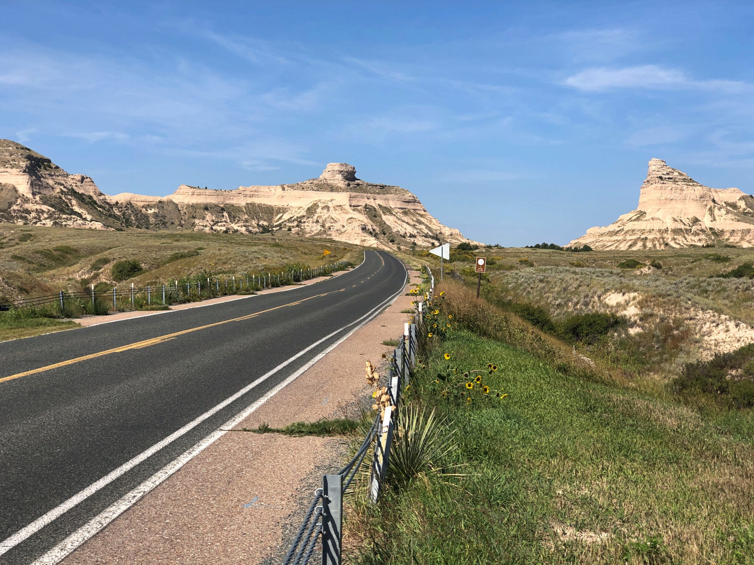
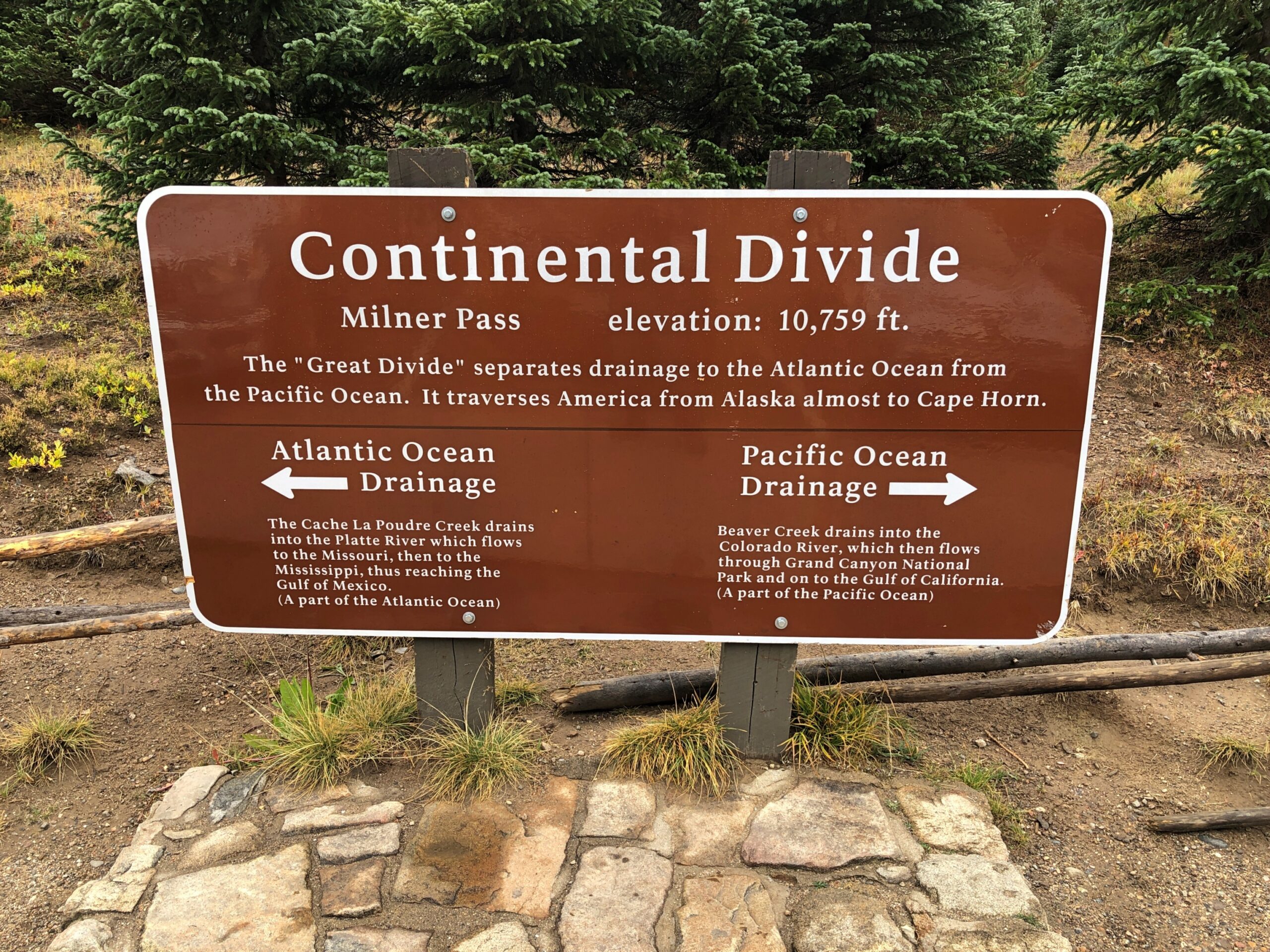
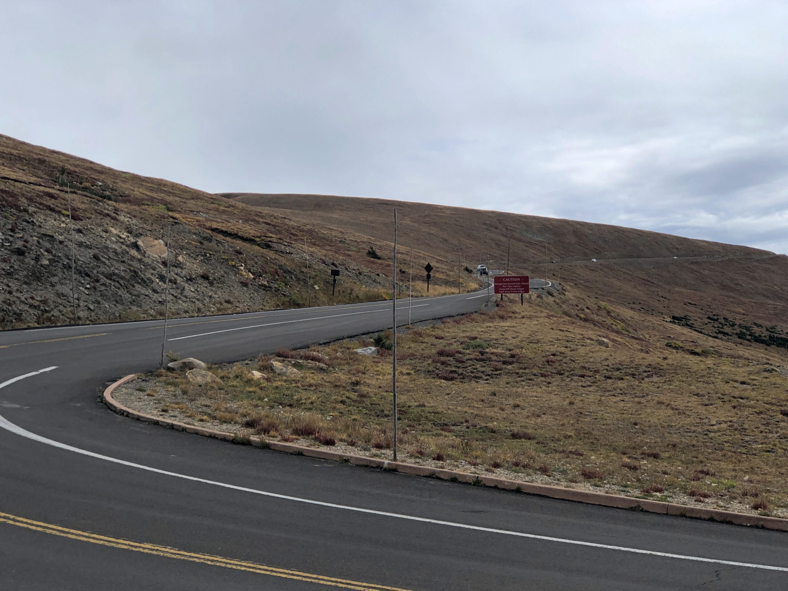
The road leading to the monument, the highway Nebraska 92, follows the Oregon Trail at his point.

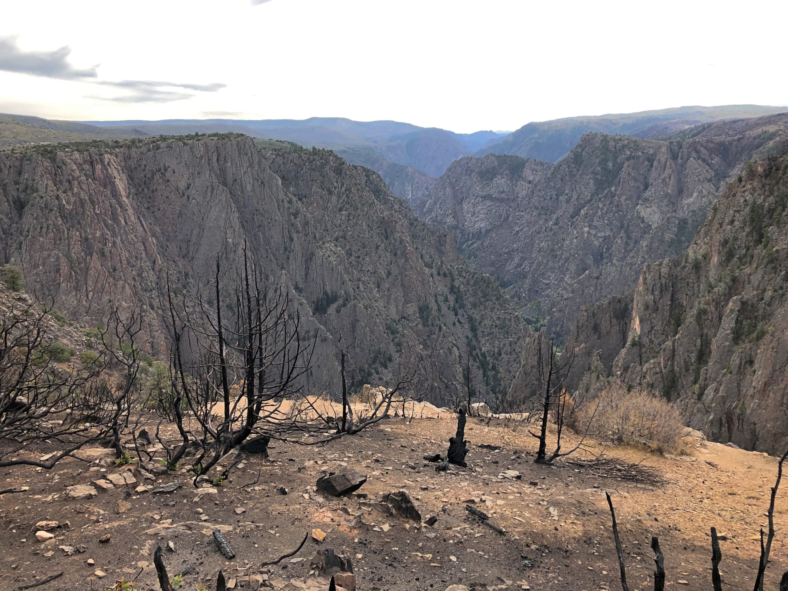
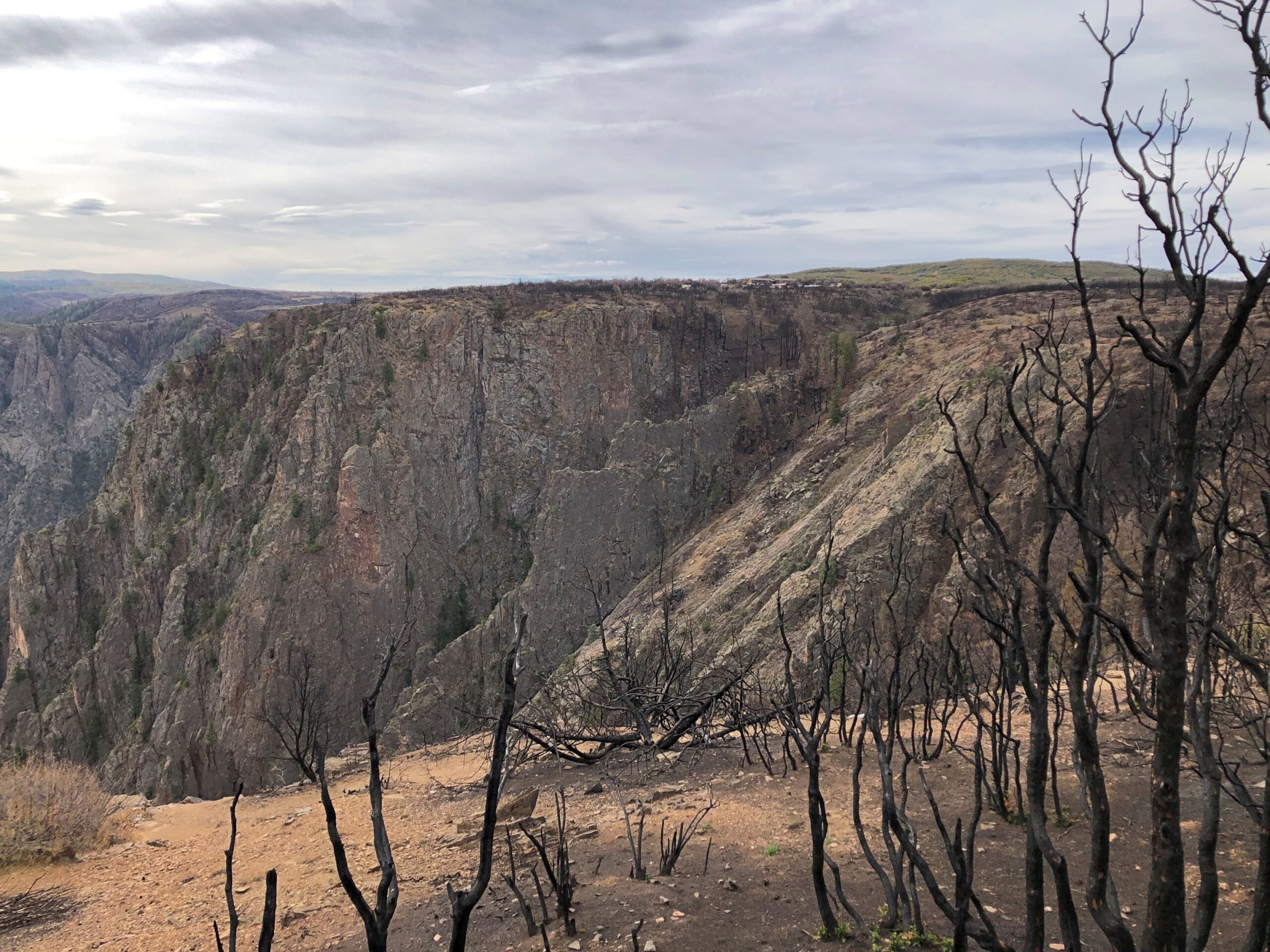
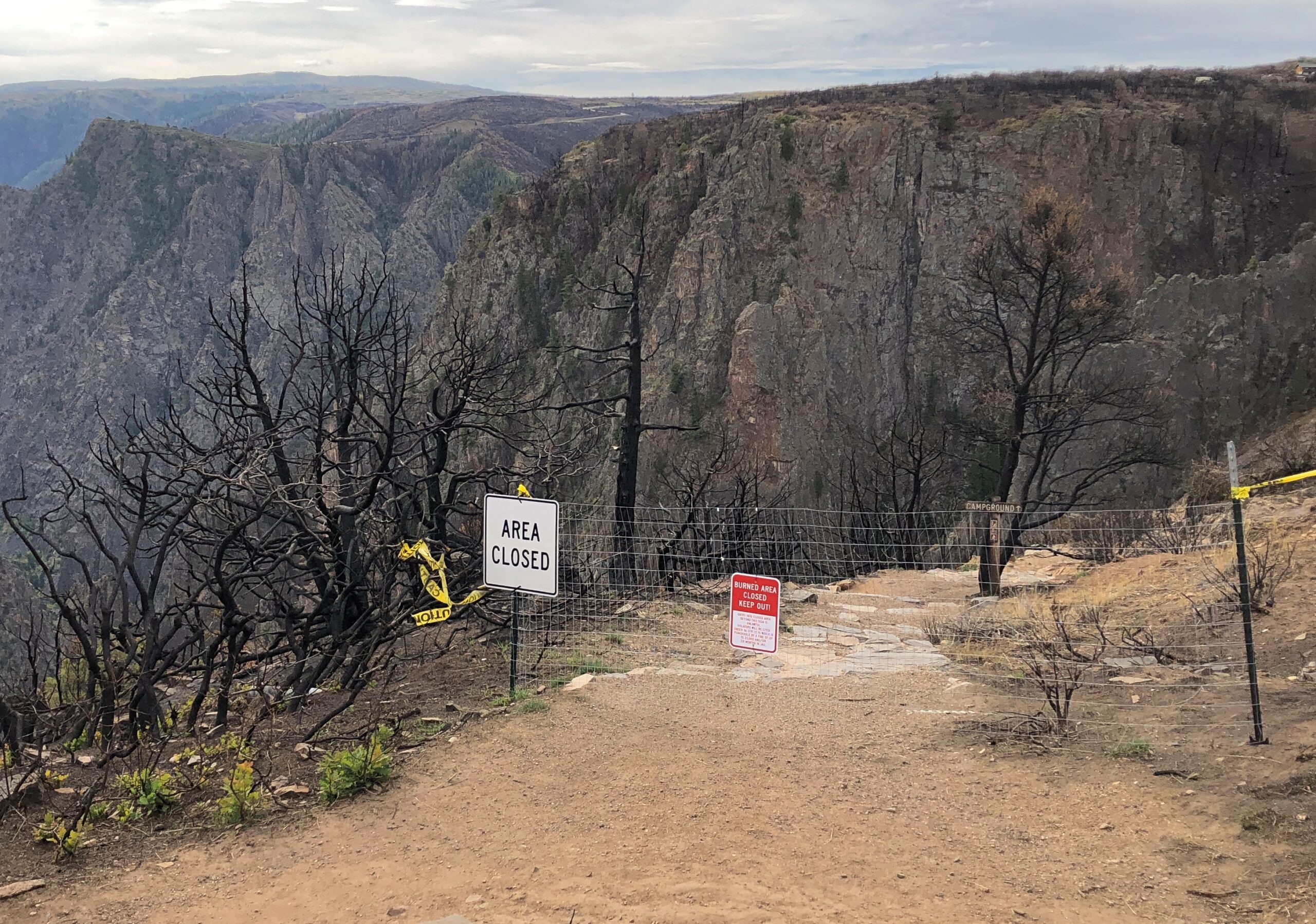
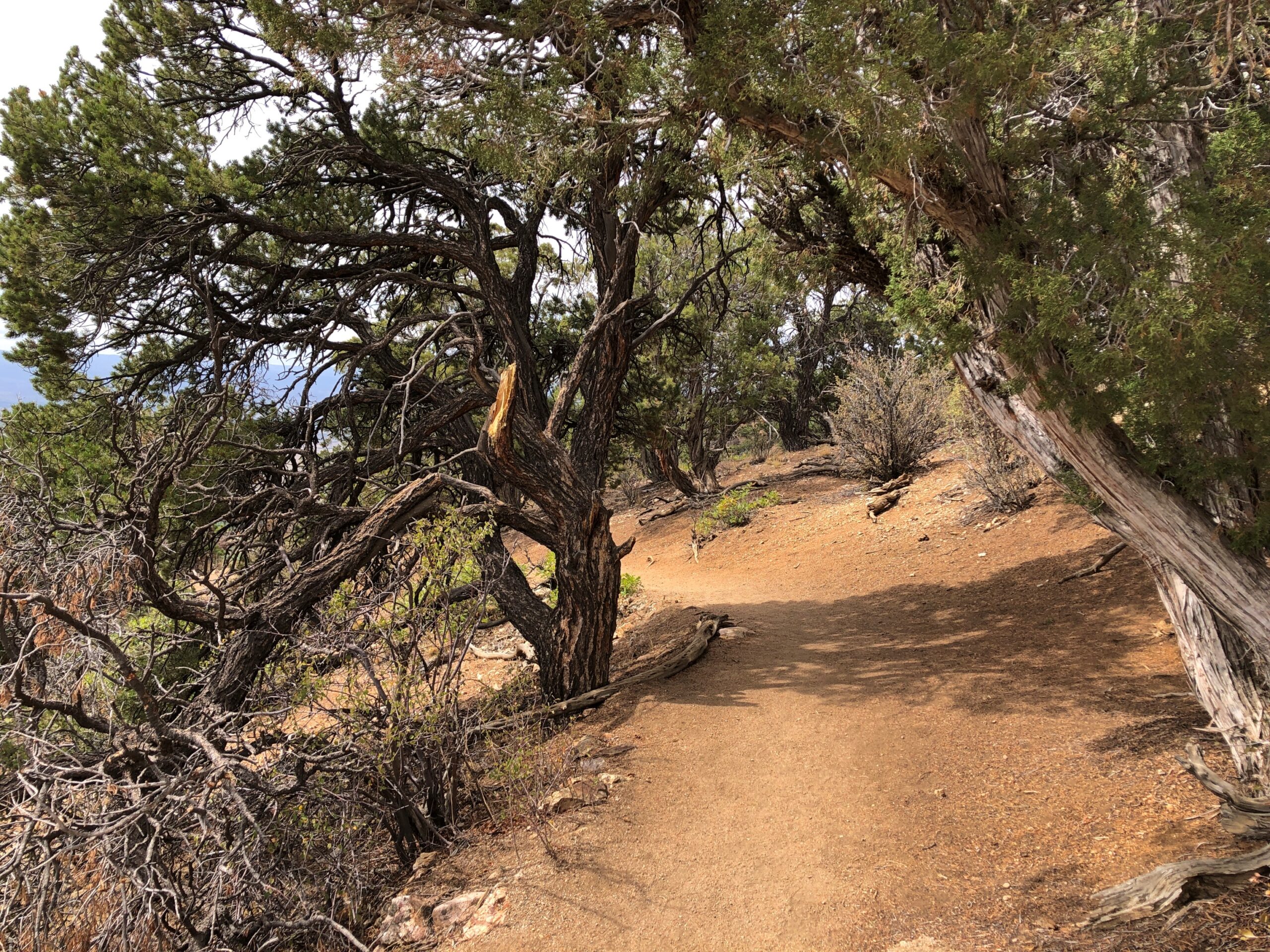
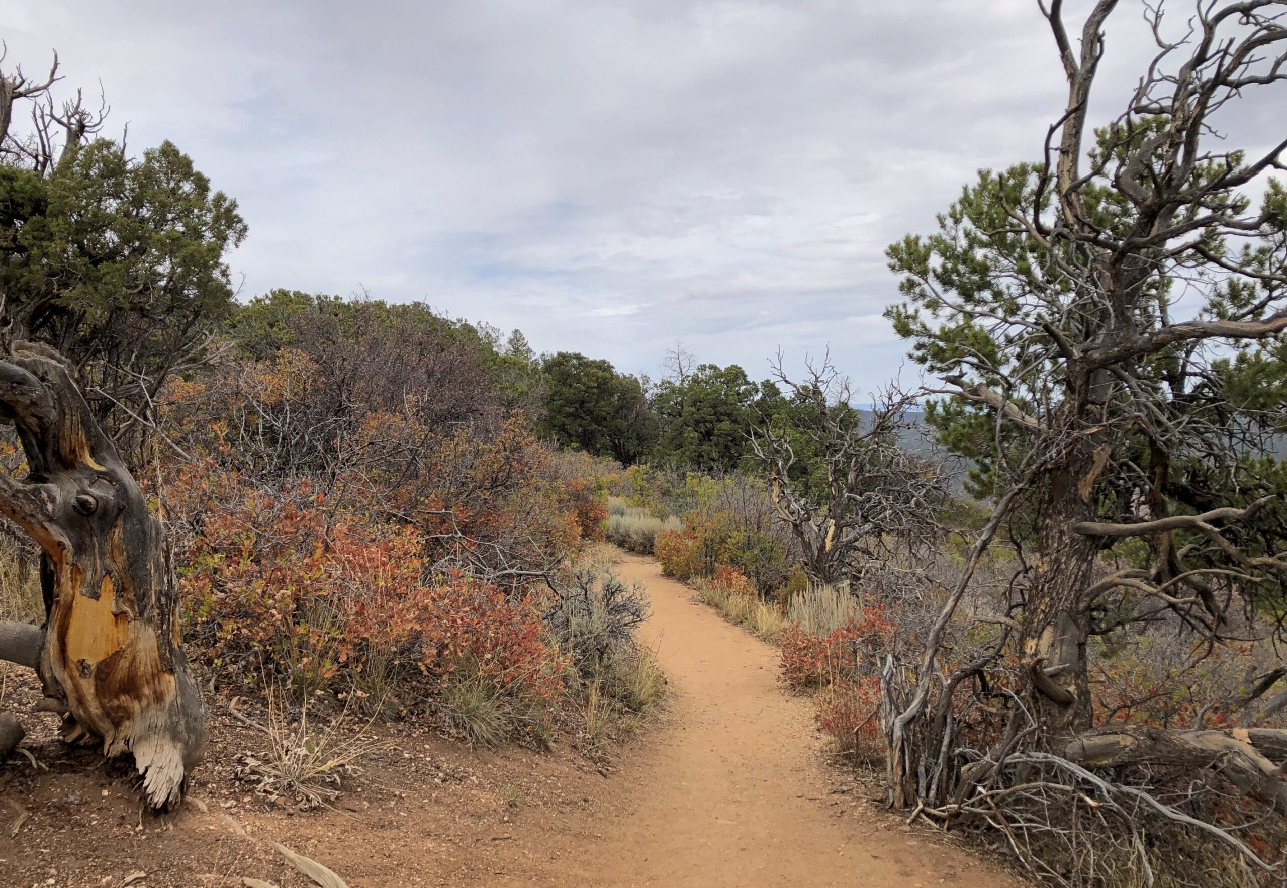
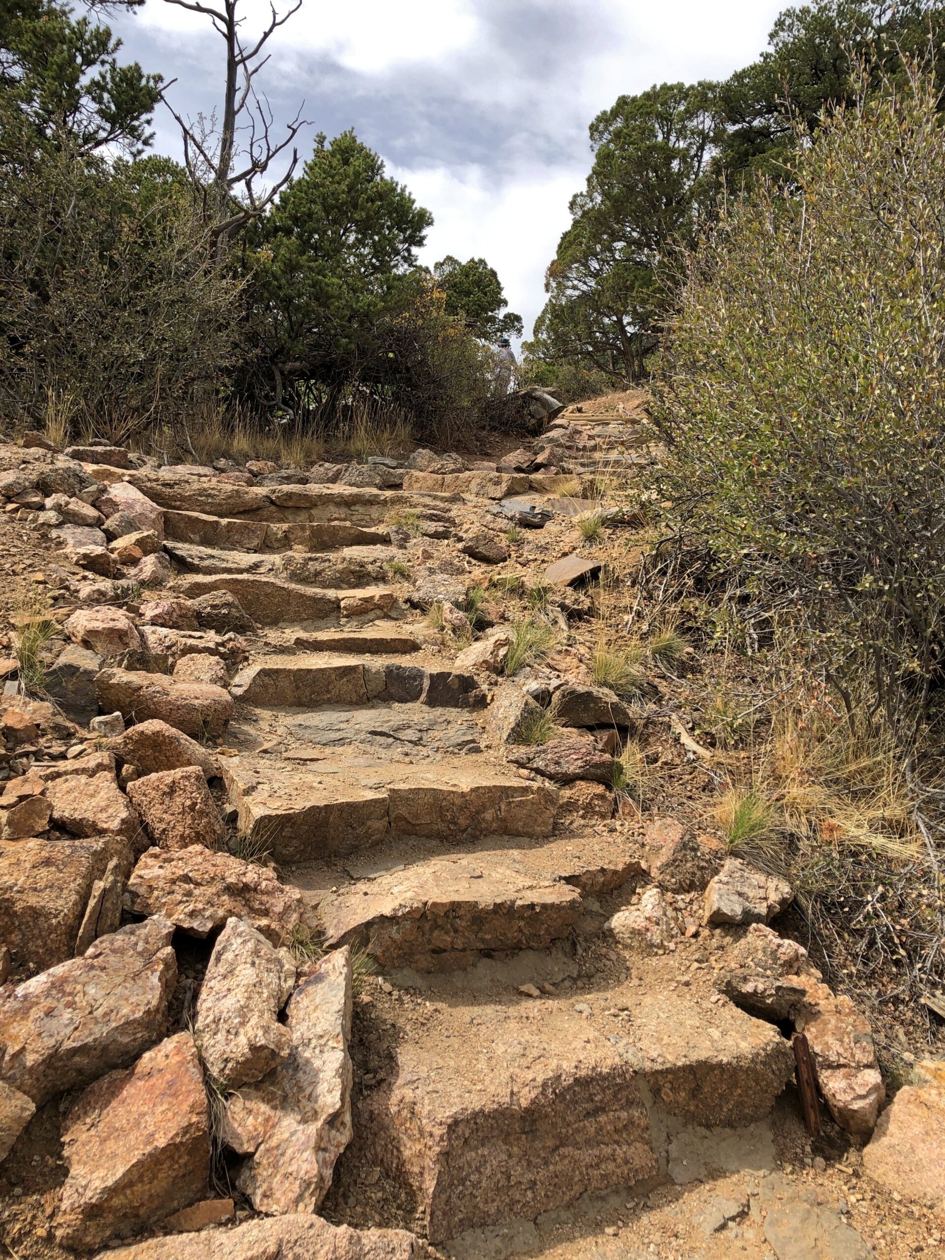
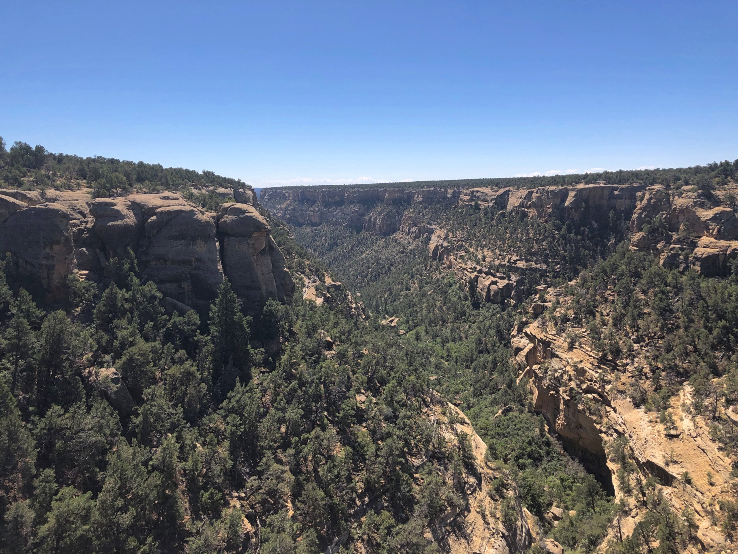
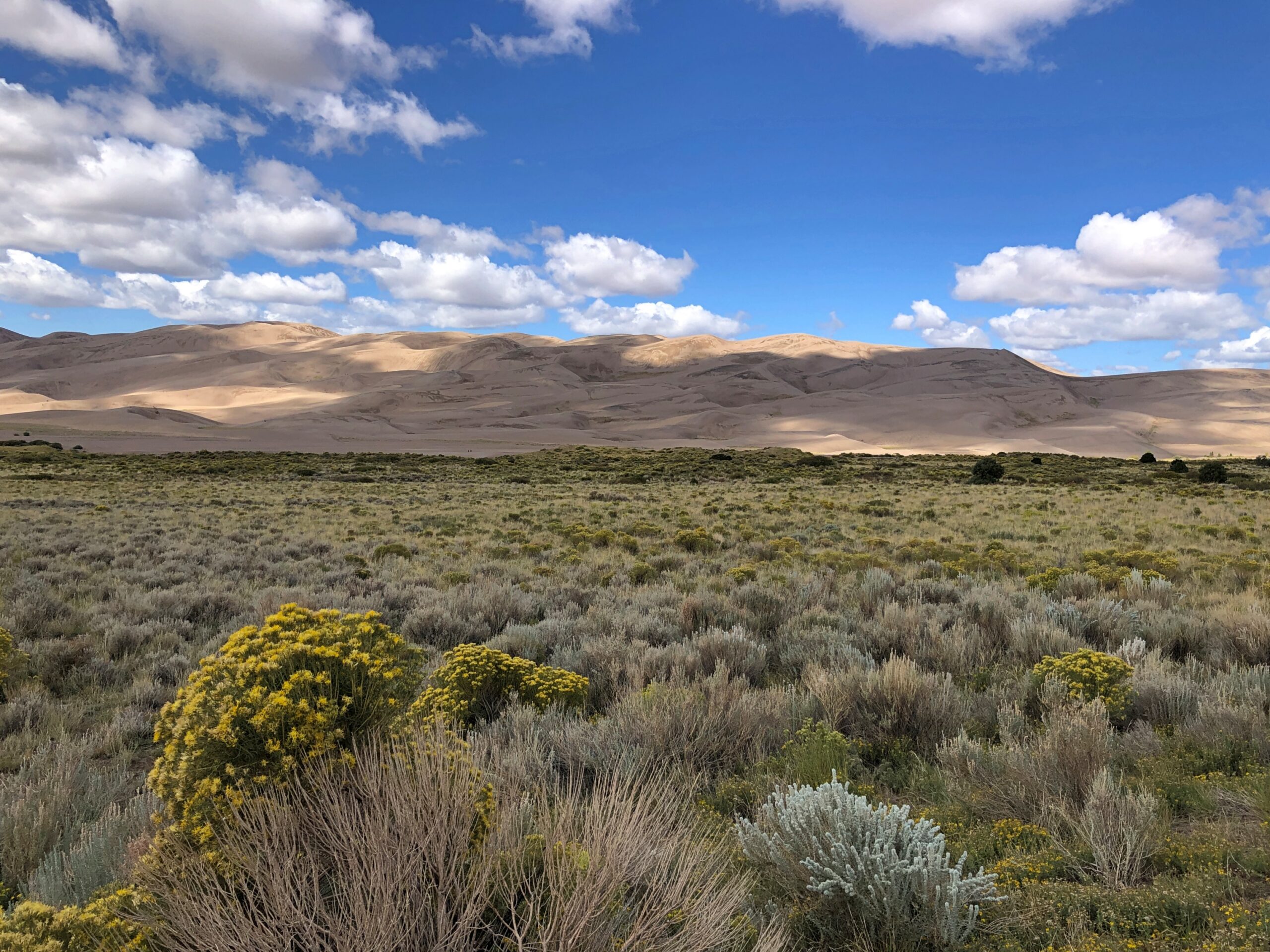
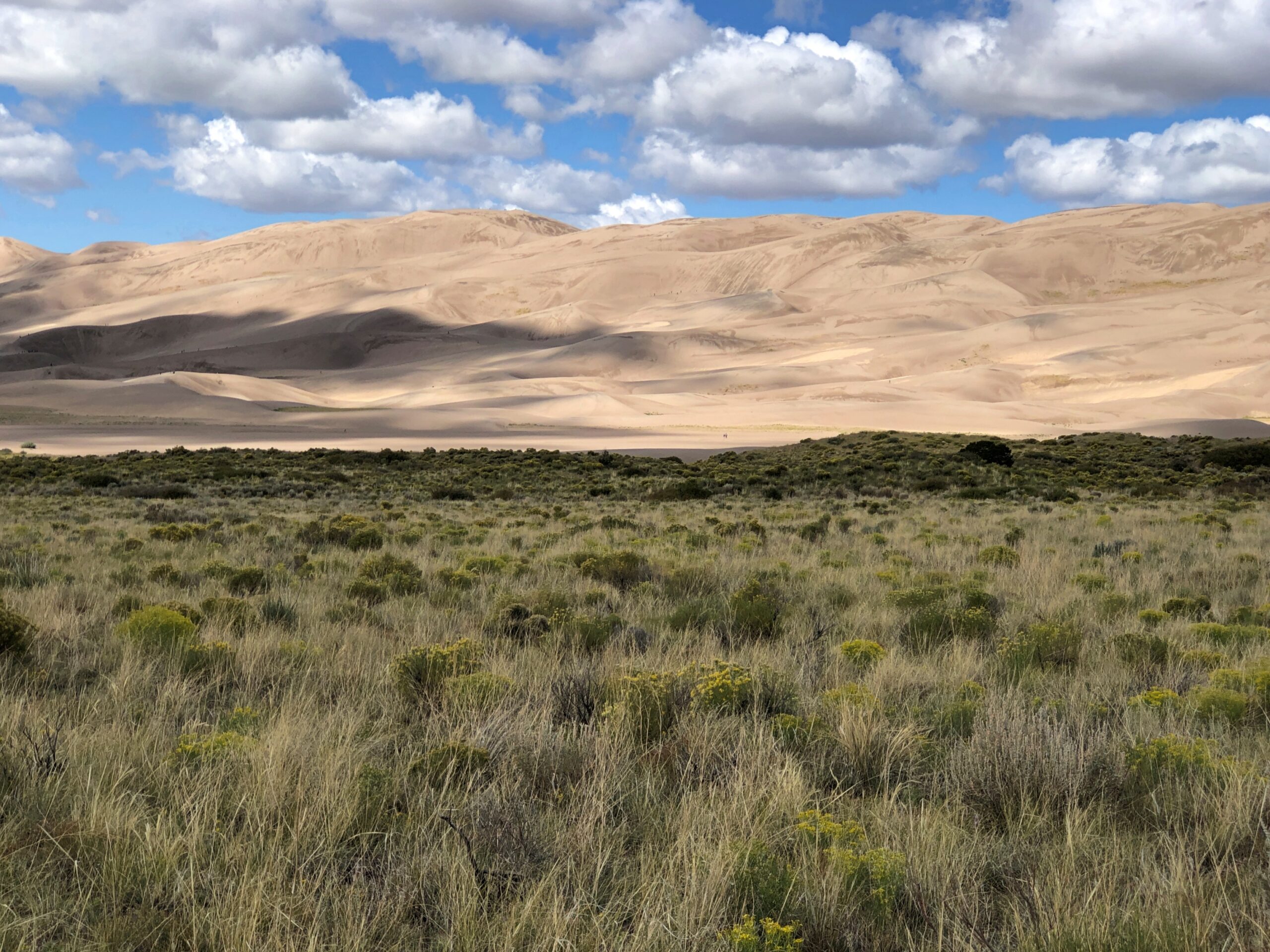
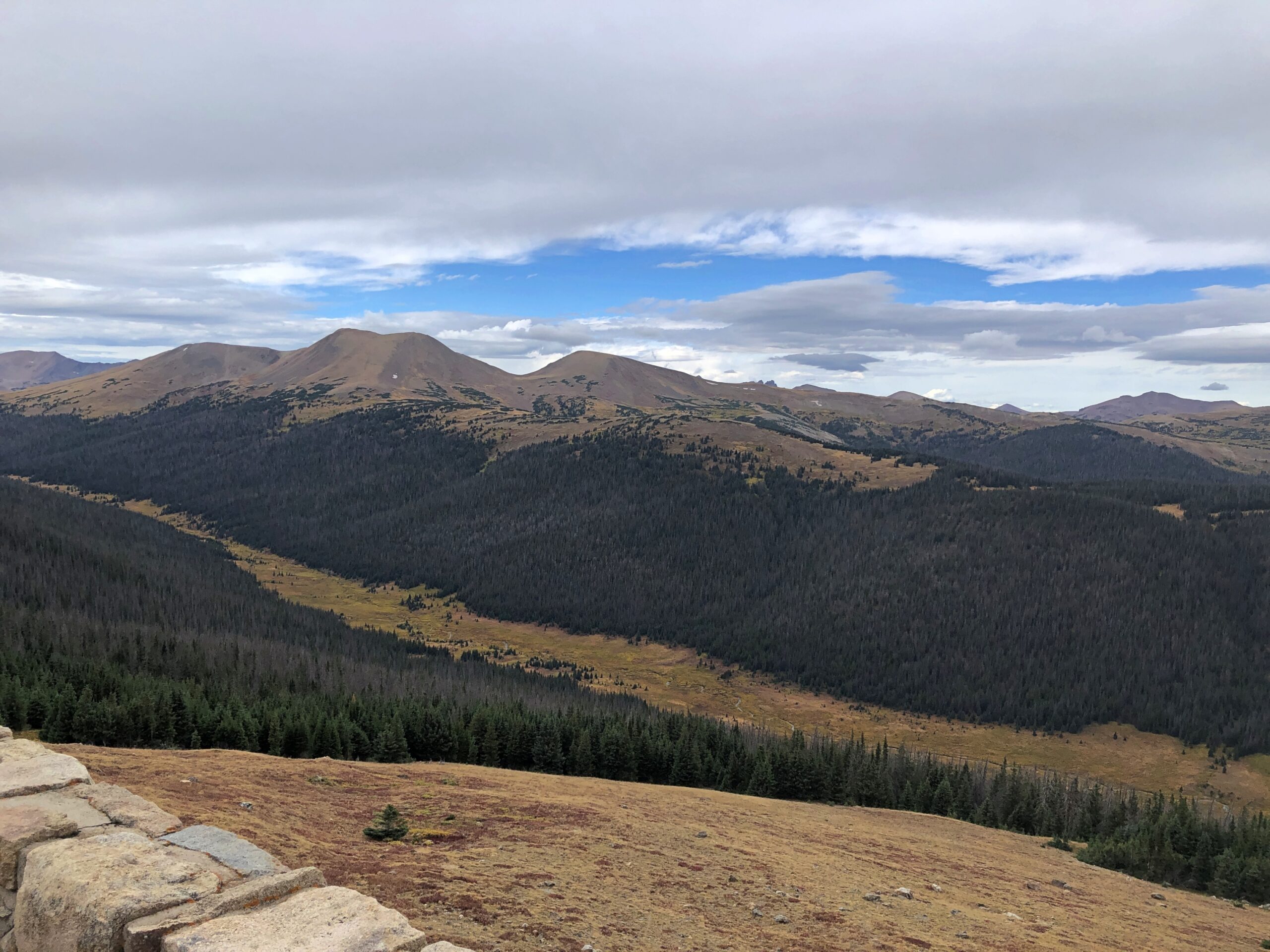
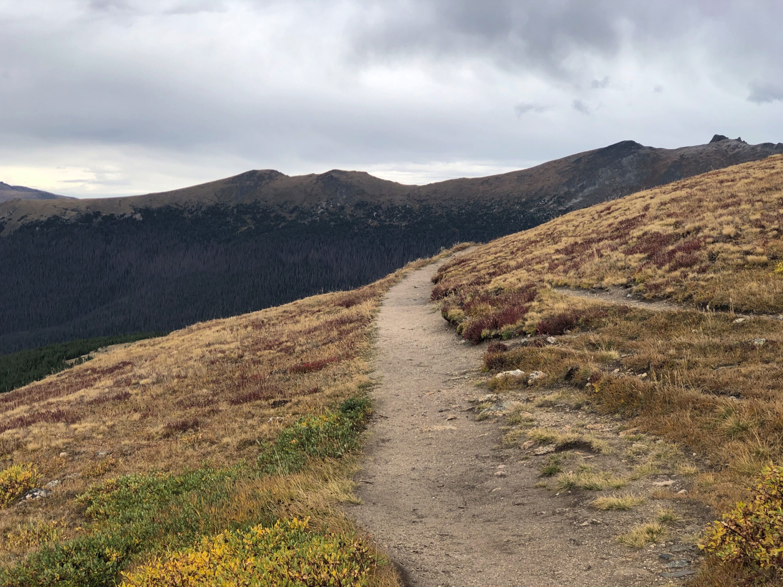
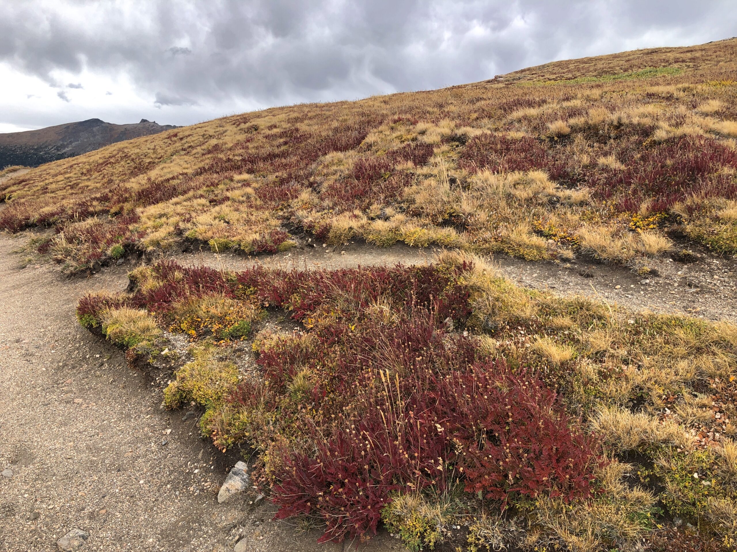
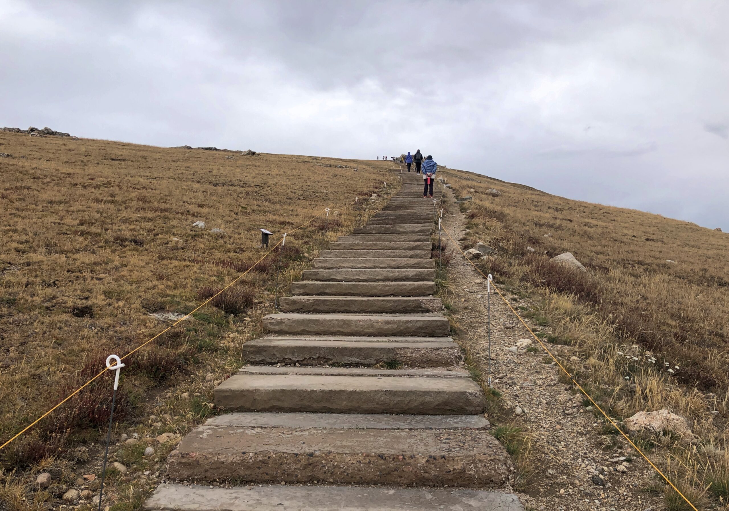
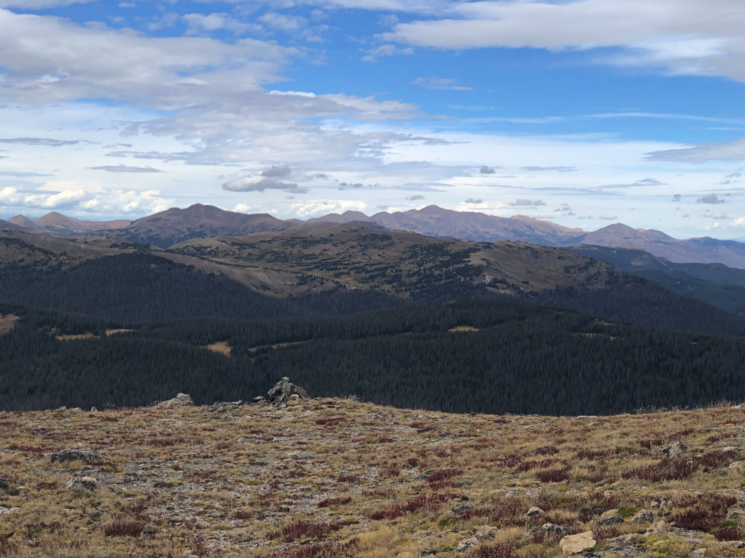
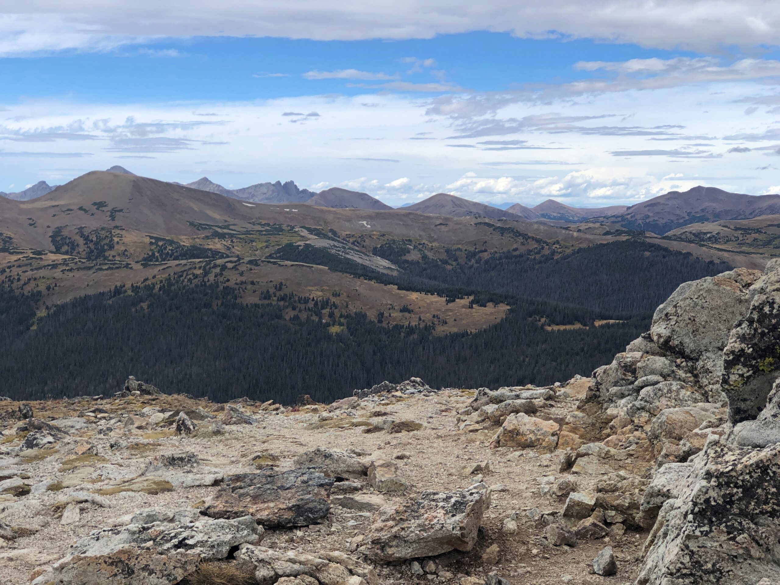
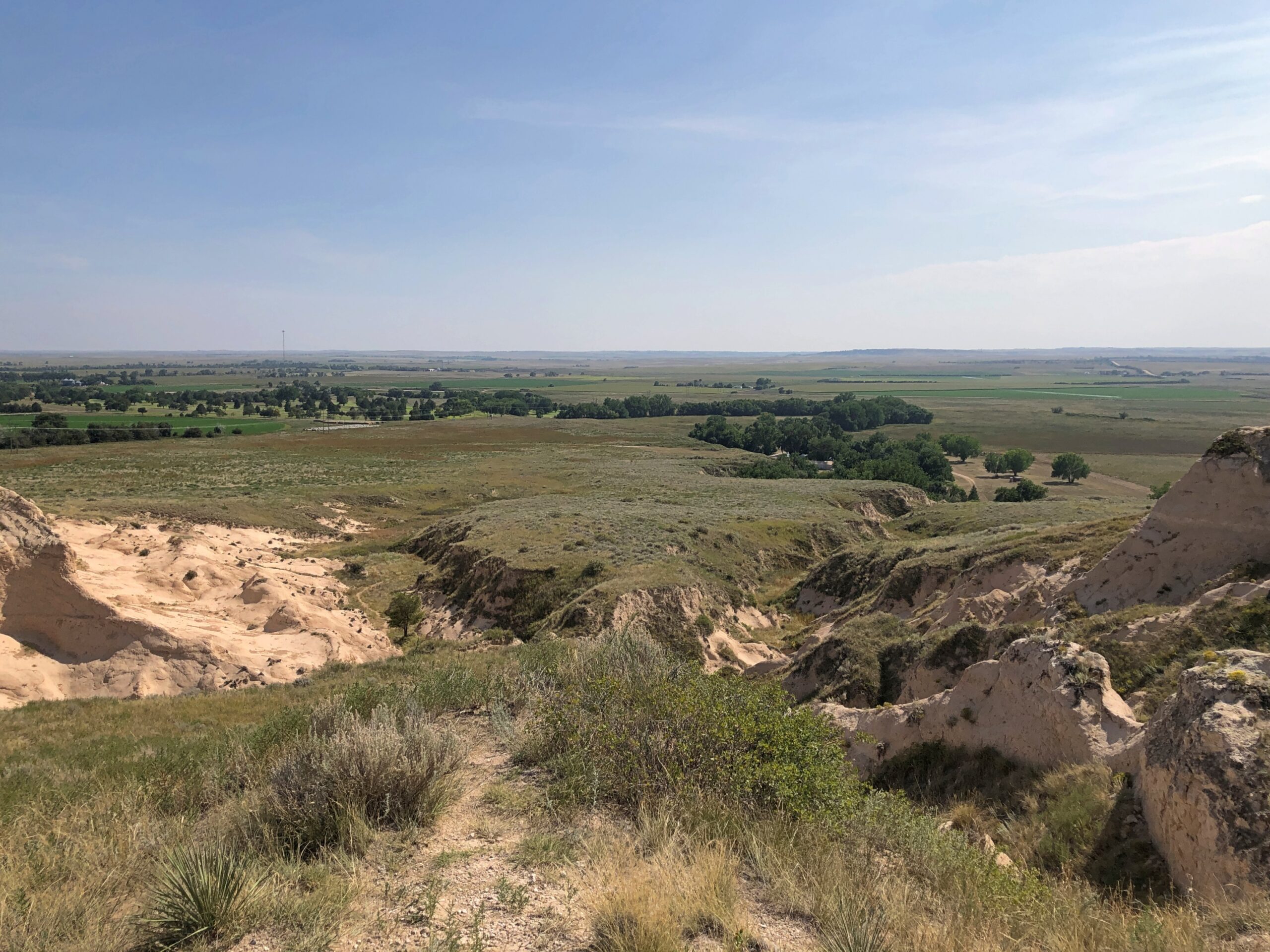
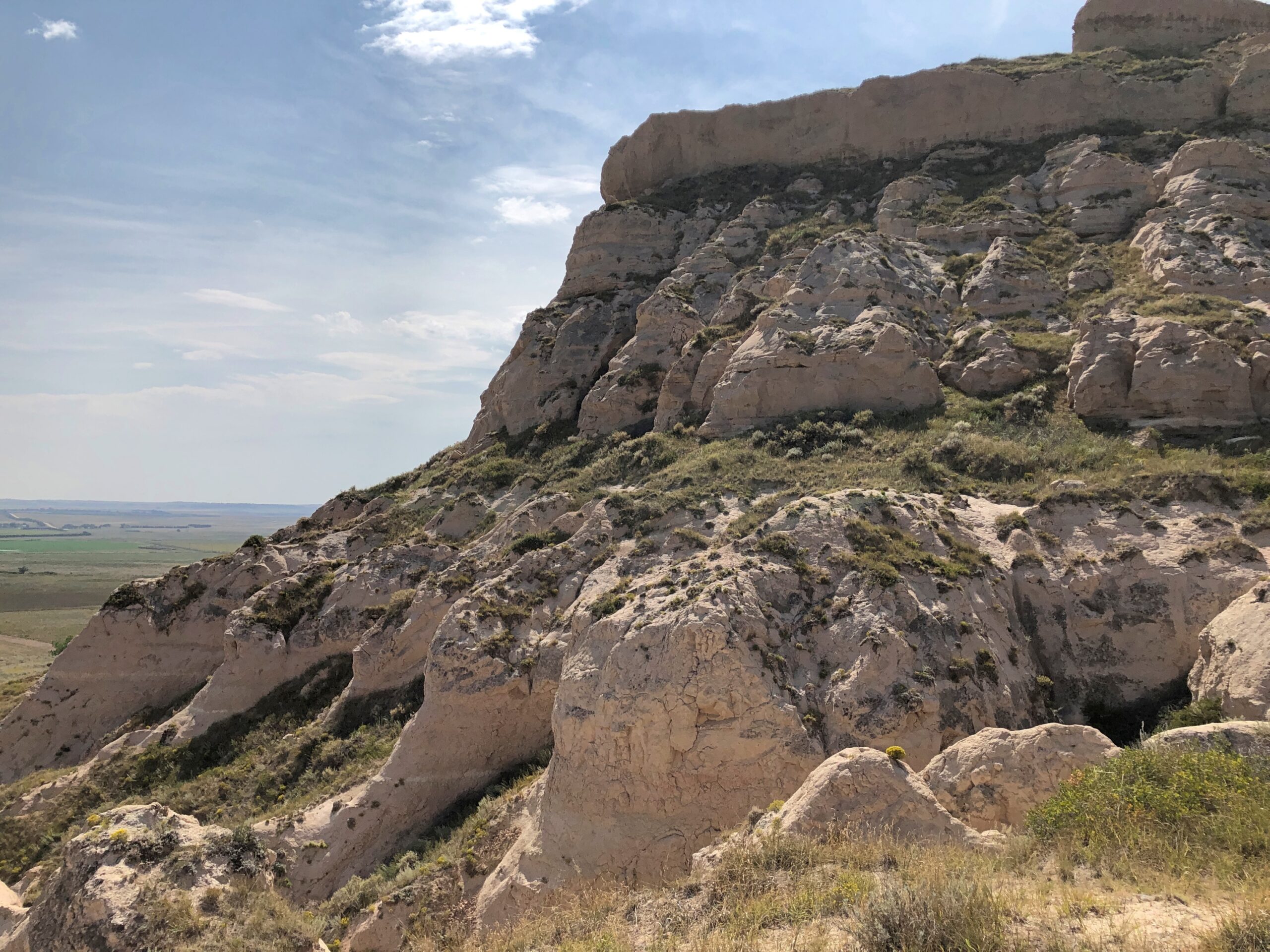
Scotts Bluff isn’t just a single bluff. A set of them, you might say. A road (yes, CCC built) provides access to the top. From there, any number of fine vistas ring the area. A fair number of people took the drive the same day as I did, but in no way did they amount to a crowd.

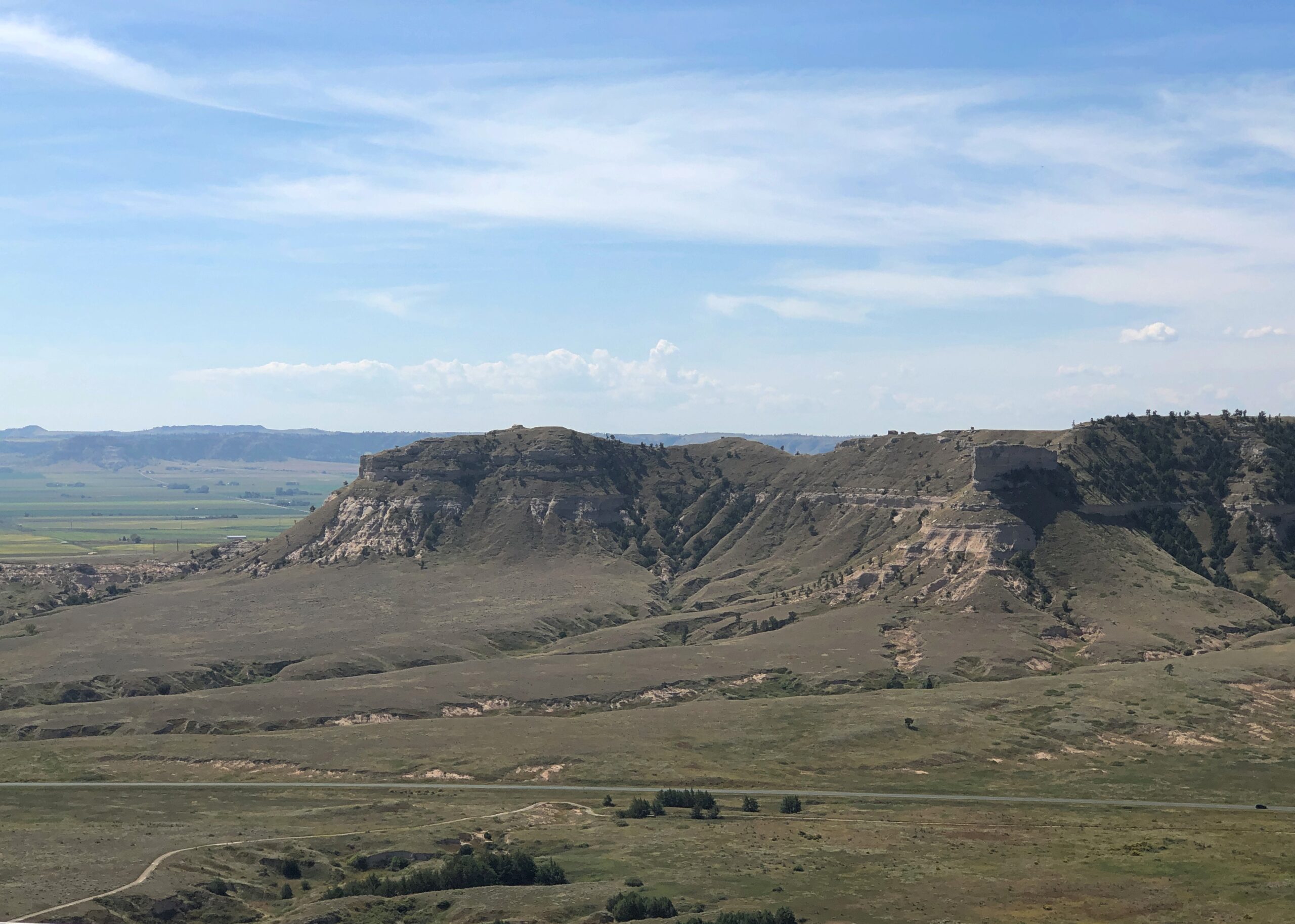
Scotts Bluff is no solitary outpost. Turning to the 1911 Enclopdaedia Britannica’s entry on Nebraska: “In the fork of the North and South Platte are the Wild Cat Mountains, with contours rising to 5300 ft., in which Wild Cat Mountain, long reported as the highest point in the state, attains 5038 ft., Hogback Mountain 5082 ft., and various other hills — Gabe Rock (5006), Big Horn Mountain (4718), Coliseum Rock (5050), Scotts Bluff (4662) &c. — rise to heights of 4500 to 5000 ft.

“In the extreme N.W. the White river and Hat Creek have carved canyons in deep lacustrine deposits, creating fantastic cliffs and buttes, bare of vegetation, gashed with drainage channels, and baked by the sun.”

East of Scotts Bluff not far from highway US 26 is a set of rocks known as Courthouse and Jail. There’s something to that name.

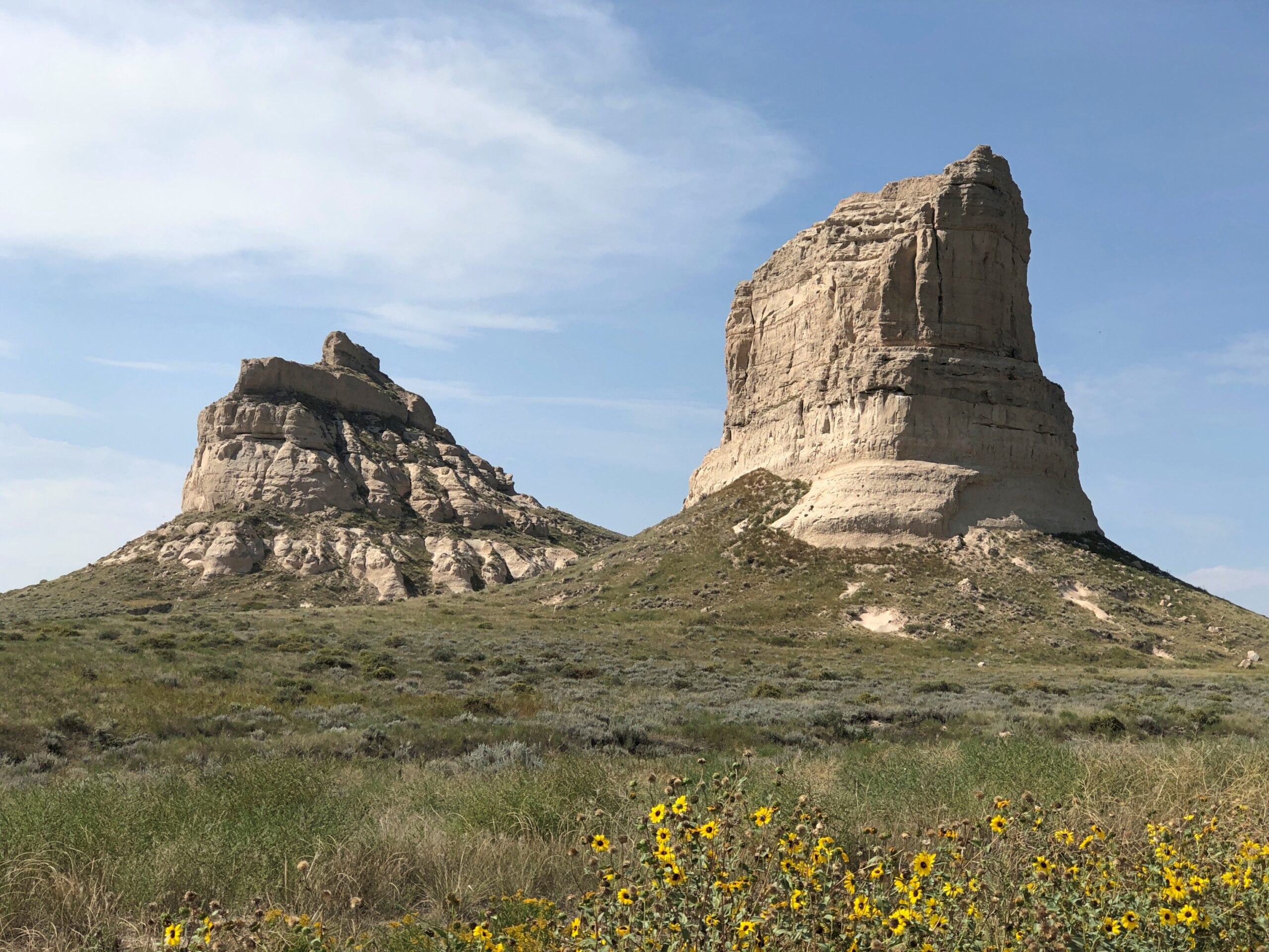
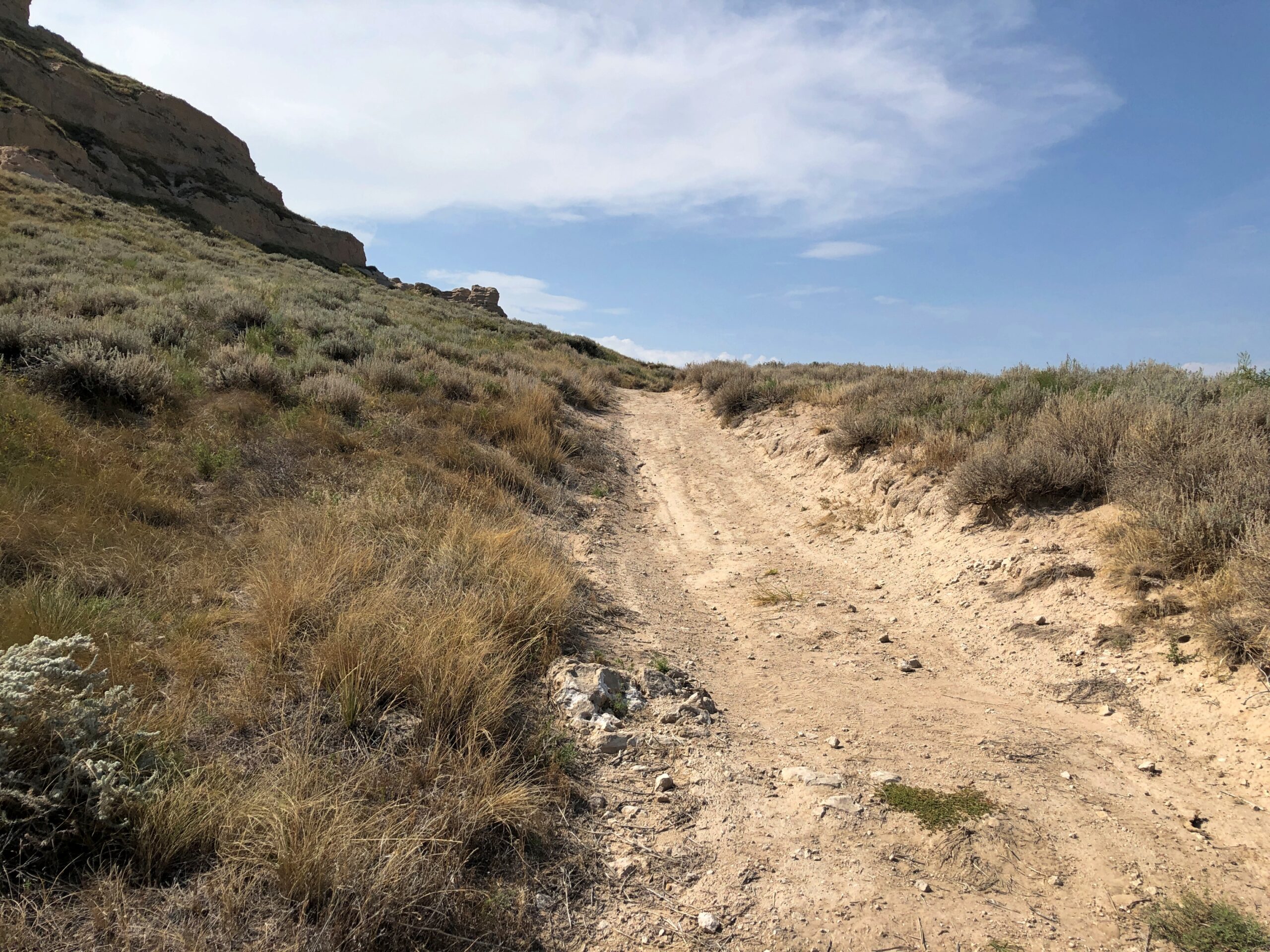
If Scotts Bluff was lightly visited, these two were almost completely empty. I stopped by on the afternoon of the 7th, and the only other people in the parking lot were sitting next to their RV, under a tarp, probably shooting the breeze over beer. So I had the trail to myself, though I didn’t go that far under the hot and copper sky.

Offering some views of its own.

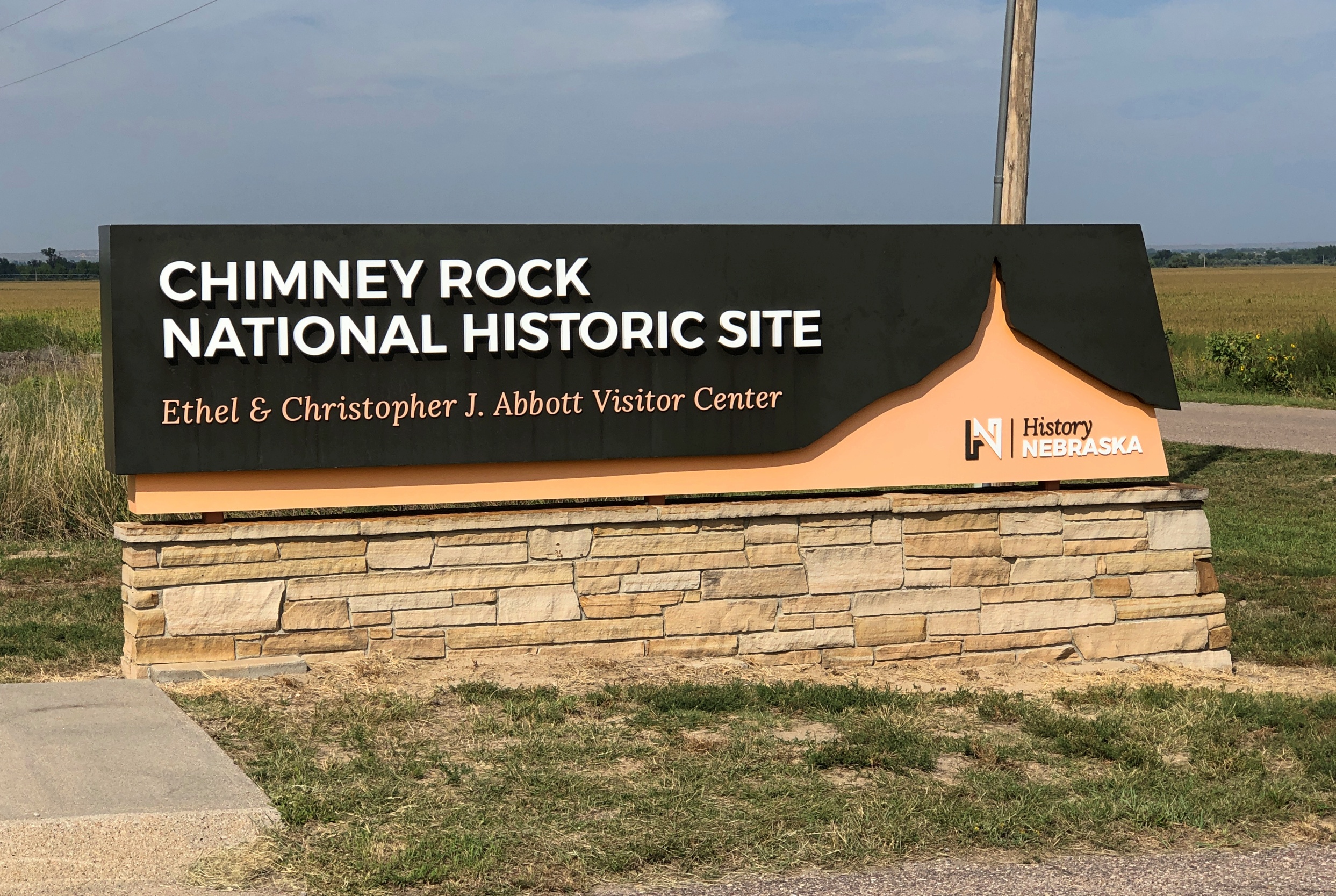
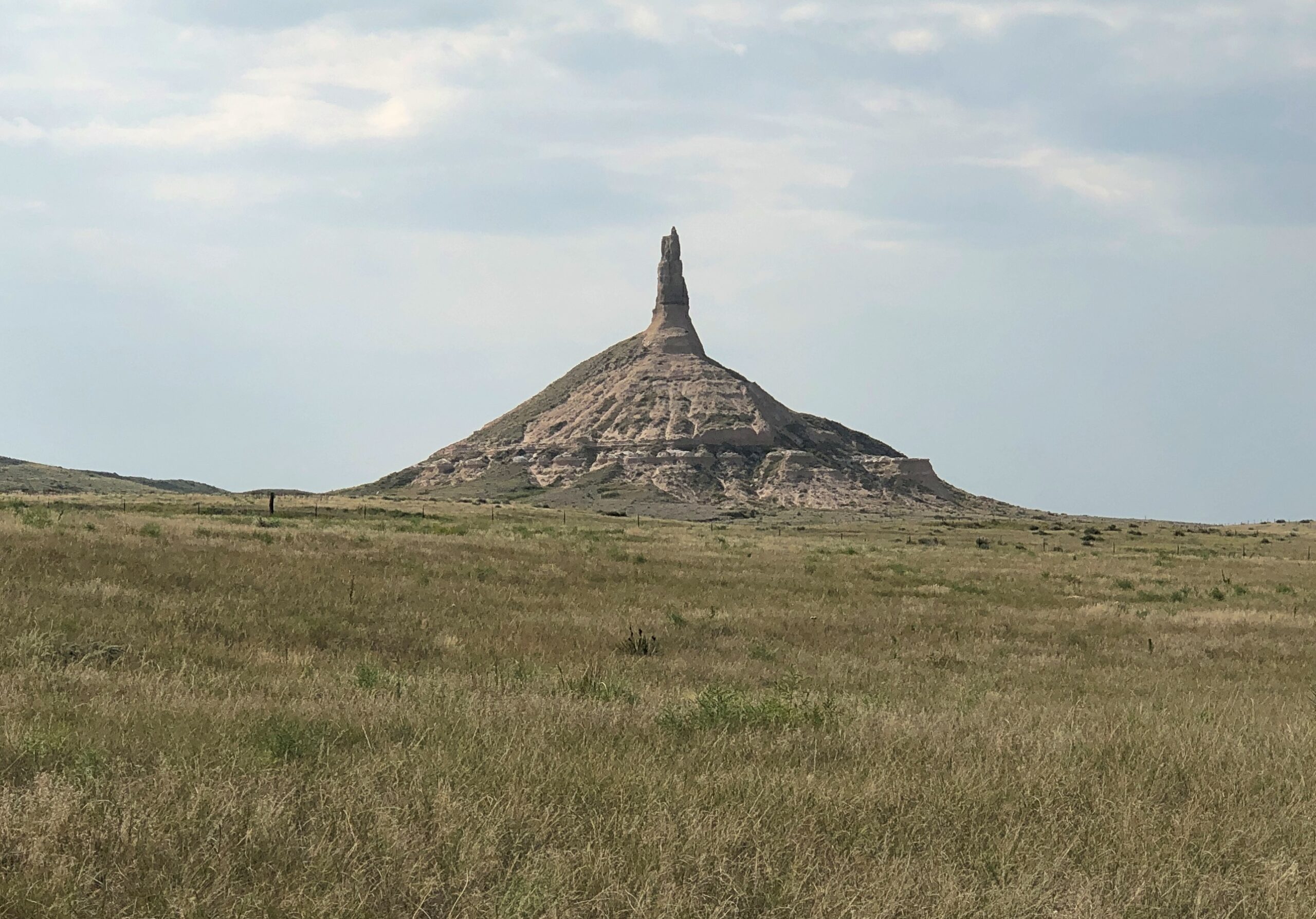
Not far away in this part of Nebraska (at least by horseless carriage) is the better known Chimney Rock National Historic Site.

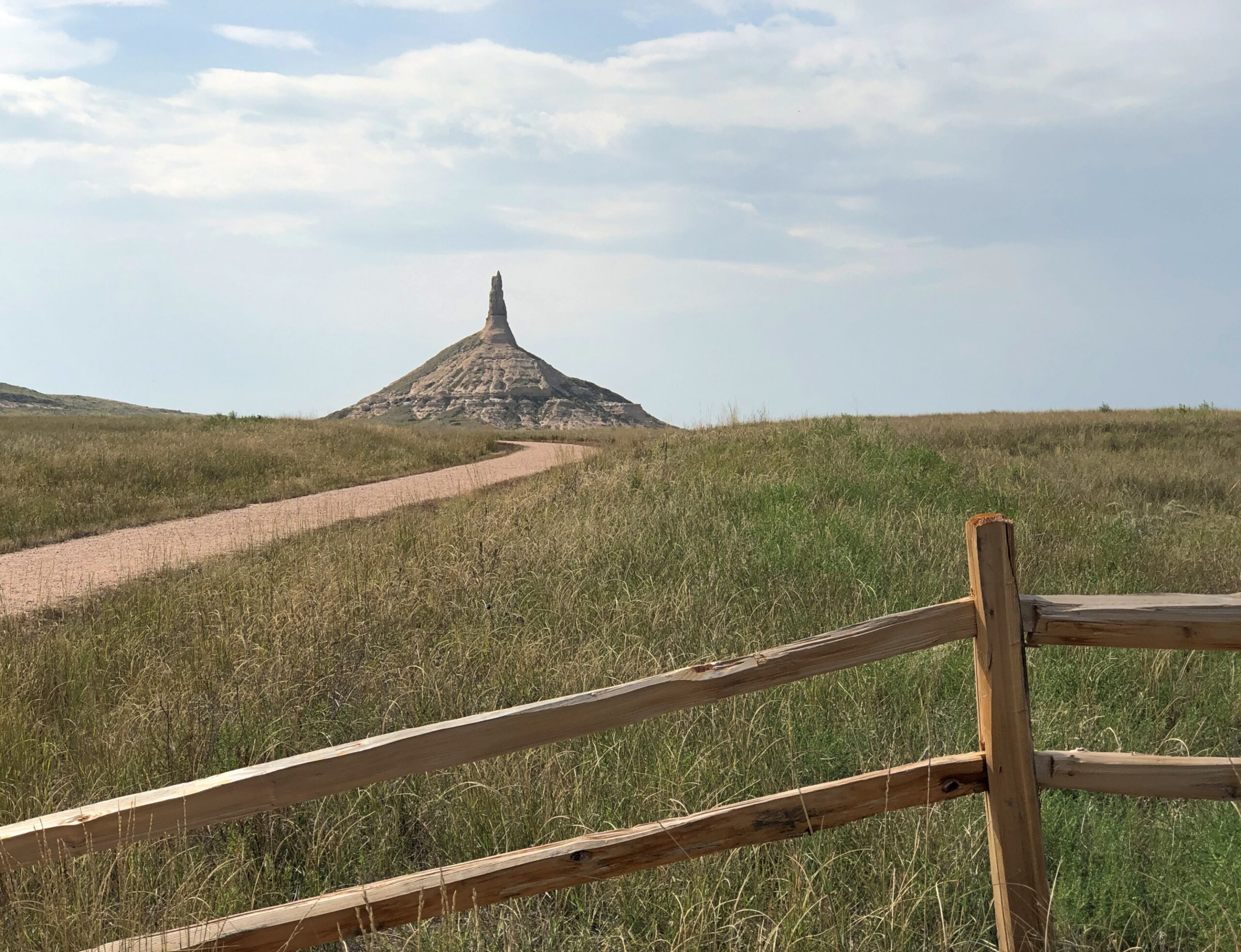
It was later on same day as Courthouse and Jail, and the heat was still on. Again, I didn’t want a personal heat event to interrupt my trip, so I didn’t go as close as the trails would have allowed.

Chimney Rock, Neb

I sent an image of Chimney Rock and a text message to old friend Tom J.:

The aliens decided that Devil’s Tower was a better site.

Then I sent this image from the Chimney Rock gift shop.
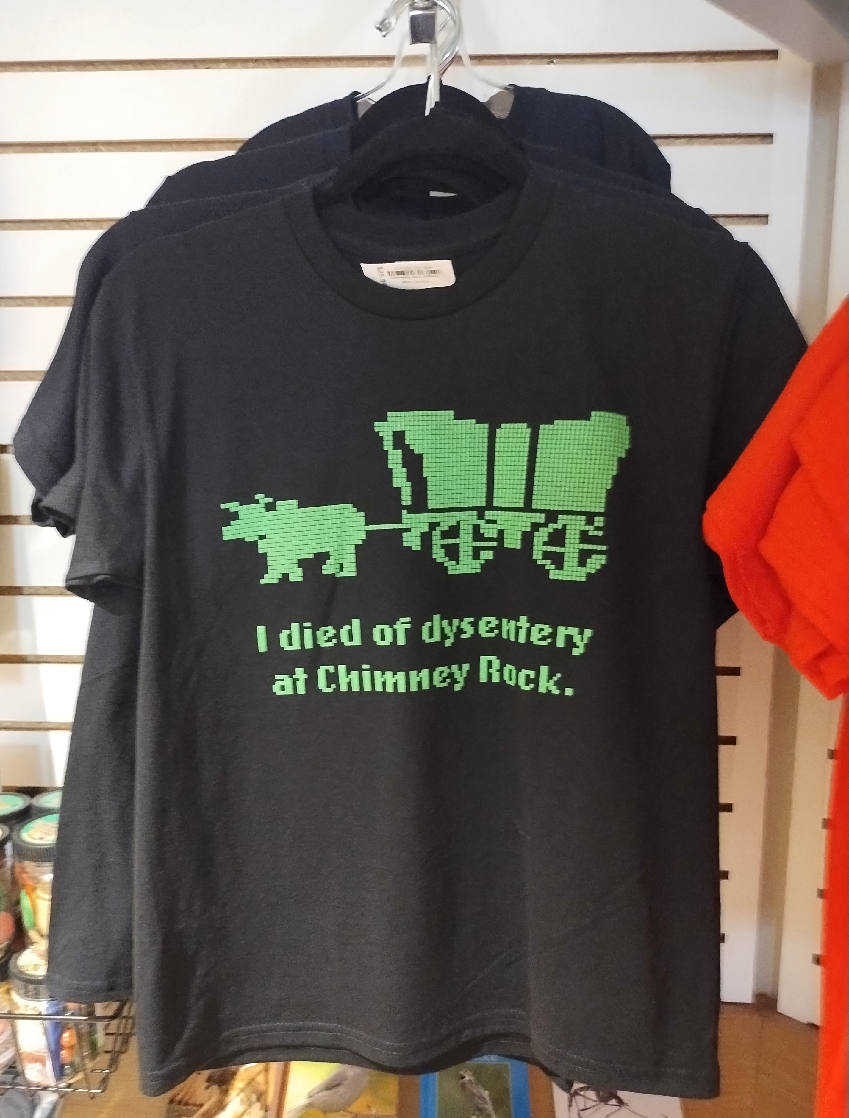
Chimney Rock, Neb

Tom answered:

lol. We never even played Oregon Trail and that’s still funny.

Carhenge

Just how many Stonehenges are there in North America? Or rather, Stonehenge-like structures, standing out in the open. For a question like that, consult the expertise of Roadside America. The answer turns out to be that there’s no definitive count – they keep “springing up,” as the web site says (and the article is worth reading in its entirety). A design borrowed from ancient Britain morphs into something distinctly American, again and again.

None is better known than Carhenge in western Nebraska, RA asserts, and I can go along with that. Its fame is international.

Though not a Stonehenge, I visited the Cadillac Ranch once upon a time, so it stands to reason that someday I’d have a strong hankering to see Carhenge. I arrived early in the afternoon of September 7, under partly cloudy and very warm skies.

Carhenge, Alliance, Nebraska

All the cars were painted gray at one time, but that has clearly given way to some being used as metal canvases.

Carhenge, Alliance, Nebraska

The colorful cars are curated works, from the looks of them, to use that word in a literal and correct way.

Carhenge, Alliance, Nebraska

RA: “[Carhenge] was built [in 1987] in a farm field north of Alliance, Nebraska, under the supervision of farmer (and engineer) Jim Reinders [d. 2021], who meant it as a memorial to his dad.

“What makes Carhenge special is that it’s made of cars, 38 of them, rescued from nearby farms and dumps. Reinders noticed that the monolithic dimensions of cars from the 1950s and ’60s nearly equaled the stones at Stonehenge, and he built his monument with a 96-foot diameter to match the proportions of the original.”

One outlying car seems to be reserved for spray painting for anyone who wants to, in the style of all the cars at the Cadillac Ranch.

Carhenge
Carhenge

The undercarriage is particularly vivid.

Carhenge

The graffiti car is apart from the Stonehenge-like array, along with other sculptures that have been added to the grounds in more recent years.

Carhenge
Carhenge, Alliance, Nebraska

Not just an upright old car, but apparently a time capsule, closed in 2003, with a slated opening in 2053.

Carhenge, Alliance, Nebraska
Not just an upright old car, but apparently a time capsule, closed in 2003, with a slated opening in 2053.

Word is that Carhenge wasn’t especially popular locally in its early years, including grunts of “eyesore” and threats to have it condemned and the like. But after a few decades, the townspeople came around, and the town of Alliance acquired the site in 2013, so now it counts as a public park. You go through an open gate, no admission is charged, and you’re free to wander around. Next to the parking lot, a gift shop stands, but visiting is optional. I supported the preservation of Carhenge in the form of a magnet- and postcard-centered purchase at the shop.

Black Canyon of the Gunnison National Park

A vast stretch of mountains majesty well over the tree line, a complex mass of sand piled at the edge of rugged mountains, and the well-hewn cliffside relics of a people remote in time but whose presence endures – the first three national parks we visited in Colorado in September all rated as exceptional destinations. But I’m glad, simply because it was last on the clockwise loop I’d planned through the state, that Black Canyon of the Gunnison National Park came last. It would have been a hard act to follow.

As a steep – and really deep – crack in the earth, the Black Canyon lives up its name, with most of the canyon cast in shadow most of the time, striking in its seeming darkness. But not pitch black all the way down its 2,000-foot cliffs. Far away, a whitish irregular ribbon runs through the gray bottom of the canyon, quickly recognizable as a river in quicksilver motion. The Gunnison, that is.

If there were no other people around, which happened sometimes at this park, you could hear the roar of the river. Faint, but distinct in its power. Mass snow melts and rushing tributary creeks enable the Gunnison to act (on a geological time scale) like a high-powered saw cutting through rocks that are unimaginably ancient. Before long, that is 2 million years, the river gouged the crack you see, exposing rocks 1,000 times older than the time it took to cut the canyon.

A single two-lane road snakes about seven miles along the south rim of the canyon (should I even have to say it? By the CCC), offering a string of overlooks. Not far from the park entrance, an overlook gives a taste of vistas to come. I might have named the place Gray Canyon, but that isn’t quite as poetic, is it?

Black Canyon of the Gunnison

Also, evidence of the fire that swept through the park in July, burning about a total of about 4,000 acres on both the south and north rims, along with some Park Service infrastructure. A number of trails leading away from the south rim overlooks were still closed when we visited the park on September 19, with signs disallowing access to charred grounds and slopes.

Black Canyon of the Gunnison

Fortunately for us, we were able to drive the South Rim Road and see what we could see at some of the overlooks. Unless you’re keen on some kind of lunatic climb into the canyon, that seems like a perfectly reasonable ambition. At the main visitor center on the road – which a ranger told us had barely escaped intact, through the efforts of hotshot crews – a path leads to scenic perch, built to accommodate casual visitors. It survived the fire as well.

Black Canyon of the Gunnison

Any photo’s going to be a pale image of this vista, but they will have to do. Believe me, it was a place to drop everything and gawk. And, even while safe behind rails, to experience a touch of vertigo. Nothing incapacitating, just an unsettling mental comparison between little you and the huge yawning drop.

Black Canyon of the Gunnison

A pointy ledge below. An opportunity for an Instagram death. It was hardly the only one.

Further down the road, a good view of the Gunnison. It’s hard to tell just by the images, but that’s around 2,000 feet down. Eventually, the water goes into the Colorado River.

Black Canyon of the Gunnison

Capt. John Gunnison is the U.S. Army officer and explorer who came to the canyon in 1853 as part of the effort to find a route for the transcontinental railroad. To sum up his conclusion, in terms he would have never used: Not through the Black Canyon, Secretary Davis. Are you kidding me? Later that year, Gunnison and most of his men got the worst of an encounter with some Ute warriors and, among other places, the river acquired his name as a posthumous honor.

I also have to say that Gunnison’s career also included surveying in the Upper Midwest, such as the Green Bay area, and that he surveyed the border between Wisconsin and Michigan. An underappreciated kind of achievement, I’d say.

None of the viewpoints were crowded. The Grand Canyon, this isn’t. The more accessible south rim of the Black Canyon isn’t crowded, even on a warm Friday afternoon, unlike the more accessible south rim of the Grand Canyon.

Black Canyon of the Gunnison

Near the end of the road is a view of the Painted Wall.

The stripes are not paint, of course, but pegmatite, an igneous rock that solidified after the surrounding rock did, for reasons that a geologist, which would not be me, might be able to explain. A sign at the viewpoint helpfully compares the height of the cliff (2,250 feet) to various manmade structures. The only one that would rise higher than the wall is Burj Khalifa, and that not by much. Note also that the top of the cliff, across on the remote north rim of the canyon, has absolutely nothing in the way of safety infrastructure. The cliff is a cliff, with gravity ready 24/7 to whisk the careless or suicidal to their doom.

I’d be remiss if I didn’t include a few more post-char landscapes: the sort that spread out from South Rim Road for long stretches. It would be a thrill of a road anyway — a little more thrill than I need, actually — with its sporadic few spots where the separation between the road’s edge and an enormous cliff was a single white line.

At the end of the road is the trailhead of Warner Point Trail. From the parking lot, according to a sign, the walk is 1,373 yards to the overlook at Warner Point. Near the sign, I heard a couple of young German men obviously working out the distance in meters (you don’t need much German to understand that). No matter how few people are at a U.S. national park, some are going to be Germans.

I preferred to work out the distances in miles. That would be nearly eight-tenths of a mile, so roughly a 1.6 miles there and back. Or 2.5 km for Euro-types. Better shoes on, poles in hands, hats on heads and water in a small backpacks, we set off on the trail. Yuriko and a few other people (including the Germans) got to Warner Point before I did , but get there I did.

The walk was partly on this kind of trail.

With a fair amount of this kind of thing.

Along the way, an impressive collection of deadwood that the recent fires missed.

With views of the agricultural valley outside the park..

Finally, the end of the trail at Warner Point.

When I got there, Yuriko was waiting. Two other people were there (not the Germans; as athletic sorts, they’d come and gone). Soon they left. So we had the vista to ourselves for about 10 minutes, until another couple came along and we left. When we were quiet, the only sound was the Gunnison far below.

Mesa Verde National Park

In 800 years or so, will people come from significant distances to look at the ruins of my mid-century neighborhood? That doesn’t seem likely for any number of reasons. I’d be surprised if my own house survives until the next century, considering how good people are now at razing and rebuilding. But considering such a long span of time, there’s no way to know.

That’s the kind of thing I wonder about when facing structures of that age, especially those whose inhabitants are known mainly by the structures and other items they long ago cast off.

On September 17, we’d come to the Cliff Palace at Mesa Verde National Park. To get close, you sign up and pay for a ranger-guided tour, which goes down stone stairs, along the edge of the cliff near the dwellings, and then back up some stone stairs (built by the CCC; does that even need to be said?). The elevation is 7,500 feet or so, but that didn’t cool things down that day. It was hot and sweaty.

A shot like that took some effort. We were hardly alone at Cliff Palace.

The ruins, which are most certainly near a cliff, are probably not a palace in the grand sense of a royal residence. More of a neighborhood, one of many in the vicinity, though the largest. Also, not quite as much of a ruin as it used to be. This is an image of the Cliff Palace from 1891, taken by Gustaf Nordenskiöld.

Not as long ago as all that, considering the age of the structures, but before TR inked the bill creating the national park, and back when you could help yourself to whatever was lying around, as the explorer (and photographer) Nordenskiöld apparently did, taking many items back home to Sweden. Eventually, the items made their way to Finland. A few were returned recently.

The ruins aren’t quite as ruined these days. The 20th century was a period of stabilization. Not as many artifacts got nicked either.

Mesa Verde National Park

A kiva. The largest one at the Cliff Palace, I think. A religious site similar to others in the Southwest, such as at Bandelier National Monument (and now I know that was a kiva).

Mesa Verde National Park

The canyon below the Cliff Palace. Imagine having to scramble up and down the walls regularly, to tend to fields or fetch water or escape from marauders.

Mesa Verde National Park

Mesa Verde is of course much more than the Cliff Palace, since the park protects an estimated 5,000 archaeological sites, including 600 cliff dwellings. The main road through the park (built by the CCC, naturally) takes visitors to other overlooks. The dwellings of Spruce Tree House are sizable and also off limits these days, until the overhead rocks are stabilized.

More cliff dwellings. They are a little hard to see, but they are there.

Mesa Verde National Park

On top of the main mesa, the road also goes through areas burned by wildfire at one time or another.

Flora always bounces back.

I had the vague idea that the inhabitants of the cliff dwellings disappeared mysteriously after about 1300, but visiting the park schooled me on more current thinking. They left, but there was nothing mysterious about it. Drought hit them, and hit them hard, so they migrated to find water and other sustenance. Persistent violence was probably a factor, too, as tends to happen in periods of strained resources. So it’s pretty clear that Ancestral Puebloans’ descendants even now live among the tribes along the Rio Grande, not too far away.

I also didn’t realize that the well-known cliff dwellings were only occupied for a relatively short time, in the grand scheme of native inhabitation: only about a century. Before that, most of the inhabitants lived atop the mesas. One such ruin is called Far View, which isn’t far from the road.

Mesa Verde National Park

I heeded this signs and didn’t enter. But you can walk around the perimeter and imagine the passing centuries.

Great Sand Dunes National Park and Preserve

It’s a safe bet that when most Americans think of scenic Colorado, they think of the sort of mountains you see at Rocky Mountain National Park, or many of the other ranges in the state. Less likely to come to mind is 1.5 cubic miles of sand. That much sand is hard to imagine at all.

That’s the amount of sand thought to be piled at Great Sand Dunes National Park in southern Colorado. Naturally, it isn’t a 1.5-mile cube, though the idea is amusing. The NPS notes that the sand is more spread out: “The 30 square mile (78 sq. km) active dunefield is where the tallest dunes reside. It is stabilized by opposing wind directions (southwestly [sic] and northeasterly), creeks that recycle sand back into it, and a 7% moisture content below the dry surface.”

Great Sand Dunes National Park

We approached the park on September 14, heading eastward on Lane 6 North, an Alamosa County road through the flatlands of San Luis Valley, an enormous stretch of land between the San Juan Mountains and the Sangre de Cristo Mountains. At 8,000 square miles, San Luis is the world’s largest alpine valley, the Denver Gazette asserts, with an average elevation at more than 7,600 feet.

Great Sand Dunes was a national monument for longer than it has been a park, though park status represents an enlargement of the monument that President Hoover created. It is Colorado’s newest national park, raised to that status only a little more than 20 years ago.

At a distance of some miles from the park, you notice a pale rim at the foot of the Sangre de Cristo range. As the mountains come better into view, so does the rim, soon looking like a vast pile of sand – which it is – pushed up against the mountains by some enormous broom – which it was not (see above).

Great Sand Dunes National Park

Also on offer: a nice view of the Sangre de Cristo, including flora that thrives in the sandy soil of its foothills.

Great Sand Dunes National Park

The tourist side of GSDNP features a visitor center and a parking lot and, a short ways away, camp sites. Vegetation girds the parking lot. From there – dunes at the other end of a long sand flat.

Great Sand Dunes National Park

No further signs, no trails. Visitors head toward the dunes and wander around wherever they want.

Great Sand Dunes National Park

A major activity is sandboarding. Like snowboarding, I suppose, only without the freezing white stuff. Atop this dune, sandboarders are ready to slide.

Great Sand Dunes National Park

It’s a young person’s and young families’ game. We happened to meet a pair of young men on one of the dune crests, boards in hand. One of them was wearing a Texas A&M cap, and I asked if he’d gone to school there. He had, finishing a few years ago. I wasn’t entirely certain that he believed me when I told him my grandfather was Class of ’16. That is, 1916.

Horseback riding is also allowed on the dunes, under certain conditions.

Great Sand Dunes National Park

We merely took a walk, climbing a few of the smaller dunes. I’d learned my lesson back in 2007, when we clawed our way up a large sand dune in Michigan, at Sleeping Bear Dunes National Lakeshore: “It was a slog. One foot up, then it slides down a bit. After all, it’s warm sand. Make that pretty hot sand. Step, slide back, step, slide back, step, slide back. Rest. Heat. Sweat. Sand in shoes. Remove sand pointlessly, because it comes back. Step, slide back, step, slide back…”

The day at GSDNP wasn’t quite as hot as in Michigan, but the sand was just as sandy. So we admired North America’s largest pile of sand, but not from the top of any particularly large pile.

Rocky Mountain National Park

On September 15, KKTV in Colorado reported that Trail Ridge Road through Rocky Mountain National Park was “briefly closed Sunday [the 14th] due to the wintry weather. This was first time snow and ice shut down the road since it reopened in May.”

We drove that road two days before, on the 12th. As the article notes, the “48-mile highway through the park is North America’s highest continuous paved road and connects the east and west sides of the park… [it] reaches 12,180 feet at its highest point. Alpine Visitor Center, where snowfall was caught on webcam, is located at about 11,796 feet.”

We’d spent the night before in Granby, Colorado, from the looks of it a growing town – complete with large rows of spanking-new townhouses – and from there entered the park from the western, or less crowded side. The eastern entrance near Estes Park, Colorado, has a more direct connection to the mobs coming from greater Denver.

RMNP is a place of majestic vistas. We came for that, and were not disappointed. But I was just as impressed by something we saw near the western entrance at a place called Holzwarth Historic Site, in the Kawuneeche Valley. A picturesque place.

It was the first place we stopped in the park, walking on a path through part of the valley. A small bridge crossed what looked like a creek.

Rocky Mountain National Parl

A sign on the bridge informed us, however, that this was the Colorado River. A flabbergasting moment. I’d known that the Colorado rises in one of the remote parts of the park, but I didn’t know we were going to encounter the river – whose downstream will carve epic canyons and be dammed to the hilt for the water and power needs of millions of people – by crossing it on foot in a few seconds.

The Holzwarths ran a dude ranch on the site for much of the 20th century, before selling it to the Nature Conservancy, which eventually resulted in the area being added to the national park. A number of the dude ranch buildings still exist not far from the baby Colorado River.

From the valley Trail Ridge Road, which is also US 34, heads upward. A look back at the valley.

Soon you reach Milner Pass on the Continental Divide, crossing back to the Atlantic side; we’d crossed to the Pacific side at Berthoud Pass the day before outside the park, on the way to Granby.

From there, the road takes you above the tree line. By that elevation, the warmth down in the valley is just a memory, as brisk chilly winds blow. The air was still above freezing that day, but not by much.

From one of the several pullouts on the road, a path through fields of alpine tundra.

Been a long time since I’d seen any. Back in the Canadian Rockies? No, Alaska. Still, a while ago. We’d reached autumn above the tree line, with the tundra turning.

Rocky Mountain National Park

The road goes on.

Who first built the road? There was none when Rocky Mountain NP became a national park, with President Wilson’s signature on the bill. Improvements came later, and of course they were by the CCC.

At the Alpine Visitor Center, parking was hard but not impossible to find. The views are good from there, but if you want the better vistas, you climb some outdoor stairs. Roughly 200 feet of them.

The air was cold and there wasn’t enough of it. Or so it seemed. I took my hiking pole, put on a sweater and cap and started up. I could have bought a small can of oxygen at the gift shop, had I known about it. I saw a woman, clearly older than me, coming up the stairs as I was headed down, pausing to inhale vigorously from such a can.

Yuriko and Emi made it to the top before I did, but by taking a number of breaks, I managed to get to there myself. Just another thing I should have done 30 (40) years ago. But even then, I’d have been tired at the top.

Rocky Mountain National Park

It’s that extra five feet that leaves you gasping, I think. No matter, the view was worth the gasps. Entirely. The images, as usual for this kind of vista, barely convey the scene in its glory. This is going to be a persistent reality over the next few days’ posts.

Rocky Mountain National Park

Enough to make you burst out with a rendition of “Rocky Mountain High.” If you had the oxygen. I have to say I was glad to repair soon to a lower altitude, one below the tree line. From the Alpine Visitor Center, the road heads toward the eastern entrance to the park, a good many miles away and several thousand feet closer to sea level.

Before we left the parking lot, we saw a fox — guess that would be an alpine fox, pointy snout, pointy ears, billowing with orange and white fur — trot onto the parking lot, as if it had a car parked there. A young ranger, presumably used to the elevation, took chase. Not to catch the fox, which would have been impossible, but probably to prevent the animal from getting run over. Roadkill is one thing, but parking lot kill would have put a small dint in the scenic wonder all around. Anyway, the fox headed for the slopes.

Not only was the air better below tree line, fall foliage was well under way, something we haven’t gotten much of even now here in northern Illinois, though it won’t be long.

Rocky Mountain National Park

One down, three to go. One of the marvels of Colorado’s four national parks is how different each of them are from the others, as we would soon see for ourselves.

Colorado Lasso ’25

Driving down from the alpine wonders of Rocky Mountain National Park a couple of weeks ago on highway US 36, I realized we’d be passing through Boulder, Colorado. So during one of the moments of standstill traffic on that highway as it winds into Boulder — it’s a crowded road, especially on a weekend during warm weather — a thought occurred to me. More of a memory-thought, since it harkened back almost 50 years.

At zero mph, I had time to consult Google for more information. (Remarkably, the signal was strong.) Google Maps pinpointed the location I’d thought of, on a leafy street in Boulder. That day I expended some tourist energy, of which I don’t have quite as much as I used to, to find Mork’s house.

That is, the house used in establishing shots in Mork & Mindy to show their home, since the show was set in Boulder. I know I’d seen Boulder on maps. Funny name, I thought as a kid. Really Big Rock City. It’s still a little funny. But other than as a spot on the map, the show was probably the first time I’d heard anything else about the place.

The passengers in my car, Yuriko and Emi, having grown up outside of the orbit of ’70s American sitcoms, didn’t particularly appreciate the place. At least not until I conveyed the information that the show made Robin Williams famous. He’s a known quantity. I read a bit about the house later, and there seems to be no consensus about whether the owner cares whether anyone stops by the take a picture. My guess would involving factoring in a dwindling number of people coming by. You know, because the show went off the air over 40 years ago.

Then again, if my U.S. travels have taught me nothing else, it’s that retirees are out being tourists. They have the time they didn’t used to, and currently are just the right age to take a peek at Mork’s house at 1619 Pine Street, which is easy enough to find. Even if, like me, their fondness for that show was lukewarm at best.

Boulder and Mork came early in the second leg of my three-legged, 4,498-mile drive, which seemed to kill that many bugs on the windshield and front hood and bumper. The house counted as merely one spot in a trip that took me through hundreds of places. I spend most of September on the road, heading west from Illinois early in the month along I-80 and smaller roads, especially Nebraska 2 through the Sandhills, and spending time in western Nebraska and its rocky outcroppings and in southeast Wyoming, before going to Denver. That would be the first leg. Which, I’m very happy to say, included a good look at Carhenge.

Yuriko flew to Denver on the last of the points I got from SWA for the Christmastime FUBAR a few years ago and we met there. (New motto for the airline: Now We’re Just Another Airline!) After an overnight jaunt to Rocky Mountain NP in the company of our friend Emi, the two of us then spent more than a week taking a clockwise circle-(like) course — a lasso, you might call it, a straight line connected to a loop — from Denver to Colorado Springs to Pueblo to Walsenburg to Alamosa to (coming down from Wolf Creek Pass) Pagosa Springs to Durango to Silverton to Ouray to Montrose to Salida and back to Denver, where Yuriko flew home. That was the second leg. The drives were varied and gorgeous.

You’d think that would be enough, but I had to drive home, loosely following I-70 this time, making my way from Colorado through Kansas, Missouri and Illinois, and making a number of stops, big and small, such as Kit Carson, Colorado; Abilene, Kansas; and Kansas City, Missouri, for a third and final leg. No single small road took me through Kansas, but a series of them did, some as empty as, well, eastern Colorado and western Kansas. That’s some fine driving. Mountains are great, but after a week or so of their twisty ups and downs on two lanes, flat is all right. More relaxing, even.

For reasons that will soon be obvious, not long ago I looked up 2024 visitation statistics for the four national parks in Colorado: Rocky Mountain, Mesa Verde, Great Sand Dunes, and Black Canyon of the Gunnison.

Far and away the top national park draw in Colorado is Rocky Mountain NP, which received 4.2 million people last year, according to the NPS. In fact, it’s a top ten among most-visited U.S. parks. That isn’t so much of a surprise, considering the monster population that lives nearby in greater Denver and other parts of the Front Range. Indeed, for a lot of people, RMNP is easily a day trip.

That isn’t true for the other three national parks, but even so I was surprised to learn how few people actually visit any of them. They aren’t that remote. We aren’t talking Gates of the Arctic NP or American Samoa NP remote. Still, out of the 63 current U.S. national parks, last year Mesa Verde ranked 41st, Great Sand Dunes 44th, and Black Canyon 49th. The three of them combined saw only about 30 percent as many visitors as Rocky Mountain in 2024.

We set out to see all four of the national parks in Colorado. And we did. You could call it a national park trip, along the lines of the one a few years ago mostly on the Colorado Plateau. But the parks were only a framework, never the total picture, over mountains and across plains. We saw a lot else besides, such a male bear outside our window about 10 miles north of Durango, a female in a tall nearby pine snarling at him, and cubs higher up in the tree. More detail to come on that, in the fullness of time.

Rocky Mountain NP is an exercise in rising above the tree line, by vehicle but also on foot, up a path, into to a satisfying exhaustion before majestic mountains. The pale sand dunes of the Great Sand Dunes NP rise from a valley and back up against a mountain range, as if a giant broom swept it off to corner, and for visitors amounts to a giant sand box. Mesa Verde NP, where the stone dwellings of the Ancient Ones are tucked away in steep stone canyons, shows how much effort people will put into making a home for themselves. Black Canyon of the Gunnison NP is a scenic great unknown, a great dark crack in the earth that reminds you that gravity is in charge, its ragged cliff edges rife with opportunities to die for an Instagram image.

Walworth County Tin Man

It may be September, but it’s still warm. Time to take advantage of the second shoulder season of the year in my own slightly demented way. Back to posting around September 28.

Last month I’d gotten a tip from one of the usual sources detailing roadside oddities, so there I was, tooling down a road in rural Walworth County, Wisconsin. The sun was hot and the corn was high. My tip was solid. I pulled off the road and walked a little ways for a good look at the oddity. It is larger than most.

Tin Man, Wisconsin
Tin Man, Wisconsin

It’s called “Tin Man,” according to published sources, rising 45 feet and weighing in at 20 tons. The creators were two local men entertaining themselves. Looks are free from the road. If that’s not an authentic roadside attraction, I don’t know what is. I was careful to stay off the property, however.

“That statue stands tall in Robert Stewart’s home near Lake Geneva. In fact, it can be seen from about a mile away. It took him and his friend Shane Pope two years to make it,” WTMJ-TV reported in early 2021.

“The statue was built primarily out of scrap metal that Robert was able to collect, which includes the legs, the arms, and body of the statue. The torso is an old water tank that was used in the Pabst Brewery. However, the most iconic piece of the statue might be its Officer Big Mac head.” (I can add that its legs are hay conveyors.)

I’d taken the head for Mayor McCheese – that would make sense in Wisconsin – but actually it’s the lesser-known Officer Big Mac, whom I suppose worked for McCheese until a falling out in the 1980s. Or actually did he answer to Ronald McDonald? Though Ronald had no official title, it was clear he was calling the shots in McDonaldland. Anyway, there the officer is, atop a scrap-metal creation.

Tin Man had been visible from a distance. That raised arm looks a little — odd. Let’s just say he’s waving at the occasional passersby on the road.

When I say rural, I mean rural.

Closer to Lake Geneva, in fact in Fontana, Wisconsin, is the Fontana Frog. I saw it the same warm summer day as the Tin Man.

Fontana Frog

Part of the long defunct Frog Hollow miniature golf course, according to Roadside America. Looks the part.

Not to be confused with another model frog to be seen in Fontana. Two giant frogs in one town. The world’s a peculiar place.

Two Southern Wisconsin Cemeteries

Something I’d never seen on a gravestone: a truck. I’ll bet most people can say that.

St Mary's Cemetery, Burlington, Wis

My best guess when I saw it was that Kenneth C. Remer was a trucking man who, among other things, lived through the short romanticization of trucking men in the mid-1970s. Something I’m sure is lost on later generations, as if that matters. If I were silly enough to say “That’s a big 10-4” to either of my daughters, I wouldn’t expect comprehension. That bit of code wasn’t invented by truckers, but even so.

I looked him up, as one can in our time. His obit says he was a “partner in Remer Milk Service.” So could be he drove a milk truck, at least sometimes. That is a liquid-hauling truck depicted on the stone. Not something celebrated in song and story, but useful work all the same.

Further down the rabbit hole, I came across this: “The 1970s Trucking Craze Can Be Traced Back to a Regional TV Commercial for Bread.” I never knew that, or if I did, I forgot it in the 50 years since then, because I’ve devoted very little thought to the subject over that time. Just another thing invented by ad men.

Another thought on that: though “Convoy” was much more popular, C.W. McCall’s “Wolf Creek Pass” is by far the more entertaining song. (And it’s a real place.) A better song about driving a truck is “Willin’,” originally by Little Feat. Of all people, the inestimable Linda Ronstadt did a remarkable cover of it.

I encountered Mr. and Mrs. Remer at St. Mary’s Cemetery in Burlington, Wisconsin last month. A Catholic cemetery with a nice assortment of stones.

St Mary's Cemetery, Burlington, Wis

Unusual: two Air Force (I assume originally Army Air Corps) Master Sergeants, married to each other.

St Mary's Cemetery, Burlington, Wis

During my recent visit to Elkhorn, Wisconsin, I did no more than look for an “historic cemetery” on Google Maps to find Hazel Ridge Cemetery. Historic for sure, founded more than 150 years ago.

Hazel Ridge Cemetery

It too has a fine collection of memorials. The cemetery is also an arboretum, with more than 25 native species and ornamental varieties.

Hazel Ridge Cemetery

Hazel Ridge has a clutch of war dead memorials, including an 8-inch siege Howitzer as the centerpiece of a Grand Army of Republic memorial.

This particular cannon, according to a nearby sign, was made in 1862 at the Fort Pitt Foundry in Pittsburgh. I assume it did its part for the Union. Nearby are soldiers who did likewise.

And those who died in later wars.

The single word “Carpetbagger” on the stone tells quite a story. Operation Carpetbagger involved black-painted B-24s flying low and slow by night, dropping supplies and agents to the resistance in France before and after the Normandy invasion. Clearly dangerous work. RIP, Bud.

Elkhorn, Wisconsin

Labor Day weekend again? How does summer vanish so quickly? Back to posting on September 2.

Once upon a time, one of the many First National Banks of the world stood in downtown Elkhorn, Wisconsin, complete with a sturdy bank interior common at the time. As seen in a postcard from the early 20th century.

Go looking for the bank these days, and this is what you find.

Elkhorn, Wisconsin
Elkhorn, Wisconsin

Once a bank, now a pocket park. The view from the inside, looking back at the facade.

Elkhorn, Wisconsin

There were no signs to indicate how the park came to be. A less imaginative act would simply have been to raze the old building in its entirety and leave a weedy gap in the downtown streetscape, hoping for redevelopment that might never come.

Inside the park is a sundial, dedicated to the memory of one Eidola Renner (d. 1983) of the Elkhorn Garden Club. Ah, garden clubs. The term makes me think of Khigh Dhiegh.

Elkhorn, Wisconsin

This must be her. The sundial – whose gnomon is missing, so it can’t function for telling time – has been there since 1987, so I assume the park has been there at least that long, if not longer.

I arrived in Elkhorn on a warm day in early August, traveling by myself in southeastern Wisconsin. It wasn’t too hot for a stroll around the town’s municipal square, home to a “government center,” a mid-century box, but not the storied old courthouse that should be there.

There was a tank. How many tanks are loose in Wisconsin?

Well-tended buildings near the square.

Elkhorn, Wisconsin
Elkhorn, Wisconsin

Every town has one of these, it seems.

What is that?

Elkhorn, Wisconsin

Public notice of an antique alarm system, that’s what.

Not the first one I’ve seen. This one was made by the O.B. McClintock Co. of Minneapolis. “In 1901 O.B. McClintock came to Minneapolis and founded the American Bank Protection Company, which produced burglar alarm systems,” explains a site called Lavilo. “After his resignation in 1908, he opened the O.B. McClintock Company to ‘manufacture electrical chime and clock systems,’ which he sold to financial institutions all across the United States.”

Banks began telling the public the time quite a while ago (McClintock surely wasn’t the first). I’m of course old enough to remember dialing time and temperature, though I can’t remember which financial institution sponsored the service in ’70s San Antonio.

Elkhorn has a fine selection of downtown churches as well. Such as the First Congregational United Church of Christ.

Elkhorn, Wisconsin
Elkhorn, Wisconsin

St. Patrick’s Catholic Church.

Elkhorn, Wisconsin
Elkhorn, Wisconsin

St. John in the Wilderness Episcopal Church.

Elkhorn, Wisconsin

Founded in 1841, back in Wisconsin Territory days, so “wilderness” was probably apt at the time.