Peace Arch Park

One thing to think about at Peace Arch Historical State Park in extreme northwestern Washington state is the last time the United States invaded Canada, namely the bungled campaigns of 1812 and ’13. Bungled from the U.S. point of view, that is, though of course there were some successes, such the battles of the Thames and Lake Eire (“We have met the enemy and they are ours.”).

The War of 1812 was the last bit of fighting along the U.S.-Canada border, not counting spats over fishing, so it’s reasonable that a bi-national park on the border commemorates the long peace. Peace Arch Park is that place, 22 acres south of the border (Peace Arch Historical State Park) and nine hectares north of the border (Peace Arch Provincial Park).

I arrived around noon on August 25, driving up from Bellingham, Wash. You take the last U.S. exit on I-5 (or maybe it’s the first exit) and park nearby, just south of the border, and then walk to the Peace Arch, which is slap on the border, meaning it’s also exactly 49 degrees North, as well as in the grass median between the northbound and southbound lanes of the highway (the meeting of I-5 and BC 99). Since traffic stops on each side of the border, crossing the road on foot there isn’t very risky.
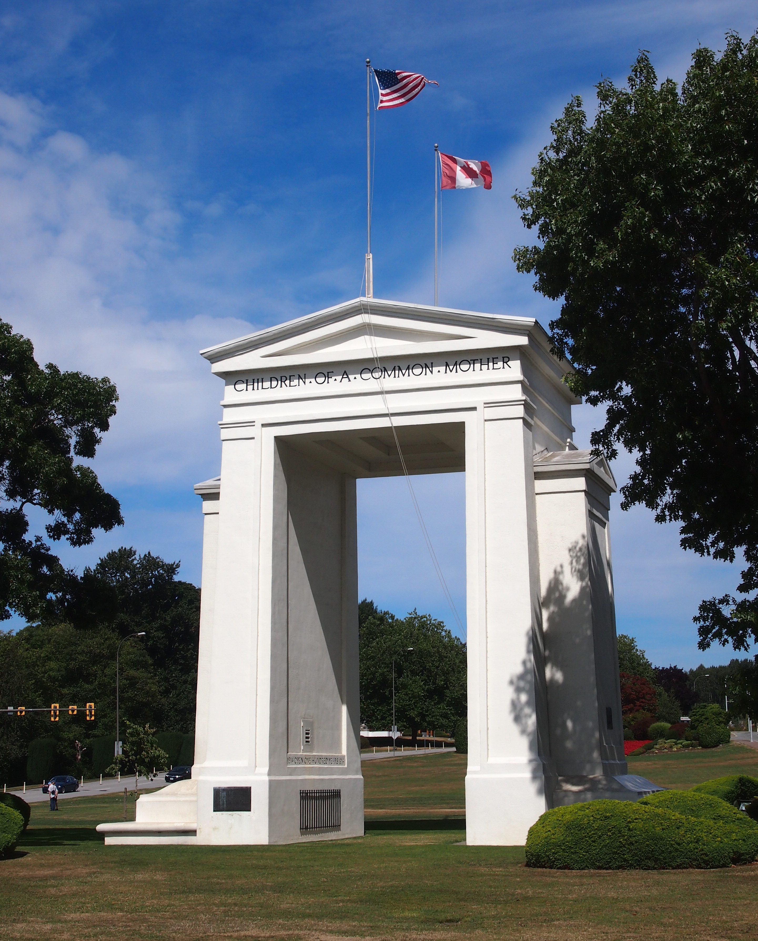
Peace Arch, August 25, 2015On the U.S. side, the Arch is 67 feet tall; on the Canadian side, 20.5 meters. It’s been standing for there for 94 years, built at the behest of Pacific Northwest business tycoon Sam Hill (1857-1931), who also had a replica of Stonehenge built in another part of Washington state, and who was an avid advocate of road improvement. (“Good roads are more than my hobby; they are my religion.”) Presumably Hill would have been happy that a major road linking the two nations passes around the Arch.

The border’s also marked by a number of concrete posts.
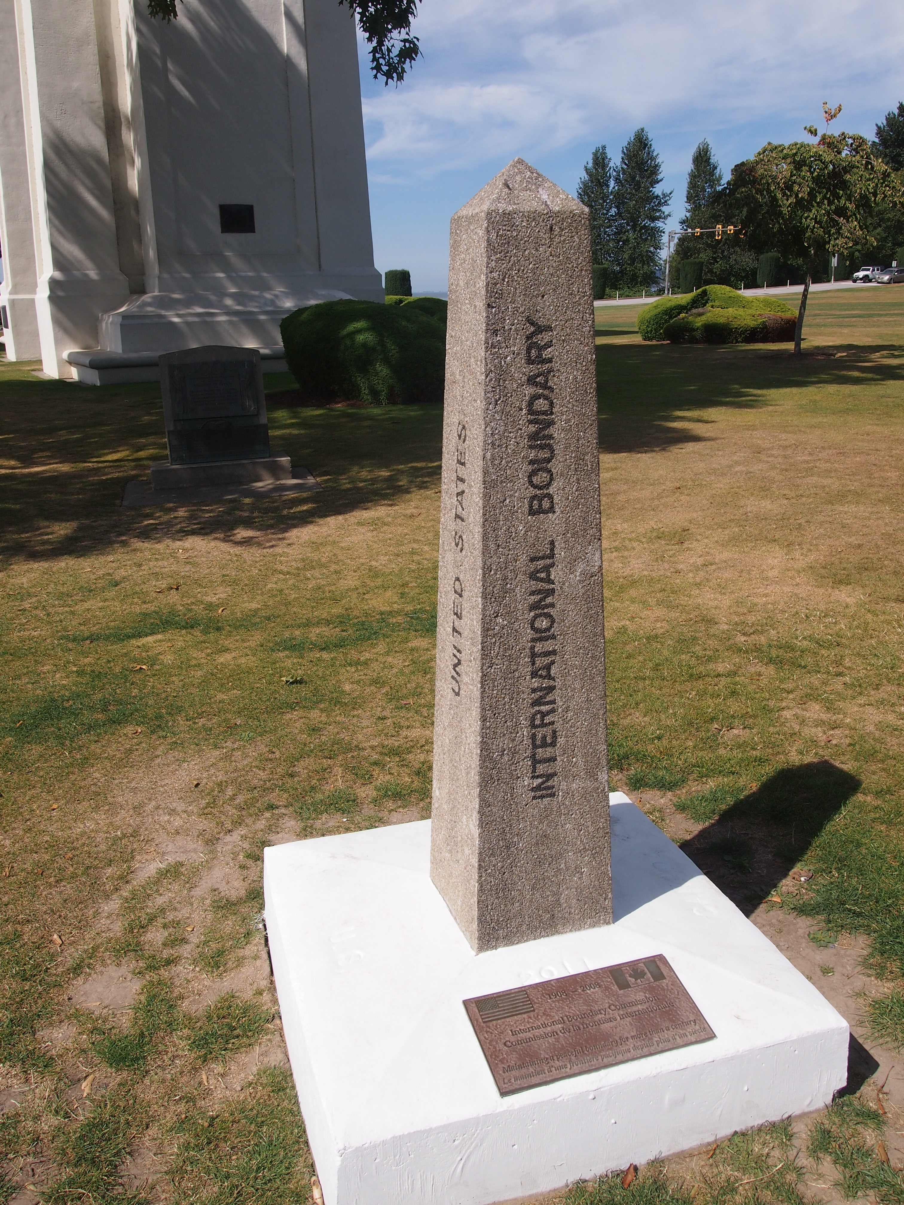
US-Canada borderThe International Boundary Commission (Commission de la frontiere internationale) put the plaque at the bottom of the post on the occasion of its centennial in 2008. I figure most Americans, and most Canadians, have never heard of the commission. I barely remember reading about it some years ago in the context of the Alaska-Yukon border.

According to the commission’s web site, “Officially, the Commission’s work is described as maintaining the [U.S.-Canada] boundary in an effective state of demarcation. This is done by inspecting it regularly; repairing, relocating or rebuilding damaged monuments or buoys; keeping the vista cleared, and erecting new boundary markers at such locations as new road crossings.”

My italics. This is the body that’s responsible for clear-cutting the border between Alaska and Yukon — a 20-foot (six-meter) swath all the way along the 141st meridian. Since I read about that some years ago, I’ve since pondered the usefulness of doing such a thing. The commission asserts that “the boundary vista must be entirely free of obstruction and plainly marked for the proper enforcement of customs, immigration, fishing and other laws of the two nations.” I’m not quite persuaded, but anyway, more about the line is here.

The border posts have four sides: UNITED STATES on the south face (visible in my picture), CANADA on the north face, and INTERNATIONAL BOUNDARY and TREATY 1925 on the other two. I wondered about that. The commission references it too.

The treaty’s formal name is: “Treaty Between the United States of America and His Britannic Majesty, in Respect of the Dominion of Canada, to Define More Accurately at Certain Points and to Complete the International Boundary Between the United States and Canada and to Maintain the Demarcation of that Boundary, Signed at Washington, February 24, 1925.”

I made a point of crossing and recrossing the border a number of times near the posts. Now I can accurately say I’ve been to Canada more than a dozen times, including the six regular check-your-passport visits, plus the half-dozen (maybe more) crossings at the Peace Arch.
Pacific Northwest ’15

I left for the Pacific Northwest on August 21 and returned home late yesterday. Imagine an axis that connects Portland, Seattle, Bellingham and Vancouver, which are all linked by I-5 (British Columbia 99 north of the border). That axis was the focus of the trip. I went to all of those cities and some points in between, some for a matter of hours, others for a few days. I spent time away from those cities as well, in hilly territory lorded over by towering pines and enchantingly quiet at night.

I drove a lot but also managed to spend a solid chunk of time walking and riding buses and light rail. The visit involved attending a conference, touring an exceptional building and seeing other fine ones, experiencing two large public markets, wandering through one of the largest book stores anywhere and a few other excellent ones, and seeing two museums and a Chinese garden very much like some of the wonderful ones in Suzhou. I ate food both awful and extraordinary, including things I’d never heard of before.

Going to another part of the country means doing new things, too. Or it should. Not necessarily life-changing experiences, but the sort of petite novelties that add up over time to make the fabric of one’s life better. Even before I got there, this was the first time I’d ever booked a rental car through Costco or a room through Airbnb. I attribute a less expensive trip, and a better one, to both. I visited a new city (Portland) in a new state (Oregon) and visited new parts of places I’d been (Vancouver in British Columbia, the Fremont neighborhood in Seattle). I witnessed a major forest fire from the air and smelled the result on the ground as the wind wafted west. Unexpectedly, according to the residents. I stood inside a building designed by Frank Gehry, rather than looking at its curious outside.

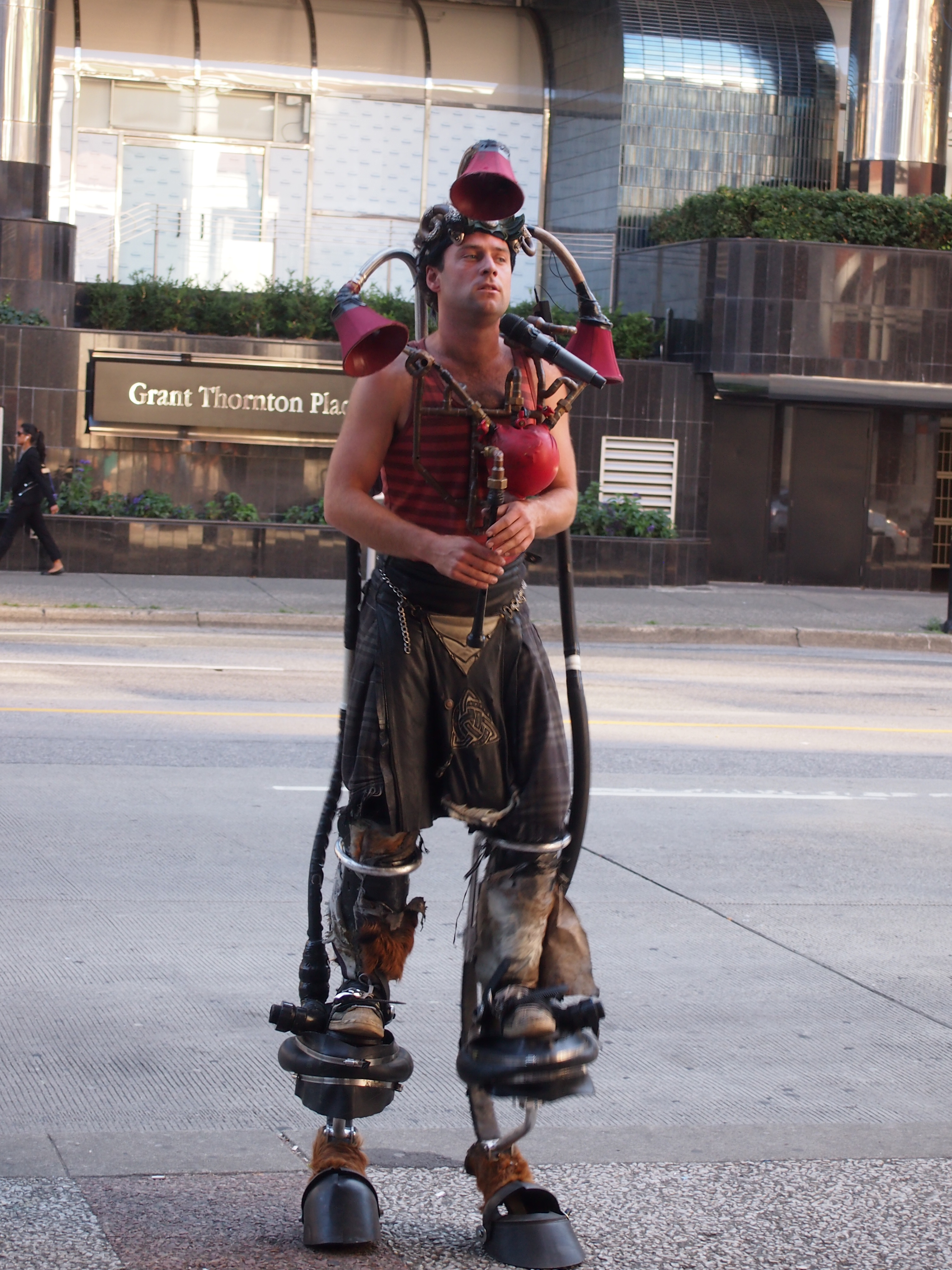
I saw a number of odd and interesting things, such as the street musician who’d modified a bagpipe and played it on stilts (Vancouver, just outside the Pacific Central Station). What to call it? Steampunk bagpiping?
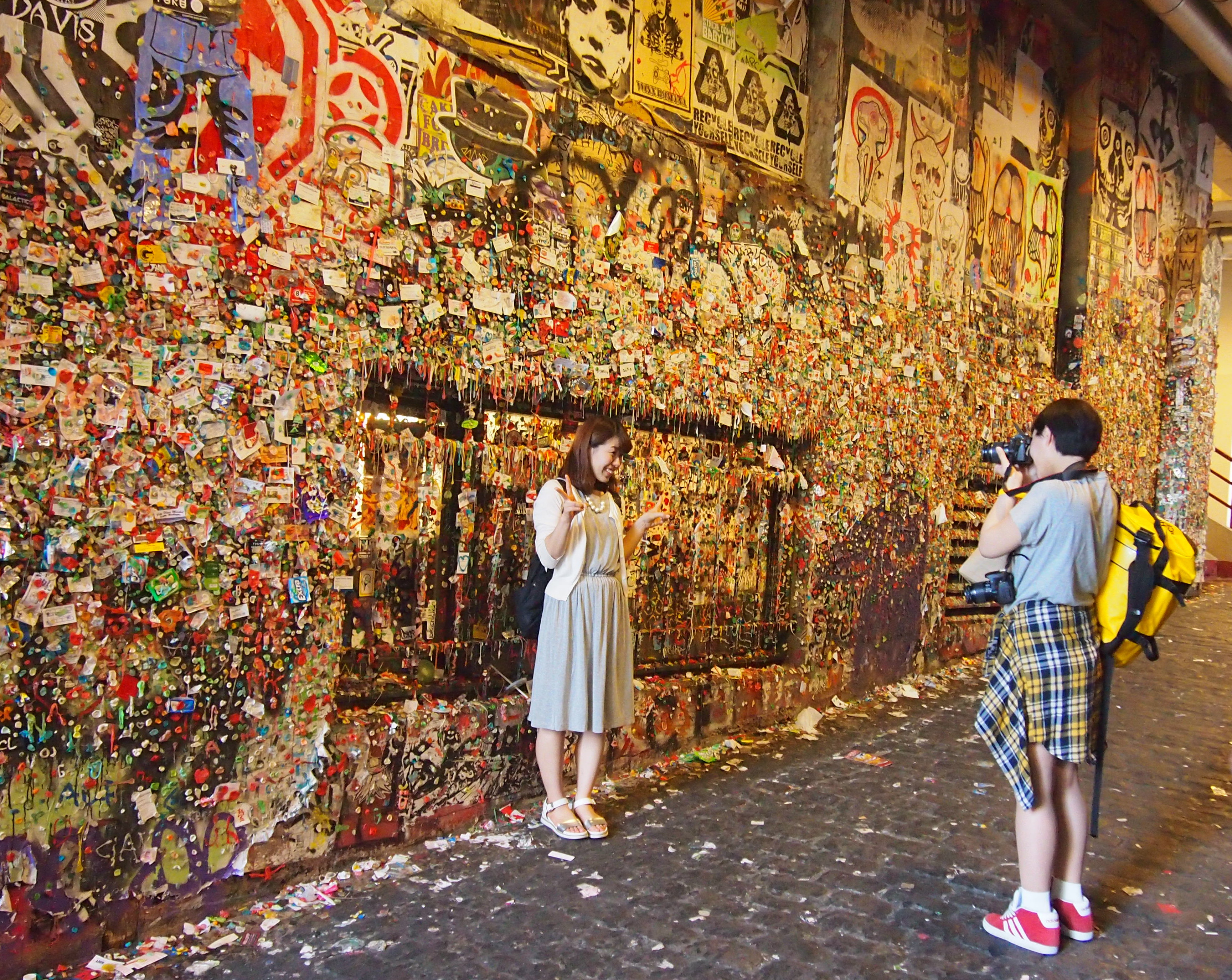
Vancouver, August 25, 2015Or the Gum Wall (Seattle, next to the Pike Place Market). Each of the those bits of color is ABC gum, often used to attach cards and small posters to an alley wall. Why? As near as I can tell, just because.

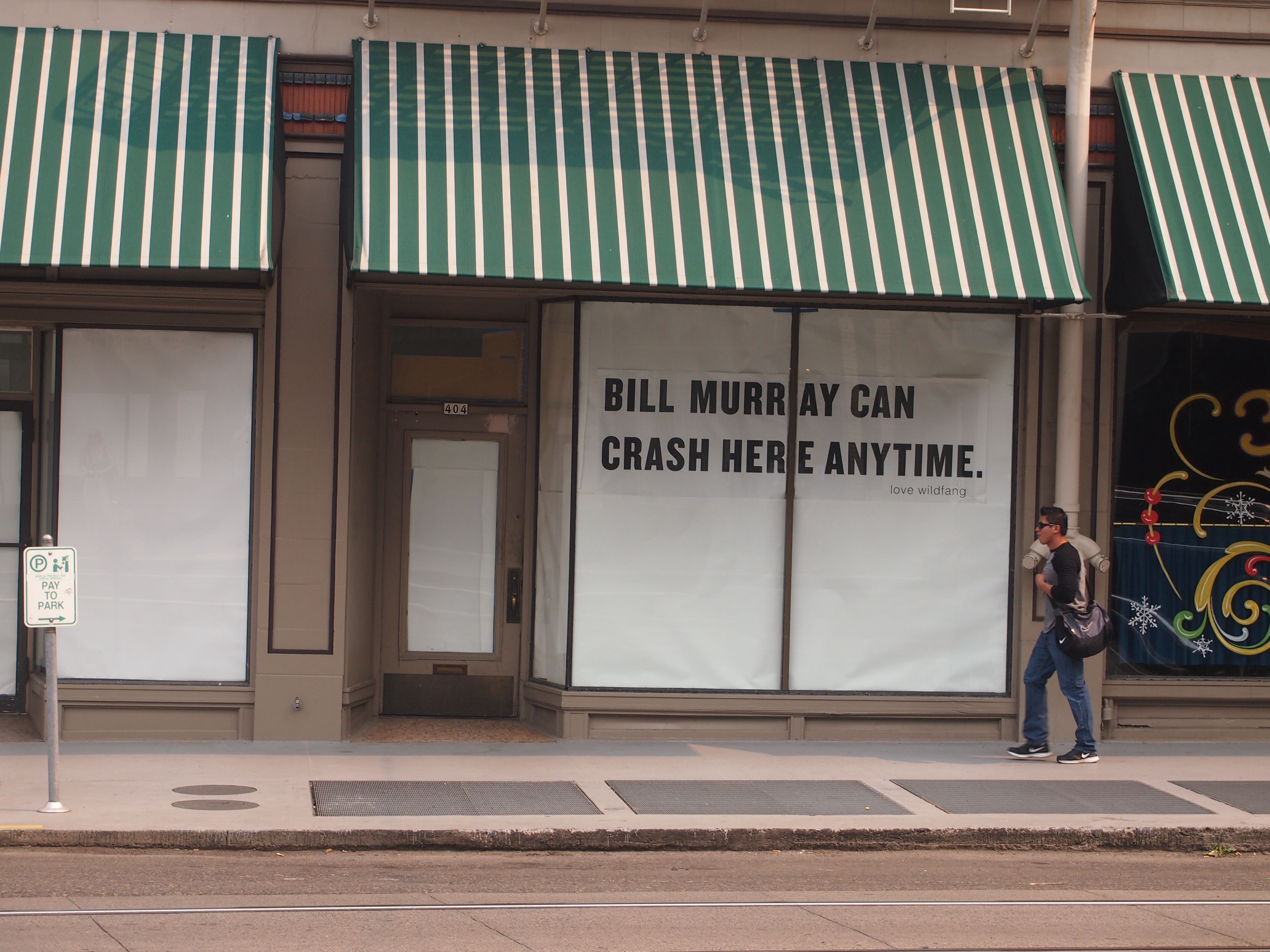
Gum Wall, Seattle, AugOr the echo of a celebrity event I’d missed when it happened, the Bill Murray Party Crashing Tour of 2012 (this sign was in Portland).

Portland, August 22, 2015I can think of a lot worse people to show up at one’s party uninvited; maybe he’s still doing it occasionally.

Most importantly, I reconnected with two dear old friends, one of whom I hadn’t seen in 18 years, another I hadn’t seen in 30 years, since my last visit to Seattle. Our friendships have been maintained over the years mostly through paper correspondence, with a more recent electronic component. But there’s no substitute for being there.

Coins from Way Down South

Hard to believe Canada Day’s rolled around again. Time to honor our neighbors up north by watching one of their major cultural achievements. Other episodes are also available on YouTube.

Lilly brought us souvenirs from her trip to Latin America — omiyagi, to use the Japanese term, which means souvenirs specially obtained for people who didn’t make the trip. It’s a custom we follow.

She got me three things, all showing that she knows her dad pretty well: coins, postcards and Ecuadorean chocolate. As it happens, both Ecuador and Panama are dollarized economies. No currency exchange was necessary; she took greenback cash and also withdrew funds, in dollars, from an ATM.

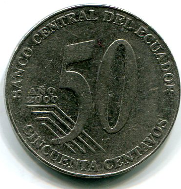
The small change is each country’s own. This is 50 centavos from Ecuador, obverse.

50 centavos, EcuadorIt features the face of one José Eloy Alfaro Delgado (1842-1912), who was president of Ecuador from 1895 to 1901 and from 1906 to 1911, and had the distinction of being assassinated by anti-secularizers, since he introduced the likes of civil marriage and divorce, and secular eduction, to his nation. He also oversaw the construction of the Ferrocarril Transandino (Trans-Andean Railroad) connecting Guayaquil and Quito.

The reserve.

50 centavos, EcuadorThe steel Ecuadorean coins are made at mints in Canada and Mexico. Other denominations include 25c, 10c, 5c, and (supposedly) 1c. Lilly brought back the first three of that list, and along with the 50c piece, I checked their sizes. They’re exactly the same size as their respective U.S. coins.

Apparently Ecuador doesn’t issue dollar coins. Lilly said that U.S. dollar coins are in circulation there much more than they are in the United States. If we’d known that, I’d have given her a roll or two of dollar coins to take with her.

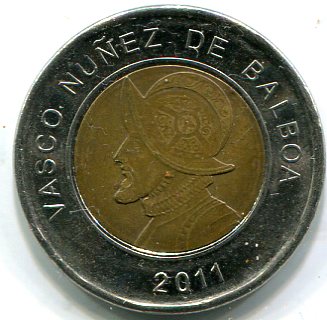
Panama, on the other hand, does have its own dollar-equivalent coin, the bimetallic balboa, which Lilly tells me circulates with U.S. dollar coins.

one balboaWho else to put on the balboa than Balboa? The man who lost his head over Panama. Here’s something I didn’t know: there’s a crater on the Moon named for him. He might have made it to the Pacific, but I’m pretty sure he didn’t get that far.

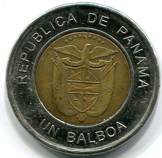
The reverse.

balboaIt’s hard to see, but the coat of arms of Panama includes a depiction of the isthmus, a sword, rifle, shovel, hoe, and more. The eagle is specifically — according to recent Panamanian law — a harpy eagle (Harpia harpyja), the national bird. The impossible-to-read motto is Pro Mundi Beneficio, for the benefit of the world.

Desk Debris

The other day, an old friend mentioned a paperweight she has on her desk, one that she acquired when we worked together in Nashville in the mid-80s. I didn’t remember the item, but it did inspire me to take a look at some of the debris on my desk even now.

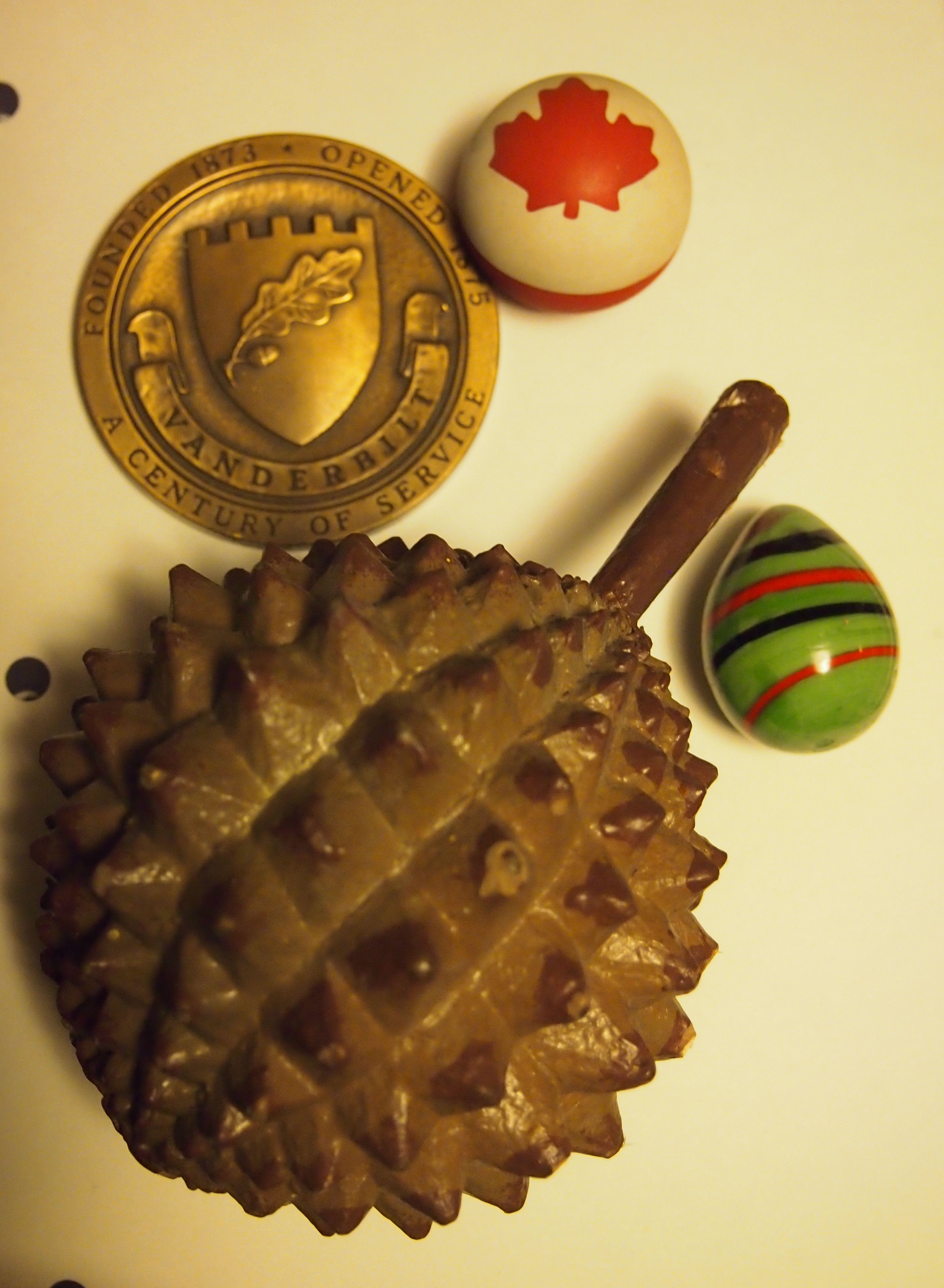
Desk Debris

The largest item is a plastic durian. A contributing editor at a magazine I once worked for, a woman who lived in Singapore for a while, gave it to me. I think because it came up in conversation that I knew what a durian was. The dog chewed on the stem not long ago, but I got it away from her.

The medallion is a Vanderbilt souvenir. Not sure when I got it, but it wasn’t when I attended school there. It’s a sturdy bronze object, weighing 9 oz., with Cornelius Vanderbilt on the obverse. Made by Medallic Art Co. of New York, according to the rim of the medallion. Maybe the company was once HQ’d in New York, but according to the web site, it’s now a division of Northwest Territorial Mint, which is headquartered in Federal Way, Washington, and has no facilities in New York.

I got the Maple Leaf bouncy ball at a store in Canmore, Alberta, in 2006. It was just after Canada Day, and Canada-themed items were at a discount.

The green item is a glass egg I bought at the Bergstrom-Mahler Museum in Neenah, Wisconsin, last year. A pretty piece of glass, but also inexpensive and hard to break.

On the Borders

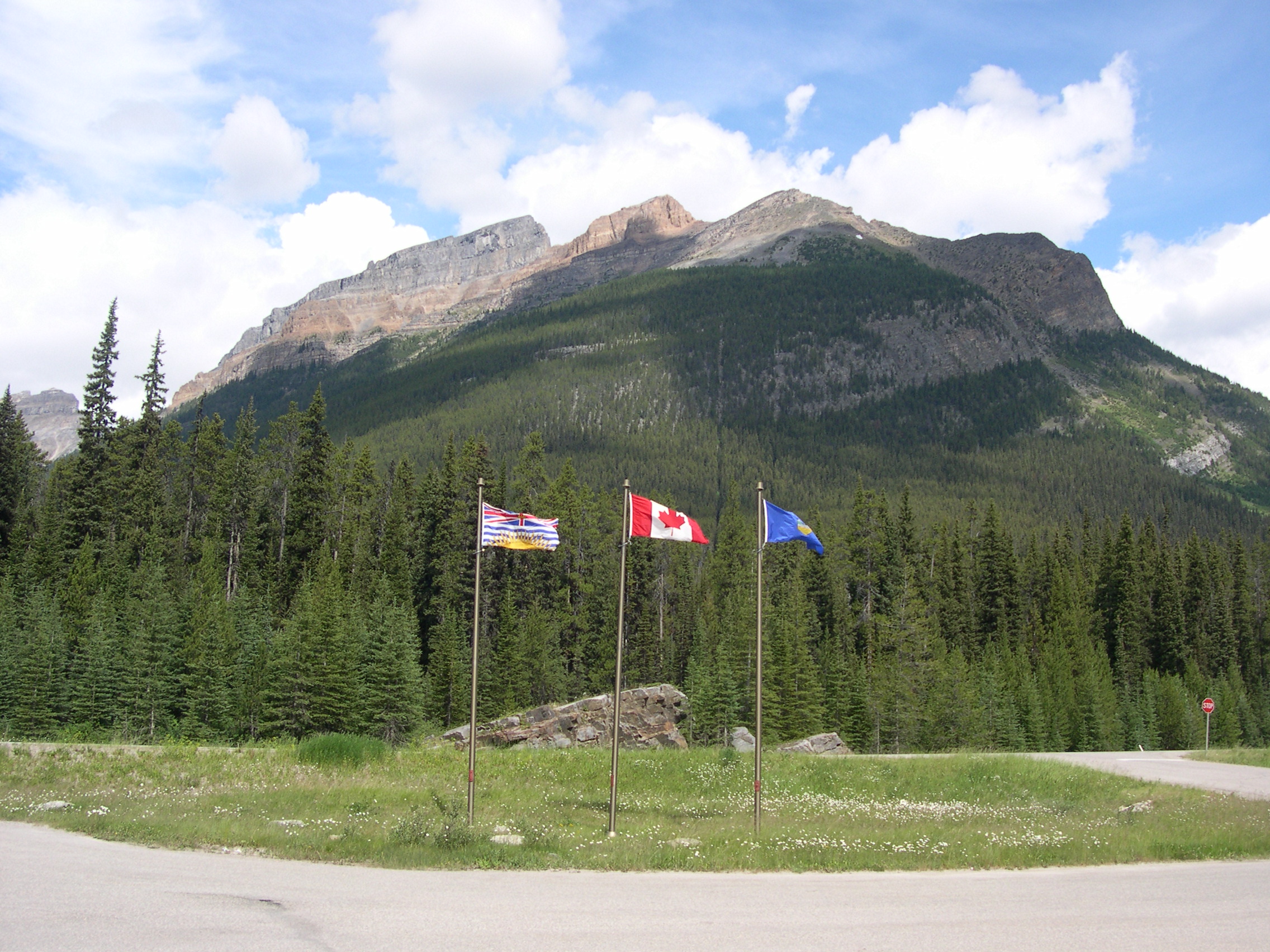
In July 2006 we found ourselves – because of much sustained effort, mostly in the form of driving long distances – at a triple border. I can’t think of anywhere else I’ve been quite like it. The spot is at the meeting of British Columbia and Alberta; of Banff National Park and Kootenay National Park; and on the Continental Divide. On one side of the road are three flagpoles, with the Maple Leaf flying between the provincial flags of British Columbia and Alberta.

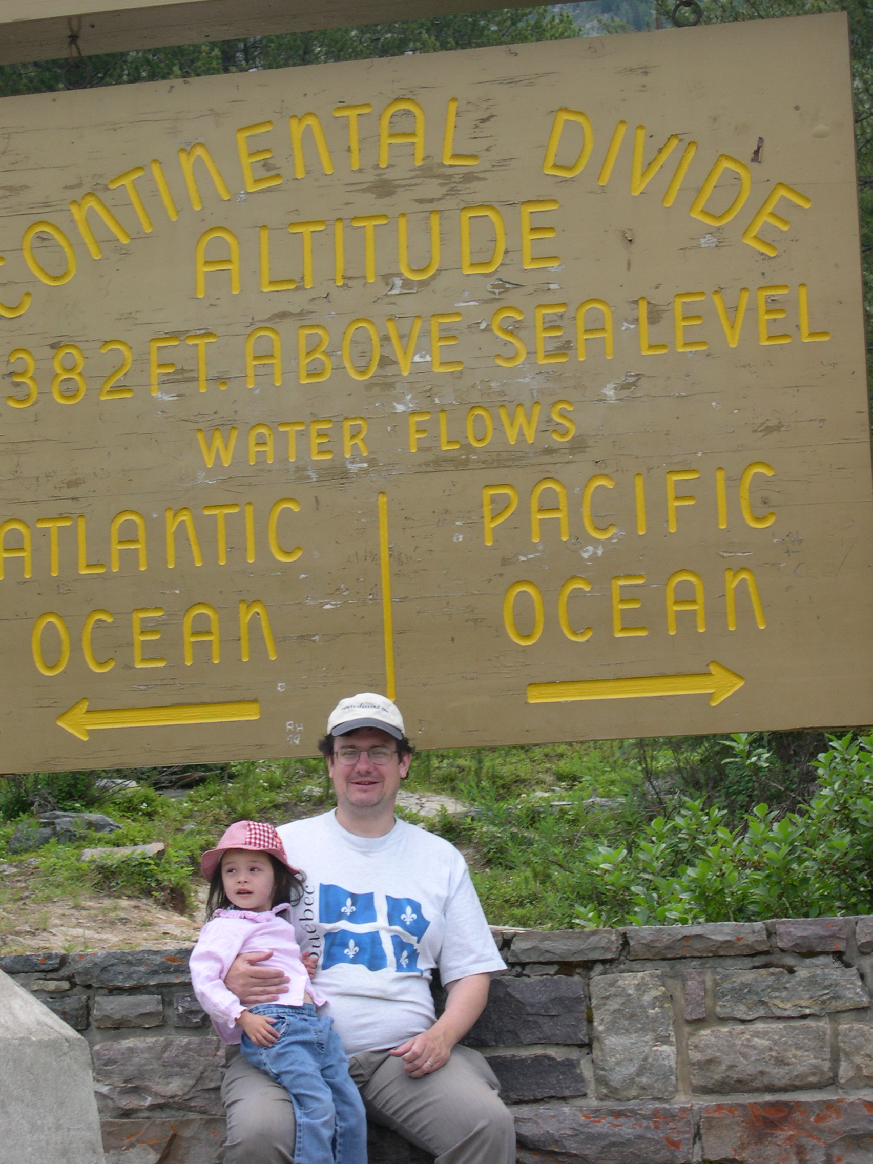
On the other side of the road is a large wooden sign offering some geographic information (it says 5,382 ft). I wore my Route of Seeing cap, and a shirt acquired on a previous visit to Canada, for a snap with the three-year-old Ann. (Be sure to read about Ed and Haleakala and that thing called Death.)

Not too far away, or at least northward on the British Columbia-Alberta border, is a triple continental divide, the Snow Dome of the Columbia Icefield. Our guide on the Icefield pointed it out to us, but that’s as close as we got. At that point water drains either to the Atlantic, Pacific or Arctic oceans.

Biosphere, Montreal

May 28, 2002. In the morning, we went back to the quays adjoining Old Montreal, this time for a boat tour of the St. Lawrence. Some nice views, especially of the unexpectedly long Port of Montreal, but the heat wore us out early. So we rested until late afternoon, at which time we took the Metro to Île Sainte-Hélène, one of the islands built (or partly built) for Expo 67.

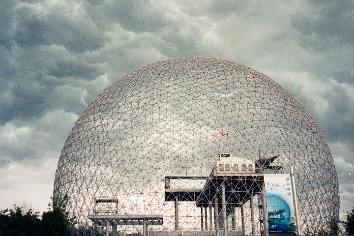
Besides walking paths and gardens, the main thing to catch the eye there is a large geodesic dome designed by a Buckminster Fuller, probably the best-known relic of that world’s fair. Once the U.S. Pavilion, now it’s called the Biosphere, and houses a museum “dedicated to water,” which was closed when we got there.

No matter. Yuriko wandered off to see the gardens, and I reveled in lying on the grass in the shadow of a five-story ball of triangles, cooled by the wind. Lilly indulged in what I believe was her favorite part of the trip: throwing rock after rock into the reflecting pond near the entrance of the Biosphere.