Coincidence or synchronicity? In September, as I was leaving Colorado Springs, I noticed an equestrian statue near a major street: William Jackson Palmer, railroad developer and Union Army officer. Stopped at a traffic light, I had a little time to look at the statue. Soon I forgot about it.
Palmer had one of those remarkable 19th-century careers, not only as a railroad man and military officer, but also a town planner, hotelier, publisher and philanthropist. He founded the towns of Colorado Springs Manitou Springs, and Durango, among others. Though he grew up near Philadelphia, he was born on a farm near Leipsic, Delaware. Barely a month after I’d spent time in some of the towns that Palmer founded, I found myself in Leipsic, Delaware.
I still wouldn’t have make the connection if I hadn’t looked up Leipsic on Wiki. I noted that the entire list of notable people from that town had exactly one name: William Jackson Palmer. Leipsic has never been a very big place, and certainly isn’t now. I looked him up, and when I saw the picture of the statue, I remembered seeing it.
I’m going with coincidence. I have a fairly high bar when it comes to synchronicity, especially since I don’t really understand the concept. Does anyone?
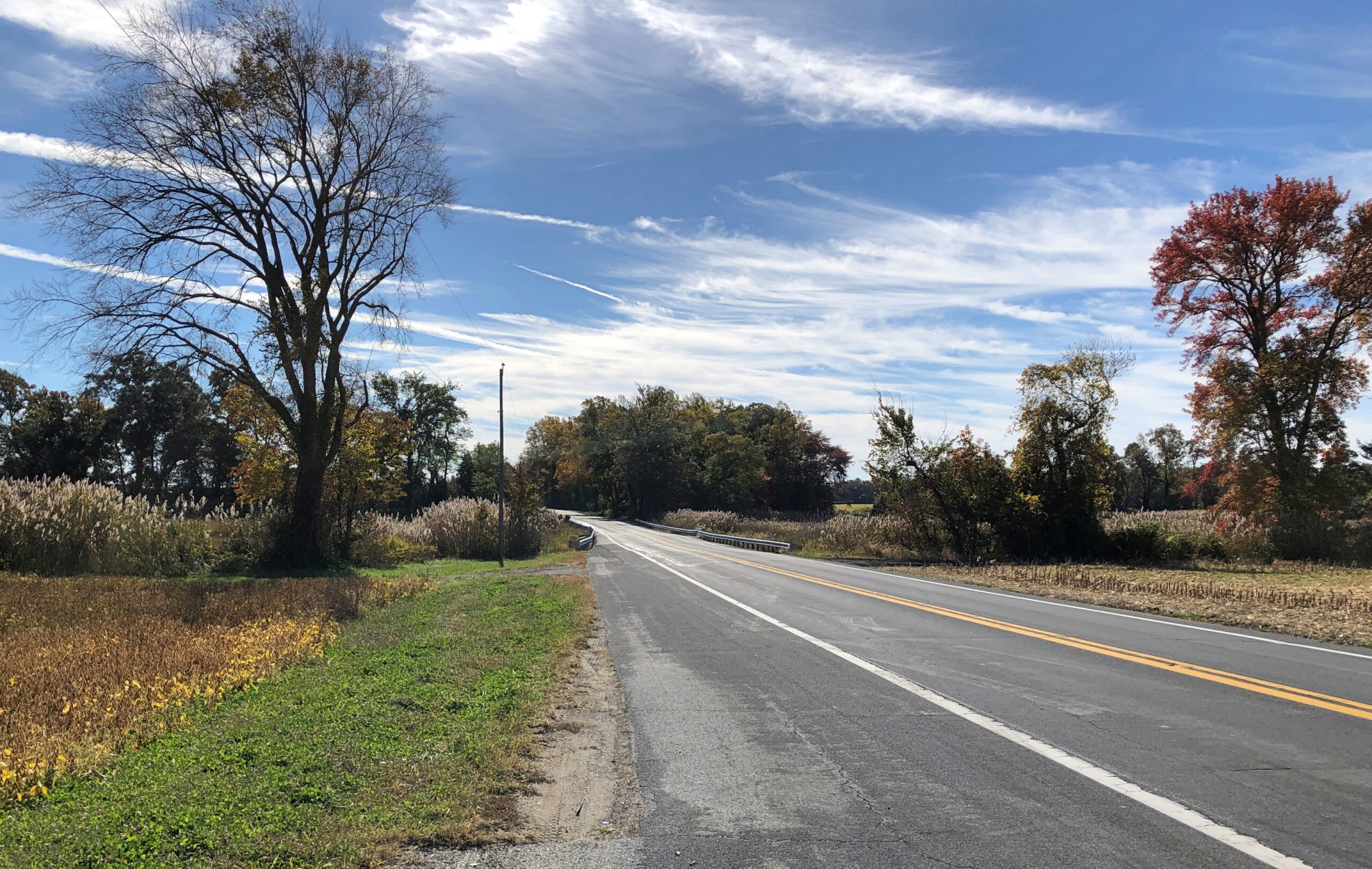
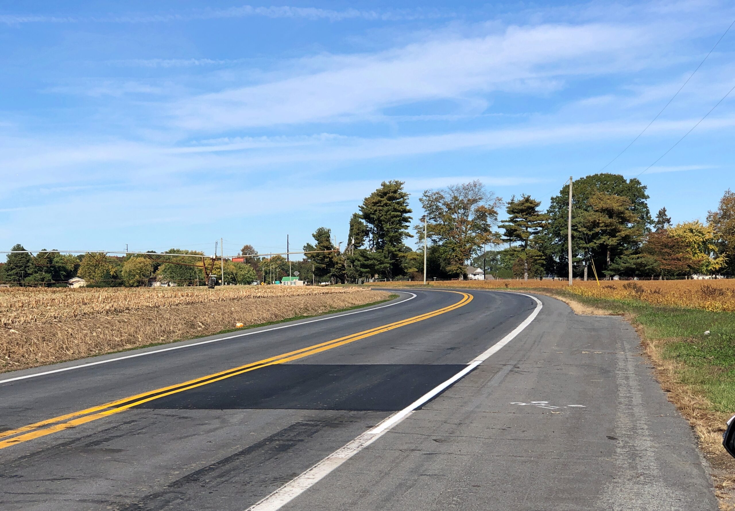
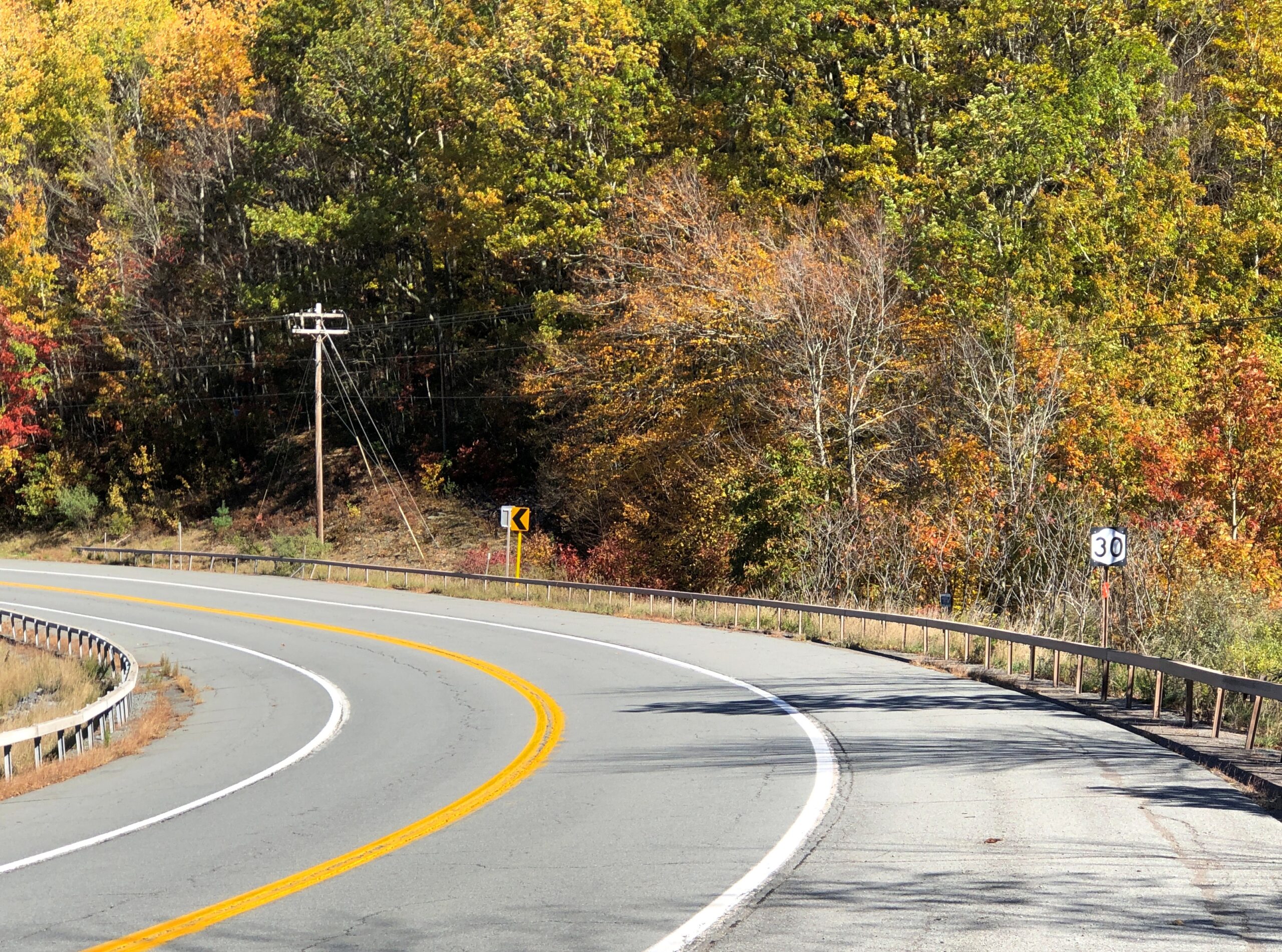
Before I left Delaware last month – and believe me, it doesn’t take long to leave Delaware – I drove a section of Delaware 9, a two-lane, north-south highway that parallels the coast of Delaware Bay, running east of places like Dover, Smyrna and Odessa. An intriguing squiggle on the map, made more intriguing by the fact that part of it is also known as the Delaware Bayshore Byway, which is a National Scenic Byway. Experience has taught me that those kinds of designations are usually accorded for good reasons.
After the traffic-jammed day before, I thoroughly enjoyed the nearly empty Delaware 9.
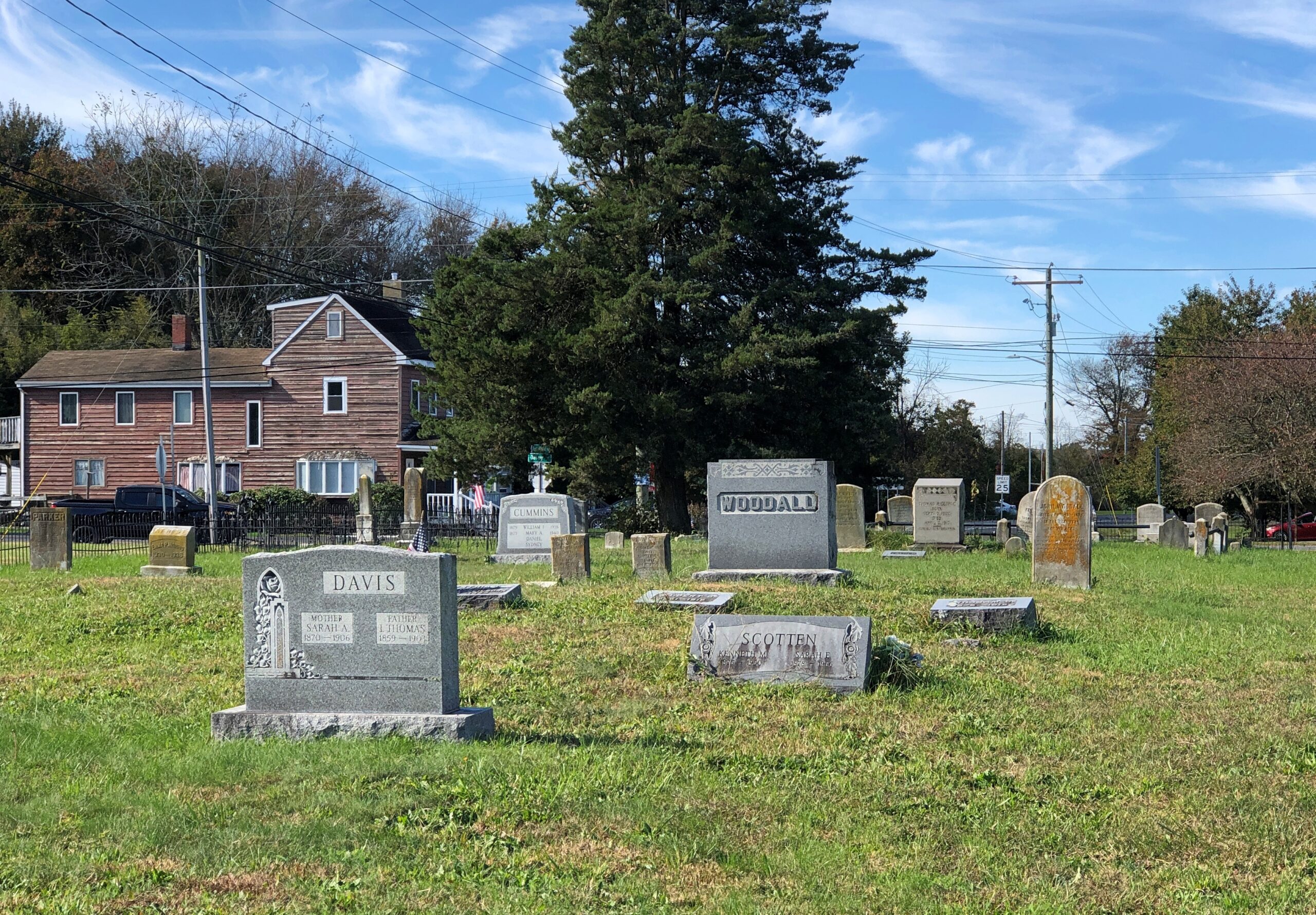
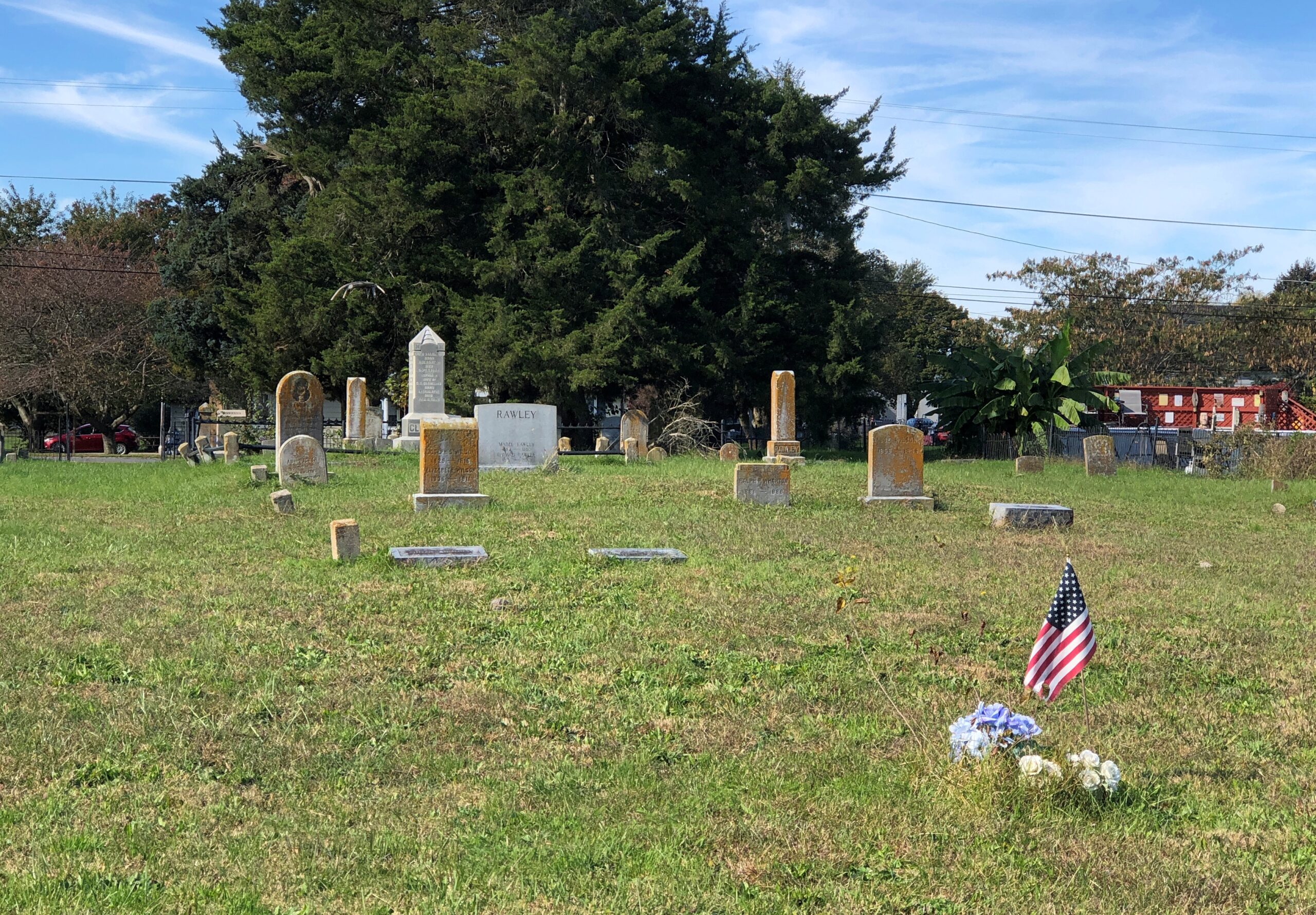
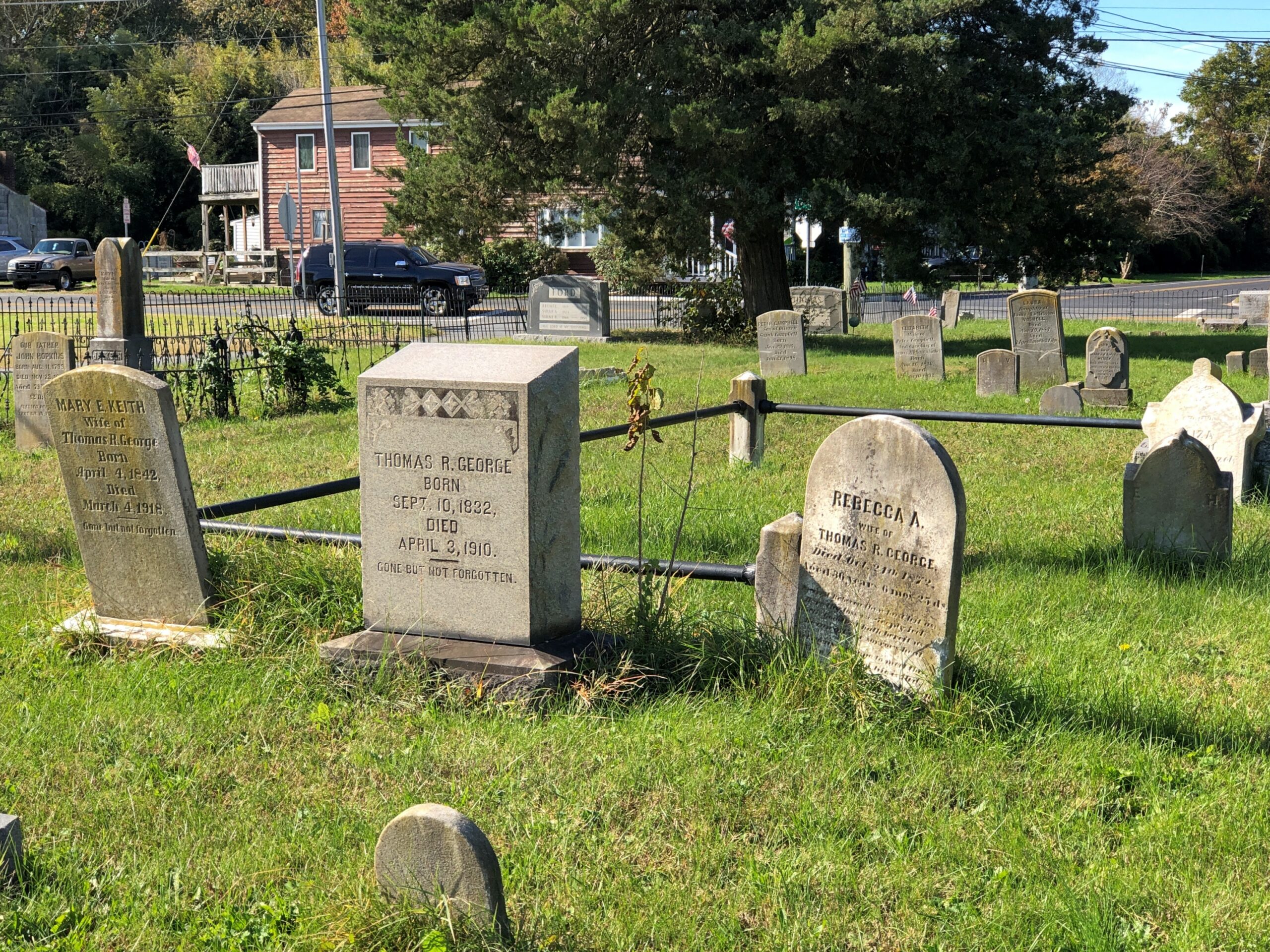
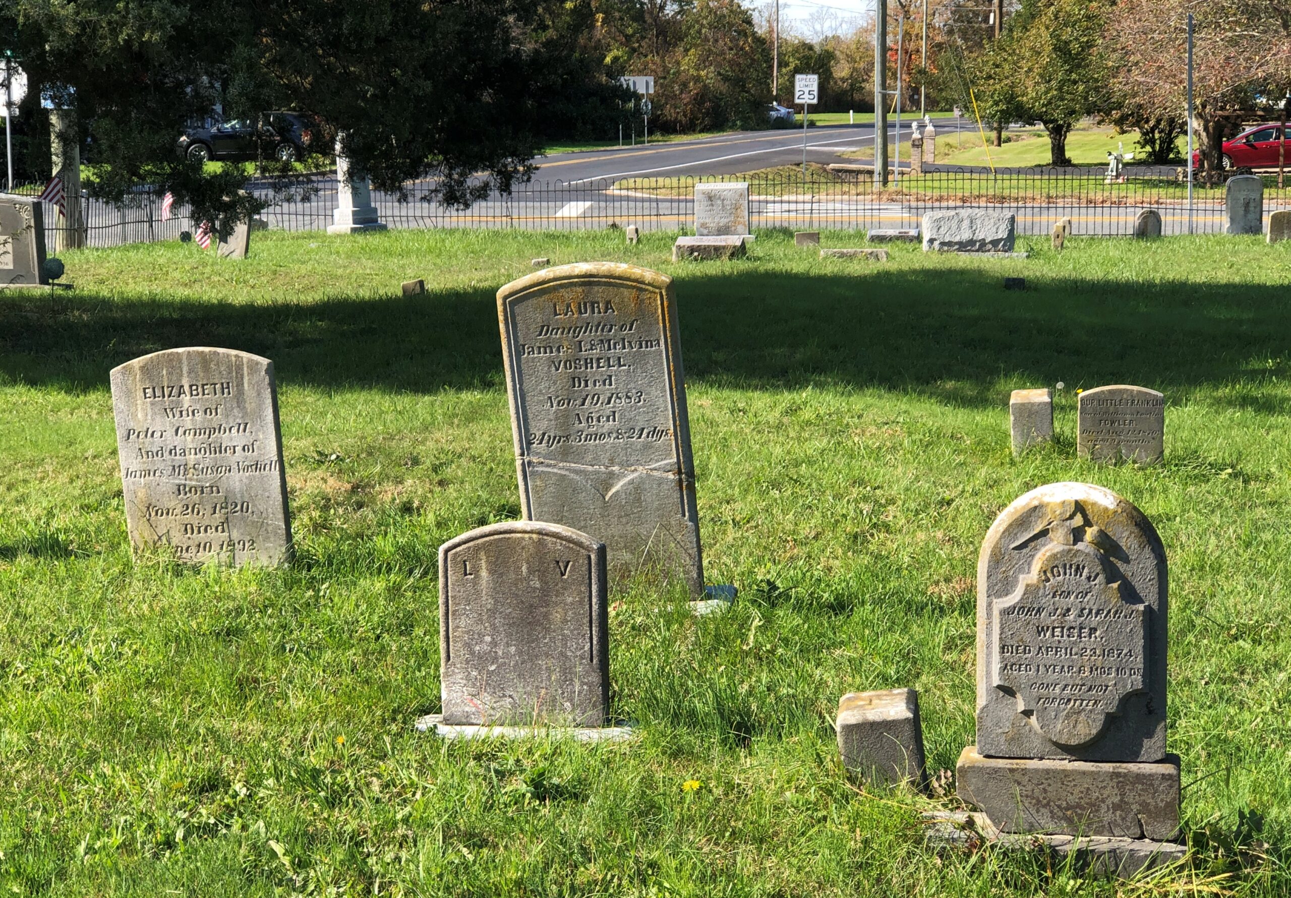
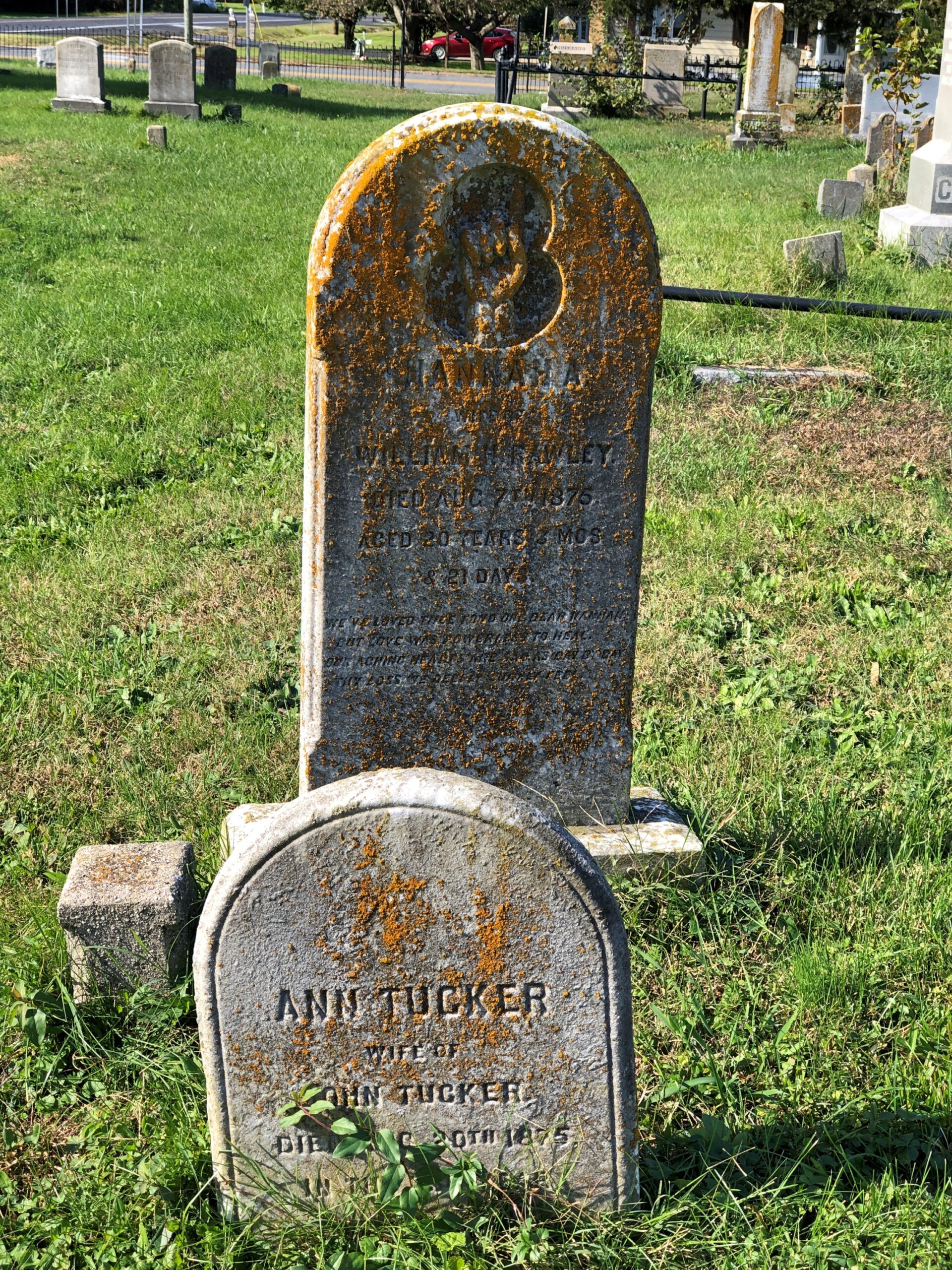
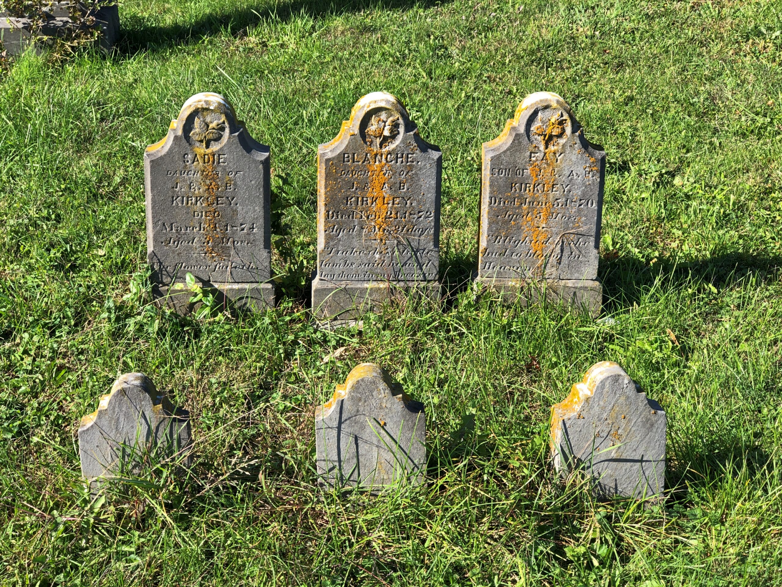
One of the few towns along Delaware 9 is Leipsic, pop. 178. I might not have stopped but for the cemetery, one so obscure that Google Maps doesn’t have a name for it, and I didn’t see evidence of a name on the ground either.
Leipsic Cemetery, perhaps. Whatever the name, it has clearly been a burial ground for a long time.
With the sort of heartbreakers you find in cemeteries of this vintage.
Three children, same family, buried in the same decade in the 19th century.
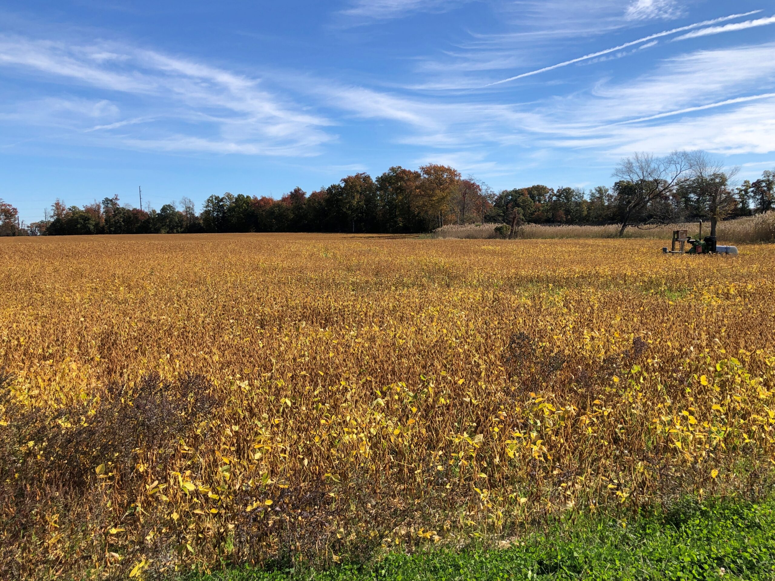
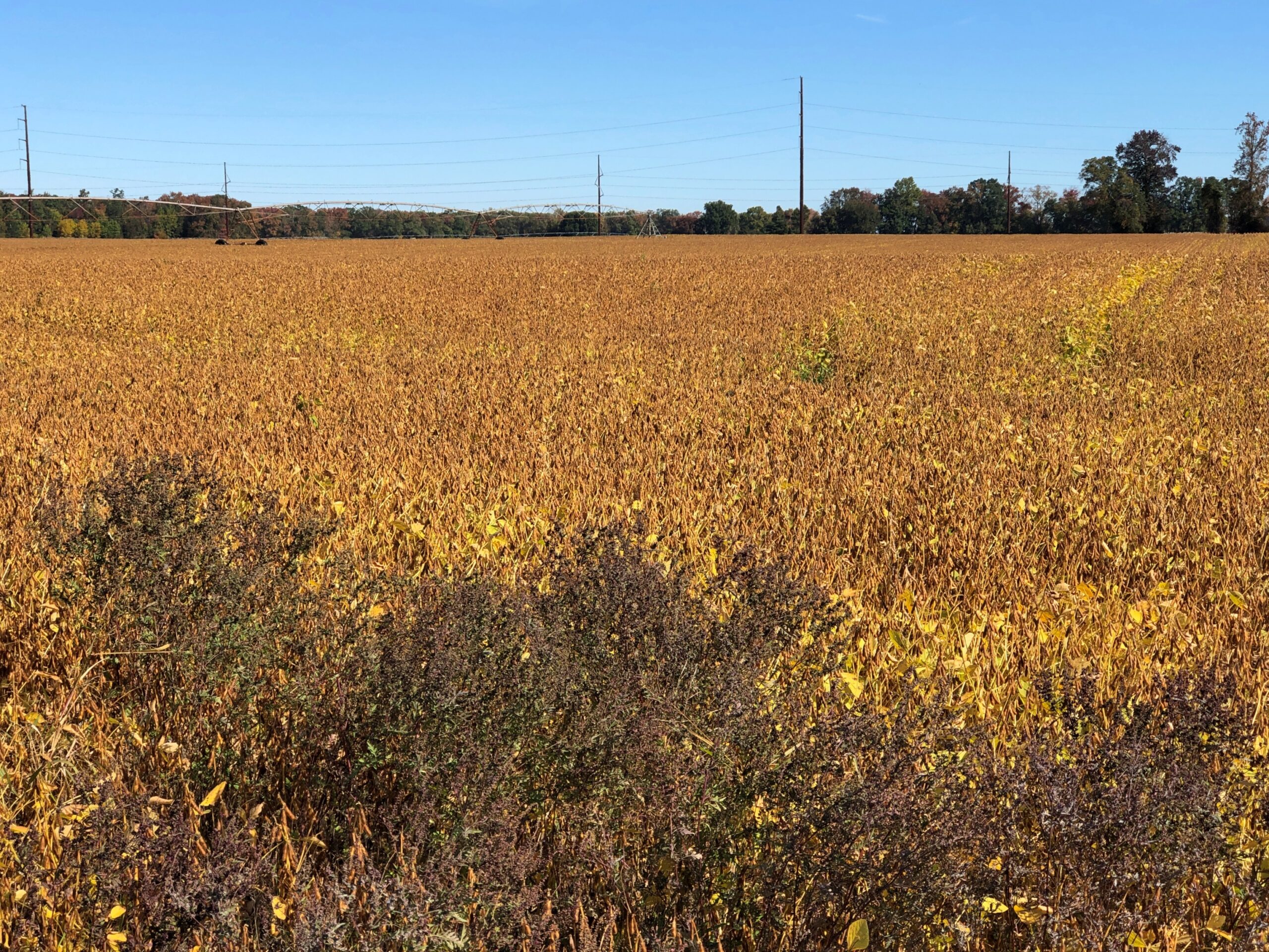
The road passes mostly through farmland, though woods and the western edge of Bombay Hook National Wildlife Refuge also mark its course. Delaware’s main crops are corn and soybeans, and I’m pretty sure I was in time to see the soybean leaves changing their color. Quite a sight.
You’d think I’d have seen that in Illinois or Indiana or any of the other states chock-a-block with soybeans, but I wasn’t sure I had. Driving on a two-lane road, you’re practically driving through the color, as opposed to the distance of a four-lane highway.
Corn and soy may be the main plant crops in Delaware, but the main livestock is chickens. Some 276,700,000 head of chickens were raised in Delaware in 2024, according to the USDA. That’s an impressive number, considering how small Delaware is: almost the same number as in much larger states such as Tennessee, Kentucky or Missouri. I’m not going to crunch the numbers (I have a life to live), but I’ll bet per square unit of territory, Delaware is the nation’s chicken champ.
The Avalon Project, run by Yale Law School, has a remarkable trove of “documents in law, history and diplomacy,” as the site says. If you’re looking for a translation of the Code of Hammurabi or the Athenian Constitution, there are links. You can also find the annotated text of Magna Carta, the Mayflower Compact, and the many founding documents of the United States, just to mention some of the more famous ones.
Also within the Avalon Project is the text of the Ratification of the U.S. Constitution by the State of Delaware, December 7, 1787. To wit:
We the Deputies of the People of the Delaware State, in Convention met, having taken into our serious consideration the Federal Constitution proposed and agreed upon by the Deputies of the United States in a General Convention held at the City of Philadelphia on the seventeenth day of September in the year of our Lord one thousand seven hundred and eighty seven, Have approved, assented to, ratified, and confirmed, and by these Presents, Do, in virtue of the Power and Authority to us given for that purpose, for and in behalf of ourselves and our Constituents, fully, freely, and entirely approve of, assent to, ratify, and confirm the said Constitution.
Delaware ratified before any other state, and so claims “First State” as its nickname. I have my own private nickname for Delaware. At least I do now, since waking up on the morning of October 25 in my rented room in Dover: “Last State.” As in, the 50th state I’ve spent the night in. That isn’t an achievement of any kind, just a reflection of the fact that I’ve been fortunate enough to have the time and resources necessary to go that many places. Also, that I’m eccentric enough to keep track.
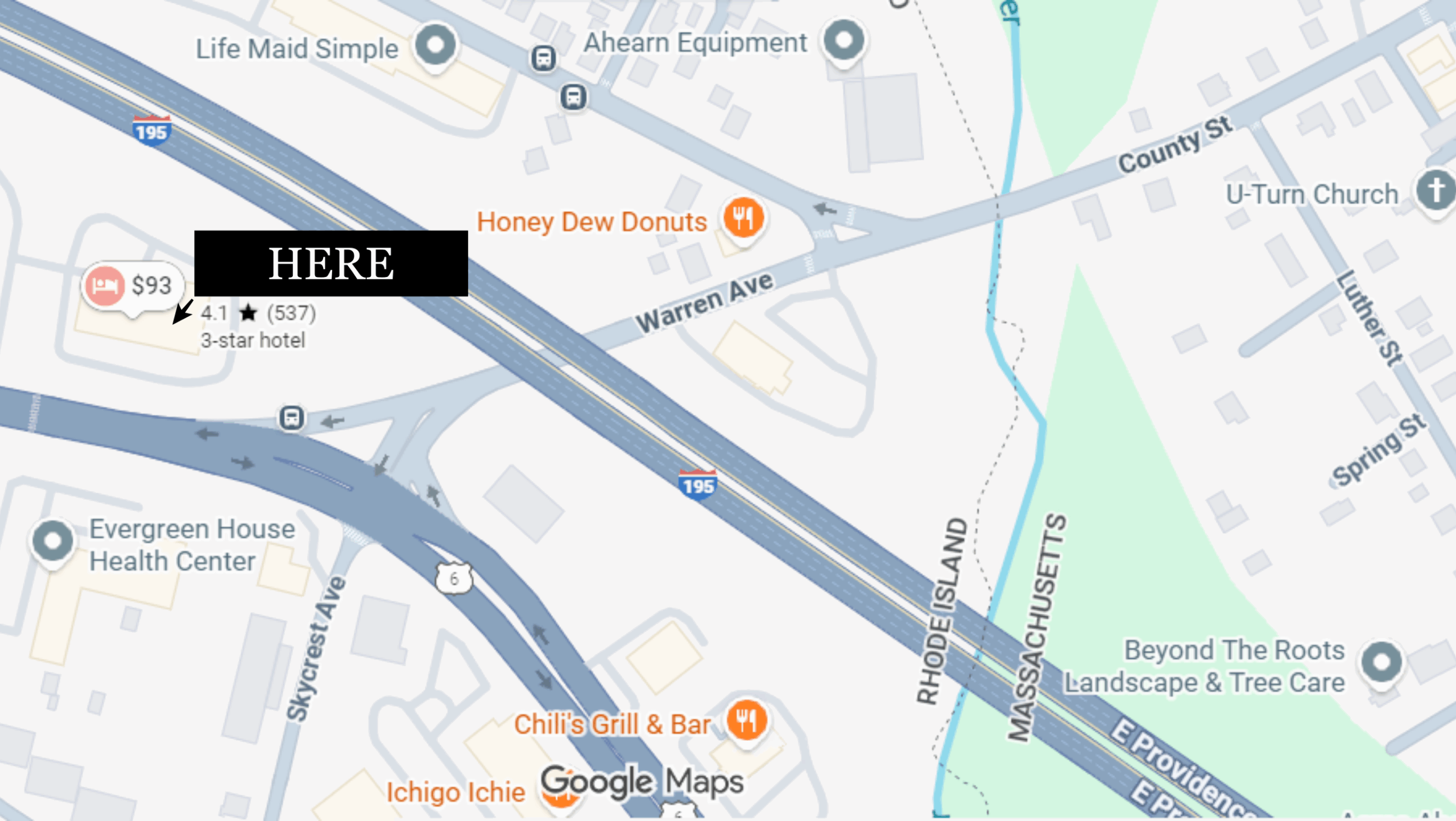
After dallying in Concord on the 23rd, and spending some time in Attleboro, Massachusetts, I arrived in East Providence, Rhode Island for the night. The point of that stop was entirely to spend the night in Rhode Island, since I’d never done that either. So RI was number 49. My hotel was just barely in that state.
I noticed the Honey Dew Donuts even closer to the border. I’d seen other locations driving in. The breakfast at my “3-star” hotel was meager, so I went to Honey Dew for a second breakfast. I wish I could say I’d discovered a great regional doughnut shop along the lines of Tim Horton’s, but it was only OK. Maybe I’ll give the brand another chance sometime.
Since I’d wanted to go from eastern Massachusetts to central Delaware, I should have broken that day’s journey somewhere in New Jersey. But that wouldn’t have involved stopping for the night in Rhode Island, which had been a short stop back in the summer of ’91 – a few hours to look around Providence, and especially the capitol – and the destination of a day trip in ’95, to Newport.
As for Delaware, my entire previous experience with the state was the Wilmington interstate bus station, a break in a bus ride from Washington DC to Boston, which was a leg of the Great Bus Loop of 1982. I’m not even sure I got off the bus, though I usually did when it stopped for long enough.
Getting to Delaware last month involved an aggravating day’s drive, mostly on I-95, spending a lot of time in traffic jams. Counting the cars on the New Jersey Turnpike, bah: more than grains of sand on a beach or stars in the sky.
Even so, there were a few worthwhile moments. I finally got to see (from the turnpike) the enormous American Dream mall, adjacent to the Meadowlands Sports Complex. Reportedly now second largest in the nation, after only the Mall of America. I’d been reading about American Dream for years, since “chronic delays” always figured in real estate reporting on the project, but now it’s more or less complete. (If the developers had asked me, they’d have kept the much cooler earlier name: Meadowlands Xanadu.)
At the Vince Lombardi Service Area on the NJ Turnpike, I parked in the very large parking lot and headed for the very large building and its very large men’s room. As I walked along, a small group of Hasidim went around me, not running but at a brisk pace, headed the same direction. By the time I got to the bathroom, they were almost done with their business, and off they went. Nothing unusual about seeing Hasidim, certainly not in New Jersey, but I have to note that October 24 was a Friday, and it was mid-afternoon. So they were racing the clock. Or, more accurately, the sun.
A digression: service areas on the New Jersey Turnpike and the Garden State Parkway are named for famed New Jerseyans. A list is here. I suppose it’s fine that musicians such as Frank Sinatra, Whitney Houston, Jon Bon Jovi and Celia Cruz are honored, but where’s Bruce Springsteen? It isn’t a matter of posthumous naming, since Bon Jovi is still alive – as is Bruce Willis, who also gets an area, and Connie Chung, who does as well, though she isn’t actually from New Jersey. The ways of the NJ Turnpike Authority are mysterious.
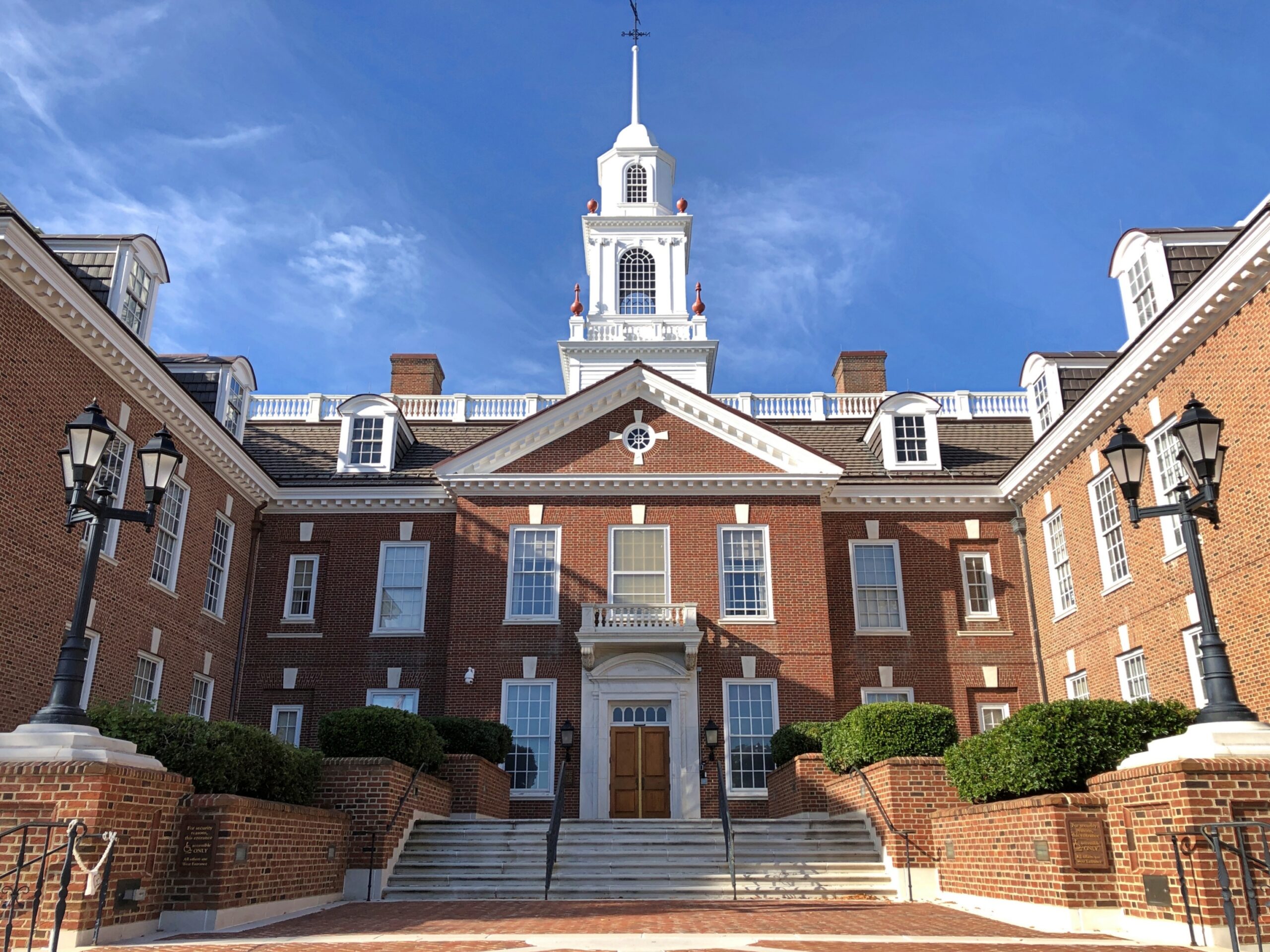
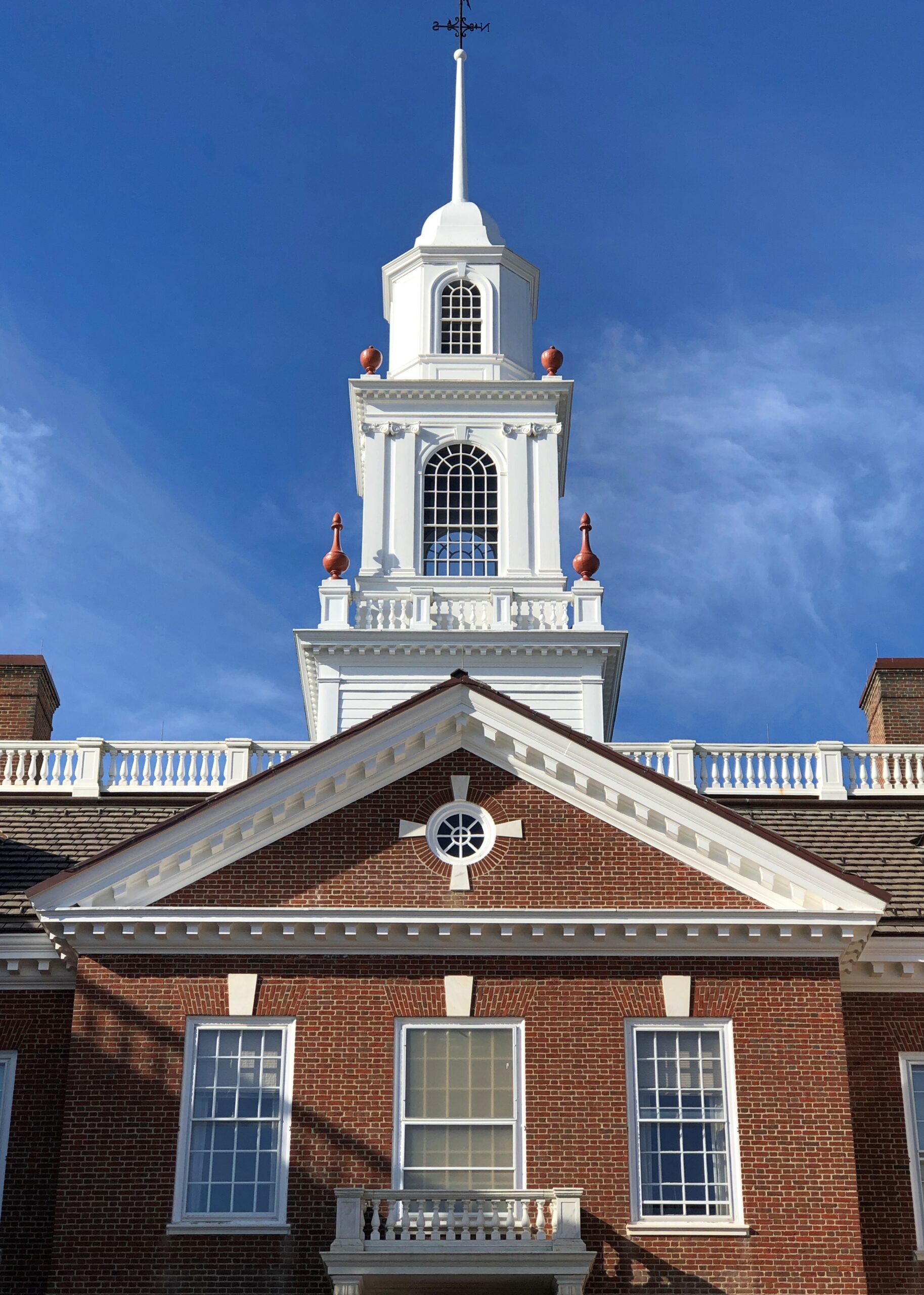
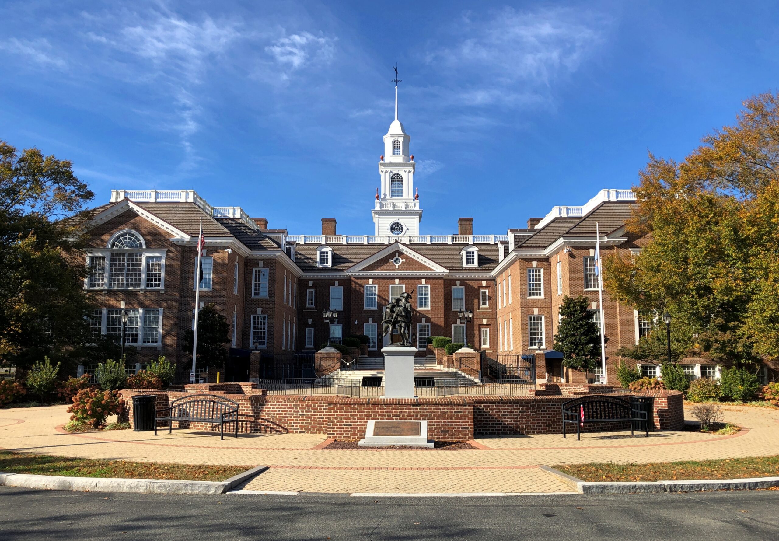
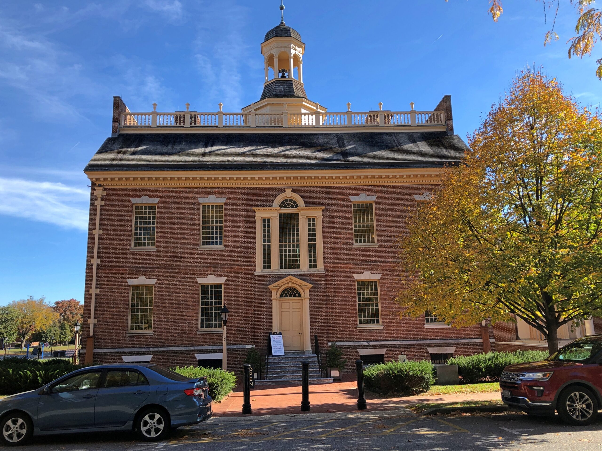
I arrived in Dover late on the October 24. The next morning, a Saturday, I left fairly early. First stop: the Delaware State House. It was closed for the weekend. My reaction: what kind of Mickey Mouse operation is this? I got a good look at the exterior, at least.
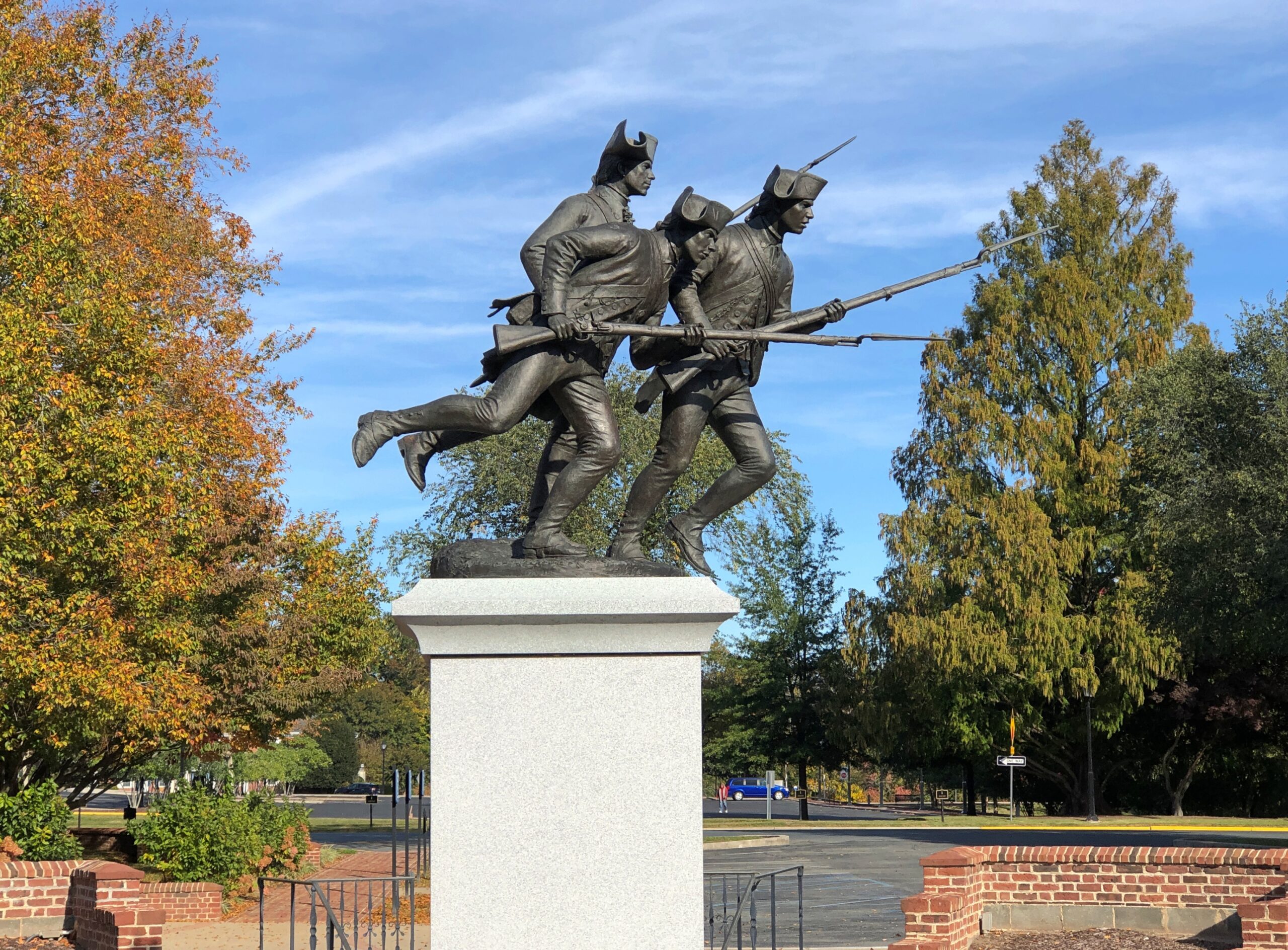
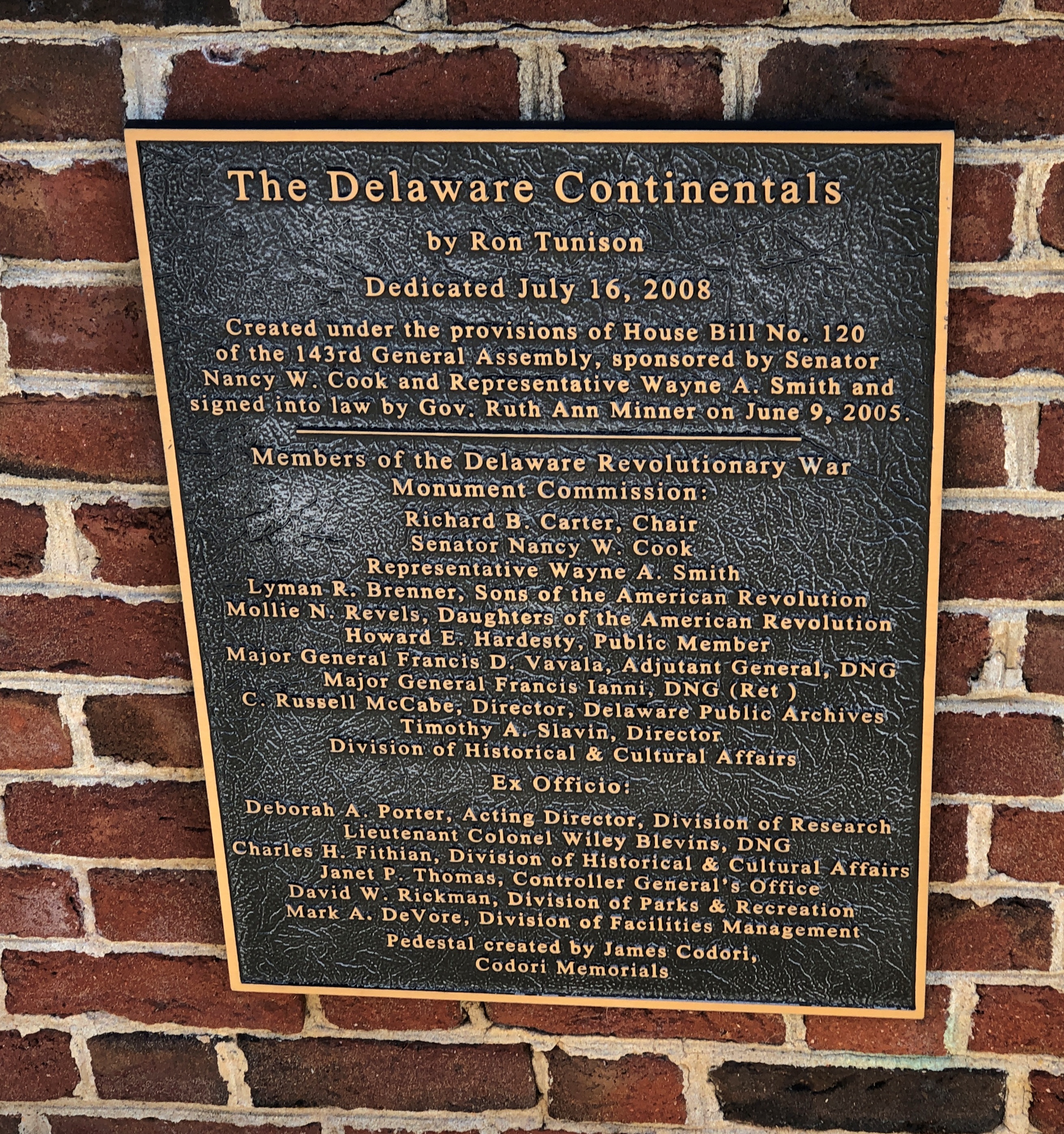
A fairly new sculpture, in front of the capitol: The Delaware Continentals.
The plaque is long on functionaries’ names, short on information about the Delaware Continentals. An historic plaque up in Wilmington says of them:
Commanded by Colonel John Haslet, the Delaware Regiment consisted of more than 500 battle-ready troops when they marched northward to join the Continental Army in August 1776. After expiration of enlistments and Haslet’s death, the Regiment was reorganized in the winter of 1776-77 under the leadership of Colonel David Hall. Participants in many of the major battles of the Revolution, their conduct earned the praise of their superiors and the respect of their enemies. Forced to endure great hardship, the Regiment was widely acclaimed for its discipline and bravery. Greatly depleted in number, they returned to Delaware victorious in January 1783.
That was hardly the end for the regiment. The 198th Signal Battalion in the Delaware Army National Guard traces itself directly to the Delaware Regiment.
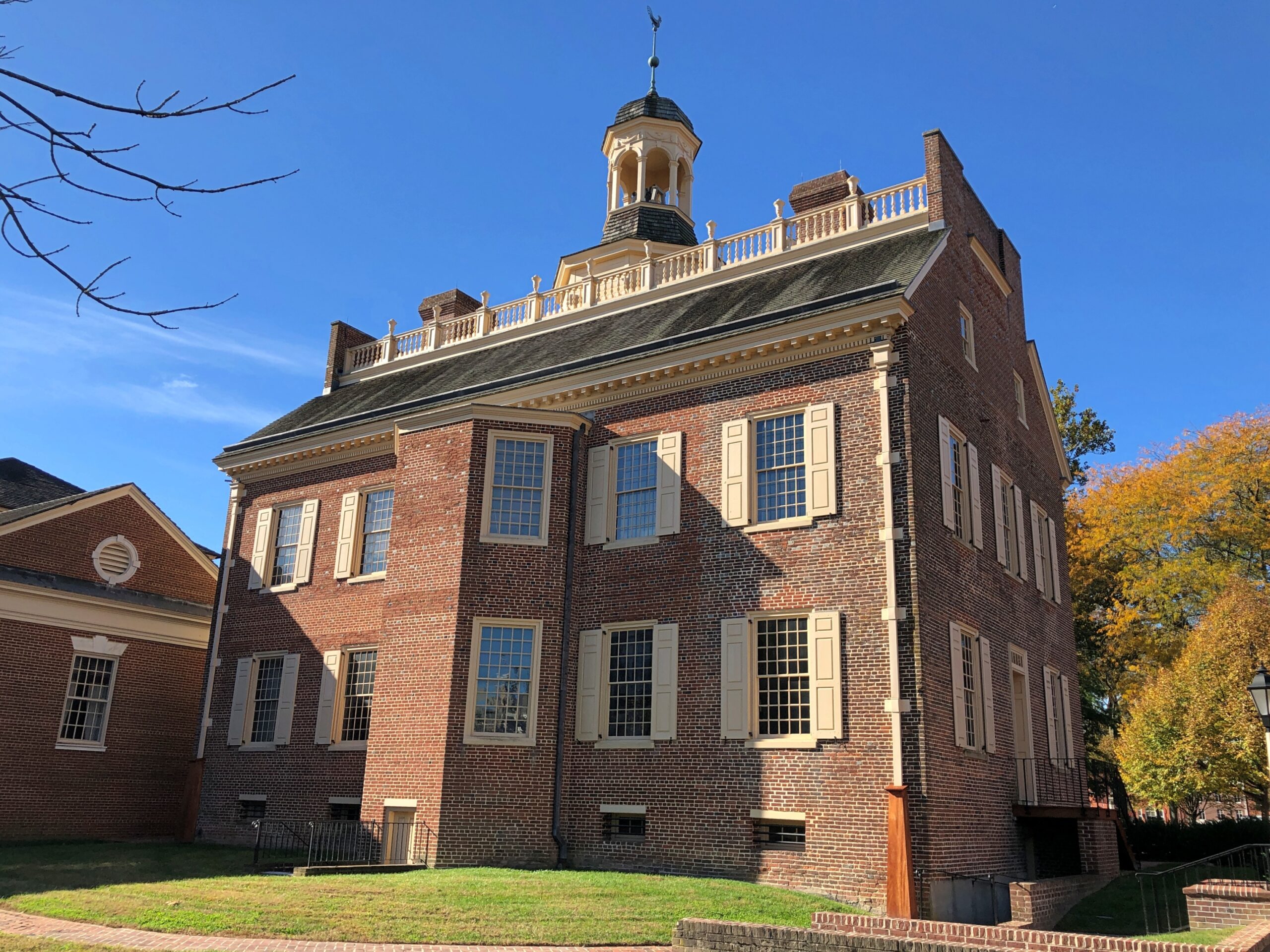
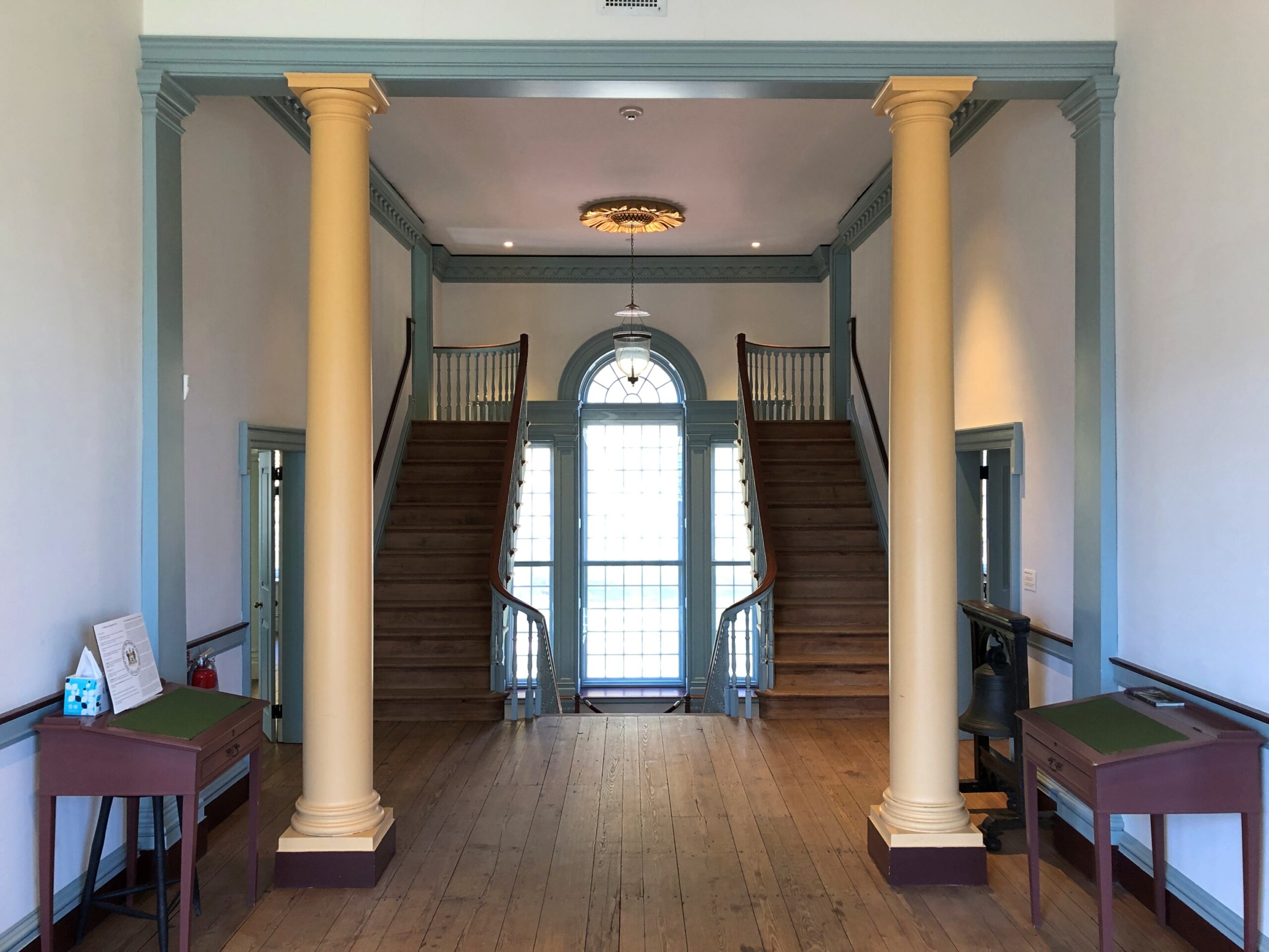
Not far from the current capitol is the former state house, now a museum. It was open.
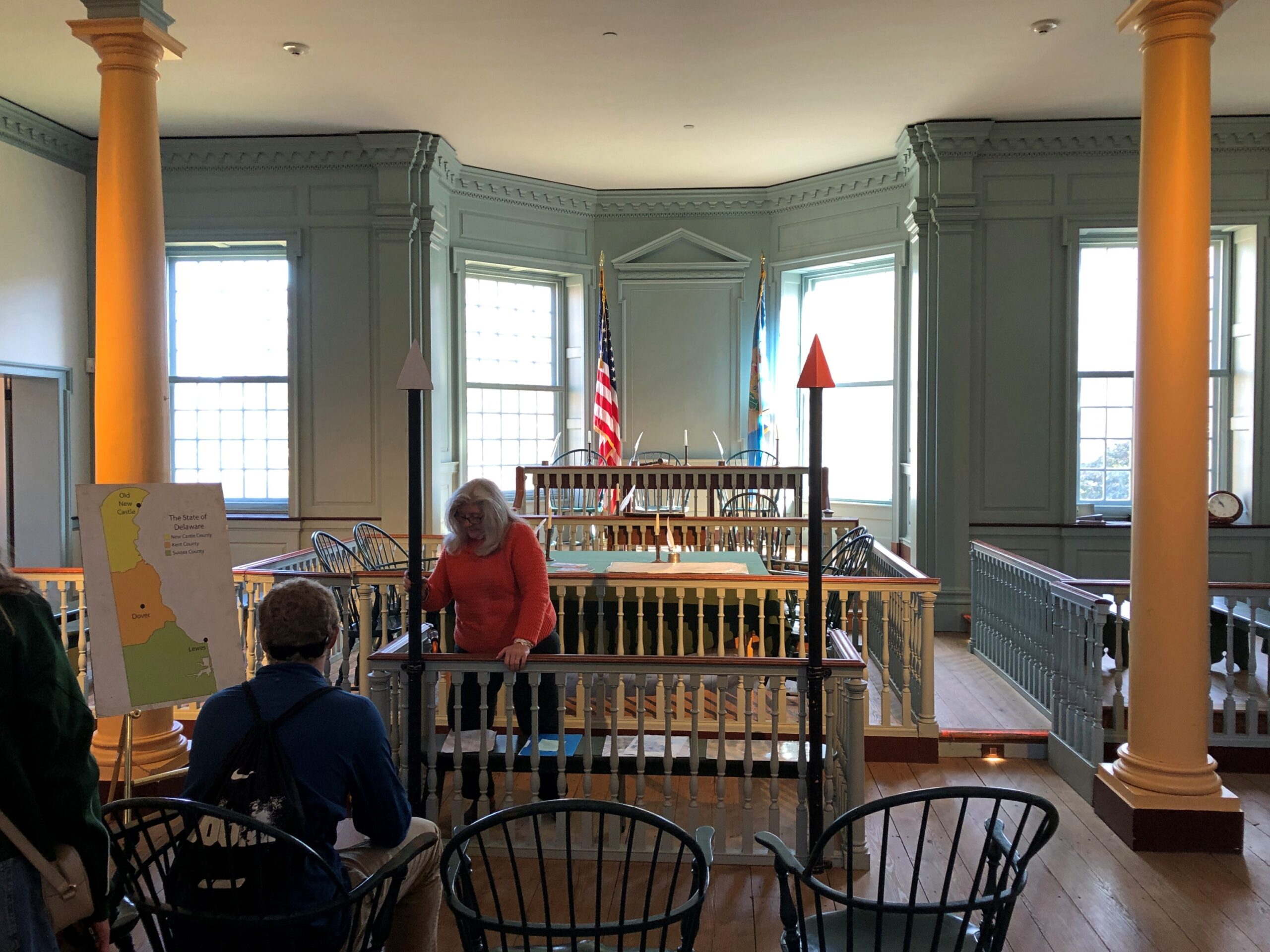
In fact, I got a tour.
I was happy to learn that here, in this very room, the delegates to the Constitutional ratifying convention met, and made their quick and unanimous decision.
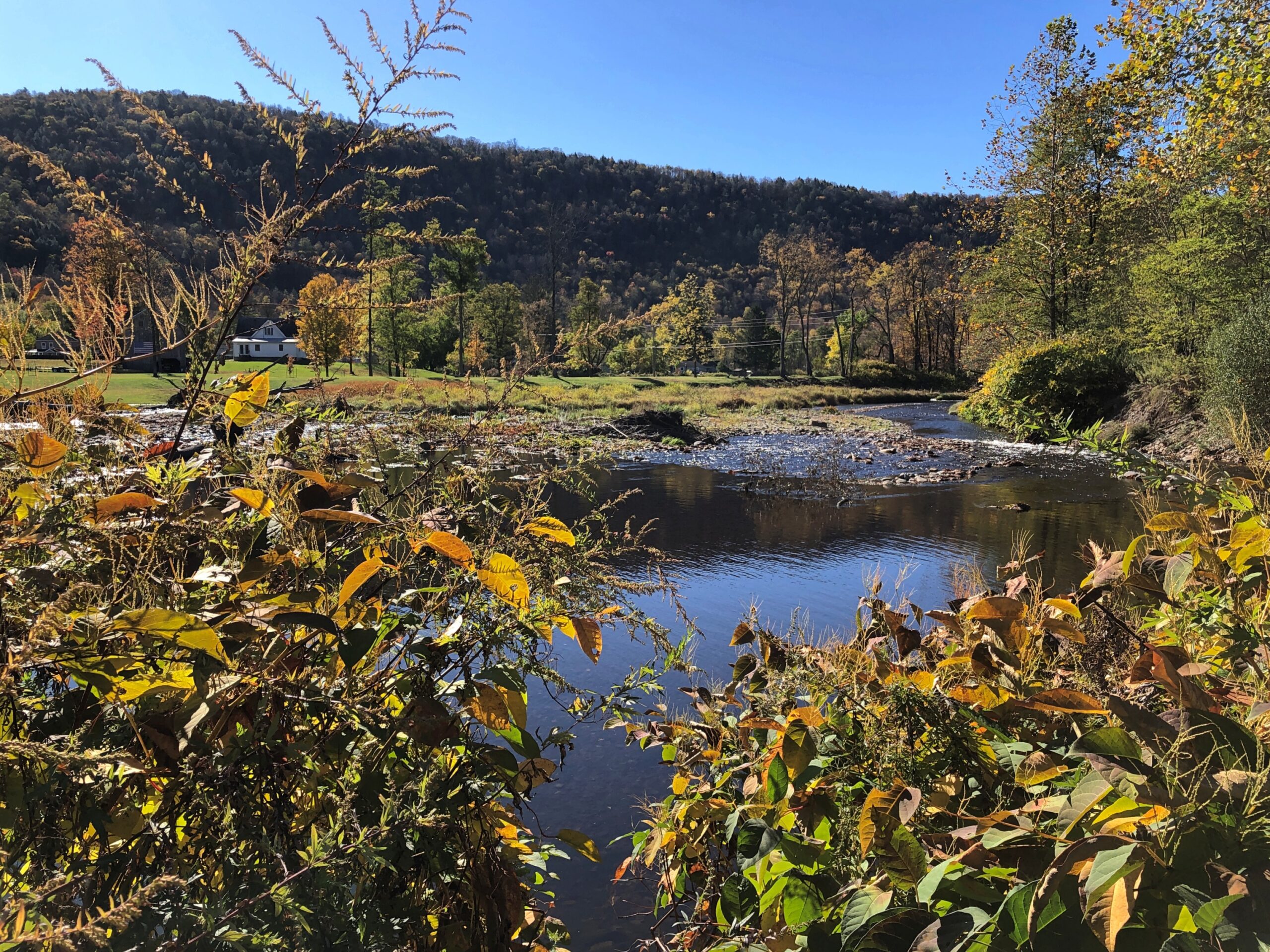
The highway New York 30 winds along the northwestern edge of Catskill Park because it follows the winding East Branch of the Delaware River, which would picturesquely come in and out of view as I drove that highway on the crisp late morning of October 16. I stopped at a place called Downsville. Wiki calls it “census-designated place, and former village in the town of Colchester, Delaware County, New York.”
This raises some questions. How is a village part of a town? (Colchester is marked on maps as not far away, but not on NY 30.) How does a place become a “former” village? People still clearly live there. Maybe I’ll investigate these questions sometime. Maybe not.
Village or former village, it’s at a pleasant spot on the East Branch.
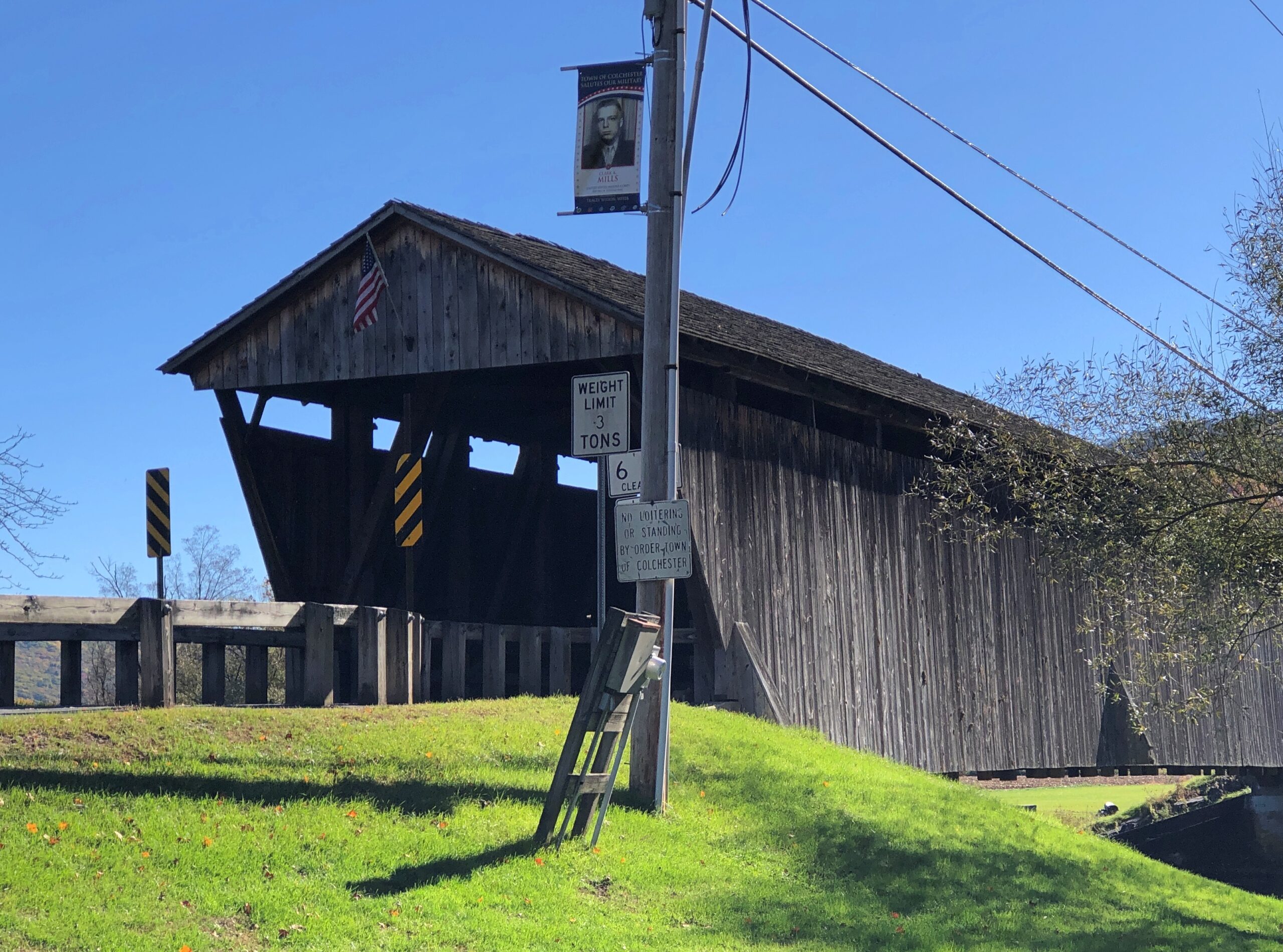
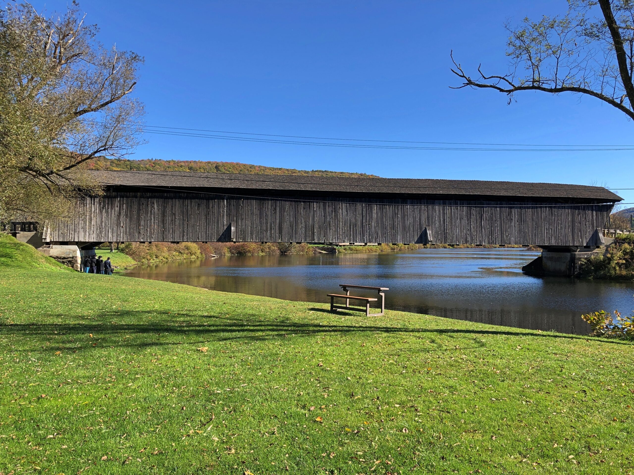
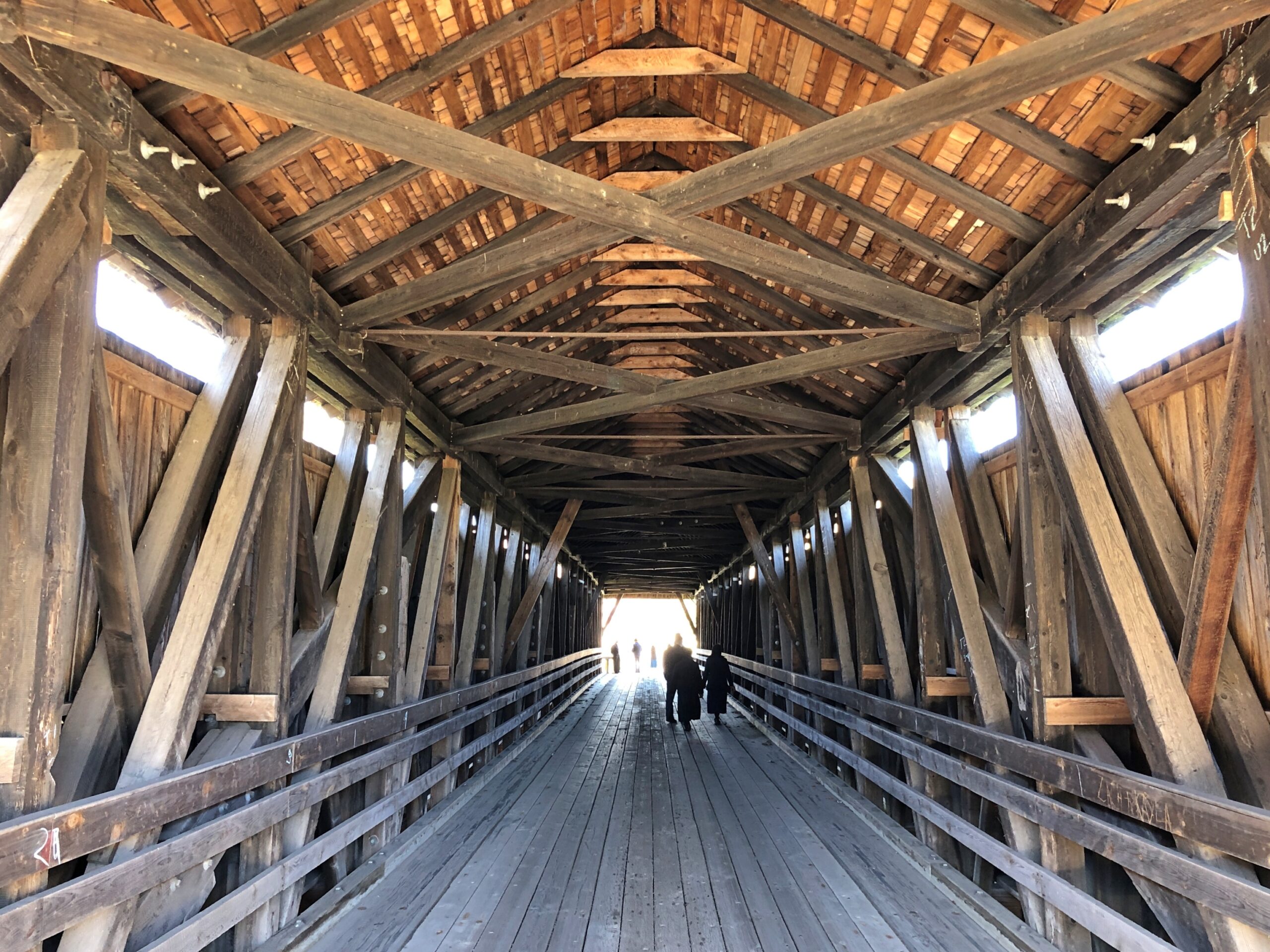
I stopped because a sign directed me to a covered wooden bridge, one that crosses the East Branch about a block away from NY 30.
“The Downsville Covered Bridge is one of six covered bridges still standing in Delaware County…” explains the New York State Covered Bridge Society. “Built by Robert Murray in 1854, this 174-foot-long, single span structure incorporates the Long truss design patented on March 6, 1830 by Lieutenant Colonel Stephen H. Long of Hopkinton, New Hampshire, with an added Queenpost truss. This truss design is rare to Northeastern covered bridges.”
Nice work, Mr. Murray, and the workers who have maintained it as a vehicular bridge down to the present day.
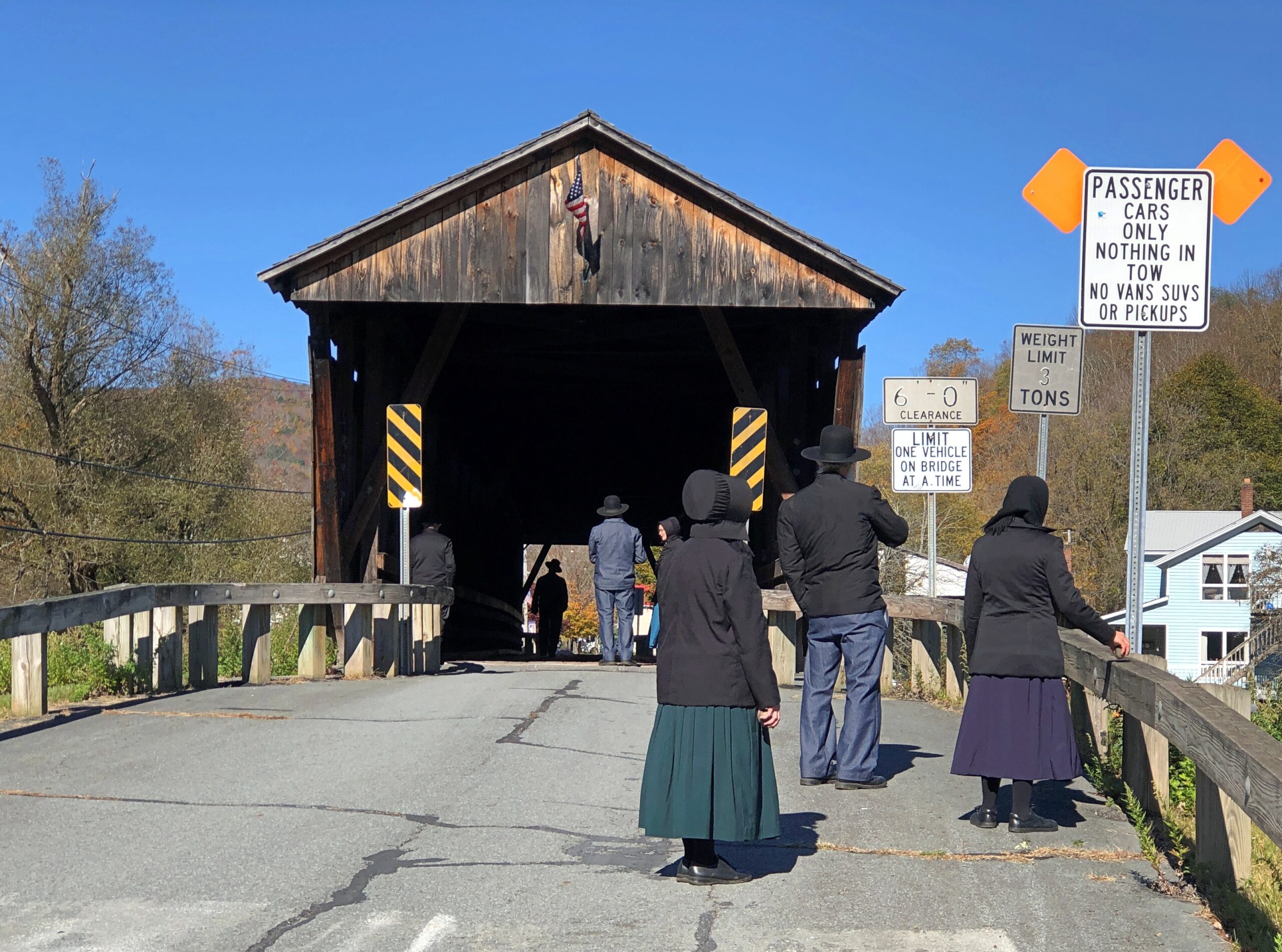
There’s a small park on the river next to the bridge, and a parking lot. Soon after I arrived for a look-see, a large van pulled up to the lot and about a half-dozen Plain People got out. They were there for a look-see too. So we were all on the bridge together.
I try not to do ethnic profiling, but I couldn’t help thinking that a top tourist sight for Plain People might well be a covered wooden bridge. Then I wondered, how is it they came in a van? As I was leaving, I noticed a non-Plain man waiting for them in the drivers seat. The Plain People equivalent of a Shabbos goy, I suppose. Except maybe that he can work any day except the Sabbath?
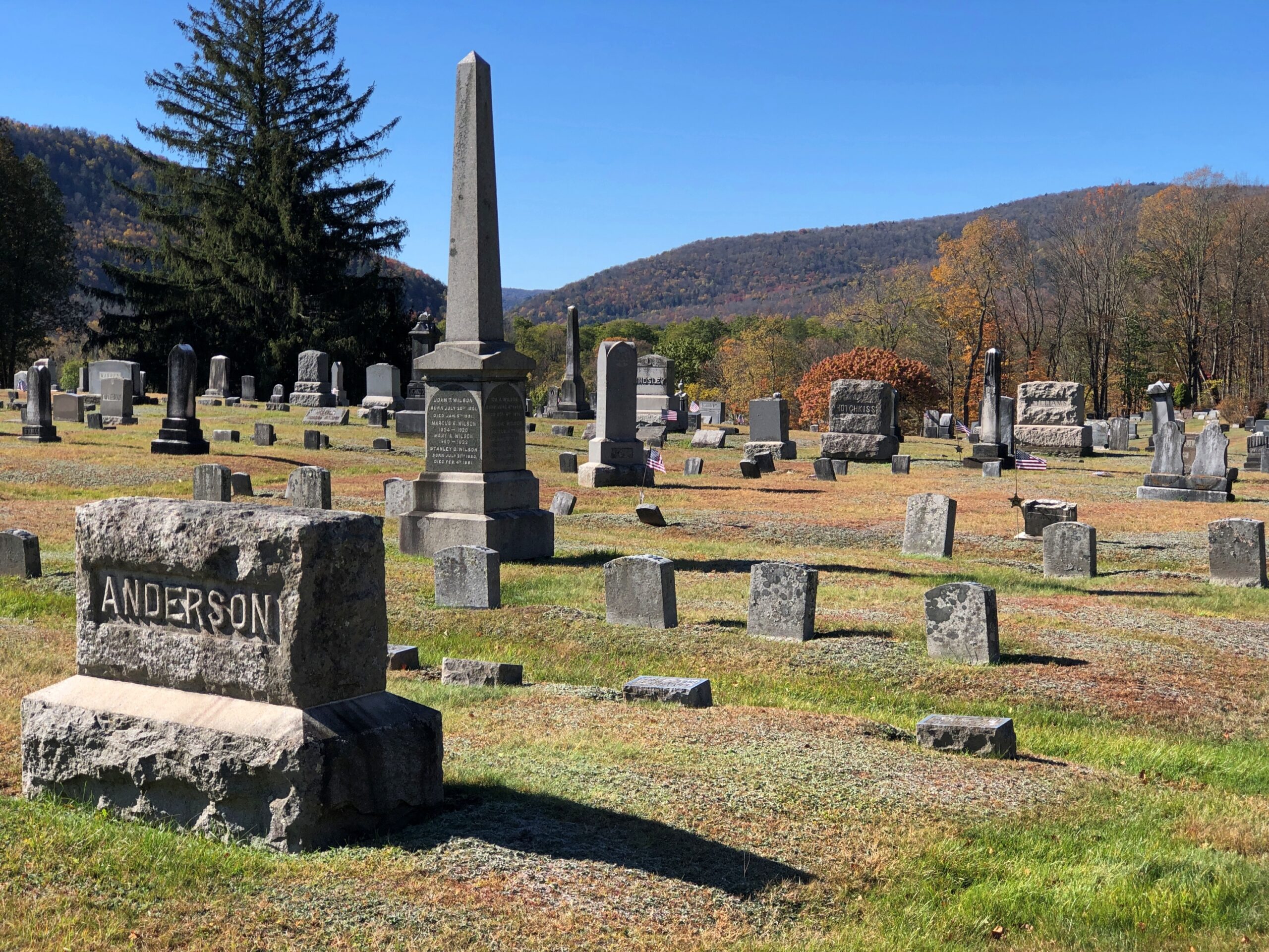
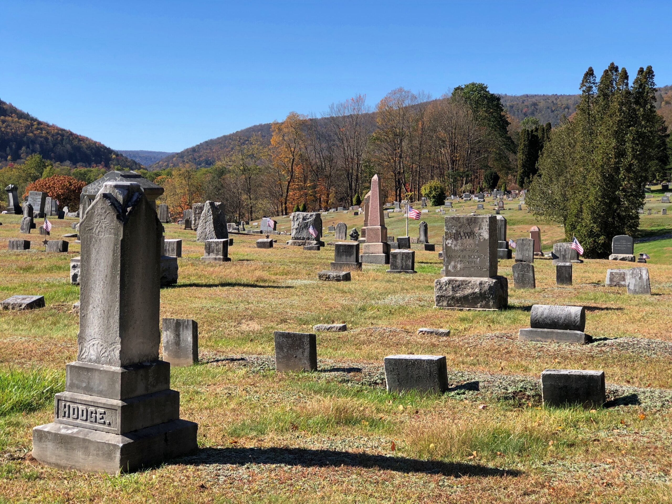
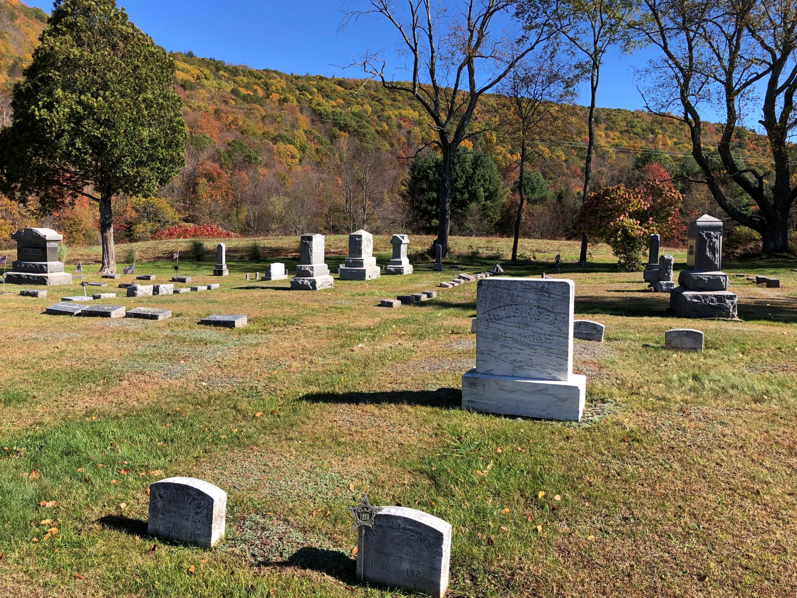
Not far away in Downsville is the Paige Cemetery. I had that to myself, as usual.
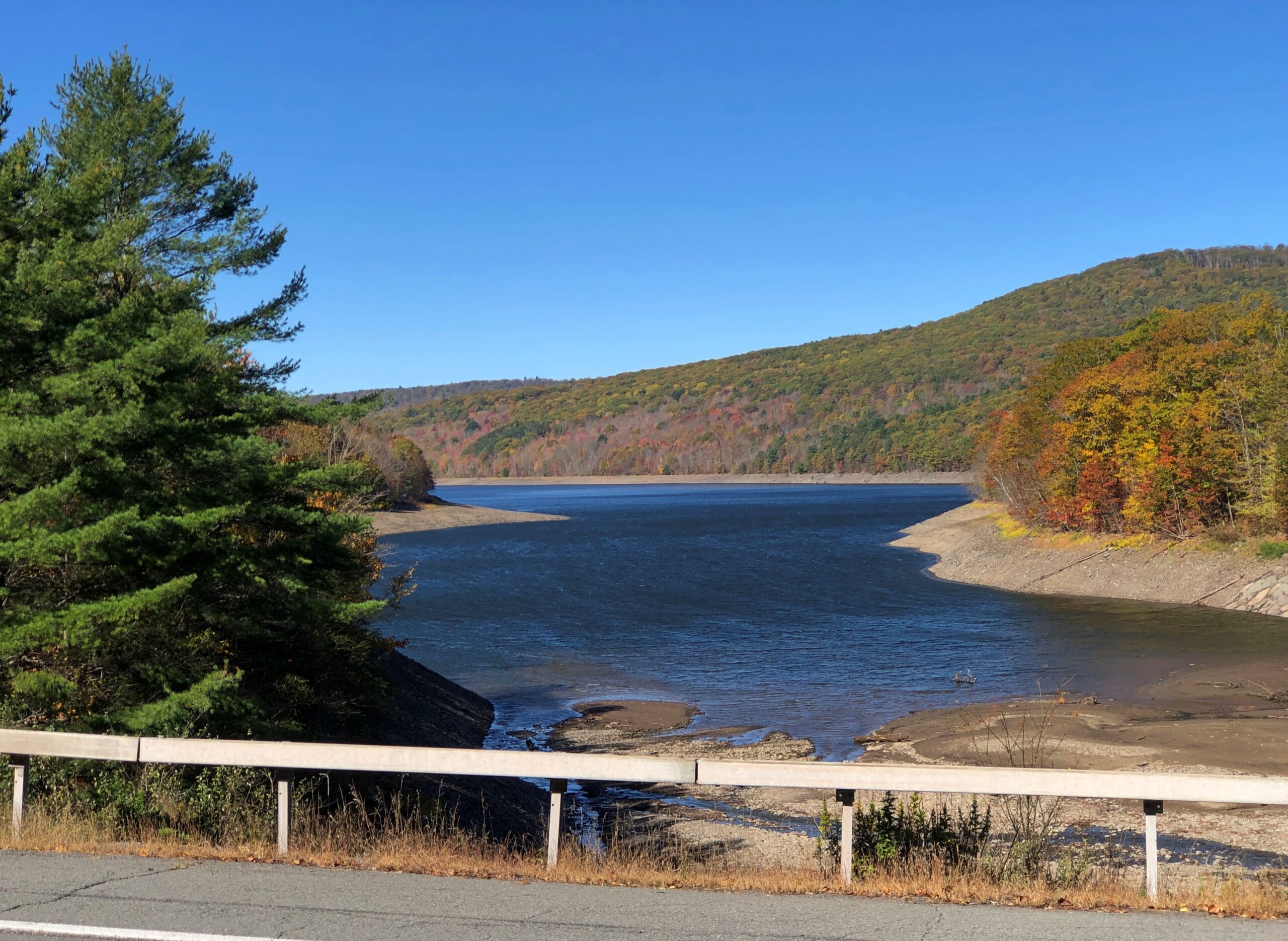
New York 30 continues a long way on the shores of the Pepacton Reservoir. Still car commercial driving.
The Pepacton Reservoir, seemingly so peaceful on a brilliant autumn day, has a hell of a back story.
“It is formed by the damming of the East Branch of the Delaware River, which continues west and joins the lower Delaware River,” says NYC Environmental Protection. “It consists of one basin, approximately 15 miles in length [that] holds 140.2 billion gallons at full capacity, making it the largest reservoir in the city system by volume. It was placed into service in 1955.
“Pepacton Reservoir is one of four reservoirs in the City’s Delaware Water Supply System. As the reservoir with the largest capacity, it normally contributes more than 25% of the total daily water flow into New York City.”
Italics added, because they needed adding.
Once I left NY 30 and headed east on NY 28, which put me on a path toward the Hudson River Valley and NYC and Long Island, traffic kicked up several notches. It was still mostly a pleasant drive.
Most of the traffic was headed west into the park, opposite of the way I was going; as only to be expected on a Thursday ahead of a colorful fall weekend. The Catskills are still a destination, if not quite the Catskills of yore. Some of the old story was told to the rest of the country through TV shows in previous decades, or even more recently: namely, The Marvelous Mrs. Maisel.
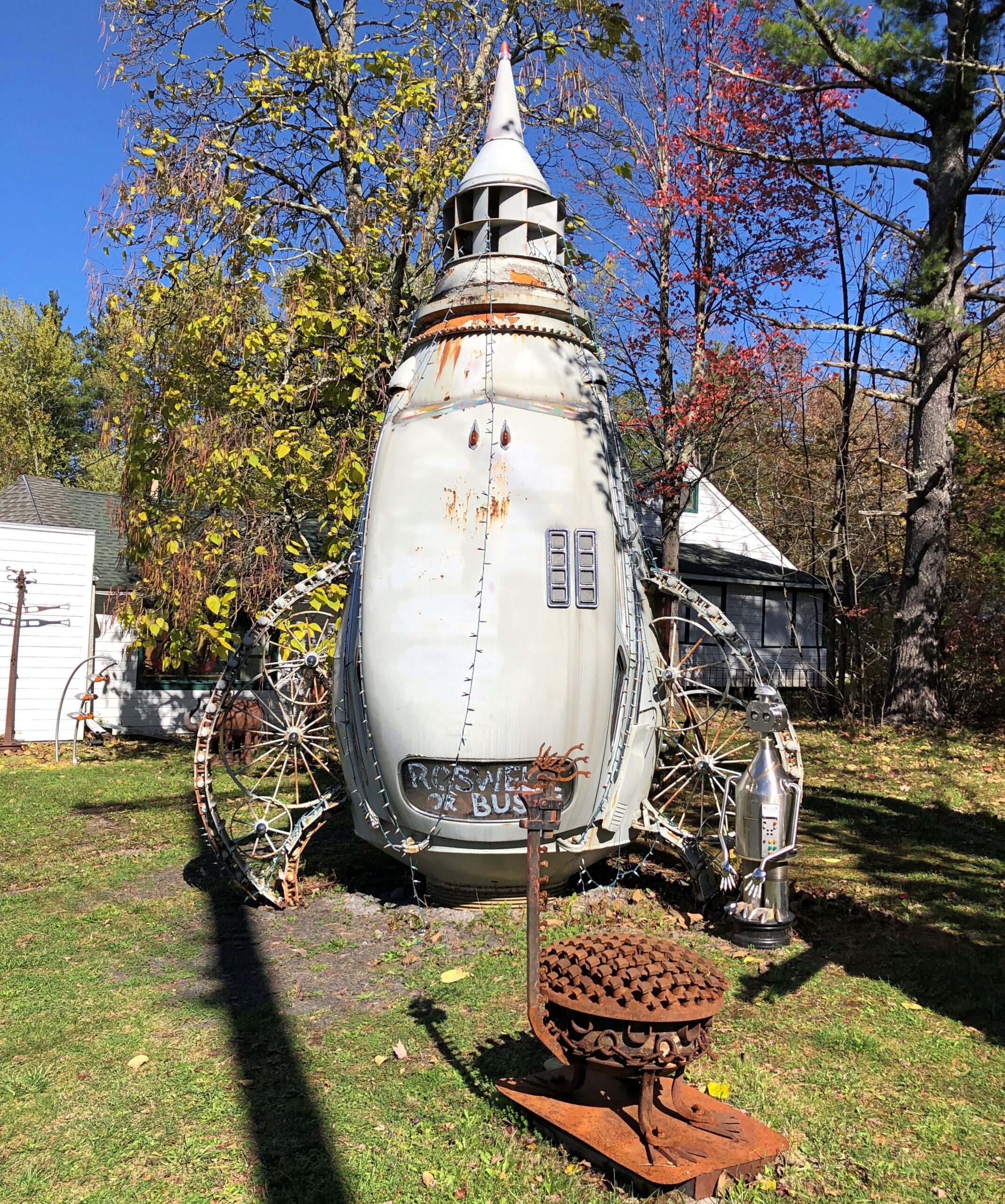
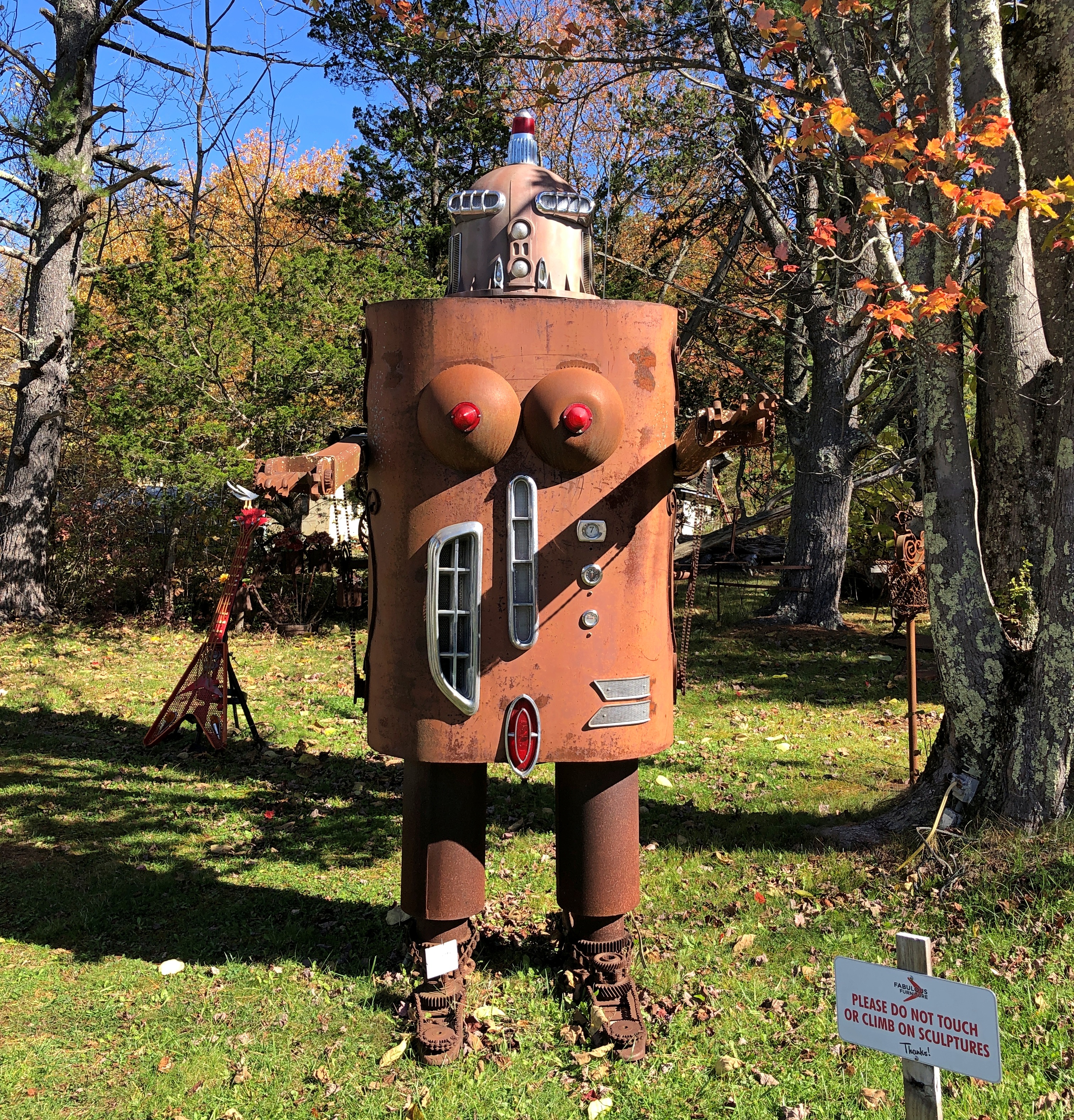
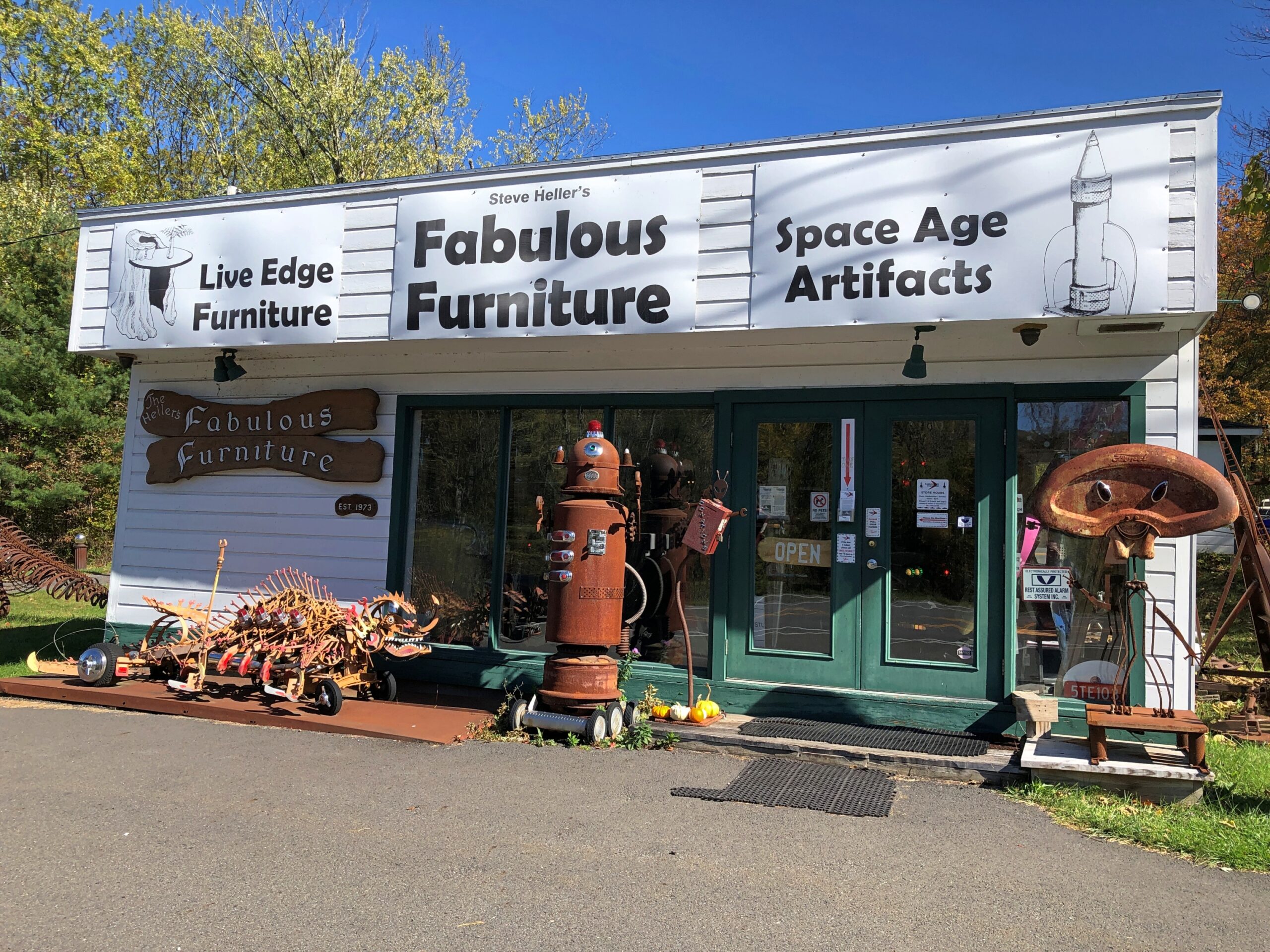
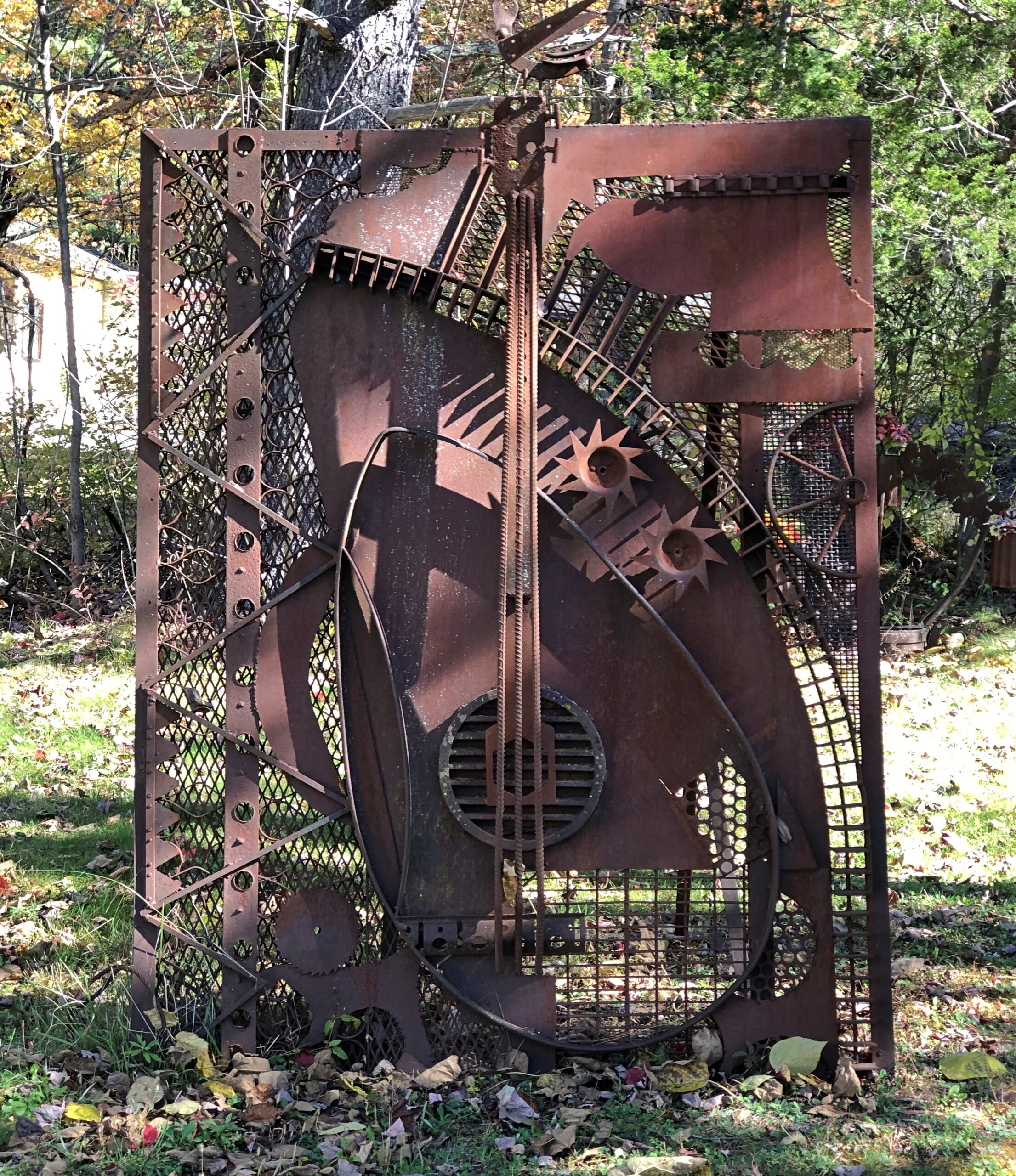
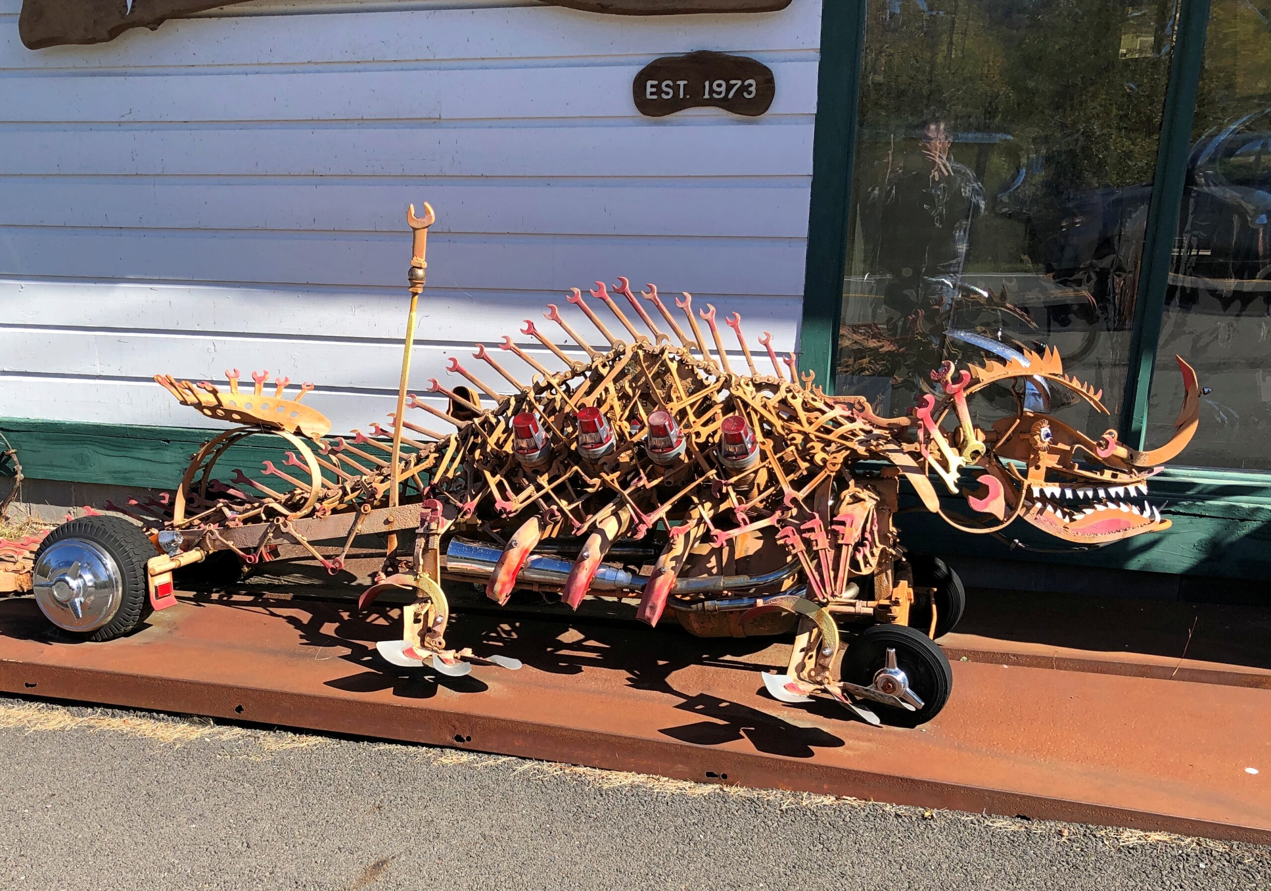
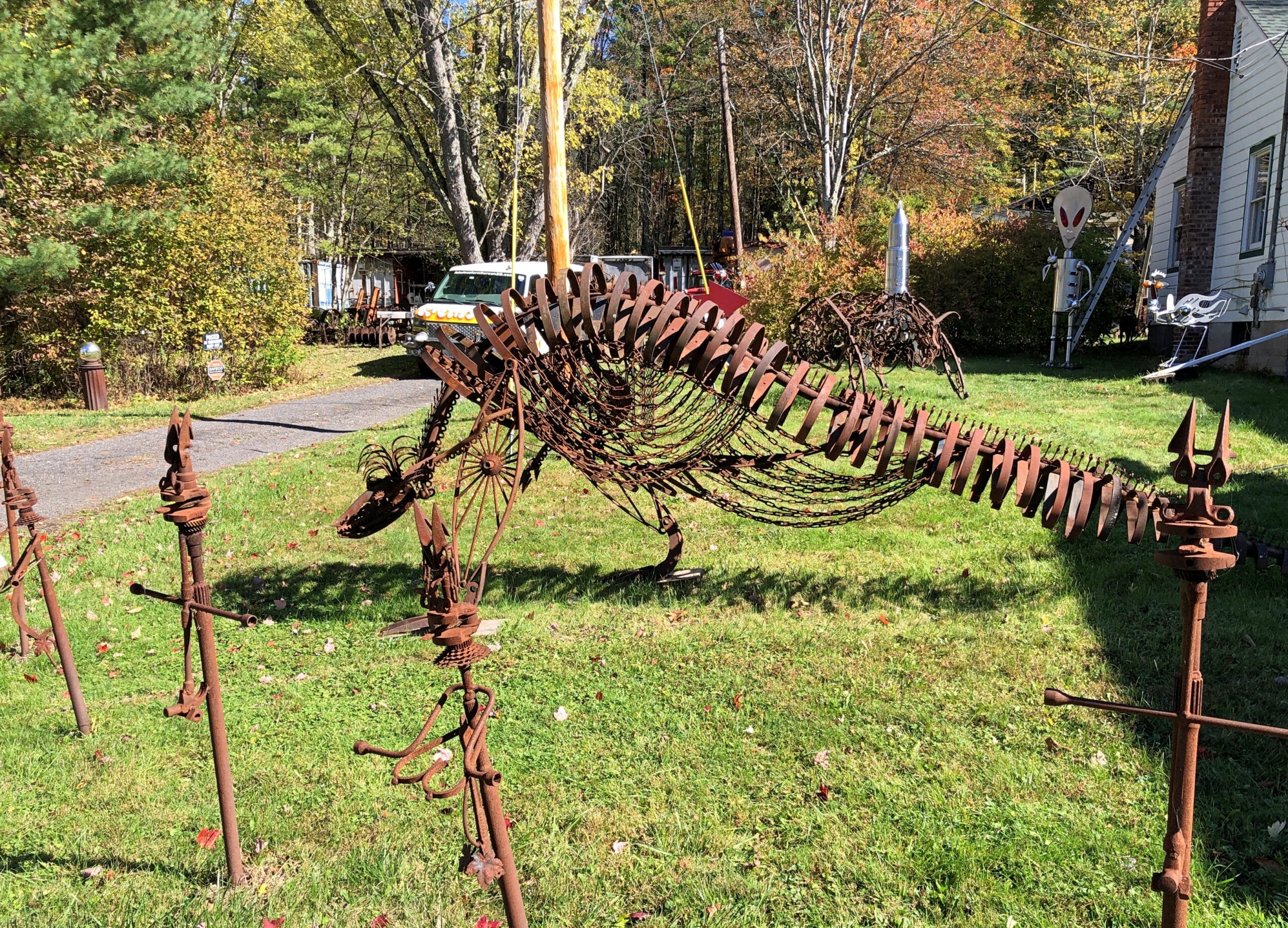
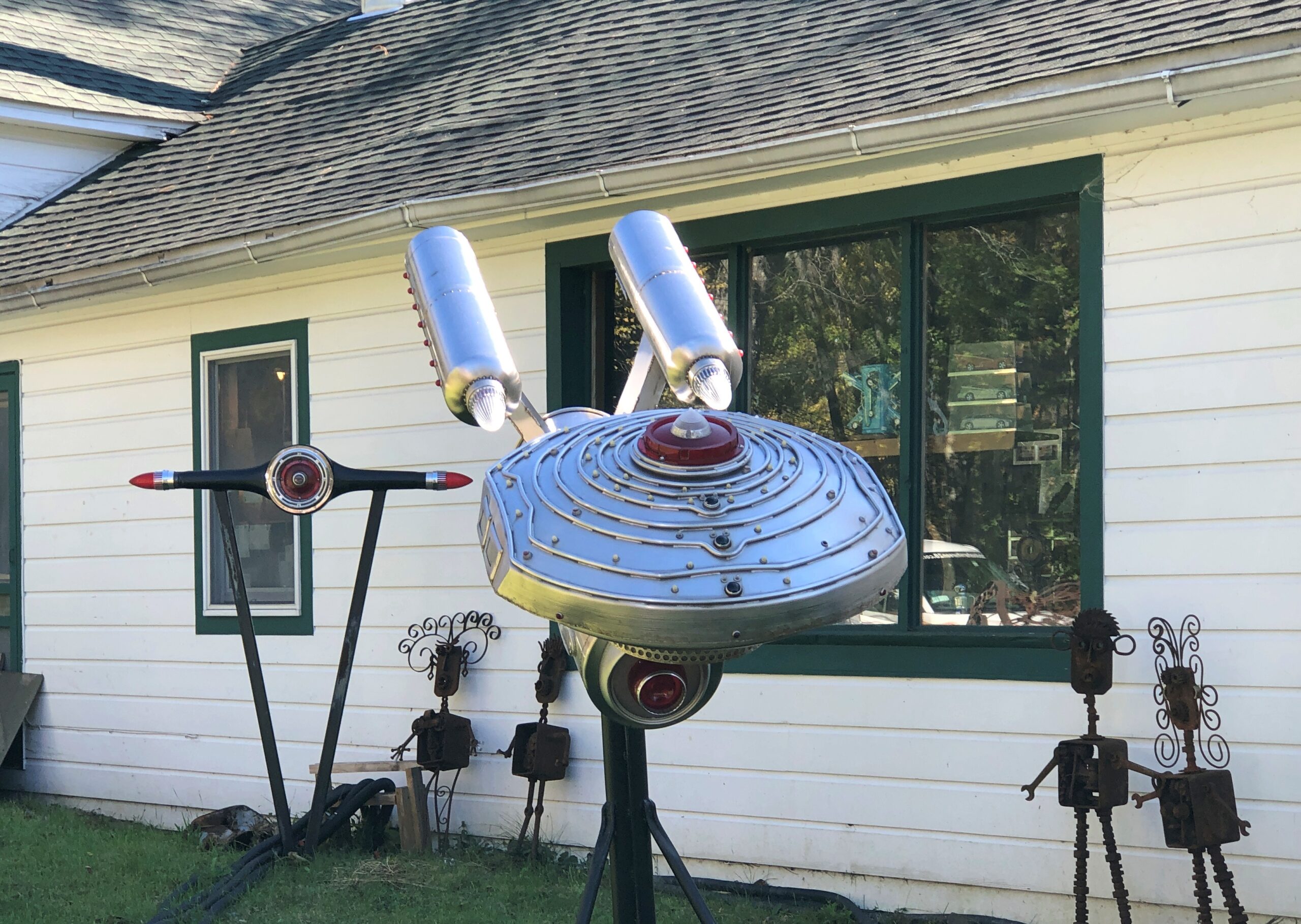
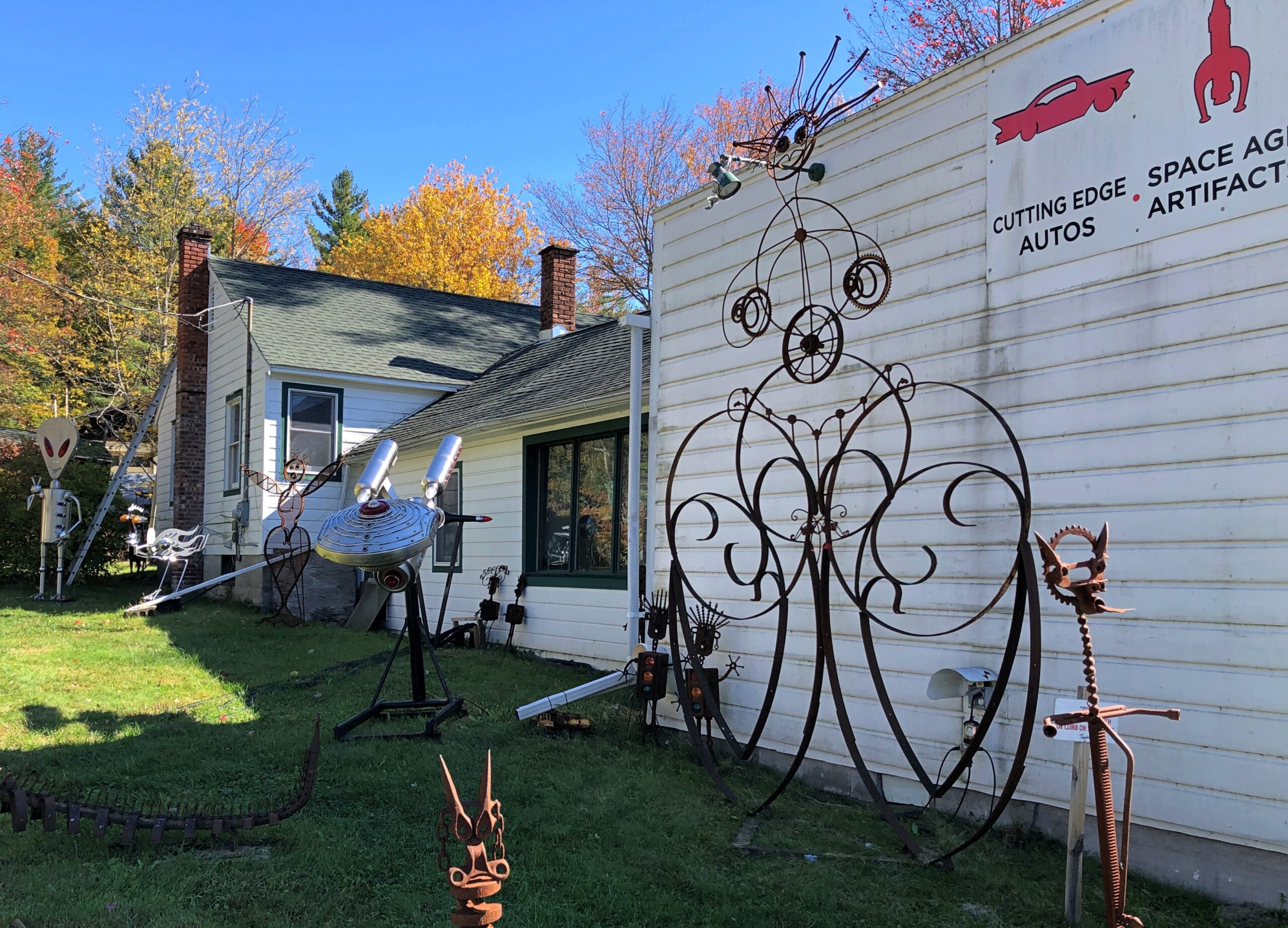
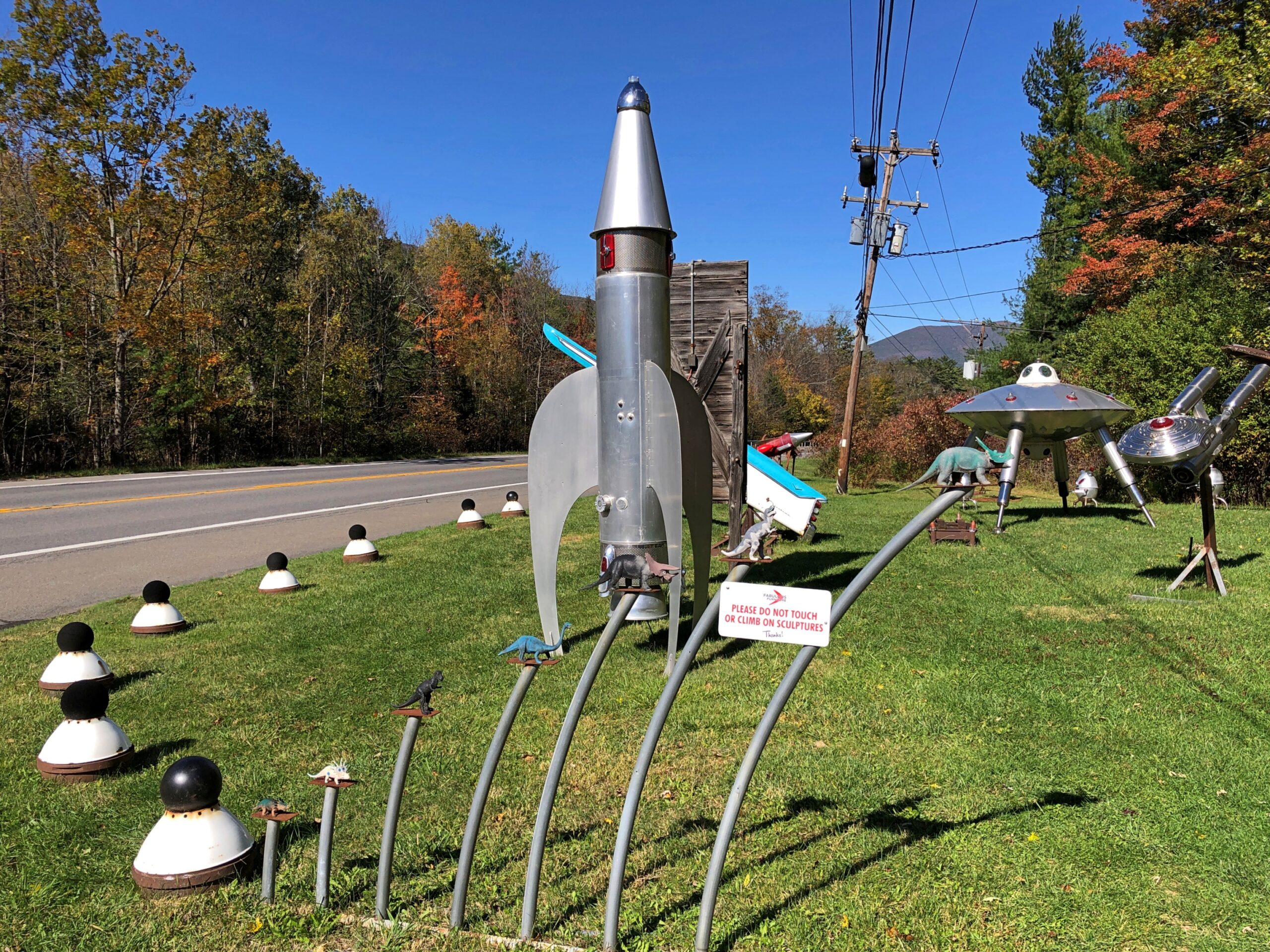
Metal spaceship and robot sculptures haven’t been part of the Catskills narrative that I know of. But there they were, right off NY 28.
As part of this place of business.
Some artful metal for sure.
More.
Fabulous work, Mr. Heller, but those Space Age artifacts are of a Space Age that never quite was. Too bad.
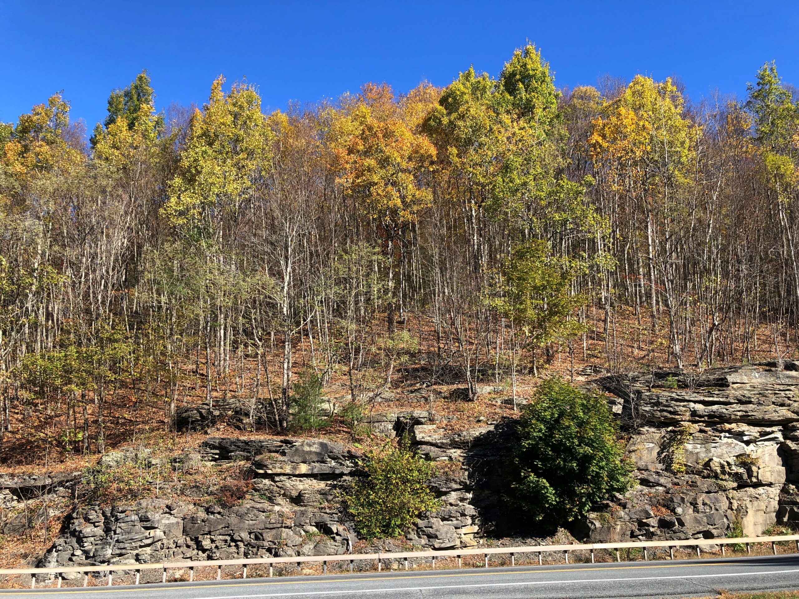
Drive out from Erie, Pa., headed northeast, and soon you have a decision to make: I-90, which becomes the New York State Thruway, or I-86, which does not. Besides costing more money, the NYST went places I didn’t want to go (this time): greater Buffalo, Rochester, Syracuse, Utica and into Albany, a route I drove as long ago as 1991 on my way to Boston.
By contrast, I-86 passes through much smaller places, winding through the hilly Allegheny Plateau, a way I had not been before. High time to do so, I thought. The road is also New York 17, with signs along the way identifying it as the Southern Tier Expressway. “Southern Tier” is the southernmost counties in upstate New York, which apparently is a longstanding regional term.
That’s a good-looking sign, and serves as a nod to the Seneca, who hold land in this part of the state. A Seneca artist named Carson Waterman did the design. For some miles before and after the town of Salamanca, which is part of the Seneca holdings, standard green highway signs include both English and Seneca.
One of the larger places on the Southern Tier Expressway is Jamestown, which I know from the song. It’s a game I occasionally play with my friends: Did You Know There’s A Song About…? and then I name something like rural electrification in Australia or the Versailles conference. In this case, the song is “Maddox Table” and it’s about labor organizing in Jamestown, hometown of the band 10,000 Maniacs. The town isn’t specifically mentioned in the lyrics, but Bemis Point is. Even before the Internet, I could look that up, and note that it’s a local recreation destination on Chautauqua Lake.
Chautauqua Lake is in Chautauqua County, the westernmost bump on the map of New York state. Ah, storied Chautauqua, which brings to mind the outdoor exhortations of men in full suits and women in long dresses, regardless of how hot it was. There’s another streaming service series for you: Chautauqua, set in the raucous 1890s. Could be a comedy or a Gritty Drama.
I wanted to reach my destination, Binghamton, NY, before too late, so I didn’t linger near the lake. But I did stop at the rest area on Chautauqua Lake, which is large, and contains multitudes of structures along its shores, and probably many more people in the summer. One of the more scenic rest areas of the trip, it turned out.
So was the next rest area, not far from Corning. A few hours to devote to the glass museum in that town would be well spent, I think.
After an uneventful night in Binghamton – the kind I prefer on the road – I set out for greater NYC, by way of the highway New York 17, the “future I-86” according to my maps, and then the highways New York 30 and 28.
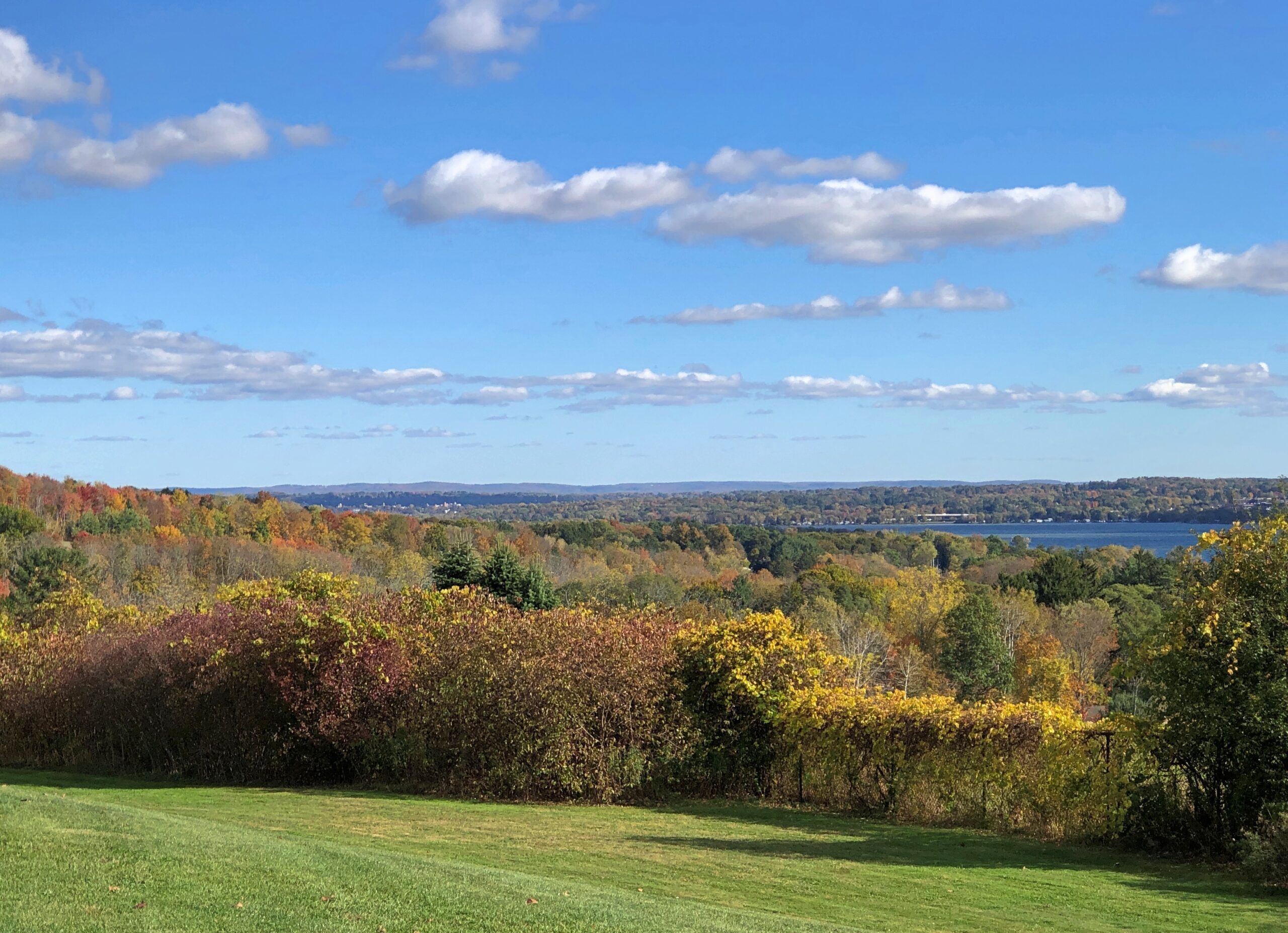
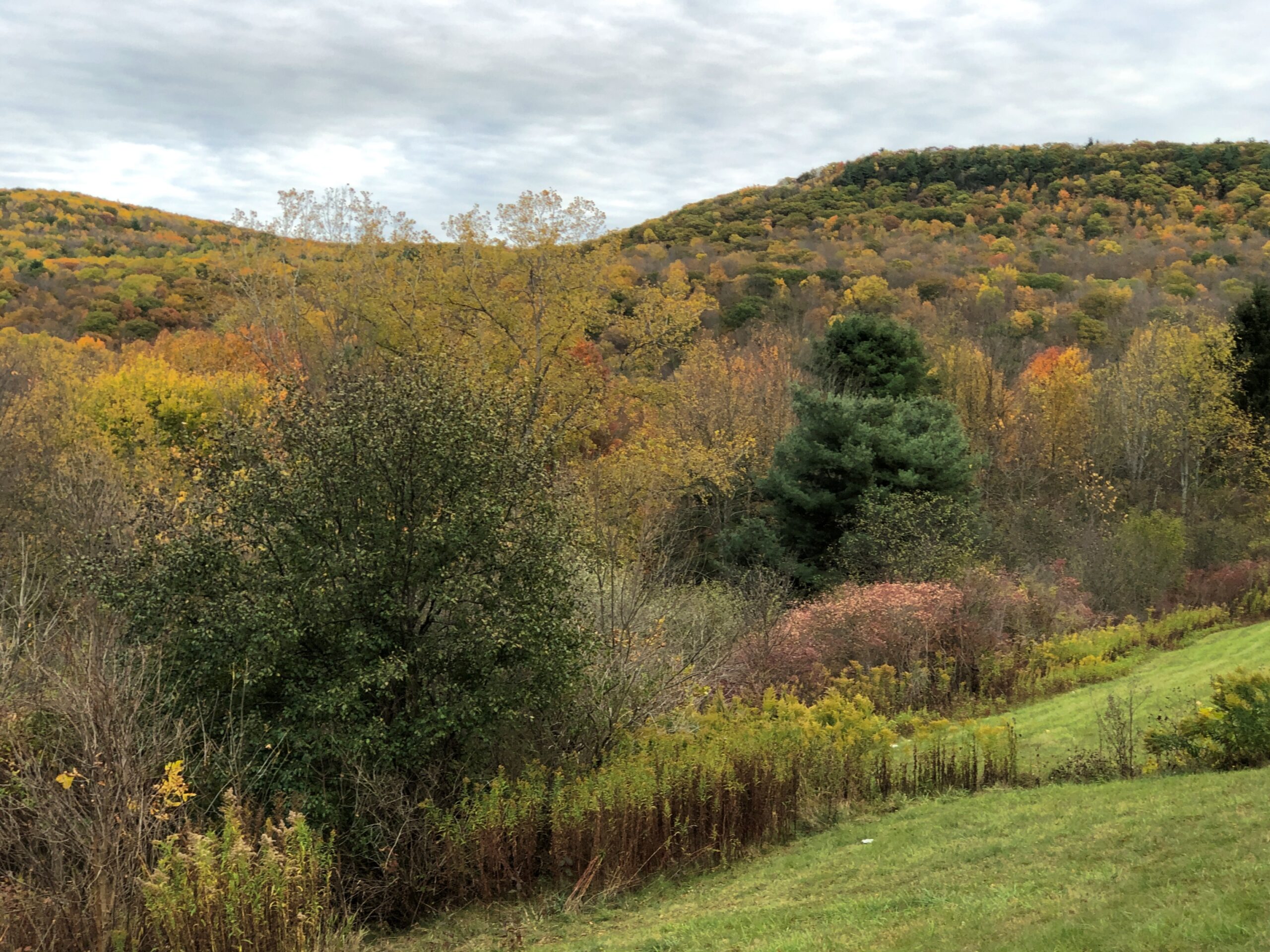
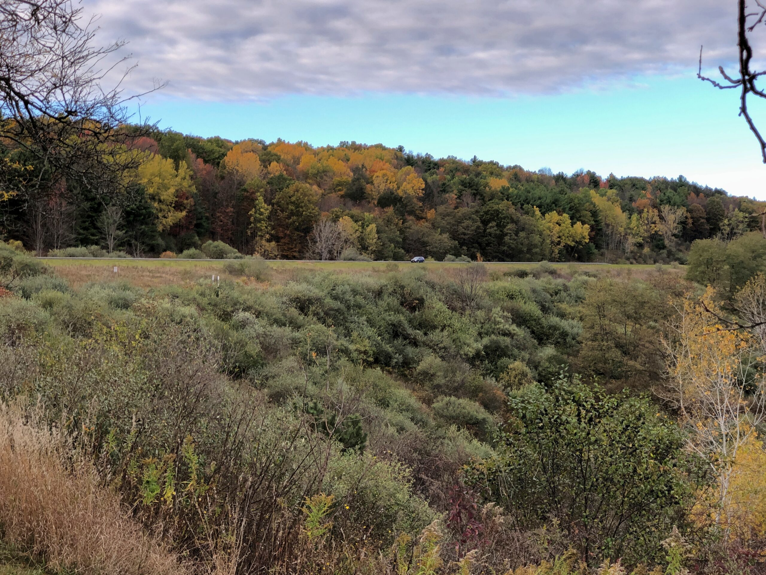
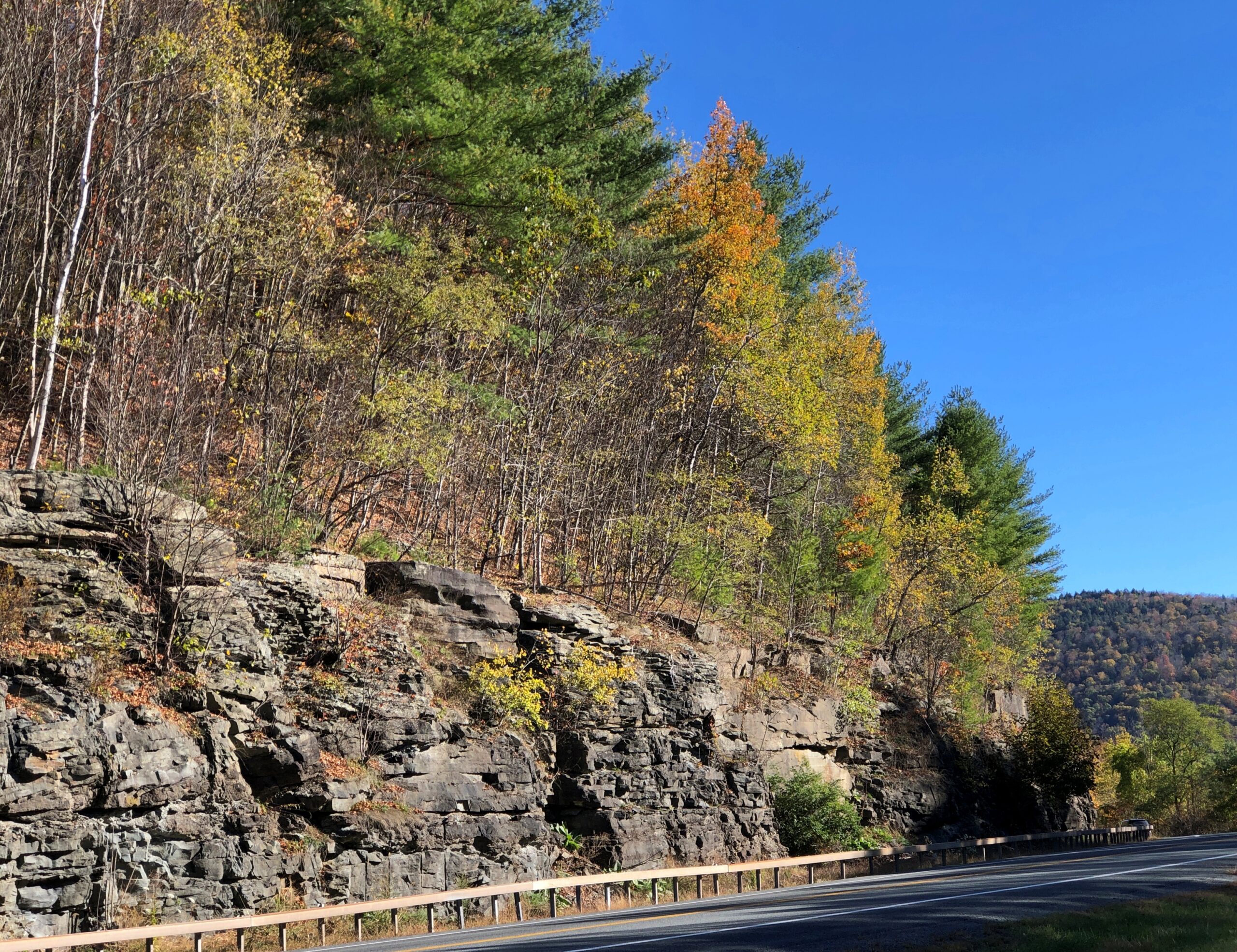
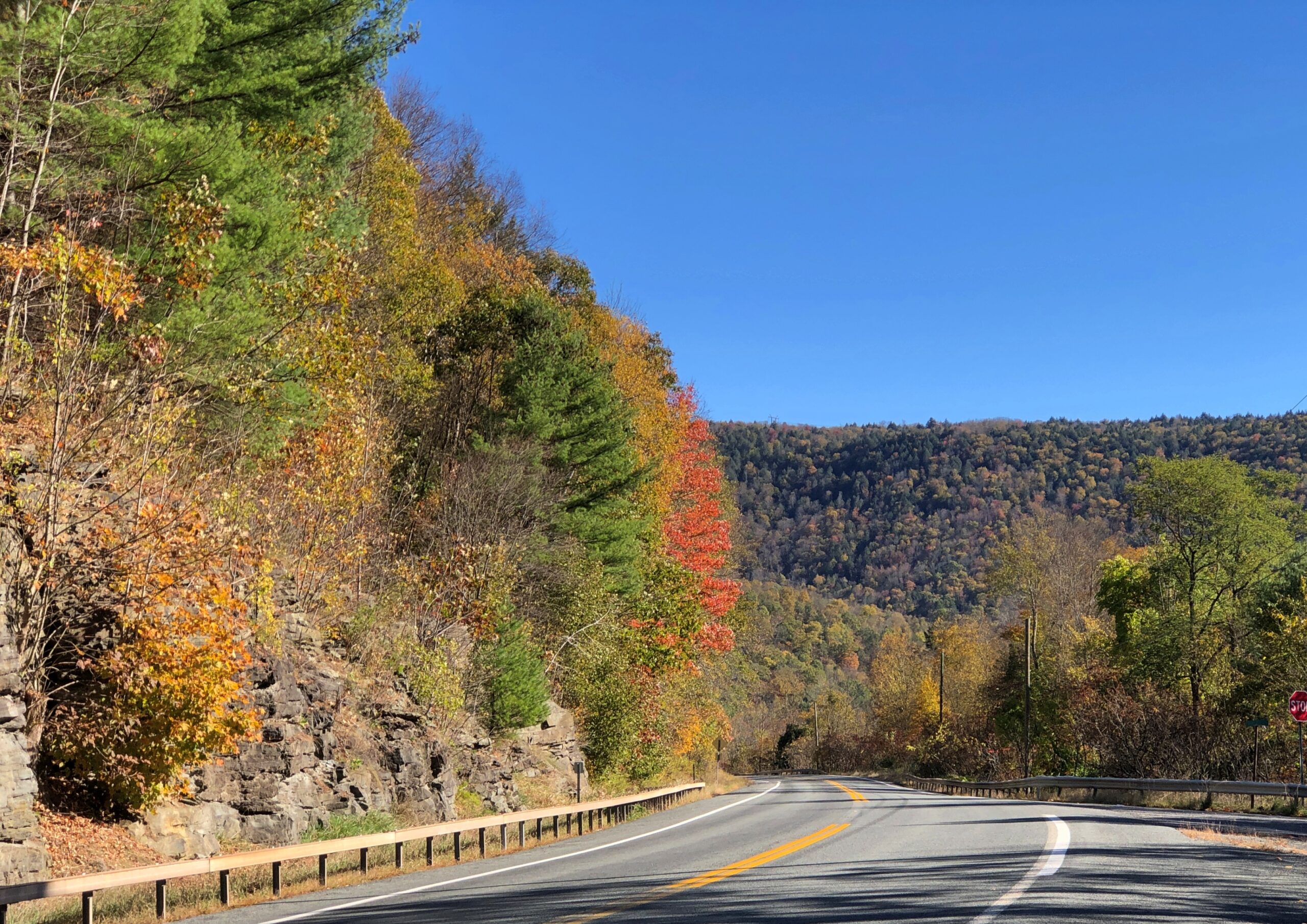
NY 30 skirts the edge of Catskill Park. Last time I was in the Catskills was during the Clinton administration, back when the Concord Hotel and Resort was still clinging to existence, so it’s been a while, and I’d never been in the colorful and nearly empty western edge of the park in October. That emptiness made all the difference in the car commercial driving I enjoyed.
During all the driving over the next week or so after NY 30, empty roads would not be part of my reality.
I didn’t realize until last night that I’d driven through some geographic oddities over the last two weeks, on my way to the Northeast and back. Actually state border oddities, such as the Erie Triangle in Pennsylvania, the curious division of the Chesapeake Peninsula, and the panhandle of Maryland.
Except they aren’t really oddities. They just look that way when you’re a kid (or an adult) poring over U.S. maps or putting your state puzzle map together for the nth time. How is it that Pennsylvania has that small chimney? Why didn’t Delaware get more of the Chesapeake Peninsula? What’s the deal with the western extension of Maryland, which narrows to only a few miles at one point?
There are historic reasons for all the shapes, both rational and arbitrary, which are the subject of books and at least one TV show. Lands were granted and claimed, borders were surveyed and quarreled over, and deals and court cases and Congress eventually settled the shapes.
The border oddities may have local and legal significance, but they’re also there to enjoy. Regular borders aren’t nearly as much fun. Sure, it’s interesting that Colorado and Wyoming look about the same, but I always liked the fact that New Mexico has a stub and Idaho tapers to meet Canada, just to name two Western examples, because not all the fun shapes are in the East. Just most of them.
To reach these border areas, I drove 2,853 miles, starting October 14, from northern Illinois to the East Coast and back, through (in order) Indiana, Michigan, Ohio, Pennsylvania, New York state (and city), New Jersey, New York (city and state) again, Connecticut, Massachusetts, Rhode Island, Connecticut again, New York state (and city) again, New Jersey again, Delaware, Maryland, West Virginia, Pennsylvania again, West Virginia again, Ohio again and Indiana again, arriving home today. I got tired just typing all that out.
The original impetus for the trip was to visit New York City during its Open House event. Unlike a rational person, who would have flown there and back, I decided to drive, and let Yuriko fly there and back. NYC is achievable from metro Chicago in two driving days. I decided not to do that, either, and stretch things out to fill in some travel lacunae of mine.
For instance, I wanted to visit Eire, Pa., because I’ve always bypassed it, and many Americans can say the same. I wanted to look around Long Island, or at least part of it, for the same reason. I wanted to spend the night in both Rhode Island and Delaware: the last two states in which I’d never done so. I wanted to see the capitols of New Jersey, Delaware and Maryland, toying with the idea of Pennsylvania too, though I decided it was out of the way. I wanted to see historic sites associated with a number of presidents along the way, and maybe a battlefield or two.
I really wanted to visit a friend in New York, and my nephew Robert, and friends in the Boston area. I’m glad to report that I did so. This has been a year of visiting old friends and relations. I’d like every year to be that way.
I had a much longer list of places to visit, and added to it every time I looked at a map, paper or electronic, since I now use both, and when I was driving — so many possibilities. But there are only so many hours in the day and so much energy in my aging body. Still, I did much of what I set out to do, with one major exception due to forces beyond my control. National Park Service sites were off the table, for reasons all too obvious and not worth rehashing here. So the homes of FDR and TR, along with Antietam and Harper’s Ferry, went unvisited. Some other time, I hope.
No matter. I visited a good number of cities and towns, drove roads large and small, empty and insanely crowded, and enjoyed a few exceptional meals and many very good ones. I saw churches and cemeteries, some historic places not managed by the federal government, and encountered the largest of the many No Kings events. I read plaques. I chatted with strangers and clerks in stores. I took a swim in Massachusetts and long walks in New York. I hadn’t planned to walk across the Brooklyn Bridge again, but Yuriko had that idea, and across we went. I listened to a lot of terrestrial radio, good, bad and indifferent. I burned gas priced between about $2.70 and $3.30 a gallon. I paid entirely too many tolls, because the Northeast is lousy with toll roads and bridges — but driving across some of those bridges, especially the Bay Bridge in Maryland, was a grand experience, and surely worth the toll.
Something I didn’t anticipate, but which improved the trip immensely, was fall color. I should have anticipated it, but I suppose I had other things on my mind. When I got to New York state, driving west to east, it became clear that I’d accidentally designed myself a fall foliage excursion. The trees were gorgeous there, and in NYC (especially Prospect Park), Long Island, and parts of New England, and in Delaware and Maryland all the way across its panhandle. Even Ohio and Indiana had some nice color when I got there, and here at home too.
One more thing: unexpected oddities along the way. It’s important to watch out for those.
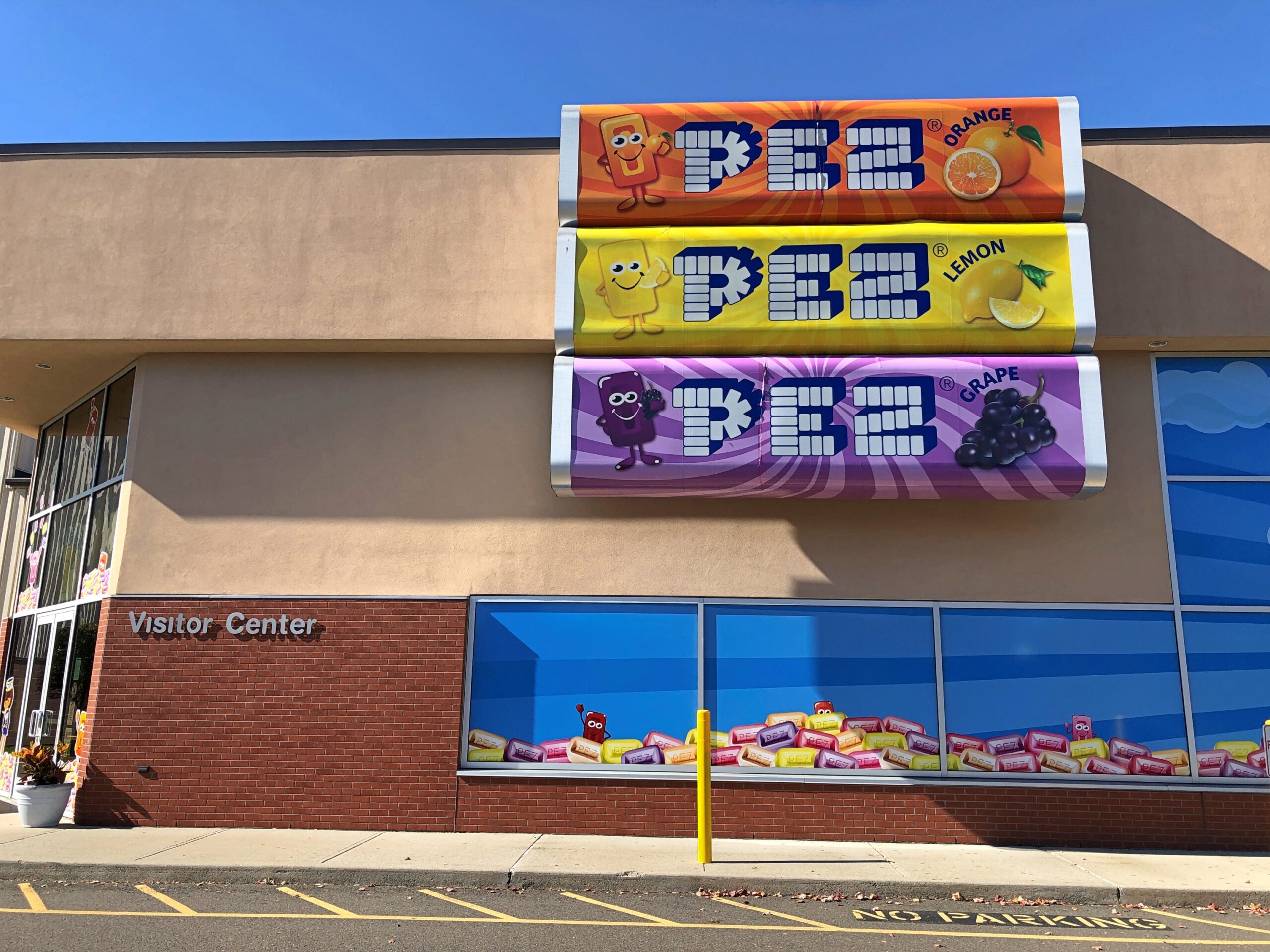
In Orange, Connecticut, I noticed a sign for the Pez Visitor Center. I had to see that.
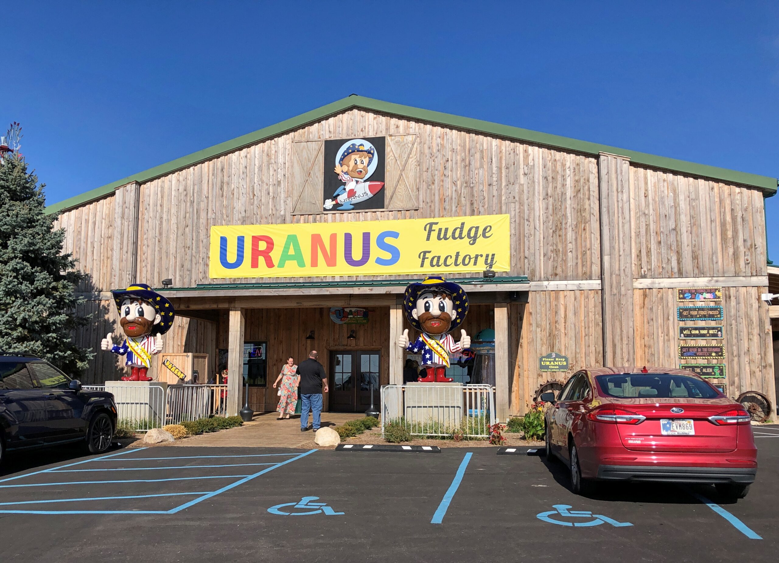
Earlier today, at the border between Ohio and Indiana, I noticed Uranus. I had to stop.
Turns out there’s more than one; I’d only ever seen the one in Missouri (the original) in passing, never stopping. But I did this time. Now I can say I’ve been to Uranus.
Driving down from the alpine wonders of Rocky Mountain National Park a couple of weeks ago on highway US 36, I realized we’d be passing through Boulder, Colorado. So during one of the moments of standstill traffic on that highway as it winds into Boulder — it’s a crowded road, especially on a weekend during warm weather — a thought occurred to me. More of a memory-thought, since it harkened back almost 50 years.
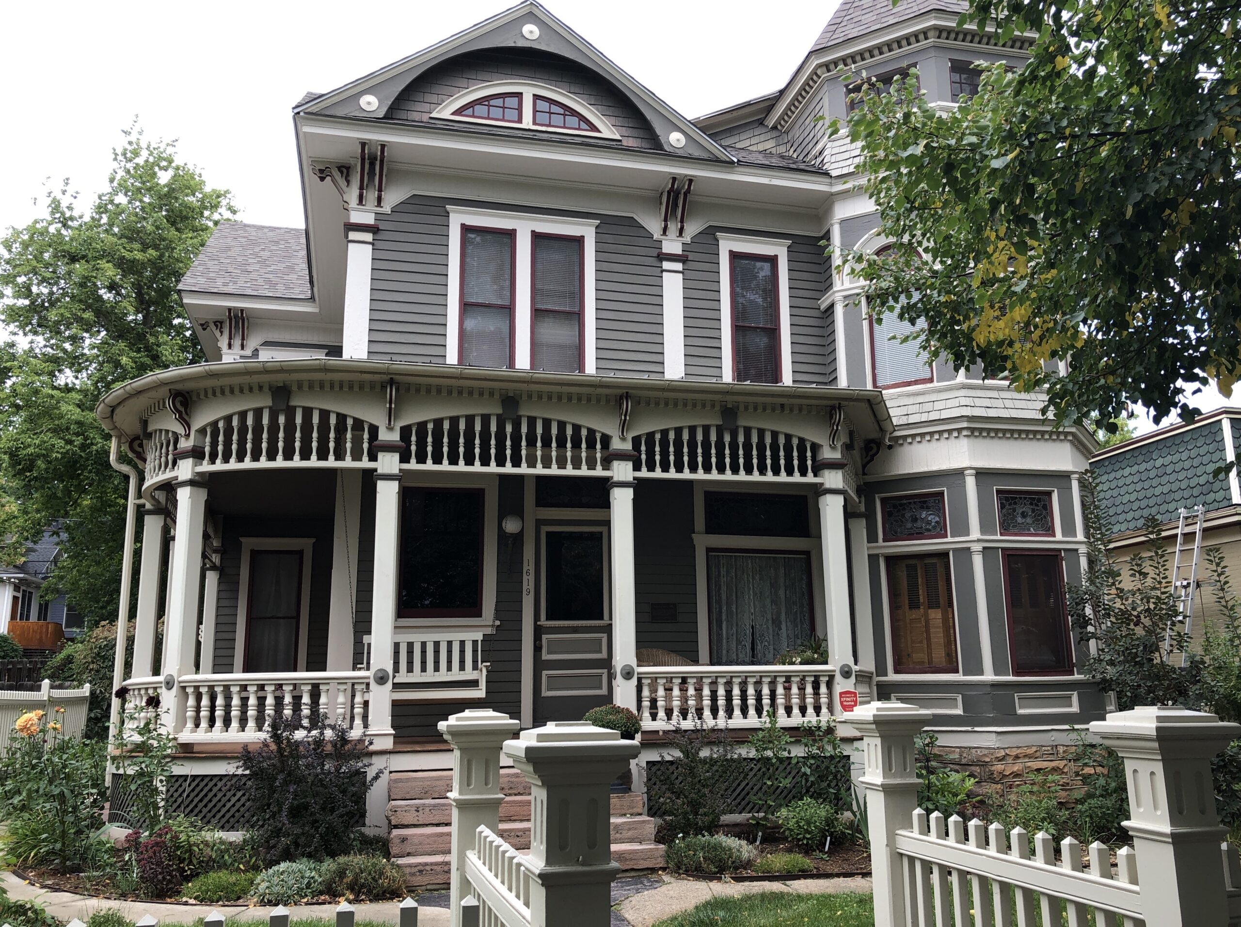
At zero mph, I had time to consult Google for more information. (Remarkably, the signal was strong.) Google Maps pinpointed the location I’d thought of, on a leafy street in Boulder. That day I expended some tourist energy, of which I don’t have quite as much as I used to, to find Mork’s house.
That is, the house used in establishing shots in Mork & Mindy to show their home, since the show was set in Boulder. I know I’d seen Boulder on maps. Funny name, I thought as a kid. Really Big Rock City. It’s still a little funny. But other than as a spot on the map, the show was probably the first time I’d heard anything else about the place.
The passengers in my car, Yuriko and Emi, having grown up outside of the orbit of ’70s American sitcoms, didn’t particularly appreciate the place. At least not until I conveyed the information that the show made Robin Williams famous. He’s a known quantity. I read a bit about the house later, and there seems to be no consensus about whether the owner cares whether anyone stops by the take a picture. My guess would involving factoring in a dwindling number of people coming by. You know, because the show went off the air over 40 years ago.
Then again, if my U.S. travels have taught me nothing else, it’s that retirees are out being tourists. They have the time they didn’t used to, and currently are just the right age to take a peek at Mork’s house at 1619 Pine Street, which is easy enough to find. Even if, like me, their fondness for that show was lukewarm at best.
Boulder and Mork came early in the second leg of my three-legged, 4,498-mile drive, which seemed to kill that many bugs on the windshield and front hood and bumper. The house counted as merely one spot in a trip that took me through hundreds of places. I spend most of September on the road, heading west from Illinois early in the month along I-80 and smaller roads, especially Nebraska 2 through the Sandhills, and spending time in western Nebraska and its rocky outcroppings and in southeast Wyoming, before going to Denver. That would be the first leg. Which, I’m very happy to say, included a good look at Carhenge.
Yuriko flew to Denver on the last of the points I got from SWA for the Christmastime FUBAR a few years ago and we met there. (New motto for the airline: Now We’re Just Another Airline!) After an overnight jaunt to Rocky Mountain NP in the company of our friend Emi, the two of us then spent more than a week taking a clockwise circle-(like) course — a lasso, you might call it, a straight line connected to a loop — from Denver to Colorado Springs to Pueblo to Walsenburg to Alamosa to (coming down from Wolf Creek Pass) Pagosa Springs to Durango to Silverton to Ouray to Montrose to Salida and back to Denver, where Yuriko flew home. That was the second leg. The drives were varied and gorgeous.
You’d think that would be enough, but I had to drive home, loosely following I-70 this time, making my way from Colorado through Kansas, Missouri and Illinois, and making a number of stops, big and small, such as Kit Carson, Colorado; Abilene, Kansas; and Kansas City, Missouri, for a third and final leg. No single small road took me through Kansas, but a series of them did, some as empty as, well, eastern Colorado and western Kansas. That’s some fine driving. Mountains are great, but after a week or so of their twisty ups and downs on two lanes, flat is all right. More relaxing, even.
For reasons that will soon be obvious, not long ago I looked up 2024 visitation statistics for the four national parks in Colorado: Rocky Mountain, Mesa Verde, Great Sand Dunes, and Black Canyon of the Gunnison.
Far and away the top national park draw in Colorado is Rocky Mountain NP, which received 4.2 million people last year, according to the NPS. In fact, it’s a top ten among most-visited U.S. parks. That isn’t so much of a surprise, considering the monster population that lives nearby in greater Denver and other parts of the Front Range. Indeed, for a lot of people, RMNP is easily a day trip.
That isn’t true for the other three national parks, but even so I was surprised to learn how few people actually visit any of them. They aren’t that remote. We aren’t talking Gates of the Arctic NP or American Samoa NP remote. Still, out of the 63 current U.S. national parks, last year Mesa Verde ranked 41st, Great Sand Dunes 44th, and Black Canyon 49th. The three of them combined saw only about 30 percent as many visitors as Rocky Mountain in 2024.
We set out to see all four of the national parks in Colorado. And we did. You could call it a national park trip, along the lines of the one a few years ago mostly on the Colorado Plateau. But the parks were only a framework, never the total picture, over mountains and across plains. We saw a lot else besides, such a male bear outside our window about 10 miles north of Durango, a female in a tall nearby pine snarling at him, and cubs higher up in the tree. More detail to come on that, in the fullness of time.
Rocky Mountain NP is an exercise in rising above the tree line, by vehicle but also on foot, up a path, into to a satisfying exhaustion before majestic mountains. The pale sand dunes of the Great Sand Dunes NP rise from a valley and back up against a mountain range, as if a giant broom swept it off to corner, and for visitors amounts to a giant sand box. Mesa Verde NP, where the stone dwellings of the Ancient Ones are tucked away in steep stone canyons, shows how much effort people will put into making a home for themselves. Black Canyon of the Gunnison NP is a scenic great unknown, a great dark crack in the earth that reminds you that gravity is in charge, its ragged cliff edges rife with opportunities to die for an Instagram image.
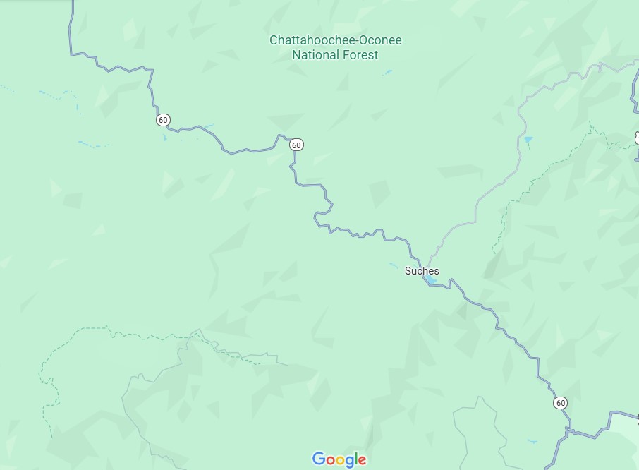
Clear skies, little traffic, good curves. I recommend driving on the two-lane Georgia 60 highway through the Chattahoochee National Forest under those conditions as certified car commercial driving. Considering all the hours of your life spent stewing in a traffic jam, it’s the kind of driving that makes you forget all of them.
Wish there had been a song on the radio to add to the driving experience — there was little but static — but that would just be icing on the cake anyway. Actually, not even that: it would be a little whip cream on a cake that already has some fine icing. To torture that analogy a little further, the cake would be the sedimentary rock lifted and cracked and shaped by whatever else rocks do over millions of years, topped by the biomass – that is, an Appalachian forest.
The history of humans in the Chattahoochee is incredibly dark and eventful. A textbook case of raping the land, only somewhat recovered in our time, partly through the efforts of the can-do CCC.
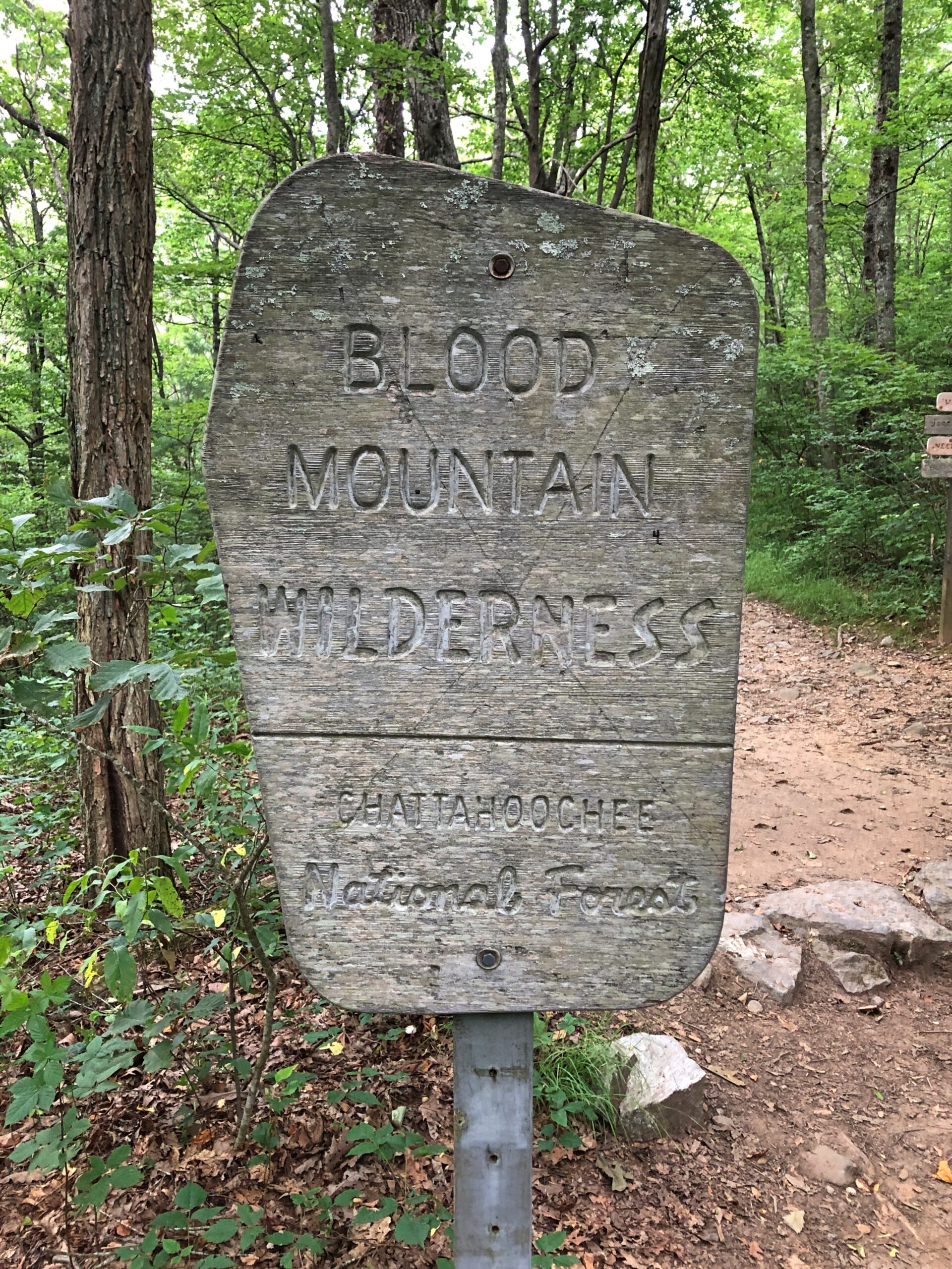
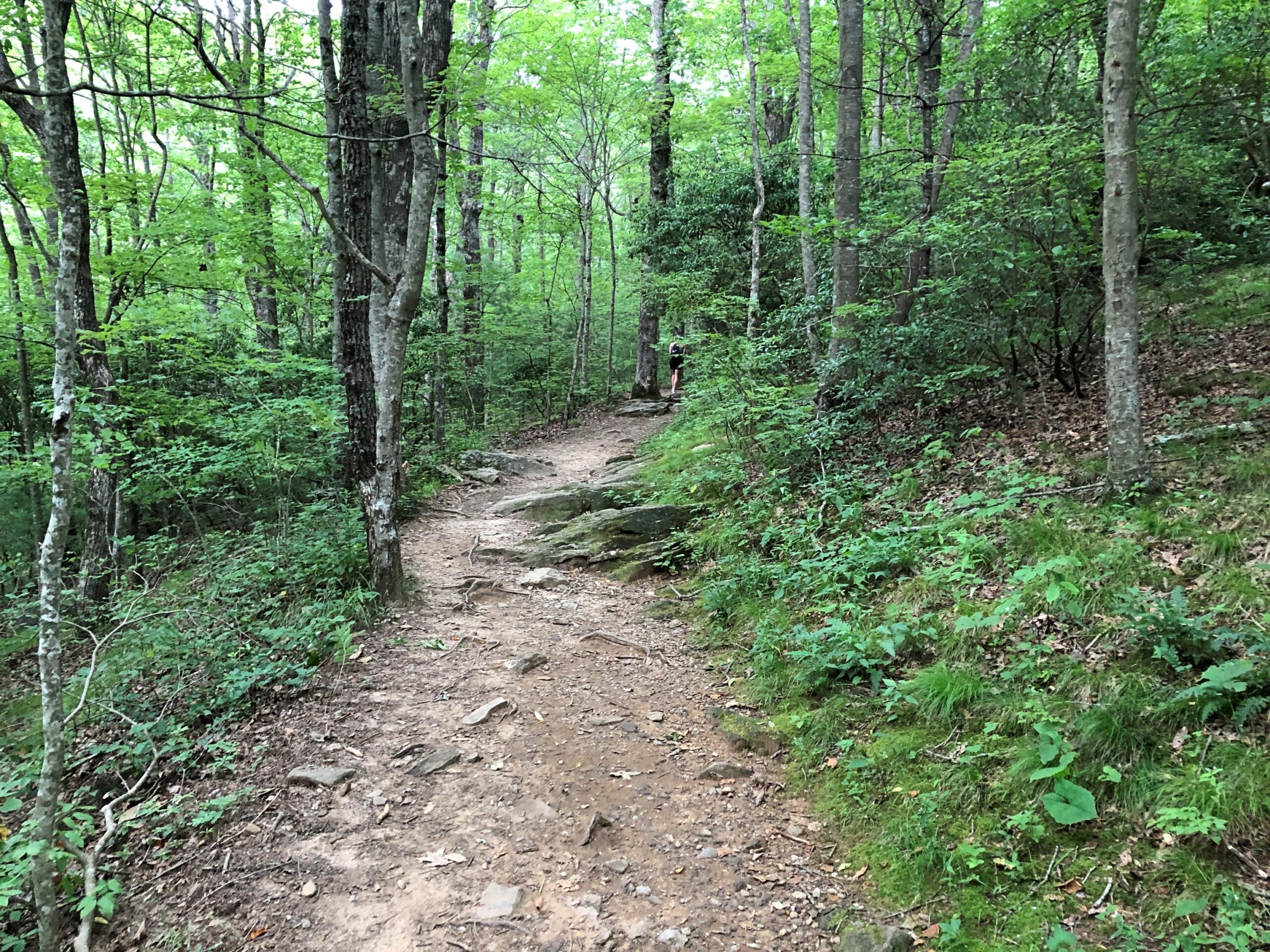
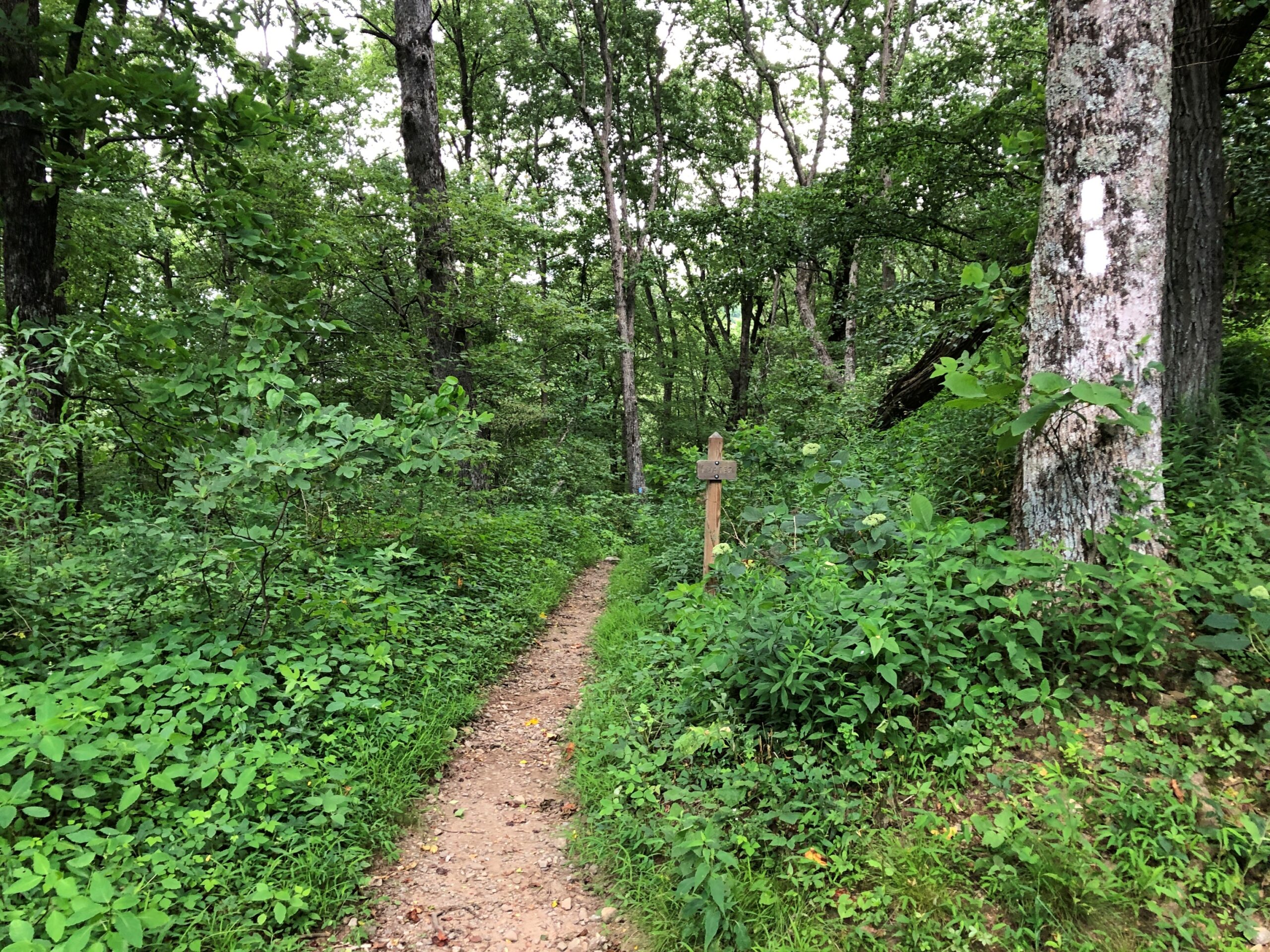
Besides the road itself, the works of man are fairly thin on the ground, literally. There is a hamlet called Suches (pop. 548), but not much else. The region has recovered enough to offer a trail through the Blood Mountain Wilderness, which crosses the highway at one point, where there is a small parking lot.
I wasn’t equipped for a hike, so I walked only a half-mile or so in, and then back. I don’t remember having to swat a single mosquito, which ups the quality of a walk right there.
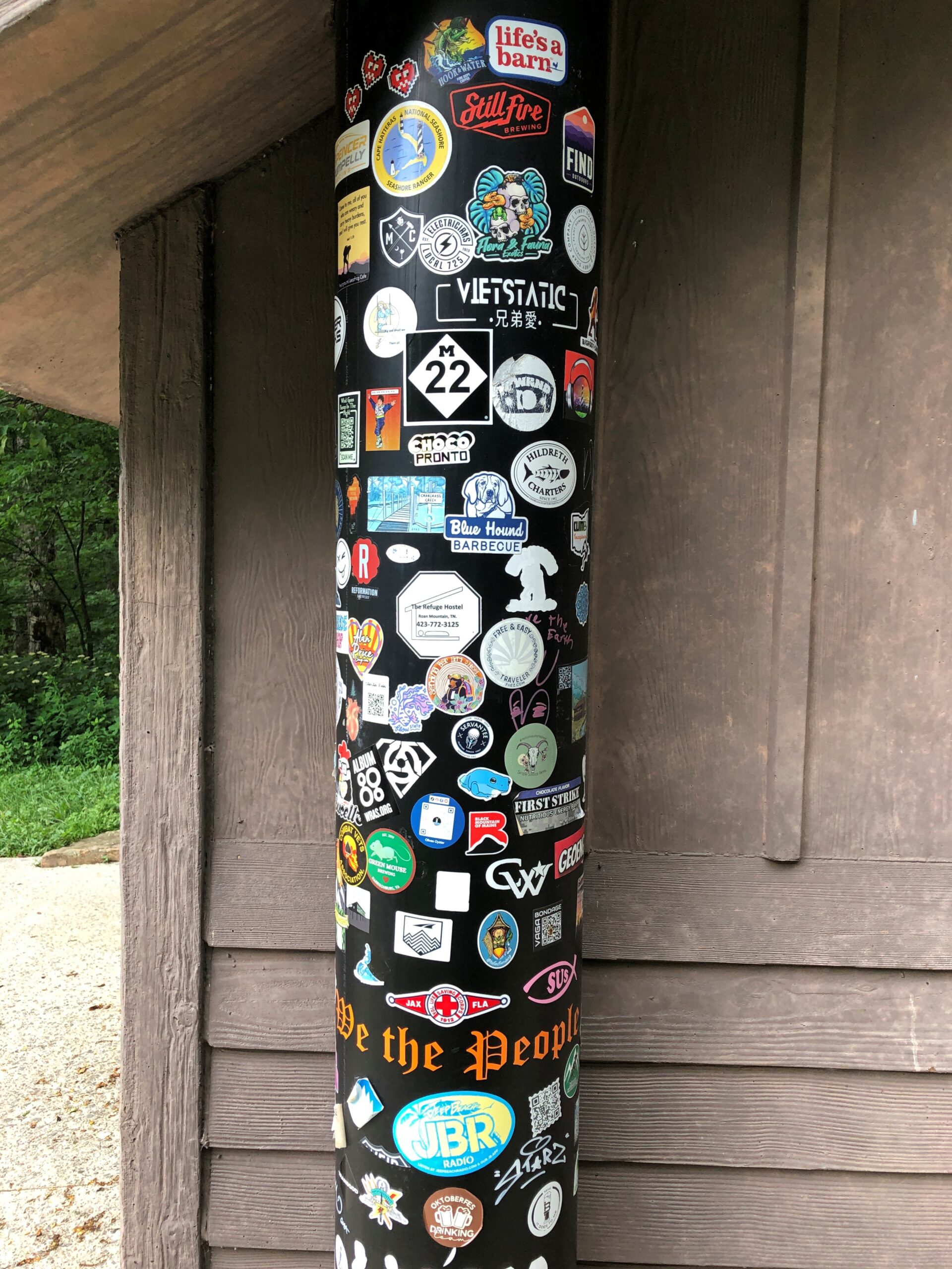
Next to the parking lot are pit toilets. Attached to the structure is a pipe, many times stickered by passersby. I didn’t see a Buc-ee’s sticker, but there could be one appearing anytime now. Good to see M-22 up in Michigan represented: that’s another fine stretch of car commercial driving.
Blood Mountain. There’s a Southern Gothic horror name for you. Or less seriously, the setting of a Scooby-Doo episode, one in which Shaggy, when he learns the name of the place, says “Zoinks! B-B-Blood Mountain?!?”
Before I take a long drive, I spend time with one or more of my highway atlases sketching a route – Rand McNally, National Geographic or Michelin. Sometimes I refer to highway department folding maps as well. Google Maps has its place, an important one, but it’s no substitute for the big-picture sweep of a paper map.
For the trip to the Carolinas earlier this summer, an atlas map made it easy to see the best way to cut across the state from Myrtle Beach to Columbia, where I planned to spend a night: US 378. As Wiki puts it, “the highway has a lengthy concurrency with US 76 between Columbia and Sumter and serves as a major route between the Midlands and the Myrtle Beach area.”
That is, from the flat damp lands along the coast through pines and the sites of long-ago rice plantations, on to modern crop lands, small sandy wooded rises, and into suburban Columbia. Small towns dot the route: Conway, Gresham, Hannah, Lake City, Turbeville, and Sumter, which is actually a small city (pop. about 43,800).
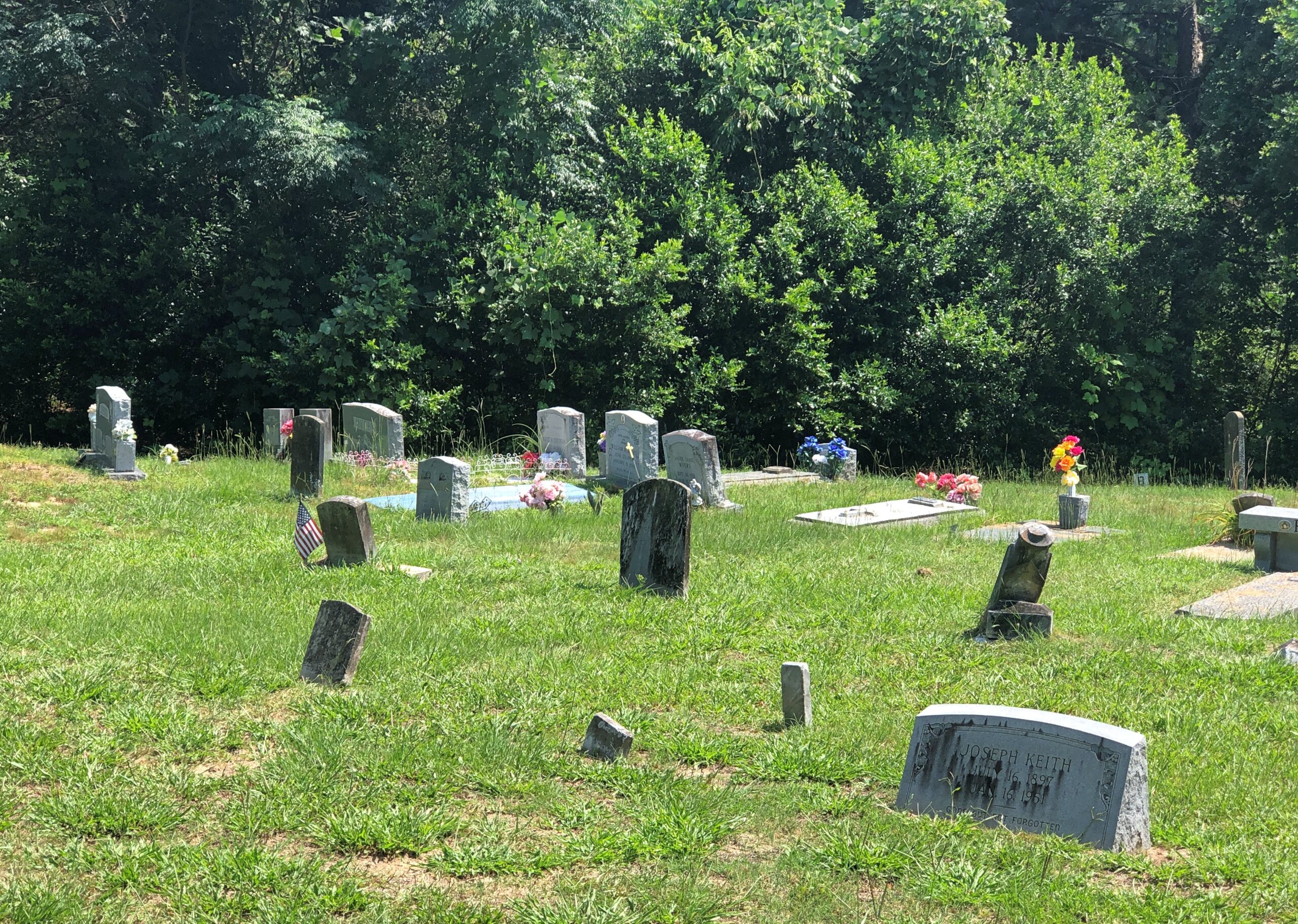
Not far west of Sumter on US 378, I noticed a point-of-interest sign suggesting a right turn. I don’t remember the exact wording, but the gist that I picked up instantly was historic church. My kind of sight, in other words. After only a few minutes on the side road (South Carolina 261, a.k.a. N. Kings Hwy.), a church and churchyard cemetery appeared.
This turned out to be the Wayman Chapel of the AME Church, which has its own graveyard.
A good many AME churches are named Wayman, after Bishop Alexander W. Wayman. Surely the place is historic in its own right, including as part of the wider history of the AME, but it wasn’t what I was looking for. I continued on, and without realizing it, had entered the High Hills of Santee, which sounds like an all around interesting place.
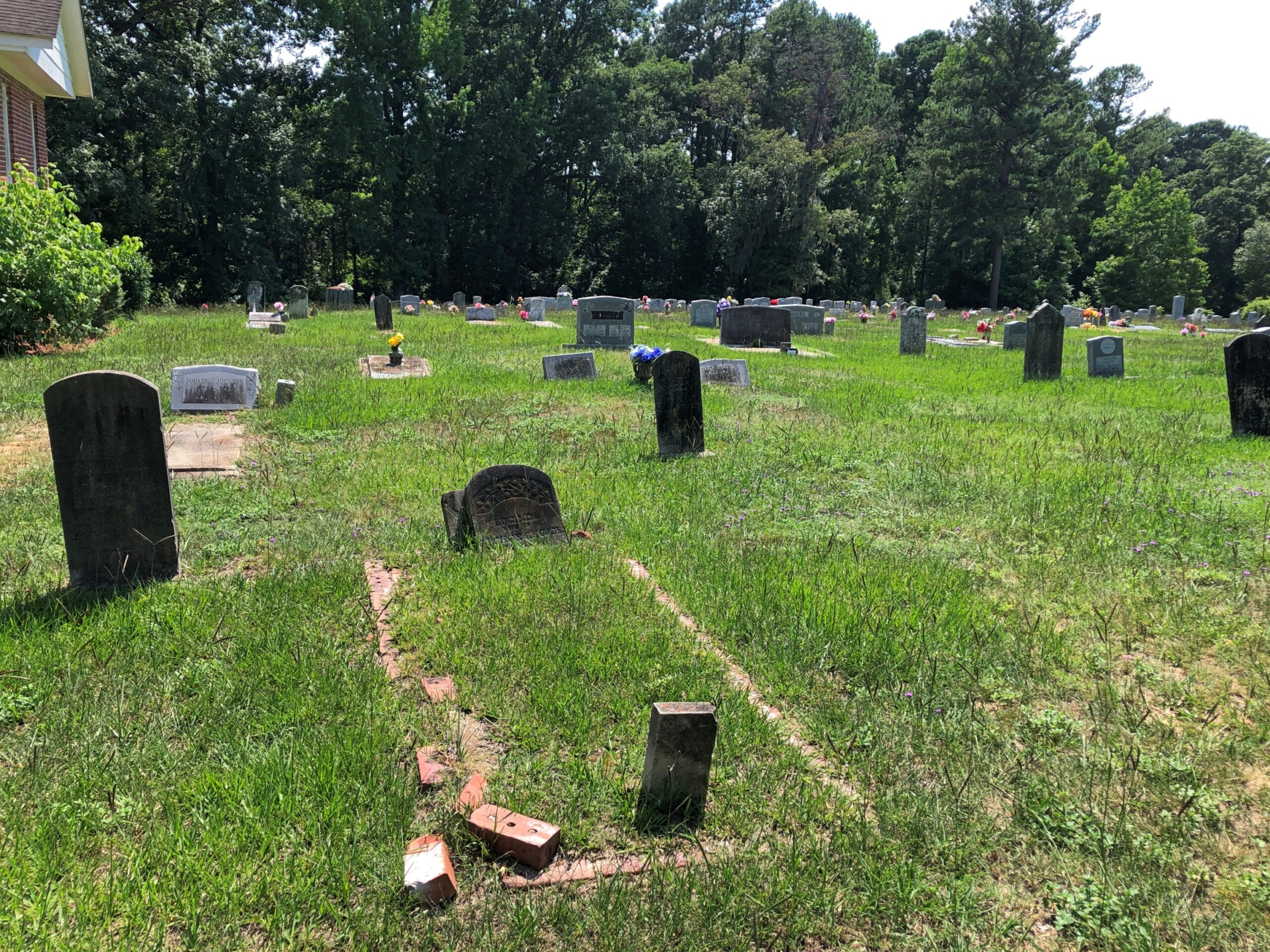
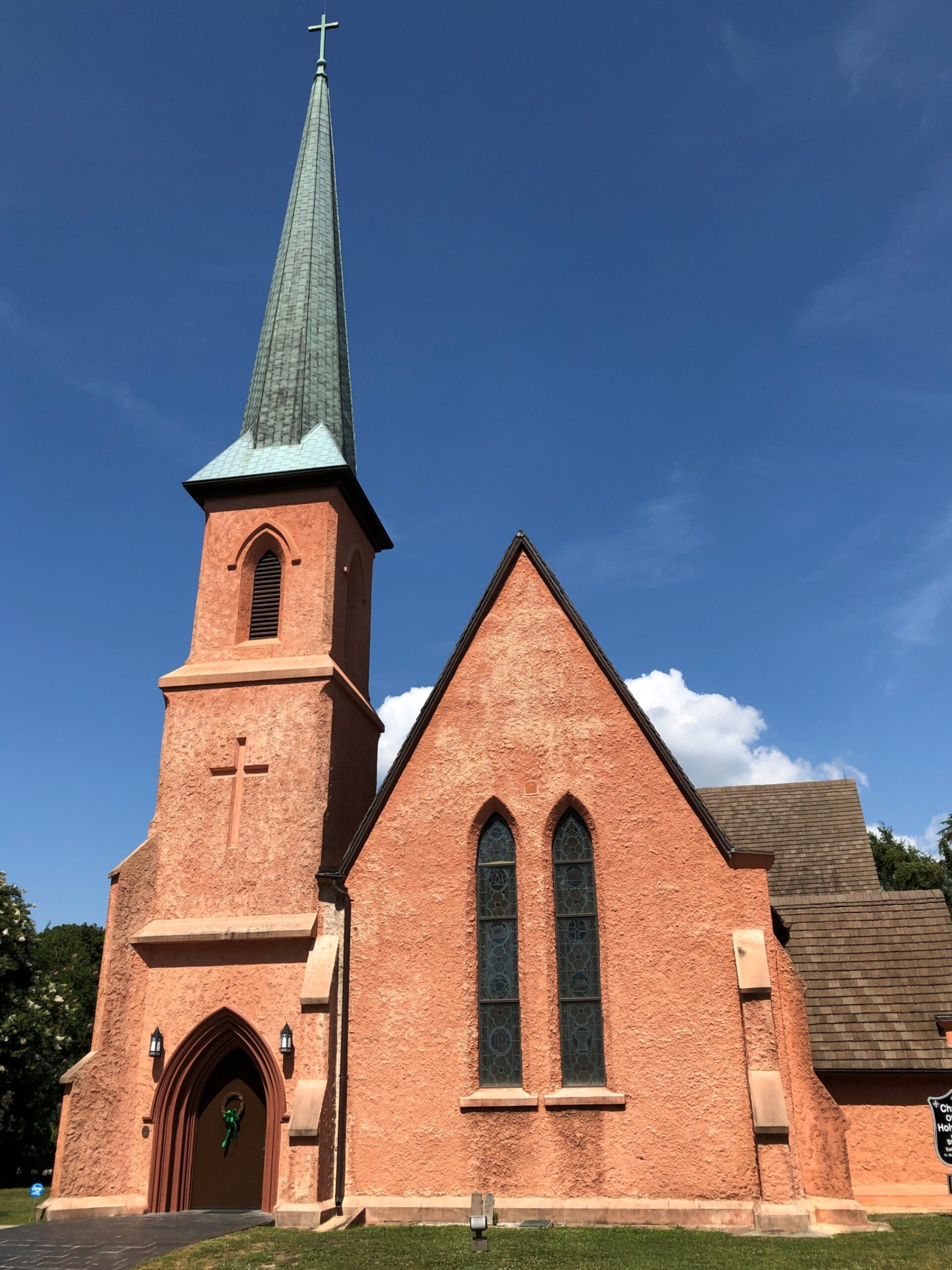
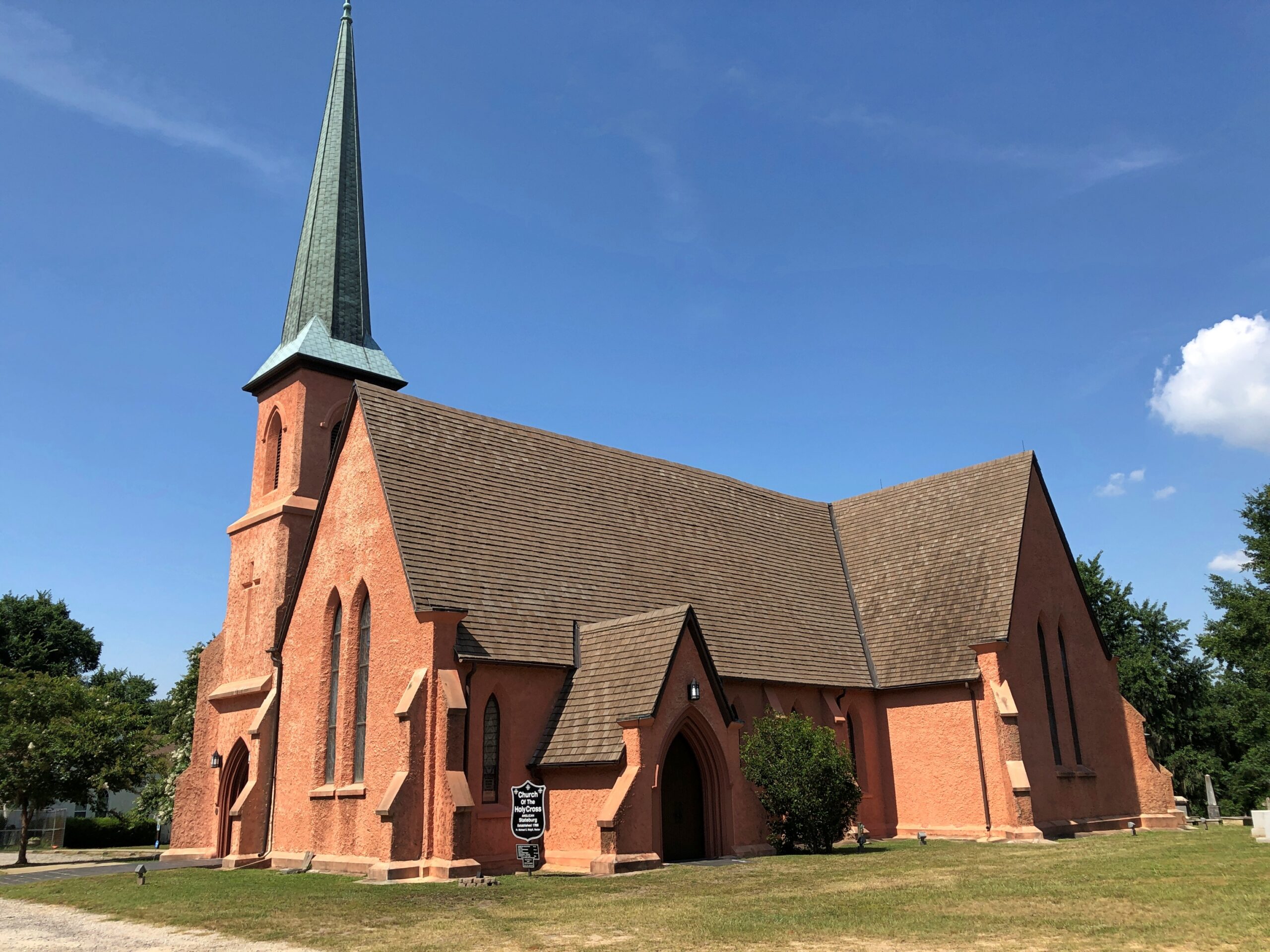
Had I realized that, I might have gone a little further down N. Kings Hwy., but serendipity on the road will only take you so far. In this case, not much further down the road, to the Church of the Holy Cross.
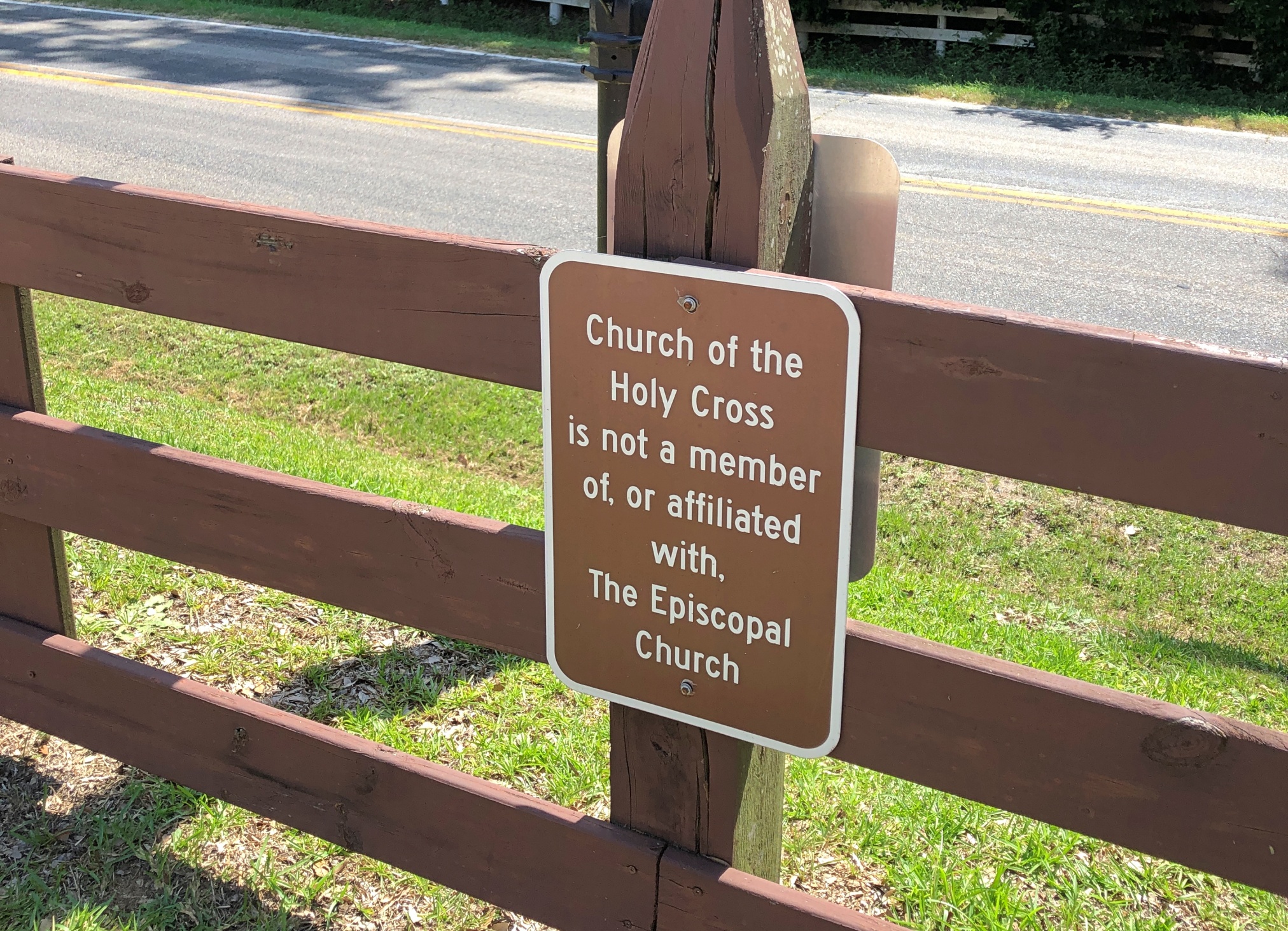
The church has a Stateburg address, but isn’t in town. For well over a century, it was an Episcopal church, but the current congregation wants one and all to know that it isn’t any more. A simple sign, but enough to carry a whiff of schism.
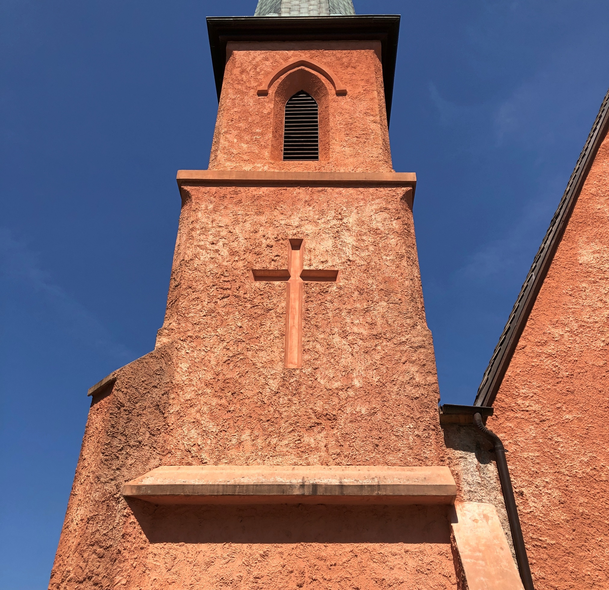
The design work was by Edward C. Jones, a busy architect, including designs at Magnolia Cemetery in Charleston. Not brick or the like, but rammed earth. I can’t say that I’d seen a rammed earth church before. It was completed in 1852.
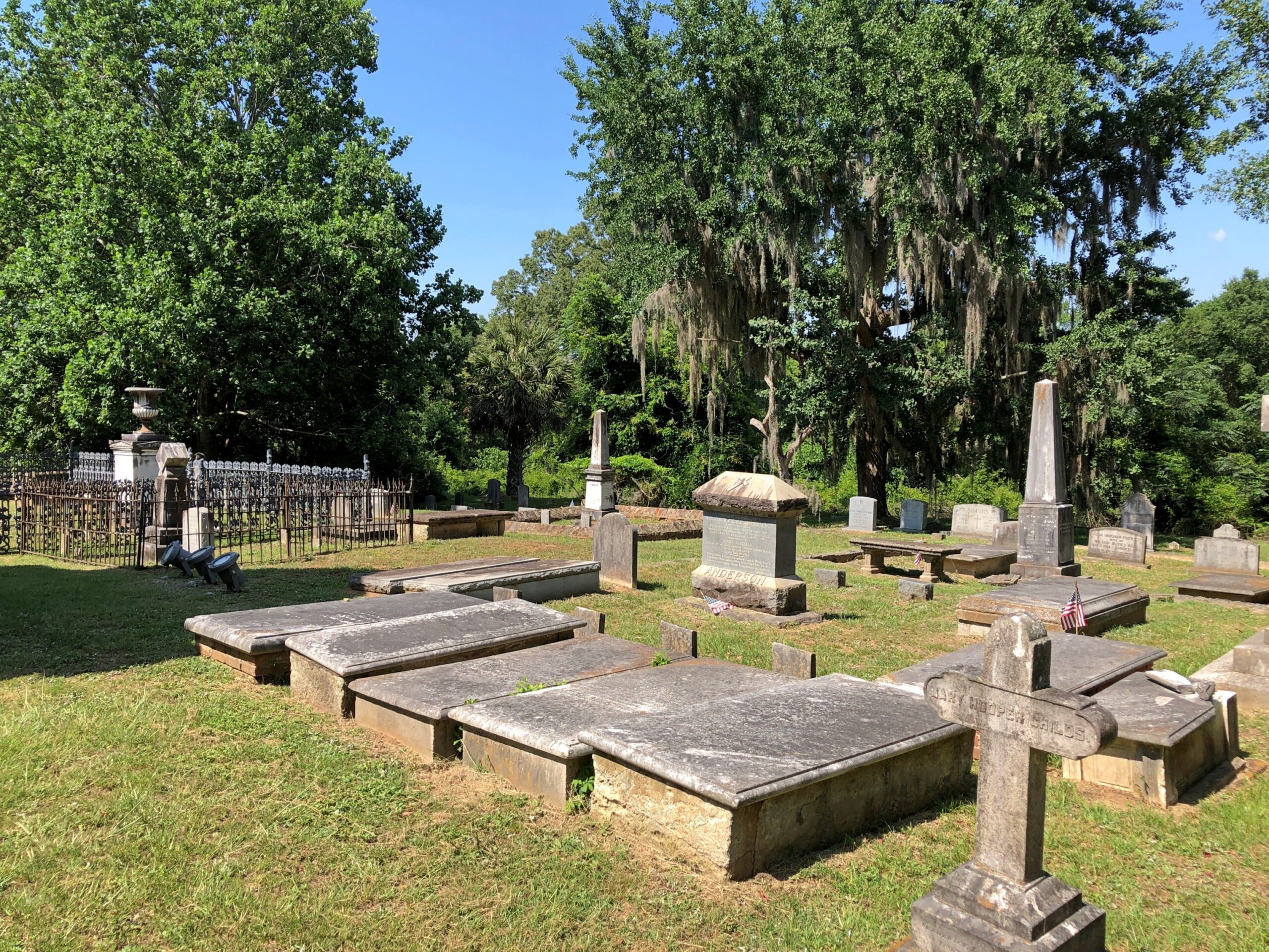
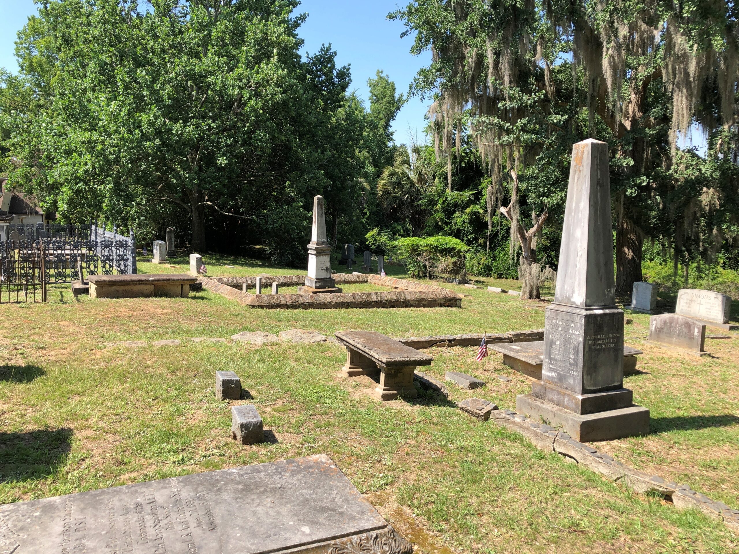
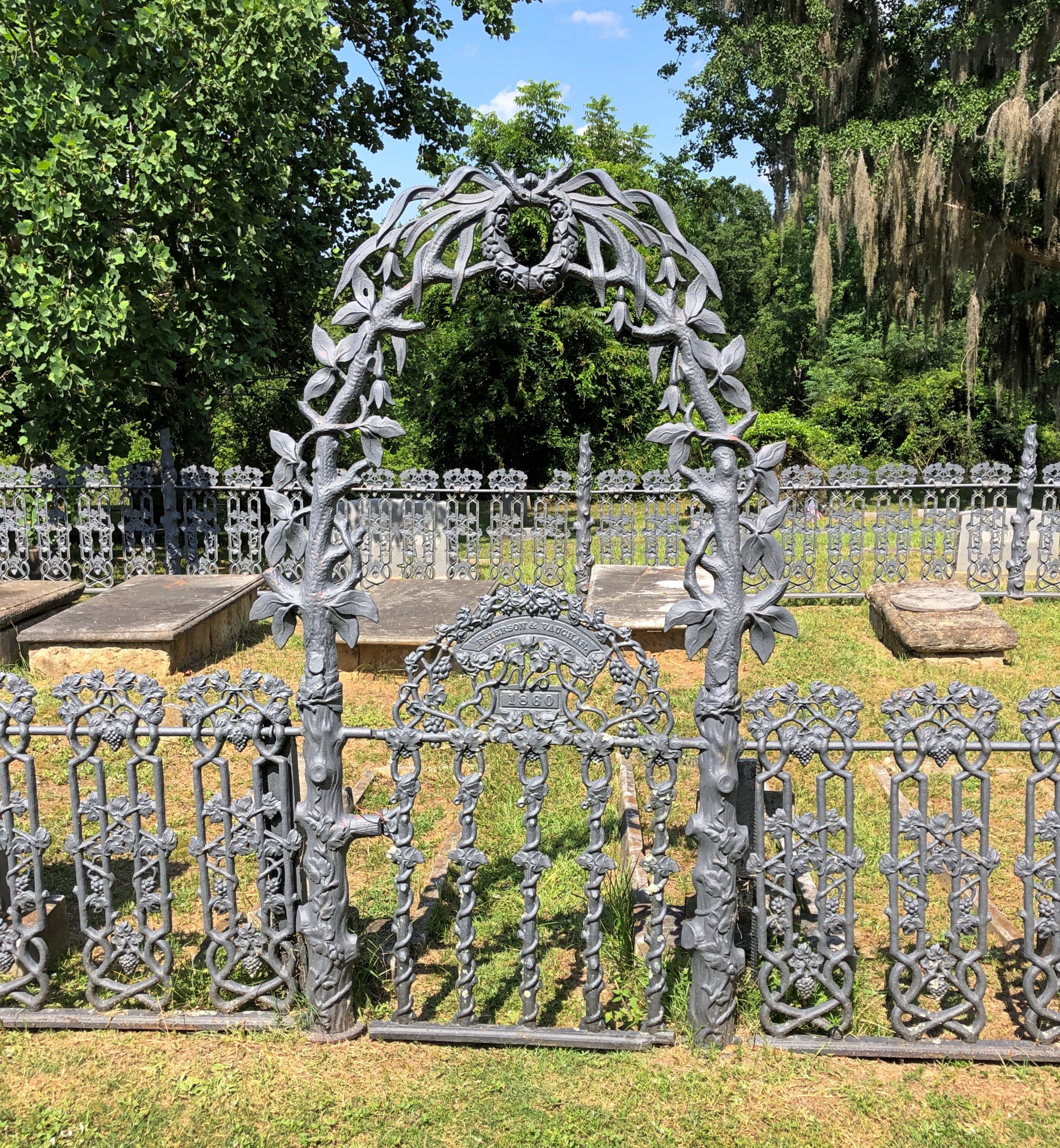
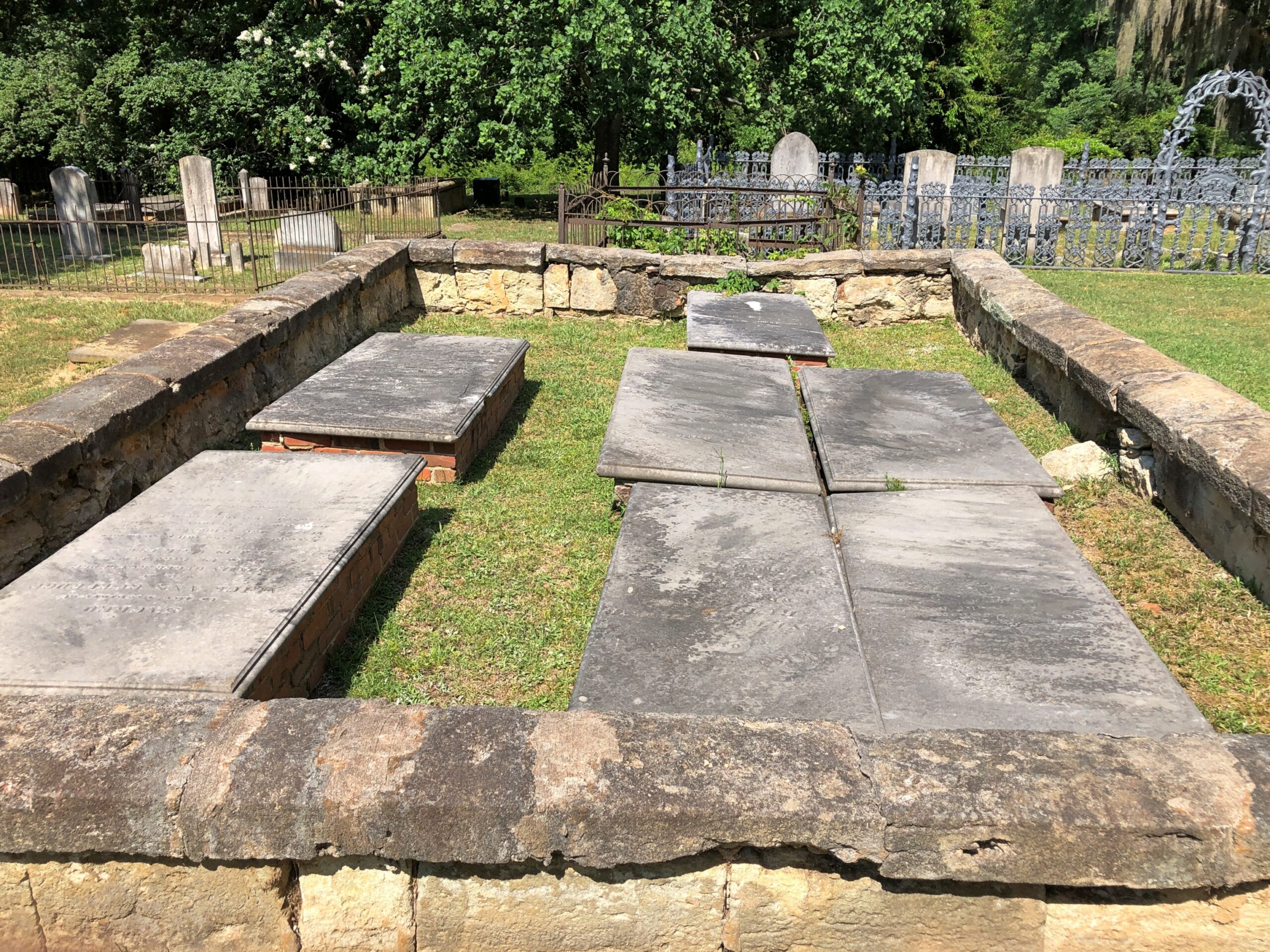
Extending some distance behind the church, which was closed, is a handsome cemetery.
Impressive ironwork and crumbling masonry. What’s not to like?
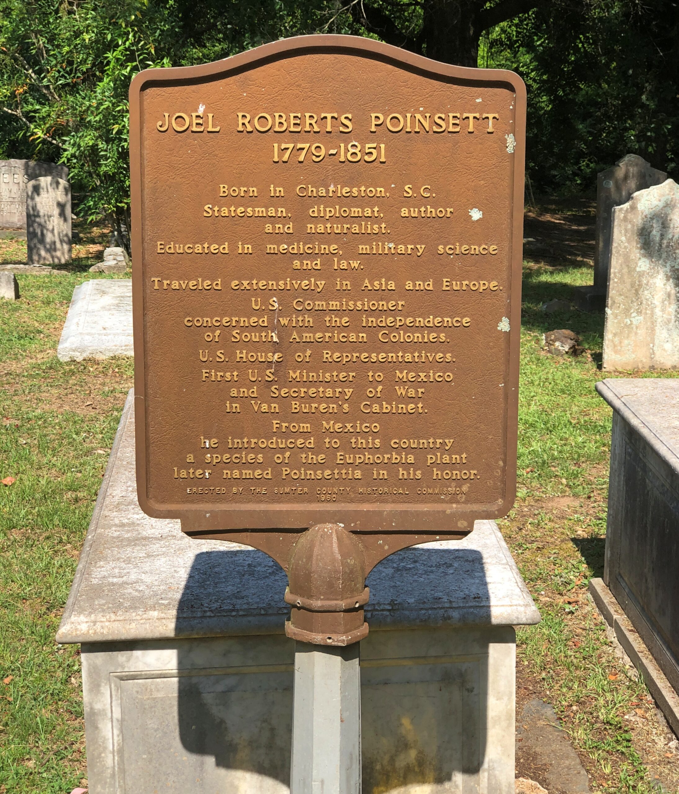
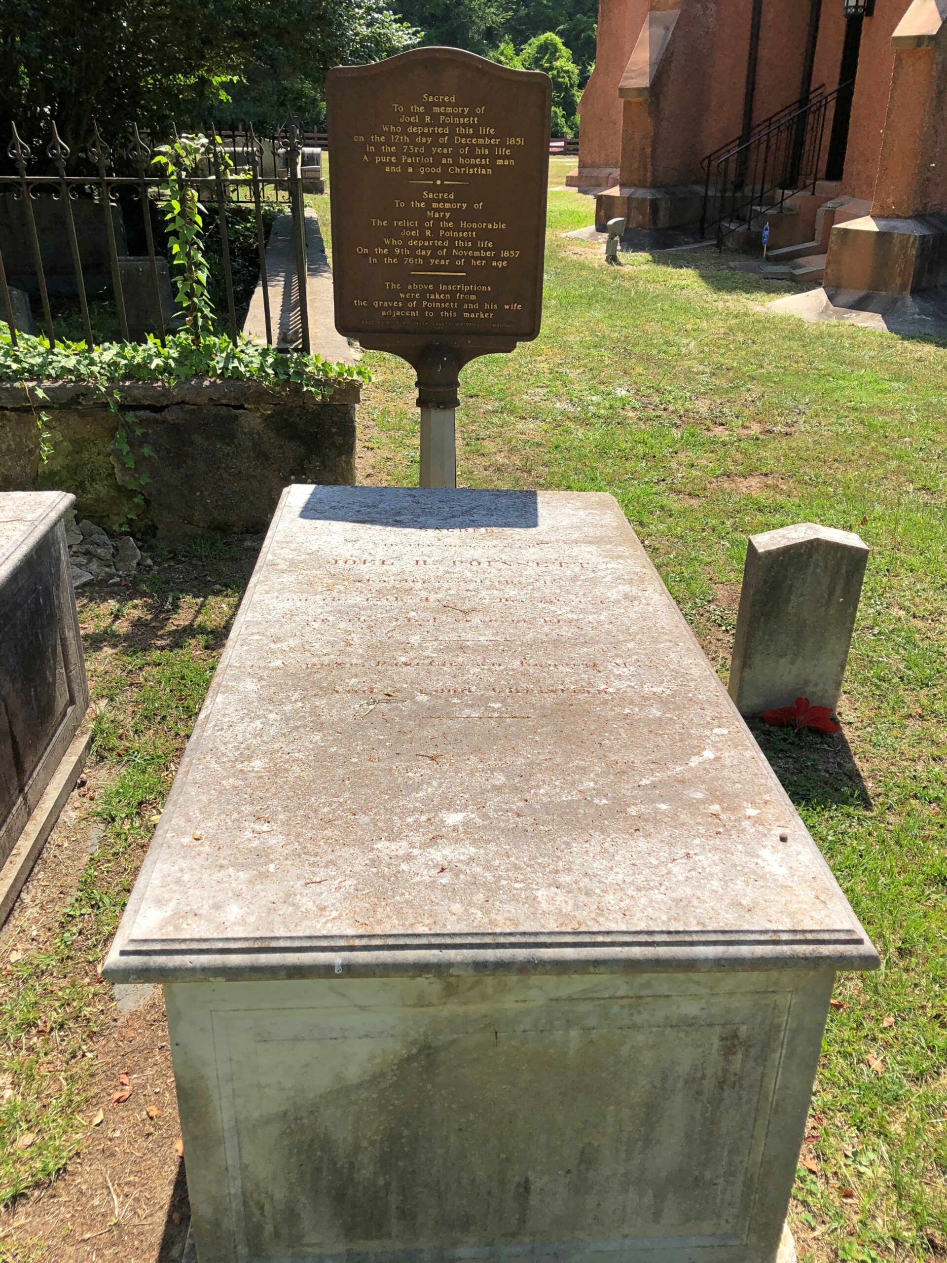
Another layer of serendipity: not only had I chanced across the church and the graveyard, but someone I’d heard of: Joel R. Poinsett, whose career was astonishingly varied, for good and ill, even for the freewheeling 19th century.
Almost everyone else has heard of him too, except they don’t know it, since of course the poinsettia is named for him. A casual search shows that were was a quixotic bubble of interest in the idea of re-naming the flower around the holidays in 2023, but not since, with such headlines as: “Poinsettia by any other name? Try ‘cuetlaxochitl’ or ‘Nochebuena’ “ (Jacksonville Journal-Courier).
Cuetlaxochitl? Names do shift over time, for unpredictable reasons, but I’m not betting on that one entering common usage anytime soon.
Maybe I should have looked at something like this before driving between Knoxville and Charlotte last month.
Note the array of Construction Zone markers along I-40. Turns out travelers are lucky to be able to drive the road at all, considering that Hurricane Helene last year did so much damage that the highway – an Interstate of considerable importance regionally – was closed for five months, only reopening on March 1.
Reopening as a two-lane road, with each lane bounded on the outside by those concrete barriers you never want to see when driving. Separating the lanes is what amounts to a curb, painted yellow. This goes on for about 12 miles, as reconstruction work goes on. That isn’t a long stretch of road under normal conditions, but when you’re between barriers, behind a truck and in front of a truck, with traffic (many trucks) coming the other way just on the other side of a yellow curb, and little margin for error on anyone’s part, your reaction as a driver is going to be: when will this end?
That was my reaction, anyway. Had some nice drives on this trip. Western North Carolina I-40 wasn’t one of them.
“The hurricane washed away about 3 million cubic yards of dirt, rock and material from the side of I-40,” NCDOT reported. I’m having trouble visualizing a million cubic yards, much less three, but I’m sure it was a staggering amount.
“The stabilization process involved driving steel rods into the bedrock, filling the rods with grout, applying a metal screen then sprayable concrete to the face of the walls. There were four different rigs operating at the same time.
“Crews installed 90,000 square feet of soil-nail walls across the 10 different damage locations in less than 130 days. They also drilled nearly 2,100 feet of nails and fortified 4 miles of the shoulder for truck traffic.”
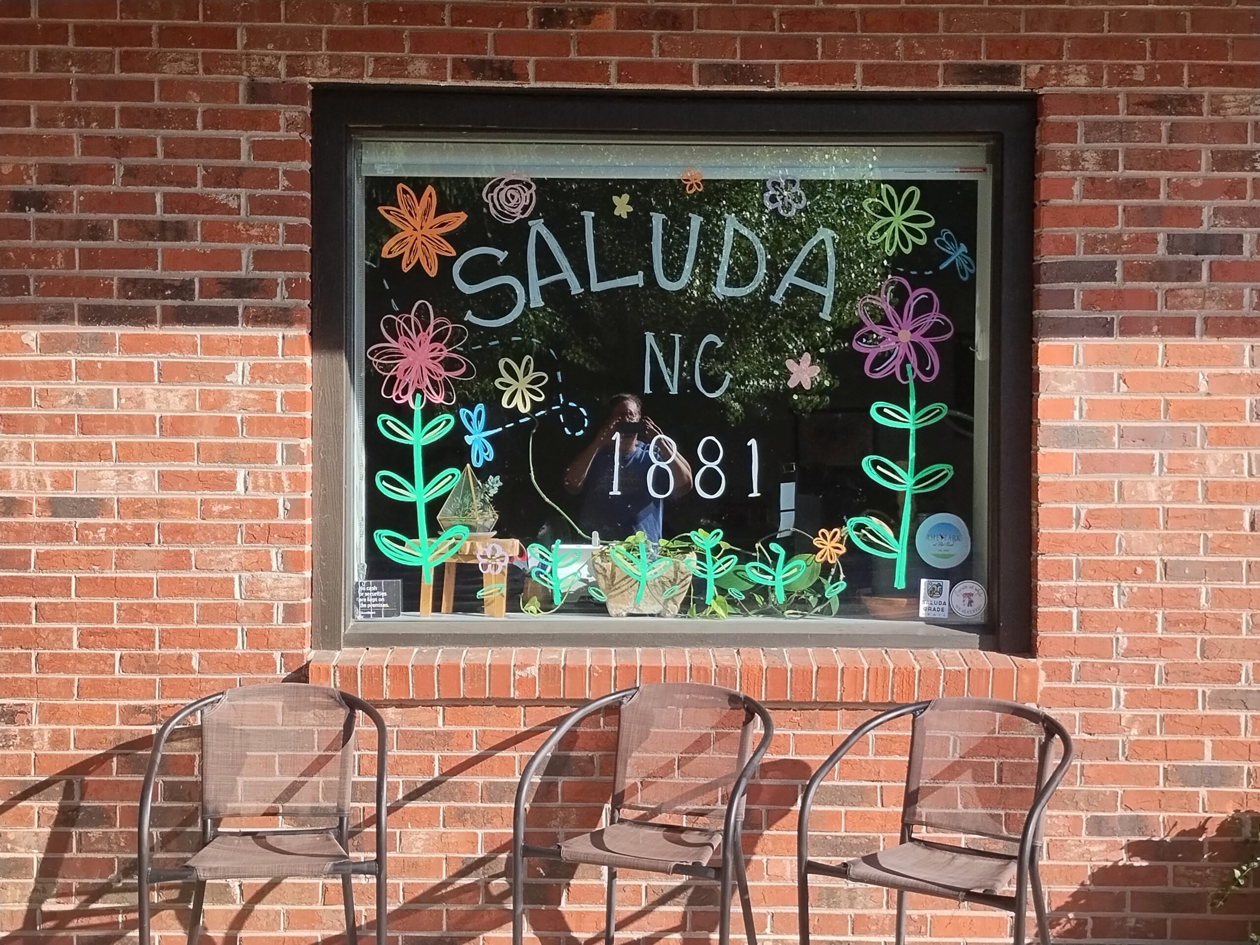
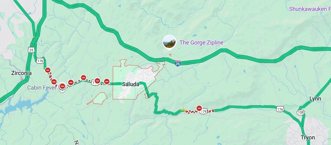
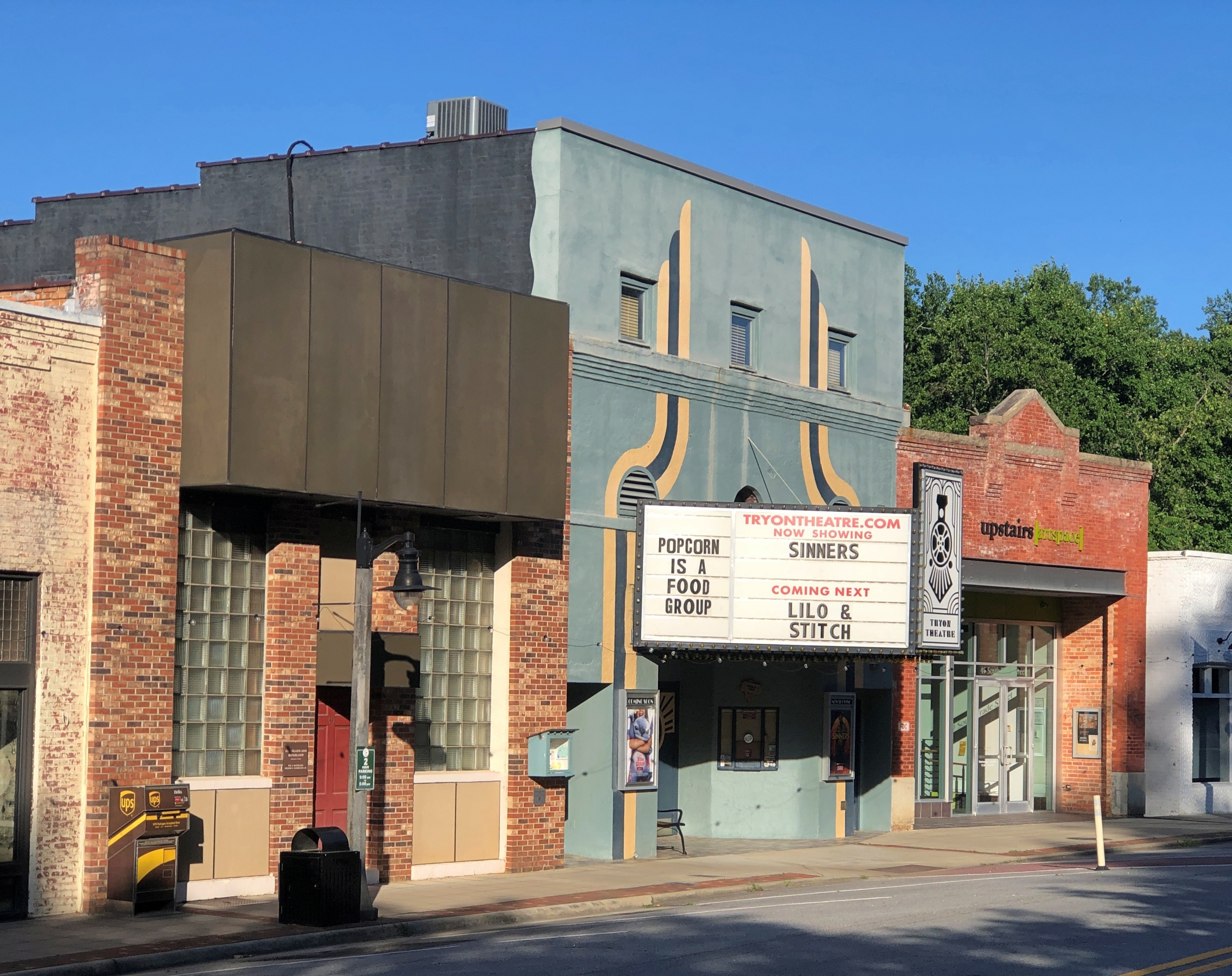
My goal for the afternoon had been to take I-40 from Knoxville to Asheville and then I-26 south to its junction with South Carolina 11, which is Cherokee Foothills Scenic Highway, and take that road east. I’d been advised that the town of Saluda, NC, on US 167, was a pleasant place to stop, and it was, though most of the shops were closed by the time I got there.
I had the idea that I would drive US 176 to the next town, Tryon, NC. Oops, no. Road closed. Maybe the hurricane did that as well.
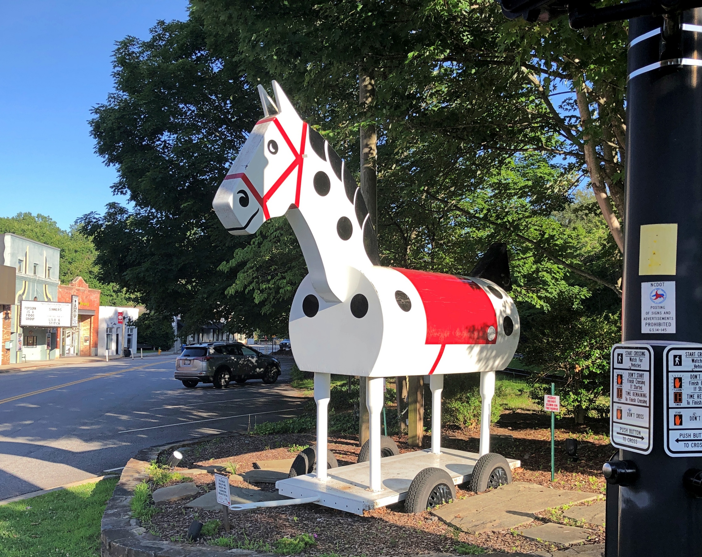
So I got back on I-26 and went to the Tryon exit. I didn’t have any idea what to expect in Tryon, certainly not the Tryon Horse, which is a large toy horse on wheels. It stands on US 176, known as South Trade St. at that point. This is the fifth iteration of the horse in nearly 100 years.
“[The first Tryon Horse] was originally designed as an advertisement for the first horse show held in Tryon at Harmon Field in 1928,” says the Tryon History Museum. “It came from a drawing done by Eleanor Vance, based on an idea from Romaine Stone, who was active in the Tryon Riding and Hunt Club, and from then seventeen-year-old master builder Meredith Lankford.
“The Tryon Horse was built in the basement of Miss Vance and Miss Yale’s house by Meredith Lankford and Odell Peeler and was assembled in the driveway… The Tryon Horse… was brought out for future horse shows and parades, and was stored in the Paper Box Factory located on Depot Street. Unfortunately, the first horse was destroyed when the factory burned in the 1930s.”
It was no accident that the talent was available locally in the 1920s to build such a thing. At the time, Tryon was noted for a company that made toys, especially high-end wooden toys.
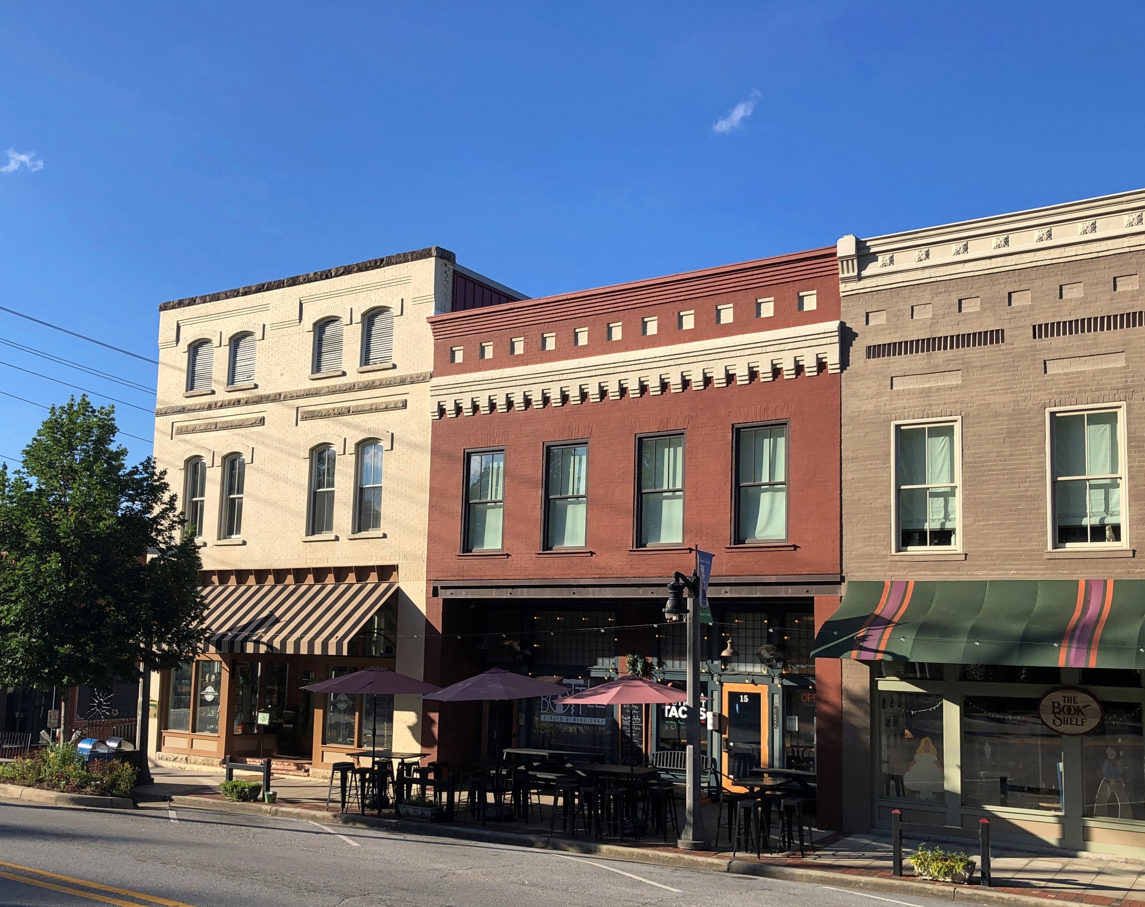
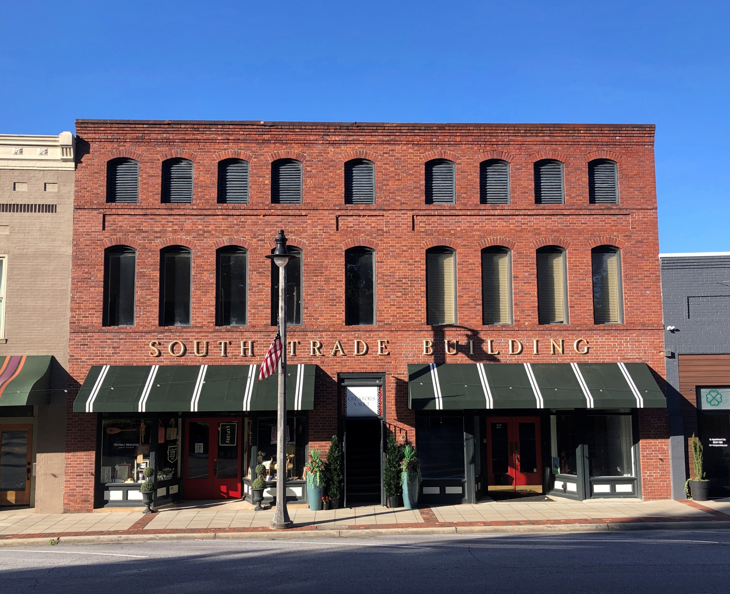
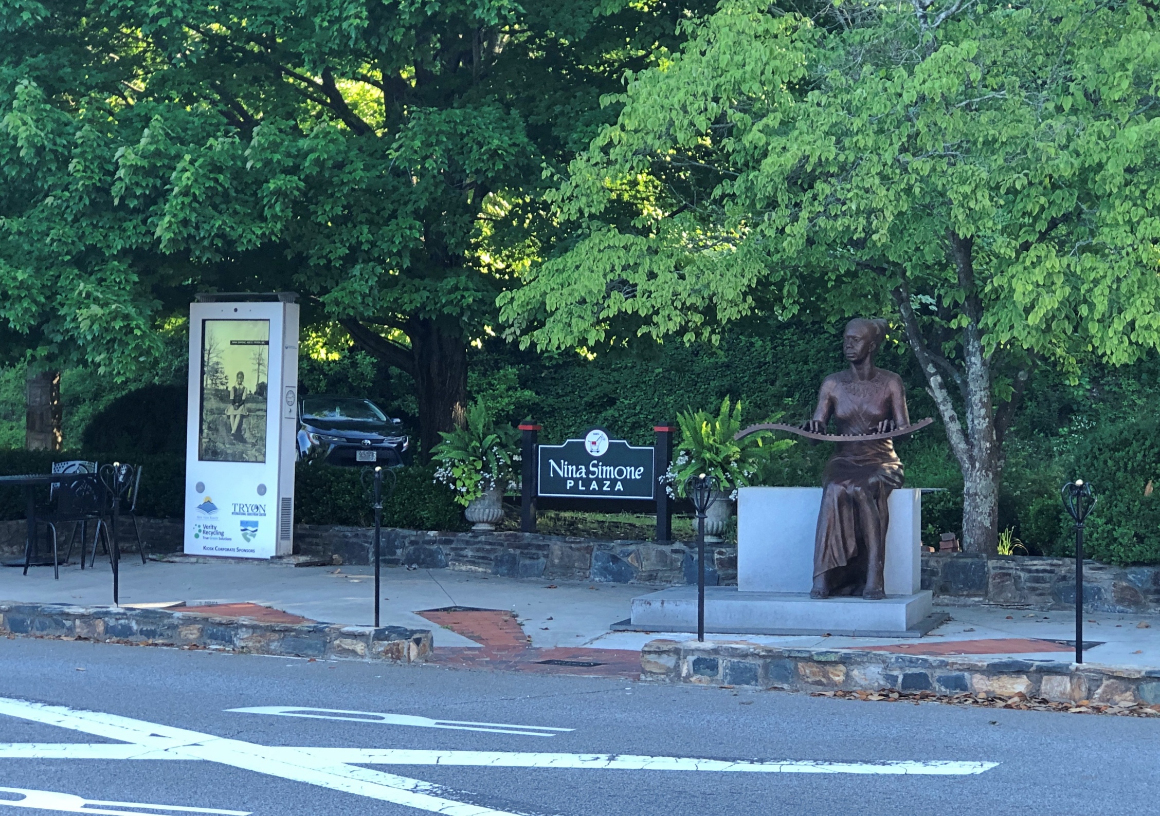
South Trade St. is a handsome thoroughfare, populated by older buildings developed to support trade.
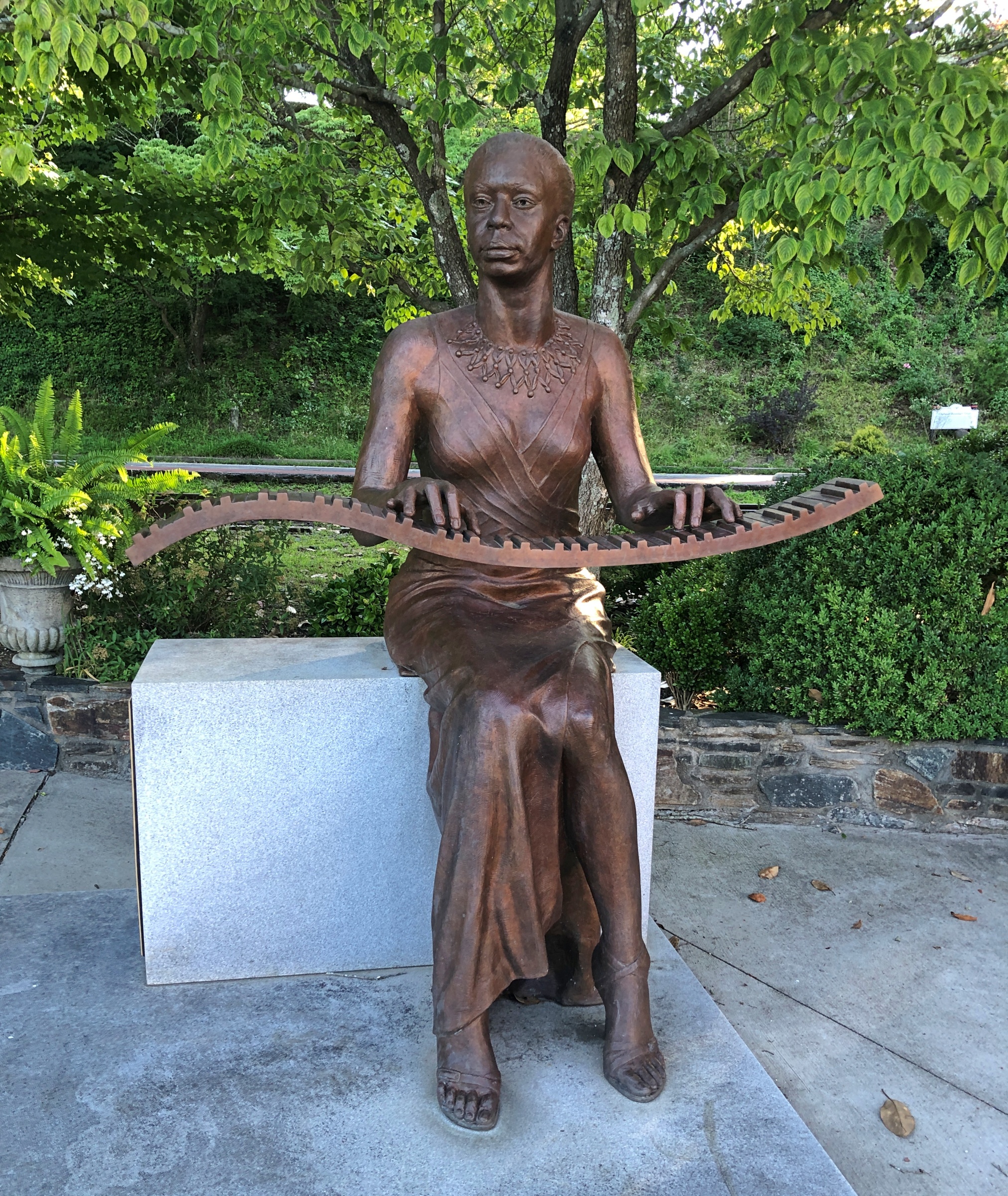
Something else I didn’t expect on the street: Nina Simone Plaza.
Complete with a bronze of the musician and activist, who grew up in Tryon, and who no doubt got out as soon as her talents allowed. She died in 2003; the statue was dedicated in 2017.
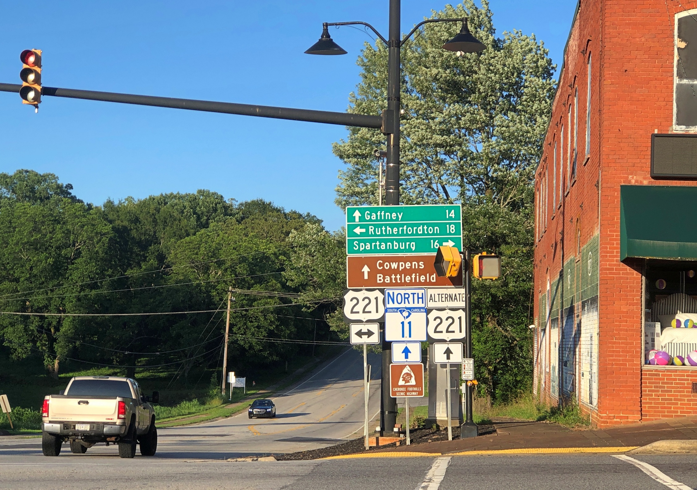
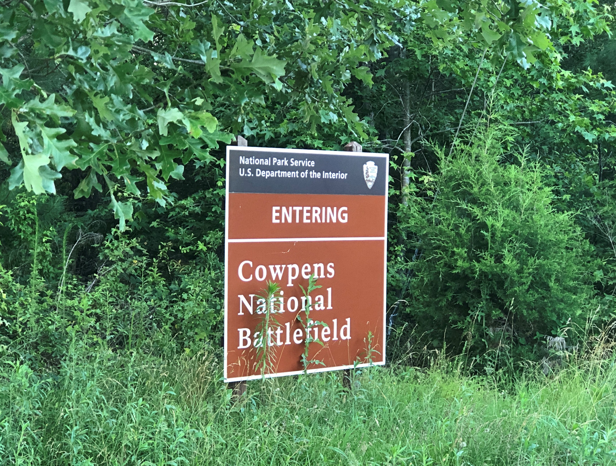
Later in the day, I eventually made it to South Carolina 11 at Campobello, SC, and drove east to its end for 50 miles or so to Gaffney, SC. I’d intended to visit Cowpens National Battlefieldalong the way.
No dice. The main entrance to Cowpens was closed by the time I arrived. I understand closing the visitors center at the end of the day, but the entire place? A mile or so east on SC 11 was an alternate entrance, so I stopped there.
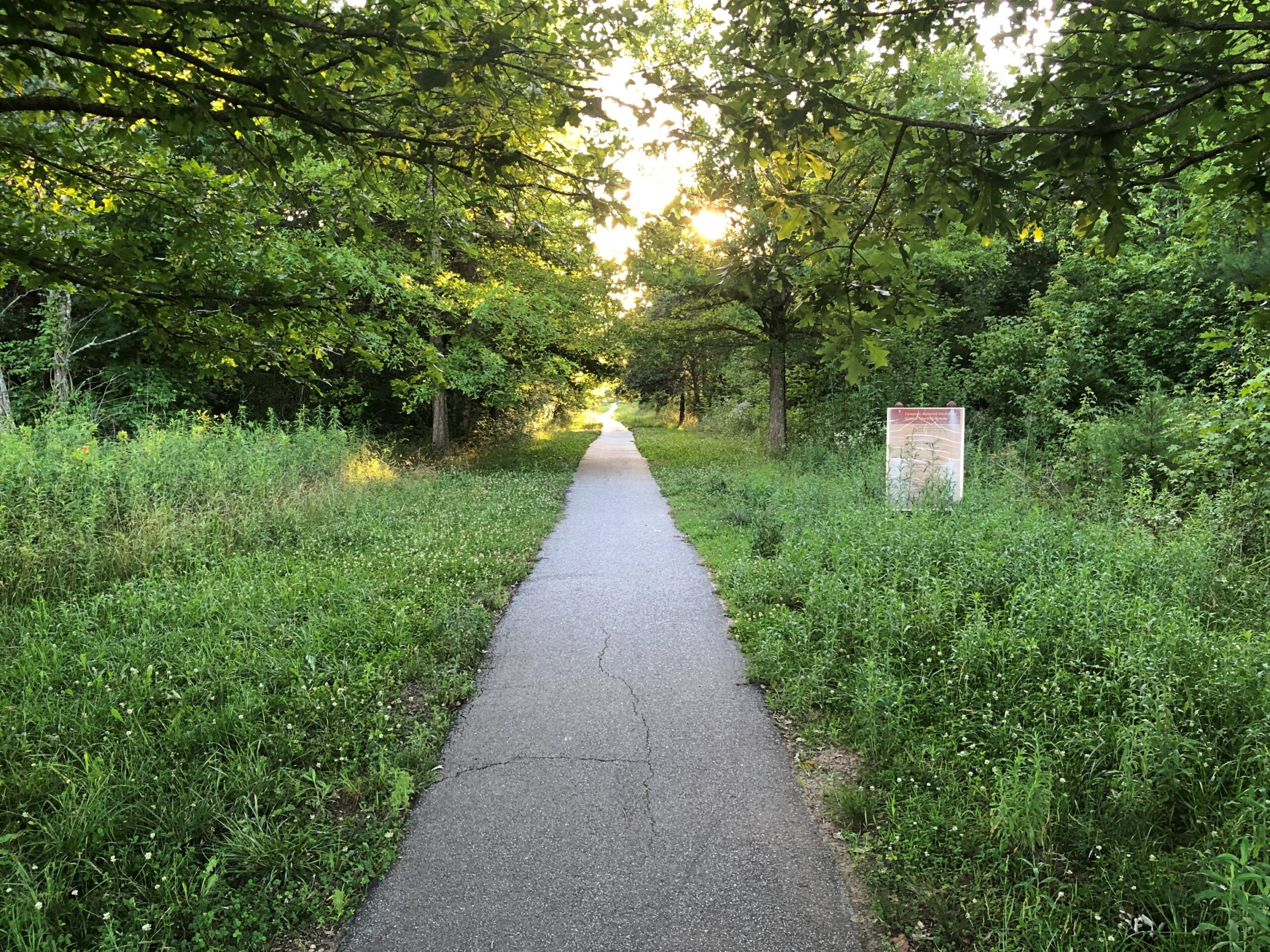
I walked down the path toward the battlefield, but thought better of it after about 10 minutes.
I wanted to get to Charlotte before the end of the day. Summer days are long, but not endless. Also, mosquitoes.
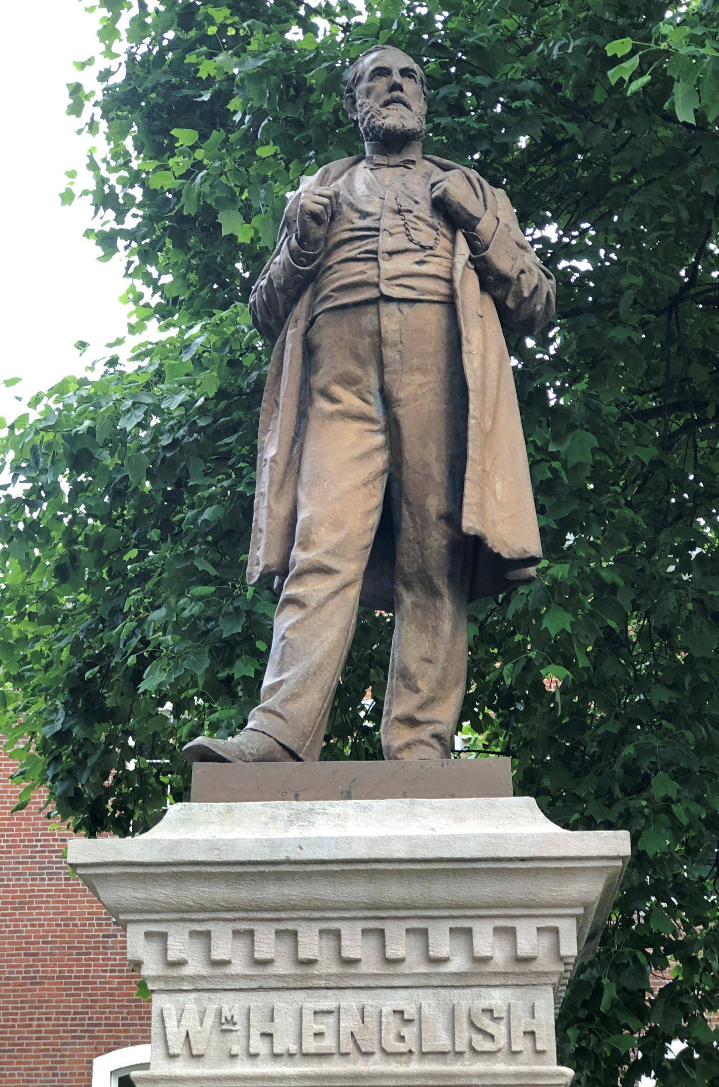
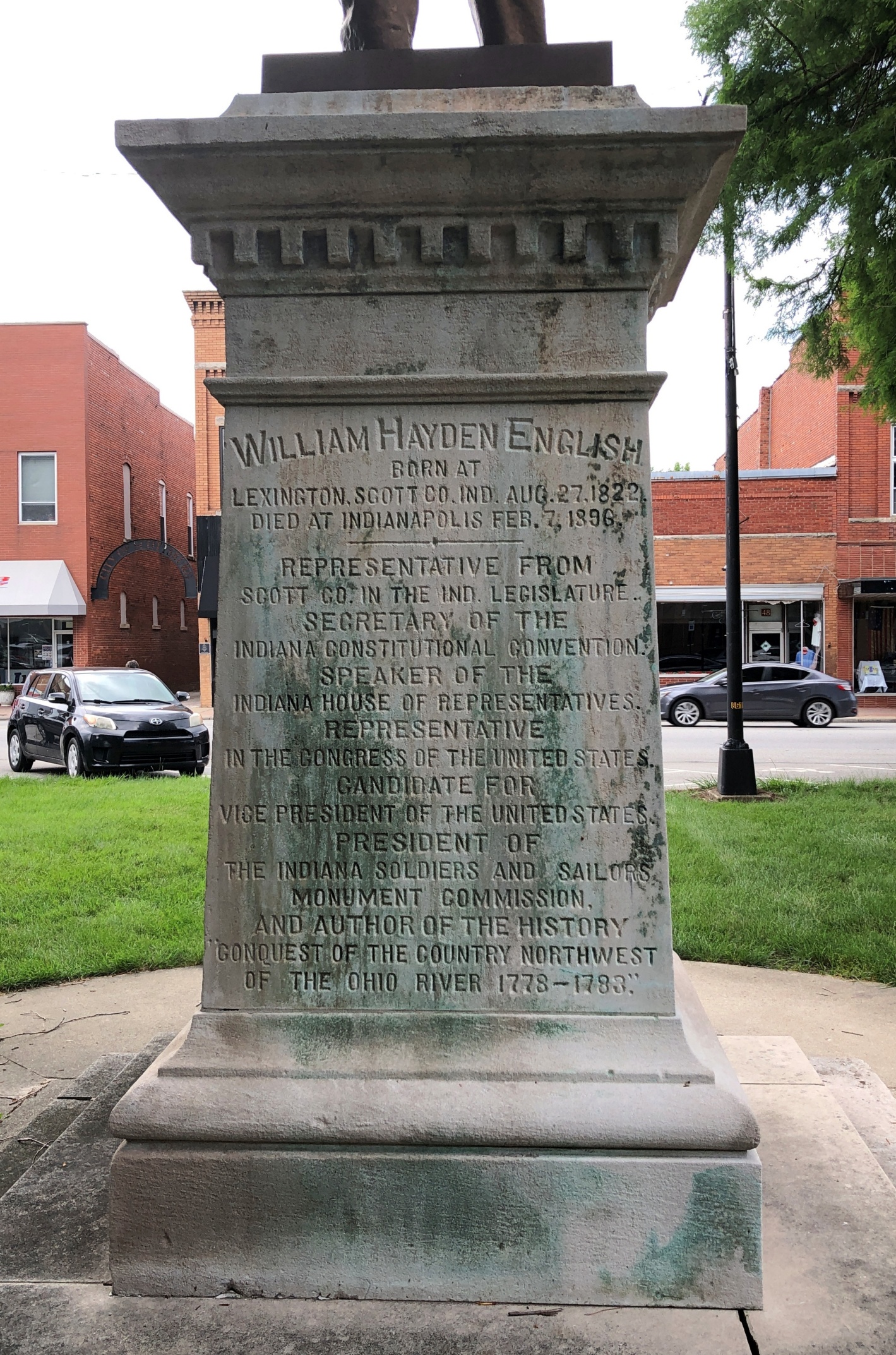
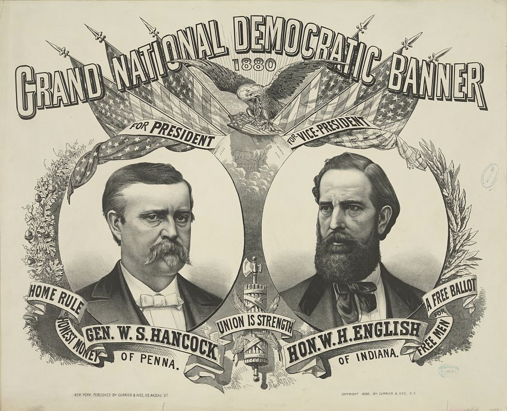
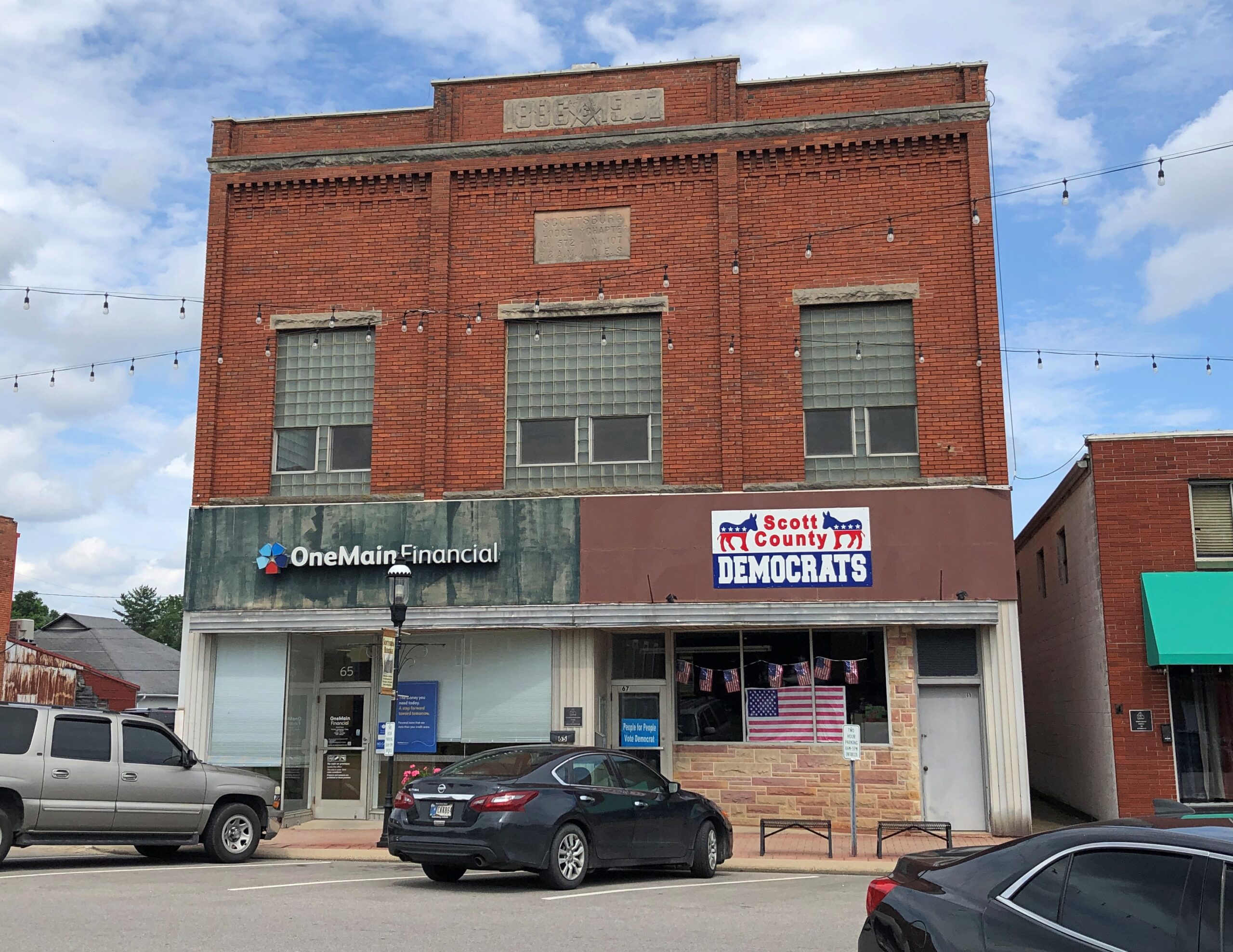
The heat was already on by the time I arrived in Scottsburg, Indiana on the first day of the trip, June 16. But not enough to keep me from taking a stroll around the Scott County courthouse, where I found native son William H. English.
After only a few hours on the road, by chance, I’d come across a presidential sight. Presidential adjacent, anyway, since English (d. 1896) is that most obscure of obscurities, someone who ran for vice president and lost – in 1880 in his case, on the Democratic ticket with Winfield Scott Hancock, who himself isn’t going to ring any bells outside presidential history buffs. The statue went up in 1908.
That was the election James Garfield won, which he no doubt regretted before long.
English, or his heirs, felt that a book he wrote, Conquest of the Country Northwest of the Ohio River 1778-1783, was worth a mention along with the offices he held or aspired to. The marvel here in the 21st century is that the work is just about instantly accessible (Vol. 1 and Vol. 2). An illustration facing the Vol. 1 title page (on the optitle page?) not only falls into the They Don’t Make ‘Em Like That Anymore category, it’s squarely in, No One Would Think of It territory. Just as well, I figure.
To get to Nashville from metro Chicago, the direct route is via I-65, which cuts across Indiana. Considering the importance of both of those cities to me, I’ve driven the route more times than I can count. But I have to report that it isn’t one of the more interesting drives in the nation, and at eight to nine hours drive time in the best of conditions, you feel it yawn beneath your wheels when you yourself yawn.
So the strategy over the years has been to break up the trip. Such as a place like Scottsburg, pop. 7,300. The town is close enough to Louisville to be its exurb – maybe. I haven’t spend enough time in Louisville, as interesting as it is, to have any sense of its greater co-prosperity sphere, or at what distance that might peter out.
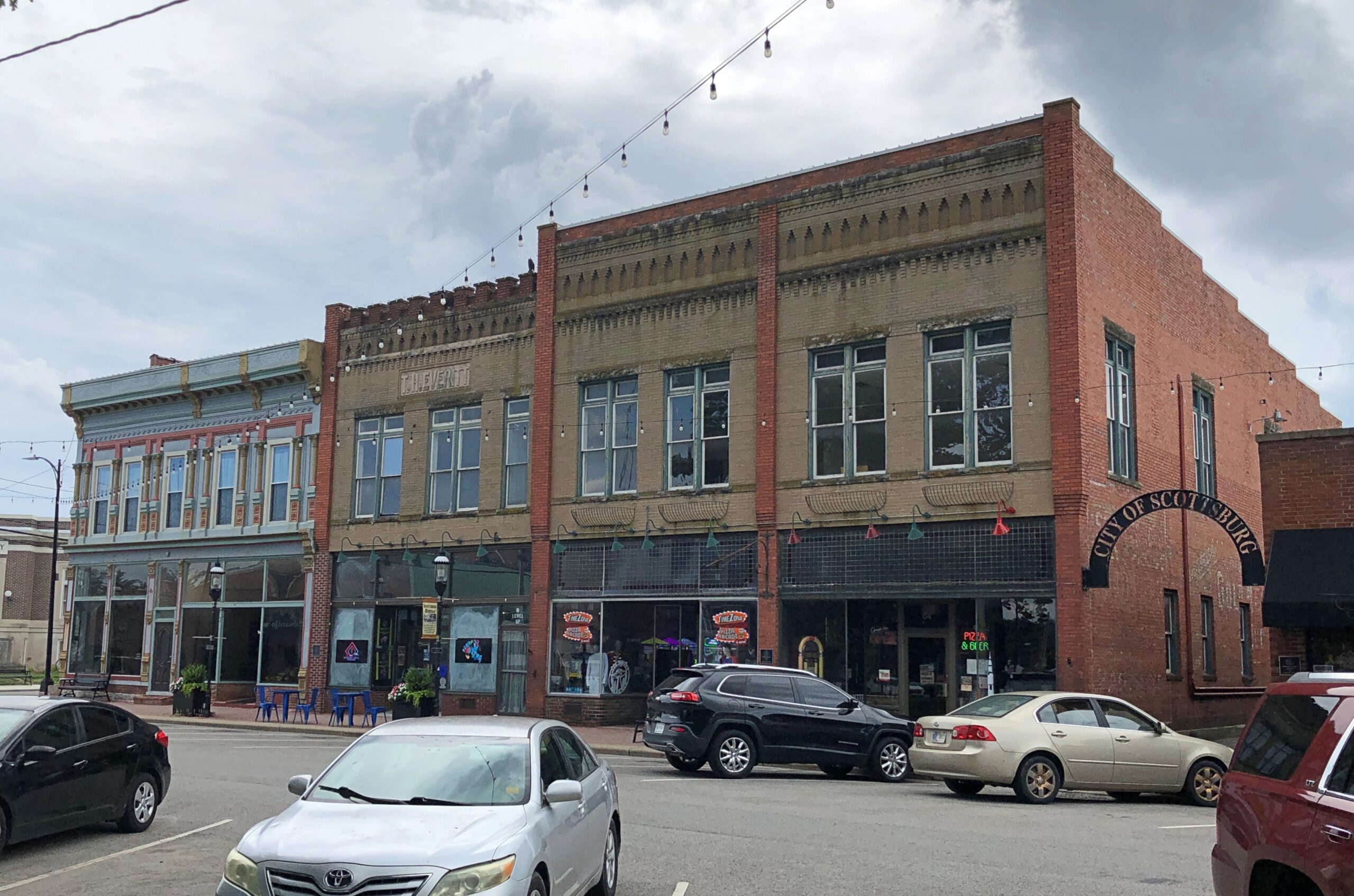
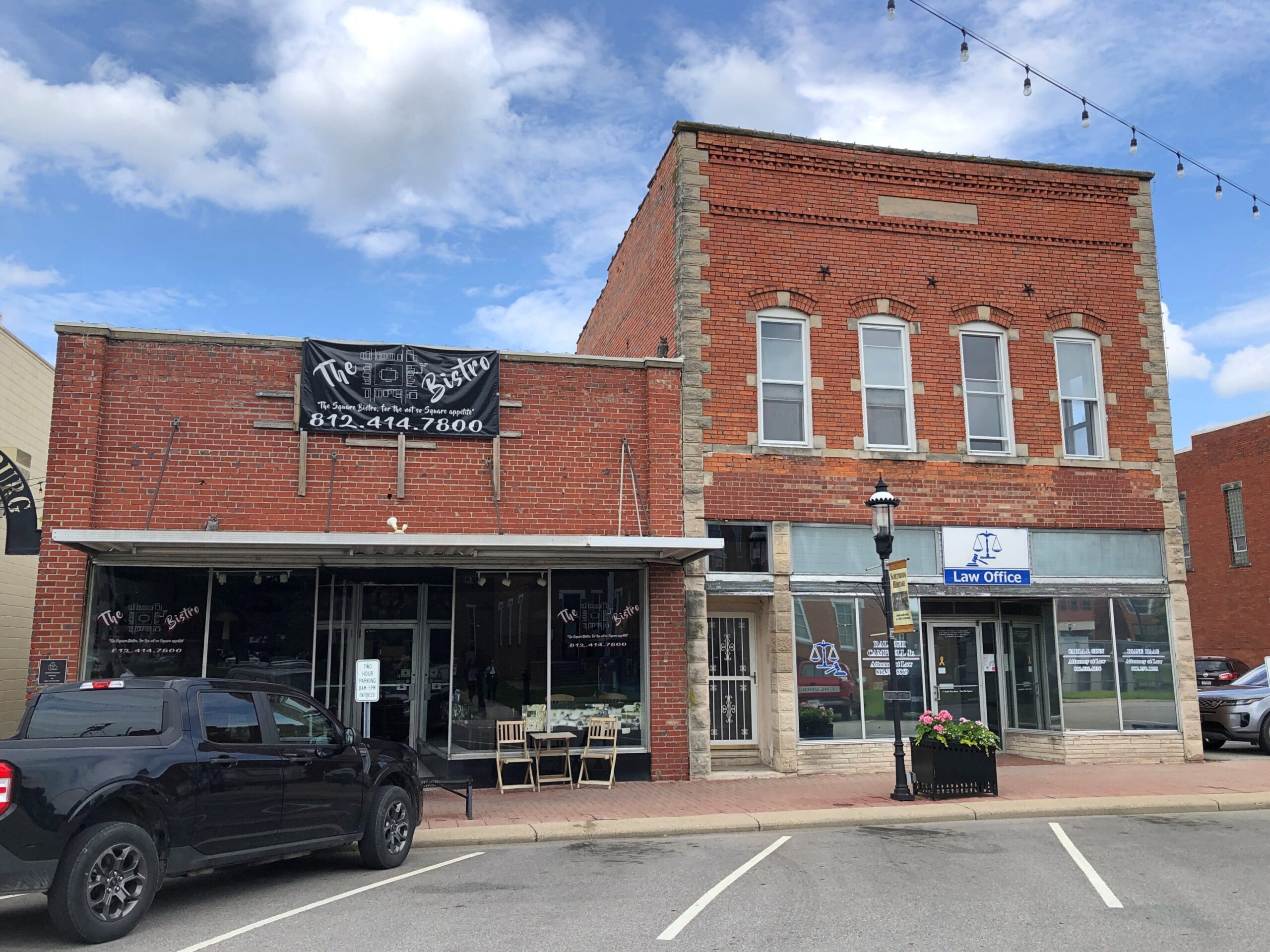
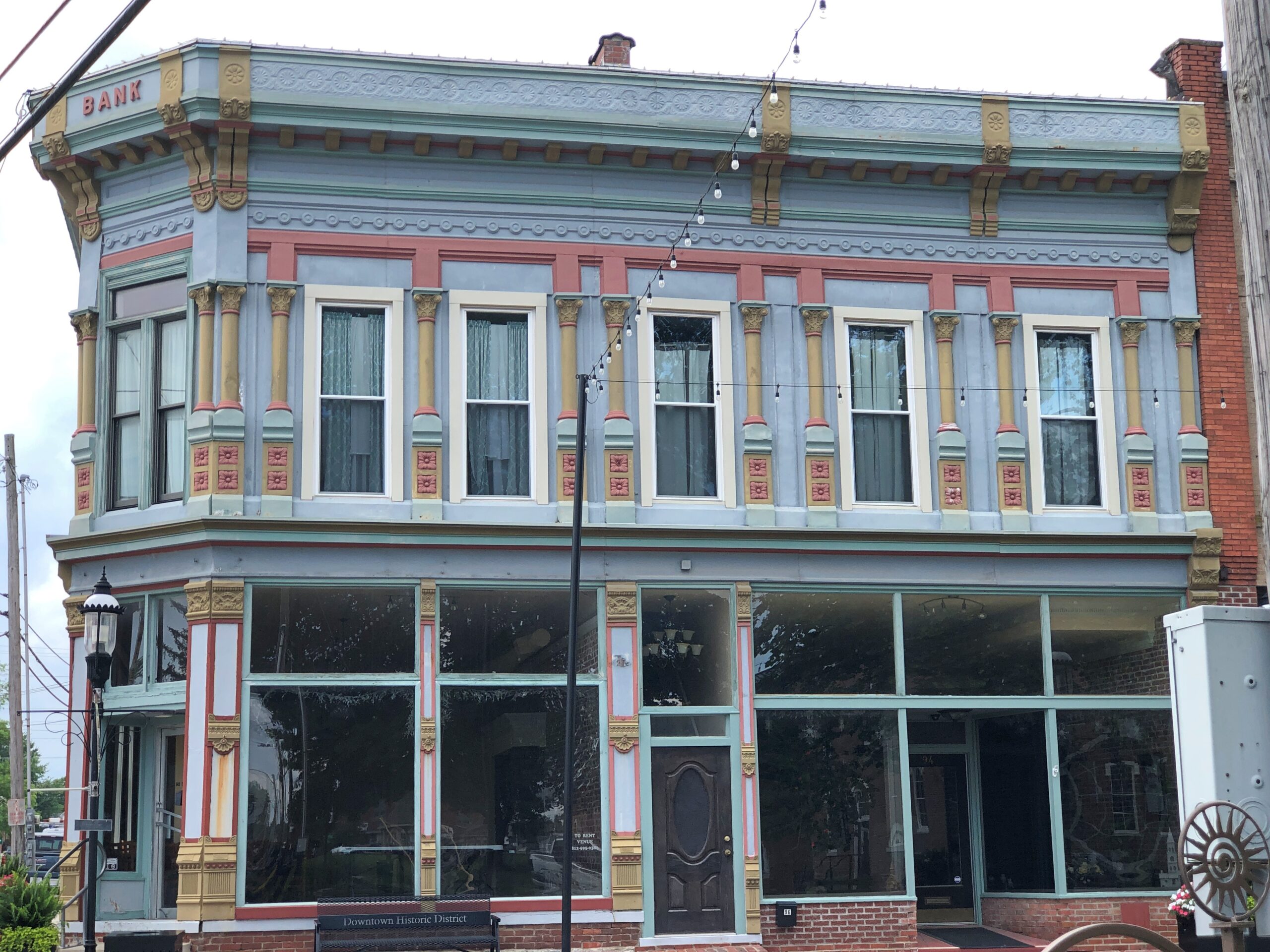
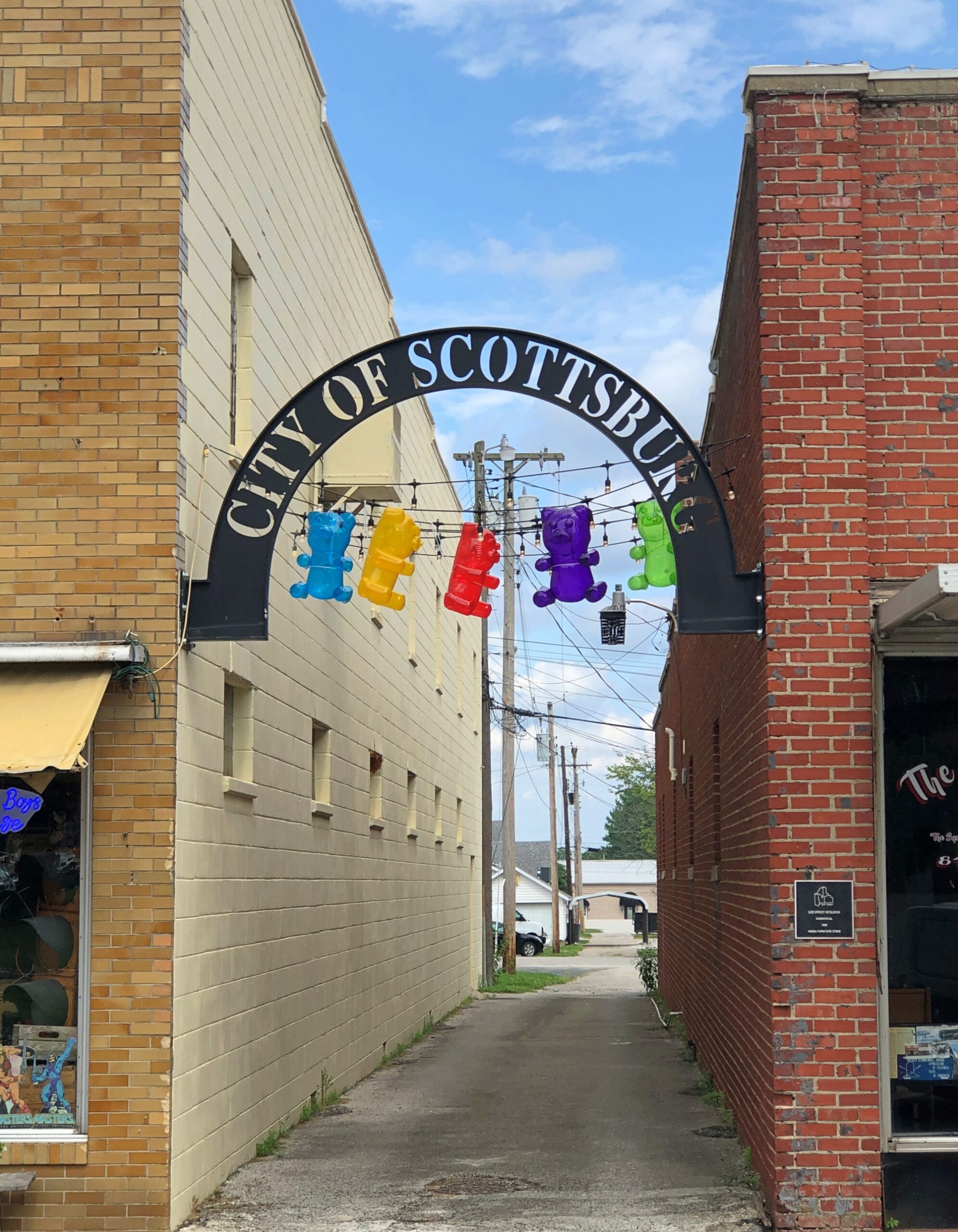
Scottsburg has one thing a picturesque exurb needs: a picturesque courthouse square. Or at least elements of it.
Downtown is in fact a national historic district: Scottsburg Courthouse Square Historic District. I get a kick out of discovering that kind of thing retroactively, which I did this time.
“The district is composed of one-, two-, two-and-a-half and three-story brick and stone commercial structures with zero setbacks, which form an essentially contiguous perimeter to the wooded courthouse lawn,” its registration form on file with the U.S. Interior Department says. “There are a total of 48 contributing buildings within the district. The character of the district is defined by late 19th and early 20th century commercial architecture with significant examples of the Italianate, so Richardsonian Romanesque, Renaissance Revival, Colonial Revival, and Art Moderne styles.
“The predominant building material is red brick, as evidenced by the courthouse and 29 commercial buildings within the district. Secondary materials include Indiana limestone and various shades of buff and yellow brick, decorative brick work, cast iron, ornamental pressed metal and glazed tile and Carrera glass…”
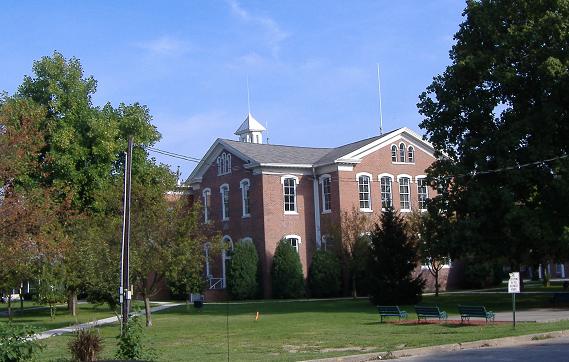
In the heat of the moment (literally), I neglected to get a decent shot of the courthouse itself, but someone called Bedford thoughtfully put an image in the public domain.
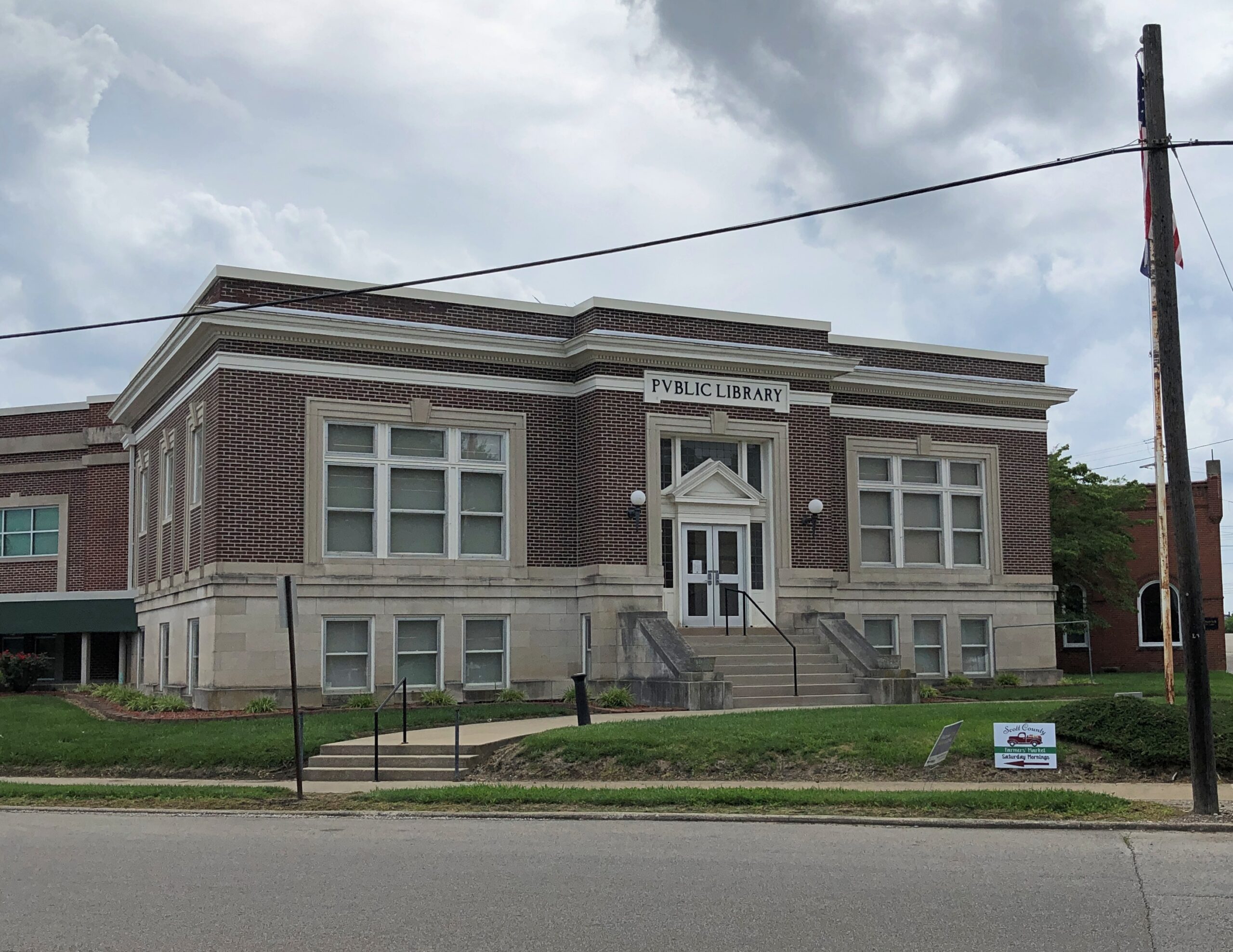
Could it be a Carnegie Library?
Yes. Completed 1917, still a library. One of the more than 1,680 in the United States funded by the robber baron, many of which endure after a century plus.
Some courthouse square details.
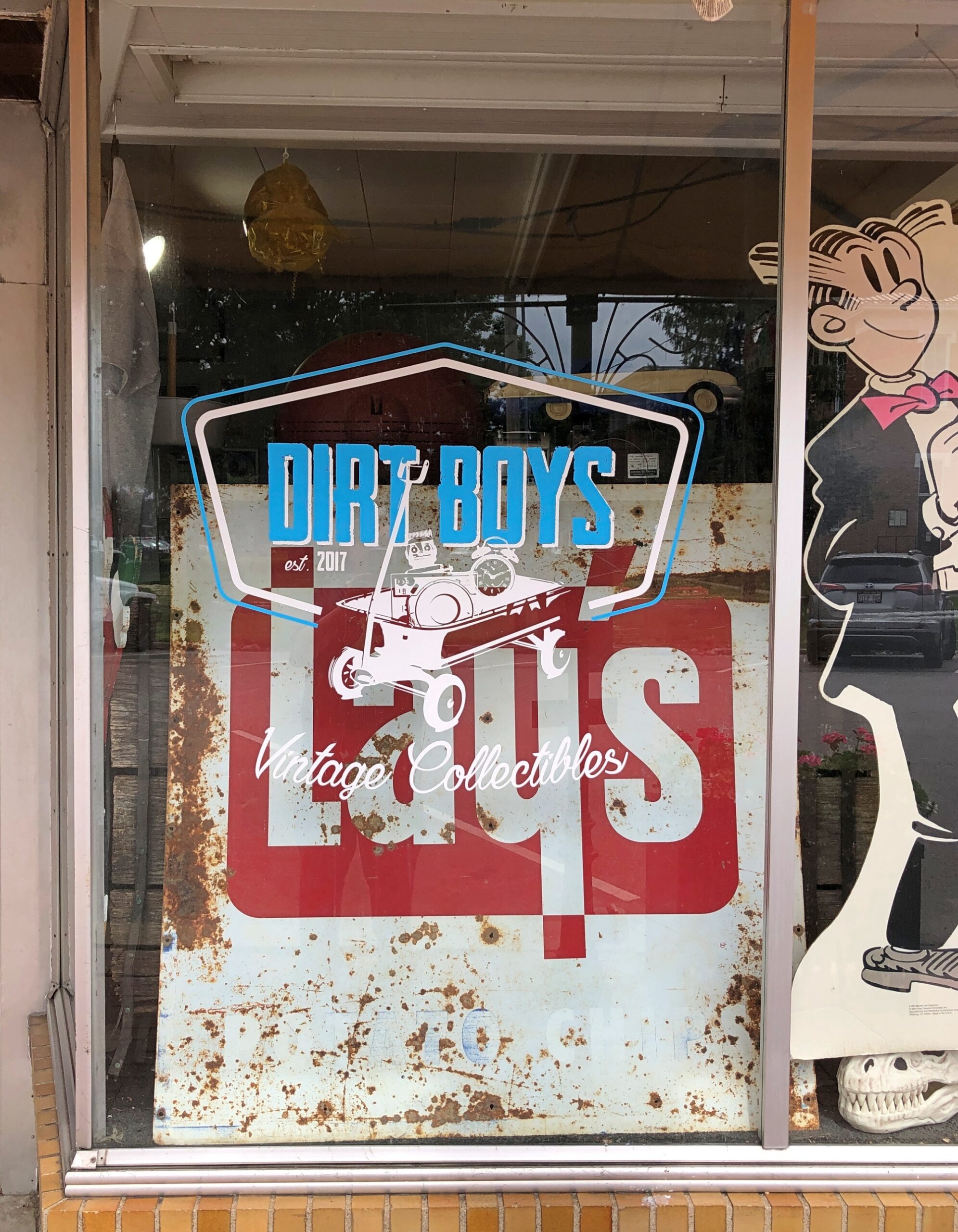
Dirt Boys Vintage Collectibles joins the likes of city offices and law offices, but also Warriors Den coffee shop, Time Zone Pizza Arcade, Chicago City Pizza and Bootlegger’s Bar & Grill. Those not needing to eat can visit Wildflowers Boutique, Moxie Music Center or Working Class Tattoo Parlor, all there on the square.
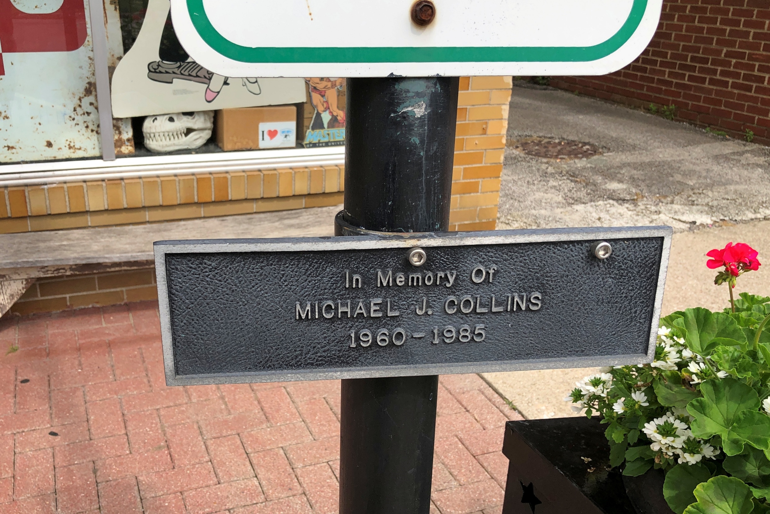
So is a plaque to the memory of one Michael J. Collins (d. 1985).
A contemporary of mine who didn’t make it far out of the gate. RIP, Michael, whoever you were. Are.


