Old Shawneetown

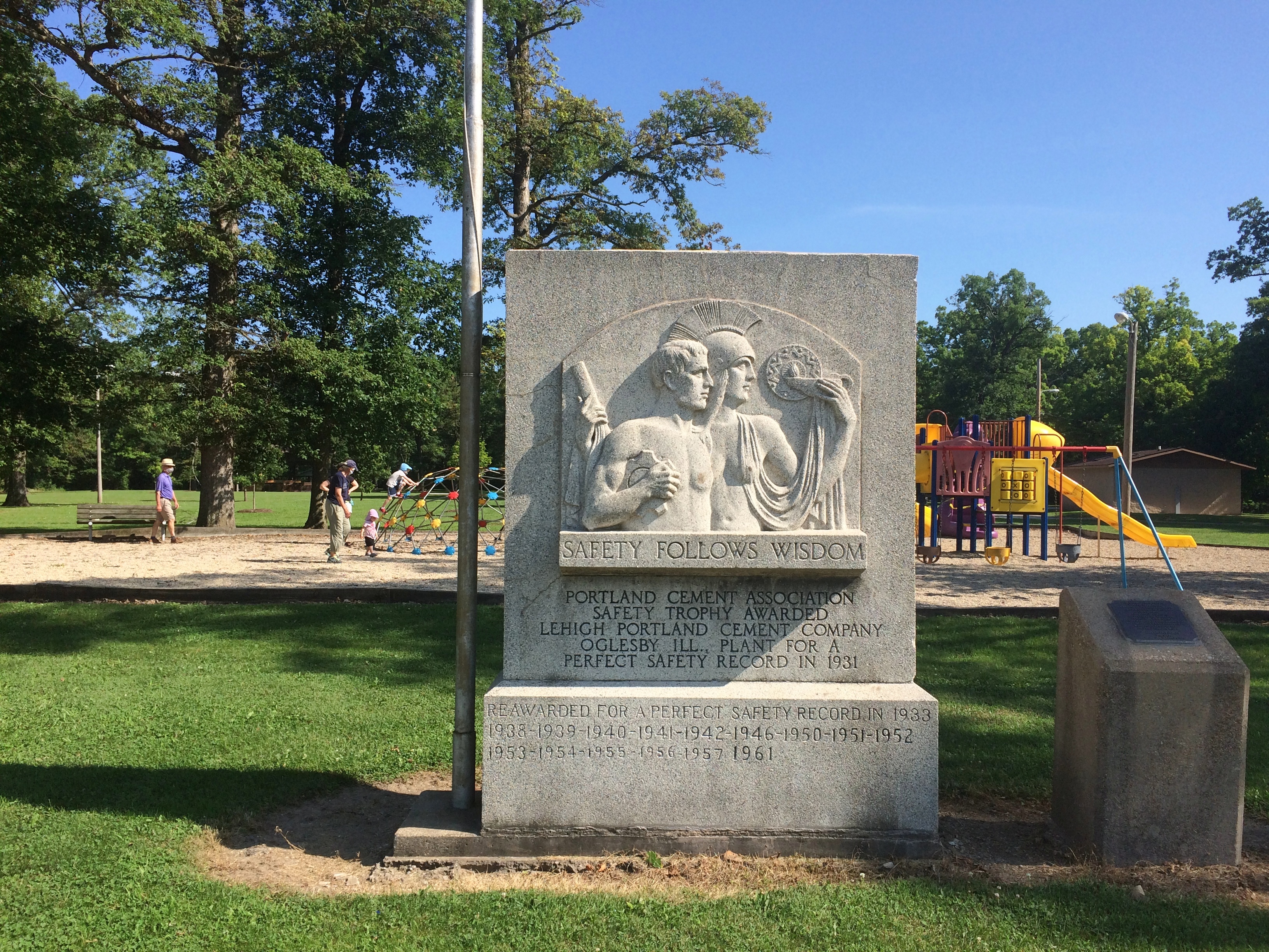
If you drive east from Carbondale along Illinois 13, you’ll pass through a number of towns connected by that four-lane highway: Cartersville, Marion and finally Harrisburg, after which the road narrows to two lanes. That was our route on the afternoon of October 10.

There’s a branch of 17th Street Barbecue in Marion, with the original in Murphysboro, Illinois. It’s a barbecue joint of some local renown. I can’t remember when I first heard about it. Some Internet list, probably, but anyway I knew about it and decided to get lunch there in Marion.

Meals on the road in 2020 have involved takeout in all cases, either to eat in the car, or our room, or when possible at an outdoor public picnic table. We found a table in a small park in Marion to eat our 17th Street ‘cue.

We both got barbecue pork sandwiches. The meat was fine, but whoever made the sandwiches shorted us on the sauce, so the meal was a little dry. I’d be willing to try the place again if ever I’m down that way, but I’m going to insist on sauce.

The eastern terminus of Illinois 13 is Old Shawneetown on the banks of the Ohio River. Too close to the river, and thus prone to flooding. The Great Ohio River Flood of 1937 finally drove most of the residents away to found a new Shawneetown a few miles to the west. But Old Shawneetown isn’t a ghost town in our time, since 160 or so people live there, just the residuum of a larger place.

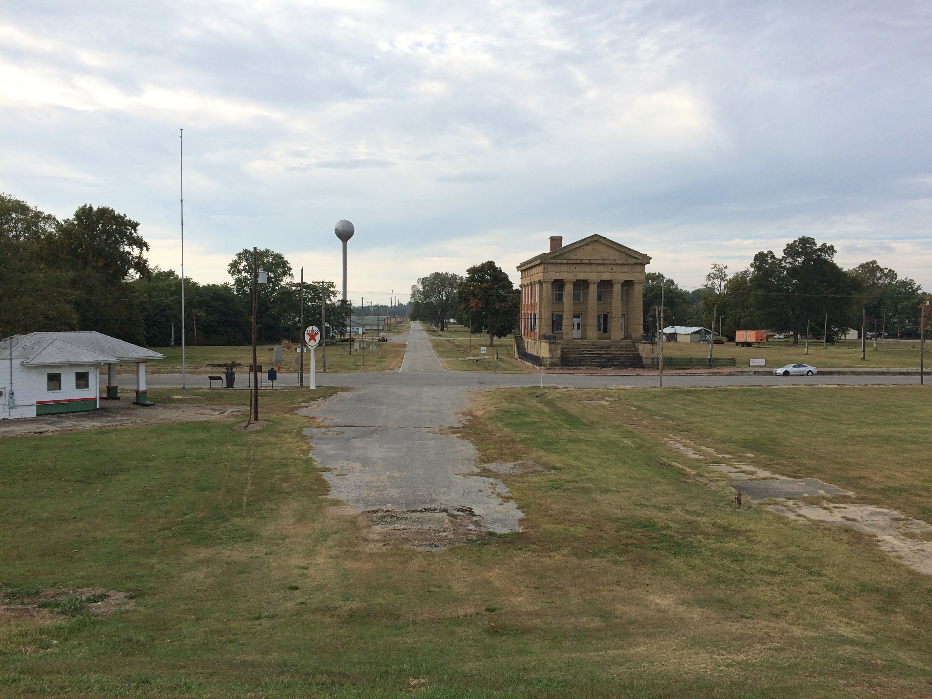
The town’s main intersection.
Old ShawneetownThe original Shawneetown had its moment, a little more than 200 years ago, when it was home to a federal government land office for the Illinois Territory, and as a transshipment point for salt extracted nearby. During the famed 1825 tour of the U.S. by Gen. Lafayette, Shawneetown was on his itinerary, surely marking the town’s peak of fame if not population.

Peaked too soon, looks like. No railroad passed through Shawneetown in the following decades, at least by the time this map was published in 1855. That tells me that Shawneetown never really prospered after the land office and salt mine closed.

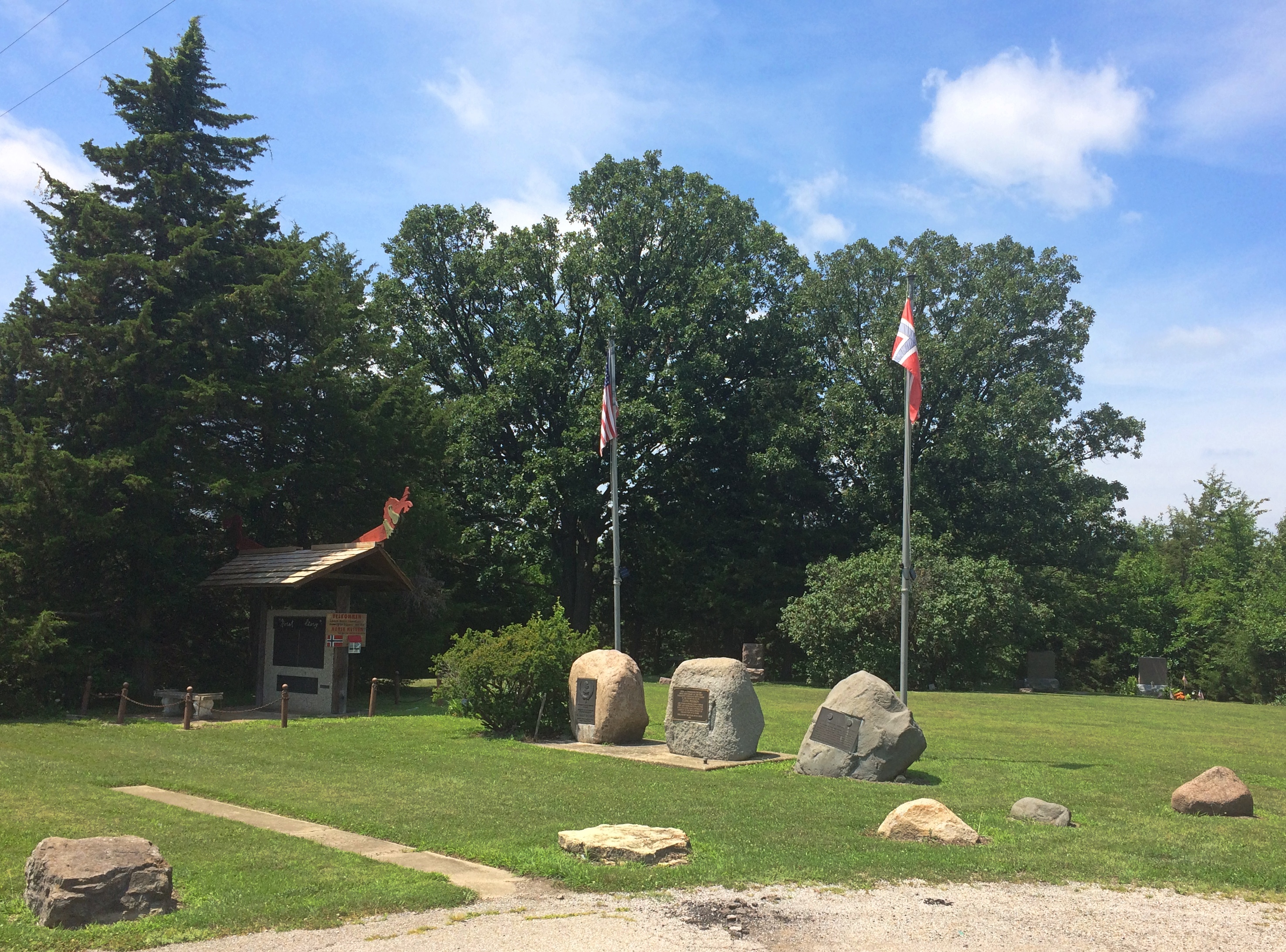
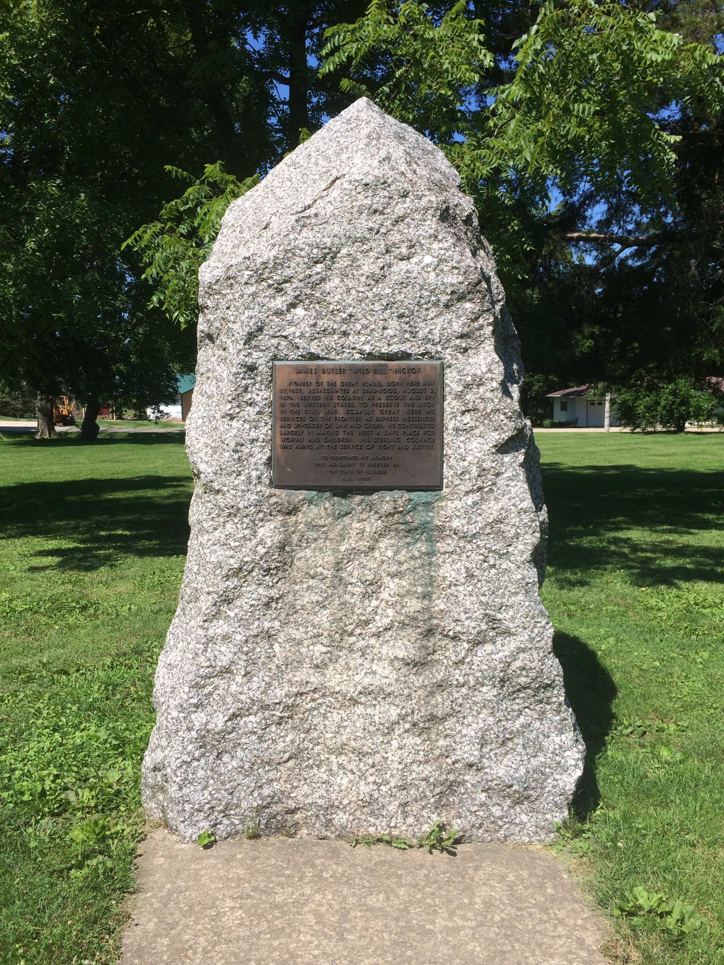
I’ve known about the place for a long time. I knew girl in college from around Shawneetown, a coaxing elf of full Irish ancestry who grew up on a nearby popcorn farm. Gallatin County even now is a nexus of popcorn agriculture. Last I heard, she lived in Ankara with her French husband. People get around.

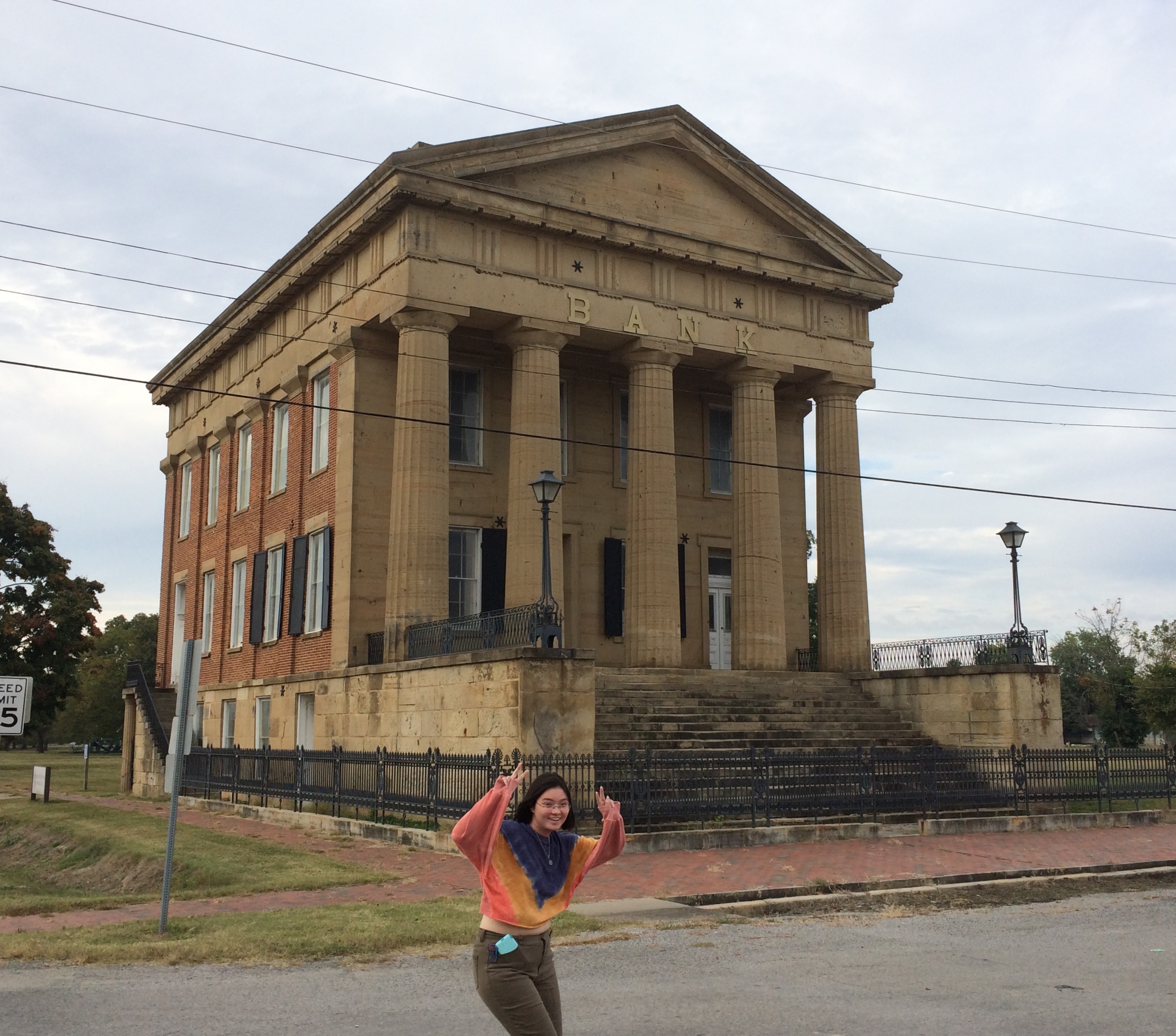
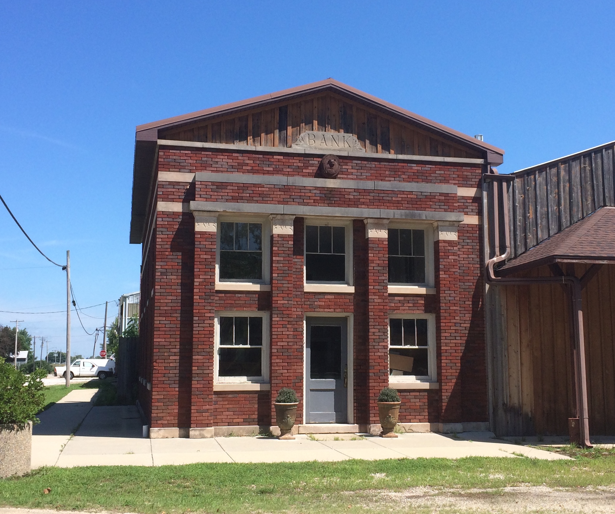
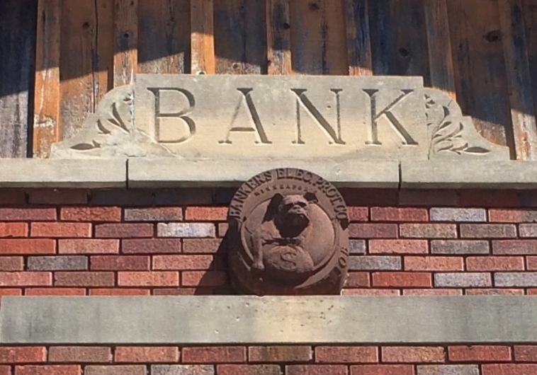
The main surviving building from the town’s storied past is the Shawneetown Bank State Historic Site, dating from 1840. Home to banks for about 100 years — they seem to have come and gone with various financial panics — it stands neglected these days.Shawneetown Bank State Historic Site
Shawneetown Bank State Historic Site
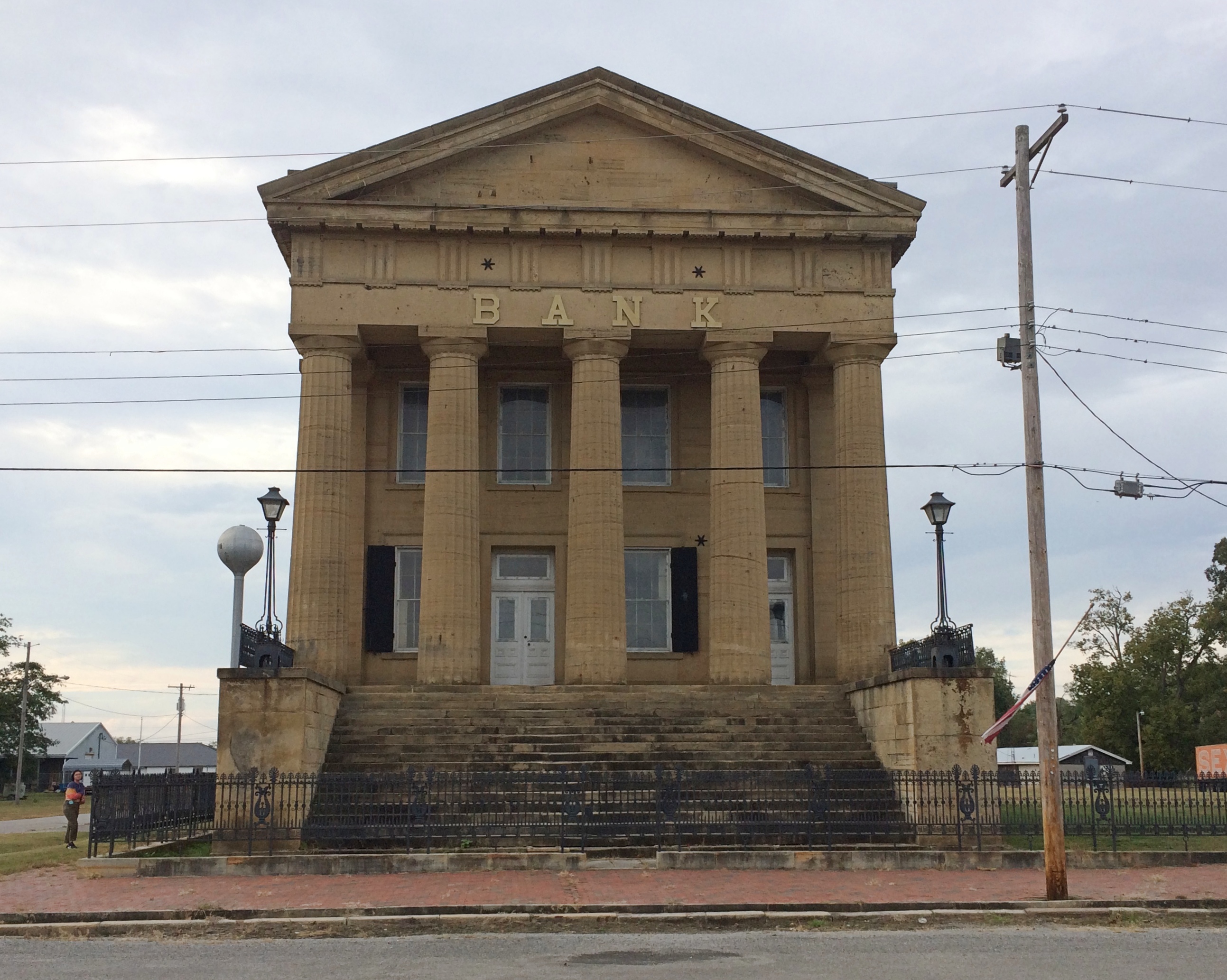
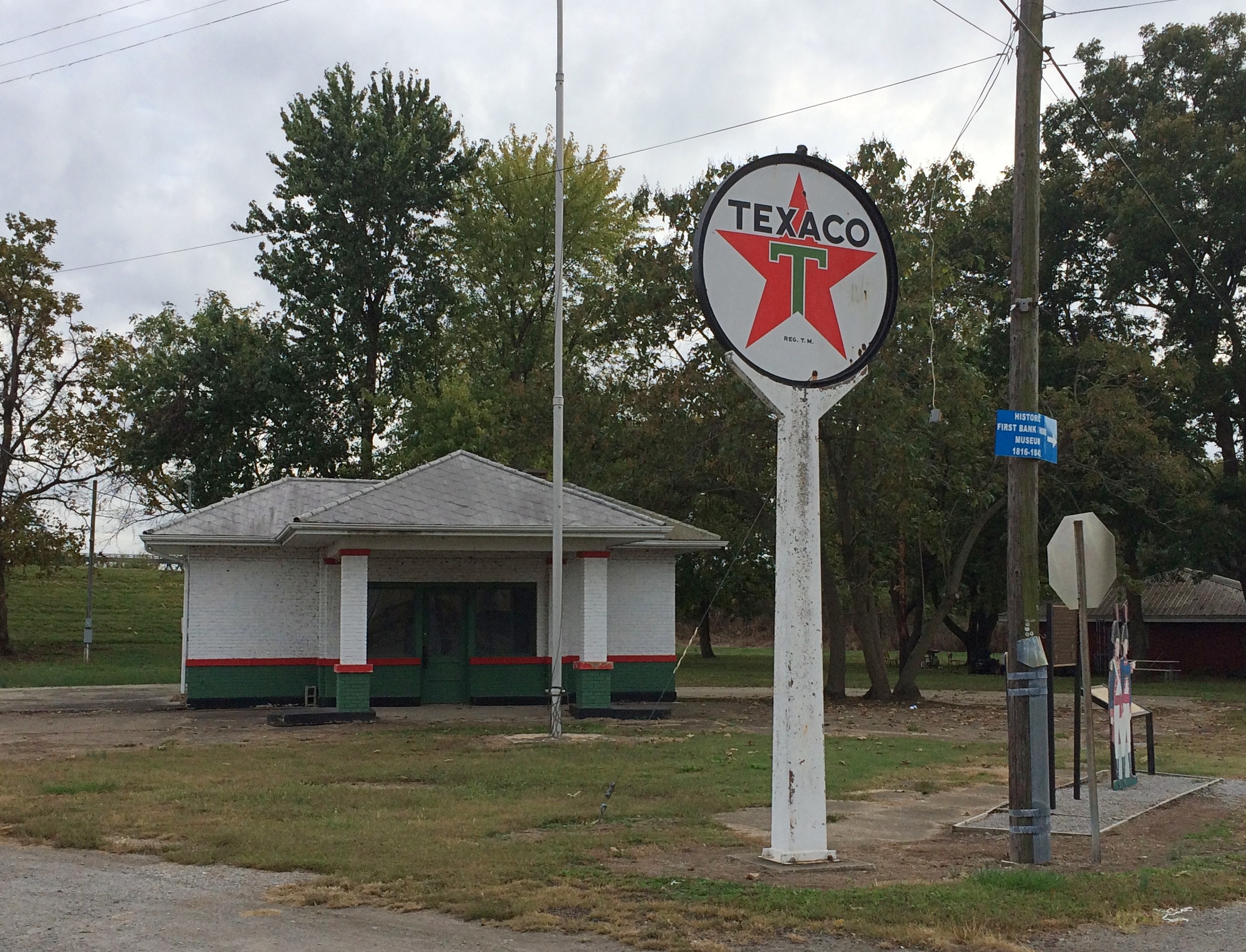
It’s not the only abandoned structure in the neighborhood. A white Texaco station is catercorner across from the bank. If it were on U.S. 66, it might be a little museum. Maybe someone has that in mind. Though abandoned, the structure looks in fairly good shape, especially the sign.
Old Shawneetown Texaco
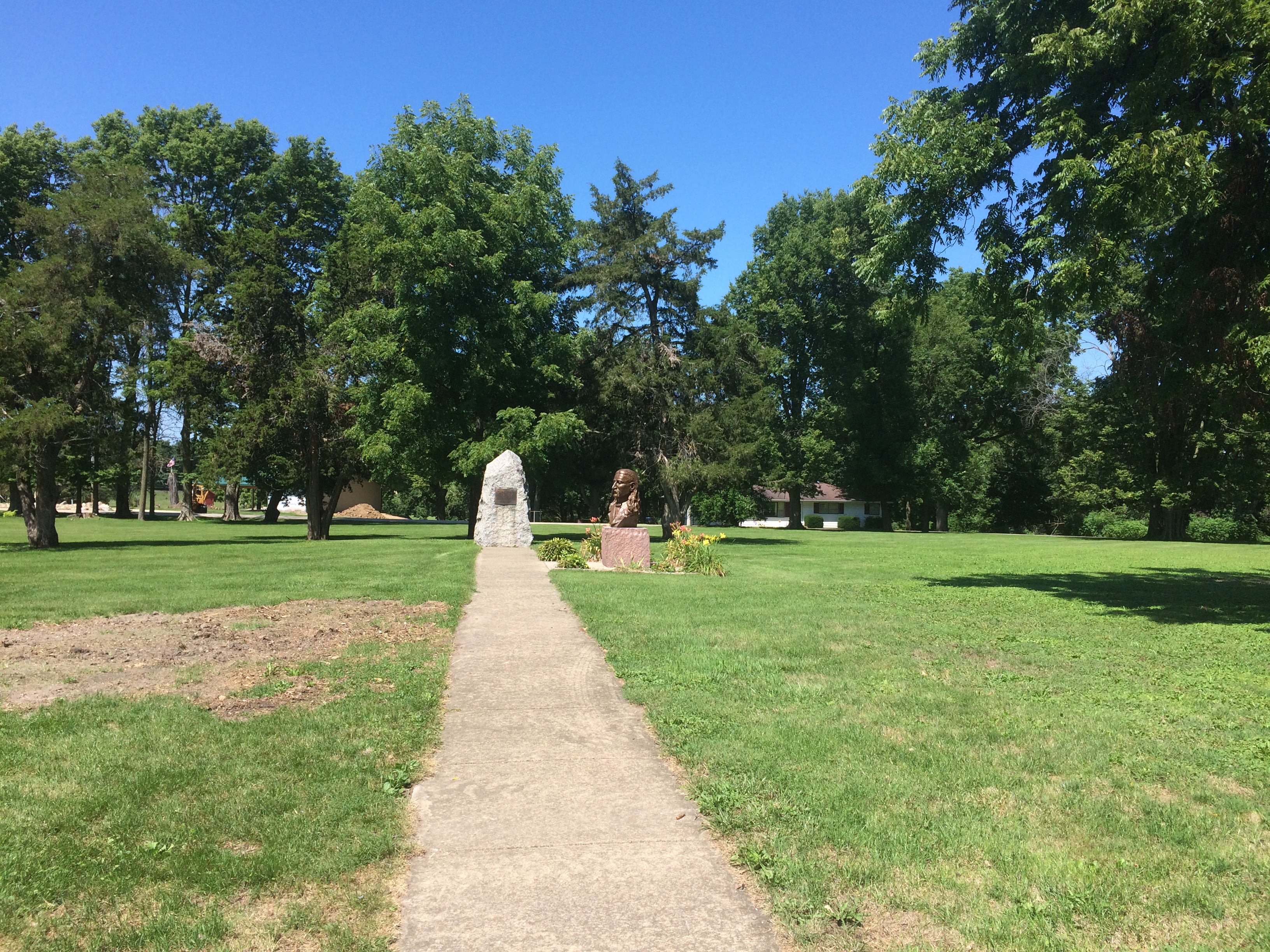
There are a few plaques and other acknowledgments of the town’s history. Such as cutouts of Lewis & Clark, who passed this way just before there was a town.
Shawneetown Texaco
I like to think that the Corps of Discovery made a stop here at the only gas station along their route.

As Lewis wrote in his journal, Nov. 6, 1803: Arrived at Swanee Txco Station. Pay’d owner 2 dollards for provisions, — Cheetos, other divers chips, Coke & Pepsi, choco bars etc. Men also bought provis. for own use Mr Wm. Jones store mger, reports recent visit by Indian band from furth. north. — buying his entr. stock of funyuns.

Down the street from the abandoned bank and the abandoned gas station is Hogdaddy’s Saloon, an abandoned entertainment venue, though not so long ago, from the looks of it.
Hogdaddy's Old Shawneetown
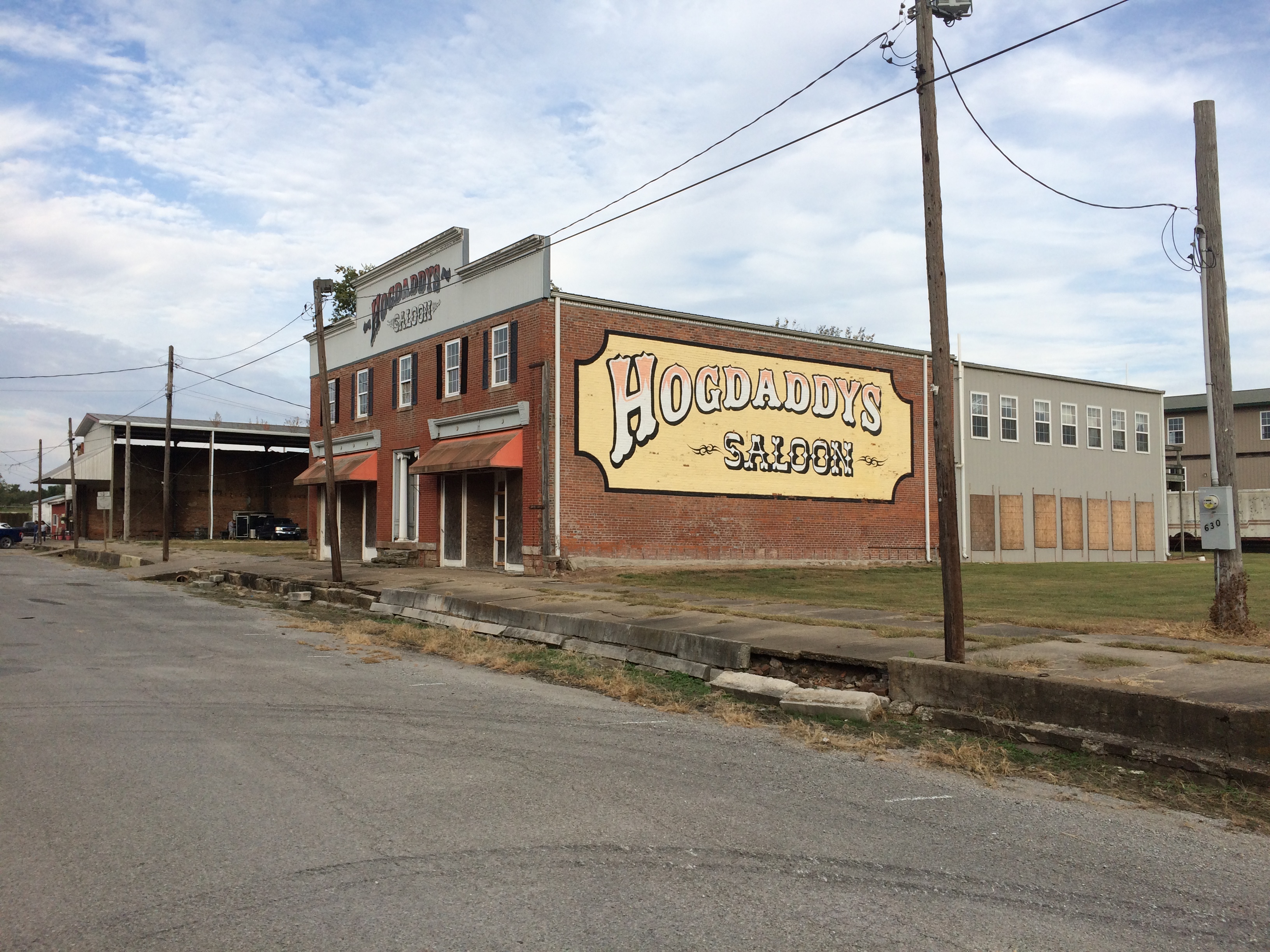
What Old Shawneetown needs (in more normal times) is a music festival right there on the main street. If Bonnaroo can, so can Shawneetown. Something for the hipsters to discover, to put the town on the hipster map and attract hipster dollars. As long as they believe the place is authentic somehow, they will come. That way a place like Hogdaddy’s could make a go of it.

An embankment separates the town from the river, part of a levee system built long ago to keep out flood waters — in vain. The always interesting WPA Guide to Illinois (1939) tells the story better than any online source I’ve found (p. 436). For that book, the ’37 flood was a recent event.

“The town bore the yearly invasions of the Ohio unprotected until the unusually severe flood of 1884, after which it constructed a comprehensive levee system,” the Guide notes. “But in 1898, and again in 1913, Shawneetown was under water. In 1932, the levee was raised five feet above the 1913 high-water mark….

“But Shawneetown had not envisioned anything like the 1937 flood. By January 24 of that year, menacing yellow waters were slipping silently past the town, only inches from the levee top… Small groups of people huddled on street corners, terrified, waiting; the telephone service ceased; hemmed in by the ever-swelling Ohio, Shawneewtown flashed a desperate cry for help over an amateur’s short-wave radio.

“Responding to the call, a river packet and several motorboats evacuated the townspeople just as the waters began to trickle over the levee. A roaring crashing avalanche soon inundated the cuplike townsite…

“The 1937 flood marked the end of Shawneetown’s ‘pertinacious adhesion’ to the riverbank. Gone were the packets and keelboats which induced her to hazard annual submersion. Gone was the steady traffic of settlers, goods and singing rivermen. With the aid of the State, the RFC, and the WPA, a project is under way for transplanting the town to the hills 4 miles back from the river… The State plans to establish a State park at the present site of Shawneetown.”

Guess the state never quite got around to that, maybe because not everyone wanted to leave.

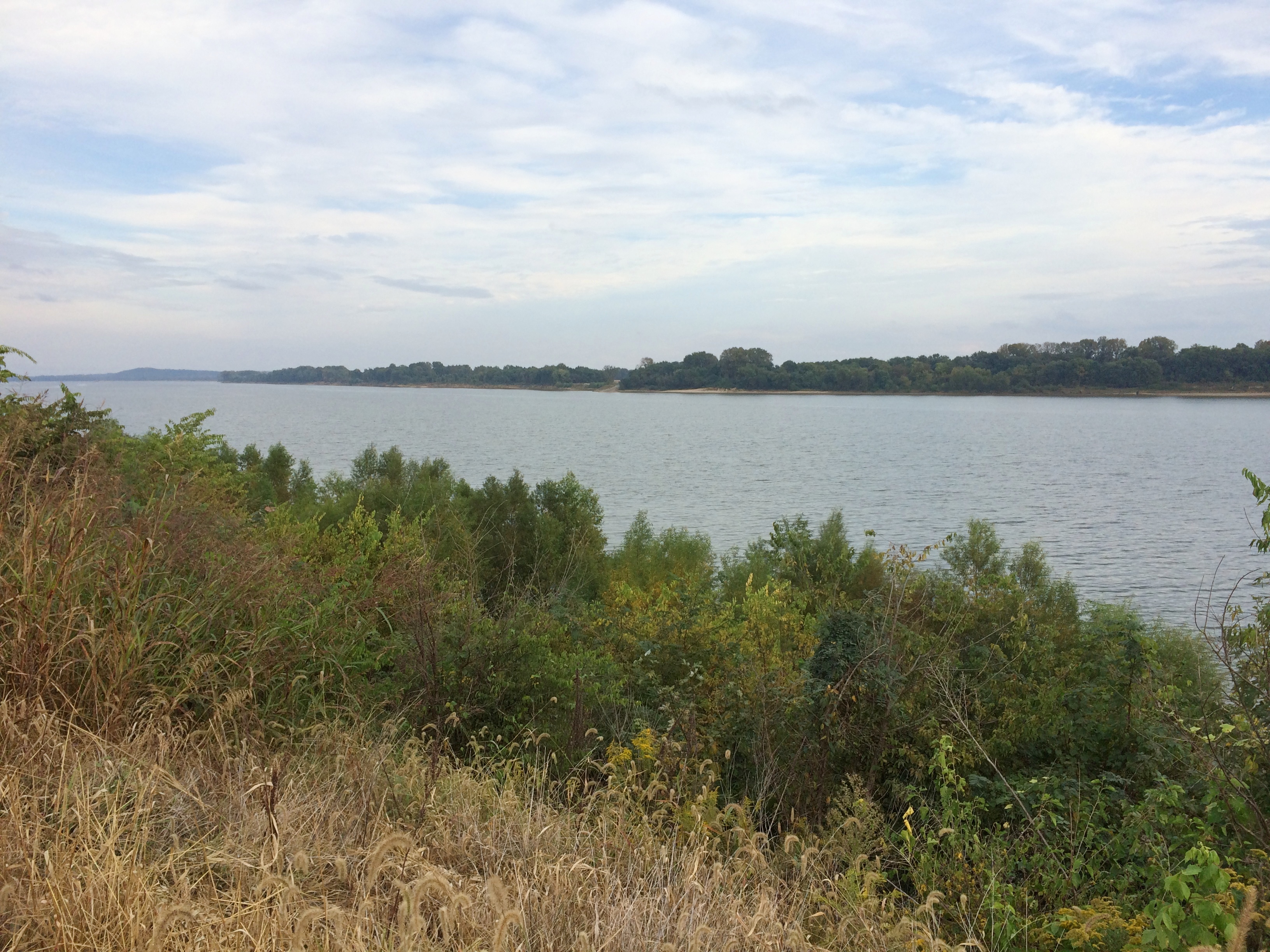
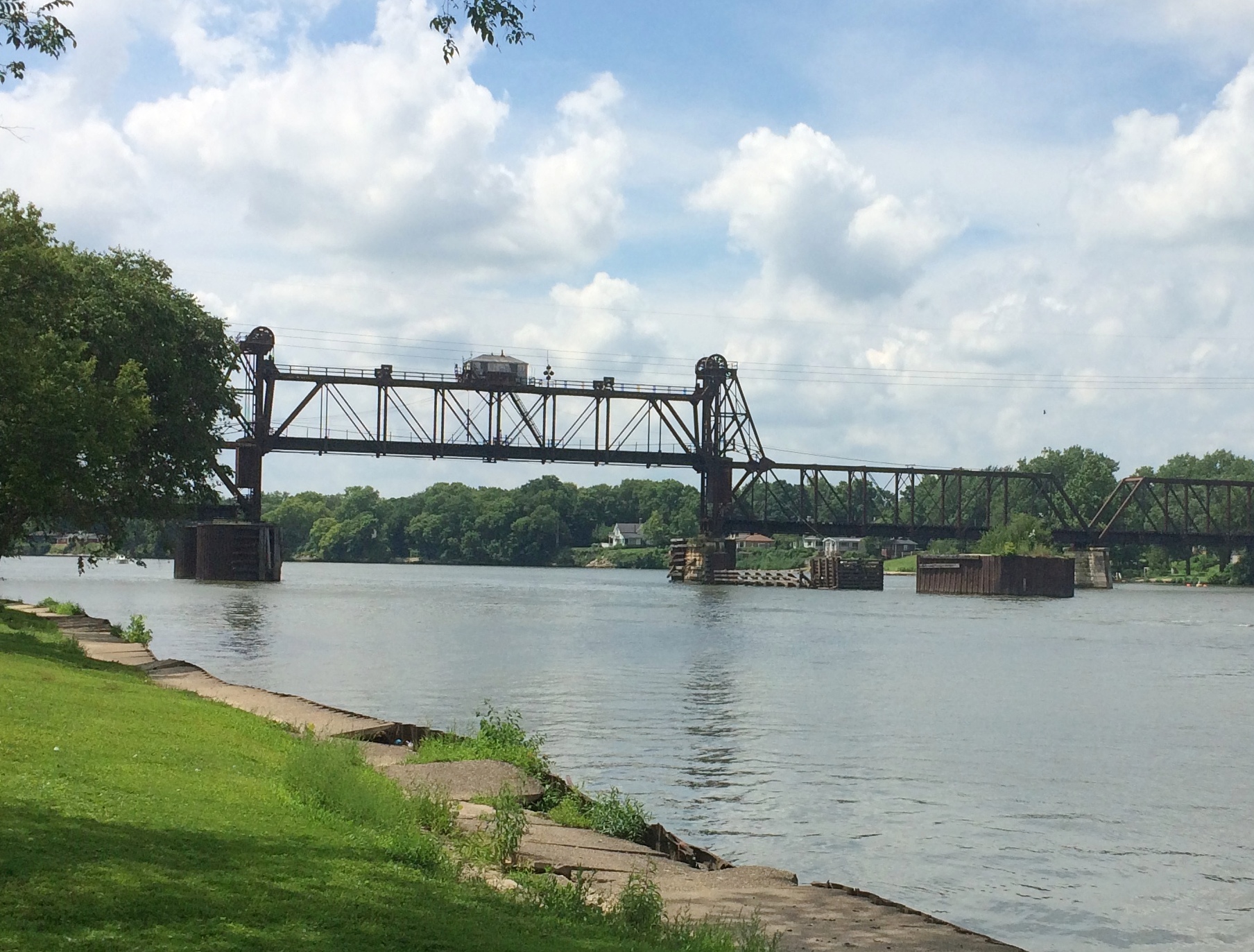
A stairway leads to the embankment’s top, which offers a view of the Ohio. Looking upriver.
Ohio River Old Shawneetown
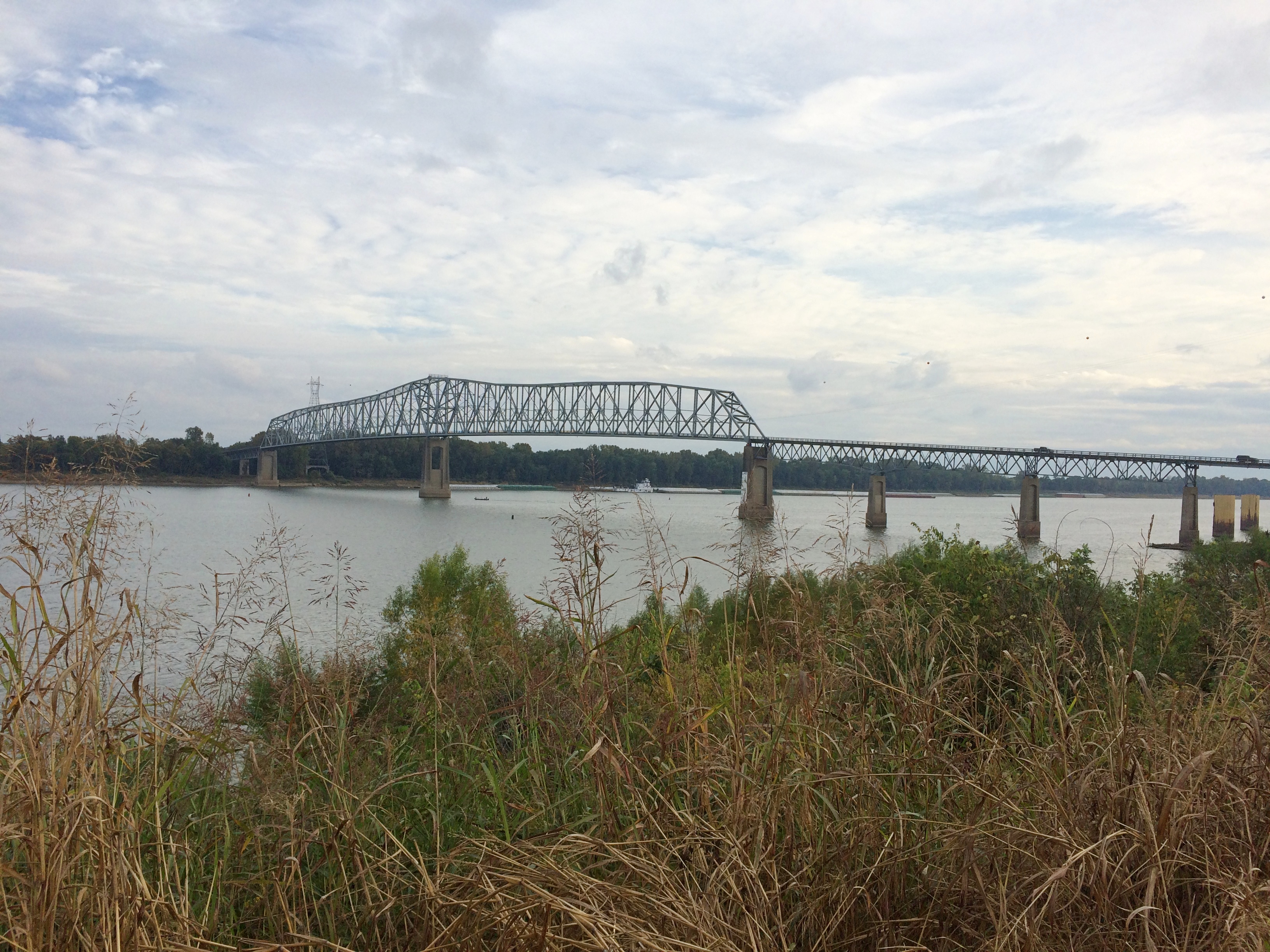
And downriver, looking at the bridge that crosses over to Kentucky.
Ohio River Old Shawneetown
On the side of the embankment is a graffito. Any graffiti would be a little odd in such a town, but this would be odd anywhere.
Ohio River Old Shawneetown
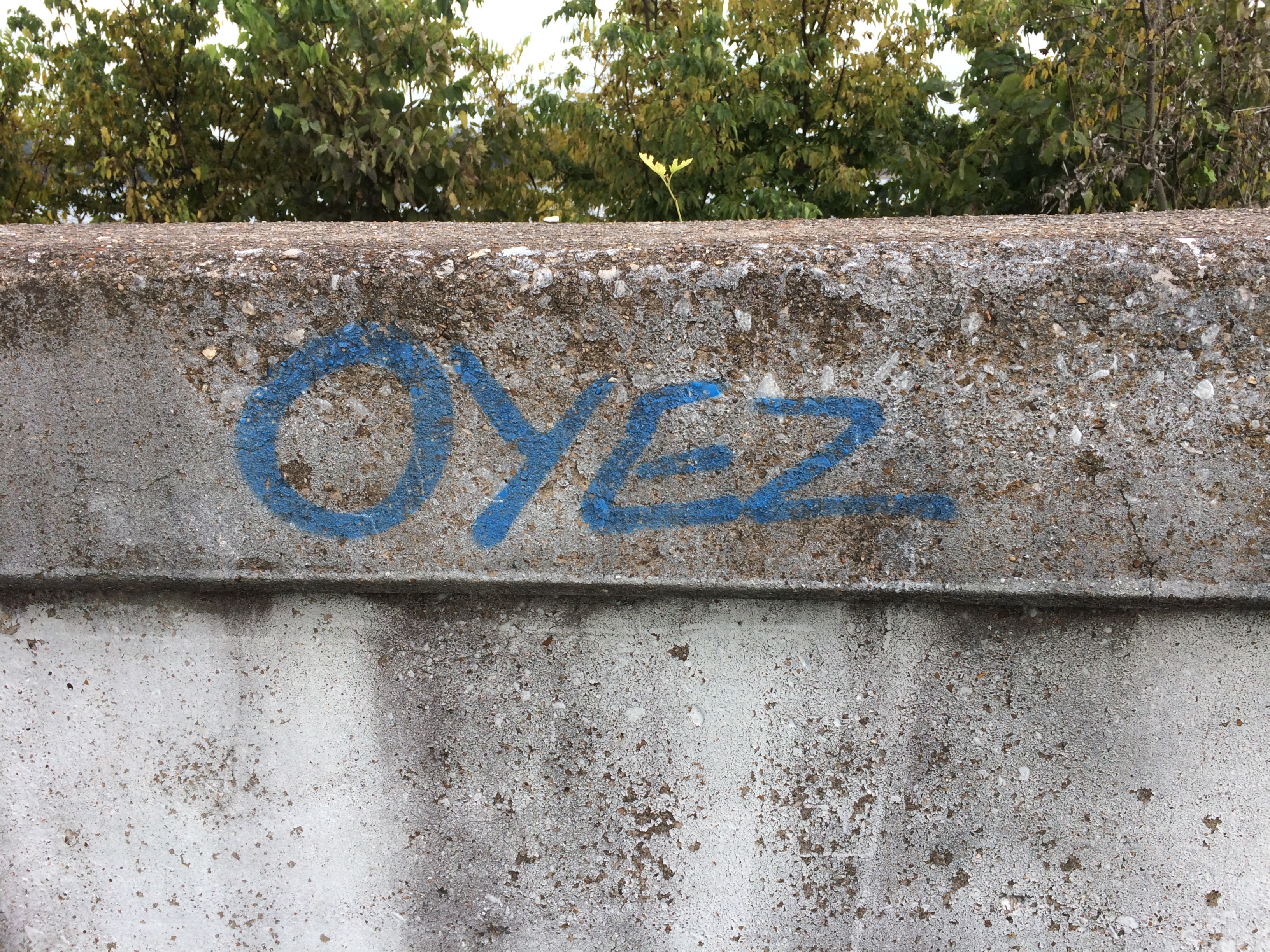
Left by a passing bailiff with a can of spray paint?

SIU and Buckminster Fuller Too

On October 10, Ann and I tooled around the Southern Illinois University campus a bit, agreeing that it isn’t the aesthetic experience that some college campuses are. Visitor parking proved hard to find, so we didn’t take a walk on campus.

We did spot the Wham Building on Wham Drive. Ann suggested that the donors were the British pop duo, now about 35 years passed their heyday. Though as a matter of style, it ought to be the Wham! Building. Their connection to SIU? None that we knew, but never mind. Maybe they decided they had enough money to fund a building on a college campus, and they threw a dart at a map to determine where it would be.

Not long after that conversation, we heard a local station playing “Wake Me Up Before You Go Go.” Coincidence or synchronicity? Coincidence, I’d say.

Not far from campus is a residential neighborhood with a fair amount of student housing, marked by some genteel seediness. Parking was easy around there, so we stopped for a short walk down a residential street.

Some of the residences stood out more than others. Some for their décor. It might be hard to see in the picture, but there’s a neon sign in the window of this Halloween-ready house: PALM READER.Carbondale palm readerOther properties stand out for more fundamental reasons. The R. Buckminster Fuller and Anne Hewlett Dome Home is at the intersection of two small streets in an otherwise unremarkable location in the neighborhood.fuller dome carbondale
fuller dome carbondale
The dome is fenced off and closed. But someone used to live there. Bucky himself, as it happens. A sign on the fence says: “Buckminster Fuller is considered one of the leading visionaries of the 20th century. He patented the geodesic dome in 1954 and it is his most enduring legacy. In April 1960 he assembled this dome home (The Fuller Dome) and lived in it with his wife Anne until 1971.”

How long had it been since I’d thought about Buckminster Fuller? Before finding out about the dome, that is, which was a few days before our visit to Carbondale. A long time, that’s how long. I suspect much of the world can say the same. Whatever Fuller’s contributions to civilization, and I’ll be the first to say geodesic domes are pretty cool, he’s headed for obscurity as surely as Ernie Pyle.

Reading about Fuller made me think of Lucy Kulik, a sixth-grade teacher of mine. She taught us math and I believe also led our participation in Man: A Course of Study almost 50 years ago. I hadn’t thought about her in a long time, either, and checked to see whether she was still among the living. Possible, but not likely, though it turned out she died only last year at 97, and now has a stone at Fort Sam Houston National Cemetery next to her husband, an Air Force lieutenant colonel — something I didn’t know about her.

RIP, Mrs. Kulik. The details have faded after a half century, but I remember you were a good teacher.

In class one day Mrs. Kulik mentioned Buckminster Fuller as the fellow who invented a dome made of triangles and who wanted the world to give up the words “sunrise” and “sunset.” I’d never heard of him at the time, or if I had, I’d forgotten.

Fuller suggested the words sunsight and sunclipse to replace sunrise and sunset, arguing that the common words reflect an incorrect understanding of the way the Earth and the Sun move. You could argue that they do, of course, and the words he suggests are perfectly fine, but to object to sunrise and sunset on those grounds itself reflects an excess of literalism in understanding language. That might be a reason his suggestions didn’t catch on.

His domes might be cool — you can’t stand in front of the Expo ’76 Fuller dome in Montreal and not feel a little awe — but I also have to add that a few of them go a long way. In the case of Carbondale, one is probably enough.

Jeremy Rochman Memorial Park, Carbondale

During the early planning for our recent trip, I didn’t give Carbondale, Illinois, much thought as a possible destination, but then Ann mentioned a park there she’d heard about from a friend who used to live in the area. After a little further investigation, I worked Carbondale, especially the park, into our plans.

“A vocal fan of the role-playing game Dungeons and Dragons, Jeremy ‘Boo’ Rochman was tragically killed in a car accident at the young age of 19,” Atlas Obscura says. “To honor his memory, his father bought a parcel of land across the street from their home in order to build a memorial park. His late son’s passion was for the role-playing game Dungeons and Dragons, so his father decided to turn the park into a fantasy land that his son would have been proud of.”

Jeremy Rochman Memorial Park is on the outskirts of Carbondale. When you arrive, various painted concrete creatures greet you.Jeremy Rochman Memorial Park
Jeremy Rochman Memorial Park

Jeremy Rochman Memorial Park

Jeremy Rochman Memorial Park

Including an enormous dragon, good for climbing, if you’re agile enough.Jeremy Rochman Memorial Park
The “castle” — the whole place is sometimes called Castle Park or Boo Castle Park — is a wood and stone structure with an elaborate set of passageways and stairs for kids to climb around.
Jeremy Rochman Memorial Park
With plenty of figures of its own.
Jeremy Rochman Memorial Park
The park wasn’t overrun with people, but we did notice a birthday party off in one corner.Jeremy Rochman Memorial ParkIf ever there were a good place for a children’s birthday, this is it.

Shawnee National Forest ’20

During my break from posting, Arlo Stribling was born to my nephew Dees and his wife Eden in Austin. Congratulations to the new parents, here’s hoping the boy is a joy. Best regards to little Arlo, an emissary to a future my generation will not see.

On the afternoon of Friday, October 9, Ann and I went southward for a visit in and around Shawnee National Forest, which stretches in large patches — in typical national forest style — from the Ohio River to the Mississippi, or vice versa, occupying a lot of extreme southern Illinois. We looked around the east part of the forest. The weather turned out to be flawless for such a little trip, warm and partly cloudy.

We spent the first night in Mattoon, Illinois, continuing southward the next morning. The first place we went on Saturday morning wasn’t in southeast Illinois, but further west: Carbondale, visiting Castle Park, or more formally Jeremy Rochman Memorial Park, on the outskirts of town. Afterwards, we looked around Southern Illinois State University, and saw the nearby Buckminster Fuller House. A domed house, of course.

Heading east on Illinois 13, we eventually made our way as far east as that road goes, Old Shawneetown, a husk of a formerly much more populous place on the banks of the Ohio, and home to the Shawneetown State Bank Historic Site. We spent the next two nights in Harrisburg, Illinois, which bills itself as the Gateway to the Shawnee National Forest.

On Sunday, we drove the roads of the southeast part of the forest, climbed a modest flagstone path to a grand vista — the Garden of the Gods — hiked along a small lake surrounded by trees approaching their peak coloration, climbed a bluff via a CCC staircase, and visited a large cave entrance facing the Ohio River at Cave-in-Rock State Park.

Small, winding roads pass through the national forest, rising and falling, flanked  alternately by walls of trees and expanses of flat farmland, post-harvest but before a winter freeze. Towns come in the sizes small, smaller and hamlet. In that part of Illinois, sometimes known as Little Egypt, small white churches are a common sight, more Baptist than any other denomination. Not quite as common, but enough in evidence were abandoned structures: farmhouses, gas stations, motels, restaurants and shops. If it were up to the people who put up political signs in that part of the country, the president would be re-elected by a wide margin. A smattering of Confederate battle flags were flying here and there.

Traffic is at a trickle on those roads most of the time. That made for easy, and sometimes picturesque, driving. Car commercial driving, I told Ann.

On Monday, Columbus Day Observed, that lightest, most gossamer of all national holidays, we headed home, with one major short detour into Indiana, to visit the town of New Harmony. The 19th-century utopian colonies there might have failed (two! count ’em, two utopian experiments), but the town has succeeded in being highly pleasant and intriguing everywhere you look in our time. Also, a famed theologian is buried there, in as much as theologians get fame.

As mentioned above, we didn’t spend much time in Mattoon. But early on Saturday I got up and looked around for a few minutes. The town looks frayed, buffeted by the contraction of U.S. manufacturing and the vagaries of the farming industry and the rural economy as a whole.

The town’s relatively greater prosperity in the early 20th century is reflected in its cemetery. A sizable place, the Dodge Grove Cemetery measures about 60 acres and has 20,000 permanent residents, including three Civil War generals and 260 soldiers from that war, one of whom is an unknown Confederate. There’s a story in that last detail, probably lost to time.Dodge Grove CemeteryDodge Grove Cemetery

Dodge Grove Cemetery

Blazes of fall color rise in places.
Dodge Grove Cemetery
According to Find a Grave, only one of those Civil War generals counts as a notable burial in Dodge Grove, James Milton True, commander of the 62nd Illinois Volunteer Infantry. I like the other major item on his CV: U.S. consul in Kingston, Ontario in the 1870s.

That hints at some pull with the postwar federal government, probably based on connections he made during the war, or because he became a local politico who could deliver votes. Or both. Seems like a plumb diplomatic assignment in the 19th century: no language skills necessary, close enough to home that you can visit periodically, and no danger of catching malaria or some other dreaded tropical disease.

I didn’t see his grave. I didn’t know he was there till later. I did see the Pythias obelisk.
Dodge Grove Cemetery

Erected by
Palestine Lodge No. 46
Knights of Pythias
In Memory of
Deceased Members
1929

I’ve encountered vestiges of the Knights before, such as in Atlanta, Illinois. I associated them with an earlier time, the sort of organization that George Babbitt might have mentioned in passing as having a chapter in Zenith. But no: the Knights of Pythias are still around, though at much diminished numbers.

Still around, and up with the times. “The Summer 2020 Edition of the Pythian International is now online,” the fraternal org’s web site says. “It includes information on the rescheduled Supreme Convention, Oct. 1-6.”

As I was about to leave, I spotted this stone.
Dodge Grove CemeteryA heartbreaker of a stone. Though I’m sure combat deaths didn’t quite stop exactly at 11 am on the 11th, since even modern armies with good internal communications can’t stop on a dime. Still, the day before the Armistice. Damn.

I don’t know why I’m surprised any more at anything online, but I was surprised to find a local newspaper account of Lawrence Riddle’s last days, though it doesn’t specify how he died (and this too: a niece that he never knew). In the article, the most attention is paid to Riddle’s participation in combat during the days before his death, charging a German machine gun position with four other men. They seized the position and brought back prisoners.

I wonder whether the Germans, eager to surrender at this point in the war, were making it easy for the raiders, or whether the Americans faced bitter-enders who were still playing for keeps. Either way, a clear act of bravery on the part of Riddle and the others.

A Good Slogan Is Hard To Find

We had a pleasant warm weekend, but rain came overnight and cooled things off. Not cold, but not summertime warmth either. Touches of yellow in the trees are growing more visible by the day, but are still patchy when it comes to fall foliage.

Not a lot of political postcards are arriving this year, probably because so few of the Illinois races are competitive in 2020. I did get a card from our incumbent state rep not long ago, however. I see that she’s dropped her earlier slogan, Mom on a Mission.

What kind of mission? That was a little vague, but I guess to make Illinois a better place for the wee tykes. Anyway, I had to look around the card for the replacement slogan, so little was it emphasized: Commonsense Leadership for Change.

Distinctly underwhelming. But expected. After all, an honest slogan like, I’ve Gotten Used to the Income, Please Re-elect Me, isn’t going to fly.

A Sunday Drive + Phishin’

The last day of August? Even this pandemic summer has sped by like an ordinary summer. I’ll post again on September 8.

We were out and about on Sunday, including a drive on I-90 between metro Chicago and Rockford. Here’s the highway as seen from the Belvidere Oasis, looking west.
tollway oasis BelvedereThat is, at a large rest stop on the toll road. They seem to be unique to Illinois.

On the whole, we did a classic Sunday drive — a trip just for the sake of driving, except that it was also driving practice for Ann, who has a learner’s permit these days, and not much experience on highways. We made it as far as Rock Cut State Park near Rockford, then headed back.

As part of our return, we stopped at Gabuttø Burger. Formerly located in Rolling Meadows, the Japanese-style hamburgerie is now in Elgin, near the Randall Road exit on I-90. Not very convenient for us most of the time, but we were in the area.

Eating in was an option, but instead we found a small nearby park with a picnic shelter. Good eating. We are fortunate indeed.
Gabutto BurgerFor some reason while we were out on Sunday, a number of phishers came calling. Our voice mail captured 13 messages. Actually all from the same source saying the same thing: Your X account has been breached…

How thoughtful of them. They provided a phone number to call, and I’m sure for a small fee — what’s that credit card number again? — they’ll be happy to fix a problem with something I don’t even use.

Also, an email (all sic) pretending to be from a major financial services company came on Sunday:

Your account security is our priority.
To validate your account, click here or the validation button below.
The link will expire in 24 hours, so be sure to use it right away.
failure to confirm your record will result in account disabled. Please confirm your records.

Such is life among the digital wonders of the 21st century.

Thursday Bits & Bobs

Some unusually cool days this week. I’m not sure whether that had anything to do with what happened at about 7:45 pm on Wednesday out on our deck. I was sitting out there, decompressing from a day of work and other tasks, when I saw a dark blob hit one of our deck loungers. Twack!
Two cicadas. Noiseless, though the cicadas have been doing their twilight bleating for a few weeks now. Crickets are also singing after dark, though maybe not as strongly as they will closer to their seasonal demise. By Thursday morning, when I next checked, the cicadas were gone.

Happy to report there’s a thin mosquito population this year, at least around here. Flies have taken up the slack. Seems like one gets in the house every day through the back door, including some of the metallic-colored ones that used to fascinate me as a kid.

Also in the back yard: blooming hibiscus. Could be Hibiscus syriacus. I can also call it rose of Sharon, though I understand that’s applied to other flowers as well.
At Starved Rock State Park recently, I spotted his plaque near the lodge. Looking its century-plus age, including countless touches of Lincoln’s nose.
GAR Ladies plaque Starved Rock State Park“Commemorating the deeds of the Union veterans of the Civil War,” it says. The Ladies of the Grand Army of the Republic erected it in 1914. Looks like the Ladies, who are still around, were trying to keep up with the Daughters.

Chronicling a lot of violence, but also a thing of great beauty.

Our most recent episode of Star Trek: “A Piece of the Action.” I suggested it as one of three options — an action/adventure story, or one of the show’s tendentious eps, or comedy. Ann picked comedy. I’d forgotten how much of a hoot “Action” is, with the high jinks gearing up especially after Kirk and Spock got into pseudo-gangster duds and Shatner hammed it up.

Oh, my, listen to that. My my my.

Two Illinois Points of Interest

For years, I’ve seen the following two points of interest routinely included on road maps of Illinois. At least, on Rand McNally and Michelin: the Norwegian Settlers State Memorial and the Wild Bill Hickok State Memorial.

When it comes to points of interest on commonly available road maps, there must be just a touch of the arbitrary in their selection. Just a touch, because certainly mapmakers have their editorial standards. Still, I see those (typically) red dots and wonder not only what it is, but also why is that on the map and not something else?
Guess being a state memorial or monument helps land a place on maps. (That link is part of a larger list.)

One goal of our recent trip was to avoid large highways, which we mostly did until we headed for home, when we wanted a more speedy return. When heading out, we kept to smaller roads. One of these was Illinois 71, which passes through the unincorporated community of Norway.

Not far from Norway is the the Norwegian Settlers State Memorial. It’s an example of the plaques-on-rocks school of memorial design, along with a wooden structure, and U.S. and Norwegian flags.
Norwegian Settlers State Memorial “This Memorial commemorates the 1834 settlement at Norway, Illinois — the first permanent Norwegian settlement in the Midwest,” says the State Historic Preservation Office. “A departure point for many Norwegians who settled other parts of the Midwest, Norway became known as the ‘mother settlement.’ The monument, dedicated in 1934, honors the community and its founder, Cleng Peerson (1783-1865).”

Peerson got around. Though he led immigrants to the New World, he didn’t seem to be interested in settling for more than a few years at a time himself. According to Wiki, he even spent time in Bishop Hill among its Swedish settlers. I guess he had no hard feelings against those oppressors of the Norwegian people. He ended up in Texas in the mid-19th century, as a lot of people did.

Why three stones? One from 1934 memorializes the 100th anniversary of the settlement of Norway, Illinois. Another from 1975 memorializes the 150th anniversary of Norwegians first coming to America en masse. The King of Norway came for that occasion. And yet another (also 1975) notes that part of Illinois 71 is the Cleng Peerson Memorial Highway.

That’s not all. The wooden structure — which I assume is an homage to Norwegian design — has text front and back. Three separate plaques on the front, dated 1980, tell the “Norsk Story,” that is, Norwegians coming to America.

Two more plaques on back (from 1982, bicentennial of Peerson’s birth) offer more detail about the memorial, including lines about Lester Severskie (1918-82) who was “dedicated to the preservation of the Norwegian heritage of Norway, Ill.”, a list of the Norwegian heritage organizations in the U.S. as of 1982 (I had no idea there were so many), and a few lines to thank Olav V, members of the Norwegian government, and so on and so forth.

This has to be the wordiest memorial I’ve ever encountered. It’s the memorial equivalent of a logorrheic movie star upon winning an Oscar. I usually enjoy reading obscure plaques, but these tried my patience, especially in the high heat of July. (The rest of my family was sitting in air-conditioned comfort in the car.)

Even so, I’m glad I stopped. Especially because I noticed that behind the memorial is a small cemetery. The Cleng Peerson Memorial Cemetery, according to one source (who spells cemetery wrong), though I didn’t see any signs or plaques at all about it, just the headstones. According to another source, it’s the Nelson Cemetery.

Norwegian Settlers State Memorial cemetery

Norwegian Settlers State Memorial cemeteryWhatever the name, it must be an active local cemetery. At least one burial was fairly recent.
Norwegian Settlers State Memorial cemeteryPeerson himself isn’t there. He’s buried near Clifton, Texas.

In a different context, you might call Peerson an empresario, along the lines of Stephen F. Austin in Texas, except that he was merely a leader of immigrants, not someone who was granted land by an existing government. Except that in the end, he was granted land by Texas, but for services rendered in populating the state with hardy Norwegians, not as an incentive to bring them.

Returning from the Illinois River Valley on Sunday, I made a point of stopping at the Wild Bill Hickok State Memorial in Troy Grove, Illinois. Wild Bill isn’t buried there either. He died in Deadwood, after all, and he rests there in Boot Hill.

Rather, the memorial marks the birthplace of James Butler Hickok, scout, spy, lawman, soldier, marksman, gambler, showman, folk hero, and dime novel and movie and TV character. It’s at the center of an open patch of land where the Hickok family home once stood, and includes one plaque and one bust.
Wild Bill Hickok State MemorialThe state of Illinois erected the plaque in 1929, and it wasn’t shy about lionizing Wild Bill. It needed a proofreader, too.
Wild Bill Hickok State Memorial“He contributed largely in making the West a safe place for woman [sic] and children,” the plaque says in part. “His sterling courage was aways [sic] at the service of right and justice.”

The bust is more recent. I had to look it up, because I couldn’t find anything on site — not a word — to say who created it or when.
Wild Bill Hickok State MemorialThe state of Illinois says a “log-carved bust” of Hickok was added in 1999, but that’s no wooden bust. It took a little looking, but I found out that “in 2009, an attractive bronze bust of Hickok by artist William Piller was placed in the park. It replaced a carved wooden bust that had been in place 10 years but had severe weather damage,” according to the Danville, Illinois, Commercial-News.

Though it was a hot day, I wasn’t quite done with Troy Grove, pop. 230. A building near the memorial caught my eye. (The rest of my family was sitting in air-conditioned comfort in the car.)
Former Bank, Troy Grove IllinoisBank, eh? Well, not any more. Still, it’s a handsome little building. A detail toward the top further got my attention.

Bankers Electrical Protection Co. of Minneapolis

A logo marker apparently left by the Bankers Electrical Protection Co. of Minneapolis: a guard dog close to a money bag. The company seems to have specialized in bank vaults and other security features for banks of yore. You know, the sort of banks at risk from unauthorized withdrawals by the likes of the Cream Can Gang.

Besides a few images, I haven’t found out much else about BEPCo. (as it surely would be called now), mostly since I don’t feel like it. Enough to assume that it went out of business or was acquired by another security company long ago. Yet traces remain, in stone no less.

Oglesby Sights

Sizable towns cluster around the Illinois River in north-central Illinois like so many stones on a necklace: Morris, Ottawa, LaSalle, Peru, Spring Valley, Princeton. Then there’s Oglesby, which isn’t so sizable, at about 3,500 people. The place is named after the long-ago Illinois governor, whom I’ve encountered before in Decatur and Chicago.

We became acquainted with Oglesby last weekend because we stayed overnight in a motel in the town, to take advantage of its proximity to Starved Rock SP and Matthiessen SP, though we decided not to visit the latter.

To become acquainted with the town, you can drive down the east-west Walnut St. for about two miles. On Sunday morning, I went out for gas early, which also meant looking around. Lilly joined me.

The town post office on Walnut looked about as WPA as can be. Being Sunday, we couldn’t go in and look at the 1942 mural, “The Illini and Pottawatomies Struggle at Starved Rock” by Fay E. Davis, which is said to be quite something.

Soon we arrived at this structure, which would loom over Walnut St., except that it’s set back a few hundred feet and behind a fence. The fence is pretty new.
Lehigh Portland Cement Co Oglesby IllinoisAn old enough ruin to sport fully grown trees in its midst. An interesting enough ruin to be fenced, though I figure local teens have no problem getting in when the mood strikes.

The blackened sign is just barely legible.

LEHIGH PORTLAND CEMENT COMPANY OGLESBY

That’s all I needed to find out more about this industrial ruin. For decades, Oglesby lived by the extraction and processing of minerals, especially the manufacture of cement and concrete.

The Chicago Cement Co. started operations on the site in 1898. Lehigh, a Pennsylvania company, acquired Chicago in 1916 and ran the plant until 1963. Apparently Lehigh decided at that time that modernization of the plant wouldn’t be worth the expense, and so closed it.

I have to report that cement and concrete production in the area isn’t dead yet. Illinois Cement Co., which is across the river in LaSalle, still seems to be in that business, and related hard-stone entities dot the map: the Mertel Gravel Co., Ladzinski Concrete Finishing Co., Lafarge Aggregates, Wenzel Concrete Works and Ruppert Concrete, to name a few (and those last two are in Oglesby).

The above image is only a part of the ruin.
Lehigh Portland Cement Co Oglesby IllinoisEven that doesn’t depict the whole of it. Note how far it goes back when you look on Google Maps. We were looking at the property from about where I’ve put a blue dot.
Lehigh Portland Cement Co Oglesby Illinois“This looks like the most interesting thing in Oglesby,” I told Lilly. Too expensive to tear down, I figure, so there it stands, letting the decades take their toll.

Down Walnut to the east was something almost as interesting, and cement related, too.Safety Follows Wisdom Oglesby IllinoisAn intriguing bit of work in a small public park — Lehigh Park — donated by the company to the town in 1945 (the side plaque says that). Turns out the work is one of a genre of memorials, awarded by the Portland Cement Association, with examples wherever cement is or was made. They’re made of cement, of course.

“Cement ‘Safety Follows Wisdom’ monuments, first presented in 1924, for perfect safety records at cement plants,” says the Historical Marker Database. “The winning design came from an Art Institute of Chicago team directed by sculptor Albin Polasek.” (I’ve happened across his work before.)

Safety Follows Wisdom Oglesby illinoisDo a casual search and you’ll find Safety Follows Wisdom stones all over the country. It’s something I had no inkling of until I drove down a main street in a small town and — more importantly — got out of the car and looked around. The devil might be in the details, but I find that the joy of traveling is in the details.

Ottawa Sights (Not the One in Canada)

We arrived in Ottawa, Illinois, on Saturday in time for lunch. We decided on carry-out from Thai Cafe on Columbus St., which seems to be the only Thai joint in town. At a population of 18,000 or so, maybe that’s all Ottawa can support.

We took our food to Allen Park, a municipal park on the south bank of the Illinois, and found a picnic shelter. The river’s large and on a weekend in July, home to a lot of pleasure craft.
Ottawa Illinois 2020Sometimes, the river must be angry, such as on April 19, 2013. Got a lot of rain in northern Illinois about then, so I believe it.

Ottawa Illinois High Water MarkDownstream a bit is the Ottawa Rail Bridge, which rates a page in Wikipedia. The current bridge dates from 1898, though it was modified in 1932.

Ottawa Illinois Rail Bridge

Two large metal sculptures rise in the park, both by Mary Meinz Fanning. The red one is “Bending.”
Ottawa Illinois BendingThe yellow one is “Reclining.”
Ottawa Illinois Reclining“Fanning was the driving force behind the creation of the red and yellow steel sculptures at Allen Park by the Illinois River in Ottawa,” says a 2010 article in The Times, which seems to be a local paper.

“The 40-foot-tall sculptures, which weigh 17 tons each, were erected in 1982 and 1983 from parts of the 1933-built steel girder Hilliard Bridge that was demolished in 1982 to make way for the present-day Veterans Memorial Bridge. Fanning died of illness Nov. 4, 1995, in Ottawa at age 48.”

Just as you enter the park, you also see a wooden sculpture: one of artist Peter Toth’s “Whispering Giants,” which I’d forgotten I’d heard of till I looked him up again. The one in Allen Park is Ho-Ma-Sjah-Nah-Zhee-Ga or, more ordinarily, No. 61.

Looked familiar. I realized I’ve seen one before —
Nee-Gaw-Nee-Gaw-Bow That one is Nee-Gaw-Nee-Gaw-Bow or No. 59, and we saw it by chance in Wakefield, Mich. about three years ago. Apparently the artist has put up at least one in each state.

Ottawa has a place in U.S. history mainly for two things. One that the town is happy to celebrate: the first Lincoln-Douglas debate in 1858. The other is the awful story of the Radium Girls, poisoned by luminous paint at a clock factory in Ottawa in the early 20th century. For a long time, there was no public acknowledgment of that incident. Now there is. But I didn’t know the Radium Girls have a statue in town (since 2011), so we missed that.

We didn’t miss the site of the Lincoln-Douglas debate, which is in the shady, square-block Washington Park.
Ottawa Illinois Washington ParkLincoln and Douglas are there as part of a fountain to memorialize the event. They were cast in bronze in 2002 by Rebecca Childers Caleel.
Ottawa Illinois Washington ParkOttawa Illinois Washington ParkIt would have been more pleasant if the fountain were on, but maybe it was dry for public health reasons in our time. The noontime heat was oppressive, so we didn’t have a leisurely look-around the area as much as we might have otherwise. There are other memorials in the park, and plenty of historic structures nearby, forming the Washington Park Historic District.

Those buildings include the Third District Appellate Court Building (1850s), the Reddick Mansion (1850s), the Ottawa First Congregational Church (1870), Christ Episcopal Church (1871), and a Masonic Temple (1910). A few blocks away, the LaSalle County Courthouse looked interesting, too, but we only drove by.

I managed to take a close look only at the former Congregational Church building.
Ottawa Illinois Washington Park Open Table Church

Ottawa Illinois Open Table Church of Christ

Gothic Revival in brick. These days, the church is part of the Open Table United Church of Christ.