Winter Park, Florida

Regards for the New Year. Back to posting four days into 2026, maybe with tales of Florida alligator tourism. The change of the year always brings me the same reaction: how did that number get so high? This time around, I wonder how is it that 1976, a good (mostly) year I remember fairly well for a number of reasons, was 50 years ago?

Orlando, Yuriko was surprised to learn, is an actual city. The day after Universal Epic Universe, we drove from our hotel near that park, past Orlando’s sizable downtown, and to the inner suburb of Winter Park. She marveled that the city had a presence besides the sprawl of the theme parks, which are at some distance from the Orlando CBD. Bet she isn’t the only person, upon leaving the theme park zone, with that reaction.

One could devise a pretty good multi-day visit to Orlando, to see its green spaces and historic sites and museums, and take in a few shops and restaurants and some live music, and never pay the Mouse or Comcast a dime. Maybe one day I will do such a visit, but the pull of the theme parks is pervasive. Even my businesses trips of yore (early 2000s) to central Florida tended to gravitate toward the parks. Why would you skip the theme parks? would be the reaction, even — and most importantly — among members of my family. For now, part of a day away from the Theme Park Industrial Complex will have to do.

I’d gotten wind of a tour boat ride on Winter Park’s small lakes that (1) wasn’t expensive and only about a hour long; (2) didn’t require reservations or a damned app or the like to access; and (3) most importantly, was something we could do sitting down, after a day of walking and more walking.

Winter Park, Fla. Dec 10, 2025

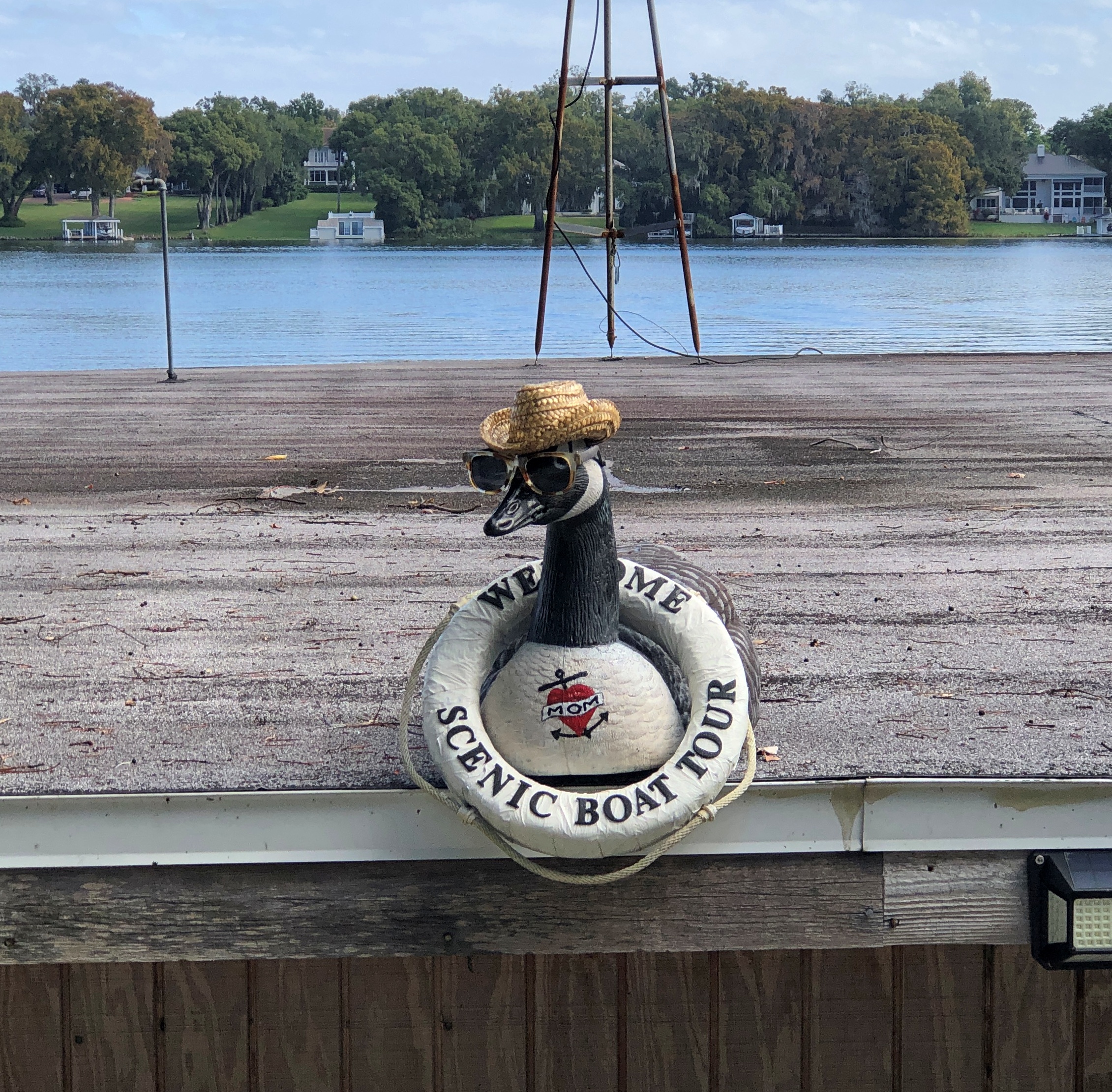
We made it for the noon tour. December 10 was as warm and clear a day in Winter Park as you could ask for, a reminder of why a couple of Victorian businessmen were able to found a town in central Florida and attract wealthy property buyers who aspired to escape the frozen North for a few months.

Our skipper for the tour.

Winter Park, Fla. Dec 10, 2025

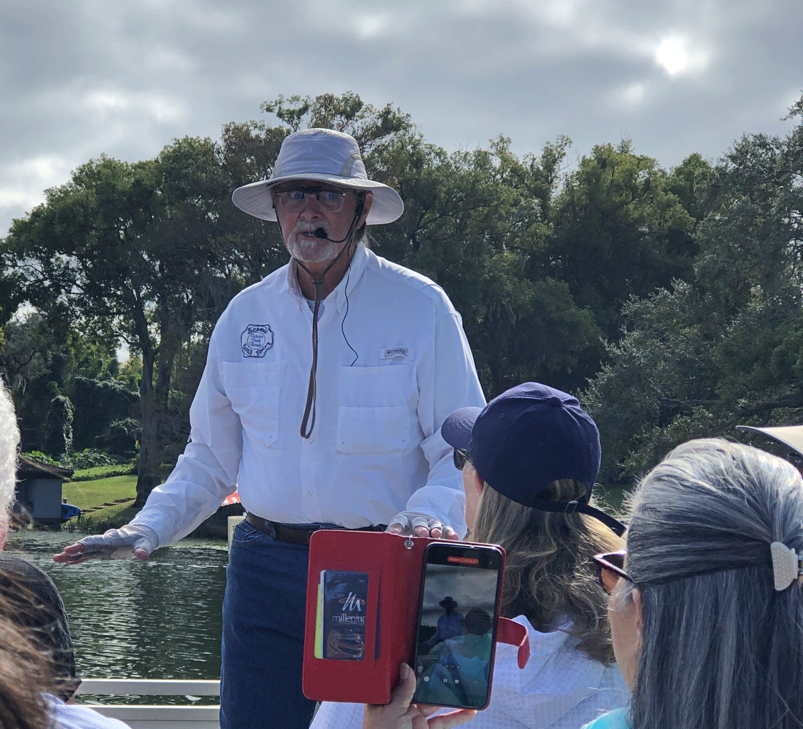
Skipper Bob, let’s call him. He took us from the tour-boat dock on Lake Osceola through a couple of canals to Lake Mizell and Lake Virginia and then back, pointing out some of the posher estates and landmarks along the way, such as the posh boat houses that tend to come with such properties.

Winter Park, Fla. Dec 10, 2025

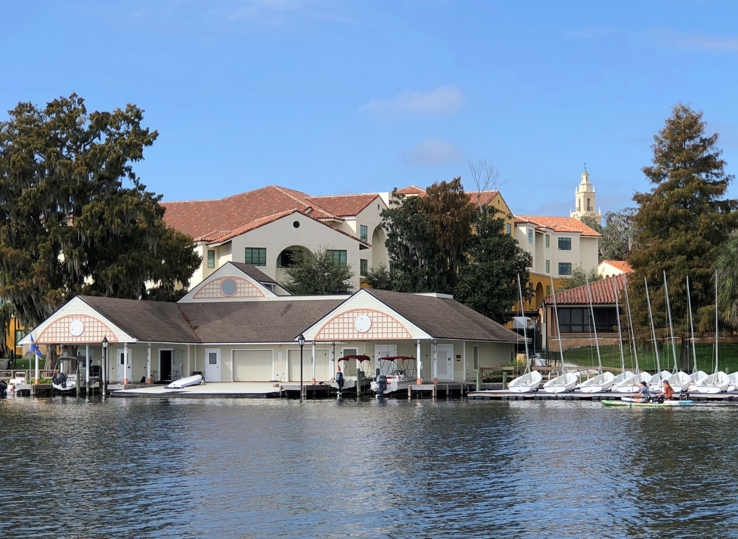
Bob also offered up some detail about the history of the area, most of it unfamiliar. I didn’t know, for example, that Fred Rogers was an alumnus of Rollins College, which occupies a sizable chunk of the Lake Virginia shore. I also learned that the college, even in our age of grossly inflated higher-ed tuition, outclasses most others in its high cost.

Out on the lakes, Bob revved up the engine from time to time, spurring the boat forward at a good clip. Wind famously blows long hair into a pleasantly billowing mass at such times, but under the warm sun and blue sky that day, even my shortish hair was picked up by the wind. Felt good.

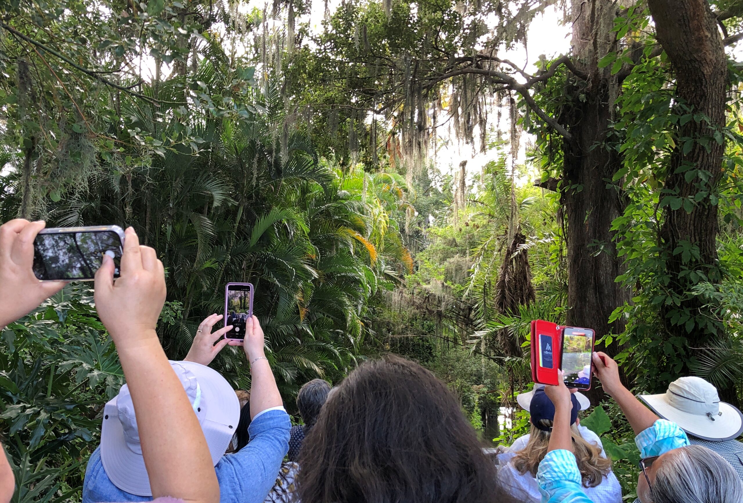
I liked the passages through the canals. I don’t think I was alone in this.

and offering up some detail about the history of the area, most of it unfamiliar. I didn’t know, for example, that Fred Rogers was an alumnus of Rollins College, which occupies a sizable chunk of the Lake Virginia shore. I also learned that the college, even in our age of grossly inflated higher-ed tuition, outclasses most others in its high cost.

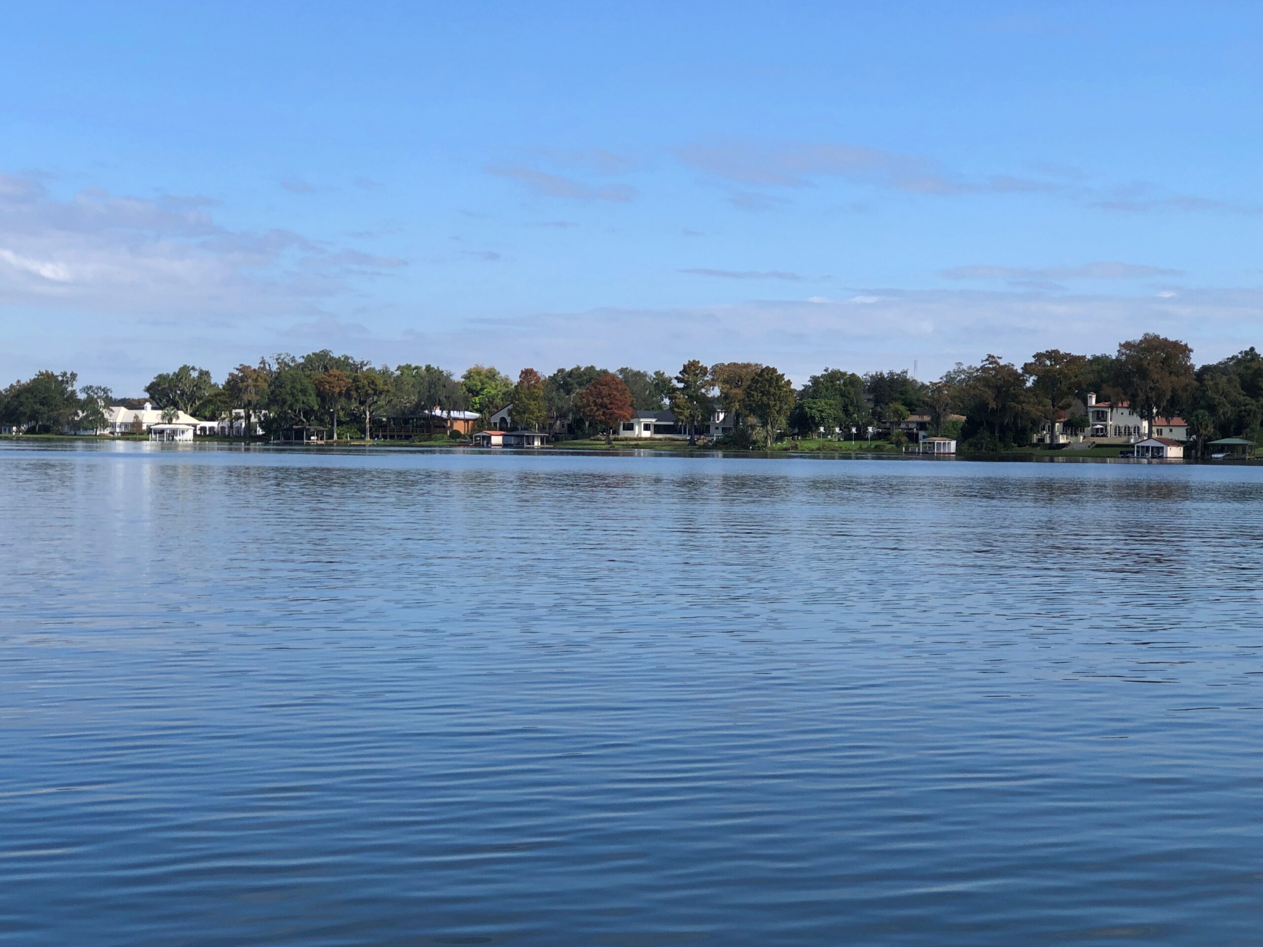
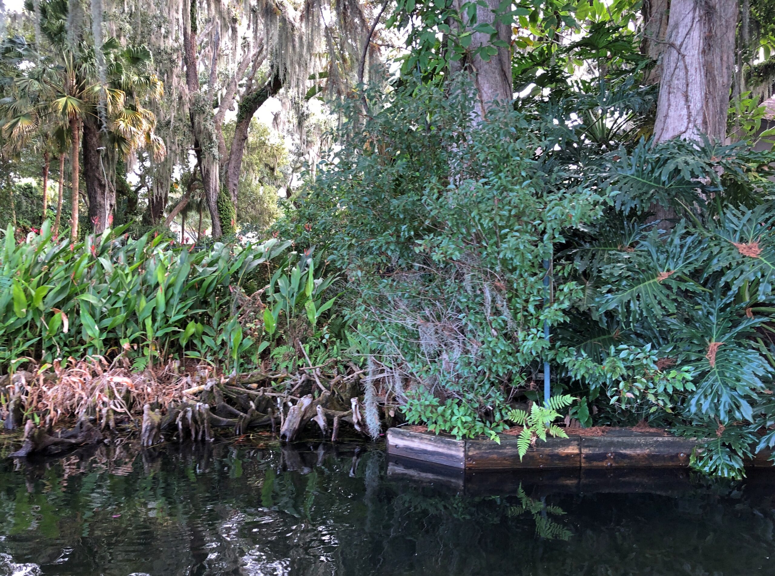
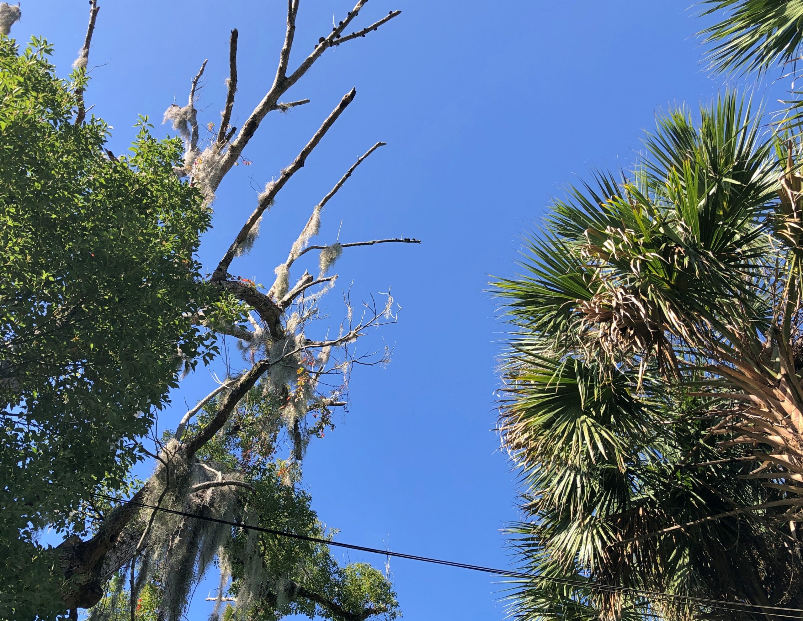
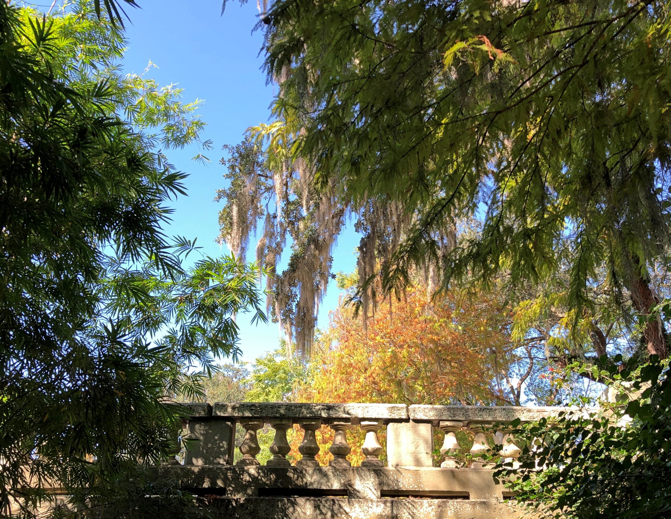
In most of the rest of the country, winter had arrived. In Winter Park, named for the season it is most unlike, you can pass through the tightly packed greenery luxuriating in warm air.

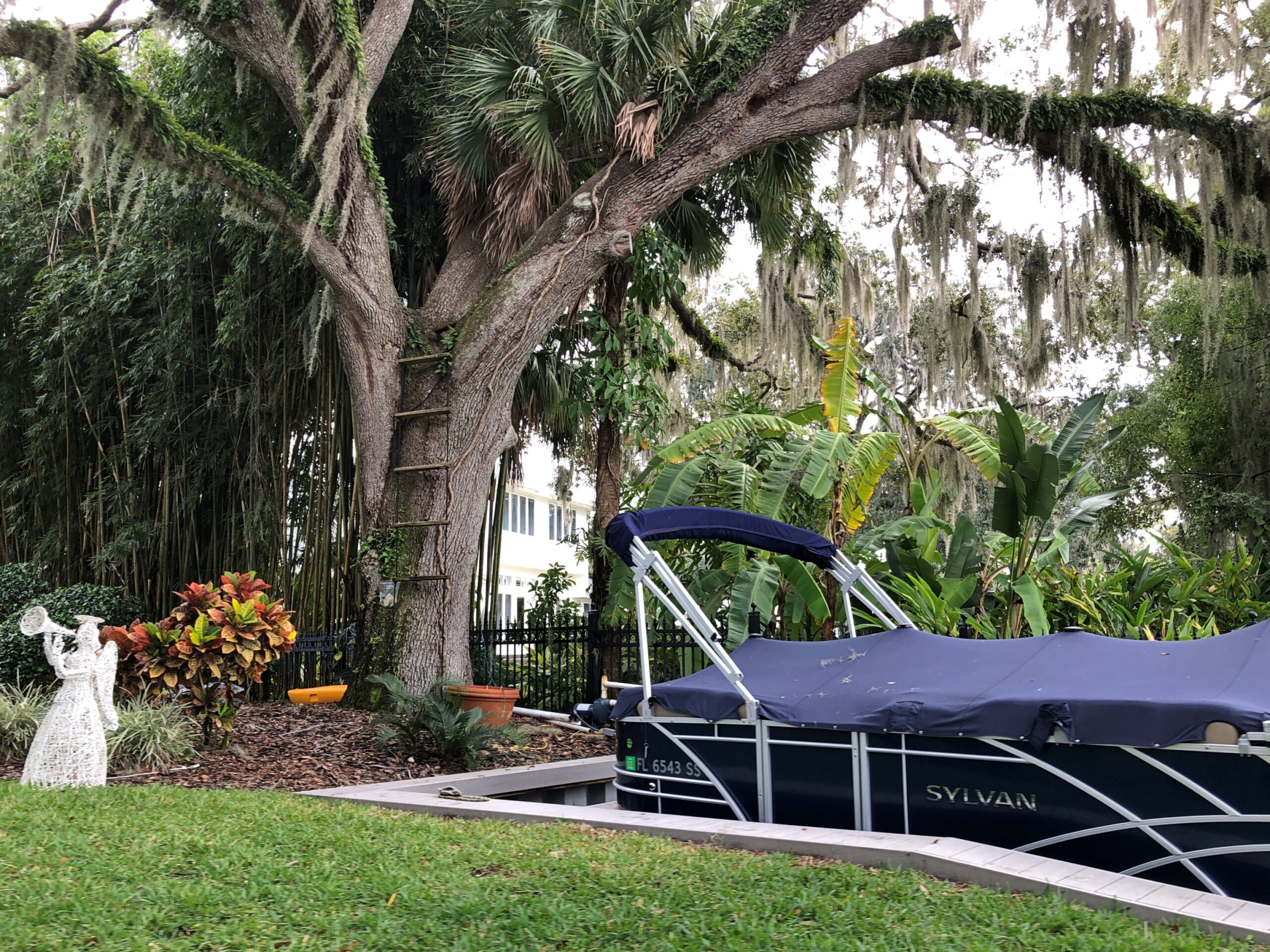
You’re up close to the yards of more modest, but still high-value real estate. Everyone’s got a dock.

Winter Park, Fla. Dec 10, 2025

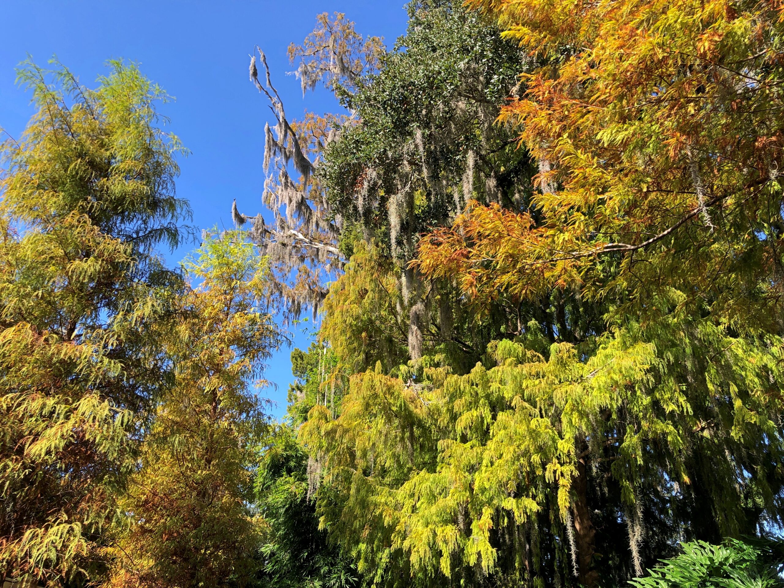
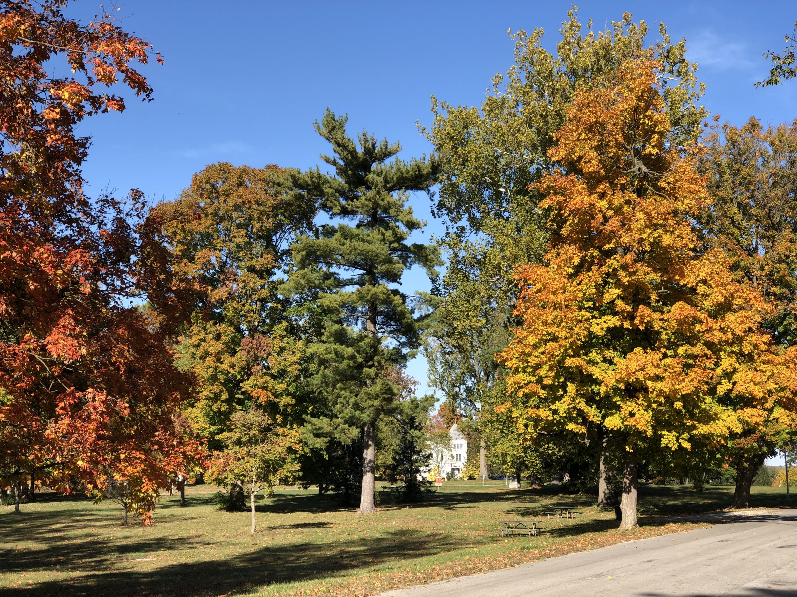
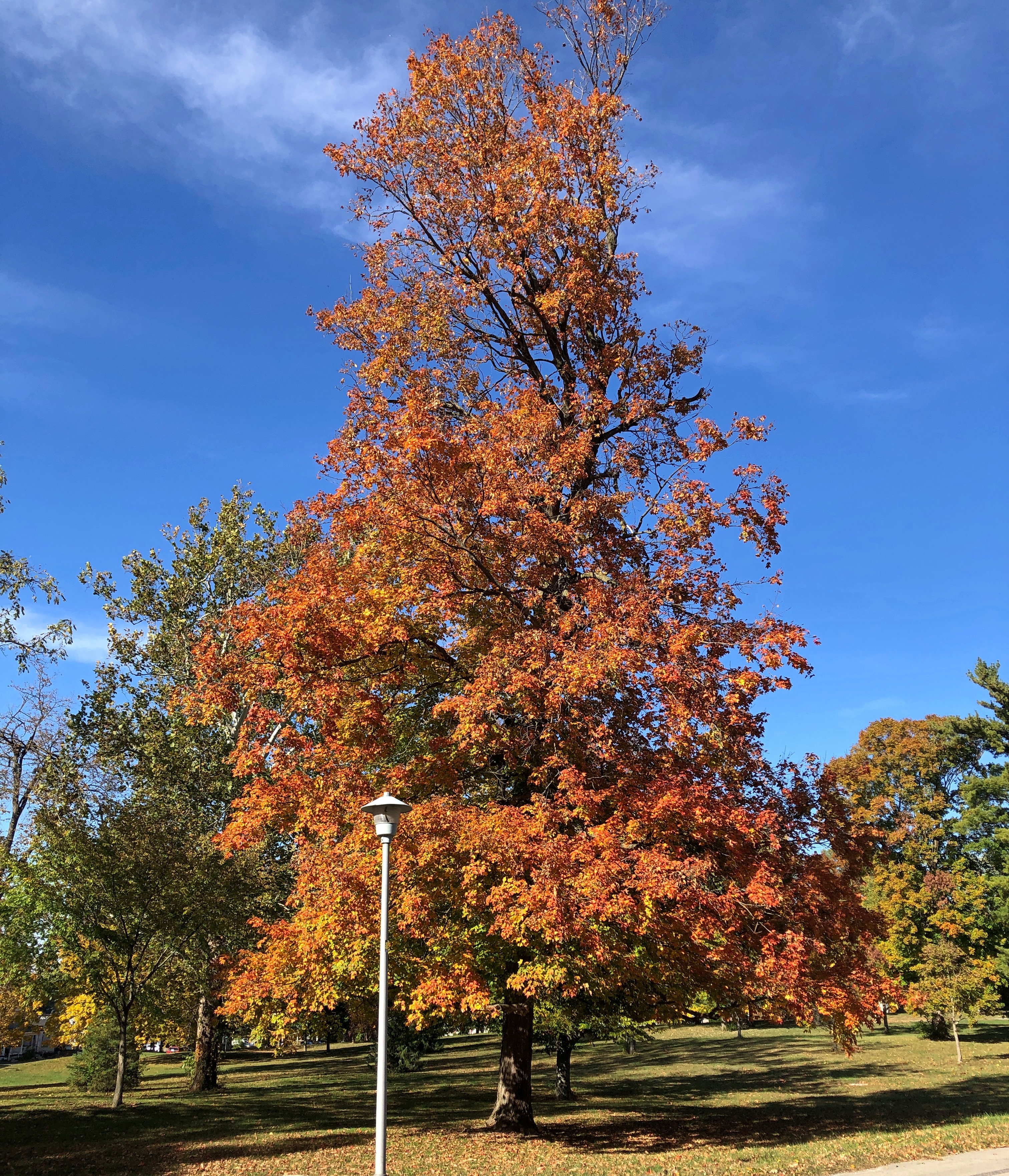
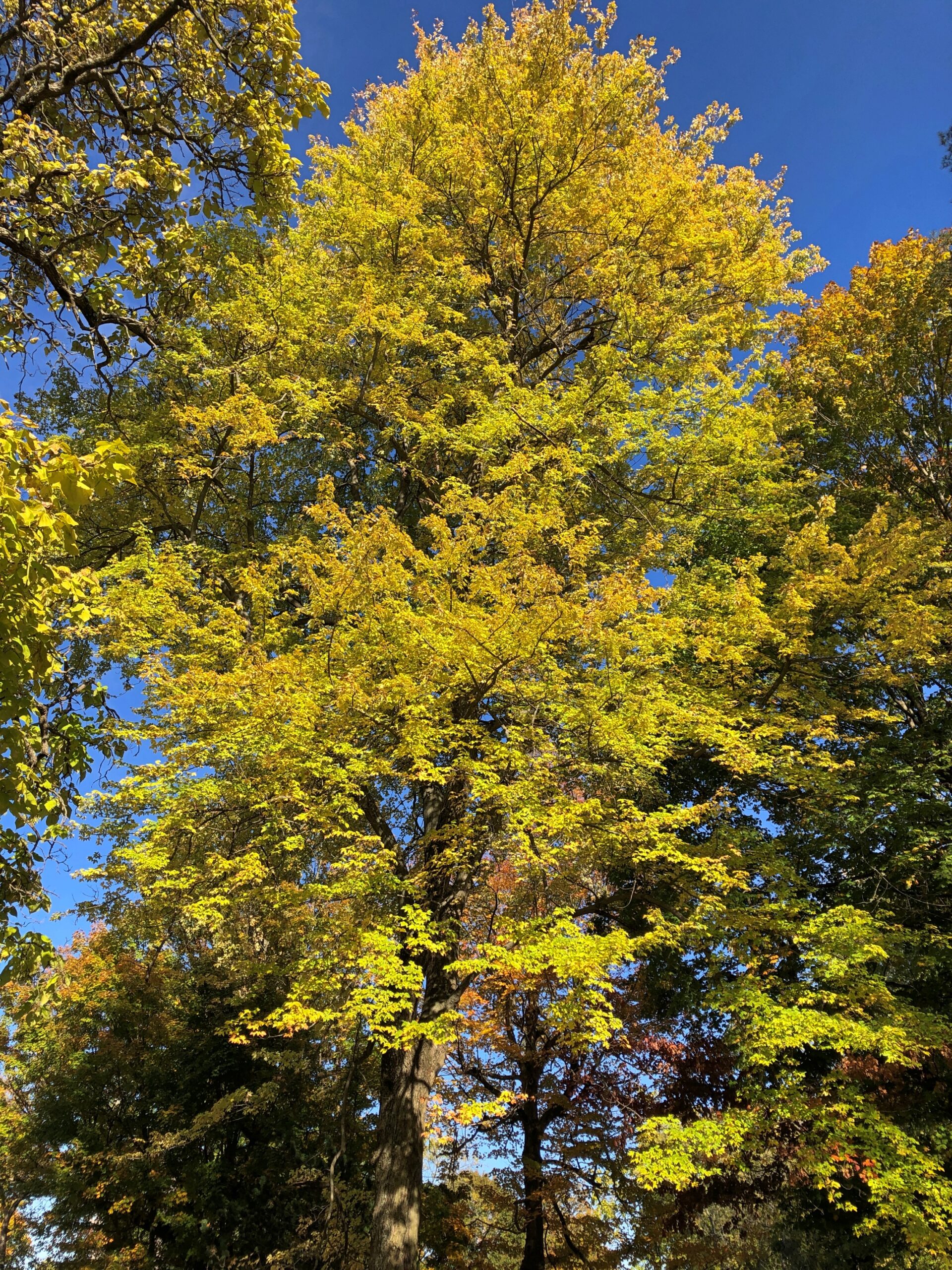
The vantage means views of the canopy above.

Winter Park, Fla. Dec 10, 2025

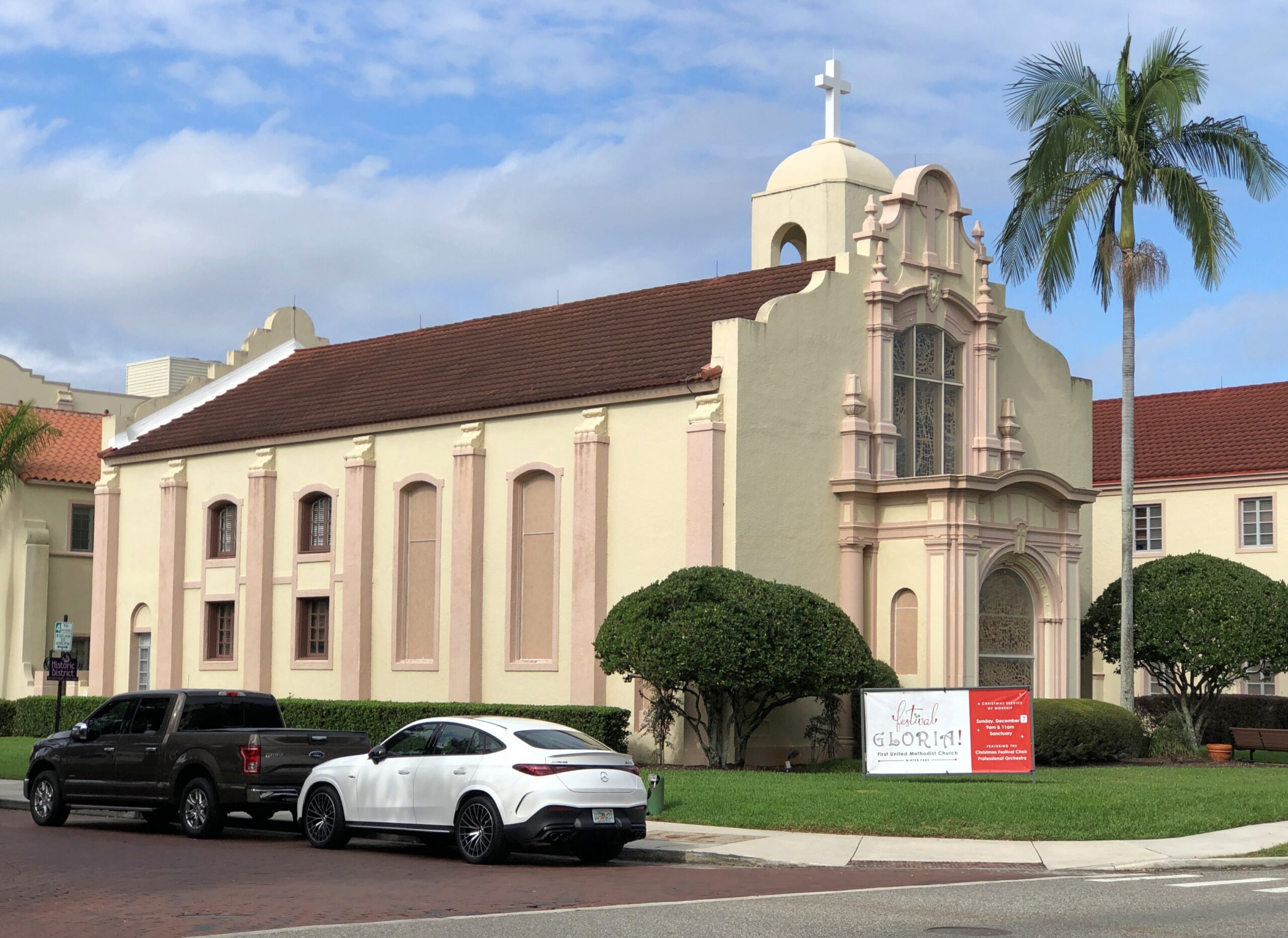
After the boat tour, we walked a few pleasant blocks along Morse Blvd., away from the lake. This handsome church, First United Methodist, didn’t look open. Too bad.

Winter Park, Fla. Dec 10, 2025

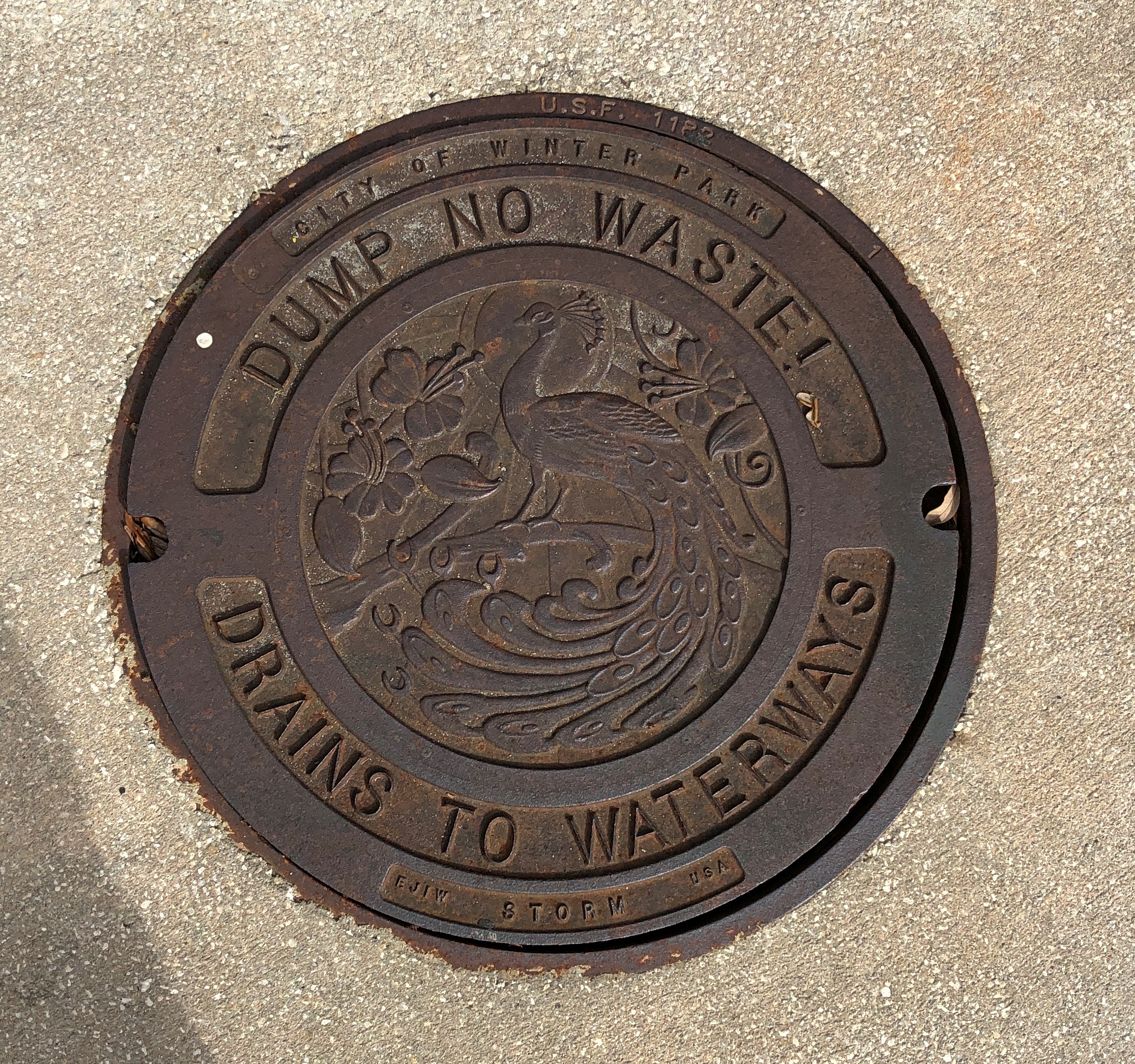
The city is fond of its peafowl, I understand.

Winter Park, Fla. Dec 10, 2025

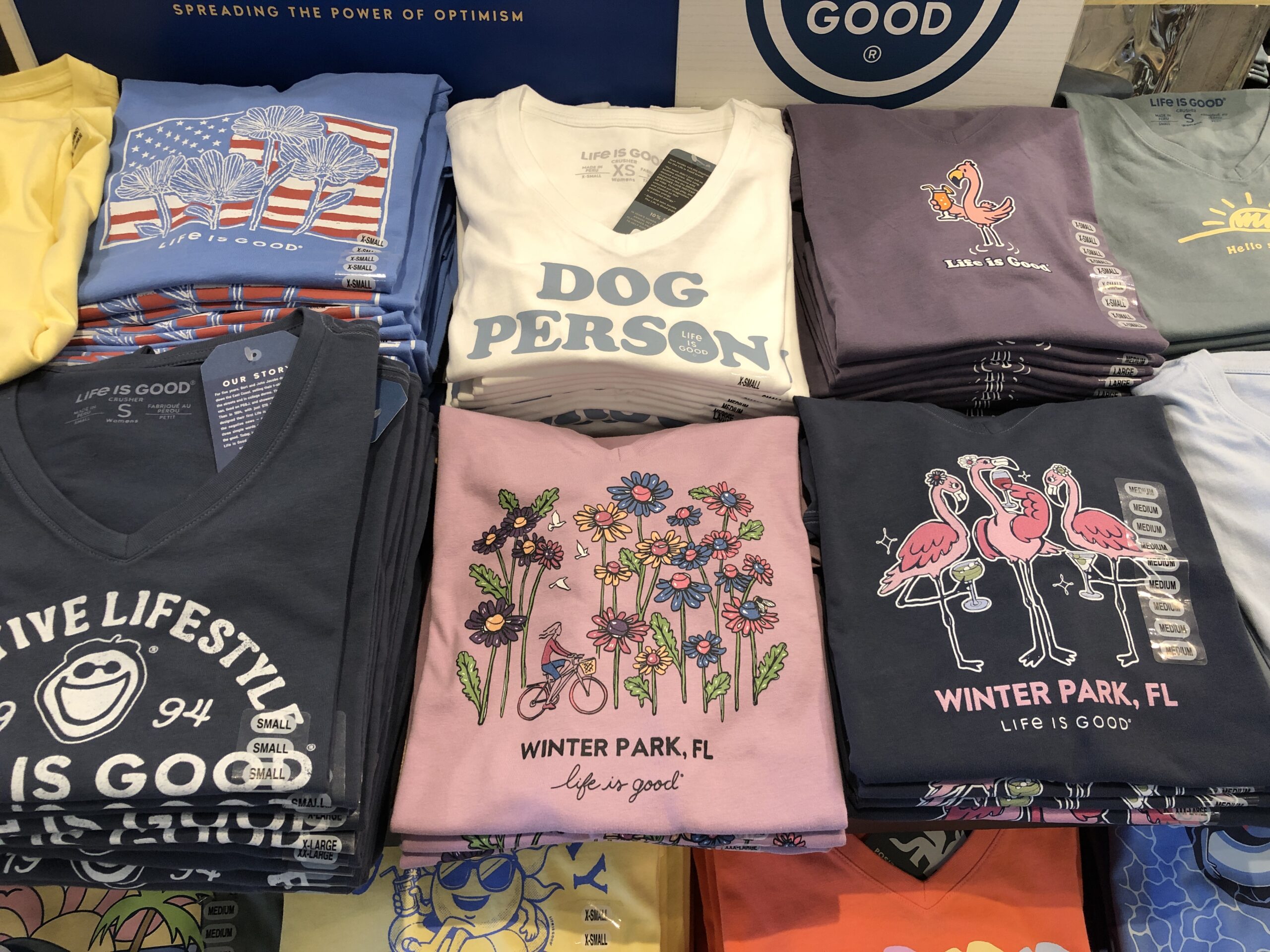
The downtown shopping street in Winter Park is Park Ave. On one side of the street are the likes of Bosphorous Turkish Cuisine, Williams-Sonoma, Ocean Blue Galleries, D’Anne Mica, Fannie Hillman + Associates real estate, Current by John Craig men’s clothing, The Imperial on Park wine bar and Be On Park Fine Jewelry. Life Is Good (registered trademark) products are available on the street.

the shopping side of the street are the likes of Bosphorous Turkish Cuisine, Williams-Sonoma, Ocean Blue Galleries, D'Anne Mica, Fannie Hillman + Associates real estate, Current by John Craig men's clothing, The Imperial on Park wine bar and Be On Park Fine Jewelry. Life Is Good (registered trademark) products are available on the street.

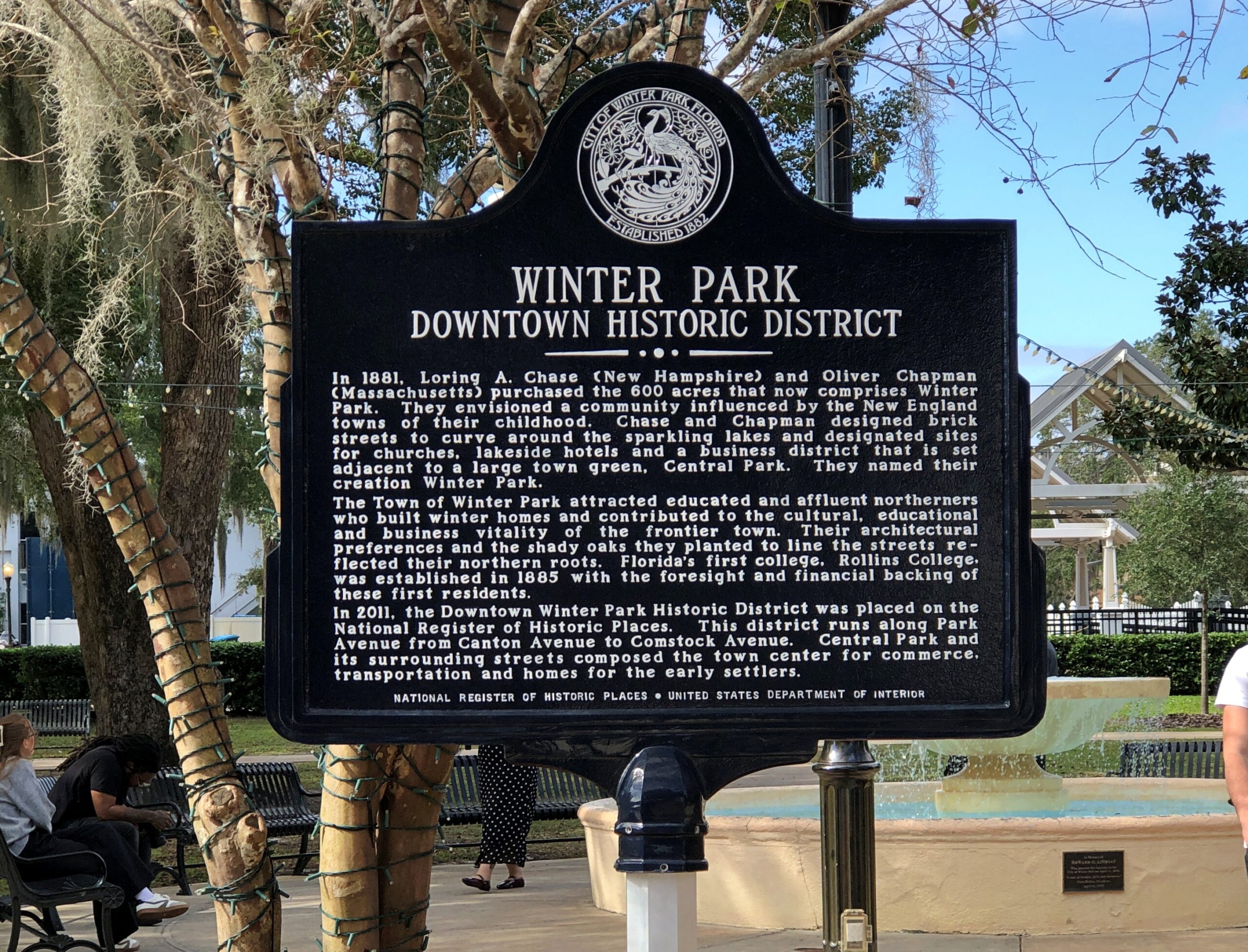
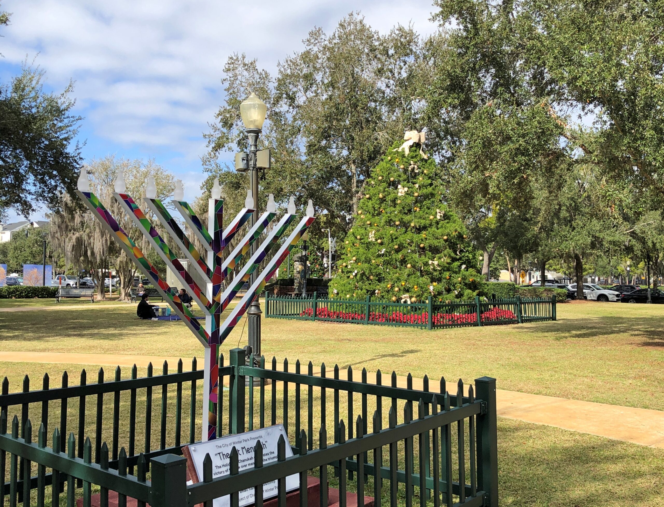
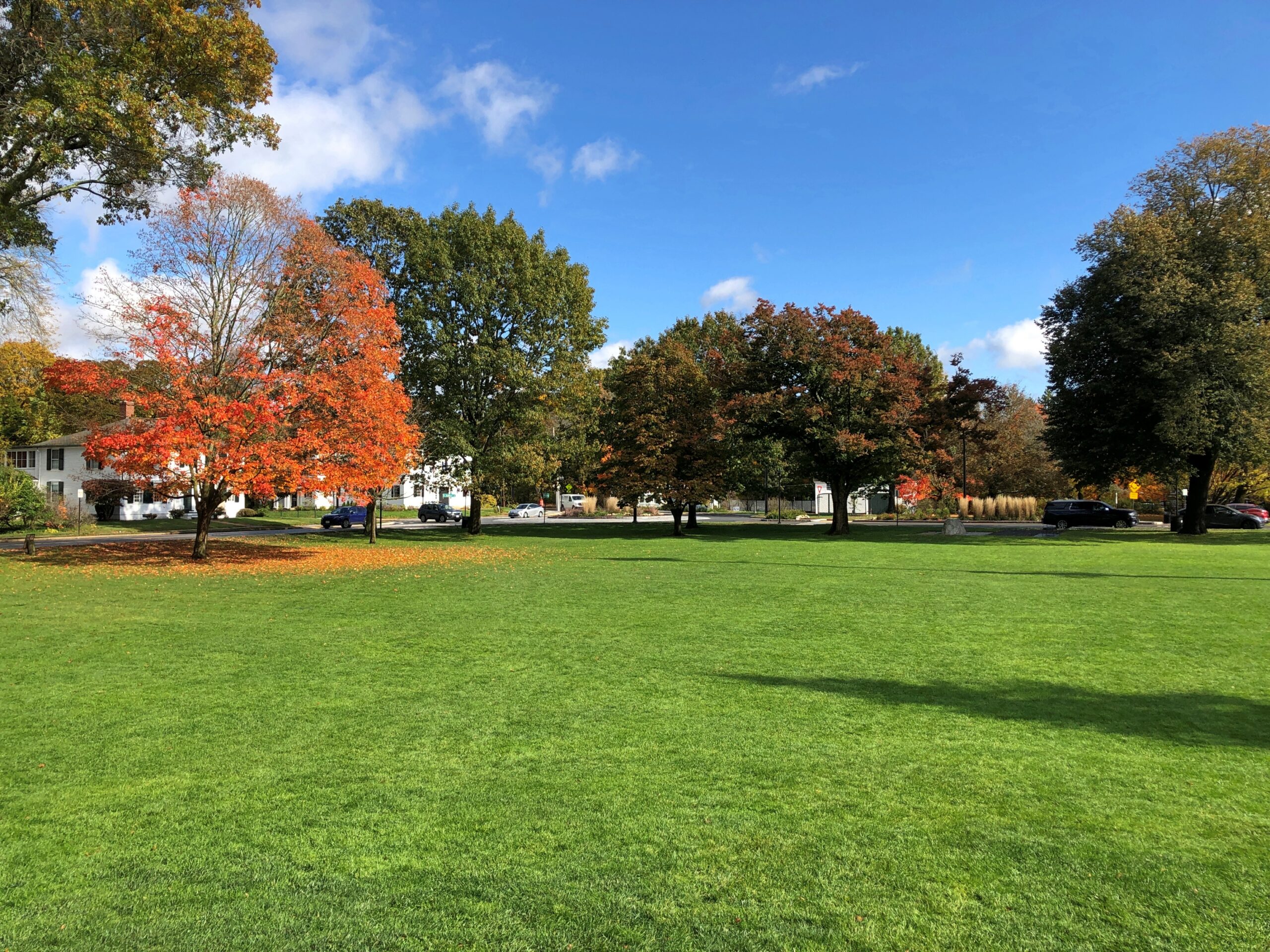
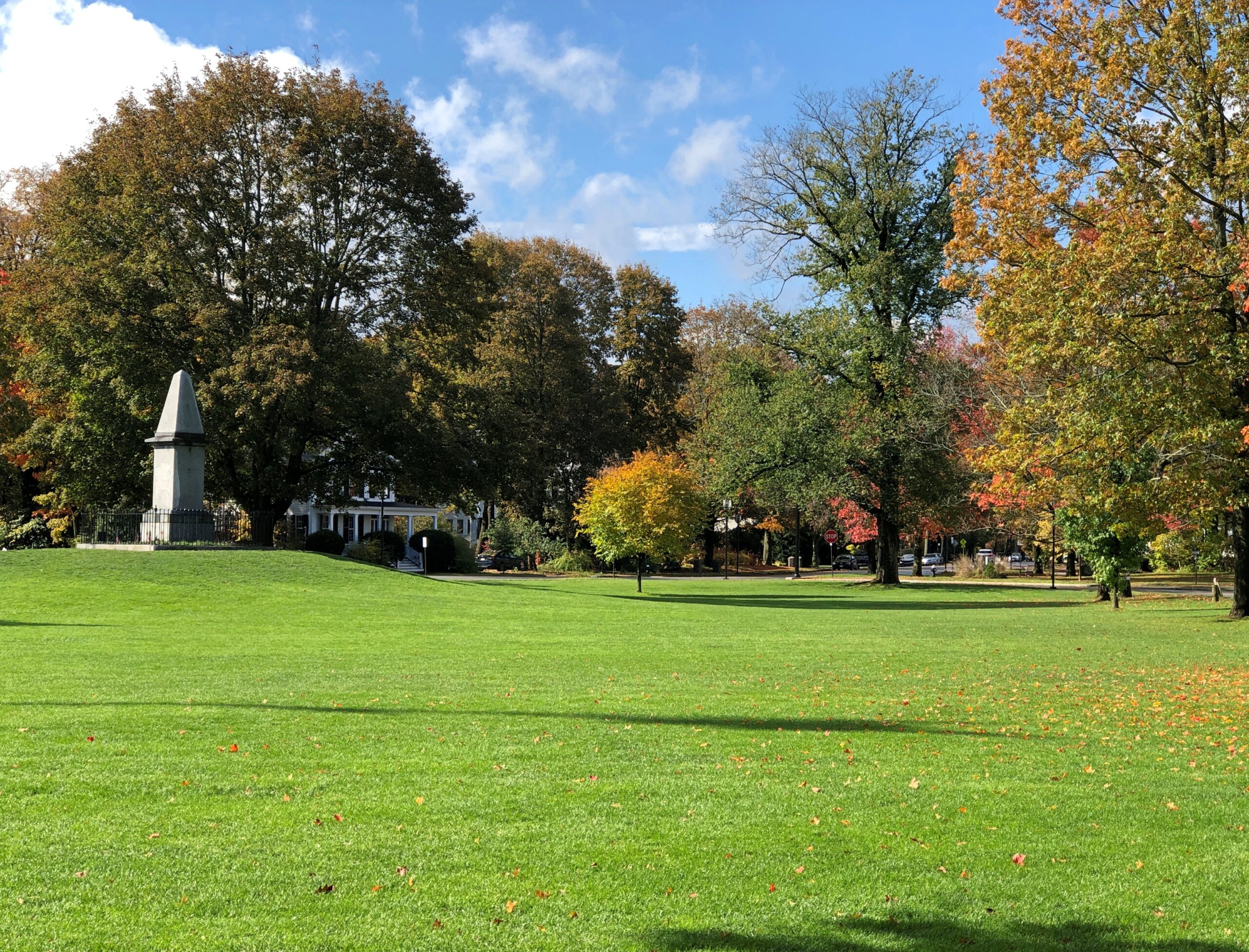
Across the street from the shops is Central Park. The developers were out, I think, to remind New Yorkers of home, but without the likelihood of snow or ice or blizzards like in ’88.

Winter Park, Fla. Dec 10, 2025

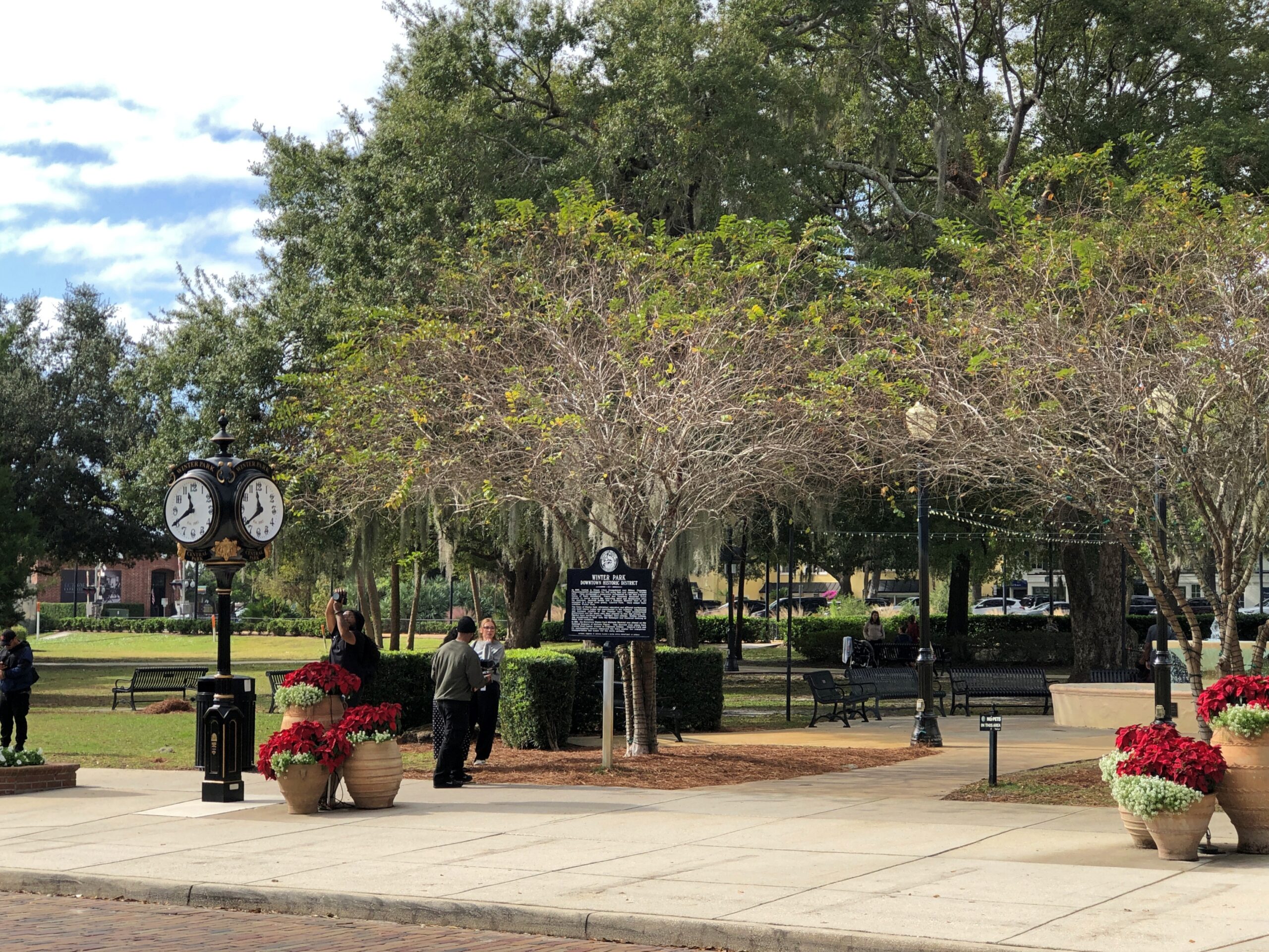
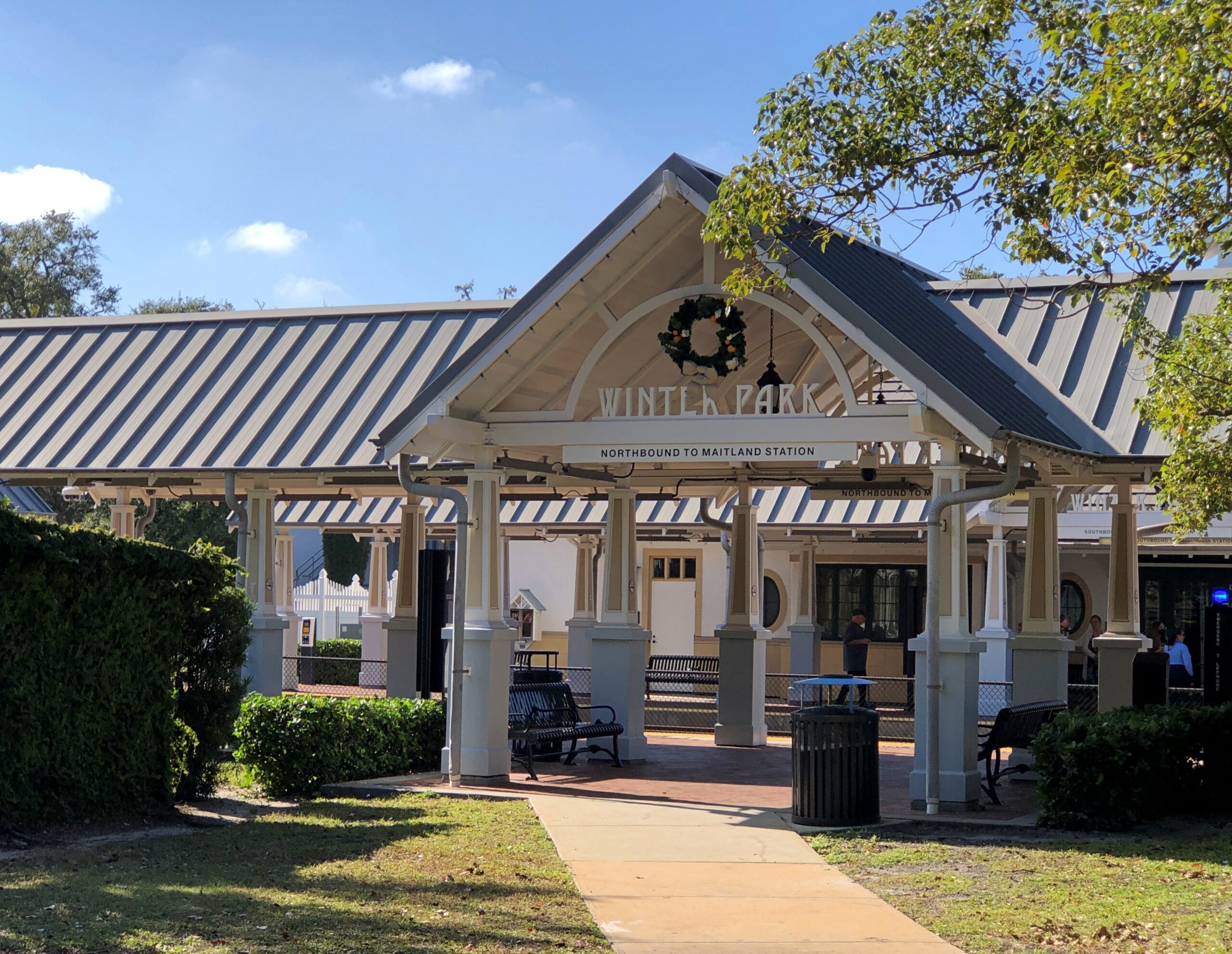
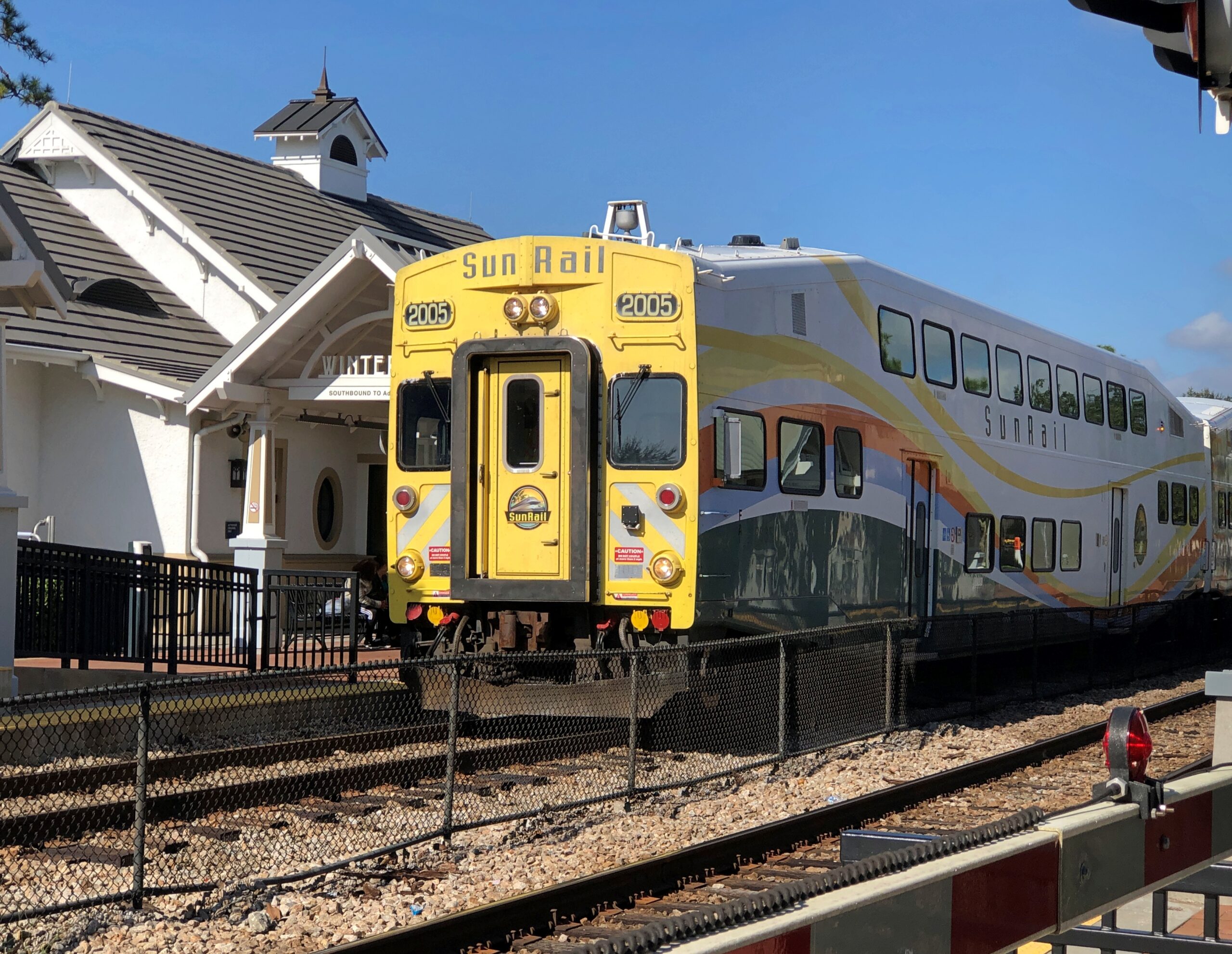
The Winter Park station on the SunRail commuter line is at the park, and a SunRail came while I was idling in the park. Amtrak stops there too.

Winter Park, Fla. Dec 10, 2025

The park was decorated for the holidays, of course. Including a phone booth.

Winter Park, Fla. Dec 10, 2025

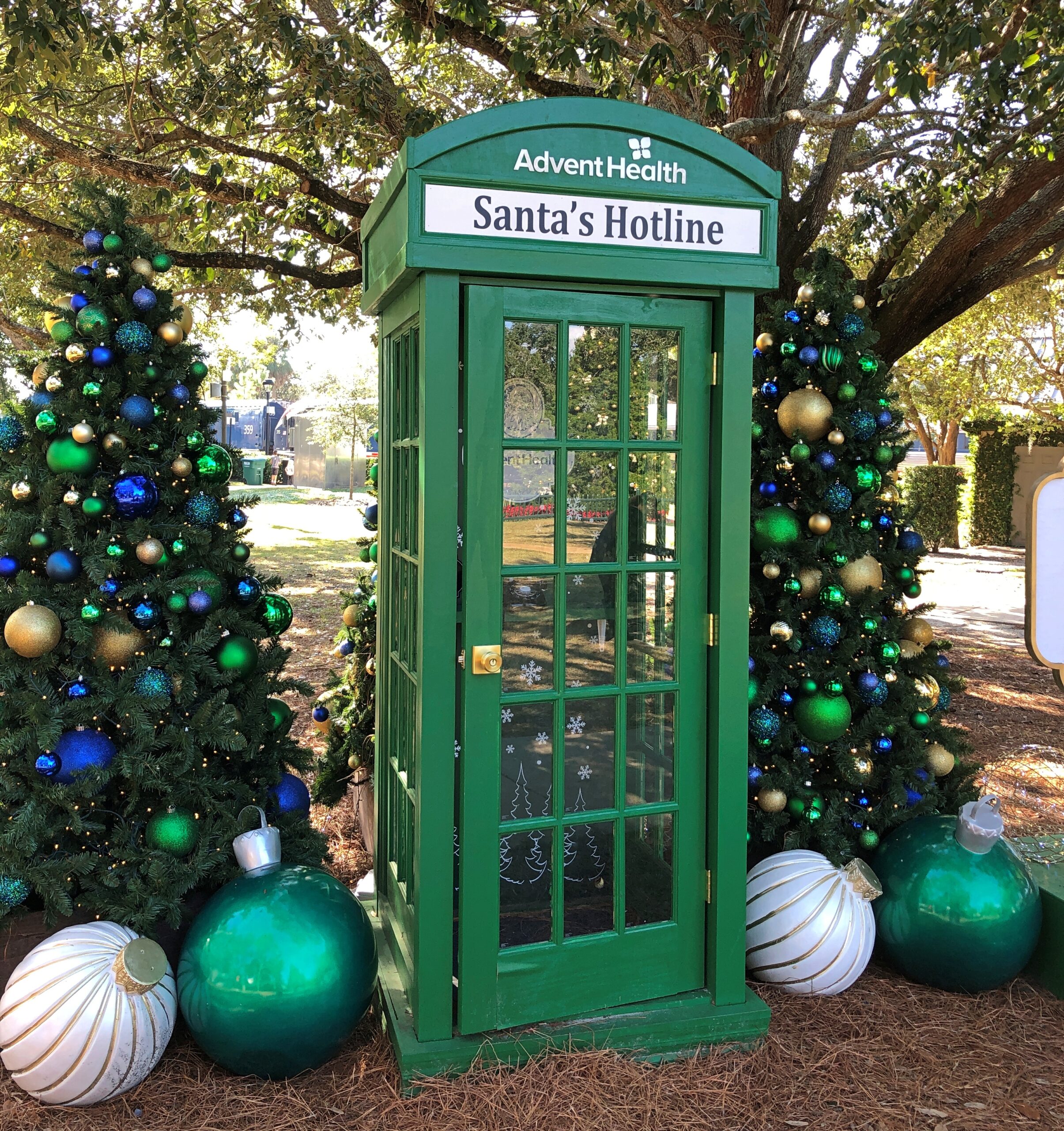
A local tradition. You can call from the booth and leave a message for Santa Claus.

Durango, Colorado

“Good morning.”

“Good morning,” Walter said in response to me, but in a hushed tone that somehow made his Austrian accent more distinct. “Do you want to see some bears?”

Yes. I followed him out to the large deck off the large common room of the Country Sunshine B&B. Outside we met with cool air, bright morning sun, and the strong smell of pine. The deck was a floor above the grassy ground, which sloped downward away from the bed and breakfast, shaded by a small copse of enormous pines.

We’d just spent the night at Country Sunshine B&B, the first of three for our visit to Durango, Colorado, a place I’d wanted to visit since the moment, years ago, when I heard Garrison Keillor describe the place in the engaging way that he had. I’d come out of our room – one of the three or four bedrooms off the common room – ahead of Yuriko, to examine the breakfast spread at the main table when Walter asked me about bears.

Under one of the tall pines, and among the many pine cones dotting the ground, was something dark and much larger: a bear.

Durango, Colorado

“He isn’t the only one,” Walter said, pointed upward. Another sizable bear was perched part way up the largest pine. I didn’t say anything, or maybe I did. Something along the lines of, How about that. When I spend time on my deck, squirrels are about as large as the animals get, except occasional rabbits and raccoons.

Durango, Colorado

“Look way up,” Walter said.

Two more bears – smaller bears, though I wouldn’t want to be face-to-face even with them – clung to the branches toward the top of the tree. They were hard to see, and my photos barely show them, but they were there, not moving a bit.

Durango, Colorado

Soon Yuriko, and some other guests, had come to the deck to see the bears and take pictures. Every few minutes while we watched, the largest of the bears, the one on the ground, would start shimmying up the tree. The bear in the tree snarled at his approach, and, after pausing for a few moments, the first bear returned to the ground.

We were about 10 miles north of Durango, where the human settlement is fairly thin, and bears known to prowl the mountains on either side of the single road, US 550.

In the two decades of so that Walter and his wife Jodi have owned the B&B, he said bears had been sighted. Of course they had. Get careless with closing an outdoor garbage receptacle and bears will make an appearance in the neighborhood. During dry spells, they come for the creek waters near the property, and Walter pointed out that this summer had been fairly dry in the region.

But this was a first, Walter said: probably a male bear out to do harm to some cubs, a female bear standing in his way — a bear drama playing out in the tree near the B&B.

Late that afternoon, we returned to the B&B. Papa Bear, as everyone was calling him now, still lingered under the tree. Mama Bear still watched him from the lower branches, and the cubs still clung to the upper branches. Papa Bear had mostly quit trying to climb the tree, Walter said, but he was still waiting around.

The bears stayed in place through that evening, but when I went to the breakfast table the next morning to examine the bagels and spreads and fruit and hot drinks, the bears – I checked from the deck – they were not to be seen. After their one-day show (from a human point of view), they’d taken their drama somewhere else,

We spent that first day (September 16) wandering around town and nearby. In downtown Durango, small buildings that have endured for more than a century line Main Street.

Durango, Colorado
Durango, Colorado
We spent that first day (September 16) wandering around town.

Or not so small. Such as the magnificent Strater Hotel, built in 1887.

Strater Hotel, Durango

The sort of place where presidents stay, or used to. Did any? The hotel web site doesn’t say. I’d ask ChatGPT, but it would probably tell me that FDR stayed there during his Grand Western States Whistle Stop Tour in 1939, a wholly fictional event. Wiki says Gerald Ford stayed there. Louis L’Amour did too, and now has a room named after him.

A competitor. Named for this fellow, Union (brevet) brigadier general and railroad man, who co-founded the Denver and Rio Grande RR.

General Palmer Hotel

Downtown Durango is well supplied with retail.

Lunch options, besides burgers and empanadas or a liquid lunch, included the likes of the Diamond Belle Saloon, Seasons of Durango, Chimayo Stone Fired Kitchen, Steamworks Brewing Company, and Eolus Bar & Dining. All very nice, I’m sure, but we chanced on something more to our tastes at that moment: the Durango Diner. In business for 60 years.

Durango Diner

Durango started not so much as a mining town, but a railroad node that served the mines further up the line. Silverton, for instance. One reason Durango is where it is: the Animas River. These days, the river is accessible to pedestrians in a number of places in town. One was near the Durango Library, also the location of a shady sculpture garden.

At this place, the tracks of the Durango & Silverton Narrow Gauge RR run along the river.

Animas River, Durango

That was also true at the 29th Street Park, though the tracks were on the other side of the river.

Animas River, Durango

We waved. A few waved back.

Nebraska 2

Which of these two destinations aren’t like the others?

Cairo, Neb

That’s a beginner’s-level question. Better question: where can you find this pole, with mileages and – what units measure the distance to Heaven or Hell? – other signs?

Answer: Cairo, Nebraska.

Cairo, Neb

Maybe a palm tree was in the works, but the city decided not to spend any more money. Cairo (pop. 822) is one of the small chain of small towns on the eastern section of the highway Nebraska 2, which runs westward and north of Grand Island. Cairo is the first place I stopped on my way west on that highway in early September.

Eventually the highway reaches the Nebraska National Forest and Grassland, a patch of (partly) wooded land that inspires the question, there’s a national forest in Nebraska?

West from the forest, Nebraska 2 crosses the Sandhills, an unusual place here in North America, with the land morphing from cropland to ranch land on sandy steppes. The towns on the way are mere hamlets, and sometimes not even that. On the western edge of the Sandhills, one comes to the sizable town of Alliance, Nebraska, home of Carhenge and railroad staging area for coal trains headed east.

Before I did the drive, I was looking forward to it as much as any of the roads in Colorado. It lived up to expectations. Nice when that happens.

Nebraska 2

The Fence Post cites Charles Kuralt’s fondness for Nebraska 2: “Highway 2 is not just another highway that goes somewhere. Highway 2 is somewhere,” he’s known to have said. I’d say whatever else his failings, Kuralt had good taste in roads.

Just outside Broken Bow (pop. 3,491), seat of Custer County and pretty much the only town of any size in that county, the Sandhills Journey Scenic Byway Visitor Center offers a building with bathrooms and pamphlets and displays and, for my visit at least, a grandmotherly and talkative volunteer. Old enough, she said, to remember when the highway was just a road through the countryside that attracted no attention from the outside world. Not a scenic byway, and sand hill cranes were just flocking birds. Now a trickle of tourists and bikers and RVers come this way. She had some solid recommendations, especially a good diner for lunch.

The visitor center grounds include a relocated (or was that reconstructed?) Sandhills cabin. The residences of the farmers trying to scratch out a living in the Sandhills, and finding out that no amount of scratching would make decent crops grow consistently from the land.

Broken Bow, Neb
Broken Bow, Neb
Broken Bow, Neb
Broken Bow, Neb

The Custer County Courthouse. Saturday, closed.

Broken Bow, Neb

A block from the courthouse, some buildings around City Square Park.

Broken Bow, Neb
Broken Bow, Neb
Broken Bow, Neb

City Square Park is a generic sort of name. Wonder whether there’s anyone from the town who can be honored by renaming the park? Looking at list of notables from Broken Bow, one instantly stands out.

This guy: Solomon Butcher.

Wiki: “Solomon D. Butcher (January 24, 1856 – March 18, 1927) was an itinerant photographer who spent most of his life in central Nebraska, in the Great Plains region of the United States… he began in 1886 to produce a photographic record of the history of European settlement in the region. Over 3,000 of his negatives survive; more than 1,000 of these depict sod houses.”

Frederic Schreyer and family, Custer County, 1880s, by Solomon Butcher.

Definitely name the park after Butcher, Broken Bow.

One more in that town. I couldn’t be bothered to get out of the car.

Broken Bow, Neb

West of Broken Bow is Anselmo (pop. 145), home of this church, St. Anselms Catholic Church, nicknamed Cathedral of the Sandhills. Saturday, closed.

Anselmo, Neb

A more common sort of building, not far from the church.

Anselmo, Neb

Not the most imposing that I saw, but representative of the many structures like it. The grist of a photo collection. Of course it has been done. I’m pretty sure I saw a room of Bernd Becher’s photos of water towers at the Modern Art Museum of Fort Worth.

Nebraska National Forest and Grassland is in an unexpected place, slap in the middle of Nebraska, not due to a freak of nature, but the efforts of human beings. Specifically, mass plantings of trees by the federal government for more than 100 years, beginning (not a surprise) during the administration of Teddy Roosevelt.

Nebraska National Forest

Near the national forest entrance is the Middle Loup River, broad but shallow, and crossable on a foot bridge.

Nebraska National Forest

I camped in the national forest. The campgrounds weren’t completely full, but there were more people than I expected for a remote spot in Nebraska. Then again, it was a Saturday night, and soon enough I figured out what brought most of them: the ATV trails. Not long after dawn on Sunday, the campers across from me – a man and a small knot of teenage boys – roared away in a small caravan of ATVs crusted with dust from the day before.

I packed up and sought out a quieter place. A national forest hill with a fire tower and some views. The tower was closed.

Nebraska National Forest

But the views were still pretty good.

Nebraska National Forest

West from the national forest, Nebraska 2 heads into the rolling grassland of the Sandhills proper. In the village of Thedford (pop. 208), varied public interpretations of the Sandhills are available for reading.

Sandhills of Nebraska

The terrain along the highway Nebraska 2 might seem monotonous to some. Too bad for them. You’re driving across a kind of ocean, terrain all wavy, except that it’s solid ground, marked by occasional trees or manmade structures, and side roads — trails — wandering deeper into the hills.

Sandhills of Nebraska

The handful of towns are really just wide places in the road. Sometimes, not even that.

Sandhills of Nebraska

Nebraska 2 parallels the BNSF line, which came first.

Sandhills of Nebraska

Note: I was standing on a public side road to take that picture, as I do with all my RR shots.

Eventually, I took the road to Alliance. But that was merely incidental. Out this far, the road, as Kuralt said, is the destination.

Five-State National Road Dash

Our first winterish weather blew through early this week, but we’re back to cool days. For now. Some leaves seem to be clinging a little longer than usual, but most are accumulating on the ground, as expected for November. A scattering of Christmas decorations are already up, and I don’t mean in stores, where they’ve been for weeks. Let November be November, I say.

Much of my return from the East Coast generally followed the westward course set by the National Road, though I didn’t use much of US 40, which has that nickname. If you want to make decent time, you take I-68 through Maryland and then I-70 across Ohio and into Indiana, which pretty much parallels the National Road.

The Interstate is designed for just that kind of efficient travel. On the whole, it delivers. The four-lane highways also deliver boring drives, to hear some tell it. That’s an erroneous assumption, to hear me tell it. The Interstate has its fine stretches, such as I-68 in October, a gloriously colorful drive. Winding and hilly, too, through Maryland’s peculiar panhandle.

A rest stop near Hancock, Maryland, offers views to the north, so most of what you see is Pennsylvania.

Maryland I-68
Maryland I-68

The rest stop is at Sideling Hill, an enormous rise gouged by an enormous cut for I-68 to go through. An impressive feat of engineering, completed only in the 1980s. Then again, blowing up mountains is a thing that happens in this part of the country.

The narrowest part of the Maryland isn’t far away. At its narrowest, there is less than two miles are between the Potomac and the Mason-Dixon Line. So if you picked up Maryland by the panhandle, it would surely break at that narrowest point.

I filled my gas tank off the highway in the last town in Maryland, Friendsville (pop. 438), at a station whose enclosed retail space (between a few pumps) seemed little bigger than a walk-in closet, and yet there was a clerk manning the place on Saturday just before dark. Rotund and massively bearded, he was playing a video game when I opened the door to pre-pay. He might have been a little surprised to encounter a customer, at least one who didn’t pay at the pump.

From there, I continued into West Virginia, then took I-79 north into Pennsylvania, then headed west on I-70, which crosses West Virginia’s odd panhandle – more like a periscope – before reaching Ohio. After overnighting in Cambridge, Ohio, I bypassed Columbus but stopped in Springfield, near Dayton but with a distinct geographic identity. Alcor to Dayton’s Mizar, you might say.

Downtown Springfield was practically devoid of pedestrians that Sunday, and not that many cars drove through either. A few buildings rise high enough to suggest a more prosperous past, but look too closely and some of them seem to be as empty as the streets, or at least underutilized.

Springfield, Ohio
Springfield, Ohio
Springfield, Ohio

The National Road went, and still goes through Springfield, in the form of US 40. A milestone in Springfield marks the point at which the federal government quit paying for further westward expansion of the road. Anything else would be on the states, namely Ohio, Indiana and Illinois.

National Road Milestone, Springfield Ohio

Later, after the National Road had become History, the Daughters of the American Revolution erected a series of statues along the route, and others to the west: “Madonna of the Trail.”

National Road Madonna of the Trail, Springfield Ohio

There are 12, with the easternmost of them along the National Road. Erected in the late 1920s, the Springfield one was renovated about 20 years ago.

Nearby, passersby are urged to Dream Big.

Springfield Ohio

About an hour west of Springfield, at the border of Ohio and Indiana on I-70 – just barely inside Indiana – is the Uranus Fudge Factory. I had to stop for that.

Uranus Fudge
Uranus Fudge
Uranus Fudge

Sure, there’s fudge in there somewhere, but also a lot of gags involving the word Uranus (Your-anus). Examples can be found in the newspaper — an honest-to-God paper newspaper — that the store produces, The Uranus Examiner, and gives away. I have a copy. My kind of souvenir.

Sample front-page headlines from the Summer 2025 edition:

Breaking News: You Can Explore Uranus In Three Locations

Eating Their Way Through Uranus

Get A Lick Of Uranus

Sink Your Balls In Our Putt Holes

The second of those stories was about the 2nd Annual Eating Uranus Fudge Galactic Championship held at the Anderson, Indiana location in March. Apparently it was a Major League Eating-sanctioned event, and apparently MLE is a real thing. One Patrick Bertoletti won the 2nd championship at Uranus, putting away a bit more than nine pounds of fudge in about as many minutes.

Fudge is one thing, but mostly Uranus sells stuff. A lot of stuff.

Uranus
Uranus Fudge

The Richmond, Indiana location is the third of three for Uranus, and I think the only one with dinosaurs —

Uranus Fudge
Uranus Fudge

— and a 100-foot cross of corrugated steel over a metal frame.

Uranus Fudge
Uranus Fudge

Until about 10 years ago, the property belonged to New Creations Chapel, which also included a church building, boarding school for troubled teens and a Bible college. The ministry, for reasons its web site explains in some detail, sold the property to Uranus, including the cross.

Heading through Richmond, Indiana, I stopped at an entrance to a large park to check my map. Glen Miller Park. A colorful spot in October.

Glen Miller Park, Richmond, Indiana

Not named after the bandleader, which would be Glenn Miller Park. “Glen Miller Park was established in 1885 and was named for Colonel John Ford Miller, who was a railroad executive during the late 1860s,” the city of Richmond says. “Colonel Miller bought the land from Nathaniel Hawkins in 1880, with the intention of transforming the land into a park.”

So Glen Miller as in glen, a term that evokes pleasant Scottish valleys. I was just about to be on my way when I noticed a statue.

Glen Miller Park, Richmond, Indiana

It was another of the 12 Madonna of the Trail statues, located at the edge of the park, where it meets US 40. Unlike the earlier one in Springfield, I hadn’t sought it out. It was just there. One’s travels, like life, can be strange sometimes.

Battle Green, Lexington

Too bad about iconic. If there ever were a time to use iconic to describe sometime distinctive and revered, John Parker in bronze would be it.

Lexington Battle Green

Icons are no accidents. The pose captures the Battle of Lexington as we, Americans, want to remember it: the resoluteness of an ordinary man in the face of the enemy. What the militiamen experienced that morning is partly enshrouded in mystery like a battlefield of the time might be with gun smoke. No one knows who fired the first shot, for instance, but that doesn’t keep the Shot Heard Around the World from having its own name during later generations — a remarkable thing for a simple firearm discharge to have.

Lore has encrusted the story. Even so, the Patriot soldiers in the Revolution, collectively, can’t be said to have lacked resoluteness over the long years of conflict.

The Parker bronze stands on the edge of Battle Green in Lexington, Massachusetts, and across the street from Buckman Tavern, where the militiamen of the town waited the night before the battle. Among their number on April 19, 1775, was a young man named Jonathan Harrington, a fifer in the militia. About 75 years later, he’s thought to have posed for a photograph, now on display at Buckman Tavern.

Jonathan Harrington, Lexington

Said to be the last survivor of the battle, and the only one to be photographed. The American Battlefield Trust cites a Harrington family history: He said he was aroused early that morning by a cry from his mother, who said: ‘Jonathan, get up, the regulars are coming, and something must be done.’ Jonathan was a fifer. He arose, went to the place where the patriots were gathering, and was with the company on the approach of the British. 

It had rained during the early hours of October 22, 2025 in Lexington, but by late morning the sun was out and only a scattering of puddles remained. Battle Green stretched out behind the bronze John Parker. For a time, I was the only person on the green, though a steady stream of car traffic was the be seen on the roads edging the grounds.

Battle Green,
Lexington
Battle Green, Lexington

John Parker, originally “Minuteman Statue” by the prolific sculptor and public monument specialist Henry Hudson Kitson, is a latecomer to the green, erected in 1900.

Battle Green, Lexington

The Battle Green flagpole is newest of all, erected only in 1962. Even so, the pole is on the National Register of Historic Places, and an act of Congress specifies that a flag will always be flown there.

Battle Green, Lexington

Well within living memory of the battle itself (1799), the town – fully aware of its role as spark of the Revolution – erected a memorial, and relocated the bones of the militiamen killed in the battle to a spot in front of it.

Battle Green, Lexington

Though not formally part of the green, First Parish Unitarian-Universalist is distinctly part of the place, and looks about as New England as a church can.

Battle Green, Lexington

It might as well be part of the green, considering the history of the congregation. The present church is a 19th-century structure near the site of Lexington’s only church in 1775, which was a hotbed of Revolutionary sentiment at the time.

Prospect Park Ramble ’25

Put this in the Those Were Different Times file: “In the early evening, I made it to the beginning of the National Association of Real Estate Editors convention. I mentioned to some colleagues of mine, who happened to be Manhattanites, that I’d spent part of the afternoon in Prospect Park — you know, in Brooklyn. Judging by their reaction, I might as well have said that I’d popped over to Outer Mongolia for a quick visit.”

I wrote that my June 2002 visit to New York included, as mentioned, time in Prospect Park. It is every bit a great park as Central Park, and I knew I wanted to return someday for a longer walk. After lunch in Chinatown in Manhattan on October 19, that’s what Yuriko and I decided to do. We took the subway to the Prospect Park station on the east side of the park, and began our wander.

Near that entrance was the Diwali Festival of Bites.

Despite the name, the food tents had a large international variety for sale, not just Indian food. Not important for us anyway, since we’d just eaten.

Prospect Park Oct 2025

We headed deeper into the park. Maybe it was a matter of species choice, but there seemed to be more coloration than in Central Park the day before.

Prospect Park Oct 2025

The handsome Prospect Park Boathouse.

Prospect Park Oct 2025

A popular setting for weddings, and in fact one was taking place when we visited. Two women were exchanging vows.

Prospect Park Oct 2025

The Prospect Park Waterfall.

Prospect Park Oct 2025

Not a vast torrent, but a pleasant gurgling. It is a slice of the park’s interior waterways. Prospect Park’s watercourse is a beautiful collection of waterfalls, pools, streams and a 60-acre Lake, and is one of the shining achievements of Park designers Olmsted and Vaux’s design, says the Prospect Park Alliance.

The deeper in, the fewer people.

Prospect Park Oct 2025

So few, sometimes, to almost make you forget you’re in a metro surrounded by about 20 million people.

Prospect Park Oct 2025

But not for long.

Dog walkers and their tethered dogs roamed the park in numbers. Some come to the Prospect Park Dog Beach.

Prospect Park Oct 2025

I wasn’t exactly sure where I’d been in 2002, but near the northern edge of the park, we came across what was probably the field, the sort of mildly rolling terrain, open short grassland ringed by wooded areas, that exists throughout the park. A summer Saturday in these fields draws a crowd, but a generally cheerful one, playing volleyball, attending to grills, picnicking, throwing frisbees or just lying around. An autumn Sunday is a little less active.

Fall has a more scattered vibe, but no less congenial than summer to the thinned our crowd.

Fort Greene Park

On the morning of October 19, Fort Greene Park in Brooklyn was still pretty green.

Fort Greene Park

Of course, the 30-acre park was named for the talented Revolutionary War general, not for the hues of its 50-plus species of trees, very many of which seemed to be ginkgoes. Whatever the coloration, the park proved to be a nice place for a stroll that day, offering a more manageable size than either Central Park the day before, or Prospect Park would later that day (as great as those two are).

My idea for attending Open House New York was Manhattan on Saturday, Brooklyn on Sunday, planning that took us – by this time, just the two of us – to Atlantic Terminal by way of the LIRR on Sunday morning. From there, Fort Greene Park is a short walk, though once you get there, it’s something of a hustle to climb the park’s central hill. A fort had been on the site, active during the Revolution and again for the War of 1812, for a reason.

As a park, Fort Greene came of age at roughly the same time as the idea of municipal parks themselves, that is during the mid-19th century, with some agitation on the part of Walt Whitman – editor of the Brooklyn Eagle in the late 1840s – helping facilitate its creation.

In 1857, Whitman wrote about the place, known at the time as Washington Park: This beautiful ground is now covered with rich verdure, and is one of the pleasantest resorts anywhere around. On its lofty tops you feel the breeze, and from them behold one of the finest views in the world. Most of the trees are yet too young to cast much shade, but they are growing finely.

We recollect there was a very obstinate and indignant opposition to the securing of these noble grounds, some twelve years since, when the project was mooted before the Common Council and the public. It was argued that Brooklyn was not rich enough to stand the expense of purchase; and that it would be better to let the “old fort” be dug away, and blocked up with buildings.

Fortunately these counsels did not prevail. A more far-sighted policy… carried the day.

Is there any one left of those who so furiously opposed Washington Park, who is not now glad that his opposition did not succeed?

I’m also glad there’s a park, though leaving the ruins of the fort might have been an interesting approach to creating one. As Whitman would surely have appreciated, 21st-century Brooklynites were out in numbers (but not crowds) to enjoy the park on a warmish fall day, walking their dogs and turning their kids loose to play. A scattering of other people had come for Open House.

The green space and trees were only the first layer. Come 1867, Frederick Law Olmsted and Calvert Vaux applied their considerable talents into making Fort Greene into their vision of an urban park, a small-scale version of Central Park or Prospect Park. That’s reason enough to visit.

One of their additions: grand outdoor stairs.

Fort Greene Park

It wasn’t until 1908 that those stairs led to the Prison Ship Martyrs Monument, memorializing the more than 11,500 POWs who died in wretched conditions aboard British prison ships during the Revolution.

Fort Greene Park
Fort Greene Park
Fort Greene Park

The column isn’t usually open, but Fort Greene Park was an Open House site, so we were able to go inside after waiting in line a short time. I was expecting stairs inside. But there was just a rusty iron ladder, which the park ranger who led us into the column called “scary.” I agree.

Fort Greene Park

There had been a spiral staircase in the memorial’s early days, but it is long gone. I wasn’t in a stair-climbing mood at that moment anyway, so for me it was just as well. If the city ever comes up with the scratch, there might be stairs again, the ranger said.

Fort Greene Park

She also told us about the formation of the park, the long delay in setting up the memorial, and the tomb on the grounds that holds bones of some of the prisoners. The tomb isn’t open to the public.

A newer memorial, plaque-on-rock style and in place almost 50 years now, was dedicated by a young King Juan Carlos in memory of the Spaniards who fought for American independence.

Fort Greene Park

French assistance to the nascent United States was mentioned prominently in school but not, that I remember, Spanish efforts, which were nothing to sneeze at. Maybe by 1898, Spaniards who gave the matter any thought considered the U.S. a pack of ingrates, but such is geopolitics. By 1976 and later, it was high time to acknowledge the likes of Bernardo de Gálvez and his men, and I was glad to find out that Pensacola still celebrates Gálvez Day (May 8).

Central Park Ramble ’25 (Strawberry Fields For Now)

Kids came in some numbers for Halloween here in the northwest suburbs yesterday, but I didn’t keep an exact count this year. The day was cool but not cold, without a hint of rain, so that might have encouraged turnout, like for voting. One time a passel of kids showed up, maybe a dozen or so, all under 10, with a smaller passel of parents off near the sidewalk.

We were giving away full-sized candy bars until they ran out, and the passel squealed with delight at receiving the various Hersey products. Even now, the costumes are a blur, maybe because I didn’t recognize a lot of the characters. Ones that I might have known weren’t familiar either. I asked the parents of a very small boy — ah, first-timers — what he was supposed to be. His shirt pattern reminded me of TMNT, but it was Hulk, they told me. “Hulk smash,” they said. “Hulk smash, all right,” I agreed.

All of the Halloween traffic, except for a handful of older kids, came before dark. My not-so-inner curmudgeon reacts: in my day, we trick-or-treated after dark, risking bodily injury on the streets, and we liked it.

But I am glad to report that the older kids – junior high and even high school – are far fewer than they were, say, 20 years ago. So it’s back to the way it should be. For older people, there are always such seasonal events as the Greenwich Village Halloween Parade. To this day, the ’06 iteration of that parade remains the only time I’ve encountered the band KISS live – they were the grand marshals (RIP, Ace Frehley). We also encountered Space Ghost then, or at least a fellow who was adamant about his Space Ghost identity.

Near Central Park on Fifth Ave. is 1 East 57th Street. We walked by last month.

Louis V 2025

A few years ago, luxe retailer LVMH Moët Hennessy Louis Vuitton added a faux facade to its NY flagship store there on the avenue, one that evokes its signature luggage trunks in a highly visible way. Redevelopment plans for the building behind the trunks were unveiled not long ago, so I suspect the trunk-appearance doesn’t have much longer to look down on Billionaire’s Row and its strato-priced residential properties (whose high rents and sale prices don’t necessarily guarantee high-quality construction, apparently).

As we neared Central Park, we spent a little time at Augustus Saint-Gaudens’ statue of William Tecumseh Sherman (dedicated 1903) in Grand Army Plaza. Life’s too short not to look at some Saint-Gaudens from time to time.

Grand Army Plaza

Not far away, something a little newer.

“First Sun,” a painted aluminum sculpture of a human-scarab figure by Senegalese artist Monira Al Qadiri, and slated to be in place until the end of next summer.


“First Sun,” a painted aluminum sculpture of a human-scarab figure by Senegalese artist Monira Al Qadiri, and slated to be in place until the end of next summer.

Visible from near the statues is the storied Plaza Hotel and an Apple Store, which is open 24 hours, Google Maps tells me. Storied in a different way.

I’m glad the Plaza acknowledges its fictional role in The Great Gatsby by featuring a lavish-beyond-the-dreams of Croesus Gatsby Suite. Of course. A smart hotel operator isn’t going to waste an opportunity like that. In this case, Fairmont Hotels and Resorts, a Canadian company, managing for owner Katara Hospitality – the large hotelier owned by the Qatari government. In the 21st century so far, the Plaza has been owned by an Israeli company and then an Indian one before Katara bought it. There’s something oddly American about an ownership trajectory like that.

We – Robert, Geof, Yuriko and I – charted ourselves a simple walking path through some of the southern reaches of Central Park. Manhattanites and visitors to the borough were out in Saturday-afternoon force. Saturday, in the park/I think it was the 18th of October. No, that doesn’t scan. A fair number of pitch-a-blanket cap and souvenir salesmen were out, too, but not nearly as many buskers as a great city park like Central Park should attract.

Central Park Oct 2025

There’s an editorial right there: why America needs more buskers, and why some American cities need to chill when it comes to suppressing buskers. Europeans might not be right about everything, but about allowing buskers? Yes.

The leaves weren’t at peak just yet, with the greens still hanging on more than not. I don’t remember which visit to Central Park it was, but one time I wandered the park during peak coloration, whipped into even greater yellow-and-red glory by a brisk October wind. Temporary clouds of leaves came and went, even as the wind shook more leaves from their branches. Color, but also motion.

Eventually, we came to The Lake by way of Bethesda Terrace and Fountain.

Central Park Oct 2025

But not all the way across The Lake to The Ramble, whose Wiki description drily states that “historically, it has been frequented for both birdwatching and cruising,” with hyperlinks articles about both of those activities. What about cruising birdwatchers? There’s a Broadway musical in that concept somewhere.

The Lake was clearly a good time and place for casual boating.

Central Park Oct 2025

The view from the Bow Bridge.

An Upper West Side backdrop.

In that part of Central Park, it’s hard to miss Strawberry Fields. There is a fairly empty section.

Central Park Oct 2025

That’s not the case when you get to the Imagine memorial. Among the visitors, a guitarist was noodling out one of the more famous Lennon-McCartney tunes, but I forget which. One of the usual ones. Not “Dr. Robert,” say, or “Happiness is a Warm Gun.” So that was one busker anyway, since I think he had a guitar case open in front of him. All you need is love, sure, but bills are bills.

Central Park Oct 2025 - Imagine

Gone these 45 years and still packing ‘em in. Good for you, Mr. Lennon. In another 45 years? It would be interesting to know, and I sure I won’t.

Central Park Oct 2025 - Imagine

I’m afraid the history of memorials doesn’t bode well for the longevity of any memorial, even the kind that people line up to pose with. I didn’t know the man, but I suspect somehow that the thought of fading into obscurity wouldn’t have bothered John Lennon.

At that point, you emerge from the park and are practically face-to-face with the Dakota.

Dakota, Manhattan

We headed east to a subway station, and happened to walk by the entrance of the Dakota. In its grim way, it’s a kind of memorial too. The signs make it known with no uncertainty that no one unauthorized is getting in.

Southern Tier Fall Crossing

Drive out from Erie, Pa., headed northeast, and soon you have a decision to make: I-90, which becomes the New York State Thruway, or I-86, which does not. Besides costing more money, the NYST went places I didn’t want to go (this time): greater Buffalo, Rochester, Syracuse, Utica and into Albany, a route I drove as long ago as 1991 on my way to Boston.

By contrast, I-86 passes through much smaller places, winding through the hilly Allegheny Plateau, a way I had not been before. High time to do so, I thought. The road is also New York 17, with signs along the way identifying it as the Southern Tier Expressway. “Southern Tier” is the southernmost counties in upstate New York, which apparently is a longstanding regional term.

That’s a good-looking sign, and serves as a nod to the Seneca, who hold land in this part of the state. A Seneca artist named Carson Waterman did the design. For some miles before and after the town of Salamanca, which is part of the Seneca holdings, standard green highway signs include both English and Seneca.

One of the larger places on the Southern Tier Expressway is Jamestown, which I know from the song. It’s a game I occasionally play with my friends: Did You Know There’s A Song About…? and then I name something like rural electrification in Australia or the Versailles conference. In this case, the song is “Maddox Table” and it’s about labor organizing in Jamestown, hometown of the band 10,000 Maniacs. The town isn’t specifically mentioned in the lyrics, but Bemis Point is. Even before the Internet, I could look that up, and note that it’s a local recreation destination on Chautauqua Lake.

Chautauqua Lake is in Chautauqua County, the westernmost bump on the map of New York state. Ah, storied Chautauqua, which brings to mind the outdoor exhortations of men in full suits and women in long dresses, regardless of how hot it was. There’s another streaming service series for you: Chautauqua, set in the raucous 1890s. Could be a comedy or a Gritty Drama.

I wanted to reach my destination, Binghamton, NY, before too late, so I didn’t linger near the lake. But I did stop at the rest area on Chautauqua Lake, which is large, and contains multitudes of structures along its shores, and probably many more people in the summer. One of the more scenic rest areas of the trip, it turned out.

Southern Tier NY
Southern Tier NY

So was the next rest area, not far from Corning. A few hours to devote to the glass museum in that town would be well spent, I think.

Southern Tier NY
Southern Tier NY

After an uneventful night in Binghamton – the kind I prefer on the road – I set out for greater NYC, by way of the highway New York 17, the “future I-86” according to my maps, and then the highways New York 30 and 28.

NY 30 skirts the edge of Catskill Park. Last time I was in the Catskills was during the Clinton administration, back when the Concord Hotel and Resort was still clinging to existence, so it’s been a while, and I’d never been in the colorful and nearly empty western edge of the park in October. That emptiness made all the difference in the car commercial driving I enjoyed.

Southern Tier NY
Southern Tier NY
Southern Tier NY

During all the driving over the next week or so after NY 30, empty roads would not be part of my reality.

Garden of the Gods

With a name like Garden of the Gods, a place better live up to expectations. I’m glad to say the one in Colorado does.

The park web site conveys the following story, which sounds just a little suspect to me, but never mind: In August 1859, two surveyors started out from Denver City to begin a town site, soon to be called Colorado City. While exploring nearby locations, they came upon a beautiful area of sandstone formations. Surveyor M. S. Beach suggested that it would be a “capital place for a Biergarten” when the country grew up. His companion, Rufus Cable, a “young and poetic man”, exclaimed, “Biergarten! Why it is a fit place for the Gods to assemble. We will call it the Garden of the Gods.” It has been so-called ever since.

Do a casual search for Garden of the Gods and you’ll notice that there’s one in Illinois (which is terrific). Also, articles like these: “Visiting Colorado’s Garden of the Gods: The Complete Guide” and “Ten Things You Can’t Miss at the Gardens of the Gods in Colorado Springs.”

That’s overthinking things. Here’s my guide to the Garden of the Gods in Colorado Springs:

1. Go there. Parking may be hard to find.

2. Look around, especially from a stroll on the Central Garden Trail.

3. Think, ain’t that cool.

One more recommended step, before the others: Drop by the visitors center, which is at some distance from the main complex of rocks, for a view of Pikes Peak. The place was fairly busy. For good reason.

Garden of the Gods, Colorado Springs
Pikes Peak, Colorado

The Central Garden parking lot was nearly full, also on a Monday morning. Give the people something to awe them, for free, and they will come. The trail from the parking lot takes you directly to pointy and picturesque rocks, mostly orange.

Garden of the Gods, Colorado Springs

And among impressive bluffs.

Garden of the Gods, Colorado Springs

A gathering place for centuries, Garden of the Gods wound up in possession of a wealthy local family early in the 20th century, who deeded it to the city of Colorado Springs in 1909 on the condition that its 480 acres remain freely open to the public, and undeveloped, except for park infrastructure. Also, “no intoxicating liquors shall be manufactured, sold, or dispensed” there, and to this day, alcohol is banned.

Some historic detail: historic graffiti. No longer legal to do, you can be sure.

Garden of the Gods, Colorado Springs

Geologically speaking, the formations aren’t that old, only going back to the tumults of the Pleistocene.

Garden of the Gods, Colorado Springs

Glaciation and erosion at work.

Garden of the Gods, Colorado Springs

Away from the Central Garden is another place with a small parking lot, called Balanced Rock, for obvious reasons.

Garden of the Gods, Colorado Springs

Geologically speaking, it’s going to tumble just any time now.