RIP, Bernie Judge. He was an old-school Chicago newspaperman and my boss 30 years ago. Not a mentor, exactly, but I did learn a few things from him — most of which I didn’t appreciate until later.
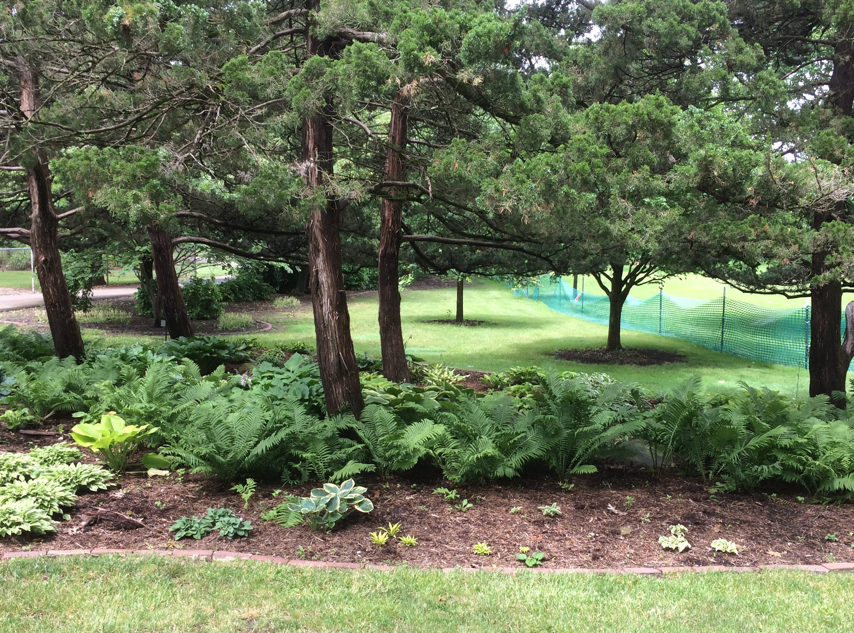
By last Sunday morning, the rain had stopped and we visited the Mabery Gelvin Botanical Gardens in Mahomet, Illinois, not far outside Champaign. At eight acres, the garden isn’t large, but it is a pretty place in June. Featuring the blooming Dogwood (Cornus kousa). A Saucer Magnolia (Magnolia x soulangeana). The South doesn’t get all the magnolias. According to the sign next to the tree, “… the genus magnolia is 95 million years old. Older than bees, they are pollinated by beetles.” Japanese lilac (Syringa reticulata). The garden is part of the larger Lake of the Woods Forest Preserve. We took a walk along some of its trails, eventually coming to a covered bridge: Lake of the Woods Covered Bridge. Wooden construction, but also with hidden steel support to make it vehicle-worthy. It isn’t one of the 19th-century bridges you find in the Midwest. Rather, vintage 1965. As the park district says: “After the purchase of an 80-acre tract of land west of the Sangamon River in the 1960s, the Lake of the Woods Covered Bridge was constructed to connect the two sides of Lake of the Woods Forest Preserve in Mahomet. Designed by German Gurfinkel, a Civil Engineering instructor at the University of Illinois, the bridge was a replica of the Pepperel Bridge [sic] near Boston.”
The view from the bridge of the Sangamon River, which flows on to Springfield and then to the Illinois River. We walked across the bridge. You should cross bridges when you come to them, if possible. Before we left the forest preserve, we also drove across it, because we don’t get to drive across covered bridges that much.
Our recent short trip to east-central Illinois and west-central Indiana found us spending two nights in Champaign, last Friday and Saturday. During the day on Saturday, we drove east on U.S. 150 and a short way on I-74 into Indiana. Then we headed south on Indiana 36 to Terra Haute, stopping in Dana.
Returning from Terra Haute, we took U.S. 150 westward — that road jogs oddly to the south from Danville, Illinois — and caught Illinois 133 in Paris, Illinois, a town that sorely needs a replica Eiffel Tower or Arc de Triomphe or some such to distinguish it. That road takes you to Arcola, a town we’re familiar with. From Arcola it’s a straight and not too interesting shot back to Champaign on I-57.
So it was a rectangular driving course (roughly east-south-west-north), good for a day trip, despite the heavy rain at times. It’s been a rainy spring and early summer, which we noticed must be damaging crops, since a lot of corn and soybean fields were covered by large puddles (an item from Ohio about the problem).
The sites associated with Ernie Pyle and Eugene V. Debs, honoring Hoosiers of somewhat different cast, were our main destinations. But I had a couple of minor destinations in mind as well. One was an obscure memorial in the obscure town of Oakland, Illinois, which is Coles County. I had passed that way 12 years earlier. Here’s what I said then about the Oakland town square:
“The place was gloomy. Maybe it was just the overcast skies… Still, I wanted to see the monument in the middle of the square. It was Memorial Day, after all. Someone had decorated the edges of sidewalk leading to the monument with small flags, forming a spot of color in the square, so that was something. The monument consisted of two statues sharing one plinth, one of a soldier and the other sailor, clearly World War I vintage, with the names of locals who had participated in that war carved in the plinth. All of it was weathered and dark.”
I wanted another look. In 2019, the square’s a little better looking (officially it’s the Oakland Centennial Park). The monument, a lot better looking. The darkness this time was from the recent rain. Maybe it was refurbished for the centennial of the war or its own centennial, since carved in stone is the memorial’s dedication date: May 30, 1919 — the first Decoration Day after the Armistice.
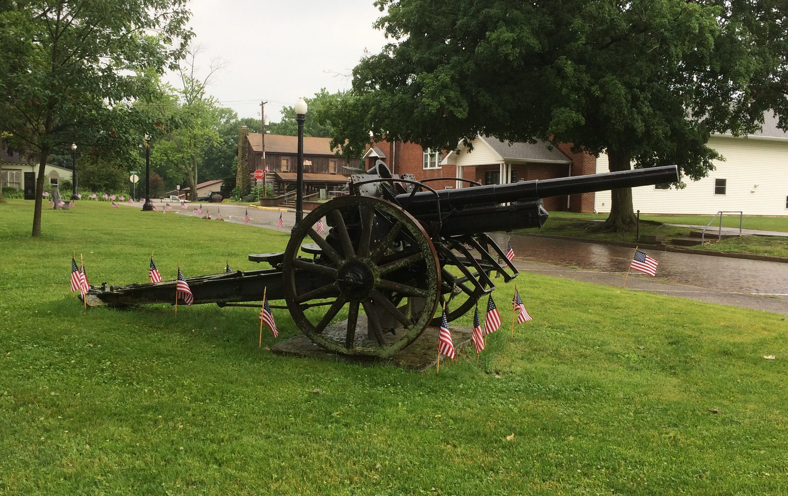
I’d forgotten about this item in the town square, a 77mm Feldkanone 16 German artillary piece. A local prize of war, I guess.
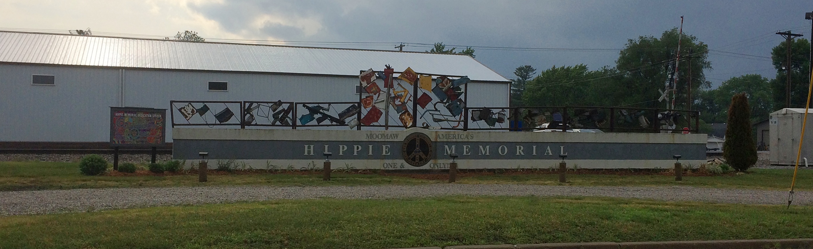
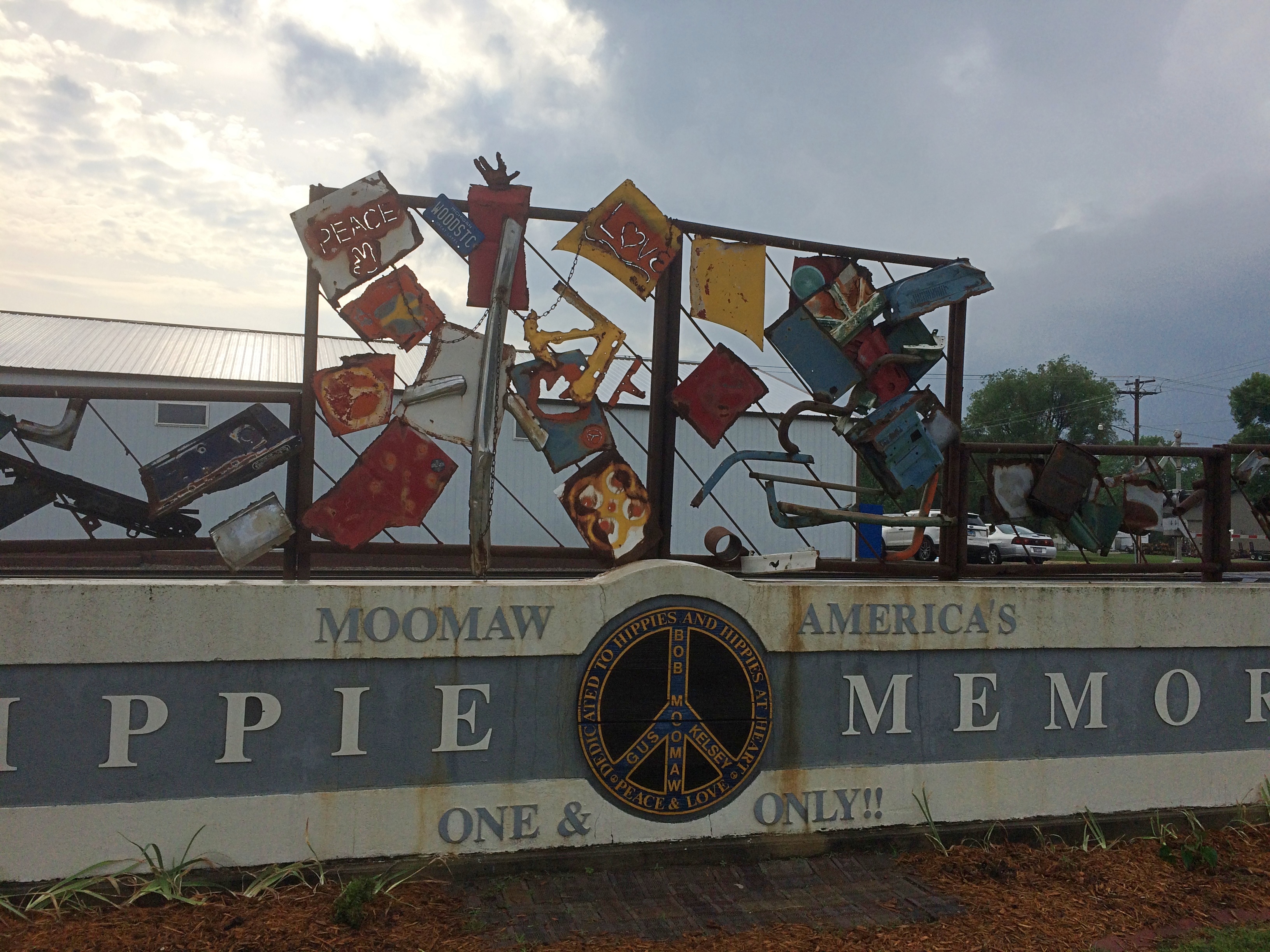
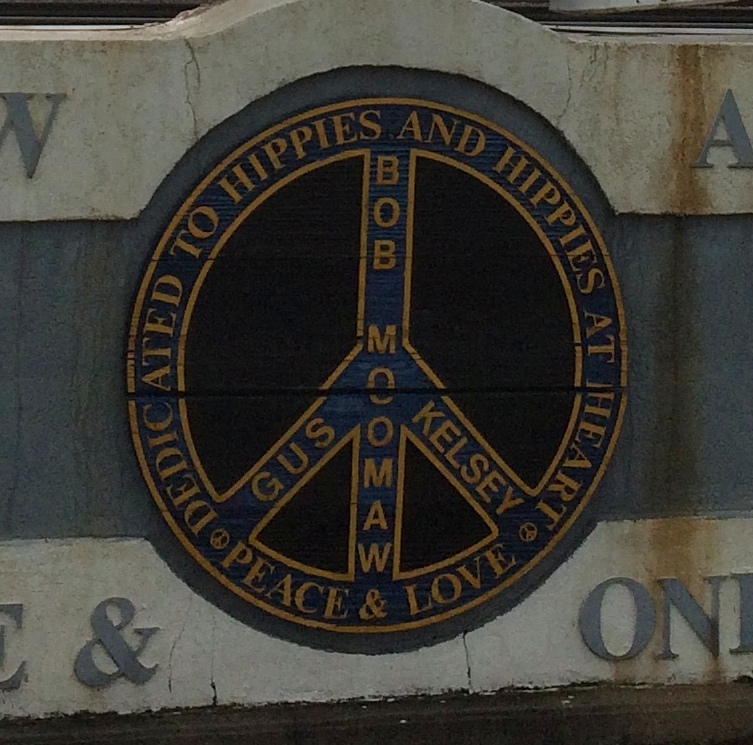
In Arcola, I wanted to see something we’d overlooked last year: the Hippie Memorial. How we missed that, I don’t know, since it’s less than a block away from that town’s Raggedy Ann and Andy sculptures, which we saw.
The Hippie Memorial is a very horizontal structure and an example of vernacular art. Better still, a vernacular memorial, which isn’t that common.
Just how much recognition does ☮ get these days? I wonder.
Nearby, a sign offers the dedication speech, made by the widow of the creator, local eccentric Bob Moomaw, almost exactly 20 years ago. The text seems the same, but the background is a lot more psychedelic than it used to be.
Sure, why not honor the hippie movement? It’s been subject to retroactive derision all out of proportion to its risibility. You can argue that hippies were yet another flowering of bohemianism, a periodic occurrence that’s helped keep things interesting since the Romantic movement at least.
Tucked away among the buildings and open fields of Indiana State University in Terra Haute is a structure from the Gilded Age, but also associated with the golden age of socialism in the United States: the Eugene V. Debs House.
We arrived in the mid-afternoon on Saturday, in time to take a detailed tour from an exceptionally knowledgeable guide, but not for an event earlier that day in honor of the 125th anniversary of the Pullman Strike.
Debs led the strike, of course, and for his trouble was tossed in the McHenry County Jail in Woodstock, Illinois, for six months — an event that radicalized him. After he got out, his commitment to socialism never wavered.
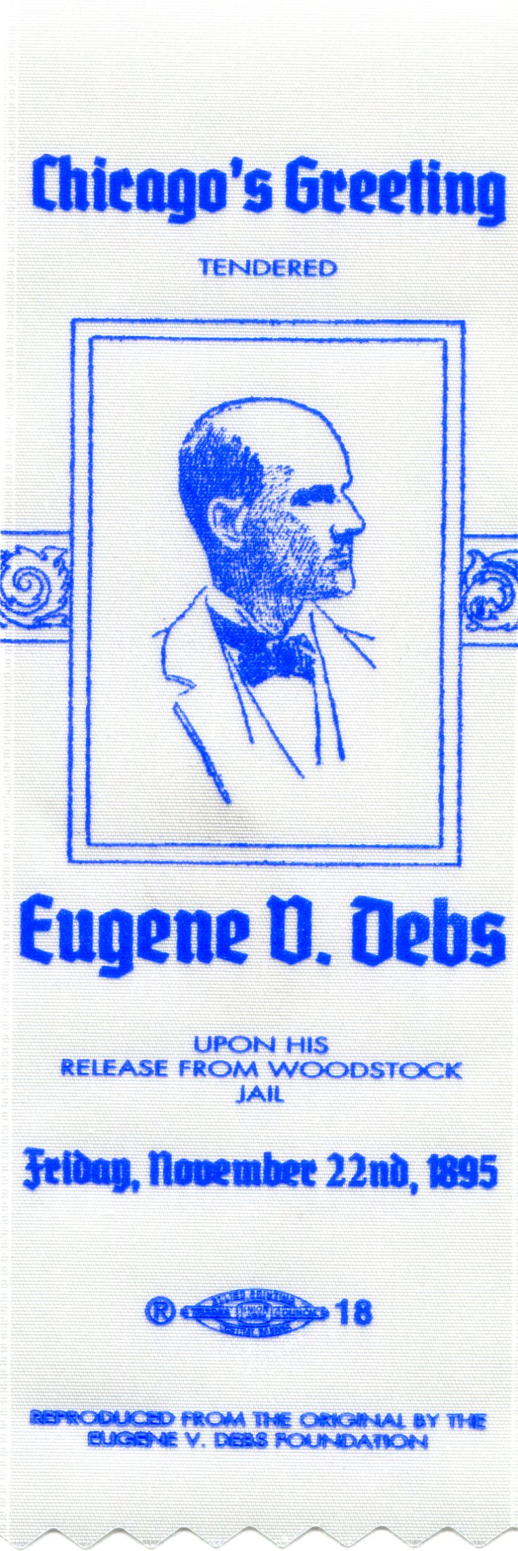
The museum’s event involved a book signing of a new volume about the Pullman Strike — The Edge of Anarchy: The Railroad Barons, the Gilded Age, and the Greatest Labor Uprising in America by Jack Kelly — and a reading of “Liberty,” the speech that Debs delivered to a crowd of thousands of supporters in Chicago after his release from Woodstock Jail, on November 22, 1895.
It was a speech I’d never read, so I looked it up later. Credit to Debs for giving good speeches in an era when political discourse hadn’t yet been dumbed down to semiliterate 280-character bursts. A couple of selections:
“Out of range of the government’s machine guns and knowing the location of judicial traps and deadfalls, Americans may still indulge in the exaltation of liberty, though pursued through every lane and avenue of life by the baying hounds of usurped and unconstitutional power, glad if when night lets down her sable curtains, they are out of prison, though still the wage-slaves of a plutocracy which, were it in the celestial city, would wreck every avenue leading up to the throne of the Infinite by stealing the gold with which they are paved, and debauch Heaven’s supreme court to obtain a decision that the command ‘thou shalt not steal’ is unconstitutional…
“I remember one old divine who, one night, selected for his text George M. Pullman, and said: ‘George is a bad egg, handle him with care. Should you crack his shell the odor would depopulate Chicago in an hour.’ All said ‘Amen’ and the services closed.
“Another old sermonizer who said he had been preaching since man was a molecule, declared he had of late years studied corporations, and that they were warts on the nose of our national industries, — that they were vultures whose beaks and claws were tearing and mangling the vitals of labor and transforming workingmen’s homes into caves.”
The museum staff was giving away souvenir ribbons, replicas of the ribbons worn by supporters who greeted Debs when he got out of Woodstock. We got one.
The house is both a house museum of the period, with many of the Debs’ possessions, as well as a museum about labor organizing, American socialism — Debs was adamant that the ideology wasn’t some imported Euro-virus — and the fight against government overreach, as expressed by siding with the bosses in the ’90s and the sedition laws of the First World War.
It was a pretty nice house for its time, vintage 1890. I understand that Debs caught some flack for living in a comfortable house. Comfortable with a few touches of affluence, since his wife Kate brought some money to the marriage. Some of the fireplaces feature cobalt blue porcelain tiles imported from Italy, the mahogany dining and parlor furniture is pretty nice, and a display case sports the Debs’ set of Haviland china.
Of course that’s the kind of lightweight criticism that politicians and activists of all stripes receive. The house was clearly upper-middle class for the time, but so what? The Debs were supposed to live in a shotgun shack? Besides, bread and roses.
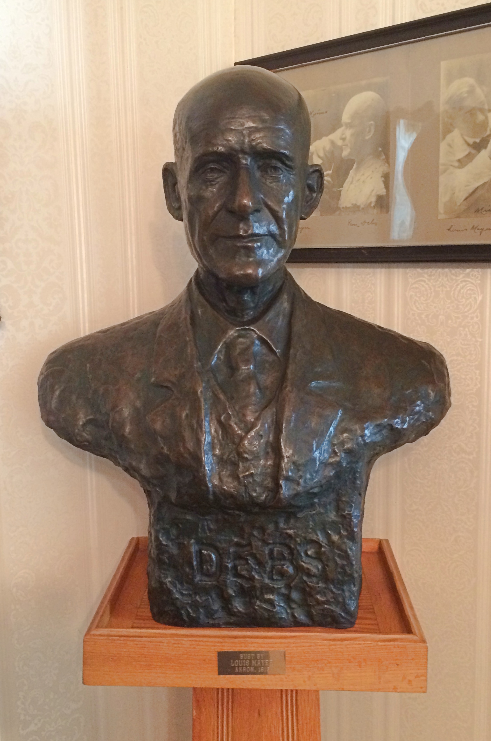
Also on display are a number of depictions of Debs. This one is by Wisconsin sculptor Louis B. Mayer (not the movie mogul).
LM could also be Louis Mayer. In any case, this is also a sedition trial-era work.
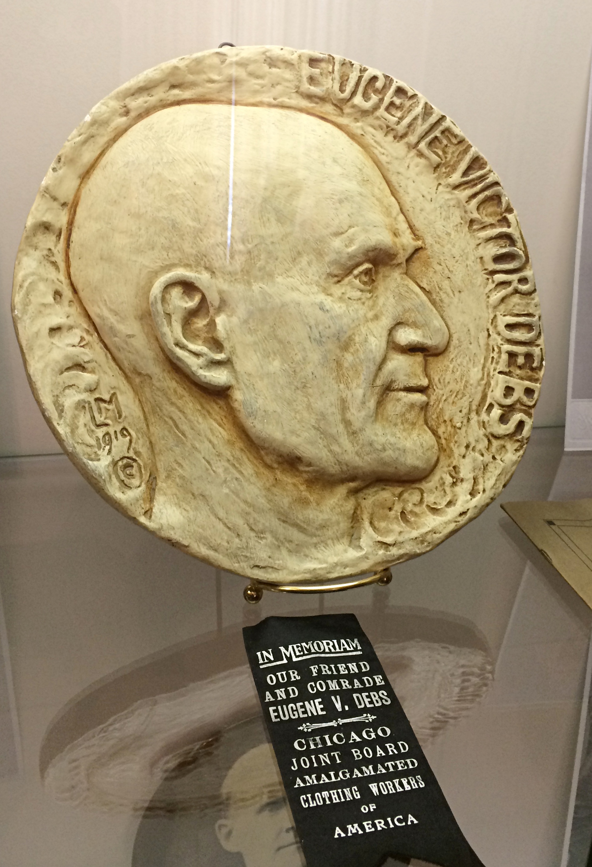
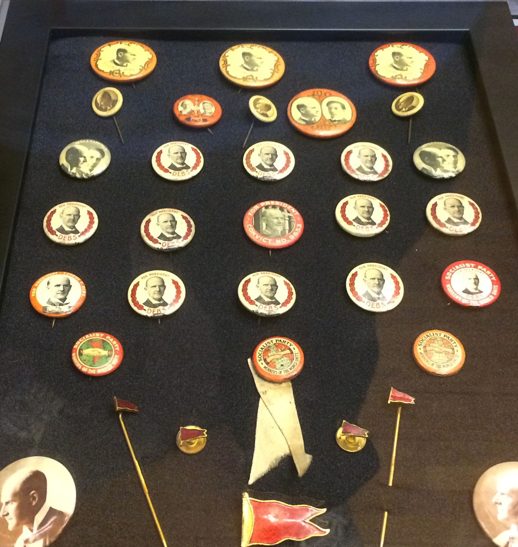
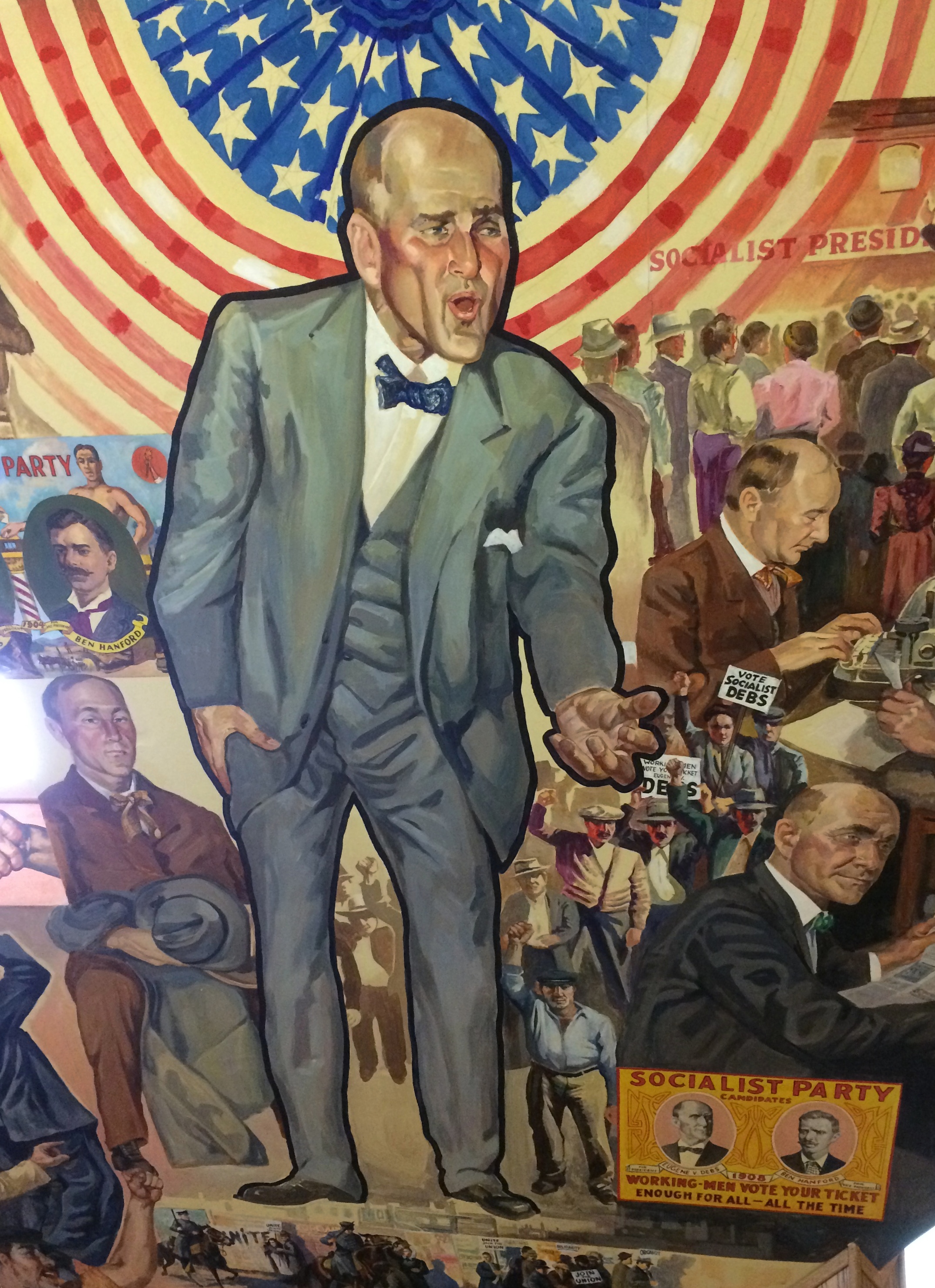
Plus plenty of buttons from Debs’ many runs for president. In the house’s attic, which was once merely storage, all of the walls are covered with murals. The centerpiece is Debs in campaigning mode. One of the smaller details on the mural walls, but one I liked best, is a campaign button from 1920. Debs received 3.5 percent of the popular vote, more than any other socialist candidate for U.S. president, before or since. While in federal prison. The museum notes: “The murals were painted by John Laska, former Professor of Art at Indiana State University and active Foundation member. Completed in 1979 after three years of hard work, the murals depict Debs’ life and time in chronological order…”
The Ernie Pyle museum reminded me of a long-ago English teacher of mine, Mr. Swinny. The Debs museum reminded me of another long-ago teacher, Mrs. Collins. She taught us freshman U.S. history. About 60 at the time, she grew up in Buffalo and — I think I remember this correctly — had been a Wobbly as a young woman.
That would have been during the Depression, after the heyday of the Wobblies, but still. Mrs. Collins wasn’t shy about throwing in some labor history and using texts sympathetic to socialism, most notably The Jungle. Naturally, Debs came up as well.
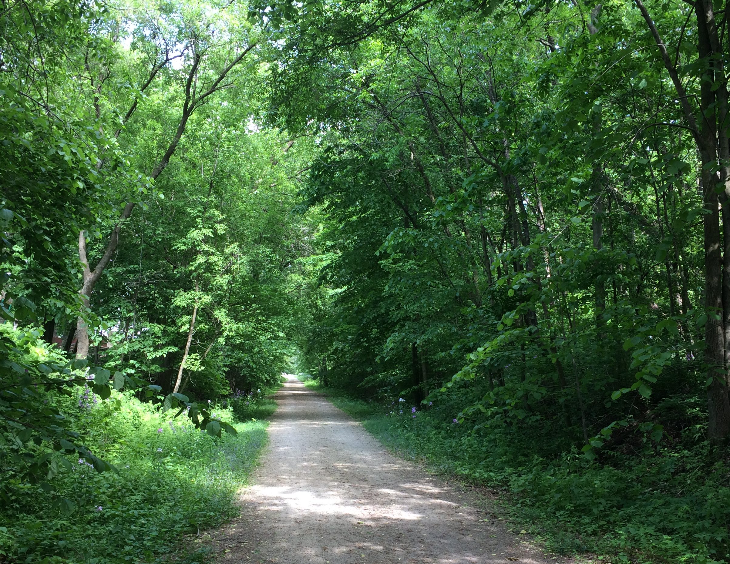
I might have heard the term drumlin before, but if so I didn’t remember what it meant. On June 2, after lunch and looking around Lake Mills, Wisconsin, for a while, we took a walk on the Glacial Drumlin State Trail, which runs through the southern part of the town.
A drumlin is a kind of elongated hill. The kind of formation receding glaciers are apt to leave. “One end is quite step, whilst the other end tapers away to ground level,” says the Geography Site, a British page with helpful diagrams.
The section of the trail we walked didn’t have any kind of slopes at all, but the name refers to the drumlins that the trail passes by or over during its entire length, which is 53 or so miles. It runs from suburban Milwaukee to suburban Madison, or the other way around.
The trail began as a section of the Chicago & North Western’s main line between Milwaukee and Madison. The railroad abandoned the line in the 1980s, after which I assume the Rails to Trails Conservancy did its fine work.
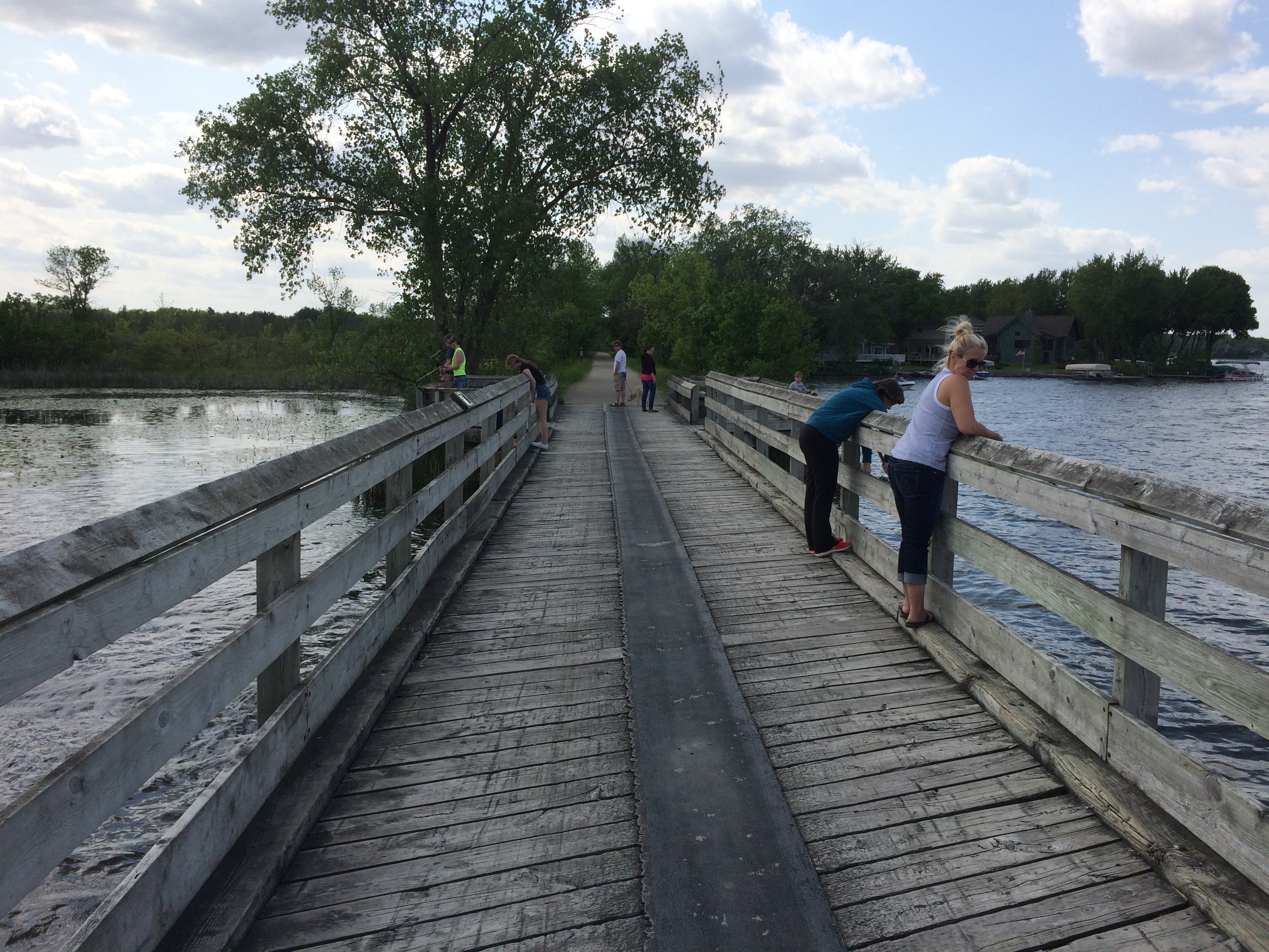
I first noticed the trail on Google Maps and decided to investigate further when I saw that the trail crossed a part of Rock Lake on a feature called Glacial Drumlin Train Trestle, which sounds like an English folk revival band from about 50 years ago. I decided I wanted to see the trestle.
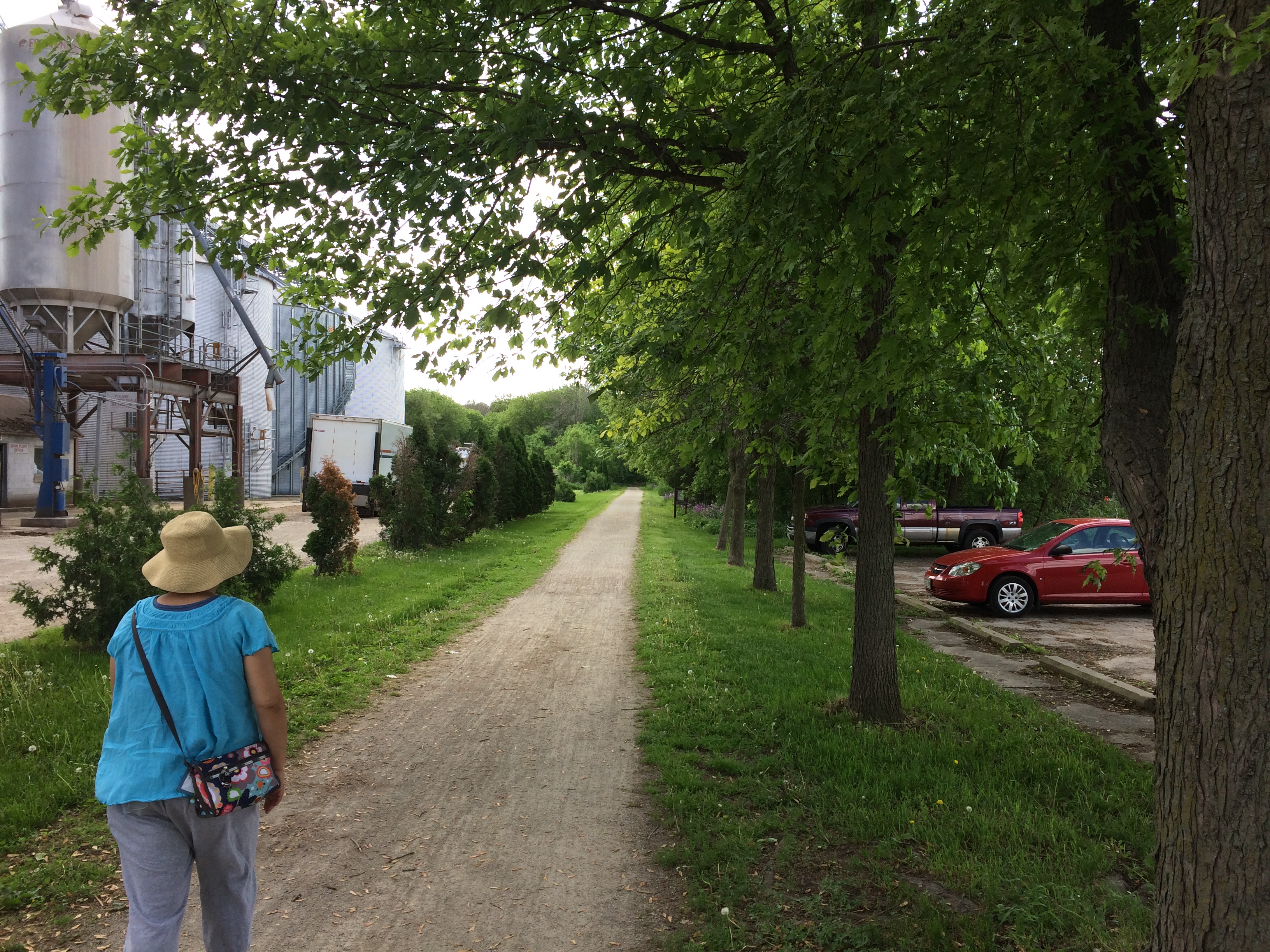
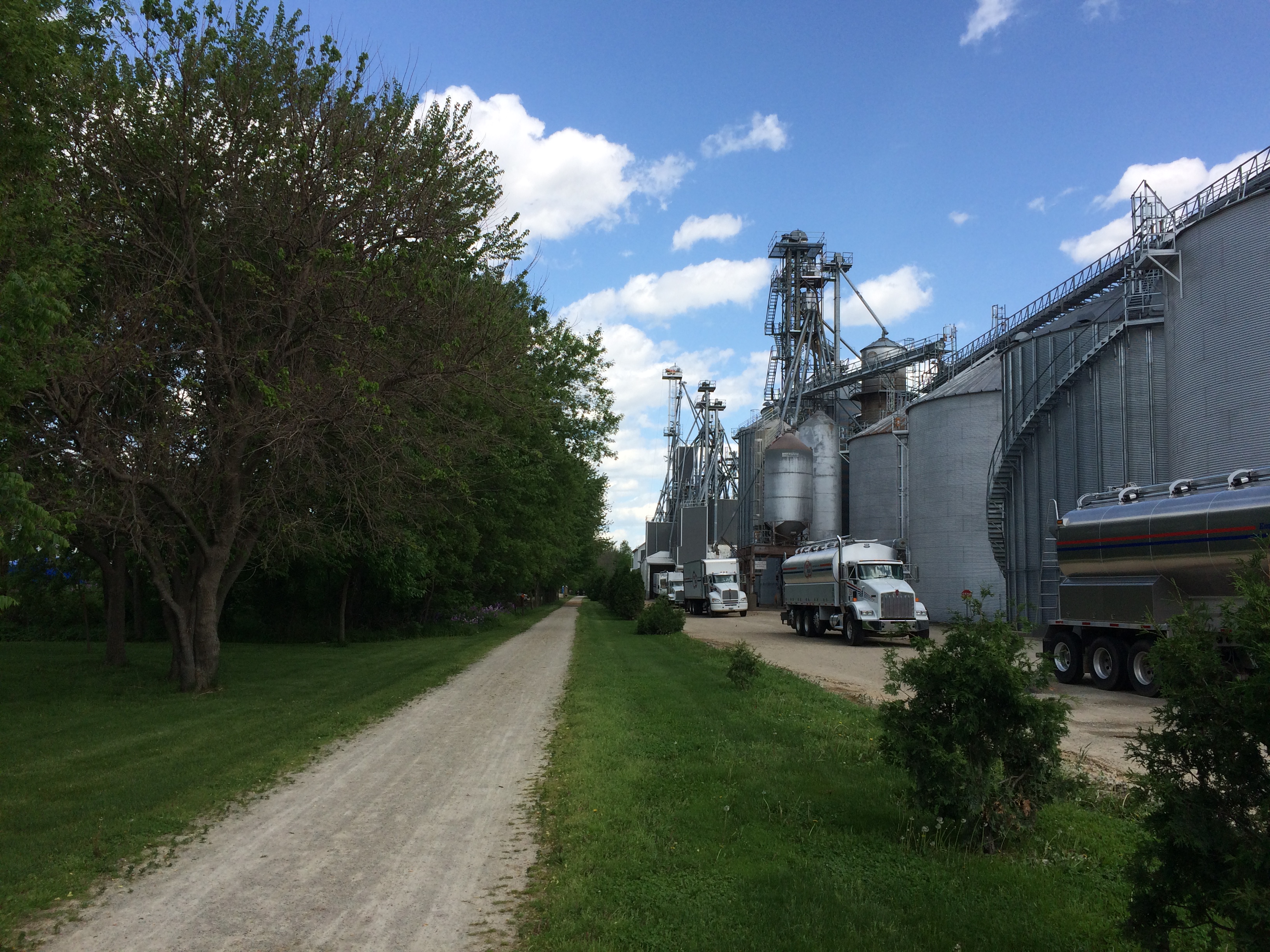
We accessed the trail from a parking lot near a renovated depot. To the south of the trail at that point is an industrial complex belonging to Vita Plus. In its way, as interesting as anything we saw in Wisconsin that day. The company provides “feed, nutrition and management expertise to dairy and livestock producers,” according to its web site.
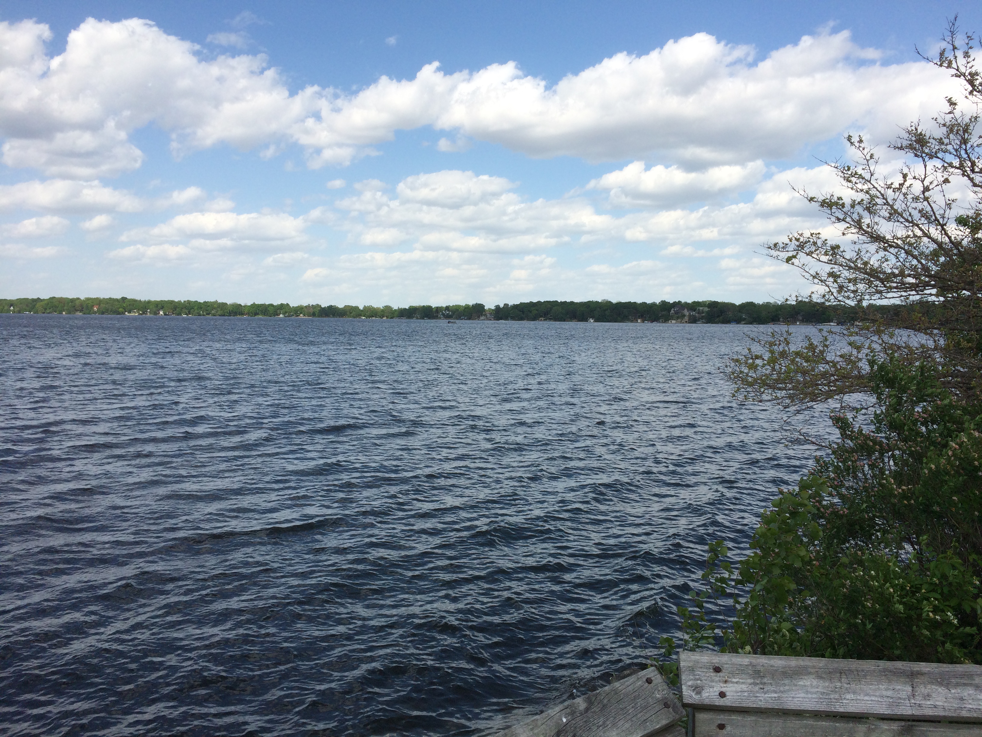
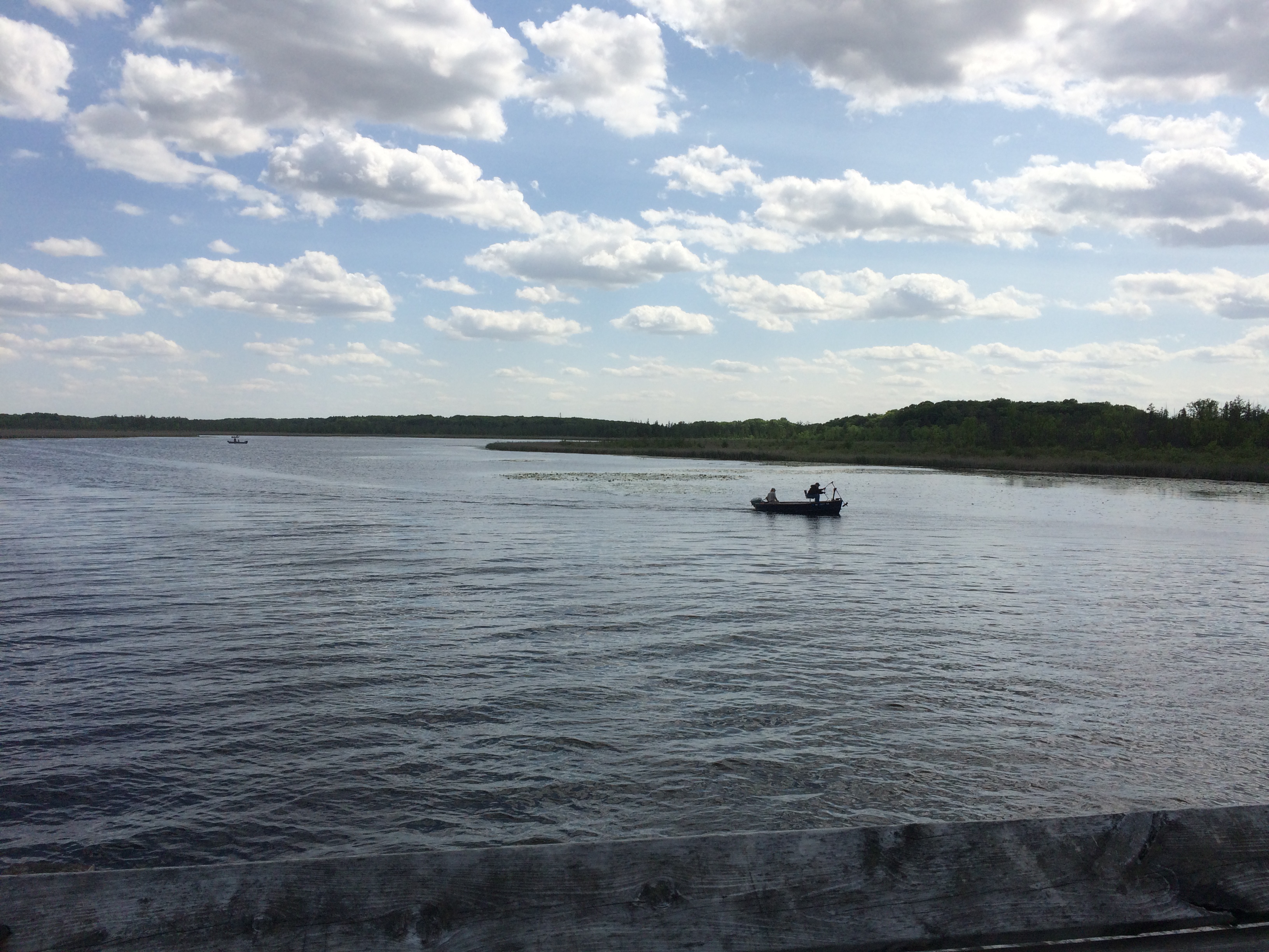
Moving on, we headed deep into the woods. Except that for most of the way to Rock Lake, residential districts were on both sides, maybe 30 feet from the edge of the trail. Still, it was a pleasant walk, crowded with neither bicyclists nor hikers. Phlox were a-bloomin’ along the trail. Eventually we got to the trestle. Because I didn’t bother to check Google Images, I was expecting to see some kind of bridge substructure. The term “trestle” inspired that idea. Instead, we crossed a nice enough but not very dramatic bridge occupied by a few fishing enthusiasts. Views of Rock Lake from the trestle, to the north and to the south. Pyramids lurk under the waves, they say. Built by aliens, no doubt. To harness pyramid power and teach mankind to live in peace and harmony.
A local Nessie would be better, but I’ll pass along whatever tales are on offer.
In late May, I benefited from a bit of service journalism offered by the Chicago Tribune, which told me that the state of Wisconsin wasn’t charging entry fees to state parks on the first weekend in June.
So on June 2, we sought to take advantage of the situation by driving up to Wisconsin for the day — and probably proving the marketing arm of the state right when it calculated that such an offering would attract some out-of-state visitors, especially from Illinois.
Before we went to any state park, however, we stopped in the pleasant town of Lake Mills, which is in Jefferson County in the southern part of the state, between Madison and Milwaukee. We had a satisfying lunch at a diner called Cafe on the Park, which is on Main St. across the street from Commons Park. Then we took a stroll over to the park.
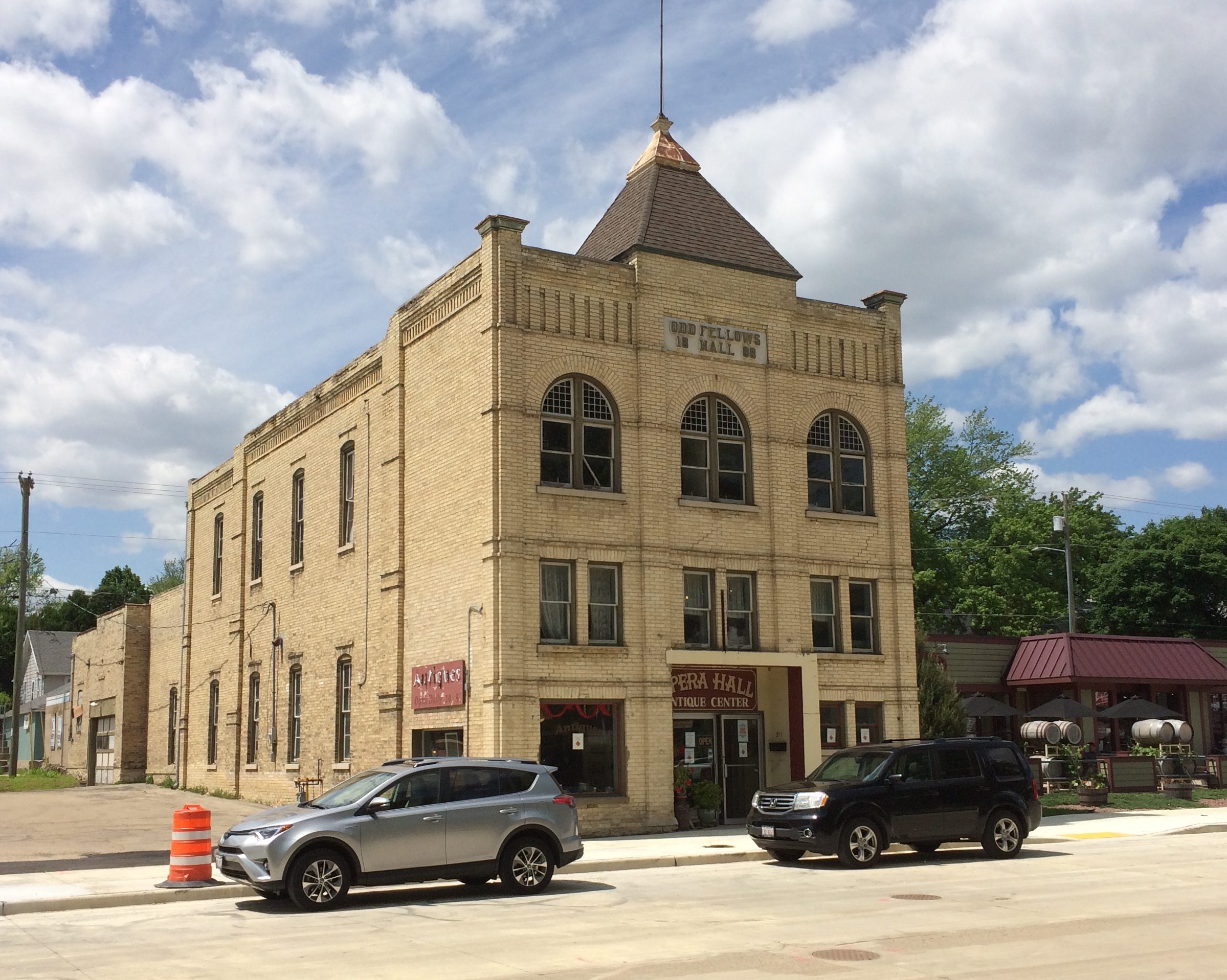
Visible from the park are some interesting buildings, such as the former Odd Fellows Hall and local opera house. Now it’s occupied by an antique mall.
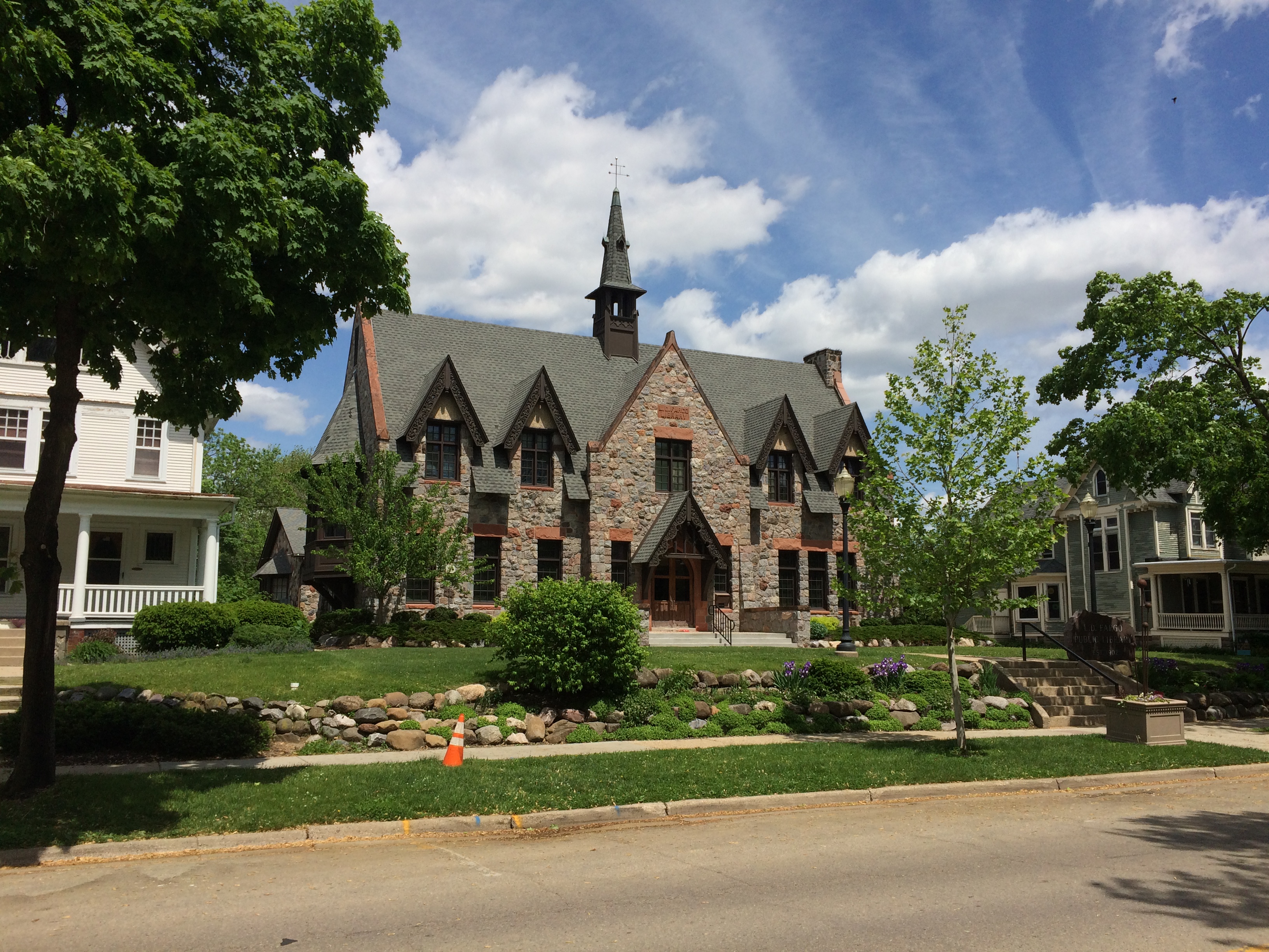
The charming Lake Mills Public Library. Closed on Sunday, or I would have gone in.
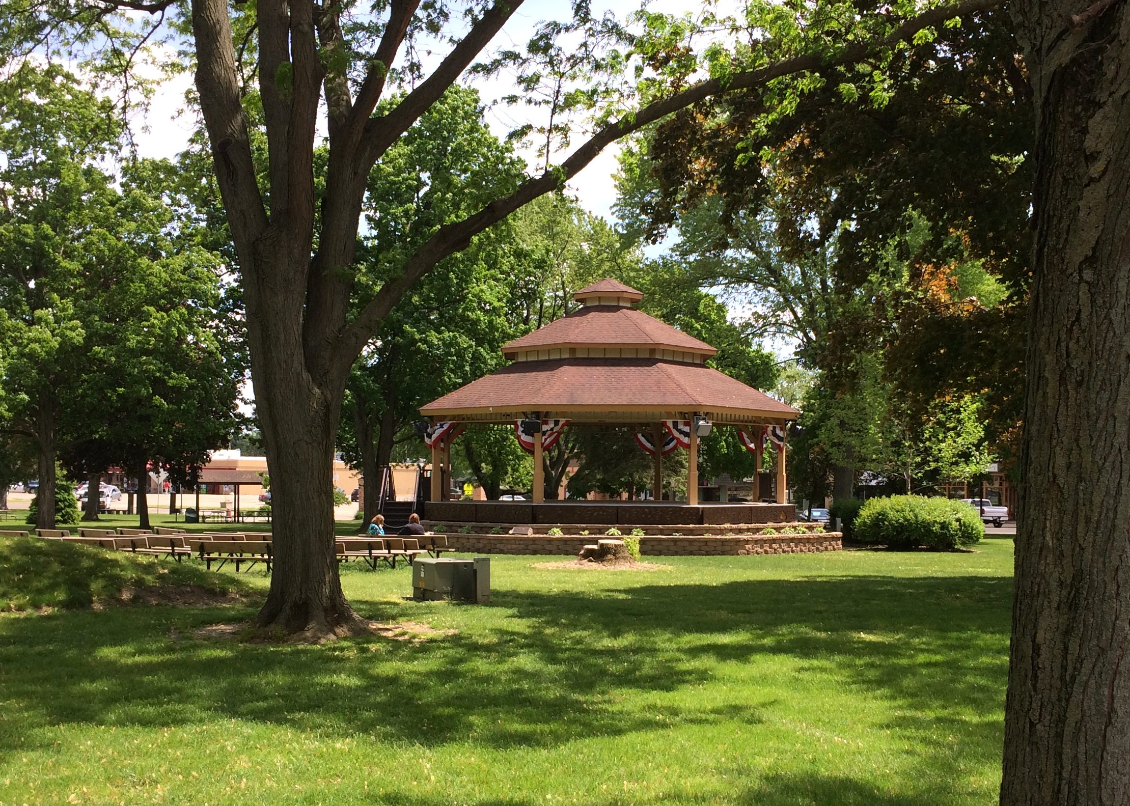
There’s a bandstand in the park. Wouldn’t be a proper small-town park without one. With patriotic bunting. Nice touch. Formally it’s the Franklin Else Memorial Bandstand, though you (I) could argue it’s a large gazebo.
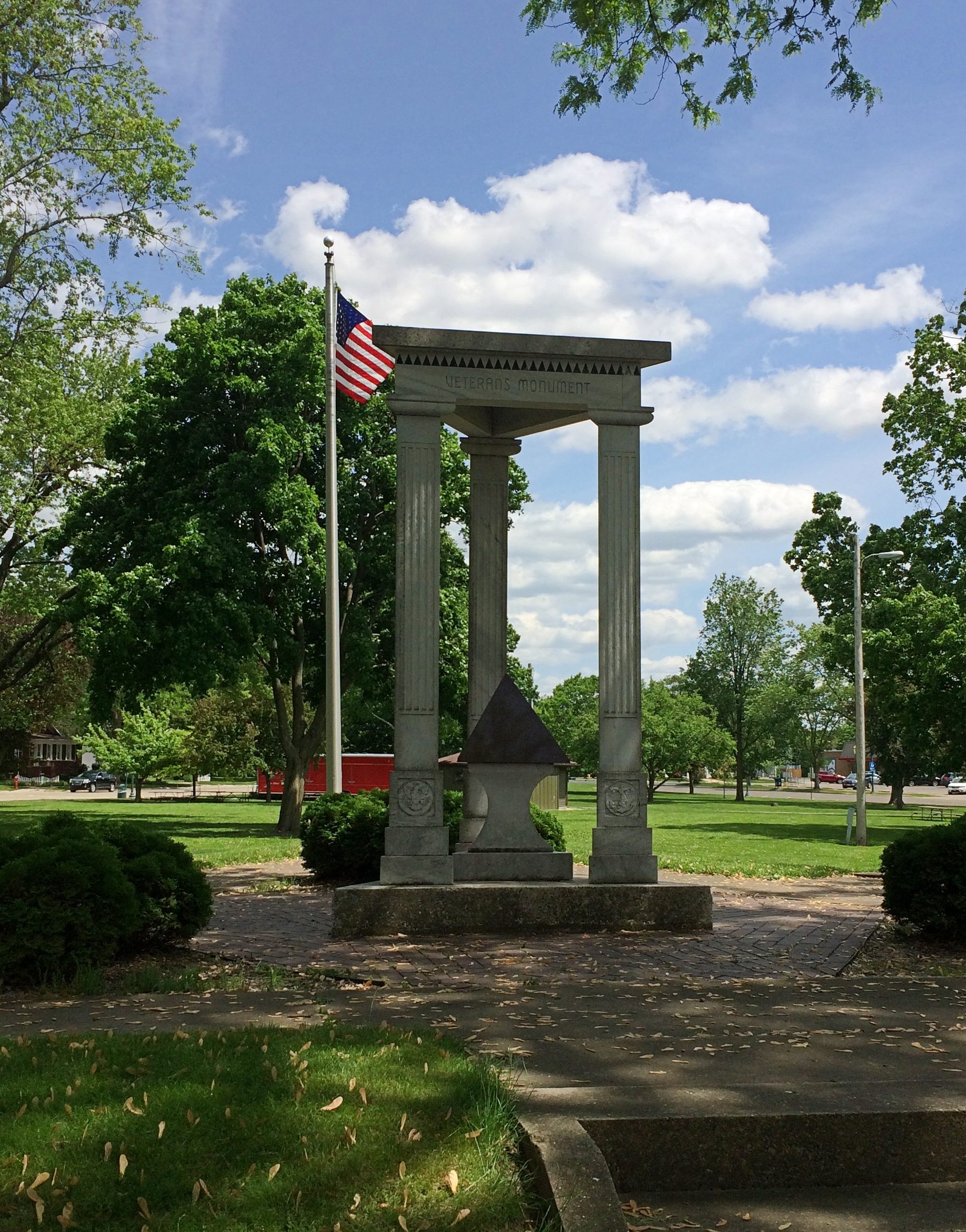
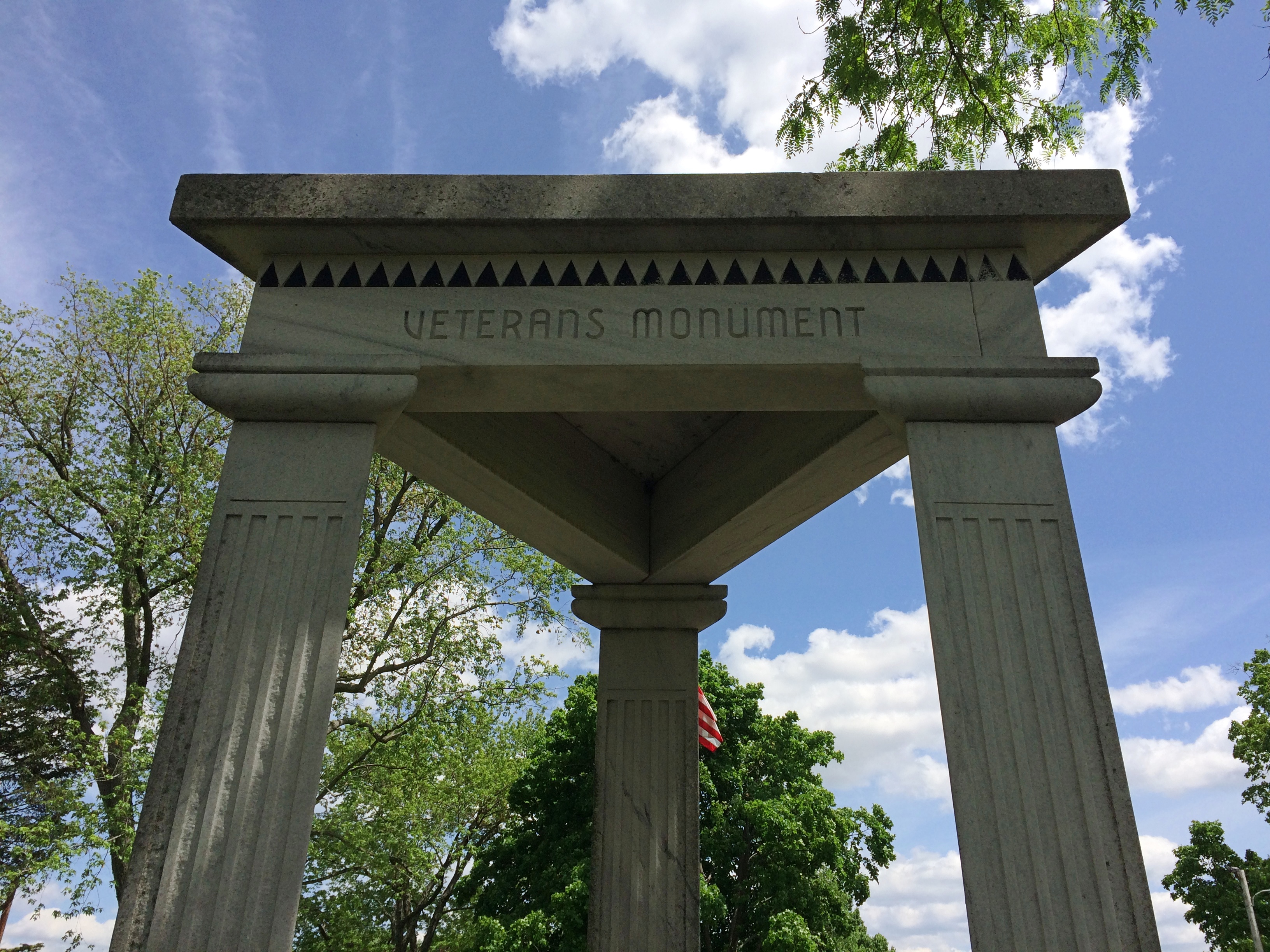
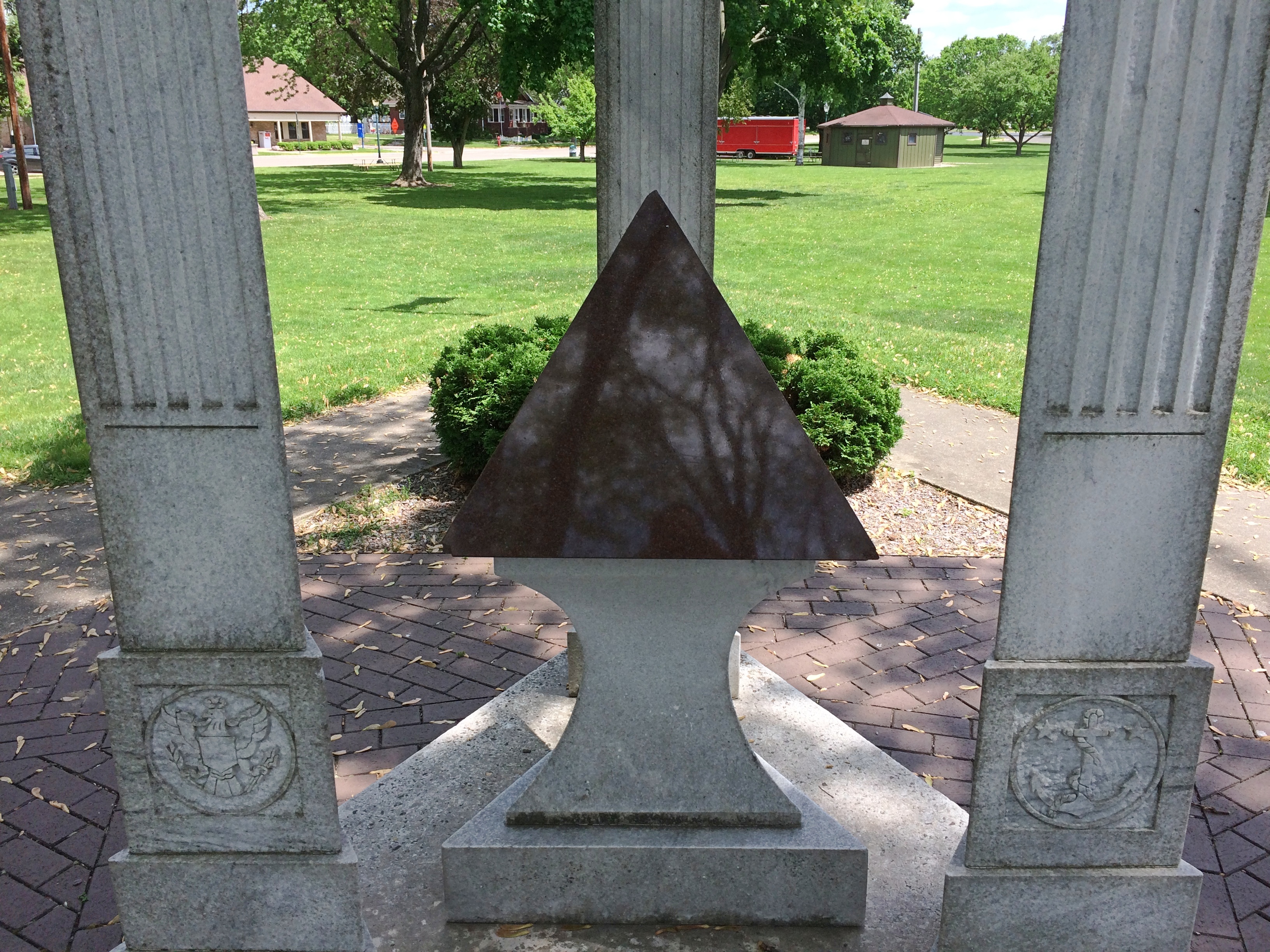
The Veterans Monument in the park is a little odd. It’s respectful and all, but has some unusual design elements. It has a triangular shape, for one thing, with three triangular columns rising from a triangular base to support a triangular top. Triangles are also etched into the design in various places. Besides all that, a black stone pyramid is the centerpiece of the memorial. Why? Or, if you’re feeling more surprised, WTF?
No marker on or near the monument explains. I didn’t know what to make of that local oddity until I got home and looked around some.
Twenty years ago, the Tribunepublished an article about Lake Mills and its adjacent body of water, Rock Lake.
“There’s something in Rock Lake.
“What, exactly, lies at the bottom of this placid fishing hole east of Madison is the stuff of local legend, the obsession of scores of divers and the spark of an unlikely controversy that has raged among locals for decades.
“Believers, including many old-timers and diving enthusiasts, say that ancient pyramids, ruins and even a serpent-like, 200-foot-long rock figure lay beneath these algae-filled waters. They say pre-Columbian dwellers built the structures on dry land before the area was flooded by geological upheavals and a dam built in the 1800s.
“Skeptics… say there’s nothing but natural piles of rocks below the 40-foot depths…. the otherwise unremarkable town of Lake Mills, which abuts Rock Lake, [calls] itself ‘City of the Pyramids.’ “
City of Pyramids, eh? Sounds like something a ’30s newspaperman made up and a ’50s chamber of commerce ran with. A little whimsical to incorporate into a veterans memorial, no? Then again, do such memorials need to be somber to the point of sameness, ignoring local lore?
That’s hardly the end of online descriptions of the supposed structures at the bottom of Rock Lake. Grazing through some of them, you come up with lines like:
“There are remarkable, artificial underwater structures beneath the waters of Rock Lake, Wisconsin but unfortunately for many years these prehistoric ruins have been ignored by researchers.”
“Much like Judge Hyer before him, Taylor believed that the three to four pyramids (the number changed with each reporting) was [sic]Aztec in origin and were built during a drought when the lake was completely drained and they were sacrificial altars to the rain god to bring the rains back.”
“Aerial photos, side boat sonar scans, and underwater divers eventually charted a complex of at least nine different stone structures, including: two rectangular pyramids, several stacked-rock walls, two ‘Stone Cone’ areas, a conical pyramid, and a large ‘Delta Triangle’ structure.”
“Former state archaeologist Bob Birmingham told the Wisconsin State Journal in 2015 that the tales were ‘a bunch of baloney.’ ”
Bob Birmingham chalks up the shapes to piles of rock left by receding glaciers, and notes that such piles are found in other Wisconsin lakes. My, that’s boring. Tales of ancient peoples building mysterious structures are awfully romantic.
This year’s back yard grilling and gabfest has come and gone, when old friends gather to sit on our deck and gab. You know, old-fashioned conversation. It’s been an annual event now since 2014 on the second Saturday of June. In recent years, I’ve been claiming that we gather to celebrate Cole Porter’s birthday, which was on Sunday this year. No Porter songs were sung at the event, however, probably because none of us can sing.
Beer bottles remain behind. Actually, beer and hard cider this year. I drank the Two Hearted Ale and tried one of the ciders this year, though I forget which.
We had a domestic array of alcohol this time. Know-Nothing brews, you might say. In fact, not just domestic, but all Midwestern.
The Holy Moses White Ale was brewed in Cleveland, while the Two Hearted Ale originated in Comstock, Michigan. Both ciders were from Stevens Point, Wisconsin, despite the Union Jack-themed label, and it did my heart glad to learn that.
Among Wisconsin towns, I have a sentimental attachment to Stevens Point, where I spent a few days in the summer of ’78. If you can’t be sentimental about the summer of ’78, when can you be?
When were driving through LaGrange, Texas, on the first day of the trip, I began to wonder. What’s this town known for? I know it’s something. Then I saw a sign calling LaGrange “the best little town in Texas.” Oh, yeah. Famed in song and story.
On the way to Buffalo Bayou Park in Houston, we took a quick detour — because I’d seen it on a map — to see the Beer Can House at 222 Malone St., a quick view from the car. Looks like this. Had we wanted to spend a little more time in Houston, I definitely would have visited the Orange Show. Ah, well.
We enjoyed our walk along Esplanade St. in New Orleans, where you can see some fine houses. Plus efforts to thwart porch pirates. We saw more than one sign along these lines during our walk down the street. We spent part of an evening in New Orleans on Frenchman St., which is described as not as rowdy or vomit-prone as Bourbon St., and I suppose that’s true, though it is a lively place. We went for the music.
At Three Muses, we saw Washboard Rodeo. They were fun. Western swing in New Orleans. Played some Bob Wills, they did.
At d.b.a, we saw Brother Tyrone and the Mindbenders. Counts as rock and soul, I’d say. Also good fun, though they were playing for a pretty thin Monday night crowd.
Adjacent to Frenchman St. is an evening outdoor market, the Frenchman Art Market, which we visited between the two performances. The market featured an impressive array of local art for sale, though nothing we couldn’t live without.
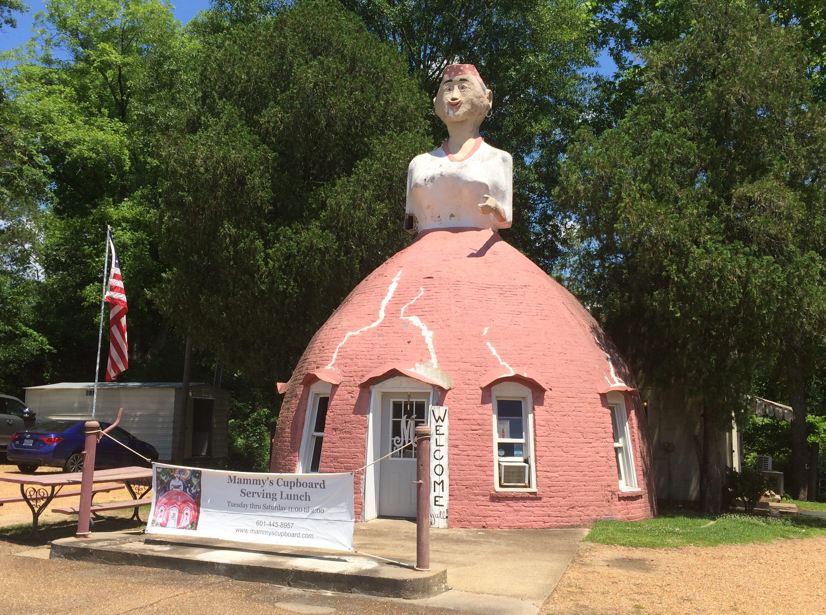
Something you see on U.S. 61 just outside of Natchez, Mississippi: Mammy’s Cupboard, a restaurant.More about it here.
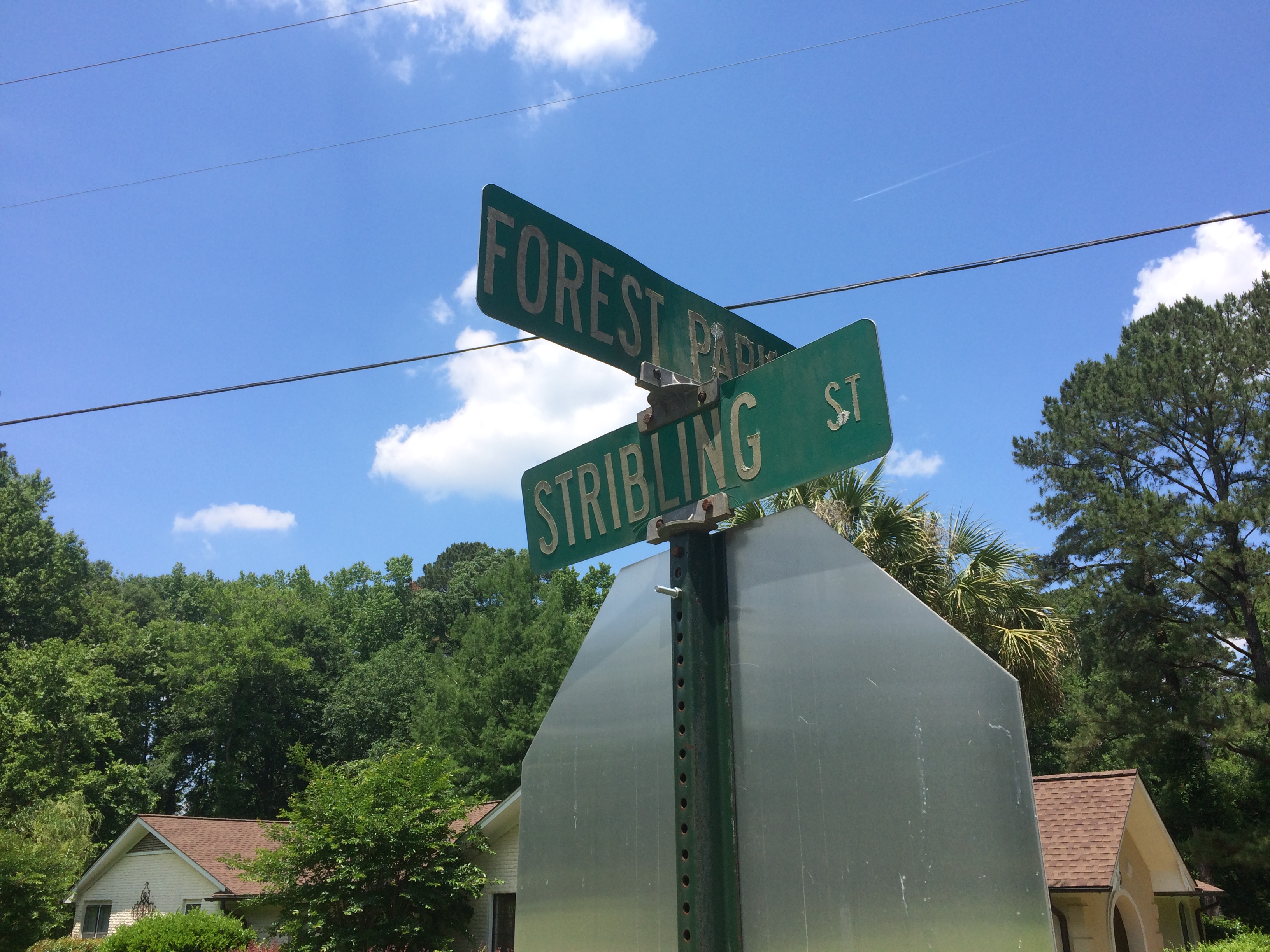
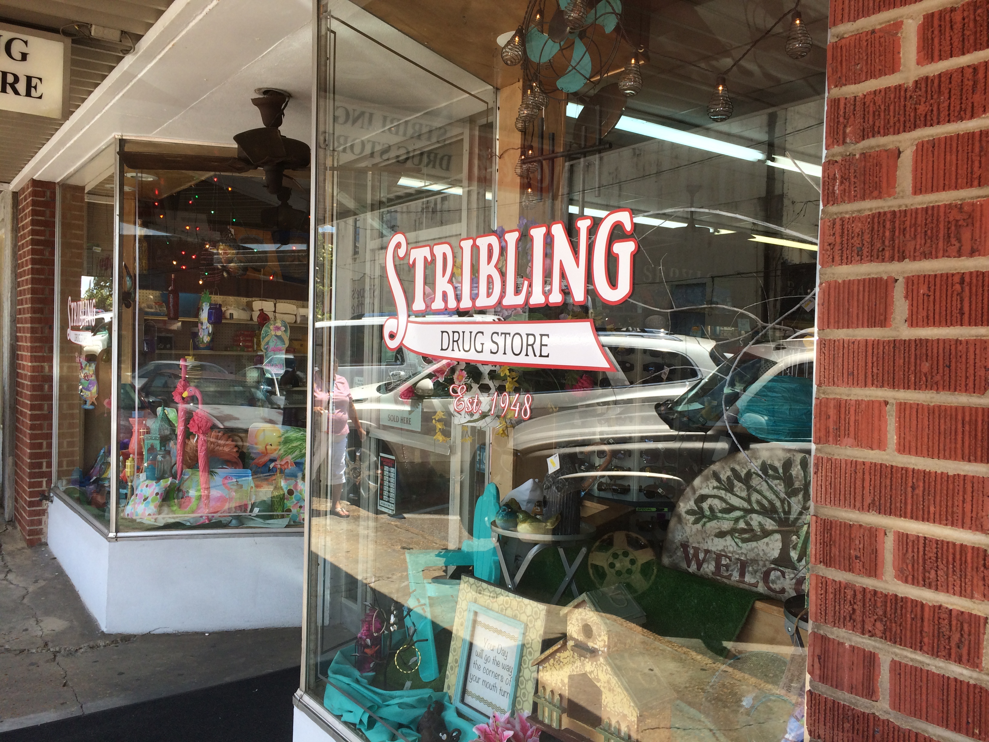
In Philadelphia, Mississippi, Stribling St. is still around. I don’t know why it wouldn’t be, but after nearly 30 years, I wanted another look.
So is the local pharmacy run by distant cousins. Glad the chains haven’t spelled its demise.
During our drive from metro Jackson, Mississippi, to Montgomery, Alabama — connected by U.S. 80 and not an Interstate, as you might think — we passed through Selma, Alabama. I made a point of driving across the Edmund Pettus Bridge, though we decided not to get out and look around. Remarkably, the bridge looks exactly as it does in pictures more than 50 years old.
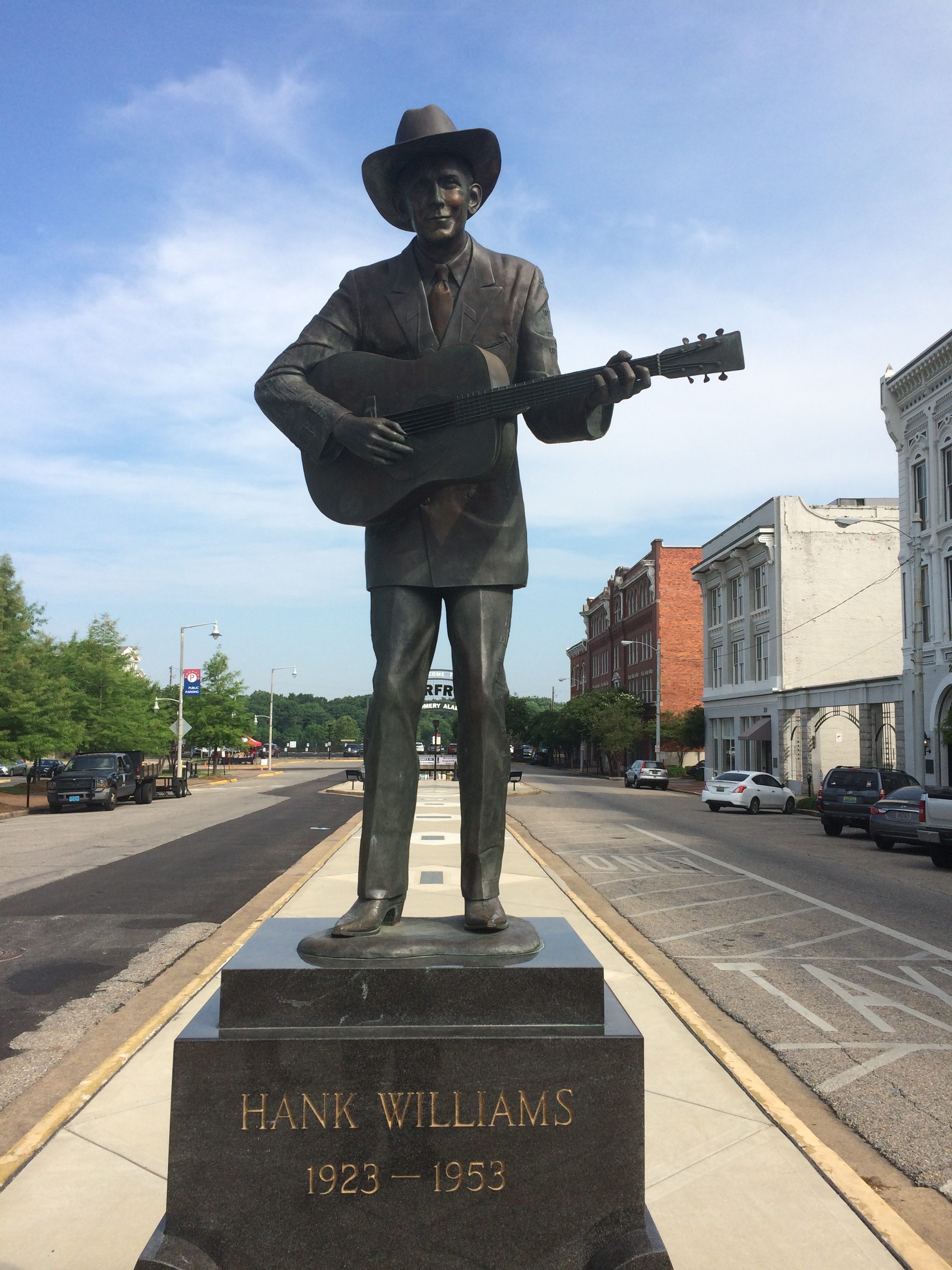
In downtown Montgomery, you can see this statue. I understand the bronze has been around since 1991, but was only recently moved to its current site not far from Riverfront Park, the river of course being the Alabama. I’d forgotten native son Hank Williams died so young. Some singers die rock ‘n’ roll deaths, some die country deaths like Hank.
Speaking of death, early in the trip, I was activating my phone — whose dim algorithm always suggests news I seldom want to see during the process — and I noticed the name “Doris Day” in the feed. I figured that could mean only one thing. Sure enough, she became the first celebrity death of the trip.
I hadn’t known she was still alive. In fairly rapid order during the trip after Ms. Day, the reaper came for Tim Conway, I.M. Pei and Grumpy Cat. I didn’t know that last one, but Lilly did.
I remember a time that Tim Conway described himself as “the funniest man in the universe” on the Carol Burnett Show. We all took that as a comedian’s hyperbole. But what if he was right? What if some higher intelligence has made a four-dimensional assessment of human humor and come to that exact conclusion?
As for Doris Day, I will try to park as close to my destinations as possible in her honor for the foreseeable future (a term I remember hearing as long ago as the ’80s in Austin).
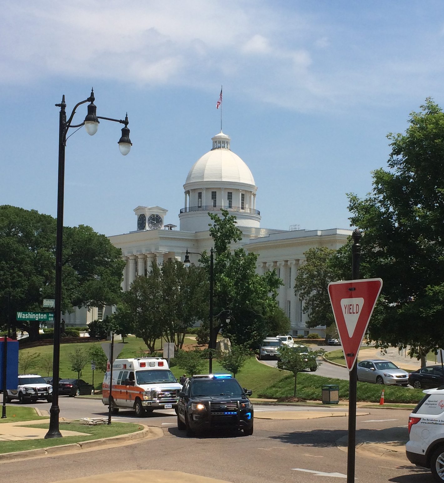
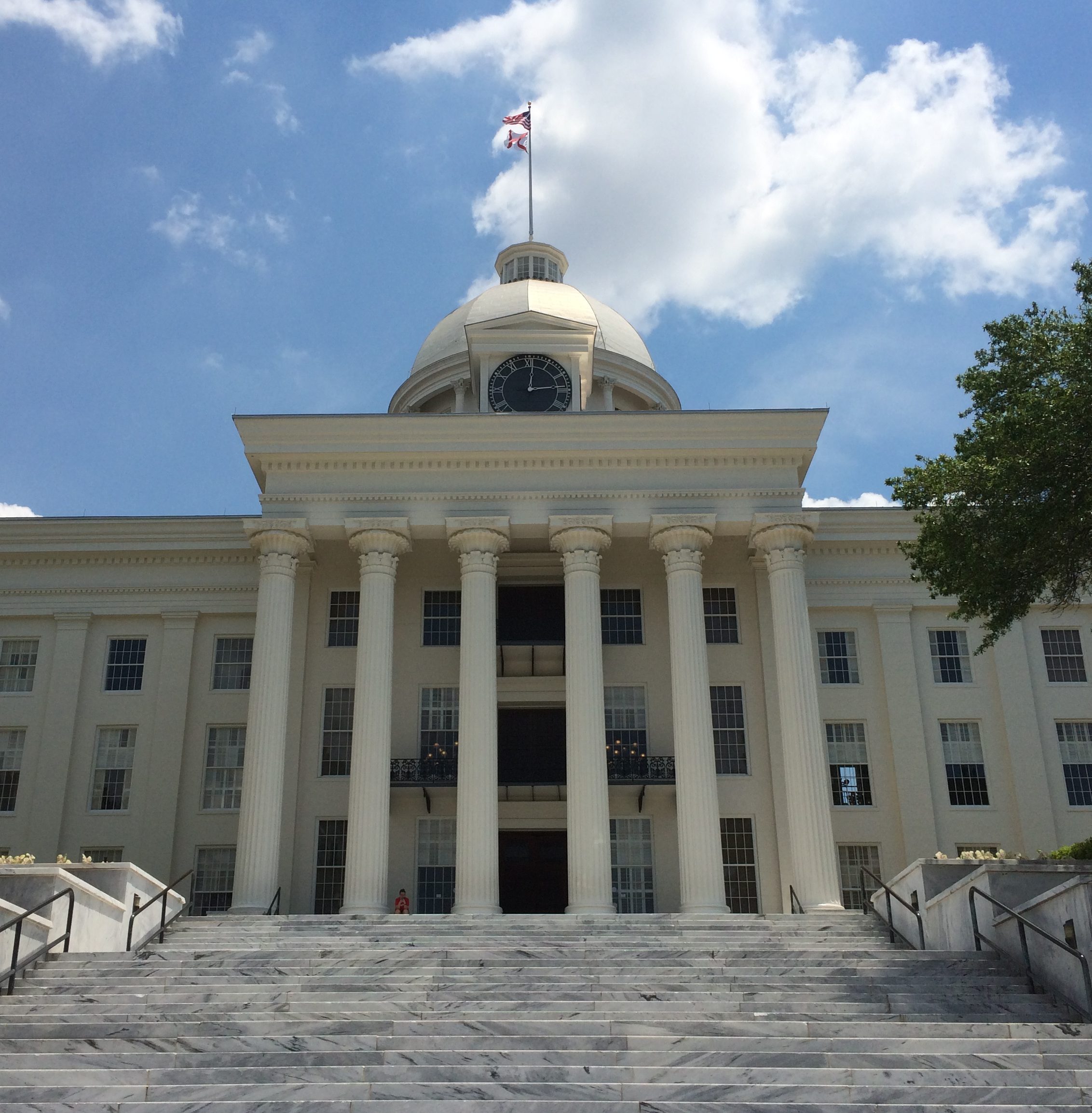
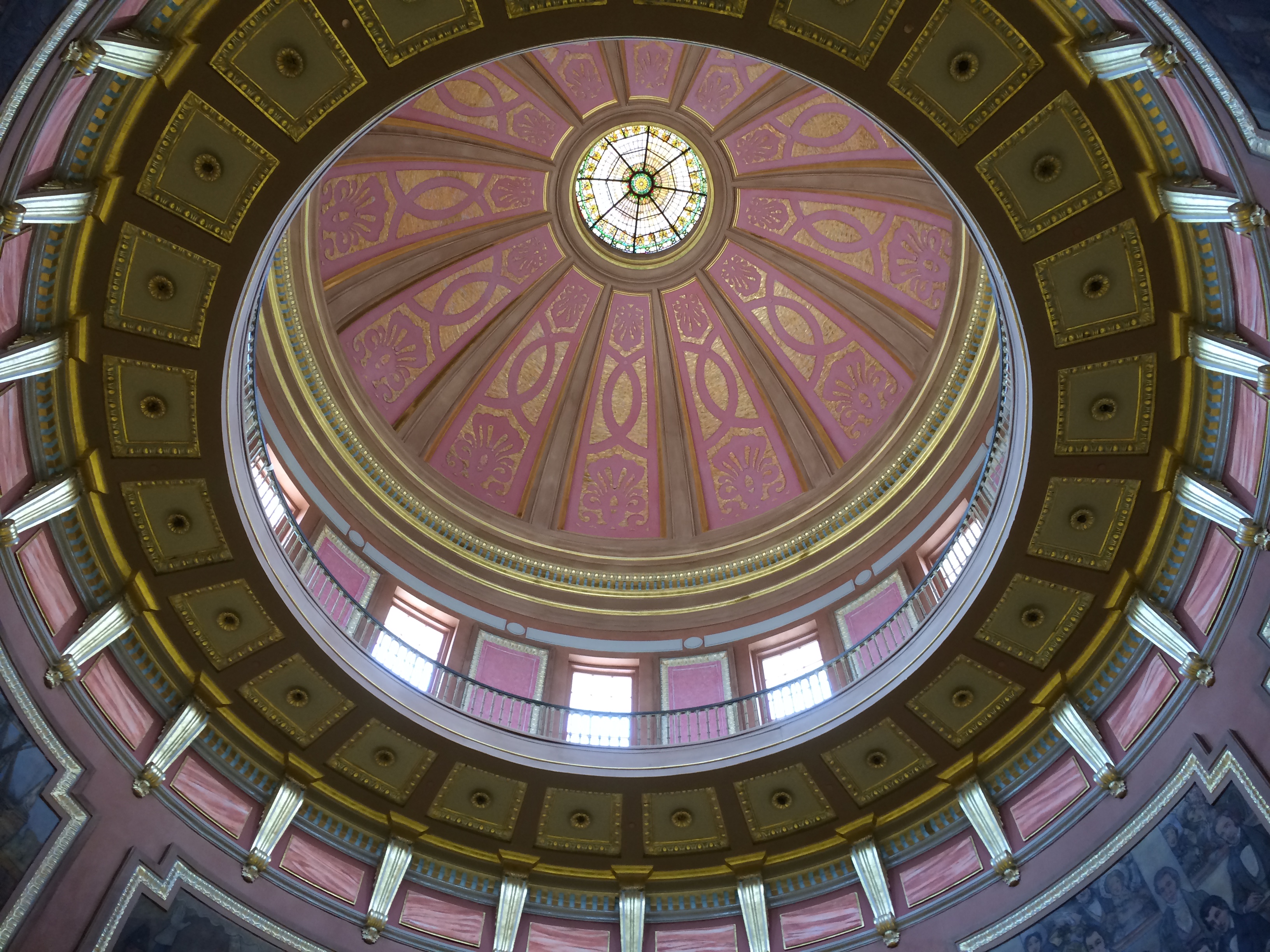
Also in Montgomery: the Alabama State Capitol. The Alabama legislature had been in the news a lot before we came to town, as the latest state body to try to topple Roe v. Wade. That isn’t why I visited. I see capitols when I can.
From a distance. Closer. The capitol was completed in 1851, though additions have been made since then. The interior of the dome is splendid.
Actually, the Alabama House and Senate don’t meet in the capitol any more, but at the nearby Alabama State House, something I found out later. When we visited, the capitol’s House and Senate chambers seemed like museum pieces rather than space for state business, and that’s why.
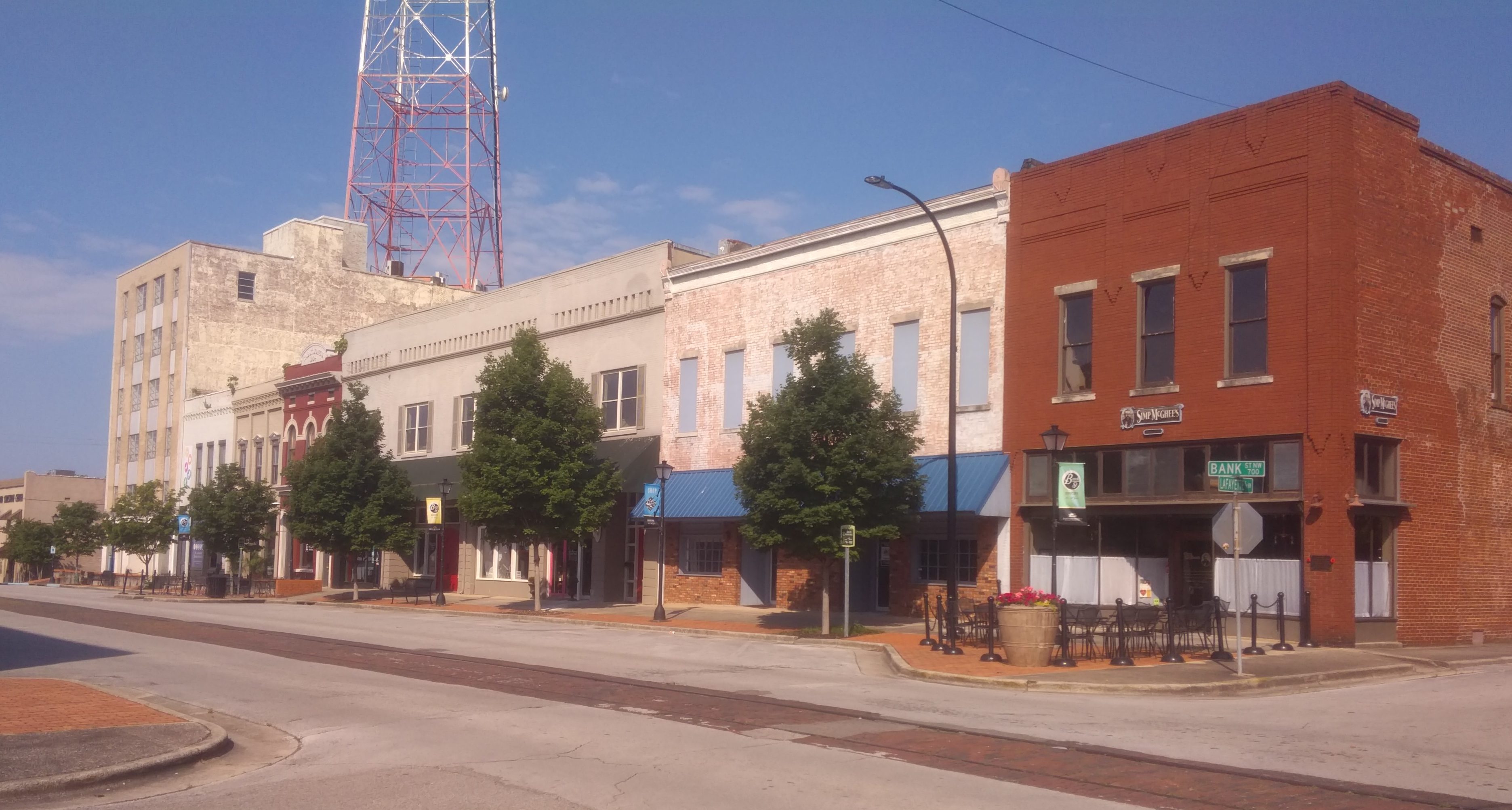
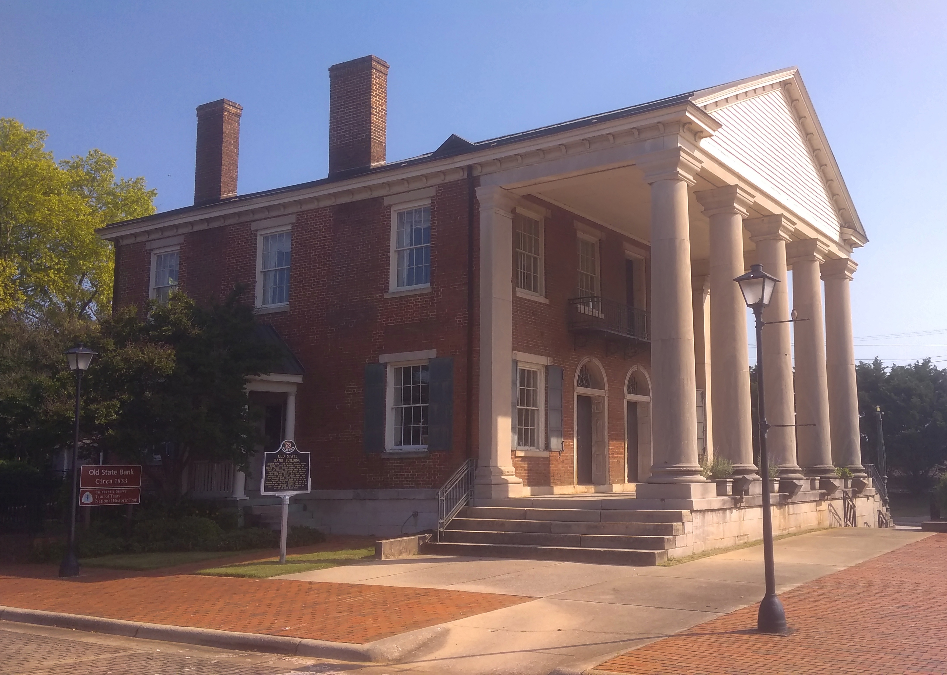
Seems like hipsters haven’t discovered Decatur, Alabama, yet. But as real estate prices balloon in other places, it isn’t out of the question. The town has a pleasant riverfront on the Tennessee and at least one street, Bank St., that could be home to overpriced boutiques and authentic-experience taprooms. Of more interest to me was the Old State Bank, dating back to 1833 and restored toward the end of the 20th century. It is where Bank St. ends, or begins, near the banks of the Tennessee River.
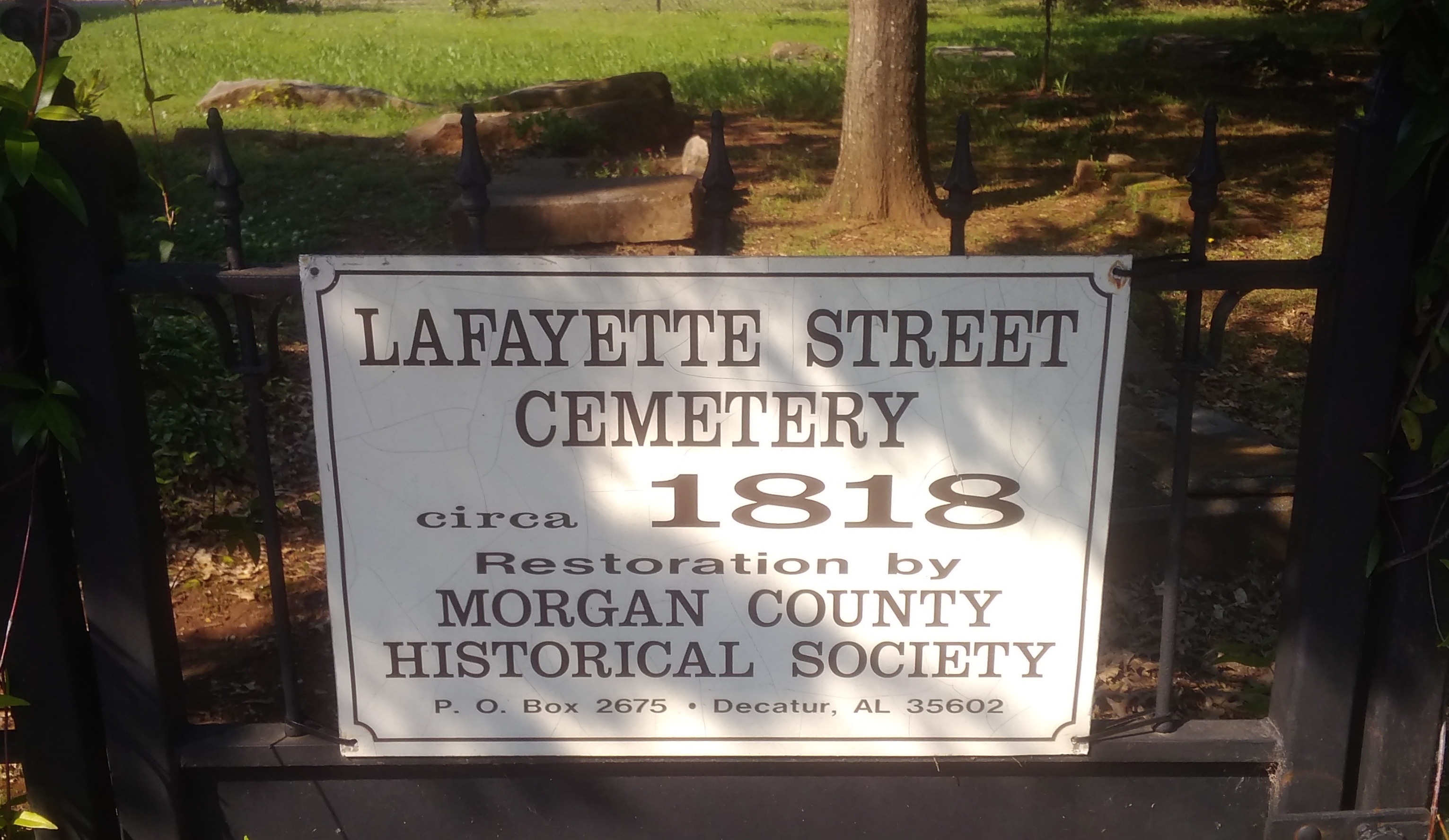
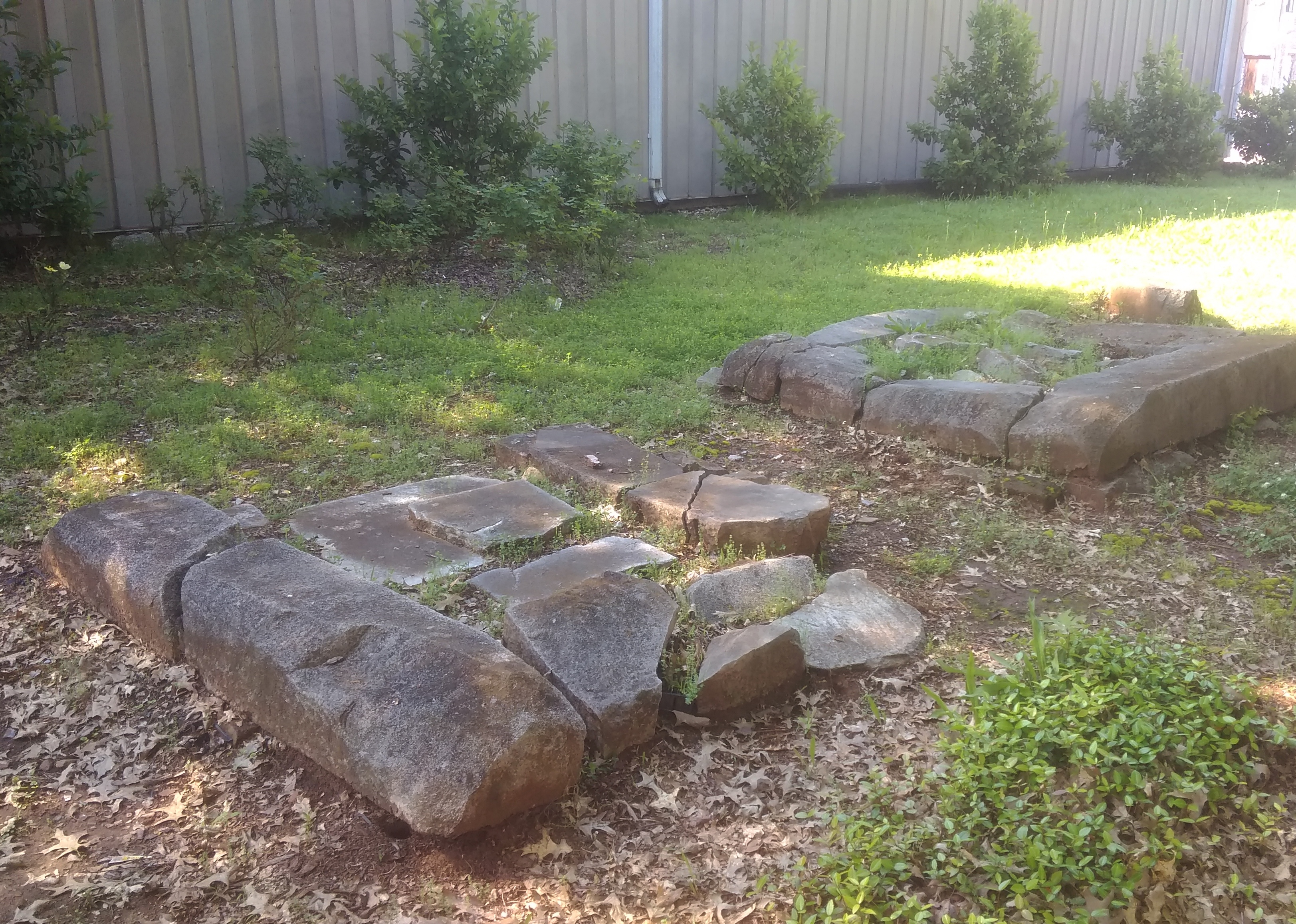
Even more interesting is the Lafayette Street Cemetery, active from ca. 1818.
It’s more of a ruin than a cemetery, but I’m glad it has survived. During the entirety of the trip, there were plenty of random bits of the South to be seen along the way. We also listened to a lot of Southern radio on the trip — something Lilly plans to avoid on future trips, Southern or not, with her Bluetooth and so on — and we had a little game whenever we tuned into someone discussing some social problem in earnest on a non-music, non-NPR station. The game: guess how long will it be before the discussion turns to God. It was never very long.
When we left New Orleans to drive to Natchez, Mississippi, on May 15, the uninspired route would be have been I-10 to Baton Rouge and then north on US 61. Instead I wanted to drive across Lake Pontchartrain, because I’ve seen that crossing on maps for years. Better yet, it’s no extra charge, since the Lake Pontchartrain Causeway collects no toll northbound.
The morning was bright and traffic light on the causeway. It’s actually two bridges, one each way, so you don’t face miles and miles of unavoidable oncoming traffic mere feet away. An enjoyable stretch of road under those conditions. Uneventful enough driving to ponder the engineering marvel that’s the causeway while still on it.
Before going, I wondered if there would be a few minutes on the causeway when we would be out of sight of land. I’d read claims to that effect. But the answer is no, not that I saw. I spotted the north shore of the lake in the distance before the south shore had completely vanished from my rear-view mirror. Once you get to the other side of the lake, you’re in Mandeville, Louisiana. I-12 from there connects with US 61 in Baton Rouge.
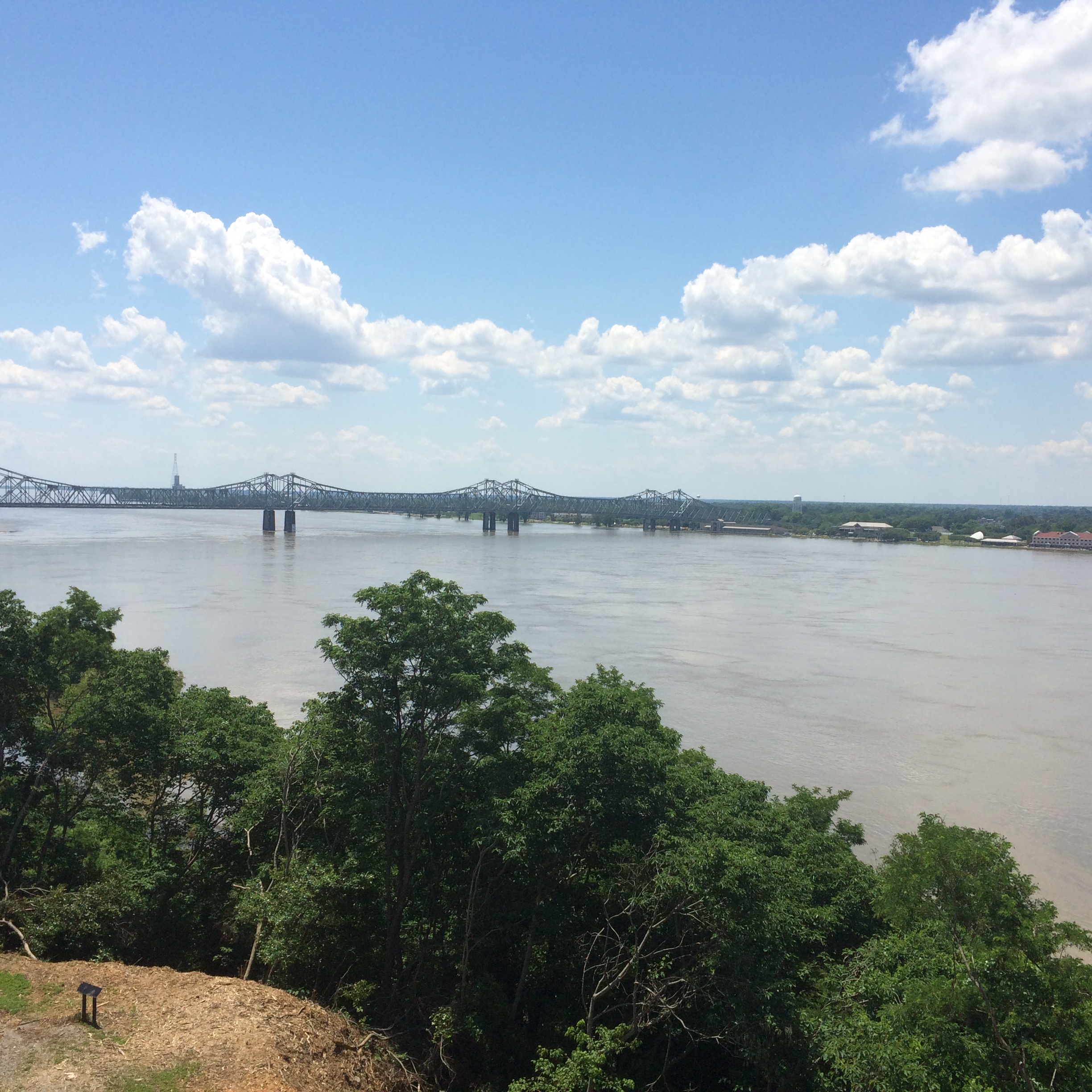
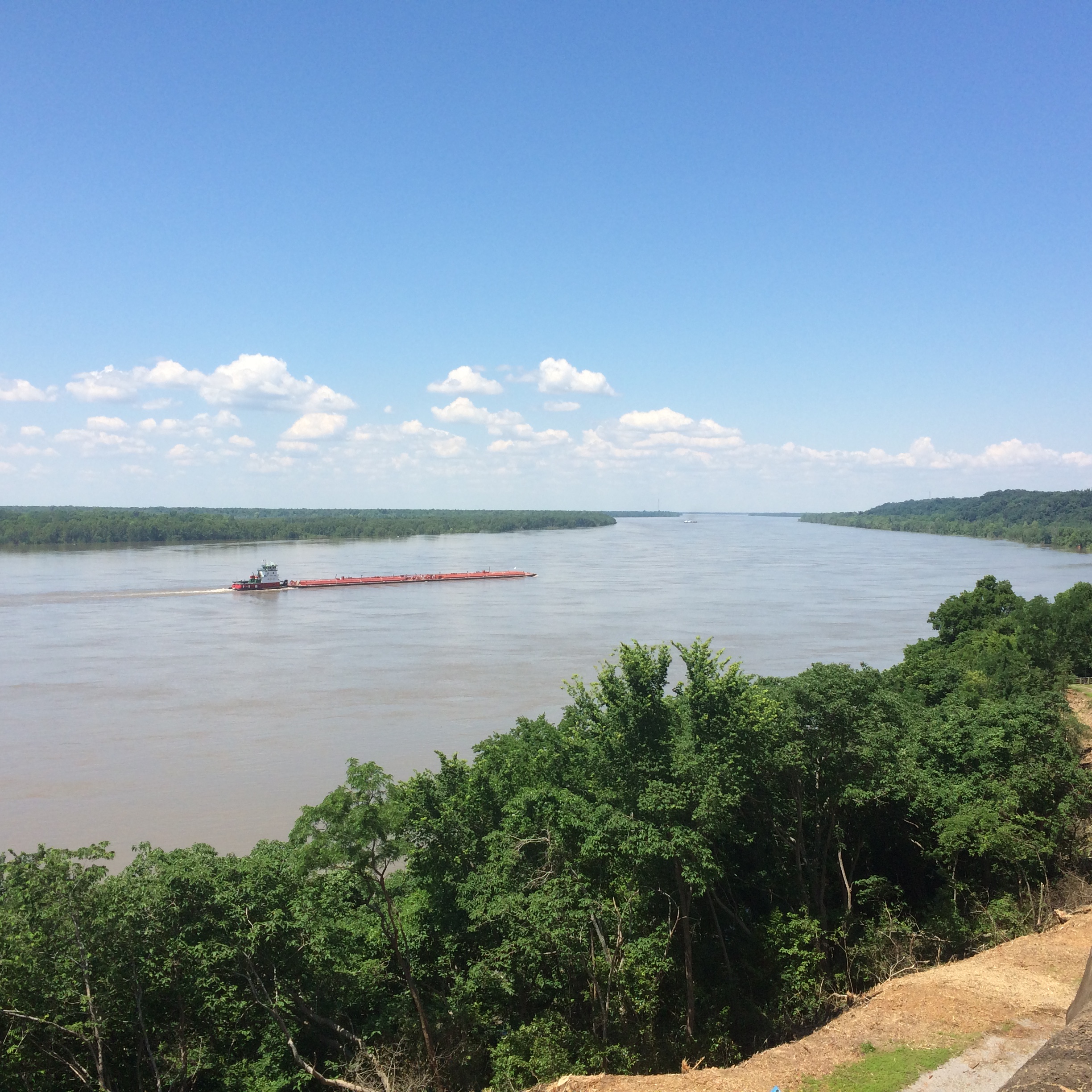
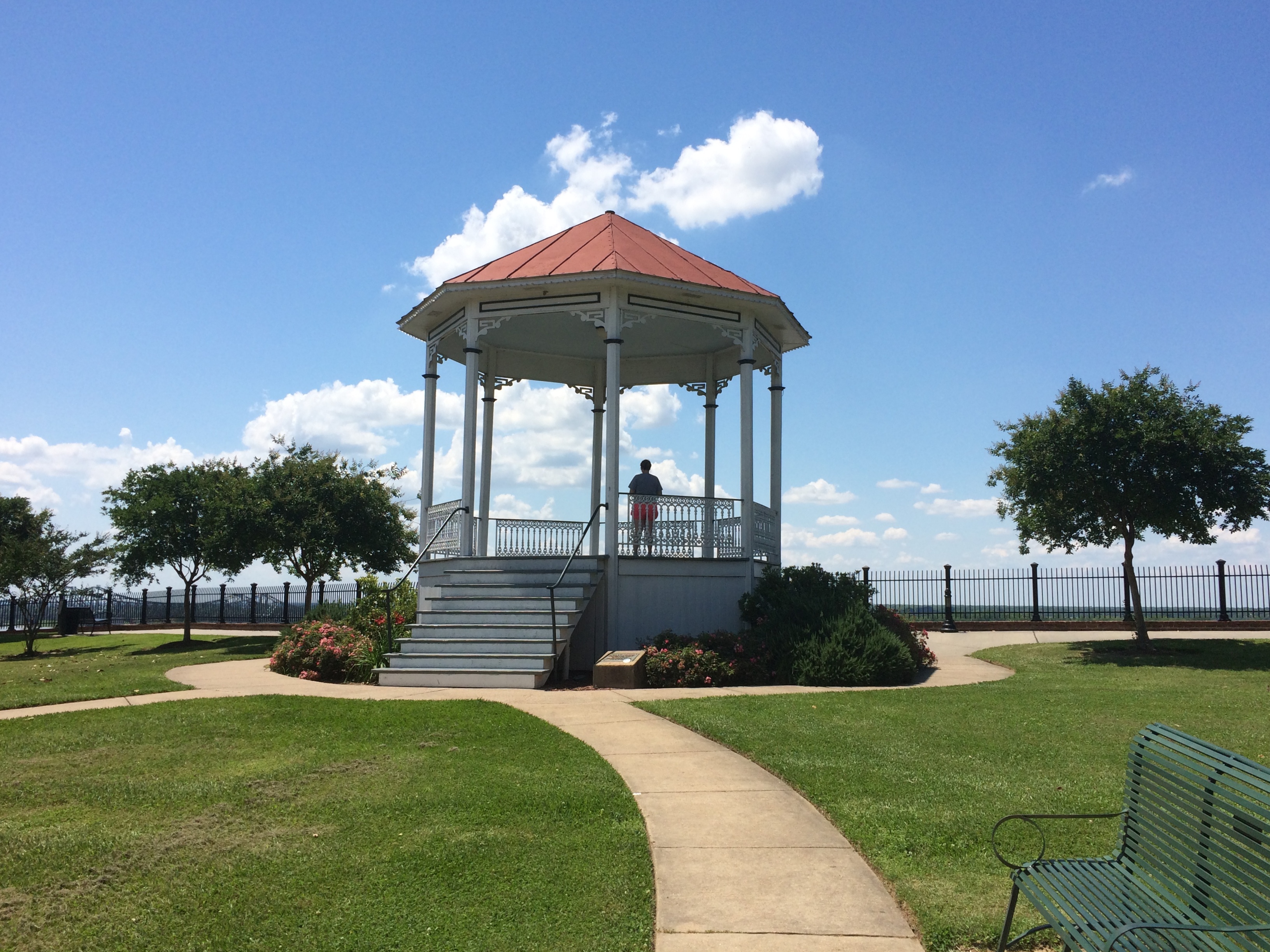
By early afternoon, we were in Natchez, Mississippi. The town has some good views of the Mississippi River from a park on the bluff. The local gazebo. It was too hot to wander around in the noonday sun for long. We decided not to tour one of the local antebellum homes, but rather spend the afternoon heading further north on the Natchez Trace Parkway to seek out antebellum ruins instead.
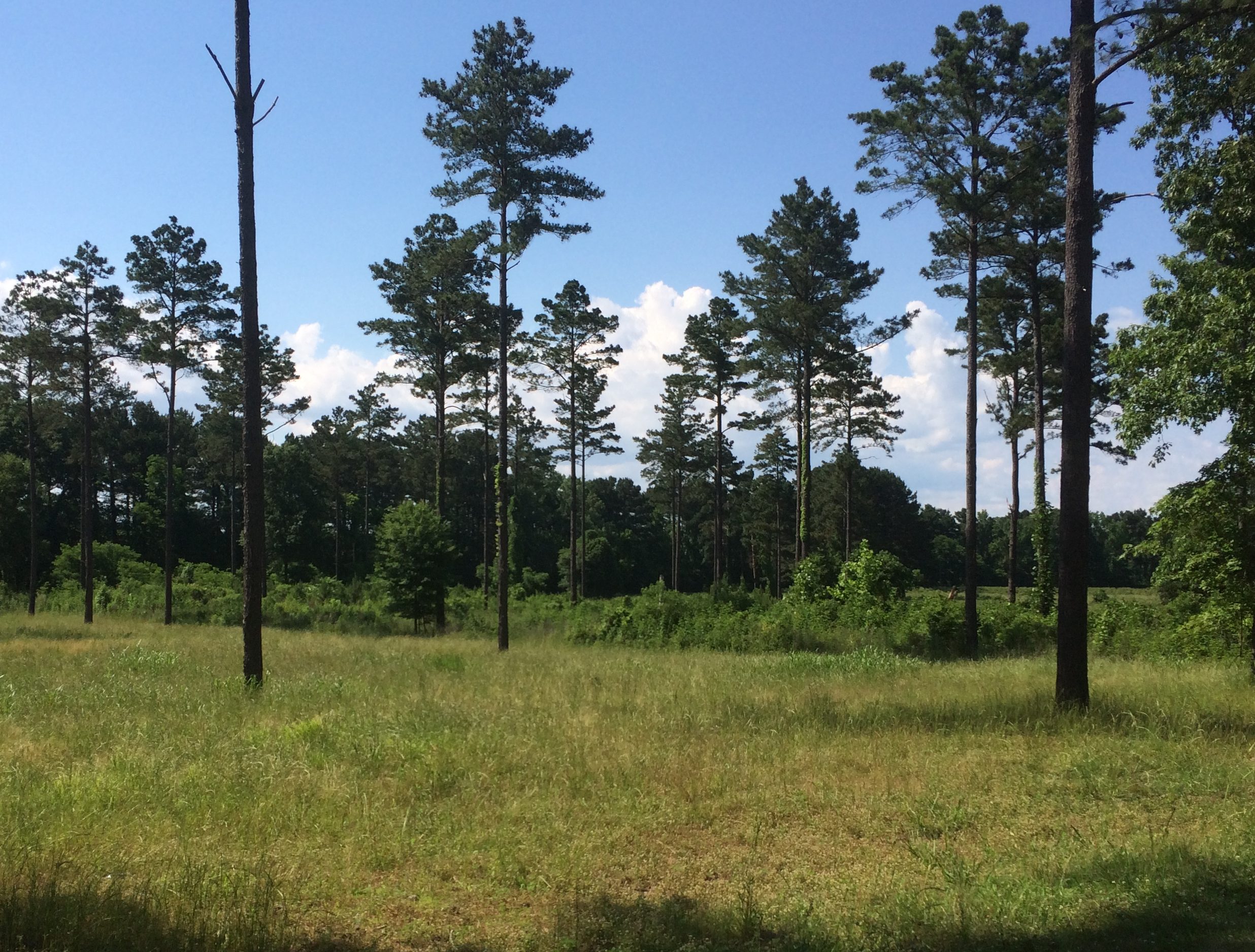
Lilly drove part of the way on the Trace and I played with my camera.
Others might find the driving dull, but I like driving the Trace for its lush greenery, and also its sparse traffic. No trucks at all.
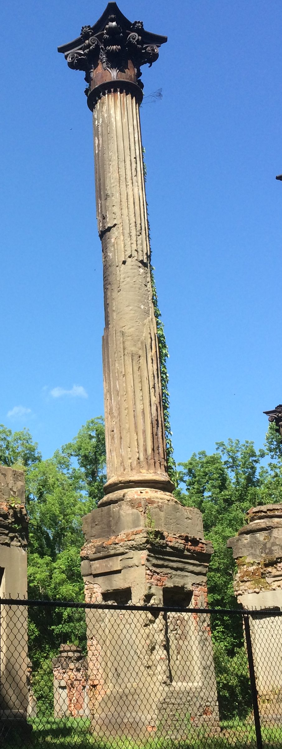
We took a diversion off the Trace before going to Port Gibson and on to Jackson, along a winding country lane called Rodney Road. Go far enough on that road, and you’ll come to the Windsor Ruins. I can’t remember where I read about the ruins, but the place has been filed under my Possible Minor Destinations for a good while. That’s such a sprawling, unorganized mental catalog of places that it’s a wonder that I ever remember to take the right detours at the right time.
We were the only ones there once another car left a minute or two after we arrived. Considering that the ruins used to be the heart of an enormous plantation, it’s remarkable how lonely the spot now feels. History has passed it by.
The view from the ruins. “Windsor, built between 1859 and 1861, was the home of Smith Coffee Daniell II, a wealthy planter who had extensive properties in the Delta and in Arkansas,” the NPS says. “Completed in 1861, the home was the largest house built at that time [in Mississippi], the plantation once covering over 2,600 acres.
Curiously, Daniell died on April 12, 1861. The mansion survived the war, probably because the Union army used it as soon as the area had been captured, but it burned down by accident in 1890.
The fence is fairly new, added by the state, which now owns the site. Guess the state of Mississippi doesn’t want any of the 23 massive Corinthian columns coming down on any hapless visitors. They’re looking a little dodgy.
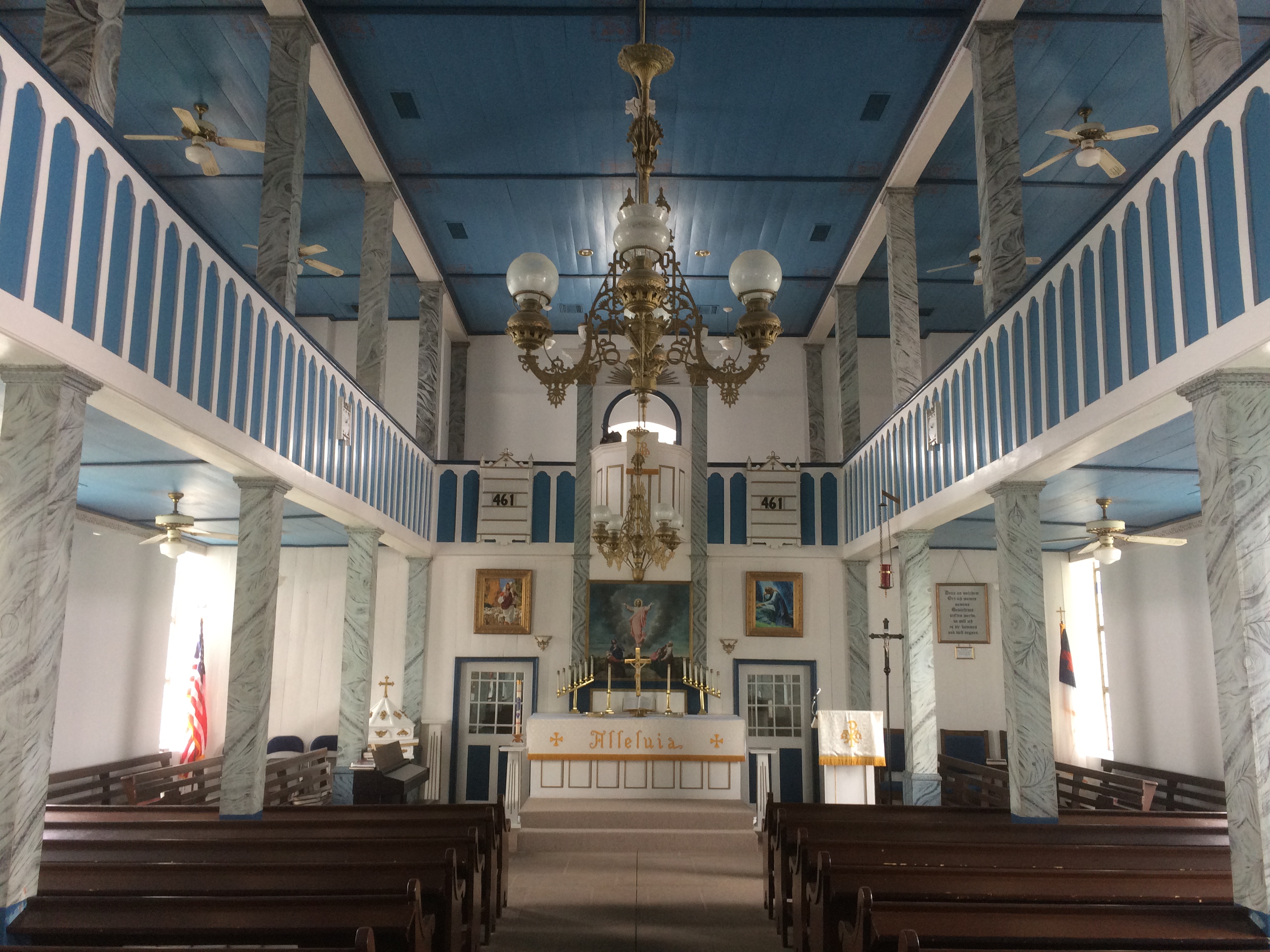
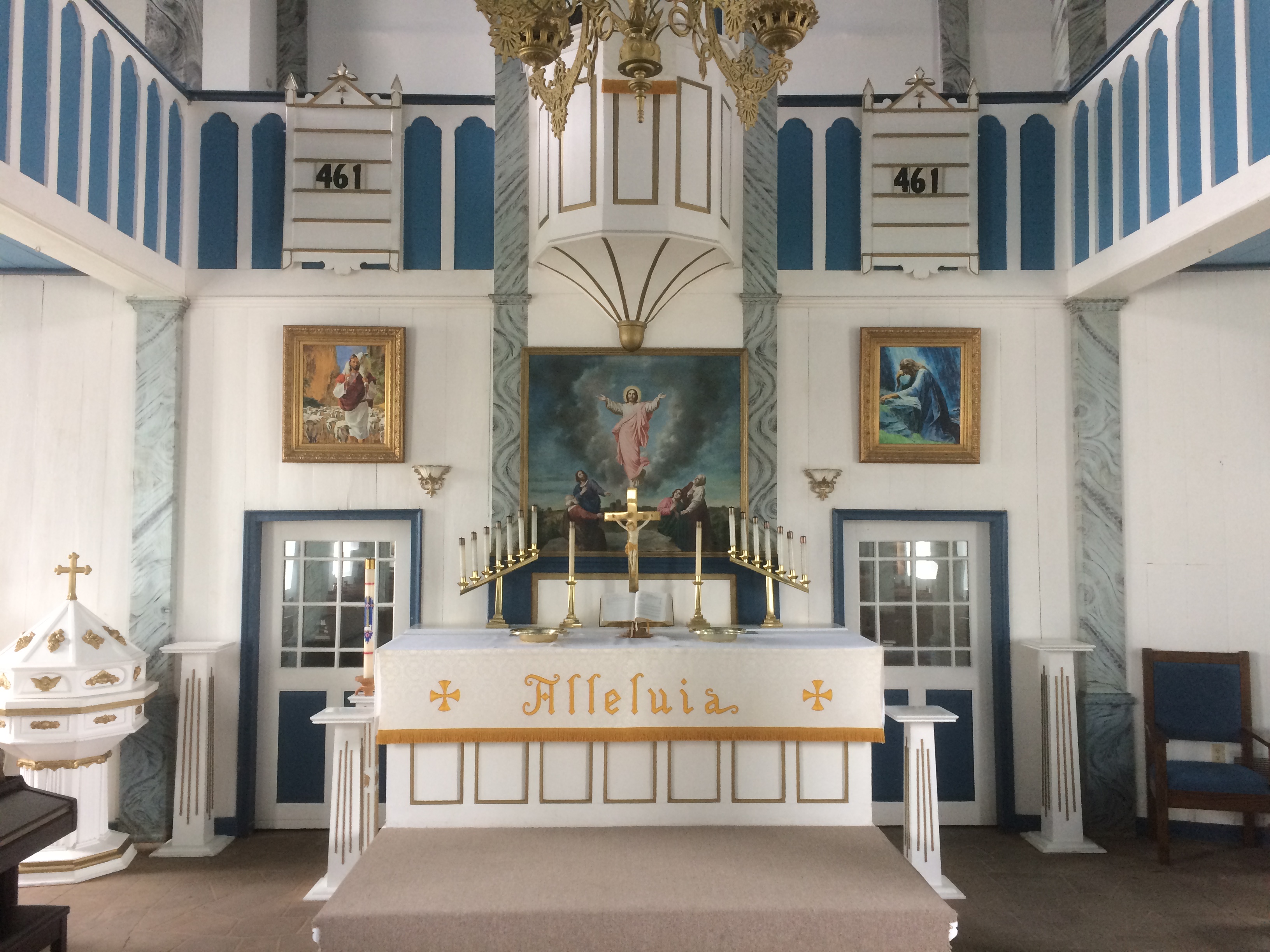
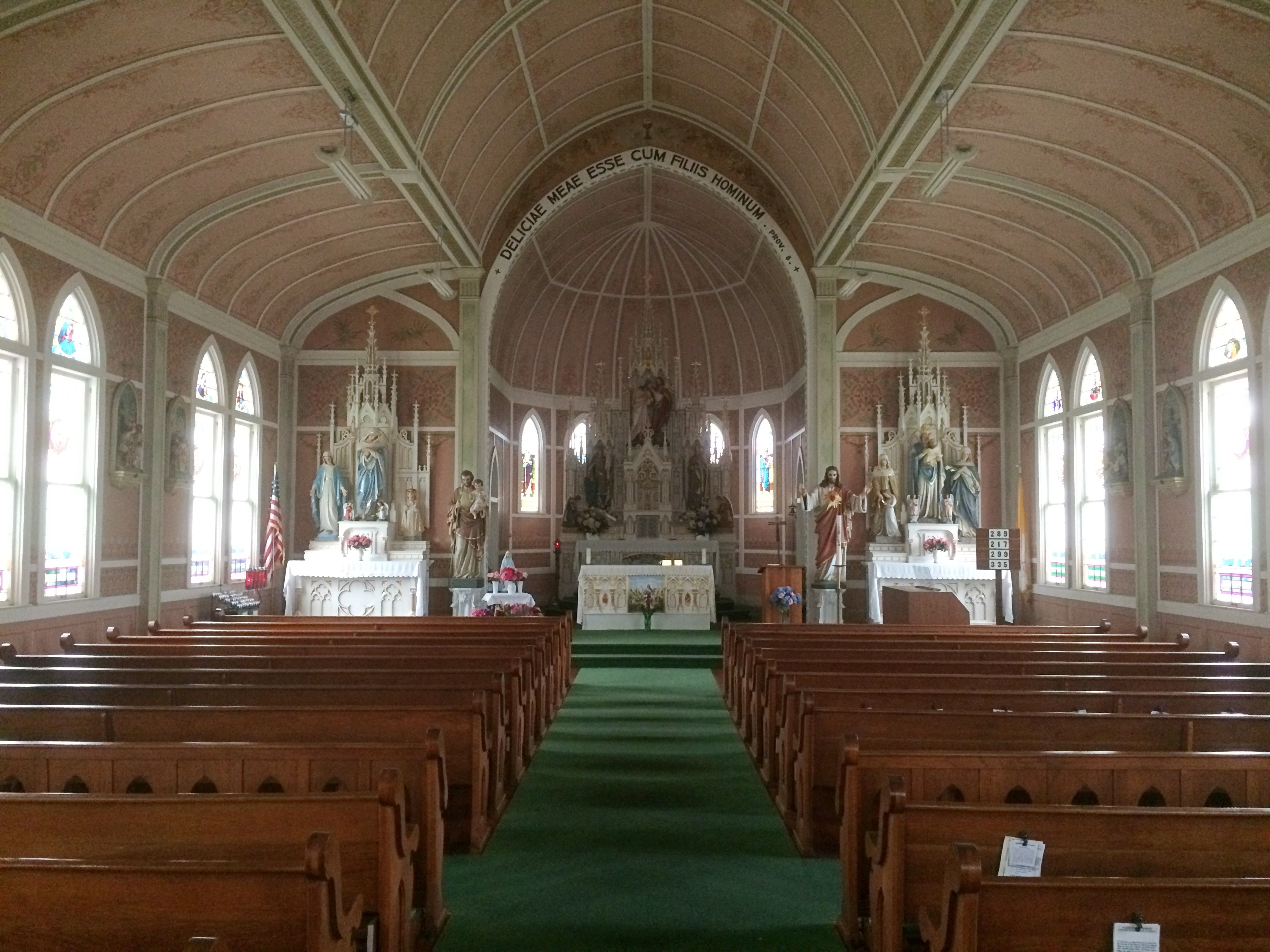
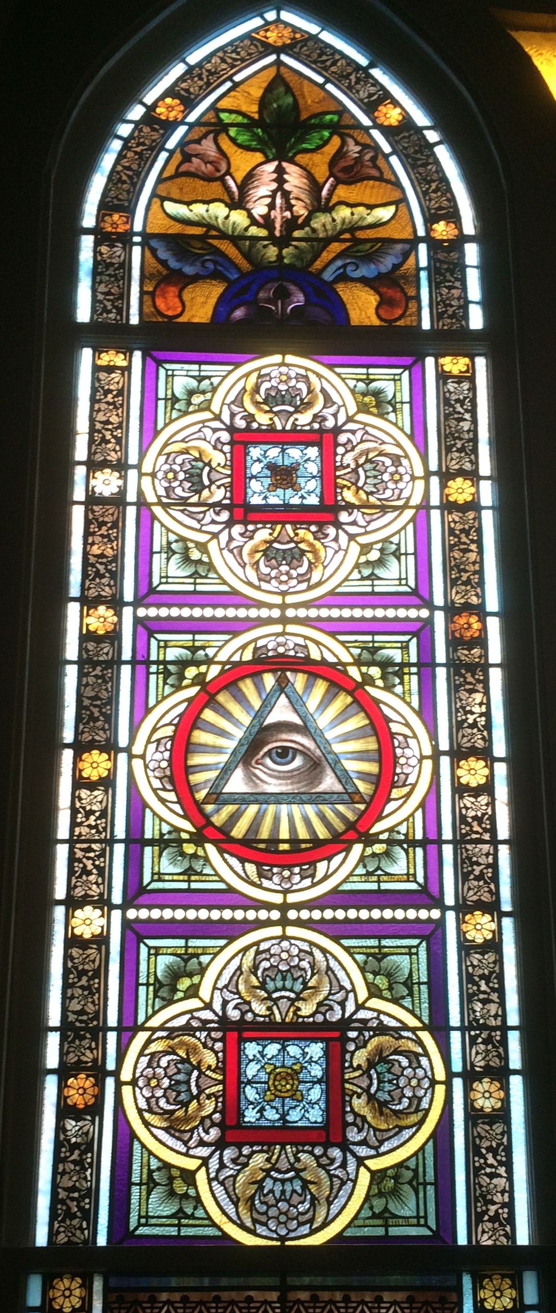
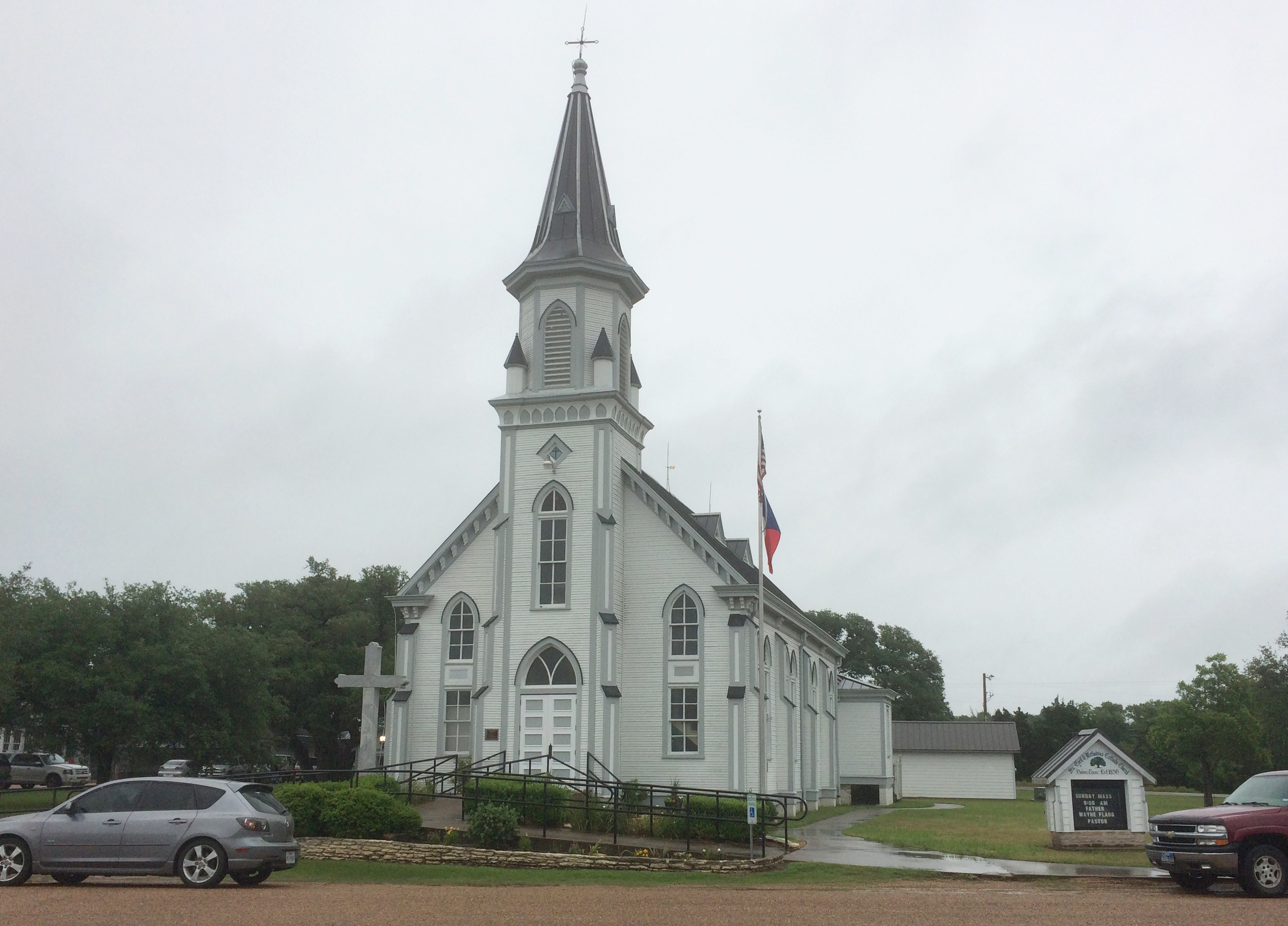
Just outside the hamlet of Serbin, Texas, if you follow your map but also keep your eyes peeled — because the map isn’t quite accurate — you’ll find yourself outside St. Paul Lutheran Church. The exterior is nice, but isn’t particularly distinctive. Inside is a different story. St. Paul is one of the Painted Churches found in Central Texas. In its case, the church was built in the late 19th century, but not decorated until 1906, when the congregation itself took up the task.
“Cross the threshold of these particular Texas churches and you’ll encounter not a simple wooden interior but an unexpected profusion of color,” says KLRU, which aired a documentary on the churches nearly 20 years ago.
“Nearly every surface is covered with bright painting: exuberant murals radiate from the apse, elaborate foliage trails the walls, wooden columns and baseboards shine like polished marble in shades of green and gray. These are the Painted Churches of Texas.
“Built by 19th-century immigrants to this rough but promising territory, these churches transport the visitor back to a different era, a different way of life. Inscriptions on the walls read not in English, but in the mother tongue of those who built them: German and Czech.”
I’ve wanted to visit the Painted Churches for some time now, but something or other has always make it inconvenient to do so. Still, potential destinations sometimes get under your skin, so I designed part of this particular driving trip to scratch that longstanding itch.
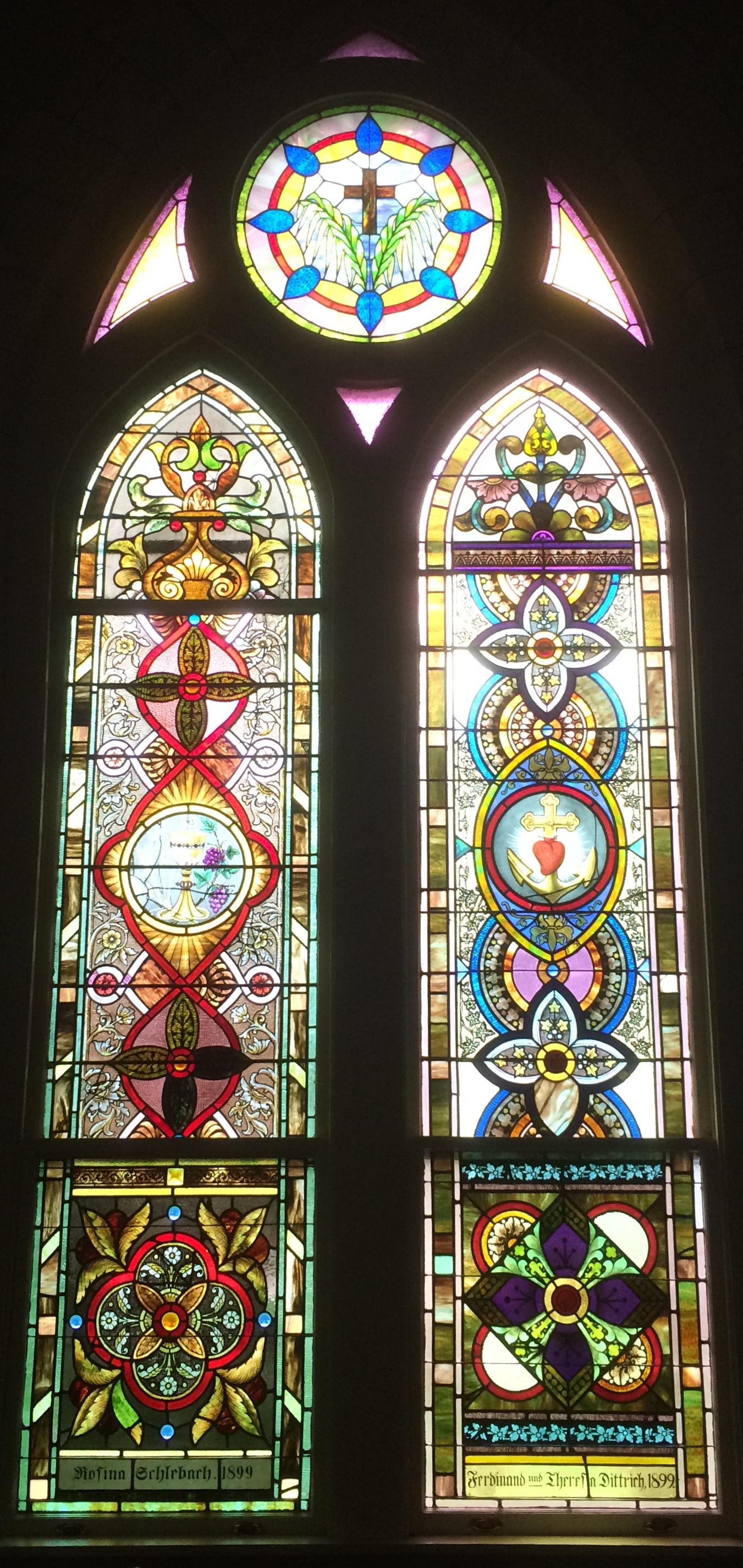
Heading south from Waco on U.S. 77 on May 11 in sometimes heavy rain — sheets of rain — we passed through such towns as Rosebud, Cameron, Rockdale and Giddings, and near the wonderfully named Old Dime Box. St. Paul Lutheran is near Giddings and the first of the four churches we visited.
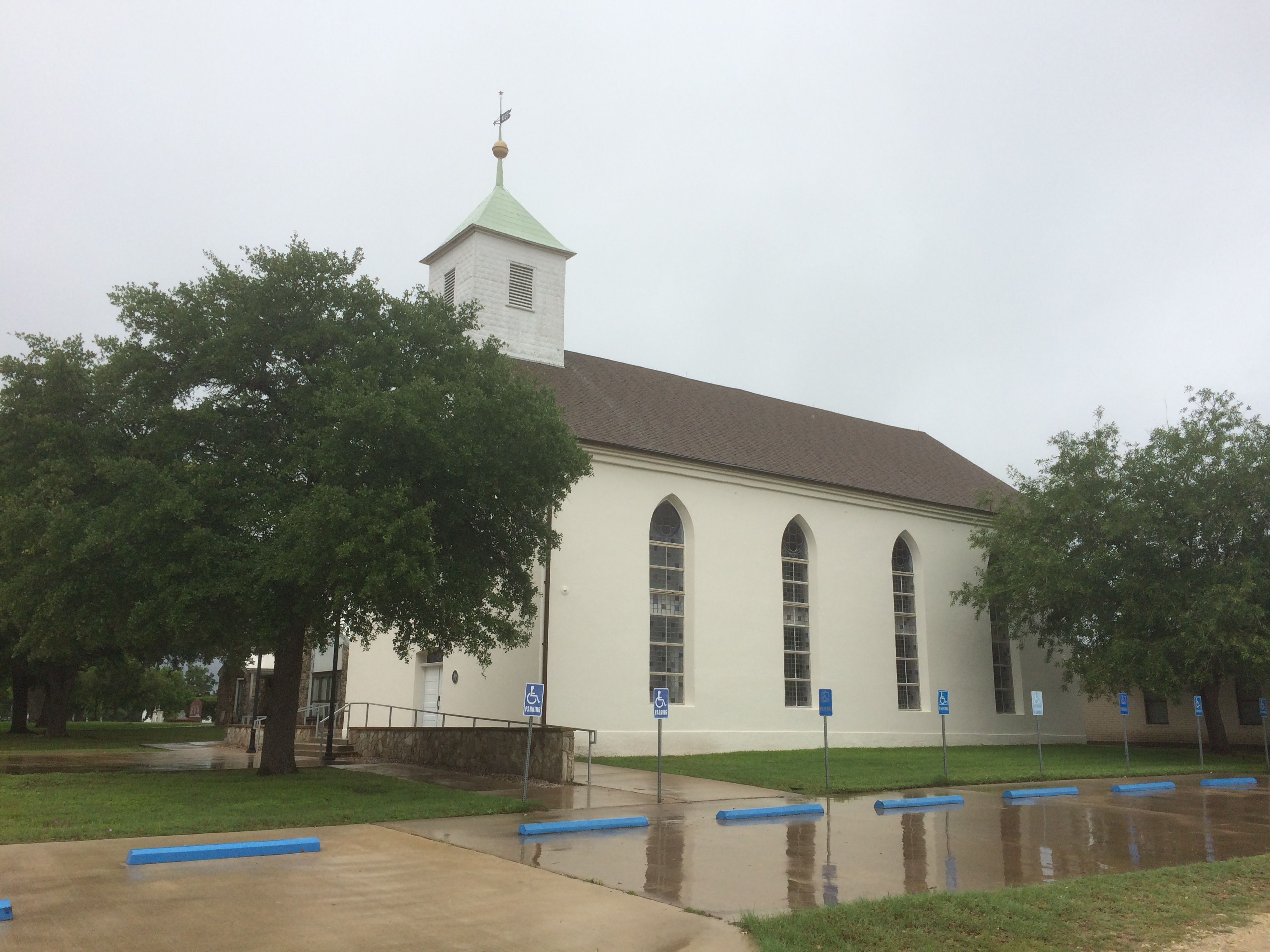
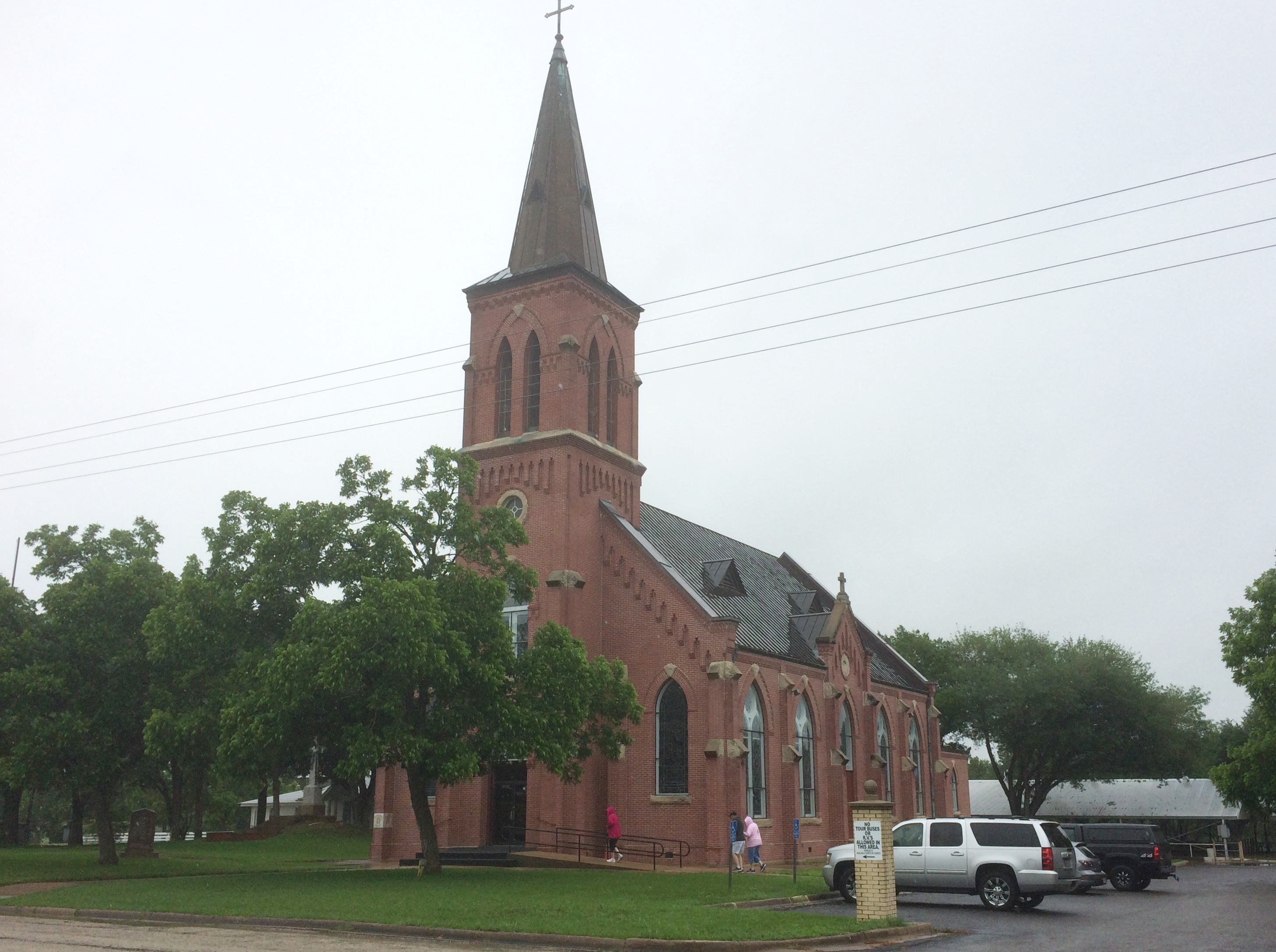
Further south, in the town of Ammansville, is St. John the Baptist Church. We went there next.
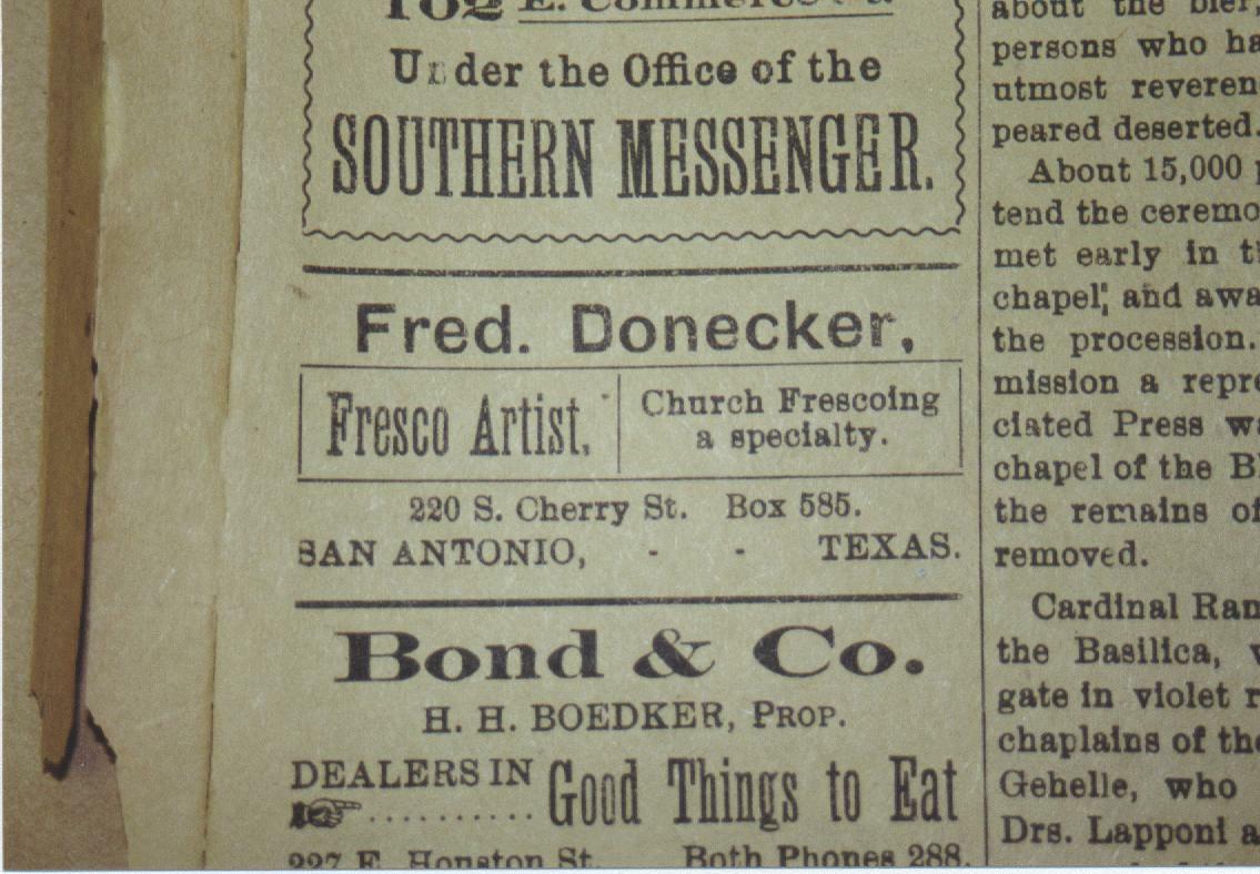
A cemetery is adjacent to St. John the Baptist, which was built in 1918 and painted the next year by one Fred. Donecker of San Antonio, who seemed to specialize in church interiors.
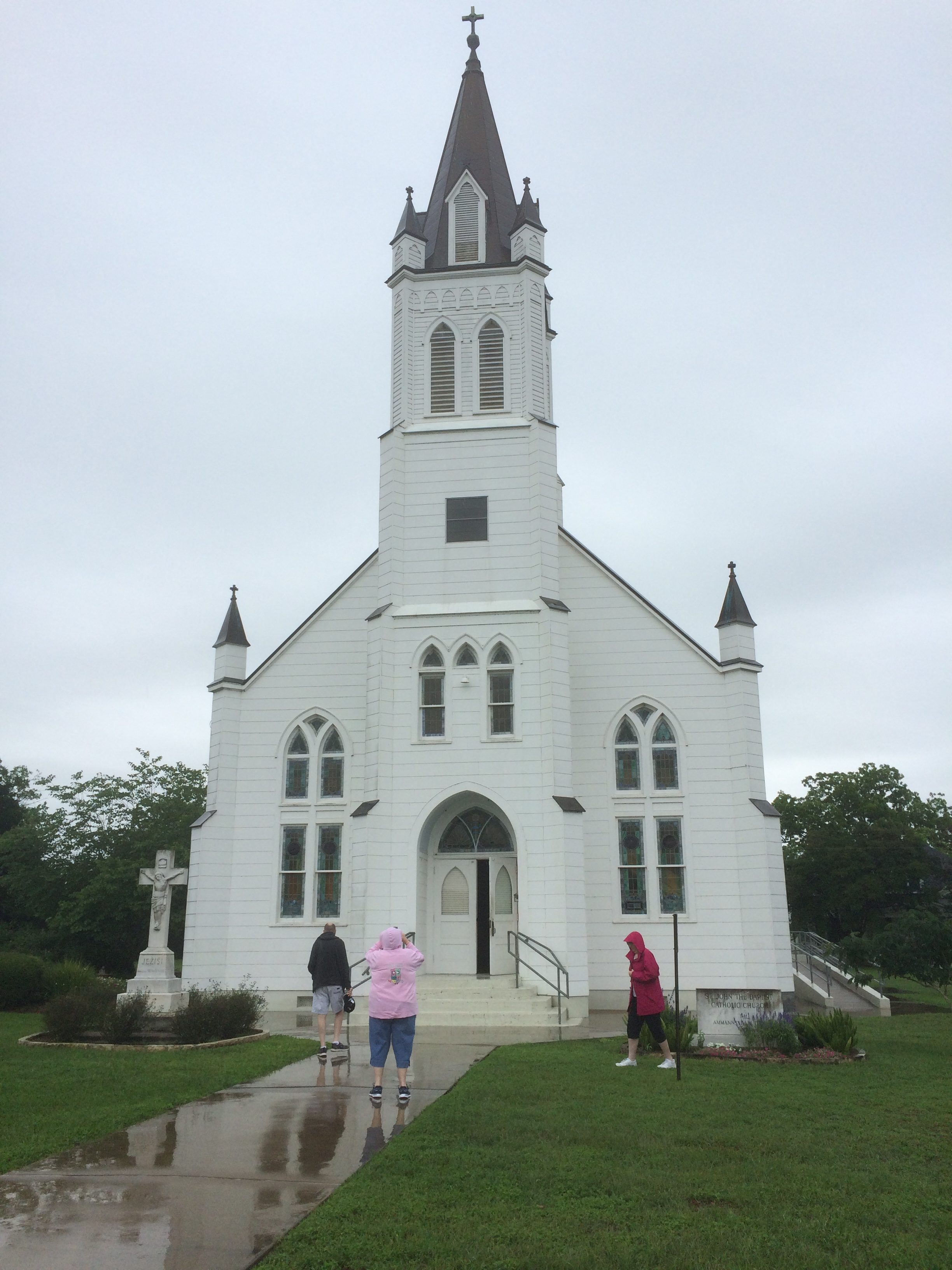
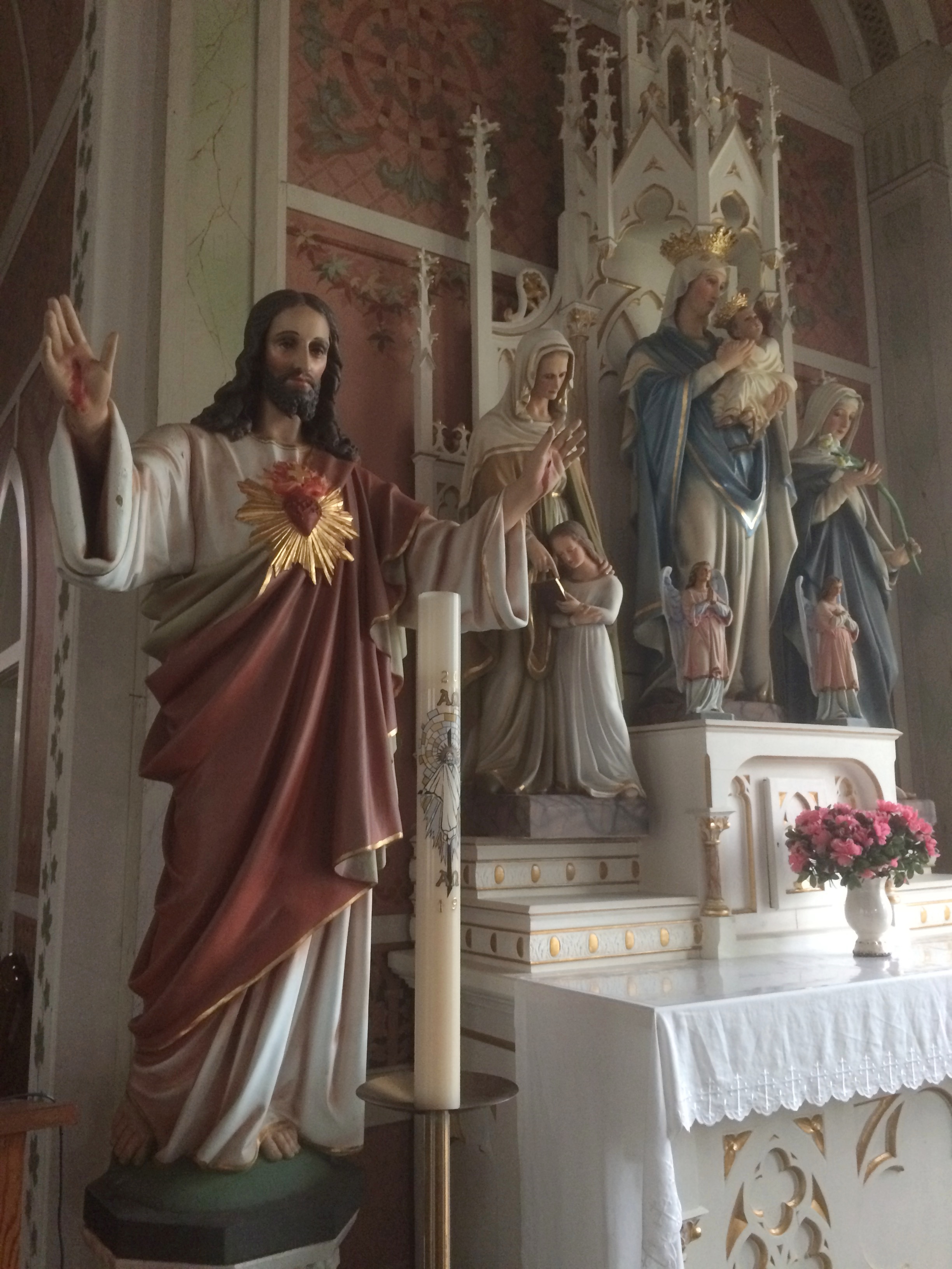
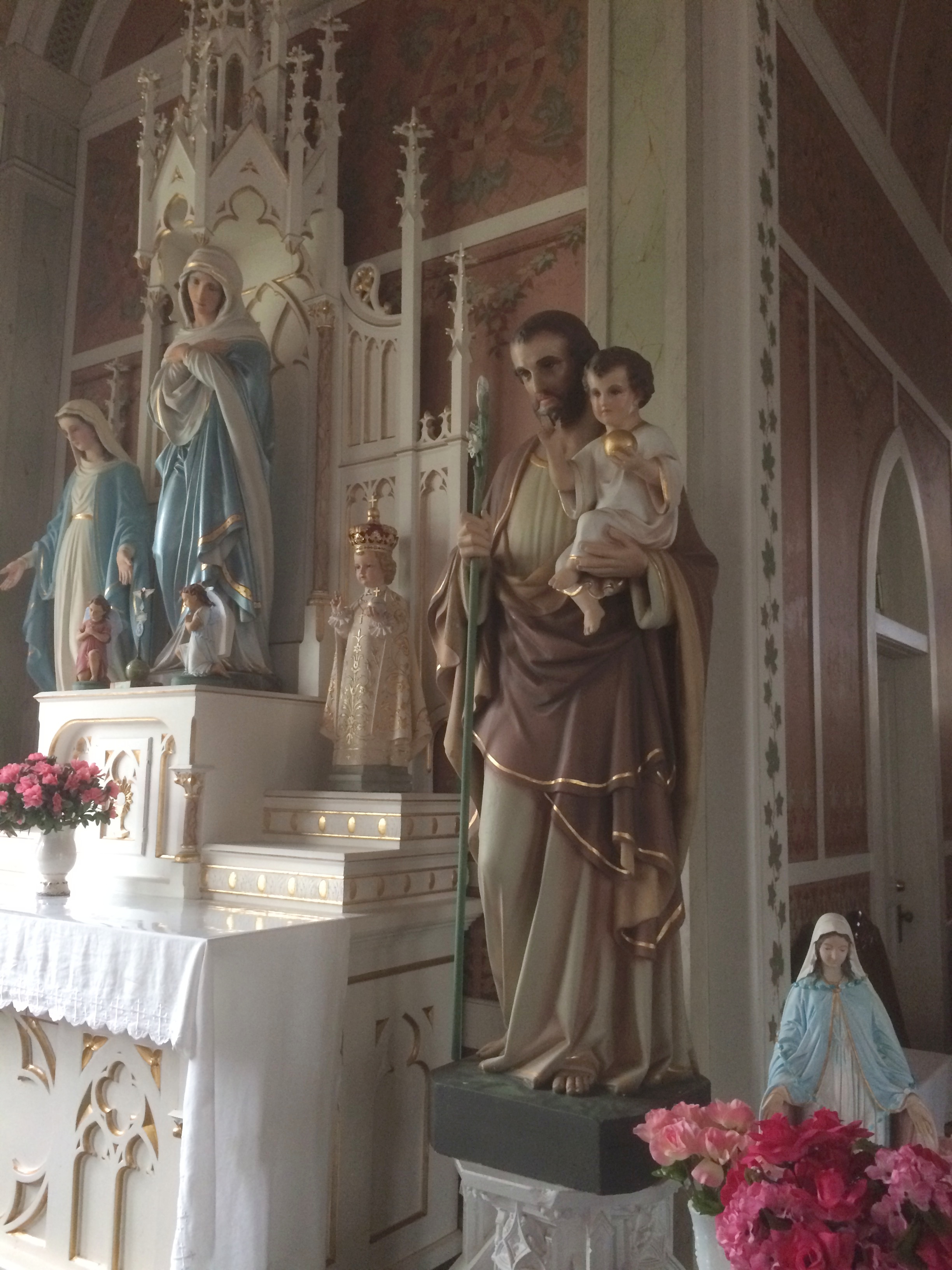
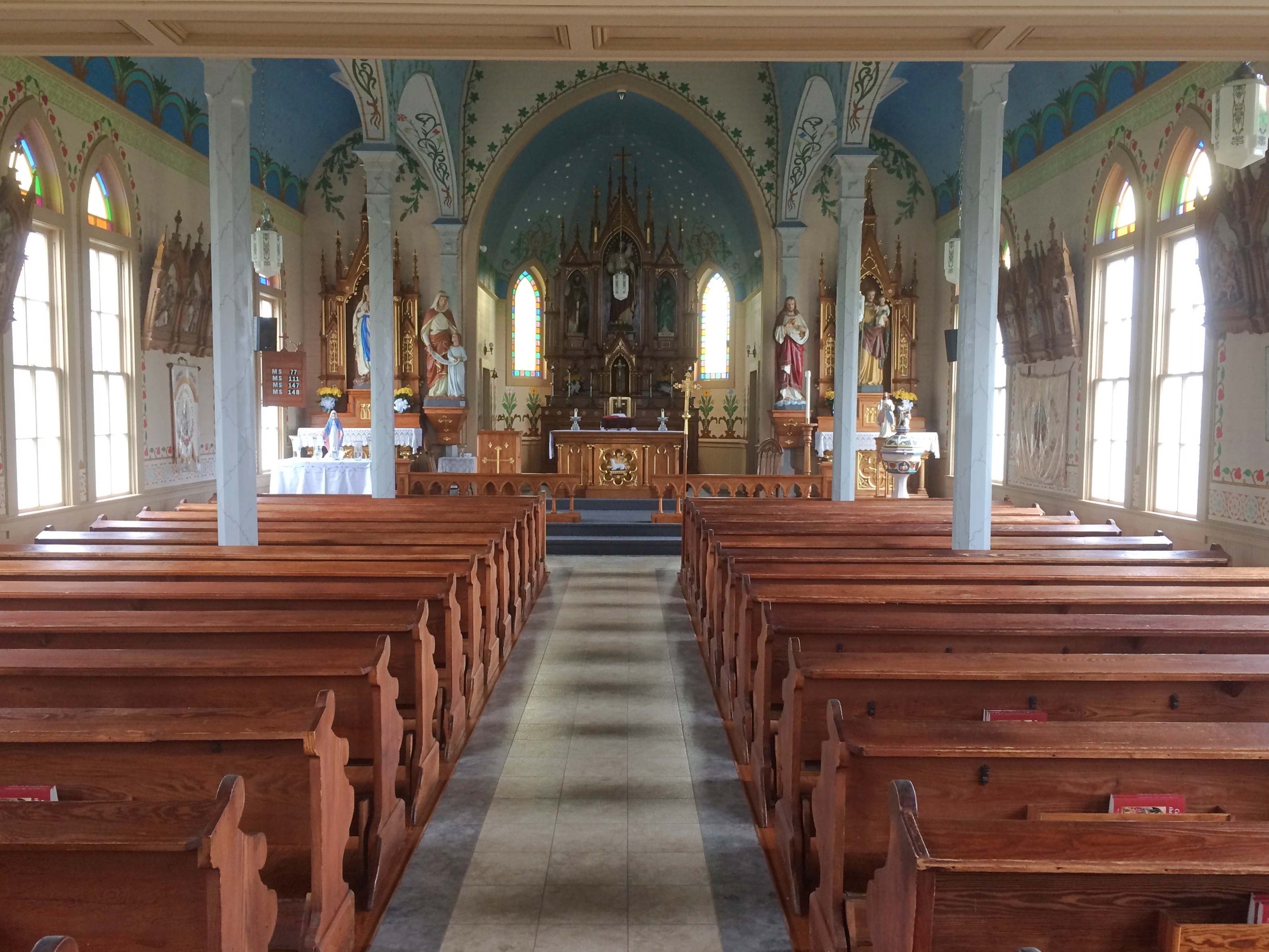
St. Mary’s, also known as Nativity of Mary, Blessed Virgin, is in High Hill, and was built in 1906. St. Mary’s billed itself as the Queen of the Painted Churches, and it was indeed gorgeous. Unfortunately, it was also dark inside. These pictures capture a bit of its ornate interior.
St. Mary’s stained glass captured a fair share of light, even on a cloudy day. Finally, near Dubina, we visited Sts. Cyril and Methodius Church. Artist unknown (1909), but he did a fine job. By some counts, there are as many as 20 Painted Churches in Texas, so our visit wasn’t comprehensive. But after four or five such structures, you begin to get your fill of even the most beautiful ecclesiastical spaces anyway. Maybe I’ll see some of the others some other time.
Just back from a driving trip whose mileage I didn’t bother to keep track of, but it was in the thousands. Actually, only part driving. Lilly and I flew separately from Chicago to Dallas earlier this month so she could take possession of her new car — an ’05 Mazda 3 that her uncle Jay gave her, provided we could drive it from north Texas to northern Illinois. The car rattled and occasionally made other odd noises, but soldiered on all the way.
The uninspired thing to do that would have been to drive straight through, which normally would take two days by breaking the trip in Missouri, such as at the Munger Moss.
Despite being a driving trip, that would be a pedestrian way to do it. Instead I took a week off so we could take a more interesting route. We left Dallas on May 11, heading south to the vicinity of Schulenburg, Texas, to visit some of the Painted Churches, which were built by late 19th-century German and Czech congregations who gave them richly artistic interiors — all the more interesting because much of it is vernacular art.
Rain came day most of that first day on the road, but we didn’t encounter any more until yesterday in Nashville. In between the days were sunny and often hot. Everyone we talked to about the weather reported a wet spring, however, and the Southern landscape looked lush, from Texas into the Deep South and up through Tennessee.
We spent the first night in Houston. I didn’t plan it this way, but our time in Houston focused on water features: the Waterwall near the Galleria Mall that first evening (the rain was over) and Buffalo Bayou and the Buffalo Bayou Park Cistern during the next morning.
The next day we drove to New Orleans, a city I haven’t visited in 30 years, and one new to Lilly, and spent two days and three nights.
We ate very well. We saw excellent live music. We rode streetcars and walked the streets of the French Quarter, Treme and the Garden District. We toured one cemetery formally and one informally, and we visited the National WW II Museum.
On May 15, we drove to suburban Jackson, Mississippi, by way of the city of Natchez and the Natchez Trace to visit our cousin Jay and his wife Kelly, who hospitably put us up for the night.
The next day we passed through Philadelphia, Mississippi, my father’s home town, stopping for a short visit — Lilly had never been there — and then went to Montgomery, Alabama, where we spent the night.
On the morning of May 17, we saw the Legacy Museum and the National Memorial for Peace and Justice, both only open since last year, and the very different Alabama State Capitol, because I visit capitols when I can.
Leaving Montgomery in the early afternoon, we had enough time to visit the Ave Marie Grotto, not far north of Birmingham, and then spent the night of May 17 in Decatur, Alabama. The next morning I took a short walkabout near the Tennessee River and along Bank St., named for a handsome bank building there dating from the 1830s.
By that afternoon, we were in Nashville to visit some of my dear old friends, including one I hadn’t seen or enjoyed the fine company of since 1990. Today we did the long drive from Nashville to greater Chicago — I used to do it fairly often — arriving this evening.
Mostly, things went smoothly. Even traffic wasn’t that bad most of the time in the cities we passed through.
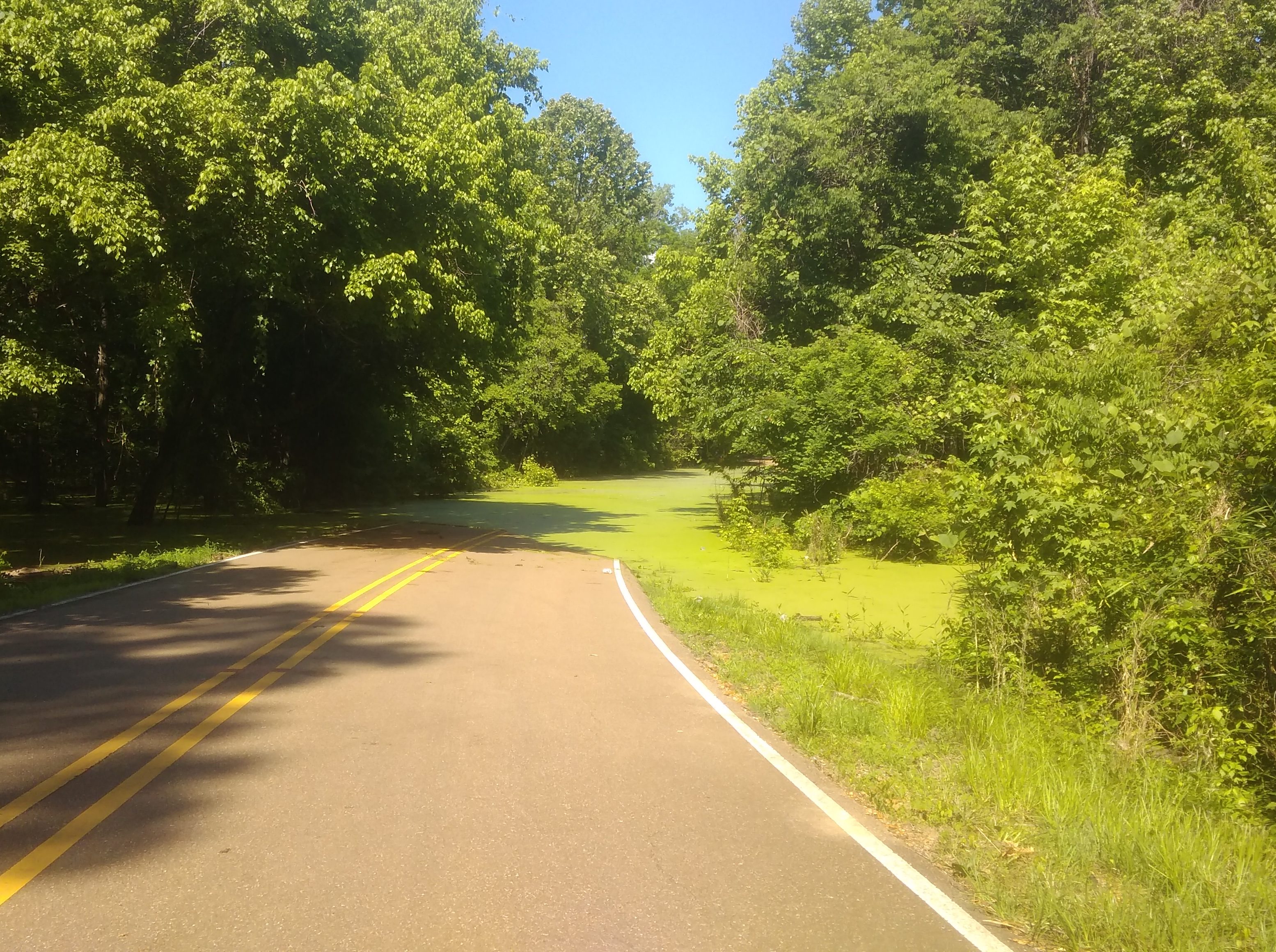
But while driving along Rodney Road in rural Mississippi outside Port Gibson and not far from the mighty river of that name, we suddenly came to this. That’s stagnant algae-filled water, completely covering the road. For as far as we could see into the distance. Who knows how deep it is. So we backtracked on Rodney to the main road at that point, which happened to be the Natchez Trace.
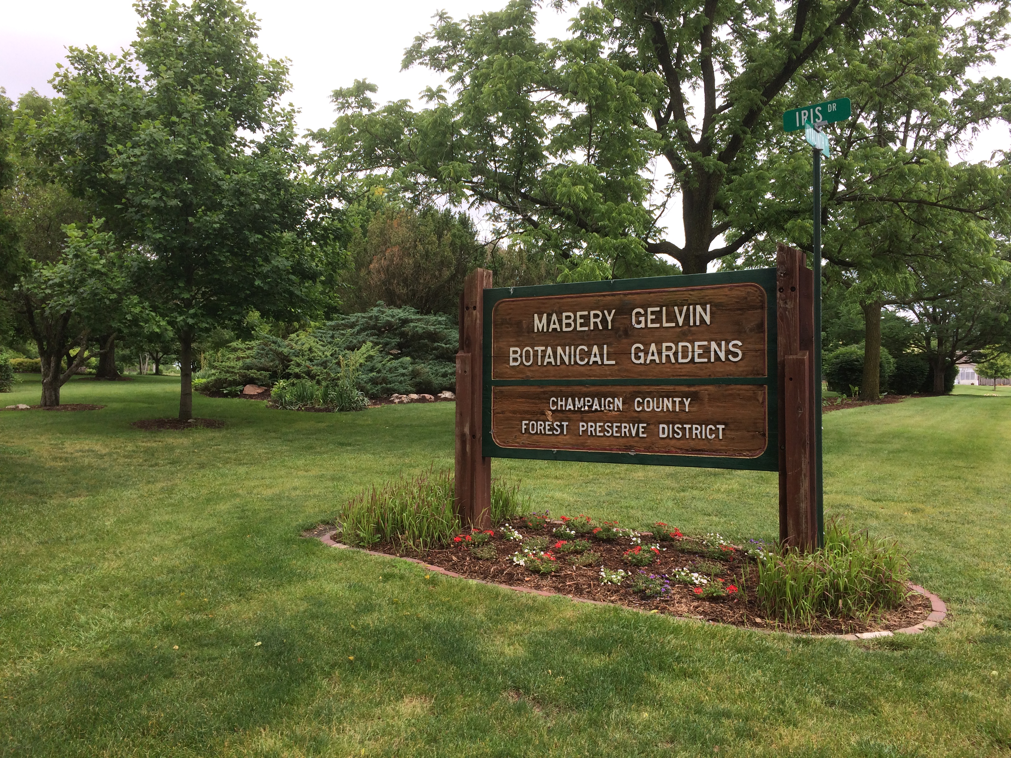 At eight acres, the garden isn’t large, but it is a pretty place in June.
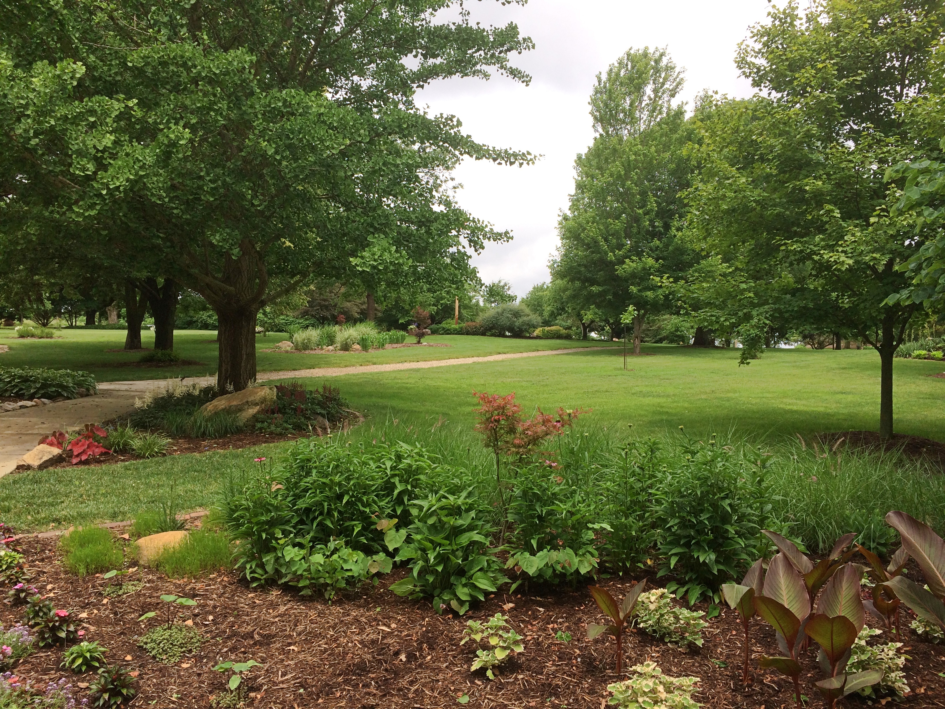
 Featuring the blooming Dogwood (Cornus kousa).
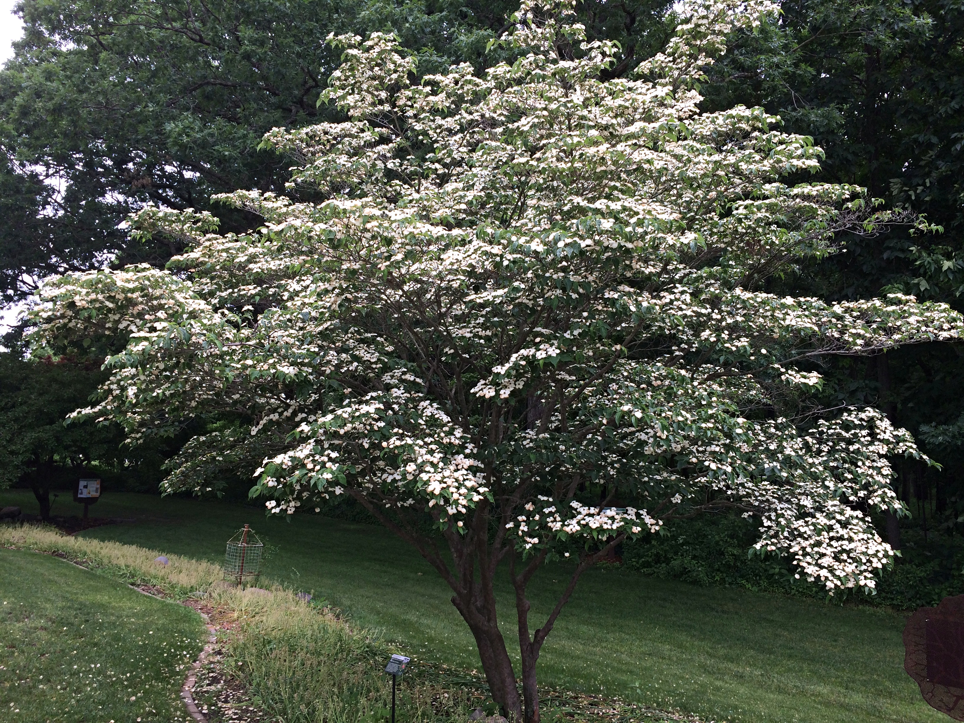 A Saucer Magnolia (Magnolia x soulangeana). The South doesn’t get all the magnolias. According to the sign next to the tree, “… the genus magnolia is 95 million years old. Older than bees, they are pollinated by beetles.”
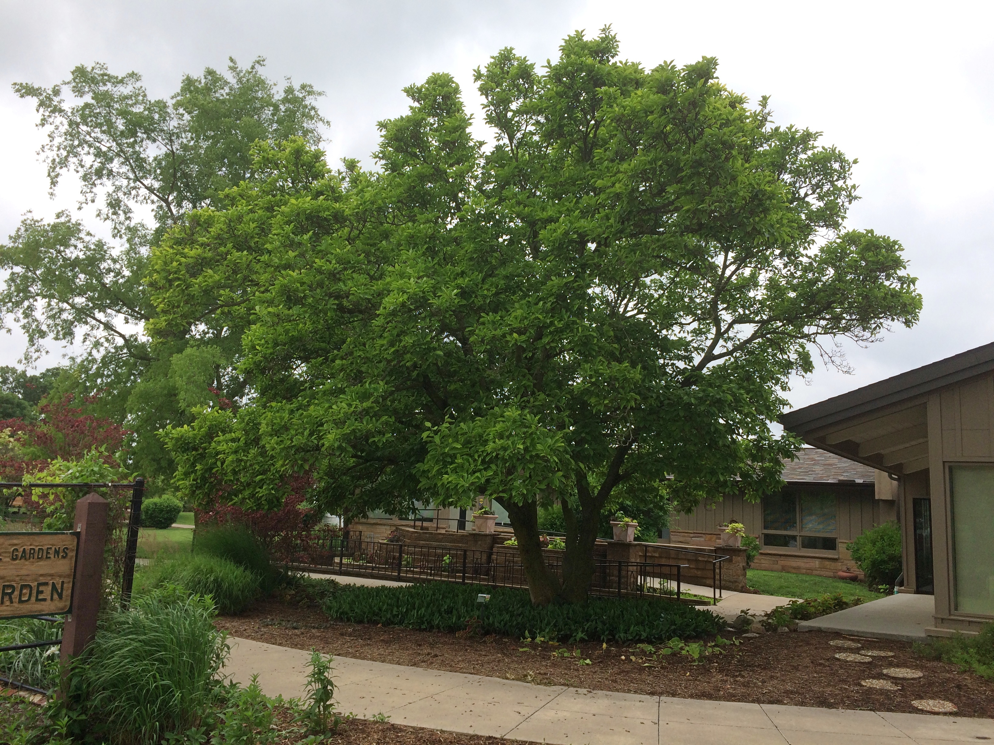 Japanese lilac (Syringa reticulata).
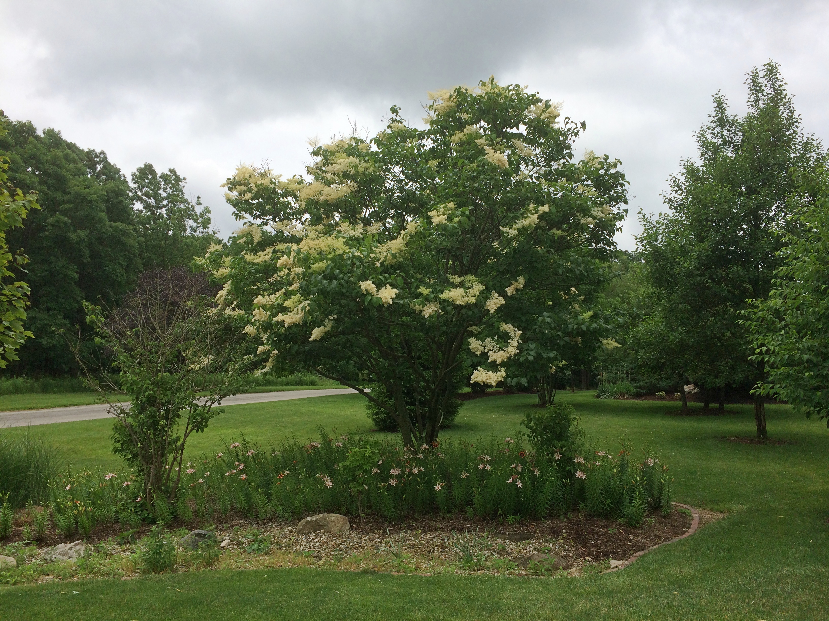 The garden is part of the larger Lake of the Woods Forest Preserve. We took a walk along some of its trails, eventually coming to a covered bridge: Lake of the Woods Covered Bridge. Wooden construction, but also with hidden steel support to make it vehicle-worthy.
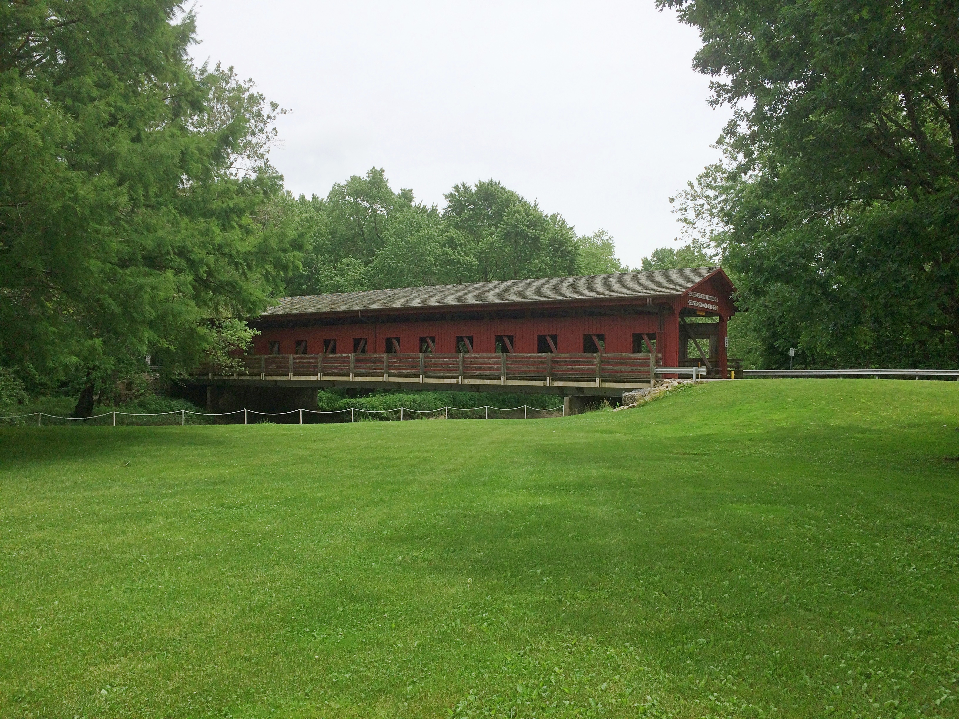
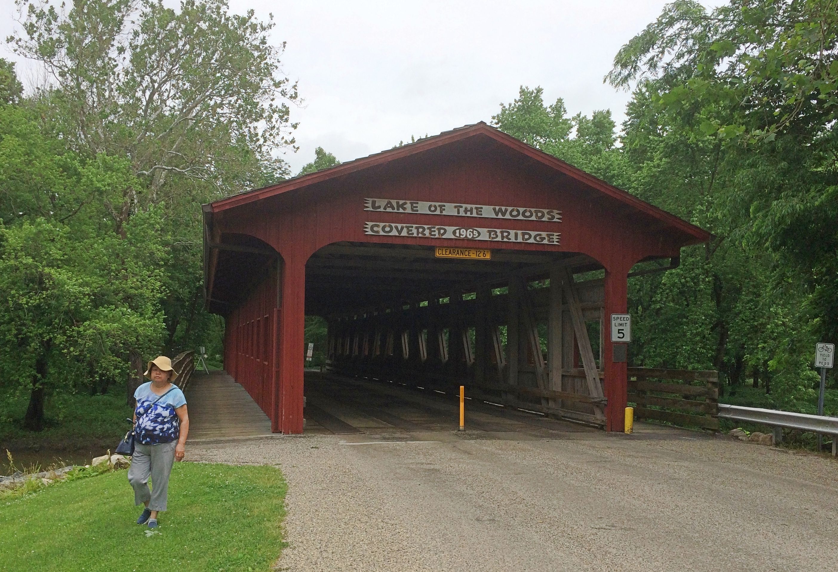 It isn’t one of the 19th-century bridges you find in the Midwest. Rather, vintage 1965. As the park district says: “After the purchase of an 80-acre tract of land west of the Sangamon River in the 1960s, the Lake of the Woods Covered Bridge was constructed to connect the two sides of Lake of the Woods Forest Preserve in Mahomet. Designed by German Gurfinkel, a Civil Engineering instructor at the University of Illinois, the bridge was a replica of the Pepperel Bridge [sic] near Boston.”
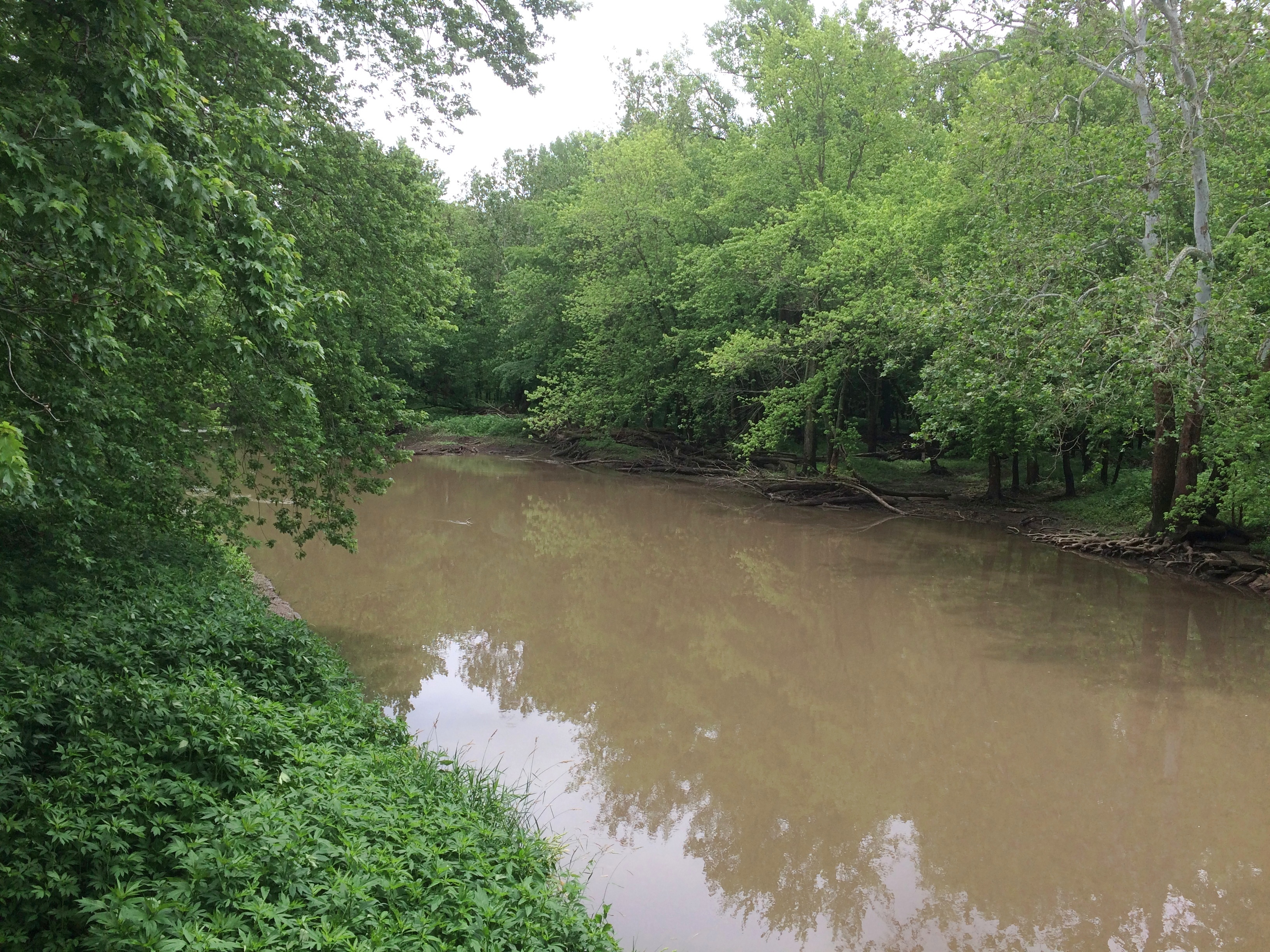 We walked across the bridge. You should cross bridges when you come to them, if possible. Before we left the forest preserve, we also drove across it, because we don’t get to drive across covered bridges that much.
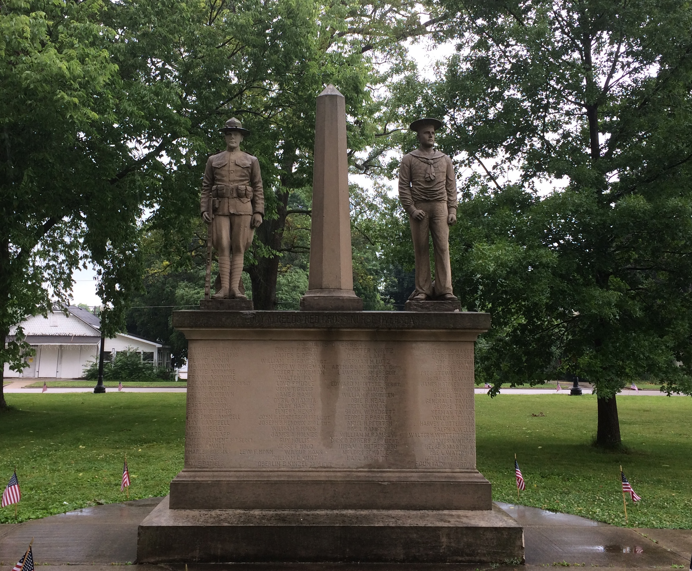
 Nearby, a sign offers the dedication speech, made by the widow of the creator, local eccentric Bob Moomaw, almost exactly 20 years ago. The text seems the same, but the background is a lot more psychedelic than it
 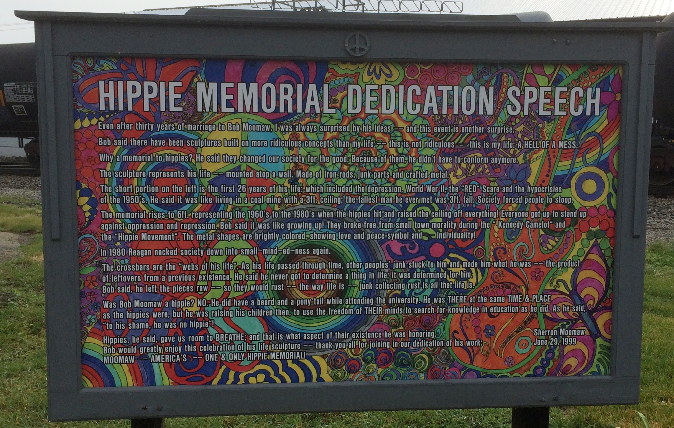 Sure, why not honor the hippie movement? It’s been subject to retroactive derision all out of proportion to its risibility. You can argue that hippies were yet another flowering of bohemianism, a periodic occurrence that’s helped keep things interesting since the Romantic movement at least.
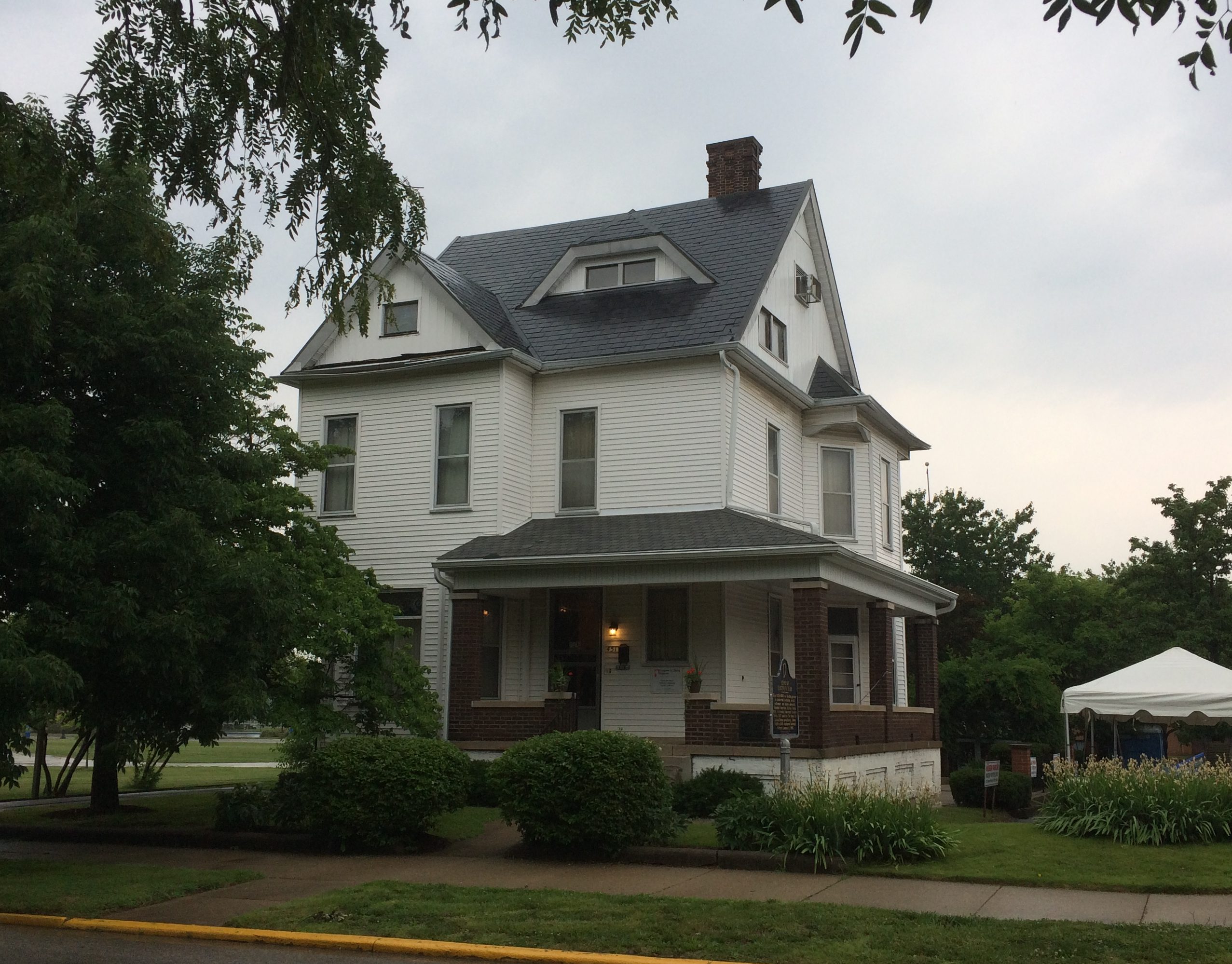


