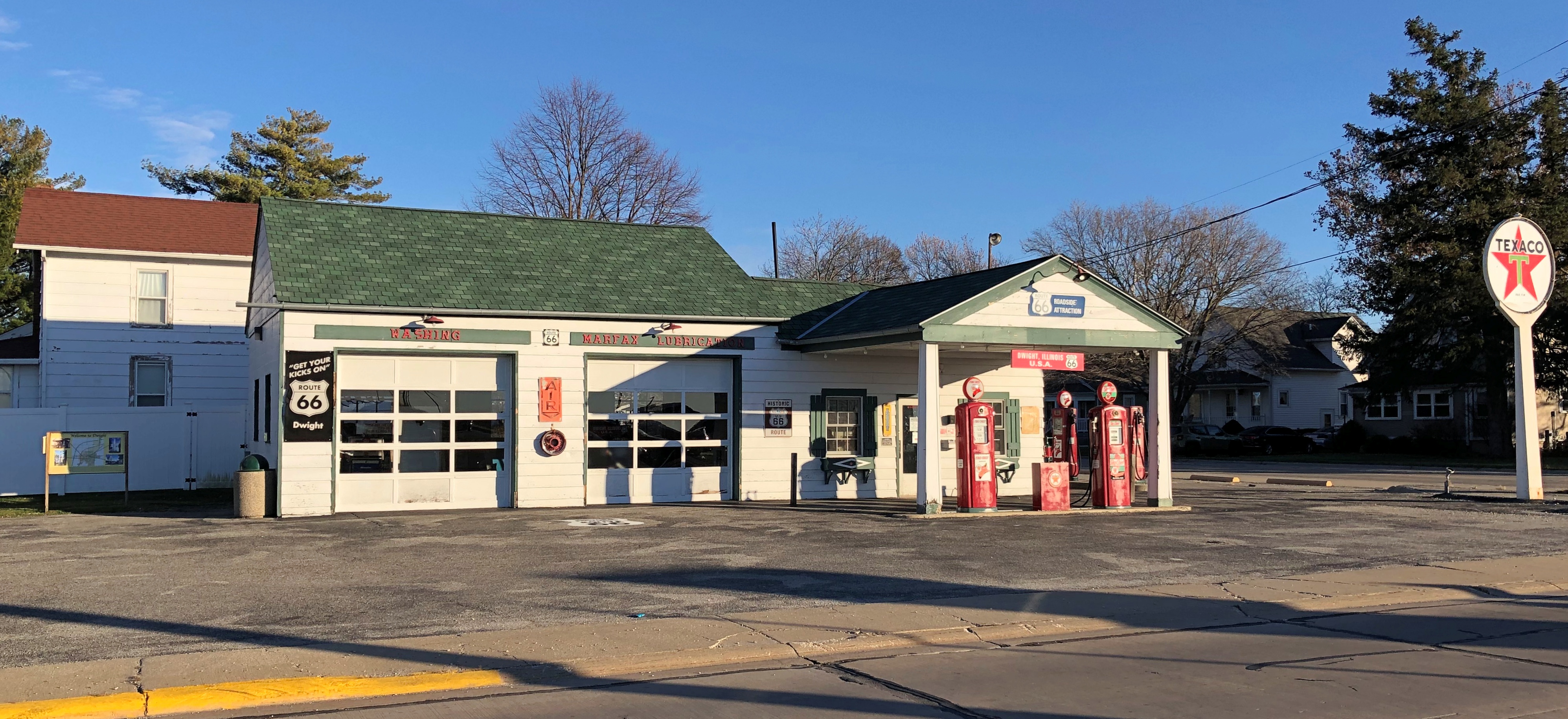
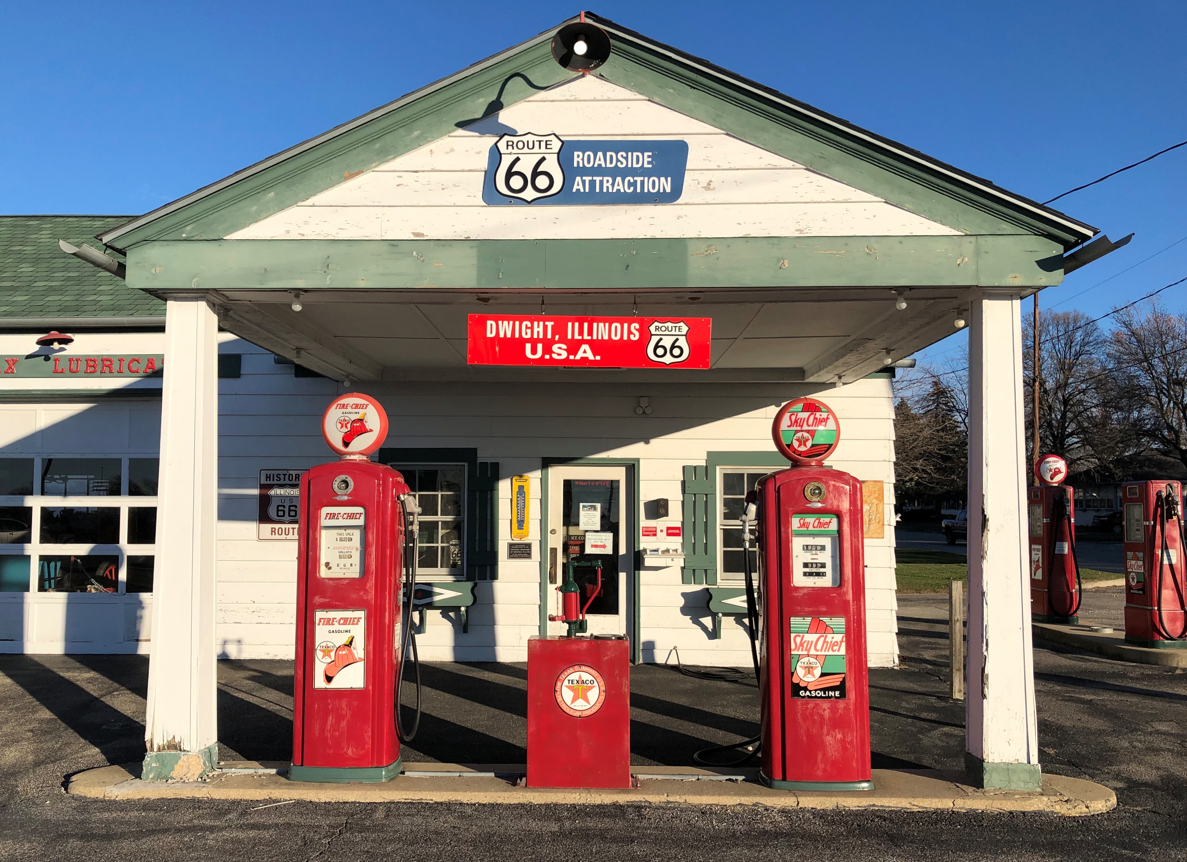
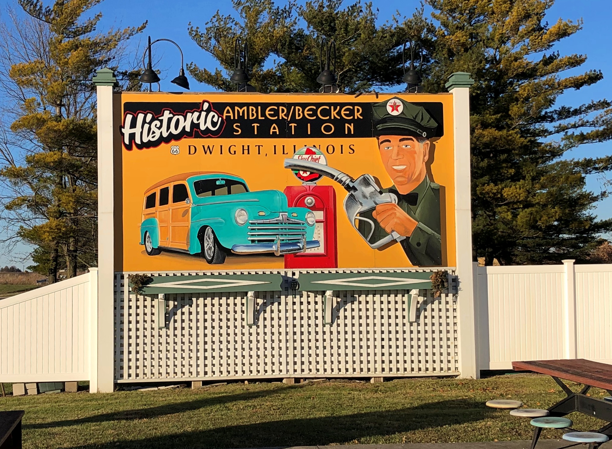
Ambler’s Texaco Gas Station is on the edge of Dwight, Illinois, not far from the Interstate, and after our short visit on Sunday, Ann and I went further into town, seeking a late lunch. We found it at El Cancun, a Mexican restaurant in the former (current?) Independent Order of Odd Fellows building, dating from 1916. Looks like the orange of the restaurant has been pasted on the less-colorful IOOF structure.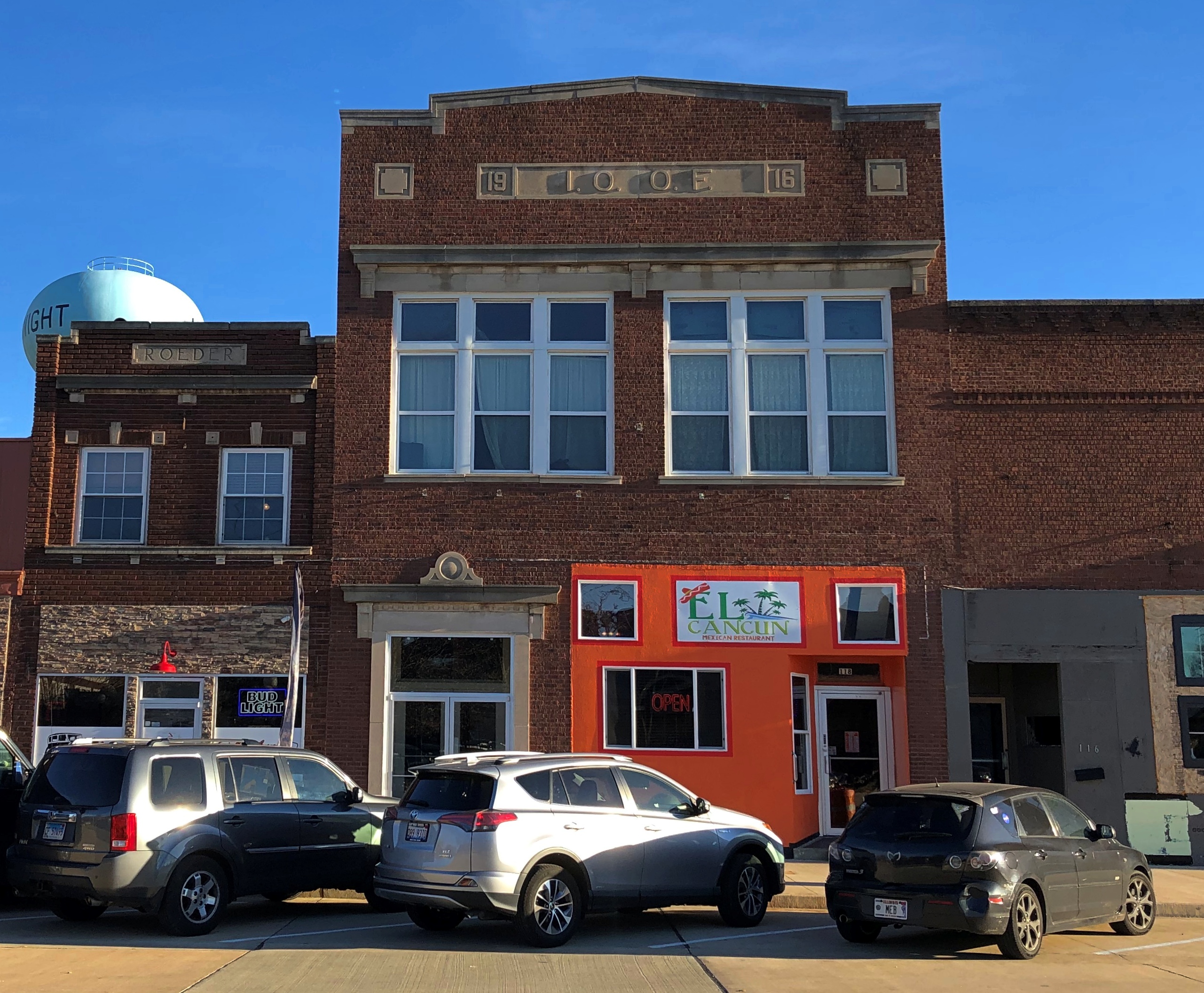
I didn’t notice IOOF on the building until after lunch, so I didn’t think to ask the waiter about the building, though I did notice that the restaurant space, whose walls were large and colorfully painted, had a gray ceiling that evoked the late 19th/early 20th century. Maybe once upon a time it was a meeting room or bar for the Odd Fellows of greater Dwight.
Even if I’d asked the waiter, I’m not sure he would have known. Got the impression he didn’t grow up in these parts. He was eager to upsell me a margarita, however. I declined. Had the enchiladas verdes, which were quite good, and a classic teetotaler beverage, water.
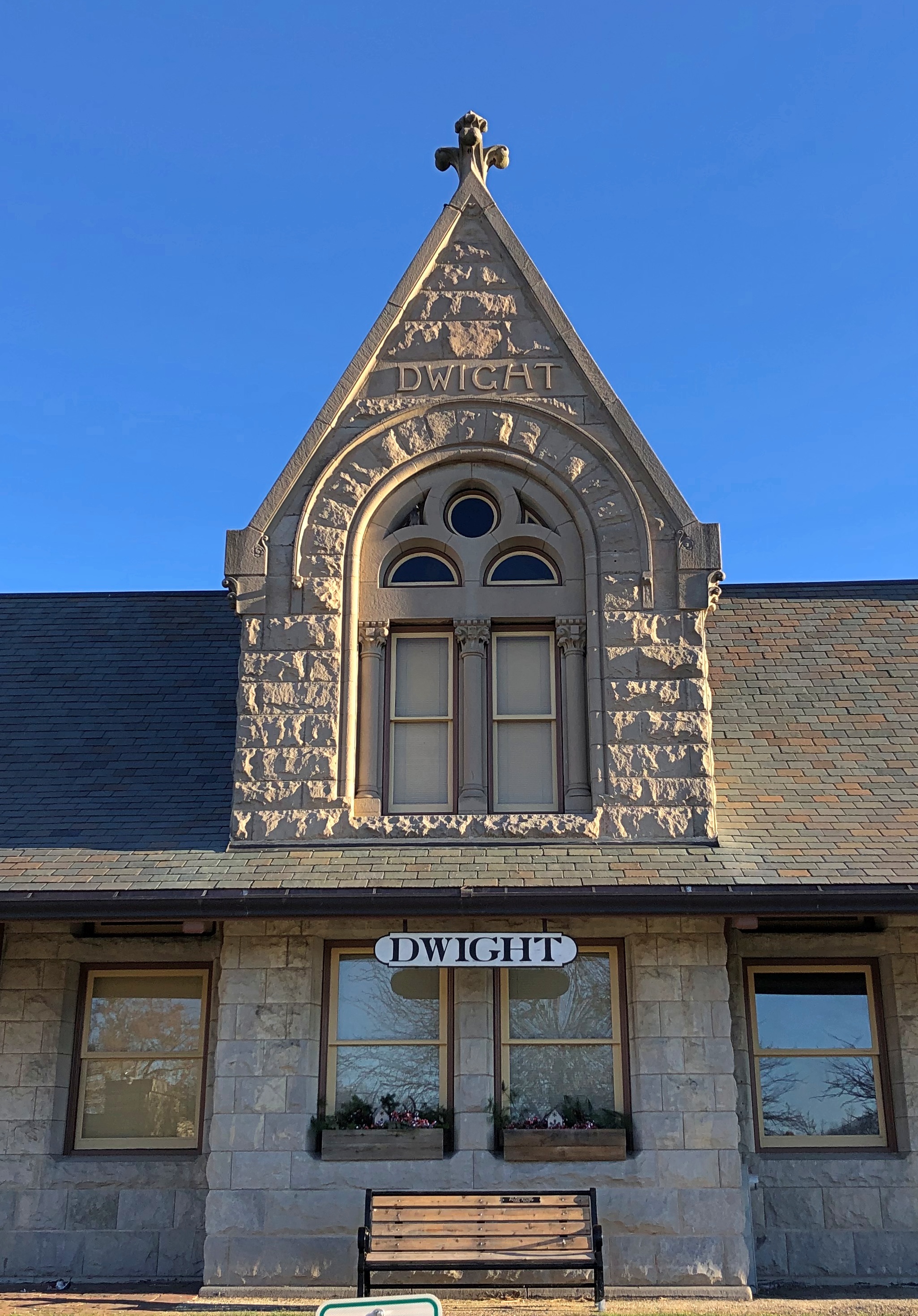
The IOOF building is across the street from the back of Dwight’s historic railroad station, now a museum. This is the front.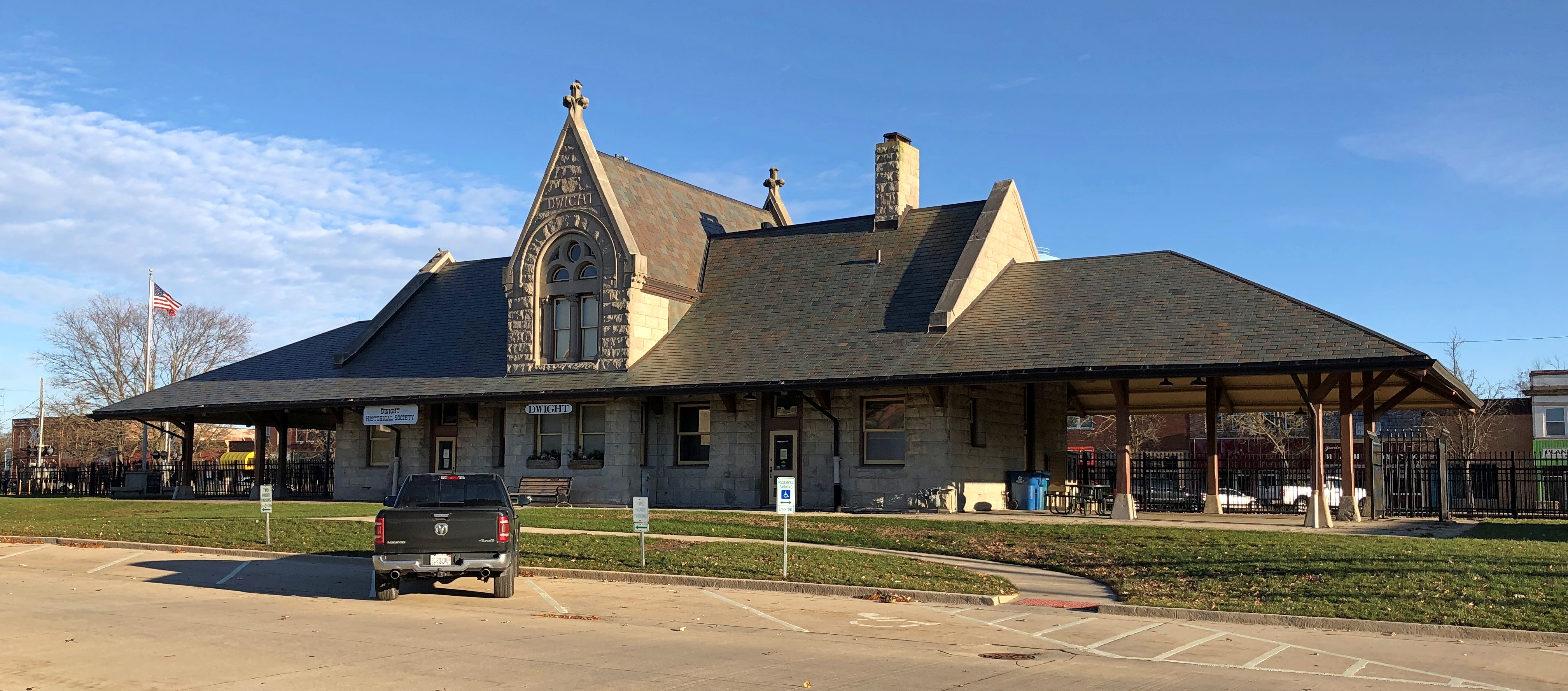
About the depot, more info is easily available. “As with other neighboring central Illinois towns, Dwight began as a locomotive watering stopover,” explains The Great American Stations (now that’s an interesting web site).
“The Chicago and Mississippi Railroad sent surveyors in the early 1850s to this prairie location, and while the stop was just two small buildings and a water tank, James Spencer, Richard Price Morgan, John Lathrop and the brothers Jesse and Kersey Fell of Bloomington participated in laying out a town that they would name for Henry Dwight, who had funded most of the building of this section of the railroad.
“Dwight began growing rapidly in the 1870s, with significant railroad traffic through to Chicago from St. Louis, and the town hired Henry Ives Cobb to design their larger, grander railroad depot.”
Jesse Fell, by golly. Him again. He was definitely a big fish in the little pond of central Illinois.
As for Cobb, he designed the wonderful Newberry Library in Chicago and the phallic but interesting Yerkes Observatory in southern Wisconsin, among many other things.
But for big-name architecture, Cobb’s work isn’t Dwight’s star attraction. That would be the modest Frank Lloyd Wright bank building facing the front of the station. FLW was trying to smash that pre-FDIC paradigm of grand bank buildings, it seems.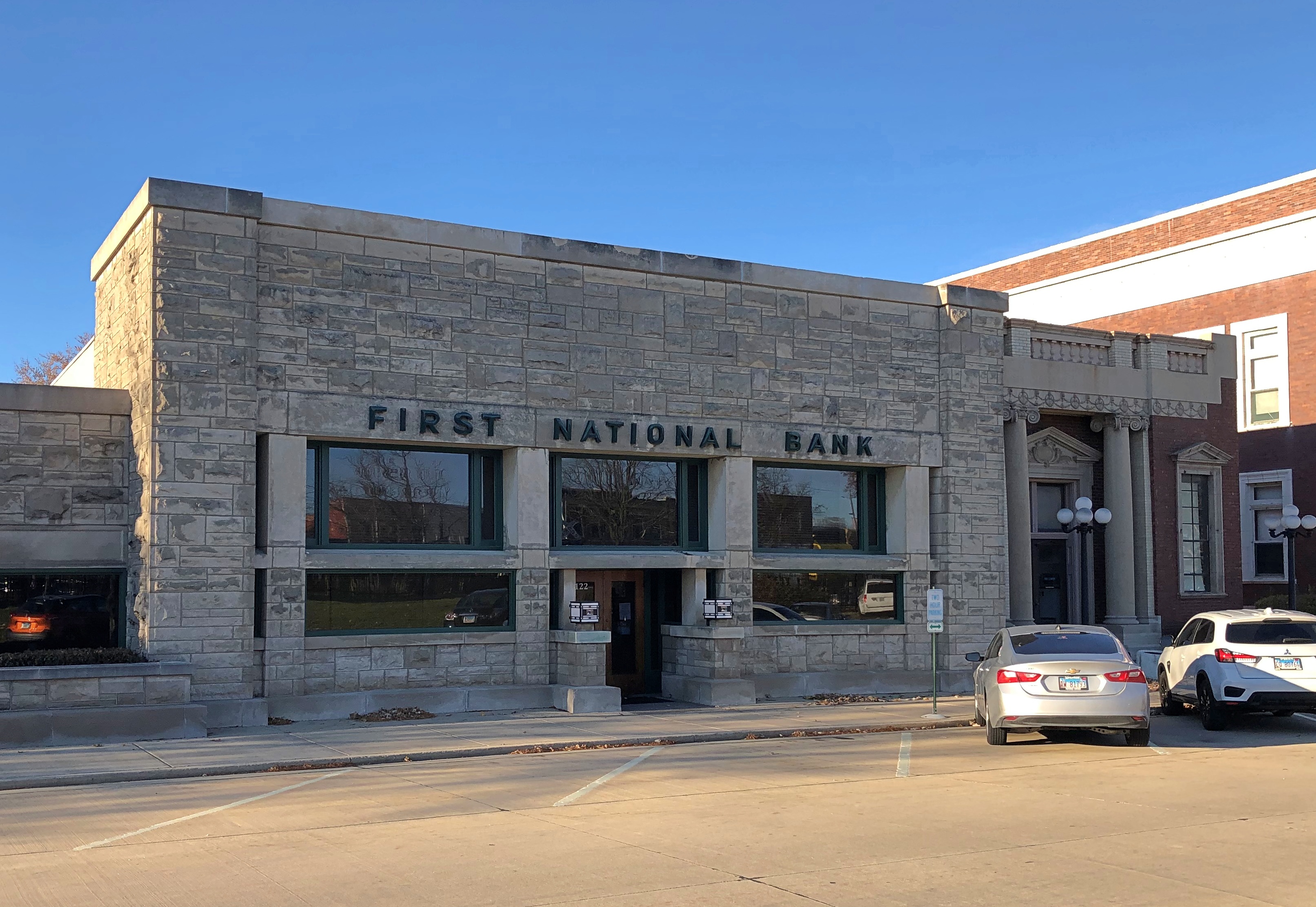
Known as the Frank L. Smith Bank when built in 1905, it’s now the Dwight Banking Center of Peoples National Bank of Kewanee. I like the old name better: Frank’s Bank. How many of us get to have our own banks?
Next to the bank is the Fox Development Center, a state-owned facility for treating people with various unfortunate conditions.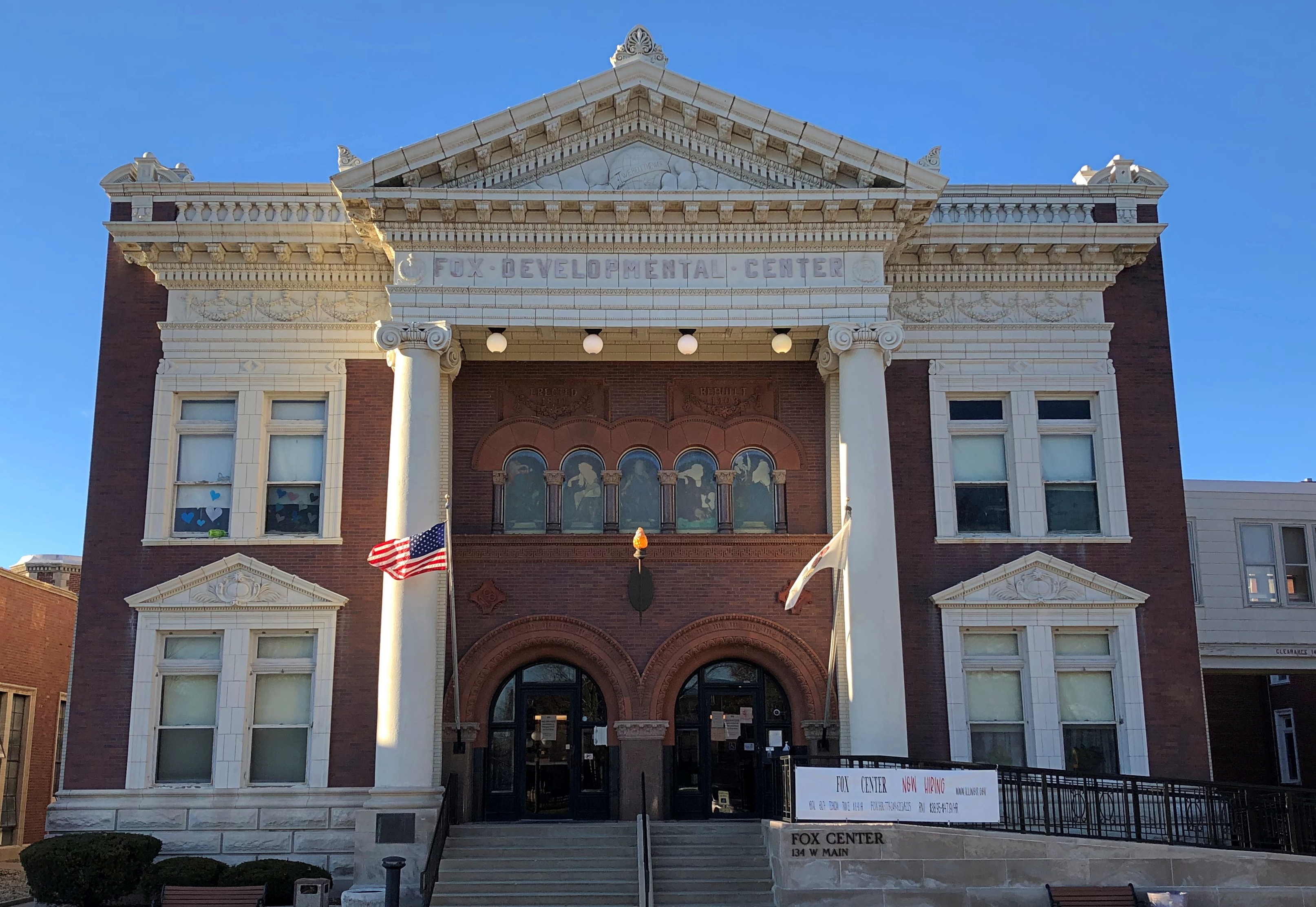
Pretty spiffy for a government structure, eh? Originally it was one of the buildings owned by the Keeley Institute, built in 1891 and rebuilt after a fire in 1902 in its current brick-and-stone Greek revival style.
I wasn’t familiar with the Keeley Institute. Here’s the long and short of it: there was a patent medicine for everything in the late 19th century, and the product of one Leslie Keeley, a small town doc, promised to cure alcoholism with injections and liquids to drink. His cure containing a substance whose exact formula was a secret, though Keeley asserted it contained the element gold in one form or another.
Not too many people believed that, but a lot of people believed the Gold Cure might just work, enough to make Keeley a fortune and open up locations around the world that lasted well into the 20th century. The institute’s international HQ was in Dwight.
Curing alcoholism with injections might seem odd to us, but actual medicine was only just beginning to separate itself from patent medicine in those days.
“I will take any liquor habitue there, soddened and saturated by twenty years of alcoholic debauch, sober him in two hours, cut short his worst spree in four hours, take him from inebriety to perfect sobriety without nervous shock or distress, and leave him antipathetic to alcoholic stimulants of every sort and kind inside of three days,” Keeley said of his treatment. He also developed “cures” for opium addition and nervous exhaustion. Ah, if only it were that easy.
Note the slogan on this ad for the Gold Cure.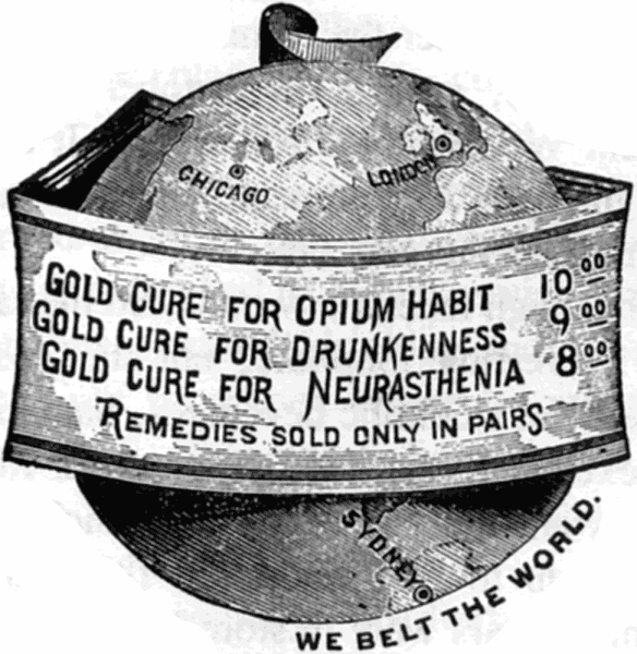
We Belt The World. Though it’s a little hard to see, that same slogan is still above the entrance of the Fox Development Center, wrapped around a globe in the pediment.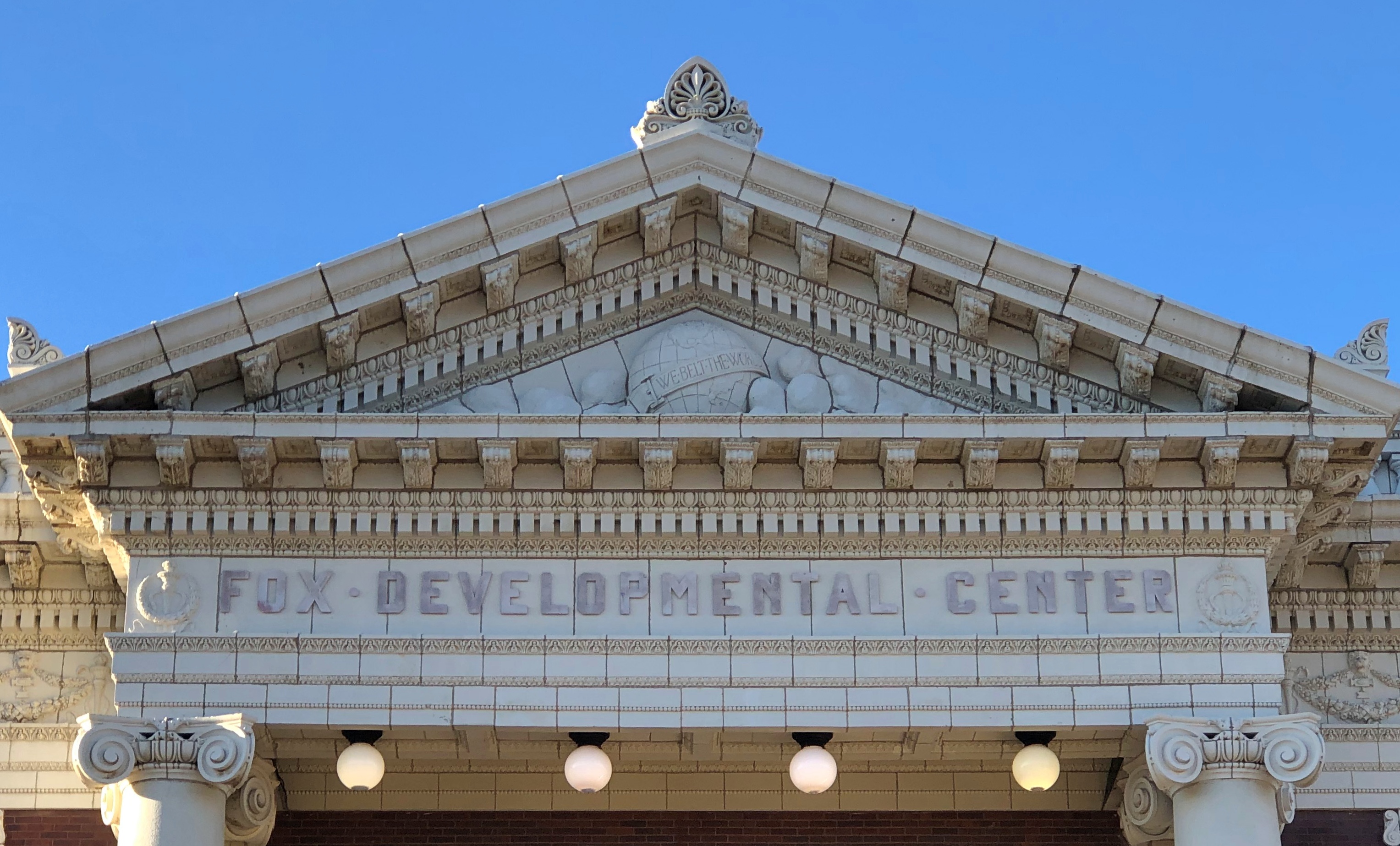
More about Keeley and the Gold Cure is here. Fascinating the things you find on the road.


#/media/File:USS_Tullibee_(SS-284).jpg)