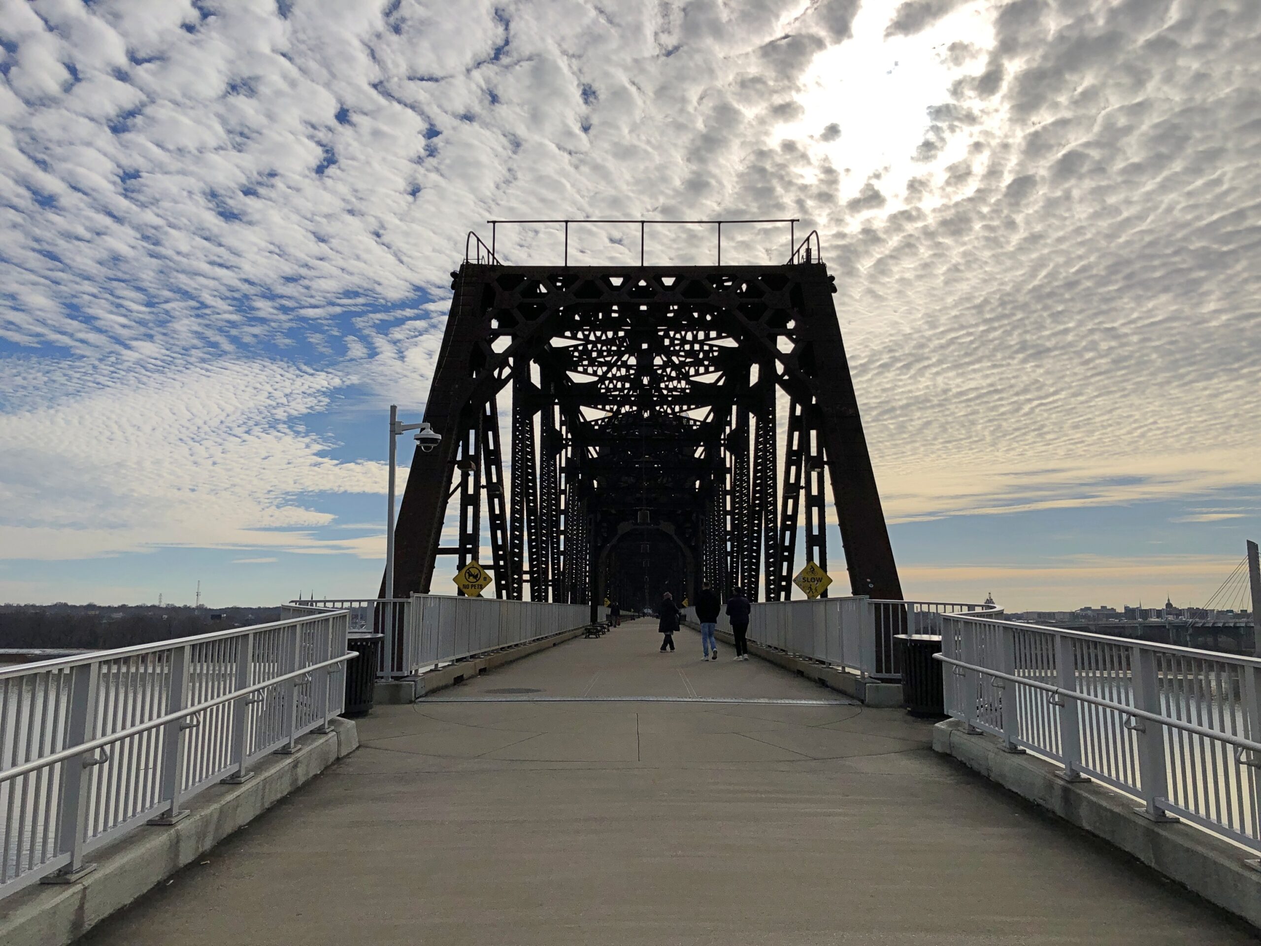
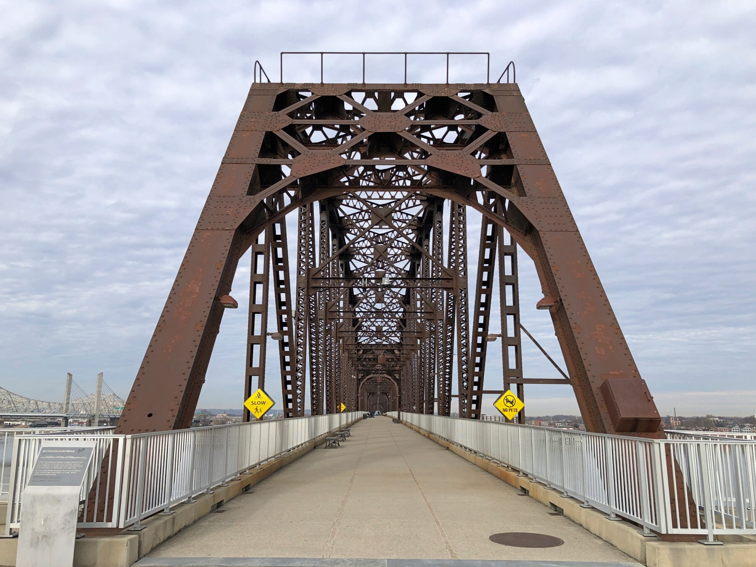
Even the last day of a long trip can include – should include – something to see. With that in mind on December 22, after we crossed the Ohio River from Louisville on the I-65 bridge, which I have done many times, we took the first exit to go to Jeffersonville, Indiana, which I have done only once, in 1990. Then we went back across the river to Louisville, this time on foot on a massive iron structure known as the Big Four Bridge.
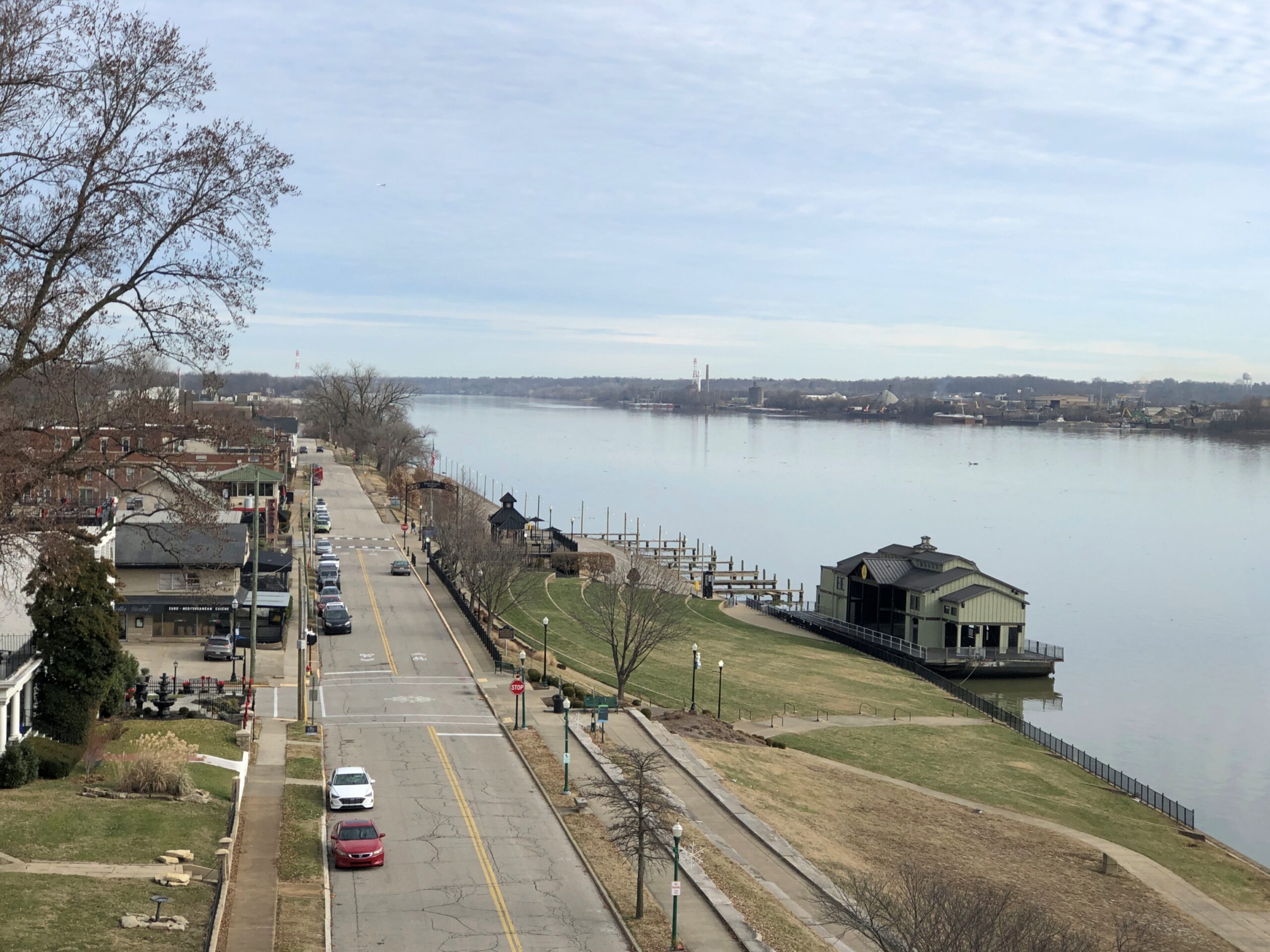
The Jeffersonville side of the bridge offers views of that town and its riverfront, where I took a wintertime stroll all those years ago. At that time, Big Four Bridge was a decaying relic, inaccessible to the public.
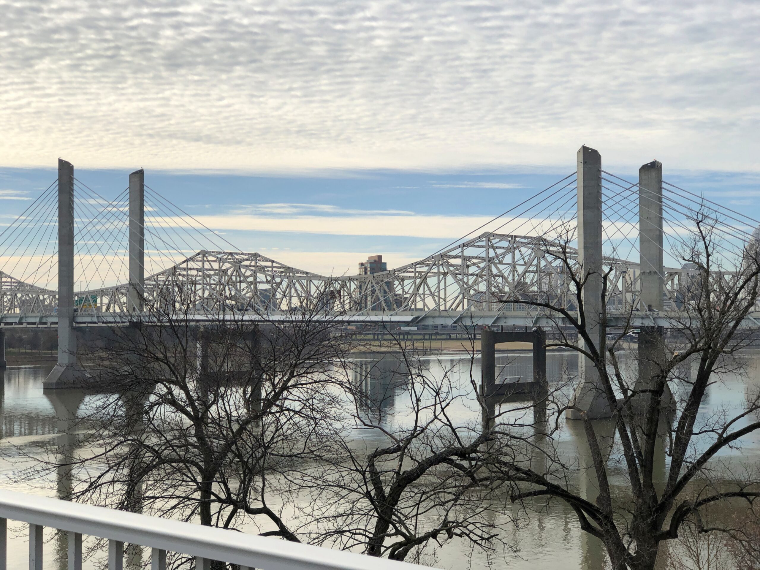
You can also see the I-65 bridge from that vantage. It too is an elegant design.
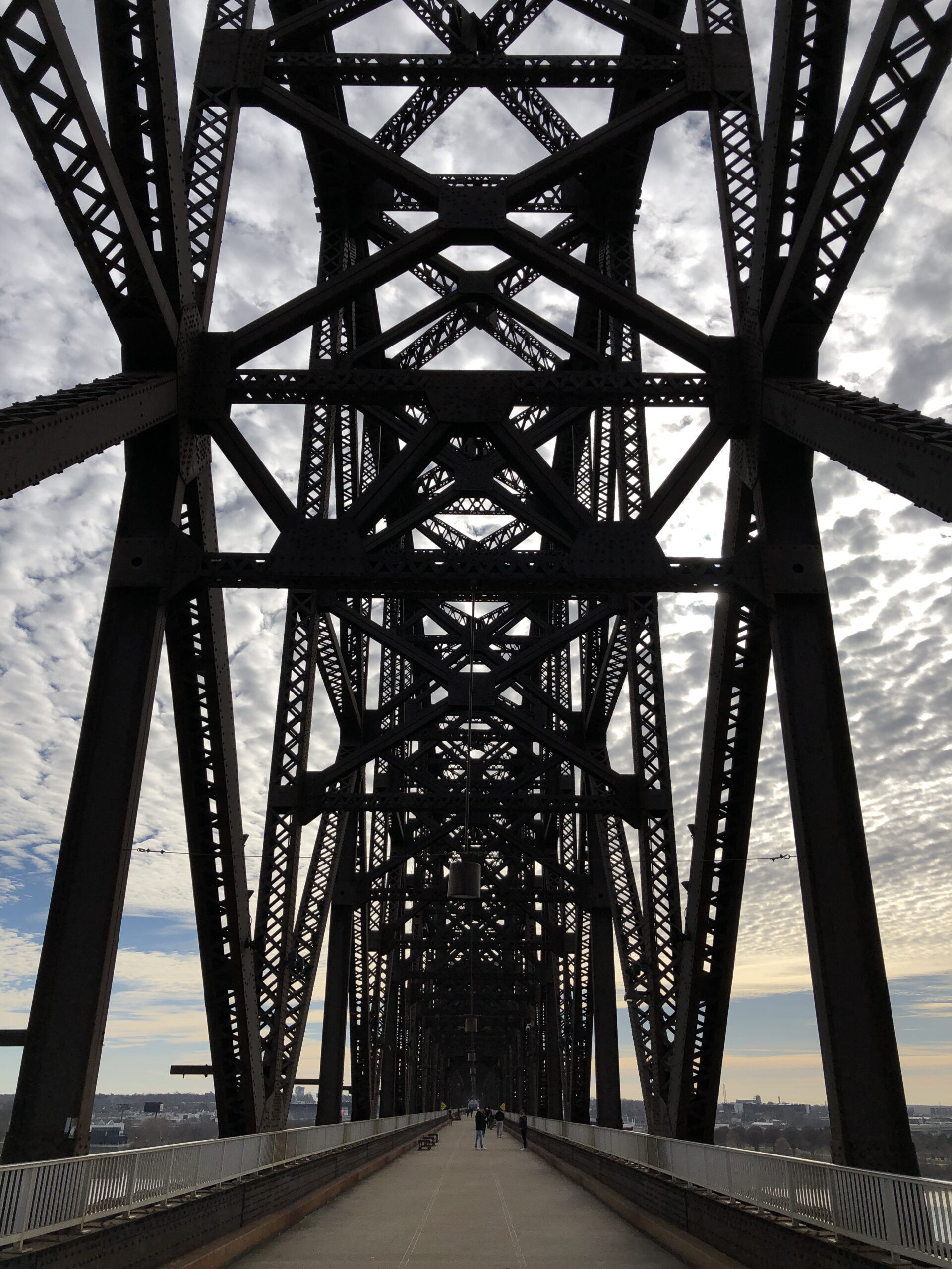
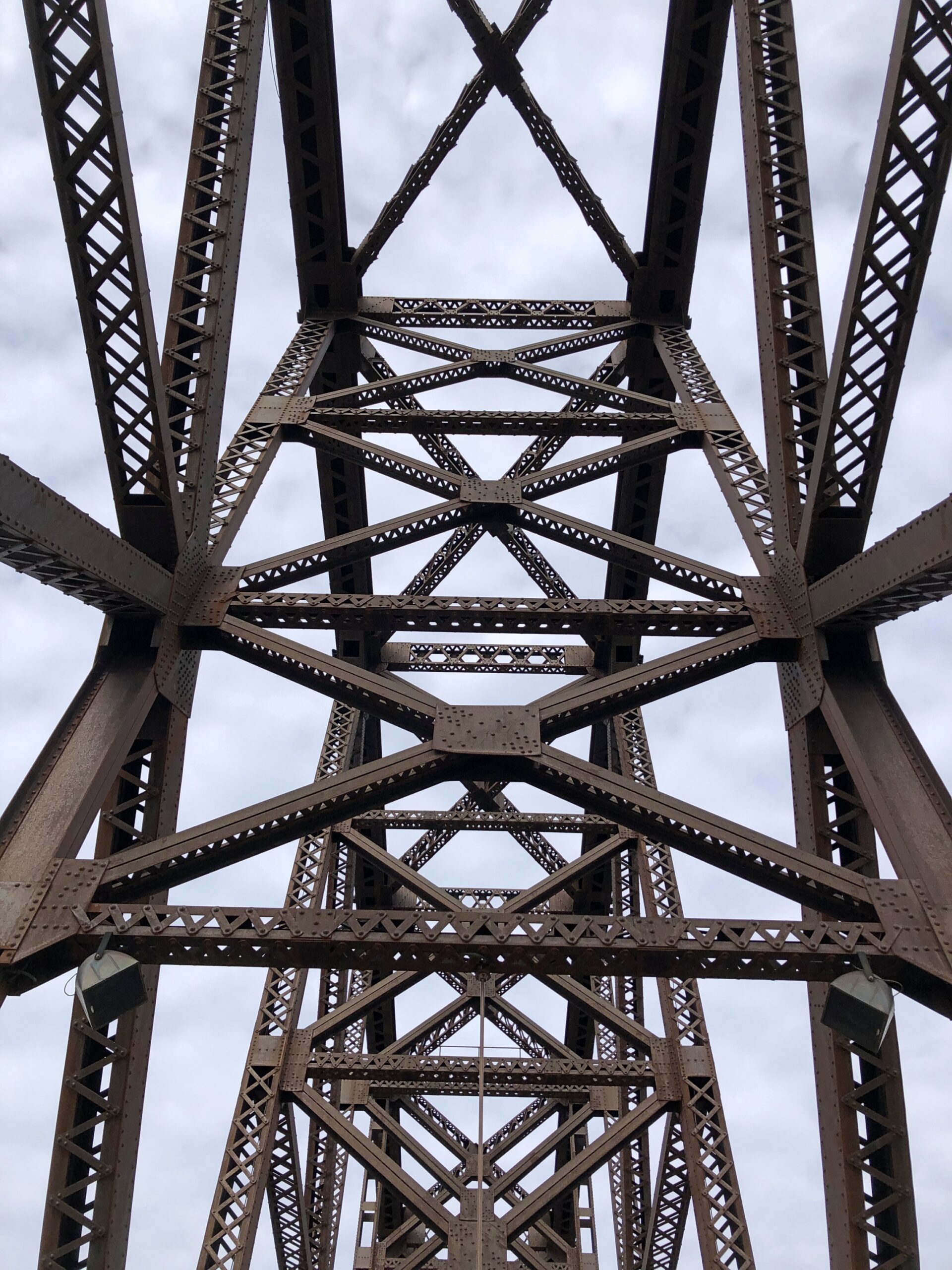
But not as impressive as the sweeping ironwork of Big Four Bridge.
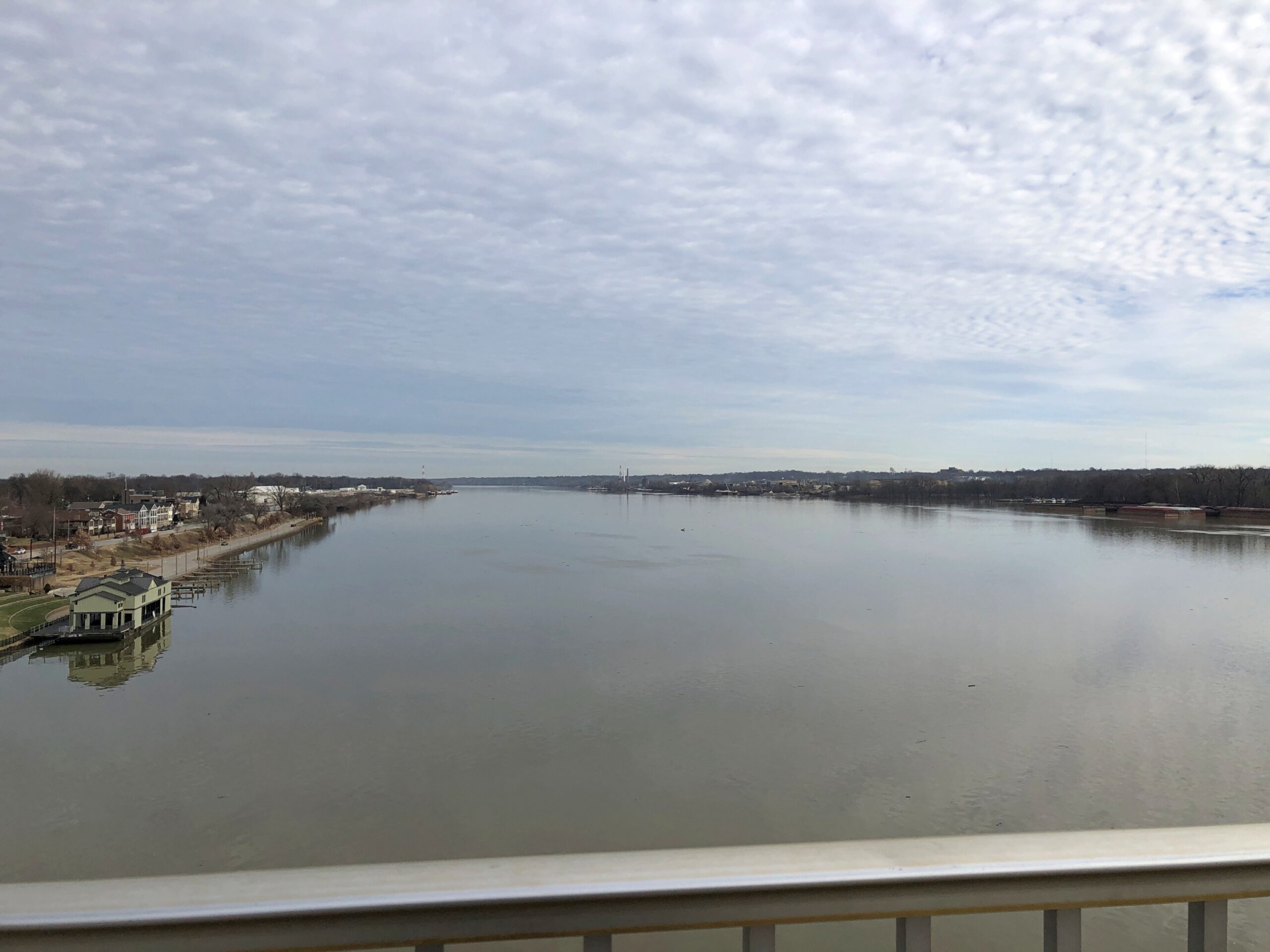
The Ohio sweeps along as well.
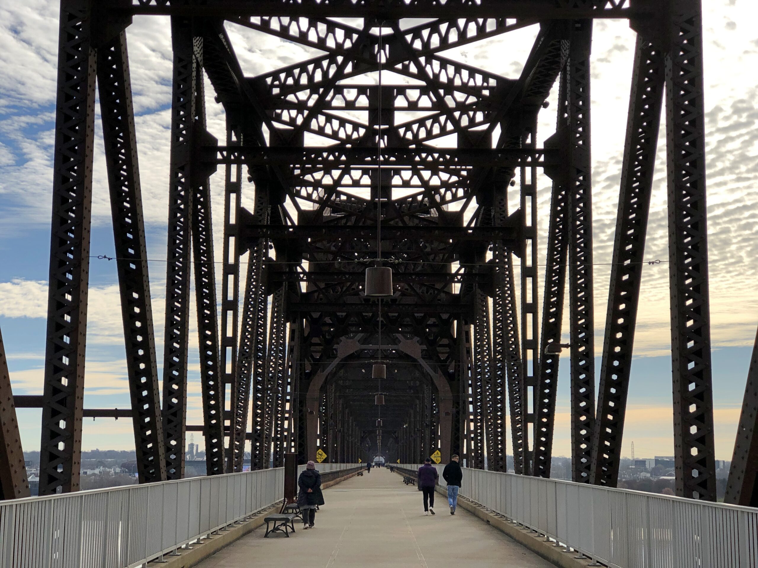
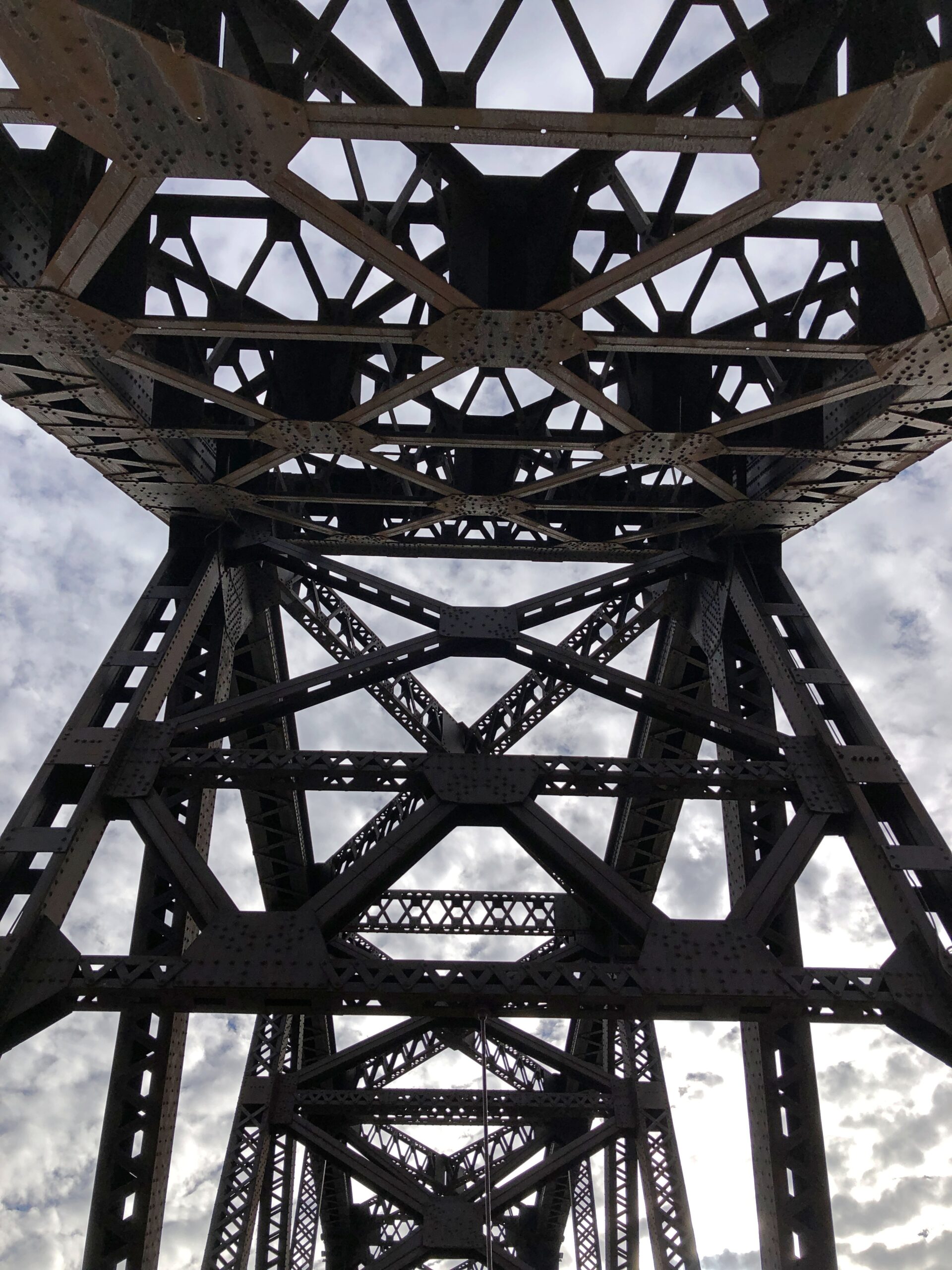
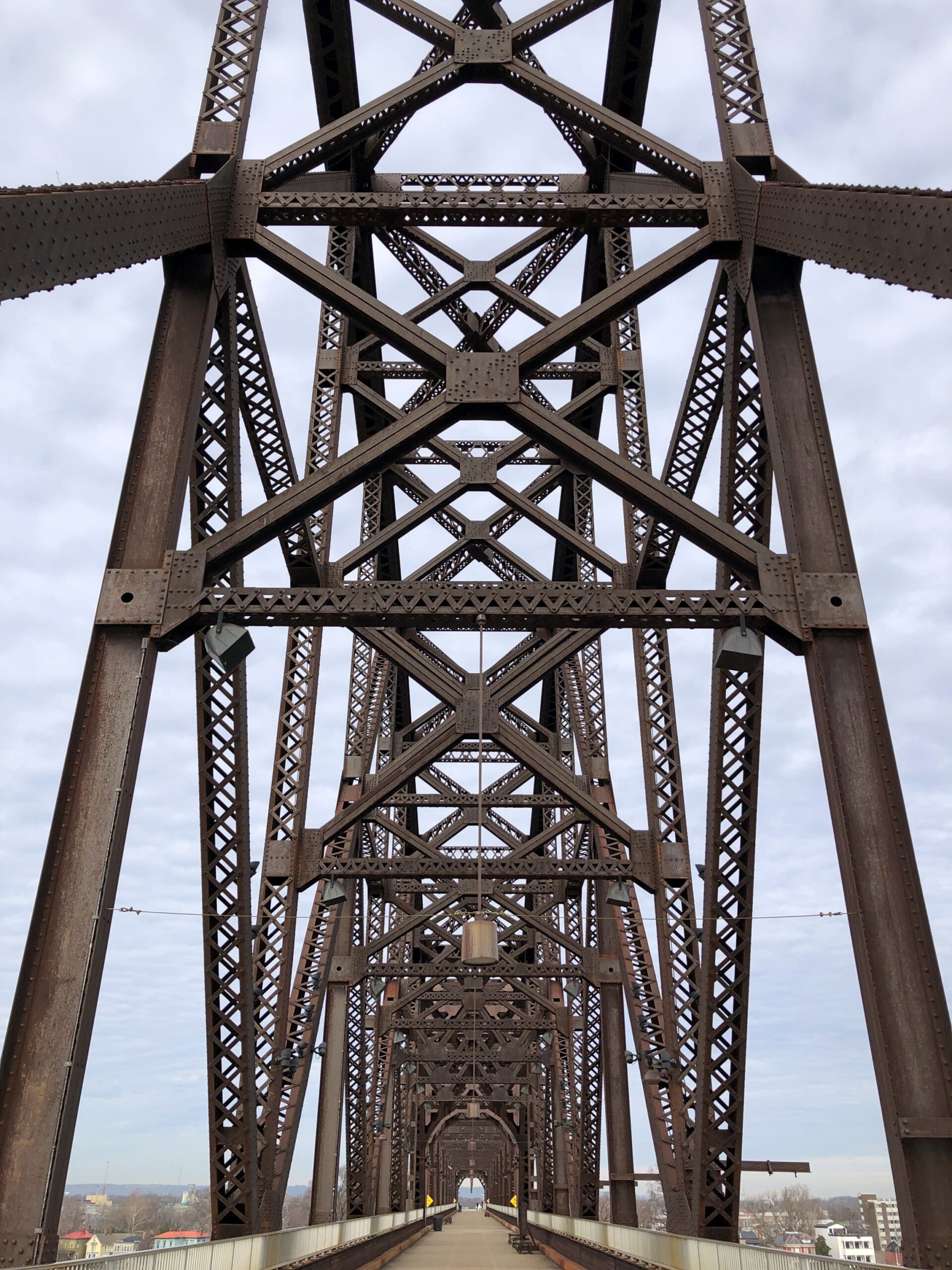
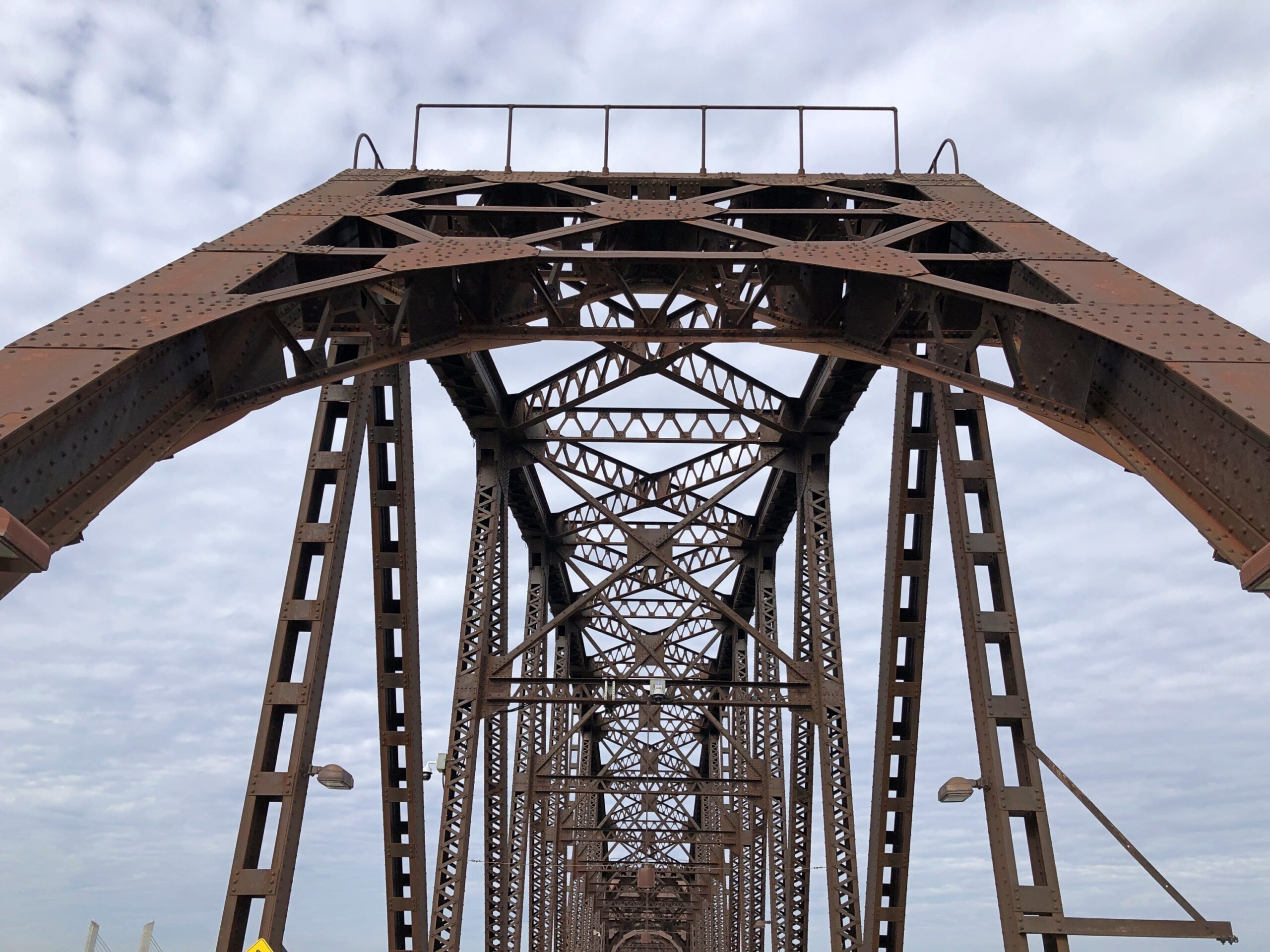
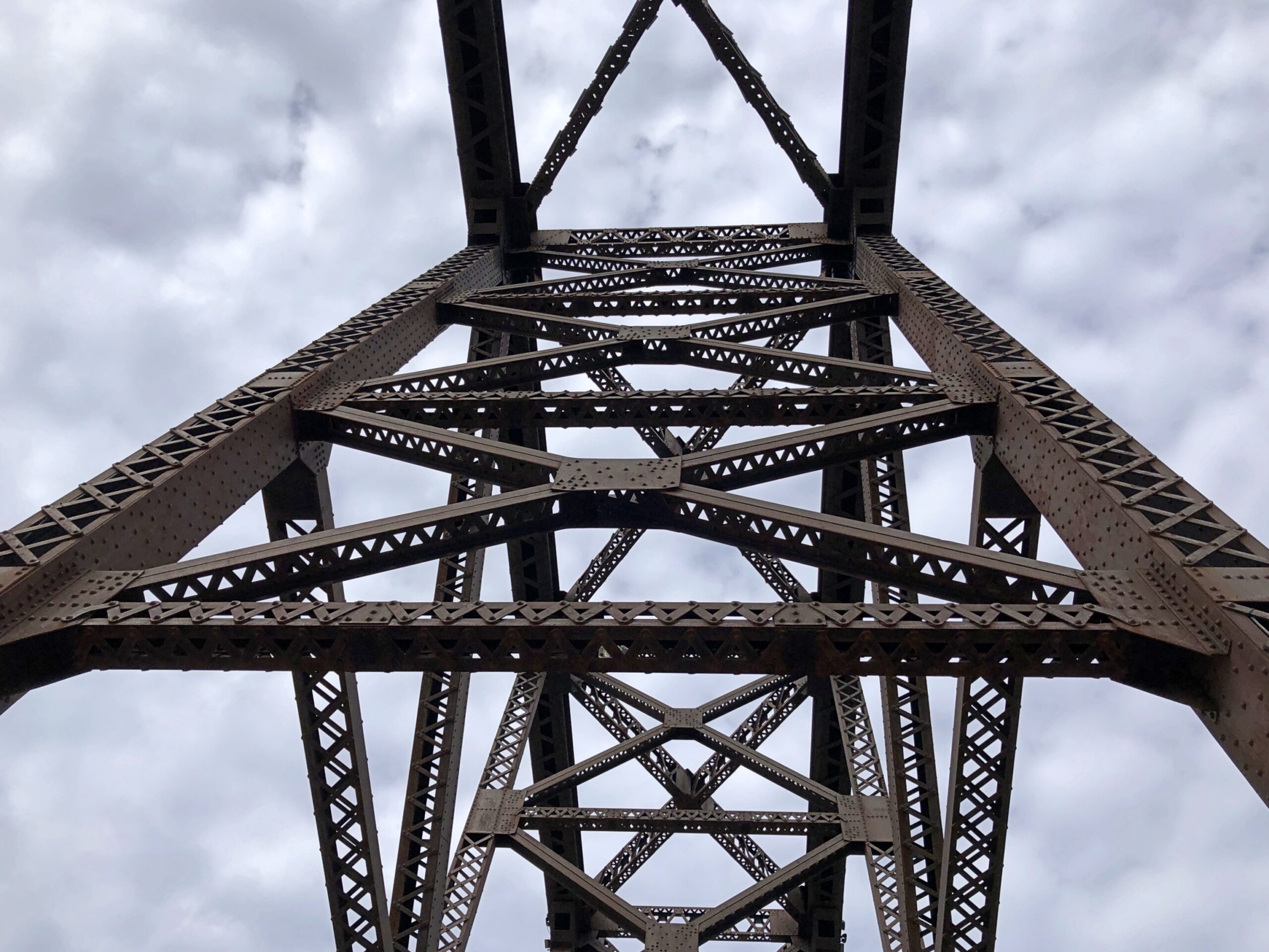
I couldn’t take enough pictures of Big Four.
Once upon a time, Big Four carried the Cleveland, Cincinnati, Chicago and St. Louis Railway, also nicknamed the Big Four Railroad. The 2,525-foot span contains six trusses, beginning as a late 19th-century project, the sort of pre-OSHA work that killed dozens of workers during construction (so why not ghost stories?).
Completed in 1895, “The Big Four Bridge allowed freight traffic to dramatically increase in Louisville, and began carrying high-speed interurbans on September 12, 1905…” says Bridges & Tunnels. “Due to bigger and larger trains, not only in size, but in weight, contracts were let in June 1928 to build a larger Big Four Bridge. The new span, constructed by the Louisville & Jefferson Bridge Co., was built on the piers of the old bridge, while leaving the existing span intact while it was upgraded.”
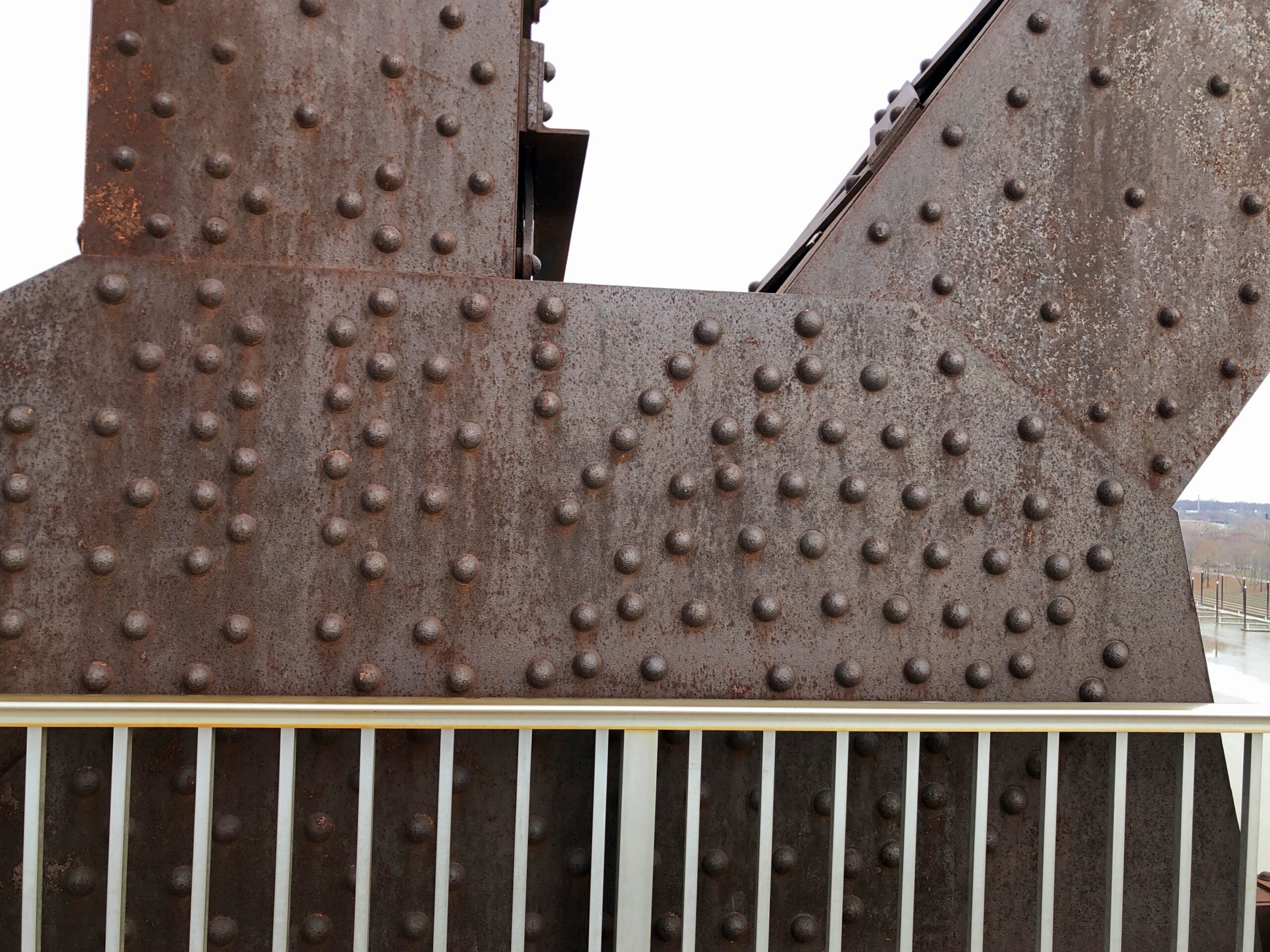
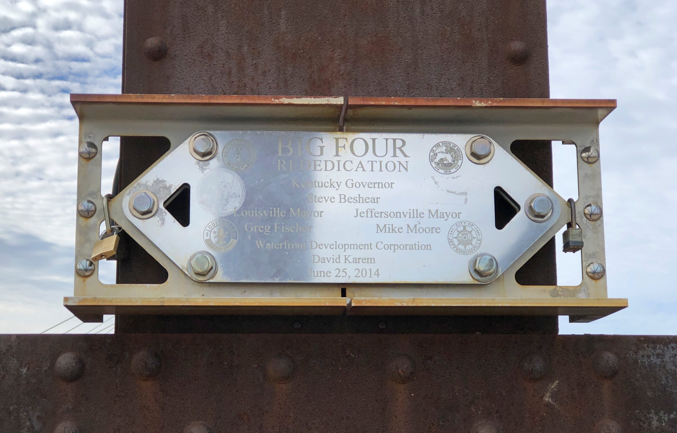
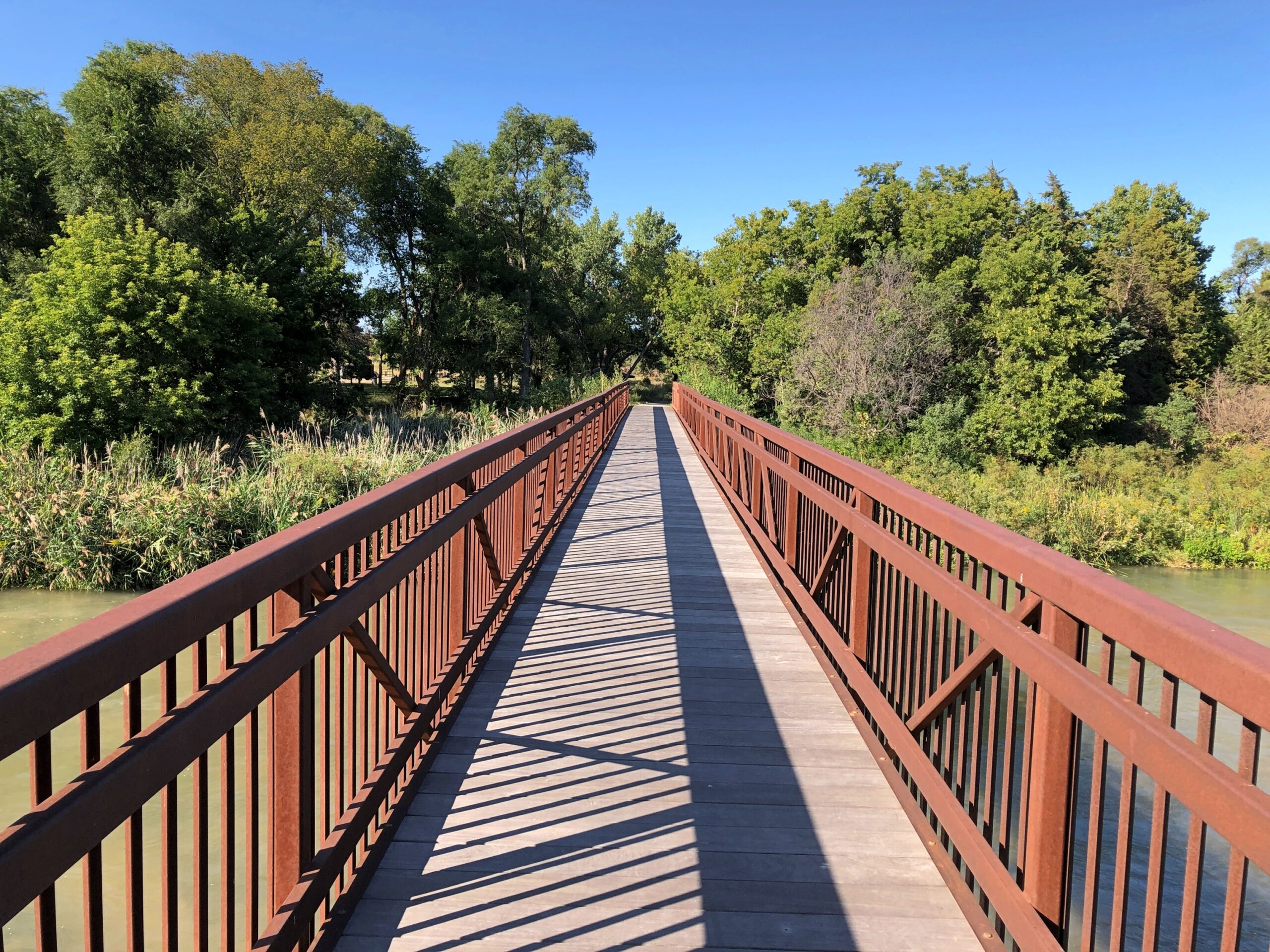
That is the structure we see today, except that in the early 21st century, it was redeveloped into a pedestrian/bicycle bridge.
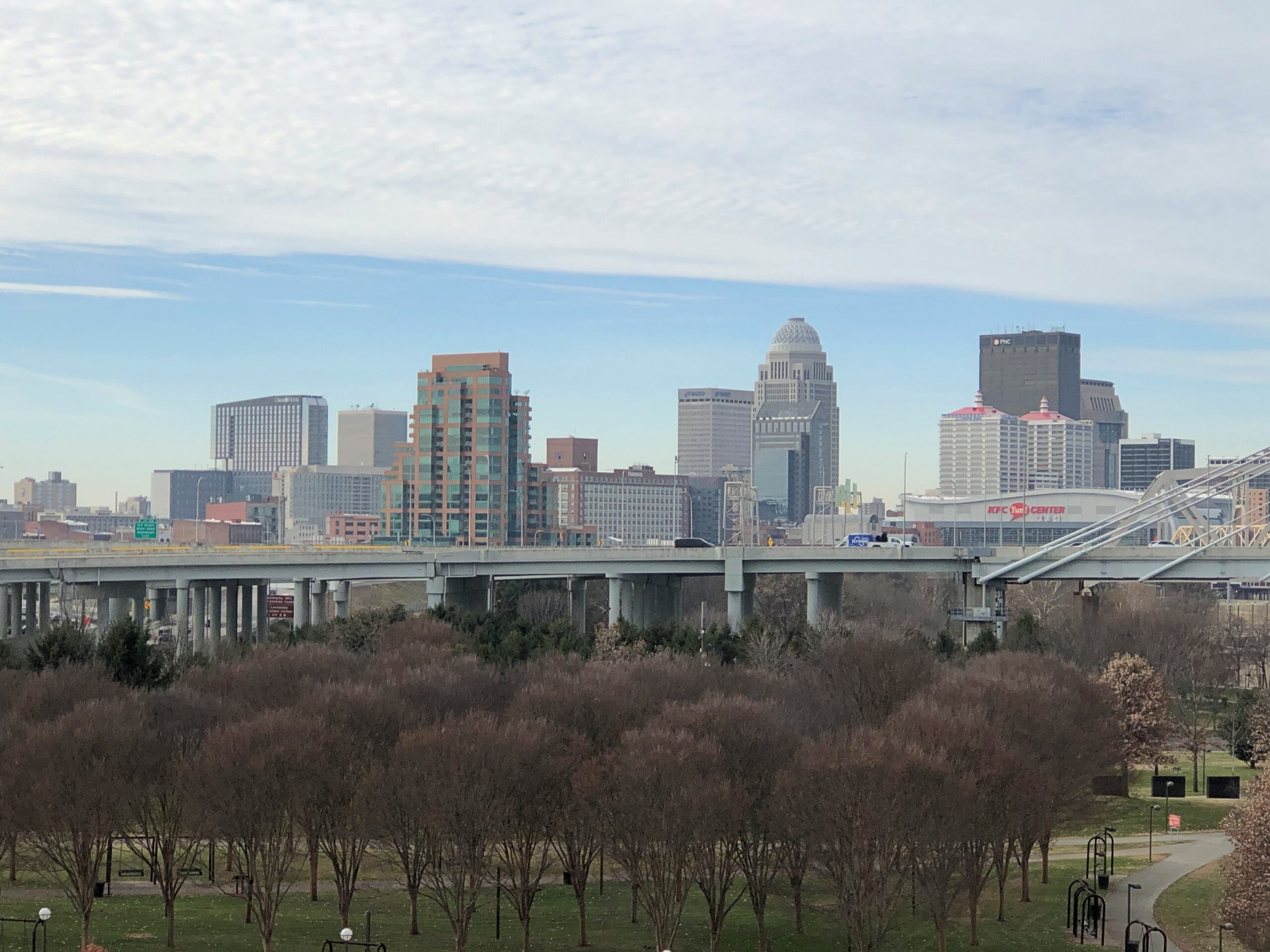
At the Louisville side of the bridge, views of the city.
And looking back at the bridge from the Kentucky (Louisville) side.
We saw the daytime bridge, of course. But “the Big Four Bridge has an LED lighting system that wraps the iron fretwork in vibrant colors,” says Our Waterfront. “The lights can be programmed to have a rainbow effect, highlighting the beauty and strength of the bridge structure. At night, the bridge becomes a colorful beacon in our city. Lights operate daily from twilight until 1 am.”
Another reason to come back to Louisville-Jeffersonville, obviously.
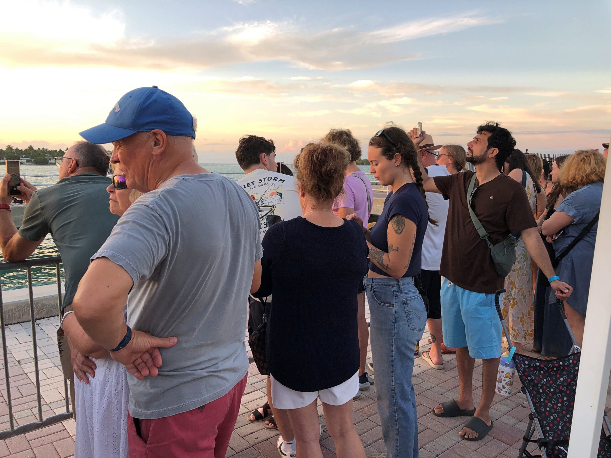
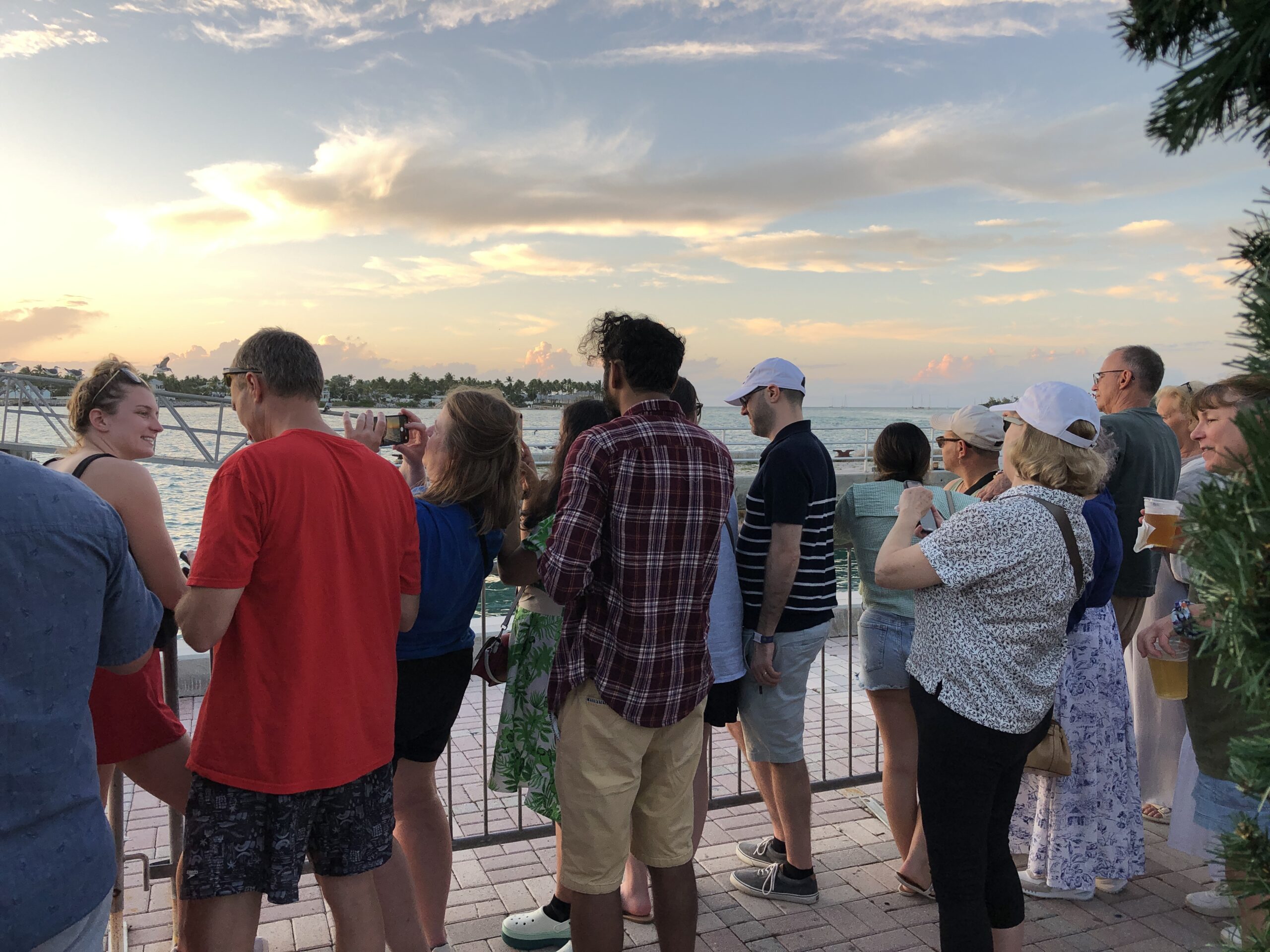
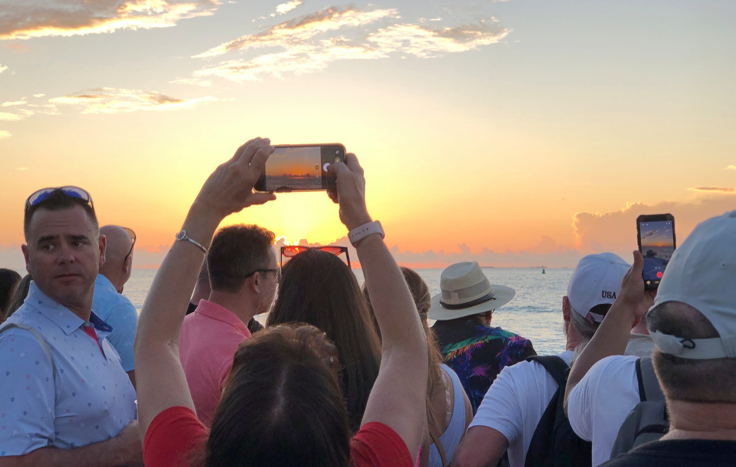
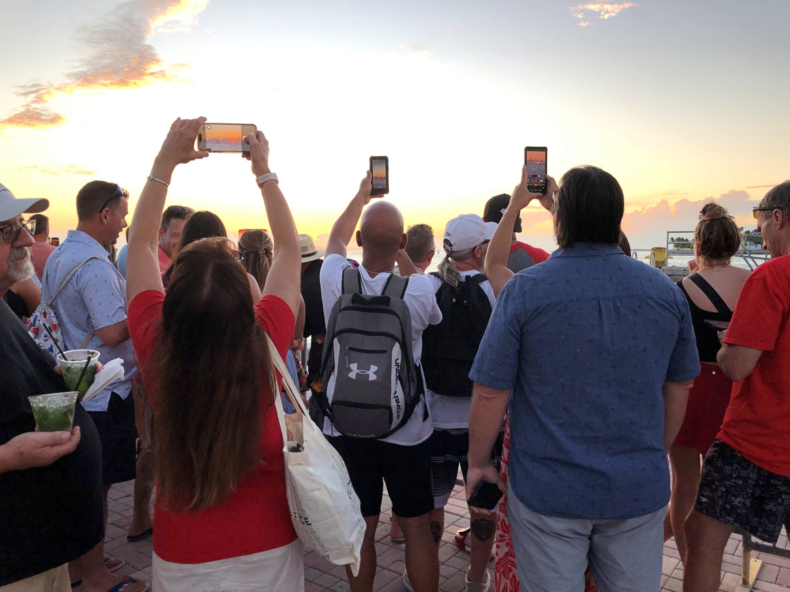
We joined the other Key West tourists, and who knows maybe a few locals, for an spontaneous sunset viewing party. I know if I lived around there, I’d be out at least occasionally, taking in something that never gets old. No organizer at all, just people collecting at the right place at the right time to see the disk of the sun transition from yellow to red and other colors, as it visibly creeps lower toward the horizon. Down the sun went, in its predictable splendor, and then — green.
I’m pretty sure what I saw was an inferior-mirage flash, to use a technical term I learned later. I checked later, finding that one characteristic of such a flash is an oval of light lasting no more than 2 seconds (I’d say it was no more than a single second, if that). They tend to happen when the surface is warmer than overlaying air, and close to sea level.
All that fits for the green flash — a variety of green intense and completely new to me — as the sun set our first day in Key West. The flash came exactly as the top edge of the disk of the sun dipped below the horizon. You have to, I believe, be looking straight at the exact right place at exactly the right moment to see it, as I was, by pure accident. I’d heard about green flashes for a long time, but I’d never seen one. A really long time: I remember them being mentioned during a planetarium show in San Antonio as a kid in the early ’70s.
We hadn’t come to Mallory Square to see a green flash or any other meteorological optical phenomena. We hadn’t even come to see the sun go down. We just happened to arrive at Mallory, a large public plaza near the north end of Duval St. and right at the water’s edge, just at the right time, after gadding about that part of Key West.
It’s a mildly festive place around sunset. Also, people are waiting. The sun was not to be hurried.
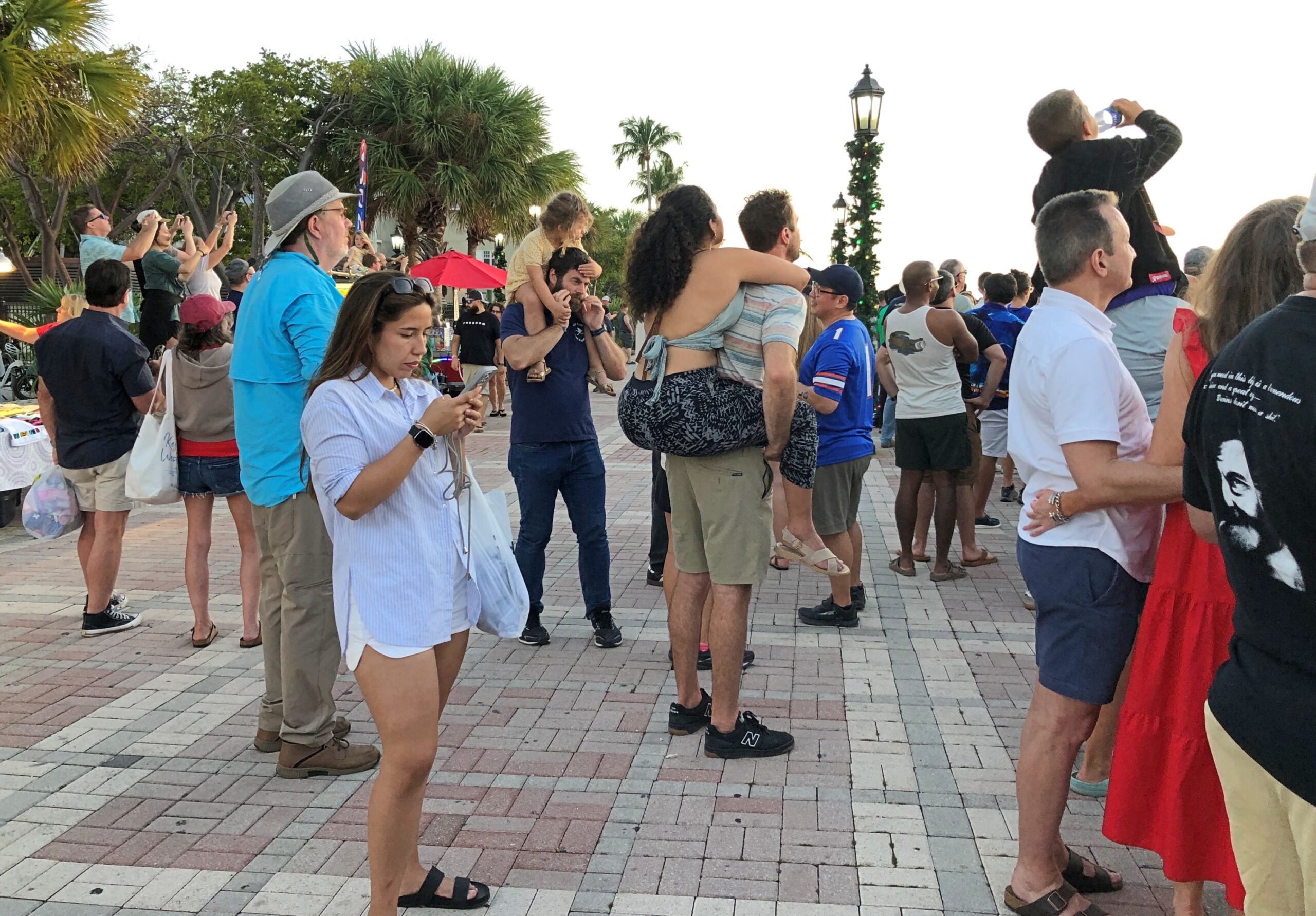
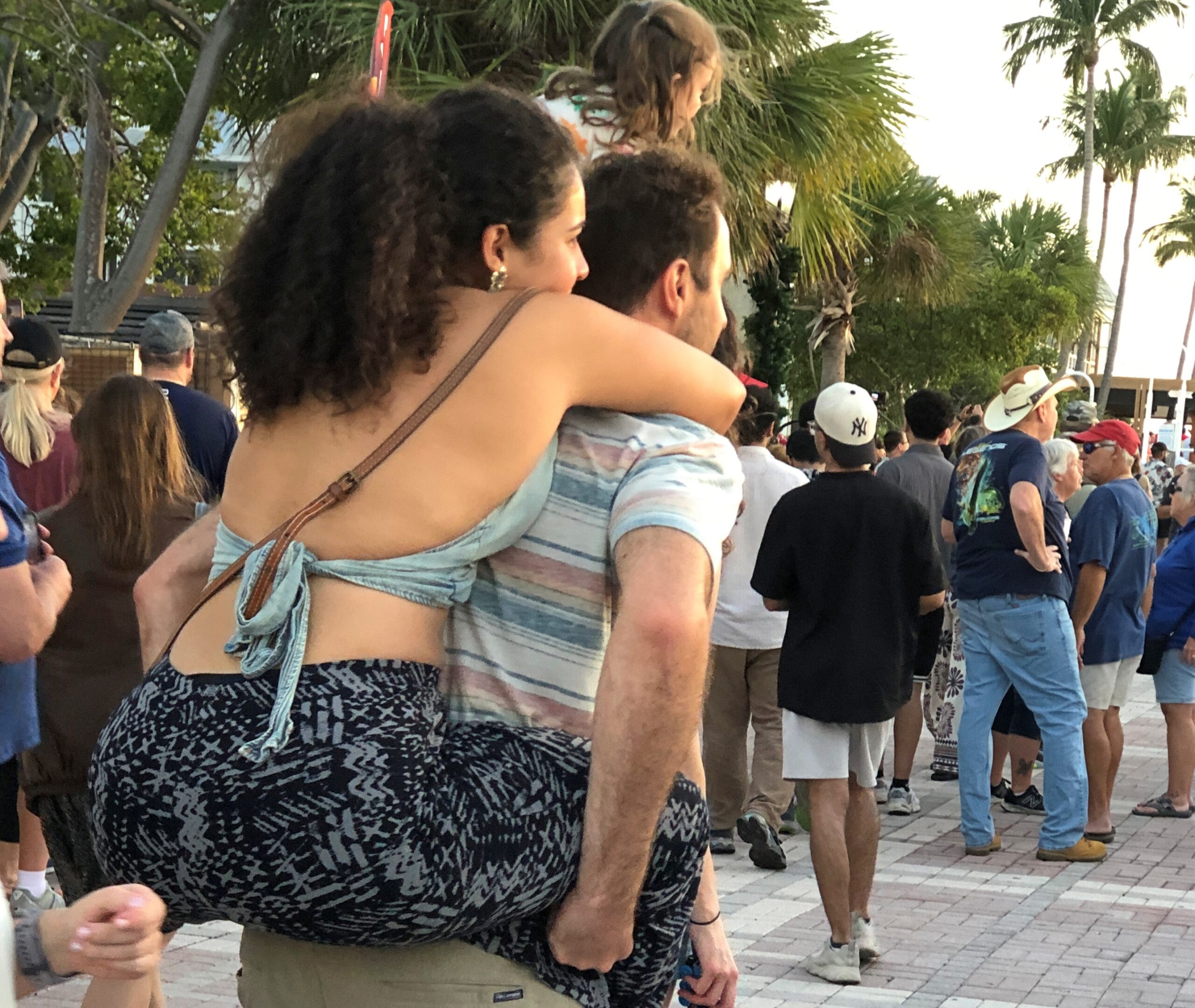
Lots of people around, not an overwhelming crowd, more of a happy milling of vacation-goers.
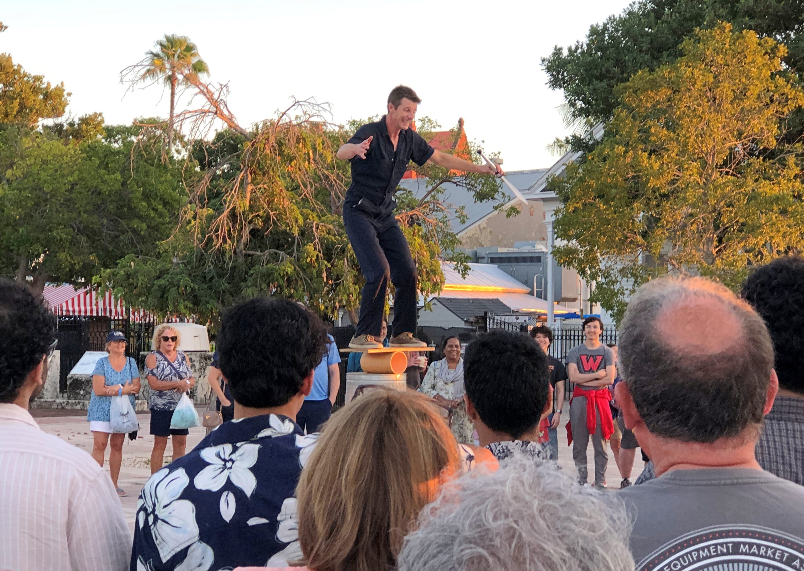
Live entertainment was on hand.
The star attraction, however – make that the solar attraction – was the sunset. Mallory Square has a fine view of the westward horizon, where sea and sky come together like a hazy kiss out on the ocean.
So now I’ve seen a green flash. A total solar eclipse (two, actually), lunar eclipses, the transit of Venus, double rainbows, ground-to-sky lightning, sun- and moondogs, meteors, planets through telescopes including the moons of Jupiter and Saturn, the impressive whisp of the Milky Way in a dark sky, the Southern Cross and the Magellanic Clouds – add a green flash to the list.
But what other cool things to see in the sky that so far have eluded me? The aurora, for one. Aurora borealis would be great, and certainly more doable than aurora australis, but wouldn’t seeing the Southern Lights be a kick? I think I first learned about it in a Carl Barks Scrooge McDuck comic, and never forgot.
As a kid, that is as a kid in the late ’60s and early ’70s, I took an unusual interest in WWI. My grandfather, my mother’s father, had been with U.S. Army Corps of Engineers in France, but it was more than that, since he was gone by the time I could remember, and I only heard bits and pieces about his service from family members who knew him. Some of his gear was still around, such as a bent-up canteen and some binoculars, and a panoramic photo of his regiment, but that was about it.
My interest was more likely sparked by The American Heritage History of World War I, a book we had around the house, along with the Civil War and WWII titles by the same publisher. The WWI volume, a weighty tome lavishly illustrated, had such chapter headings as When the Lights Went Out, Appointment at the Marne, Deadlock, Ordeal of Nations, Crisis in the Allied Camp, Enter the Yanks and Eleventh Hour. I spent quality time with that book.
Just as important, there was a companion record to go with the book: World War I, Historic Music and Voices. I listened to it many times, fascinated by the music and voices from an age that seemed to have nothing to do with the time and place I found myself. That was an illusion of youth. Growing up in the 20th century meant you were in the shadow of that war, know it or not. I’d argue that’s still true. Anyway, I ended up knowing such songs as “Over There,” “It’s a Long Way to Tipperary,” “Keep the Home Fires Burning,” and even “K-K-K-Katy.” all of which were mostly unknown to my contemporaries.
I’m glad to report that the record is available on line. The narrator, Charles Collingwood, had just the right earnest, commanding voice for the record. It was years before I knew anything else about him – his time covering WWII for radio, especially, but also as a TV journalist for CBS.
Like many boyhood interests, WWI carried over into adulthood, faded but never quite gone. I knew, for instance, of the shameful neglect when it came to memorializing the war in the U.S., especially in Washington, DC. The first time I ever visited the National Mall, in 1982, I noticed a (relatively) small memorial, the District of Columbia War Memorial, off to the side at some distance, forlorn and badly aged, though I understand it was finally renovated in the 2010s. The memorial honors the “residents and citizens” of DC who performed military service in the Great War.
There was nothing else in the nation’s capital to honor anyone else in that war, not until National World War I Memorial was completed last year, and even it isn’t on the National Mall.
I haven’t seen the new DC memorial, though I’m sure it’s a worthwhile effort. Still, for a memorial really worthy of the event, go to Kansas City, Missouri.
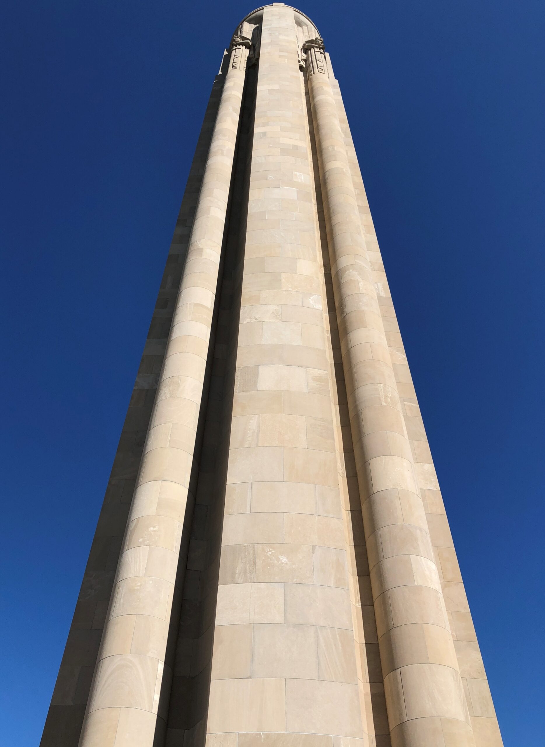
The National World War I Museum and Memorial started as a local memorial soon after the war ended. Long enough ago that Vice President Coolidge was at the groundbreaking, as was Gen. Pershing and a number of other Allied military luminaries. Local, perhaps, but with the heft of a national memorial, designed by Harold Van Buren Magonigle, who was known for his memorial work.
Magonigle’s limestone tower soars.
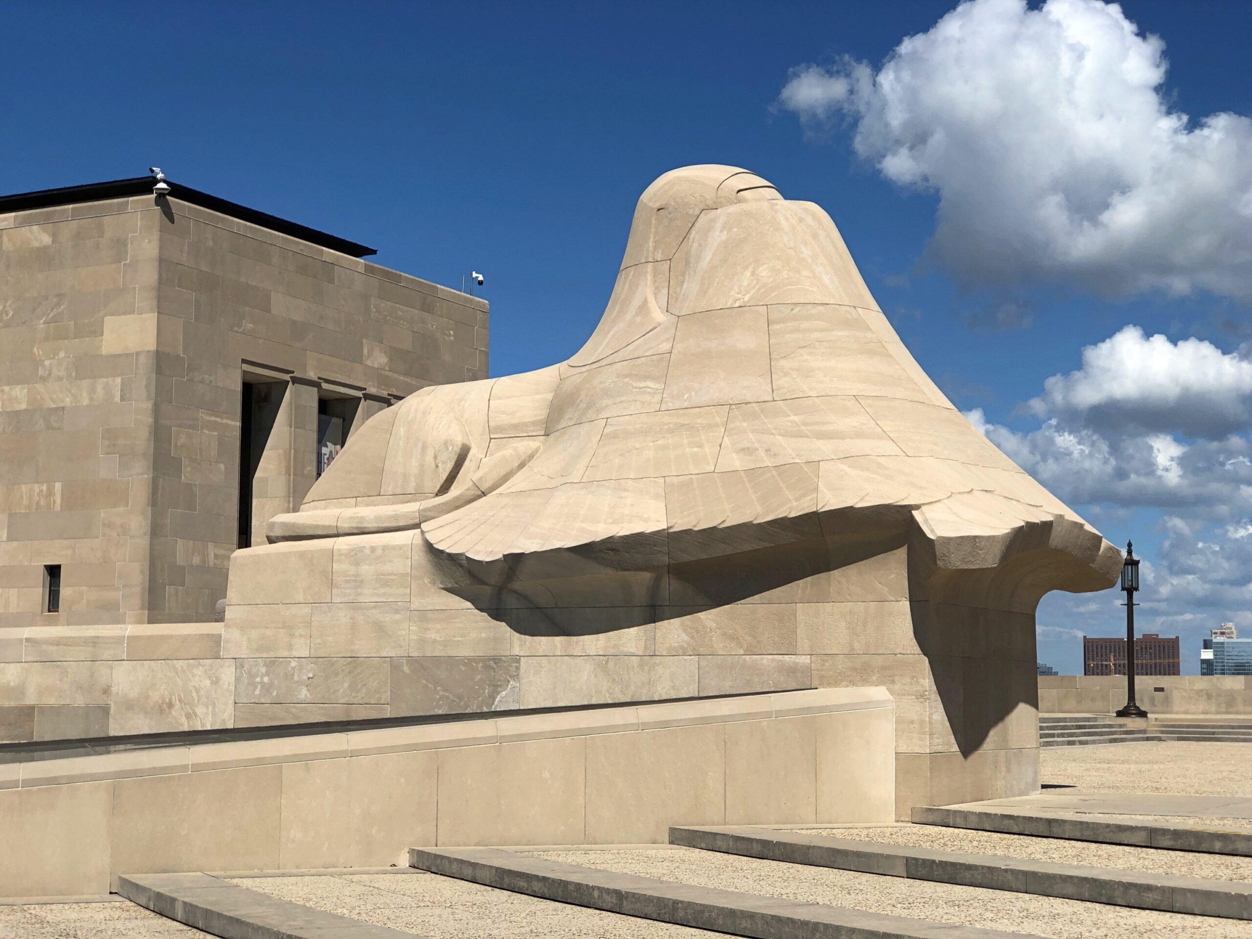
Sphinxes crouch near the shaft, supposedly covering their eyes from the horrors of war.
Naturally the memorial went through a period of neglect, and the museum came later, as the site evolved from a local to a national memorial, finally acknowledged as such by Congress in 2004. I’m glad to report that now the memorial stands renewed, and the museum, built under the memorial, is first rate. Beginning at the entrance: One enters the museum over a glass bridge that crosses a field of 9,000 red poppies, each representing 1,000 combatant deaths during the war.
As usual with any good museum, there is more than you can absorb in one go, organized in two wings: the war before U.S. entry, and after. All together, it holds more than 350,000 items, a collection comparable with the likes of the Imperial War Museum or the Musée de la Grande Guerre du pays de Meaux.
The museum’s scope is wide ranging as well, including not just the U.S. part, but perspectives and memories from people from all of the major participating nations, and some smaller ones. There was even a small display, including a map that explained things well, about the Japanese participation in the war. Japan joined the Allied side early in the game, taking the opportunity to kick the Germans out of China and seize Germany’s scattered possessions in the Pacific. A low cost, high-gain exercise for Japan, unlike the next war in the Pacific.
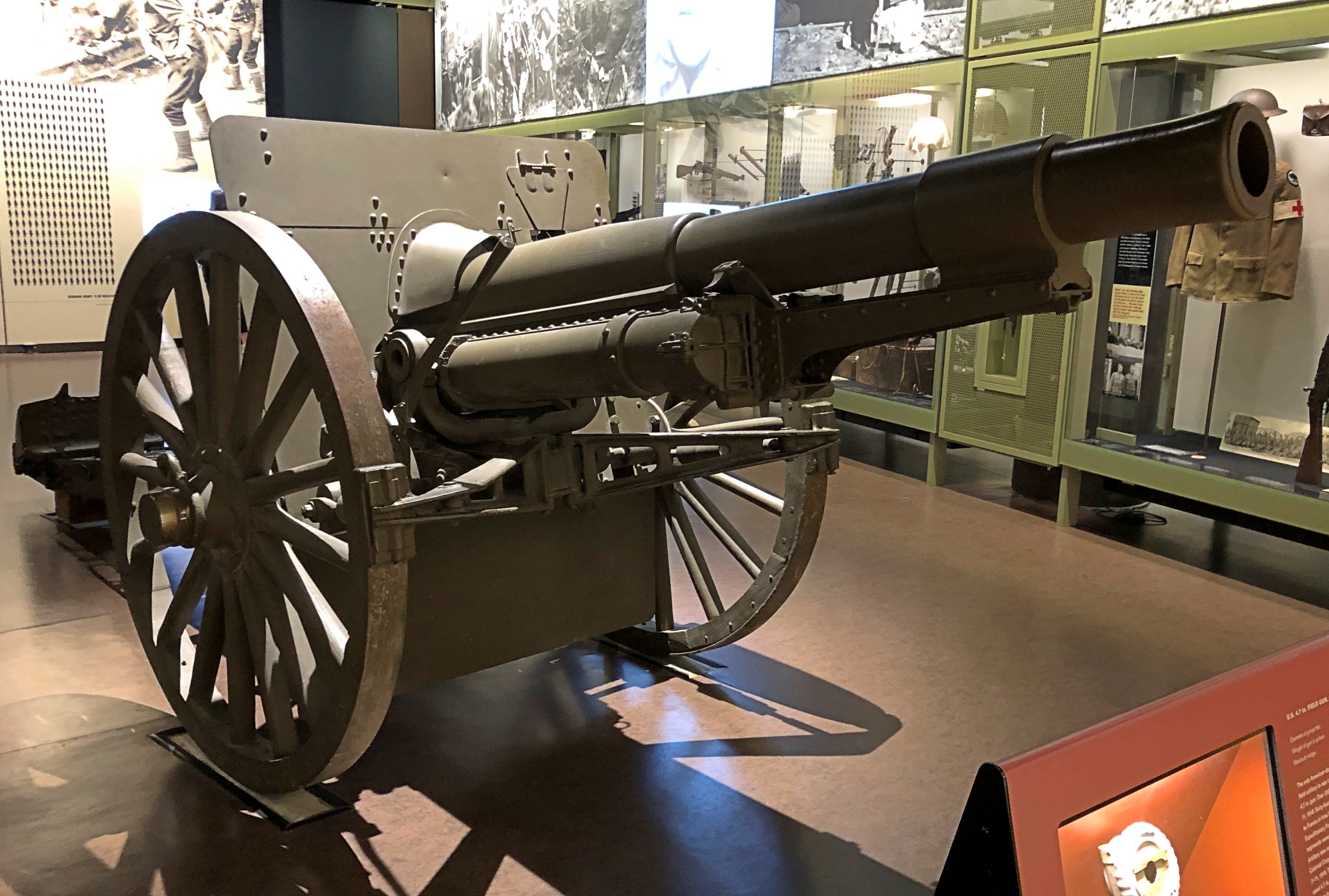
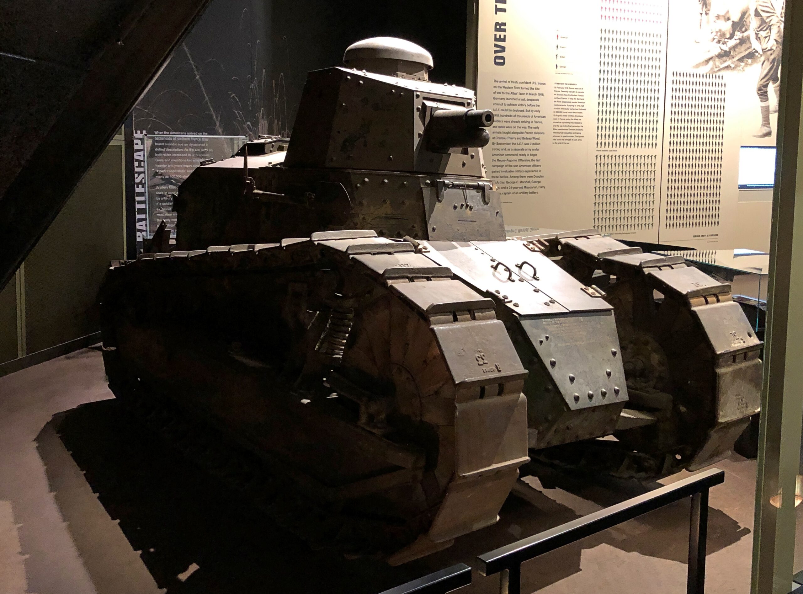
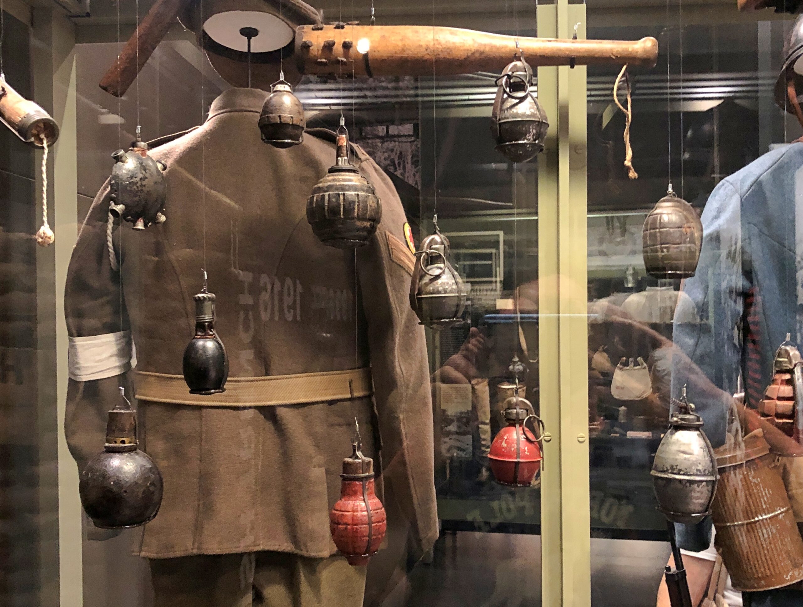
Artifacts were large and small.
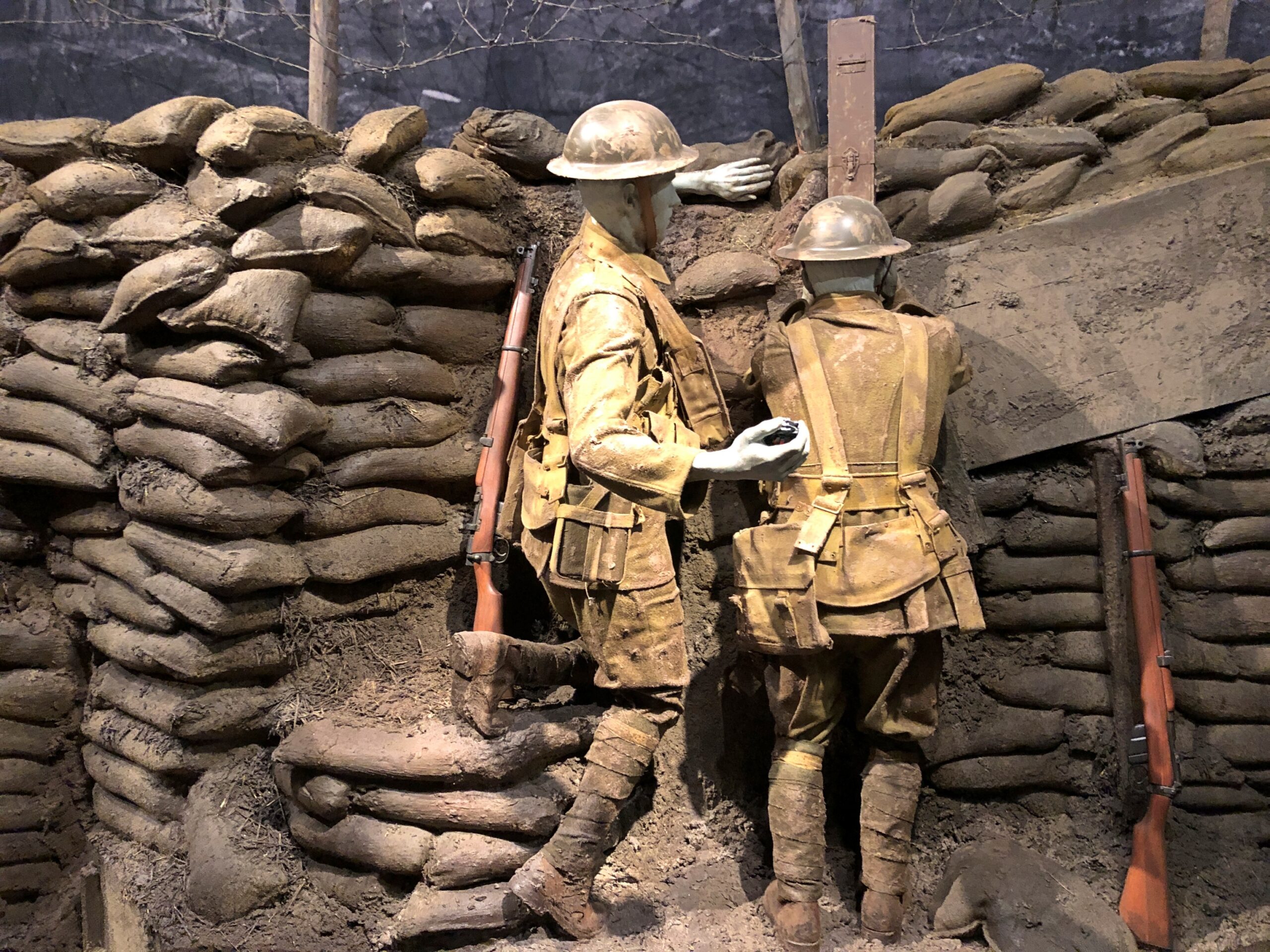
There are only a few life-sized dioramas – there are more to be found at the National WWII Museum in New Orleans – but the WWI museum did a good job of it.
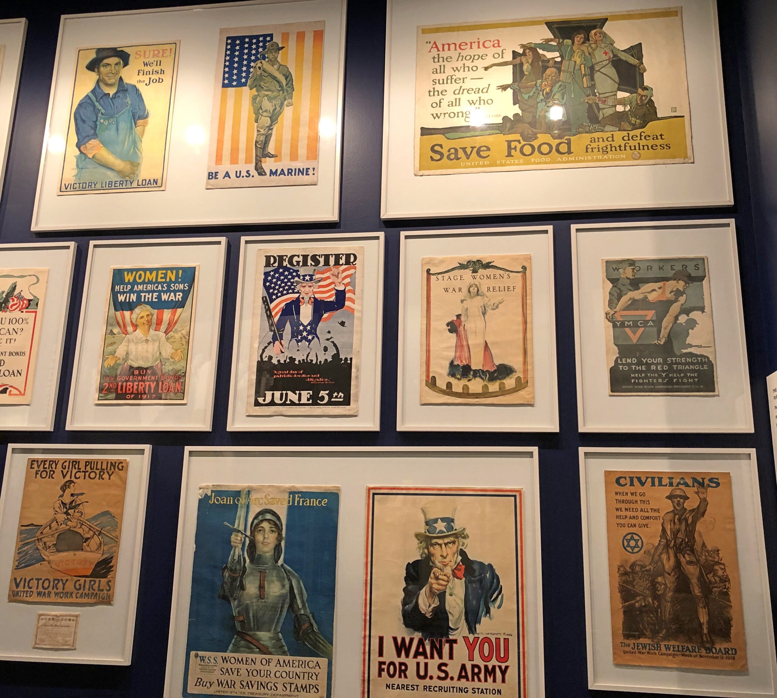
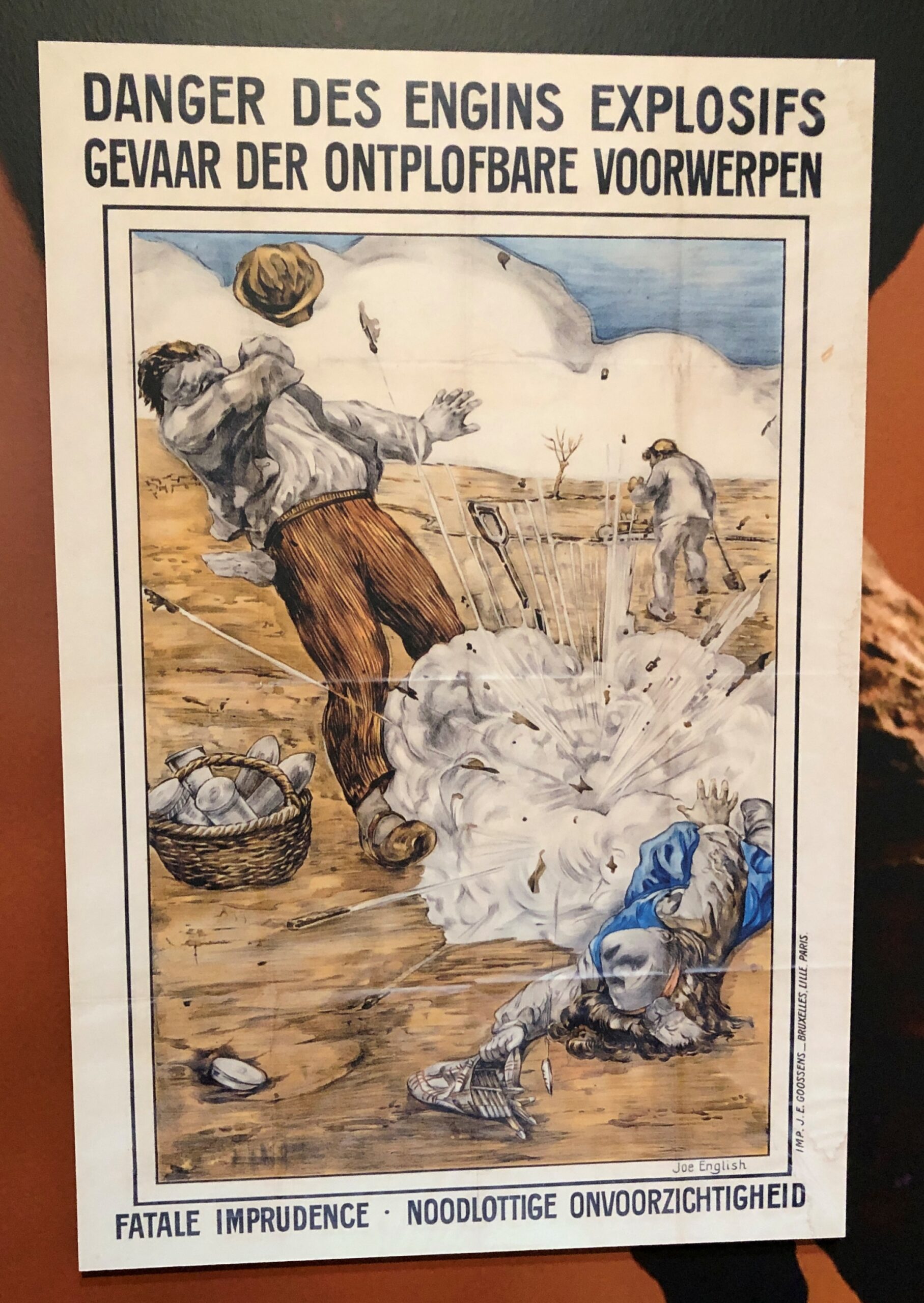
I was particularly taken with the posters. I’d never seen most of them.
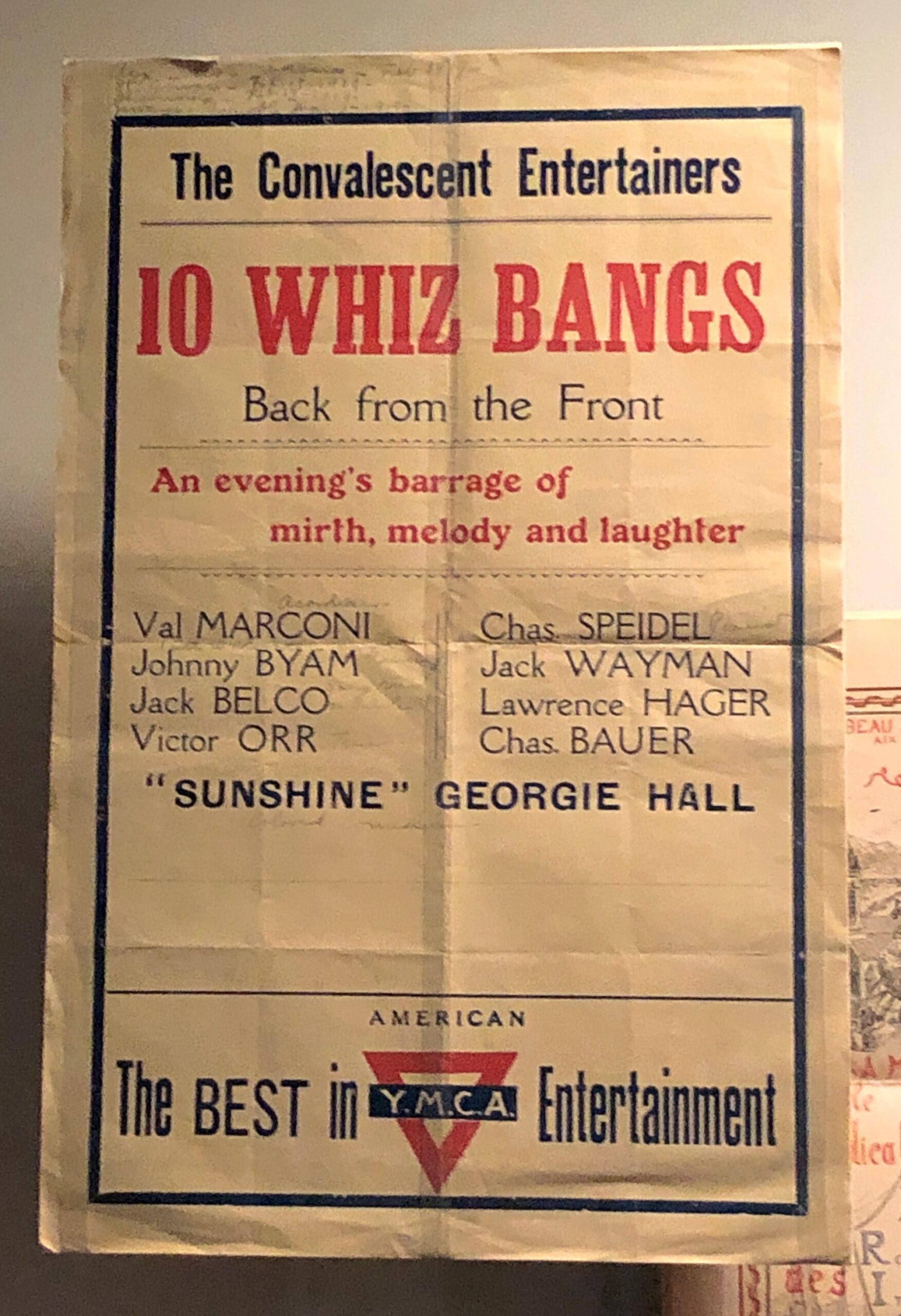
The 10 Whiz Bangs, even though there are only nine names listed. Then I realized that, at least symbolically and maybe literally, the 10th man hadn’t made it home, like so many.
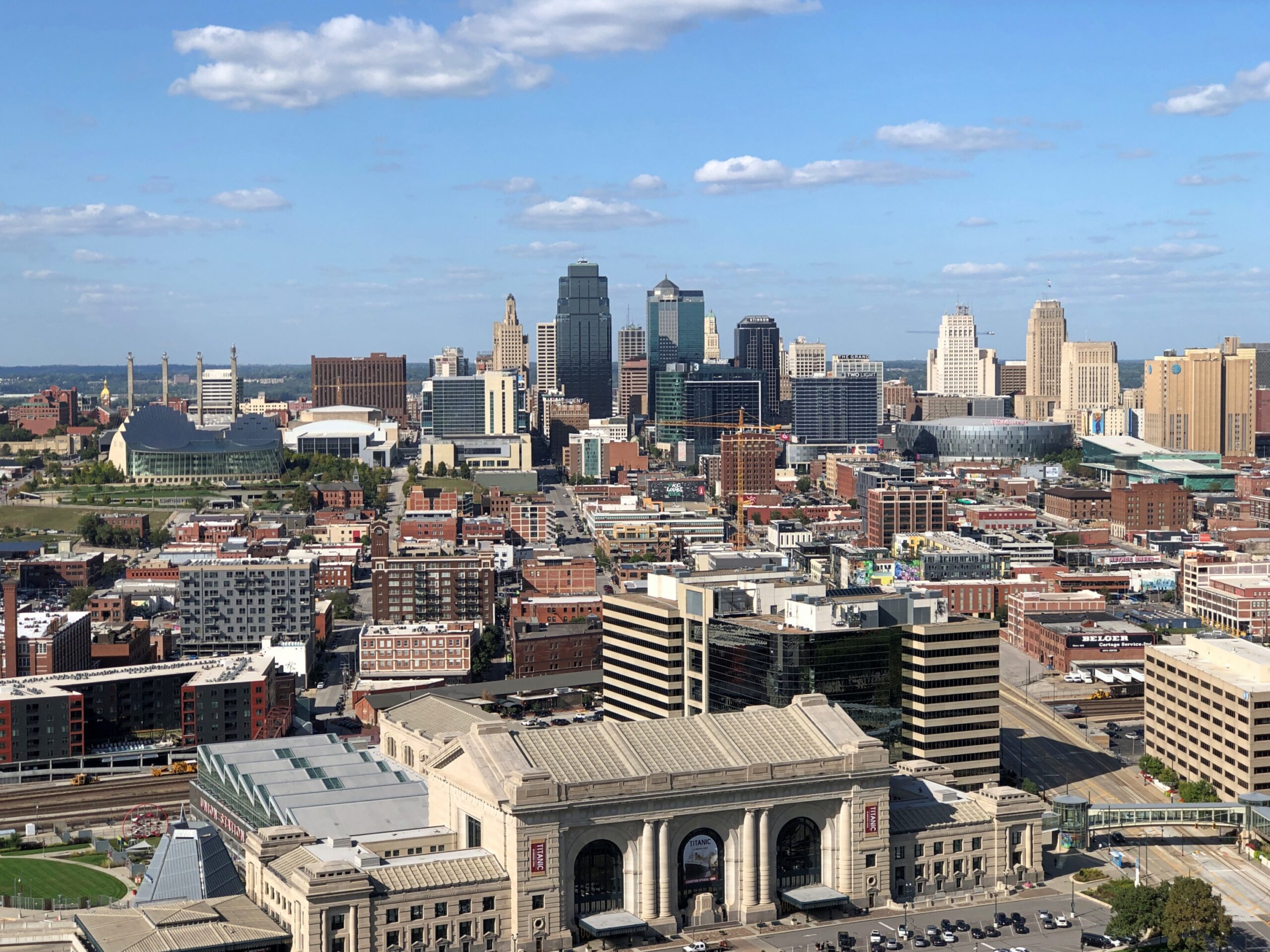
After visiting the museum, the thing to do is take the elevator to the top of the memorial, for a modest extra fee. Elevator, then iron circular stairs, actually, for an excellent view of downtown Kansas City.
Cold winds rolled through northern Illinois today. Seven inches of snow are forecast for Saturday. What? Right, it’s winter. The winter solstice is just the shortest day of the year.
Back to posting on Sunday. Regards for Thanksgiving.
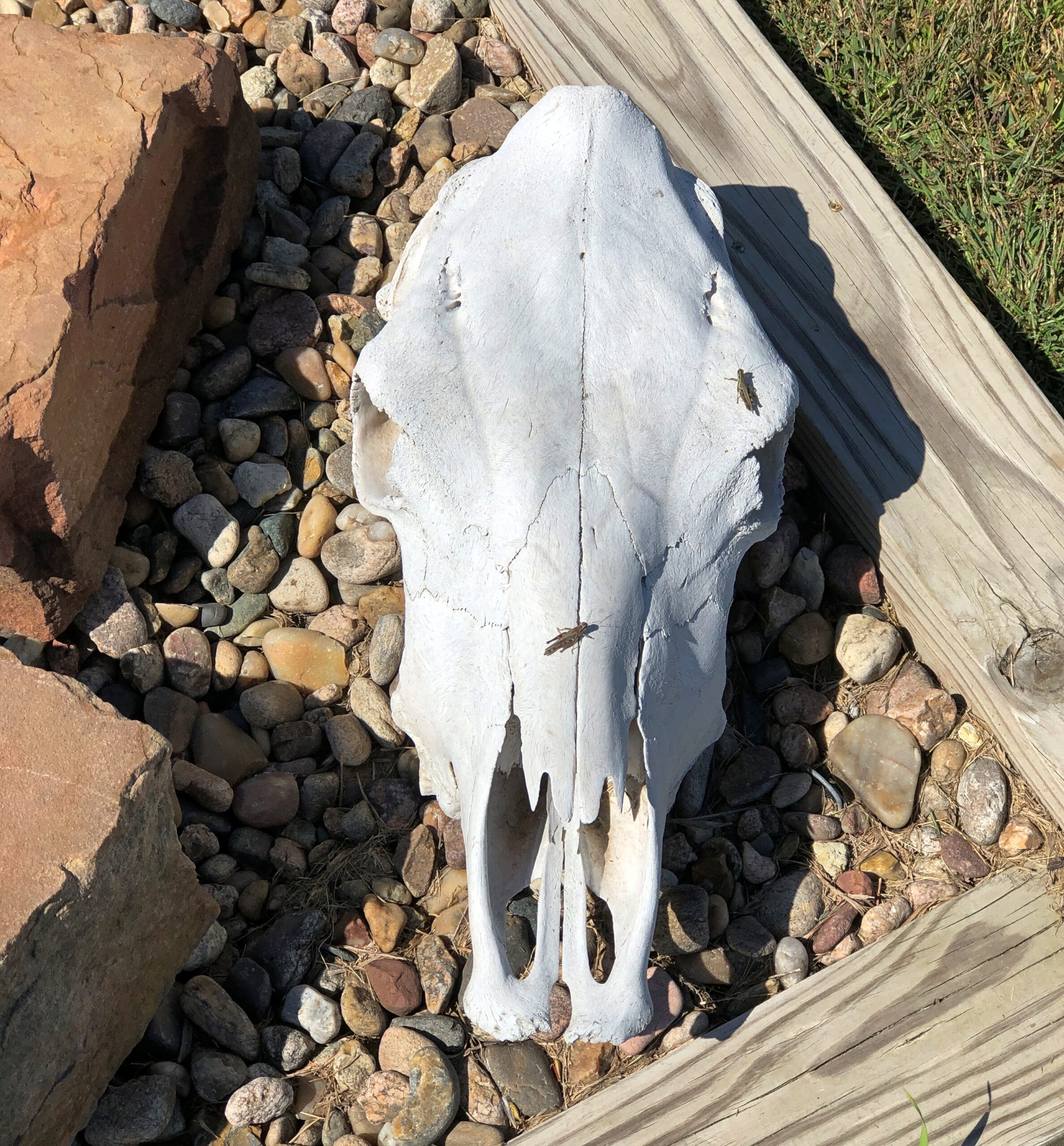
Something to upset PETA sympathizers.
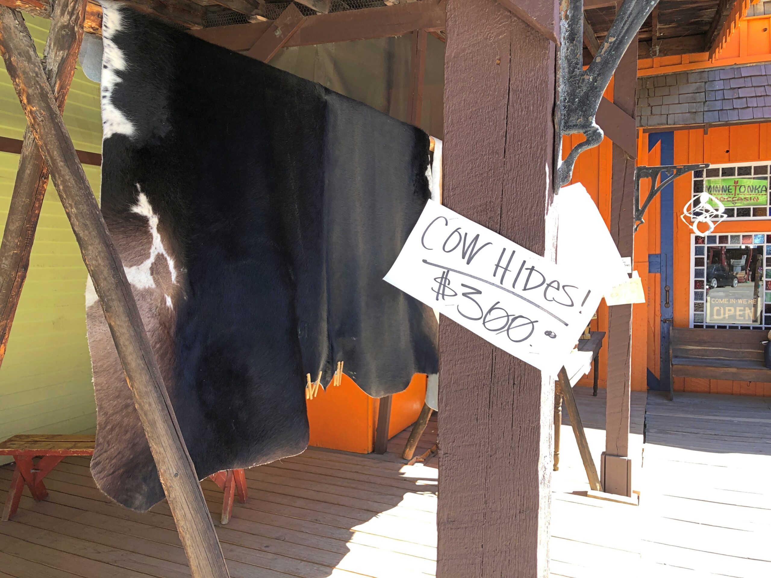
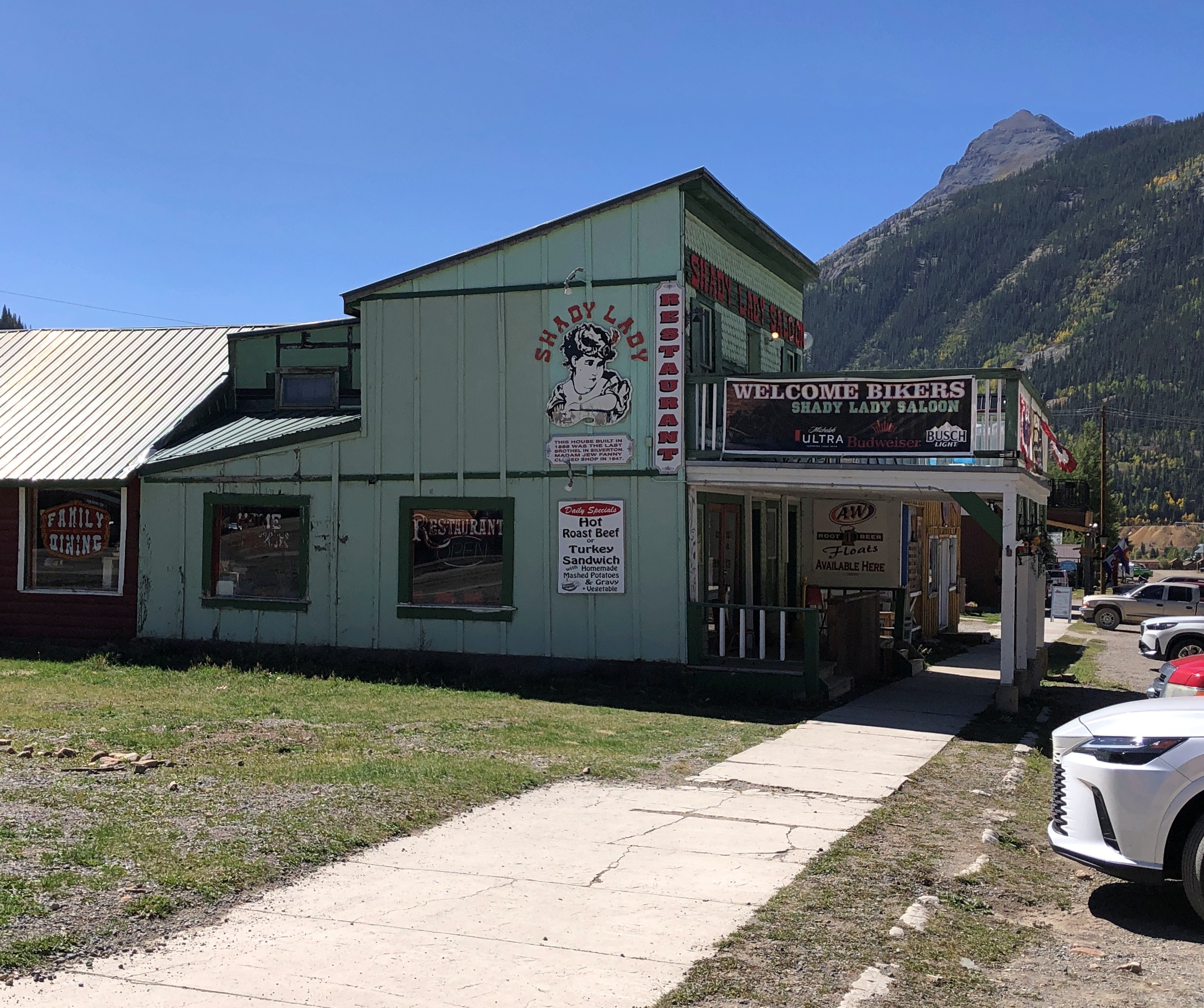
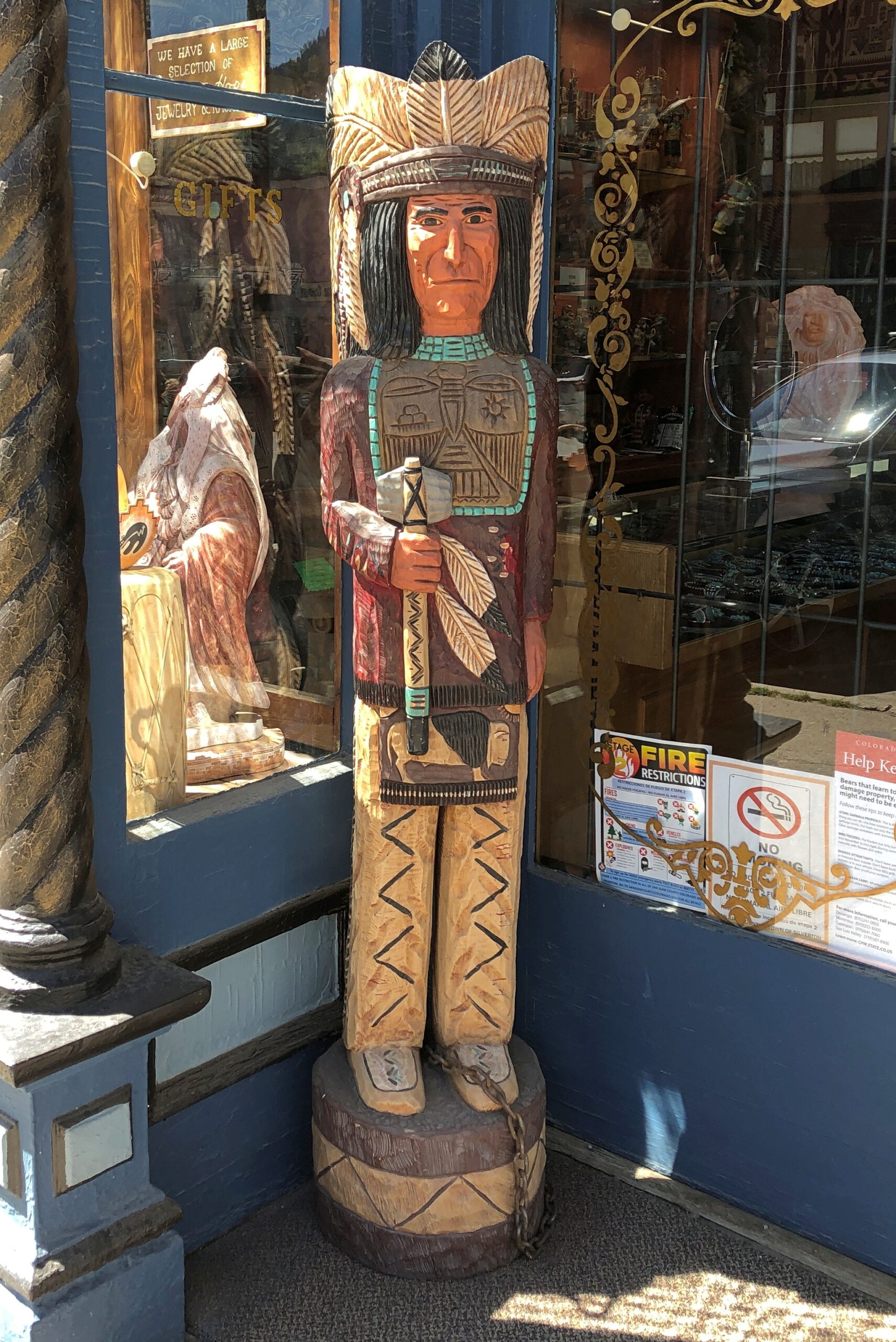
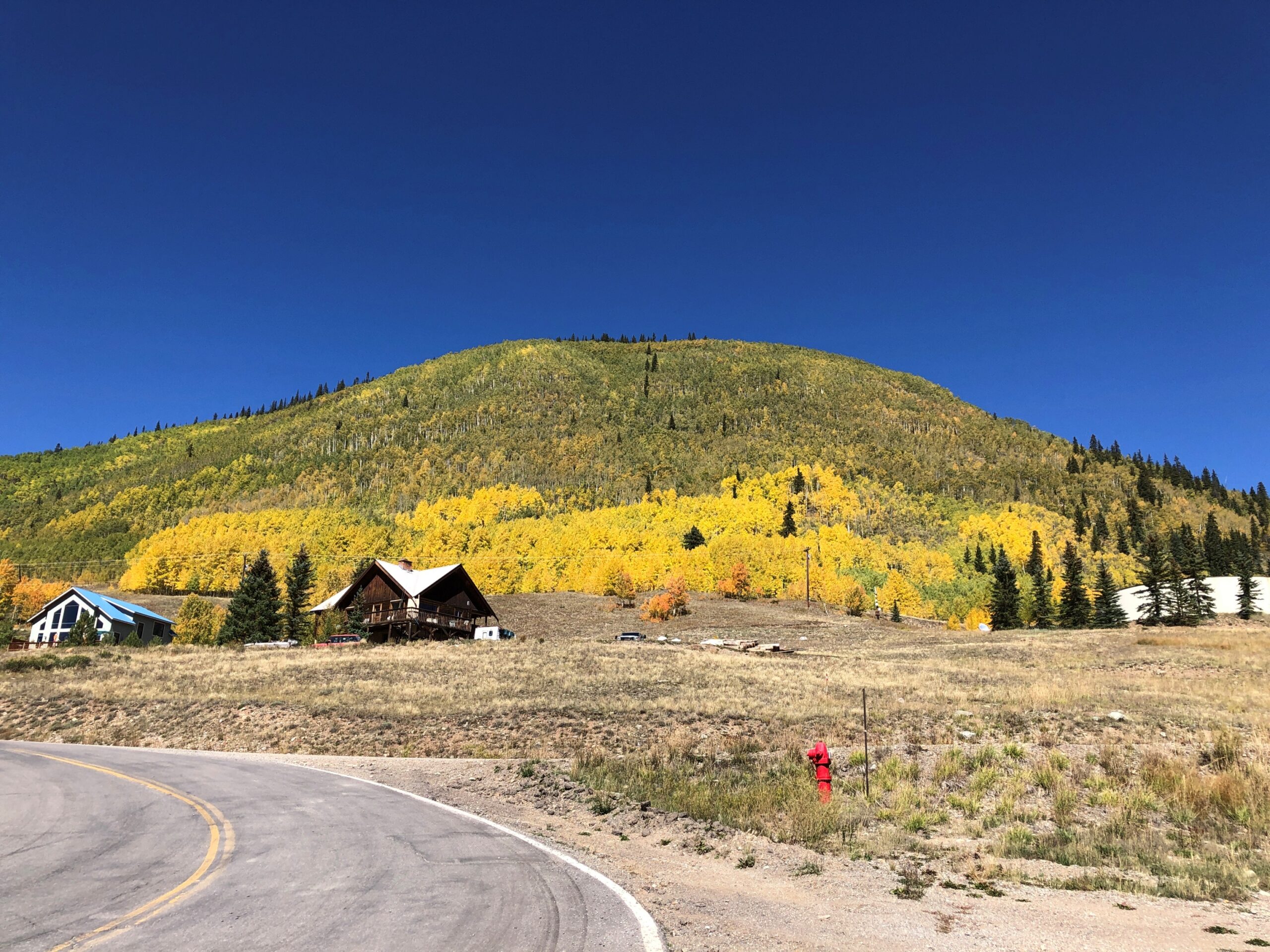
Stroll down Greene St. in the mountain town of Silverton, Colorado, at least in mid-September this year, and you’d have had the opportunity to buy a hide for $300. We did, but declined. Still, it wasn’t just a Colorado detail, but a Western one. The West, where men are men and cow hides hang in the sun. As far as I could tell, you couldn’t buy a hide with Bitcoin, but I suppose you’d have to ask the seller to be sure.
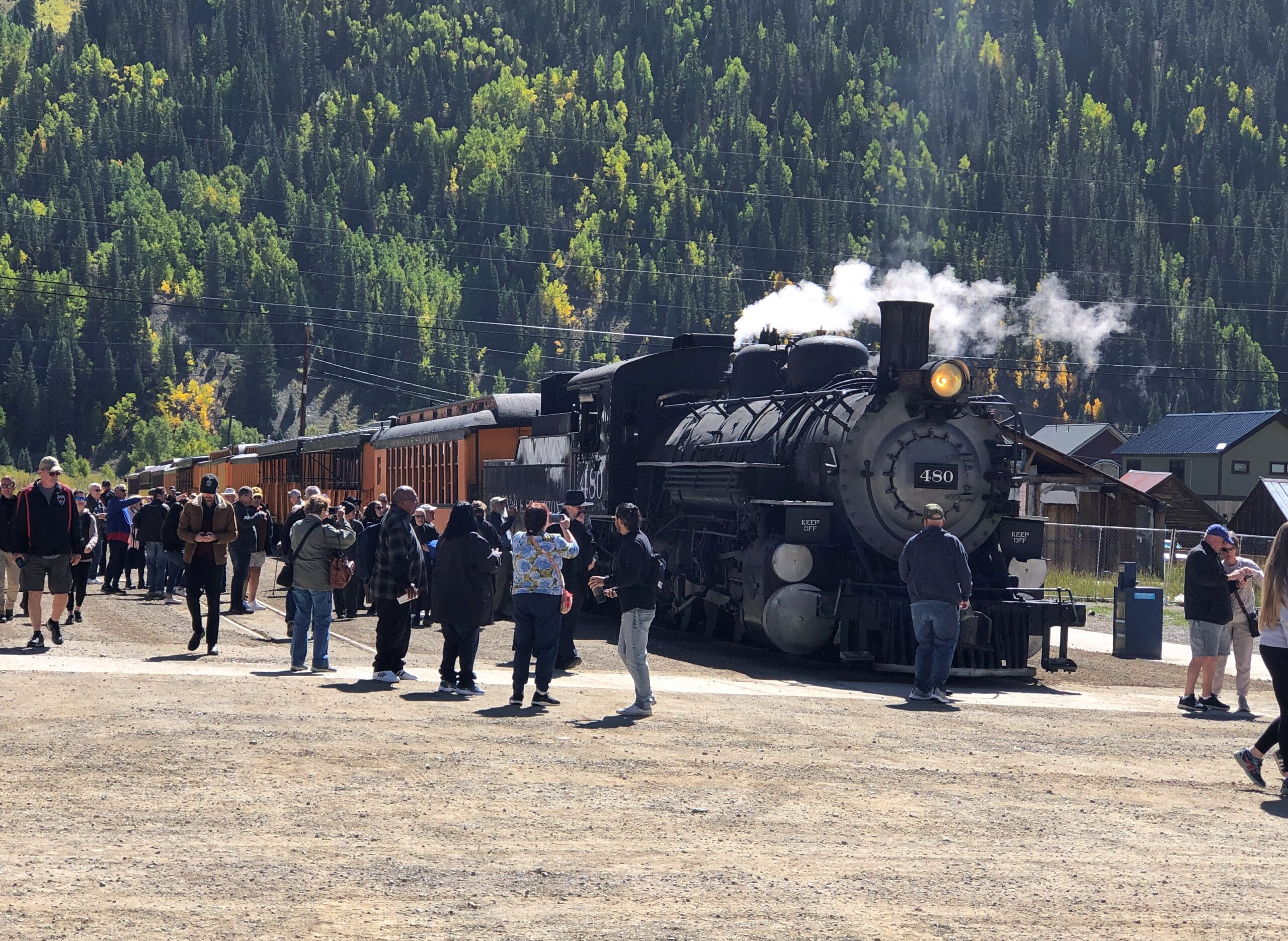
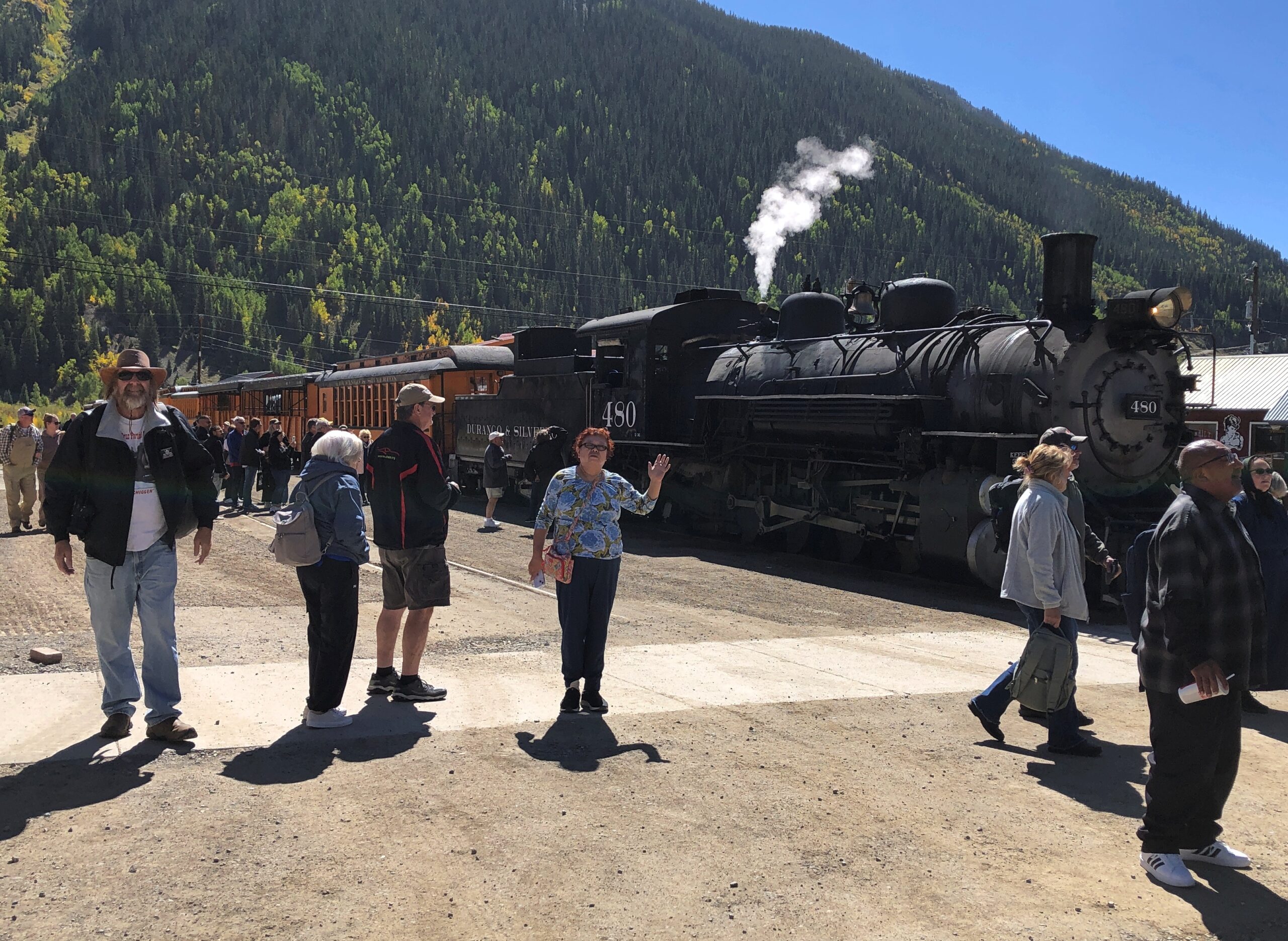
Not five minutes after we’d parked off the main thoroughfare of Greene Street in Silverton, on a large side street, a steam locomotive hauling a valuable cargo — tourists — pulled into town, a block from where we parked. The Durango & Silverton Narrow Gauge RR train from Durango had arrived. Instantly the streets around the train were thick with those same tourists who had paid roughly $100 a head for the scenic ride, though I suppose many, the majority maybe, had gotten a slight discount as seniors.
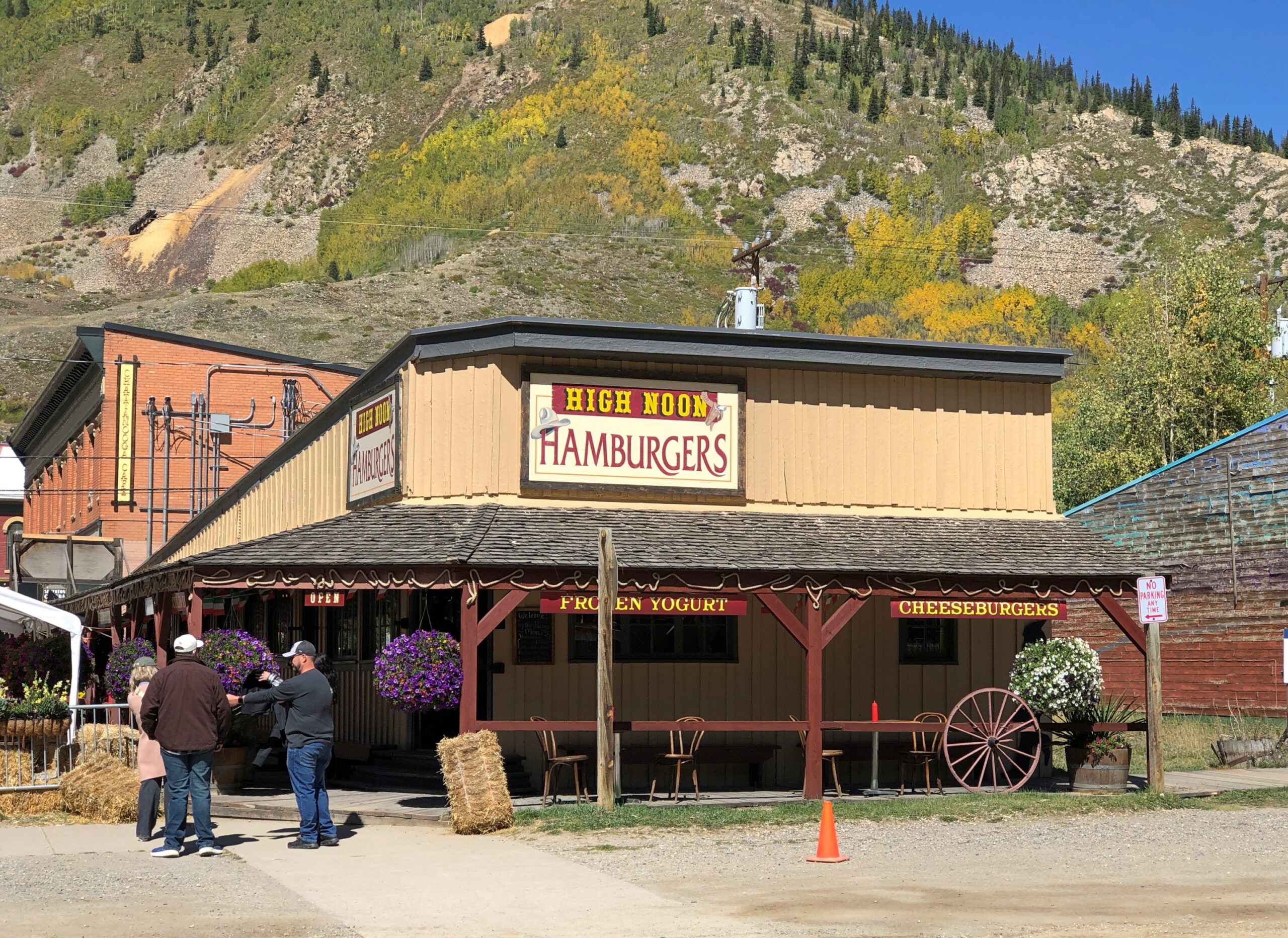
I assume the economy of 21st-century Silverton depends pretty heavily on these arrivals, at least in the warm months, as day after day the line disgorges its many passengers for their layover. No doubt the likes of High Noon Hamburgers or the Shady Lady or a lot of the other businesses in town wouldn’t be viable otherwise.
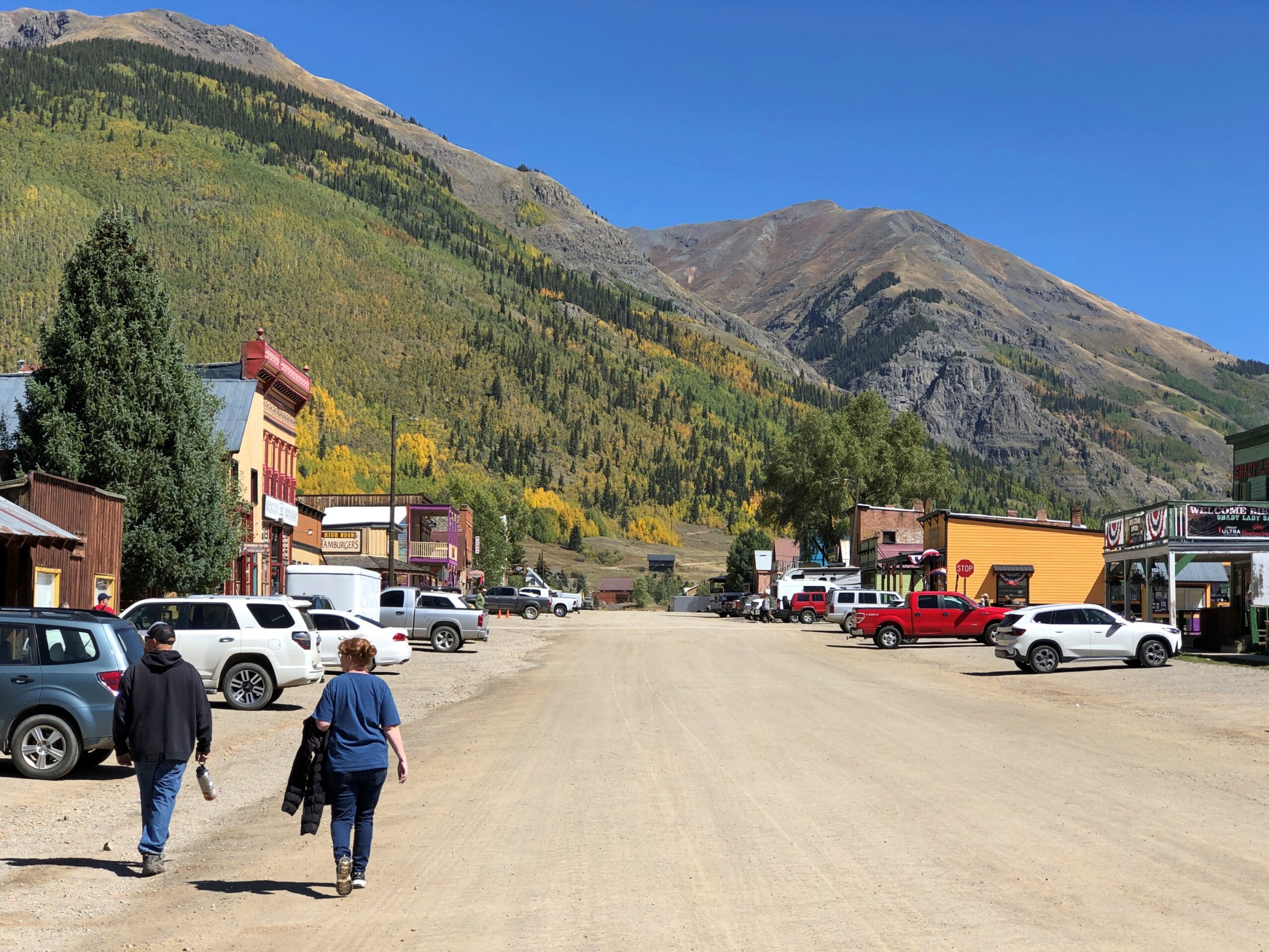
Blair St., paralleling Greene St. a block away. No need for pavement.
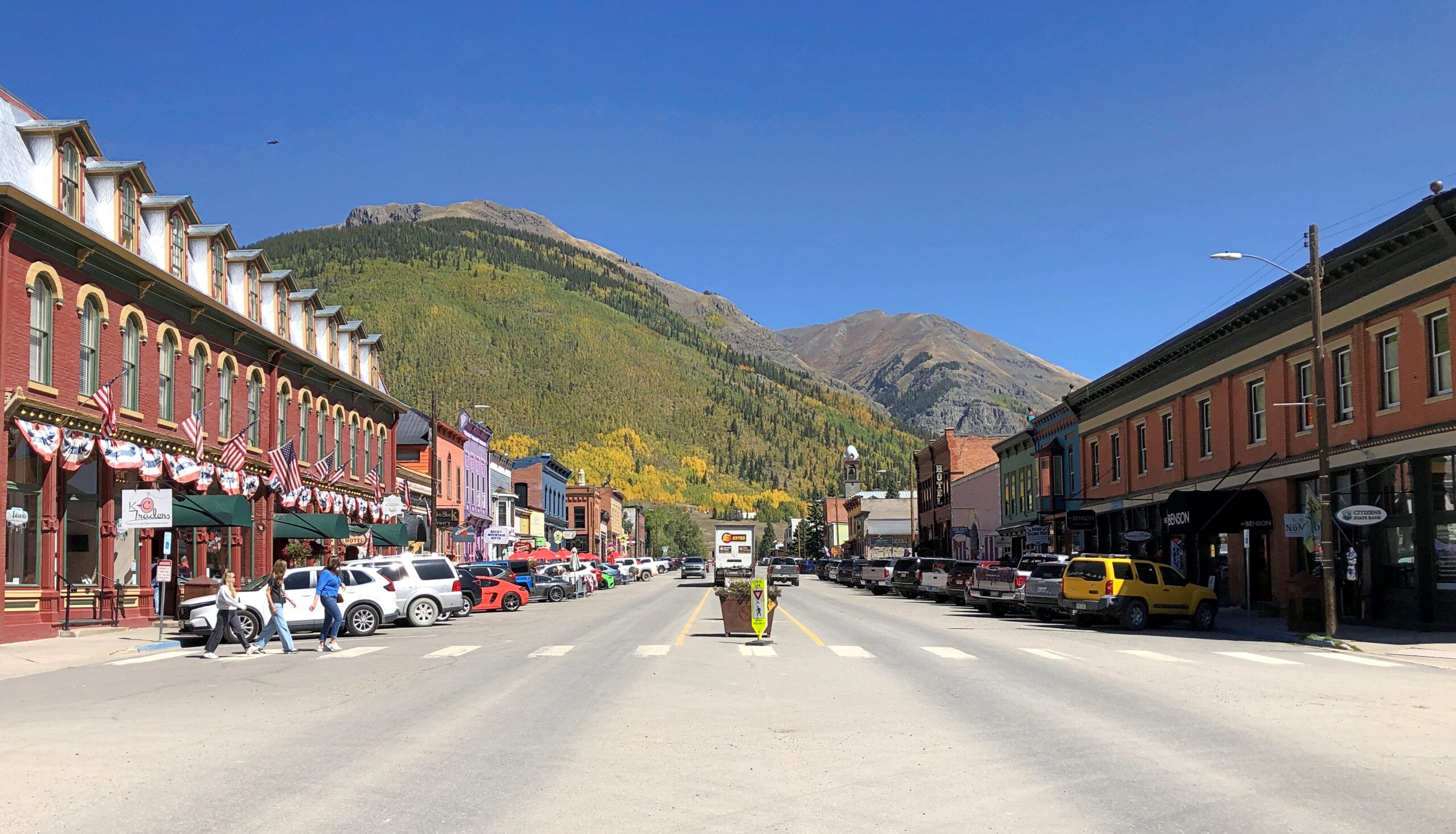
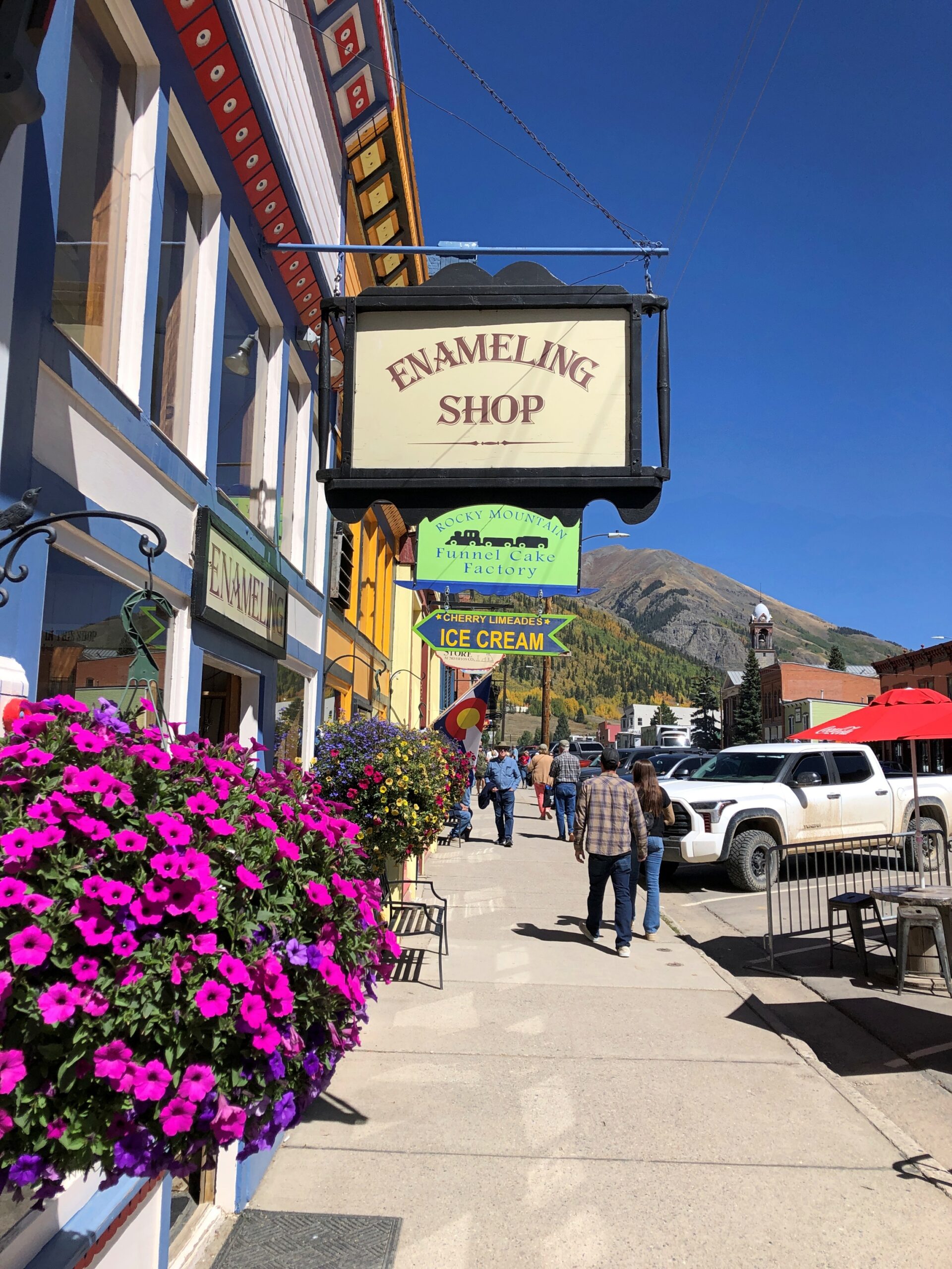
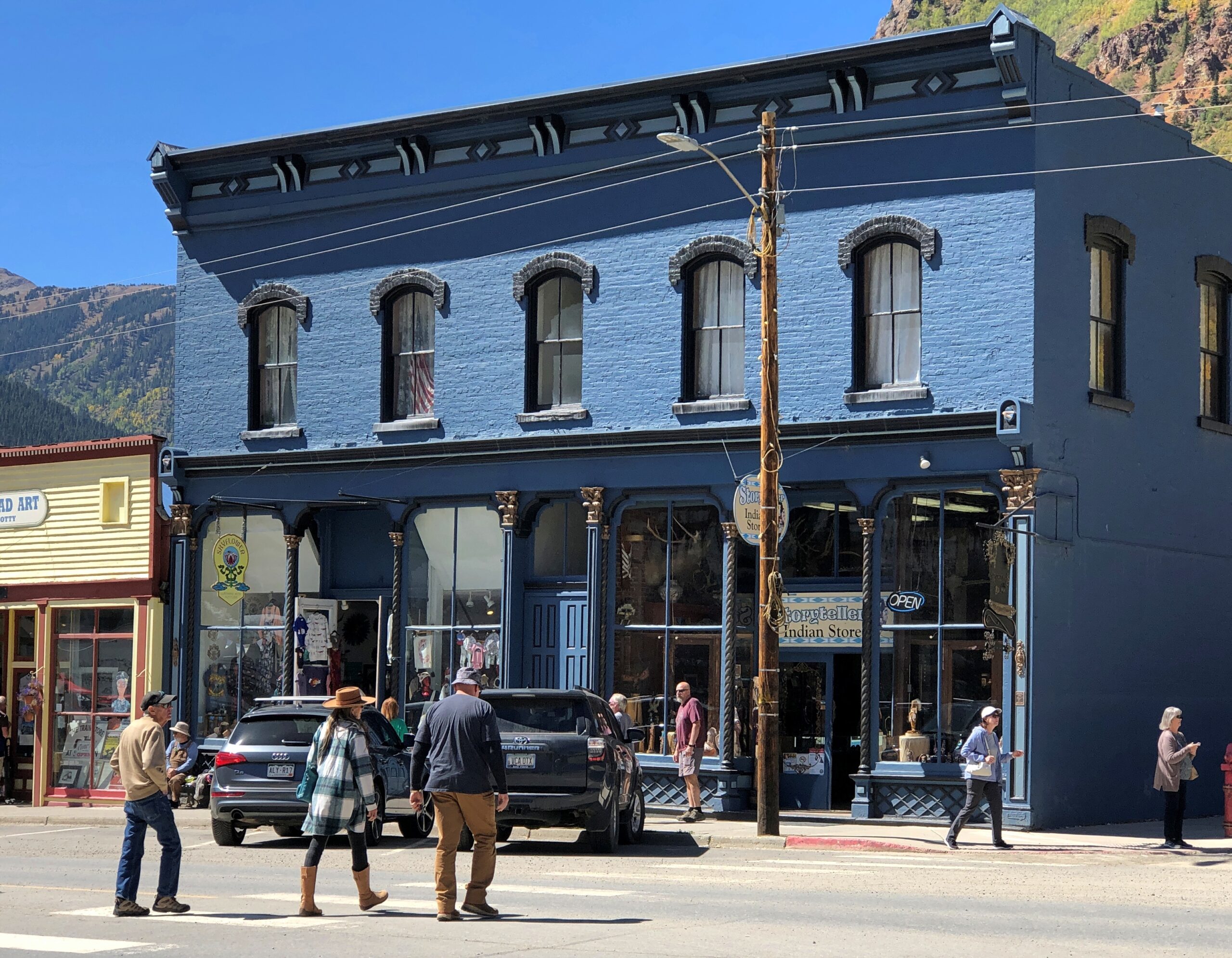
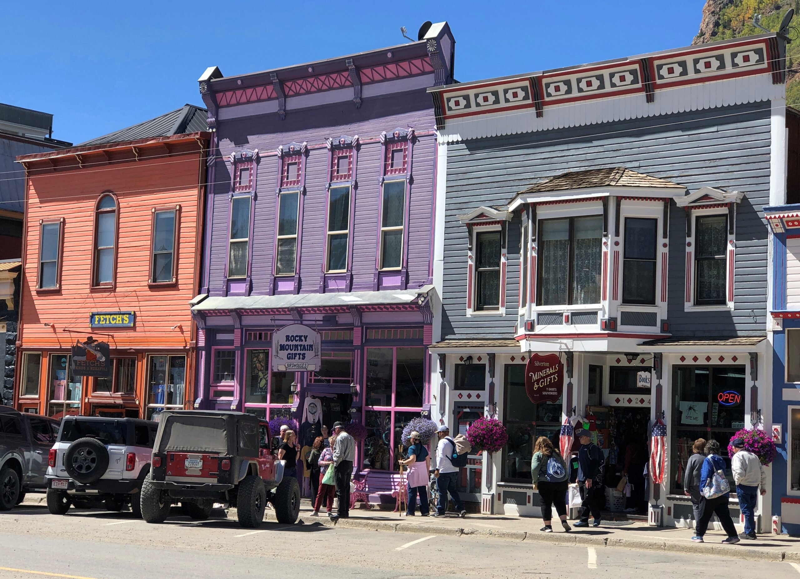
Greene St.
Lots to see on Greene.
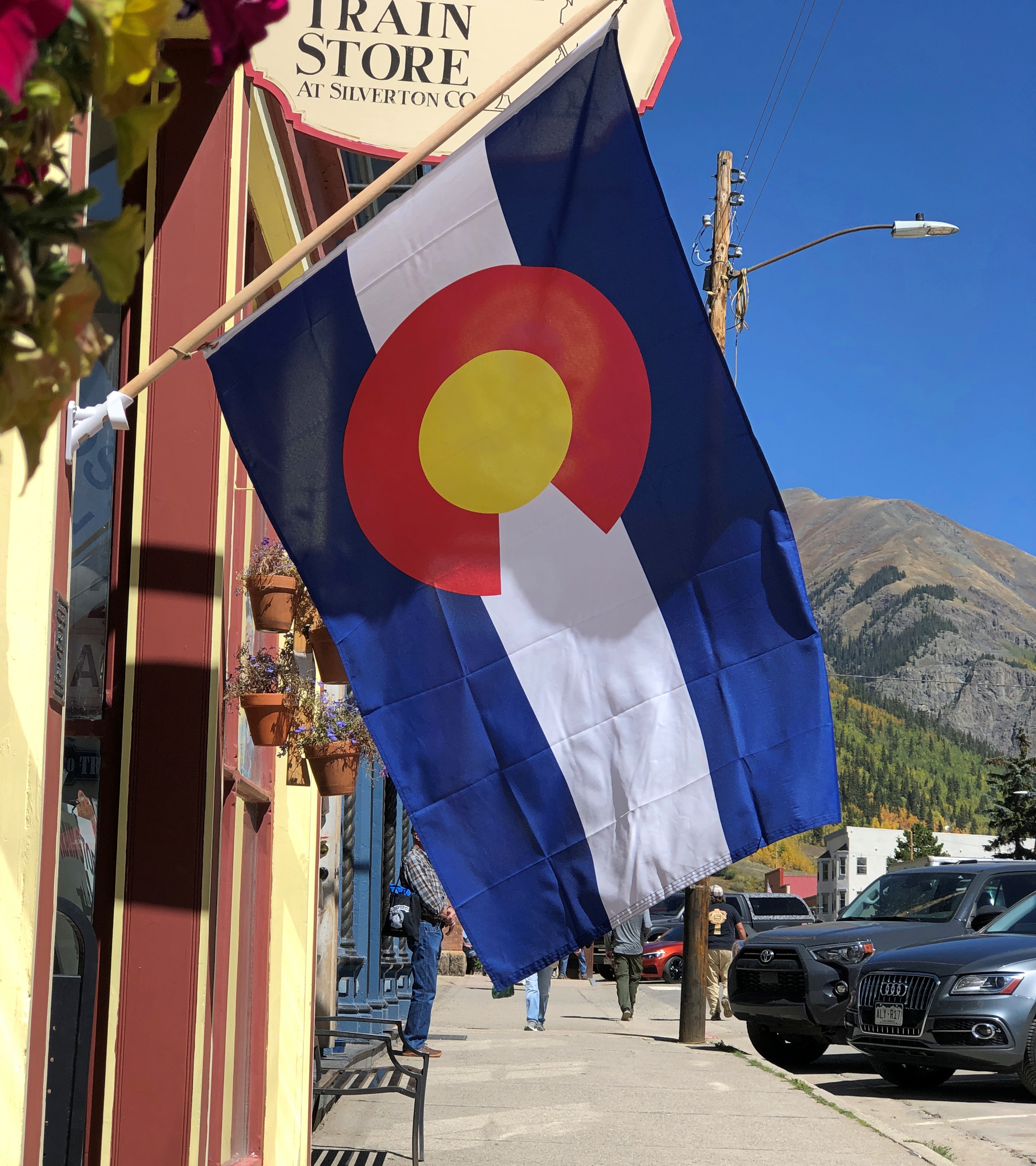
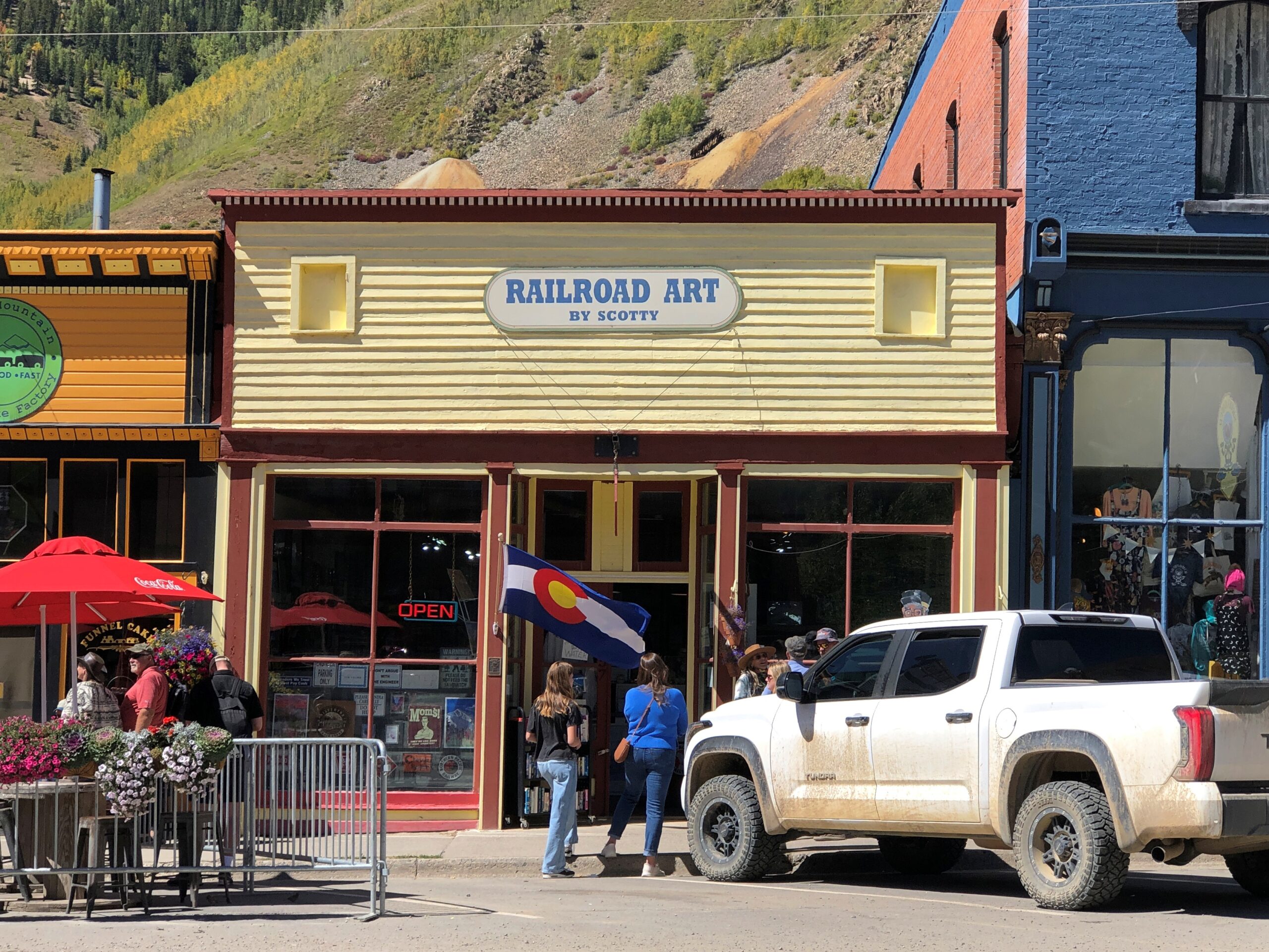
Including the fine Colorado flag, flying at Railroad Art by Scotty, a seriously cool gallery.
“Railroad Art by Scotty presents the custom matted and framed collector Railroad Art Prints by renowned railroad artist H.L. Scott, III,” its web site says. “These are not photographs and they are not created on the computer. These are pen & ink drawings created by Scott using the technique known as STIPPELING or pointillism.”
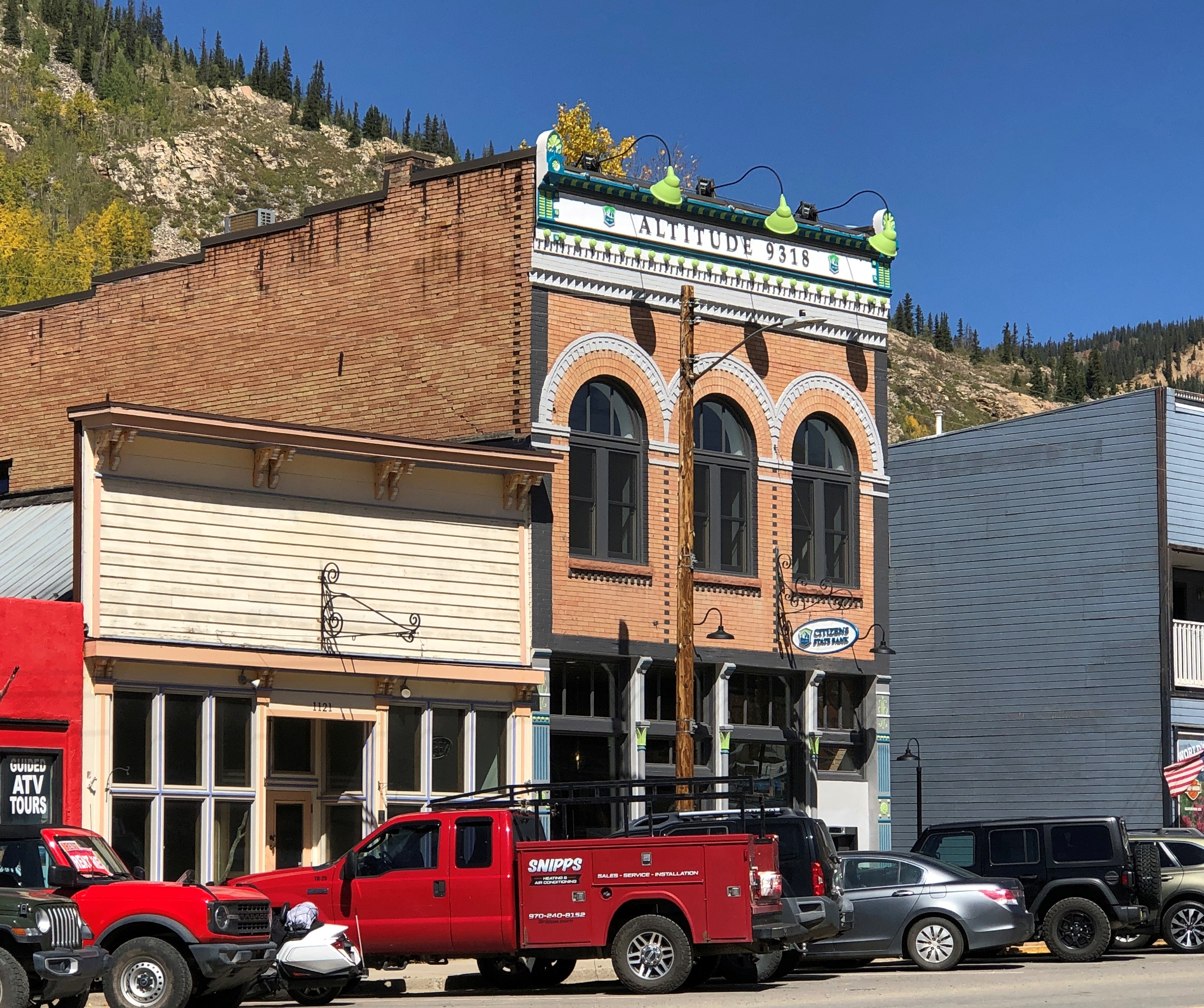
One of the few buildings I’ve seen that clearly states its elevation.
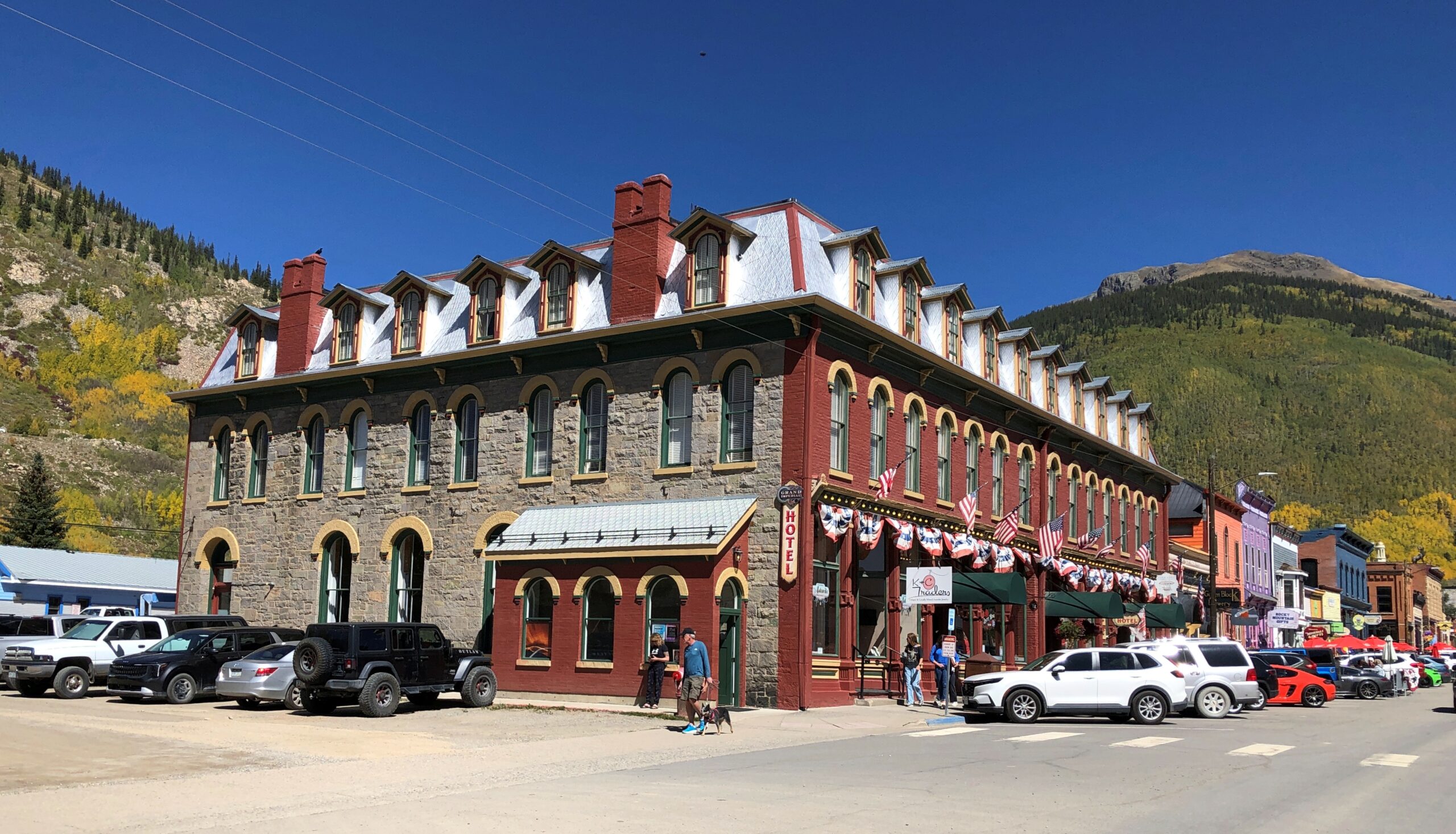
The Grand Imperial Hotel. A lofty name to live up to, but probably posh enough to do so.
Restored to its 1880s appearance in the 2010s, no doubt at considerable expense.
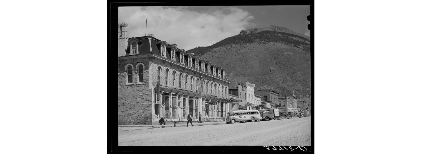
As it looked in 1940, a photo from the Library of Congress, Farm Security Administration-Office of War Information Photograph Collection.
More Greene St.
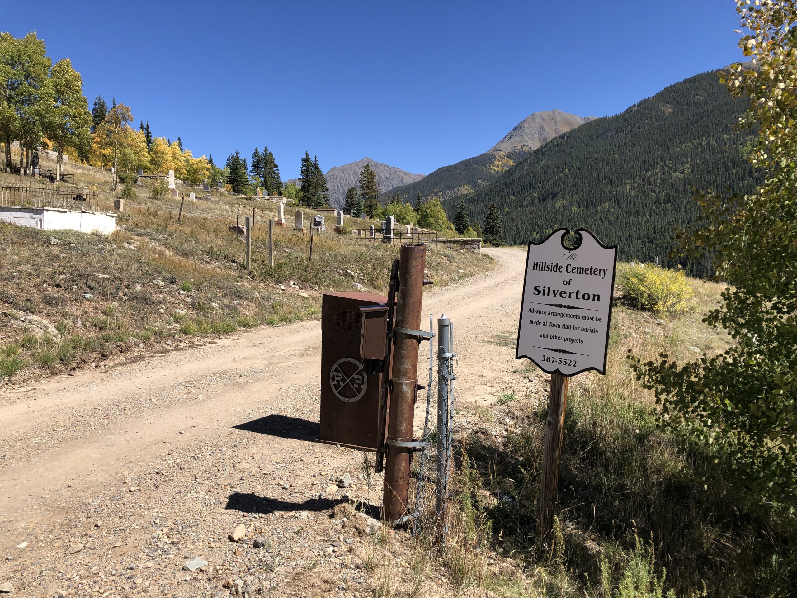
Greene is short, because Silverton isn’t very large, and so the street, now a road, soon heads for the hills.
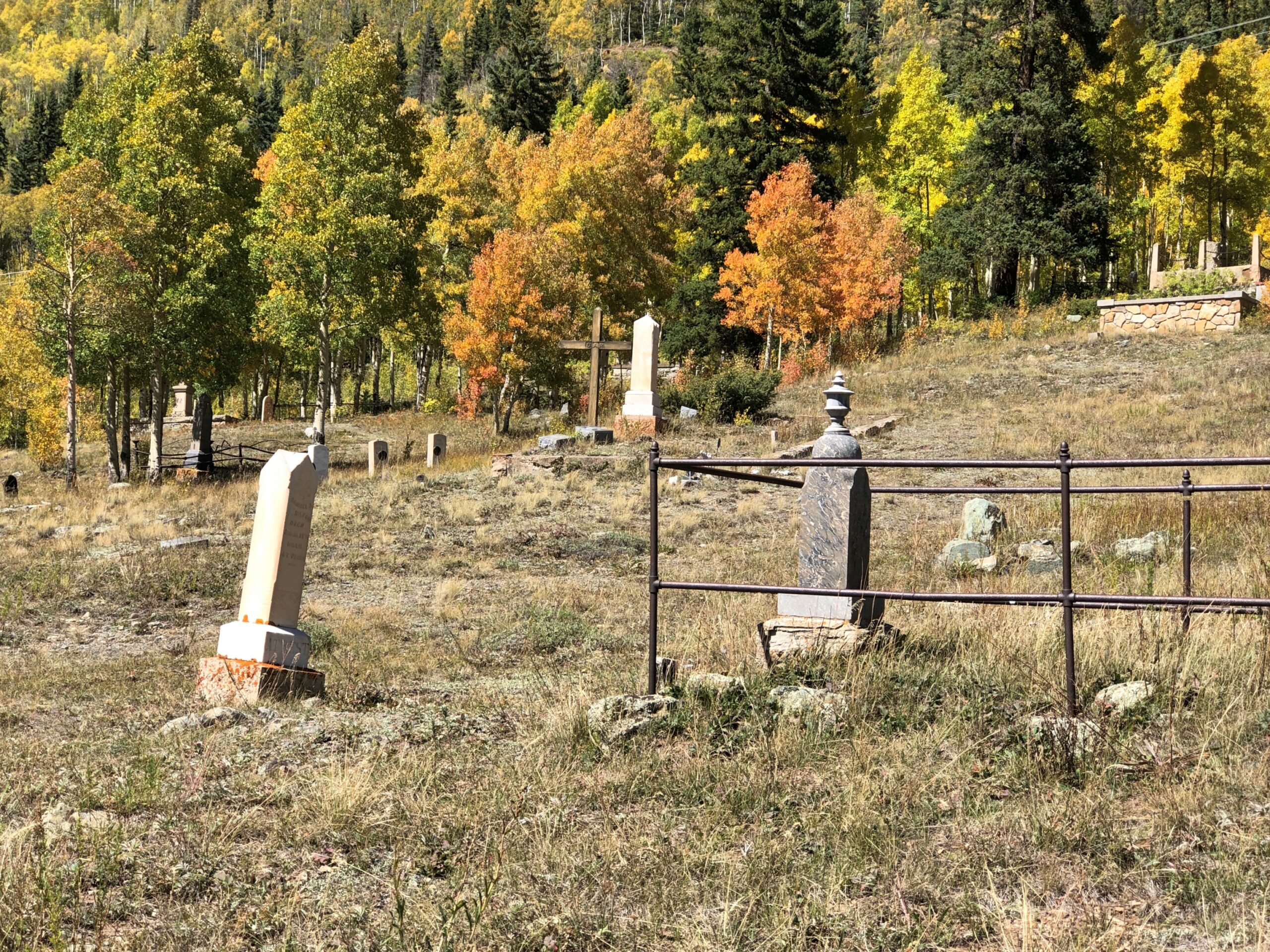
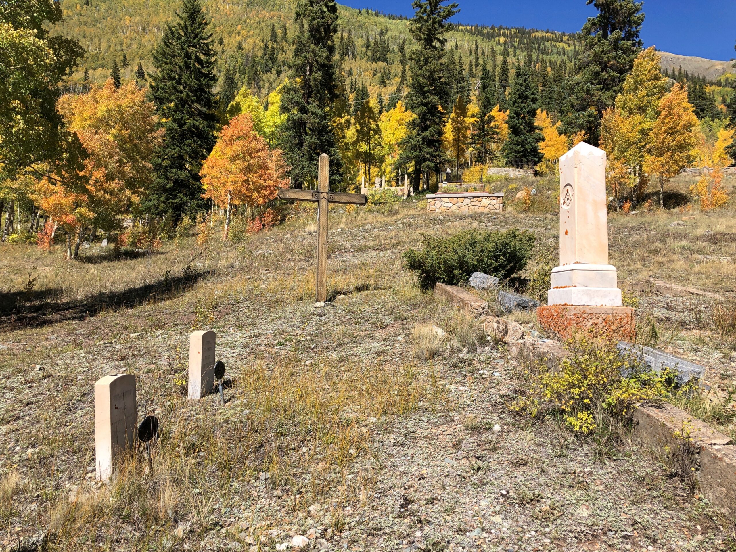
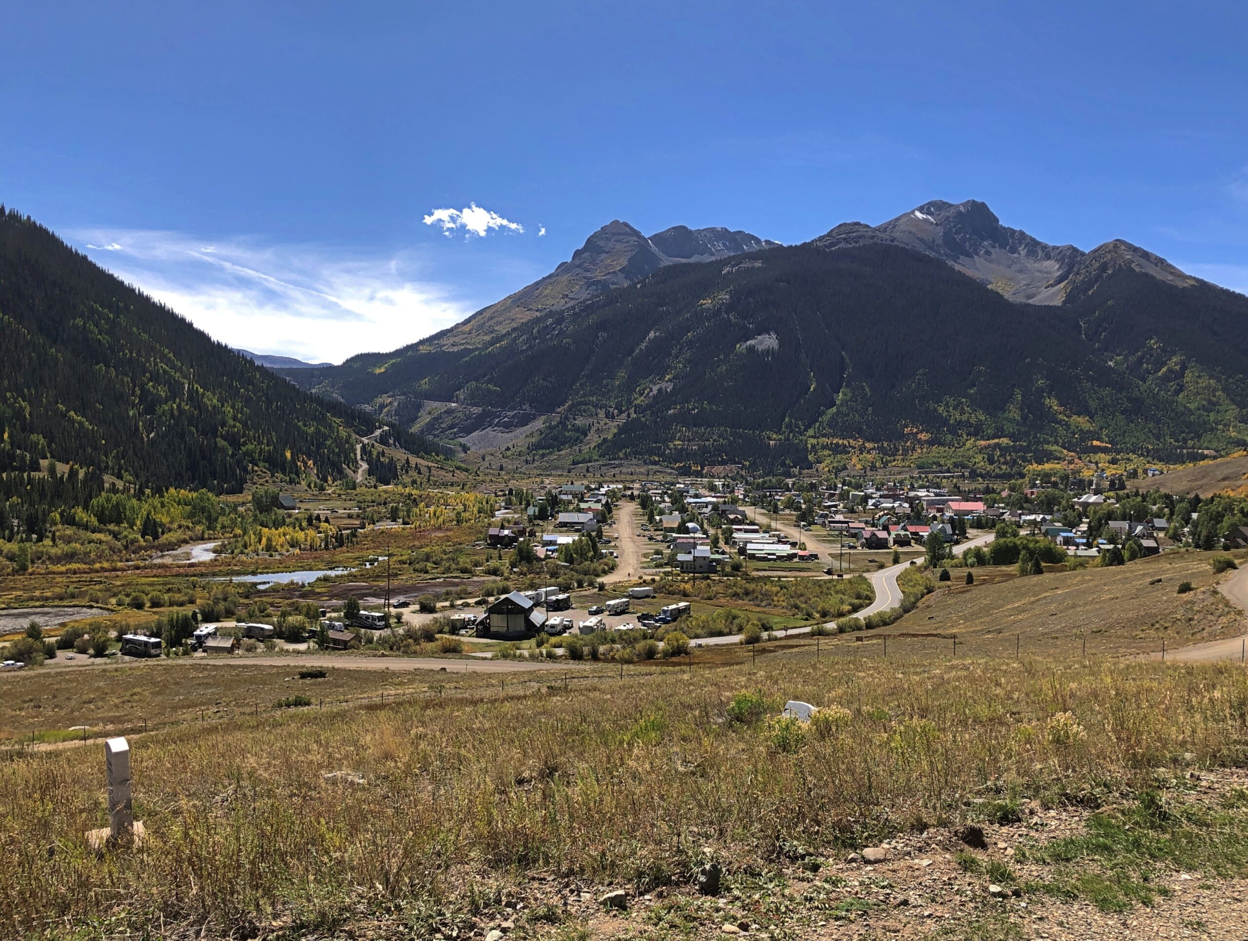
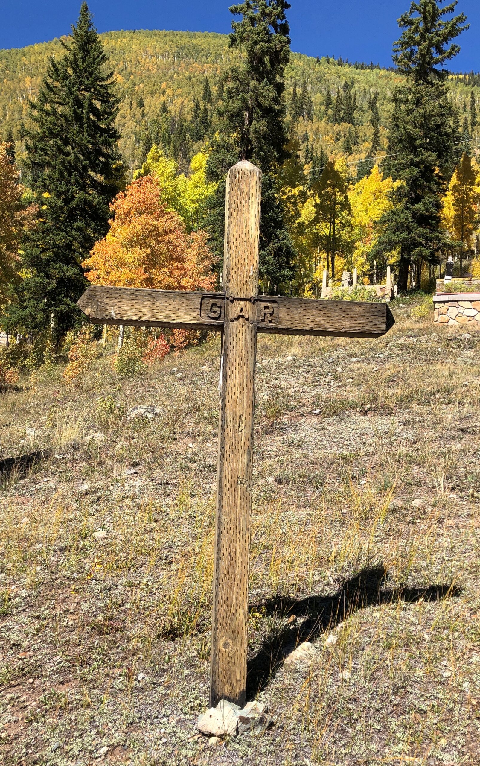
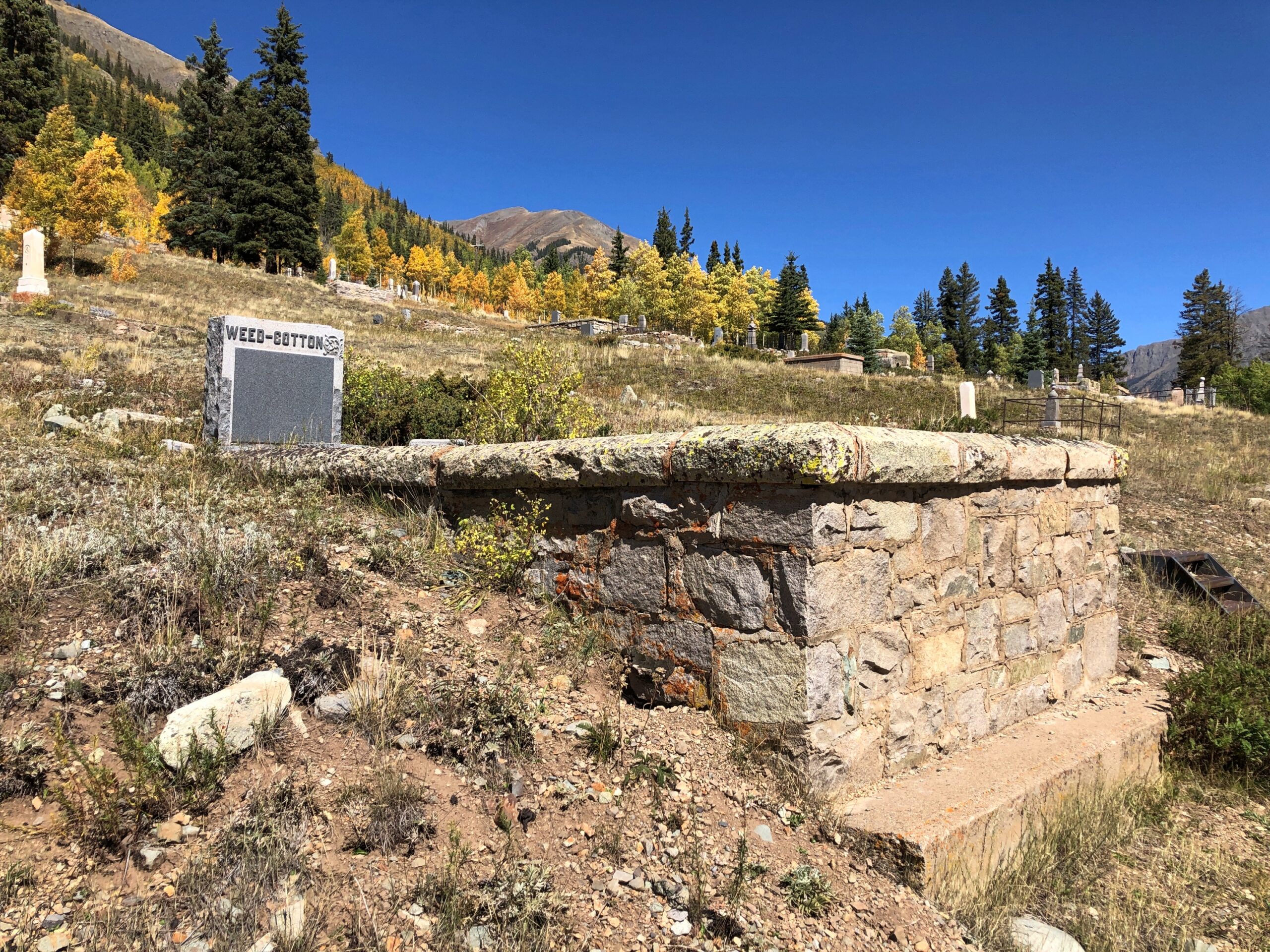
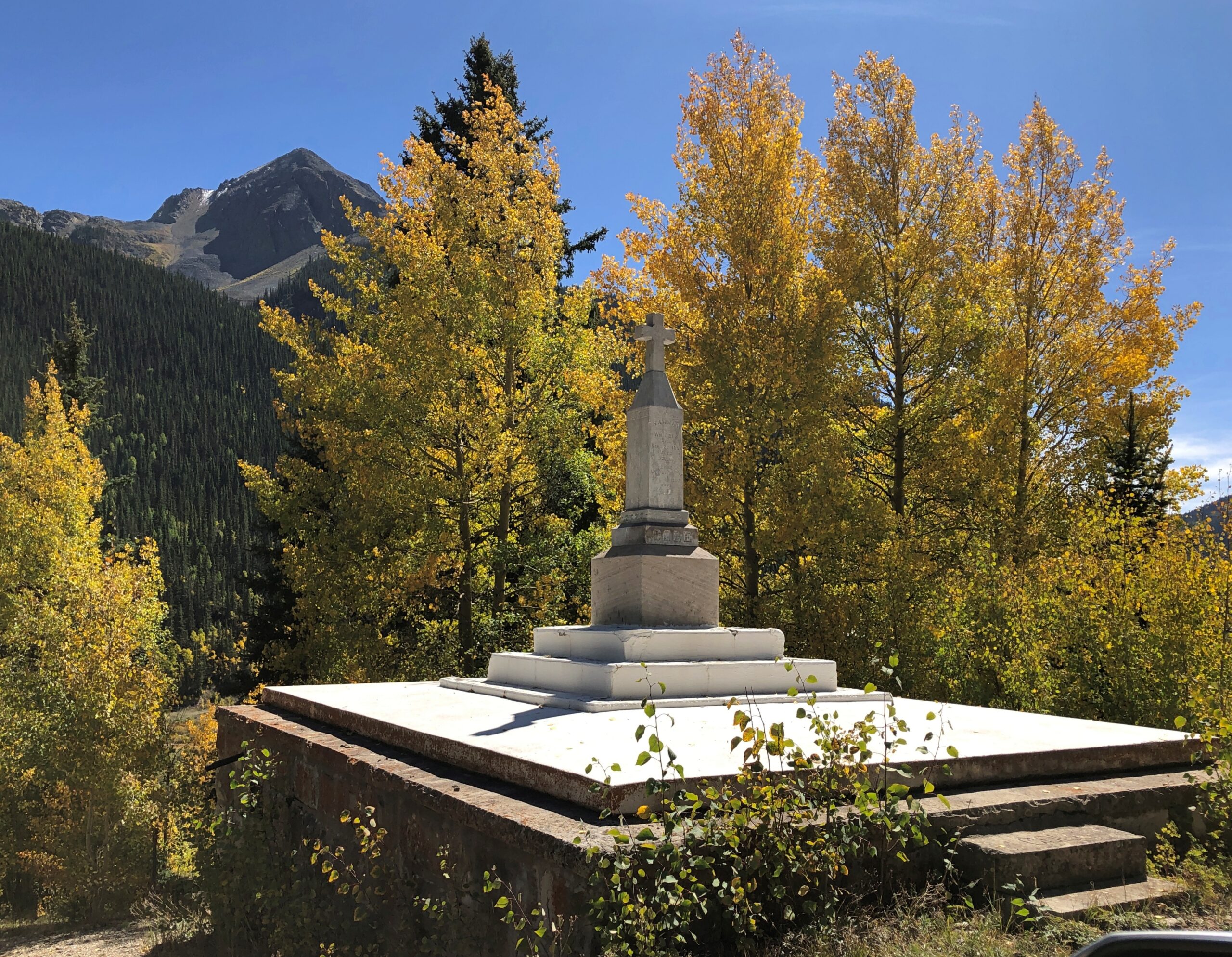
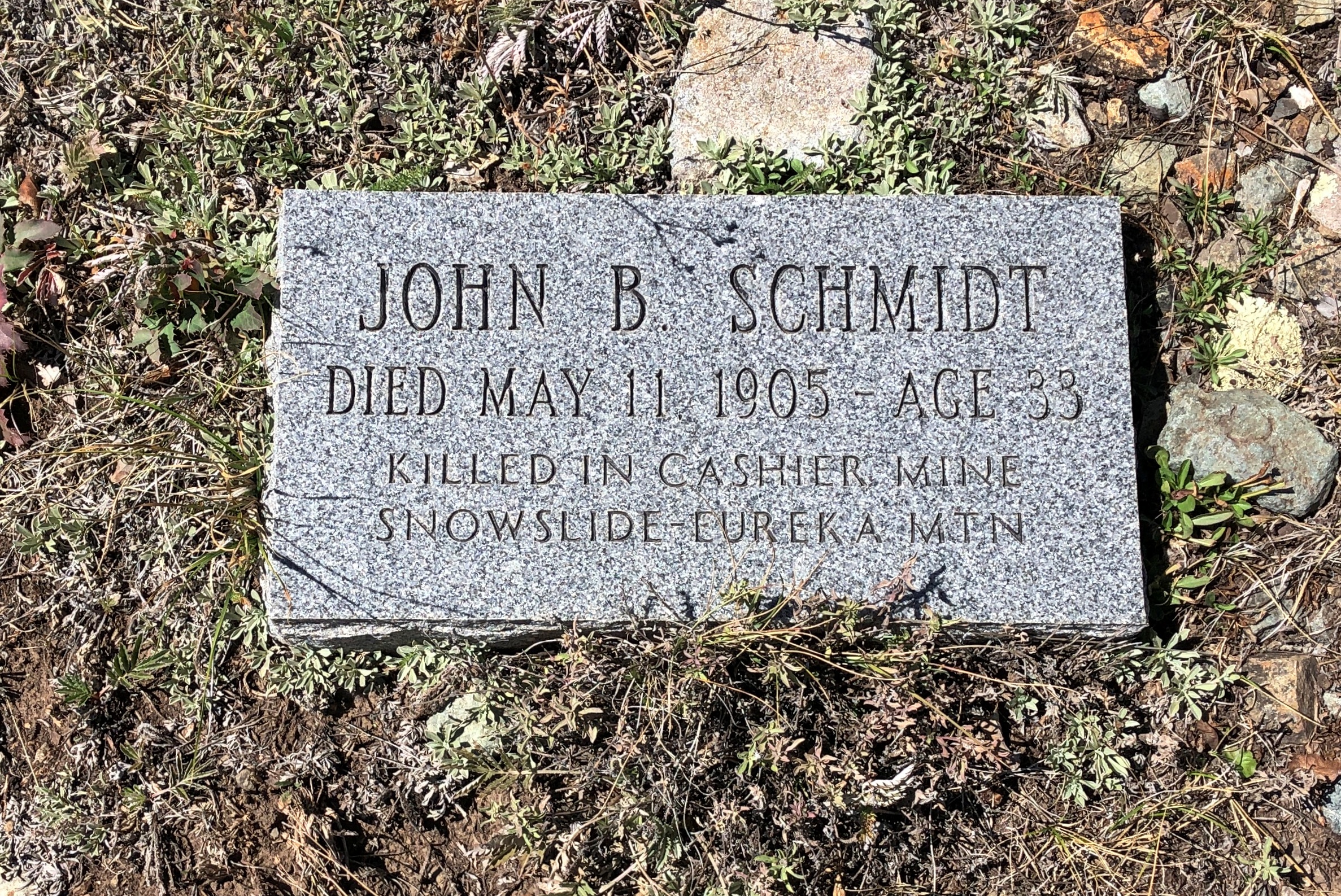
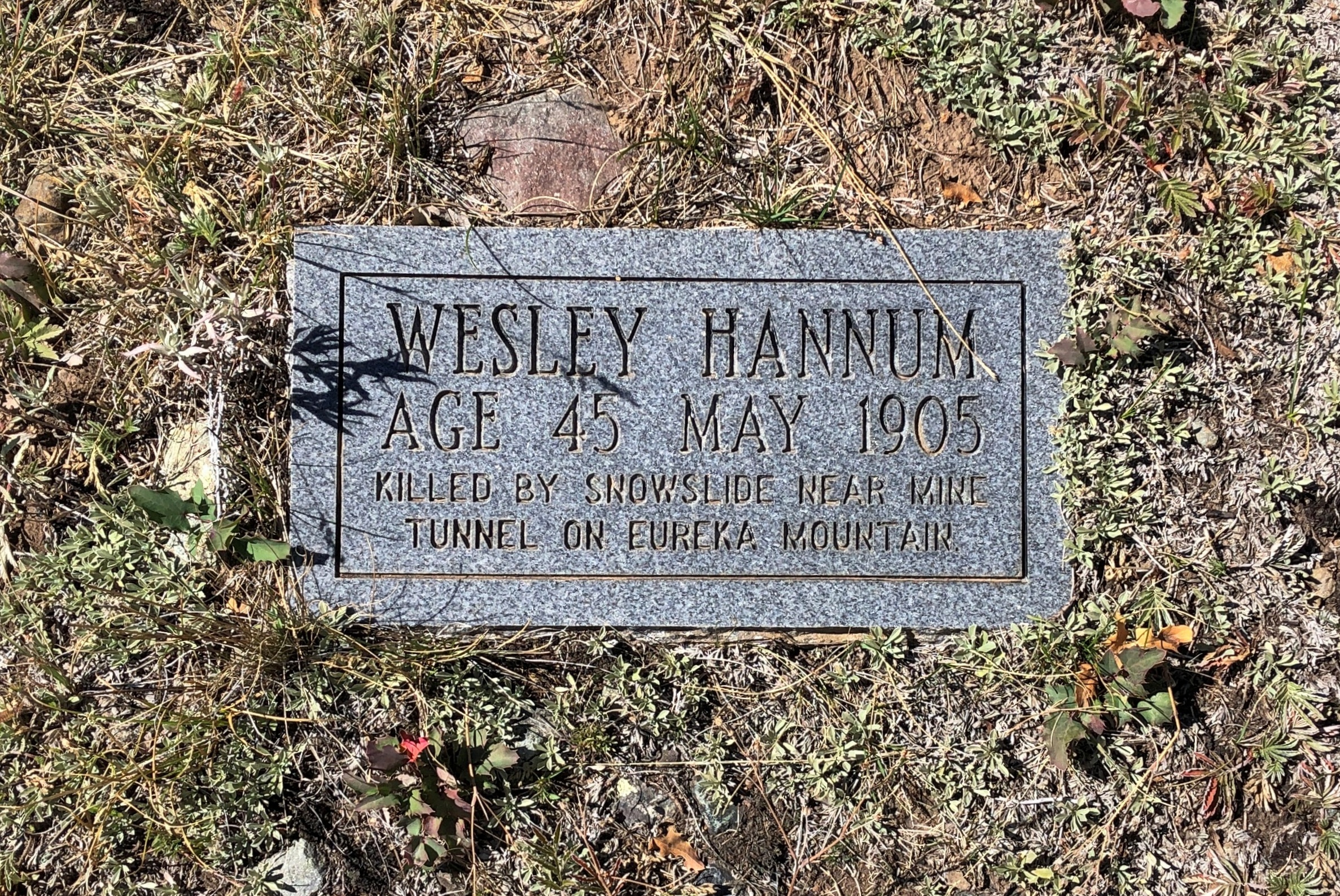
The Hillside Cemetery of Silverton.
An apt name.
With a good view of the town.
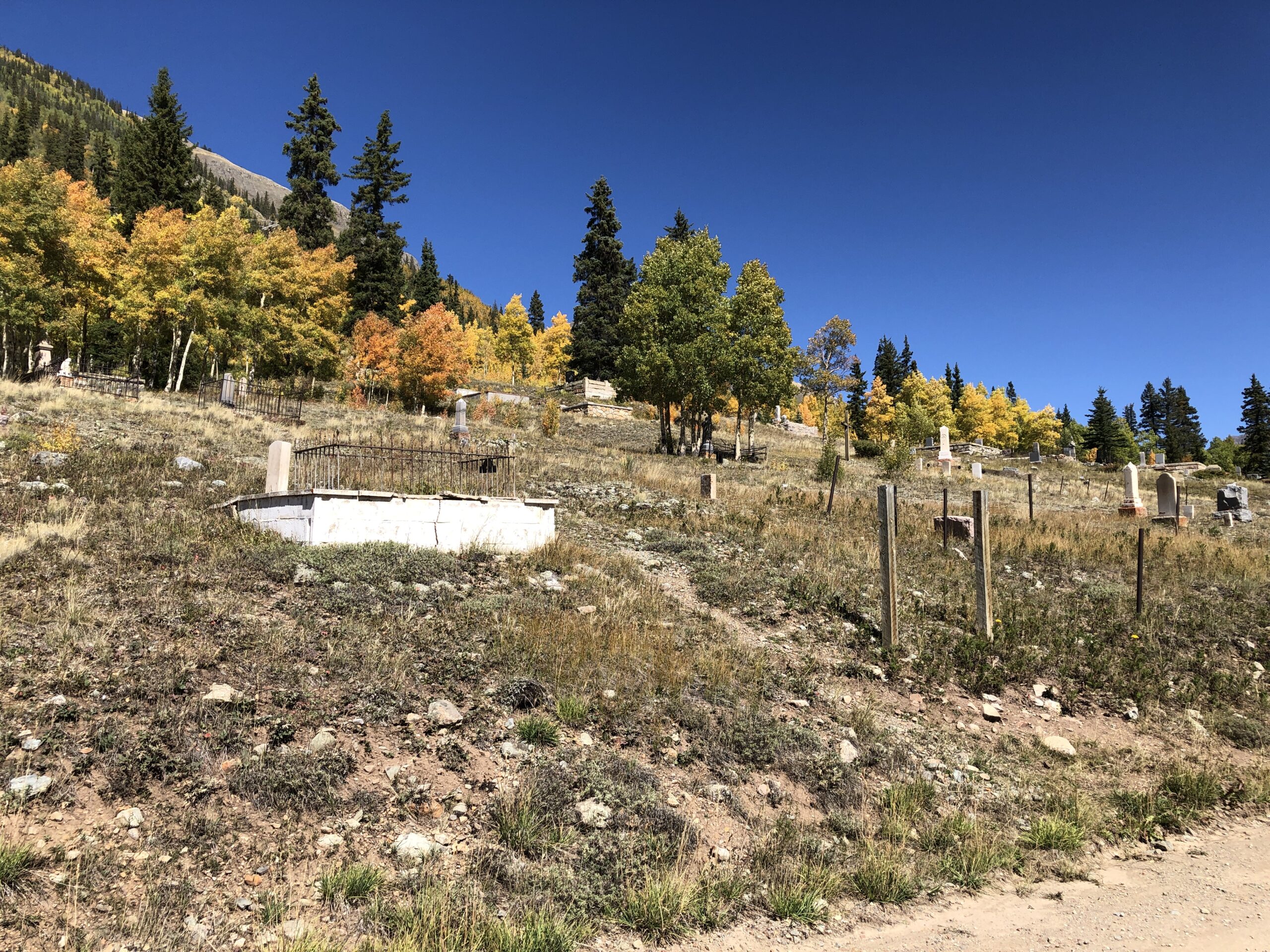
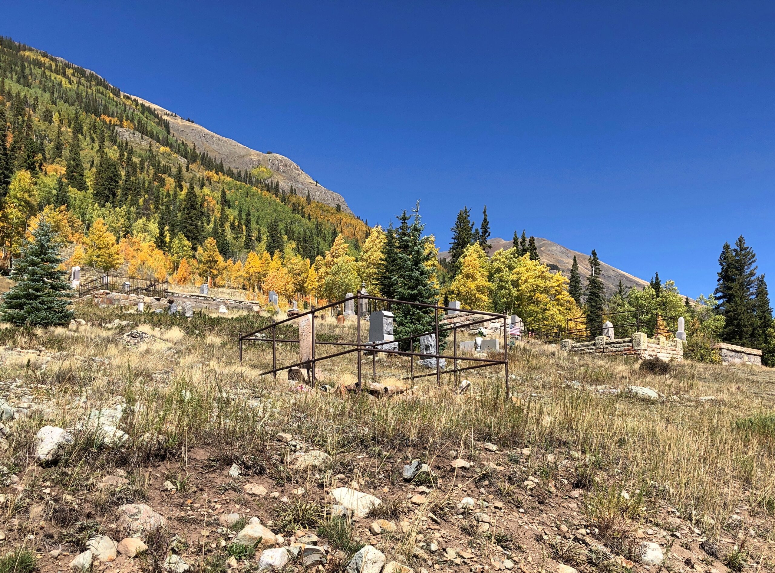
Some sizable memorials.
More modest ones.
Echoes of lost men from another time. Beyond the outstanding beauty of a hillside cemetery in the flush of autumn, reason enough to visit the cemetery.
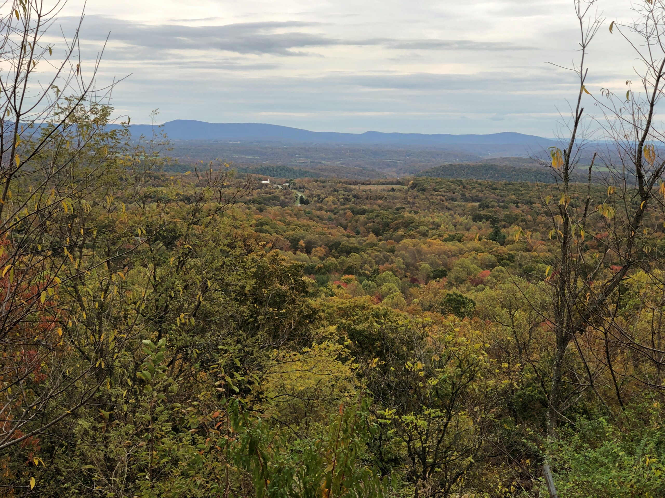
Metro Denver is enormous, much larger than I remembered, even as recently as 2017. Or so it seemed. To the south, Colorado Springs is fairly large, but some orders of magnitude less than the monster metro to its north. Further south, Pueblo doesn’t seem that big, but even so it has 111,000 residents, give or take.
Then you come to Walsenburg. Who has heard of Walsenburg, Colorado (pop. 3,035), even though it too is on I-25 and on the irregular line where prairie and mountains meet? Colorado’s brisk growth over the last few decades seem to have passed it by. Its peak population was in 1940, when more than 5,800 people lived there.
I wish I could say I’d formed an impression of Walsenburg, but we stopped only for gas, and to get off the Interstate.
US 160, Walsenburg to Alamosa
Walsenburg has few people, and when you go west on US 160, that dwindles to practically none. The road crosses the Culebra Range of the Sangre de Cristo Mountains at North La Veta Pass, elevation 9,413 feet, into the San Luis Valley. I enjoyed writing that sentence almost a much as I enjoyed the drive itself.
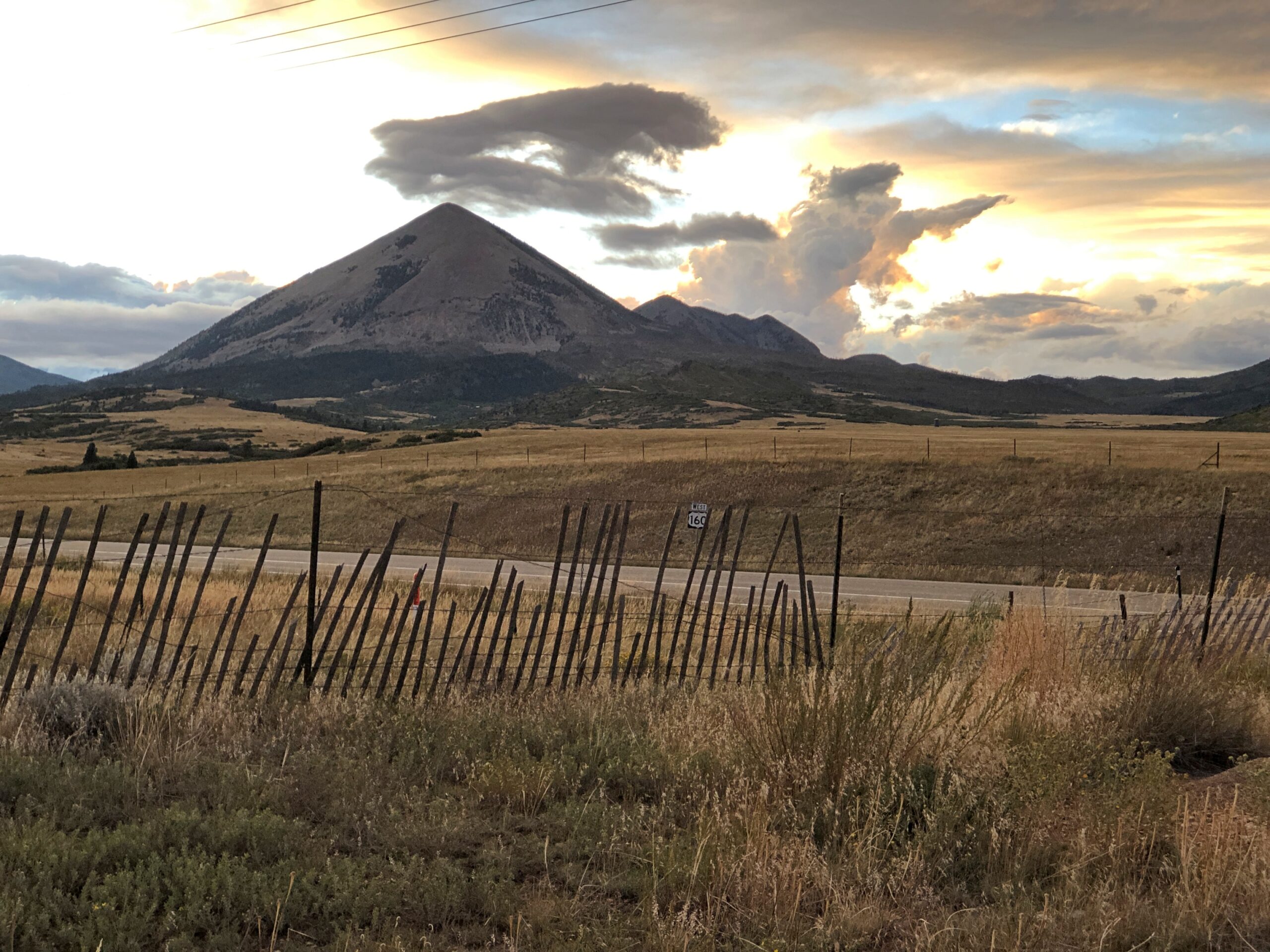
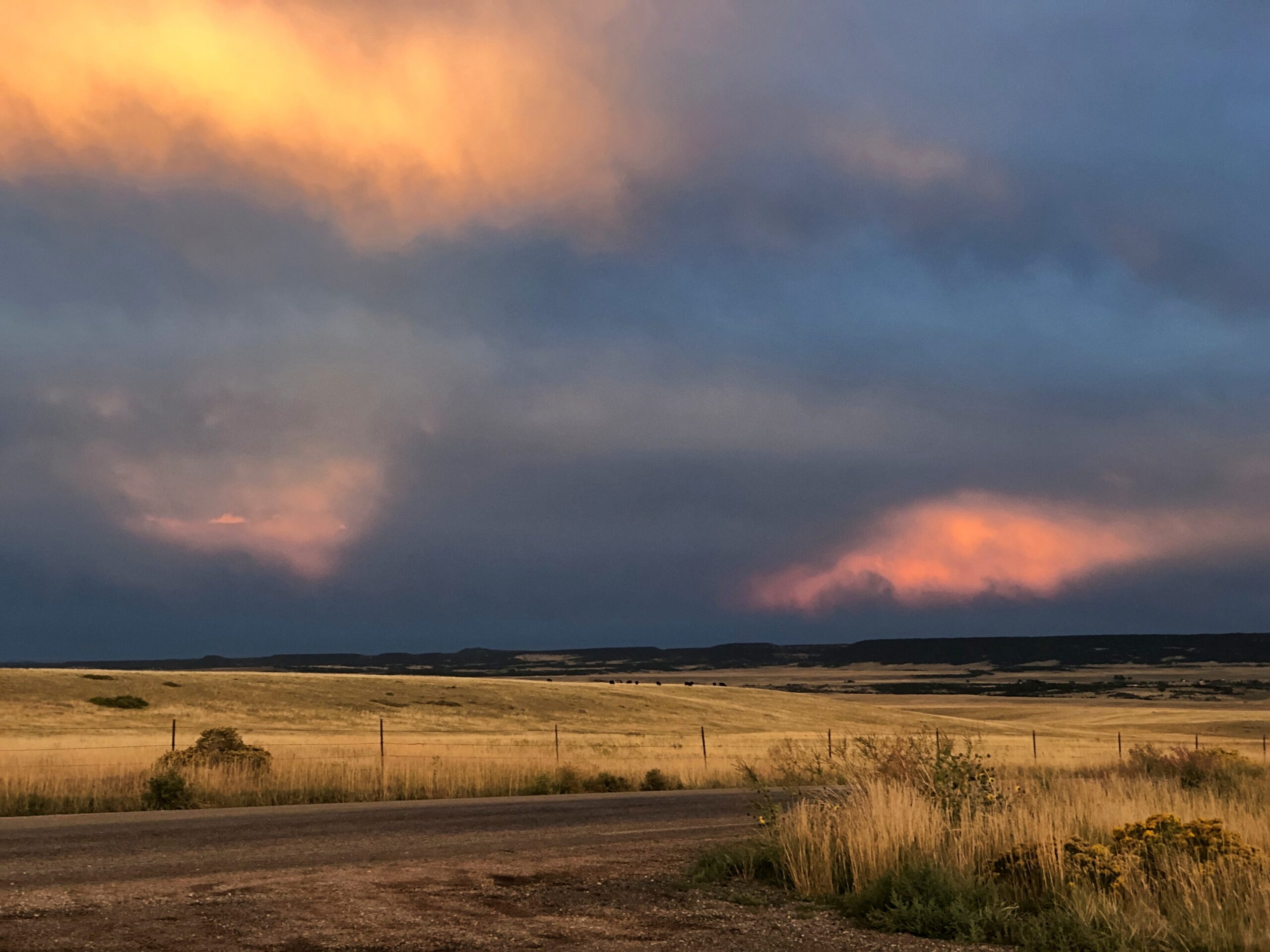
Enjoyable at least until dark. Wish we’d gotten to see more of it. We’d futzed around in Colorado Springs much of that day, September 13, including a fine lunch at Edelweiss German Restaurant. So the sun went down before we got to our destination, Alamosa. But we did stop for a few minutes on US 160 before we lost the light. A chilly wind blew clouds along at quite a speed, and for their part the clouds were catching the sunset in luminous patches. Until I can see the aurora, that will more than do.
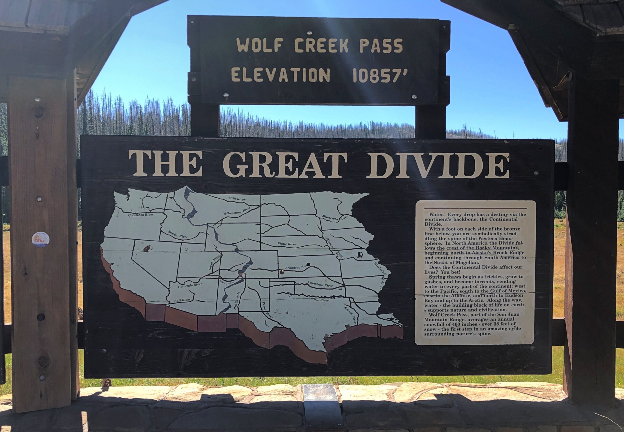
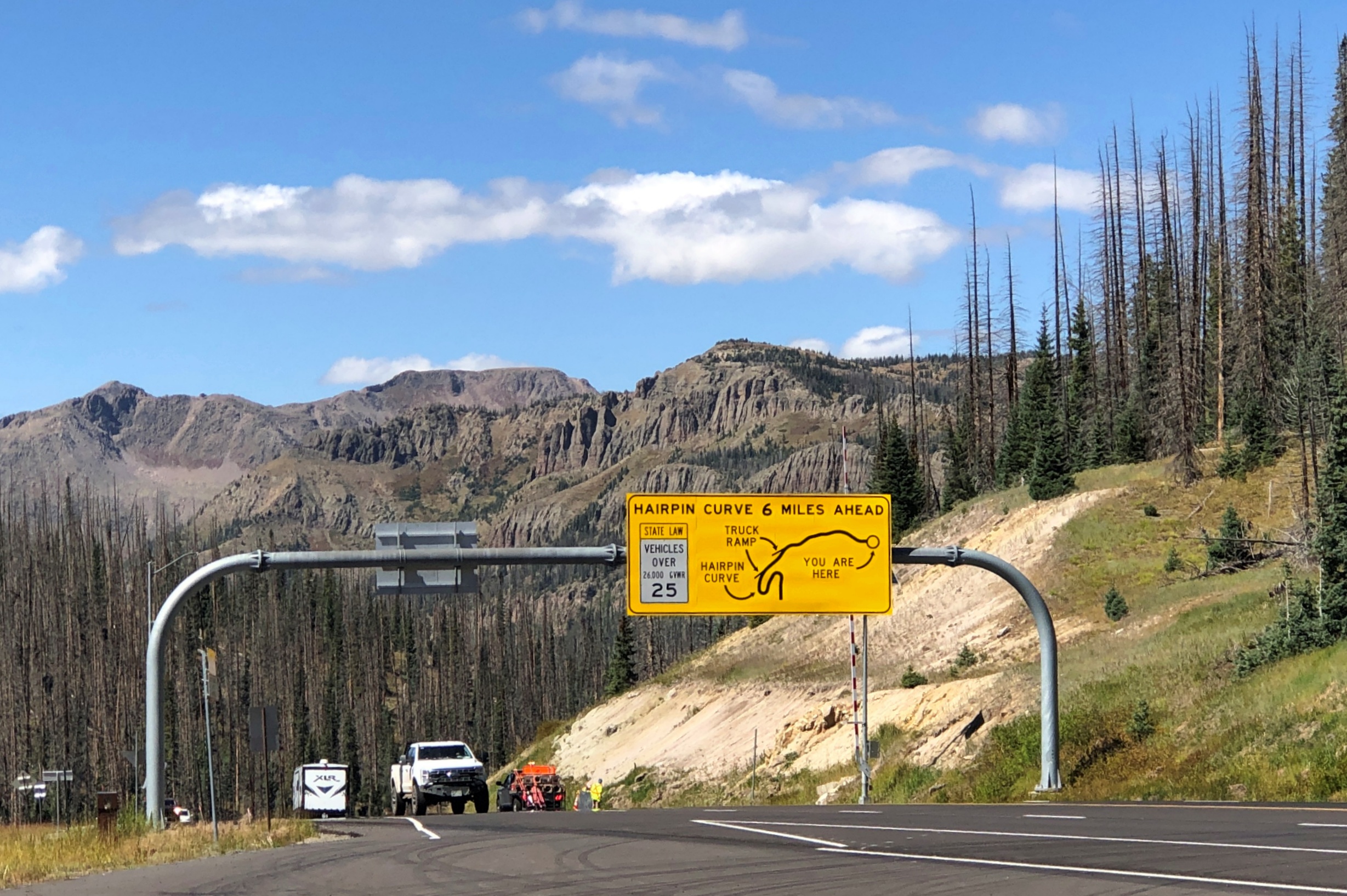
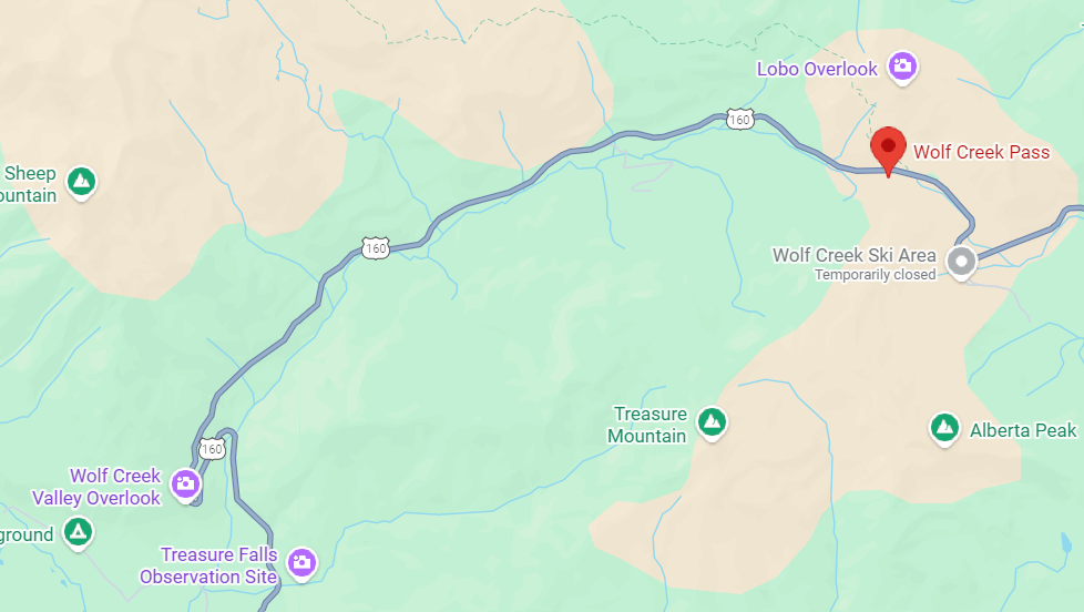
Wolf Creek Pass, Way Up on the Great Divide
Follow US 160 west from Alamosa and eventually you’ll get to Four Corners. We didn’t go that far on the 15th, just to Durango. The road passes through much of the San Luis Valley, which is wide – the largest alpine valley in the world, they say – so the way is flat until you reach South Fork, Colorado. Then you climb into the San Juan Mountains, until you reach Wolf Creek Pass. Way up on the Great Divide.
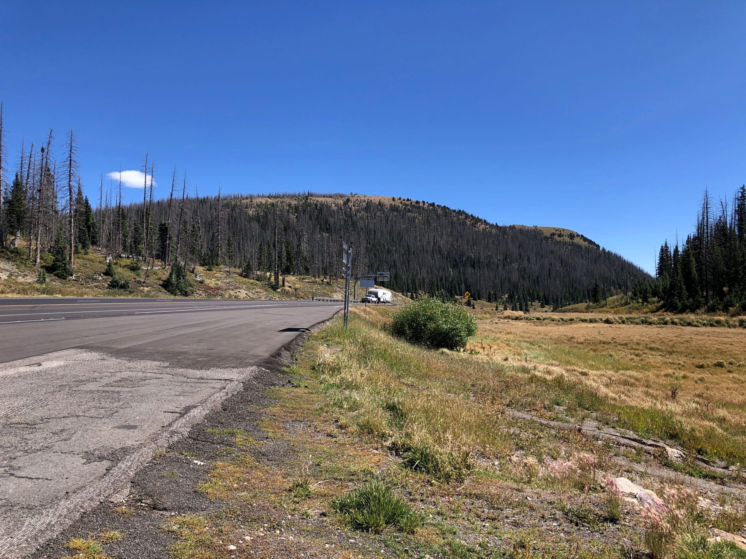
Yuriko had been driving on the ascent to Wolf Creek Pass. Usually she doesn’t care for mountain roads, but she focused on a wide-load vehicle ahead of us, and we followed it up, though not at too close a distance. She thought better of driving down the other side, even though she’s never heard it immortalized by C.W. McCall.
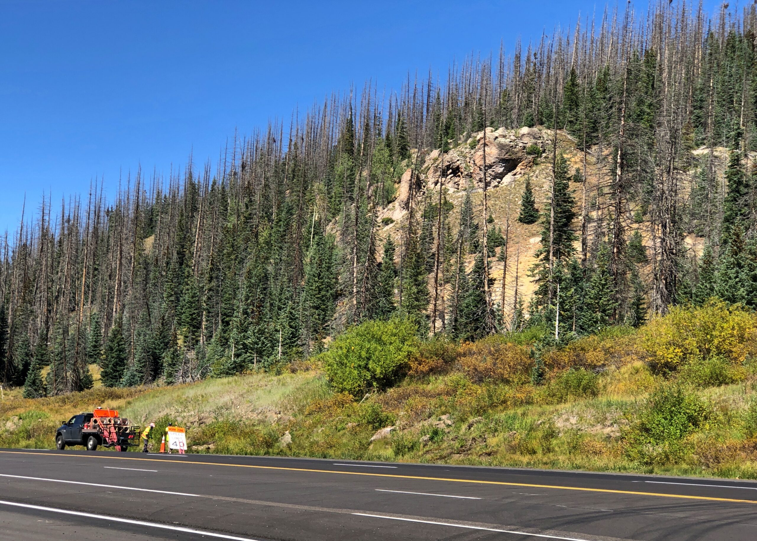
So I drove down. Truth be told, it’s not that bad on a clear day. In our time, US 160 down from Wolf Creek Pass is four lanes, and while curvy, only the hairpin turn – which you are well warned about – is a little tricky. Not that bad in a car, anyway. I couldn’t say about taking a truck down. I’ll bet 50 years ago the route was probably still two lanes and maybe even more winding, so C.W. was only exaggerating for comic effect, not making everything up.
At the end of the drop is Pagosa Springs, whose main street was completely torn up with construction. We found lunch off the main drag at PS FroYo, which is one of those restaurants that makes money for a local charity, in this case Aspen House. We didn’t know that before we ate our sandwiches, just that it was near where we parked and not fast food. A nice bonus to find out.
Lewis Street wasn’t under construction, so that made for a pleasant stroll after lunch, including time at a resale shop. No post cards. Bought some nearly new jeans, which proved their $5 worth (and much more) when I was later deposited briefly in the Kansas mud. They were standing by at that moment, sitting in a bag on top of everything else in the back seat — blankets, sleeping bag, small bags with some winter wear. I didn’t have to dig around looking for them. That never happens, or so it seems, so I thought I’d remember when it did by noting it here.
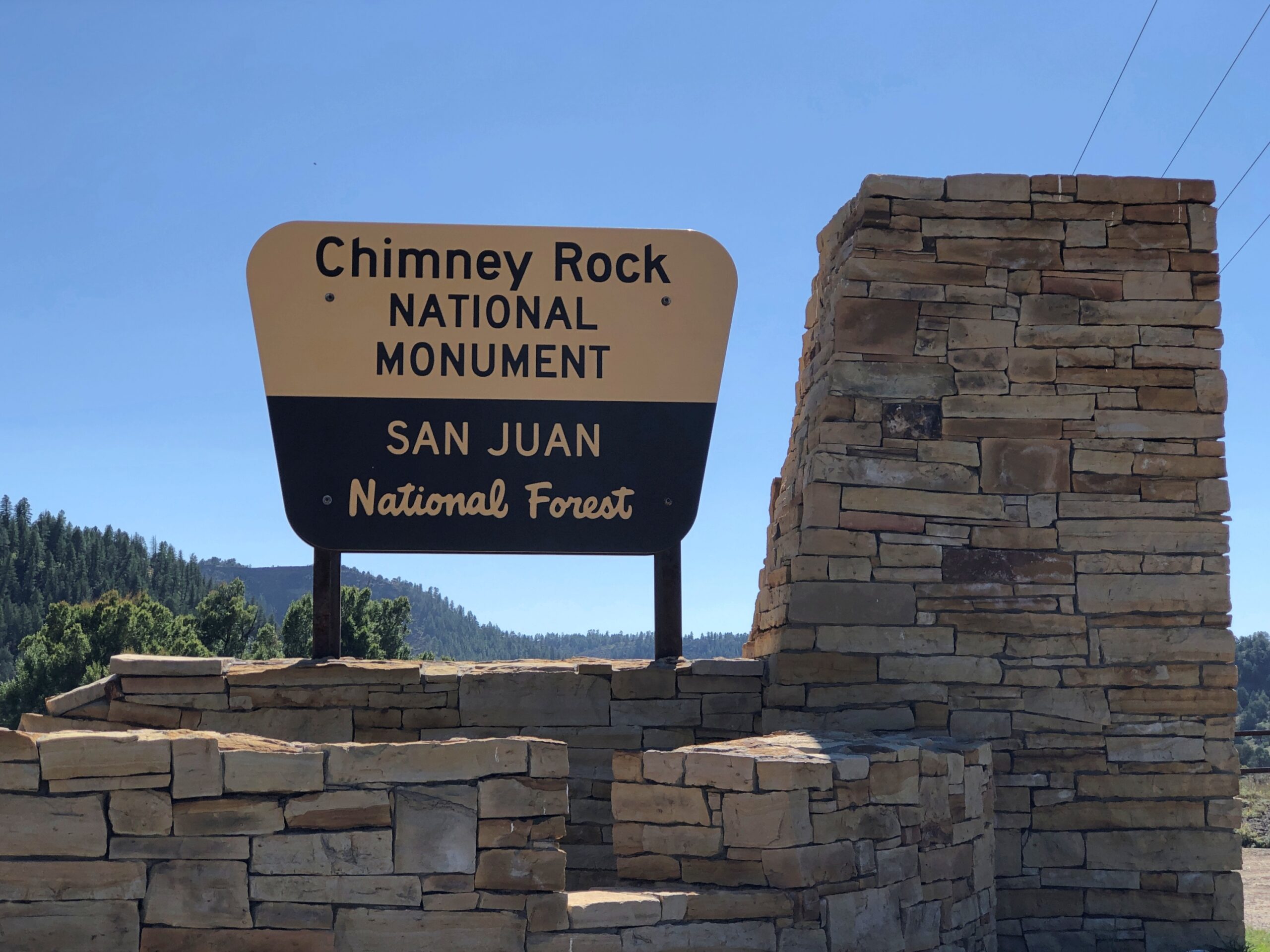
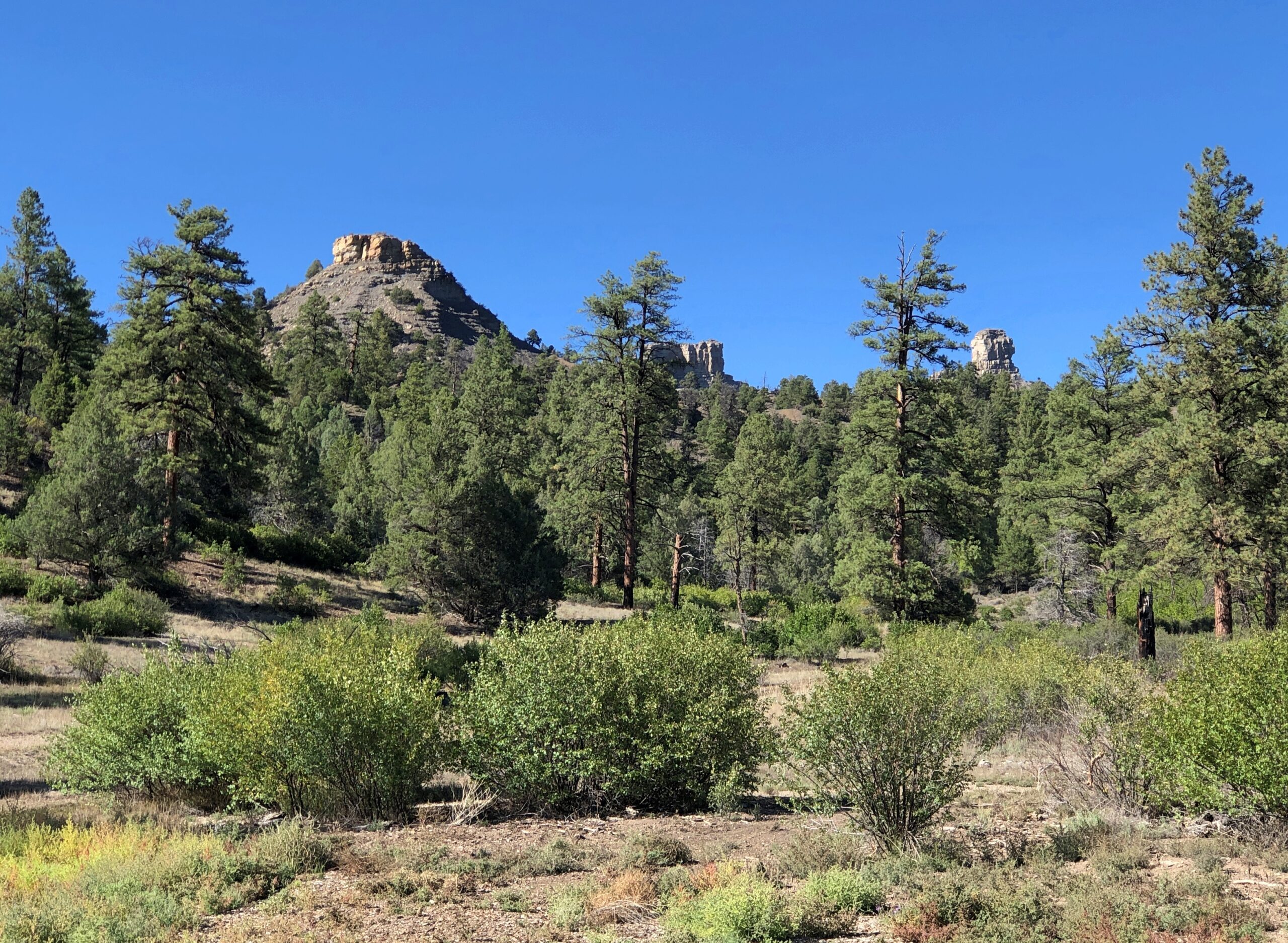
There is a road up to Colorado’s Chimney Rock, a ridge-top archaeological site that is the nucleus of the national monument, but it was closed. The small museum at the base of the rock was still open, so along with our view, we took in a little about the Ancestral Puebloans who used to live there.
Chimney Rock and Companion Rock, foci of the national monument.
“Chimney Rock covers seven square miles and preserves 200 ancient homes and ceremonial buildings, some of which have been excavated for viewing and exploration: a Great Kiva, a Pit House, a Multi-Family Dwelling, and a Chacoan-style Great House Pueblo,” says the Chimney Rock Interpretive Association. “Chimney Rock is the highest in elevation of all the Chacoan sites, at about 7,000 feet above sea level.”
US 550 North from Durango
North from Durango on US 550, the scenery starts pretty soon.
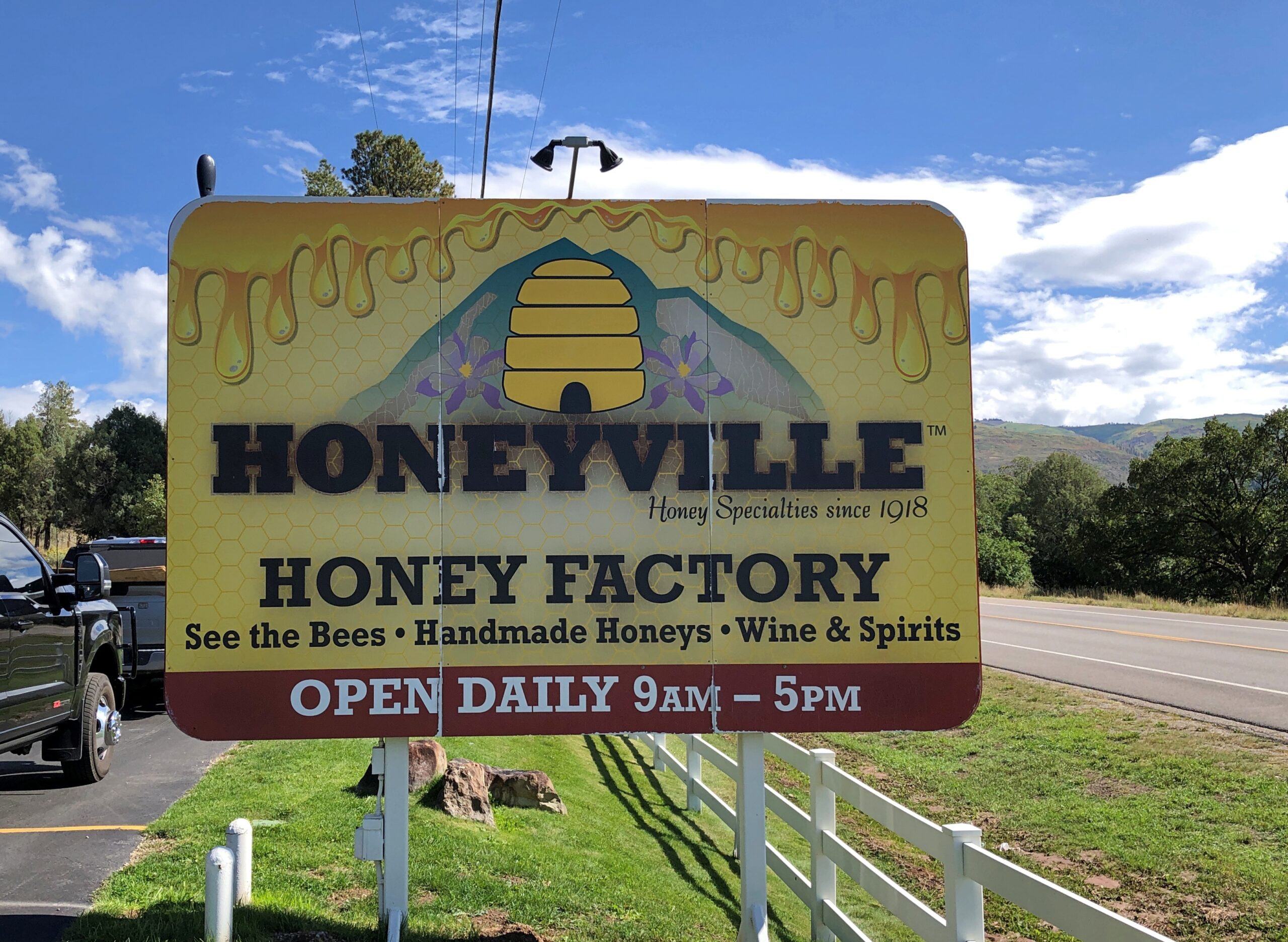
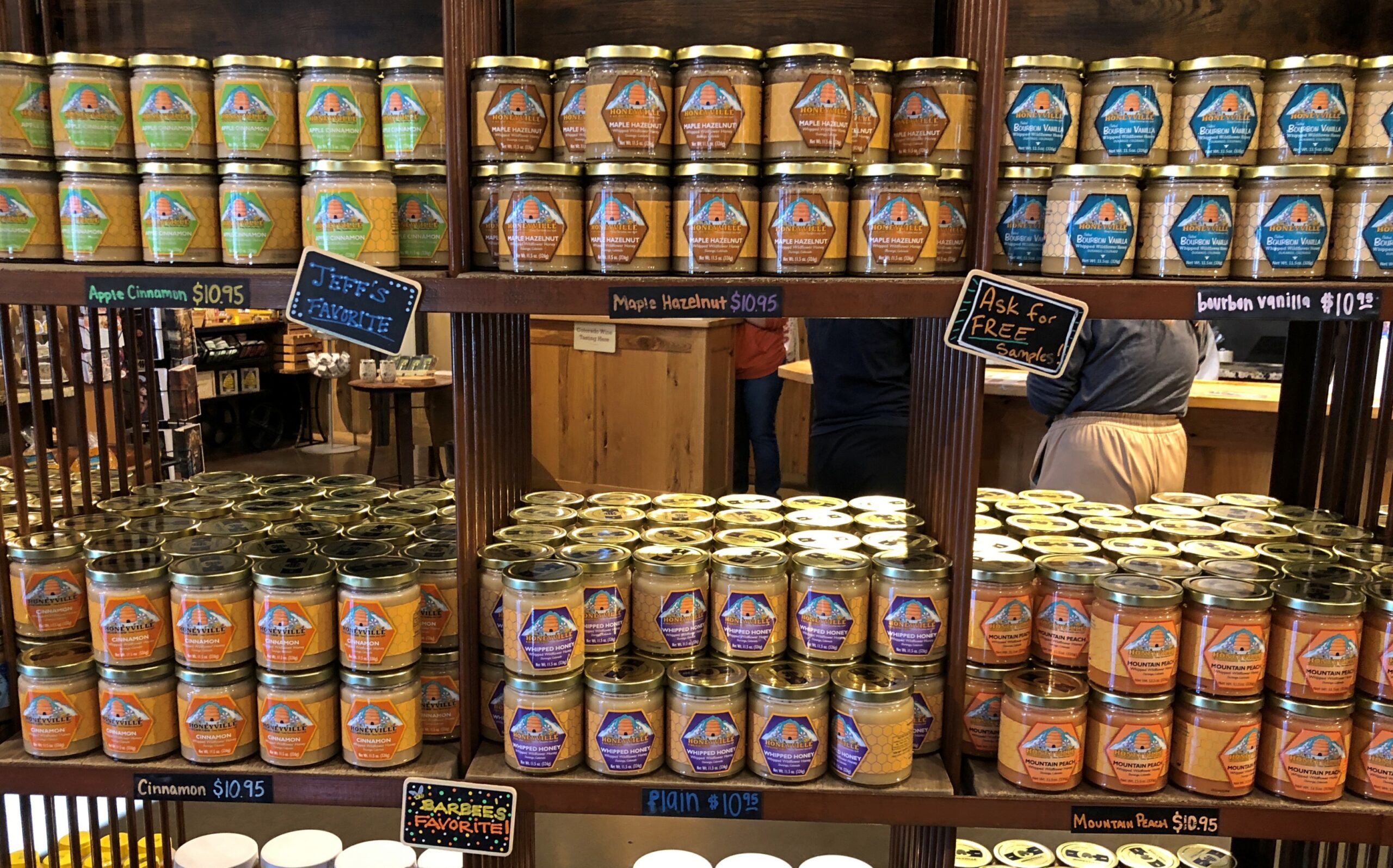
A few miles out of town, Honeyville. It looked like a good place for souvenirs.
It was. I’m still working on a Honeyville jar of whipped cinnamon honey, which makes a warm biscuit sing.
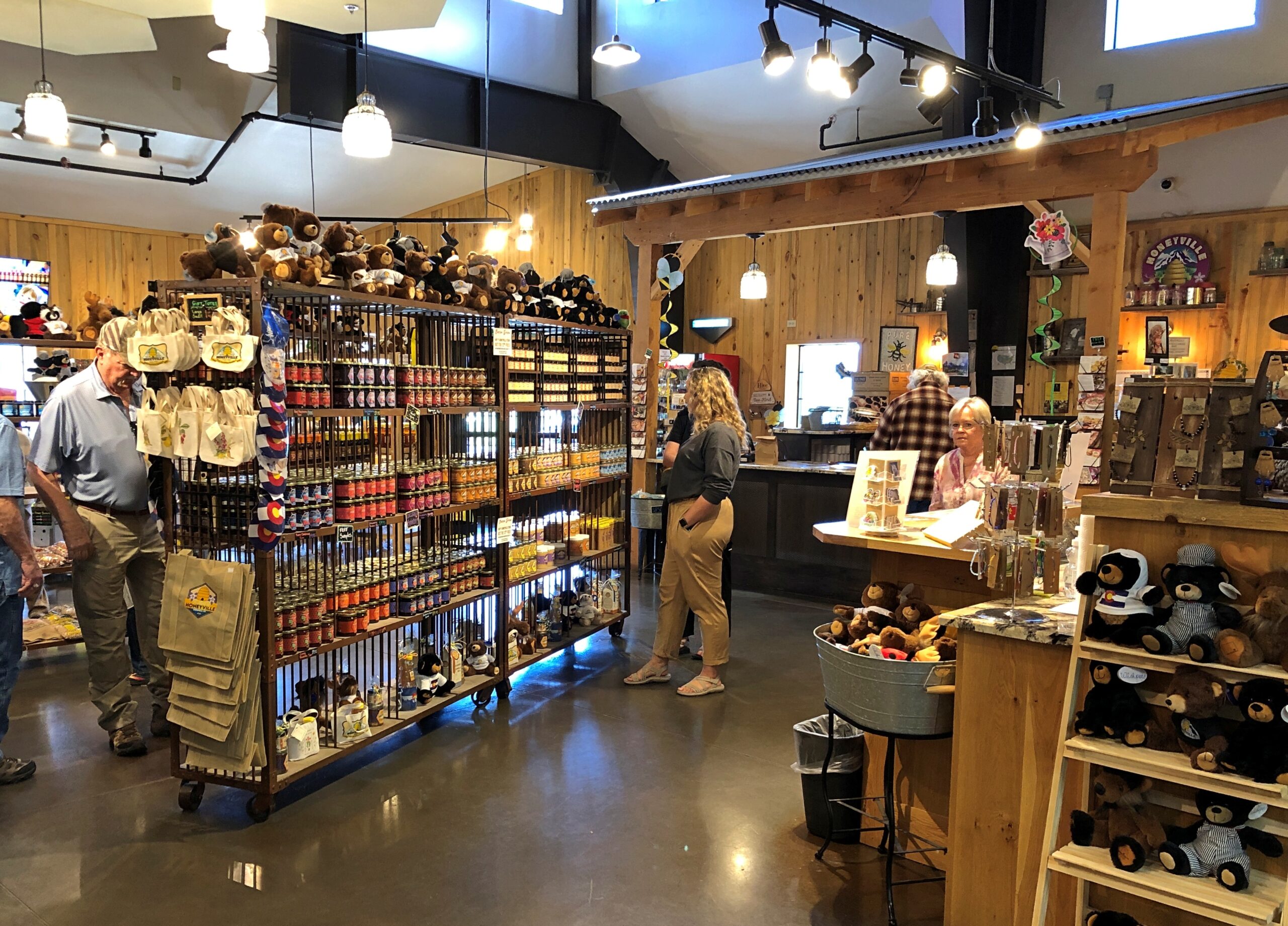
All sorts of honey products are available.
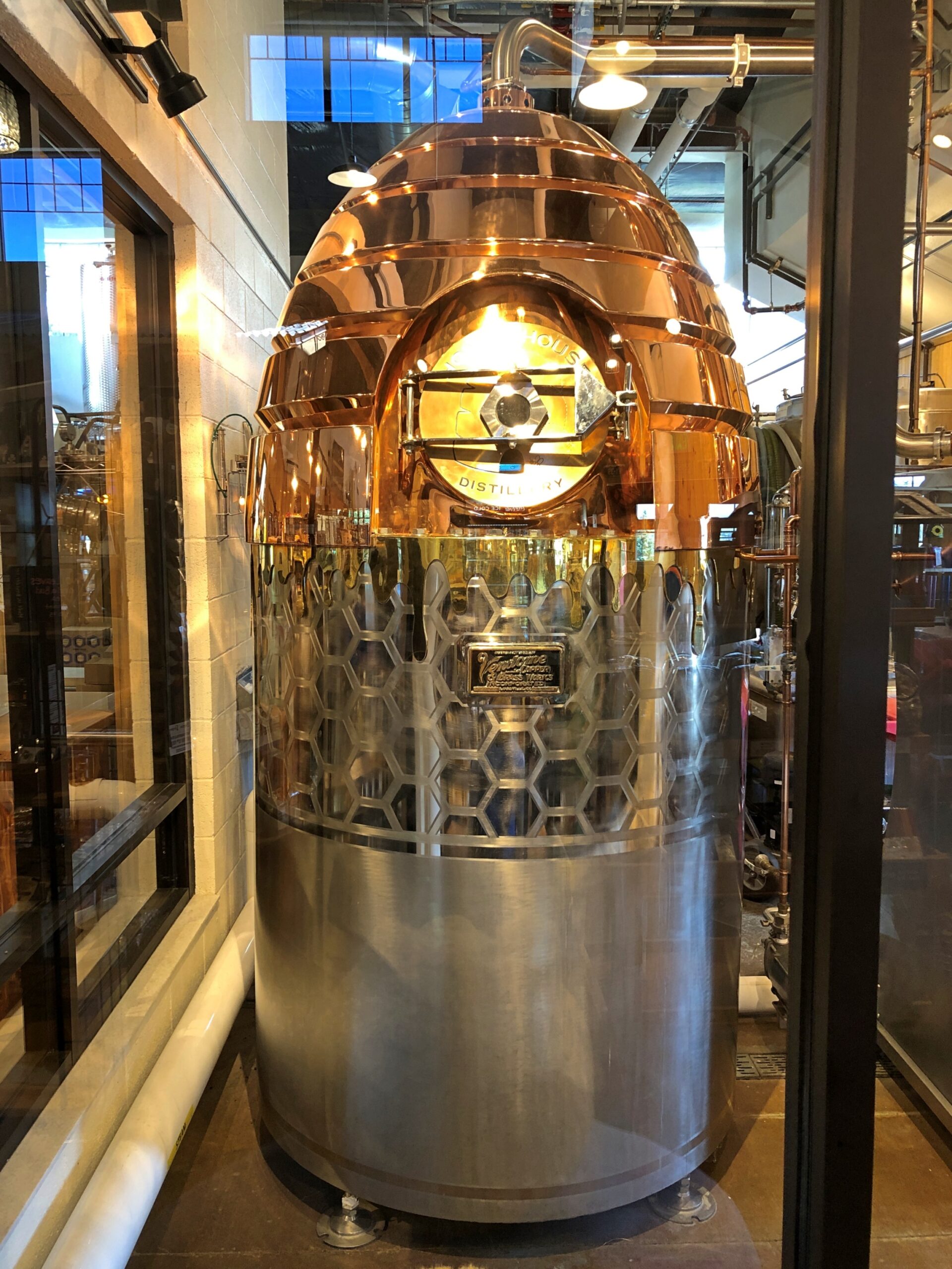
You can watch part of the process.
A warp drive engine fueled by honey? Could be that Zefram Cochrane kept (will keep) bees.
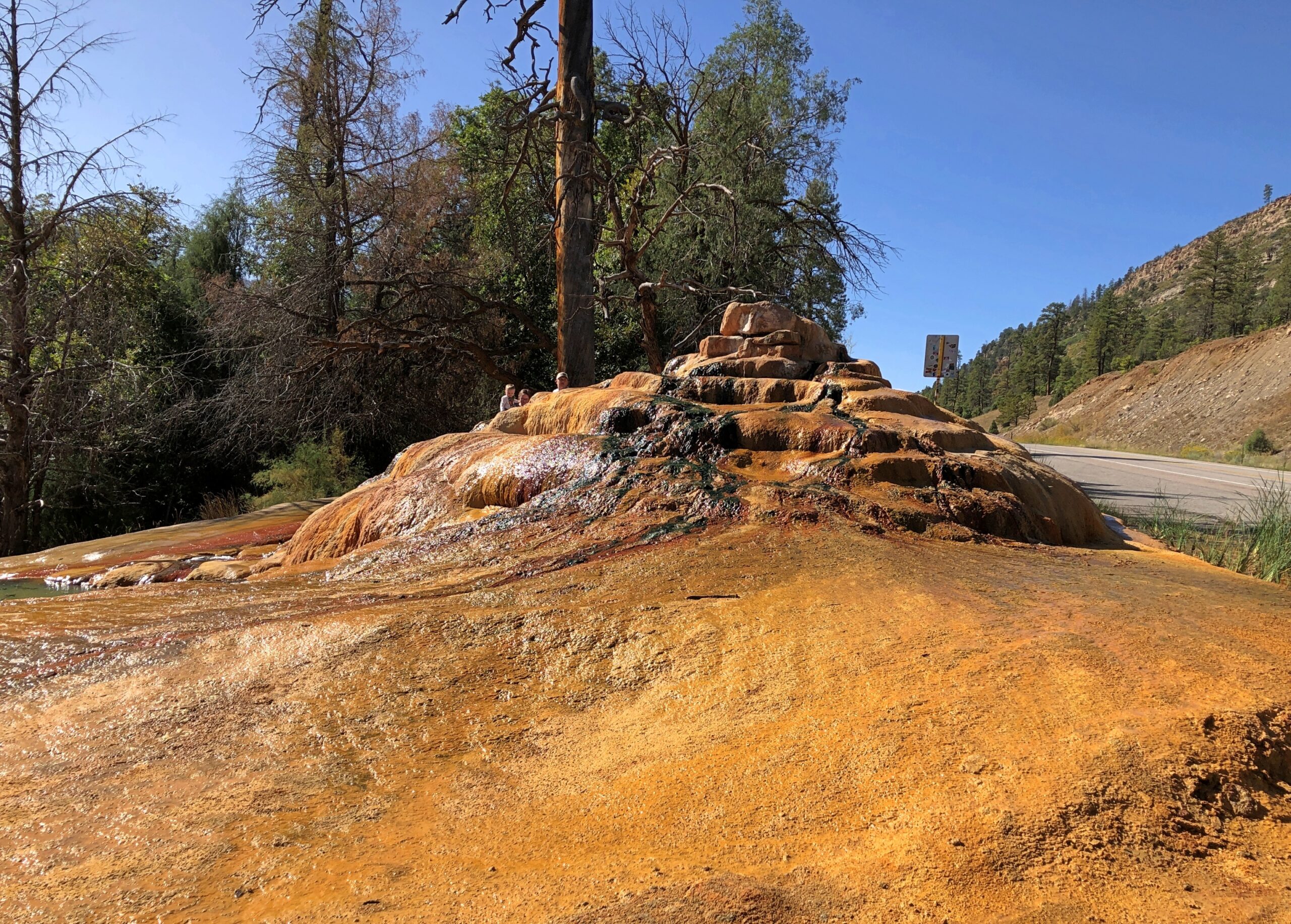
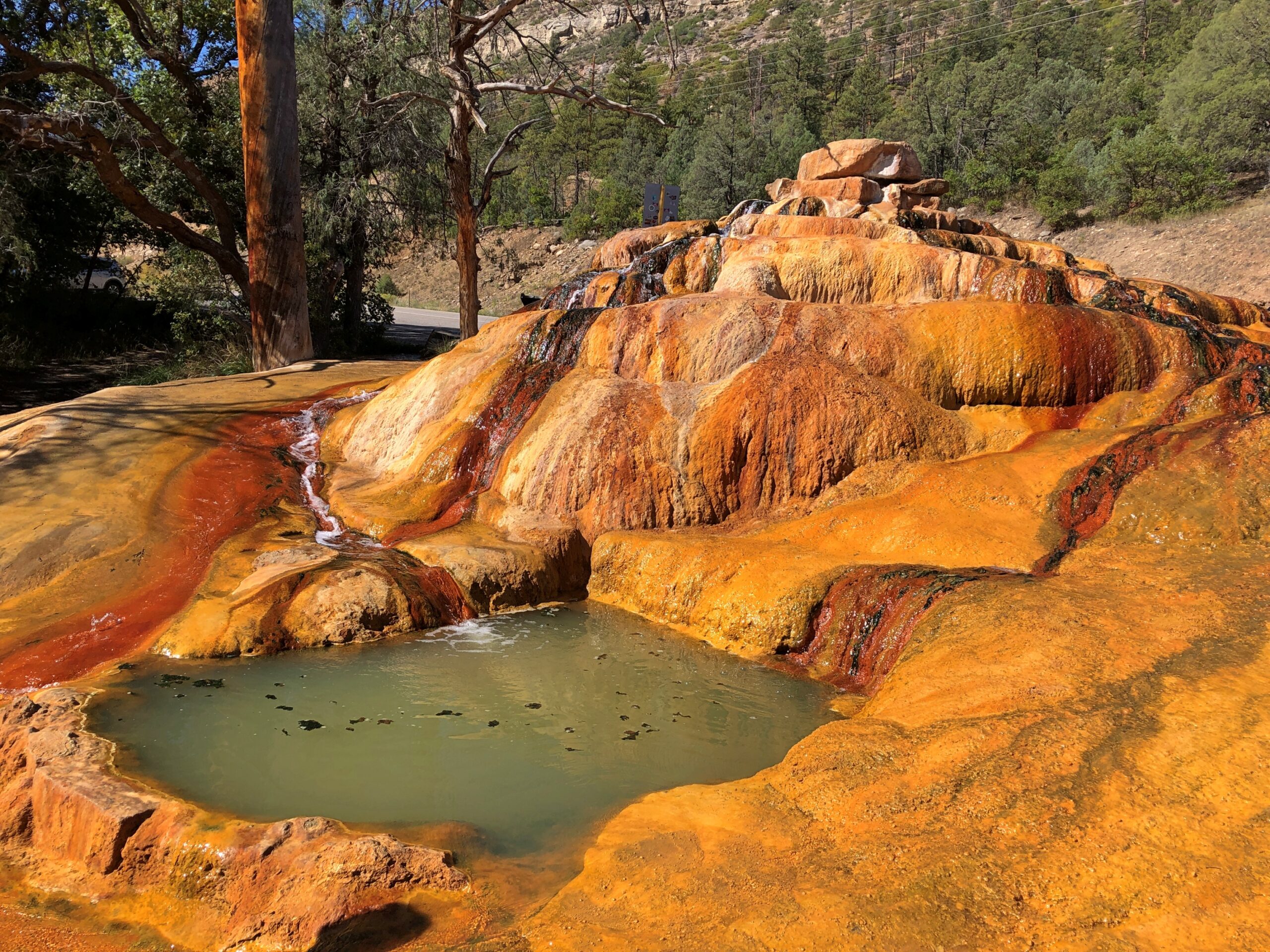
Only a few miles north, just off US 550, is Pinkerton Hot Springs, which is the kind of place that winds up on Atlas Obscura lists (actually, so does Honeyville). We took a look, but not a dip.
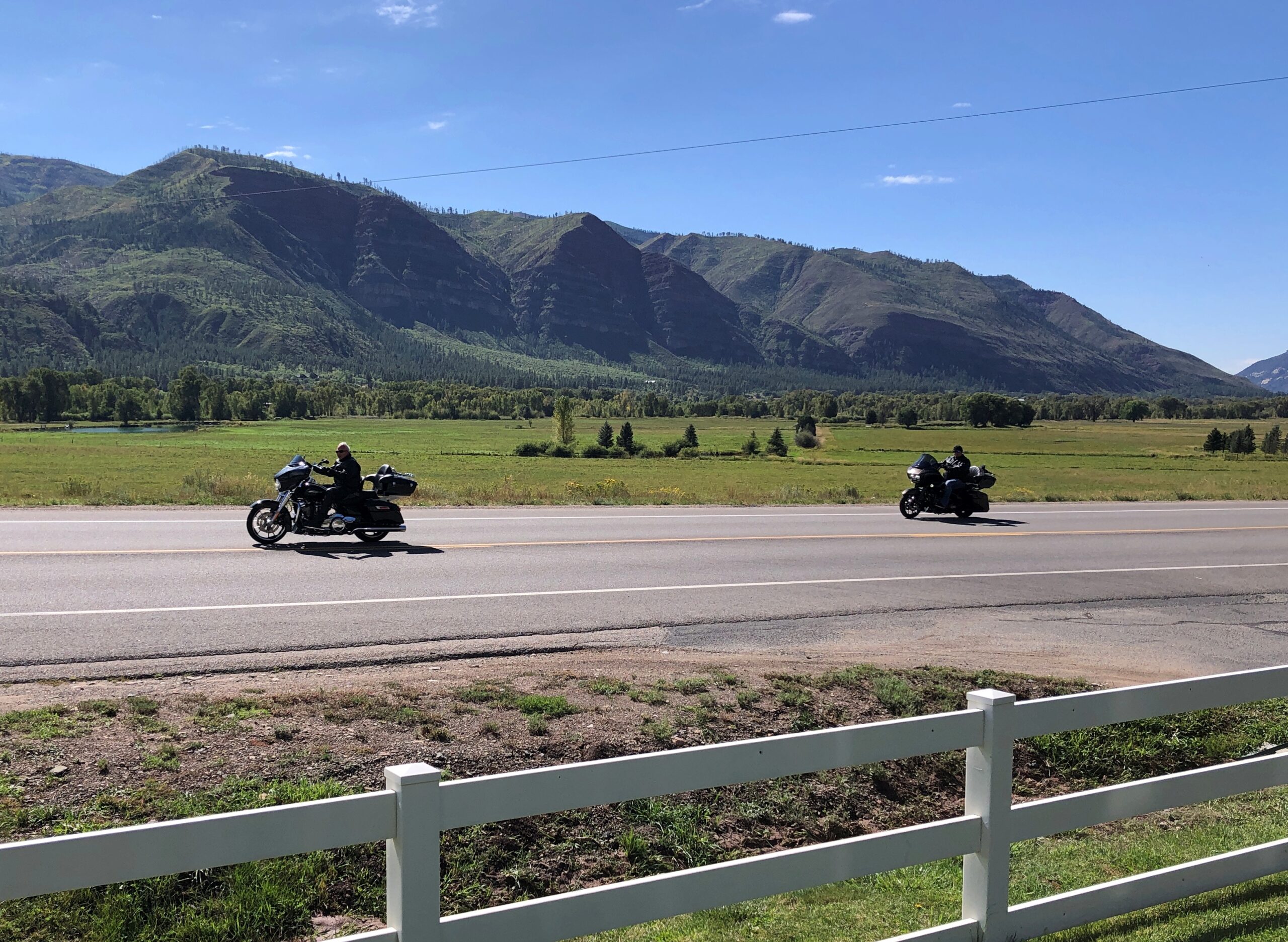
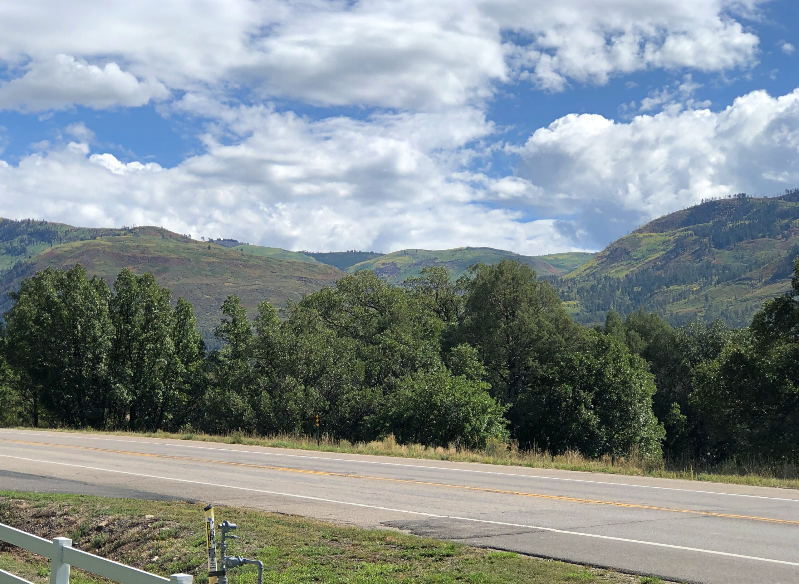
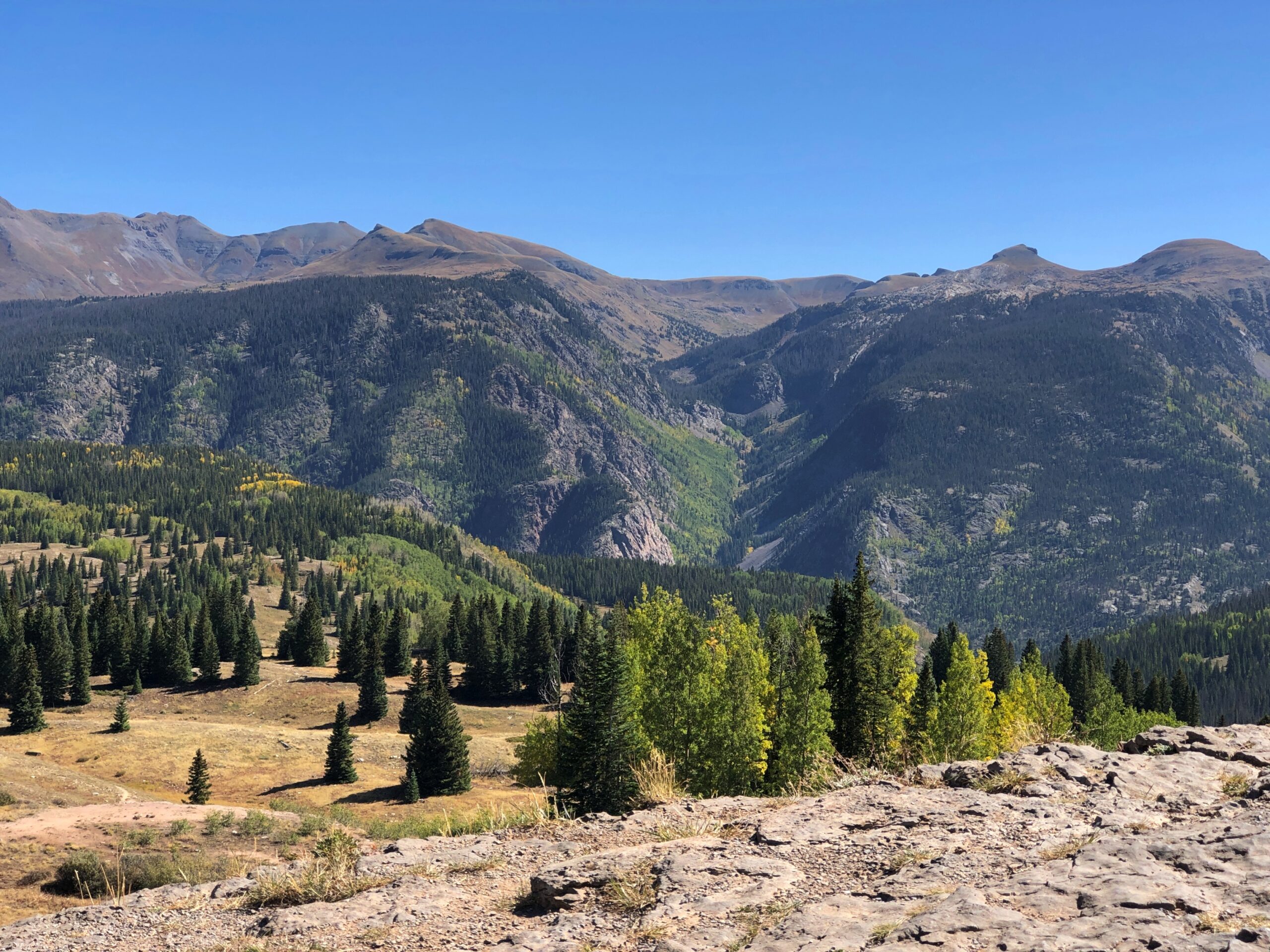
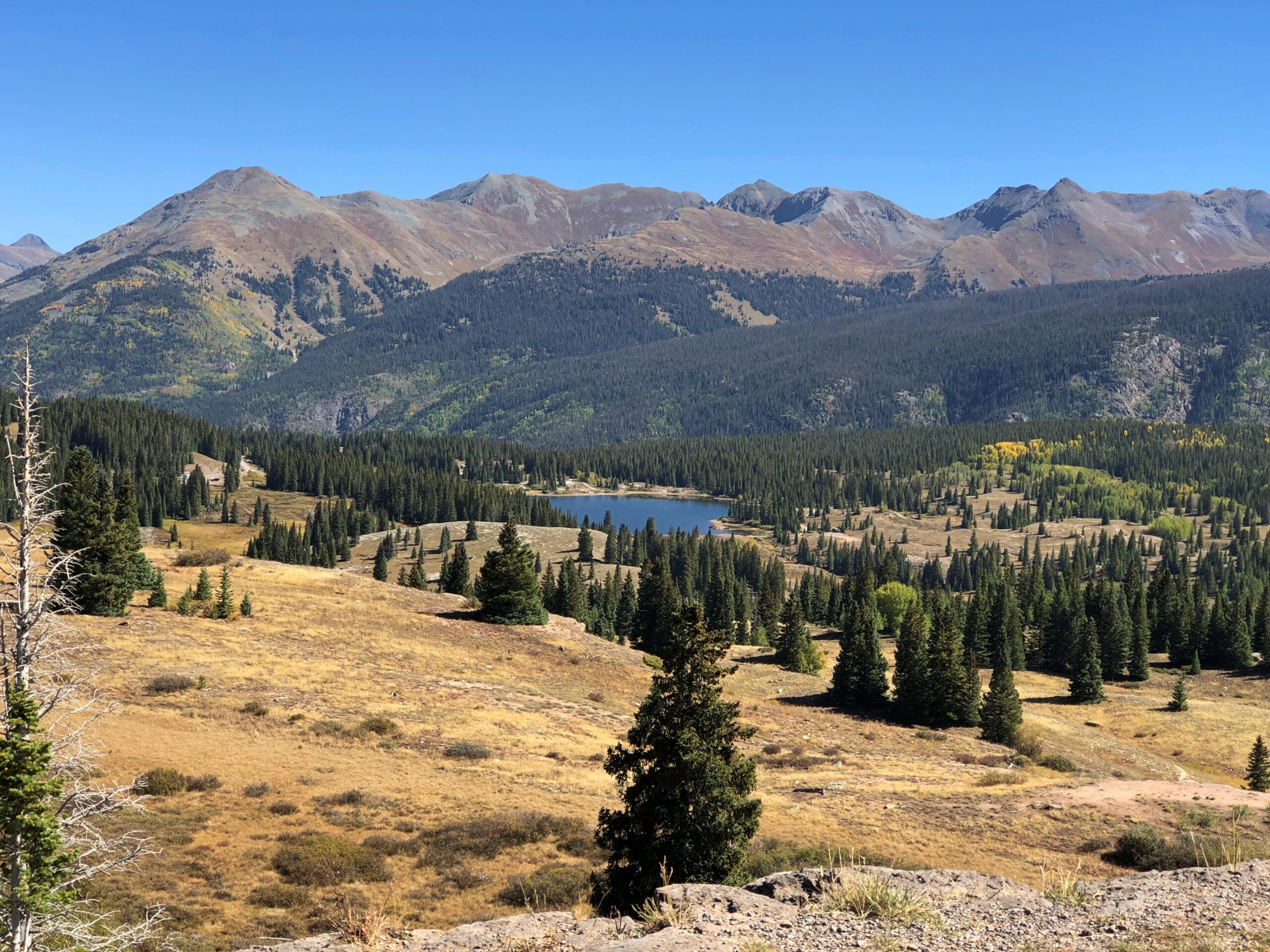
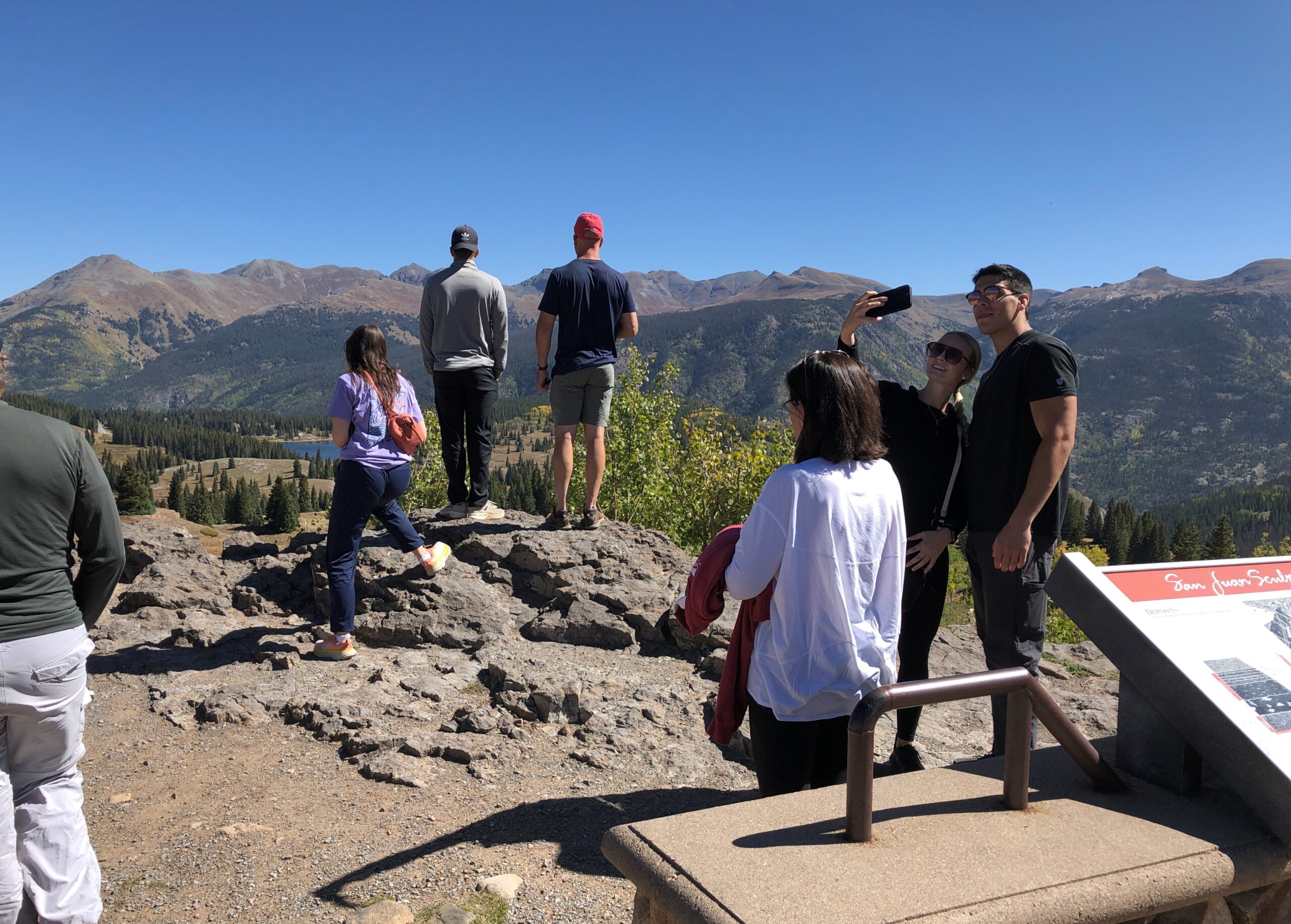
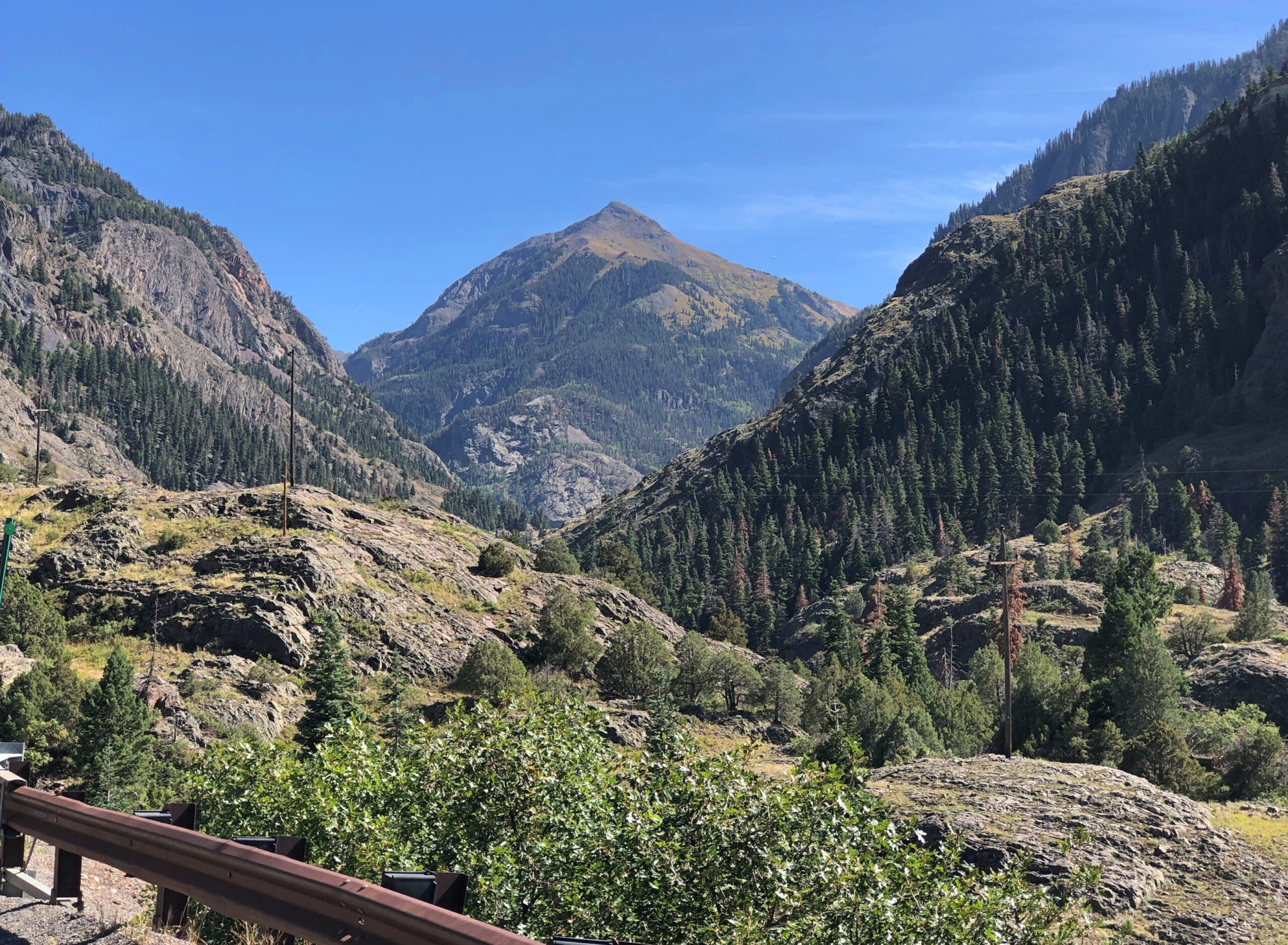
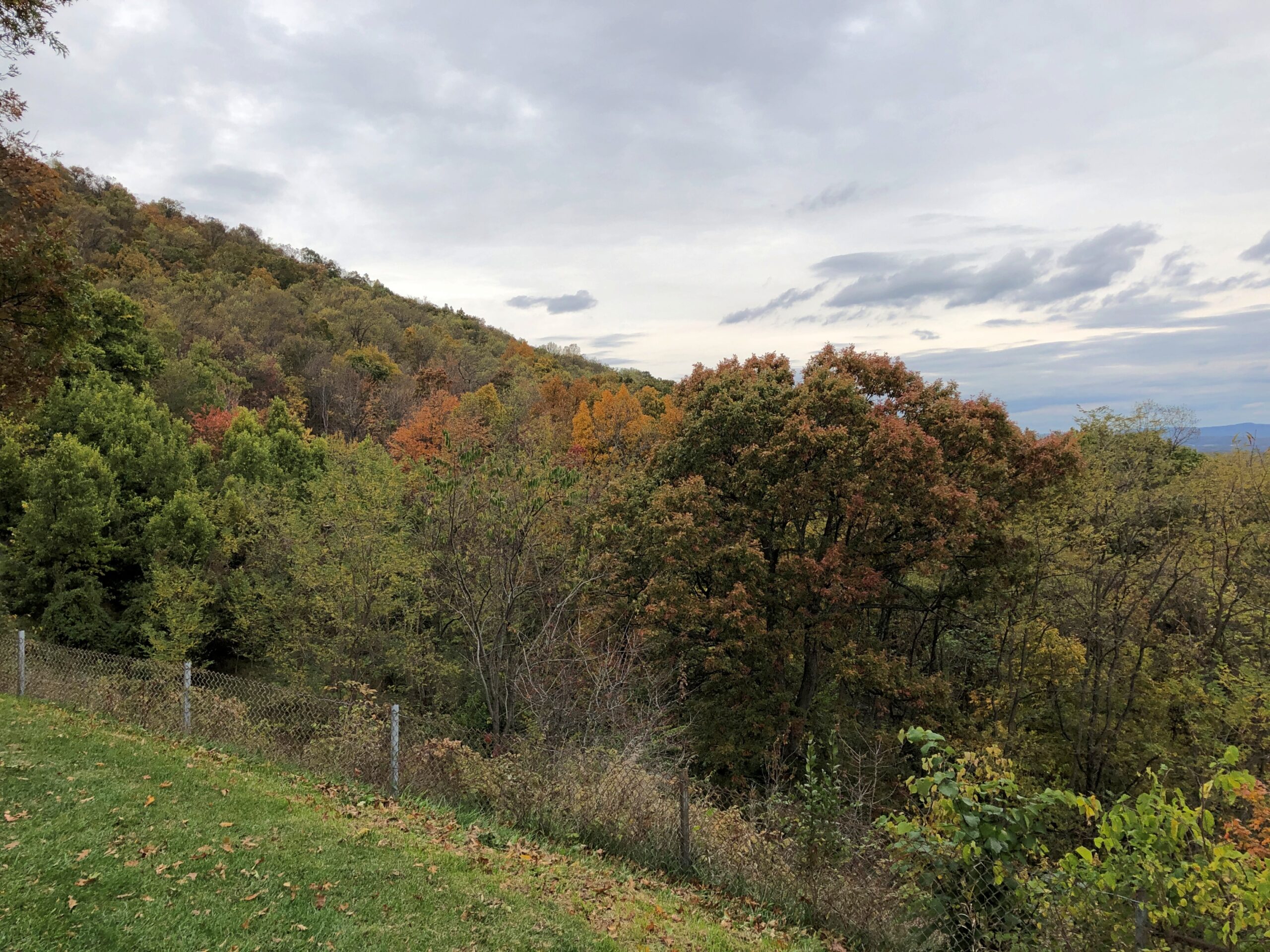
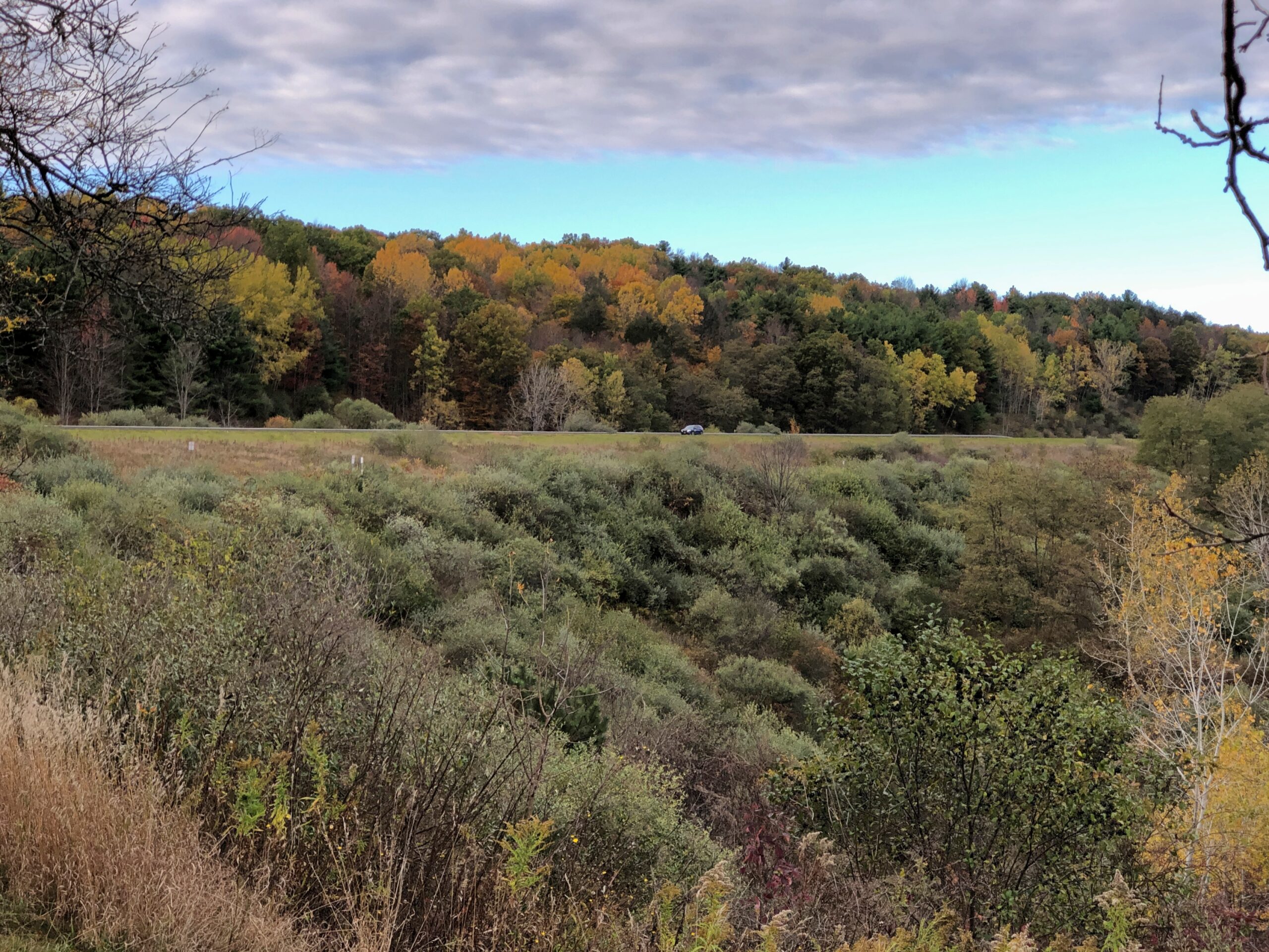
Before you get to Silverton on US 550, you cross Molas Pass, which has some terrific views of the edge of the Weminuche Wilderness. The day, by this time September 18, was clear and not exactly warm, but not that cold yet. Good day for a mountain drive.
Like the highway, the Molas Pass viewpoint was busy, but not overcrowded.
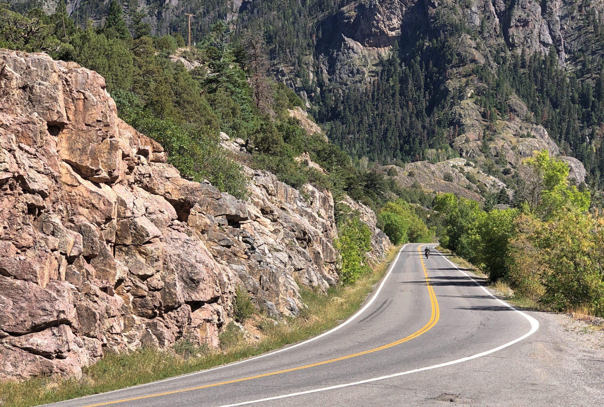
The route from Silverton to Ouray is known as the Million Dollar Highway. There isn’t a consensus about why that might be.
“There are a variety of explanations regarding the source of the name for the ‘Million Dollar Highway,’ says Roadtrip America. “One version claims it is based on the value of the ore-bearing fill that was used to construct the road, and another says it refers to the high cost of building a road over Red Mountain Pass (11,008 feet) and the Uncompahgre Gorge. One thing no one will dispute is the million-dollar views around every turn. This marvel of engineering, designed by Russian immigrant Otto Mears, slices through rugged mountains as it follows old stagecoach routes and former pack trails.”
If you want some twisty mountain road action, Million Dollar’s got it. Also, stretches without guard rails.
“About 40 accidents take place on the Million Dollar Highway each year, with an average of seven deaths per year,” the Durango Herald reported in 2023. “Most of the accidents are caused by careless or fast driving in bad road conditions. Other factors are mudslides, inclement weather and wildlife appearing on the road when there is nowhere to swerve.
“While avalanches used to be a factor, the last reported death on the road because of an avalanche came in 1992.”
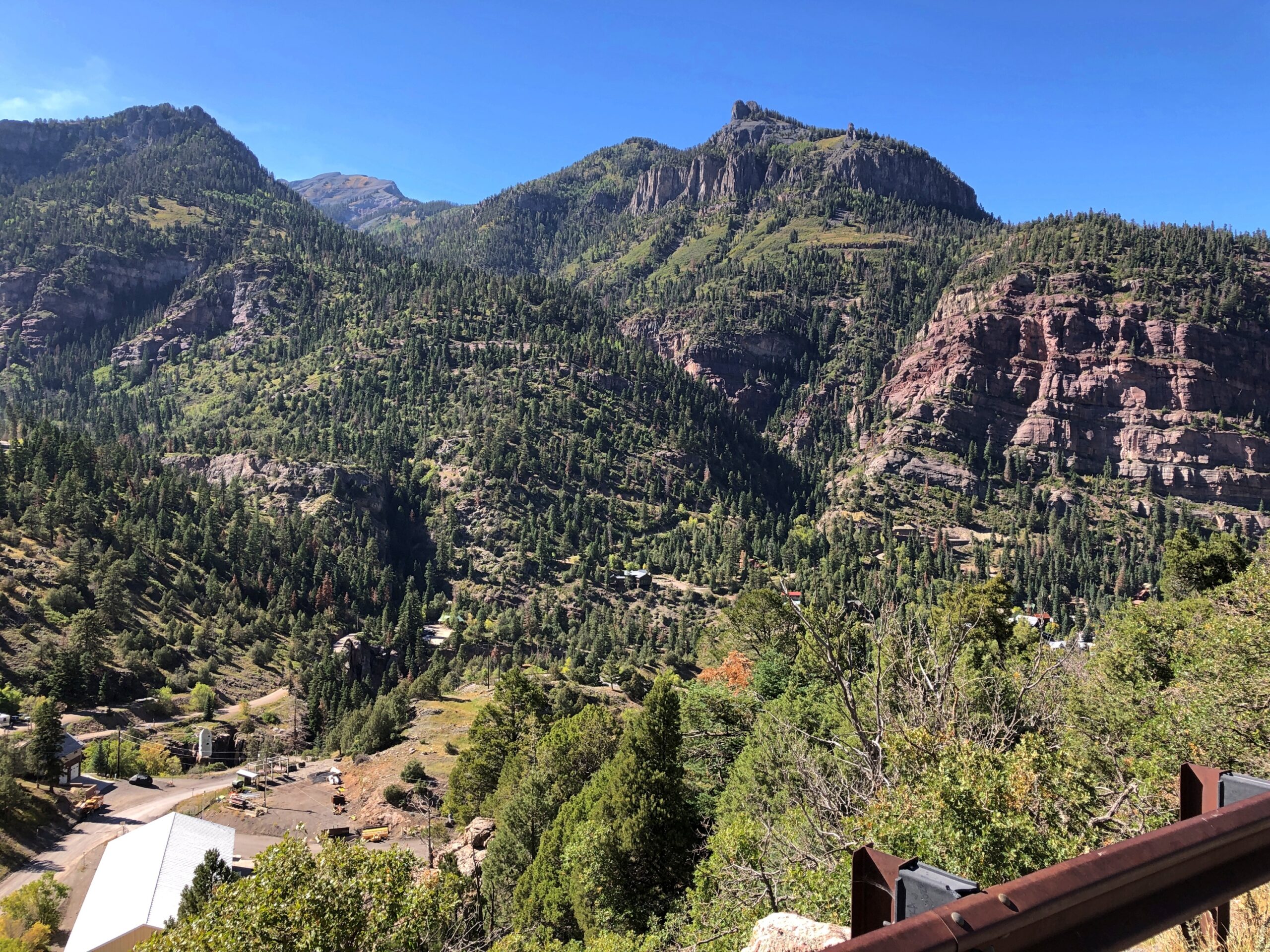
The views are exceptional, both as you move and when you stop. The road near Ouray.
Views near Ouray.
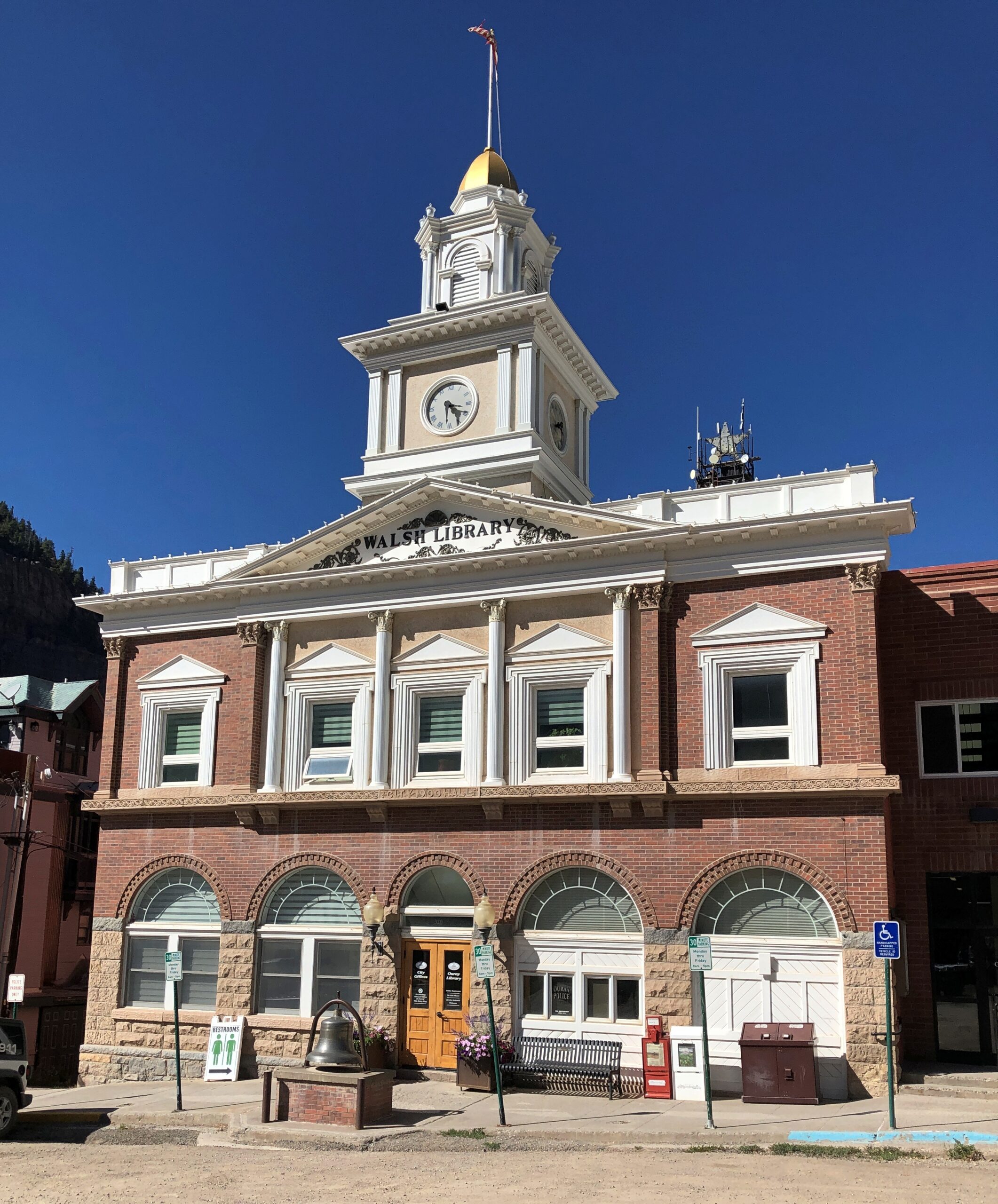
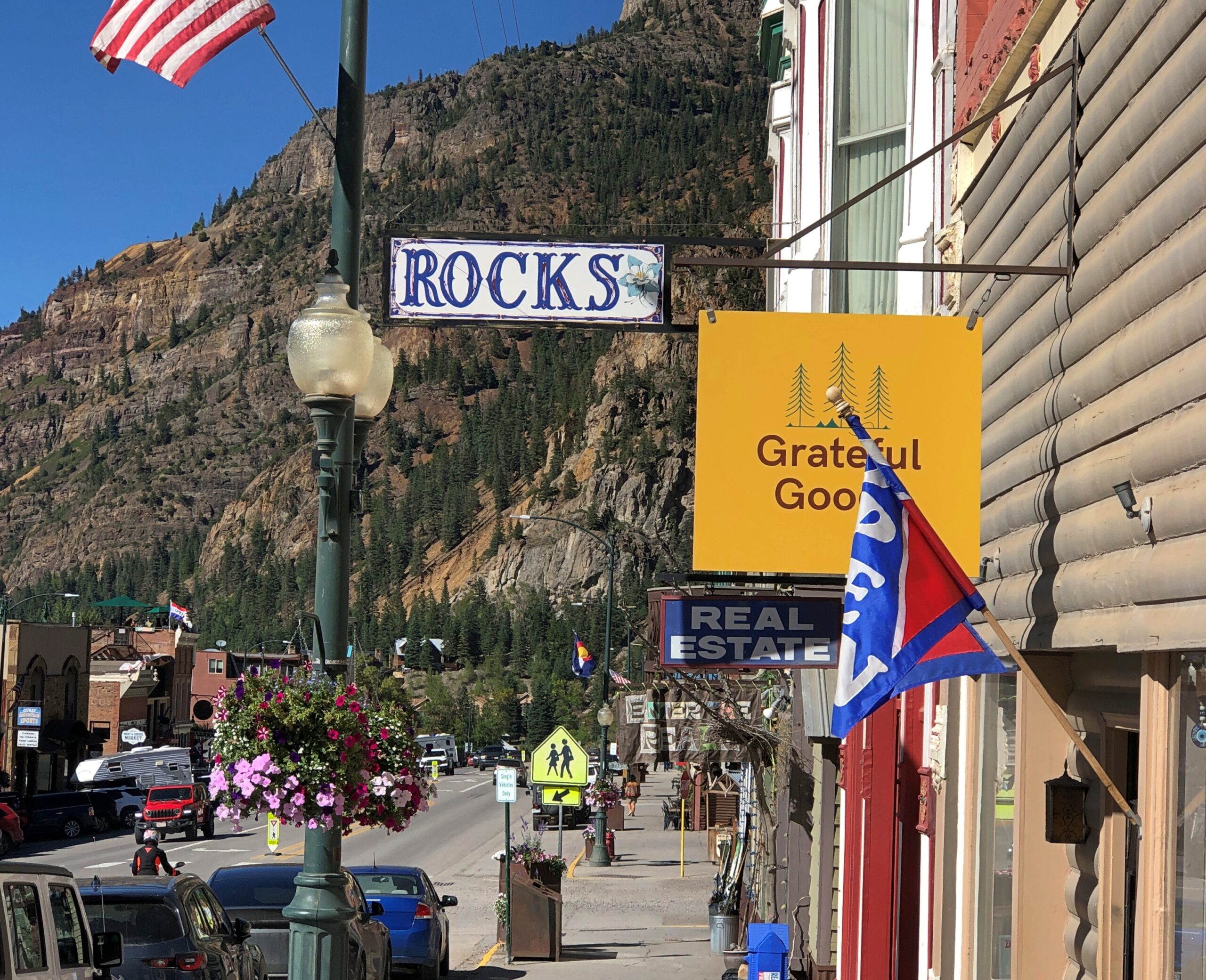
Ouray’s got some handsome buildings.
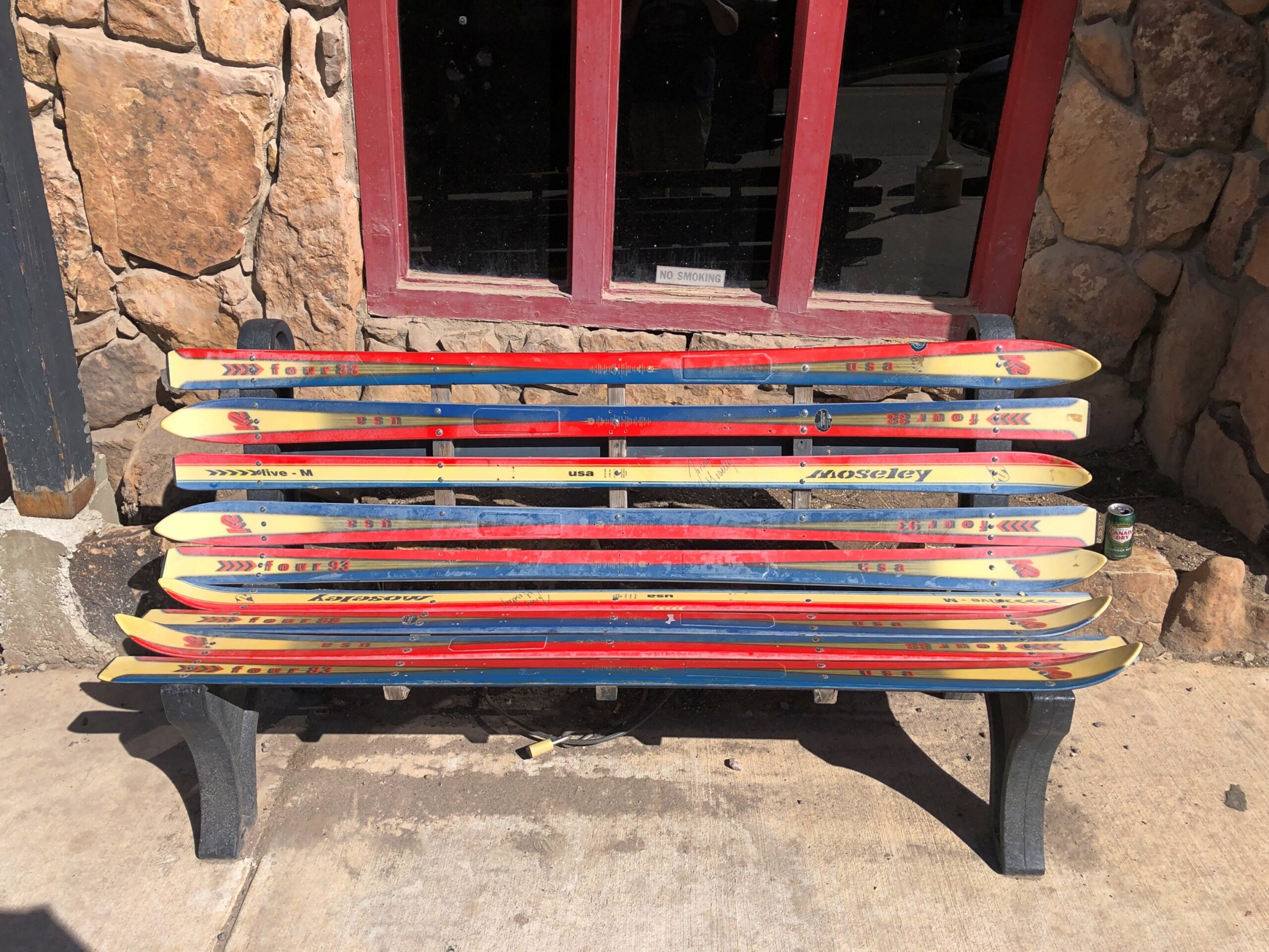
The main street in Ouray is the kind of place that has benches made from skis. Not the only time I saw that in Colorado.
Also, some boutique retail. Good to see that Grateful Goo is available.
Who sells that again? Gwyneth Paltrow? Anyway, hipsters, or more likely plastic surgeons and orthodontists and tech millionaires, seem to have long ago discovered Ouray, close as it is to Telluride. I saw a bumper sticker-like posting on a light pole in town that said: What do you mean there’s an employee housing crisis in Ouray? My 2nd home is always empty.
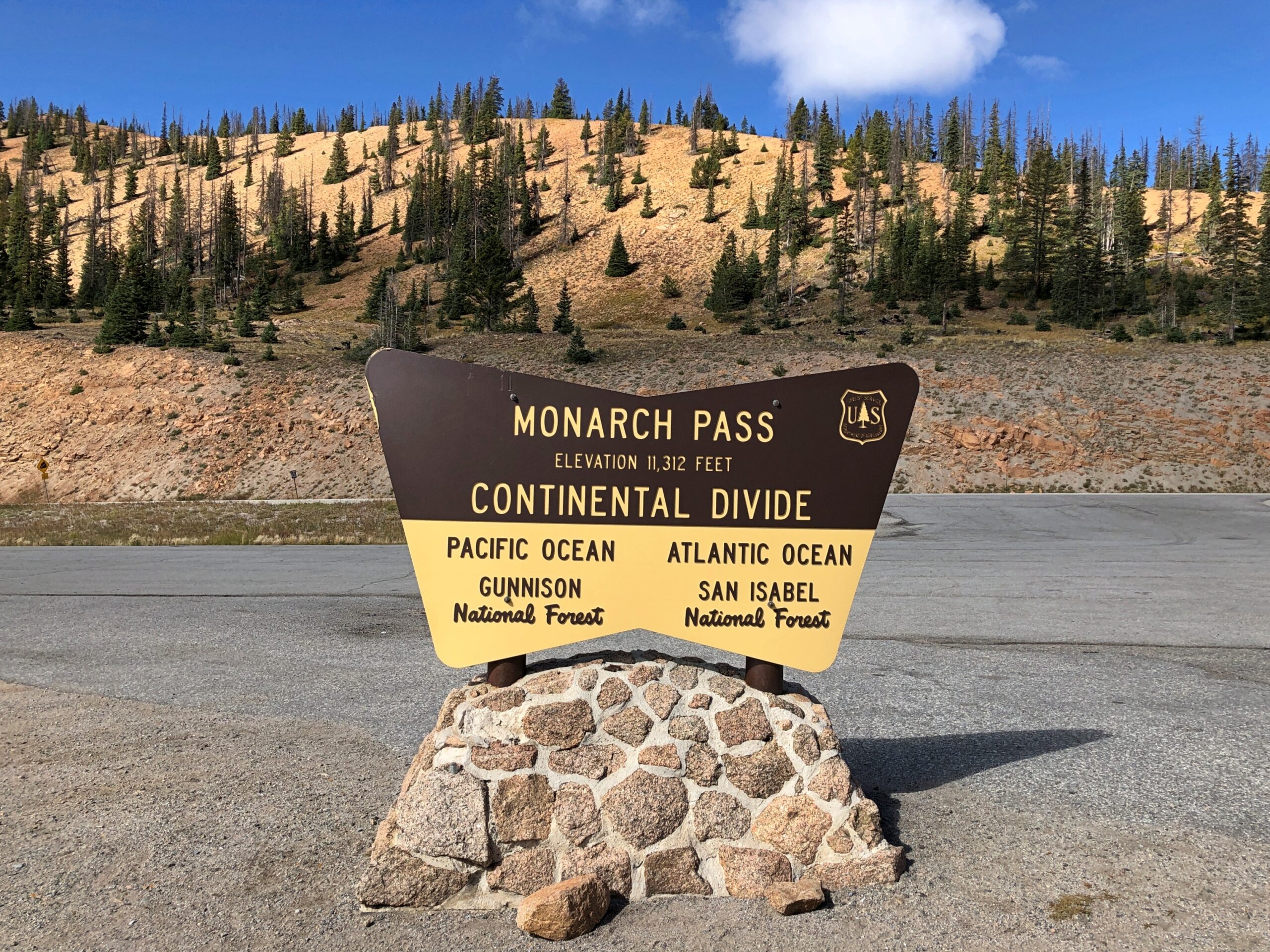
Monarch Pass
On our return to Denver, we headed out of Montrose east on US 50, a route that edges the gorgeous Blue Mesa Reservoir, and on to Gunnison and Salida. Just west of Salida, we took US 285 north, which goes to greater Denver. That highway crosses the Great Divide at Monarch Pass, elevation 11,312 feet.
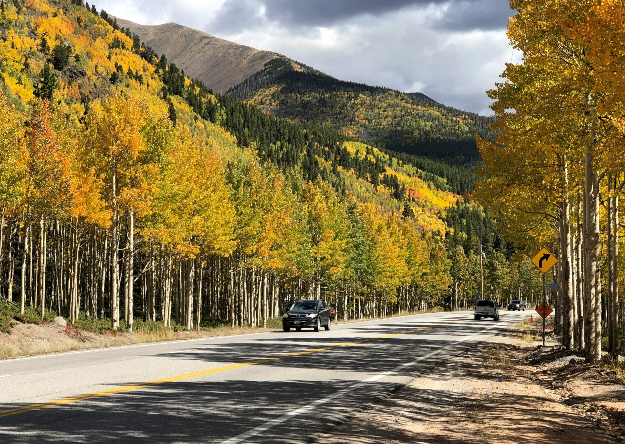
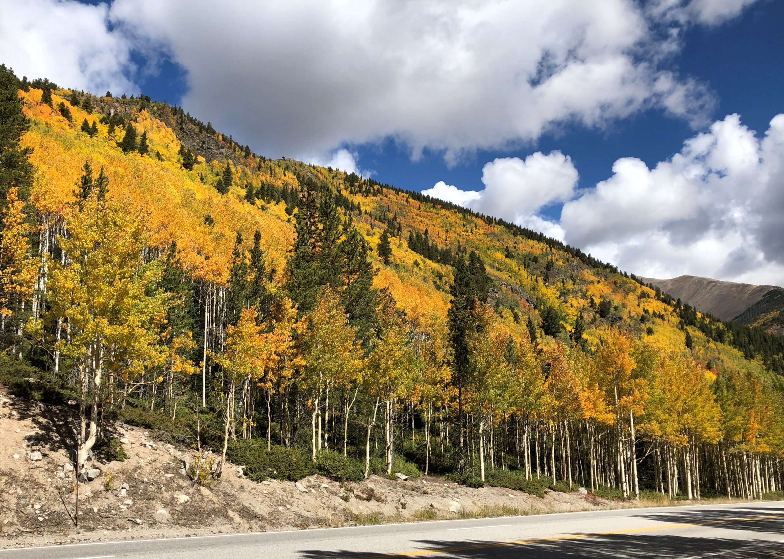
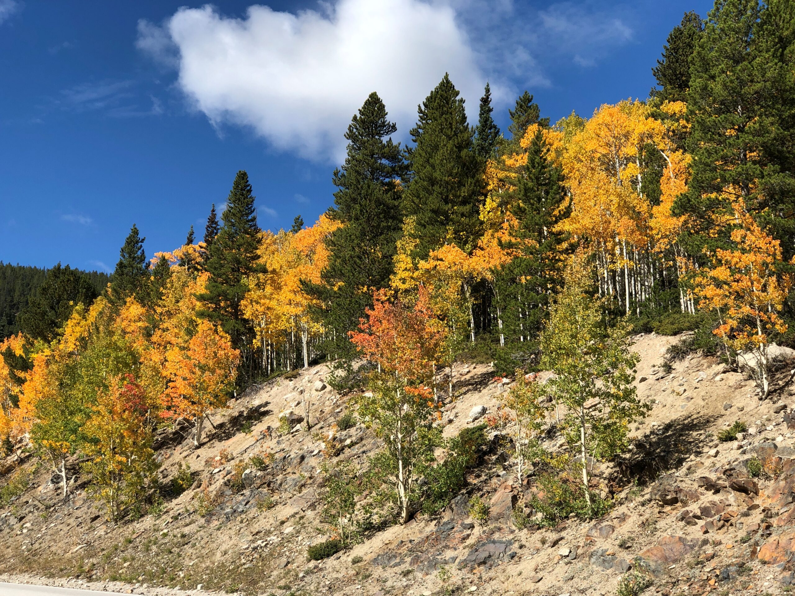
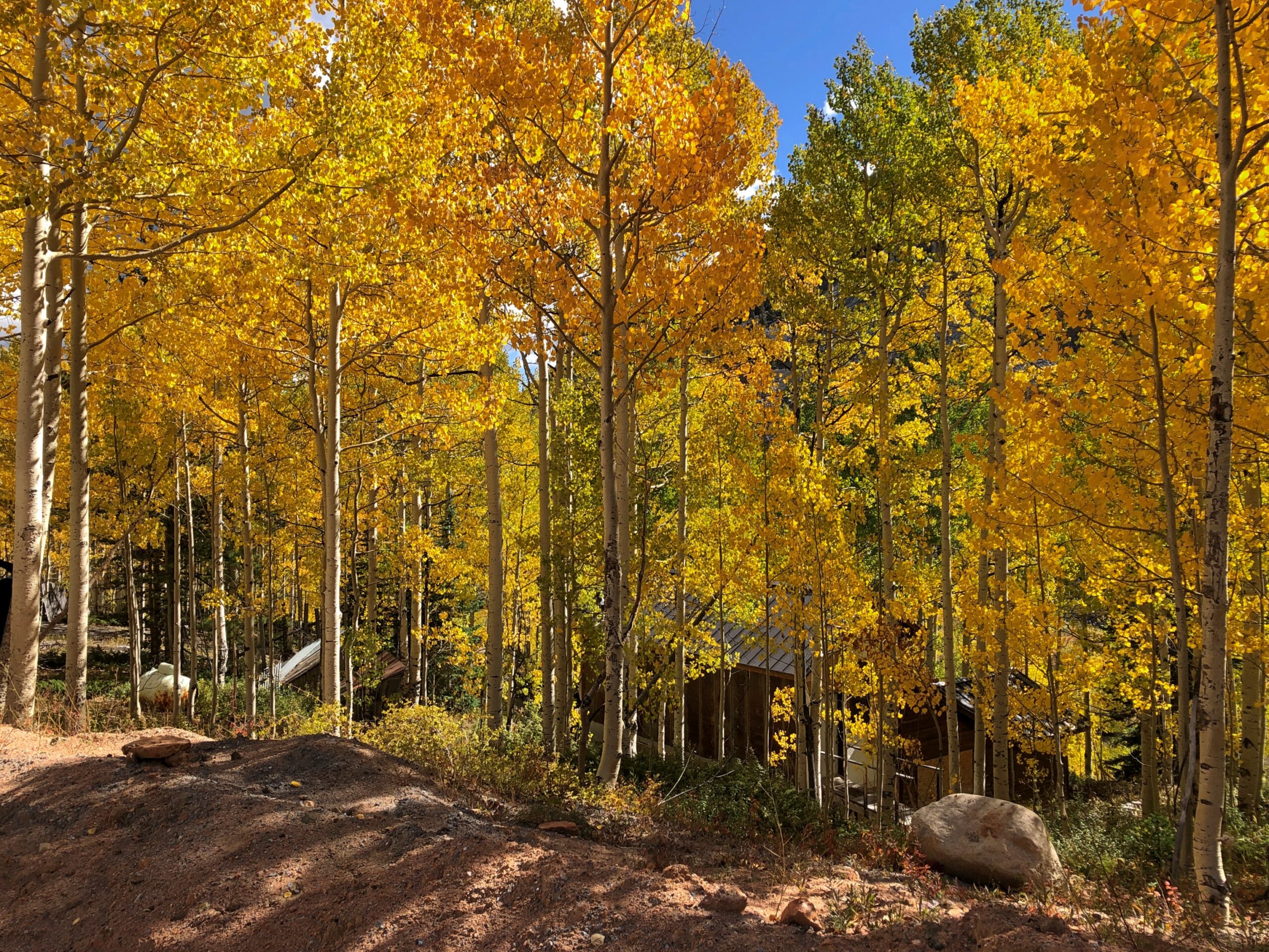
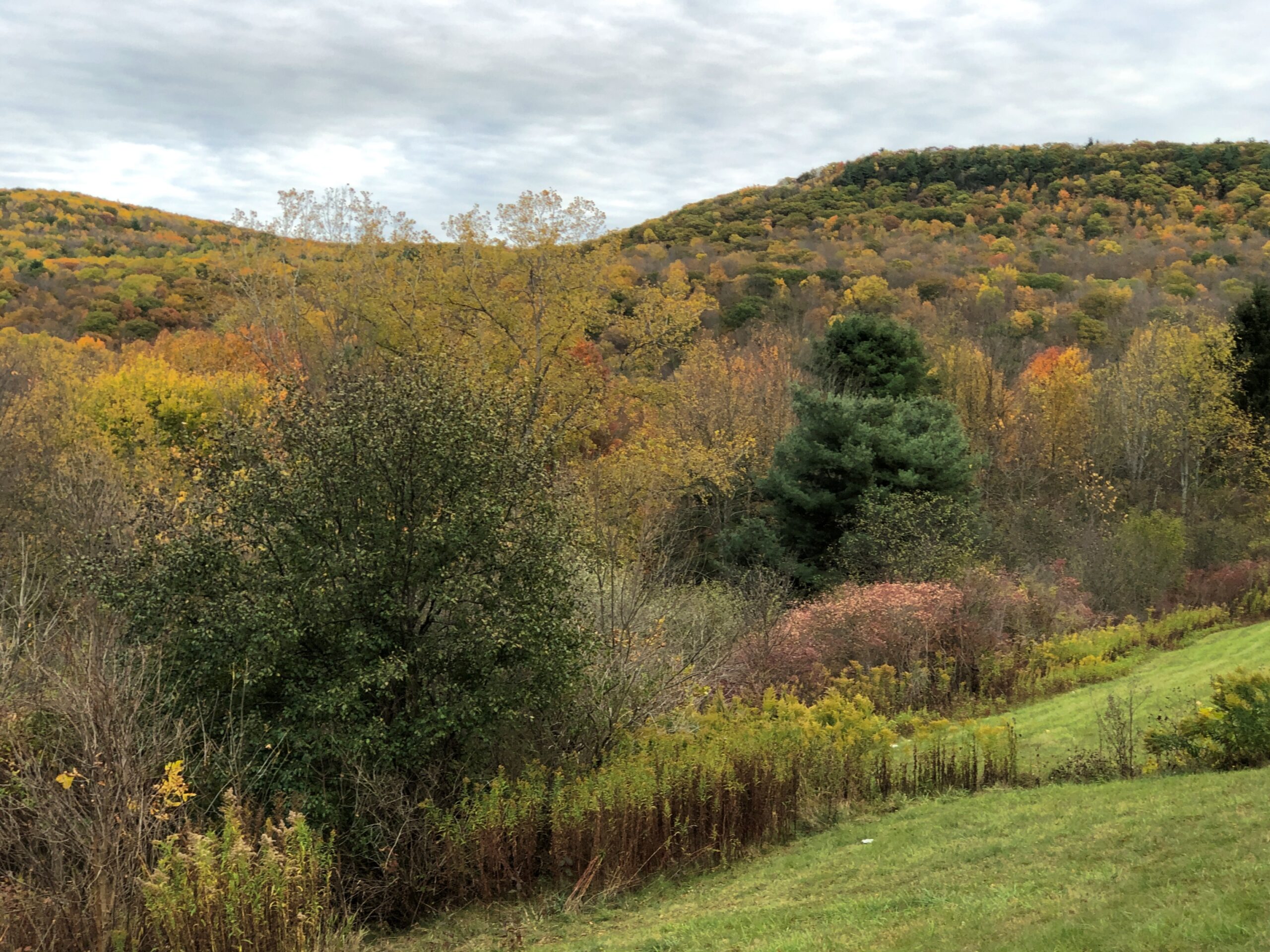
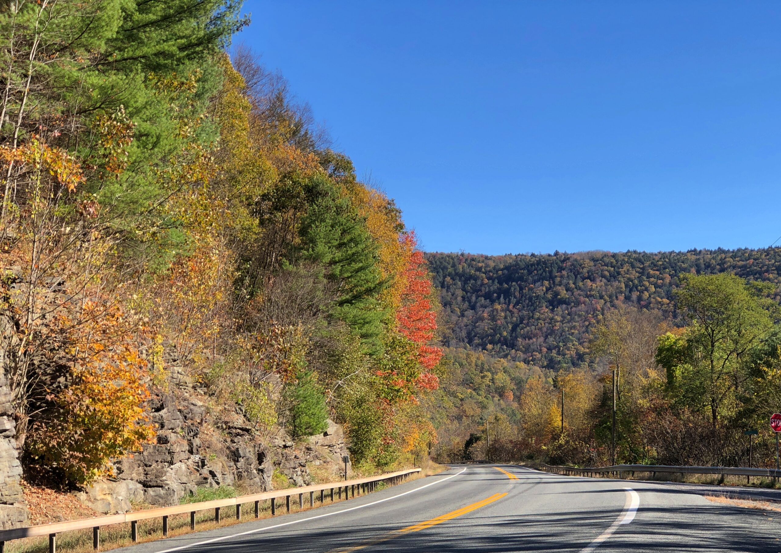
Even as early as September 20, the trees were ablaze.
I suppose that isn’t early for that elevation. We saw trees turning a week earlier, further north at Rocky Mountain NP. I didn’t know it at that time, but we were just beginning a fall season during which we’d see more colors (probably) than any other year. It’s not quite over even yet, with some reds and yellows here in the neighborhood. That isn’t so unusual. Lots of people seek out fall foliage. The odd thing was that it was completely unplanned.
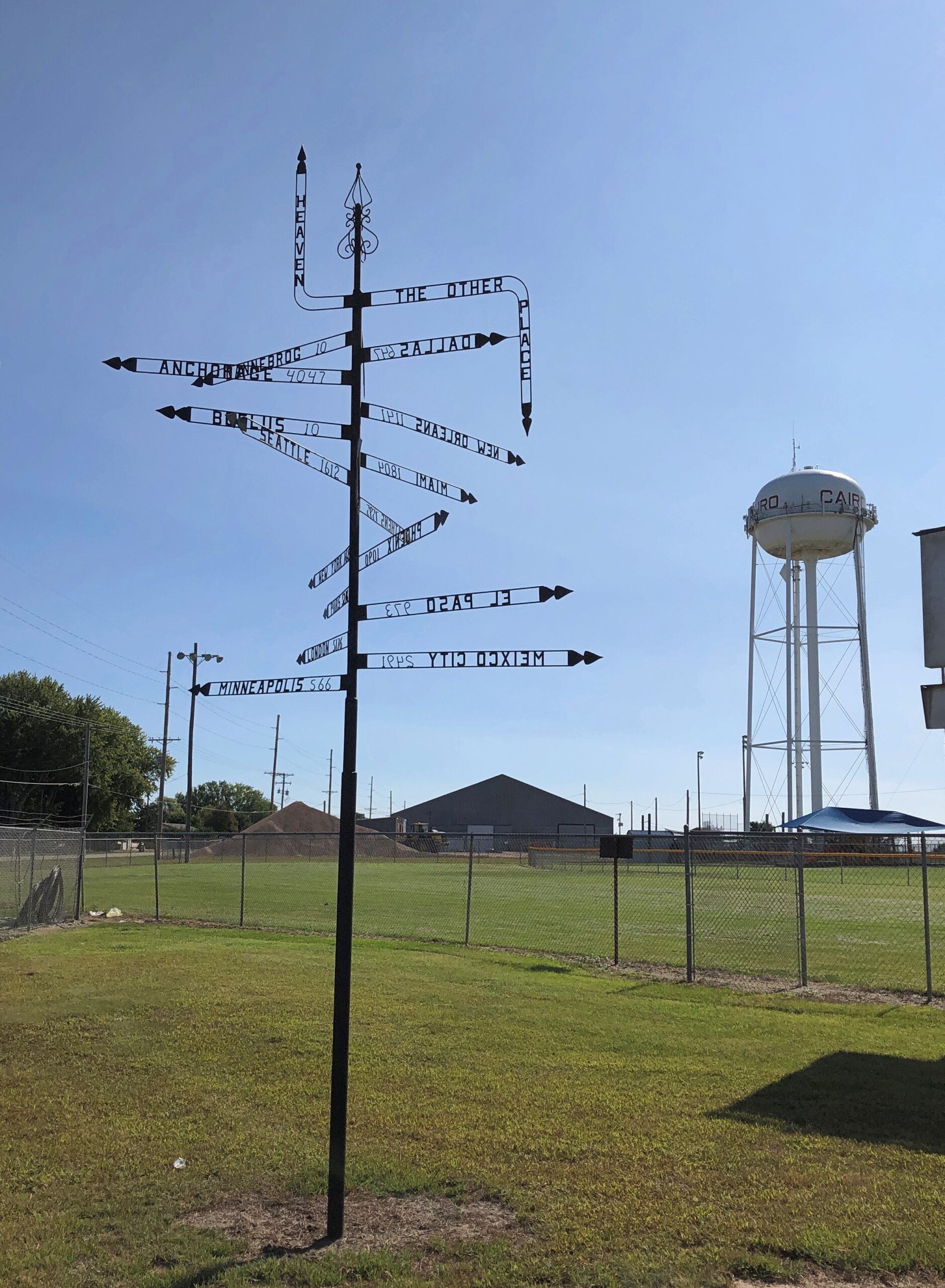
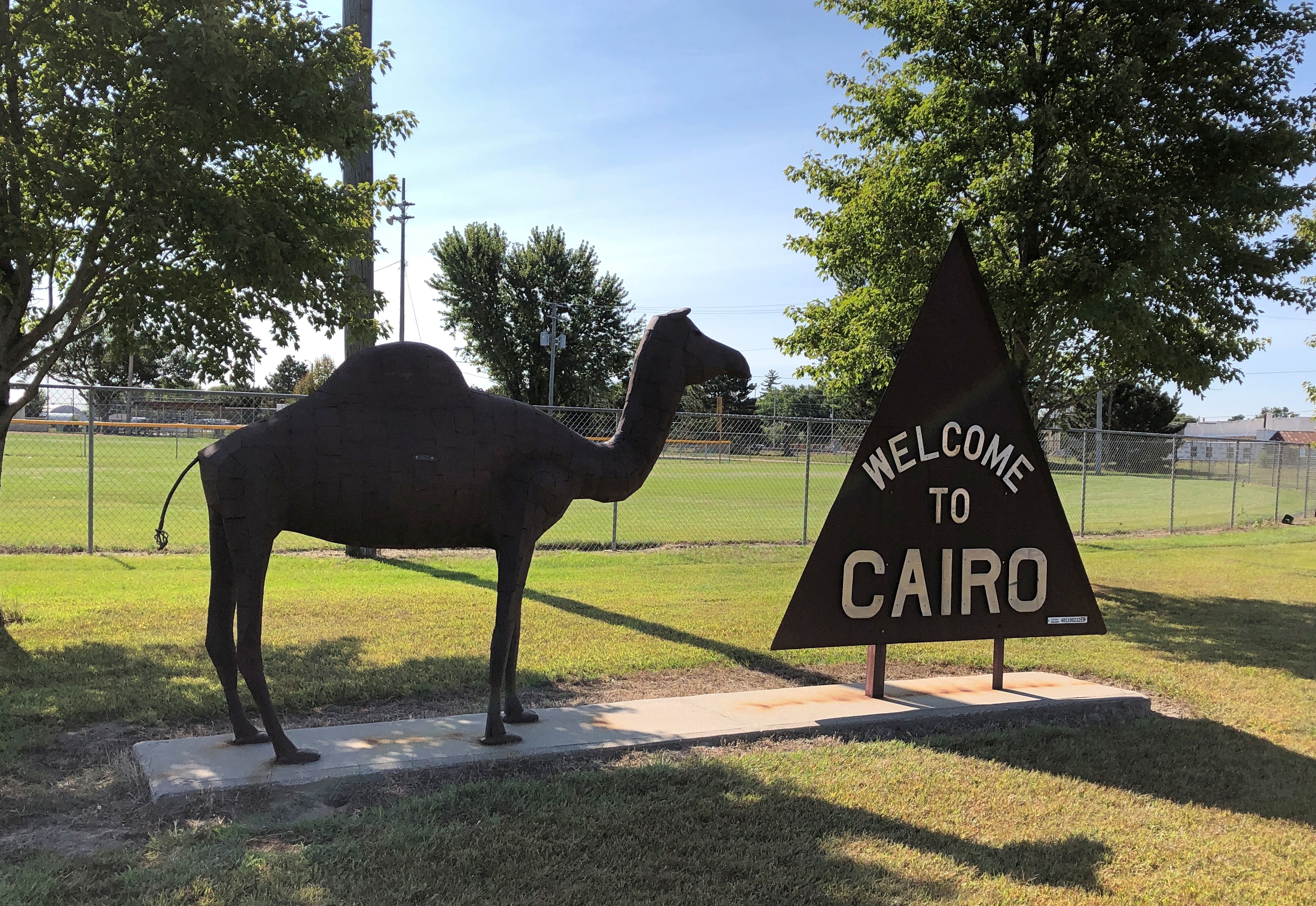
Which of these two destinations aren’t like the others?
That’s a beginner’s-level question. Better question: where can you find this pole, with mileages and – what units measure the distance to Heaven or Hell? – other signs?
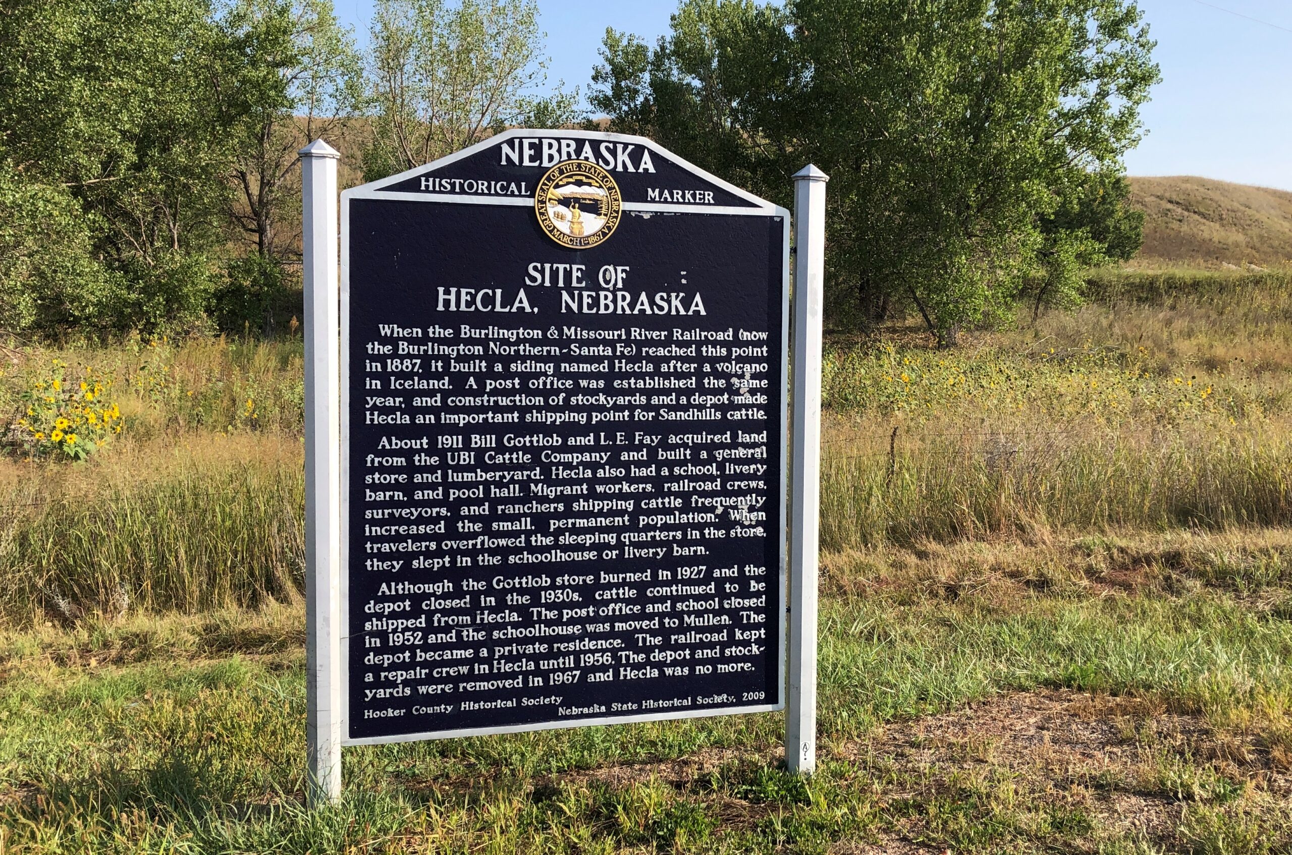
Answer: Cairo, Nebraska.
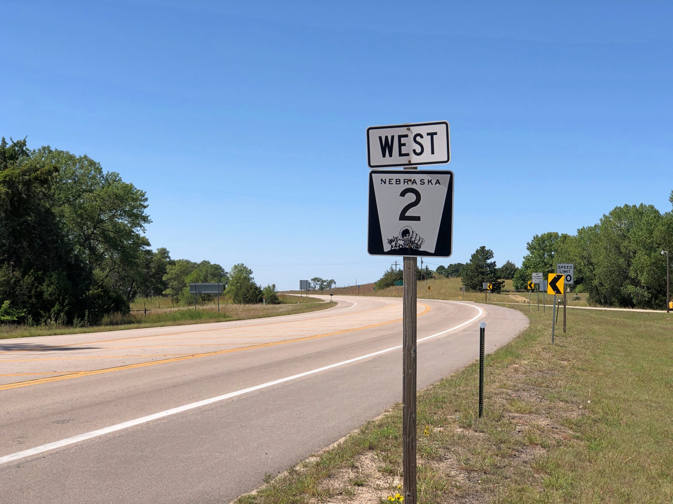
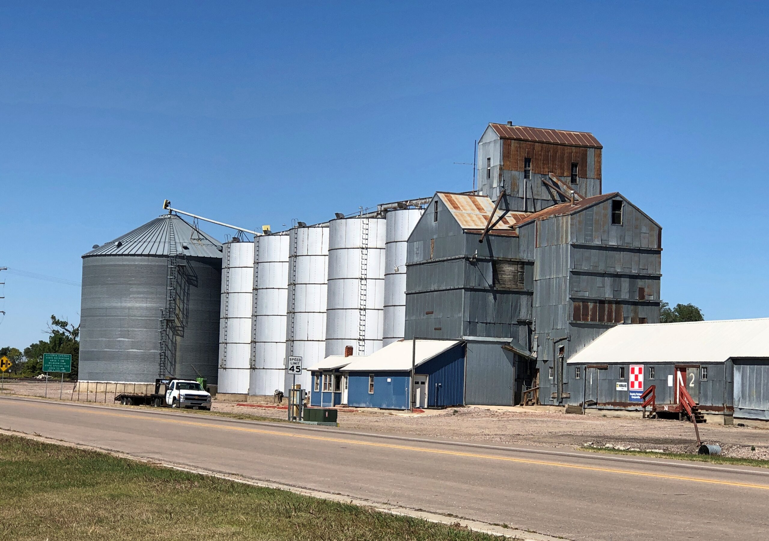
Maybe a palm tree was in the works, but the city decided not to spend any more money. Cairo (pop. 822) is one of the small chain of small towns on the eastern section of the highway Nebraska 2, which runs westward and north of Grand Island. Cairo is the first place I stopped on my way west on that highway in early September.
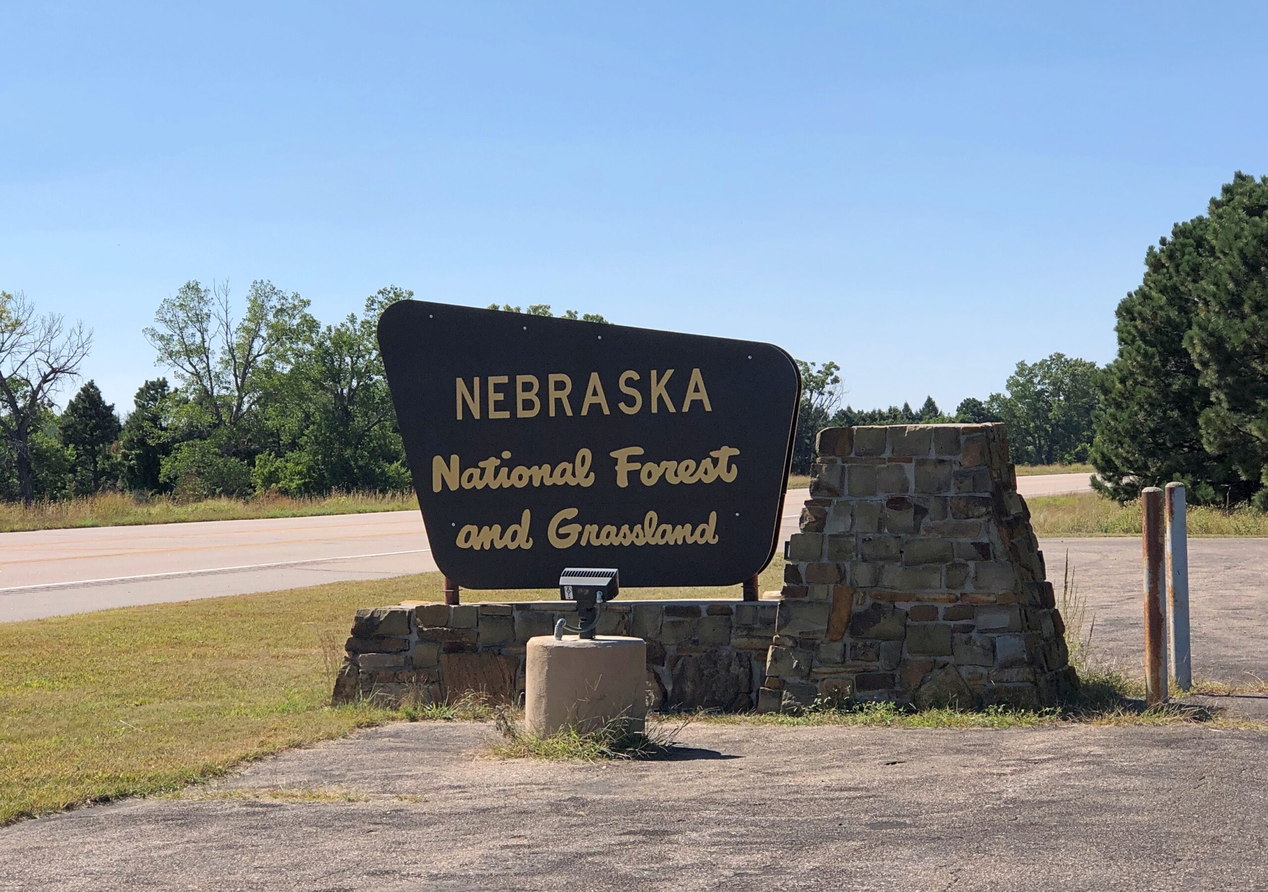
Eventually the highway reaches the Nebraska National Forestand Grassland, a patch of (partly) wooded land that inspires the question, there’s a national forest in Nebraska?
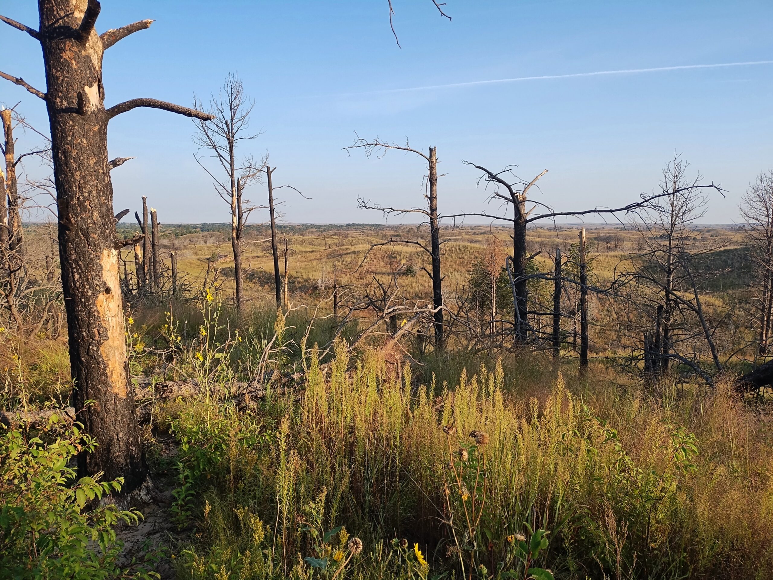
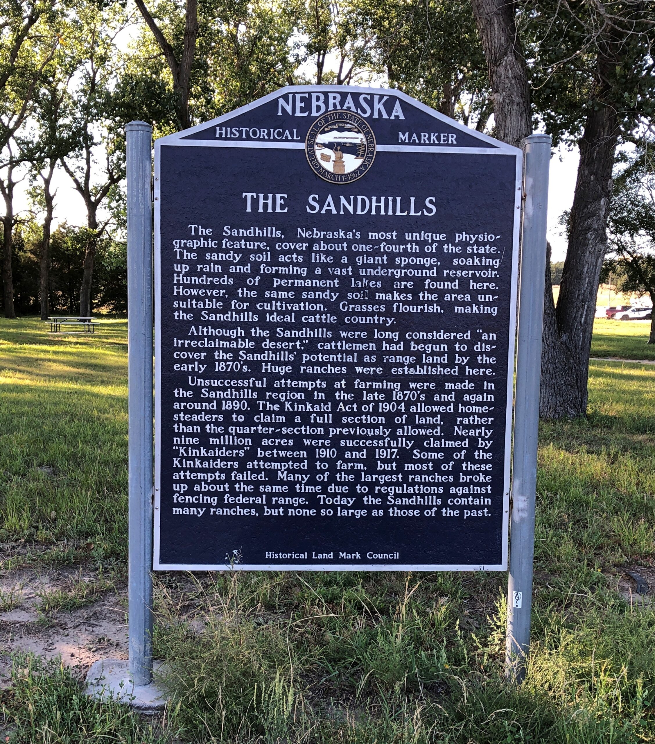
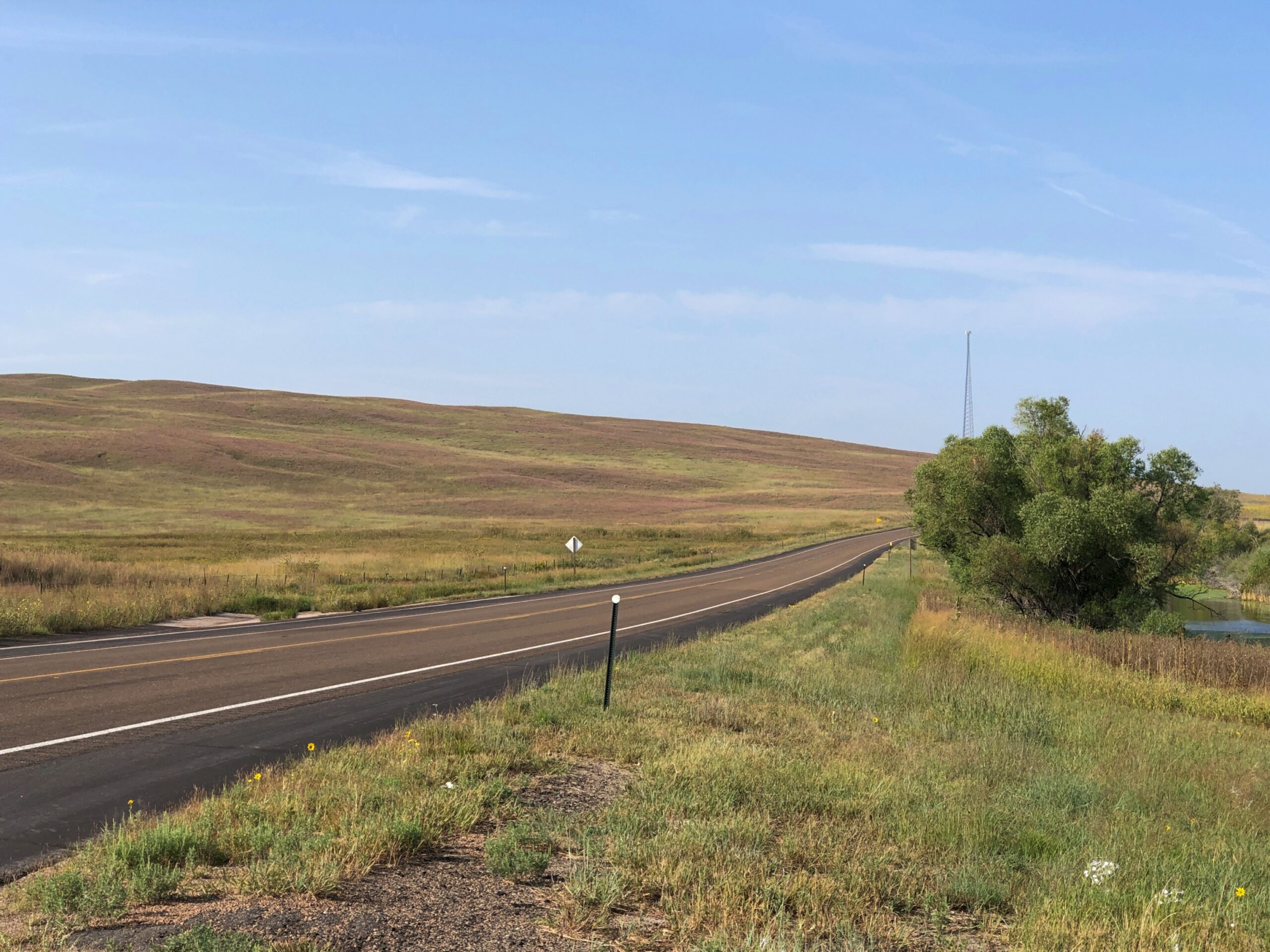
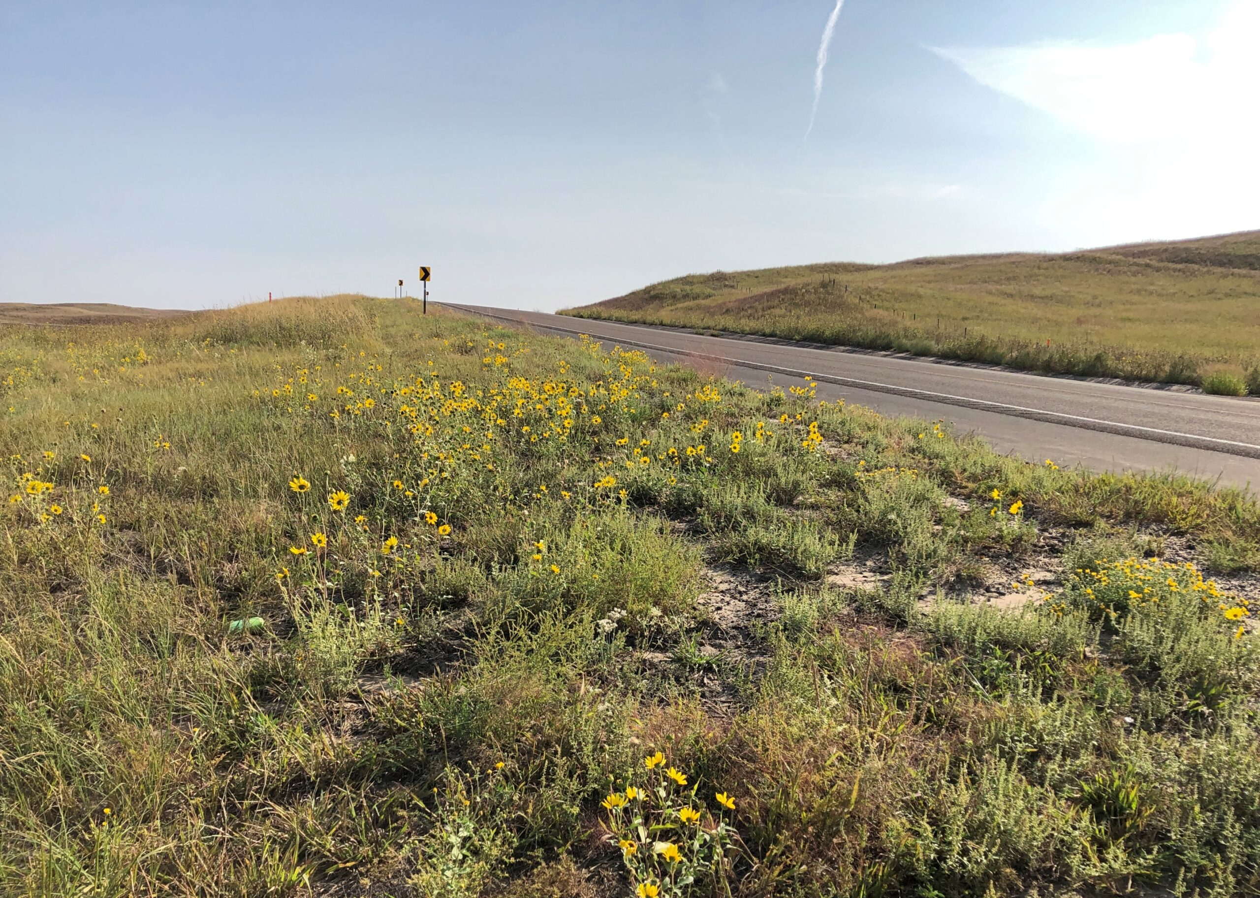
West from the forest, Nebraska 2 crosses the Sandhills, an unusual place here in North America, with the land morphing from cropland to ranch land on sandy steppes. The towns on the way are mere hamlets, and sometimes not even that. On the western edge of the Sandhills, one comes to the sizable town of Alliance, Nebraska, home of Carhenge and railroad staging area for coal trains headed east.
Before I did the drive, I was looking forward to it as much as any of the roads in Colorado. It lived up to expectations. Nice when that happens.
The Fence Postcites Charles Kuralt’s fondness for Nebraska 2: “Highway 2 is not just another highway that goes somewhere. Highway 2 is somewhere,” he’s known to have said. I’d say whatever else his failings, Kuralt had good taste in roads.
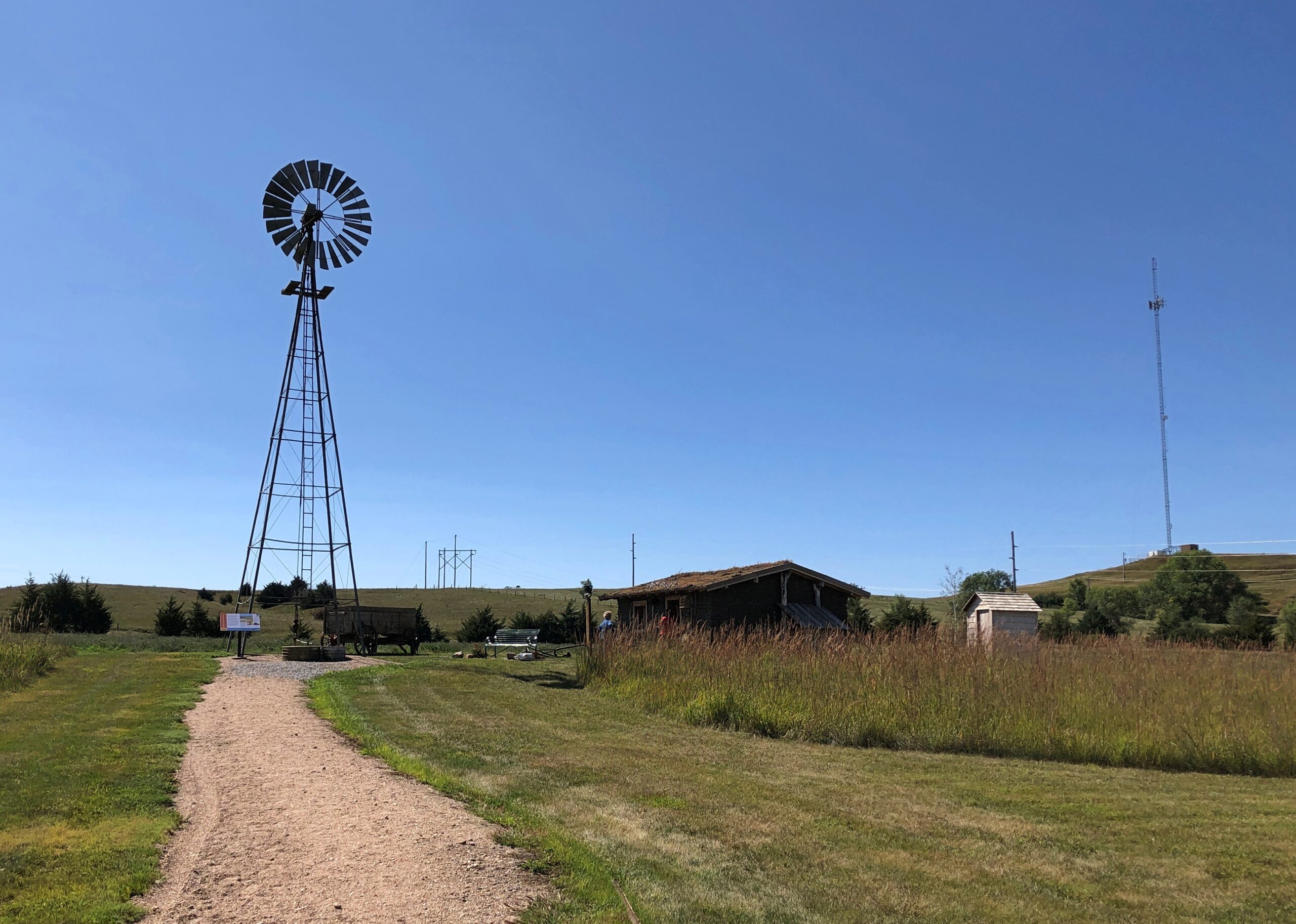
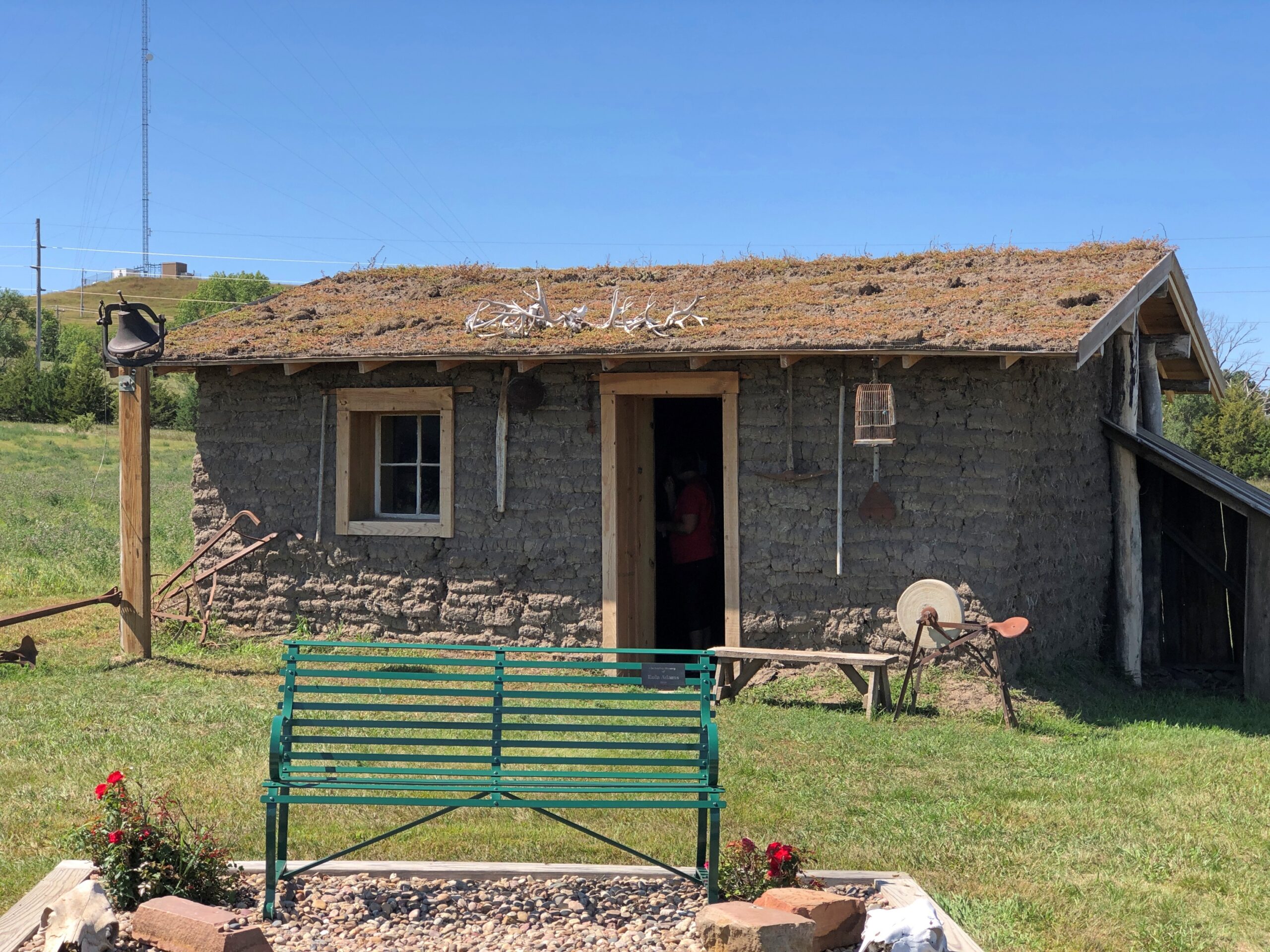
Just outside Broken Bow (pop. 3,491), seat of Custer County and pretty much the only town of any size in that county, the Sandhills Journey Scenic Byway Visitor Center offers a building with bathrooms and pamphlets and displays and, for my visit at least, a grandmotherly and talkative volunteer. Old enough, she said, to remember when the highway was just a road through the countryside that attracted no attention from the outside world. Not a scenic byway, and sand hill cranes were just flocking birds. Now a trickle of tourists and bikers and RVers come this way. She had some solid recommendations, especially a good diner for lunch.
The visitor center grounds include a relocated (or was that reconstructed?) Sandhills cabin. The residences of the farmers trying to scratch out a living in the Sandhills, and finding out that no amount of scratching would make decent crops grow consistently from the land.
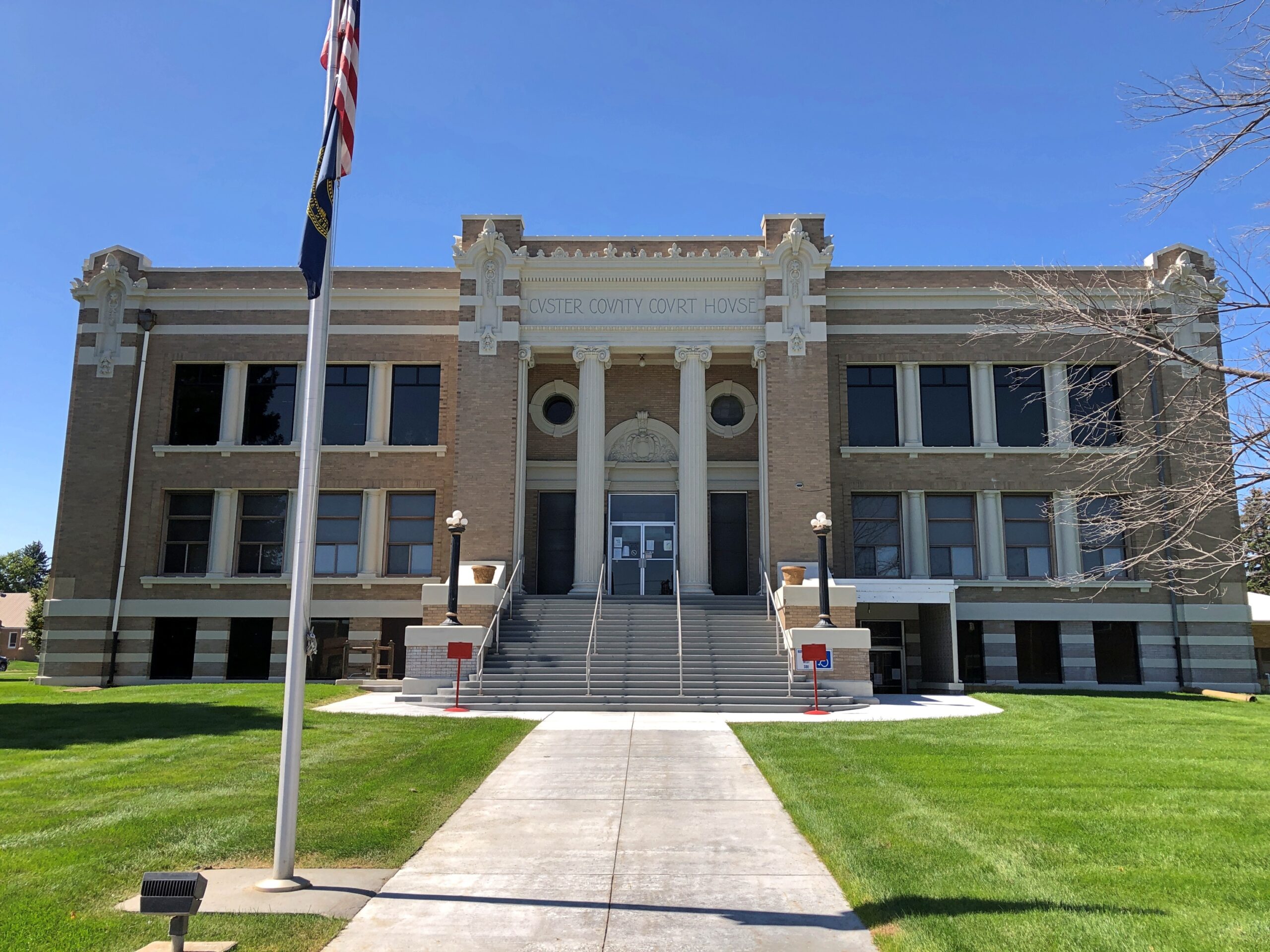
The Custer County Courthouse. Saturday, closed.
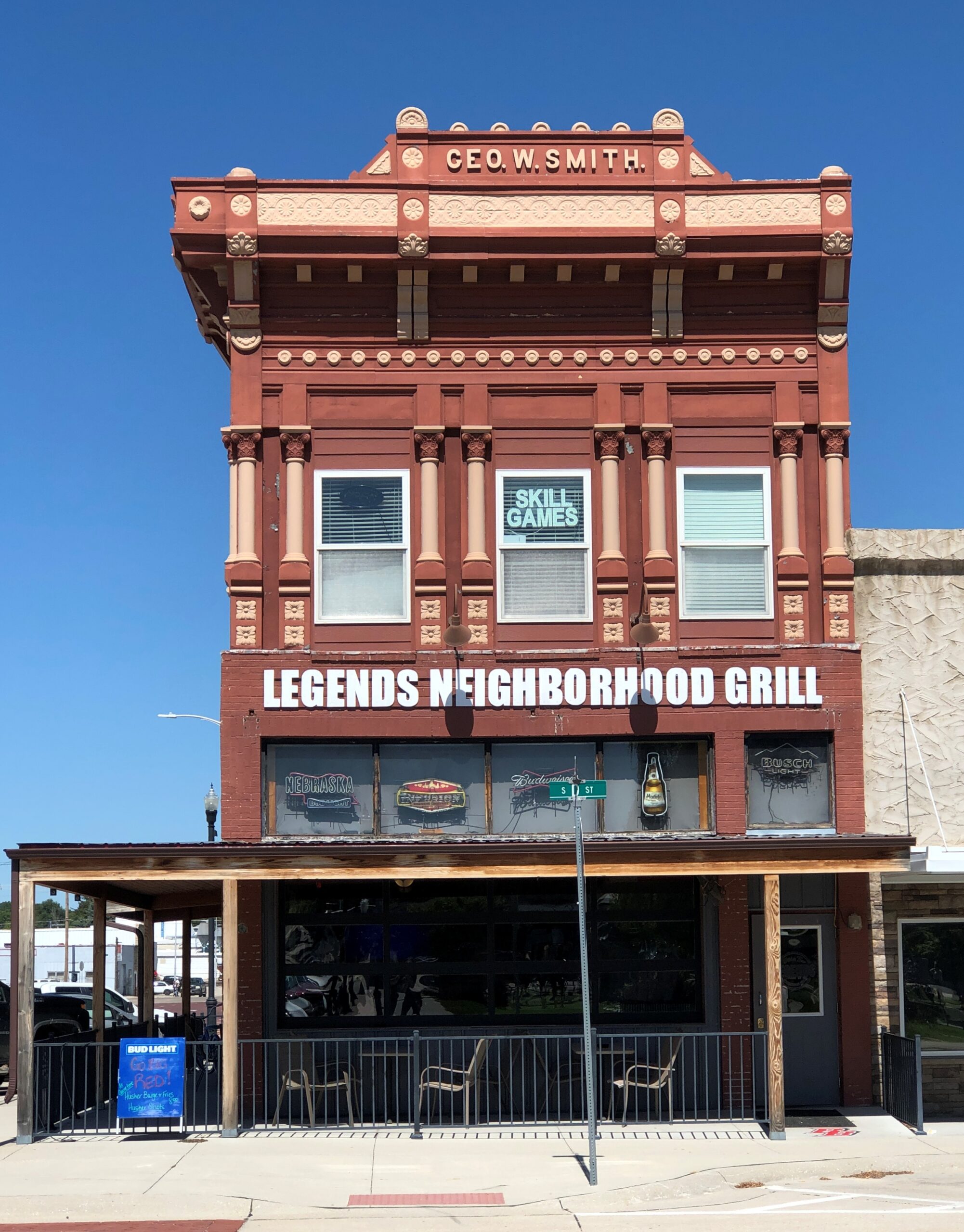
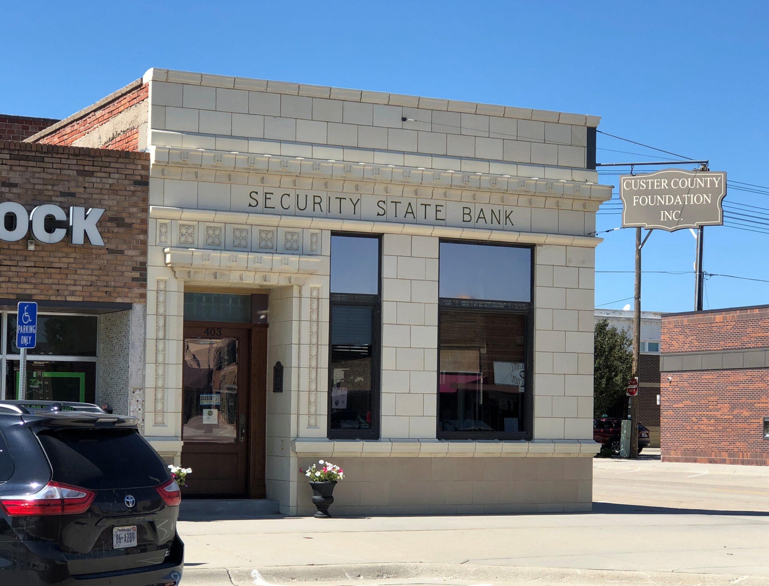
A block from the courthouse, some buildings around City Square Park.
City Square Park is a generic sort of name. Wonder whether there’s anyone from the town who can be honored by renaming the park? Looking at list of notables from Broken Bow, one instantly stands out.
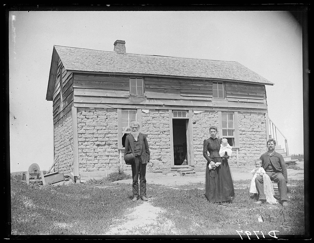
Wiki: “Solomon D. Butcher (January 24, 1856 – March 18, 1927) was an itinerant photographer who spent most of his life in central Nebraska, in the Great Plains region of the United States… he began in 1886 to produce a photographic record of the history of European settlement in the region. Over 3,000 of his negatives survive; more than 1,000 of these depict sod houses.”
Frederic Schreyer and family, Custer County, 1880s, by Solomon Butcher.
Definitely name the park after Butcher, Broken Bow.
One more in that town. I couldn’t be bothered to get out of the car.
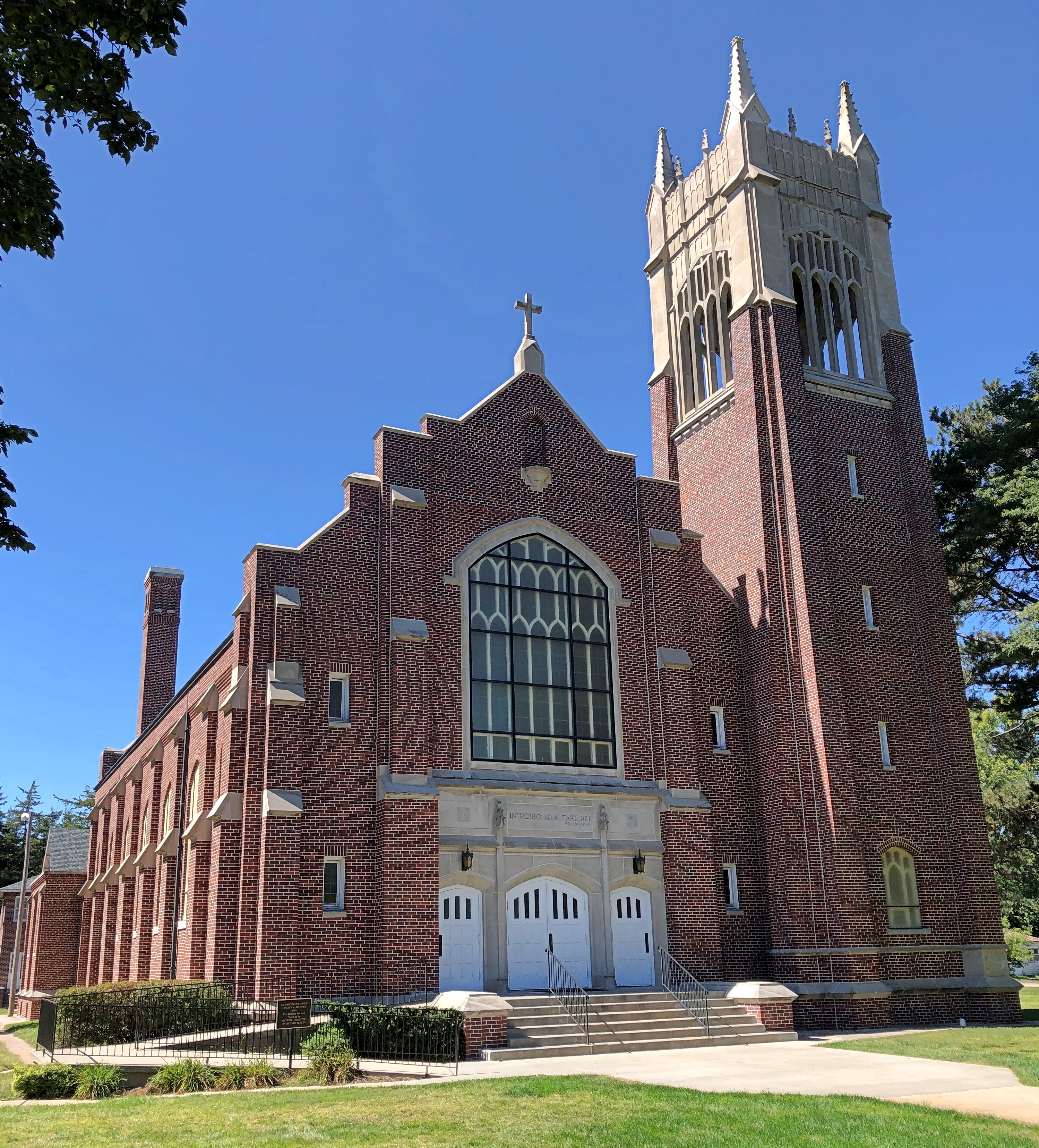
West of Broken Bow is Anselmo (pop. 145), home of this church, St. Anselms Catholic Church, nicknamed Cathedral of the Sandhills. Saturday, closed.
A more common sort of building, not far from the church.
Not the most imposing that I saw, but representative of the many structures like it. The grist of a photo collection. Of course it has been done. I’m pretty sure I saw a room of Bernd Becher’s photos of water towers at the Modern Art Museum of Fort Worth.
Nebraska National Forest and Grassland is in an unexpected place, slap in the middle of Nebraska, not due to a freak of nature, but the efforts of human beings. Specifically, mass plantings of trees by the federal government for more than 100 years, beginning (not a surprise) during the administration of Teddy Roosevelt.
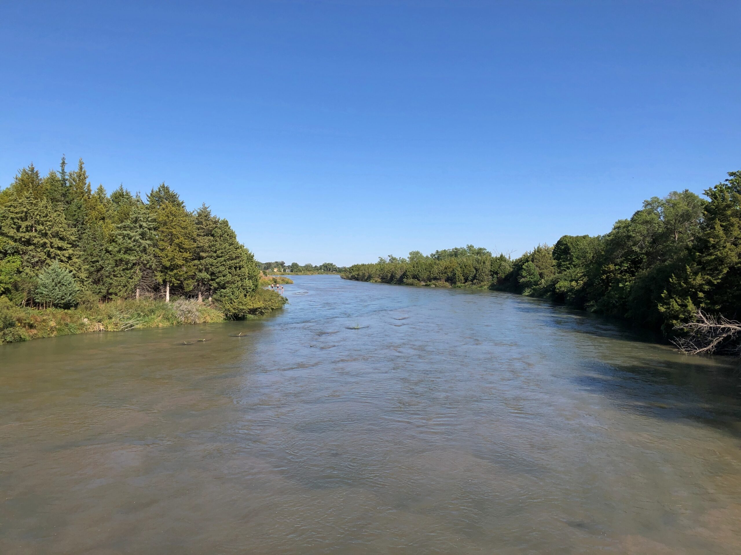
Near the national forest entrance is the Middle Loup River, broad but shallow, and crossable on a foot bridge.
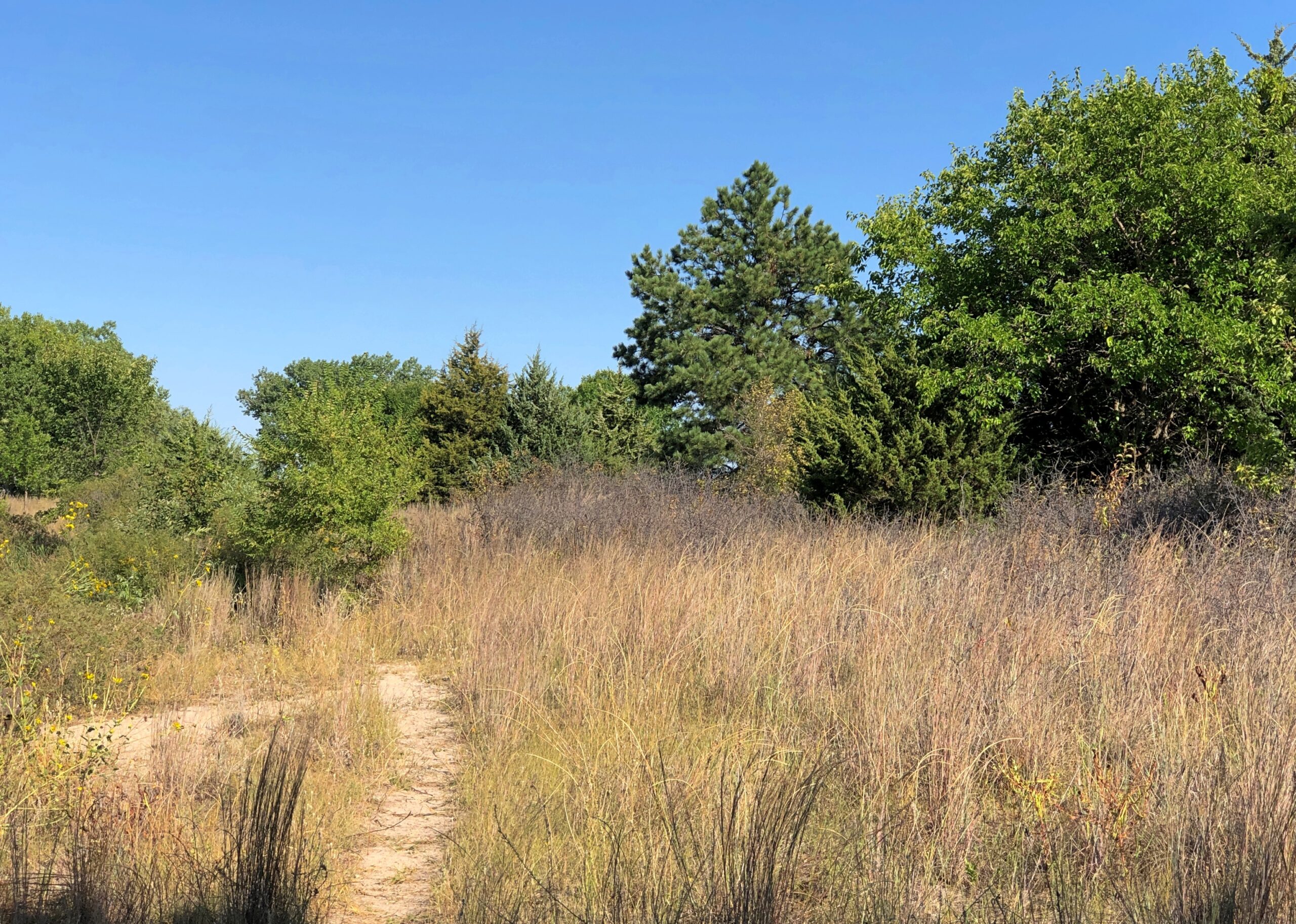
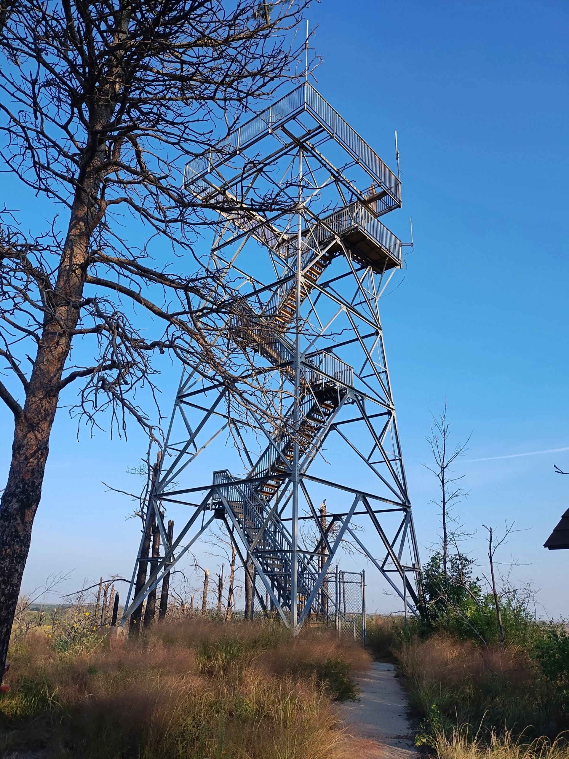
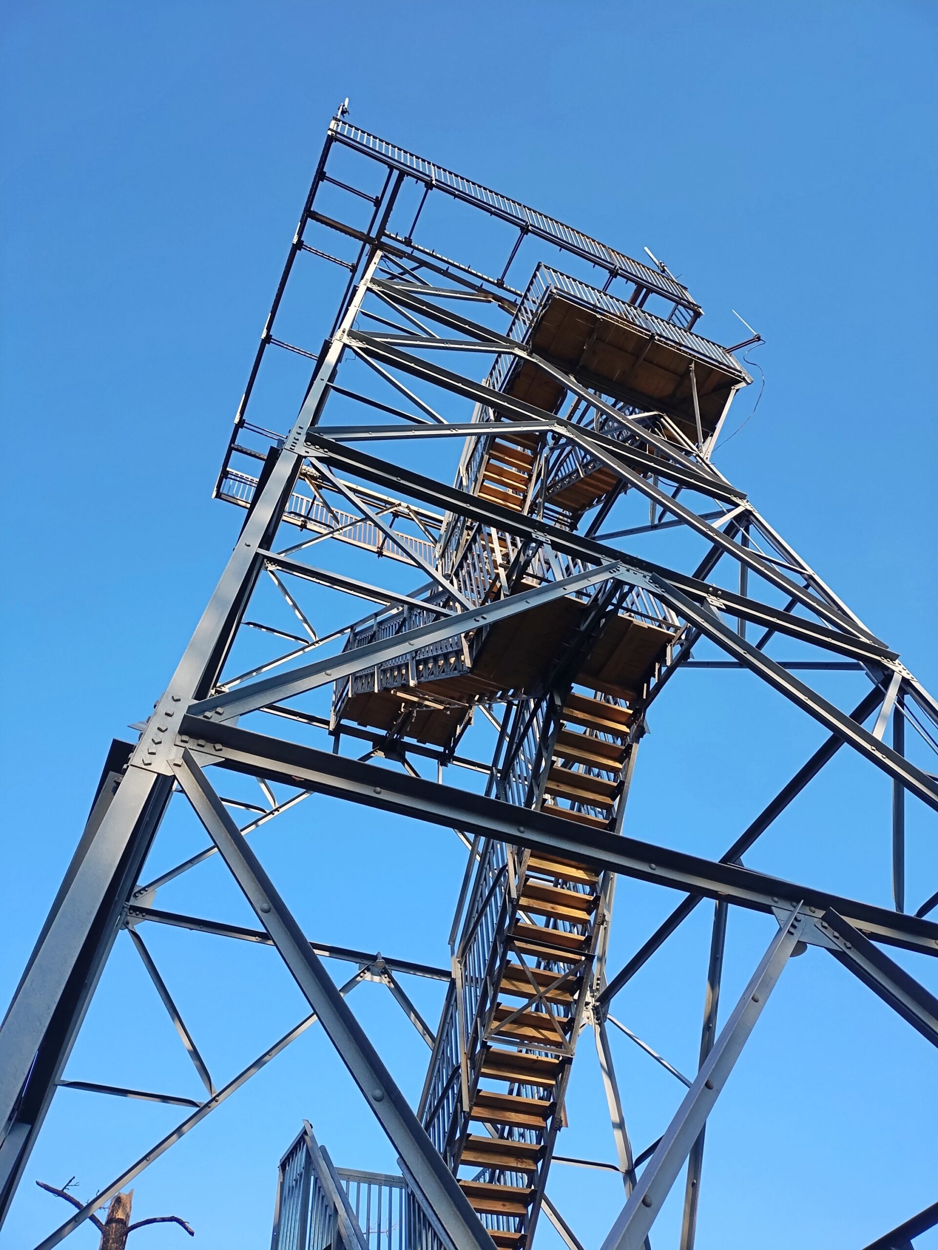
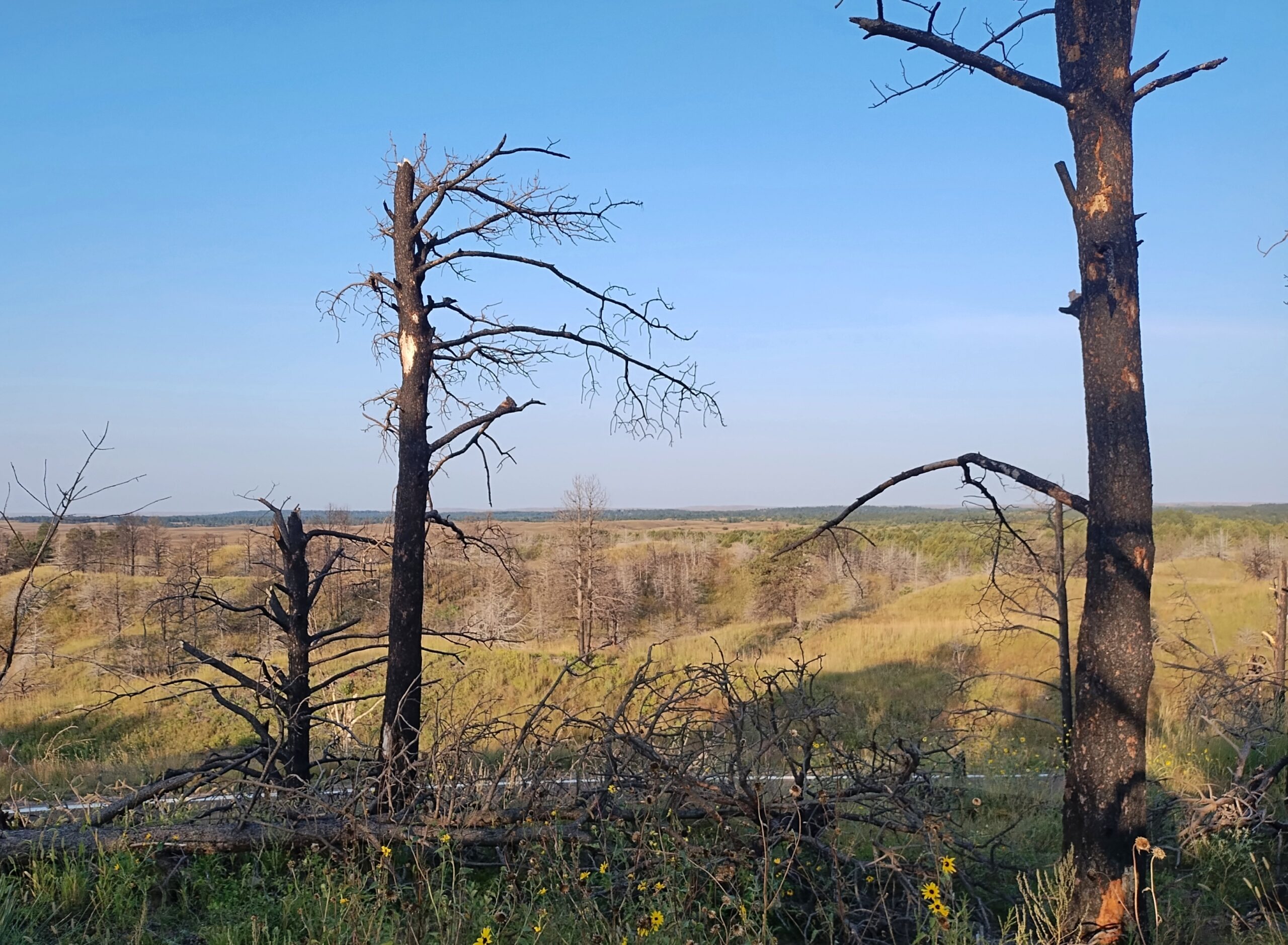
I camped in the national forest. The campgrounds weren’t completely full, but there were more people than I expected for a remote spot in Nebraska. Then again, it was a Saturday night, and soon enough I figured out what brought most of them: the ATV trails. Not long after dawn on Sunday, the campers across from me – a man and a small knot of teenage boys – roared away in a small caravan of ATVs crusted with dust from the day before.
I packed up and sought out a quieter place. A national forest hill with a fire tower and some views. The tower was closed.
But the views were still pretty good.
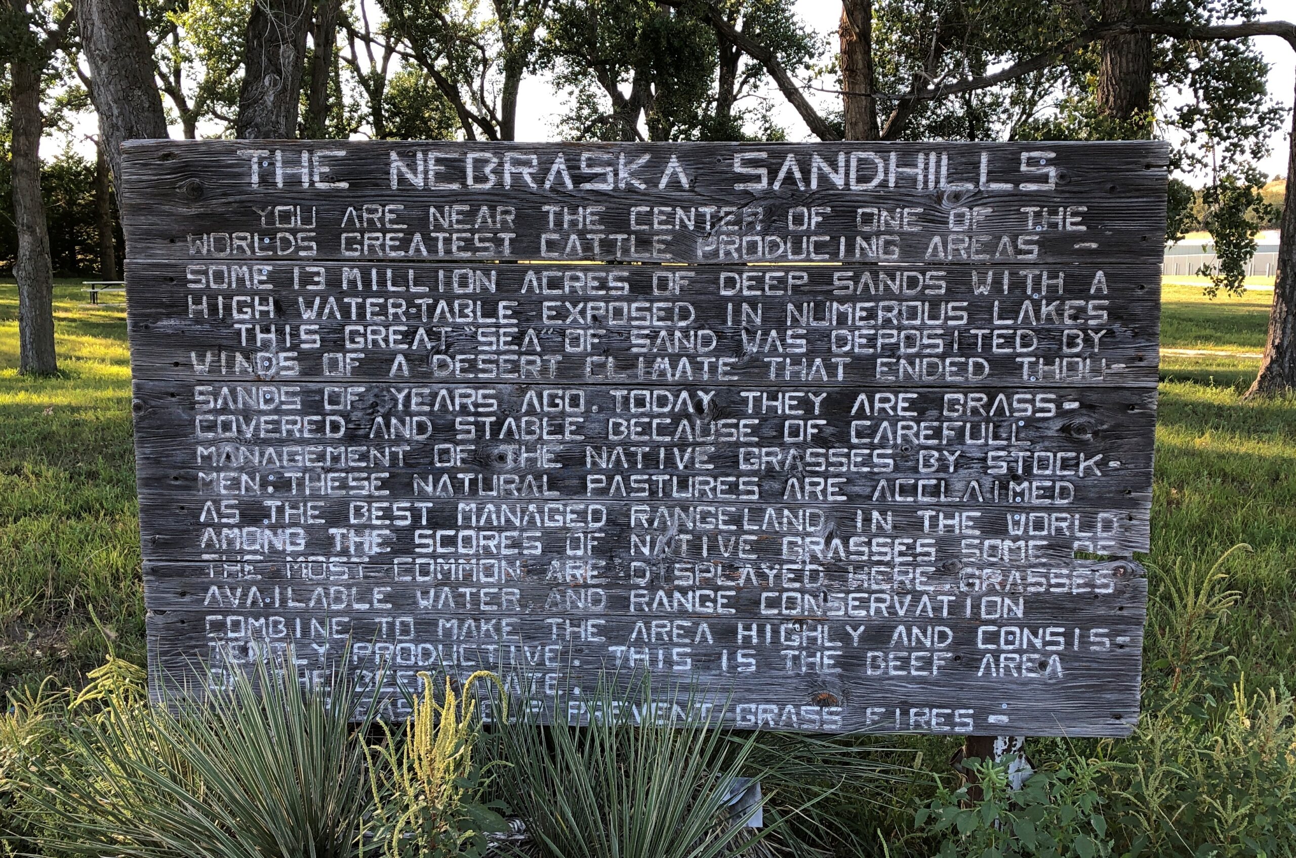
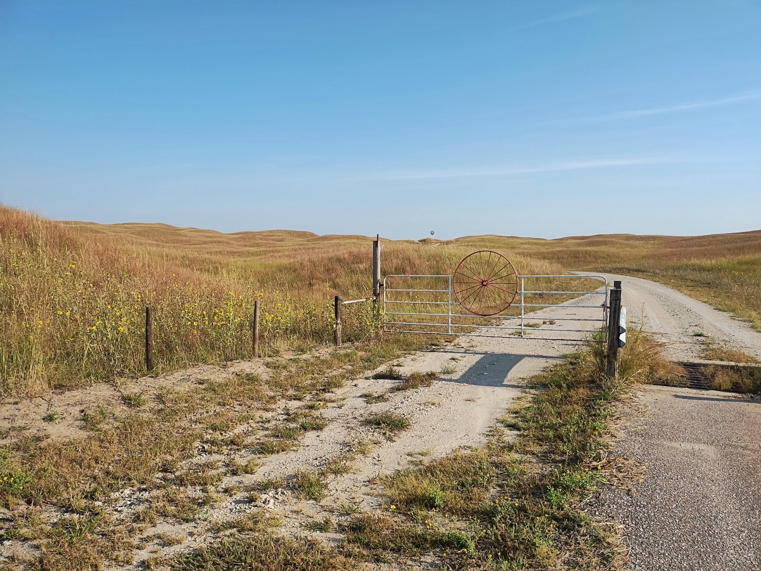
West from the national forest, Nebraska 2 heads into the rolling grassland of the Sandhills proper. In the village of Thedford (pop. 208), varied public interpretations of the Sandhills are available for reading.
The terrain along the highway Nebraska 2 might seem monotonous to some. Too bad for them. You’re driving across a kind of ocean, terrain all wavy, except that it’s solid ground, marked by occasional trees or manmade structures, and side roads — trails — wandering deeper into the hills.
The handful of towns are really just wide places in the road. Sometimes, not even that.
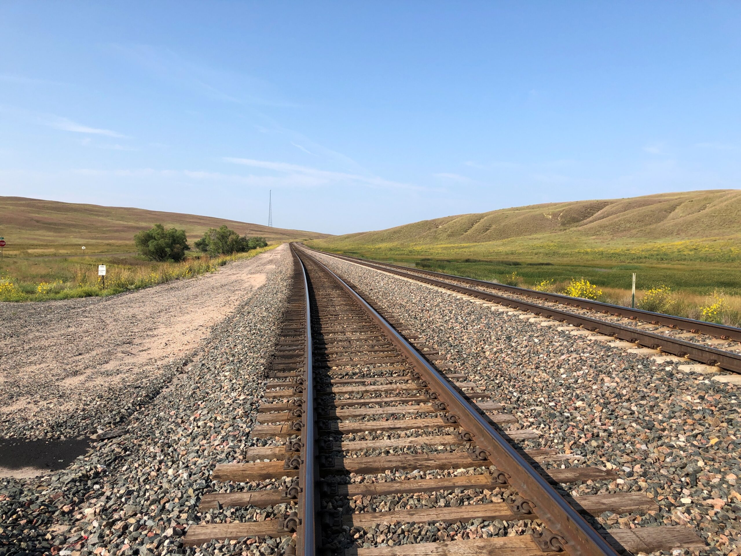
Nebraska 2 parallels the BNSF line, which came first.
Note: I was standing on a public side road to take that picture, as I do with all my RR shots.
Eventually, I took the road to Alliance. But that was merely incidental. Out this far, the road, as Kuralt said, is the destination.
Our first winterish weather blew through early this week, but we’re back to cool days. For now. Some leaves seem to be clinging a little longer than usual, but most are accumulating on the ground, as expected for November. A scattering of Christmas decorations are already up, and I don’t mean in stores, where they’ve been for weeks. Let November be November, I say.
Much of my return from the East Coast generally followed the westward course set by the National Road, though I didn’t use much of US 40, which has that nickname. If you want to make decent time, you take I-68 through Maryland and then I-70 across Ohio and into Indiana, which pretty much parallels the National Road.
The Interstate is designed for just that kind of efficient travel. On the whole, it delivers. The four-lane highways also deliver boring drives, to hear some tell it. That’s an erroneous assumption, to hear me tell it. The Interstate has its fine stretches, such as I-68 in October, a gloriously colorful drive. Winding and hilly, too, through Maryland’s peculiar panhandle.
A rest stop near Hancock, Maryland, offers views to the north, so most of what you see is Pennsylvania.
The rest stop is at Sideling Hill, an enormous rise gouged by an enormous cut for I-68 to go through. An impressive feat of engineering, completed only in the 1980s. Then again, blowing up mountains is a thing that happens in this part of the country.
The narrowest part of the Maryland isn’t far away. At its narrowest, there is less than two miles are between the Potomac and the Mason-Dixon Line. So if you picked up Maryland by the panhandle, it would surely break at that narrowest point.
I filled my gas tank off the highway in the last town in Maryland, Friendsville (pop. 438), at a station whose enclosed retail space (between a few pumps) seemed little bigger than a walk-in closet, and yet there was a clerk manning the place on Saturday just before dark. Rotund and massively bearded, he was playing a video game when I opened the door to pre-pay. He might have been a little surprised to encounter a customer, at least one who didn’t pay at the pump.
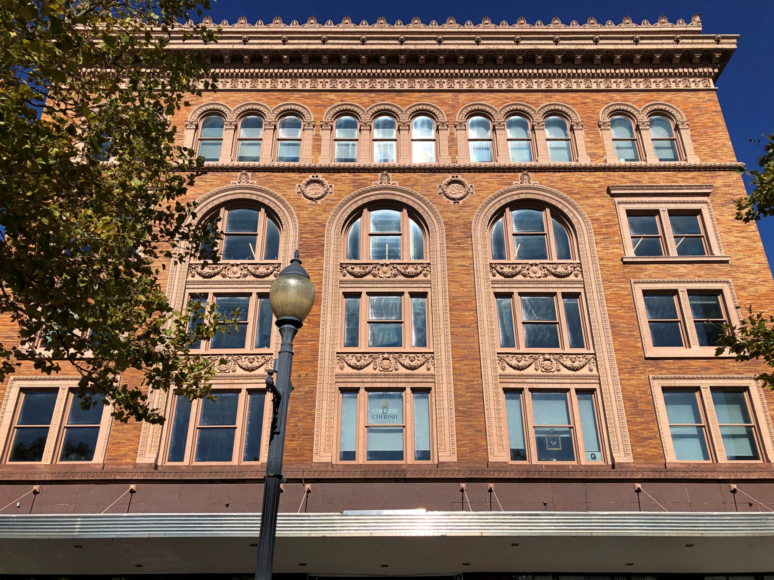
From there, I continued into West Virginia, then took I-79 north into Pennsylvania, then headed west on I-70, which crosses West Virginia’s odd panhandle – more like a periscope – before reaching Ohio. After overnighting in Cambridge, Ohio, I bypassed Columbus but stopped in Springfield, near Dayton but with a distinct geographic identity. Alcor to Dayton’s Mizar, you might say.
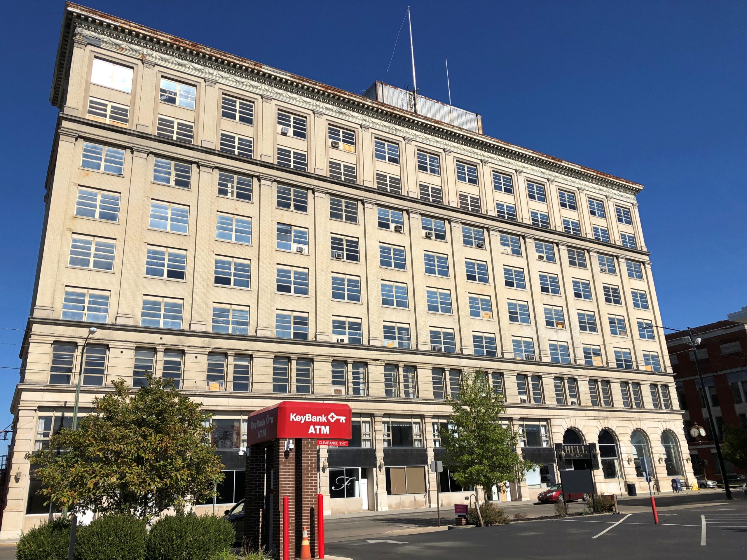
Downtown Springfield was practically devoid of pedestrians that Sunday, and not that many cars drove through either. A few buildings rise high enough to suggest a more prosperous past, but look too closely and some of them seem to be as empty as the streets, or at least underutilized.
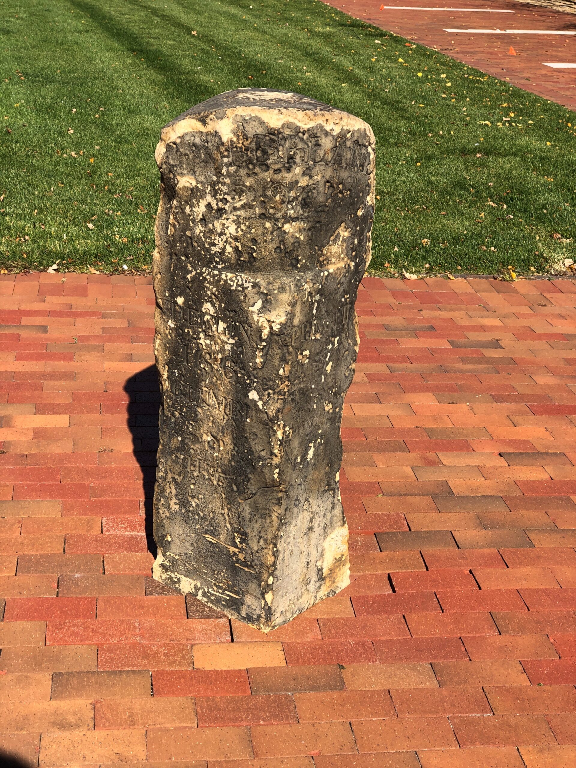
The National Road went, and still goes through Springfield, in the form of US 40. A milestone in Springfield marks the point at which the federal government quit paying for further westward expansion of the road. Anything else would be on the states, namely Ohio, Indiana and Illinois.
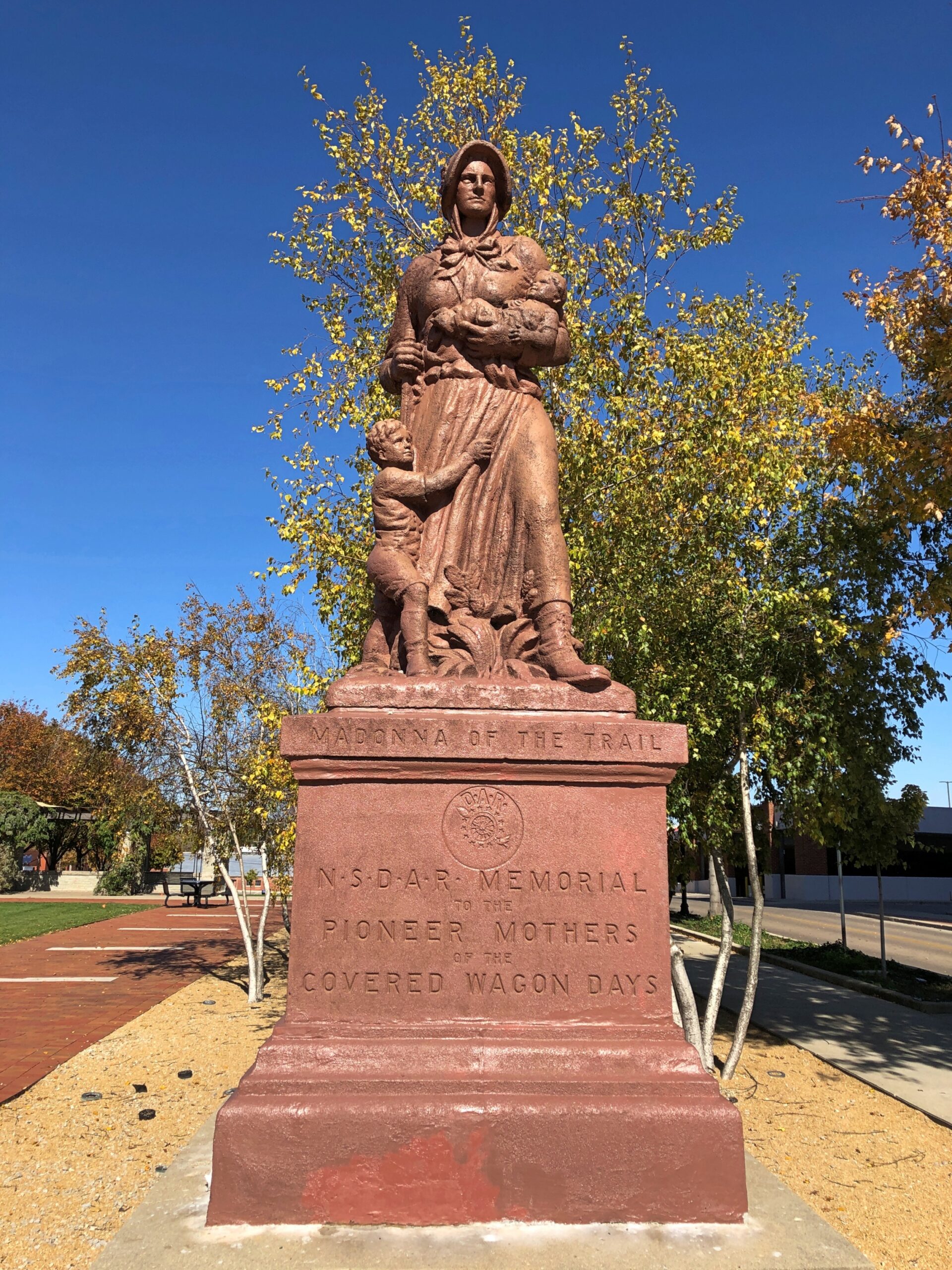
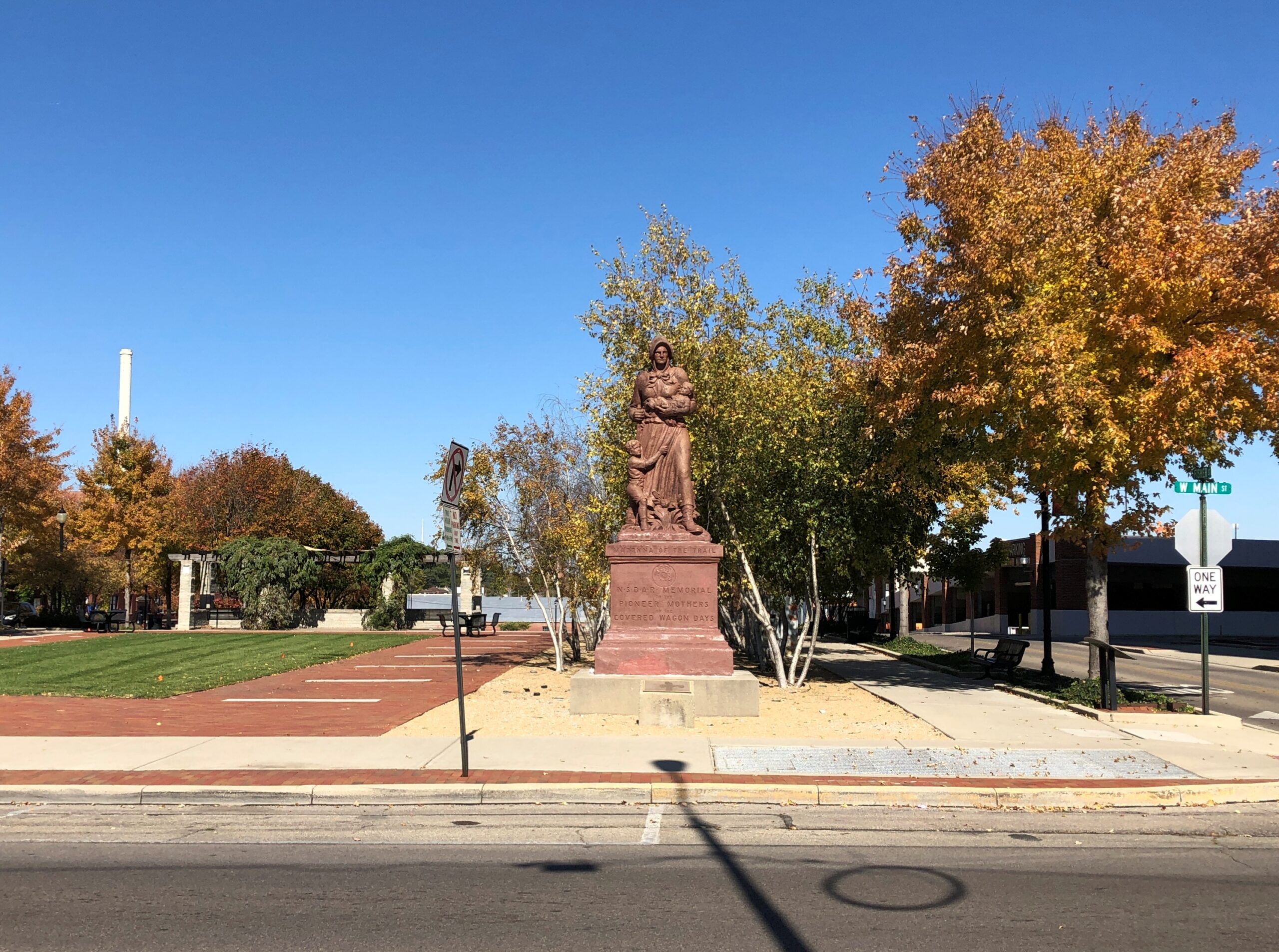
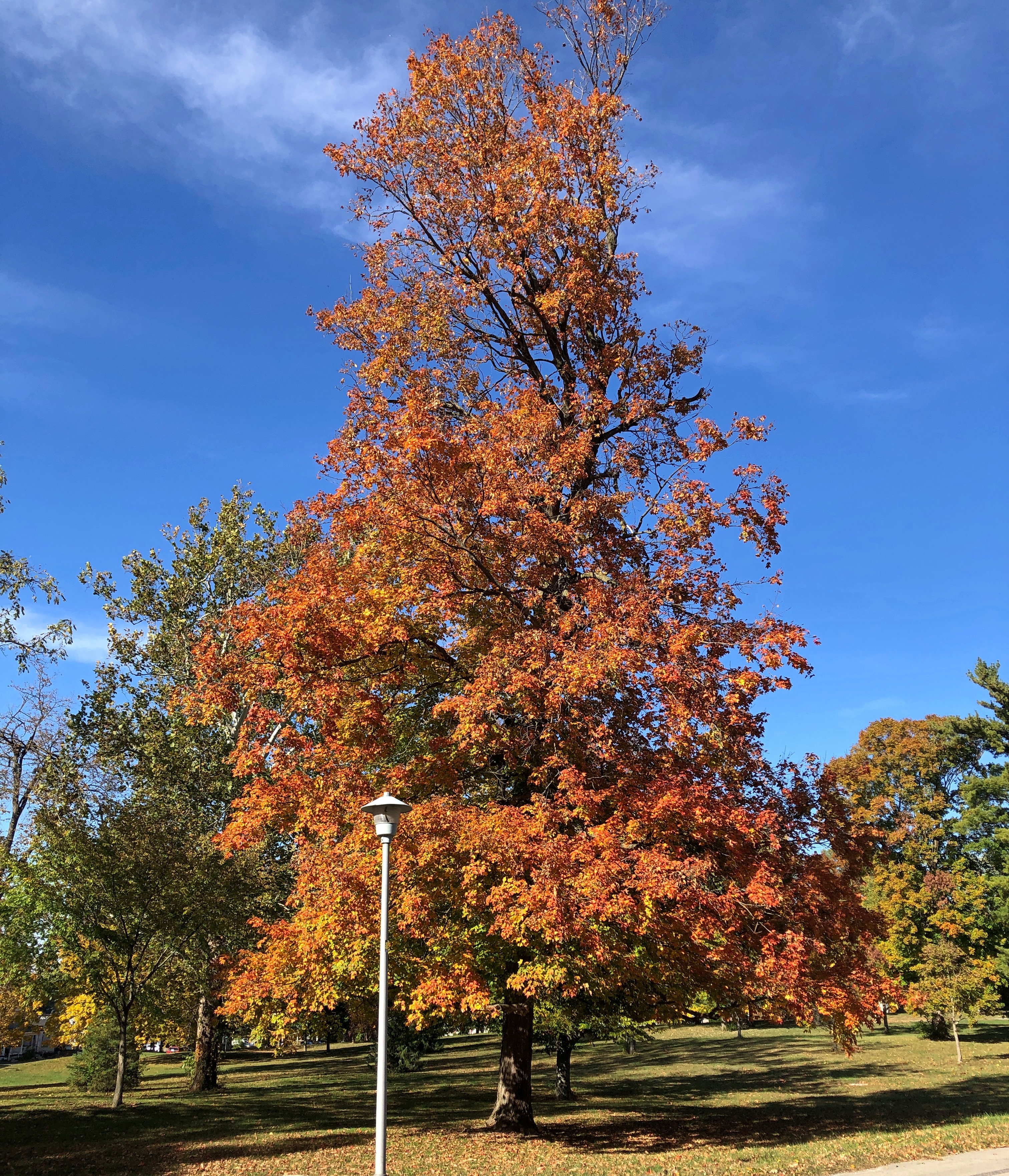
Later, after the National Road had become History, the Daughters of the American Revolution erected a series of statues along the route, and others to the west: “Madonna of the Trail.”
There are 12, with the easternmost of them along the National Road. Erected in the late 1920s, the Springfield one was renovated about 20 years ago.
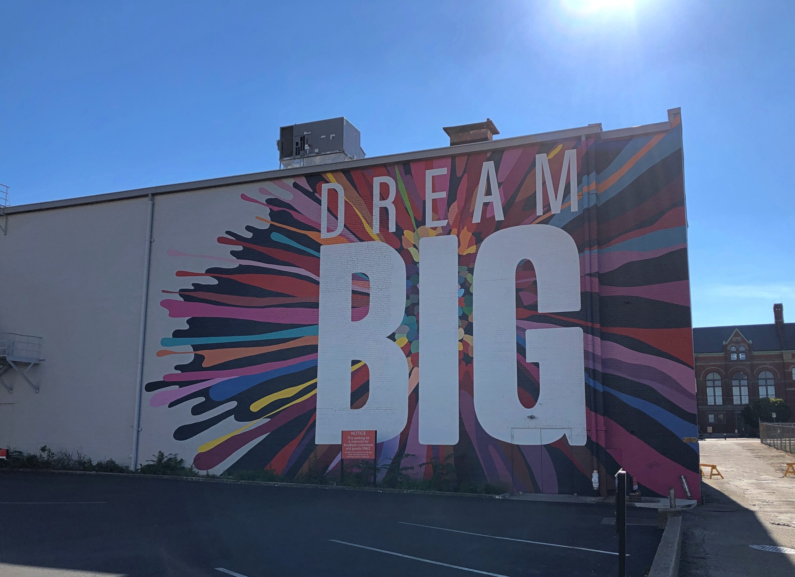
Nearby, passersby are urged to Dream Big.
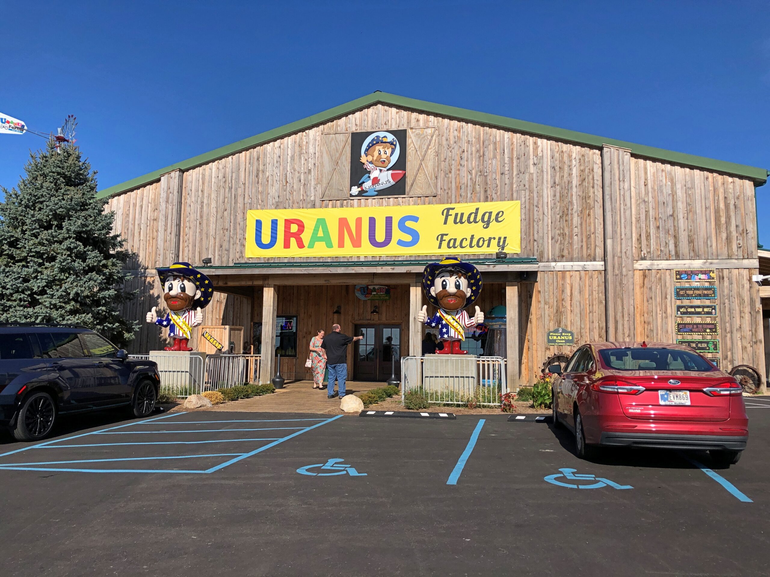
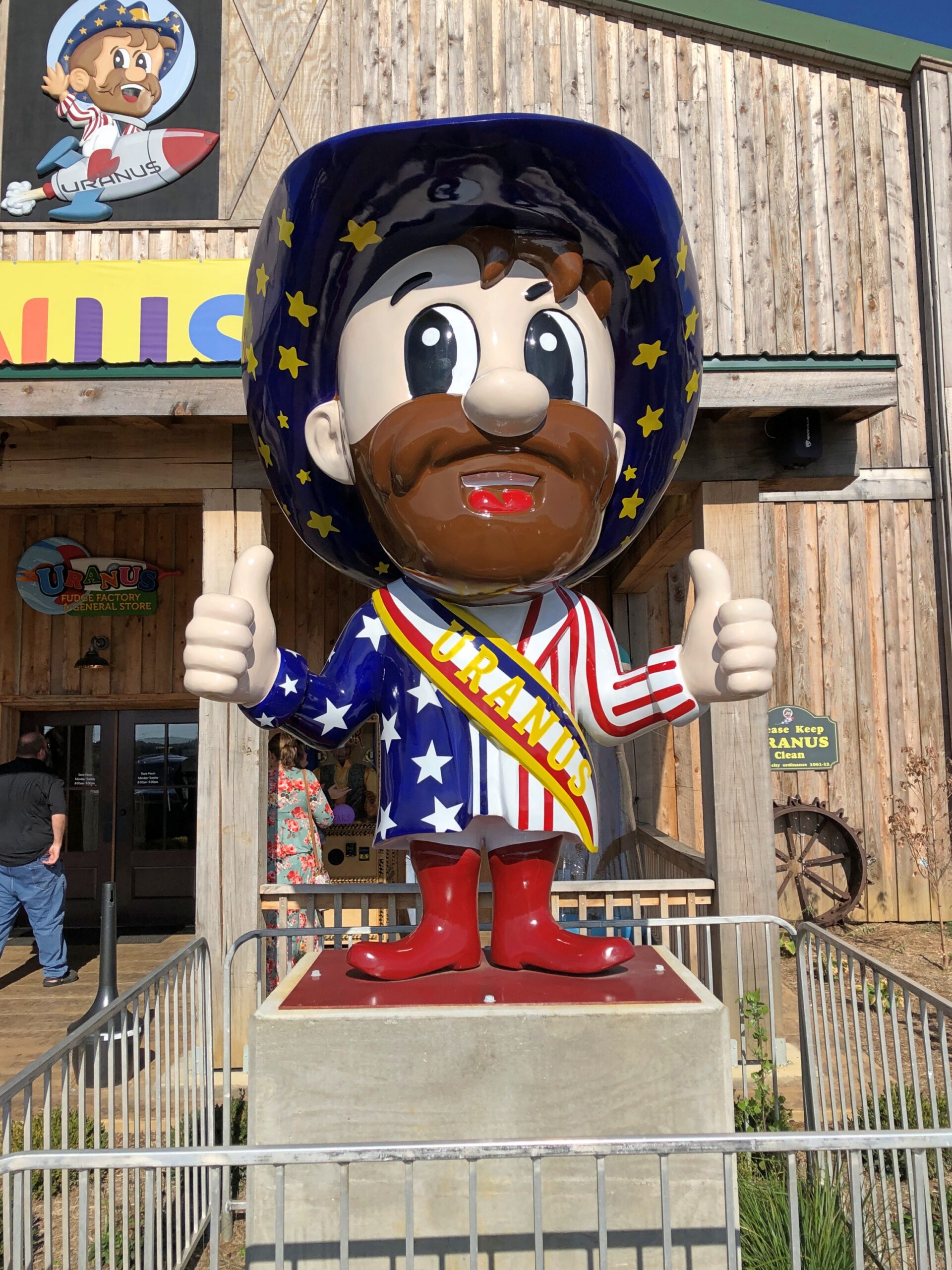
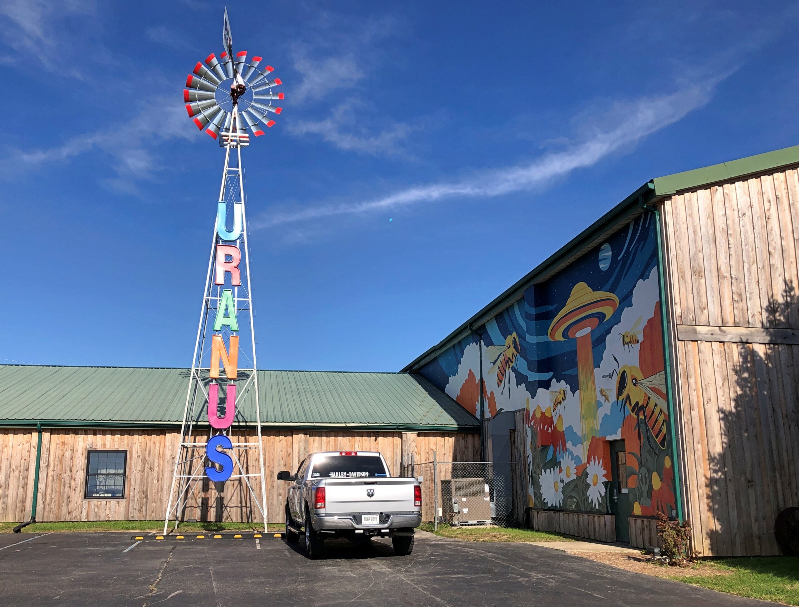
About an hour west of Springfield, at the border of Ohio and Indiana on I-70 – just barely inside Indiana – is the Uranus Fudge Factory. I had to stop for that.
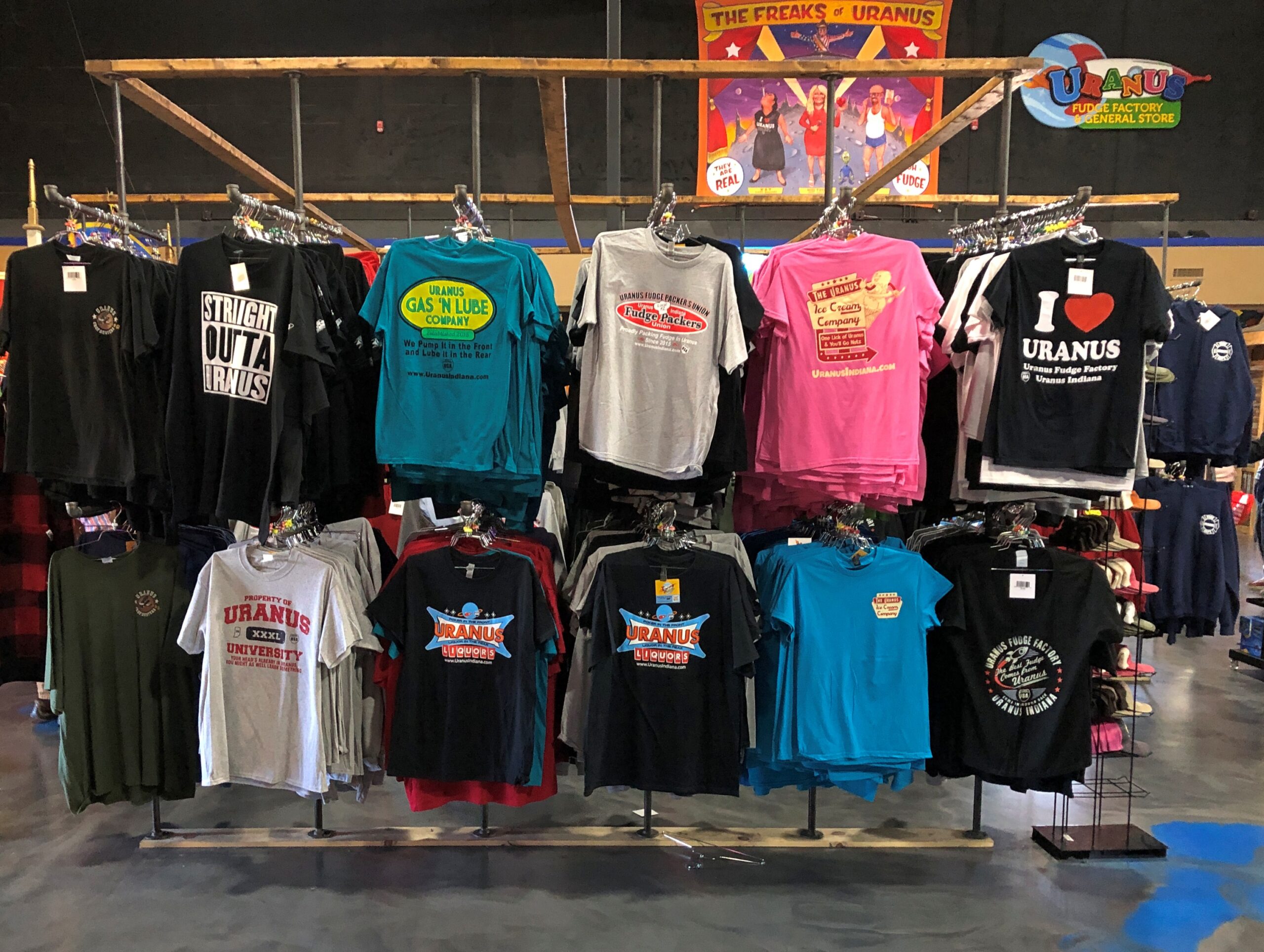
Sure, there’s fudge in there somewhere, but also a lot of gags involving the word Uranus(Your-anus). Examples can be found in the newspaper — an honest-to-God paper newspaper — that the store produces, The Uranus Examiner, and gives away. I have a copy. My kind of souvenir.
Sample front-page headlines from the Summer 2025 edition:
Breaking News: You Can Explore Uranus In Three Locations
Eating Their Way Through Uranus
Get A Lick Of Uranus
Sink Your Balls In Our Putt Holes
The second of those stories was about the 2nd Annual Eating Uranus Fudge Galactic Championship held at the Anderson, Indiana location in March. Apparently it was a Major League Eating-sanctioned event, and apparently MLE is a real thing. One Patrick Bertoletti won the 2nd championship at Uranus, putting away a bit more than nine pounds of fudge in about as many minutes.
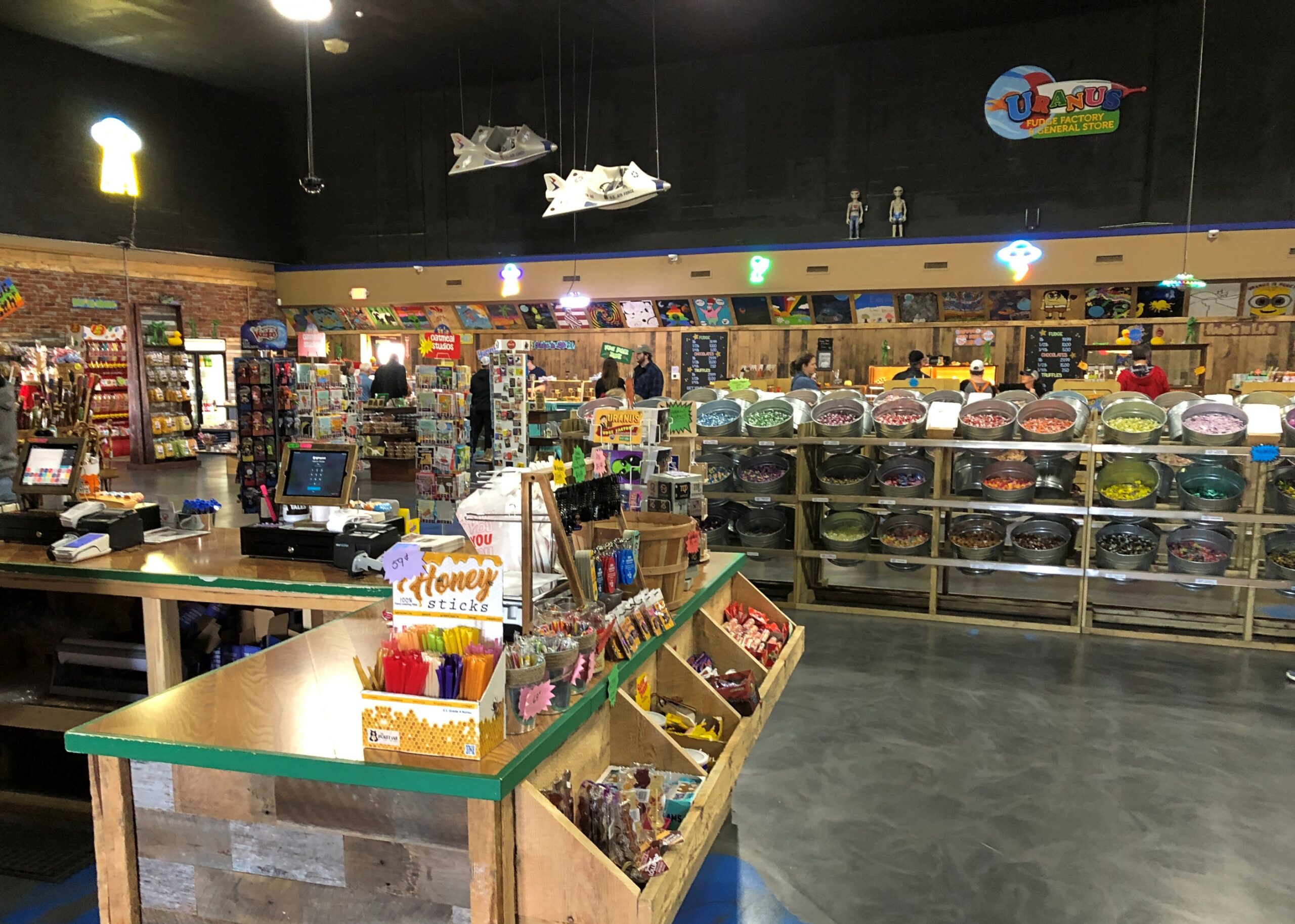
Fudge is one thing, but mostly Uranus sells stuff. A lot of stuff.
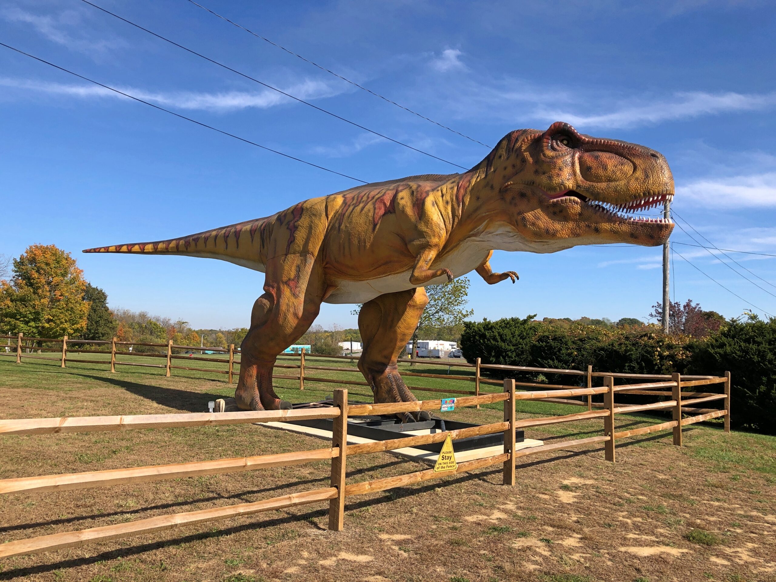
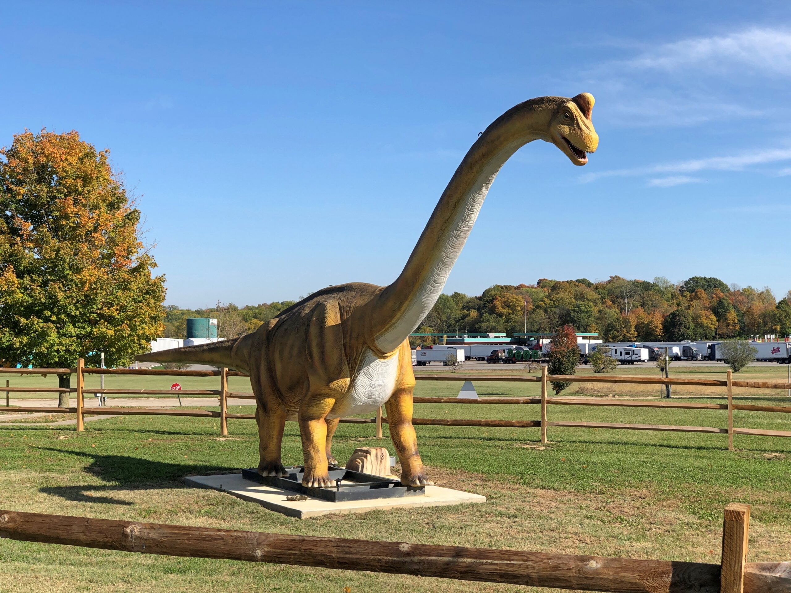
The Richmond, Indiana location is the third of three for Uranus, and I think the only one with dinosaurs —
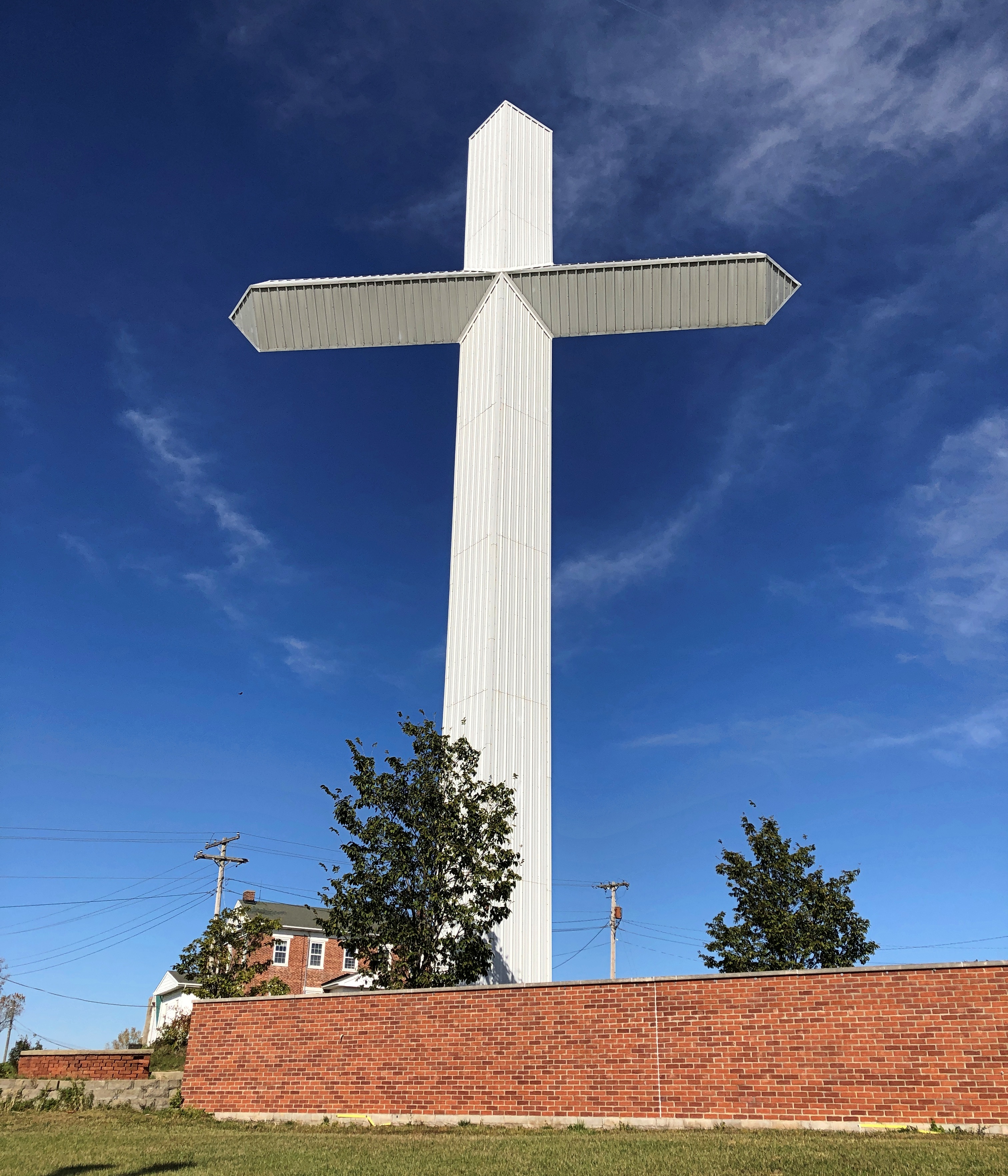
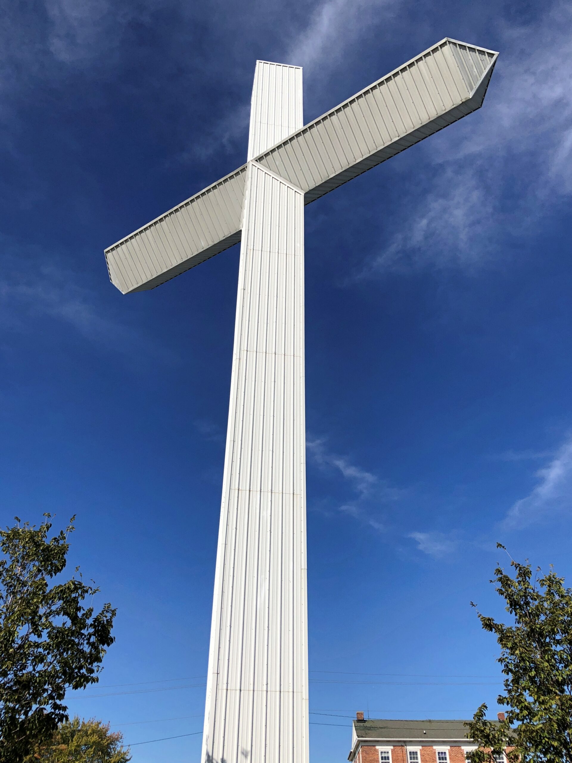
— and a 100-foot cross of corrugated steel over a metal frame.
Until about 10 years ago, the property belonged to New Creations Chapel, which also included a church building, boarding school for troubled teens and a Bible college. The ministry, for reasons its web site explains in some detail, sold the property to Uranus, including the cross.
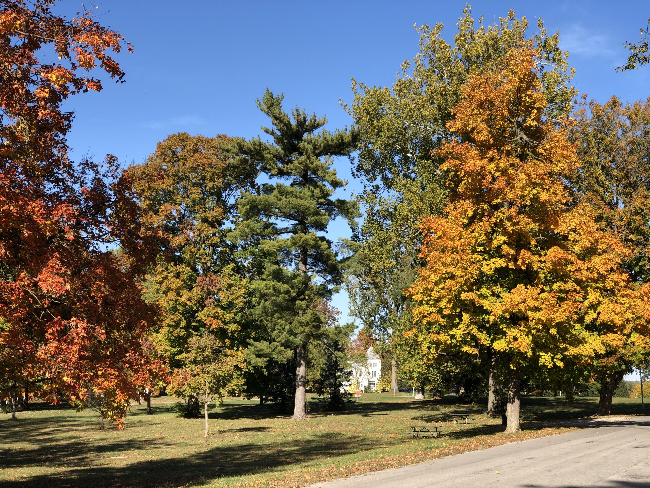
Heading through Richmond, Indiana, I stopped at an entrance to a large park to check my map. Glen Miller Park. A colorful spot in October.
Not named after the bandleader, which would be Glenn Miller Park. “Glen Miller Park was established in 1885 and was named for Colonel John Ford Miller, who was a railroad executive during the late 1860s,” the city of Richmond says. “Colonel Miller bought the land from Nathaniel Hawkins in 1880, with the intention of transforming the land into a park.”
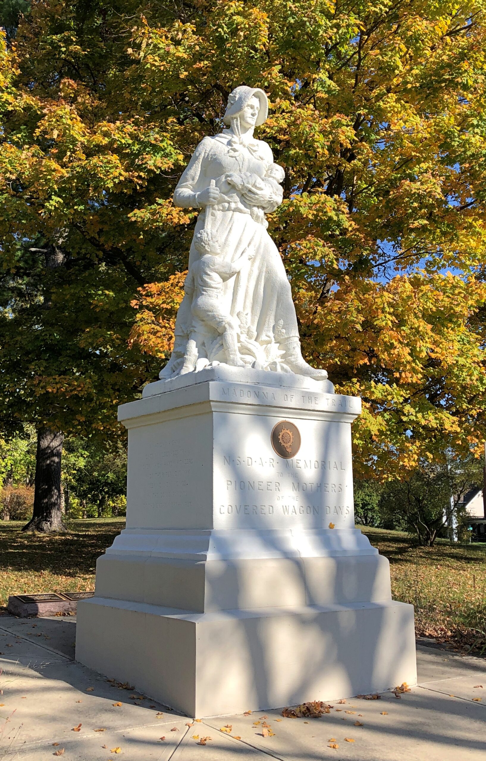
So Glen Miller as in glen, a term that evokes pleasant Scottish valleys. I was just about to be on my way when I noticed a statue.
It was another of the 12 Madonna of the Trail statues, located at the edge of the park, where it meets US 40. Unlike the earlier one in Springfield, I hadn’t sought it out. It was just there. One’s travels, like life, can be strange sometimes.
On May 24, 1983, I flew from San Antonio to New York City, since in those days the way to get to Europe was via NY. I remember only one thing about that flight, which I assume took me to LaGuardia. As we made our final approach, the plane banked over the East River and I happened to be on the correct side, in a window seat, for a terrific view of the Brooklyn Bridge.
The captain might have even mentioned the bridge, because it so happened that the Brooklyn Bridge was celebrating its centennial that very day. A hundred years earlier, on May 24, 1883, the bridge had opened with great festivities, including attendance by President Chester Arthur and NY Gov. Grover Cleveland.
I’d never seen the bridge with my own eyes before then, either, since my brief layover in the city a year earlier mostly involved time at the Port Authority Bus Terminal. Yet I recognized the bridge at once, from TV and movies. Such as the time, in one movie, when Tarzan (Johnny Weissmuller, accept no substitutes) went the Brooklyn Bridge, did a Brodie off of it, and of course survived, unlike some real divers.
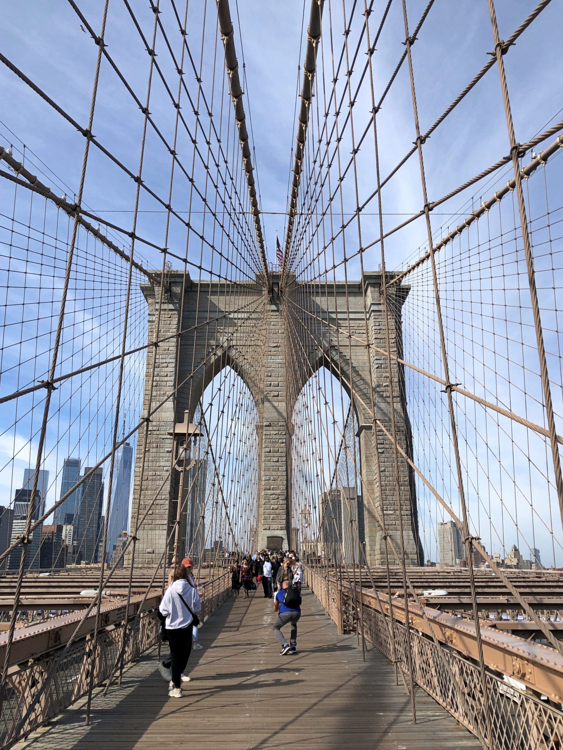
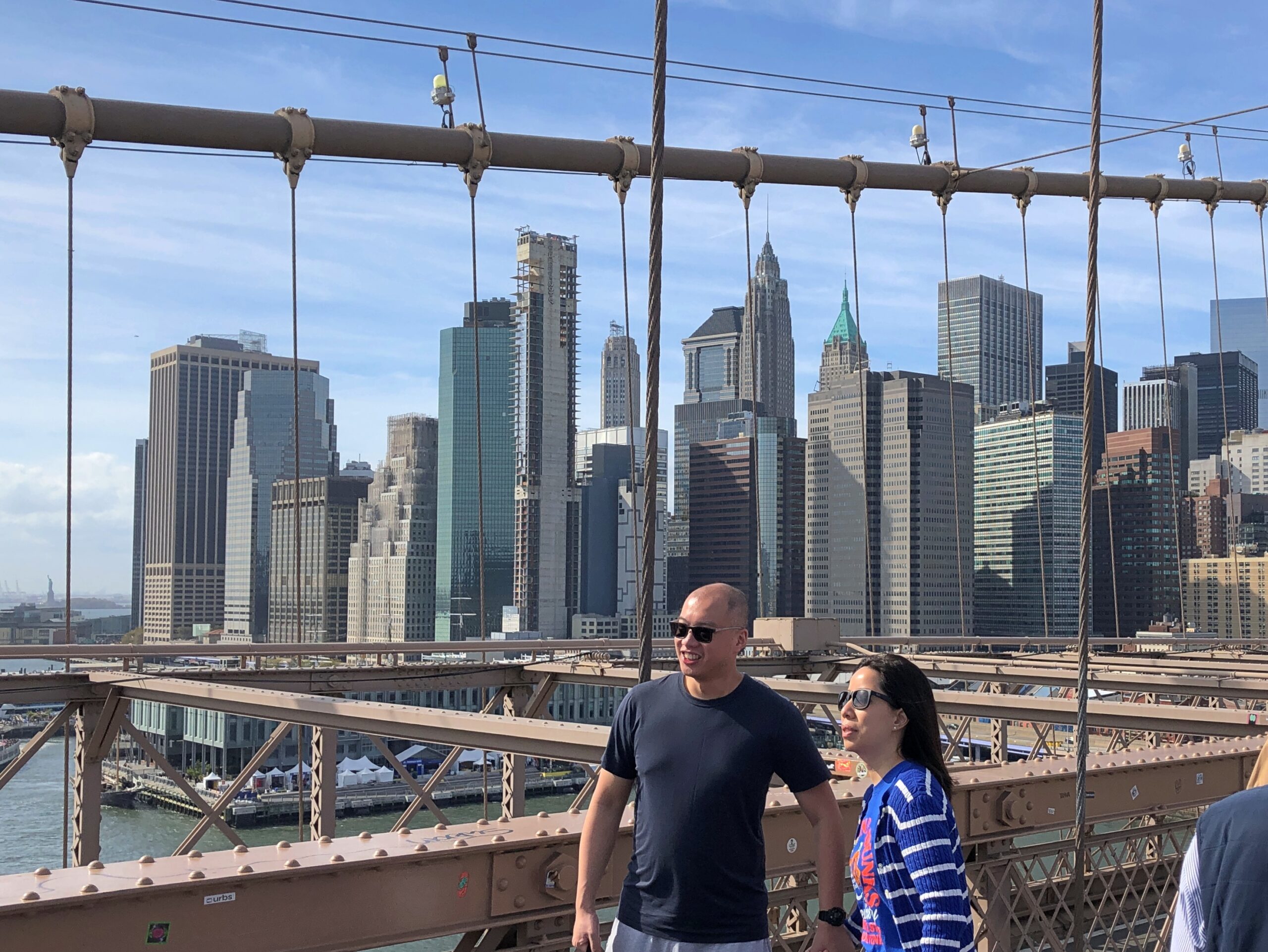
One day in August ’83, having returned to New York and with more time on my hands, I decided to cross the Brooklyn Bridge on foot toward Brooklyn, to facilitate my first-ever visit to that borough. Except for that fact that it was blazing hot, it was a good idea. The bridge itself is a work of industrial beauty and the views are great.
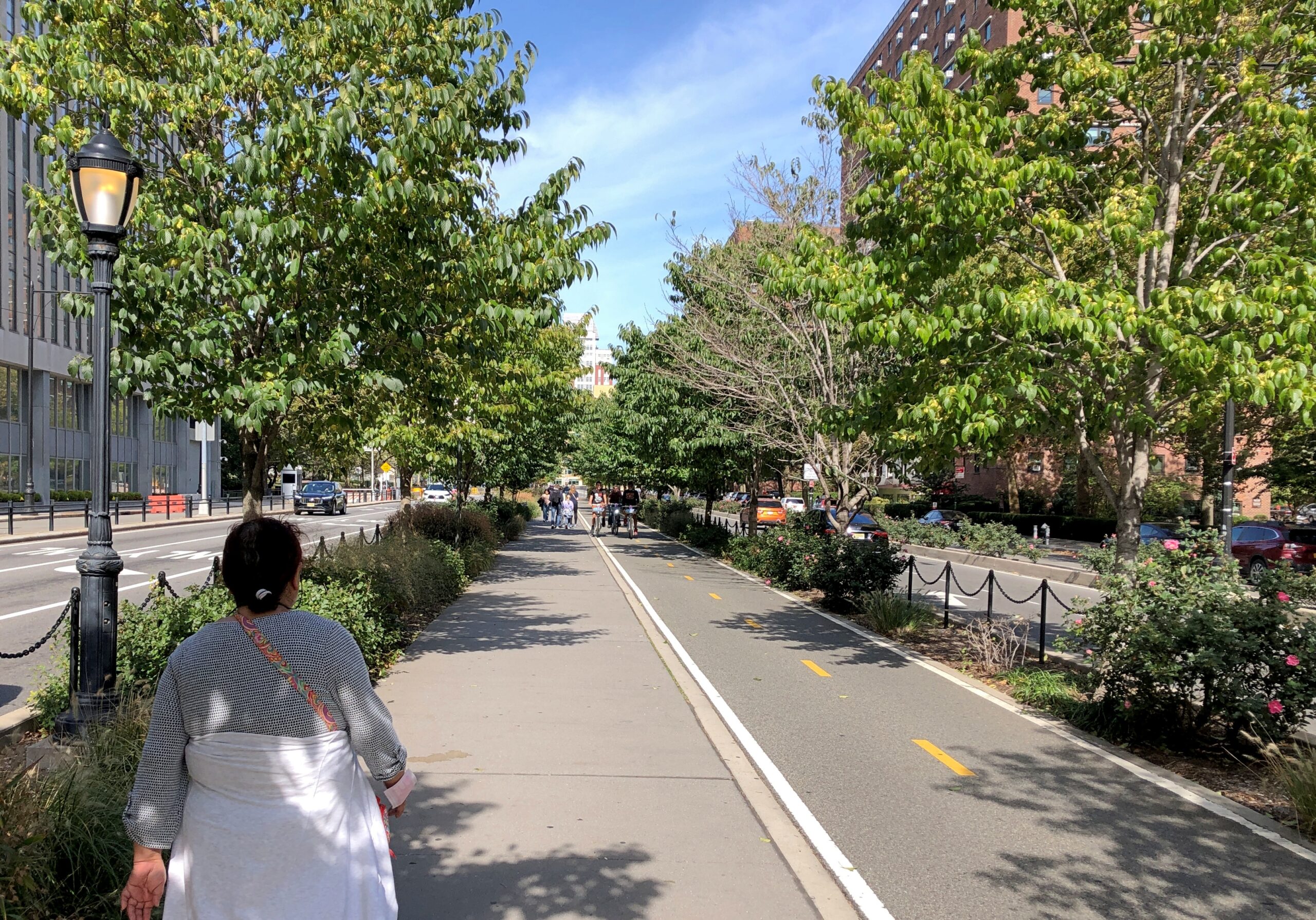
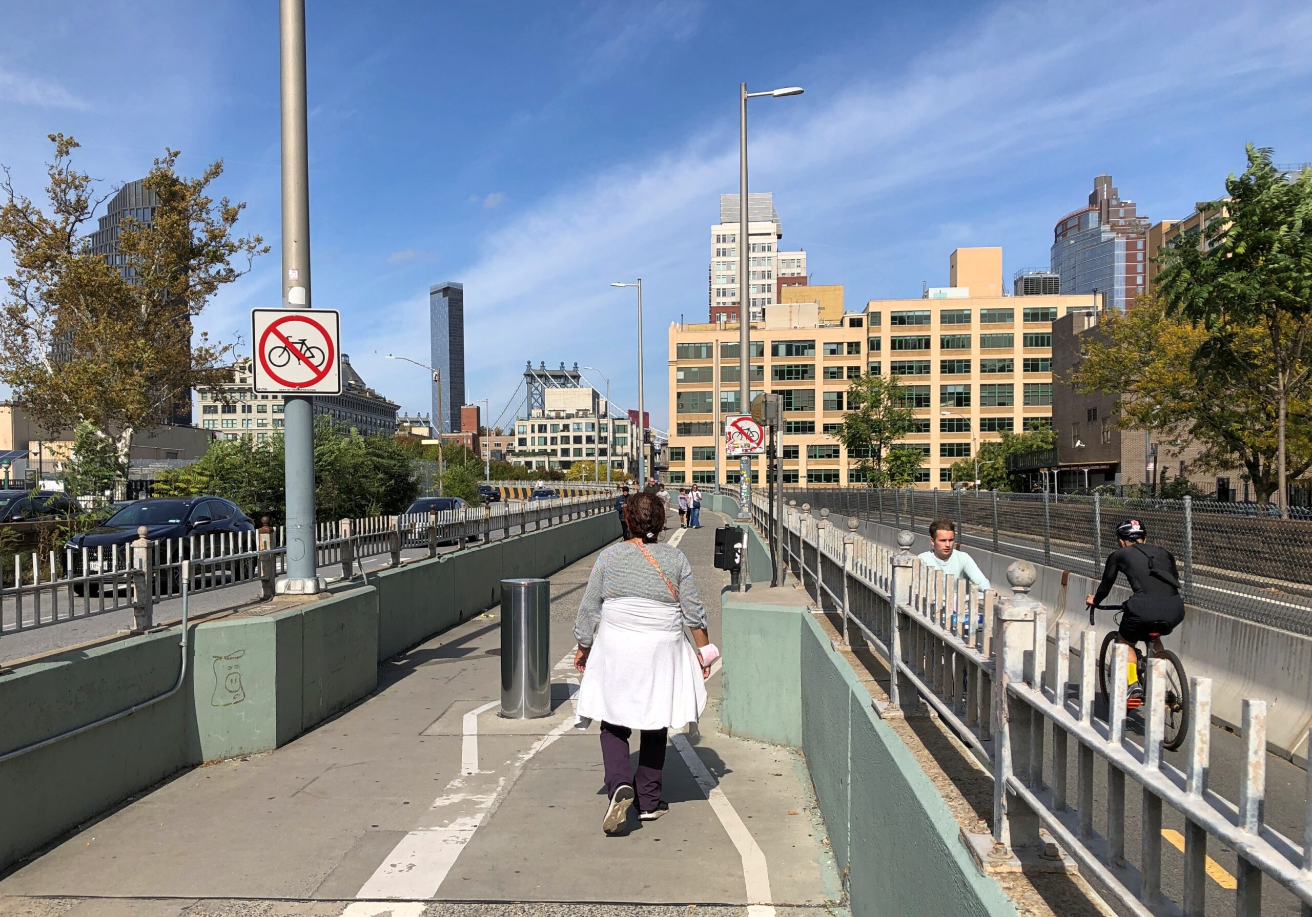
After leaving Fort Greene Park, Yuriko expressed the idea that she wanted to see the Brooklyn Bridge — which she hadn’t up close — and I couldn’t begrudge her a visit, especially since we weren’t far away. We walked from Myrtle Ave. to Flatbush Ave. (actually the “Flatbush Avenue Extension”) to Tillary St., where you can find the entrance to the Brooklyn Bridge Promenade. At that point, it’s both pedestrians and bicyclists.
I didn’t realize at first that the promenade leads directly to crossing the bridge, though it takes about 20 minutes to get there. I imagined, at first, that it would lead to Dumbo and a view below the bridge. An excellent spot, which I most recently visited in 2014.
Soon I realized that we were headed for the bridge itself. Not only that, I saw that pedestrians were soon separated from bicyclists, beginning fairly far away from the bridge.
What an amazingly good idea, only done in 2021. Considering the crowds that the Brooklyn Bridge attracts, it probably should have been done years ago.
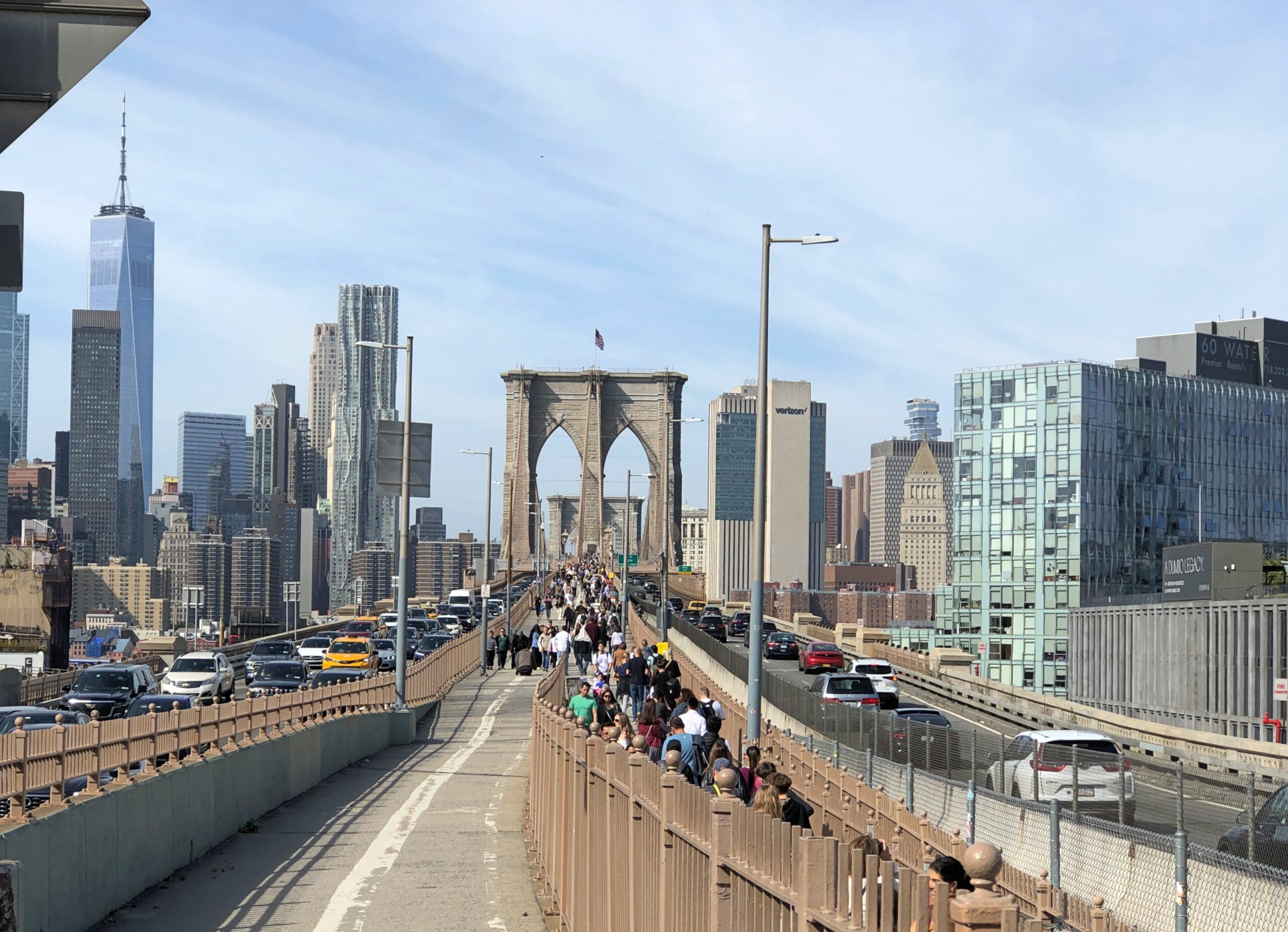
We walked from Tillary St., but the more popular Brooklyn-side pedestrian entrance is stairs at Washington Street and Prospect Street, seen below.
I didn’t remember the bridge being that crowded my first time, though at a remove of 40+ years, the details are a little hard to remember. It was hot, and probably a weekday, so that might have thinned out the pedestrian traffic.
That wasn’t the case on a pleasant October Sunday. New Yorkers and tourists were out in force.
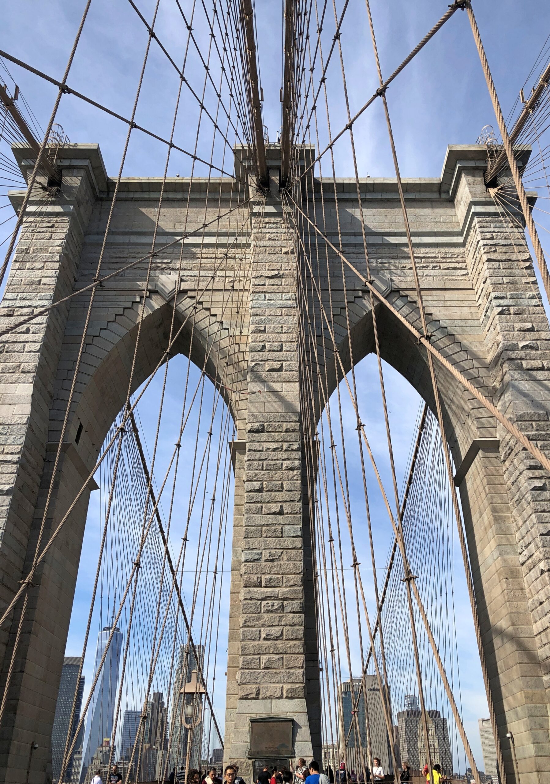
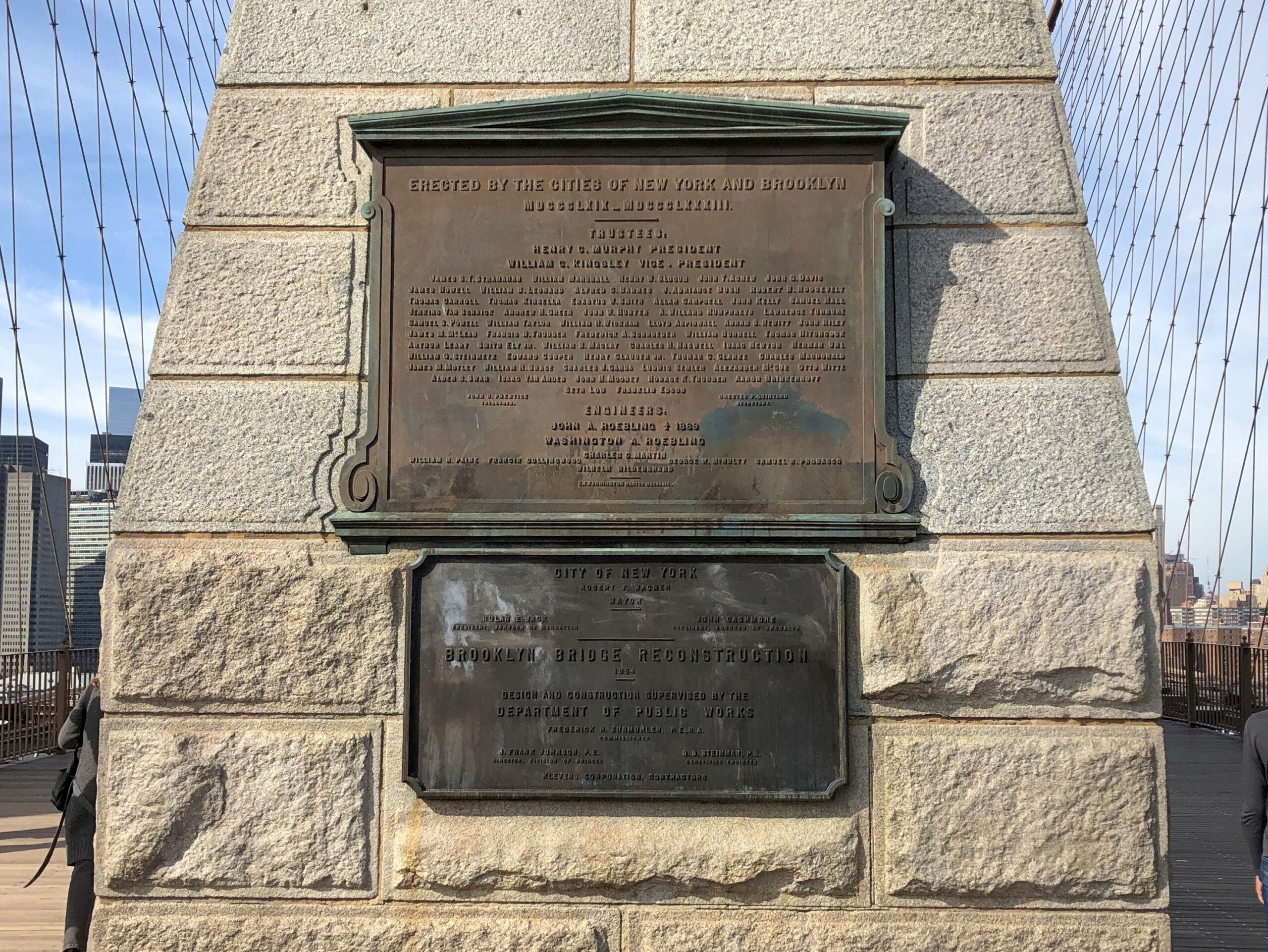
Mostly the bridge holds its crowds well. From the many wooden planks, you still get a closeup of the web-like intricacies and gray hulking towers created by the Roeblings and thousands of workmen.
Credits.
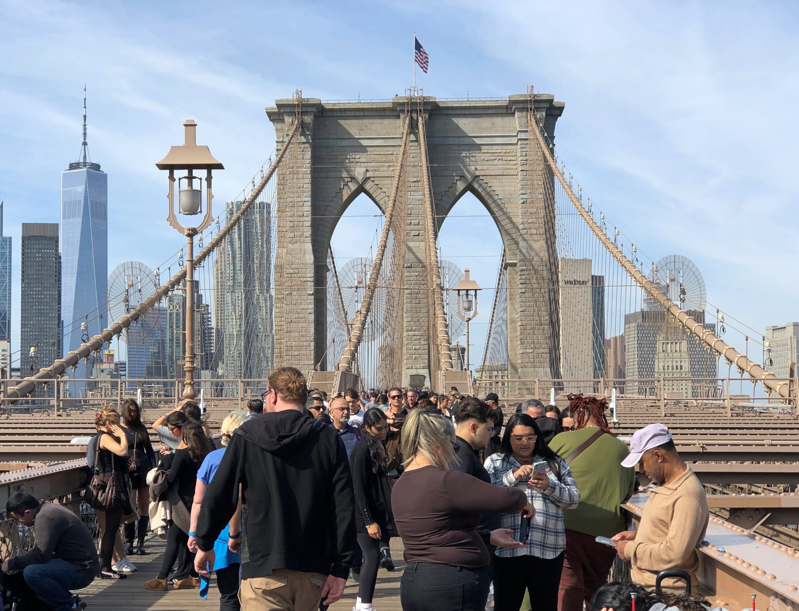
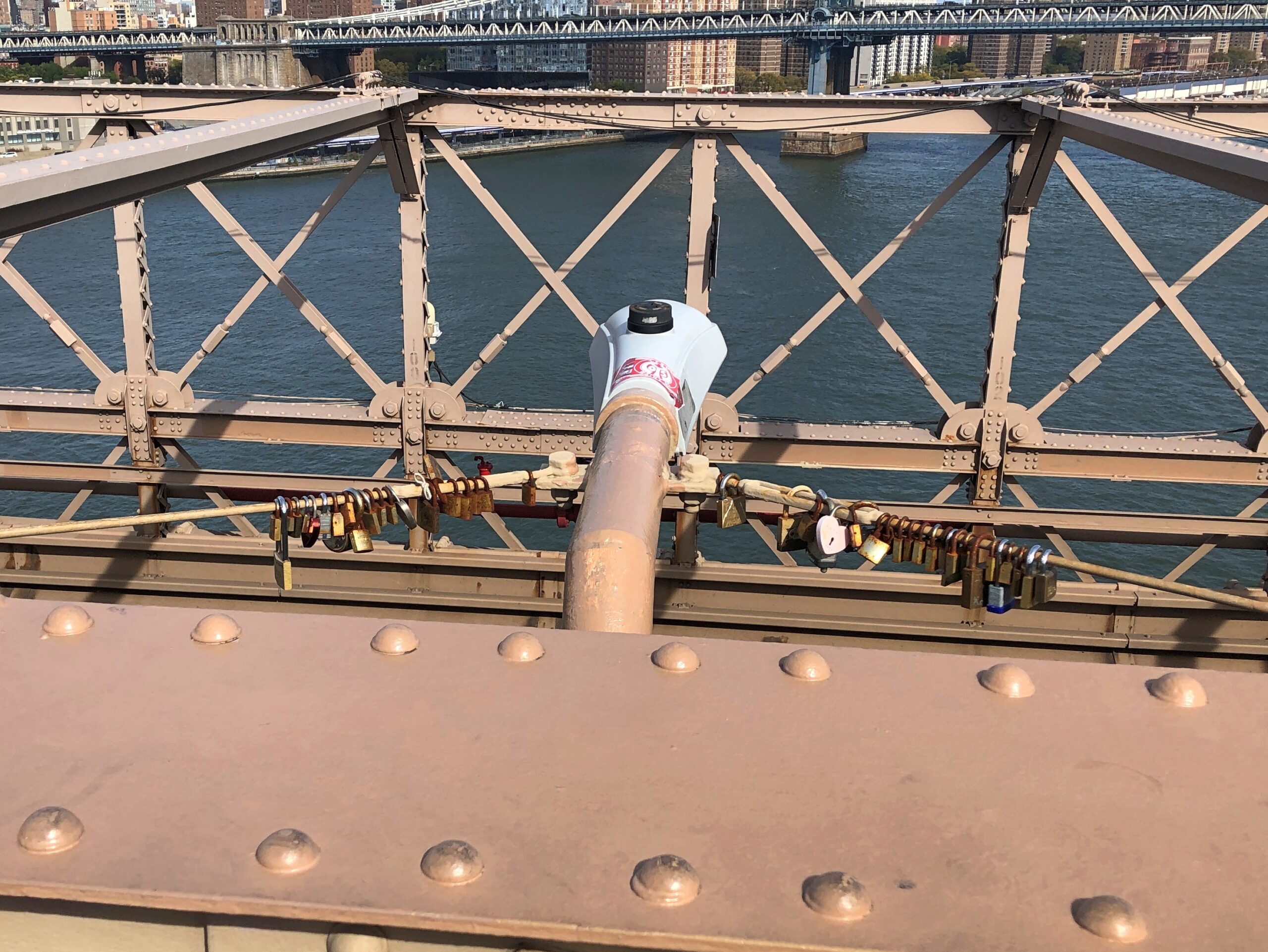
Love locks. I understand the city frowns on their attachment to critical infrastructure. That doesn’t change a thing.
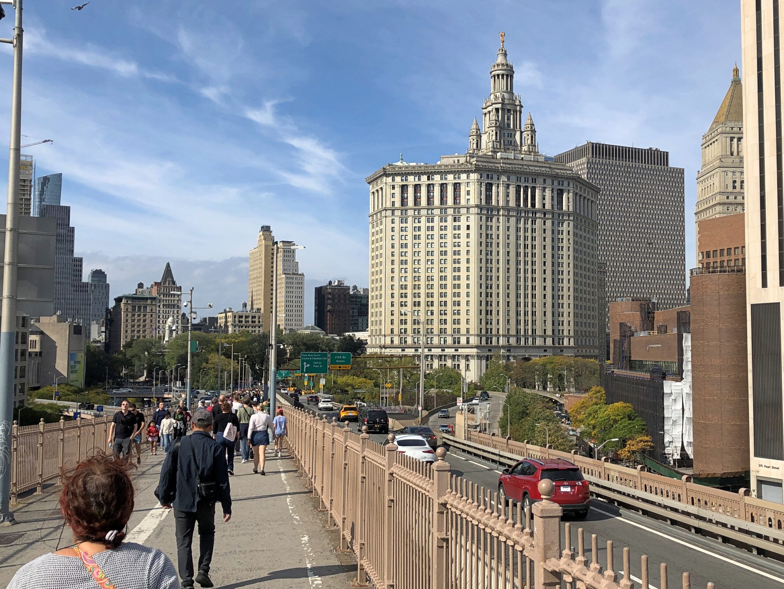
Provided you pay attention that there isn’t someone walking right behind you, it’s easy enough to stop to take in the famed views of Manhattan.
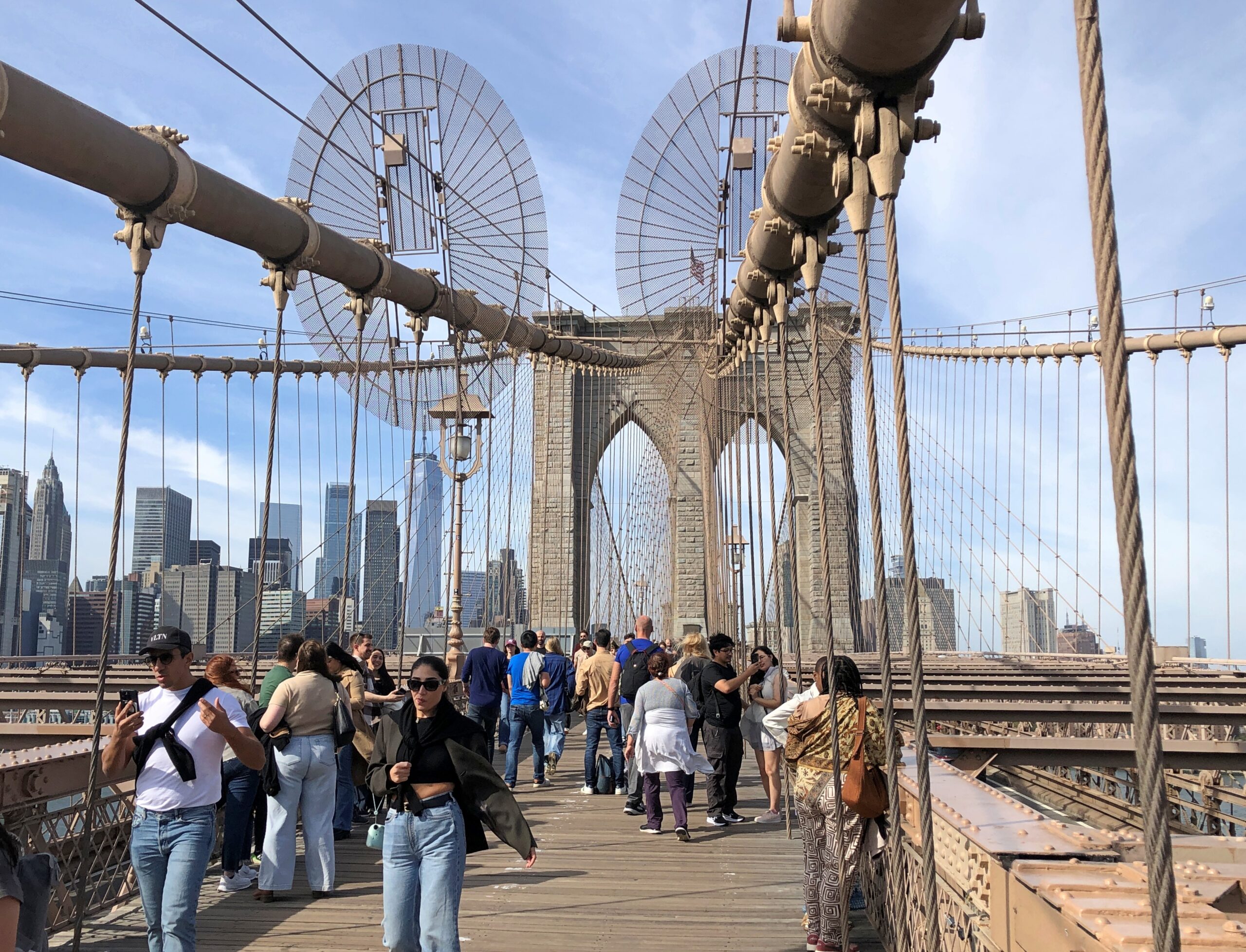
Soon enough you’re approaching Manhattan.
Yuriko had fulfilled her wish to walk the bridge, and it occurred to me that not only have I walked across the Brooklyn Bridge twice, I’ve done it once each way. Guess I need to visit San Francisco again and walk across to (near) Sausalito, then take a bus back, which would be the reverse of 1990. Or for that matter, visit the Ohio Bridge in Cincinnati again (another Roebling work), though I don’t remember which way I crossed it. Or visit the Roebling Museum. Ah, so many bridges to cross.
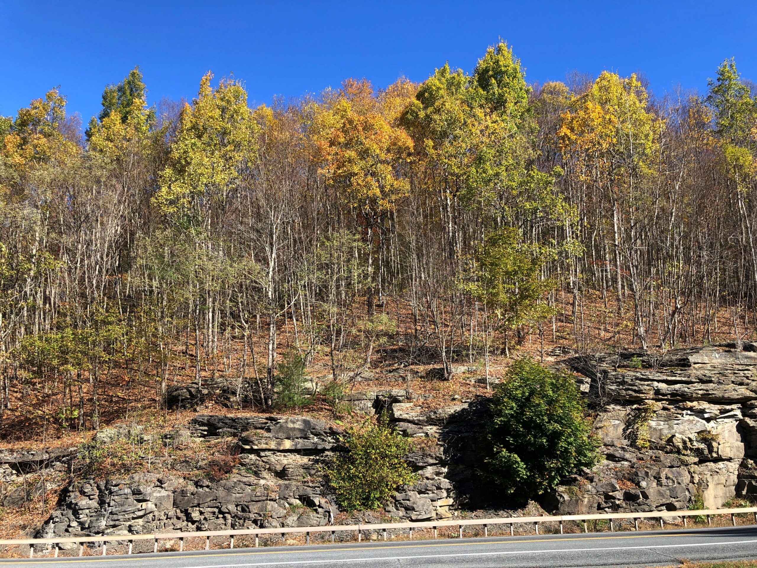
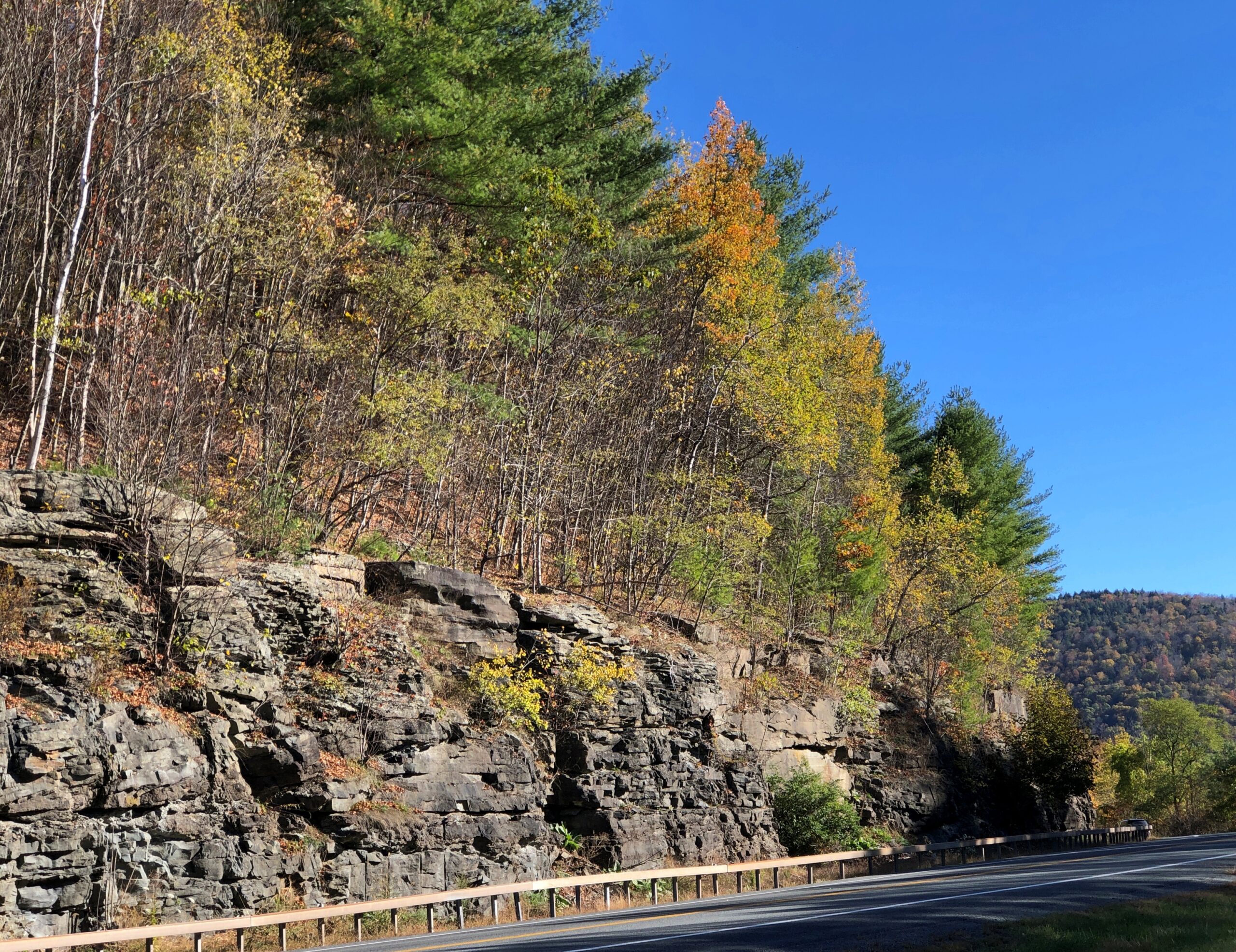
Drive out from Erie, Pa., headed northeast, and soon you have a decision to make: I-90, which becomes the New York State Thruway, or I-86, which does not. Besides costing more money, the NYST went places I didn’t want to go (this time): greater Buffalo, Rochester, Syracuse, Utica and into Albany, a route I drove as long ago as 1991 on my way to Boston.
By contrast, I-86 passes through much smaller places, winding through the hilly Allegheny Plateau, a way I had not been before. High time to do so, I thought. The road is also New York 17, with signs along the way identifying it as the Southern Tier Expressway. “Southern Tier” is the southernmost counties in upstate New York, which apparently is a longstanding regional term.
That’s a good-looking sign, and serves as a nod to the Seneca, who hold land in this part of the state. A Seneca artist named Carson Waterman did the design. For some miles before and after the town of Salamanca, which is part of the Seneca holdings, standard green highway signs include both English and Seneca.
One of the larger places on the Southern Tier Expressway is Jamestown, which I know from the song. It’s a game I occasionally play with my friends: Did You Know There’s A Song About…? and then I name something like rural electrification in Australia or the Versailles conference. In this case, the song is “Maddox Table” and it’s about labor organizing in Jamestown, hometown of the band 10,000 Maniacs. The town isn’t specifically mentioned in the lyrics, but Bemis Point is. Even before the Internet, I could look that up, and note that it’s a local recreation destination on Chautauqua Lake.
Chautauqua Lake is in Chautauqua County, the westernmost bump on the map of New York state. Ah, storied Chautauqua, which brings to mind the outdoor exhortations of men in full suits and women in long dresses, regardless of how hot it was. There’s another streaming service series for you: Chautauqua, set in the raucous 1890s. Could be a comedy or a Gritty Drama.
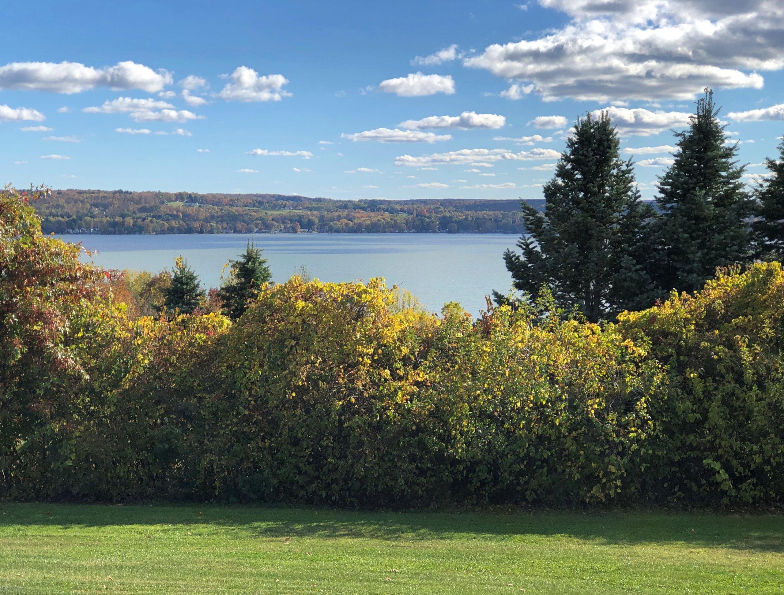
I wanted to reach my destination, Binghamton, NY, before too late, so I didn’t linger near the lake. But I did stop at the rest area on Chautauqua Lake, which is large, and contains multitudes of structures along its shores, and probably many more people in the summer. One of the more scenic rest areas of the trip, it turned out.
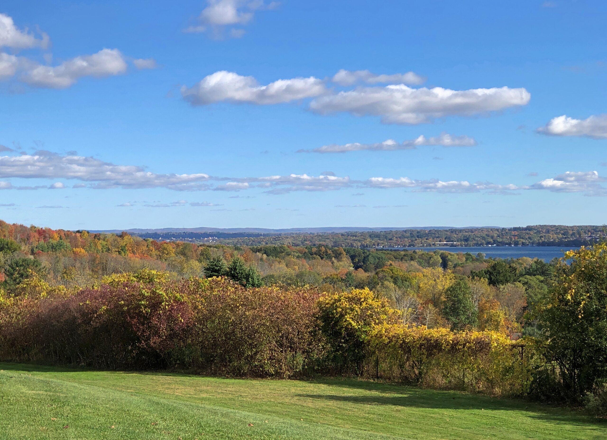
So was the next rest area, not far from Corning. A few hours to devote to the glass museum in that town would be well spent, I think.
After an uneventful night in Binghamton – the kind I prefer on the road – I set out for greater NYC, by way of the highway New York 17, the “future I-86” according to my maps, and then the highways New York 30 and 28.
NY 30 skirts the edge of Catskill Park. Last time I was in the Catskills was during the Clinton administration, back when the Concord Hotel and Resort was still clinging to existence, so it’s been a while, and I’d never been in the colorful and nearly empty western edge of the park in October. That emptiness made all the difference in the car commercial driving I enjoyed.
During all the driving over the next week or so after NY 30, empty roads would not be part of my reality.
Pity the people whose job it is to promote tourism in Nebraska. Set ideas are notoriously resistant to change, at least over periods less than a generation, so I expect the idea “nothing to see there” is a constant battle for those who know otherwise.
I didn’t need to be persuaded. A drive across the state – a reward in itself, more about which later – takes you Carhenge (see yesterday) but also to terrain not generally associated with Nebraska.
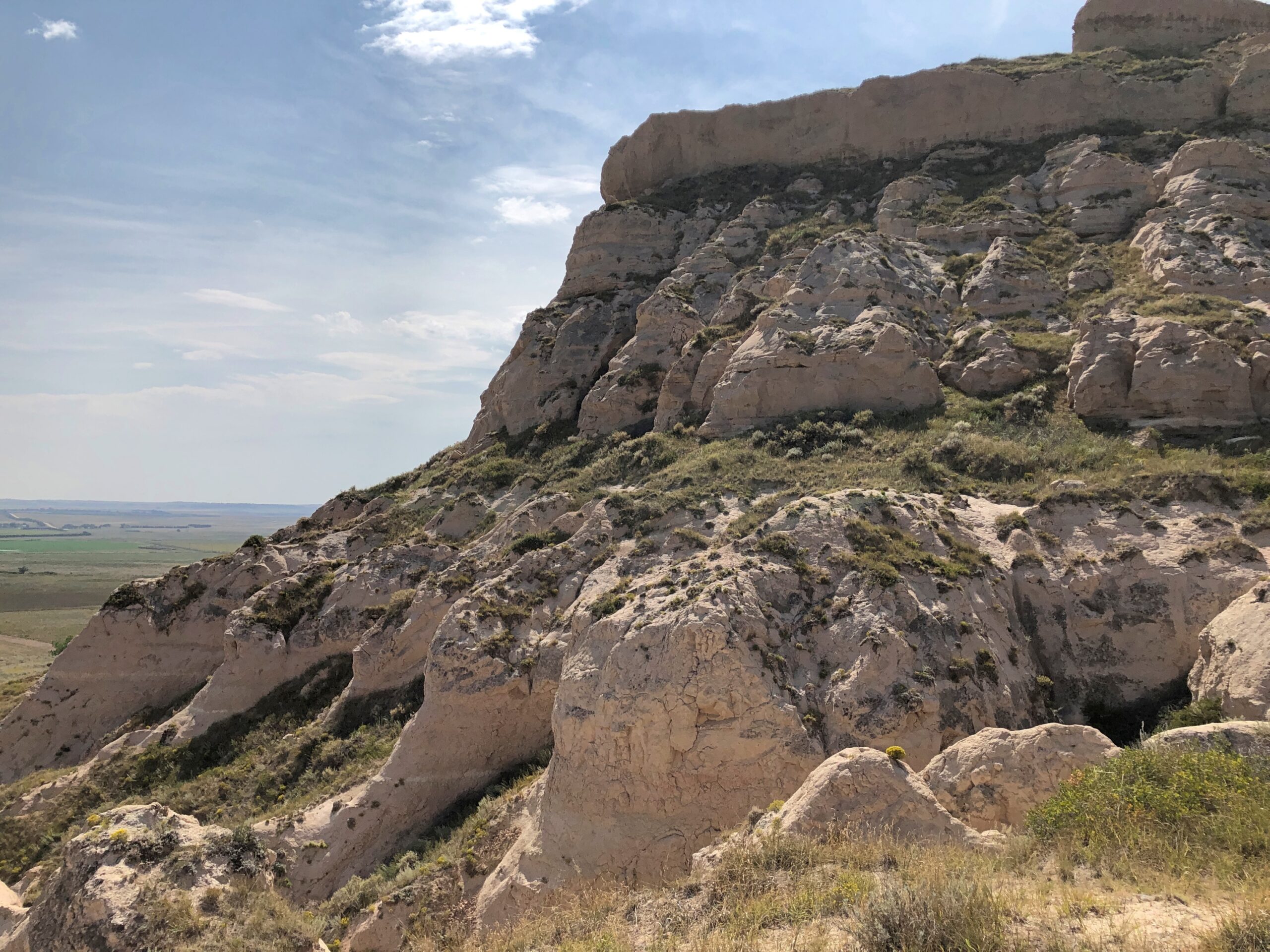
At the western edge of the state, rocks. Big, impressive rocks that poke out of the still-flat ground, stubborn geological leftovers that refuse to erode as fast as the surrounding terrain. Natives, mountain men, trappers, and wagon trains across the prairie all knew about these rocks, knew that they marked a certain point in their journeys. I’m sure they were hard to miss.
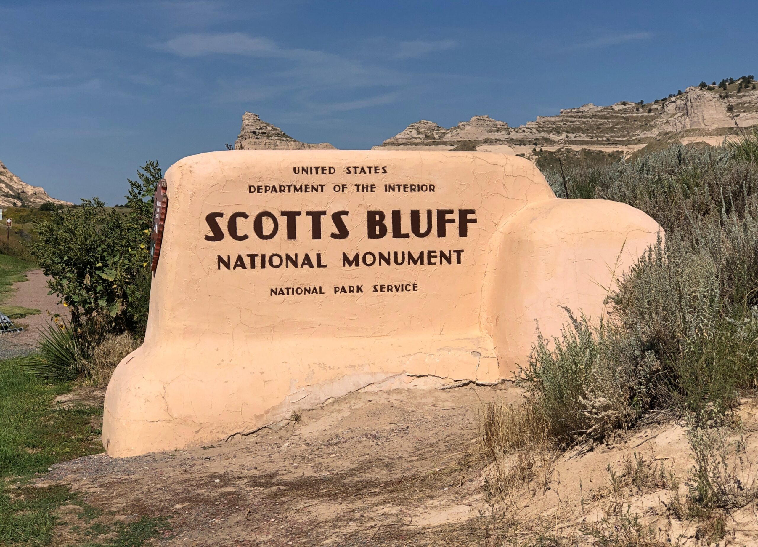
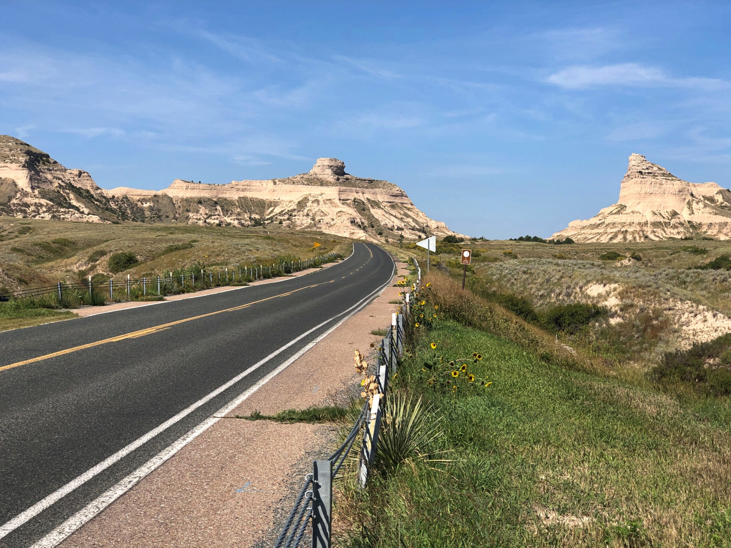
Since 1919, the rocks a few miles from Gering, Nebraska have been known as Scotts Bluff National Monument. I arrived on the morning of September 8.
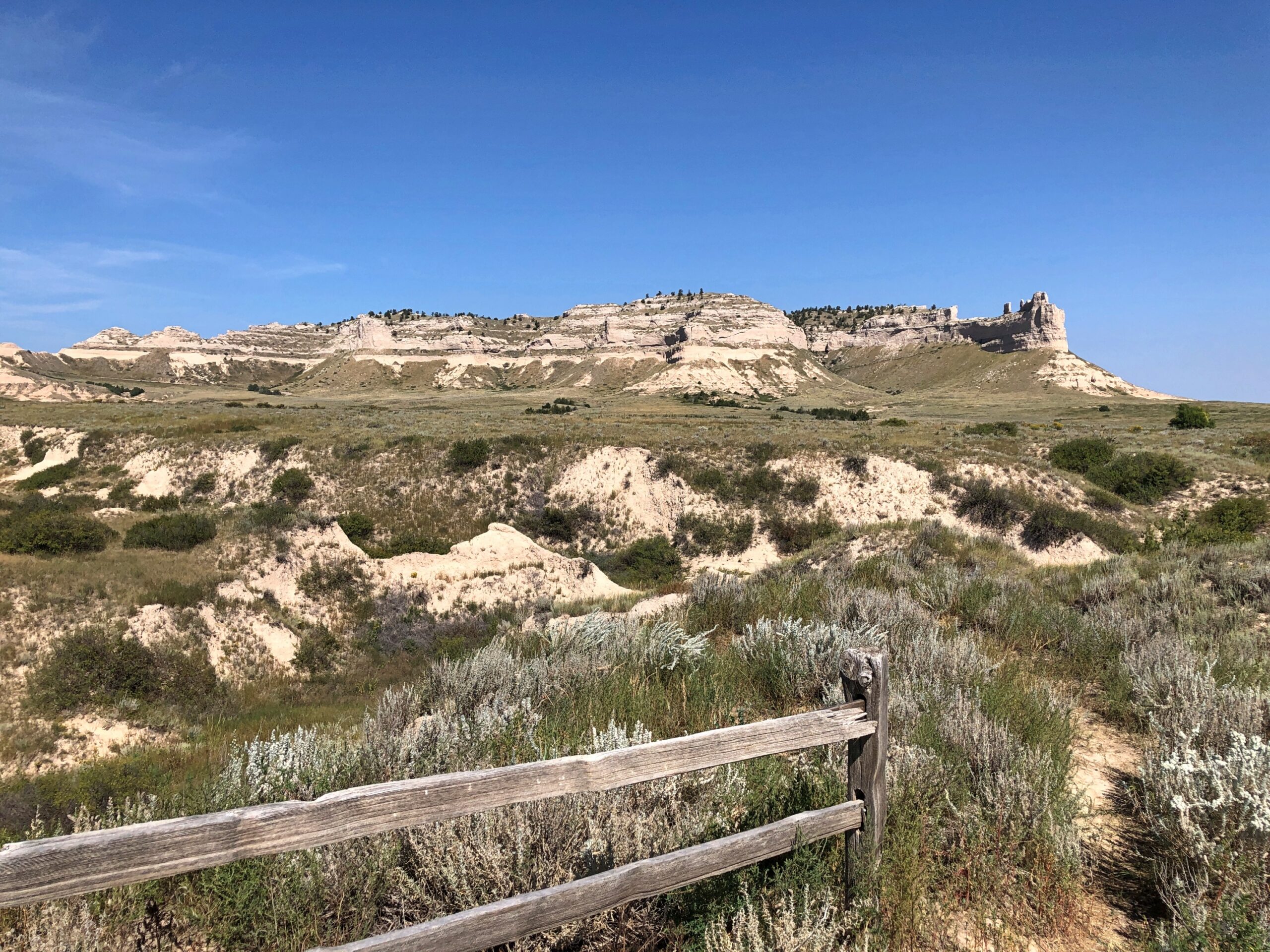
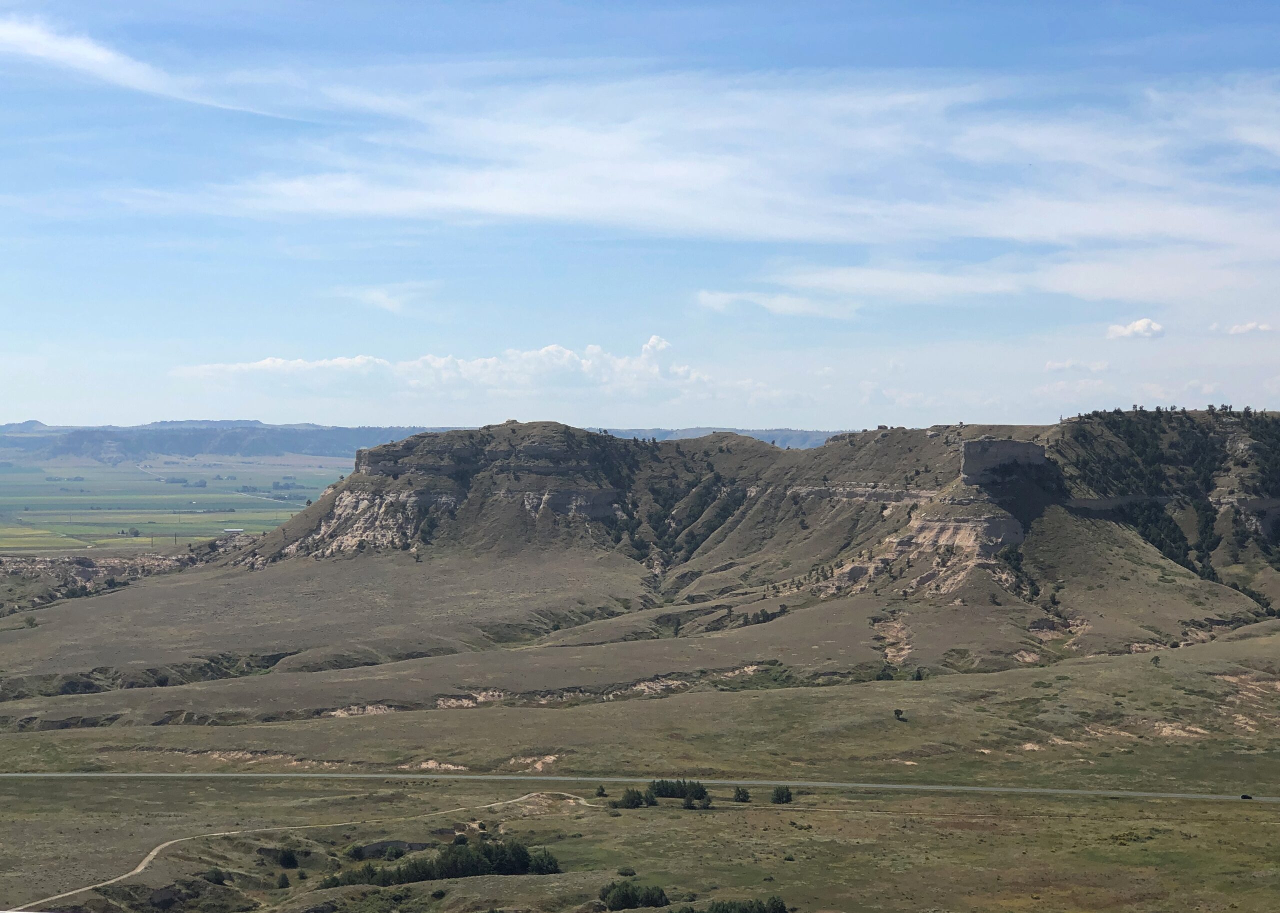
On this particular trip, the monument was an appetizer, ahead of the main course in Colorado. The Sandhills of Nebraska, which I’d just driven through, aren’t pancake flat, but waves of grassy hills with scattered outcropings of rock. After a drive like that, the Scotts Bluff seemed to appear suddenly, rising in your field of vision to take over half the sky.
I exaggerate, but only because that’s how I seem to remember it. An outcropping like that in the Rockies would be lost in the crowd, but here in western Nebraska it’s the star of the show.
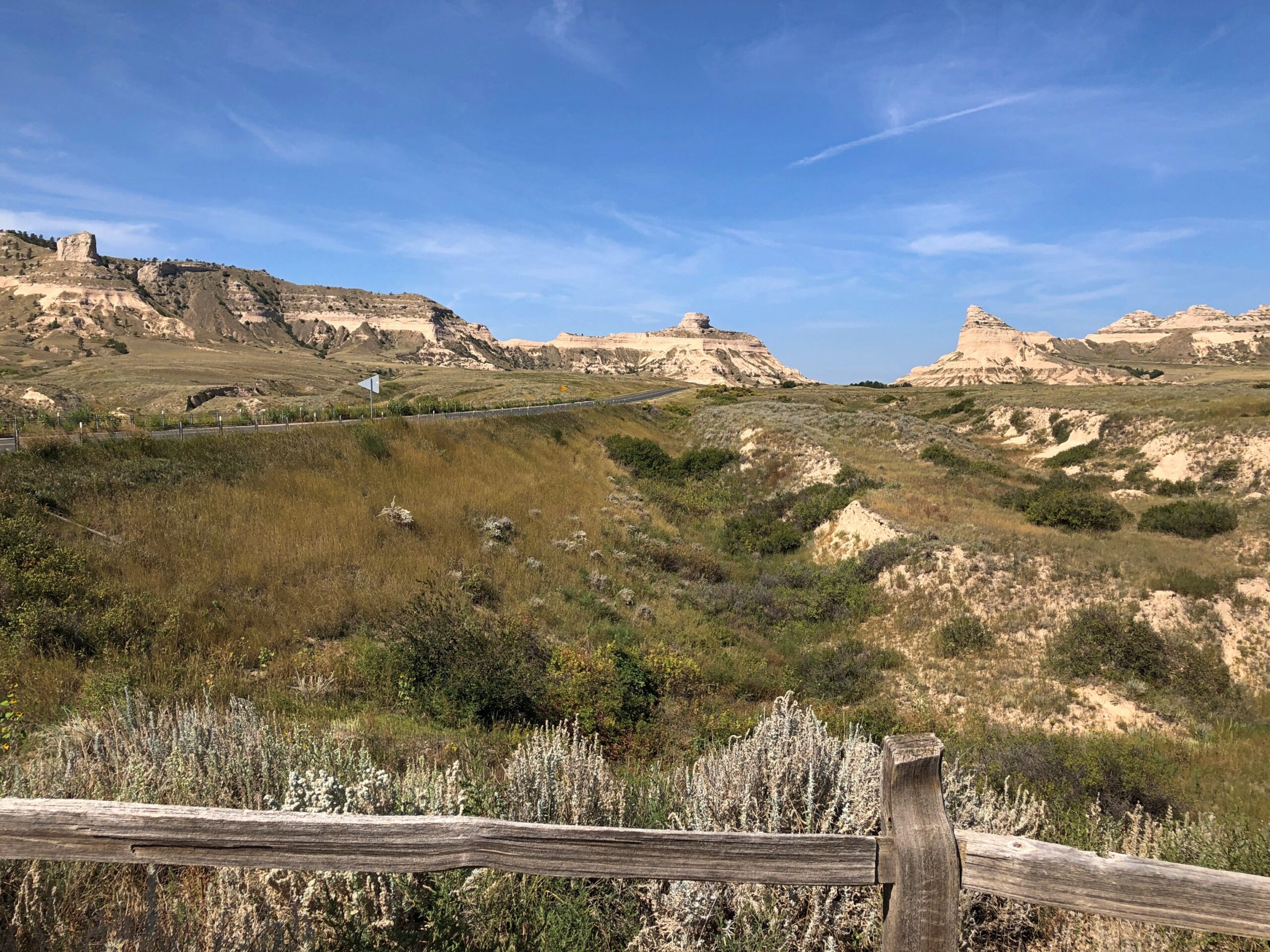
The road leading to the monument, the highway Nebraska 92, follows the Oregon Trail at his point.
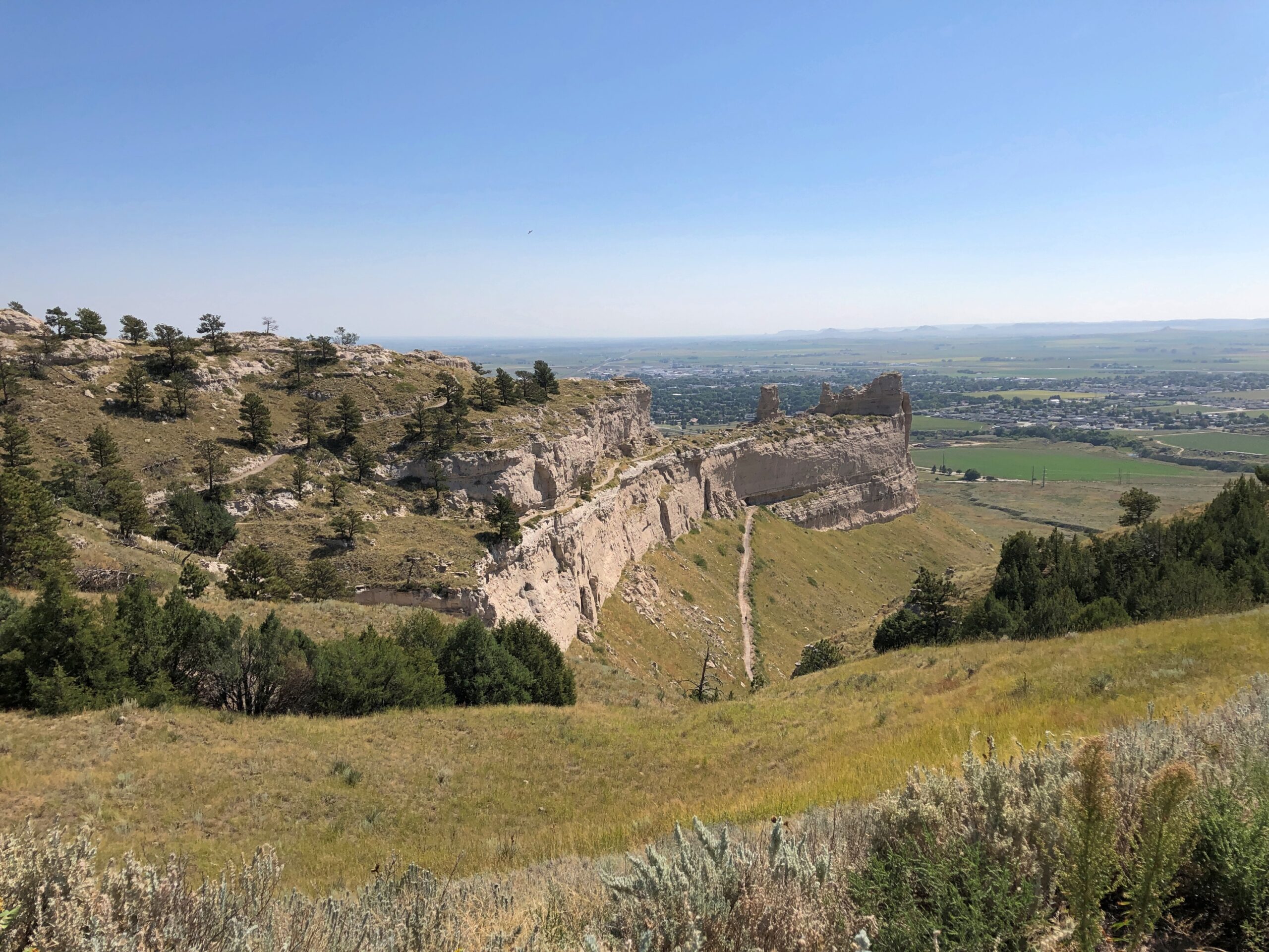
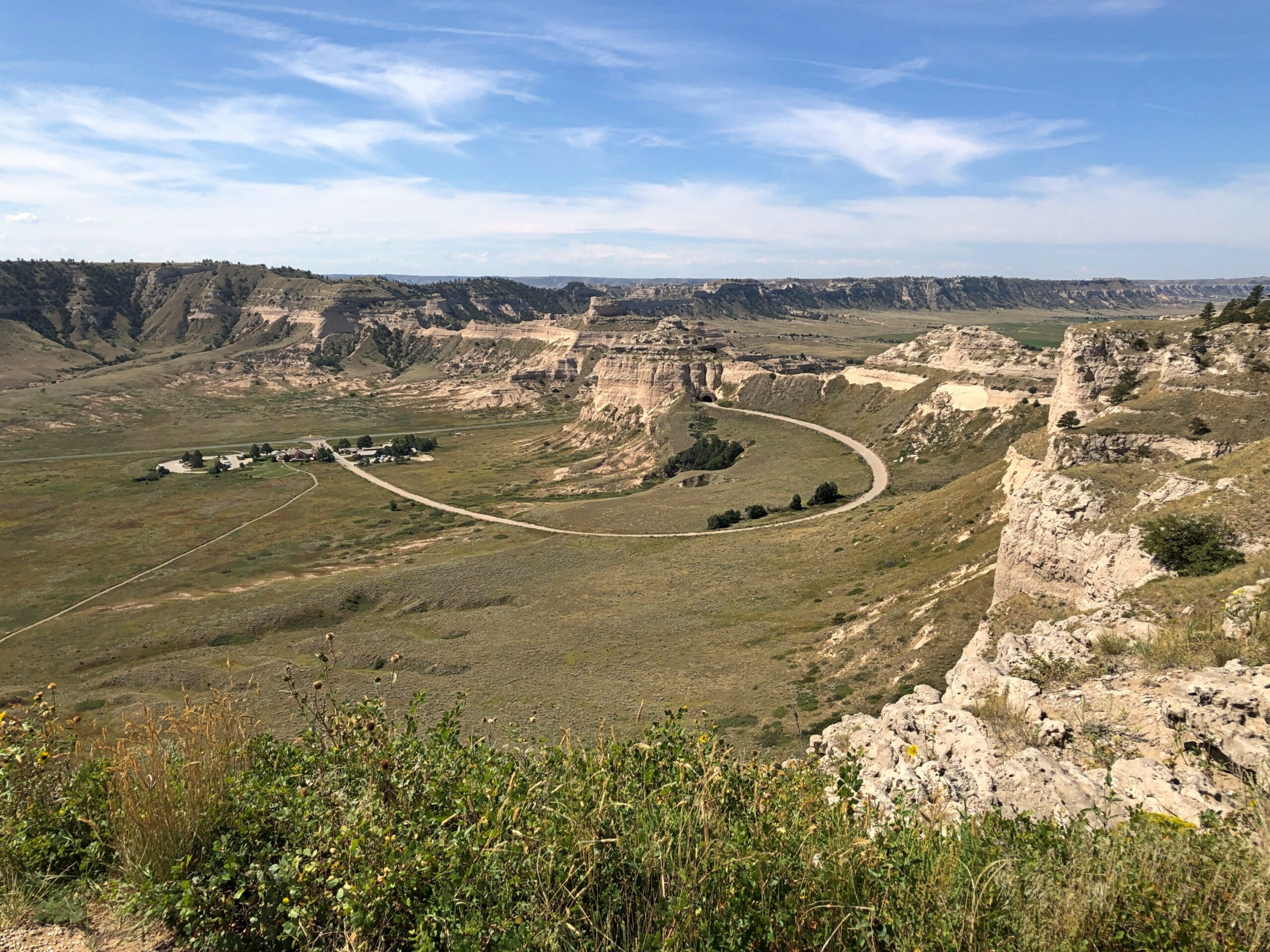
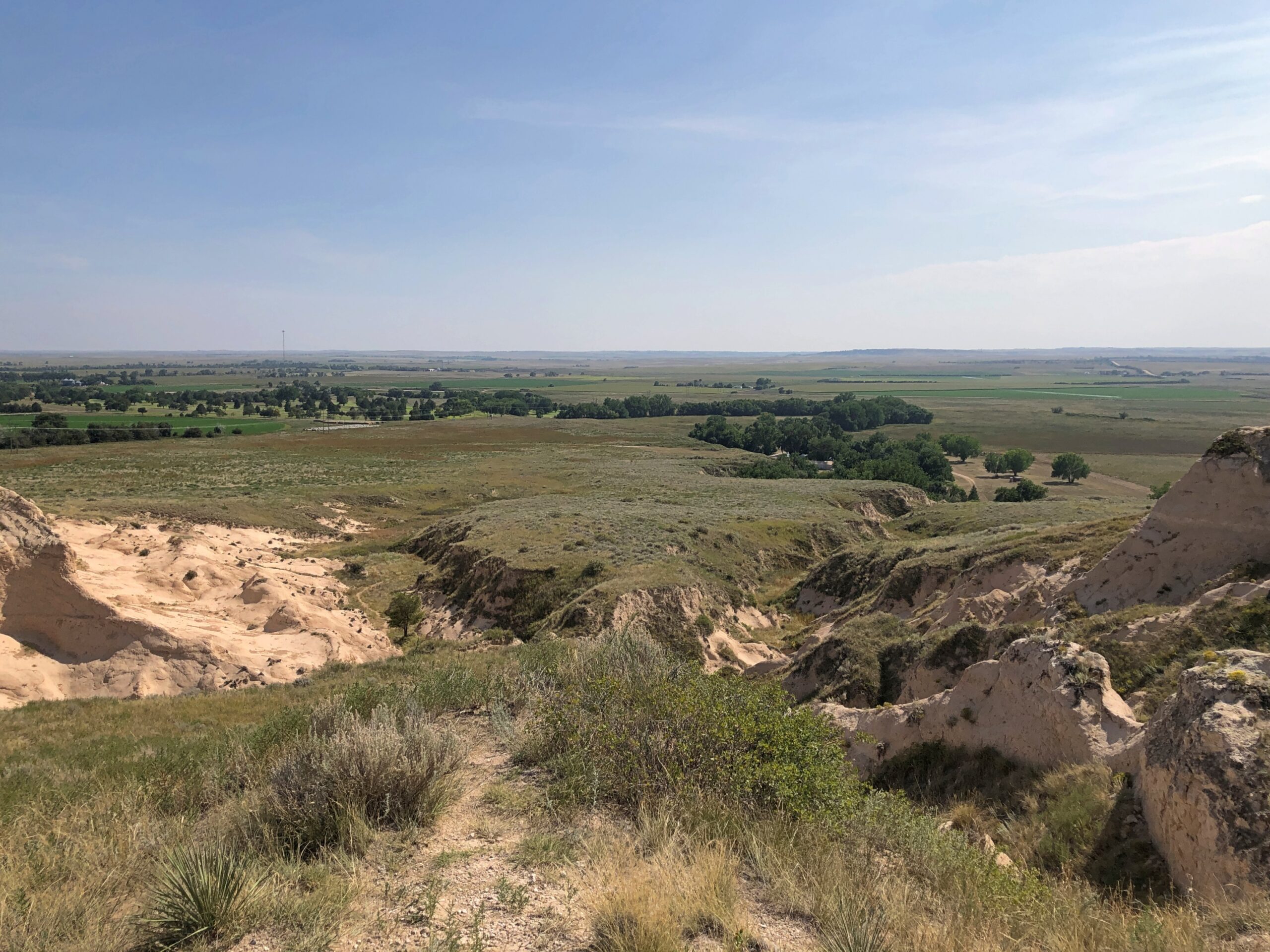
Scotts Bluff isn’t just a single bluff. A set of them, you might say. A road (yes, CCC built) provides access to the top. From there, any number of fine vistas ring the area. A fair number of people took the drive the same day as I did, but in no way did they amount to a crowd.
Scotts Bluff is no solitary outpost. Turning to the 1911 Enclopdaedia Britannica’s entry on Nebraska: “In the fork of the North and South Platte are the Wild Cat Mountains, with contours rising to 5300 ft., in which Wild Cat Mountain, long reported as the highest point in the state, attains 5038 ft., Hogback Mountain 5082 ft., and various other hills — Gabe Rock (5006), Big Horn Mountain (4718), Coliseum Rock (5050), Scotts Bluff (4662) &c. — rise to heights of 4500 to 5000 ft.
“In the extreme N.W. the White river and Hat Creek have carved canyons in deep lacustrine deposits, creating fantastic cliffs and buttes, bare of vegetation, gashed with drainage channels, and baked by the sun.”
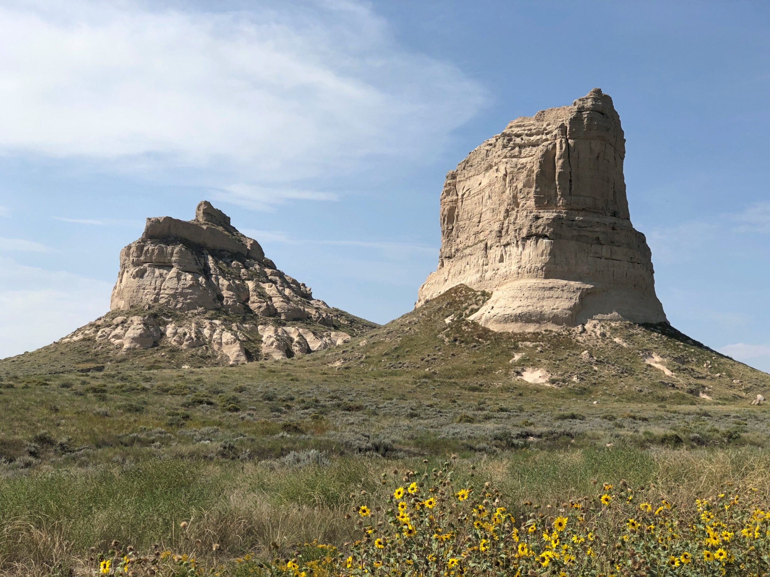
East of Scotts Bluff not far from highway US 26 is a set of rocks known as Courthouse and Jail. There’s something to that name.
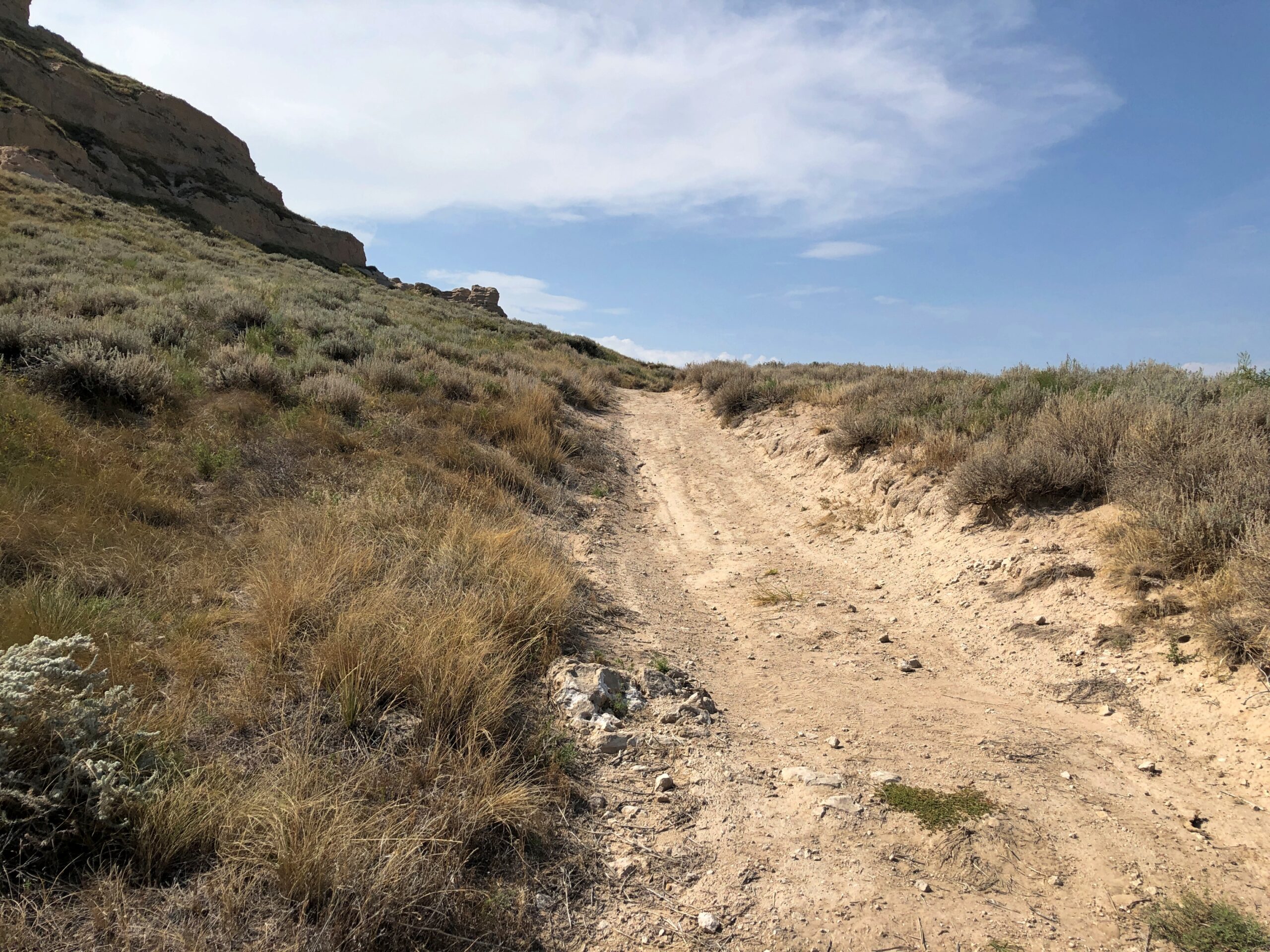
If Scotts Bluff was lightly visited, these two were almost completely empty. I stopped by on the afternoon of the 7th, and the only other people in the parking lot were sitting next to their RV, under a tarp, probably shooting the breeze over beer. So I had the trail to myself, though I didn’t go that far under the hot and copper sky.
Offering some views of its own.
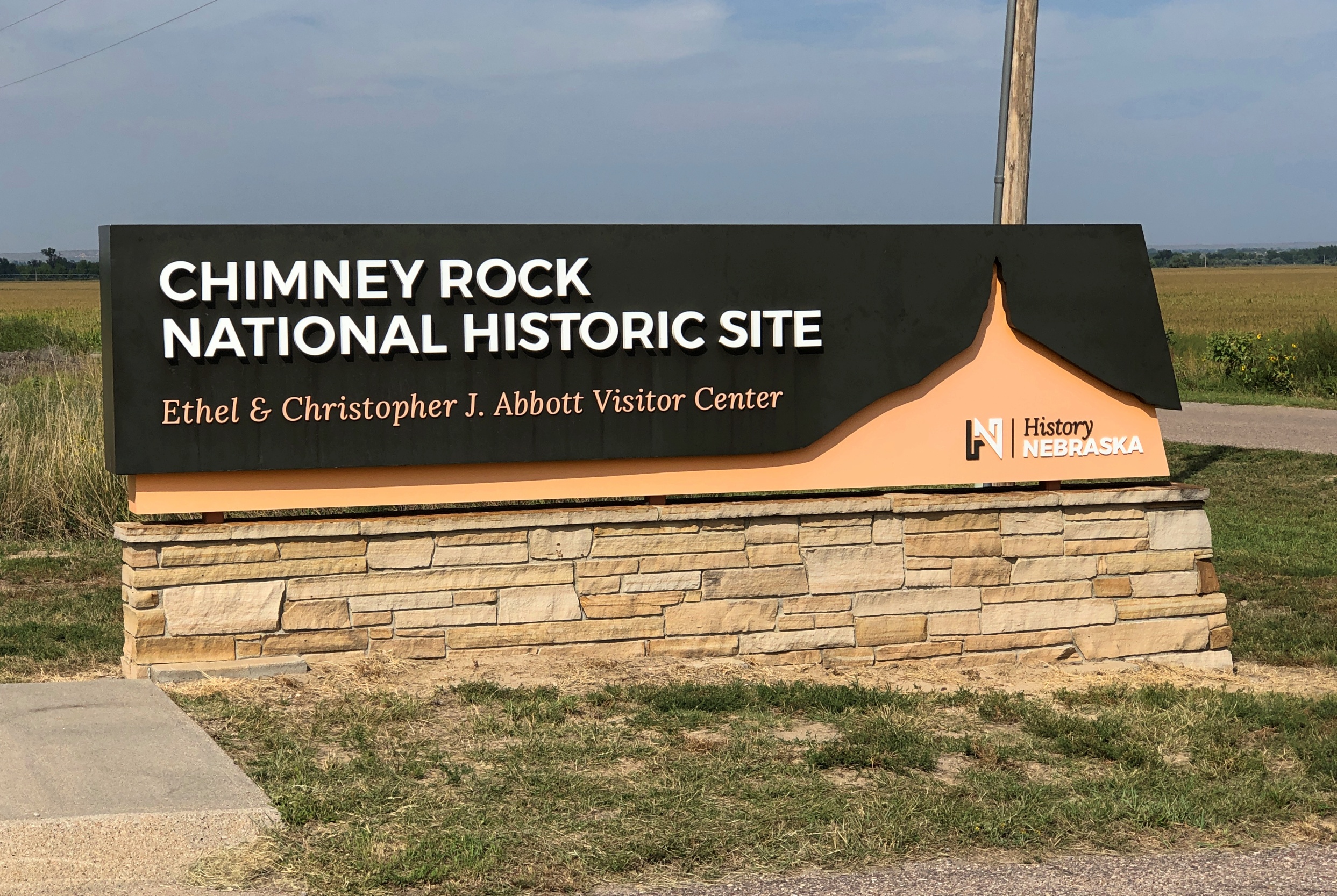
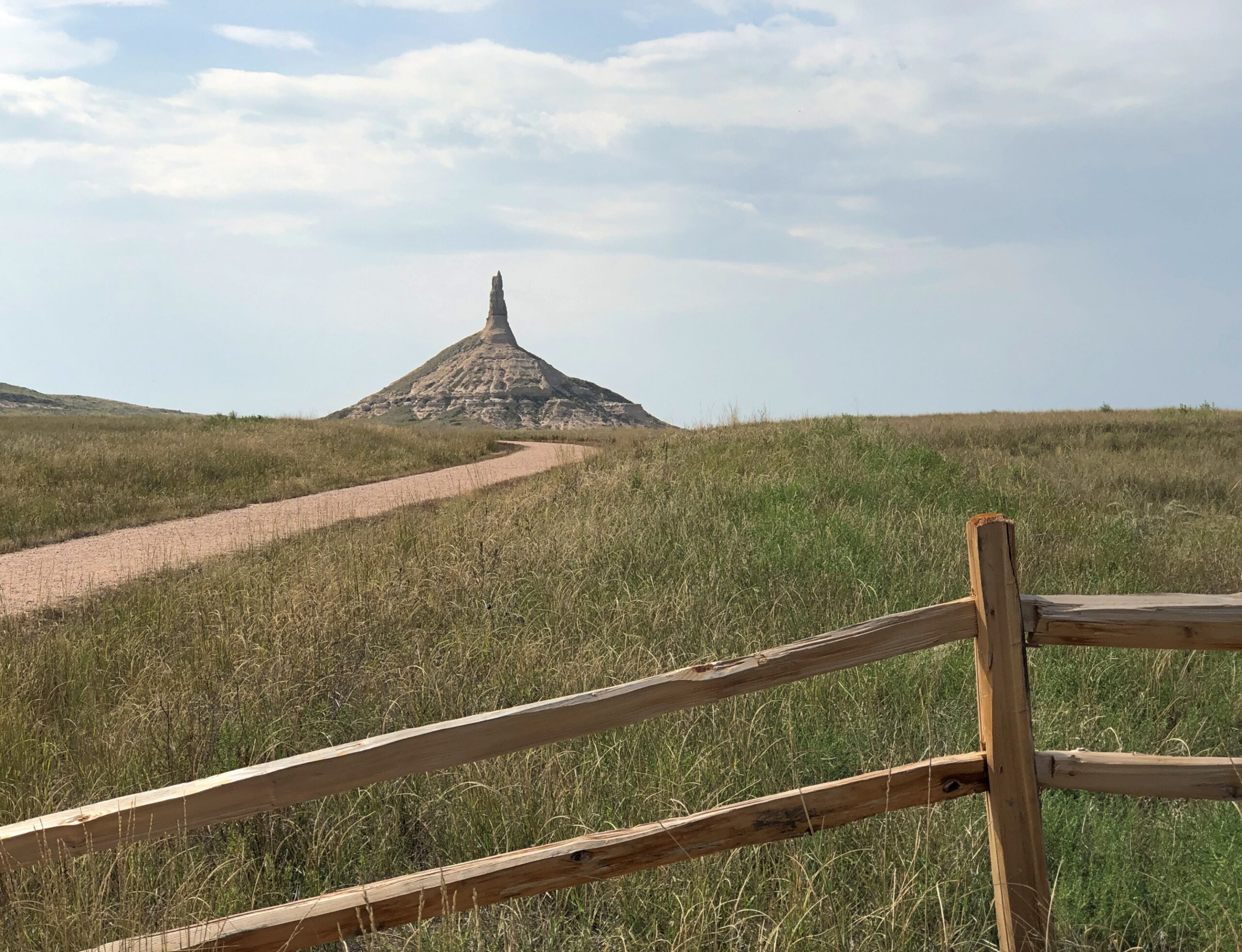
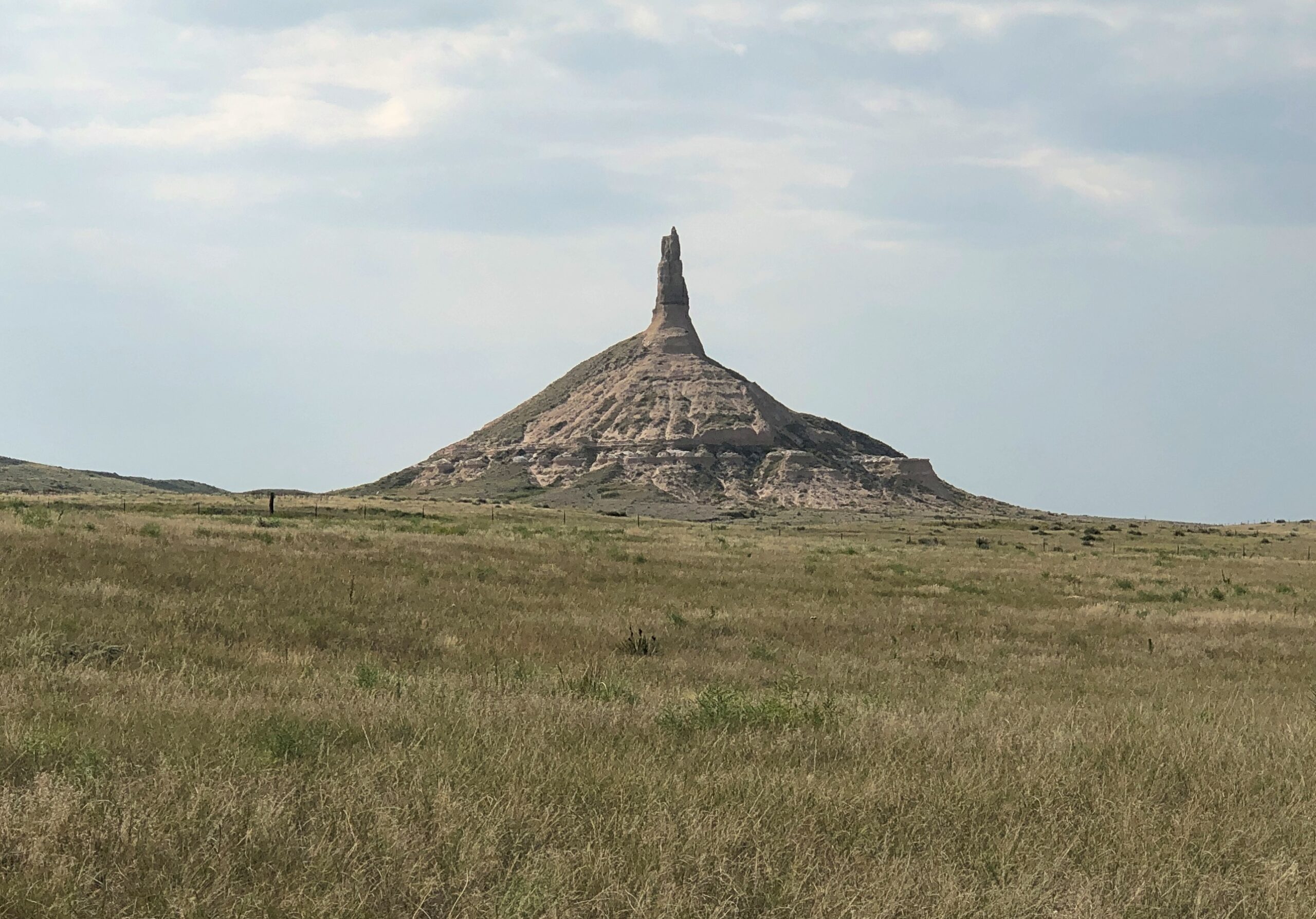
Not far away in this part of Nebraska (at least by horseless carriage) is the better known Chimney RockNational Historic Site.
It was later on same day as Courthouse and Jail, and the heat was still on. Again, I didn’t want a personal heat event to interrupt my trip, so I didn’t go as close as the trails would have allowed.
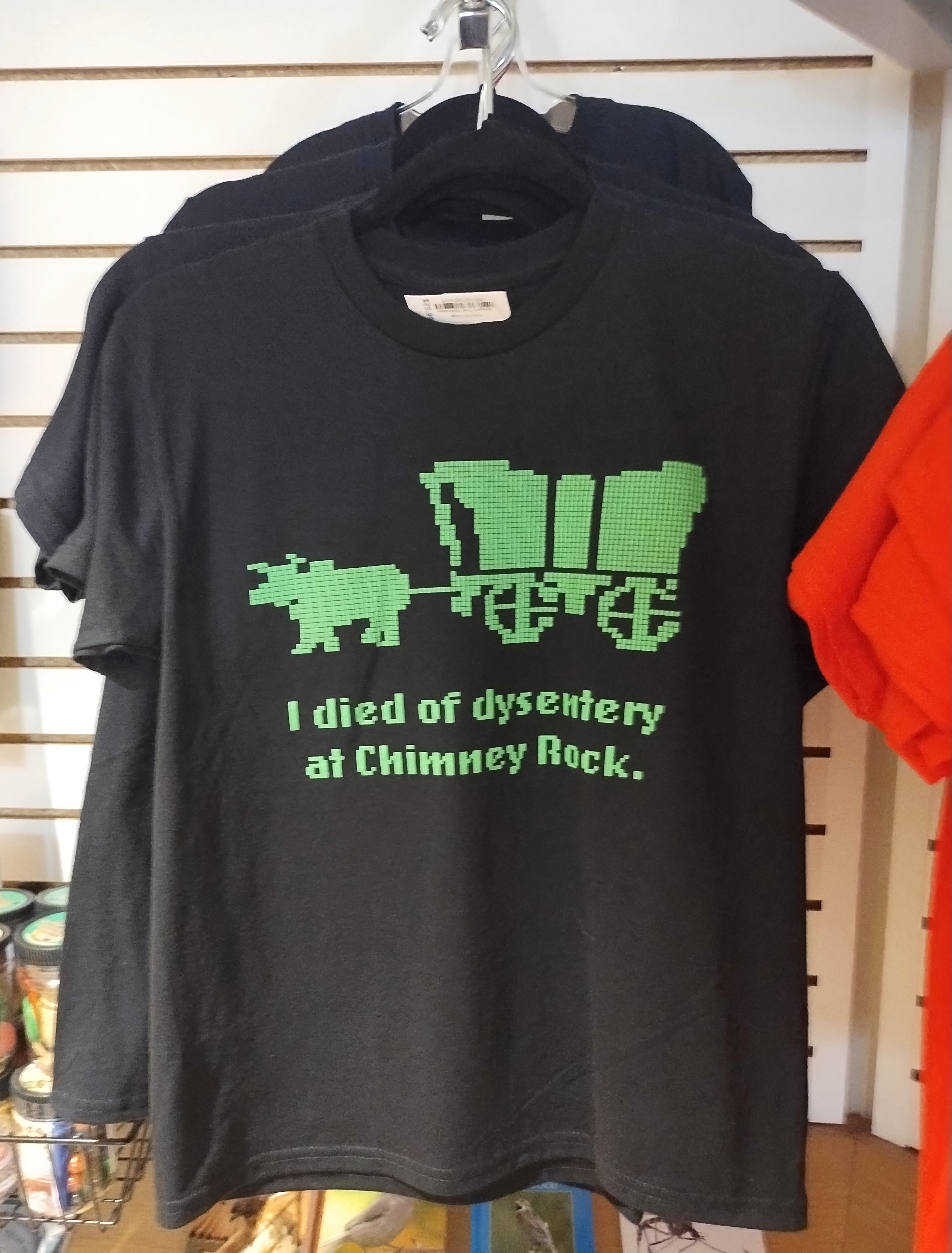
I sent an image of Chimney Rock and a text message to old friend Tom J.:
The aliens decided that Devil’s Tower was a better site.
Then I sent this image from the Chimney Rock gift shop.
Tom answered:
lol. We never even played Oregon Trail and that’s still funny.


