Den-Tex ’17

Before my most recent visit to Texas, which ended today, I spent a few days in Denver. It was like a first visit, because the last time was in June 1980. I had a layover of six — eight? — hours as part of a bus odyssey from Texas to Utah that summer, and took the opportunity to kick around downtown Denver, including a visit to the state capitol and the U.S. Mint.

Though I only remember Denver faintly from that visit, this time around I still felt that there’s a lot more Denver than there used to be. Of course, as a matter of objective fact that’s pretty easy to check. The metro population in 1980 was about 1.3 million. Now the Census Bureau puts the metro population at 2.8 million, though it seems that the definition of the statistical area has expanded over the last three decades-plus.

So it’s a big place. I can see why people want to move there. There’s lots to recommend greater Denver, except for the traffic and some dodgy areas, but every big city has those.

My trip focused on metro Denver. I didn’t climb cathedral mountains, or see silver clouds below. Saturday before last, I started with a walkabout in the Capitol Hill neighborhood, which included a look at two major churches, the Cathedral Basilica of the Immaculate Conception (Catholic) and St. John’s Cathedral (Episcopal).

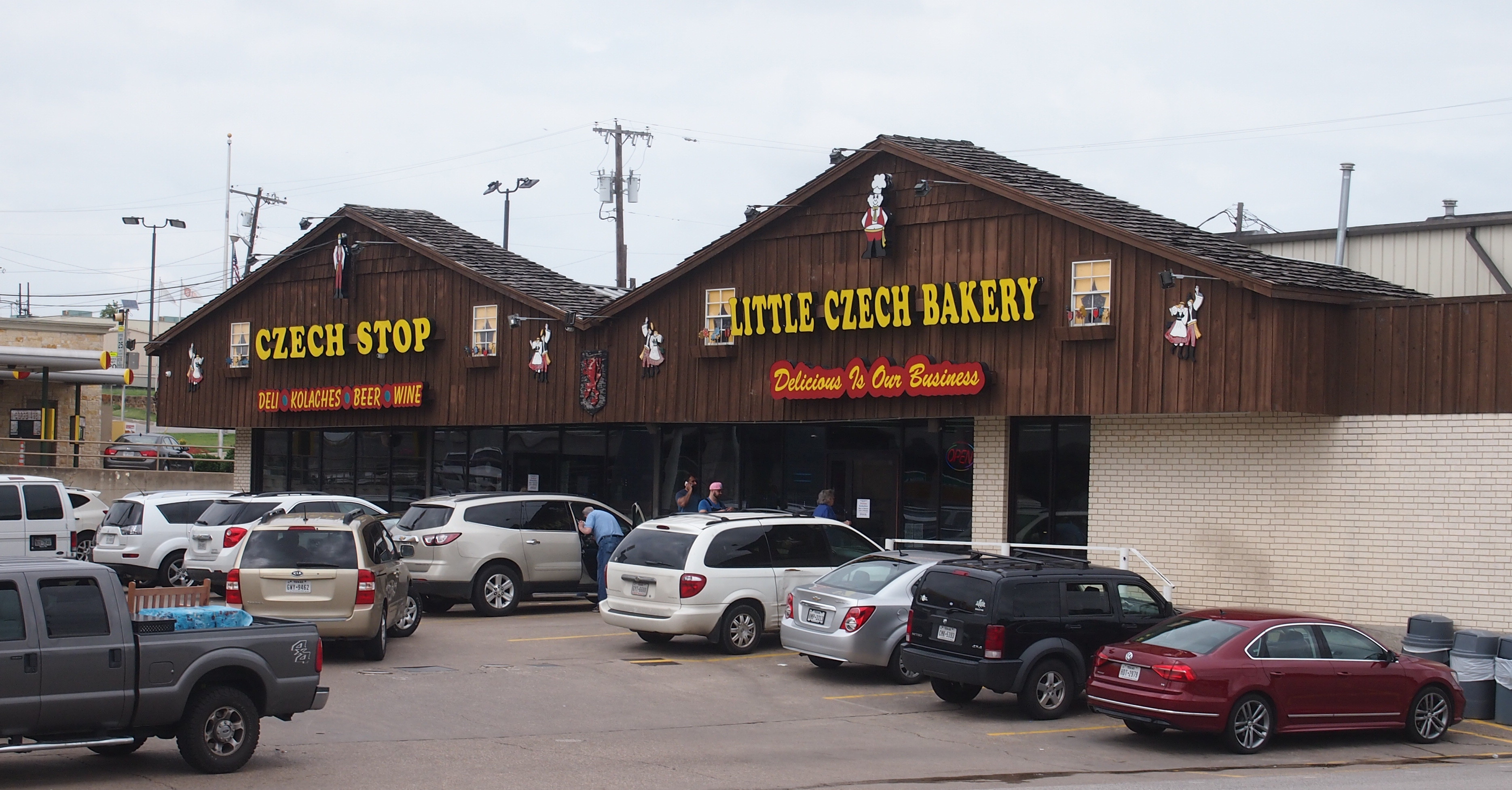
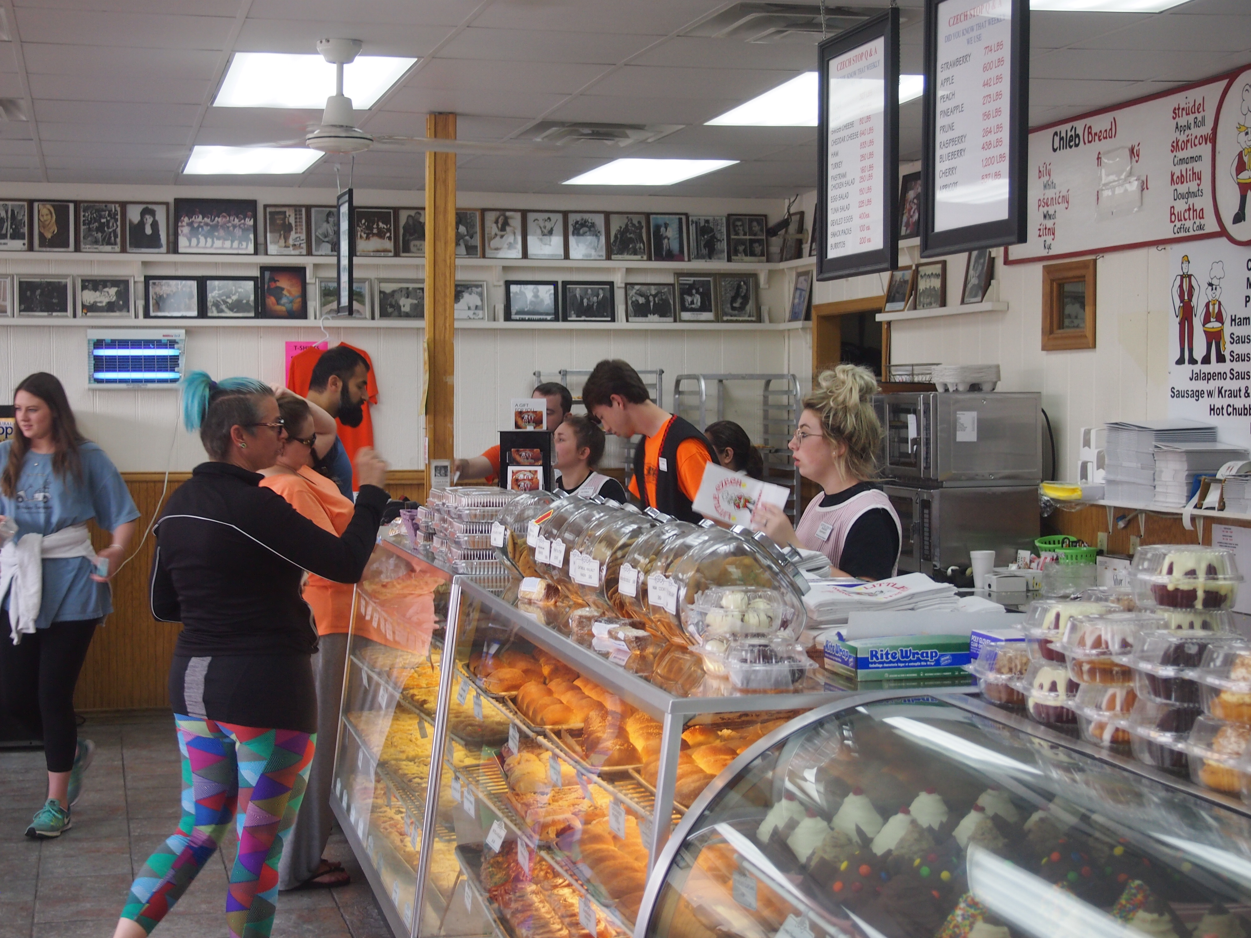
I also had a late breakfast or early lunch — I can’t call it brunch, it just didn’t have that atmosphere — at a joint on E. Colfax Ave. called Tom’s Diner.

Tom's Diner, Denver
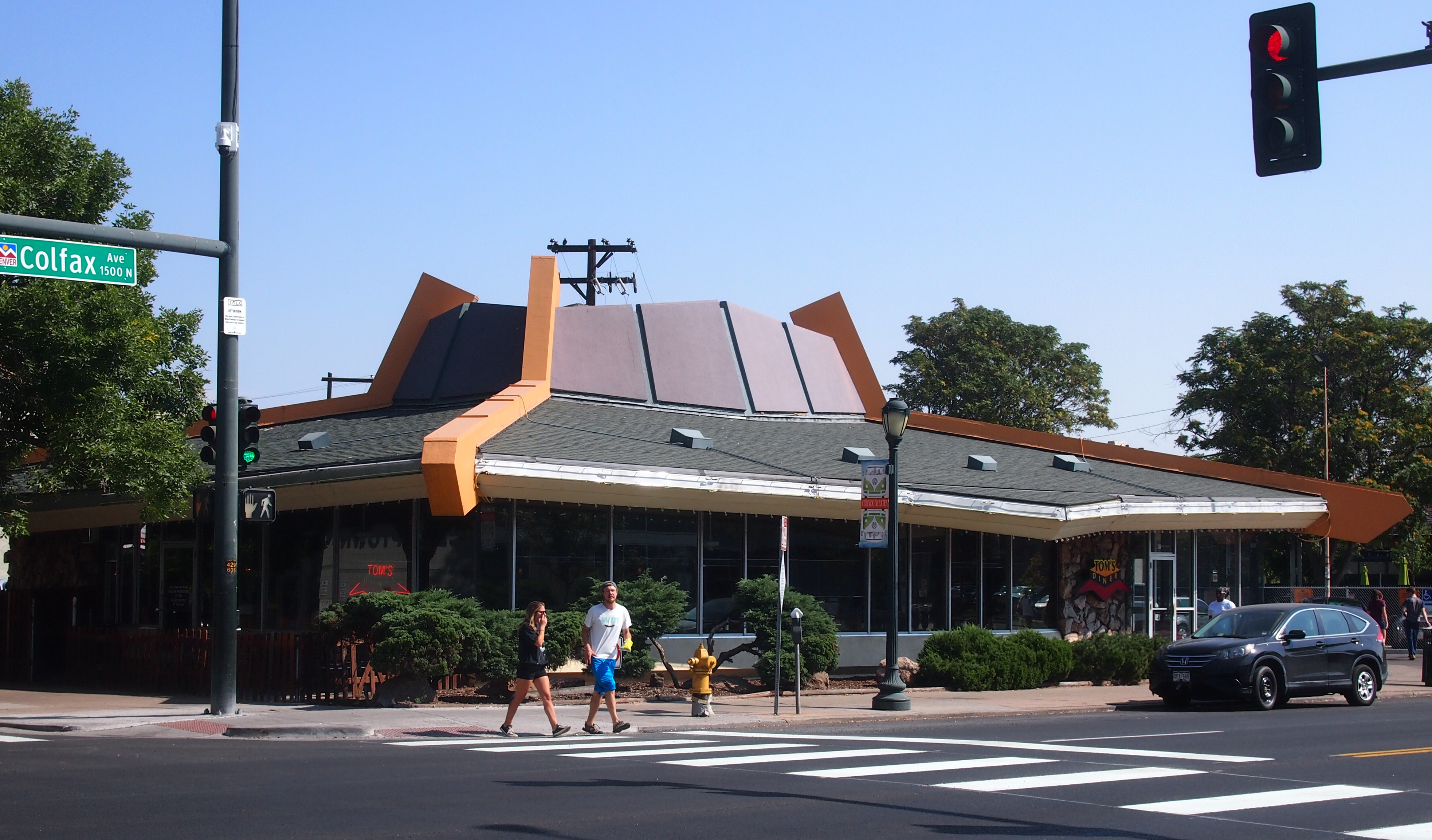
Decorative stone walls, avocado and orange tiles, big windows, yellow-surfaced booth tabletops, a counter to sit at while facing the kitchen: it was like stepping into 1973.

Later, I headed over to the Denver Art Museum and spent time wandering through the galleries. Just outside the museum, the Friendship Powwow and American Indian Cultural Celebration was going on that day, so I got to see some of that too.

I visited the Colorado State Capitol again, though just the grounds, since it was closed for the weekend. From there, I caught the no-charge bus that plies 16th Street through downtown, making my way to two urban spaces that I’ve written about a number of times, and which I very much wanted to see: Denver Union Station and Larimer Square. Both are superb examples of redevelopment.

I couldn’t visit urban Denver without riding the RTD, the city’s relatively new light rail system. I’ve written about it, too. I caught a train not far from Union Station.
RTD Denver Union Station
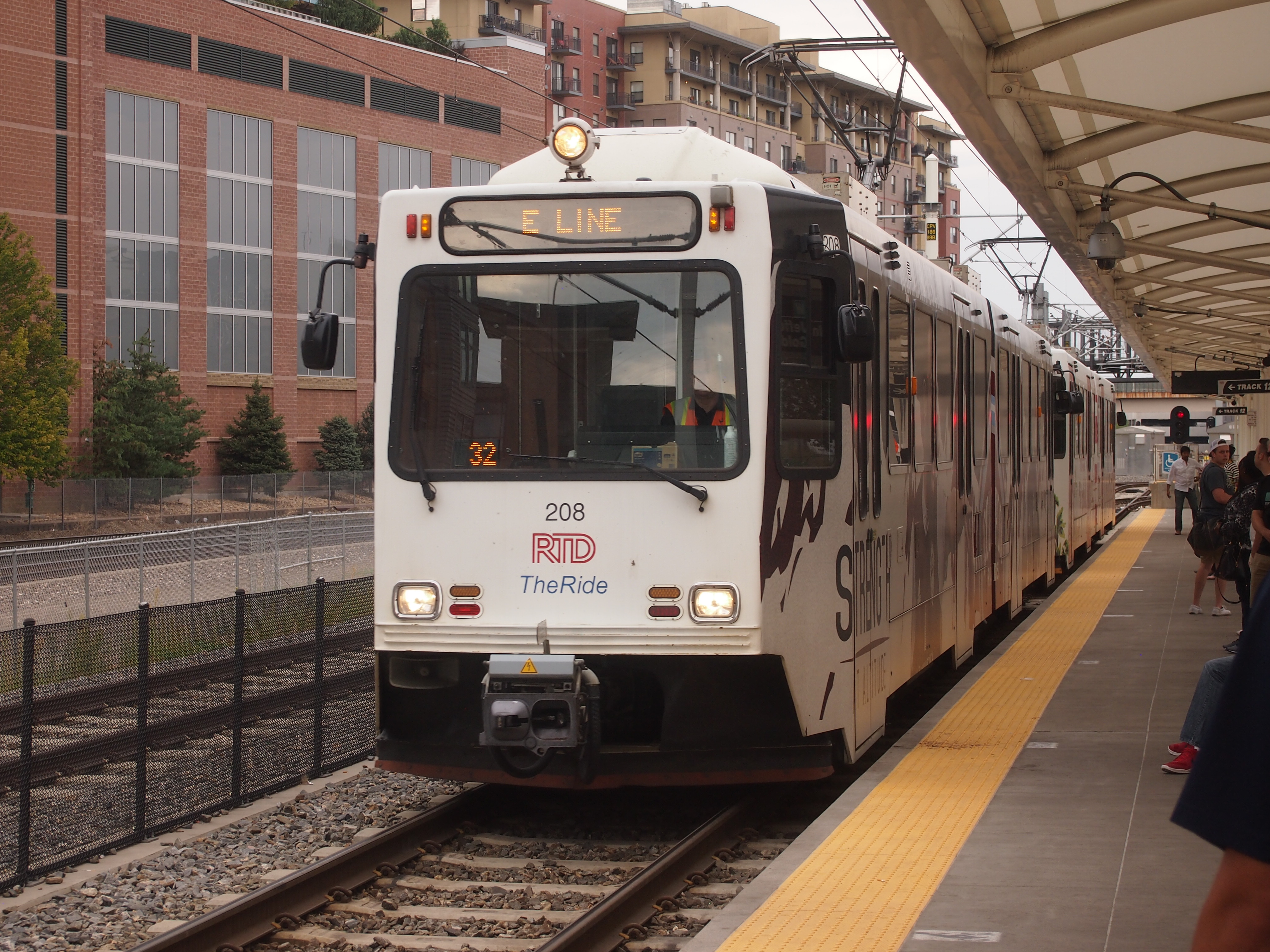
A sleek, new system: it was everything it needed to be, depositing me near the Denver Convention Center. It wasn’t long before I found myself looking at “I See What You Mean.”
"I See What You Mean" Denver
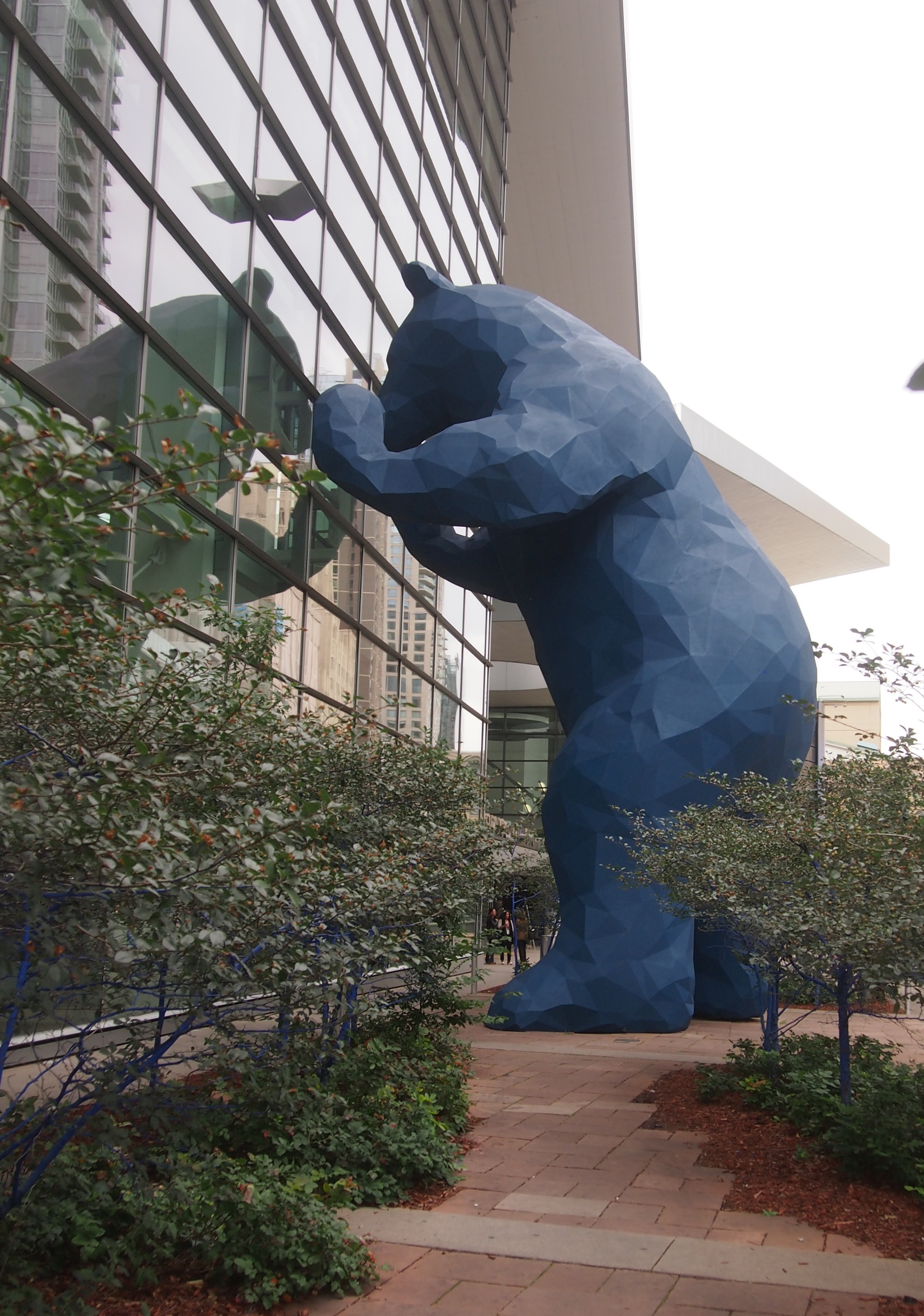
A 40-foot blue bear statue, the work of Lawrence Argent, installed in 2005. A lot of tourists reportedly take pictures of it. Why should I be any different?

After Saturday, I had less time for tooling around metro Denver, but I did squeeze in a few other places, such as Golden, Colo. Guess it counts as outer suburban Denver now, but in any case the town has some exceedingly pleasant public spaces, especially along Clear Creek (which is a river).

In Morrison, not far from Golden, I visited the extraordinary Red Rocks Park and Amphitheatre. I didn’t see a concert there, but I can see the appeal to both the musicians and the audience. It’s an uplifting, masterpiece of space design.

At Red Rocks — which is owned by the City and County of Denver — I took note of the flag of Denver (on the right).
Flags: Colorado, US, Denver
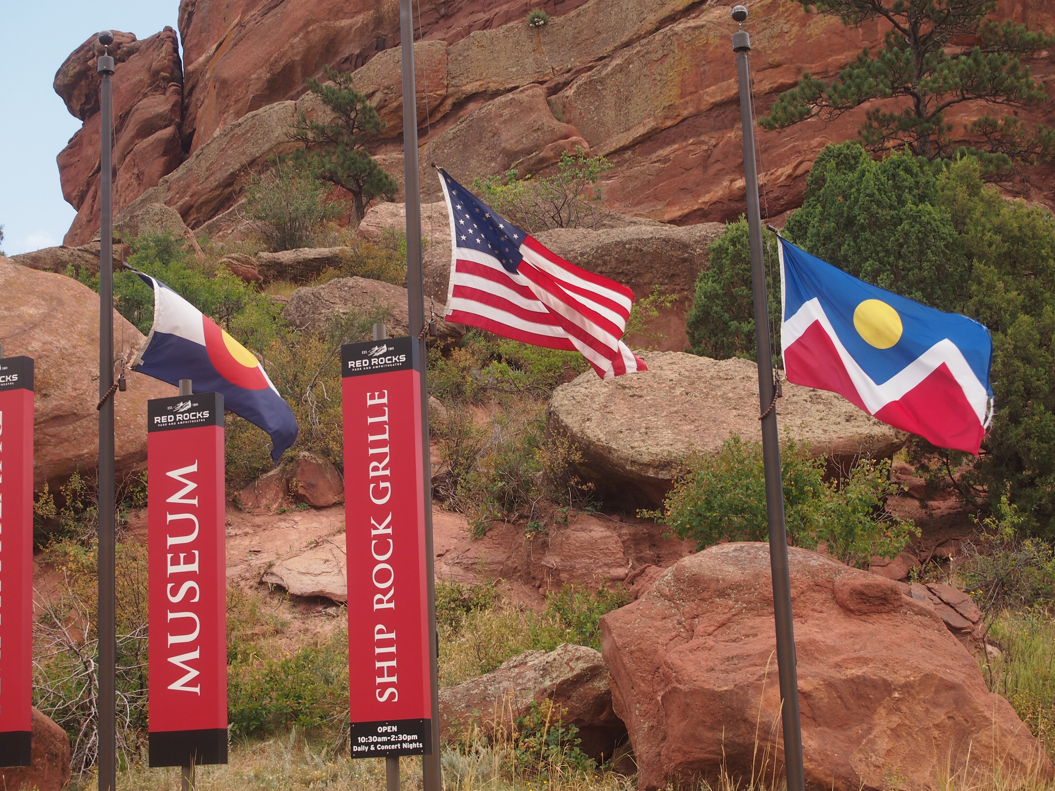
I don’t remember seeing it before. Like the Colorado flag, it’s a fine design. (Number three on the American City Flags Survey of 2004.)

I wanted to visit two historic Denver cemeteries, but I only had time for one: Fairmount Cemetery. It’s a well-tended property, unlike Riverside, which is on the South Platte and supposedly has the virtue of being unkempt.

The Texas section of the trip was mostly devoted to work and family matters. But I did get out for a few hours one day to visit the King William District just south of downtown San Antonio. The last time I was there was ca. 1976. I mentioned that to a person even older than I am, and he said, “Yeah, I remember it then. It was a slum.”

Not any more. For example, the house at 425 King William St., according to Zillow at least, is for sale for $2.7 million.

The Great American Solar Eclipse Road Trip

How long did I know about this week’s solar eclipse? I don’t know. It wasn’t because of the recent media buzz. The better part of a decade ago, probably. Sometime back then, I filed away the notion: I am going to see the solar eclipse of August 21, 2017. In the path of totality.

So I did yesterday, along with my immediate family. And some unspecified millions of other people. It was an event among events. During totality, we were in Paducah, Kentucky, which occurred there for a bit more than two minutes beginning at 1:22:15 pm CDT. All my remaining days, I will remember where I was at that moment, and what I saw, and I hope so will the other members of my family.

I’d like to report that I overcame various trials and adversity to arrive at that place at that time, like an intrepid 19th-century scientist off to see eclipses over remote parts of the globe, but all it really took was a modest amount of planning, plus a bit of time and money. Back in October, for instance, I booked a room at a limited-service motel in Paducah for the night of August 20. I mentioned this to the clerk.

“That’s why you paid the regular rate,” she said. “People who booked this month had to pay twice as much.” Surge pricing among motels. She also claimed that nearby motels, only a bit better than the one we were staying in, charged $400 a night for some rooms. “And they’re getting it.”

We left on Saturday and drove from the northwest suburbs via Champaign-Urbana to Terre Haute, Indiana, where we spent the night of the 19th. On the way, we stopped at Shades State Park in Montgomery County, Ind.

The next day we went from Terre Haute to Paducah, spending a few hours in between in Vincennes, Indiana, on the Wabash River. We saw three things there: Grouseland, home of William Henry Harrison as governor of the Indiana Territory; the splendid Basilica of St. Francis Xavier, and the monumental yet obscure George Rogers Clark National Historical Park.

The thinking behind these stopovers was that seeing the eclipse at totality was no certain thing. Clouds don’t care about your peak-life-affirming-you-are-a-child-of-the-Universe experience, or even if you’re a scientist (or citizen scientist) looking to add to mankind’s body of total knowledge. It’s just another day to the atmosphere. So in case that happened — and the prospect kept me antsy for days — the trip wouldn’t be a total bust.

All together, the trip from our house to Paducah, using the most direct roads, is nearly 400 miles. St Louis is closer, about 300 miles, but I wanted to stay away from a large city for the event, which would mean adding crowds to crowds. Also, I’d acquainted myself with much smaller Paducah in 2009 at the same time as Metropolis, Ill. (misspelling Paducah in my posting), and found it pleasant enough.

Why see the eclipse at all? Because of the astronomy books I had as a kid that explained and illustrated the phenomenon, especially with maps of where total eclipses would be in far-off future years like 1979. Because of the eclipse of March 7, 1970, which was partial in Texas. My eight-year-old self made a pinhole box but, finding that unsatisfying — and this was before widespread eclipse glasses — I stole an instant’s look at it the thing itself in partly cloudy skies, very clearly seeing the black disk on the bright one. Because the subject came up at the planetarium I visited almost monthly in elementary school. Because men were going to the Moon at the same time. Because of the lyric in “You’re So Vain” that seems to reference the ’70 eclipse. The idea of winging off to Nova Scotia just to see an eclipse seemed (seems) impossibly intoxicating. Because of A Connecticut Yankee in King Arthur’s Court and “Nightfall” and other stories and movies using an eclipse as a plot point. Because I read Isaac Asimov writing about the Eclipse of Thales, and later read Herodotus on that event, which probably was on May 28, 585 BC, and if so history’s first exact date. Because I read about the eclipse of May 29, 1919, which helped confirm general relativity. Because of the annular eclipse I experienced in Nashville (as a partial) on May 30, 1984, which dimmed the sky in a strange way. Because it’s a cool thing to see not before I die, but while I’m still alive, just like the Transit of Venus. Because, to paraphrase George Mallory, it’s up there.

UP ’17

For someone who grew up in Texas, I’m unaccountably fond of the Upper Peninsula. A little, probably, since I first saw as a lad its fine ragged outline on a map, and a lot more since my first visit, solo, in 1989. Maybe my appreciation came into full flower on H-13, a two-lane road through Hiawatha National Forest, as I drove north a little faster than strictly necessary, my cassette player playing a little louder than usual, zipping between walls of pines. It was a Be Here Now moment.

Also, I’ve never grown tired of gazing out into the vastness of Lake Superior, as I first did that year and most recently on July 1 at the mouth of Presque Isle River.

Lake Superior, Presque Isle RiverThe shore was rocky at that point, with smooth white driftwood beached on the shore. Not only that, people had built small cairns there, mostly on the wood, something I didn’t notice until I did. Then I started seeing them all around. I built one too, though not this one.
Lake Superior, Presque Isle River
We left the northwest Chicago suburbs late in the afternoon on June 29, spending the first night in Madison. From there, it’s a straight shot north through central Wisconsin, for much of the way on I-39 and then the slower but more interesting US 51. On the last day of June, we made our way north to the western reaches of the UP.

As I wrote 14 years ago: “At the northern end of I-39, which runs like a spine through most of central Wisconsin, US 51 takes over, though for a time it’s a divided highway of four lanes, and thus exactly like the Interstate. Just north of the wee resort town of Tomahawk… the road narrows. By this time, the driving visuals were compelling anyway, and all the narrowing of the road did was bring the scenery that much closer.”

Near Hurley, Wis., US 51 meets US 2. Unlike the 2003 trip, this time we headed east on US 2 into Michigan, into new territory for all of us — me, Yuriko and Ann. Staying at a modest but charming non-chain hotel in Wakefield, Mich., on the nights of the 30th and the 1st, the focus of the 2017 trip was the western UP, especially the Porcupine Mountains Wilderness State Park. We also visited the Keweenaw Peninsula, but time didn’t allow a fuller look at Keweenaw.

Evenings were cool and days in the 70s F. and partly cloudy most of the time. Weather forecasts had spoken of rain, but the closer we got to the trip, such forecasts were revised, downplaying the chance of rain. In the event, only a little fell on us on July 1 as we drove back toward Wakefield in the late afternoon. On the evening before, just before sunset, patches of thick fog clung to the Black River Road near Potawatomi and Gorge waterfalls. Ann commented on its eerieness.

Walking was an important part of the trip. Essential, as far as I’m concerned. On the first day of July, Yuriko thought to check the app on her phone that counts steps. We took over 14,000 steps that day. Many of the steps were on forest paths like this.

Porcupine Mountains Wilderness State Park

Or this.

Porcupine Mountains Wilderness State Park

A lot of the steps looked like this.

Porcupine Mountains Wilderness State Park

I felt my age. I usually brought up the rear, and took more breaks than I might have 10 or 20 years ago, but I got through.

Since time was short and distances, while not great, did involve miles to cover, driving was important, too. Also an essential experience on the trip, in my opinion. Tracing a course around the southern edge of the state park, the utilitarian-named South Boundary Road snaked through the intense summertime UP greenery, made all the more flush by a rainy spring, up and over hills, encountering few other cars. Light traffic on a two-lane road like that is the difference between an enjoyable time and constant white-knuckle dread. It was car-commercial driving. I got a kick out of that road.

Other roads in that part of the UP, routes through Ottawa National Forest and up into Keweenaw, were more developed and traveled, but had their attractions as drives and for their roadside sites. Though I know they represent a backstory of hardship — the UP must be a difficult place to make a living for a fair number of people — the area’s abandoned buildings were strangely fascinating. Such as a derelict store with gas pumps near (in?) Silver City.

Silver City, Michigan 2017

Detroit has no monopoly on abandoned Michigan structures. I suspect no root beer has been served at this former Wakefield drive-in in some time.

Family Root Beer Drive In, Wakefield, Mich 2017

In Wakefield, I made a point of taking a picture of a couple of Lake Superior Circle Tour signs.
Lake Superior Circle Tour signs, Wakefield, MichThe Circle Tours are networks of roads that, as the name implies, go all the way around each Great Lake, and in this case Superior. The idea was obviously hatched to promote tourism, and not that long ago, in the 1980s. To that I say, so what? The signs sit there quietly, but make a grand suggestion to passersby all the same.

I saw Lake Michigan Circle Tour signs in the late ’80s, as far south as Illinois, and on a sunny September day in ’89, on M-28 headed west to Marquette, I first saw a Lake Superior Circle Tour sign, which I hadn’t known existed. To me, the sign said — still says — Drop Everything and Drive Around the Lake. I’ve managed to drive around Lake Michigan, clockwise and counterclockwise. Lake Superior, no.

GTT 2017

This month Lilly and I visited Texas for a couple of weeks, beginning when I picked her up on May 12 in Champaign, at the end of her exams at UIUC, and ending with our return to metro Chicago on May 26. Unlike last summer, we mostly took direct routes, there and back. All together, we drove just a shade over 2611 miles through only four states, but ranging from about 42 degrees North to 29 degrees North.

Mostly we spent time with family: her grandmother and uncles and cousins, in San Antonio and Dallas, most of whom she hasn’t seen recently. She also met little cousin Neil for the first time.

From Champaign, we headed to Effingham, where we passed the giant cross, visible from the highway, but did not stop for it, and then headed west to St. Louis. By evening, we’d made it to Lebanon, Mo., and the Munger Moss Motel, which has had a few more neon burnouts since Ann and I stopped there last year.

Munger Moss sign 2017The second day, we went to Dallas by way of Springfield, Mo., where we stopped to stroll in the Mizumoto Japanese Stroll Garden, a part of the Springfield Botanical Gardens. Later that day, we stopped in Muskogee, Okla., and took a look at the USS Batfish, a WWII-vintage submarine incongruously perched on land and functioning as a museum.

On Sunday, May 14, we proceeded to San Antonio, with my brother Jay joining us. We stopped for a delightful lunch in Austin with Tom Jones that afternoon at Trudy’s, a local brand. Tom was already an old friend of mine when I was Lilly’s age.

Circumstances forced us to scrub our plans to drive to Big Bend National Park for a long weekend beginning on the 18th. While in San Antonio, Lilly went to North Star Mall one day by Uber, and on another day Jay and Lilly and my nephew Dees went to the Witte Museum and then the Sunken Gardens (formally, the Japanese Tea Garden). On Saturday, May 20, we to returned to Jay’s house Dallas via U.S. 281 until north of Austin, picking up I-35 near Killeen, because there’s no reason to go through Austin unless you’re going to Austin.

In West, Texas, — which is in Central Texas — we bought some kolaches at the Little Czech Bakery, which is next to the Czech Stop. Been there a number of times since I wrote this.
Czech Stop, West, Texas 2017The line wasn’t quite as long as usual. Good thing.
Czech Stop, West, Texas 2017Czech Stop, West, Texas 2017One day in Dallas we visited the Dallas Arboretum and Botanic Gardens, as lovely a garden as I’ve seen in quite a while. Despite its location on White Rock Lake, close to Jay’s house, I’d never been. Another day I dropped Lilly off at North Park Mall, known for its collection of artwork, and visited the next-door Sparkman-Hillcrest Cemetery, or in full, the Sparkman-Hillcrest Memorial Park Cemetery. A first-rate bit of landscaping.

We headed back for home beginning on May 25, driving from Dallas back to the Munger Moss for one more night (getting room 67; the first time we got 66). The next day we passed through St. Louis en route to the Chicago area and home.

On the last leg of the trip I was determined to stop a few places. First, we saw the abandoned Gasconade River Bridge, which counts as a Route 66 sight, though it could have been along any old road and still be just as fine. In St. Louis we visited the Cathedral Basilica of St. Louis, one of my favorite churches in North America, and then the wooded, hilly Bellefontaine Cemetery north of downtown, which is in the same league as Green-Wood in Brooklyn or Woodland in Dayton. First rate, that is.

Char-Tex ’17

Recently, before I went to Texas for a week, I had a day to spend in Charleston, SC, a city I’ve wanted to visit for many years. Just a day, so I packed in the sights. It wasn’t an example of slow travel. Sometimes, you’ve got to hit the ground and go.

I saw the oldest part of Charleston — the site of Charles Towne — on foot for a few hours, took the boat out to Fort Sumter, which took a few more hours, visited Magnolia Cemetery, and saw the H.L. Hunley later in the afternoon.

The old part of Charleston is very handsome, replete with structures surviving from the Antebellum period squeezed into tight city blocks along such streets as Calhoun, Cumberland, Meeting, and at the intersection of King St. and Queen St. A fine thing to do on a February morning that’s warmer than it should be, even in the South: wander past the elegant or curious buildings, admire the churches, take in the details of the streetscapes and sidewalks.

The War Between the States and Reconstruction crushed the local economy. Bad for the people who lived then, good for historic preservation in the late 20th and early 21st centuries, when considerable prosperity has returned to Charleston. Had prosperity continued in the 19th and early 20th centuries, the city might sport handsome Victorian architecture, or might have been Eisenhowered into something less pleasing.

Fort Sumter National Monument is about a 30-minute boat ride away from the city. The fort is as historic as can be, but apparently doesn’t look much like it did in 1861. The war flattened it, the post-war U.S. Army rebuilt and redesigned it until the place was turned over to the Park Service after WWII.

The Confederate submarine H.L. Hunley, whose insufficient design killed more men than the vessel did as a weapon of war, now rests in a tank of water at the Warren Lasch Conservation Center, an industrial structure north of the good-looking parts of town, near other industrial facilities. Eventually, the Hunley will be the star of its own museum, but for now conservation efforts are ongoing.

The Magnolia Cemetery is also north of the old part of town. An old cemetery, it’s rich with old stones, funerary art, monuments to the Lost Cause, and trees festooned with Spanish moss. Also, a warning about not violating South Carolina law.

Magnolia Cemetery, CharlestonWho sees an alligator and thinks, I want to feed it.

Phil-Tex ’16

Just returned from Texas, where I visited family, but before I went there I had about a day and a half to kick around in Philadelphia, the largest city in the United States that I’d never been to before. Of course, size is only one measure of a city. After only a small sample, I’d say that Philadelphia counts as a highly worthwhile place to go for all kinds of reasons.

The visit was partly mad dash — on foot, by bus and by rail to a few places I really wanted to see — while also trying to take a more leisurely gaze at interesting things as I wandered down streets or sat next to bus windows. Those sound like contradictory activities, but not really. I was helped by the fact that both days were good for walking for different reasons: Friday, October 21 because it was warm, clear and nearly summer-like; Saturday, October 22 because it was overcast, cool and a distinctly fall day.

The region’s fall appearance was very distinctive in some places, such as this view of the west bank of the Schuylkill River (I didn’t make it over to the Delaware River).

Schuylkill River from Laurel Hill CemeteryI made it to the Laurel Hill Cemetery, one of the nation’s first park-like burial grounds, and about as picturesque as a cemetery can be, with weathered stones and funerary artwork and massive trees covering large hills along the Schuylkill, plus a few famed residents.

Also, I visited Eastern State Penitentiary, a museum that was once an enormous prison for the state of Pennsylvania. Not just any prison, but a 19th-century structure that was the first of an important kind of prison, and so an historic site. In our time it’s a magnificent ruin and quite a tourist attraction. Urban ruins are a little hard to come by, but not impossible.

I fulfilled a childhood ambition — I was a peculiar child — when I visited the U.S. Mint in Philadelphia just before it closed for the day on Friday, October 21. The last time I’d been to a functioning U.S. Mint facility was in 1980 in Denver, back before Big Zinc took an abiding interest preserving the penny.

I wouldn’t have been a first-time Philadelphia tourist worth my salt if I didn’t find myself at Independence National Historic Park during my visit, whose star attractions are Independence Hall and the Liberty Bell. It was a popular place. Tourists from all over were there, taking pictures of the place where the United States was invented.

Independence National Historic ParkAs well as of each other.
Independence National Historic ParkShe took five or six jumps before he took a picture she liked.

Ann Goes to Washington

Yesterday Ann returned from Washington DC after a long weekend there. She took advantage of the quasi-holiday that’s Columbus Day to go on a quasi-school trip; four days and three nights (there was no school last Friday because of parent-teacher conferences).

Quasi because it wasn’t actually a school function, or even a school club trip, but organized by a company that makes money from the trips, with some teachers participating as chaperons, not as teacher-chaperons. Three busloads of kids from a number of junior high schools around here went. It was a crowded scene at the parking lot where they boarded the buses.

In some ways, the moment of departure is the best part of any trip.

She says it was a good trip. Except that she had a camera-phone mishap and deleted a lot of her pictures before she could get home. All I could tell her was that the important thing was being there, not taking the pictures. As often as I take pictures myself these days, I believe that. I’ve been plenty of places without a camera, and even now leave it behind when I don’t want to mess with it.

Among other things, she saw various memorials, such as those honoring Lincoln, Jefferson, FDR, MLK, and the U.S. soldiers of WWII, Korea and Vietnam; visited Ford’s Theatre and the Peterson House, Arlington National Cemetery, the U.S. Holocaust Memorial Museum, the Newseum, Mount Vernon and the National Cathedral; went on a dinner cruise on the Potomac; and swam at the Spring Hill Recreation Center in Fairfax County. Those kids were busy. Sounds like good tourist value for the money to me.

And some of her pictures survived.

20161009_170322

That’s a better shot than I ever got of the Lincoln Memorial.

Kankakee Walkabout

For no charge, the Kankakee County Convention & Visitors Bureau will send you a 24-page booklet (six forms of four pages each) called “Historic Churches of the Kankakee Area Self-Guided Walking and Driving Tour.” It’s a high-quality, full-color bit of work, with some text, a few maps and a lot of interior and exterior pictures of Kankakee-area churches, such as Asbury United Methodist, Wildwood Church of the Nazarene, First Presbyterian, St. Paul’s Episcopal, and others.

There’s also a few interesting historical tidbits about some of the buildings. This is my favorite, about St. Paul’s: “Divine intervention spared the stained glass windows during two great hail storms in 1932 and 1982.”

The churches weren’t the only reason we went to Kankakee on Saturday, braving intermittent rain, but as long as we were going to be in the area, I wanted a look. Ideally, a look inside a few of the churches, including divinely protected stained glass, but I suspected that would be impossible. We went to four of them, all in walking distance of the Kankakee County Courthouse, and none were open.

I understand the reasons. Things would go missing if they didn’t lock up most of the time. Still, it was irritating. We did get a look at the outsides, some of which are impressive enough, such as Ashbury United Methodist, which dates from 1868.

Ashbury United Methodist, Kankakee 2016I liked the bell tower of First Presbyterian, vintage 1855. According to the booklet, its 2000-lb. bell is rung by hand on Sundays.
First Presbyterian Church of Kankakee 2016Churches weren’t the only buildings of note. This is the Kankakee County Courthouse, standing on this site since 1912.
Kankakee County Courthouse 2016The architect who designed it, Zachary Taylor Davis, ought to be better known in Chicago, considering that he also did the original Comiskey Park (gone) and the still-beloved and still-standing Wrigley Field. It should also be remembered that lunch-counter baron Charlie Weeghman commissioned that ball park for his team, the Chicago Whales of the Federal League.

The courthouse statute, dated 1887. As you’d expect, “In memory of the soldiers of Kankakee County who fought for the Union.”
Kankakee County Courthouse statue 2016
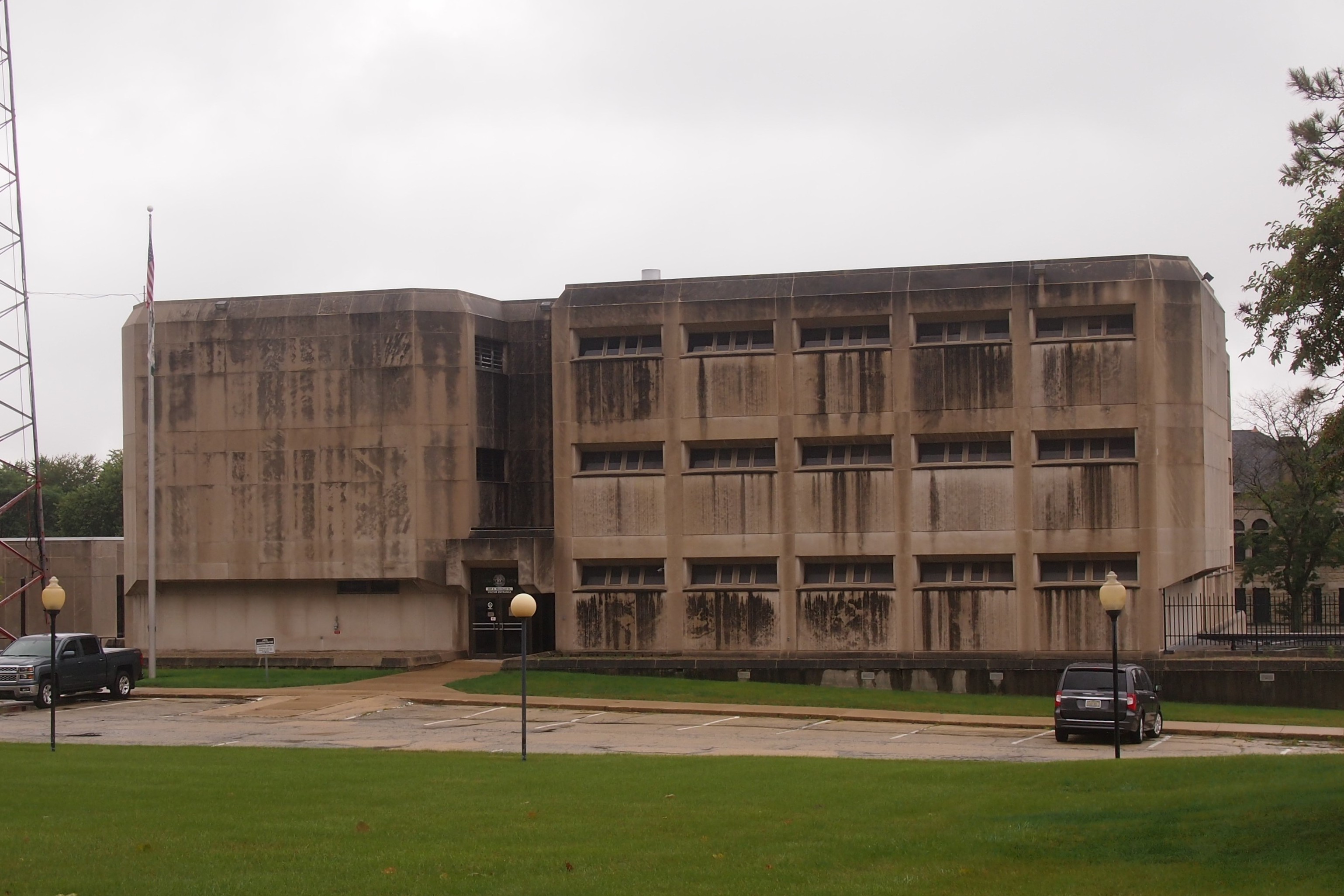
One more Kankakee County structure, just south of the courthouse: the brutalist county “detention center.”
Kankakee County jailThe jail, that is. Detention is what you get in school. Otherwise it’s just official euphemism.

GTT 2016

On June 23, Ann and I left the Chicago area and headed south, returning earlier today. I’m calling the trip GTT 2016, as in Gone to Texas, but also Gone to Tennessee, another destination. Our route took us south to through Indiana and Kentucky and then to Nasvhille; west through West Tennessee and Arkansas and on to Dallas; and south again to Austin and San Antonio. The return was via Dallas and through Oklahoma and Missouri. All together, from backing out of my driveway to coming back to it, I put exactly 3,005 miles on my car, mostly on Interstates and US routes, but also a fair amount on the streets of Nashville, Austin and San Antonio.

None of the routes or places were new to me, except maybe Texarkana, where I’d never stopped before, and it’s been a long time since I’d traveled US 281 north of Johnson City, Texas, or on US 67 on to Dallas. But no matter how familiar the place or the route, you can always find new things.

In central Kentucky, near Elizabethtown, we visited Abraham Lincoln Birthplace National Historical Park, which features a granite and marble monumental building with a not-really-Lincoln’s log cabin inside. Near Mammoth Cave NP, we walked through Diamond Caverns, an unrelated show cave.

By the time we got to Nashville, the heat was on — in the 90s at least every day, which made stomping around outside less pleasant, especially for Ann, but I did manage to take her to the Nashville Parthenon, which she didn’t remember seeing in 2008. The more important thing we did in Nashville was spend time with old friends Stephanie and Wendall, and pay a visit to Mike Johnson’s widow, Betra.

In Memphis, we saw the Peabody Hotel ducks and the National Civil Rights Museum. In Texarkana, we drove down State Line Road and stopped at the only post office in the nation in two states. In Little Rock, I visited Mt. Holly Cemetery in the morning just before the heat of the day and then the Clinton Library (in full, the William J. Clinton Presidential Center and Park) and, just before we left town, the Arkansas State Capitol.

Dallas was mostly given over to visiting my brother Jay and working. Jay joined us for our few days in Austin, including the Fourth of July, and for a few more days in San Antonio. In Austin on July 2, Ann went to RTX 2016 at the Austin Convention Center, a sizable event held by the media company called Rooster Teeth; I was her chaperon. We visited my old friend Tom Jones the next day, and on Independence Day, saw both the Baylor Street Art Wall and municipal fireworks over Lady Bird Lake. San Antonio was mostly about visiting my mother and brother Jim, and (for me) holing up in a cool place with Wifi and doing more work.

Naturally, the trip involved long stretches of driving. I want to do that while I still want to do that. Because of my obstinance in not getting Sirius or the like, terrestrial radio helps fill the yawning spaces between destinations. The trip was bookended by two news events whose coverage was limitless, even when there was no new information beyond speculation: Brexit near the beginning, and the murder of Dallas policemen toward the end. I also listened to more religious radio more than usual, mostly only minutes at a time, except for the erudite Alistair Begg, whom I will listen to until his show’s over or the signal fades.

The selection of music was mostly what you’d expect, drawn from the rigid genres created by the radio business, though there were a few oddities, such as the Mesquite Independent School District radio station (KEOM) in metro Dallas that played teacher and student shows, besides a selection of completely conventional ’70s music. On I-40 between Nashville and Memphis — the Music Highway, according to official signs along the way — I picked up an oldies station whose playlist was a little older and odder than usual. I heard it play “Waterloo” (Stonewall Jackson), “Ahab the Arab,” “and “Running Bear and Little White Dove,” the last two I haven’t heard in years.

We stayed in a nondescript chain motel in Elizabethtown; in Stephanie and Wendall’s fine guest rooms in Nashville; in another, less nondescript motel in Little Rock; with Jay in Dallas; in the Austin Motel on South Congress in Austin, an updated version of a tourist court that’s been there since 1938; and in an updated former company hotel (vintage 1914) in San Antonio, the Havana Hotel, since there were too many of us to be comfortable at my mother’s house.

During the return home, we stayed at the Munger Moss Motel in Lebanon, Mo., last night, because of course we did.

Munger Moss Motel 2016It’s the same as it was in 2009 and two years ago. Except (maybe) a couple of signs like this were added to the grounds.

Munger Moss Motel 2016Motel co-owner Ramona Lehman was selling Gasconade River Bridge postcards, sales of which help support the restoration of the bridge, a structure about 15 miles east of Munger Moss on the former US 66. I bought one. I didn’t stop to look at the bridge — this time — but it’s visible from I-44 if you know when to look, and I did.

Dayton ’16

Not long before Memorial Day weekend this year, my professional duties took me to AAA’s web site, and a press release there told me that among American travelers, “the top destinations this Memorial Day weekend, based on AAA.com and AAA travel agency sales, are: Orlando, Myrtle Beach, Washington, DC, New York, Miami, San Francisco, Boston, Honolulu, Los Angeles and South Padre Island.”

We didn’t go to any of those destinations last weekend, as interesting as they all are. (I’ll bet Myrtle Beach has its charms; it’s the only one on the list I’ve never been to.) Instead, we went to Dayton as the primary destination, with shorter stops in Wapakoneta, also in Ohio, along with Indianapolis and Fort Wayne — the last two for meals. So it was a western Ohio trip.

Ohio, land of the curious swallowtail flag. The Ohio Burgee, it’s called.
Ohio BurgeeOr maybe we took an aerospace-themed trip, since we spent the better part of Saturday at the sprawling, extraordinary National Museum of the U.S. Air Force just outside of Dayton, on the grounds of the Wright-Patterson Air Force Base. It has a reputation as one of the best aviation museums in the country, often mentioned in the company of the Smithsonian Air & Space Museum. Now that I’ve been there, I can see why.

The Wright brothers were from Dayton, and the Wright sister too. Four boys and a girl survived to adulthood, and all but the eldest brother were ultimately involved in the business of flying machines. These days, the city features the Dayton Aviation Heritage National Historical Park. Part of the park includes a museum dedicated to the Wrights — and, curiously enough, to Ohioan poet Paul Laurence Dunbar, who did have a remarkable life. After lunch on Saturday, we took in the Wright-Dunbar exhibits, despite our tired feet.

On Sunday morning, as my family lolled in our room, I went to the Woodland Cemetery and Arboretum in Dayton. Covering 200 hilly, wooded acres, Woodland is a fitting name and most aesthetic burying ground I’ve seen since Green-Wood Cemetery in Brooklyn.

We came by way of I-65 to Indianapolis and then I-70 to Dayton. I didn’t want to return the same way, so we headed north on I-75 to Wapakoneta, boyhood home of Neil Armstrong, and current location of a spaceflight museum. From there, US 27/33 took us to Fort Wayne, a city I’d never visited, despite its relative proximity.

I also wanted to drive US 30 from Ft. Wayne across Indiana. It turned out to be a fairly fast way to traverse the state, something like the Trans-Canada Highway out in Saskatchewan or Manitoba; that is, as a divided highway, but not limited access one.

Maxine’s Chicken & Waffles in Indianapolis offered the best meal of the trip, so good and filling that we barely needed to eat the rest of the day after stopping there at about 4 EDT on Friday (but still 3 CDT according to our stomachs). Chicken and pancakes were on the menu, which I had this time around.

When we came out of Maxine’s, I saw something I’d only ever heard about: a Megabus.Megabus, Indianapolis 2016The bus on the Chicago-Indianapolis run. I suppose there on N. East St., toward the eastern edge of downtown, is where it picks up its budget-minded passengers. According to the web site, the price for Chicago-Indianapolis is “from $25.” I’m not sure how much that really would be, but at least the bus offers wifi. They know their market.