Late Summer Thursday Stew

A package arrived in the mail for Lilly today from UIUC.

“Your high GPA has earned you the privilege of graduating Cum Laude…. This accomplishment, which is referred to as Latin Honors, is also recognized by a special bronze cord,” the enclosed letter said. “Because we were unable to have an on campus commencement ceremony in May, we will be mailing cords to the mailing address you have on file with campus.”

Sure enough, the package also included a bronze cord, looking something like a curtain accessory. Lilly’s already in the Pacific Northwest, so she’ll have to wait for one of us to deliver it in person, since I’m not planning on re-mailing it.

Never got a Latin Honor myself. Missed it by a whisker of GPA, I think. But I don’t really remember, and in nearly 40 years, that fact has never come up at any time for any reason.

I’m surprised some of these TV shows count as public domain. Then again, under the copyright rules before Disney put its imprint on the law, copyright holders had to renew after a certain number of years, and I expect many producers didn’t bother. The other day I watched the first episode of Car 54, Where Are You? It had its amusing moments.

Summer is ebbing away. I’m trying to spend as much time on my deck as possible. A refuge from work and word of the troubled world beyond my little spot.

A few days ago, after work but before dinner, I parked myself on the reclining deck chair on the deck and managed to take a nap. My family marveled at that, considering the heat and noise of the cicadas. But it wasn’t that hot that late in the day, and the sound of cicadas is something to drift off to sleep to, though not as soothing as cricketsong.

I’m about half way through The Unredeemed Captive by John Demos (1994), which Lilly and Ann gave to me last Christmas, on a tip (I believe) from one of Ann’s teachers.

“The setting for this haunting and encyclopedically researched work of history is colonial Massachusetts,” Penguin Random House says. “There, in February 1704, a French and Indian war party descended on the village of Deerfield, abducting a Puritan minister and his children. Although John Williams was eventually released, his daughter horrified the family by staying with her captors and marrying a Mohawk husband.”

It’s a good read about a time and place I’m not especially familiar with, early 18th-century New England. Interesting how in only 50 years or so, that place evolved into the more familiar (to me) mid-century and Revolutionary New England.

Wait, when did Random House and Penguin merge? In 2013, it turns out. I wasn’t paying attention because book publishing isn’t my sort of publishing. I’m used to thinking of Penguin as a solidly British operation, but these days it’s owned by shadowy German billionaires.

Two Illinois Points of Interest

For years, I’ve seen the following two points of interest routinely included on road maps of Illinois. At least, on Rand McNally and Michelin: the Norwegian Settlers State Memorial and the Wild Bill Hickok State Memorial.

When it comes to points of interest on commonly available road maps, there must be just a touch of the arbitrary in their selection. Just a touch, because certainly mapmakers have their editorial standards. Still, I see those (typically) red dots and wonder not only what it is, but also why is that on the map and not something else?
Guess being a state memorial or monument helps land a place on maps. (That link is part of a larger list.)

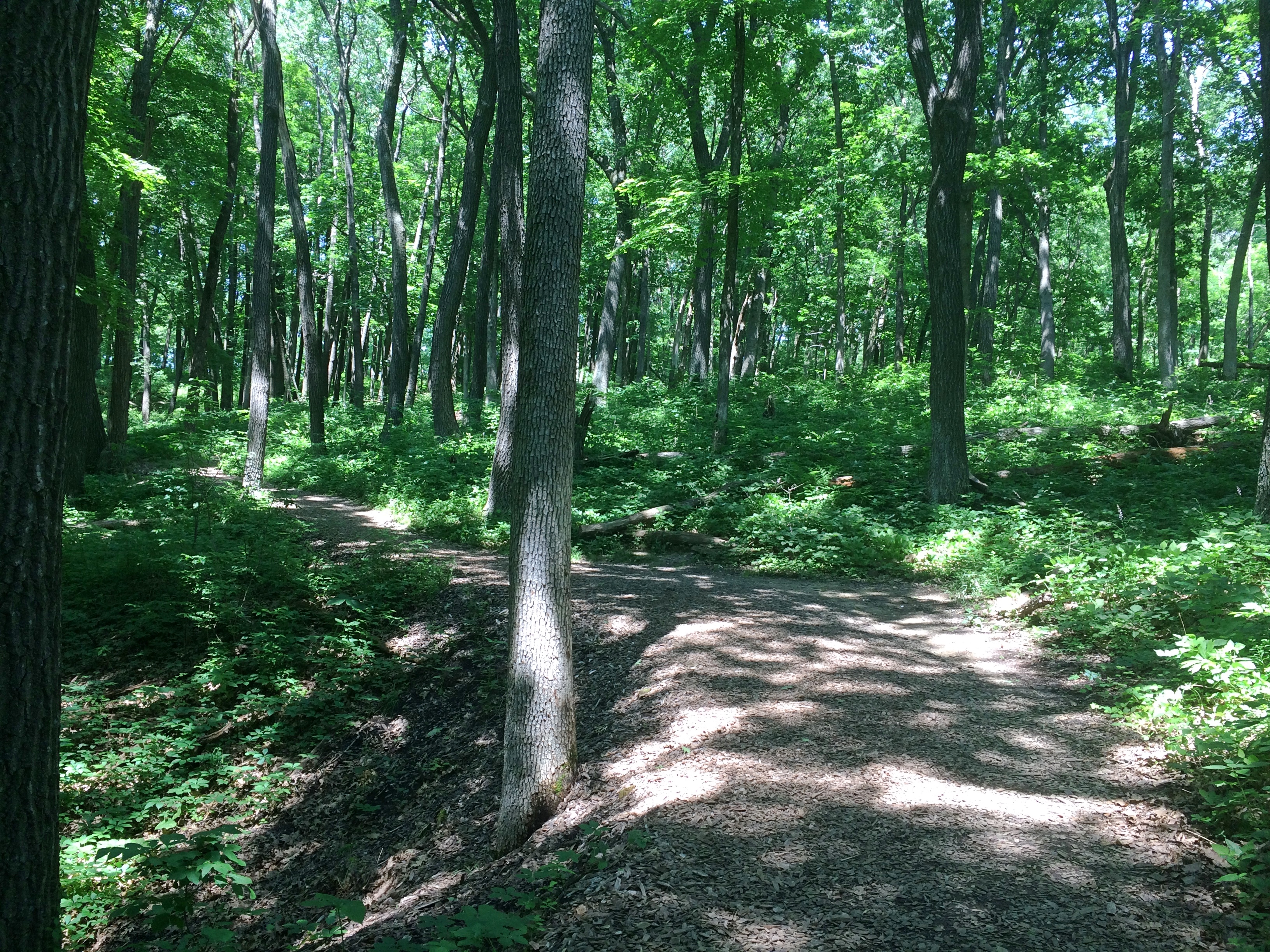
One goal of our recent trip was to avoid large highways, which we mostly did until we headed for home, when we wanted a more speedy return. When heading out, we kept to smaller roads. One of these was Illinois 71, which passes through the unincorporated community of Norway.

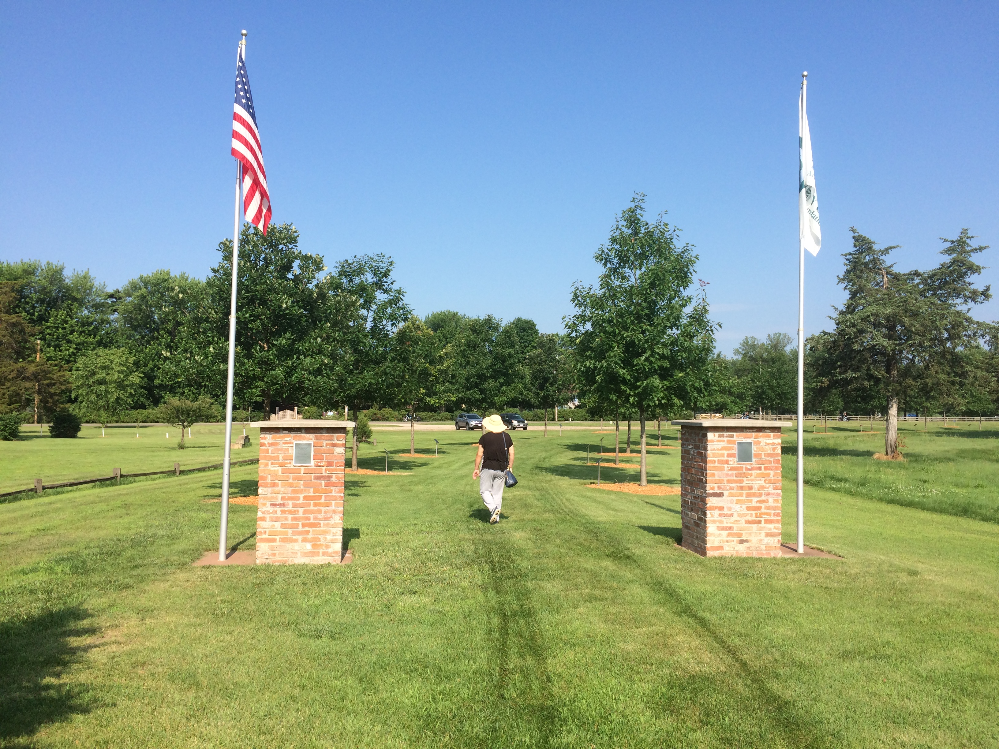
Not far from Norway is the the Norwegian Settlers State Memorial. It’s an example of the plaques-on-rocks school of memorial design, along with a wooden structure, and U.S. and Norwegian flags.
Norwegian Settlers State Memorial 
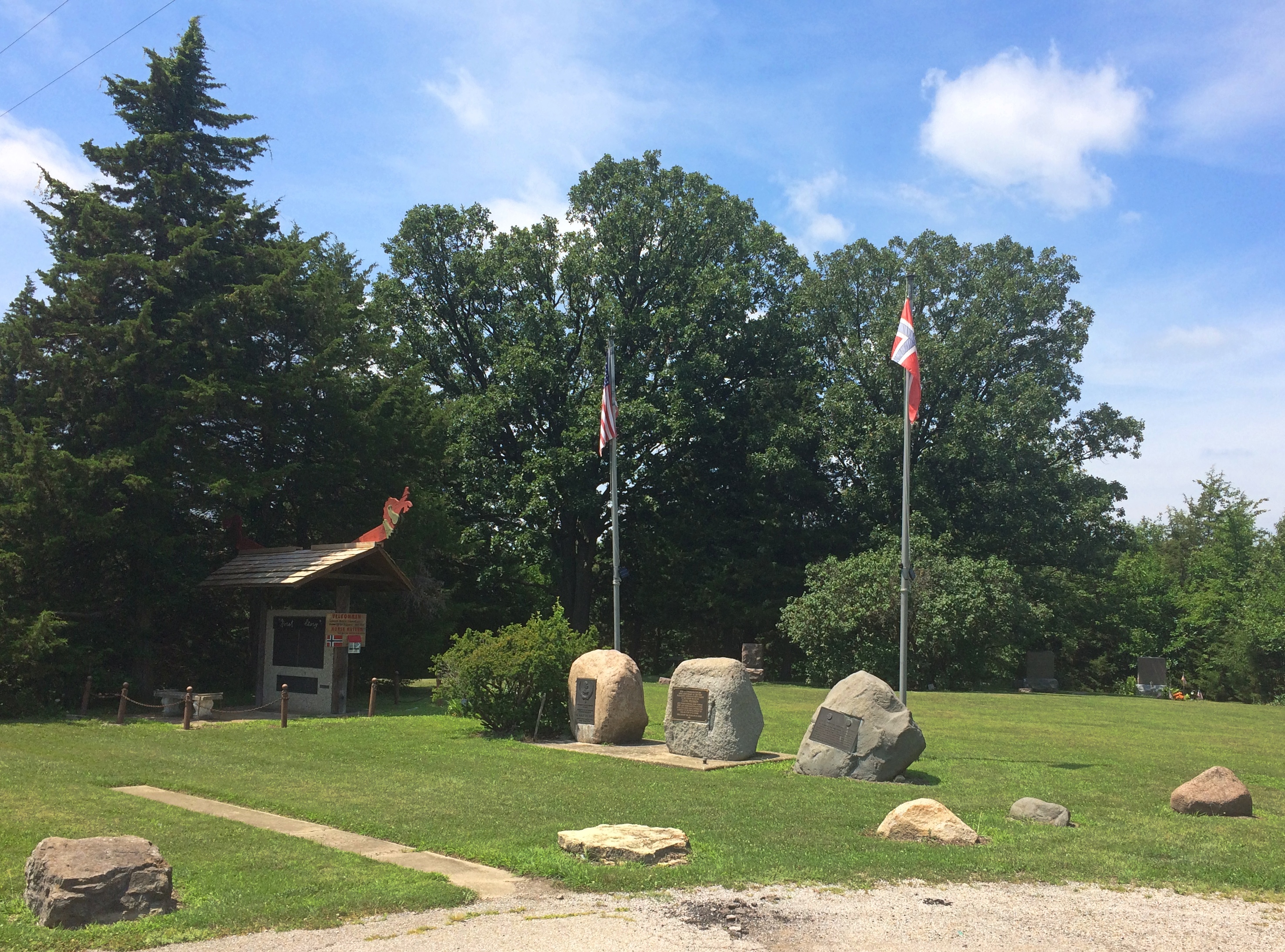
“This Memorial commemorates the 1834 settlement at Norway, Illinois — the first permanent Norwegian settlement in the Midwest,” says the State Historic Preservation Office. “A departure point for many Norwegians who settled other parts of the Midwest, Norway became known as the ‘mother settlement.’ The monument, dedicated in 1934, honors the community and its founder, Cleng Peerson (1783-1865).”

Peerson got around. Though he led immigrants to the New World, he didn’t seem to be interested in settling for more than a few years at a time himself. According to Wiki, he even spent time in Bishop Hill among its Swedish settlers. I guess he had no hard feelings against those oppressors of the Norwegian people. He ended up in Texas in the mid-19th century, as a lot of people did.

Why three stones? One from 1934 memorializes the 100th anniversary of the settlement of Norway, Illinois. Another from 1975 memorializes the 150th anniversary of Norwegians first coming to America en masse. The King of Norway came for that occasion. And yet another (also 1975) notes that part of Illinois 71 is the Cleng Peerson Memorial Highway.

That’s not all. The wooden structure — which I assume is an homage to Norwegian design — has text front and back. Three separate plaques on the front, dated 1980, tell the “Norsk Story,” that is, Norwegians coming to America.

Two more plaques on back (from 1982, bicentennial of Peerson’s birth) offer more detail about the memorial, including lines about Lester Severskie (1918-82) who was “dedicated to the preservation of the Norwegian heritage of Norway, Ill.”, a list of the Norwegian heritage organizations in the U.S. as of 1982 (I had no idea there were so many), and a few lines to thank Olav V, members of the Norwegian government, and so on and so forth.

This has to be the wordiest memorial I’ve ever encountered. It’s the memorial equivalent of a logorrheic movie star upon winning an Oscar. I usually enjoy reading obscure plaques, but these tried my patience, especially in the high heat of July. (The rest of my family was sitting in air-conditioned comfort in the car.)

Even so, I’m glad I stopped. Especially because I noticed that behind the memorial is a small cemetery. The Cleng Peerson Memorial Cemetery, according to one source (who spells cemetery wrong), though I didn’t see any signs or plaques at all about it, just the headstones. According to another source, it’s the Nelson Cemetery.

Norwegian Settlers State Memorial cemetery

Norwegian Settlers State Memorial cemetery
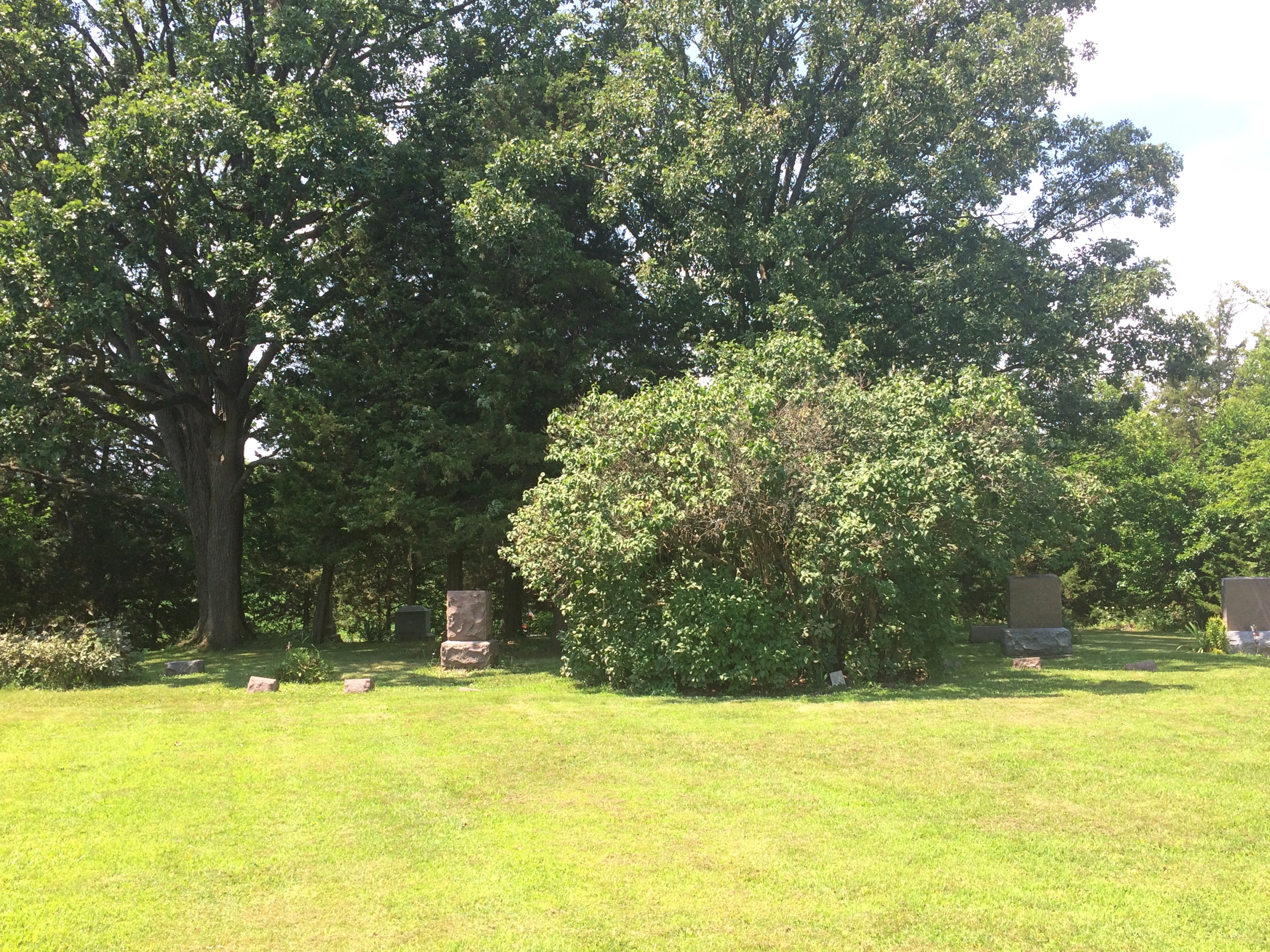
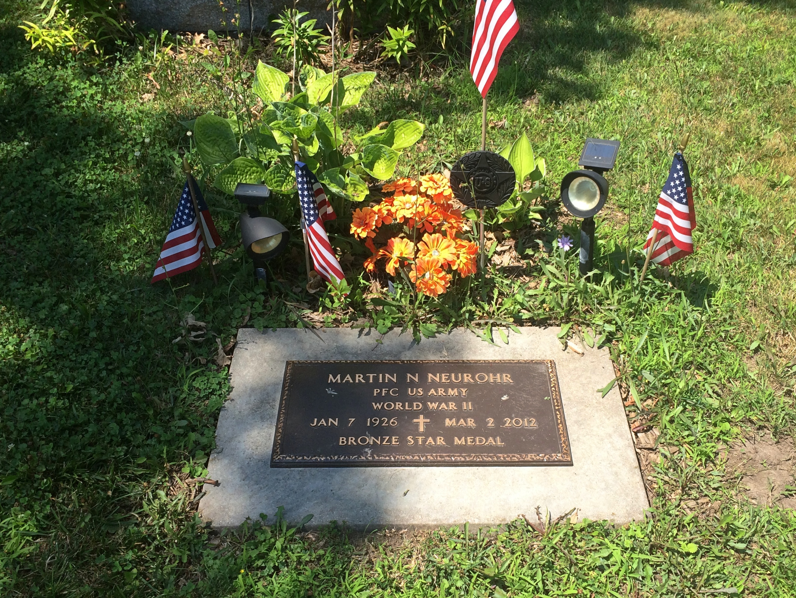
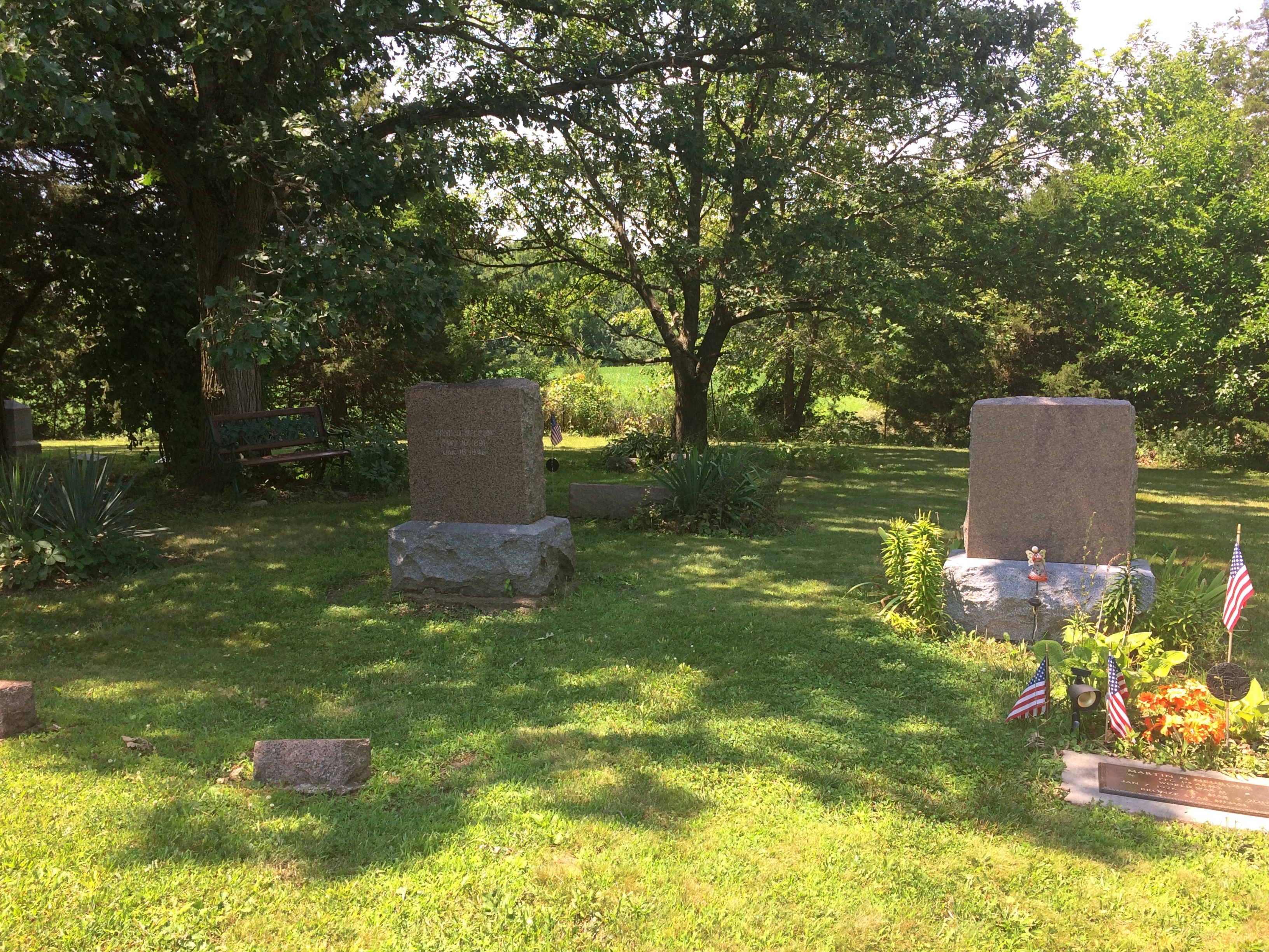
Whatever the name, it must be an active local cemetery. At least one burial was fairly recent.
Norwegian Settlers State Memorial cemeteryPeerson himself isn’t there. He’s buried near Clifton, Texas.

In a different context, you might call Peerson an empresario, along the lines of Stephen F. Austin in Texas, except that he was merely a leader of immigrants, not someone who was granted land by an existing government. Except that in the end, he was granted land by Texas, but for services rendered in populating the state with hardy Norwegians, not as an incentive to bring them.

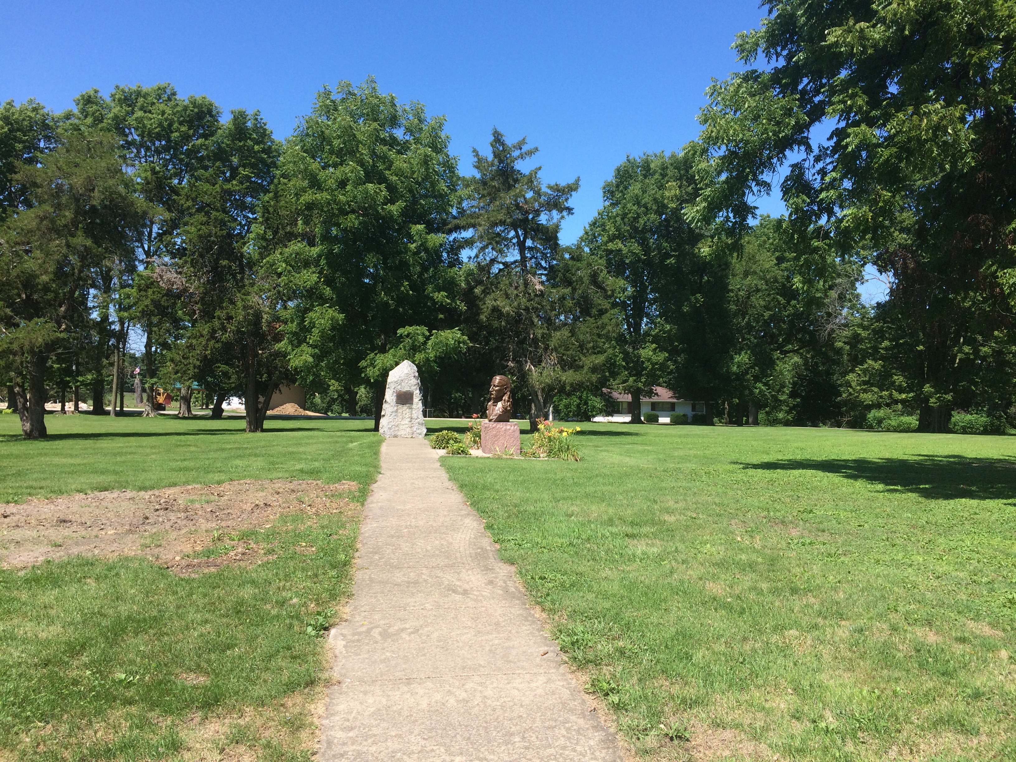
Returning from the Illinois River Valley on Sunday, I made a point of stopping at the Wild Bill Hickok State Memorial in Troy Grove, Illinois. Wild Bill isn’t buried there either. He died in Deadwood, after all, and he rests there in Boot Hill.

Rather, the memorial marks the birthplace of James Butler Hickok, scout, spy, lawman, soldier, marksman, gambler, showman, folk hero, and dime novel and movie and TV character. It’s at the center of an open patch of land where the Hickok family home once stood, and includes one plaque and one bust.
Wild Bill Hickok State MemorialThe state of Illinois erected the plaque in 1929, and it wasn’t shy about lionizing Wild Bill. It needed a proofreader, too.
Wild Bill Hickok State Memorial
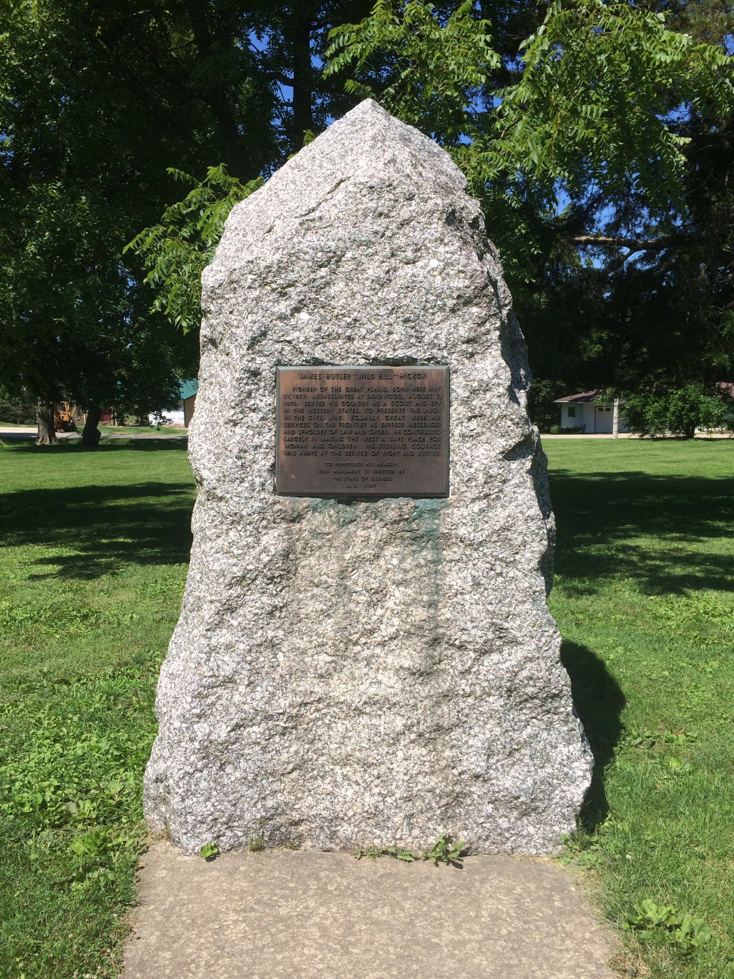
“He contributed largely in making the West a safe place for woman [sic] and children,” the plaque says in part. “His sterling courage was aways [sic] at the service of right and justice.”

The bust is more recent. I had to look it up, because I couldn’t find anything on site — not a word — to say who created it or when.
Wild Bill Hickok State Memorial
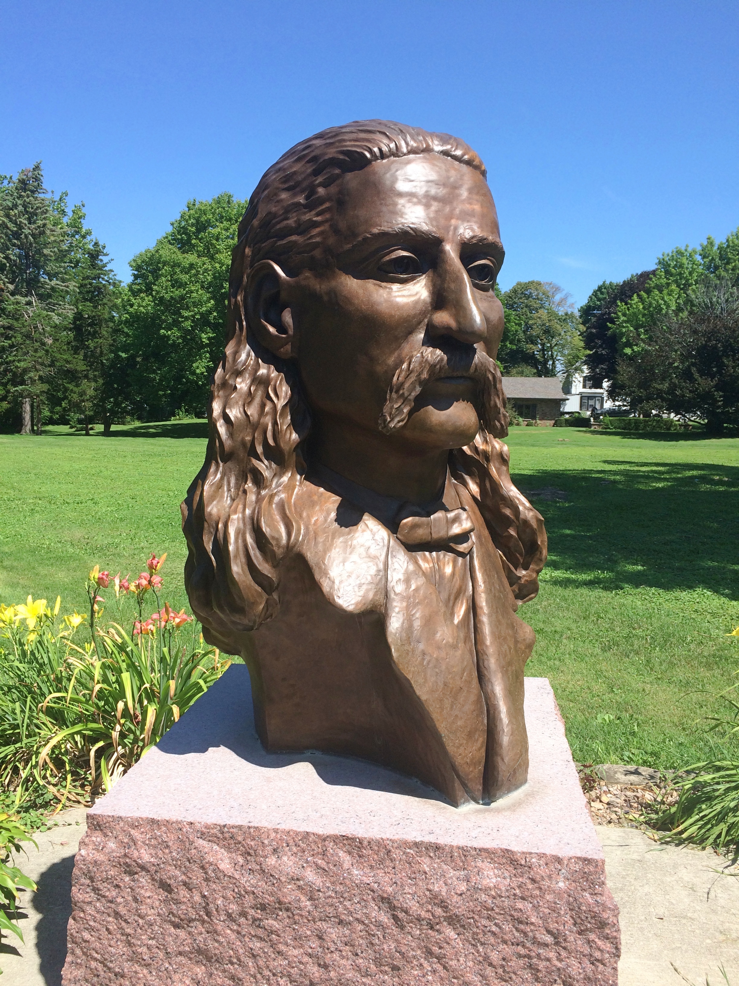
The state of Illinois says a “log-carved bust” of Hickok was added in 1999, but that’s no wooden bust. It took a little looking, but I found out that “in 2009, an attractive bronze bust of Hickok by artist William Piller was placed in the park. It replaced a carved wooden bust that had been in place 10 years but had severe weather damage,” according to the Danville, Illinois, Commercial-News.

Though it was a hot day, I wasn’t quite done with Troy Grove, pop. 230. A building near the memorial caught my eye. (The rest of my family was sitting in air-conditioned comfort in the car.)
Former Bank, Troy Grove Illinois
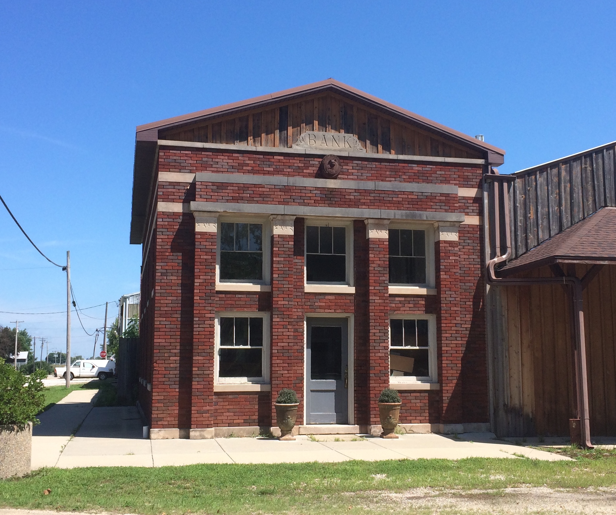
Bank, eh? Well, not any more. Still, it’s a handsome little building. A detail toward the top further got my attention.

Bankers Electrical Protection Co. of Minneapolis

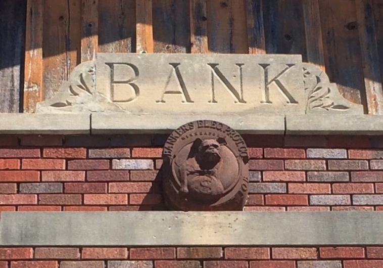
A logo marker apparently left by the Bankers Electrical Protection Co. of Minneapolis: a guard dog close to a money bag. The company seems to have specialized in bank vaults and other security features for banks of yore. You know, the sort of banks at risk from unauthorized withdrawals by the likes of the Cream Can Gang.

Besides a few images, I haven’t found out much else about BEPCo. (as it surely would be called now), mostly since I don’t feel like it. Enough to assume that it went out of business or was acquired by another security company long ago. Yet traces remain, in stone no less.
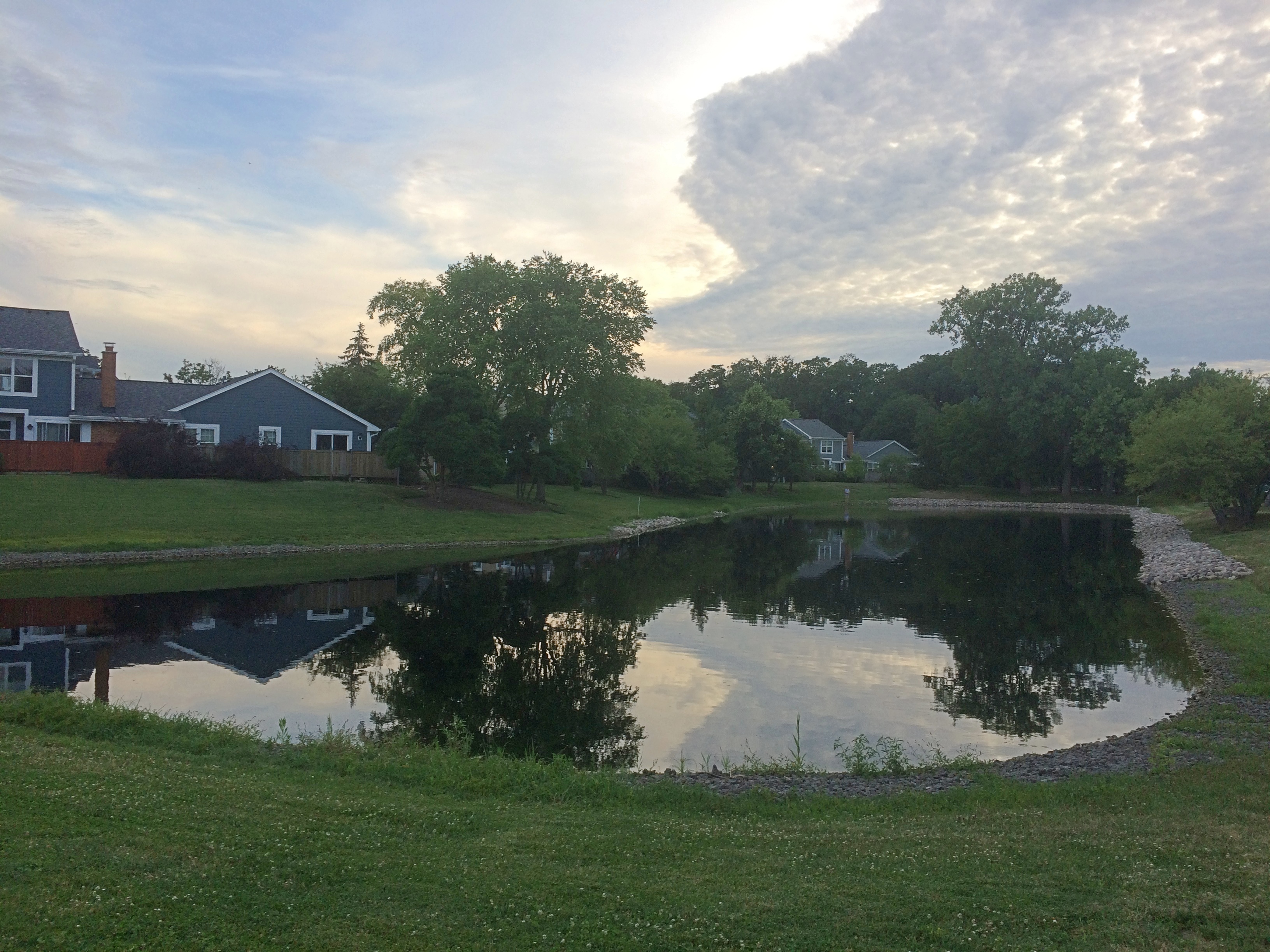
Oglesby Sights

Sizable towns cluster around the Illinois River in north-central Illinois like so many stones on a necklace: Morris, Ottawa, LaSalle, Peru, Spring Valley, Princeton. Then there’s Oglesby, which isn’t so sizable, at about 3,500 people. The place is named after the long-ago Illinois governor, whom I’ve encountered before in Decatur and Chicago.

We became acquainted with Oglesby last weekend because we stayed overnight in a motel in the town, to take advantage of its proximity to Starved Rock SP and Matthiessen SP, though we decided not to visit the latter.

To become acquainted with the town, you can drive down the east-west Walnut St. for about two miles. On Sunday morning, I went out for gas early, which also meant looking around. Lilly joined me.

The town post office on Walnut looked about as WPA as can be. Being Sunday, we couldn’t go in and look at the 1942 mural, “The Illini and Pottawatomies Struggle at Starved Rock” by Fay E. Davis, which is said to be quite something.

Soon we arrived at this structure, which would loom over Walnut St., except that it’s set back a few hundred feet and behind a fence. The fence is pretty new.
Lehigh Portland Cement Co Oglesby IllinoisAn old enough ruin to sport fully grown trees in its midst. An interesting enough ruin to be fenced, though I figure local teens have no problem getting in when the mood strikes.

The blackened sign is just barely legible.

LEHIGH PORTLAND CEMENT COMPANY OGLESBY

That’s all I needed to find out more about this industrial ruin. For decades, Oglesby lived by the extraction and processing of minerals, especially the manufacture of cement and concrete.

The Chicago Cement Co. started operations on the site in 1898. Lehigh, a Pennsylvania company, acquired Chicago in 1916 and ran the plant until 1963. Apparently Lehigh decided at that time that modernization of the plant wouldn’t be worth the expense, and so closed it.

I have to report that cement and concrete production in the area isn’t dead yet. Illinois Cement Co., which is across the river in LaSalle, still seems to be in that business, and related hard-stone entities dot the map: the Mertel Gravel Co., Ladzinski Concrete Finishing Co., Lafarge Aggregates, Wenzel Concrete Works and Ruppert Concrete, to name a few (and those last two are in Oglesby).

The above image is only a part of the ruin.
Lehigh Portland Cement Co Oglesby IllinoisEven that doesn’t depict the whole of it. Note how far it goes back when you look on Google Maps. We were looking at the property from about where I’ve put a blue dot.
Lehigh Portland Cement Co Oglesby Illinois“This looks like the most interesting thing in Oglesby,” I told Lilly. Too expensive to tear down, I figure, so there it stands, letting the decades take their toll.

Down Walnut to the east was something almost as interesting, and cement related, too.Safety Follows Wisdom Oglesby IllinoisAn intriguing bit of work in a small public park — Lehigh Park — donated by the company to the town in 1945 (the side plaque says that). Turns out the work is one of a genre of memorials, awarded by the Portland Cement Association, with examples wherever cement is or was made. They’re made of cement, of course.

“Cement ‘Safety Follows Wisdom’ monuments, first presented in 1924, for perfect safety records at cement plants,” says the Historical Marker Database. “The winning design came from an Art Institute of Chicago team directed by sculptor Albin Polasek.” (I’ve happened across his work before.)

Safety Follows Wisdom Oglesby illinoisDo a casual search and you’ll find Safety Follows Wisdom stones all over the country. It’s something I had no inkling of until I drove down a main street in a small town and — more importantly — got out of the car and looked around. The devil might be in the details, but I find that the joy of traveling is in the details.

Ottawa Sights (Not the One in Canada)

We arrived in Ottawa, Illinois, on Saturday in time for lunch. We decided on carry-out from Thai Cafe on Columbus St., which seems to be the only Thai joint in town. At a population of 18,000 or so, maybe that’s all Ottawa can support.

We took our food to Allen Park, a municipal park on the south bank of the Illinois, and found a picnic shelter. The river’s large and on a weekend in July, home to a lot of pleasure craft.
Ottawa Illinois 2020Sometimes, the river must be angry, such as on April 19, 2013. Got a lot of rain in northern Illinois about then, so I believe it.

Ottawa Illinois High Water MarkDownstream a bit is the Ottawa Rail Bridge, which rates a page in Wikipedia. The current bridge dates from 1898, though it was modified in 1932.

Ottawa Illinois Rail Bridge

Two large metal sculptures rise in the park, both by Mary Meinz Fanning. The red one is “Bending.”
Ottawa Illinois BendingThe yellow one is “Reclining.”
Ottawa Illinois Reclining“Fanning was the driving force behind the creation of the red and yellow steel sculptures at Allen Park by the Illinois River in Ottawa,” says a 2010 article in The Times, which seems to be a local paper.

“The 40-foot-tall sculptures, which weigh 17 tons each, were erected in 1982 and 1983 from parts of the 1933-built steel girder Hilliard Bridge that was demolished in 1982 to make way for the present-day Veterans Memorial Bridge. Fanning died of illness Nov. 4, 1995, in Ottawa at age 48.”

Just as you enter the park, you also see a wooden sculpture: one of artist Peter Toth’s “Whispering Giants,” which I’d forgotten I’d heard of till I looked him up again. The one in Allen Park is Ho-Ma-Sjah-Nah-Zhee-Ga or, more ordinarily, No. 61.

Looked familiar. I realized I’ve seen one before —
Nee-Gaw-Nee-Gaw-Bow That one is Nee-Gaw-Nee-Gaw-Bow or No. 59, and we saw it by chance in Wakefield, Mich. about three years ago. Apparently the artist has put up at least one in each state.

Ottawa has a place in U.S. history mainly for two things. One that the town is happy to celebrate: the first Lincoln-Douglas debate in 1858. The other is the awful story of the Radium Girls, poisoned by luminous paint at a clock factory in Ottawa in the early 20th century. For a long time, there was no public acknowledgment of that incident. Now there is. But I didn’t know the Radium Girls have a statue in town (since 2011), so we missed that.

We didn’t miss the site of the Lincoln-Douglas debate, which is in the shady, square-block Washington Park.
Ottawa Illinois Washington ParkLincoln and Douglas are there as part of a fountain to memorialize the event. They were cast in bronze in 2002 by Rebecca Childers Caleel.
Ottawa Illinois Washington ParkOttawa Illinois Washington ParkIt would have been more pleasant if the fountain were on, but maybe it was dry for public health reasons in our time. The noontime heat was oppressive, so we didn’t have a leisurely look-around the area as much as we might have otherwise. There are other memorials in the park, and plenty of historic structures nearby, forming the Washington Park Historic District.

Those buildings include the Third District Appellate Court Building (1850s), the Reddick Mansion (1850s), the Ottawa First Congregational Church (1870), Christ Episcopal Church (1871), and a Masonic Temple (1910). A few blocks away, the LaSalle County Courthouse looked interesting, too, but we only drove by.

I managed to take a close look only at the former Congregational Church building.
Ottawa Illinois Washington Park Open Table Church

Ottawa Illinois Open Table Church of Christ

Gothic Revival in brick. These days, the church is part of the Open Table United Church of Christ.

Beavers Attack! Olde Schaumburg Centre Park

Tucked off a busy northwest suburban street is Olde Schaumburg Centre Park. We were there not long ago just before sunset. Here in July, days are noticeably shorter, though not that much shorter yet.
Beavers Attack! Olde Schaumburg Centre ParkThough modest in scope, Olde Schaumburg Centre Park is a pleasant green space in the summer, and a lush wetland and wildlife preserve besides. The focus is a pond. That’s the wetland part of the equation.
Olde Schaumburg Centre ParkThere are trails and a gazebo. Schaumburg wouldn’t be a proper suburb without a public gazebo.
Olde Schaumburg Centre ParkPlus flourishes of flowers.
Olde Schaumburg Centre Park
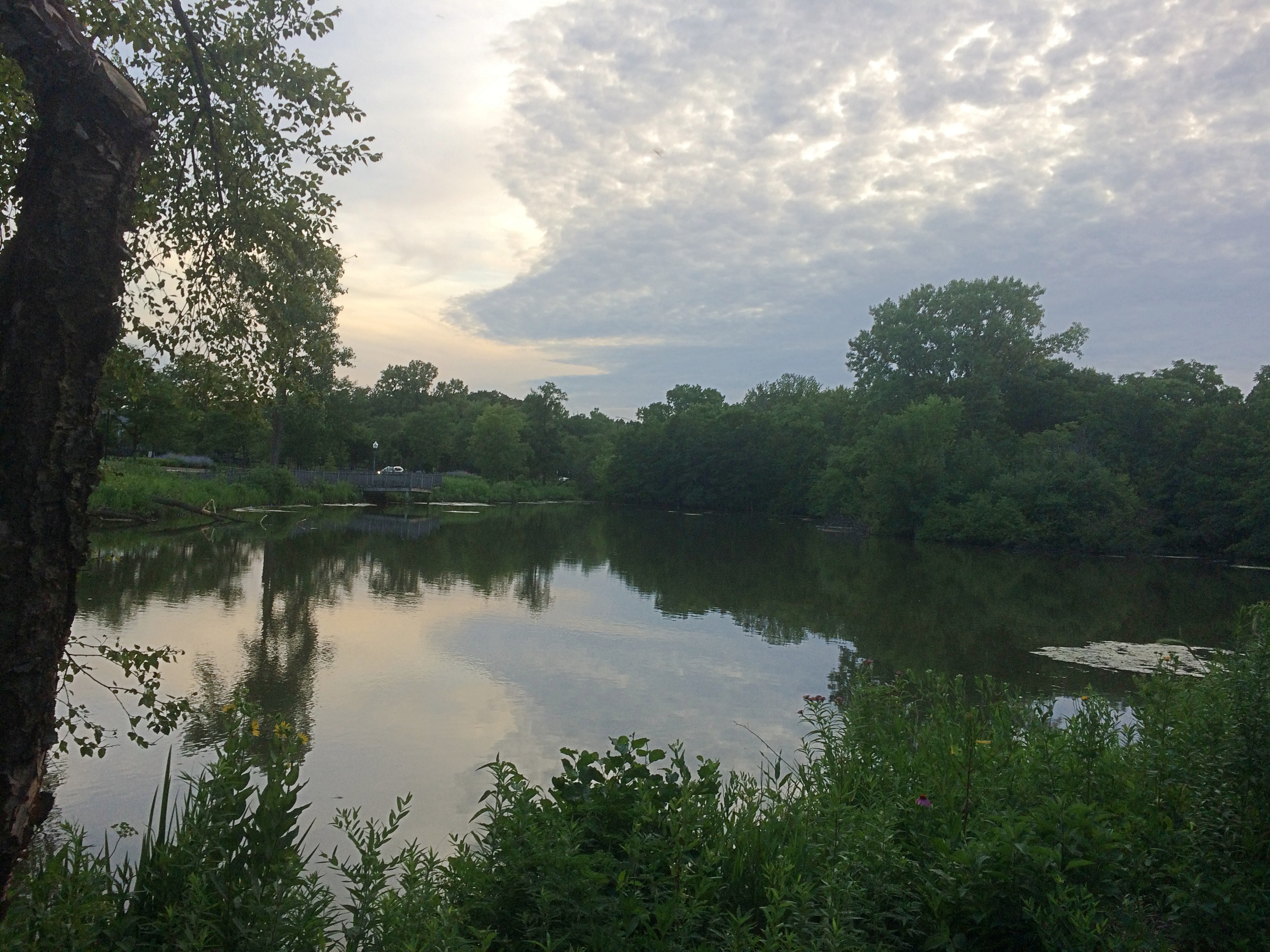
As for being a wildlife preserve, we saw clear evidence of beavers in the area.
Olde Schaumburg Centre ParkDoing what beavers do. Gnaw marks appeared on other trees, though no others were toppled. Does the village consider beavers a nuisance? They do seem to be attacking park trees, which take a long time to grow, but then again they might be a protected species in these parts.

The animals are a village concern, because the park is village property, not part of the Schaumburg Park District — something I didn’t realize until recently, despite all the years I’ve driven past the park.

The park is also part of a formally designated area called Olde Schaumburg Centre, which is an historic district: the OSC Overlay District, established in 1978. Much information about that and early Schaumburg has been published by the village community development department.

In the mid-19th century, the small farm village that would become a major Chicago suburb was known as Sarah’s Grove. Later, German farmers came in numbers, and Schaumburg schall et heiten!

The name Sarah’s Grove lingers. The subdivision across the street from in Olde Schaumburg Centre Park is called Sarah’s Grove, and so is a park district park near the subdivision.
Sarah's Grove ParkIt too focuses on a water feature, but without many trees or thickets.
Sarah's Grove Park
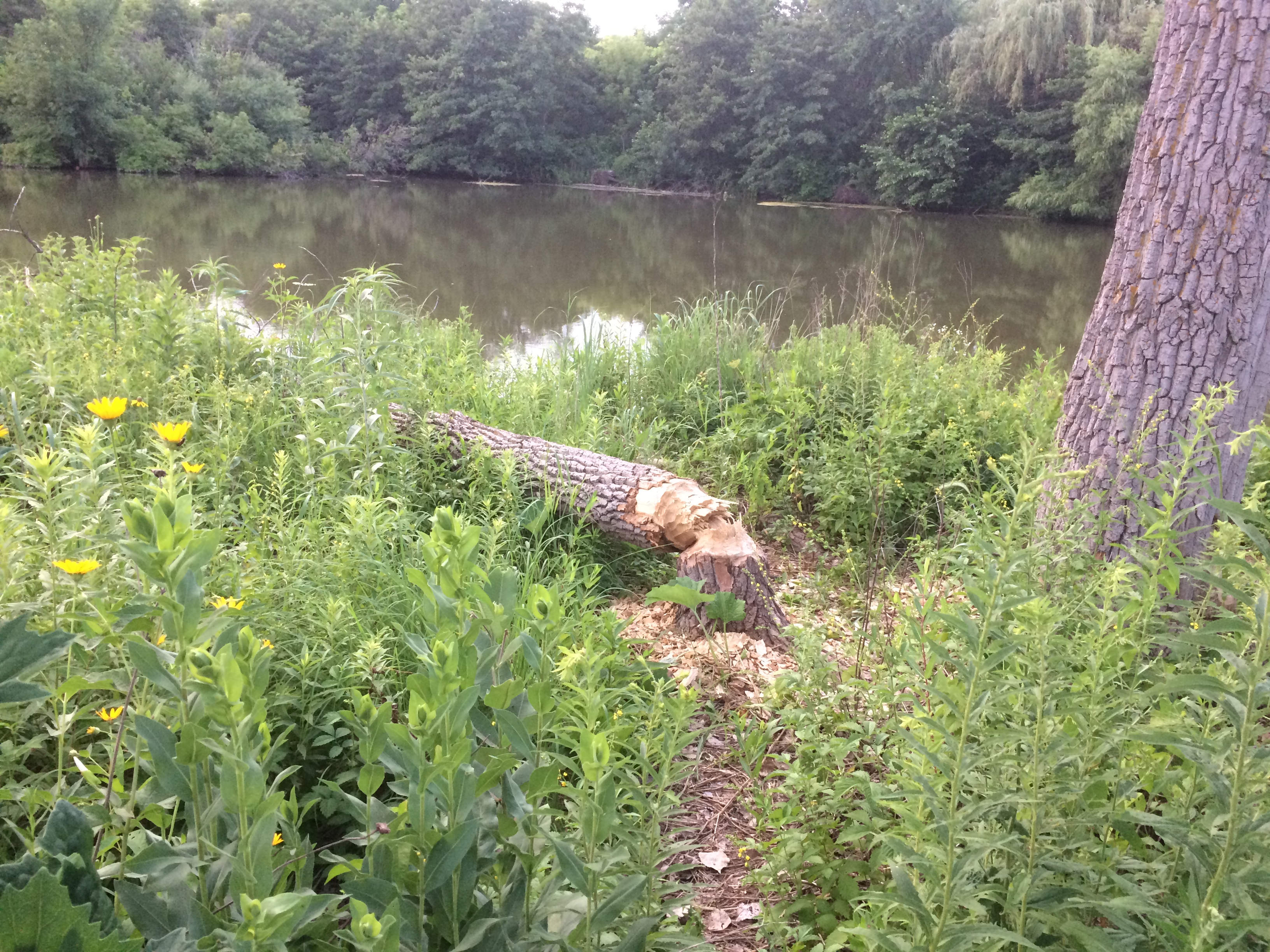
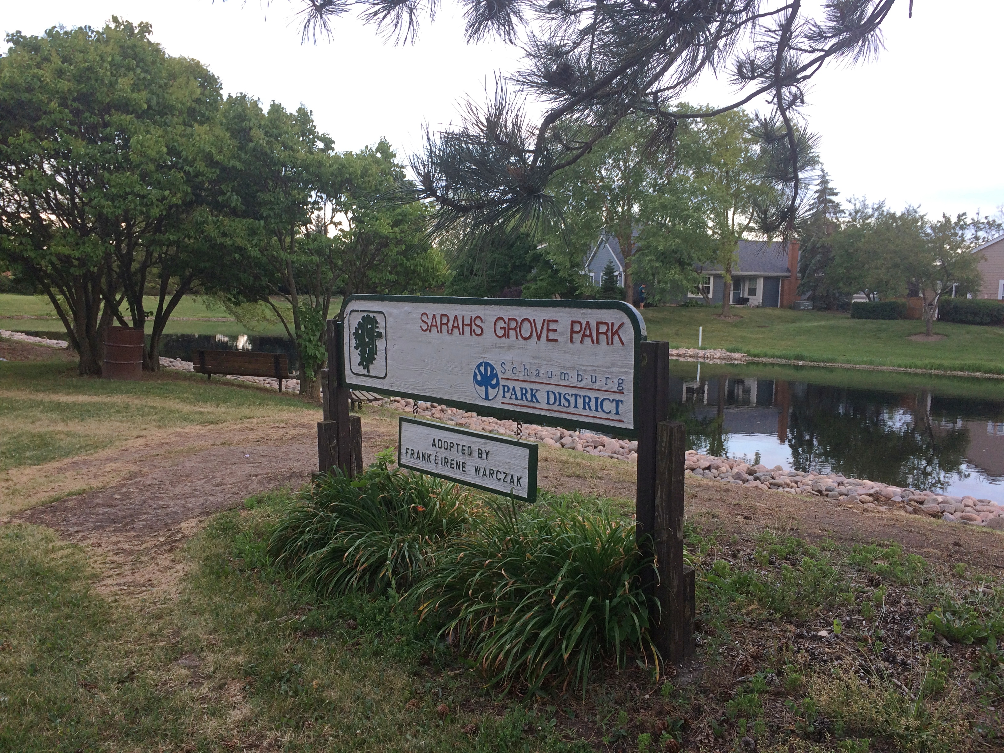
Though no one was there at that moment, I see people fishing at the pond pretty often.

Nike Park, Addison

What do I get for reading the likes of Atlas Obscura? Ideas about obscure places to go. Or to stop if I’m already nearby, because naturally some places are worth seeing, but not worth going to see, to paraphrase Dr. Johnson.

Not long ago I was near Nike Park in west suburban Addison, so I dropped by. It’s accessible via a short street tucked between two light industrial properties and lined with trucks, and as a park, it isn’t much to write about. At about seven acres, the park has a small baseball field, playground, picnic table and a portable toilet.

There’s also this.
Nike Park Addison
To quote Atlas Obscura: “Once part of a larger Nike Missile complex (Nike C-72), the Nike Park land was given over to the Addison Park District after the missiles, launchers, and most of the equipment was removed, and the site decommissioned.

“Unfortunately, no evidence of the launch site exists any longer, as it now part of the Fullerton County Forest Preserve. The radar installation and control tower located on the northwest end of the base, however, still stand in what is now Nike Park…”

As a Cold War relic, worth seeing, but not going to see, I’d say.

Boscobel & Fennimore

Road trips aren’t just about the destination, but sights and oddities along the way. Recently in southwestern Wisconsin, for instance, we stopped in Boscobel, looking for takeout. We found it at Udder Brothers Creamery. How could we pass up a place with a giant cow? Also, a giant wild turkey?

Note that the turkey not only proclaims Boscobel as Wisconsin’s Turkey Hunting Capital, but as Birthplace of the Gideon Bible as well. We wanted to be on our way, so we didn’t investigate that further at the time.

But now I know: “The birthplace of the Gideons was the Central House Hotel on September 14, 1898, in Boscobel, Wisconsin,” says Wisconsin Historical Markers. “Traveling salesmen John H. Nicholson of Janesville, Wisconsin, and Samuel E. Hill of Beloit, Wisconsin, shared a room in the crowded hotel because of a lumberman’s convention.

“In Room 19, the men discovered that they were both Christians; they talked about starting a Christian traveling men’s association. The following May the two salesmen, joined by a third, William J. Knights, rekindled that idea, and on July 1, 1899, founded the Gideons.”

Dang. I should have at least found the plaque. Down the road from Boscobel is Fennimore, another Badger State burg we passed through. Hunger wasn’t the main consideration there, so we spent a little more time, especially at a small park featuring The Dinky.
Fennimore, Wisconsin train
It’s a narrow-gauge (3-ft.) locomotive in operation from 1878 to 1926. “Trains ran daily between Fennimore and Woodman by way of Werley, Anderson Mills and Conley Cut, meandering 16 miles through the Green River Valley,” its historical marker says.
Fennimore, Wisconsin train
“At the peak of narrow gauge operations, the state had 150 miles, some used in logging operations in northern Wisconsin, now all abandoned.”
Fennimore, Wisconsin train
Narrow gauge, for sure.

Prairie du Chien: Fort Crawford Military Cemetery, Trail of Presidents &c.

Not all road trips include visits to cemeteries or presidential sites, but I’m glad when they do. Our recent visit to the Driftless Area included both. On Saturday morning, I got up a little early to put gas in the car by myself. Yuriko knows what this means: I visit a local cemetery, too, if I can. She dozed on in the room while I drove a short distance to the Fort Crawford Military Cemetery, also known as the Fort Crawford Cemetery Soldiers’ Lot.

The entrance to the cemetery is a narrow patch of land in the residential section of mainland Prairie du Chien, with the burial ground at some distance behind an iron fence. Or maybe soldiers are buried in patch of ground, but I didn’t see any indication of it.
Fort Crawford Military Cemetery
“Fort Crawford Cemetery is located on the former site of the Fort Crawford Military Reservation in Prairie du Chien, Wisconsin,” says the National Cemetery Administration, which is part of the VA.

“There were two subsequent Fort Crawfords in Prairie du Chien during the 1800s. The original Fort Crawford, built in 1816, was situated adjacent to the Mississippi River. Repeated flooding led to its abandonment in 1826. Rebuilt on higher ground in 1830, the second incarnation of Fort Crawford operated until 1856.

“The first burials here were of the members of the 1st and 5th Infantry regiments stationed at the fort. The soldiers’ lot includes eight above-ground box-tombs that were likely erected by the regiments. The United States received the title for the lot in 1866. There are approximately 64 interments in the 0.59-acre soldiers’ lot…”Fort Crawford Military Cemetery

It’s sparsely populated.
Fort Crawford Military Cemetery
With some of the inscriptions practically illegible.
Fort Crawford Military Cemetery
Others were legible, but conveyed only anonymity. This looks like a latter-day stone, dedicated to an unknown. There were a sprinkling of these in the cemetery.Fort Crawford Military Cemetery

As I left, I spotted this near the entrance, attached to a boulder.
Fort Crawford Military Cemetery
Just goes to show you how thorough the Daughters were. A memorial so obscure that no one has called for its removal? Not so.

On St. Feriole Island, I happened across a presidential site of sorts: Trail of Presidents. Trees in honor of presidents, arrayed in two rows to form a path, and originally planted in 2014.Trail of Presidents
I expected a tree planted for every U.S. president, which would have been the standard approach. But in fact the trees only honor presidents who visited Prairie du Chien either in or out of office, and includes two presidents of other entities besides the United States. I was surprised.

The full and semi-literate text of the sign at Trail of Presidents is here.

The honored U.S. presidents include: Andrew Jackson, William Henry Harrison, Zachary Taylor, Millard Fillmore, James Buchanan, Abraham Lincoln, Ulysses Grant, James Garfield, Grover Cleveland, Benjamin Harrison, William McKinley, Woodrow Wilson, Calvin Coolidge, Herbert Hoover, Harry Truman, Dwight Eisenhower, John Kennedy, Richard Nixon, Jimmy Carter, George H.W. Bush, Bill Clinton and George W. Bush.

For instance, President Fillmore has a white oak.
Trail of PresidentsHis plaque explains that he passed through Prairie du Chien when he was vice president in 1849. I haven’t ever seen anything about the travels of Vice President Fillmore — and out to the spanking-new state of Wisconsin that year would have been far afield — but I assume there’s some source for this buried in Fillmore’s papers, or maybe local news accounts.

The non-U.S. presidents? One was him again. He was stationed here, after all.
Trail of Presidents

Also, curiously, Vicente Fox also has a tree, a red oak. “Vicente Fox attended Campion High School in Prairie du Chien in the 1960s,” the plaque says. “He then returned to Mexico.”

The last tree has been reserved for the next president to visit, so it isn’t too late for the most recent living officeholders.

One more Prairie du Chien sight I came across was overlooking the Mississippi, but not on St. Feriole Island. Rather, a statue of Marquette stands atop a tall column near the local chamber of commerce, and also not far from the bridge connecting Prairie du Chien with the town of Marquette, Iowa.
Prairie du Chien Marquette statue

Rev. James Marquette, S.J.
Who discovered the
Mississippi River
at
Prairie du Chien, Wisconsin
June 17, 1673
This monument was erected
with
The solicited contributions
of generous citizens
by
The Business Men’s Association
Of Prairie du Chien, Wisconsin
A.D. 1910
Fred Herber & Son Architects

Unusual to see him called “James,” which doesn’t sound very French. We’ve seen him honored elsewhere around the Great Lakes; Pere Marquette got around, back when muscle power (yours or an animal’s) was the only way to do it.

Prairie du Chien: St. Feriole Island

One thing I wanted to find out from our most recent road trip was how to pronounce Prairie du Chien, pop. 5,600 and seat of Crawford County, Wisconsin. Or more exactly, how to say the local version of Chien. However that turned out, it was bound to be more elegant than Dog Prairie.

Sure, I could have looked it up any time. The Internet overflows with such minutiae. But sometimes random web sites are wrong.

According to what I heard many times on local radio, this is correct. Prairie du SHEEN, as in a soft luster or the actors Martin and Charlie. Maybe the 17th-century Frenchmen who founded the place said it some other way, but that hardly matters.

Marquette Road (Wisconsin 35) is the commercial spine of the modern town, featuring chain stores, restaurants, motels, gas stations and other businesses. Residential Prairie du Chien is a few blocks on either side. Perpendicular to Marquette Road is a much shorter shopping/tourist street, Blackhawk Ave., sporting the likes of Bob’s Bar, Jim’s Bar, Cafe Hope, the Blackhawk and Rowdy’s (more bars), Something for Everyone (a thrift store) and Pete’s Hamburger Stand.

During the day on July 3, Blackhawk Ave., which we drove down a few times, was fairly busy. Among other things, a long line of people were waiting to buy takeout from Pete’s. Guess it’s a local favorite.

Much less crowded — not crowded at all — was St. Feriole Island, an island in the Mississippi that’s part of Prairie du Chien and just to the west of the rest of the town. We spent some time there looking around, both before and after we visited Effigy Mounds NM.

The island is prominent on this map, published in Madison, Wisconsin, in 1870.Note that the 1870 town isn’t connected to the rest of the world by a state highway system, but by a rail line and, more importantly, the Father of Waters. Also, what is now Blackhawk Ave. was then called Bluff St.

“Prairie du Chien had its beginnings on this island,” the town web site says. “It was the first location of Fort Crawford, which was involved in the War of 1812, and is the home of the historic Villa Louis mansion, the origin of which goes back to Joseph ‘King’ Rolette and Hercules Dousman, who made fortunes in fur trading and land dealings…

“This is where the industry that supported the city in the 1800s was located, so rail access was installed in 1890 [sic, the map clearly shows a rail line 20 years earlier, which still runs near the river]. After repeated floods and fires, the city was relocated to the mainland on the Wisconsin side, which was higher and far less prone to flood. Industry remained on the island, gradually closing down or moving to the mainland until well past World War II.”

The Mississippi River Flood of 1965 was apparently the final straw for the neighborhood. These days, the island is mostly St. Feriole Island Park, with sports and recreation facilities, a few historic structures, and a lot of open land, though still divided in part by a grid of streets.
St. Feriole Island
St. Feriole Island
We had lunch on Friday at one of the picnic tables with a view of the Mississippi.
St Feriole island
The Brisbois House is one of the park’s historic structures, dating from 1837 (though other sources put its construction in 1815).St. Feriole IslandIn any case, it isn’t open now. Neither is the Villa Louis, nor the Fur Trade Museum on the island.St. Feriole Island Villa LouisThe Mississippi River Sculpture Park on the island is open. Unlike most sculpture parks, which feature a variety of works by a variety of artists, this one includes only works by sculptor Florence Bird, which are depictions of people associated with the history of Prairie du Chien.

Such as the park’s most recent addition — less than a month ago — of a bronze of Marianne LaBuche, a frontier doctor (“community healer,” her sign says) of the early 19th century.St. Feriole Island
Also depicted: Julian Coryer, voyageur, though it looks like he’s between voyages.St. Feriole Island
A “Victorian lady.”
St. Feriole Island
Emma Big Bear, basketmaker.St. Feriole Island
Here’s Black Hawk (Ma-ka-tai-me-she-kia-kiak).St. Feriole Island Black HawkNote his medallion.St. Feriole Island Black Hawk
His plaque has been edited, either officially or unofficially, since 2005.
St. Feriole Island Black Hawk
Not sure what was blocked out or why. But these times make me attuned to statue revisionism, however minor.

Effigy Mounds National Monument

Another holiday weekend, another pop up to Wisconsin for a short spell. Actually, Wisconsin and a small slice of Iowa — that being the main goal of the trip: Effigy Mounds National Monument, which is mostly in Allamakee County, Iowa’s northeastern-most county.
Effigy Mounds National MonumentThe 50-hour trip took us to Madison on Thursday evening to spend the first night, and from there to Prairie du Chien, Wisconsin and environs, where we stayed from late morning Friday to early afternoon Saturday. We returned home late Saturday afternoon, in time for Vietnamese takeout dinner at home — and to hear a July 4 neighborhood blasting of fireworks like none I’ve heard before.

Why Effigy Mounds and Prairie du Chien? Because I’ve seen those places on maps for years. I’ve read about them as well, of course, but spots on a map can be alluring in a way no mere textual description is. Come here, the spots say; come see what’s here.
Also, the rolling, verdant Driftless Area is a special place. I’ve only come to appreciate it in recent years.

A road trip at this moment in history is necessarily different than before. Gone for now are casual meals at restaurants picked on a whim, visits to intriguing local museums or wandering down busy small-town shopping/tourist streets and spending time in their specialty stores.

Now the trip means takeout — from the only Chinese restaurant in Prairie du Chien, for example — finding places where few people go (such as cemeteries) and generally spending your time outdoors, as we did on the trails of the national monument and a Wisconsin state park.

Or staying in your room. It so happened that on Friday night, some high school-vintage friends (two in this picture) invited me to a social Zoom, and I managed to figure out how I could attend using my phone. We had a good time.

We arrived at Effigy Mounds NM early Friday afternoon. Temps were high, about 90, and we were warned on a sign that the trail from the (closed) visitors center to the first fork involved a rise of about 350 feet.

I can’t say I wasn’t warned. Up we went.
Effigy Mounds National Monument
The shade moderated the heat some. I wore a hat — one I’d bought at Joshua Tree NP in February, where it was just as sunny but not as hot. I had water. I made progress through the winding green tunnels, resting often. Yuriko was soon far ahead.
Effigy Mounds National Monument
Eventually I could tell I was near the crest of the hill.
Effigy Mounds National Monument
I don’t need a sign to tell me that. By that point, I was well tired. Just another thing I should have done 20 (30) years ago. Still, the vista was worth the effort: a view of the Mississippi, looking southeast, from a spot called Fire Point. Prairie du Chien is in the distance.
Effigy Mounds National Monument
Due east: party boats gathered on the river for July 3.
Effigy Mounds National Monument
Besides a nice vista, Fire Point featured a collection of mounds. Larger —
Effigy Mounds National Monument
— and a row of smaller ones.
Effigy Mounds National Monument

Something inspired the peoples who lived here to reshape the ground into recognizable forms. Recognizable, but you need to squint a little. Not nearly as recognizable in simple photos, unfortunately.

Not far from Fire Point is Great Bear Mound. Probably best visible from above, though park management helpfully trimmed the grass to make the shape a little easier to see from ground level, and you do see it — but it’s also good to bring a little historical imagination to the task. (As it is even in highly visible places.)Effigy Mounds National Monument - Big BearI expect these mounds survived farming and other depredations of the 19th century because the land was too steep to farm or even harvest timber. President Truman created the monument, which protects 206 mounds, in 1949.

“The Late Woodland Period (1400-750 B.P.) along the Upper Mississippi River and extending east to Lake Michigan is associated with the culture known today as the Effigy Moundbuilders,” notes the NPS. “The construction of effigy mounds was a regional cultural phenomenon. Mounds of earth in the shapes of birds, bear, deer, bison, lynx, turtle, panther or water spirit are the most common images…

“The Effigy Moundbuilders also built linear or long rectangular mounds that were used for ceremonial purposes that remain a mystery. Some archeologists believe they were built to mark celestial events or seasonal observances. Others speculate they were constructed as territorial markers or as boundaries between groups.”

Why did Moundbuilders build mounts? The answer is dunno even among modern experts. They had their reasons. The mists of time are pretty thick in the hills of the Driftless Area.