To Lake Huron and Back

On Saturday we left town remarkably early (for us) and drove across the Lower Peninsula of Michigan so that on Sunday morning, I could stick my feet in Lake Huron.Lake Huron
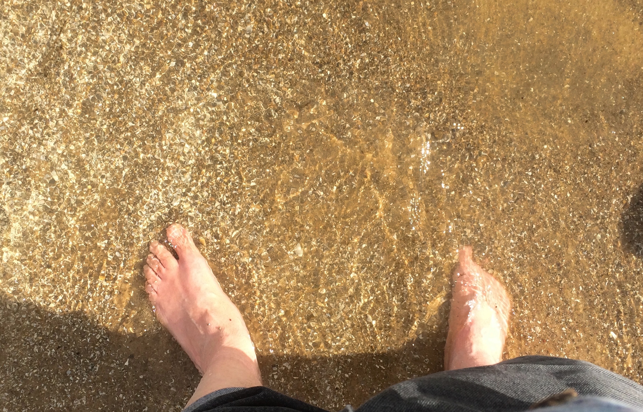
Saginaw Bay in particular. Of course that wasn’t the entirety of the trip. But it was the inspiration. Sometime years ago, I realized that I’d never really gotten a look at Lake Huron. I’ve crossed the Mackinac Bridge a number of times, which offers a view of the lake to the east, but somehow that doesn’t count. I wanted to see Lake Huron from outside a car, moving at zero miles an hour, and hear the waves and smell the water and feel the sand and pebbles.

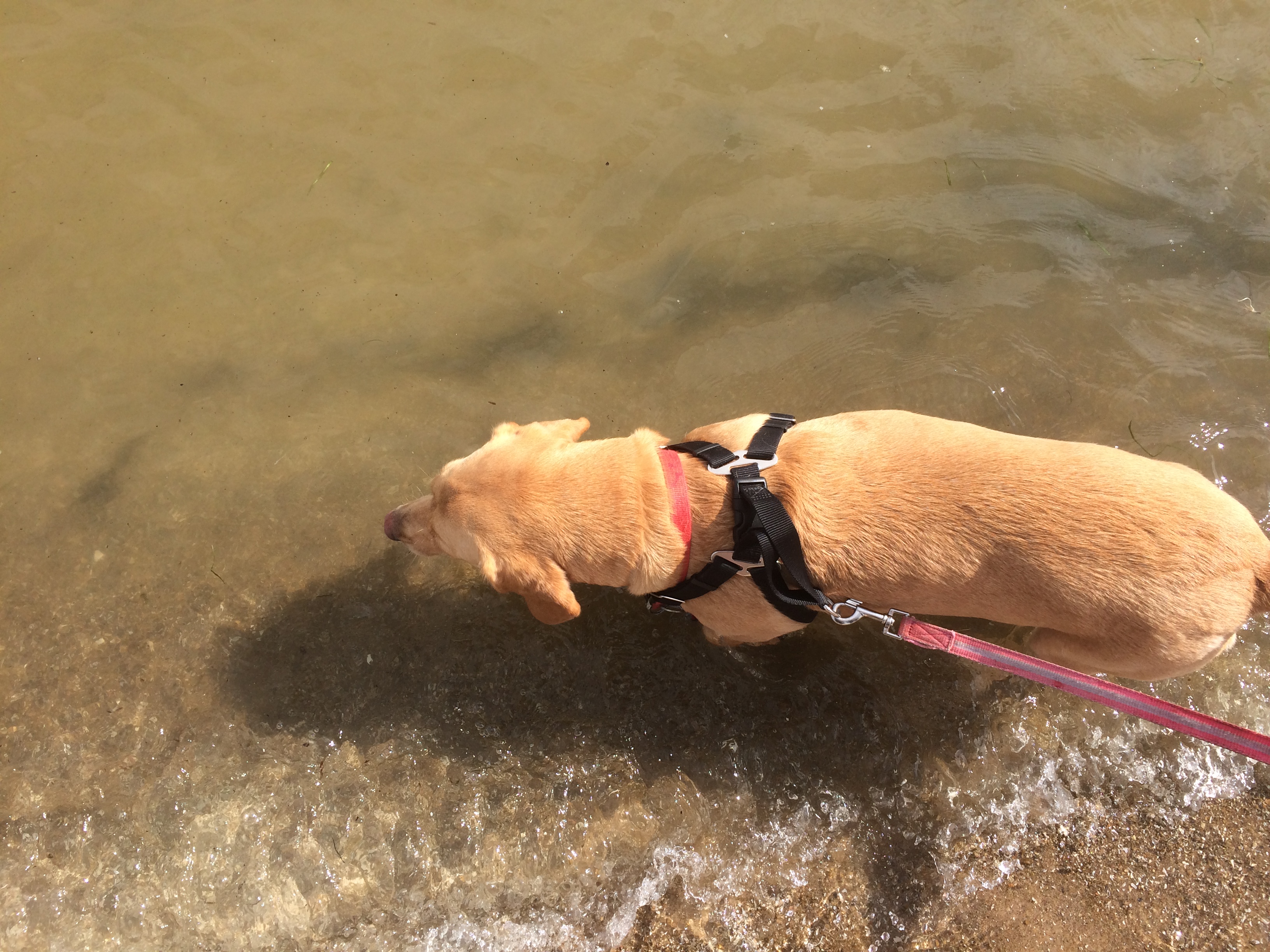
So Labor Day weekend was the time. We all went, including the dog. First stop on Saturday morning was at one of the Sweetwater’s Donut Mills in Kalamazoo because I hadn’t forgotten them.
Sweetwater's Donut Mill
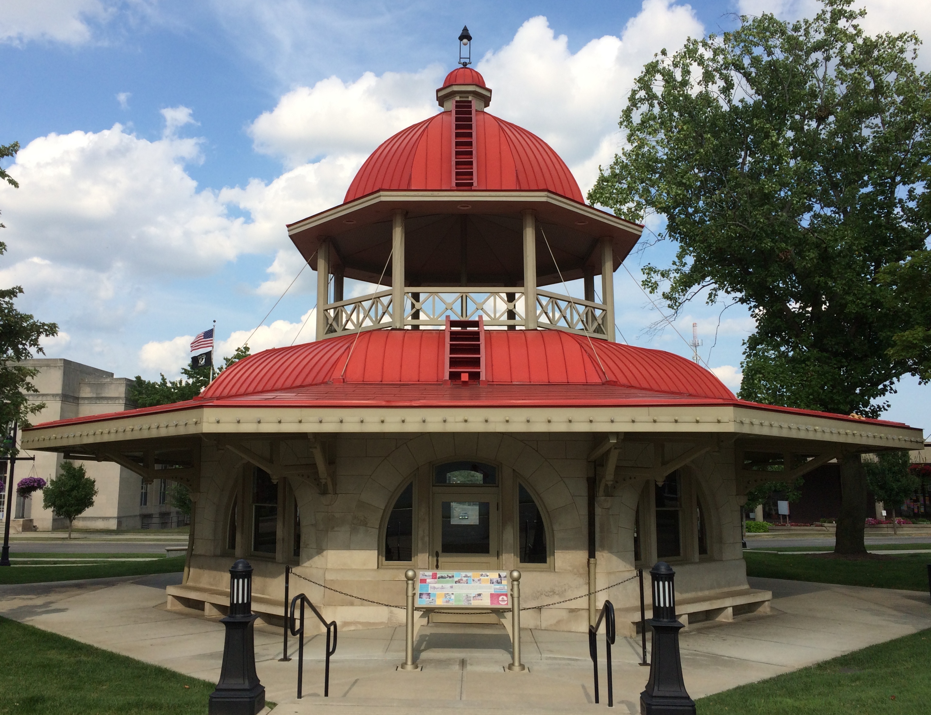
Near Battle Creek, we stopped at a novel local spot: Historic Bridge Park. I’ve seen open-air museums devoted to houses and other buildings, but this is the only place I know that functions as an open-air museum featuring bridges.

Heading northeast, we arrived in Lansing in time to visit the Michigan State Capitol. Or so I thought. There are usually Saturday hours, but not on Labor Day weekend. Still, we had a good walk around the grounds and Washington Square to the east, along with an al fresco lunch of Cuban sandwiches.

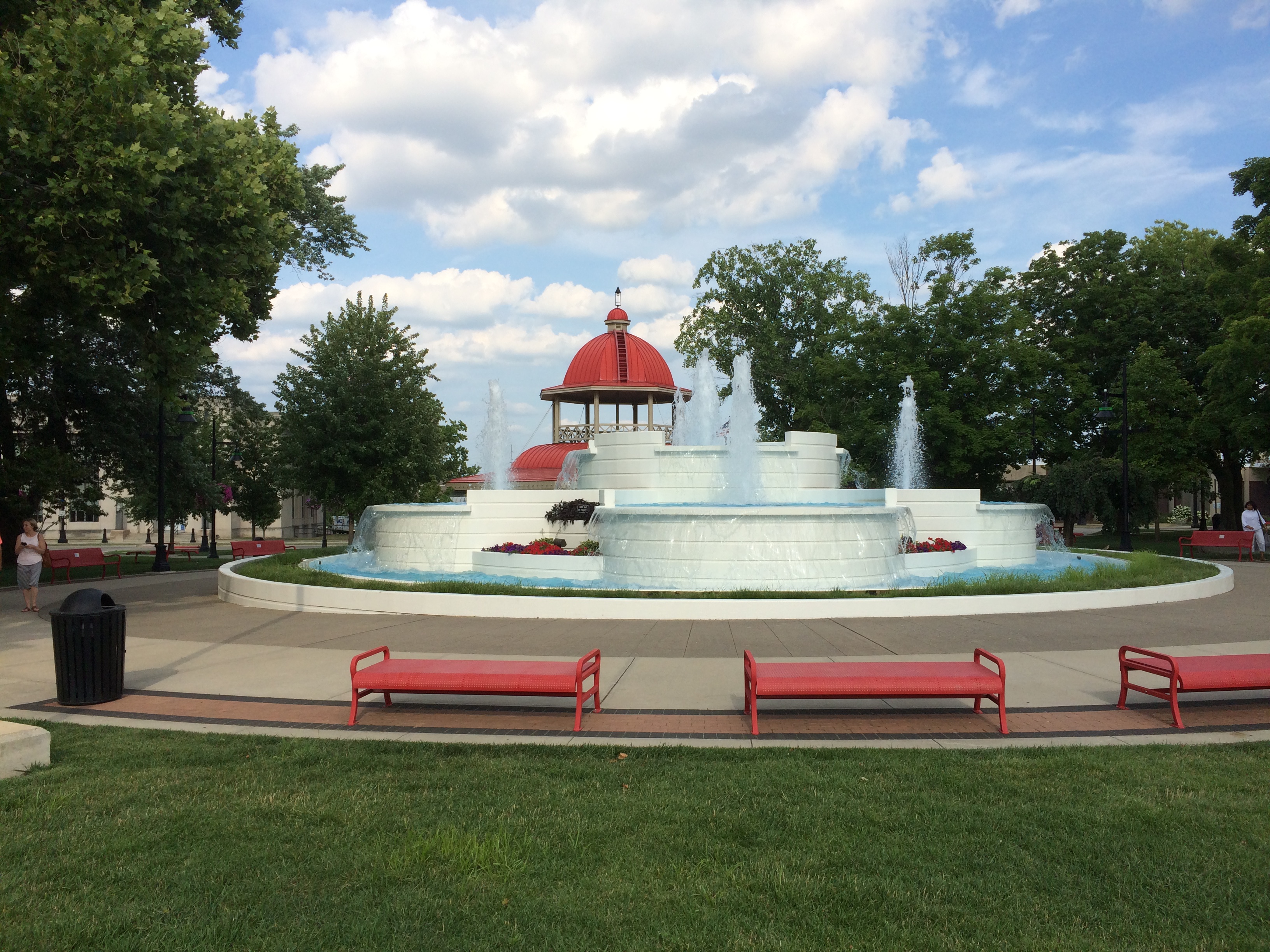
Michigan State University is in East Lansing. After some wandering around the sprawling campus, we found the W.J. Beal Botanical Garden, the first of three gardens we visited.

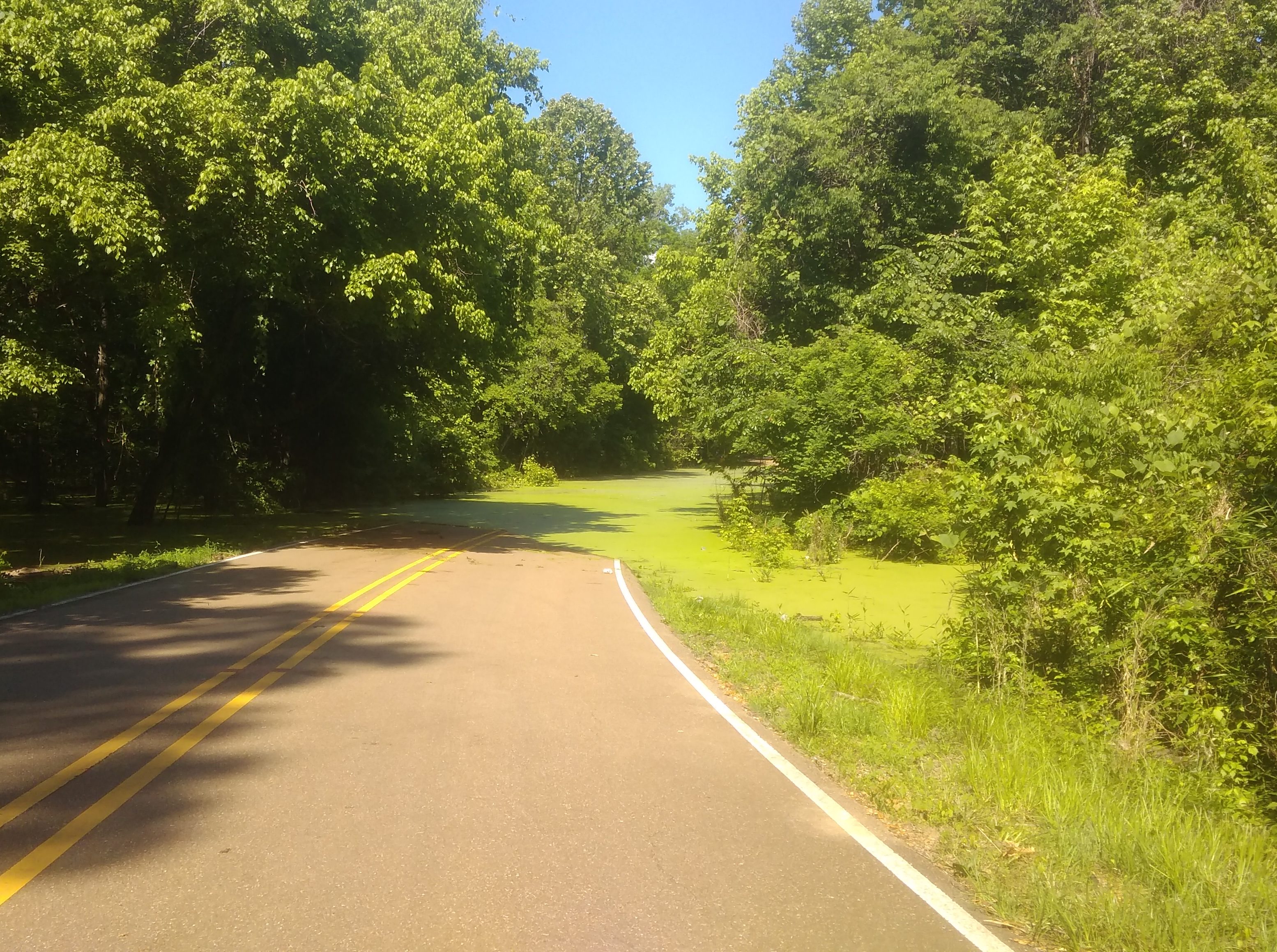
We made it to Midland, Michigan, before dark and spent the next two nights there. On Sunday morning, we visited Bay City State Park on the lakeshore, walking on the beach and a path around a large lagoon. By lunchtime, we were back in Midland, eating al fresco again — the thing to do with a dog in tow.

Midland has a lot of large parks accessible from its small downtown, but that’s not the distinctive feature. That would be the Tridge, a three-way bridge across the confluence of the Chippewa and Tittabawassee rivers. Naturally we had to cross that.

Next we visited Midland’s Dahlia Hill, which is planted with thousands of dahlias and open to wander around. After that, Yuriko and Ann visited the much larger Dow Gardens, while I took a drive with the dog to Bay City. No dogs allowed at Dow Gardens.

During my driving look-see in Bay City, I noticed a Huron Circle Tour sign. Like Superior, that would be a drive.
Lake Huron Circle Tour signWant. To. Do. It. But not now. While everyone else rested in the room early in the evening, I visited the expansive and exhausting Dow Gardens, along with the adjacent Whiting Forest. Open till 8:30 in the evening until Labor Day, fortunately.

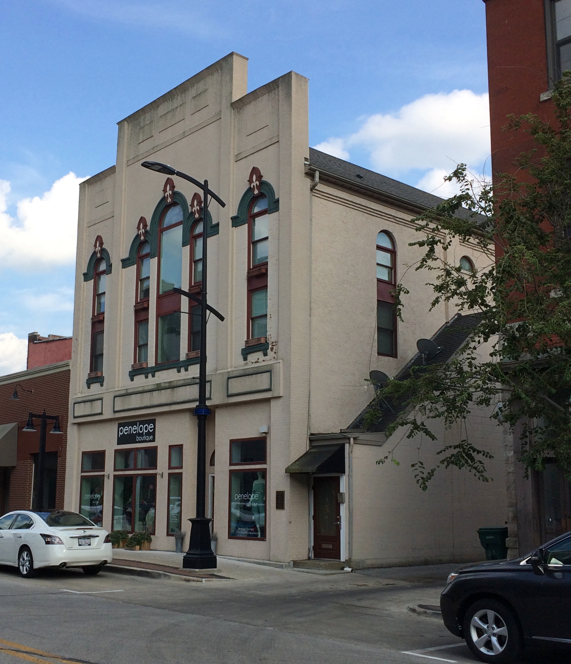
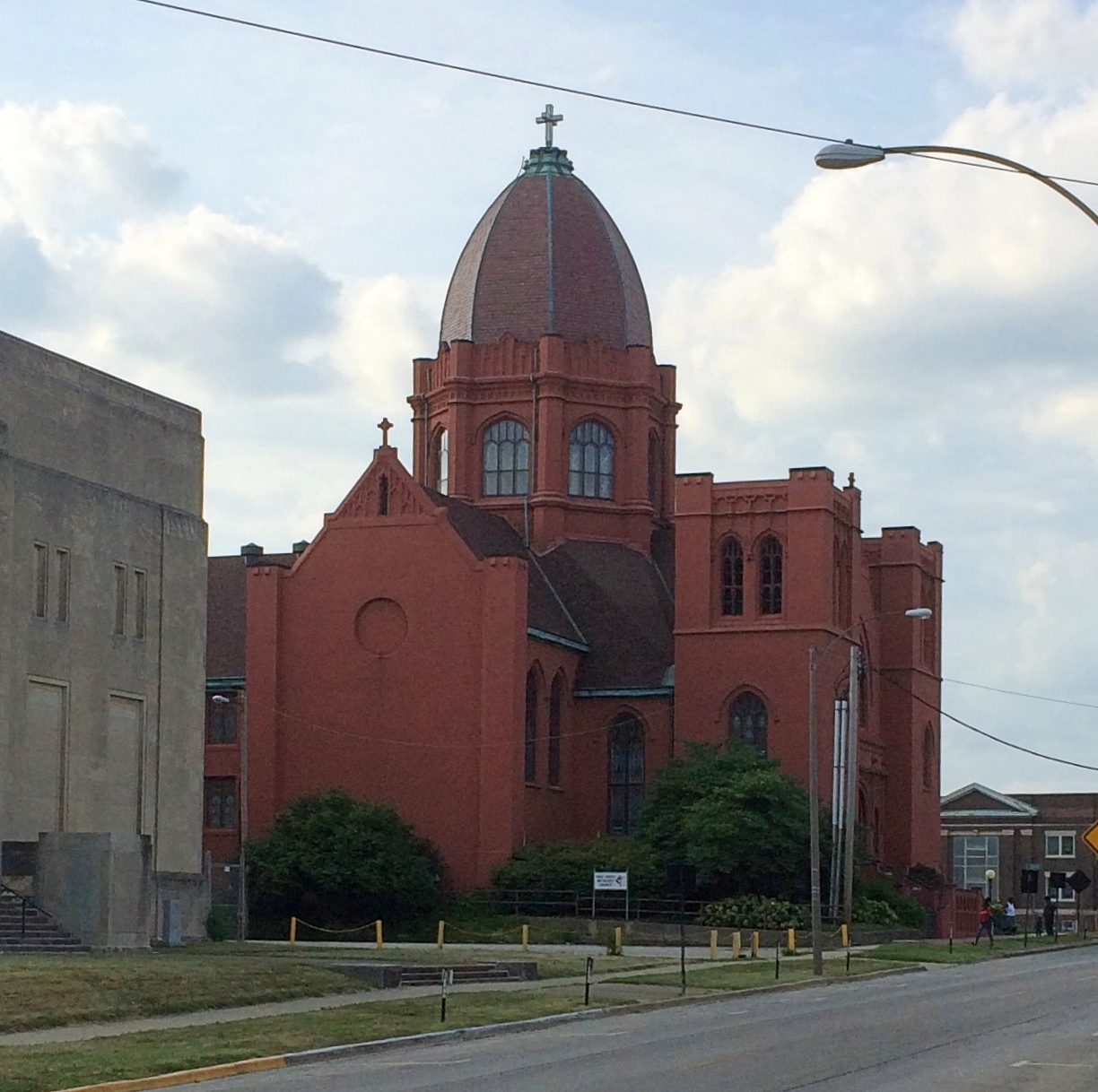
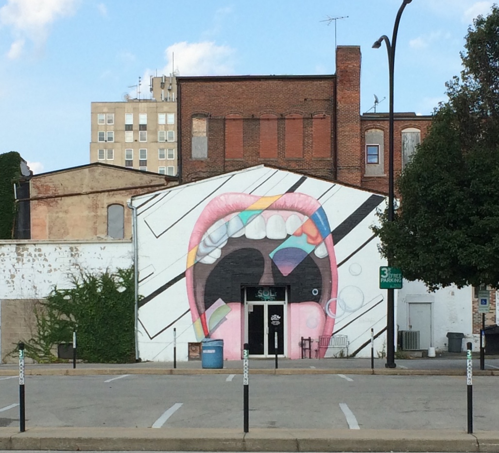
On Labor Day we drove home, but not the most direct way. We passed through parts of Saginaw — parts beaten down by the contraction of U.S. manufacturing, it looked like — and then on to Michigan’s faux Bavarian tourist town, Frankenmuth.

Had a good time and a chicken lunch there, but the overstimulation of it all made the dog as nervous as I’ve ever seen her, so we headed home. Riding in the back seat seems to be as calming for her as parking herself on the couch at home.

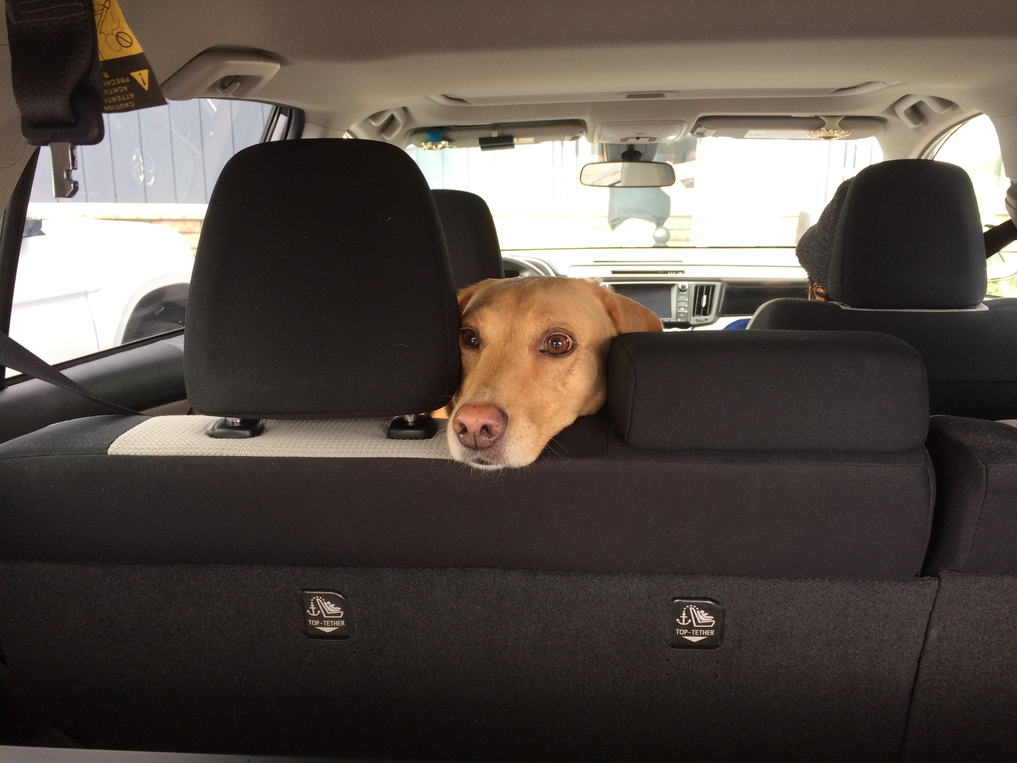
As far as I can tell, she enjoyed the trip and the many new smells.

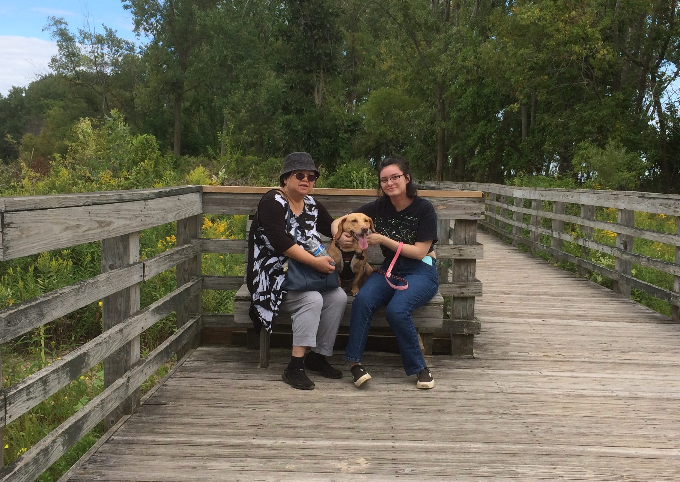
That last one almost instantly became a favorite picture of her.

Our Second Decatur This Year

On Saturday, I wondered how many U.S. cities and towns are named for Stephen Decatur. Later I looked it up: Counting Decatur City, Iowa, and a ghost town in Missouri of that name, 17 — not counting counties, of which there are six among the several states.

Now mostly forgotten except by the Navy and naval history enthusiasts, he had his moment. He even took a lethal bullet in a duel, though Commodore Decatur isn’t known as well as Alexander Hamilton for that distinction. Lin-Manuel Miranda needs to get on the stick and write Decatur: A Musical of Kicking Barbary Pirate Asses.

Decatur’s moment also happened to be when towns and counties were being named in the United States. Decatur, Illinois, has the largest population of any of them, edging out Decatur, Alabama by some thousands of souls, even though the Prairie State Decatur has been shrinking in recent decades.

We spent most of Saturday afternoon in Decatur, Illinois, our second visit to a city of that name this year. Though the more northern Decatur isn’t quite the industrial town it used to be, a number of large manufacturers are still in evidence, such as Mueller Co., more about which later. Downtown Decatur seemed in fair shape as well. Good enough for a walkabout late in the afternoon, when the heat was ebbing away.

Decatur’s signature structure is the Transfer House.
Transfer House Decatur Illinois“The Transfer House was erected in 1895, replacing a smaller shelter dating from 1892,” writes H. George Friedman Jr., whose page features many pictures. “The City Electric Railway paid $500 toward the $2,700 building fund subscribed by local merchants and property owners, and agreed to furnish and maintain the building. As its name implies, it was used as a central transfer point for all the streetcar lines (and later the bus lines) in the city.”

Designed by W.W. Boyington, of all people. That only seems odd to me because we visited another one of his works just last week, the Old Joliet Prison. So there’s nothing really odd about it. The man got a lot of commissions.

Remarkably, the Transfer House was originally located at Main and Main streets — that always sought-after address, at least among commercial real estate investors. Decatur still has a north-south Main and an east-west Main, and their meeting looks like an ordinary intersection, though there is a statue of young A. Lincoln nearby.

In 1962, the city moved the Transfer House to its current location in Central Park, near a fountain.
The park also features a memorial to the Macon County’s Civil War soldiers.
On the back of the base, a plaque says:

Grand Army of the Republic
Organized in this city
April 6, 1866
Erected by Dorcas Society,
and Other
Patriotic Citizens

Not erected until 1904. Maybe funds were in short supply for years, but then the people of Decatur realized their veterans didn’t have much longer.

Near Central Park are a number of buildings, including this one sporting one of Decatur’s murals, featuring Mike Elroy, a recent mayor.
Driving into town we saw a more interesting mural featuring Bob Marley on the side of a record store building, but we didn’t stop for it.

A former Universalist church building, originally erected in 1854.
The handsome Merchant Street, formerly a hive of scum and villainy.

Further from the park was the equally handsome Library Block, home these days to a brewpub and other businesses.
The Decatur Masonic Temple, looking a lot like a WPA post office.
The First United Methodist Church of Decatur.
As with many city churches, it would have been nice to get inside for a look, but no go.

At first, I thought this might be the entrance to an eccentric dentist’s office, an oral equivalent of the eyes of Doctor T. J. Eckleburg.

But no: it’s the entrance to the Sol Bistro restaurant.

Pittsburgh ’19

Independence Day fell on a Thursday this year, creating a four-day window of opportunity to go somewhere. So late on the afternoon of July 3 we headed east, spending the night near Toledo, Ohio. On the 4th, we drove on to Pittsburgh, where we spent three nights and two full days, returning after an all-day drive today.

We stayed at a hotel in the pleasant Moon Township, Pa., not far from Pittsburgh International Airport. The days were hot and steamy and punctuated by vigorous rainfall in the afternoons — supposedly typical for western Pennsylvania in July, though it was a lot like home this summer. Anyway, even occasional heavy downpours didn’t slow us down much.

The road from metro Chicago to Pittsburgh, if you take the Indiana East-West Toll Road and then the Ohio Turnpike, takes you smack through the Cuyahoga Valley National Park. We spend a few hours walking its trails on July 4 as a stopover on the way to Pittsburgh.

Getting up early(ish) on July 5, we first went to the Duquesne Incline, one of Pittsburgh’s two funiculars, and rode it up and down. At the top we took in the hazy morning view of the city and the meeting of the Allegheny and Monongahela rivers. My thinking about funiculars: when you find one, ride it. My thinking about the Monongahela: that’s just a damned fun name to say.

Next we drove to the Oakland neighborhood and spent time at the University of Pittsburgh. Specifically, the Heinz Memorial Chapel — the church that ketchup built — and the Cathedral of Learning and some of its highly artful, internationally themed rooms, unlike anything I’ve seen before.

Lunch on the first day was at the the Original Oyster House on Market Square, which is known as Pittsburgh’s oldest bar and restaurant, and which serves up a mighty fine array of seafood. From there we repaired to Point State Park at the meeting of the rivers, site of a French and then British fort in the days before American independence, and the seed of modern Pittsburgh. That’s also where our lengthy guided walking tour of downtown Pittsburgh began, which took up the rest of the afternoon.

That should have been enough for the first day, but our momentum carried us on to the Andy Warhol Museum for a few hours in the early evening, taking advantage of its longer hours on Fridays. A suburban location of Primanti Bros., a local chain, provided a hearty dinner that night.

The second day, July 6, wasn’t quite as busy, but we got around. Late in the morning, we took an extensive tour of Carrie Furnace, a hulk of a former blast furnace complex on the Monongahela. It reminded me greatly of the Sloss Furnaces in Birmingham, Alabama, though the scale was even larger. After all, Birmingham was the Pittsburgh of the South, not the other way around.

After lunch in a nondescript but decent Chinese restaurant, we visited the Frick Pittsburgh, whose grounds include his mansion, a museum with his art, a greenhouse, and a carriage and antique auto exhibit. We saw the greenhouse and the auto exhibit.

After treating ourselves to some hipster ice cream late in the afternoon, we went to one more place, despite thunder and rain: Randyland.
Randyland

It’s the kind of outsider art phantasmagoria beloved by the likes of Roadside America or the Atlas Obscura. For good reason. As Roadside America puts it, the place is a “circus-colored oasis of sunny vibes on Pittsburgh’s formerly grim North Side.”

Indiana Dash ’19: The Ernie Pyle World War II Museum

I have a sneaking suspicion that the later 21st century is going to be completely indifferent to war correspondent Ernie Pyle. Like almost everyone else, he’ll join the ranks of the obscure. The items now collected at the Ernie Pyle World War II Museum in rural Indiana will scatter to archives or private collections or landfills. Only occasionally will anyone read his writings, as found in libraries or odd corners of the Internet.

The process is already underway. The museum used to be the Ernie Pyle State Historic Site, owned and run by the state of Indiana. When the recession came 10 years ago, state budgets suffered. I doubt that anyone put it down officially in a memo or the like, but I’m sure the decision to close the Ernie Pyle SHS came down to, “Who’s heard of him anyway?”

A nonprofit, the Friends of Ernie Pyle, now owns the site and carries on the struggle against obscurity. The organization renamed the museum nearly a decade ago. Yet Randy McNally, in its 2017 Road Atlas, still calls it a state historic site. So does Google Maps. It isn’t a place that gets a lot of attention.

We arrived in the hamlet of Dana, Indiana, early in the afternoon on Saturday. Rain had dogged us most of the way from Champaign, Illinois, where we’d spent the previous night. The museum includes the house in which Ernie Pyle was born in 1900, relocated from the nearby farm fields.

Next to the birth house are two Quonset huts, World War II vintage but never used for military purposes, that house displays and Ernie Pyle artifacts. It continued to rain while we were in the huts, with drops drumming on the metal in their distinctive way the whole time.

I probably would have heard about Ernie Pyle later anyway, but I like to think that the reason we came was that Bill Swinny, one of my high school English teachers, planted the seed by telling us about him during class one day. Mr. Swinny, who taught us a good deal more than high school-level literature, managed to convey how upset the nation was at the death of Ernie Pyle, coming as it did right after the death of President Roosevelt.

We were the only visitors at the museum. An informative woman in her 60s took our admission. Also on staff was a much quieter young man, perhaps as young as 20 and perhaps a relative of the older woman, who was doing his bit to help out, though that’s just a guess on my part.

The larger displays, including Pyle-like mannequins standing in for him, evoke Ernie Pyle’s wartime circumstances. That is, living with the GIs he wrote about.
A good number of his columns are posted for visitors to read. You can also listen to excerpts from the columns by picking up telephone receivers. There are a few videos. One is devoted to a single early 1944 column, “The Death of Captain Waskow.” As well it should be, since the column is a masterpiece of reportage.

Good to know that Ernie Pyle got a Purple Heart, by act of Congress in 1983. A rare honor for a civilian.
The birth house was interesting, though less compelling. But I did learn that Ernest Taylor Pyle was born poor. At the time of his birth, his parents were tenant farmers.

The museum isn’t quite all there is when it comes to commemorating Ernie Pyle in that part of Indiana. A few miles to the east of Dana, on U.S. 36, is the Ernie Pyle Rest Park, essentially a wayside rest stop. One feature stands out, and got me to stop despite the rain.

Ernie Pyle Memorial IndianaIt’s a replica of Ernie Pyle’s memorial on Ie Shima, the small island on which he was killed by enemy fire.

At This Spot
The
77th Infantry Division
Lost A Buddy
Ernie Pyle
18 April 1945

This is a replica of the original built at Ie Shima by the 111S Engineer Combat Group United States Army.

I can’t speak for Ernie Pyle, but I imagine that the thought of being forgotten by future generations might not have troubled him. I get the sense that he would have preferred that the men he wrote about be remembered instead.

Southern Loop ’19

Just back from a driving trip whose mileage I didn’t bother to keep track of, but it was in the thousands. Actually, only part driving. Lilly and I flew separately from Chicago to Dallas earlier this month so she could take possession of her new car — an ’05 Mazda 3 that her uncle Jay gave her, provided we could drive it from north Texas to northern Illinois. The car rattled and occasionally made other odd noises, but soldiered on all the way.

The uninspired thing to do that would have been to drive straight through, which normally would take two days by breaking the trip in Missouri, such as at the Munger Moss.

Despite being a driving trip, that would be a pedestrian way to do it. Instead I took a week off so we could take a more interesting route. We left Dallas on May 11, heading south to the vicinity of Schulenburg, Texas, to visit some of the Painted Churches, which were built by late 19th-century German and Czech congregations who gave them richly artistic interiors — all the more interesting because much of it is vernacular art.

Rain came day most of that first day on the road, but we didn’t encounter any more until yesterday in Nashville. In between the days were sunny and often hot. Everyone we talked to about the weather reported a wet spring, however, and the Southern landscape looked lush, from Texas into the Deep South and up through Tennessee.

We spent the first night in Houston. I didn’t plan it this way, but our time in Houston focused on water features: the Waterwall near the Galleria Mall that first evening (the rain was over) and Buffalo Bayou and the Buffalo Bayou Park Cistern during the next morning.

The next day we drove to New Orleans, a city I haven’t visited in 30 years, and one new to Lilly, and spent two days and three nights.

We ate very well. We saw excellent live music. We rode streetcars and walked the streets of the French Quarter, Treme and the Garden District. We toured one cemetery formally and one informally, and we visited the National WW II Museum.

On May 15, we drove to suburban Jackson, Mississippi, by way of the city of Natchez and the Natchez Trace to visit our cousin Jay and his wife Kelly, who hospitably put us up for the night.

The next day we passed through Philadelphia, Mississippi, my father’s home town, stopping for a short visit — Lilly had never been there — and then went to Montgomery, Alabama, where we spent the night.

On the morning of May 17, we saw the Legacy Museum and the National Memorial for Peace and Justice, both only open since last year, and the very different Alabama State Capitol, because I visit capitols when I can.

Leaving Montgomery in the early afternoon, we had enough time to visit the Ave Marie Grotto, not far north of Birmingham, and then spent the night of May 17 in Decatur, Alabama. The next morning I took a short walkabout near the Tennessee River and along Bank St., named for a handsome bank building there dating from the 1830s.

By that afternoon, we were in Nashville to visit some of my dear old friends, including one I hadn’t seen or enjoyed the fine company of since 1990. Today we did the long drive from Nashville to greater Chicago — I used to do it fairly often — arriving this evening.

Mostly, things went smoothly. Even traffic wasn’t that bad most of the time in the cities we passed through.

But while driving along Rodney Road in rural Mississippi outside Port Gibson and not far from the mighty river of that name, we suddenly came to this.
That’s stagnant algae-filled water, completely covering the road. For as far as we could see into the distance. Who knows how deep it is. So we backtracked on Rodney to the main road at that point, which happened to be the Natchez Trace.

Punta Mita 2009

Been almost exactly* 10 years since I visited Punta Mita, near Puerto Vallarta in Nayarit state. An awfully pleasant little trip, with plenty of views of the Bay of Banderas and its coastline. Including these images, but also these.
The villa where we stayed was much more luxurious than my usual haunts, at home or elsewhere.
Including a small infinity pool. A novelty for me.

It was the dry season, so the non-irrigated land was dry.
Naturally, the golf course was irrigated, except for the hole on a peninsula. I don’t play golf, but I was happy to wander around the course, on foot and in a golf cart.

Our guide around the resort.

She had an exotic background, if I remember right. A father from — Syria, I believe — who immigrated to one of the northern South American countries, where her mother was from. Later they came to Mexico.

* Some long-ago teacher got on my case for using the phrase “almost exactly.” Red-inked it, I think. “Either it is exact, or it is not” was, I believe, the faulty reasoning that gave birth to that nonsense. I can say now, in my opinion as a professional writer of some decades, that there’s nothing wrong with the construction.

Texas Winter ’19

My recent trip to wintertime Texas took me to Dallas and Fort Worth, San Antonio, and a few other burgs. February is winter in Texas, but it’s a pale moon of a winter compared with where I live. During the trip, temps varied but didn’t drop below freezing, and we experienced rain but no ice or snow.

I spent the weekdays working, but I also visited my brothers, one nephew and his family, one nephew by himself and a friend I’ve known for 45 years now.

I made it to a few new places and a few familiar old places. No matter how often you go somewhere, there are always new places, and no matter how familiar an old place is, there are always new aspects.

One new place was the Modern Art Museum of Fort Worth, which I’ve had a mind to see since we went to Wrightwood 659 in December. Tadao Ando designed both Wrightwood and the Modern, which is easy to visit from Dallas, as Jay and I did: just pop on over on I-30.

While gadding around in greater DFW, we also saw the Cao Dai Tay Ninh Temple and the Cambodian Buddhist Temple of Dallas, whose neighbors in the southwest of the city are the likes of Mission Foods, Standard Meat, Cartamundi USA and Old Dominion Freight Line.

In San Antonio, we had the benefit of a free evening admission to the McNay Art Museum — an example of a familiar place offering some new things to see. Later, while on the road between San Antonio and Dallas, we stopped by the Hays County Courthouse in San Marcos and the San Marcos City Cemetery, whose burials go back to the 1870s.

Had some good meals along the way too. In San Antonio, a dinner at one of the Paesanos locations, a local Italian restaurant with roots in the 1968 world’s fair. Good pork shank and gnocchi. In Waco, a lunch at a joint that goes even further back: the curiously named Health Camp, in business, as the exterior says, since 1949. Good burger and shake.

In Dallas, on the day I flew in, I enjoyed sausage and homemade sauerkraut and Texas beer and other good things at my nephew Sam’s house, on the occasion of his 36th birthday. Naturally there was birthday cake too.

Reminded me of the morning, late in my college career, when Jay called me to tell me that Sam had been born. Been an uncle ever since.

Yellowstone 2005: Yellowstone, Badlands, Albert Lea, Etc.

Part of a letter I wrote to Ed about 13 years ago, with a few relevant pictures and hindsight notes in brackets.

Aug 22, 2005

Time to start another letter, which I might as well subhead “Things About My Recent Travels That Didn’t Make It Into the Blog.” If letters had subheads, that is.

In some ways, I hope this is a pattern for future travels [mostly it wasn’t]. Of the nine nights we spent on the road, six were in a tent, three in a motel. Better still, of the six nights in a tent, four cost nothing. Call me a cheapskate, but it did me good to return every night to Yankee Jim Canyon about 15 miles north of Yellowstone, in Gallatin Nat’l Forest land, and crawl into the tent knowing that I paid nothing. Well, no extra charge, no insidious “user’s fee,” because some small bit of my taxes must go to support the Gallatin Nat’l Forest.

Some of the most striking things about the many striking things in Yellowstone were the places — whole mountainsides, in some cases — that had clearly burned down in 1988. Hundreds of grey-dead trunks, stripped of anything remotely alive, still stand, lording — if such be possible among trees — over forests of mid-sized pines, very much alive, the spawn of the great fire. In other places, hundreds of tree corpses have tumbled into random piles, also interlarded with young living trees. You can drive for miles and miles and see scene after scene like these. They say it was a hell of a fire, a complex of hell-fires, really, and I believe it.

[A post-fire landscape in Yellowstone in 2005, 17 years later.]Yellowstone 2005

I saw something in South Dakota that the rest of the nation can emulate: two kinds of X signs, marking traffic deaths I think. One says: “WHY DIE? Drive carefully.” And the other: “THINK: X marks the spot. Drive carefully.” For such a sparse population, South Dakotans seem to kill themselves often enough on the roads. Long winters, cheap booze, almost empty roads.

I recommend the drive along the Missouri River from I-90 to Pierre, SD — along state roads 50, 10, and mostly 1806, all of which also form a National Scenic Byway. Hilly, bleak territory largely given over to Indian reservations, though not quite as bleak-looking as Badlands NP.

[Badlands NP, 2005]

In places, except for the road, it couldn’t have been that much different than what Lewis and Clark saw. I never can remember, without looking it up, which one probably blew his brains out a few years after co-leading the Corps of Discovery. [Lewis] Clinically depressed, before there were clinics worth visiting, and before melancholia became depression. Anyway, if I remember right, there’s a monument to him near where he died, on the Natchez Trace. I saw it years ago. A lonely place to die.

We spent the first night out at a campground near Albert Lea, Minnesota. According to me (and only me), Albert Lea is important for two things. One I just noticed: it’s the closest town to the junction of I-35, the U.S. branch of the Pan-American Highway, and I-90, the Boston-Seattle transcontinental epic of a highway. [I’ve since learned that no U.S. road is officially called the Pan-American; it’s just custom that attaches the name to I-35.]

The other thing is that I was visiting Albert Lea for the second time, after a span of 27 years. What was I, a south Texas lad of 17, doing in south Minnesota en route to Wisconsin one August day in 1978? Am I repeating myself here? Maybe I mentioned that epic bus trip before. It was an important one for me. No family, distant states — Wisconsin seemed wildly exotic. Christmas trees grew in people’s yards.

Anyway, in 1978 we stopped for lunch in Albert Lea. I went with the bus driver and some other kids to Godfather’s Pizza, a place I’d never heard of. After that, I walked around a little, relishing the remoteness of the place.

In 2005, we encountered wildlife at the campground near Albert Lea, namely mosquitoes in great numbers. The place was fairly green and lush, so I guess southern Minnesota hasn’t had the drought that Illinois has had this year. When we were leaving the next morning, we drove down the town’s main drag and there it was: Godfather’s Pizza, looking like not much maintenance had been done since the late 1970s, though of course I had no memory of how it looked then, just that I was there. [In Eau Claire this year, we ordered a pizza from a Godfather’s and ate it in our room. I ordered from there because of my experience 40 years earlier. And it was close.]

One other note, for now: Hot Springs, SD, is a lovely town. Near much of the main street flows a river, and alongside most of the main street across from the river are picturesque sandstone buildings, vintage pre-WWI. Evidently, it was locally inexpensive building material.

I left the family at a spring-fed swimming complex while I looked for a pay phone, since my cell phone refused to transcend the hilly surroundings. Argh, what an odyssey that was – “Yeah, we used to have a phone…” I’d foolishly agreed to do an interview that day, figuring I could use my cell. Anyway, after much to-do, I found a phone, did the interview, and then relaxed by the riverside, which has a sidewalk and a hot spring (Kidney Spring) under a gazebo. Free for all to drink, with a metal plaque describing its properties. Not bad. A little salty, but not bad, even on a hot day in South Dakota.

Duluth & Environs ’18

When I was very young, I had a U.S. map puzzle that I put together who knows how many times, fascinated by the individual shapes of the states. Some states more than others, including Minnesota, with its rough northern border, more-or-less straight-back western border, concave eastern border and pointy southeast and especially northeast corners.

The northeast corner still holds some fascination, and for more than just the shape. There’s the lure of the North Woods, and Lake Superior is always calling. Enough to inspire a short trip. On July 27, after I finished my Friday work, we hit the road for a five-night trip to Duluth and environs.

Since reaching Duluth means crossing northwest all the way through Wisconsin, a few points in that state were part of the trip as well, especially Eau Claire, where we spent the first night at a spartan but tolerable chain motel.

From Saturday afternoon until the morning of Wednesday, August 1, we stayed at the non-chain Allyndale Motel, a notch up from spartan. It’s in west Duluth, almost at the edge of town, but actually Duluth isn’t that large, so the location wasn’t bad.

I guessed that the Allyndate dated from the golden age of independent motel development, namely the 1950s. The details were right, except no bottle opener attached to a surface somewhere in the room. Just before we left, in a talk with the owner, I was able to confirm that vintage. The first rooms dated from 1952, he said, with later additions.

Before checking into the motel that first day, we spent a short while in downtown Duluth, walking along E. Superior St., which features shops and entertainment venues, including a legitimate theater, art house cinema and a casino. Rain, which had been holding back on the way into town, started to come down hard, so we ducked into the Duluth Coffee Company Cafe long enough to wait it out over various beverages.

That evening, we took in a show at the Marshall W. Alworth Planetarium, which is part of the University of Minnesota Duluth. The recorded show, narrated by Liam Neeson, was about black holes, and then an astrophysics grad student (I think) talked about the night sky. Many planetariums don’t bother with live narration anymore, so that was refreshing.

On Sunday we drove along much of the winding and often scenic Skyline Parkway in Duluth, stopping along the route to take in the sweeping view of the city, as well its twin city of Superior, Wis., and a large stretch of Lake Superior, from the Enger Tower in the aptly named Enger Park.

There happened to be a coffee and ice cream truck in the park, so Lilly had iced coffee and Ann had ice cream. The truck showed its regional pride in the form of a Minnesota flag.

The design needs work, like many Midwest state flags. Here’s an alternative.

Late that morning we saw Duluth’s Aerial Lift Bridge up close, along with other parts of Canal Park and lakeside spots. The lofty bridge — crossing the entrance to Lake Superior from St. Louis Bay — is the Eiffel Tower of Duluth, a stand-in for the city that appears in a lot of places, including a refrigerator magnet that we brought home. (But I refuse to use the i-word.)

In the afternoon, we headed northeast from town along U.S. 61, which follows the shore of Lake Superior. That region, I discovered, is known locally as the North Shore. We made it as far as Gooseberry Falls State Park.

On Monday, July 30, we headed north, mostly via U.S. 53, to Voyageurs National Park, which is hard by the Canadian border. The trip up and back from Duluth is a little far for a single day, but ultimately seemed worth the effort. Besides, something about the symmetry of visiting Voyageurs NP and Big Bend NP during the same year appealed to me.

As the girls slept late on the last day of July, I made my way to Superior, Wis., and visited the Richard I. Bong Veterans Historical Center, a small military museum. WWII is increasingly distant, and except in Wisconsin, the memory of air ace Bong’s deeds has faded. But he had his moment.

The main event of July 31, our last day in town, was the Great Lakes Aquarium, which is in downtown Duluth, on St. Louis Bay not far from the Aerial Lift Bridge and Canal Park. The aquarium’s distinction is that it focuses on freshwater creatures.

Late that afternoon, I struck out again on my own to see one more place: Forest Hill Cemetery, which is in the hills northeast of the University of Minnesota Duluth. My kind of site, not the girls’.

On August 1, we got up early and drove home, stopping only to eat lunch in Madison. I wanted to take Lilly to Ella’s Deli, since she wasn’t with us last year when we went. But it’s closed.

Too bad. Wonder what happened to all the oddball stuff Ella’s had. Instead we found Monty’s Blue Plate Diner. Not as much whimsy on the walls as Ella’s, but the food was good.

South Texas, Summer ’18: The King William District in July

Just back from eight days in San Antonio. Most of the time I visited with family or worked, since my kind of work is mobile. Also, temps in the high 90s and sometimes over 100 degrees F. discouraged me from too much wandering around during the day.

Even so, last Sunday toward the late afternoon I drove down to the King William District, which is leafy this time of year and so not quite unbearably hot, and took a few short walks.

“The district encompasses land that was once irrigated farm land belonging to the Mission San Antonio de Valero, commonly known as the Alamo,” the City of San Antonio says. “When the mission was secularized in 1793, the lands were divided among the resident Indian families from the mission or sold at public auction. In the 1860s the area was subdivided into lots and laid out with the present streets.

“In the mid-nineteenth century… a great many Germans, who had immigrated to Texas in the 1840s, began to settle in this area… The area developed into an idyllic neighborhood of large, impressive houses designed in the Greek Revival, Victorian, and Italianate styles.

“The main street into the neighborhood was given the name King William in honor of King Wilhelm I, King of Prussia in the 1870s. During World War I, when America was at war with Germany, the name was changed to Pershing Avenue. A few years after the war ended the King William name was restored.”

These days there’s a Pershing Ave. in San Antonio, but it’s further north, fittingly not far from Fort Sam Houston. By the mid-20th century, the King William District was run down. By the late 20th century, restoration was under way.

One of my short walks took me along King William St., which is an important street in the district, but hardly the only one. The array of houses made me think of the East End Historic District in Galveston. In King William, there are large and historic houses such as the Villa Finale.
The Steves Homested. One of these days, I’ll take the tour.
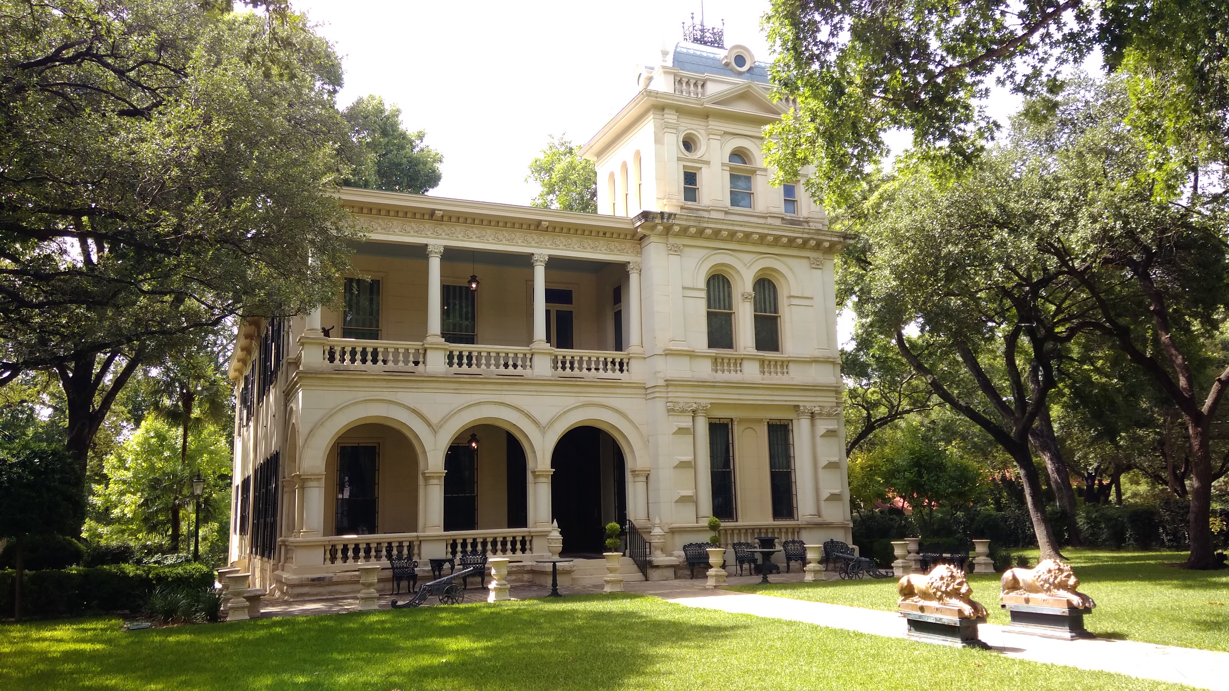
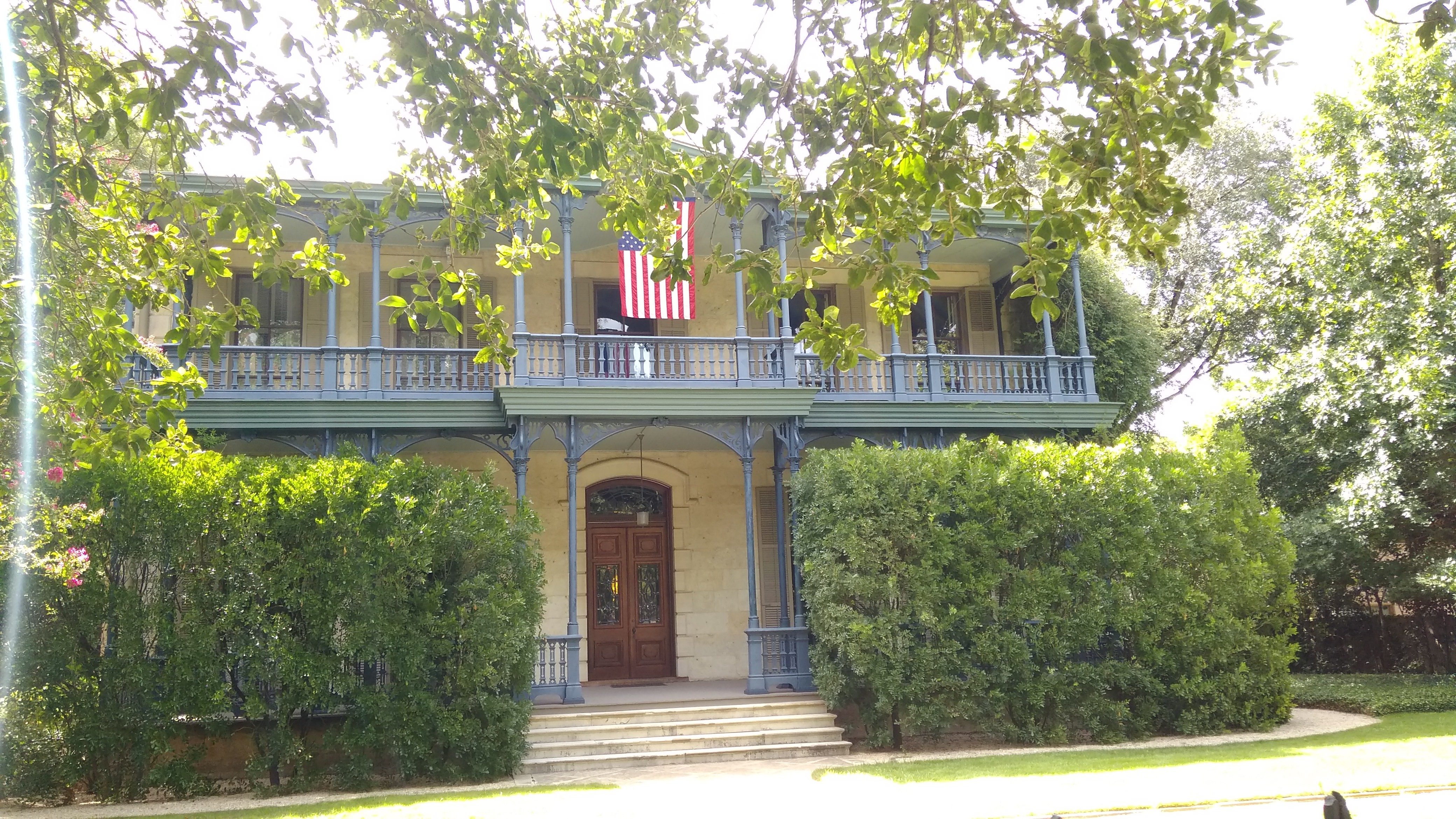
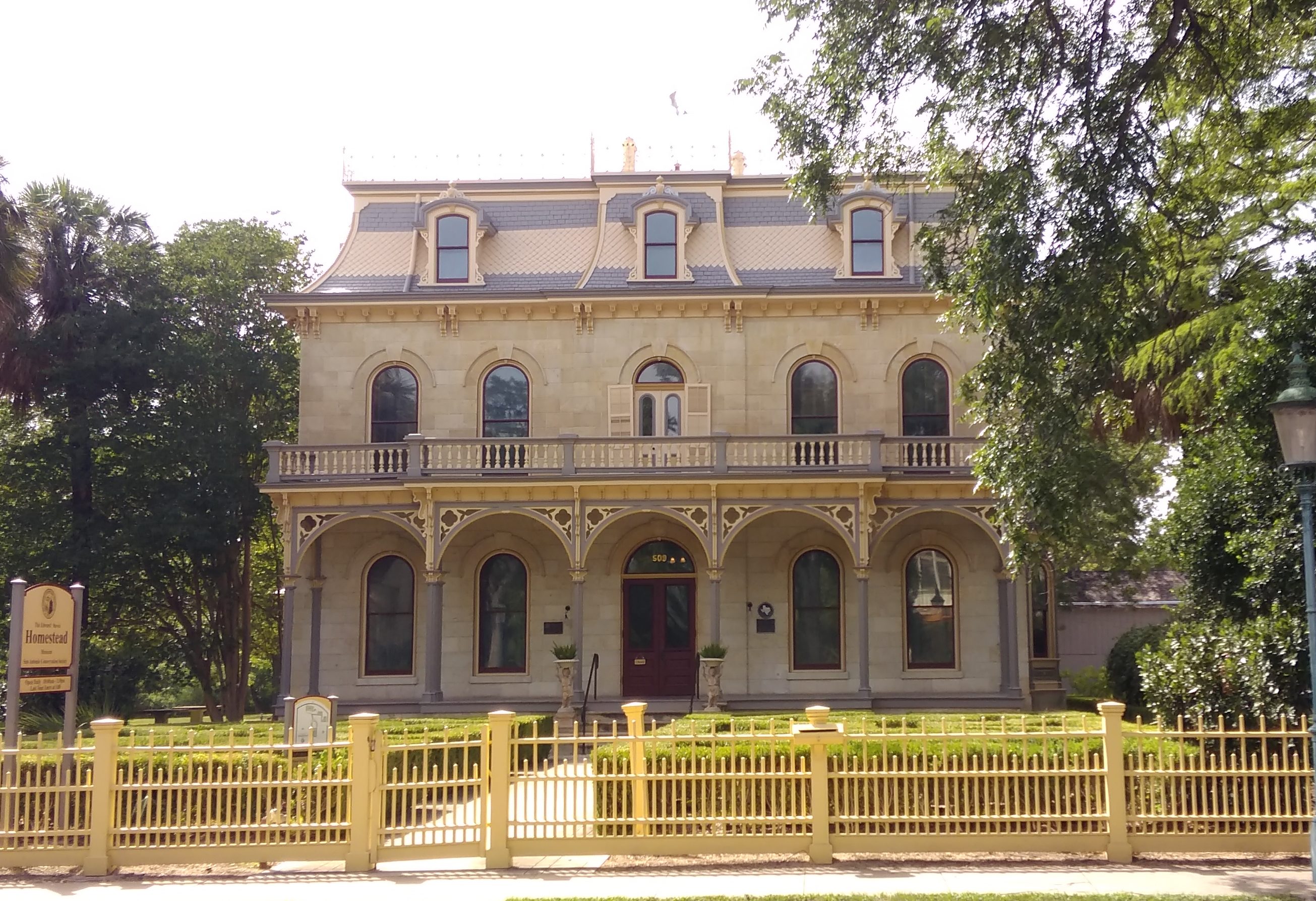
Edward Steves was a successful businessman in lumber in San Antonio in the 19th century, and Steves & Sons, which makes doors, is still around. I went to high school with a girl who was descended from Steves on her mother’s side.

There are plenty of other large and not-so-large houses on the street, most of which are worth a look.
That last one is the Alfred Giles House. One the architect of that name designed for himself. He’s thought to have done the Steves Homestead, and he certainly designed a lot of buildings in Texas, including some county courthouses (such for Goliad County and Presidio County) and even some in Monterrey, Mexico.